


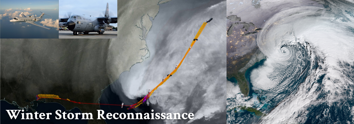
The Winter Storm Reconnaissance (WSR) program is a critical, multi-agency effort designed to enhance operational forecasts for high-impact weather events across the continental United States. Leveraging specialized aircraft reconnaissance observations, the program systematically targets data-sparse non-land regions—including the Western Atlantic for Nor'easters and the Pacific for atmospheric river events—to inject vital, real-time data into numerical prediction models. This strategic data collection substantially improves model guidance, directly advancing the National Oceanic and Atmospheric Administration’s (NOAA) and National Weather Service (NWS) core mission to build a more resilient and Weather-Ready Nation.