| Suspect Data Shortages in Critical Types - Monitor | ||||||||||||||
|---|---|---|---|---|---|---|---|---|---|---|---|---|---|---|
| Type | Description | Hourly Count | Monthly Average | Percent (%) of Monthly Mean | UTC Time Window | |||||||||
NOAA 18-19 & METOP 1-2 HIRS-4 NCEP-proc. br.temps |
0 |
4805 |
0.0 % |
0417.00-0422.99 |
||||||||||
| Shortage in Data Type of Opportunity - Monitor | ||||||||||||||
|---|---|---|---|---|---|---|---|---|---|---|---|---|---|---|
| Type | Description | Hourly Count | Monthly Average | Percent (%) of Monthly Mean | UTC Time Window | |||||||||
NOAA 15-19 & METOP 1-2 HIRS-3/4 pr btmps frm RARS |
0 |
2978 |
0.0 % |
0419.00-0421.00 |
||||||||||
DMSP SSM/IS 1C radiance data (Unified Pre-Proc.) |
0 |
51017 |
0.0 % |
0418.00-0421.99 |
||||||||||
| Critical Data with Normal Counts | ||||||||||||||
|---|---|---|---|---|---|---|---|---|---|---|---|---|---|---|
| Type | Description | Hourly Count | Monthly Average | Percent (%) of Monthly Mean | UTC Time Window | |||||||||
NOAA 15-19 & METOP 1-2 AMSU-A NCEP-proc. br.temps |
16294 |
20062 |
81.2 % |
0417.00-0422.99 |
||||||||||
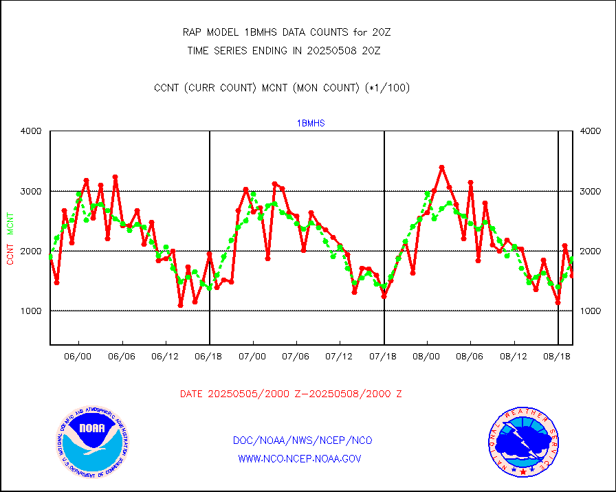
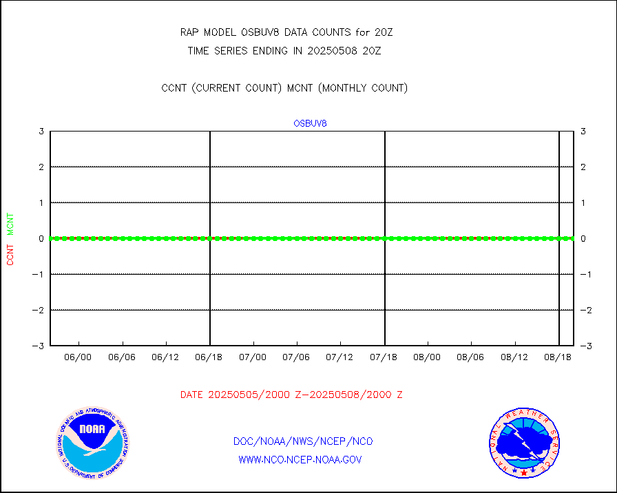
NOAA 18-19 & METOP 1-2 MHS NCEP-proces. br. temps |
144477 |
152598 |
94.7 % |
0417.00-0422.99 |
||||||||||
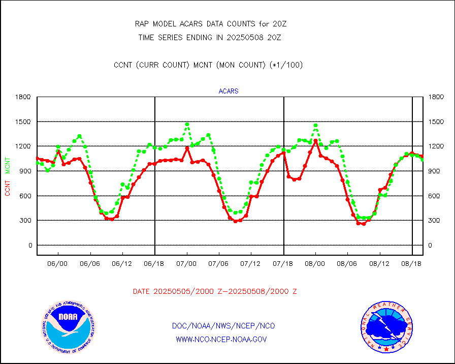
MDCRS ACARS acft data from ARINC(dcded from BUFR) |
110921 |
117326 |
94.5 % |
0416.75-0423.25 |
||||||||||
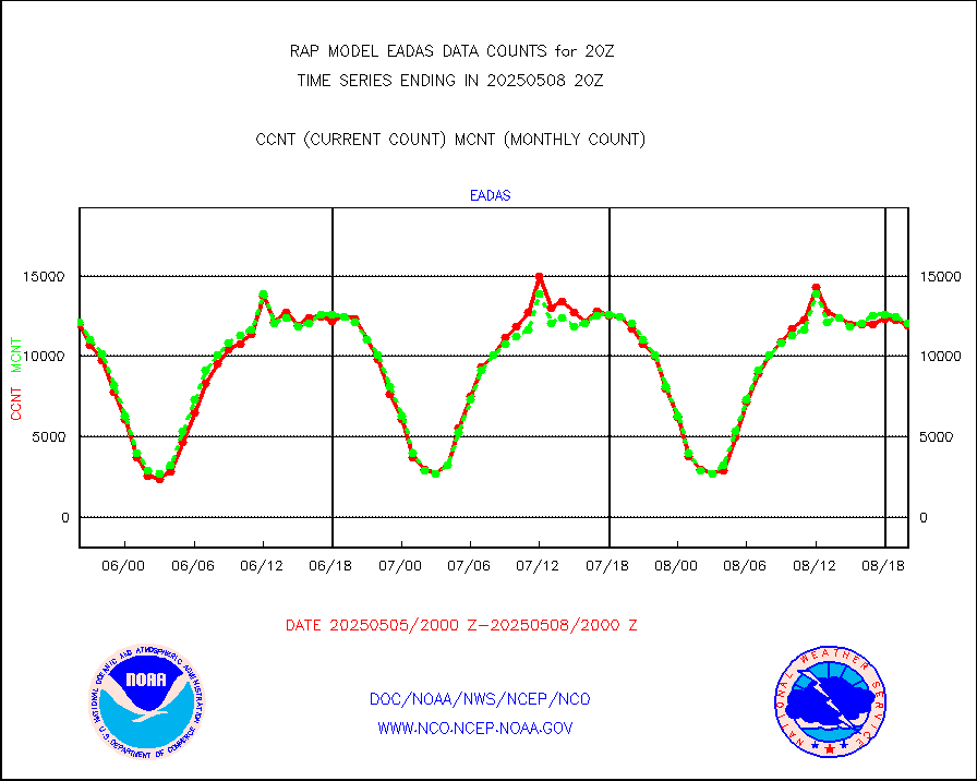
Canadian AMDAR aircraft data (decoded from BUFR) |
0 |
0 |
n/a |
0416.75-0423.25 |
||||||||||
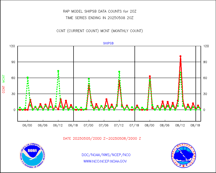
Surface Marine CMAN rpts decoded from BUFR format |
1603 |
1570 |
102.1 % |
0419.50-0420.50 |
||||||||||
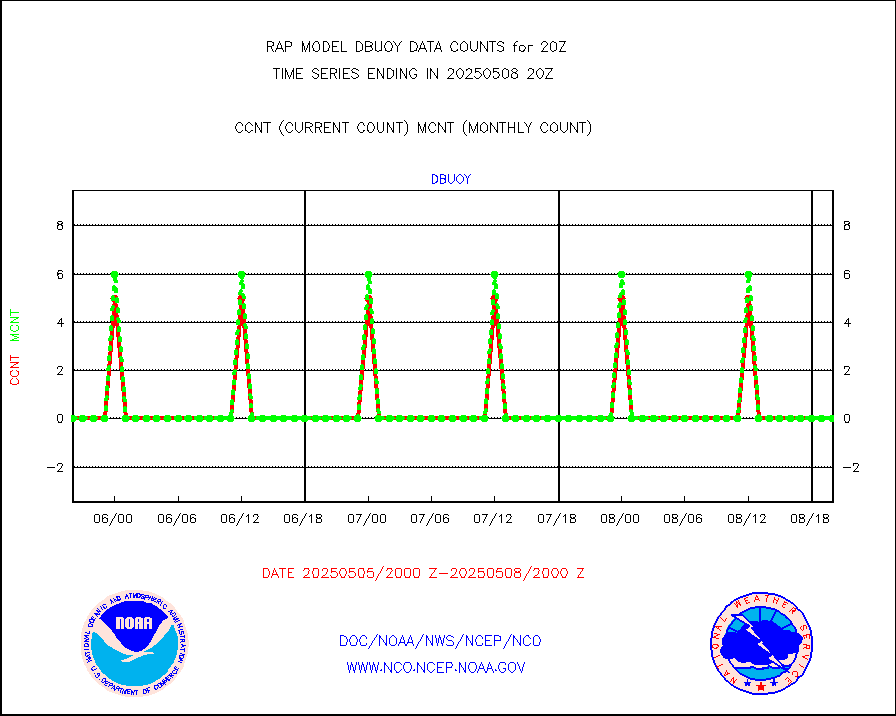
Buoys decoded from FM-18 fmt (moored or drifting) |
0 |
0 |
n/a |
0419.50-0420.50 |
||||||||||
Grnd-based Gbl Navigation Sat System (GNSS) data |
2769 |
1829 |
151.4 % |
0418.95-0419.05 |
||||||||||
MODIS (AQUA/TERRA) wvpr imager derived cld motion |
0 |
0 |
n/a |
0417.50-0422.50 |
||||||||||
MODIS (AQUA/TERRA) ir l-wave derived cloud motion |
0 |
0 |
n/a |
0417.50-0422.50 |
||||||||||
GOES/NASA(Langley) hi-res. (1x1 f-o-v) cloud data |
1876797 |
1872647 |
100.2 % |
0419.50-0420.50 |
||||||||||
Buoys decoded from FM-13 format (moored) |
118 |
140 |
84.3 % |
0419.50-0420.50 |
||||||||||
Aviation - METAR |
5601 |
5533 |
101.2 % |
0419.50-0420.50 |
||||||||||
NEXRAD Vel Azm Dsp(VAD) winds via radar coded msg |
0 |
0 |
n/a |
0419.00-0421.00 |
||||||||||
Multi-Agency Profiler (MAP) and SODAR winds |
82 |
97 |
84.5 % |
0418.50-0421.50 |
||||||||||
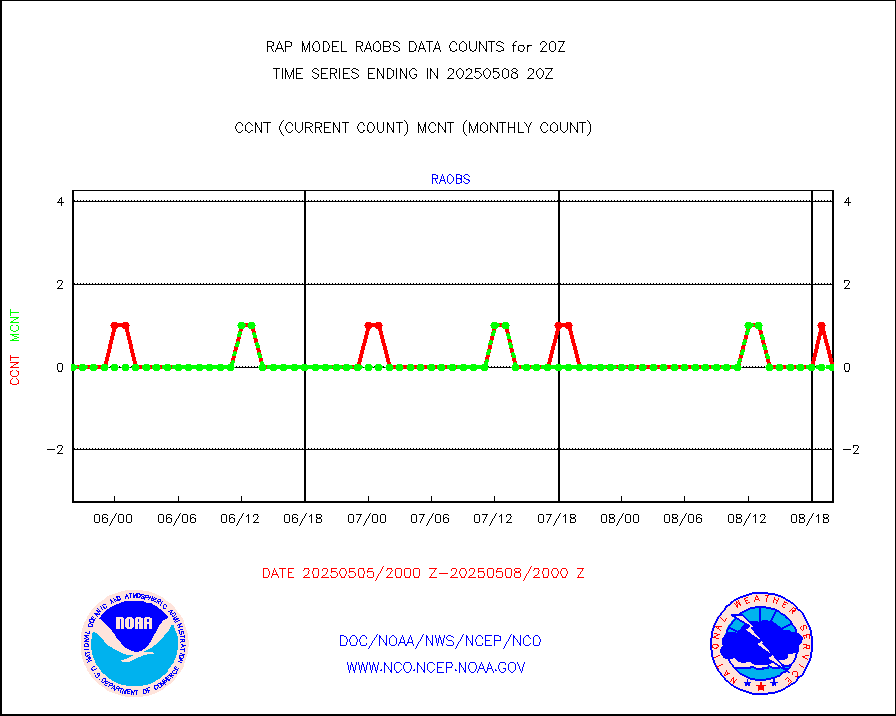
Rawinsonde - fixed land (from TEMP or PILOT) |
1 |
1 |
100.0 % |
0419.00-0421.00 |
||||||||||
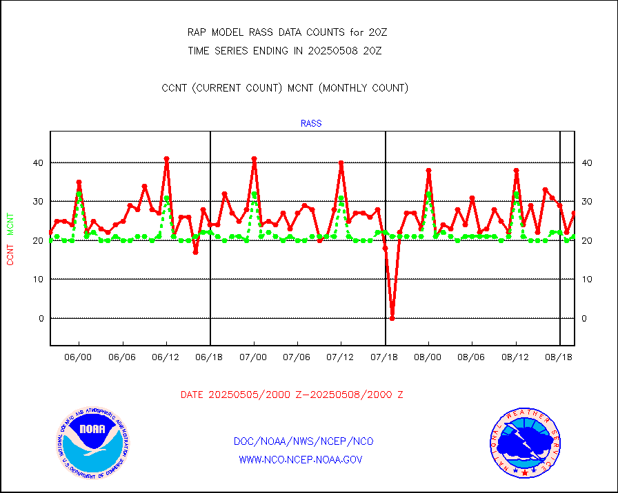
RASS temperatures (NOAA and Multi-Agency) |
16 |
20 |
80.0 % |
0419.50-0420.50 |
||||||||||
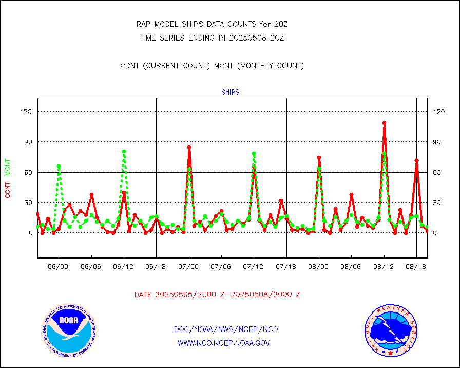
Ship - manual and automatic, restricted (BUFR) |
0 |
0 |
n/a |
0419.50-0420.50 |
||||||||||
Ship - manual and automatic, unrestricted |
48 |
59 |
81.4 % |
0419.50-0420.50 |
||||||||||
Ship - manual and automatic, unrestricted (BUFR) |
759 |
694 |
109.4 % |
0419.50-0420.50 |
||||||||||
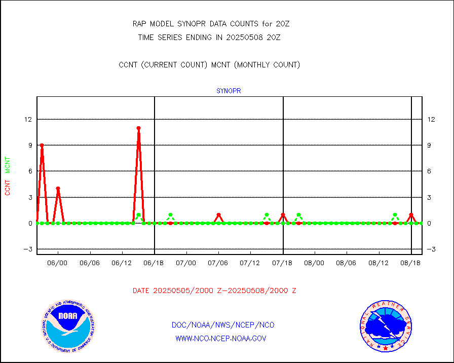
Synoptic - fixed manual and automatic |
222 |
296 |
75.0 % |
0419.50-0420.50 |
||||||||||
Synoptic - fixed manual & auto (decoded fr BUFR) |
1999 |
1979 |
101.0 % |
0419.50-0420.50 |
||||||||||
Tide gauge reports decoded from CREX format |
186 |
185 |
100.5 % |
0419.50-0420.50 |
||||||||||
| Data Types of Opportunity with Normal Counts | ||||||||||||||
|---|---|---|---|---|---|---|---|---|---|---|---|---|---|---|
| Type | Description | Hourly Count | Monthly Average | Percent (%) of Monthly Mean | UTC Time Window | |||||||||
GOES-16&up/NESDIS ir short-wv derived cld motion |
0 |
0 |
n/a |
0419.00-0419.99 |
||||||||||
MDCRS ACARS acft data (ARINC via AFWA)(AIREP fmt) |
0 |
0 |
n/a |
0416.75-0423.25 |
||||||||||
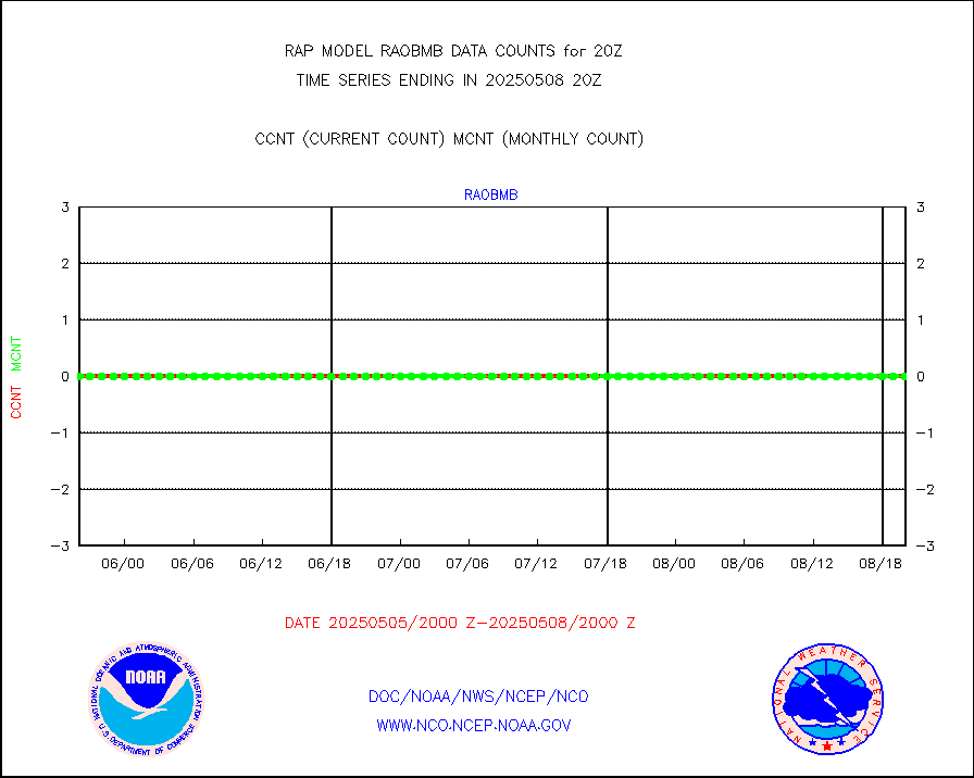
Manual AIREP aircraft data (dcded from AIREP fmt) |
1507 |
1637 |
92.1 % |
0416.75-0423.25 |
||||||||||
AQUA AIRS/AMSU-A/HSB brightness temps- every FOV |
0 |
0 |
n/a |
0417.00-0422.99 |
||||||||||
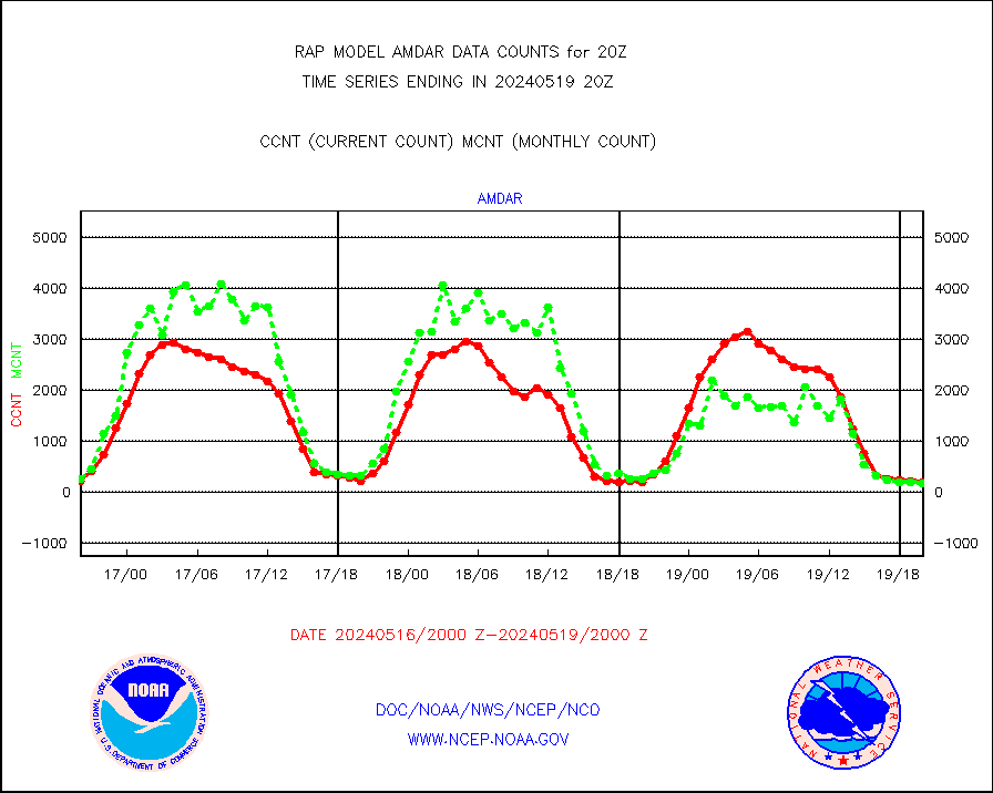
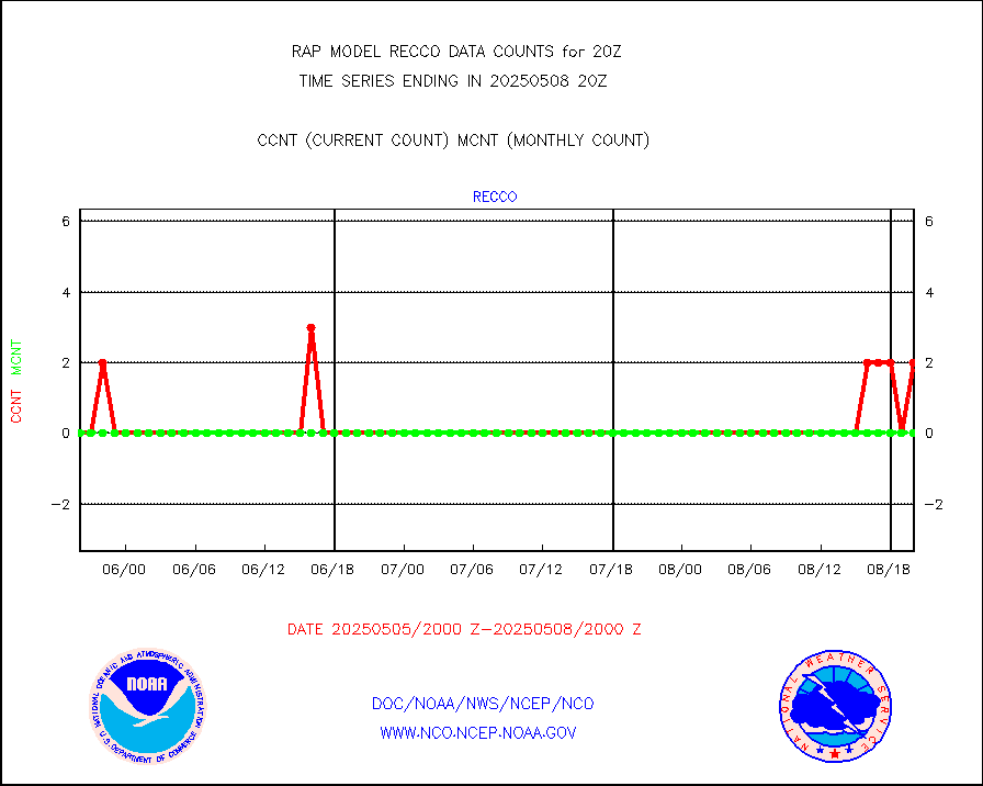
AMDAR aircraft data (decoded from AMDAR format) |
266 |
377 |
70.6 % |
0416.75-0423.25 |
||||||||||
AMDAR aircraft data (decoded from BUFR) |
6984 |
7300 |
95.7 % |
0416.75-0423.25 |
||||||||||
GCOM-W AMSR2 1B brightness temperatures |
312433 |
783206 |
39.9 % |
0417.00-0417.99 |
||||||||||
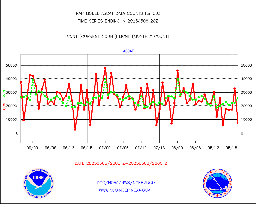
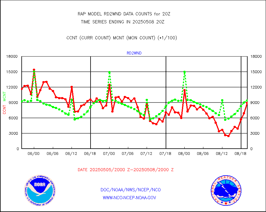
METOP 1-2 ASCAT products |
14972 |
25579 |
58.5 % |
0418.00-0422.00 |
||||||||||
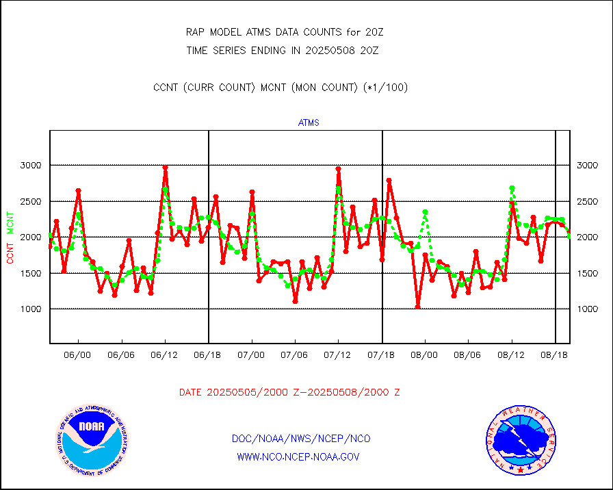
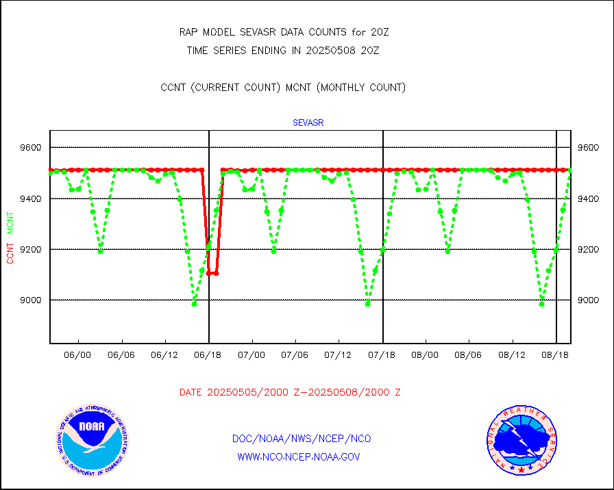
NPP/NOAA-20 ATMS brightness temperatures |
126583 |
195924 |
64.6 % |
0418.00-0421.99 |
||||||||||
NPP/NOAA-20 ATMS bright. temps-direct b-cast SSEC |
157651 |
177157 |
89.0 % |
0418.00-0421.99 |
||||||||||
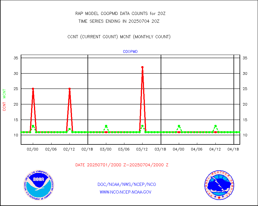
Coop/MADIS NEPP & HCN-Modernization NOAA COOP Obs |
11 |
11 |
100.0 % |
0419.50-0420.50 |
||||||||||
NPP/NOAA-20 CrIS full spctrl radn (431 ch subset) |
117608 |
108681 |
108.2 % |
0418.00-0421.99 |
||||||||||
NPP/NOAA-20 CrIS full spctrl radn dir brdcst SSEC |
82053 |
84945 |
96.6 % |
0418.00-0421.99 |
||||||||||
Coast Guard |
13 |
9 |
144.4 % |
0419.50-0420.50 |
||||||||||
Drifting buoys (decoded from BUFR) |
547 |
508 |
107.7 % |
0419.50-0420.50 |
||||||||||
Dropwinsonde (from TEMP DROP) |
0 |
0 |
n/a |
0419.00-0421.00 |
||||||||||
Dropwinsonde (decoded from BUFR) |
0 |
0 |
n/a |
0419.00-0421.00 |
||||||||||
E-AMDAR (European AMDAR acft decoded from BUFR) |
11850 |
12116 |
97.8 % |
0416.75-0423.25 |
||||||||||
NOAA 15-19 & METOP 1-2 AMSU-A proc btmps frm RARS |
3041 |
7619 |
39.9 % |
0419.00-0421.00 |
||||||||||
NPP Adv. Tech. MW Sndr (ATMS) br. temps from RARS |
0 |
152 |
0.0 % |
0418.00-0421.99 |
||||||||||
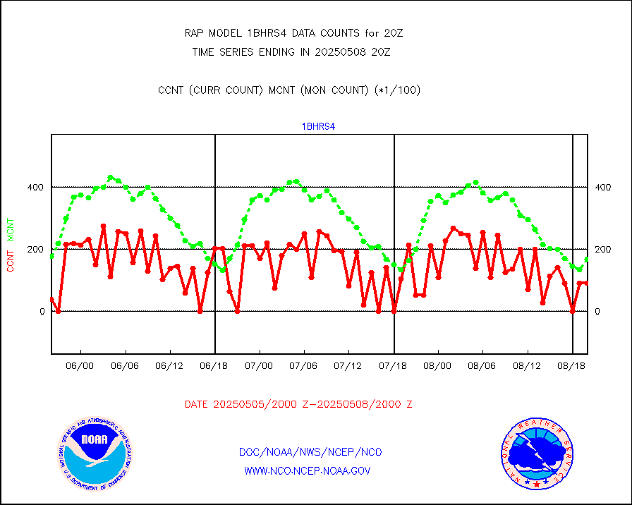
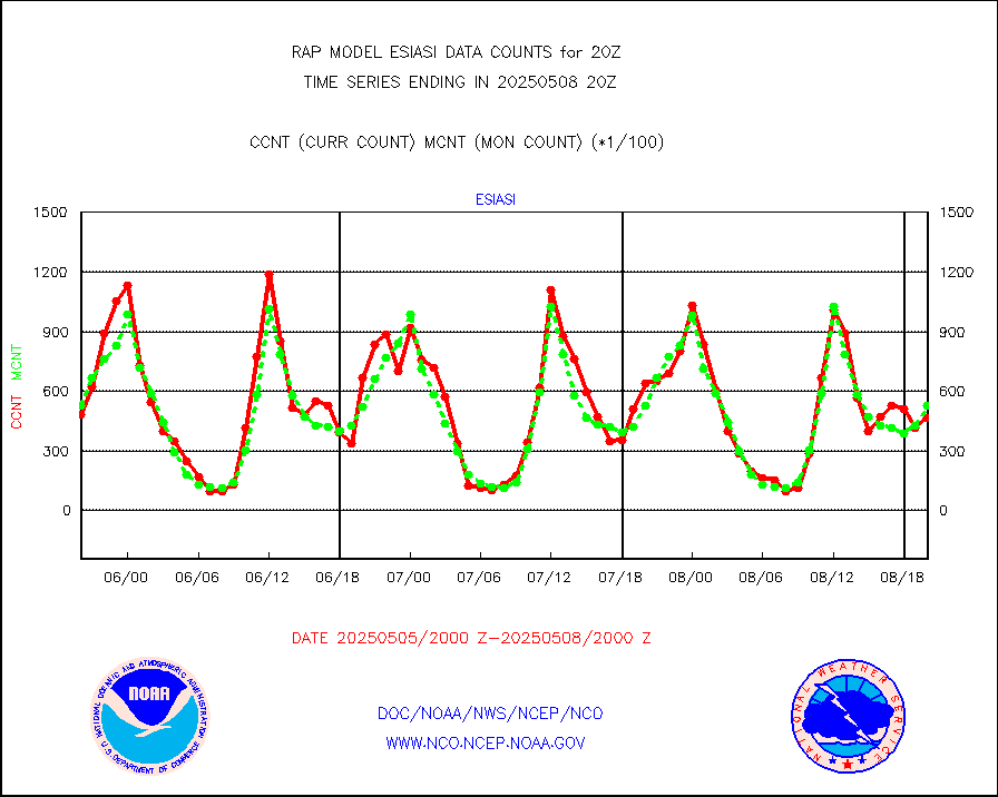
METOP 1-2 IASI 1C radiance data vbl chn from RARS |
54548 |
3746 |
n/a |
0418.00-0421.99 |
||||||||||
NOAA 18-19 & METOP 1-2 MHS proc. btemps from RARS |
37507 |
78279 |
47.9 % |
0419.00-0421.00 |
||||||||||
GPM GMI Level 1C-R brightness temperatures |
454535 |
356158 |
127.6 % |
0417.00-0422.99 |
||||||||||
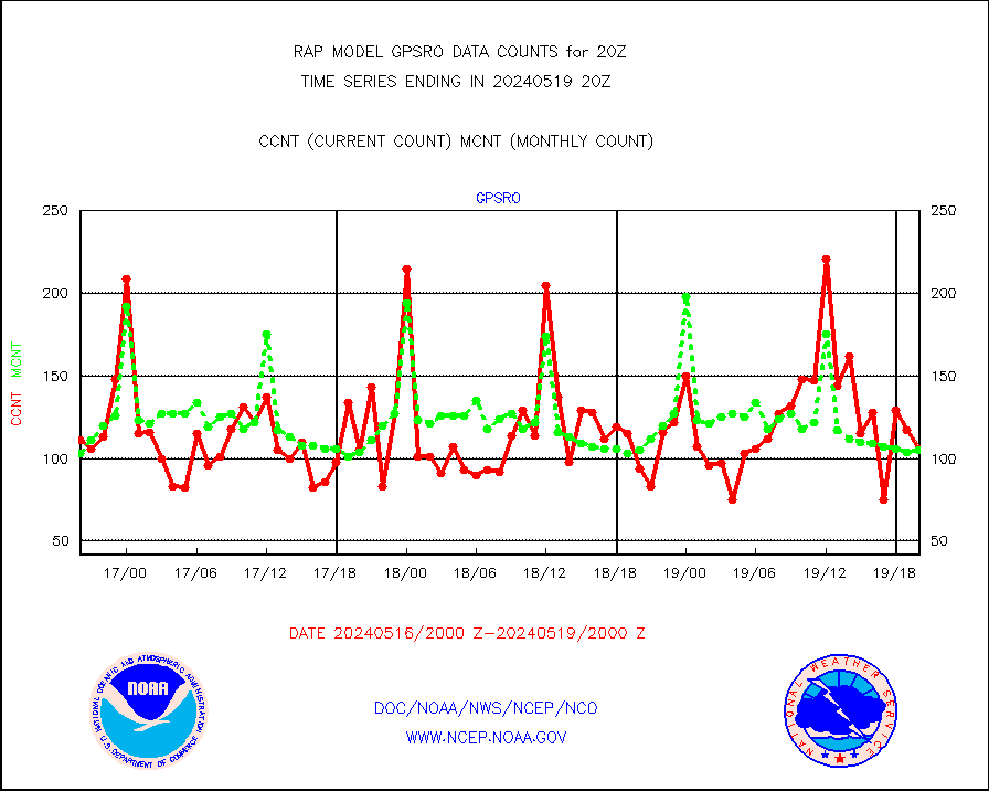
GPS radio occultation data |
169 |
127 |
133.1 % |
0418.00-0421.99 |
||||||||||
GOES-16/17 All Sky Radiances (proc.) |
812097 |
811445 |
100.1 % |
0418.00-0421.99 |
||||||||||
GOES-16/17 Clear Sky Radiances (proc.) |
415950 |
399074 |
104.2 % |
0418.00-0421.99 |
||||||||||
MTSAT/JMA water vapor imager derived cloud motion |
2451 |
2878 |
85.2 % |
0417.50-0422.50 |
||||||||||
GOES-16&up/NESDIS wv imgr/deep-lyr derivd cld mtn |
8726 |
7739 |
112.8 % |
0419.00-0419.99 |
||||||||||
METEOSAT/EUMETSAT wvpr imgr drv cld motion NBseq |
5518 |
5581 |
98.9 % |
0418.50-0421.49 |
||||||||||
GOES-16&up/NESDIS wv imgr/cld-top derived cld mtn |
15050 |
15241 |
98.7 % |
0419.00-0419.99 |
||||||||||
METOP 1-2 IASI 1C radiances-direct broadcast SSEC |
41038 |
66844 |
61.4 % |
0418.00-0421.99 |
||||||||||
METEOSAT/EUMETSAT ir lg-wave drv cld motion NBseq |
3073 |
3141 |
97.8 % |
0418.50-0421.49 |
||||||||||
VIIRS (NPP/NOAA-20) ir lg-wv drv cloud motion(NB) |
0 |
0 |
n/a |
0417.50-0422.50 |
||||||||||
AVHRR (NOAA/METOP) ir lg-wave derived cld motion |
0 |
0 |
n/a |
0417.50-0422.50 |
||||||||||
AVHRR (METOP) ir lg-wave derived cld motion |
0 |
0 |
n/a |
0418.50-0421.49 |
||||||||||
MTSAT/JMA infrared long-wave derived cloud motion |
2163 |
2340 |
92.4 % |
0417.50-0422.50 |
||||||||||
GOES-16&up/NESDIS ir long-wave derived cld motion |
33338 |
32102 |
103.9 % |
0419.00-0419.99 |
||||||||||
Korean AMDAR aircraft data (decoded from BUFR) |
0 |
0 |
n/a |
0416.75-0423.25 |
||||||||||
Land-based CMAN stations decoded from CMAN format |
43 |
50 |
86.0 % |
0419.50-0420.50 |
||||||||||
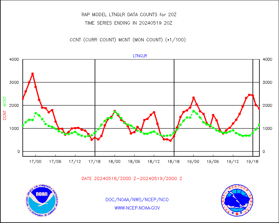
LLDN Long-rng lightning from Vaisala via NOAAPORT |
226491 |
223391 |
101.4 % |
0419.00-0420.50 |
||||||||||
NLDN Shrt-rng lightning from Vaisala via NOAAPORT |
14890 |
12925 |
115.2 % |
0419.00-0420.50 |
||||||||||
Moored buoys (decoded from BUFR) |
671 |
582 |
115.3 % |
0419.50-0420.50 |
||||||||||
Mesonet/MADIS Colorado E-470 (Interstate 470) |
24 |
23 |
104.3 % |
0419.50-0420.50 |
||||||||||
Mesonet/MADIS Alaska Department of Transportation |
118 |
53 |
222.6 % |
0419.50-0420.50 |
||||||||||
Mesonet/MADIS U.S. Army Aberdeen Proving Grounds |
0 |
0 |
n/a |
0419.50-0420.50 |
||||||||||
Mesonet/MADIS Citizen Weather Observers Program |
60110 |
56665 |
106.1 % |
0419.50-0420.50 |
||||||||||
Mesonet/MADIS AWS Convergence Technologies, Inc. |
23277 |
19943 |
116.7 % |
0419.50-0420.50 |
||||||||||
Mesonet/MADIS "Anything Weather" |
0 |
0 |
n/a |
0419.50-0420.50 |
||||||||||
Mesonet/MADIS Colorado Dept. of Transportation |
0 |
0 |
n/a |
0419.50-0420.50 |
||||||||||
Mesonet/MADIS DC Net |
0 |
0 |
n/a |
0419.50-0420.50 |
||||||||||
Mesonet/MADIS Denver Urban Drainage & Flood Cntrl |
0 |
0 |
n/a |
0419.50-0420.50 |
||||||||||
Mesonet/MADIS Florida (FAWN & USF) |
4 |
3 |
133.3 % |
0419.50-0420.50 |
||||||||||
Mesonet/MADIS Florida Dept. of Transportation |
0 |
0 |
n/a |
0419.50-0420.50 |
||||||||||
Mesonet/MADIS Georgia Dept. of Transportation |
0 |
0 |
n/a |
0419.50-0420.50 |
||||||||||
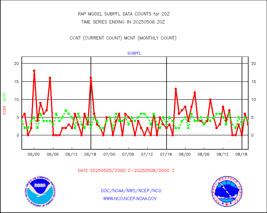
Mesonet/MADIS NWS Hydromet Auto Data System(HADS) |
5502 |
4571 |
120.4 % |
0419.50-0420.50 |
||||||||||
Mesonet/MADIS Iowa Environmental |
178 |
155 |
114.8 % |
0419.50-0420.50 |
||||||||||
Mesonet/MADIS Indiana Dept. of Transportation |
0 |
0 |
n/a |
0419.50-0420.50 |
||||||||||
Mesonet/MADIS Iowa Department of Transportation |
0 |
0 |
n/a |
0419.50-0420.50 |
||||||||||
Mesonet/MADIS Kansas Department of Transportation |
368 |
319 |
115.4 % |
0419.50-0420.50 |
||||||||||
Mesonet/MADIS Oklahoma Mesonet |
628 |
546 |
115.0 % |
0419.50-0420.50 |
||||||||||
Mesonet/MADIS Louisiana State/Jackson State Univ. |
0 |
0 |
n/a |
0419.50-0420.50 |
||||||||||
Mesonet/MADIS Missouri Commercial Agricult Wx Net |
297 |
277 |
107.2 % |
0419.50-0420.50 |
||||||||||
Mesonet/MADIS Minnesota Dept. of Transportation |
0 |
0 |
n/a |
0419.50-0420.50 |
||||||||||
Mesonet/MADIS NOS-Phys Oceanographic Realtime Sys |
308 |
251 |
122.7 % |
0419.50-0420.50 |
||||||||||
Mesonet/MADIS NFIC Remote Automated Wx Stns(RAWS) |
1649 |
1268 |
130.0 % |
0419.50-0420.50 |
||||||||||
Mesonet/MADIS many providers, not separated out |
42301 |
37620 |
112.4 % |
0419.50-0420.50 |
||||||||||
Mesonet/MADIS UrbaNet |
2936 |
2962 |
99.1 % |
0419.50-0420.50 |
||||||||||
Mesonet/MADIS Virginia Dept. of Transportation |
0 |
0 |
n/a |
0419.50-0420.50 |
||||||||||
Mesonet/MADIS "Weather for You" |
0 |
0 |
n/a |
0419.50-0420.50 |
||||||||||
Mesonet/MADIS Wisconsin Dept. of Transportation |
0 |
0 |
n/a |
0419.50-0420.50 |
||||||||||
Mesonet/MADIS MesoWest (many subproviders) |
39712 |
35207 |
112.8 % |
0419.50-0420.50 |
||||||||||
Mesonet/MADIS West Texas |
5412 |
5020 |
107.8 % |
0419.50-0420.50 |
||||||||||
METOP 1-2 IASI 1C radiance data (varbl. channels) |
33696 |
26448 |
127.4 % |
0418.00-0421.99 |
||||||||||
NEXRAD Vel Azm Dsp(VAD) winds via Level 2 decoder |
829 |
719 |
115.3 % |
0419.00-0421.00 |
||||||||||
NOAA 16-19 Solar Backscatter UV-2 rad frm V8 BUFR |
0 |
0 |
n/a |
0418.00-0420.99 |
||||||||||
PIBAL (from PILOT, PILOT SHIP, PILOT MOBIL) |
0 |
0 |
n/a |
0419.00-0421.00 |
||||||||||
PIBAL (decoded from BUFR) |
0 |
0 |
n/a |
0419.00-0421.00 |
||||||||||
Manual PIREP aircraft data (dcded from AIREP fmt) |
519 |
523 |
99.2 % |
0416.75-0423.25 |
||||||||||
Profilr winds from PIBAL (PILOT,PILOT SHIP/MOBIL) |
0 |
0 |
n/a |
0418.50-0421.50 |
||||||||||
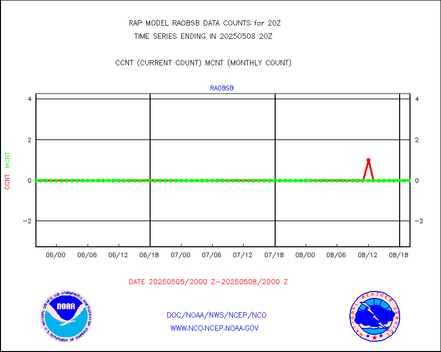
Rawinsonde - fixed land (decoded from BUFR) |
0 |
0 |
n/a |
0419.00-0421.00 |
||||||||||
Rawinsonde - mobile land (from TEMP/PILOT MOBIL) |
0 |
0 |
n/a |
0419.00-0421.00 |
||||||||||
Rawinsonde - mobile land (decoded from BUFR) |
0 |
0 |
n/a |
0419.00-0421.00 |
||||||||||
Rawinsonde - ship (from TEMP SHIP, PILOT SHIP) |
0 |
0 |
n/a |
0419.00-0421.00 |
||||||||||
Rawinsonde - ship (decoded from BUFR) |
0 |
0 |
n/a |
0419.00-0421.00 |
||||||||||
NEXRAD radial wind (Level 2 - GTS) |
1326509 |
1232272 |
107.6 % |
0419.50-0420.49 |
||||||||||
Flight level reconnaissance aircraft data |
0 |
0 |
n/a |
0419.00-0421.00 |
||||||||||
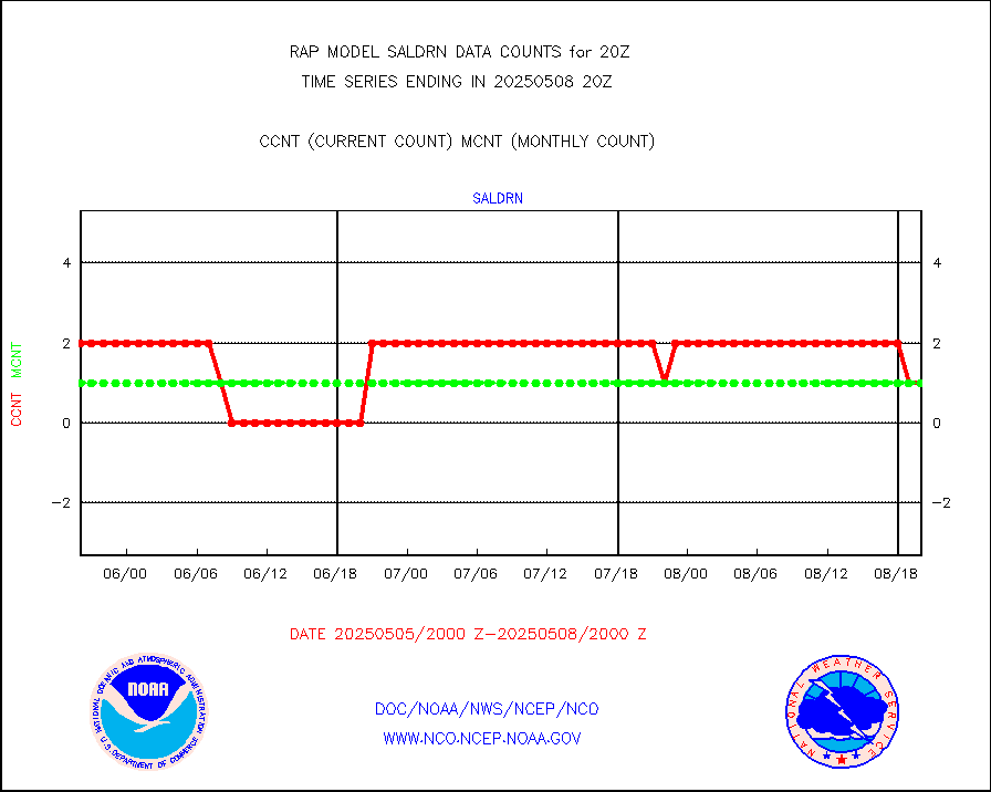
Surface Marine Saildrone (decoded from BUFR) |
2 |
2 |
100.0 % |
0418.00-0421.99 |
||||||||||
Megha-Tropiques SAPHIR L1A2 brightness temps |
0 |
0 |
n/a |
0417.00-0422.99 |
||||||||||
METEOSAT-10 2nd Gen SEVIRI All Sky Radiance(proc) |
9512 |
9512 |
100.0 % |
0418.00-0421.99 |
||||||||||
METEOSAT-10 2nd Gen SEVIRI Clr Sky Radiance(proc) |
0 |
0 |
n/a |
0418.00-0421.99 |
||||||||||
Ship - manual and automatic, restricted |
0 |
4 |
0.0 % |
0419.50-0420.50 |
||||||||||
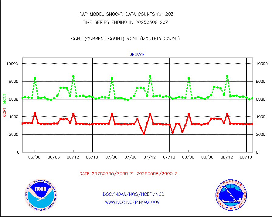
NOW COVER, DEPTH/DENSITY AND WATER EQUIVALENT |
3123 |
6280 |
49.7 % |
0418.00-0422.00 |
||||||||||
Sub-surface float and glider profile (BUFR) |
0 |
2 |
0.0 % |
0418.00-0421.99 |
||||||||||
Synoptic - restricted (WMO Res 40) manual & auto. |
0 |
0 |
n/a |
0419.50-0420.50 |
||||||||||
Synoptic - restricted (WMO Res 40)(decoded BUFR) |
291 |
343 |
84.8 % |
0419.50-0420.50 |
||||||||||
Synoptic - mobile manual & auto (decoded fr BUFR) |
0 |
0 |
n/a |
0419.50-0420.50 |
||||||||||
TAMDAR aircft data-all types(from Panasonic,BUFR) |
180 |
199 |
90.5 % |
0416.75-0423.25 |
||||||||||
MTSAT/JMA visible derived cloud motion |
1275 |
1164 |
109.5 % |
0417.50-0422.50 |
||||||||||
GOES-16&up/NESDIS visible derived cloud motion |
207325 |
198106 |
104.7 % |
0419.00-0419.99 |
||||||||||
METEOSAT/EUMETSAT visible drv cld motion NBseq |
5874 |
5809 |
101.1 % |
0418.50-0421.49 |
||||||||||


