| Suspect Data Shortages in Critical Types - Monitor | ||||||||||||||
|---|---|---|---|---|---|---|---|---|---|---|---|---|---|---|
| Type | Description | Hourly Count | Monthly Average | Percent (%) of Monthly Mean | UTC Time Window | |||||||||
NOAA 18-19 & METOP 1-2 HIRS-4 NCEP-proc. br.temps |
0 |
11583 |
0.0 % |
0118.00-0118.99 |
||||||||||
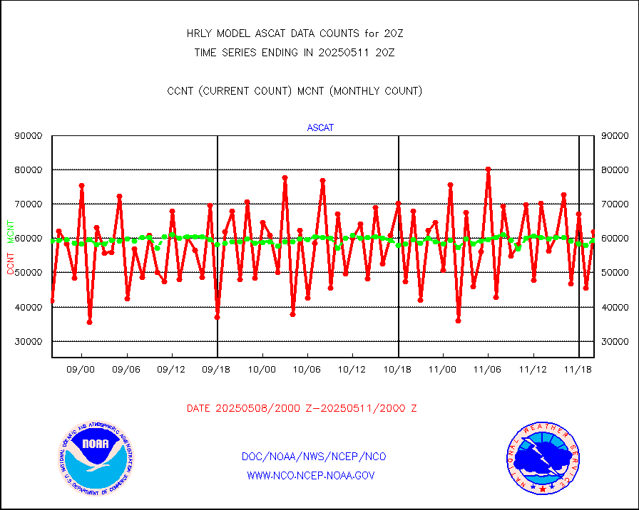
NOAA 15-19 & METOP 1-2 HIRS-3/4 pr btmps frm RARS |
0 |
5431 |
0.0 % |
0119.50-0120.49 |
||||||||||
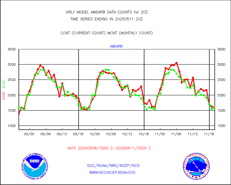
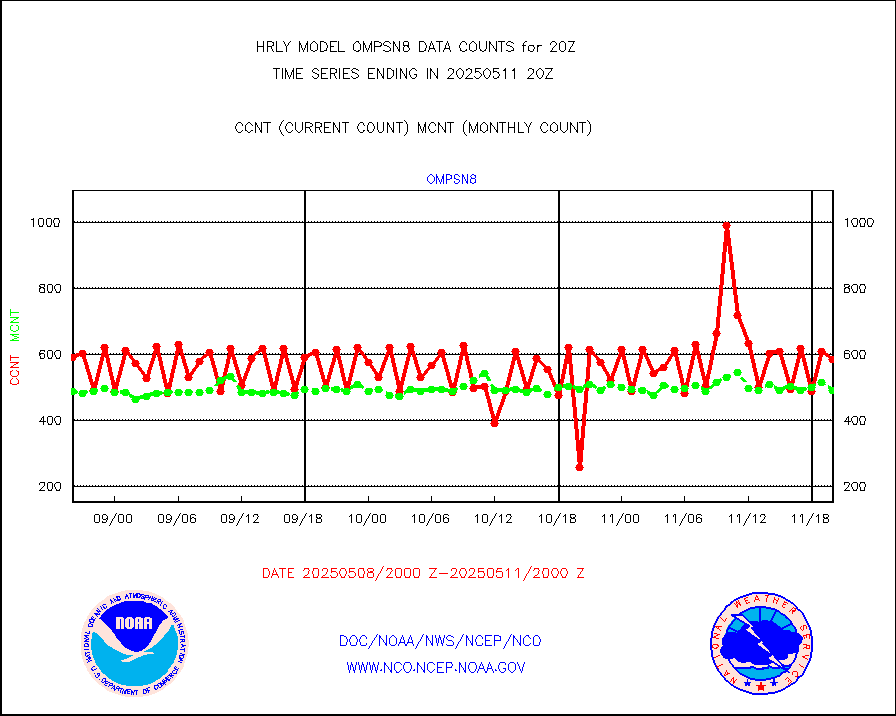
Grnd-based Gbl Navigation Sat System (GNSS) data |
1306 |
6700 |
19.5 % |
0119.00-0119.99 |
||||||||||
| Shortage in Data Type of Opportunity - Monitor | ||||||||||||||
|---|---|---|---|---|---|---|---|---|---|---|---|---|---|---|
| Type | Description | Hourly Count | Monthly Average | Percent (%) of Monthly Mean | UTC Time Window | |||||||||
P.M.(N18-19) AVHRR GAC NCEP-proc clr & sea btemps |
0 |
450342 |
0.0 % |
0117.50-0118.49 |
||||||||||
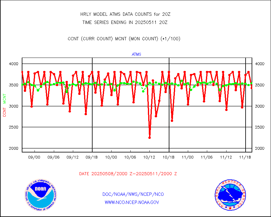
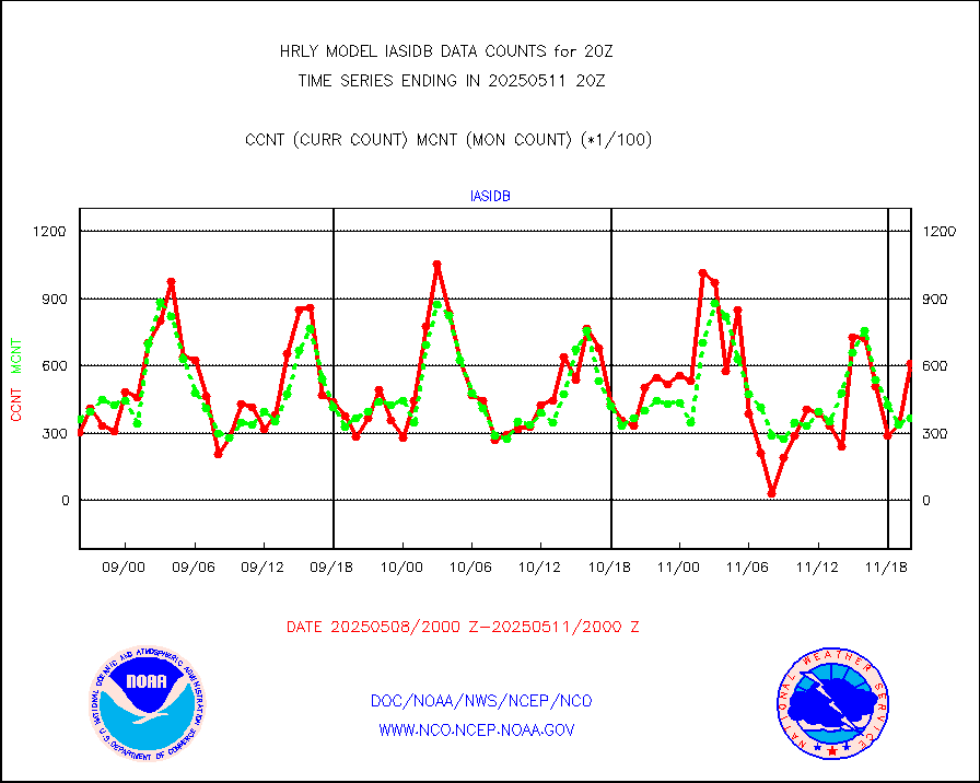
METOP 1-2 IASI 1C radiance data vbl chn from RARS |
0 |
3157 |
0.0 % |
0119.00-0119.99 |
||||||||||
INDIA SATWIND, INSAT WV channel |
0 |
887 |
0.0 % |
0119.00-0119.99 |
||||||||||
High Density OBs from reconnaissance acft data |
0 |
26 |
0.0 % |
0119.50-0120.49 |
||||||||||
INDIA SATWIND, INSAT IR channel |
0 |
1226 |
0.0 % |
0119.00-0119.99 |
||||||||||
NPP/NOAA-20 VIIRS SST - CLEAR & OVER WATER |
0 |
708579 |
0.0 % |
0119.50-0120.49 |
||||||||||
NPP/NOAA-20 VIIRS SST - PROBABLY CLR & OVER WATER |
0 |
220806 |
0.0 % |
0119.50-0120.49 |
||||||||||
| Critical Data with Normal Counts | ||||||||||||||
|---|---|---|---|---|---|---|---|---|---|---|---|---|---|---|
| Type | Description | Hourly Count | Monthly Average | Percent (%) of Monthly Mean | UTC Time Window | |||||||||
NOAA 15-19 & METOP 1-2 AMSU-A NCEP-proc. br.temps |
26737 |
34467 |
77.6 % |
0118.00-0118.99 |
||||||||||
NOAA 18-19 & METOP 1-2 MHS NCEP-proces. br. temps |
158403 |
257476 |
61.5 % |
0118.00-0118.99 |
||||||||||
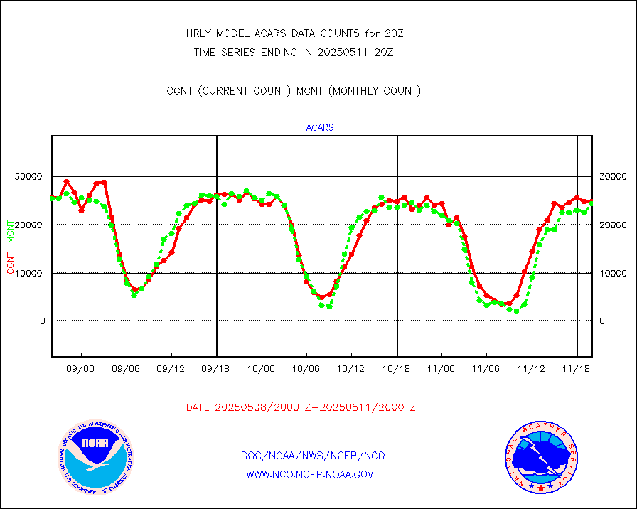
MDCRS ACARS acft data from ARINC(dcded from BUFR) |
27135 |
28095 |
96.6 % |
0119.50-0120.49 |
||||||||||
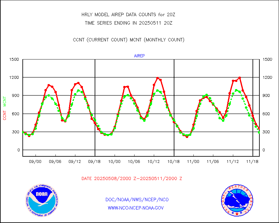
Manual AIREP aircraft data (dcded from AIREP fmt) |
340 |
309 |
110.0 % |
0119.50-0120.49 |
||||||||||
AQUA AIRS/AMSU-A/HSB brightness temps- every FOV |
0 |
0 |
n/a |
0117.50-0118.49 |
||||||||||
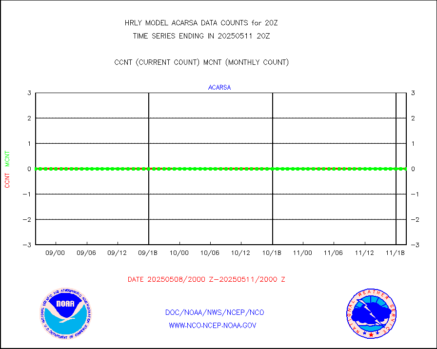
AMDAR aircraft data (decoded from AMDAR format) |
53 |
30 |
176.7 % |
0119.50-0120.49 |
||||||||||
AMDAR aircraft data (decoded from BUFR) |
1672 |
1601 |
104.4 % |
0119.50-0120.49 |
||||||||||
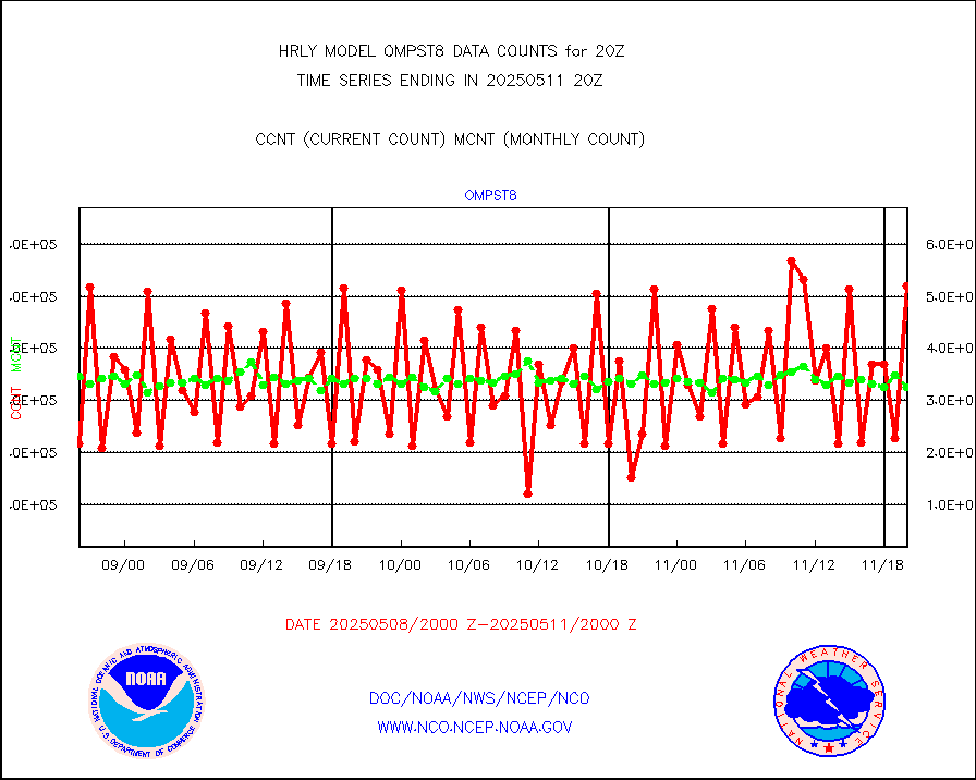
METOP 1-2 ASCAT products |
68082 |
57603 |
118.2 % |
0118.50-0119.49 |
||||||||||
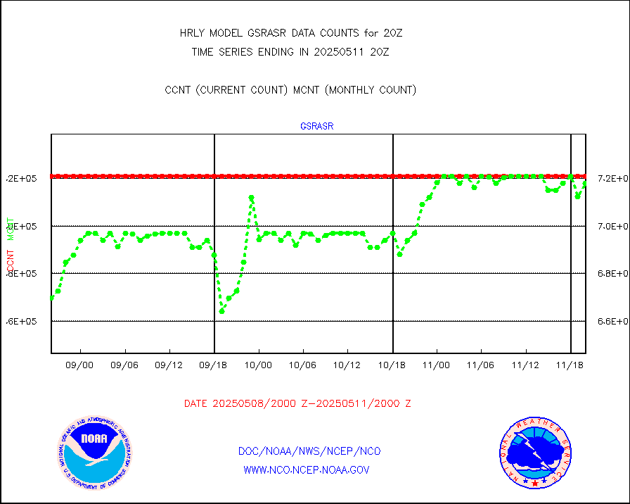
NPP/NOAA-20 ATMS brightness temperatures |
381504 |
336726 |
113.3 % |
0118.50-0119.49 |
||||||||||
Canadian AMDAR aircraft data (decoded from BUFR) |
0 |
0 |
n/a |
0119.50-0120.49 |
||||||||||
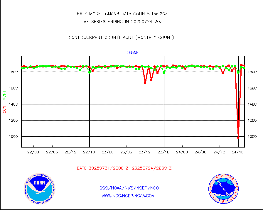
Surface Marine CMAN rpts decoded from BUFR format |
1866 |
1797 |
103.8 % |
0119.50-0120.50 |
||||||||||
Buoys decoded from FM-18 fmt (moored or drifting) |
10 |
12 |
83.3 % |
0119.50-0120.49 |
||||||||||
E-AMDAR (European AMDAR acft decoded from BUFR) |
2197 |
2377 |
92.4 % |
0119.50-0120.49 |
||||||||||
NOAA 15-19 & METOP 1-2 AMSU-A proc btmps frm RARS |
8241 |
10328 |
79.8 % |
0119.50-0120.49 |
||||||||||
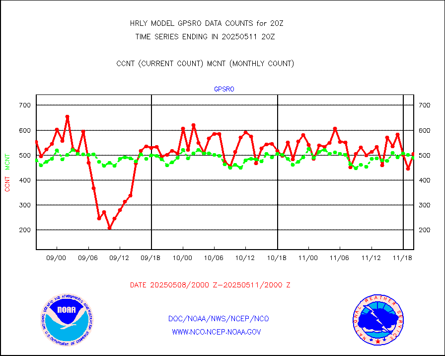
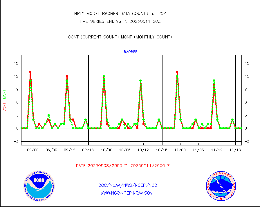
GPS radio occultation data |
492 |
514 |
95.7 % |
0117.50-0118.49 |
||||||||||
GOES-16/17 All Sky Radiances (proc.) |
720952 |
720587 |
100.1 % |
0119.50-0120.49 |
||||||||||
GOES-16/17 Clear Sky Radiances (proc.) |
383005 |
384800 |
99.5 % |
0119.50-0120.49 |
||||||||||
MTSAT/JMA water vapor imager derived cloud motion |
20878 |
19031 |
109.7 % |
0117.50-0118.49 |
||||||||||
MODIS (AQUA/TERRA) wvpr imager derived cld motion |
0 |
0 |
n/a |
0116.00-0116.99 |
||||||||||
GOES-16&up/NESDIS wv imgr/cld-top derived cld mtn |
25738 |
28739 |
89.6 % |
0119.00-0119.99 |
||||||||||
METEOSAT/EUMETSAT ir lg-wave drv cld motion NBseq |
22142 |
21135 |
104.8 % |
0118.50-0119.49 |
||||||||||
MTSAT/JMA infrared long-wave derived cloud motion |
16523 |
15592 |
106.0 % |
0117.50-0118.49 |
||||||||||
MODIS (AQUA/TERRA) ir l-wave derived cloud motion |
0 |
0 |
n/a |
0116.00-0116.99 |
||||||||||
GOES-16&up/NESDIS ir long-wave derived cld motion |
84831 |
85562 |
99.1 % |
0119.00-0119.99 |
||||||||||
GOES/NASA(Langley) hi-res. (1x1 f-o-v) cloud data |
6451672 |
6441503 |
100.2 % |
0119.50-0120.49 |
||||||||||
Buoys decoded from FM-13 format (moored) |
123 |
132 |
93.2 % |
0119.50-0120.49 |
||||||||||
Aviation - METAR |
7930 |
7633 |
103.9 % |
0119.50-0120.49 |
||||||||||
Mesonet/MADIS Colorado E-470 (Interstate 470) |
24 |
24 |
100.0 % |
0119.50-0120.49 |
||||||||||
Mesonet/MADIS Alaska Department of Transportation |
118 |
84 |
140.5 % |
0119.50-0120.49 |
||||||||||
Mesonet/MADIS U.S. Army Aberdeen Proving Grounds |
0 |
0 |
n/a |
0119.50-0120.49 |
||||||||||
Mesonet/MADIS Citizen Weather Observers Program |
52156 |
61158 |
85.3 % |
0119.50-0120.49 |
||||||||||
Mesonet/MADIS AWS Convergence Technologies, Inc. |
15171 |
20257 |
74.9 % |
0119.50-0120.49 |
||||||||||
Mesonet/MADIS "Anything Weather" |
0 |
0 |
n/a |
0119.50-0120.49 |
||||||||||
Mesonet/MADIS Colorado Dept. of Transportation |
0 |
0 |
n/a |
0119.50-0120.49 |
||||||||||
Mesonet/MADIS DC Net |
0 |
0 |
n/a |
0119.50-0120.49 |
||||||||||
Mesonet/MADIS Denver Urban Drainage & Flood Cntrl |
0 |
0 |
n/a |
0119.50-0120.49 |
||||||||||
Mesonet/MADIS Florida (FAWN & USF) |
4 |
4 |
100.0 % |
0119.50-0120.49 |
||||||||||
Mesonet/MADIS Florida Dept. of Transportation |
0 |
0 |
n/a |
0119.50-0120.49 |
||||||||||
Mesonet/MADIS Georgia Dept. of Transportation |
0 |
0 |
n/a |
0119.50-0120.49 |
||||||||||
Mesonet/MADIS NWS Hydromet Auto Data System(HADS) |
5841 |
5979 |
97.7 % |
0119.50-0120.49 |
||||||||||
Mesonet/MADIS Iowa Environmental |
193 |
181 |
106.6 % |
0119.50-0120.49 |
||||||||||
Mesonet/MADIS Indiana Dept. of Transportation |
0 |
0 |
n/a |
0119.50-0120.49 |
||||||||||
Mesonet/MADIS Iowa Department of Transportation |
0 |
0 |
n/a |
0119.50-0120.49 |
||||||||||
Mesonet/MADIS Kansas Department of Transportation |
426 |
366 |
116.4 % |
0119.50-0120.49 |
||||||||||
Mesonet/MADIS Oklahoma Mesonet |
630 |
619 |
101.8 % |
0119.50-0120.49 |
||||||||||
Mesonet/MADIS Louisiana State/Jackson State Univ. |
0 |
0 |
n/a |
0119.50-0120.49 |
||||||||||
Mesonet/MADIS Missouri Commercial Agricult Wx Net |
321 |
325 |
98.8 % |
0119.50-0120.49 |
||||||||||
Mesonet/MADIS Minnesota Dept. of Transportation |
0 |
0 |
n/a |
0119.50-0120.49 |
||||||||||
Mesonet/MADIS NOS-Phys Oceanographic Realtime Sys |
338 |
356 |
94.9 % |
0119.50-0120.49 |
||||||||||
Mesonet/MADIS NFIC Remote Automated Wx Stns(RAWS) |
1939 |
1787 |
108.5 % |
0119.50-0120.49 |
||||||||||
Mesonet/MADIS many providers, not separated out |
61286 |
72948 |
84.0 % |
0119.00-0120.49 |
||||||||||
Mesonet/MADIS Virginia Dept. of Transportation |
0 |
0 |
n/a |
0119.50-0120.49 |
||||||||||
Mesonet/MADIS "Weather for You" |
0 |
0 |
n/a |
0119.50-0120.49 |
||||||||||
Mesonet/MADIS Wisconsin Dept. of Transportation |
0 |
0 |
n/a |
0119.50-0120.49 |
||||||||||
Mesonet/MADIS MesoWest (many subproviders) |
25520 |
35847 |
71.2 % |
0119.50-0120.49 |
||||||||||
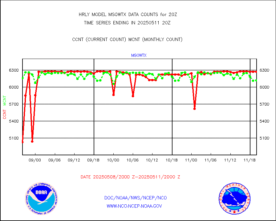
Mesonet/MADIS West Texas |
5156 |
5894 |
87.5 % |
0119.50-0120.49 |
||||||||||
METOP 1-2 IASI 1C radiance data (varbl. channels) |
69552 |
89072 |
78.1 % |
0118.00-0118.99 |
||||||||||
NEXRAD Vel Azm Dsp(VAD) winds via radar coded msg |
0 |
0 |
n/a |
0119.50-0120.49 |
||||||||||
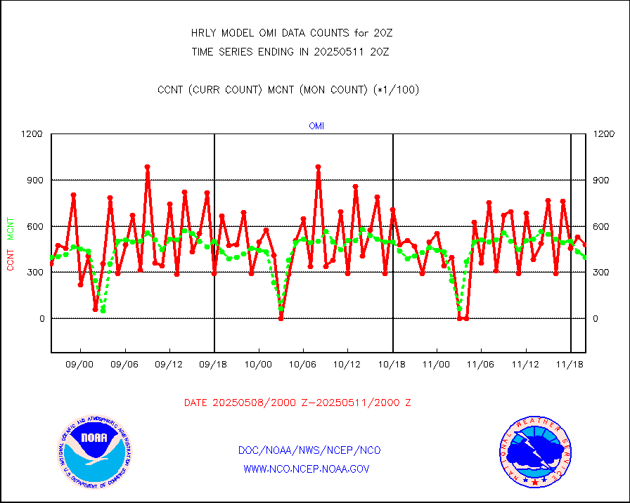
Aura Ozone Monitoring Instrument (OMI) data |
0 |
0 |
n/a |
0117.50-0118.49 |
||||||||||
NOAA 16-19 Solar Backscatter UV-2 rad frm V8 BUFR |
0 |
0 |
n/a |
0118.00-0118.99 |
||||||||||
PIBAL (from PILOT, PILOT SHIP, PILOT MOBIL) |
0 |
0 |
n/a |
0119.50-0120.49 |
||||||||||
Multi-Agency Profiler (MAP) and SODAR winds |
46 |
44 |
104.5 % |
0119.50-0120.49 |
||||||||||
Rawinsonde - fixed land (from TEMP or PILOT) |
0 |
0 |
n/a |
0119.50-0120.49 |
||||||||||
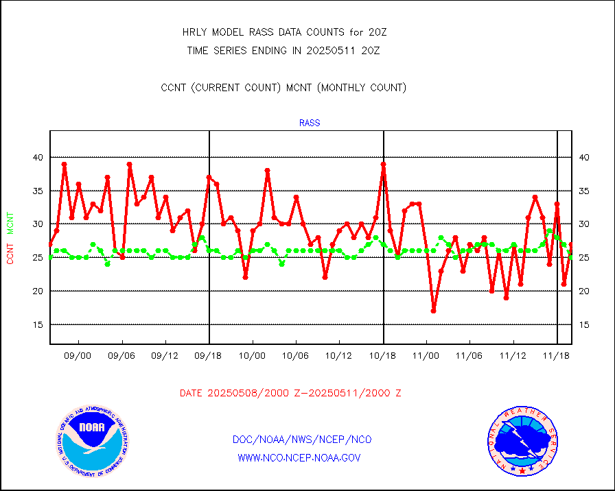
RASS temperatures (NOAA and Multi-Agency) |
24 |
23 |
104.3 % |
0119.50-0120.49 |
||||||||||
NEXRAD reflectivity (Lvl 2 - GTS) |
4651035 |
4519016 |
102.9 % |
0119.50-0120.49 |
||||||||||
NEXRAD radial wind (Level 2 - GTS) |
2256735 |
1649242 |
136.8 % |
0119.50-0120.49 |
||||||||||
METEOSAT-10 2nd Gen SEVIRI Clr Sky Radiance(proc) |
0 |
0 |
n/a |
0119.50-0120.49 |
||||||||||
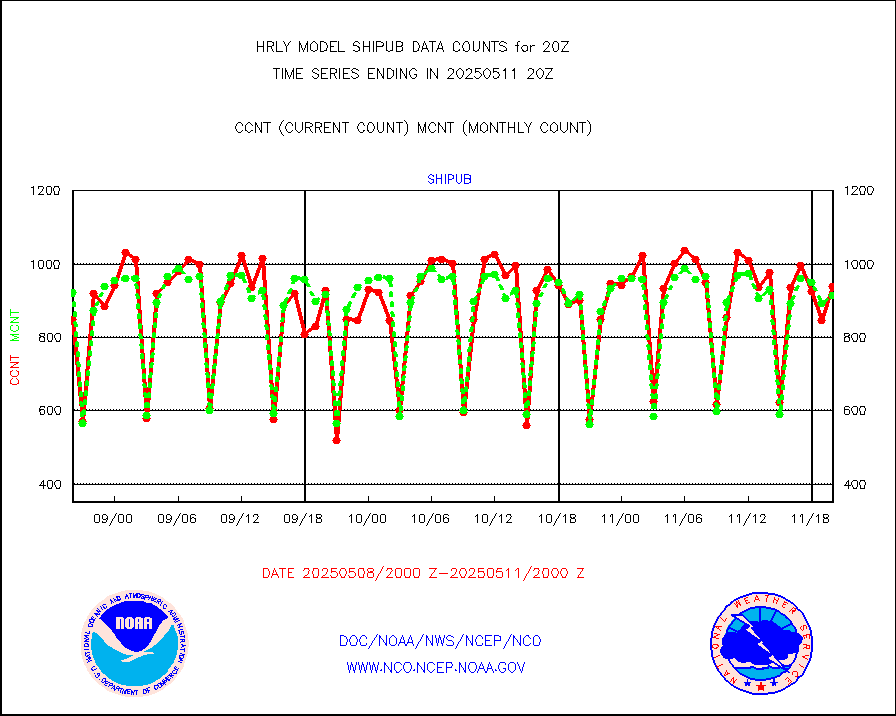
Ship - manual and automatic, restricted (BUFR) |
0 |
0 |
n/a |
0119.50-0120.50 |
||||||||||
Ship - manual and automatic, unrestricted |
146 |
137 |
106.6 % |
0119.50-0120.50 |
||||||||||
Ship - manual and automatic, unrestricted (BUFR) |
1034 |
930 |
111.2 % |
0119.50-0120.50 |
||||||||||
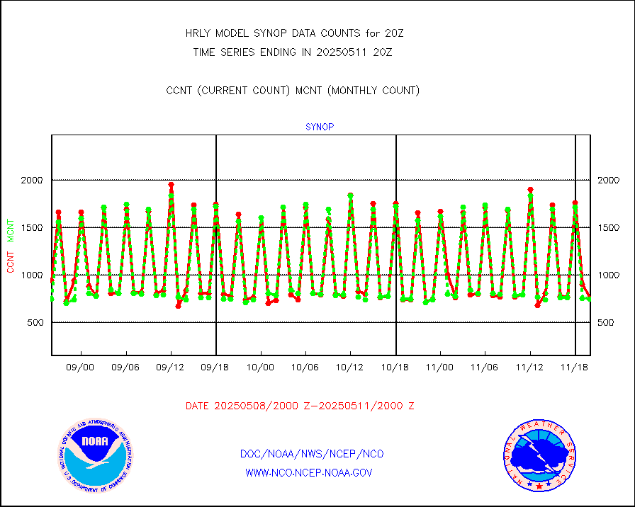
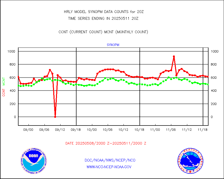
Synoptic - fixed manual and automatic |
666 |
763 |
87.3 % |
0119.50-0120.49 |
||||||||||
Synoptic - fixed manual & auto (decoded fr BUFR) |
5285 |
5172 |
102.2 % |
0119.50-0120.49 |
||||||||||
Synoptic - restricted (WMO Res 40) manual & auto. |
0 |
0 |
n/a |
0119.50-0120.49 |
||||||||||
Synoptic - restricted (WMO Res 40)(decoded BUFR) |
344 |
405 |
84.9 % |
0119.50-0120.49 |
||||||||||
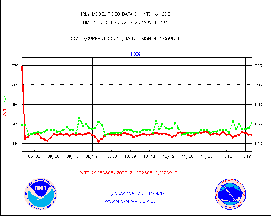
Tide gauge reports decoded from CREX format |
660 |
655 |
100.8 % |
0119.00-0119.99 |
||||||||||
| Data Types of Opportunity with Normal Counts | ||||||||||||||
|---|---|---|---|---|---|---|---|---|---|---|---|---|---|---|
| Type | Description | Hourly Count | Monthly Average | Percent (%) of Monthly Mean | UTC Time Window | |||||||||
GOES-16&up/NESDIS ir short-wv derived cld motion |
1764 |
1678 |
105.1 % |
0119.00-0119.99 |
||||||||||
MDCRS ACARS acft data (ARINC via AFWA)(AIREP fmt) |
0 |
0 |
n/a |
0119.50-0120.49 |
||||||||||
Himawari Clear Sky Radiance |
0 |
0 |
n/a |
0119.00-0119.99 |
||||||||||
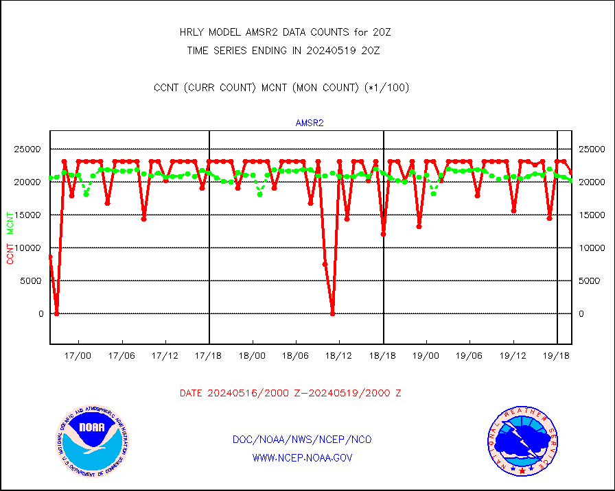
GCOM-W AMSR2 1B brightness temperatures |
2309472 |
2135063 |
108.2 % |
0118.00-0118.99 |
||||||||||
NPP/NOAA-20 ATMS bright. temps-direct b-cast SSEC |
188513 |
135790 |
138.8 % |
0118.50-0119.49 |
||||||||||
POES/NESDIS - processed ATOVS soundings/radiances |
0 |
0 |
n/a |
0118.00-0118.99 |
||||||||||
A.M.(N17,M2,M3) AVHRR GAC NCEP-proc clr&sea btmps |
1089726 |
1309778 |
83.2 % |
0117.50-0118.49 |
||||||||||
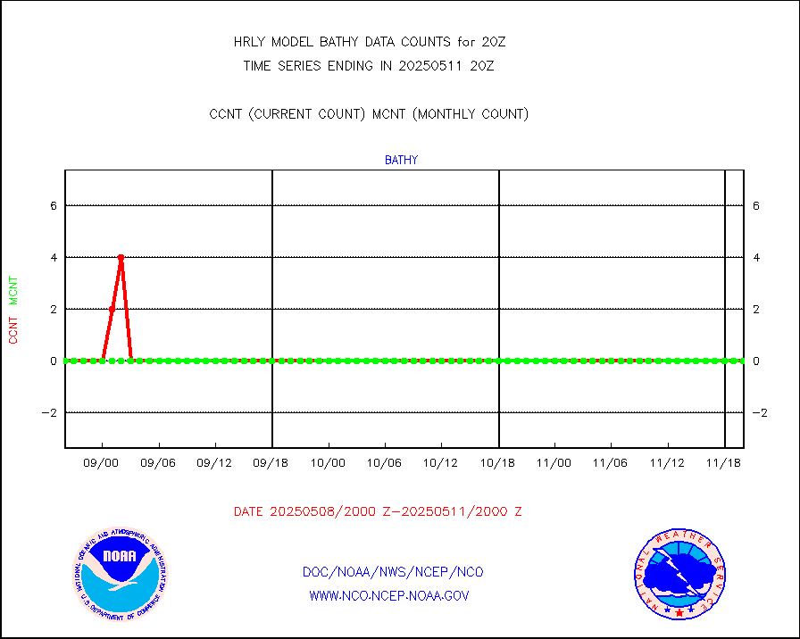
eXpendable BathyThermograph, mooring (BATHY fmt) |
0 |
0 |
n/a |
0113.00-0113.99 |
||||||||||
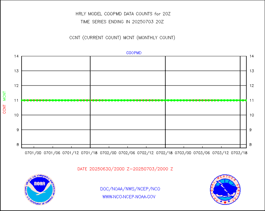
Coop/MADIS NEPP & HCN-Modernization NOAA COOP Obs |
11 |
11 |
100.0 % |
0119.50-0120.49 |
||||||||||
NPP/NOAA-20 CrIS full spctrl radn (431 ch subset) |
240534 |
219071 |
109.8 % |
0118.50-0119.49 |
||||||||||
NPP/NOAA-20 CrIS full spctrl radn dir brdcst SSEC |
79145 |
62562 |
126.5 % |
0118.50-0119.49 |
||||||||||
Coast Guard |
5 |
10 |
50.0 % |
0119.50-0120.50 |
||||||||||
Drifting buoys (decoded from BUFR) |
1432 |
1408 |
101.7 % |
0119.50-0120.50 |
||||||||||
Dropwinsonde (from TEMP DROP) |
0 |
0 |
n/a |
0119.50-0120.49 |
||||||||||
Dropwinsonde (decoded from BUFR) |
0 |
0 |
n/a |
0119.51-0120.49 |
||||||||||
GOES imager effective cloud amount data (U.Wisc.) |
8535568 |
8038034 |
106.2 % |
0119.50-0120.49 |
||||||||||
NPP Adv. Tech. MW Sndr (ATMS) br. temps from RARS |
71118 |
46939 |
151.5 % |
0118.50-0119.49 |
||||||||||
NOAA 18-19 & METOP 1-2 MHS proc. btemps from RARS |
75870 |
101451 |
74.8 % |
0119.50-0120.49 |
||||||||||
GOES/NESDIS (11x17 f-o-v) imager clear radiances |
0 |
0 |
n/a |
0119.00-0119.99 |
||||||||||
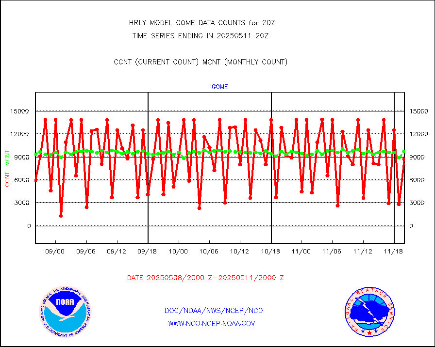
METOP 1-2 Global Ozone Monitoring Exp.-2 (GOME-2) |
13882 |
8231 |
168.7 % |
0118.50-0119.49 |
||||||||||
GOES-16&up/NESDIS wv imgr/deep-lyr derivd cld mtn |
21062 |
17495 |
120.4 % |
0119.00-0119.99 |
||||||||||
METEOSAT/EUMETSAT wvpr imgr drv cld motion NBseq |
35548 |
37787 |
94.1 % |
0118.50-0119.49 |
||||||||||
METOP 1-2 IASI 1C radiances-direct broadcast SSEC |
48297 |
40770 |
118.5 % |
0118.50-0119.49 |
||||||||||
VIIRS (NPP/NOAA-20) ir lg-wv drv cloud motion(NB) |
15321 |
15458 |
99.1 % |
0116.00-0116.99 |
||||||||||
AVHRR (NOAA/METOP) ir lg-wave derived cld motion |
0 |
0 |
n/a |
0116.00-0116.99 |
||||||||||
AVHRR (METOP) ir lg-wave derived cld motion |
0 |
0 |
n/a |
0119.50-0120.50 |
||||||||||
INSAT/KALPANA India ir lg-wave derived cld motion |
0 |
0 |
n/a |
0117.50-0118.49 |
||||||||||
Korean AMDAR aircraft data (decoded from BUFR) |
0 |
0 |
n/a |
0119.50-0120.49 |
||||||||||
Land-based CMAN stations decoded from CMAN format |
105 |
78 |
134.6 % |
0119.50-0120.49 |
||||||||||
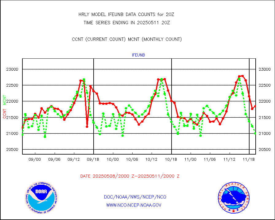
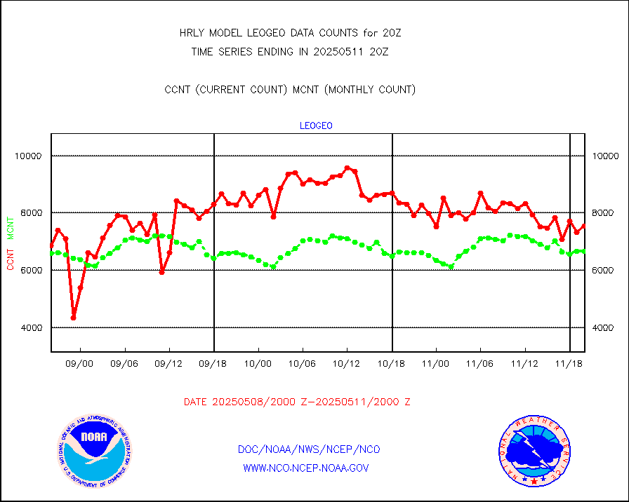
LEO-GEO satellite AMVs from UWisc. |
6798 |
7275 |
93.4 % |
0116.00-0116.99 |
||||||||||
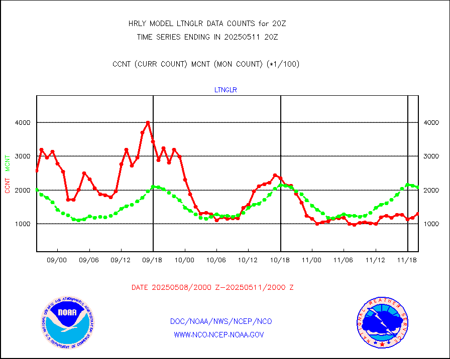
LLDN Long-rng lightning from Vaisala via NOAAPORT |
276180 |
249048 |
110.9 % |
0119.50-0120.49 |
||||||||||
NLDN Shrt-rng lightning from Vaisala via NOAAPORT |
14466 |
9262 |
156.2 % |
0119.50-0120.49 |
||||||||||
Moored buoys (decoded from BUFR) |
971 |
893 |
108.7 % |
0119.50-0120.50 |
||||||||||
Aura Microwave Limb Sounder (MLS) ozone data |
0 |
0 |
n/a |
0118.00-0118.99 |
||||||||||
Mesonet/MADIS UrbaNet |
3604 |
3466 |
104.0 % |
0119.50-0120.49 |
||||||||||
NEXRAD Vel Azm Dsp(VAD) winds via Level 2 decoder |
419 |
389 |
107.7 % |
0119.50-0120.49 |
||||||||||
OMPS Limb Profiler ozone data (NPP) |
231 |
257 |
89.9 % |
0113.00-0113.99 |
||||||||||
OMPS nadir profile ozone (Version 8 BUFR) |
557 |
560 |
99.5 % |
0118.00-0118.99 |
||||||||||
OMPS total column ozone (Version 8 BUFR) |
211975 |
345379 |
61.4 % |
0118.00-0118.99 |
||||||||||
PIBAL (decoded from BUFR) |
0 |
0 |
n/a |
0119.51-0120.49 |
||||||||||
Manual PIREP aircraft data (dcded from AIREP fmt) |
153 |
124 |
123.4 % |
0119.50-0120.49 |
||||||||||
Profilr winds from PIBAL (PILOT,PILOT SHIP/MOBIL) |
0 |
0 |
n/a |
0119.50-0120.49 |
||||||||||
Rawinsonde - fixed land (decoded from BUFR) |
0 |
0 |
n/a |
0119.51-0120.49 |
||||||||||
Rawinsonde - mobile land (from TEMP/PILOT MOBIL) |
0 |
0 |
n/a |
0119.50-0120.49 |
||||||||||
Rawinsonde - mobile land (decoded from BUFR) |
0 |
0 |
n/a |
0119.51-0120.49 |
||||||||||
Rawinsonde - ship (from TEMP SHIP, PILOT SHIP) |
0 |
0 |
n/a |
0119.50-0120.49 |
||||||||||
Rawinsonde - ship (decoded from BUFR) |
0 |
0 |
n/a |
0119.51-0120.49 |
||||||||||
Flight level reconnaissance aircraft data |
0 |
0 |
n/a |
0119.50-0120.49 |
||||||||||
Megha-Tropiques SAPHIR L1A2 brightness temps |
0 |
0 |
n/a |
0117.50-0118.49 |
||||||||||
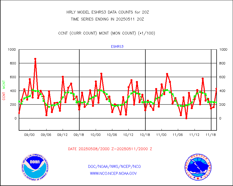
METEOSAT-10 2nd Gen SEVIRI All Sky Radiance(proc) |
75512 |
75468 |
100.1 % |
0119.50-0120.49 |
||||||||||
Ship - manual and automatic, restricted |
10 |
5 |
200.0 % |
0119.50-0120.49 |
||||||||||
DMSP SSM/IS 1C radiance data (Unified Pre-Proc.) |
107640 |
102482 |
105.0 % |
0118.50-0119.49 |
||||||||||
Synoptic - mobile manual and automatic |
647 |
643 |
100.6 % |
0119.50-0120.49 |
||||||||||
Synoptic - mobile manual & auto (decoded fr BUFR) |
1 |
1 |
100.0 % |
0119.50-0120.49 |
||||||||||
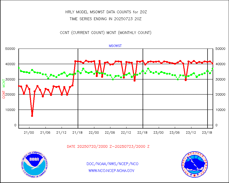
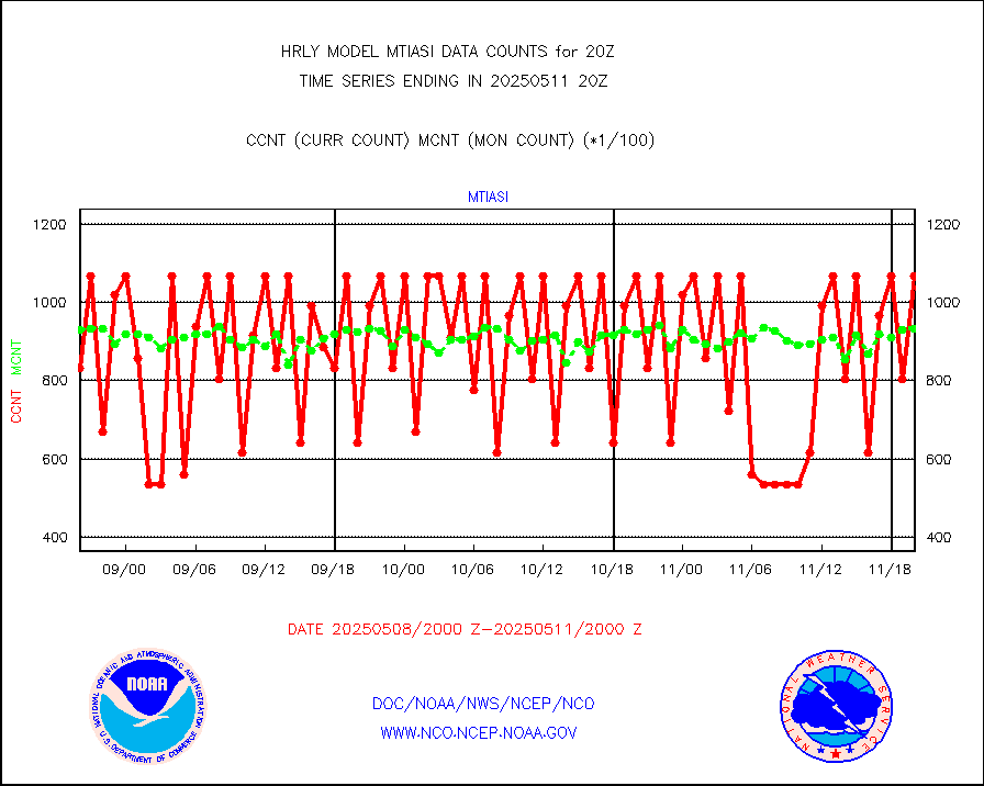
CTD probe, Argo prflng float, mooring (TESAC fmt) |
215 |
209 |
102.9 % |
0119.50-0120.49 |
||||||||||
TAMDAR aircft data-all types(from Panasonic,BUFR) |
43 |
37 |
116.2 % |
0119.50-0120.49 |
||||||||||
ThermoSalinoGraph (TSG) TRACKOB format) |
92 |
85 |
108.2 % |
0118.50-0119.49 |
||||||||||
INSAT/KALPANA India visible derived cloud motion |
0 |
0 |
n/a |
0117.50-0118.49 |
||||||||||
INDIA SATWIND, INSAT VIS channel |
0 |
0 |
n/a |
0119.00-0119.99 |
||||||||||
MTSAT/JMA visible derived cloud motion |
1471 |
1484 |
99.1 % |
0117.50-0118.49 |
||||||||||
GOES-16&up/NESDIS visible derived cloud motion |
563037 |
514772 |
109.4 % |
0119.00-0119.99 |
||||||||||
METEOSAT/EUMETSAT visible drv cld motion NBseq |
15711 |
13264 |
118.4 % |
0118.50-0119.49 |
||||||||||


