| Abnormal Data Shortage in Critical Types - Investigation Required | ||||||||||||||
|---|---|---|---|---|---|---|---|---|---|---|---|---|---|---|
| Type | Description | Hourly Count | Monthly Average | Percent (%) of Monthly Mean | UTC Time Window | |||||||||
E-AMDAR (European AMDAR acft decoded from BUFR) |
0 |
2405 |
0.0 % |
0118.50-0119.49 |
||||||||||
| Suspect Data Shortages in Critical Types - Monitor | ||||||||||||||
|---|---|---|---|---|---|---|---|---|---|---|---|---|---|---|
| Type | Description | Hourly Count | Monthly Average | Percent (%) of Monthly Mean | UTC Time Window | |||||||||
NOAA 18-19 & METOP 1-2 HIRS-4 NCEP-proc. br.temps |
0 |
10330 |
0.0 % |
0117.00-0117.99 |
||||||||||
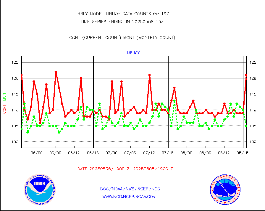
Buoys decoded from FM-18 fmt (moored or drifting) |
0 |
15 |
0.0 % |
0118.50-0119.49 |
||||||||||
NOAA 15-19 & METOP 1-2 HIRS-3/4 pr btmps frm RARS |
0 |
6950 |
0.0 % |
0118.50-0119.49 |
||||||||||
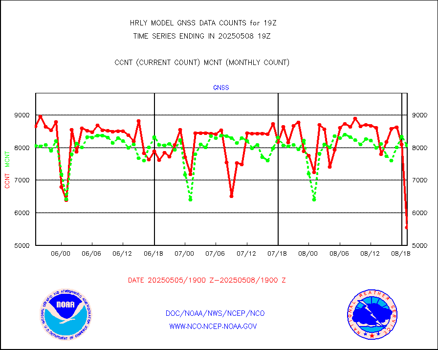
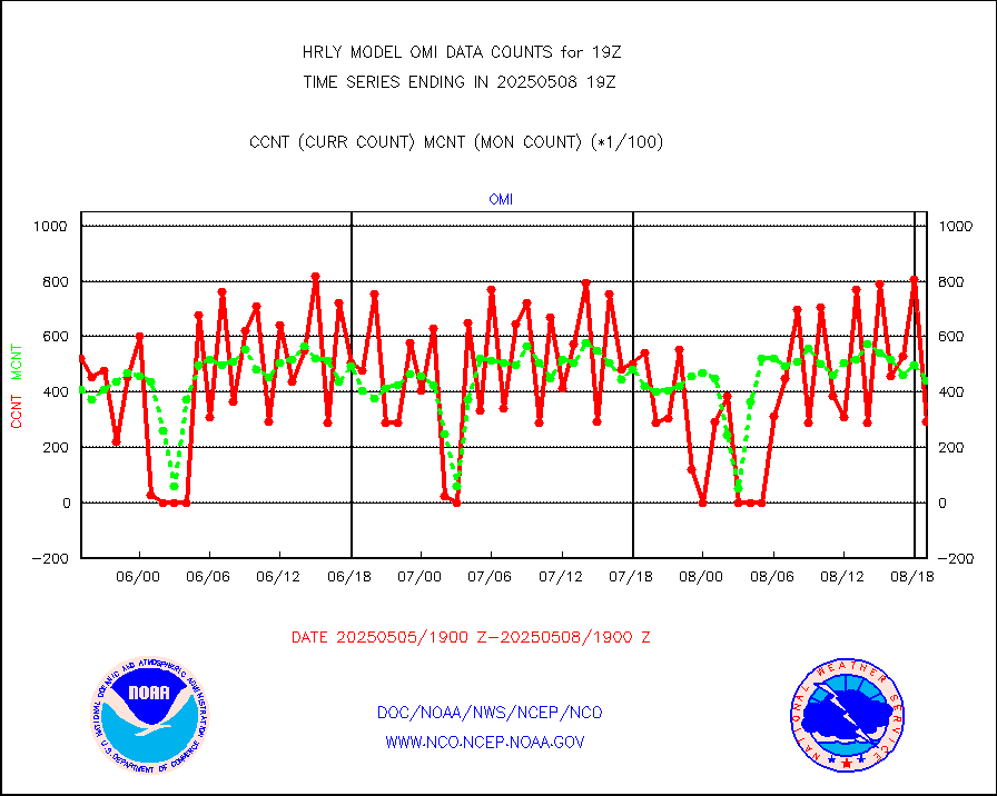
Grnd-based Gbl Navigation Sat System (GNSS) data |
338 |
6635 |
5.1 % |
0118.00-0118.99 |
||||||||||
METEOSAT/EUMETSAT ir lg-wave drv cld motion NBseq |
0 |
21295 |
0.0 % |
0117.50-0118.49 |
||||||||||
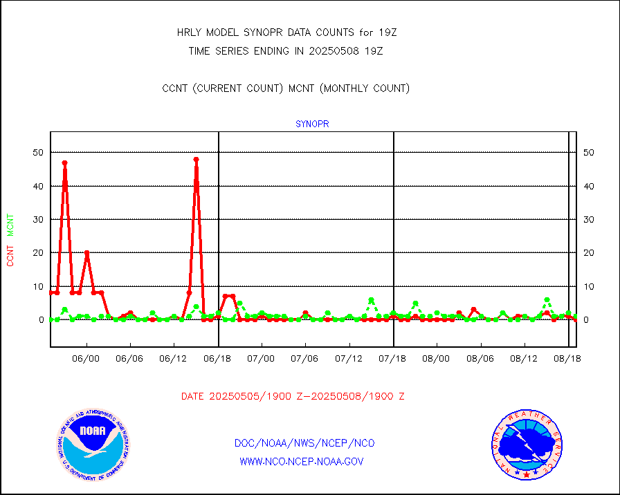
Synoptic - restricted (WMO Res 40)(decoded BUFR) |
0 |
406 |
0.0 % |
0118.50-0119.49 |
||||||||||
| Shortage in Data Type of Opportunity - Monitor | ||||||||||||||
|---|---|---|---|---|---|---|---|---|---|---|---|---|---|---|
| Type | Description | Hourly Count | Monthly Average | Percent (%) of Monthly Mean | UTC Time Window | |||||||||
P.M.(N18-19) AVHRR GAC NCEP-proc clr & sea btemps |
0 |
359999 |
0.0 % |
0116.50-0117.49 |
||||||||||
METOP 1-2 IASI 1C radiance data vbl chn from RARS |
0 |
2330 |
0.0 % |
0118.00-0118.99 |
||||||||||
INDIA SATWIND, INSAT WV channel |
0 |
969 |
0.0 % |
0118.00-0118.99 |
||||||||||
METEOSAT/EUMETSAT wvpr imgr drv cld motion NBseq |
0 |
38092 |
0.0 % |
0117.50-0118.49 |
||||||||||
High Density OBs from reconnaissance acft data |
0 |
24 |
0.0 % |
0118.50-0119.49 |
||||||||||
INDIA SATWIND, INSAT IR channel |
0 |
1475 |
0.0 % |
0118.00-0118.99 |
||||||||||
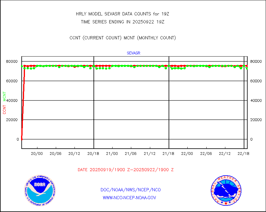
METEOSAT-10 2nd Gen SEVIRI All Sky Radiance(proc) |
0 |
75483 |
0.0 % |
0118.50-0119.49 |
||||||||||
METEOSAT/EUMETSAT visible drv cld motion NBseq |
0 |
20963 |
0.0 % |
0117.50-0118.49 |
||||||||||
| Critical Data with Normal Counts | ||||||||||||||
|---|---|---|---|---|---|---|---|---|---|---|---|---|---|---|
| Type | Description | Hourly Count | Monthly Average | Percent (%) of Monthly Mean | UTC Time Window | |||||||||
NOAA 15-19 & METOP 1-2 AMSU-A NCEP-proc. br.temps |
26734 |
35033 |
76.3 % |
0117.00-0117.99 |
||||||||||
NOAA 18-19 & METOP 1-2 MHS NCEP-proces. br. temps |
238623 |
256785 |
92.9 % |
0117.00-0117.99 |
||||||||||
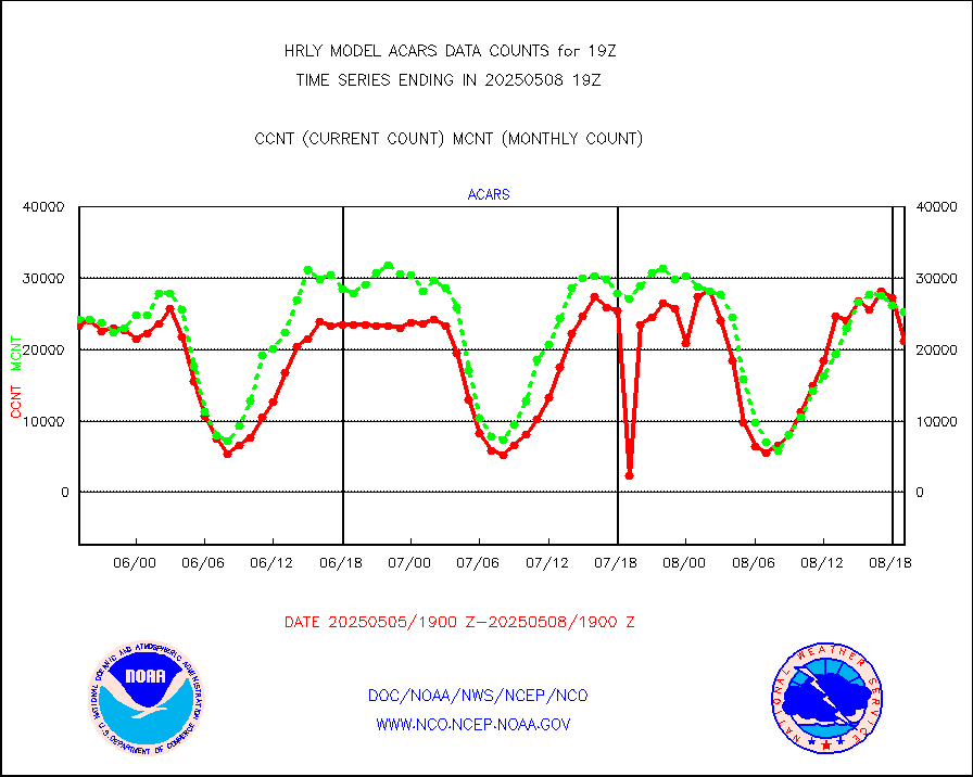
MDCRS ACARS acft data from ARINC(dcded from BUFR) |
23884 |
28417 |
84.0 % |
0118.50-0119.49 |
||||||||||
Manual AIREP aircraft data (dcded from AIREP fmt) |
450 |
406 |
110.8 % |
0118.50-0119.49 |
||||||||||
AQUA AIRS/AMSU-A/HSB brightness temps- every FOV |
0 |
0 |
n/a |
0116.50-0117.49 |
||||||||||
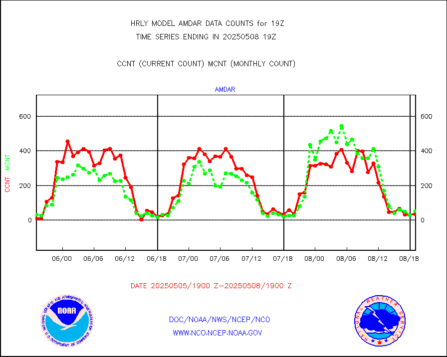
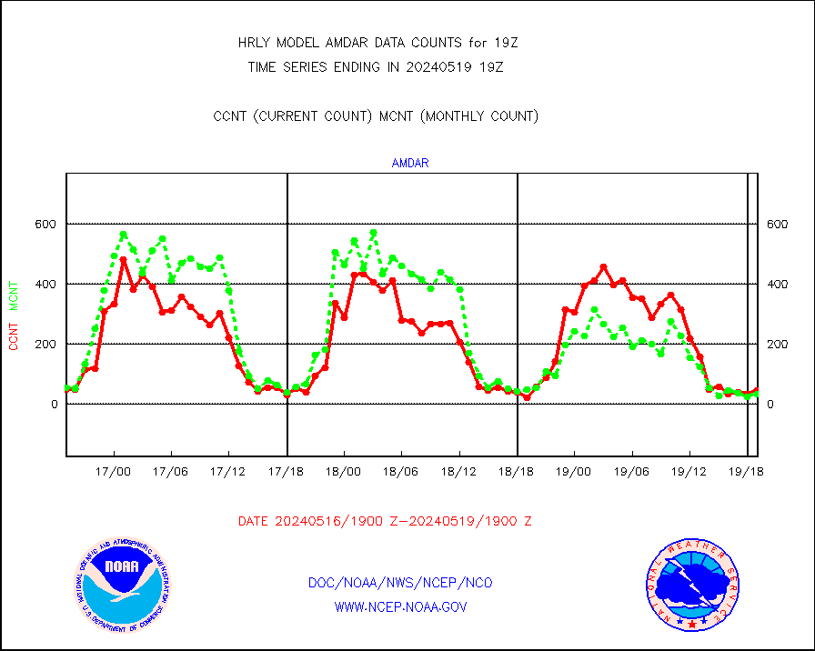
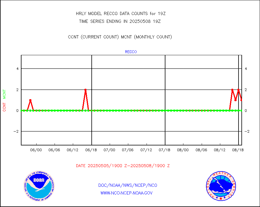
AMDAR aircraft data (decoded from AMDAR format) |
69 |
42 |
164.3 % |
0118.50-0119.49 |
||||||||||
AMDAR aircraft data (decoded from BUFR) |
1552 |
1658 |
93.6 % |
0118.50-0119.49 |
||||||||||
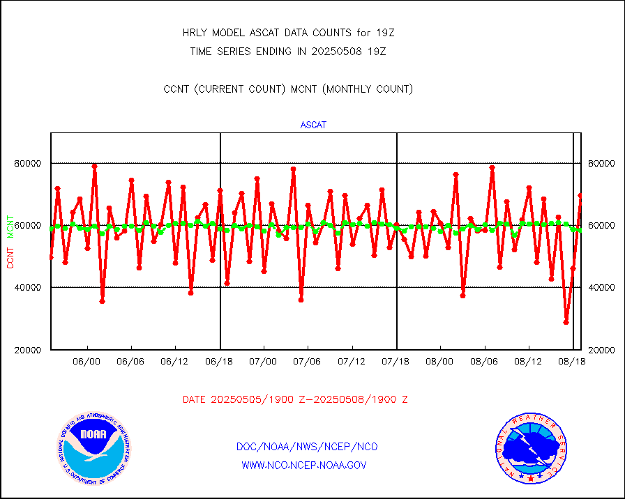
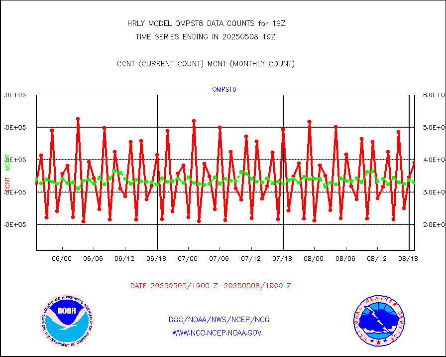
METOP 1-2 ASCAT products |
63882 |
58570 |
109.1 % |
0117.50-0118.49 |
||||||||||
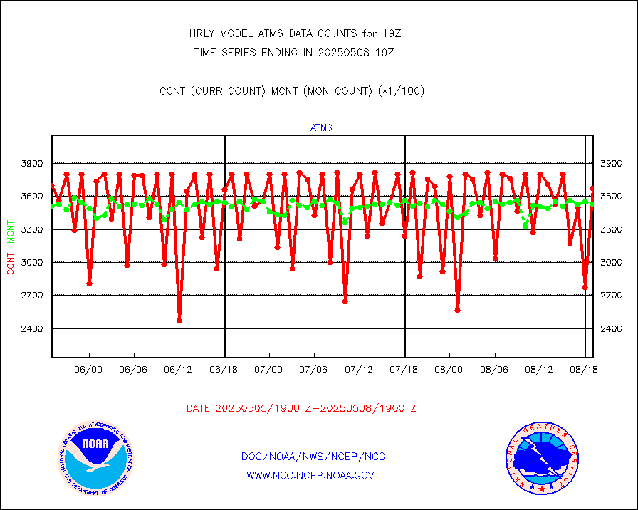
NPP/NOAA-20 ATMS brightness temperatures |
346752 |
336611 |
103.0 % |
0117.50-0118.49 |
||||||||||
Canadian AMDAR aircraft data (decoded from BUFR) |
0 |
0 |
n/a |
0118.50-0119.49 |
||||||||||
Surface Marine CMAN rpts decoded from BUFR format |
1759 |
1844 |
95.4 % |
0118.50-0119.50 |
||||||||||
NOAA 15-19 & METOP 1-2 AMSU-A proc btmps frm RARS |
5100 |
10085 |
50.6 % |
0118.50-0119.49 |
||||||||||
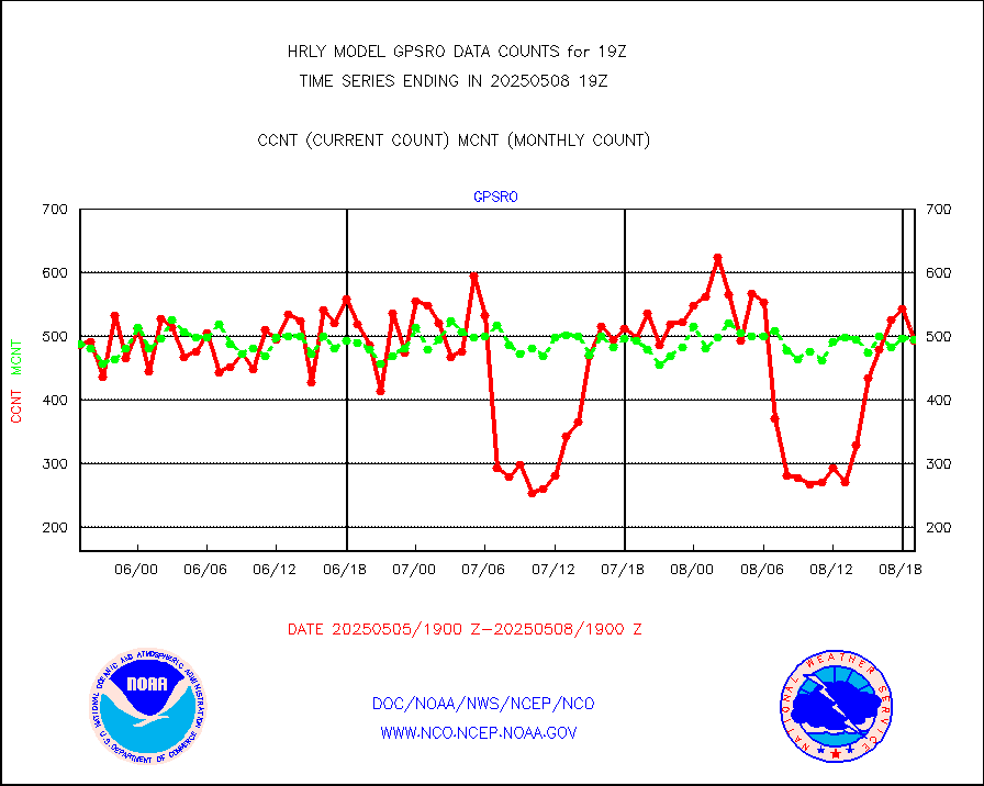
GPS radio occultation data |
417 |
505 |
82.6 % |
0116.50-0117.49 |
||||||||||
GOES-16/17 All Sky Radiances (proc.) |
720952 |
720952 |
100.0 % |
0118.50-0119.49 |
||||||||||
GOES-16/17 Clear Sky Radiances (proc.) |
382065 |
382960 |
99.8 % |
0118.50-0119.49 |
||||||||||
MTSAT/JMA water vapor imager derived cloud motion |
21068 |
19154 |
110.0 % |
0116.50-0117.49 |
||||||||||
MODIS (AQUA/TERRA) wvpr imager derived cld motion |
0 |
0 |
n/a |
0115.00-0115.99 |
||||||||||
GOES-16&up/NESDIS wv imgr/cld-top derived cld mtn |
24483 |
27686 |
88.4 % |
0118.00-0118.99 |
||||||||||
MTSAT/JMA infrared long-wave derived cloud motion |
16687 |
15553 |
107.3 % |
0116.50-0117.49 |
||||||||||
MODIS (AQUA/TERRA) ir l-wave derived cloud motion |
0 |
0 |
n/a |
0115.00-0115.99 |
||||||||||
GOES-16&up/NESDIS ir long-wave derived cld motion |
84711 |
85877 |
98.6 % |
0118.00-0118.99 |
||||||||||
GOES/NASA(Langley) hi-res. (1x1 f-o-v) cloud data |
6454754 |
6302734 |
102.4 % |
0118.50-0119.49 |
||||||||||
Buoys decoded from FM-13 format (moored) |
132 |
130 |
101.5 % |
0118.50-0119.49 |
||||||||||
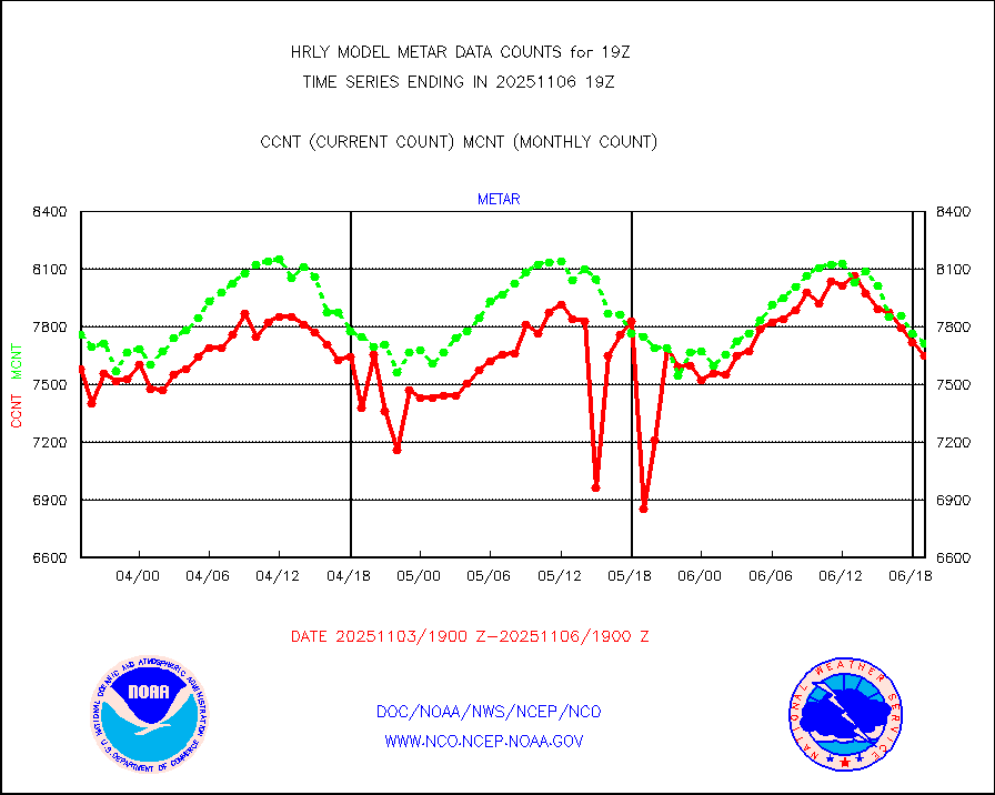
Aviation - METAR |
7624 |
7717 |
98.8 % |
0118.50-0119.49 |
||||||||||
Mesonet/MADIS Colorado E-470 (Interstate 470) |
16 |
24 |
66.7 % |
0118.50-0119.49 |
||||||||||
Mesonet/MADIS Alaska Department of Transportation |
120 |
88 |
136.4 % |
0118.50-0119.49 |
||||||||||
Mesonet/MADIS U.S. Army Aberdeen Proving Grounds |
0 |
0 |
n/a |
0118.50-0119.49 |
||||||||||
Mesonet/MADIS Citizen Weather Observers Program |
16988 |
56618 |
30.0 % |
0118.50-0119.49 |
||||||||||
Mesonet/MADIS AWS Convergence Technologies, Inc. |
5120 |
19031 |
26.9 % |
0118.50-0119.49 |
||||||||||
Mesonet/MADIS "Anything Weather" |
0 |
0 |
n/a |
0118.50-0119.49 |
||||||||||
Mesonet/MADIS Colorado Dept. of Transportation |
0 |
0 |
n/a |
0118.50-0119.49 |
||||||||||
Mesonet/MADIS DC Net |
0 |
0 |
n/a |
0118.50-0119.49 |
||||||||||
Mesonet/MADIS Denver Urban Drainage & Flood Cntrl |
0 |
0 |
n/a |
0118.50-0119.49 |
||||||||||
Mesonet/MADIS Florida (FAWN & USF) |
3 |
4 |
75.0 % |
0118.50-0119.49 |
||||||||||
Mesonet/MADIS Florida Dept. of Transportation |
0 |
0 |
n/a |
0118.50-0119.49 |
||||||||||
Mesonet/MADIS Georgia Dept. of Transportation |
0 |
0 |
n/a |
0118.50-0119.49 |
||||||||||
Mesonet/MADIS NWS Hydromet Auto Data System(HADS) |
4466 |
6115 |
73.0 % |
0118.50-0119.49 |
||||||||||
Mesonet/MADIS Iowa Environmental |
156 |
182 |
85.7 % |
0118.50-0119.49 |
||||||||||
Mesonet/MADIS Indiana Dept. of Transportation |
0 |
0 |
n/a |
0118.50-0119.49 |
||||||||||
Mesonet/MADIS Iowa Department of Transportation |
0 |
0 |
n/a |
0118.50-0119.49 |
||||||||||
Mesonet/MADIS Kansas Department of Transportation |
338 |
374 |
90.4 % |
0118.50-0119.49 |
||||||||||
Mesonet/MADIS Oklahoma Mesonet |
523 |
613 |
85.3 % |
0118.50-0119.49 |
||||||||||
Mesonet/MADIS Louisiana State/Jackson State Univ. |
0 |
0 |
n/a |
0118.50-0119.49 |
||||||||||
Mesonet/MADIS Missouri Commercial Agricult Wx Net |
272 |
329 |
82.7 % |
0118.50-0119.49 |
||||||||||
Mesonet/MADIS Minnesota Dept. of Transportation |
0 |
0 |
n/a |
0118.50-0119.49 |
||||||||||
Mesonet/MADIS NOS-Phys Oceanographic Realtime Sys |
241 |
368 |
65.5 % |
0118.50-0119.49 |
||||||||||
Mesonet/MADIS NFIC Remote Automated Wx Stns(RAWS) |
1359 |
1840 |
73.9 % |
0118.50-0119.49 |
||||||||||
Mesonet/MADIS many providers, not separated out |
16383 |
67821 |
24.2 % |
0118.00-0119.49 |
||||||||||
Mesonet/MADIS Virginia Dept. of Transportation |
0 |
0 |
n/a |
0118.50-0119.49 |
||||||||||
Mesonet/MADIS "Weather for You" |
0 |
0 |
n/a |
0118.50-0119.49 |
||||||||||
Mesonet/MADIS Wisconsin Dept. of Transportation |
0 |
0 |
n/a |
0118.50-0119.49 |
||||||||||
Mesonet/MADIS MesoWest (many subproviders) |
7071 |
33524 |
21.1 % |
0118.50-0119.49 |
||||||||||
Mesonet/MADIS West Texas |
4803 |
5952 |
80.7 % |
0118.50-0119.49 |
||||||||||
METOP 1-2 IASI 1C radiance data (varbl. channels) |
106920 |
94401 |
113.3 % |
0117.00-0117.99 |
||||||||||
NEXRAD Vel Azm Dsp(VAD) winds via radar coded msg |
0 |
0 |
n/a |
0118.50-0119.49 |
||||||||||
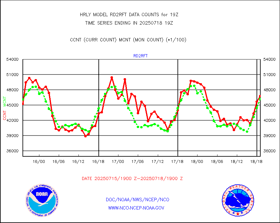
Aura Ozone Monitoring Instrument (OMI) data |
0 |
0 |
n/a |
0116.50-0117.49 |
||||||||||
NOAA 16-19 Solar Backscatter UV-2 rad frm V8 BUFR |
0 |
0 |
n/a |
0117.00-0117.99 |
||||||||||
PIBAL (from PILOT, PILOT SHIP, PILOT MOBIL) |
0 |
0 |
n/a |
0118.50-0119.49 |
||||||||||
Multi-Agency Profiler (MAP) and SODAR winds |
44 |
44 |
100.0 % |
0118.50-0119.49 |
||||||||||
Rawinsonde - fixed land (from TEMP or PILOT) |
0 |
0 |
n/a |
0118.50-0119.49 |
||||||||||
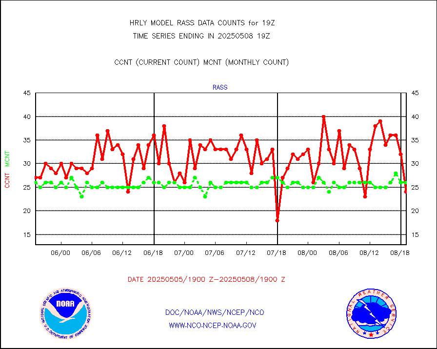
RASS temperatures (NOAA and Multi-Agency) |
24 |
23 |
104.3 % |
0118.50-0119.49 |
||||||||||
NEXRAD reflectivity (Lvl 2 - GTS) |
4730538 |
4426368 |
106.9 % |
0118.50-0119.49 |
||||||||||
NEXRAD radial wind (Level 2 - GTS) |
2046949 |
1563374 |
130.9 % |
0118.50-0119.49 |
||||||||||
METEOSAT-10 2nd Gen SEVIRI Clr Sky Radiance(proc) |
0 |
0 |
n/a |
0118.50-0119.49 |
||||||||||
Ship - manual and automatic, restricted (BUFR) |
0 |
6 |
0.0 % |
0118.50-0119.50 |
||||||||||
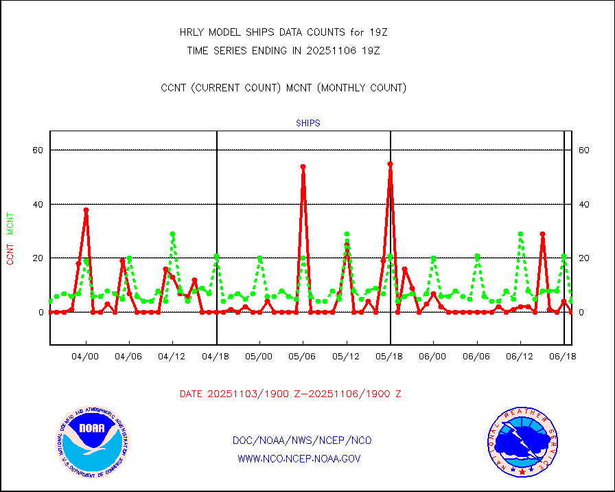
Ship - manual and automatic, unrestricted |
104 |
144 |
72.2 % |
0118.50-0119.50 |
||||||||||
Ship - manual and automatic, unrestricted (BUFR) |
612 |
947 |
64.6 % |
0118.50-0119.50 |
||||||||||
Synoptic - fixed manual and automatic |
1802 |
775 |
232.5 % |
0118.50-0119.49 |
||||||||||
Synoptic - fixed manual & auto (decoded fr BUFR) |
1998 |
5172 |
38.6 % |
0118.50-0119.49 |
||||||||||
Synoptic - restricted (WMO Res 40) manual & auto. |
0 |
0 |
n/a |
0118.50-0119.49 |
||||||||||
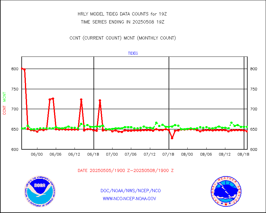
Tide gauge reports decoded from CREX format |
658 |
655 |
100.5 % |
0118.00-0118.99 |
||||||||||
| Data Types of Opportunity with Normal Counts | ||||||||||||||
|---|---|---|---|---|---|---|---|---|---|---|---|---|---|---|
| Type | Description | Hourly Count | Monthly Average | Percent (%) of Monthly Mean | UTC Time Window | |||||||||
GOES-16&up/NESDIS ir short-wv derived cld motion |
4446 |
2699 |
164.7 % |
0118.00-0118.99 |
||||||||||
MDCRS ACARS acft data (ARINC via AFWA)(AIREP fmt) |
0 |
0 |
n/a |
0118.50-0119.49 |
||||||||||
Himawari Clear Sky Radiance |
0 |
0 |
n/a |
0118.00-0118.99 |
||||||||||
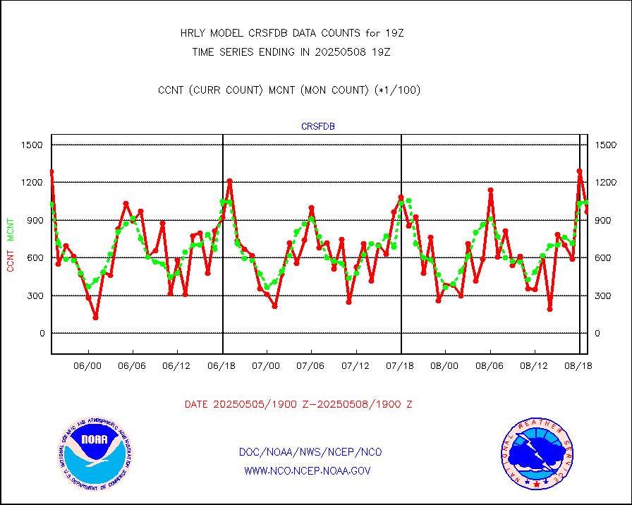
GCOM-W AMSR2 1B brightness temperatures |
2309472 |
2120904 |
108.9 % |
0117.00-0117.99 |
||||||||||
NPP/NOAA-20 ATMS bright. temps-direct b-cast SSEC |
199482 |
164873 |
121.0 % |
0117.50-0118.49 |
||||||||||
POES/NESDIS - processed ATOVS soundings/radiances |
0 |
0 |
n/a |
0117.00-0117.99 |
||||||||||
A.M.(N17,M2,M3) AVHRR GAC NCEP-proc clr&sea btmps |
1159564 |
1302512 |
89.0 % |
0116.50-0117.49 |
||||||||||
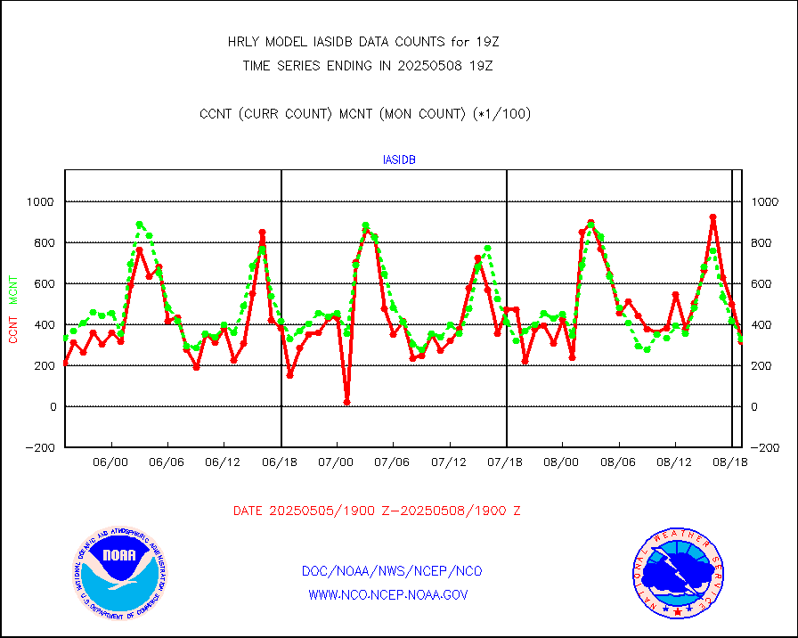
eXpendable BathyThermograph, mooring (BATHY fmt) |
0 |
0 |
n/a |
0112.00-0112.99 |
||||||||||
Coop/MADIS NEPP & HCN-Modernization NOAA COOP Obs |
11 |
11 |
100.0 % |
0118.50-0119.49 |
||||||||||
NPP/NOAA-20 CrIS full spctrl radn (431 ch subset) |
236160 |
214991 |
109.8 % |
0117.50-0118.49 |
||||||||||
NPP/NOAA-20 CrIS full spctrl radn dir brdcst SSEC |
89964 |
91375 |
98.5 % |
0117.50-0118.49 |
||||||||||
Coast Guard |
5 |
6 |
83.3 % |
0118.50-0119.50 |
||||||||||
Drifting buoys (decoded from BUFR) |
1353 |
1414 |
95.7 % |
0118.50-0119.50 |
||||||||||
Dropwinsonde (from TEMP DROP) |
0 |
0 |
n/a |
0118.50-0119.49 |
||||||||||
Dropwinsonde (decoded from BUFR) |
1 |
1 |
100.0 % |
0118.51-0119.49 |
||||||||||
GOES imager effective cloud amount data (U.Wisc.) |
8535568 |
8109423 |
105.3 % |
0118.50-0119.49 |
||||||||||
NPP Adv. Tech. MW Sndr (ATMS) br. temps from RARS |
54332 |
82307 |
66.0 % |
0117.50-0118.49 |
||||||||||
NOAA 18-19 & METOP 1-2 MHS proc. btemps from RARS |
71006 |
99510 |
71.4 % |
0118.50-0119.49 |
||||||||||
GOES/NESDIS (11x17 f-o-v) imager clear radiances |
0 |
0 |
n/a |
0118.00-0118.99 |
||||||||||
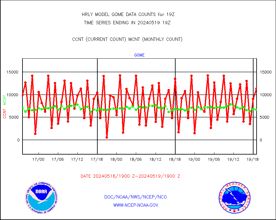
METOP 1-2 Global Ozone Monitoring Exp.-2 (GOME-2) |
9428 |
8905 |
105.9 % |
0117.50-0118.49 |
||||||||||
GOES-16&up/NESDIS wv imgr/deep-lyr derivd cld mtn |
21457 |
17449 |
123.0 % |
0118.00-0118.99 |
||||||||||
METOP 1-2 IASI 1C radiances-direct broadcast SSEC |
45472 |
36433 |
124.8 % |
0117.50-0118.49 |
||||||||||
VIIRS (NPP/NOAA-20) ir lg-wv drv cloud motion(NB) |
13694 |
13708 |
99.9 % |
0115.00-0115.99 |
||||||||||
AVHRR (NOAA/METOP) ir lg-wave derived cld motion |
0 |
0 |
n/a |
0115.00-0115.99 |
||||||||||
AVHRR (METOP) ir lg-wave derived cld motion |
0 |
0 |
n/a |
0118.50-0119.50 |
||||||||||
INSAT/KALPANA India ir lg-wave derived cld motion |
0 |
0 |
n/a |
0116.50-0117.49 |
||||||||||
Korean AMDAR aircraft data (decoded from BUFR) |
0 |
0 |
n/a |
0118.50-0119.49 |
||||||||||
Land-based CMAN stations decoded from CMAN format |
64 |
82 |
78.0 % |
0118.50-0119.49 |
||||||||||
LEO-GEO satellite AMVs from UWisc. |
7099 |
7551 |
94.0 % |
0115.00-0115.99 |
||||||||||
LLDN Long-rng lightning from Vaisala via NOAAPORT |
198606 |
237298 |
83.7 % |
0118.50-0119.49 |
||||||||||
NLDN Shrt-rng lightning from Vaisala via NOAAPORT |
8374 |
7730 |
108.3 % |
0118.50-0119.49 |
||||||||||
Moored buoys (decoded from BUFR) |
791 |
931 |
85.0 % |
0118.50-0119.50 |
||||||||||
Aura Microwave Limb Sounder (MLS) ozone data |
0 |
0 |
n/a |
0117.00-0117.99 |
||||||||||
Mesonet/MADIS UrbaNet |
2856 |
3554 |
80.4 % |
0118.50-0119.49 |
||||||||||
NEXRAD Vel Azm Dsp(VAD) winds via Level 2 decoder |
396 |
374 |
105.9 % |
0118.50-0119.49 |
||||||||||
OMPS Limb Profiler ozone data (NPP) |
189 |
253 |
74.7 % |
0112.00-0112.99 |
||||||||||
OMPS nadir profile ozone (Version 8 BUFR) |
534 |
554 |
96.4 % |
0117.00-0117.99 |
||||||||||
OMPS total column ozone (Version 8 BUFR) |
477773 |
329670 |
144.9 % |
0117.00-0117.99 |
||||||||||
PIBAL (decoded from BUFR) |
0 |
0 |
n/a |
0118.51-0119.49 |
||||||||||
Manual PIREP aircraft data (dcded from AIREP fmt) |
99 |
132 |
75.0 % |
0118.50-0119.49 |
||||||||||
Profilr winds from PIBAL (PILOT,PILOT SHIP/MOBIL) |
0 |
0 |
n/a |
0118.50-0119.49 |
||||||||||
Rawinsonde - fixed land (decoded from BUFR) |
0 |
0 |
n/a |
0118.51-0119.49 |
||||||||||
Rawinsonde - mobile land (from TEMP/PILOT MOBIL) |
0 |
0 |
n/a |
0118.50-0119.49 |
||||||||||
Rawinsonde - mobile land (decoded from BUFR) |
0 |
0 |
n/a |
0118.51-0119.49 |
||||||||||
Rawinsonde - ship (from TEMP SHIP, PILOT SHIP) |
0 |
0 |
n/a |
0118.50-0119.49 |
||||||||||
Rawinsonde - ship (decoded from BUFR) |
0 |
0 |
n/a |
0118.51-0119.49 |
||||||||||
Flight level reconnaissance aircraft data |
0 |
0 |
n/a |
0118.50-0119.49 |
||||||||||
Megha-Tropiques SAPHIR L1A2 brightness temps |
0 |
0 |
n/a |
0116.50-0117.49 |
||||||||||
Ship - manual and automatic, restricted |
3 |
11 |
27.3 % |
0118.50-0119.49 |
||||||||||
DMSP SSM/IS 1C radiance data (Unified Pre-Proc.) |
29460 |
82708 |
35.6 % |
0117.50-0118.49 |
||||||||||
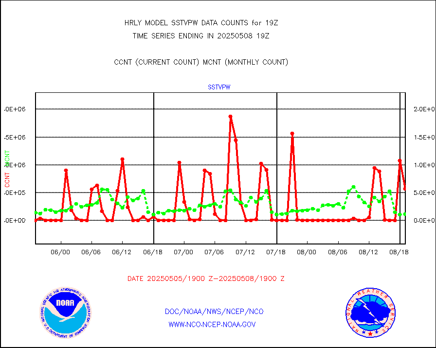
NPP/NOAA-20 VIIRS SST - CLEAR & OVER WATER |
202906 |
950973 |
21.3 % |
0118.50-0119.49 |
||||||||||
NPP/NOAA-20 VIIRS SST - PROBABLY CLR & OVER WATER |
47306 |
194683 |
24.3 % |
0118.50-0119.49 |
||||||||||
Synoptic - mobile manual and automatic |
522 |
634 |
82.3 % |
0118.50-0119.49 |
||||||||||
Synoptic - mobile manual & auto (decoded fr BUFR) |
0 |
1 |
0.0 % |
0118.50-0119.49 |
||||||||||
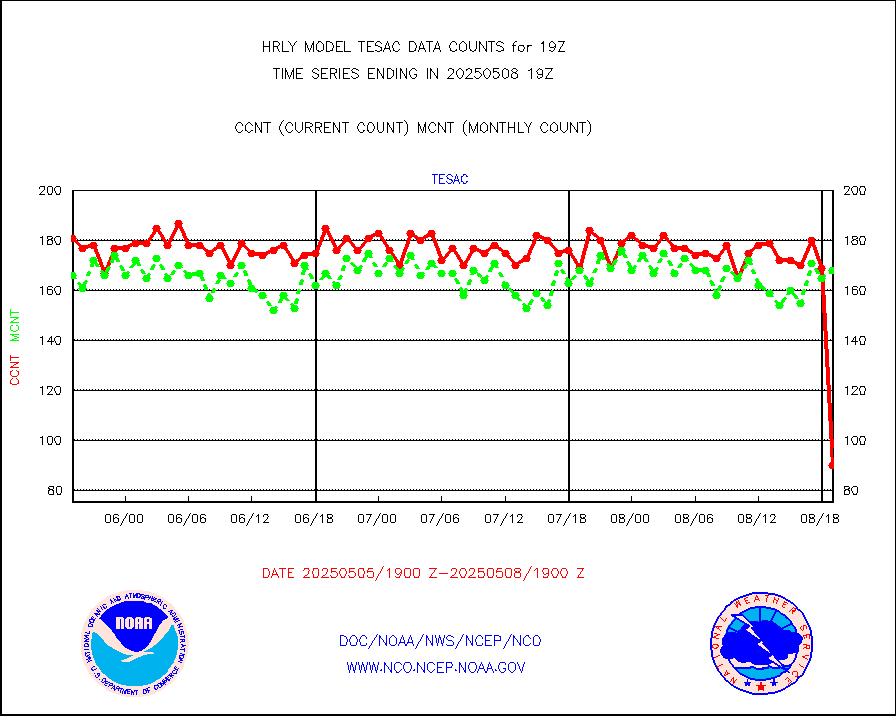
CTD probe, Argo prflng float, mooring (TESAC fmt) |
196 |
219 |
89.5 % |
0118.50-0119.49 |
||||||||||
TAMDAR aircft data-all types(from Panasonic,BUFR) |
46 |
46 |
100.0 % |
0118.50-0119.49 |
||||||||||
ThermoSalinoGraph (TSG) TRACKOB format) |
93 |
94 |
98.9 % |
0117.50-0118.49 |
||||||||||
INSAT/KALPANA India visible derived cloud motion |
0 |
0 |
n/a |
0116.50-0117.49 |
||||||||||
INDIA SATWIND, INSAT VIS channel |
0 |
0 |
n/a |
0118.00-0118.99 |
||||||||||
MTSAT/JMA visible derived cloud motion |
121 |
156 |
77.6 % |
0116.50-0117.49 |
||||||||||
GOES-16&up/NESDIS visible derived cloud motion |
573989 |
522596 |
109.8 % |
0118.00-0118.99 |
||||||||||


