| Abnormal Data Shortage in Critical Types - Investigation Required | ||||||||||||||
|---|---|---|---|---|---|---|---|---|---|---|---|---|---|---|
| Type | Description | Hourly Count | Monthly Average | Percent (%) of Monthly Mean | UTC Time Window | |||||||||
E-AMDAR (European AMDAR acft decoded from BUFR) |
0 |
2291 |
0.0 % |
0117.50-0118.49 |
||||||||||
| Suspect Data Shortages in Critical Types - Monitor | ||||||||||||||
|---|---|---|---|---|---|---|---|---|---|---|---|---|---|---|
| Type | Description | Hourly Count | Monthly Average | Percent (%) of Monthly Mean | UTC Time Window | |||||||||
NOAA 18-19 & METOP 1-2 HIRS-4 NCEP-proc. br.temps |
0 |
12862 |
0.0 % |
0116.00-0116.99 |
||||||||||
NOAA 15-19 & METOP 1-2 HIRS-3/4 pr btmps frm RARS |
0 |
4693 |
0.0 % |
0117.50-0118.49 |
||||||||||
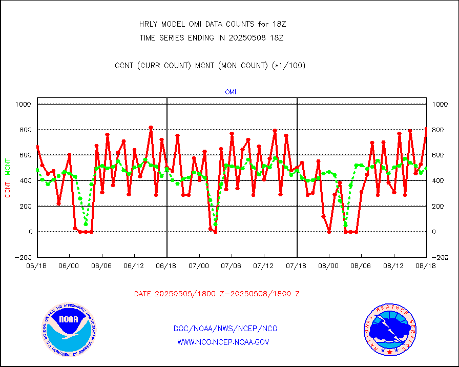
Grnd-based Gbl Navigation Sat System (GNSS) data |
341 |
6888 |
5.0 % |
0117.00-0117.99 |
||||||||||
Synoptic - restricted (WMO Res 40)(decoded BUFR) |
0 |
356 |
0.0 % |
0117.50-0118.49 |
||||||||||
| Shortage in Data Type of Opportunity - Monitor | ||||||||||||||
|---|---|---|---|---|---|---|---|---|---|---|---|---|---|---|
| Type | Description | Hourly Count | Monthly Average | Percent (%) of Monthly Mean | UTC Time Window | |||||||||
P.M.(N18-19) AVHRR GAC NCEP-proc clr & sea btemps |
0 |
419806 |
0.0 % |
0115.50-0116.49 |
||||||||||
METOP 1-2 IASI 1C radiance data vbl chn from RARS |
0 |
2126 |
0.0 % |
0117.00-0117.99 |
||||||||||
INDIA SATWIND, INSAT WV channel |
0 |
539 |
0.0 % |
0117.00-0117.99 |
||||||||||
INDIA SATWIND, INSAT IR channel |
0 |
853 |
0.0 % |
0117.00-0117.99 |
||||||||||
METEOSAT-10 2nd Gen SEVIRI All Sky Radiance(proc) |
0 |
75451 |
0.0 % |
0117.50-0118.49 |
||||||||||
| Critical Data with Normal Counts | ||||||||||||||
|---|---|---|---|---|---|---|---|---|---|---|---|---|---|---|
| Type | Description | Hourly Count | Monthly Average | Percent (%) of Monthly Mean | UTC Time Window | |||||||||
NOAA 15-19 & METOP 1-2 AMSU-A NCEP-proc. br.temps |
21921 |
34388 |
63.7 % |
0116.00-0116.99 |
||||||||||
NOAA 18-19 & METOP 1-2 MHS NCEP-proces. br. temps |
195933 |
260720 |
75.2 % |
0116.00-0116.99 |
||||||||||
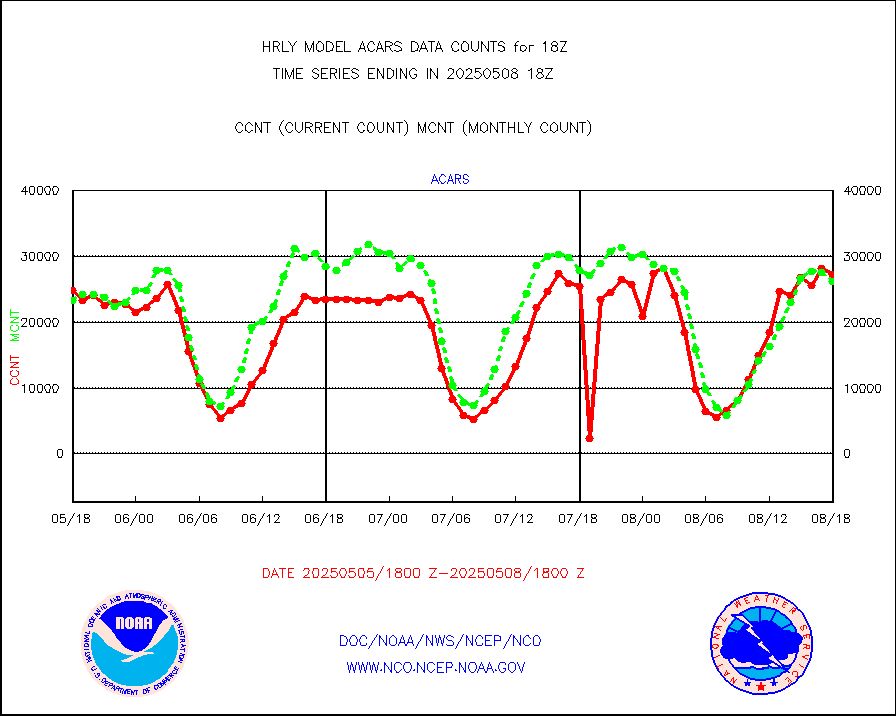
MDCRS ACARS acft data from ARINC(dcded from BUFR) |
26780 |
29325 |
91.3 % |
0117.50-0118.49 |
||||||||||
Manual AIREP aircraft data (dcded from AIREP fmt) |
520 |
498 |
104.4 % |
0117.50-0118.49 |
||||||||||
AQUA AIRS/AMSU-A/HSB brightness temps- every FOV |
0 |
0 |
n/a |
0115.50-0116.49 |
||||||||||
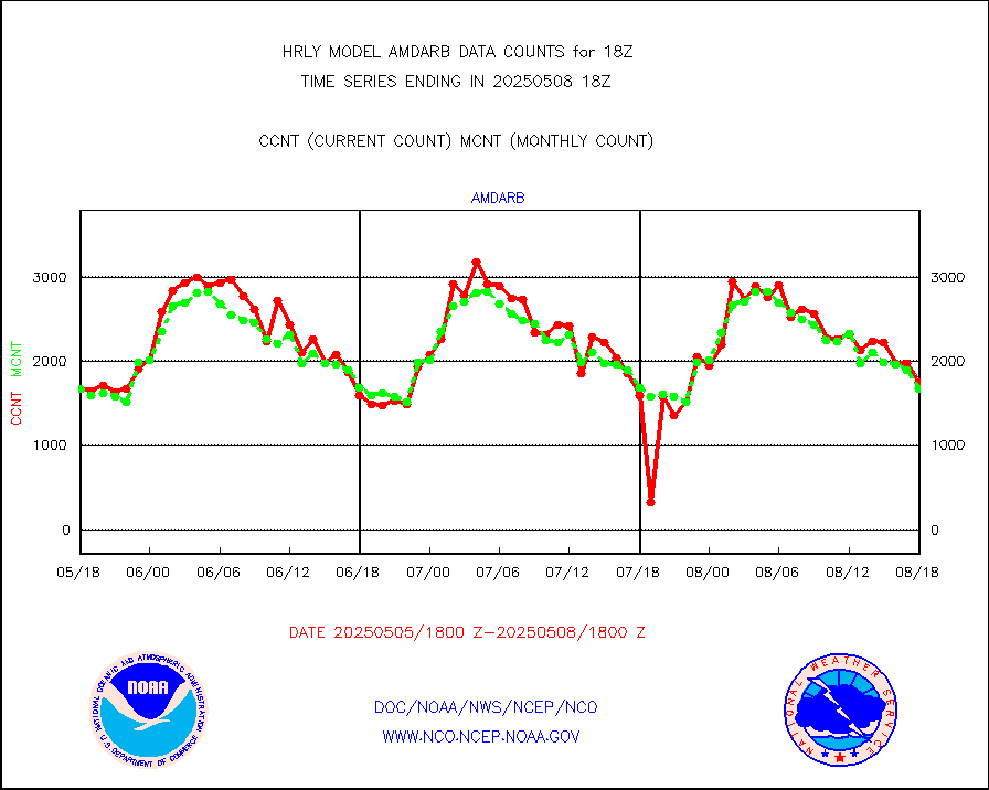
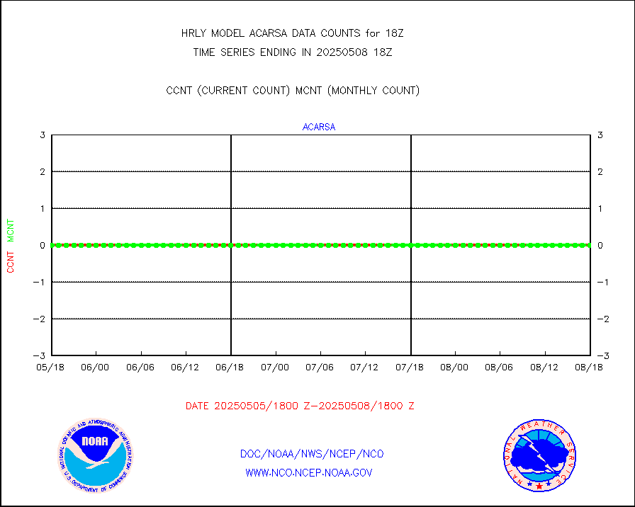
AMDAR aircraft data (decoded from AMDAR format) |
60 |
24 |
250.0 % |
0117.50-0118.49 |
||||||||||
AMDAR aircraft data (decoded from BUFR) |
1865 |
1753 |
106.4 % |
0117.50-0118.49 |
||||||||||
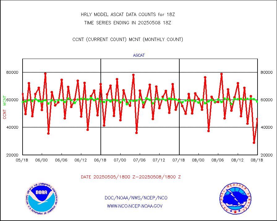
METOP 1-2 ASCAT products |
48174 |
51460 |
93.6 % |
0116.50-0117.49 |
||||||||||
NPP/NOAA-20 ATMS brightness temperatures |
301632 |
335789 |
89.8 % |
0116.50-0117.49 |
||||||||||
Canadian AMDAR aircraft data (decoded from BUFR) |
0 |
0 |
n/a |
0117.50-0118.49 |
||||||||||
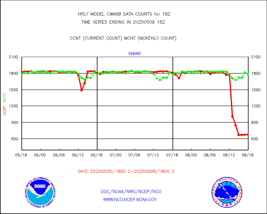
Surface Marine CMAN rpts decoded from BUFR format |
1786 |
1840 |
97.1 % |
0117.50-0118.50 |
||||||||||
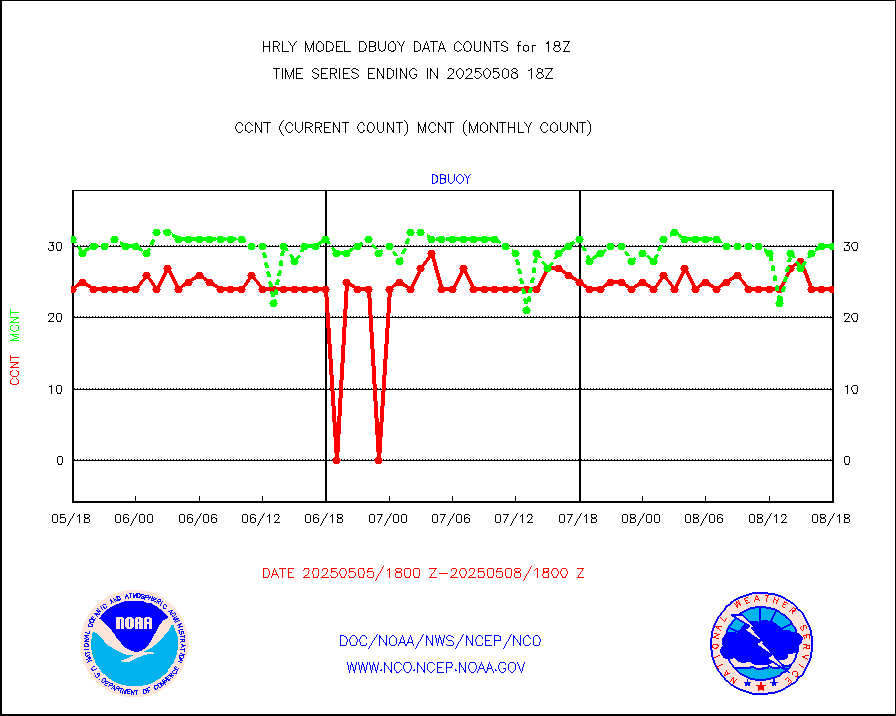
Buoys decoded from FM-18 fmt (moored or drifting) |
0 |
15 |
0.0 % |
0117.50-0118.49 |
||||||||||
NOAA 15-19 & METOP 1-2 AMSU-A proc btmps frm RARS |
11927 |
8593 |
138.8 % |
0117.50-0118.49 |
||||||||||
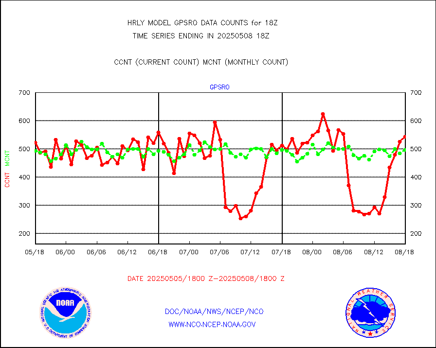
GPS radio occultation data |
360 |
517 |
69.6 % |
0115.50-0116.49 |
||||||||||
GOES-16/17 All Sky Radiances (proc.) |
720952 |
720630 |
100.0 % |
0117.50-0118.49 |
||||||||||
GOES-16/17 Clear Sky Radiances (proc.) |
380972 |
380288 |
100.2 % |
0117.50-0118.49 |
||||||||||
MTSAT/JMA water vapor imager derived cloud motion |
20913 |
18509 |
113.0 % |
0115.50-0116.49 |
||||||||||
MODIS (AQUA/TERRA) wvpr imager derived cld motion |
0 |
0 |
n/a |
0114.00-0114.99 |
||||||||||
GOES-16&up/NESDIS wv imgr/cld-top derived cld mtn |
23665 |
26102 |
90.7 % |
0117.00-0117.99 |
||||||||||
METEOSAT/EUMETSAT ir lg-wave drv cld motion NBseq |
0 |
21458 |
0.0 % |
0116.50-0117.49 |
||||||||||
MTSAT/JMA infrared long-wave derived cloud motion |
16605 |
15027 |
110.5 % |
0115.50-0116.49 |
||||||||||
MODIS (AQUA/TERRA) ir l-wave derived cloud motion |
0 |
0 |
n/a |
0114.00-0114.99 |
||||||||||
GOES-16&up/NESDIS ir long-wave derived cld motion |
85066 |
85116 |
99.9 % |
0117.00-0117.99 |
||||||||||
GOES/NASA(Langley) hi-res. (1x1 f-o-v) cloud data |
6428322 |
6145329 |
104.6 % |
0117.50-0118.49 |
||||||||||
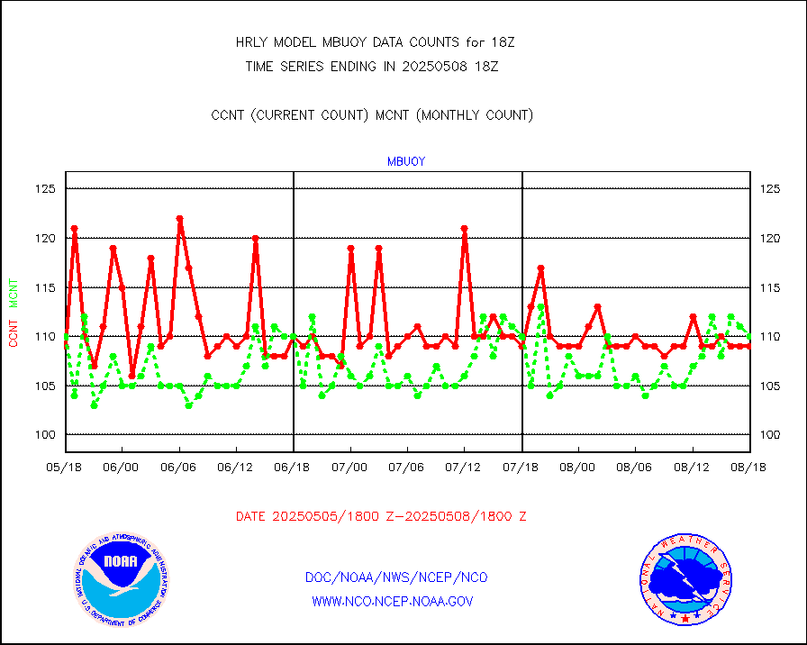
Buoys decoded from FM-13 format (moored) |
123 |
129 |
95.3 % |
0117.50-0118.49 |
||||||||||
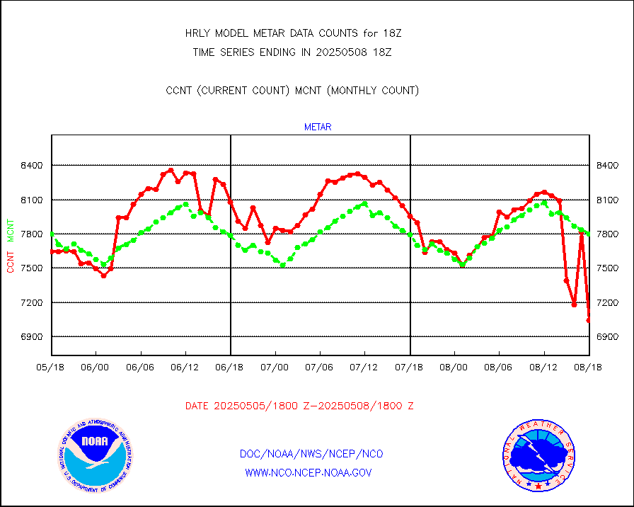
Aviation - METAR |
7295 |
7793 |
93.6 % |
0117.50-0118.49 |
||||||||||
Mesonet/MADIS Colorado E-470 (Interstate 470) |
24 |
24 |
100.0 % |
0117.50-0118.49 |
||||||||||
Mesonet/MADIS Alaska Department of Transportation |
115 |
90 |
127.8 % |
0117.50-0118.49 |
||||||||||
Mesonet/MADIS U.S. Army Aberdeen Proving Grounds |
0 |
0 |
n/a |
0117.50-0118.49 |
||||||||||
Mesonet/MADIS Citizen Weather Observers Program |
64699 |
63657 |
101.6 % |
0117.50-0118.49 |
||||||||||
Mesonet/MADIS AWS Convergence Technologies, Inc. |
17050 |
20878 |
81.7 % |
0117.50-0118.49 |
||||||||||
Mesonet/MADIS "Anything Weather" |
0 |
0 |
n/a |
0117.50-0118.49 |
||||||||||
Mesonet/MADIS Colorado Dept. of Transportation |
0 |
0 |
n/a |
0117.50-0118.49 |
||||||||||
Mesonet/MADIS DC Net |
0 |
0 |
n/a |
0117.50-0118.49 |
||||||||||
Mesonet/MADIS Denver Urban Drainage & Flood Cntrl |
0 |
0 |
n/a |
0117.50-0118.49 |
||||||||||
Mesonet/MADIS Florida (FAWN & USF) |
2 |
4 |
50.0 % |
0117.50-0118.49 |
||||||||||
Mesonet/MADIS Florida Dept. of Transportation |
0 |
0 |
n/a |
0117.50-0118.49 |
||||||||||
Mesonet/MADIS Georgia Dept. of Transportation |
0 |
0 |
n/a |
0117.50-0118.49 |
||||||||||
Mesonet/MADIS NWS Hydromet Auto Data System(HADS) |
4051 |
5977 |
67.8 % |
0117.50-0118.49 |
||||||||||
Mesonet/MADIS Iowa Environmental |
156 |
182 |
85.7 % |
0117.50-0118.49 |
||||||||||
Mesonet/MADIS Indiana Dept. of Transportation |
0 |
0 |
n/a |
0117.50-0118.49 |
||||||||||
Mesonet/MADIS Iowa Department of Transportation |
0 |
0 |
n/a |
0117.50-0118.49 |
||||||||||
Mesonet/MADIS Kansas Department of Transportation |
275 |
359 |
76.6 % |
0117.50-0118.49 |
||||||||||
Mesonet/MADIS Oklahoma Mesonet |
525 |
620 |
84.7 % |
0117.50-0118.49 |
||||||||||
Mesonet/MADIS Louisiana State/Jackson State Univ. |
0 |
0 |
n/a |
0117.50-0118.49 |
||||||||||
Mesonet/MADIS Missouri Commercial Agricult Wx Net |
268 |
328 |
81.7 % |
0117.50-0118.49 |
||||||||||
Mesonet/MADIS Minnesota Dept. of Transportation |
0 |
0 |
n/a |
0117.50-0118.49 |
||||||||||
Mesonet/MADIS NOS-Phys Oceanographic Realtime Sys |
231 |
376 |
61.4 % |
0117.50-0118.49 |
||||||||||
Mesonet/MADIS NFIC Remote Automated Wx Stns(RAWS) |
1232 |
1843 |
66.8 % |
0117.50-0118.49 |
||||||||||
Mesonet/MADIS many providers, not separated out |
65823 |
76392 |
86.2 % |
0117.00-0118.49 |
||||||||||
Mesonet/MADIS Virginia Dept. of Transportation |
0 |
0 |
n/a |
0117.50-0118.49 |
||||||||||
Mesonet/MADIS "Weather for You" |
0 |
0 |
n/a |
0117.50-0118.49 |
||||||||||
Mesonet/MADIS Wisconsin Dept. of Transportation |
0 |
0 |
n/a |
0117.50-0118.49 |
||||||||||
Mesonet/MADIS MesoWest (many subproviders) |
36510 |
37725 |
96.8 % |
0117.50-0118.49 |
||||||||||
Mesonet/MADIS West Texas |
4874 |
5941 |
82.0 % |
0117.50-0118.49 |
||||||||||
METOP 1-2 IASI 1C radiance data (varbl. channels) |
85752 |
92279 |
92.9 % |
0116.00-0116.99 |
||||||||||
NEXRAD Vel Azm Dsp(VAD) winds via radar coded msg |
0 |
0 |
n/a |
0117.50-0118.49 |
||||||||||
Aura Ozone Monitoring Instrument (OMI) data |
0 |
0 |
n/a |
0115.50-0116.49 |
||||||||||
NOAA 16-19 Solar Backscatter UV-2 rad frm V8 BUFR |
0 |
0 |
n/a |
0116.00-0116.99 |
||||||||||
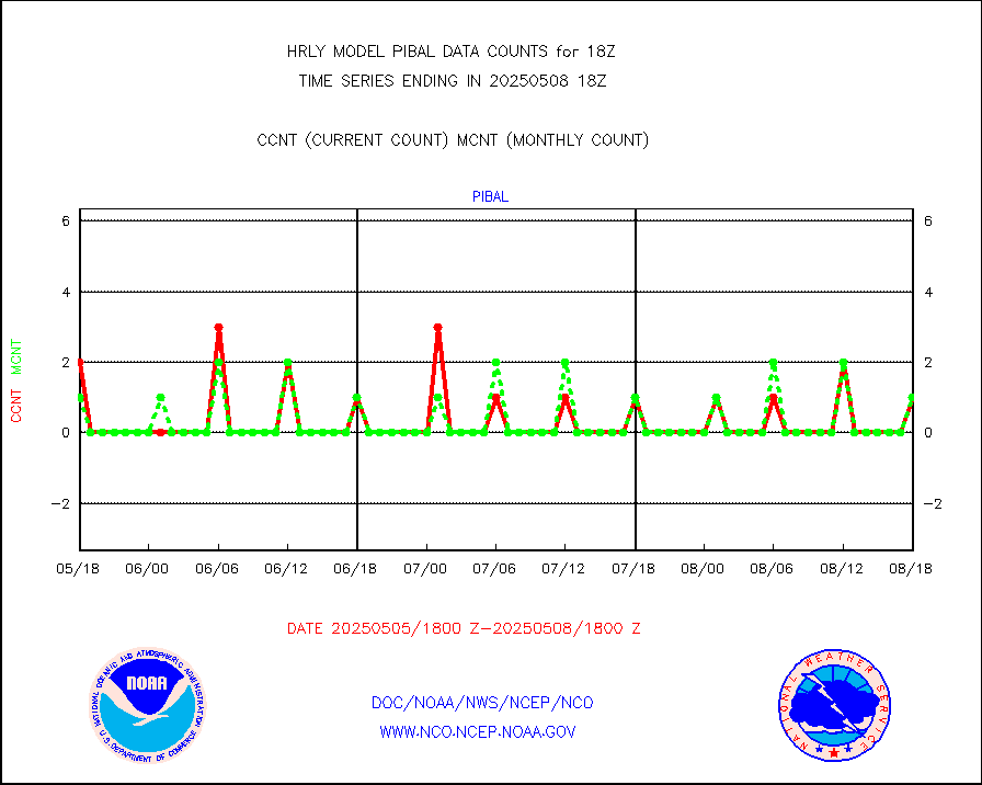
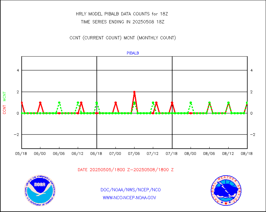
PIBAL (from PILOT, PILOT SHIP, PILOT MOBIL) |
1 |
1 |
100.0 % |
0117.50-0118.49 |
||||||||||
Multi-Agency Profiler (MAP) and SODAR winds |
43 |
44 |
97.7 % |
0117.50-0118.49 |
||||||||||
Rawinsonde - fixed land (from TEMP or PILOT) |
13 |
15 |
86.7 % |
0117.50-0118.49 |
||||||||||
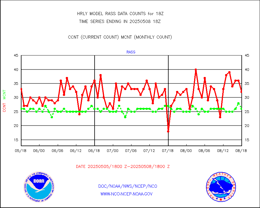
RASS temperatures (NOAA and Multi-Agency) |
19 |
24 |
79.2 % |
0117.50-0118.49 |
||||||||||
NEXRAD reflectivity (Lvl 2 - GTS) |
4341965 |
4269169 |
101.7 % |
0117.50-0118.49 |
||||||||||
NEXRAD radial wind (Level 2 - GTS) |
1684618 |
1487756 |
113.2 % |
0117.50-0118.49 |
||||||||||
METEOSAT-10 2nd Gen SEVIRI Clr Sky Radiance(proc) |
0 |
0 |
n/a |
0117.50-0118.49 |
||||||||||
Ship - manual and automatic, restricted (BUFR) |
0 |
0 |
n/a |
0117.50-0118.50 |
||||||||||
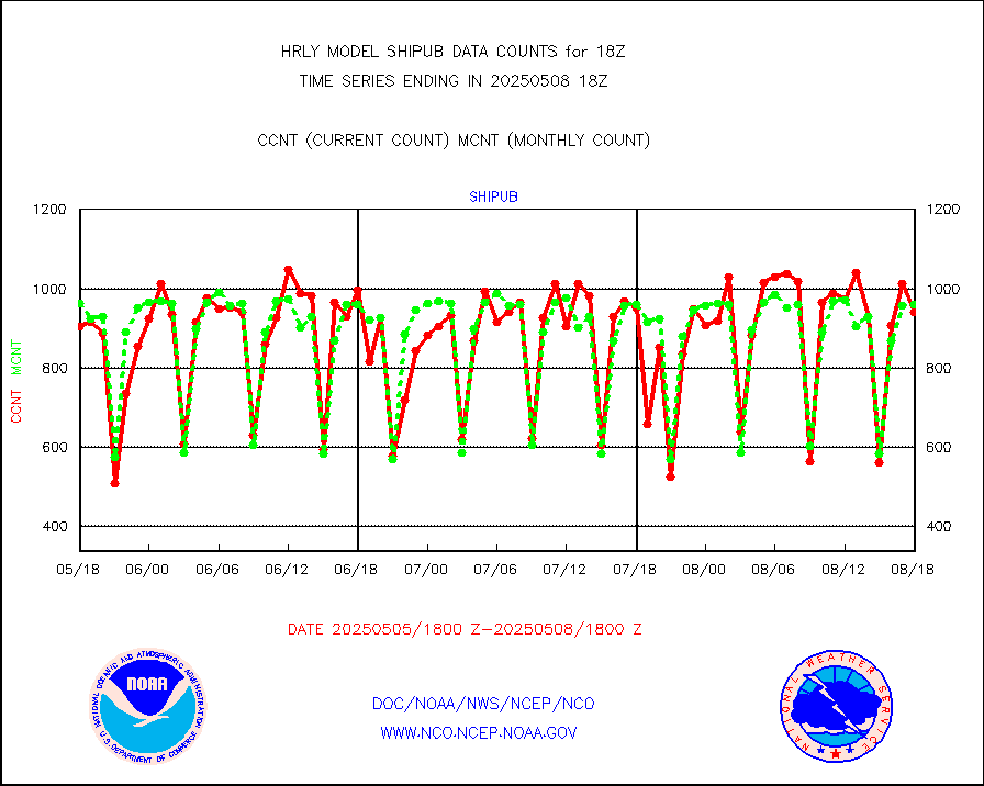
Ship - manual and automatic, unrestricted |
90 |
265 |
34.0 % |
0117.50-0118.50 |
||||||||||
Ship - manual and automatic, unrestricted (BUFR) |
636 |
964 |
66.0 % |
0117.50-0118.50 |
||||||||||
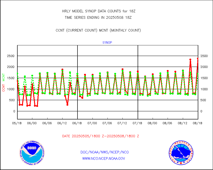
Synoptic - fixed manual and automatic |
3044 |
1723 |
176.7 % |
0117.50-0118.49 |
||||||||||
Synoptic - fixed manual & auto (decoded fr BUFR) |
3085 |
6769 |
45.6 % |
0117.50-0118.49 |
||||||||||
Synoptic - restricted (WMO Res 40) manual & auto. |
9 |
1 |
900.0 % |
0117.50-0118.49 |
||||||||||
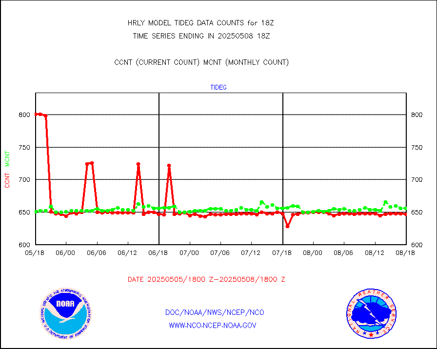
Tide gauge reports decoded from CREX format |
656 |
655 |
100.2 % |
0117.00-0117.99 |
||||||||||
| Data Types of Opportunity with Normal Counts | ||||||||||||||
|---|---|---|---|---|---|---|---|---|---|---|---|---|---|---|
| Type | Description | Hourly Count | Monthly Average | Percent (%) of Monthly Mean | UTC Time Window | |||||||||
GOES-16&up/NESDIS ir short-wv derived cld motion |
8514 |
5578 |
152.6 % |
0117.00-0117.99 |
||||||||||
MDCRS ACARS acft data (ARINC via AFWA)(AIREP fmt) |
0 |
0 |
n/a |
0117.50-0118.49 |
||||||||||
Himawari Clear Sky Radiance |
0 |
0 |
n/a |
0117.00-0117.99 |
||||||||||
GCOM-W AMSR2 1B brightness temperatures |
2310444 |
2081635 |
111.0 % |
0116.00-0116.99 |
||||||||||
NPP/NOAA-20 ATMS bright. temps-direct b-cast SSEC |
146350 |
163485 |
89.5 % |
0116.50-0117.49 |
||||||||||
POES/NESDIS - processed ATOVS soundings/radiances |
0 |
0 |
n/a |
0116.00-0116.99 |
||||||||||
A.M.(N17,M2,M3) AVHRR GAC NCEP-proc clr&sea btmps |
935095 |
1086579 |
86.1 % |
0115.50-0116.49 |
||||||||||
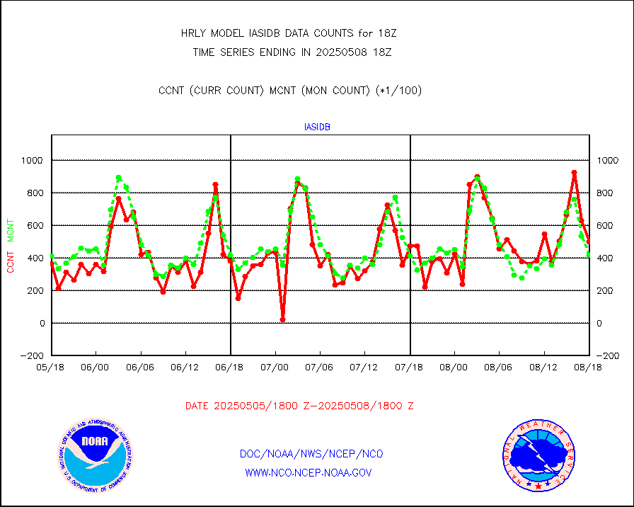
eXpendable BathyThermograph, mooring (BATHY fmt) |
0 |
0 |
n/a |
0111.00-0111.99 |
||||||||||
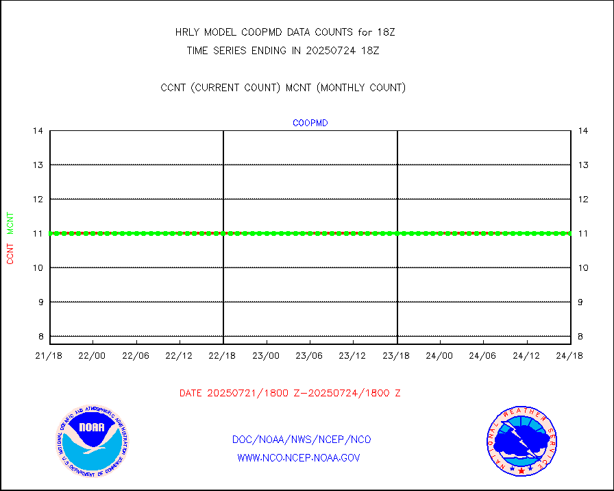
Coop/MADIS NEPP & HCN-Modernization NOAA COOP Obs |
11 |
11 |
100.0 % |
0117.50-0118.49 |
||||||||||
NPP/NOAA-20 CrIS full spctrl radn (431 ch subset) |
183780 |
213585 |
86.0 % |
0116.50-0117.49 |
||||||||||
NPP/NOAA-20 CrIS full spctrl radn dir brdcst SSEC |
87624 |
91557 |
95.7 % |
0116.50-0117.49 |
||||||||||
Coast Guard |
11 |
9 |
122.2 % |
0117.50-0118.50 |
||||||||||
Drifting buoys (decoded from BUFR) |
1322 |
1440 |
91.8 % |
0117.50-0118.50 |
||||||||||
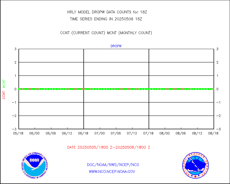
Dropwinsonde (from TEMP DROP) |
0 |
0 |
n/a |
0117.50-0118.49 |
||||||||||
Dropwinsonde (decoded from BUFR) |
0 |
0 |
n/a |
0117.51-0118.49 |
||||||||||
GOES imager effective cloud amount data (U.Wisc.) |
8535568 |
8061868 |
105.9 % |
0117.50-0118.49 |
||||||||||
NPP Adv. Tech. MW Sndr (ATMS) br. temps from RARS |
96768 |
76822 |
126.0 % |
0116.50-0117.49 |
||||||||||
NOAA 18-19 & METOP 1-2 MHS proc. btemps from RARS |
92195 |
85572 |
107.7 % |
0117.50-0118.49 |
||||||||||
GOES/NESDIS (11x17 f-o-v) imager clear radiances |
0 |
0 |
n/a |
0117.00-0117.99 |
||||||||||
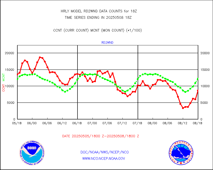
METOP 1-2 Global Ozone Monitoring Exp.-2 (GOME-2) |
5452 |
8476 |
64.3 % |
0116.50-0117.49 |
||||||||||
GOES-16&up/NESDIS wv imgr/deep-lyr derivd cld mtn |
21614 |
17483 |
123.6 % |
0117.00-0117.99 |
||||||||||
METEOSAT/EUMETSAT wvpr imgr drv cld motion NBseq |
0 |
38527 |
0.0 % |
0116.50-0117.49 |
||||||||||
High Density OBs from reconnaissance acft data |
7 |
29 |
24.1 % |
0117.50-0118.49 |
||||||||||
METOP 1-2 IASI 1C radiances-direct broadcast SSEC |
37536 |
43356 |
86.6 % |
0116.50-0117.49 |
||||||||||
VIIRS (NPP/NOAA-20) ir lg-wv drv cloud motion(NB) |
14129 |
13643 |
103.6 % |
0114.00-0114.99 |
||||||||||
AVHRR (NOAA/METOP) ir lg-wave derived cld motion |
0 |
0 |
n/a |
0114.00-0114.99 |
||||||||||
AVHRR (METOP) ir lg-wave derived cld motion |
0 |
0 |
n/a |
0117.50-0118.50 |
||||||||||
INSAT/KALPANA India ir lg-wave derived cld motion |
0 |
0 |
n/a |
0115.50-0116.49 |
||||||||||
Korean AMDAR aircraft data (decoded from BUFR) |
0 |
0 |
n/a |
0117.50-0118.49 |
||||||||||
Land-based CMAN stations decoded from CMAN format |
63 |
80 |
78.8 % |
0117.50-0118.49 |
||||||||||
LEO-GEO satellite AMVs from UWisc. |
6838 |
7465 |
91.6 % |
0114.00-0114.99 |
||||||||||
LLDN Long-rng lightning from Vaisala via NOAAPORT |
187727 |
211958 |
88.6 % |
0117.50-0118.49 |
||||||||||
NLDN Shrt-rng lightning from Vaisala via NOAAPORT |
6233 |
5739 |
108.6 % |
0117.50-0118.49 |
||||||||||
Moored buoys (decoded from BUFR) |
869 |
923 |
94.1 % |
0117.50-0118.50 |
||||||||||
Aura Microwave Limb Sounder (MLS) ozone data |
0 |
0 |
n/a |
0116.00-0116.99 |
||||||||||
Mesonet/MADIS UrbaNet |
2745 |
3573 |
76.8 % |
0117.50-0118.49 |
||||||||||
NEXRAD Vel Azm Dsp(VAD) winds via Level 2 decoder |
340 |
399 |
85.2 % |
0117.50-0118.49 |
||||||||||
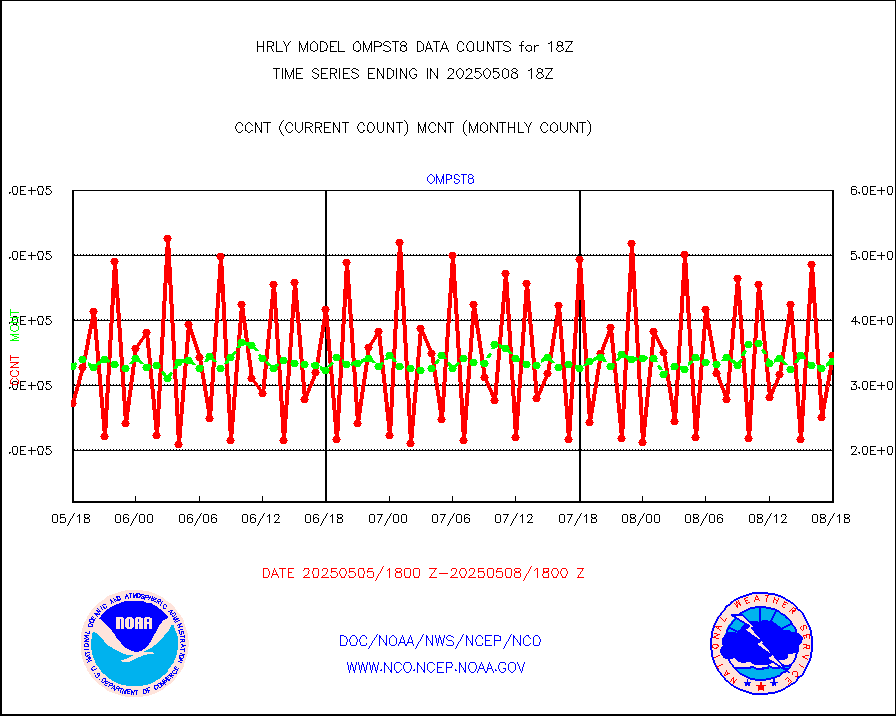
OMPS Limb Profiler ozone data (NPP) |
426 |
259 |
164.5 % |
0111.00-0111.99 |
||||||||||
OMPS nadir profile ozone (Version 8 BUFR) |
627 |
526 |
119.2 % |
0116.00-0116.99 |
||||||||||
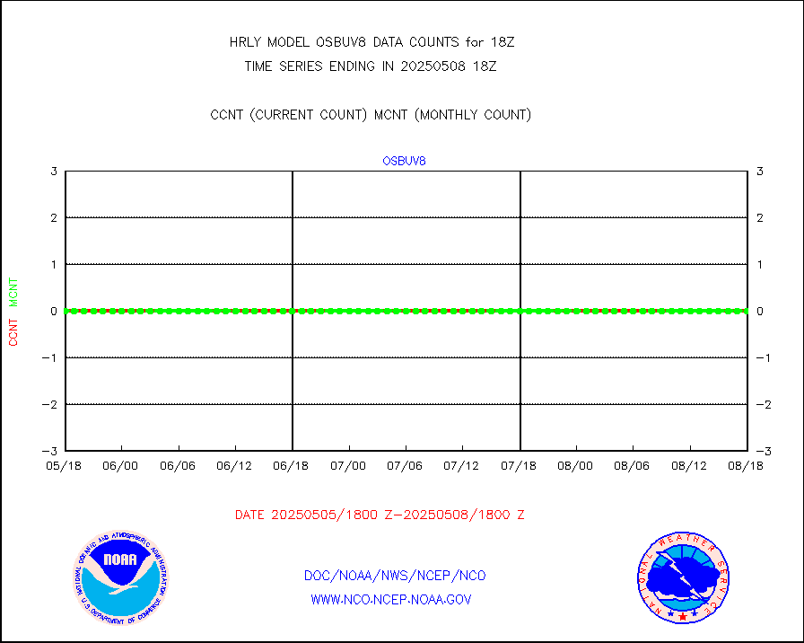
OMPS total column ozone (Version 8 BUFR) |
266770 |
326743 |
81.6 % |
0116.00-0116.99 |
||||||||||
PIBAL (decoded from BUFR) |
0 |
1 |
0.0 % |
0117.51-0118.49 |
||||||||||
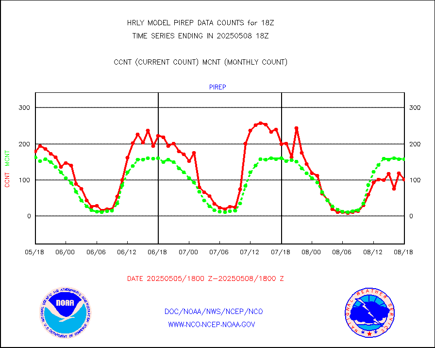
Manual PIREP aircraft data (dcded from AIREP fmt) |
72 |
127 |
56.7 % |
0117.50-0118.49 |
||||||||||
Profilr winds from PIBAL (PILOT,PILOT SHIP/MOBIL) |
0 |
0 |
n/a |
0117.50-0118.49 |
||||||||||
Rawinsonde - fixed land (decoded from BUFR) |
0 |
0 |
n/a |
0117.51-0118.49 |
||||||||||
Rawinsonde - mobile land (from TEMP/PILOT MOBIL) |
0 |
0 |
n/a |
0117.50-0118.49 |
||||||||||
Rawinsonde - mobile land (decoded from BUFR) |
0 |
0 |
n/a |
0117.51-0118.49 |
||||||||||
Rawinsonde - ship (from TEMP SHIP, PILOT SHIP) |
0 |
0 |
n/a |
0117.50-0118.49 |
||||||||||
Rawinsonde - ship (decoded from BUFR) |
0 |
0 |
n/a |
0117.51-0118.49 |
||||||||||
Flight level reconnaissance aircraft data |
0 |
0 |
n/a |
0117.50-0118.49 |
||||||||||
Megha-Tropiques SAPHIR L1A2 brightness temps |
0 |
0 |
n/a |
0115.50-0116.49 |
||||||||||
Ship - manual and automatic, restricted |
49 |
25 |
196.0 % |
0117.50-0118.49 |
||||||||||
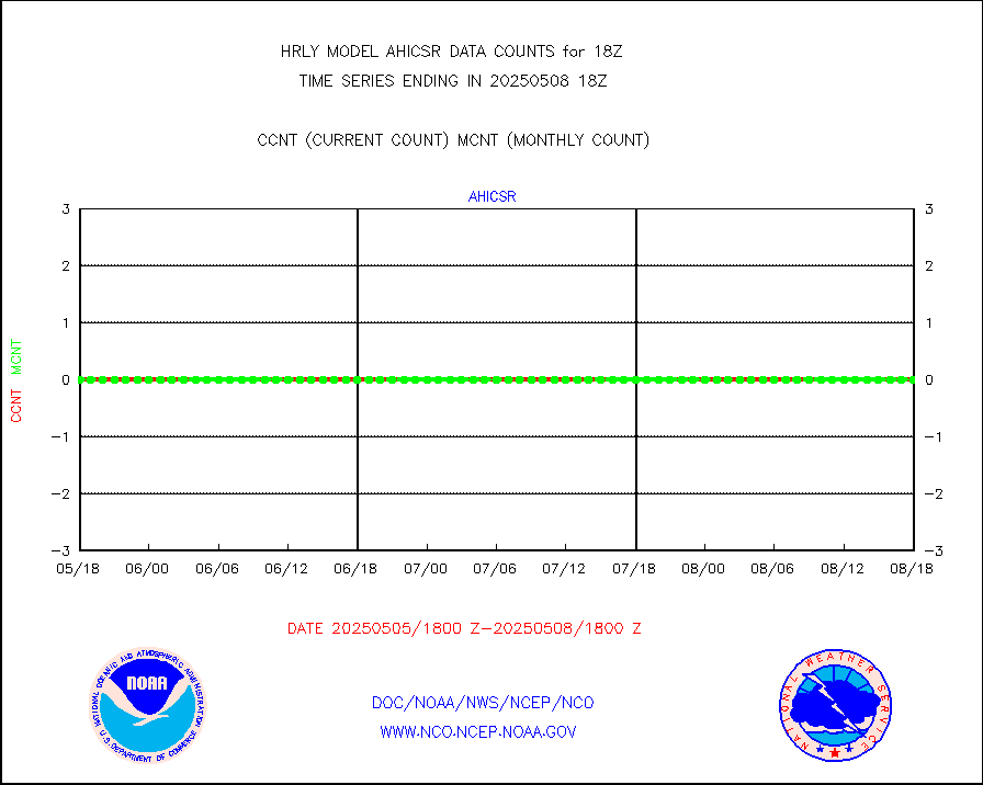
DMSP SSM/IS 1C radiance data (Unified Pre-Proc.) |
208380 |
106376 |
195.9 % |
0116.50-0117.49 |
||||||||||
NPP/NOAA-20 VIIRS SST - CLEAR & OVER WATER |
5995370 |
772140 |
776.5 % |
0117.50-0118.49 |
||||||||||
NPP/NOAA-20 VIIRS SST - PROBABLY CLR & OVER WATER |
1016665 |
136570 |
744.4 % |
0117.50-0118.49 |
||||||||||
Synoptic - mobile manual and automatic |
522 |
646 |
80.8 % |
0117.50-0118.49 |
||||||||||
Synoptic - mobile manual & auto (decoded fr BUFR) |
2 |
1 |
200.0 % |
0117.50-0118.49 |
||||||||||
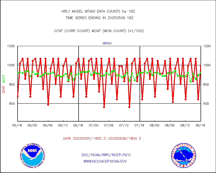
CTD probe, Argo prflng float, mooring (TESAC fmt) |
221 |
212 |
104.2 % |
0117.50-0118.49 |
||||||||||
TAMDAR aircft data-all types(from Panasonic,BUFR) |
64 |
55 |
116.4 % |
0117.50-0118.49 |
||||||||||
ThermoSalinoGraph (TSG) TRACKOB format) |
93 |
94 |
98.9 % |
0116.50-0117.49 |
||||||||||
INSAT/KALPANA India visible derived cloud motion |
0 |
0 |
n/a |
0115.50-0116.49 |
||||||||||
INDIA SATWIND, INSAT VIS channel |
0 |
0 |
n/a |
0117.00-0117.99 |
||||||||||
MTSAT/JMA visible derived cloud motion |
0 |
0 |
n/a |
0115.50-0116.49 |
||||||||||
GOES-16&up/NESDIS visible derived cloud motion |
534158 |
496202 |
107.6 % |
0117.00-0117.99 |
||||||||||
METEOSAT/EUMETSAT visible drv cld motion NBseq |
0 |
29208 |
0.0 % |
0116.50-0117.49 |
||||||||||


