| Suspect Data Shortages in Critical Types - Monitor | ||||||||||||||
|---|---|---|---|---|---|---|---|---|---|---|---|---|---|---|
| Type | Description | Hourly Count | Monthly Average | Percent (%) of Monthly Mean | ||||||||||
NOAA 18-19 & METOP 1-2 HIRS-4 NCEP-proc. br.temps |
0 |
63606 |
0.0 % |
|||||||||||
NOAA 15-19 & METOP 1-2 HIRS-3/4 pr btmps frm RARS |
0 |
123357 |
0.0 % |
|||||||||||
| Suspect Excess in Critical Types - Monitor | ||||||||||||||
|---|---|---|---|---|---|---|---|---|---|---|---|---|---|---|
| Type | Description | Hourly Count | Monthly Average | Percent (%) of Monthly Mean | ||||||||||
NPP/NOAA-20 VIIRS SST - CLEAR & OVER WATER |
9999999 |
4331365 |
230.9 % |
|||||||||||
| Shortage in Data Type of Opportunity - Monitor | ||||||||||||||
|---|---|---|---|---|---|---|---|---|---|---|---|---|---|---|
| Type | Description | Hourly Count | Monthly Average | Percent (%) of Monthly Mean | ||||||||||
P.M.(N18-19) AVHRR GAC NCEP-proc clr & sea btemps |
0 |
1875848 |
0.0 % |
|||||||||||
METOP 1-2 IASI 1C radiance data vbl chn from RARS |
0 |
23941 |
0.0 % |
|||||||||||
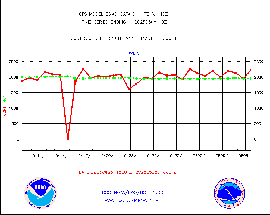
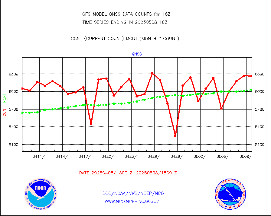
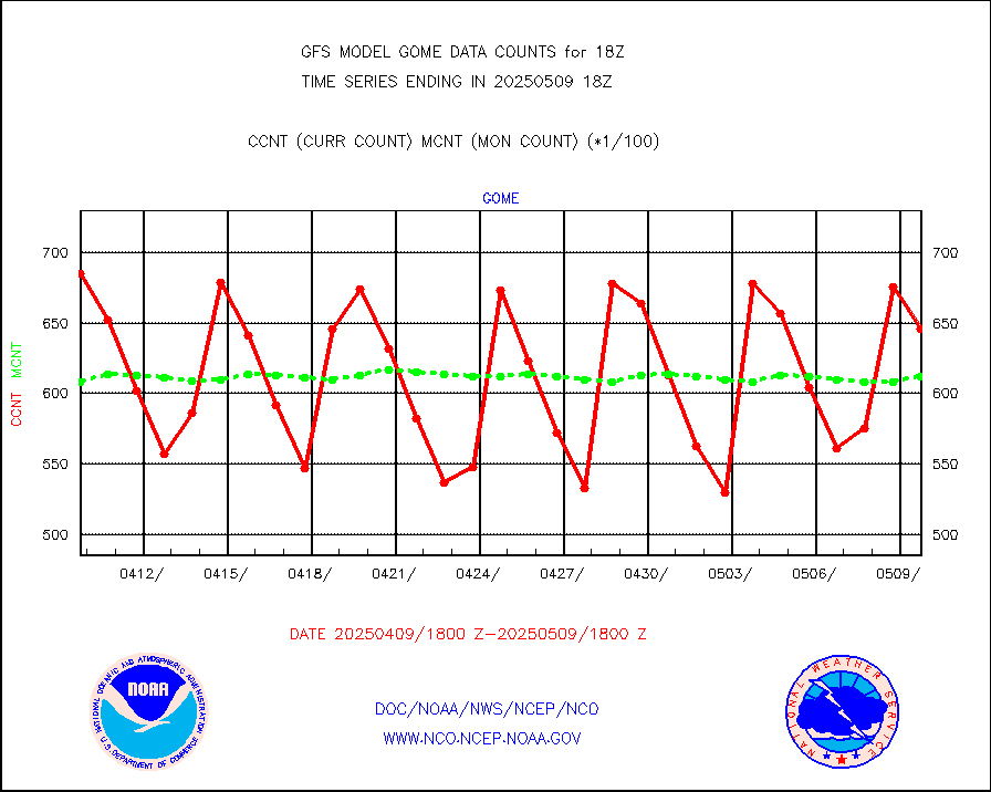
Grnd-based Gbl Navigation Sat System (GNSS) data |
1282 |
5260 |
24.4 % |
|||||||||||
| Critical Data with Normal Counts | ||||||||||||||
|---|---|---|---|---|---|---|---|---|---|---|---|---|---|---|
| Type | Description | Hourly Count | Monthly Average | Percent (%) of Monthly Mean | ||||||||||
NOAA 15-19 & METOP 1-2 AMSU-A NCEP-proc. br.temps |
109868 |
181508 |
60.5 % |
|||||||||||
NOAA 18-19 & METOP 1-2 MHS NCEP-proces. br. temps |
978128 |
1345162 |
72.7 % |
|||||||||||
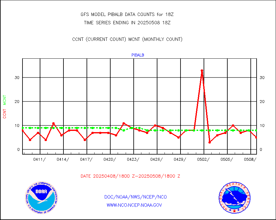
MDCRS ACARS acft data from ARINC(dcded from BUFR) |
201653 |
189096 |
106.6 % |
|||||||||||
Himawari Clear Sky Radiance |
234291 |
239447 |
97.8 % |
|||||||||||
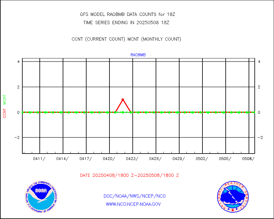
Manual AIREP aircraft data (dcded from AIREP fmt) |
3886 |
3497 |
111.1 % |
|||||||||||
AQUA AIRS/AMSU-A/HSB brightness temps- every FOV |
0 |
0 |
n/a |
|||||||||||
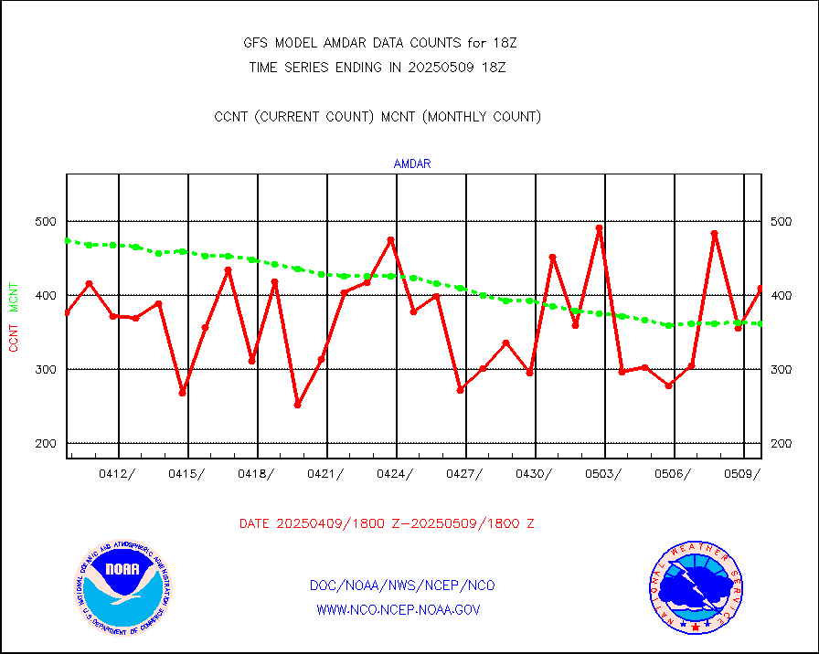
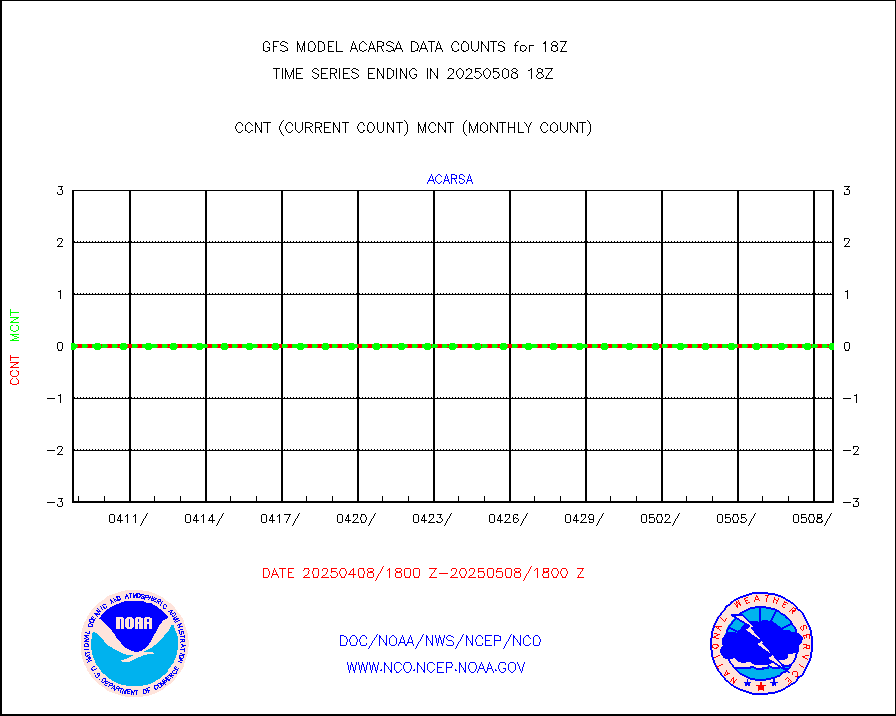
AMDAR aircraft data (decoded from AMDAR format) |
320 |
416 |
76.9 % |
|||||||||||
AMDAR aircraft data (decoded from BUFR) |
12181 |
12261 |
99.3 % |
|||||||||||
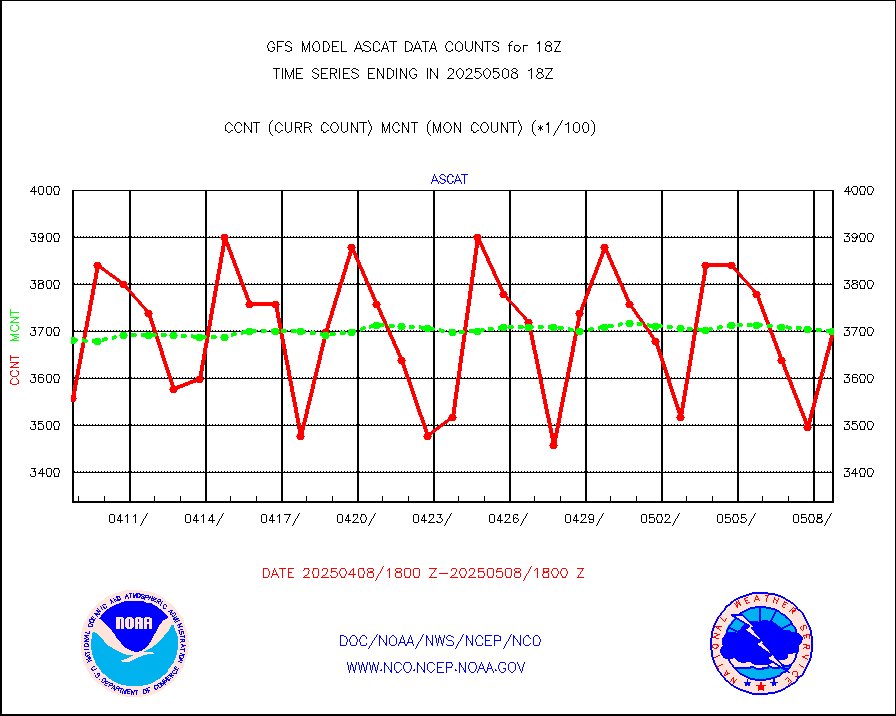
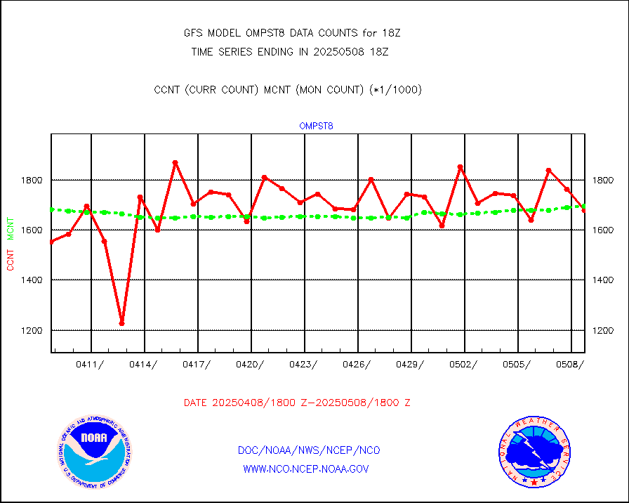
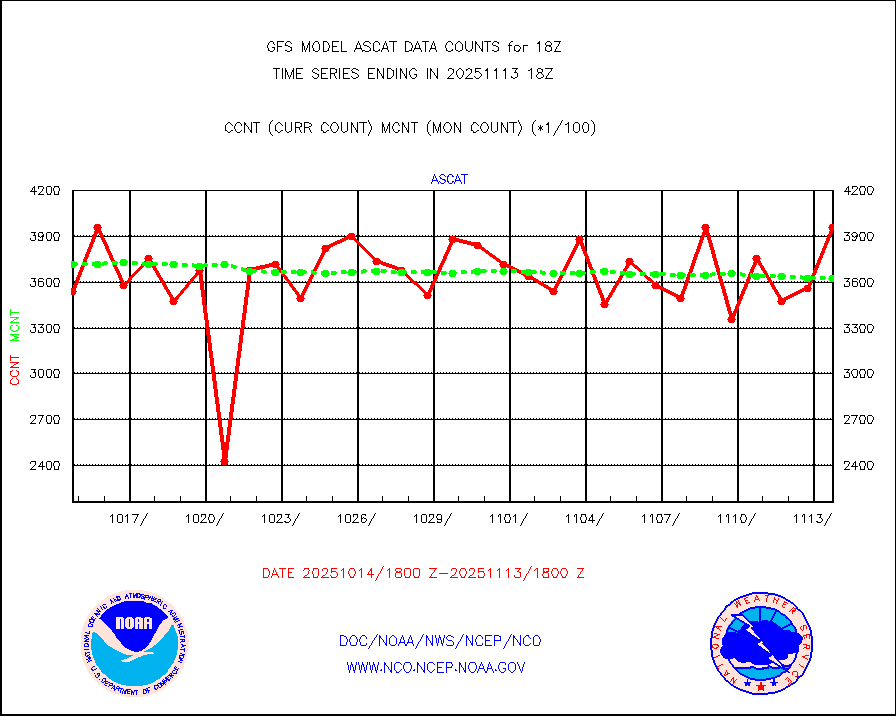
METOP 1-2 ASCAT products |
386064 |
368256 |
104.8 % |
|||||||||||
NPP/NOAA-20 ATMS brightness temperatures |
1909056 |
1886891 |
101.2 % |
|||||||||||
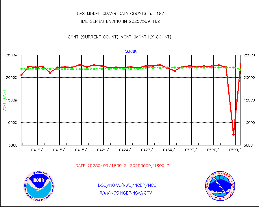
Surface Marine CMAN rpts decoded from BUFR format |
22605 |
22606 |
100.0 % |
|||||||||||
Buoys decoded from FM-18 fmt (moored or drifting) |
109 |
138 |
79.0 % |
|||||||||||
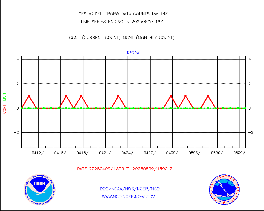
Dropwinsonde (from TEMP DROP) |
0 |
1 |
0.0 % |
|||||||||||
E-AMDAR (European AMDAR acft decoded from BUFR) |
18918 |
21139 |
89.5 % |
|||||||||||
NOAA 15-19 & METOP 1-2 AMSU-A proc btmps frm RARS |
63991 |
94898 |
67.4 % |
|||||||||||
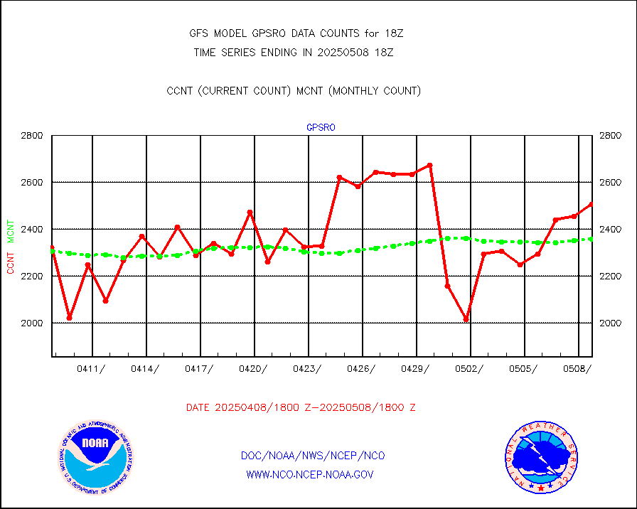
GPS radio occultation data |
2445 |
2503 |
97.7 % |
|||||||||||
GOES-16/17 All Sky Radiances (proc.) |
5947854 |
5936569 |
100.2 % |
|||||||||||
GOES-16/17 Clear Sky Radiances (proc.) |
3067273 |
3133400 |
97.9 % |
|||||||||||
MTSAT/JMA water vapor imager derived cloud motion |
59615 |
56510 |
105.5 % |
|||||||||||
MODIS (AQUA/TERRA) wvpr imager derived cld motion |
0 |
0 |
n/a |
|||||||||||
GOES-16&up/NESDIS wv imgr/cld-top derived cld mtn |
157359 |
161547 |
97.4 % |
|||||||||||
METEOSAT/EUMETSAT ir lg-wave drv cld motion NBseq |
108514 |
105256 |
103.1 % |
|||||||||||
MTSAT/JMA infrared long-wave derived cloud motion |
47830 |
45928 |
104.1 % |
|||||||||||
MODIS (AQUA/TERRA) ir l-wave derived cloud motion |
0 |
0 |
n/a |
|||||||||||
GOES-16&up/NESDIS ir long-wave derived cld motion |
521793 |
506205 |
103.1 % |
|||||||||||
Land-based CMAN stations decoded from CMAN format |
482 |
474 |
101.7 % |
|||||||||||
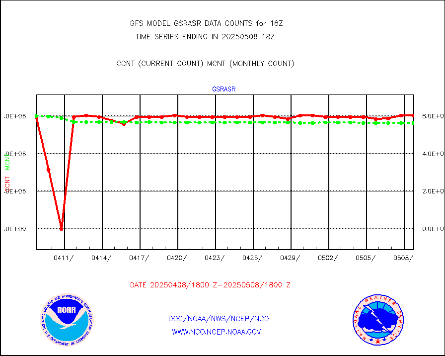
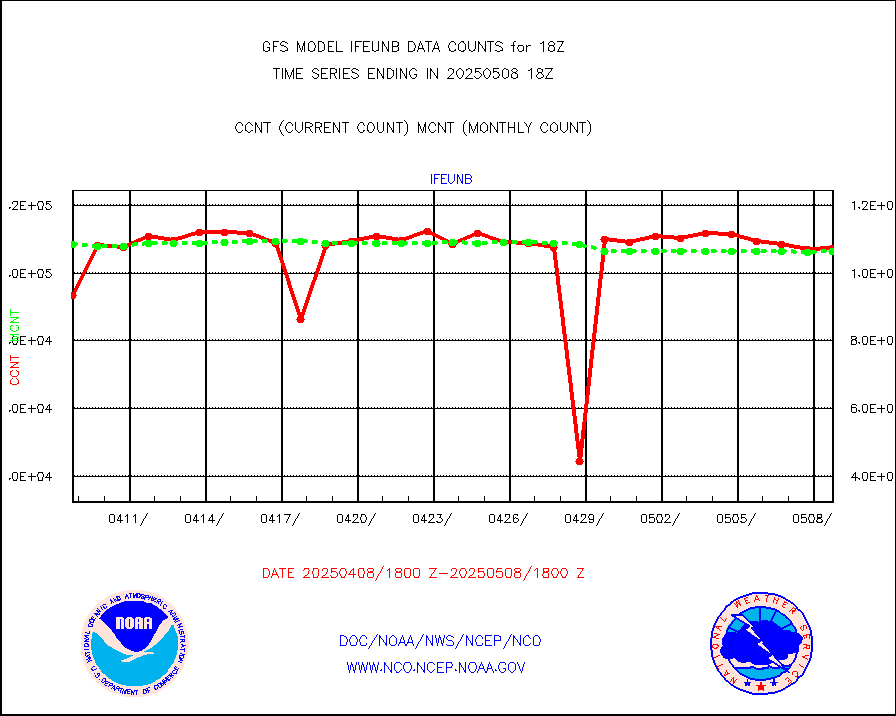
LEO-GEO satellite AMVs from UWisc. |
20966 |
21210 |
98.8 % |
|||||||||||
Buoys decoded from FM-13 format (moored) |
811 |
804 |
100.9 % |
|||||||||||
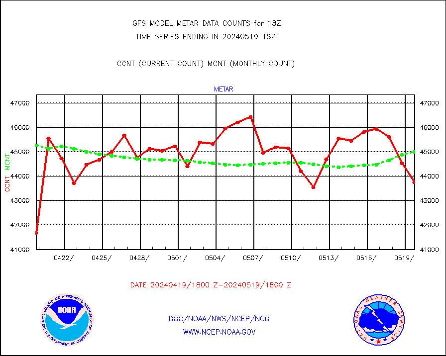
Aviation - METAR |
45383 |
44944 |
101.0 % |
|||||||||||
METOP 1-2 IASI 1C radiance data (varbl. channels) |
434484 |
475606 |
91.4 % |
|||||||||||
NEXRAD Vel Azm Dsp(VAD) winds via radar coded msg |
0 |
0 |
n/a |
|||||||||||
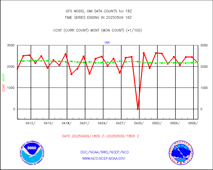
Aura Ozone Monitoring Instrument (OMI) data |
0 |
0 |
n/a |
|||||||||||
NOAA 16-19 Solar Backscatter UV-2 rad frm V8 BUFR |
0 |
0 |
n/a |
|||||||||||
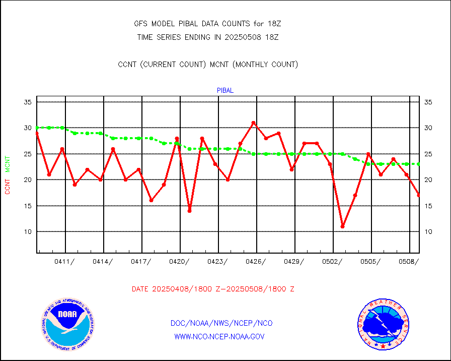
PIBAL (from PILOT, PILOT SHIP, PILOT MOBIL) |
25 |
20 |
125.0 % |
|||||||||||
Profilr winds from PIBAL (PILOT,PILOT SHIP/MOBIL) |
1 |
1 |
100.0 % |
|||||||||||
Rawinsonde - fixed land (from TEMP or PILOT) |
42 |
37 |
113.5 % |
|||||||||||
Rawinsonde - mobile land (from TEMP/PILOT MOBIL) |
0 |
0 |
n/a |
|||||||||||
Rawinsonde - ship (from TEMP SHIP, PILOT SHIP) |
1 |
1 |
100.0 % |
|||||||||||
Flight level reconnaissance aircraft data |
1 |
1 |
100.0 % |
|||||||||||
Ship - manual and automatic, restricted |
199 |
198 |
100.5 % |
|||||||||||
Ship - manual and automatic, restricted (BUFR) |
785 |
761 |
103.2 % |
|||||||||||
Ship - manual and automatic, unrestricted |
781 |
813 |
96.1 % |
|||||||||||
Ship - manual and automatic, unrestricted (BUFR) |
6239 |
6170 |
101.1 % |
|||||||||||
Synoptic - fixed manual & auto (decoded fr BUFR) |
38090 |
40140 |
94.9 % |
|||||||||||
Synoptic - mobile manual and automatic |
4732 |
4134 |
114.5 % |
|||||||||||
Synoptic - restricted (WMO Res 40) manual & auto. |
3 |
5 |
60.0 % |
|||||||||||
Synoptic - restricted (WMO Res 40)(decoded BUFR) |
2301 |
2366 |
97.3 % |
|||||||||||
Synoptic - mobile manual & auto (decoded fr BUFR) |
241 |
270 |
89.3 % |
|||||||||||
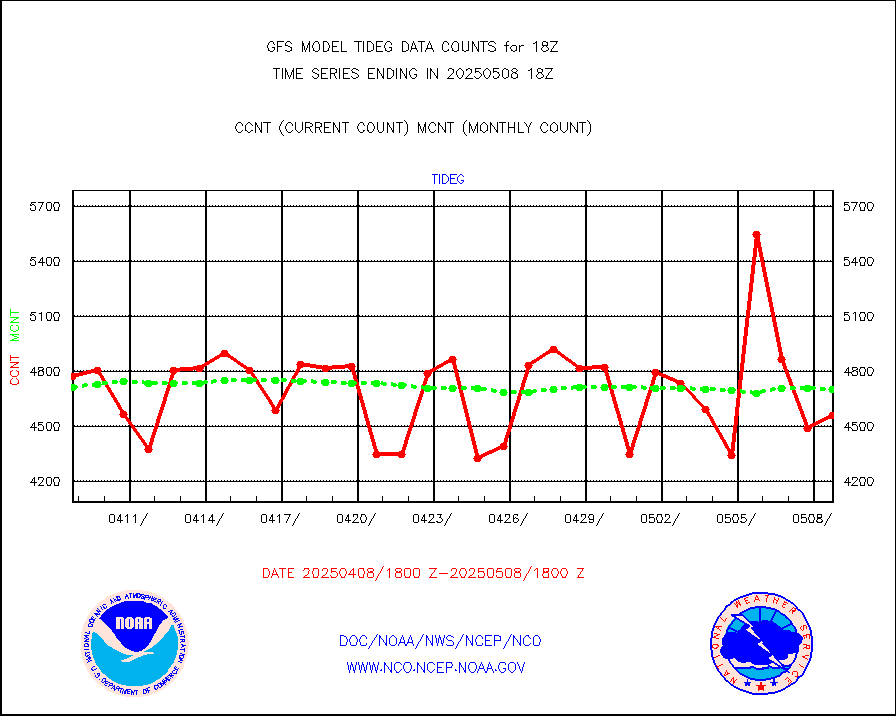
Tide gauge reports decoded from CREX format |
4853 |
4705 |
103.1 % |
|||||||||||
MTSAT/JMA visible derived cloud motion |
4132 |
3903 |
105.9 % |
|||||||||||
METEOSAT/EUMETSAT visible drv cld motion NBseq |
113000 |
100057 |
112.9 % |
|||||||||||
| Data Types of Opportunity with Normal Counts | ||||||||||||||
|---|---|---|---|---|---|---|---|---|---|---|---|---|---|---|
| Type | Description | Hourly Count | Monthly Average | Percent (%) of Monthly Mean | ||||||||||
GOES-16&up/NESDIS ir short-wv derived cld motion |
46619 |
37410 |
124.6 % |
|||||||||||
MDCRS ACARS acft data (ARINC via AFWA)(AIREP fmt) |
0 |
0 |
n/a |
|||||||||||
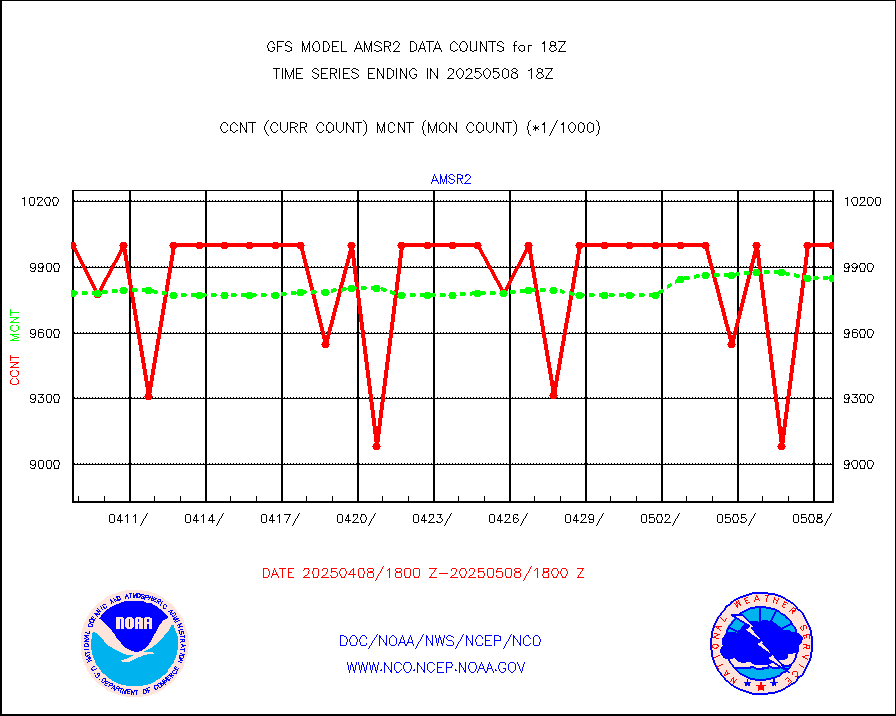
GCOM-W AMSR2 1B brightness temperatures |
9327312 |
9812257 |
95.1 % |
|||||||||||
NPP/NOAA-20 ATMS bright. temps-direct b-cast SSEC |
892601 |
790591 |
112.9 % |
|||||||||||
A.M.(N17,M2,M3) AVHRR GAC NCEP-proc clr&sea btmps |
5311063 |
5716763 |
92.9 % |
|||||||||||
eXpendable BathyThermograph, mooring (BATHY fmt) |
0 |
0 |
n/a |
|||||||||||
Canadian AMDAR aircraft data (decoded from BUFR) |
0 |
0 |
n/a |
|||||||||||
NPP/NOAA-20 CrIS full spctrl radn (431 ch subset) |
1163736 |
1140667 |
102.0 % |
|||||||||||
NPP/NOAA-20 CrIS full spctrl radn dir brdcst SSEC |
409866 |
382710 |
107.1 % |
|||||||||||
Coast Guard |
33 |
40 |
82.5 % |
|||||||||||
Drifting buoys (decoded from BUFR) |
8943 |
8972 |
99.7 % |
|||||||||||
Dropwinsonde (decoded from BUFR) |
4 |
5 |
80.0 % |
|||||||||||
NPP Adv. Tech. MW Sndr (ATMS) br. temps from RARS |
195840 |
285608 |
68.6 % |
|||||||||||
NOAA 18-19 & METOP 1-2 MHS proc. btemps from RARS |
665921 |
939734 |
70.9 % |
|||||||||||
GOES/NESDIS (11x17 f-o-v) imager clear radiances |
0 |
0 |
n/a |
|||||||||||
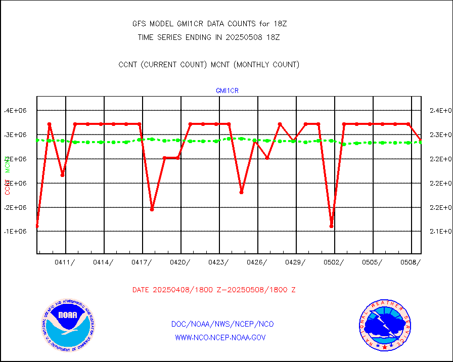
GPM GMI Level 1C-R brightness temperatures |
2322710 |
2289700 |
101.4 % |
|||||||||||
METOP 1-2 Global Ozone Monitoring Exp.-2 (GOME-2) |
68784 |
60934 |
112.9 % |
|||||||||||
INSAT/KALPANA India wvpr derived cloud motion |
0 |
0 |
n/a |
|||||||||||
INDIA SATWIND, INSAT WV channel |
20037 |
25737 |
77.9 % |
|||||||||||
GOES-16&up/NESDIS wv imgr/deep-lyr derivd cld mtn |
119748 |
103912 |
115.2 % |
|||||||||||
METEOSAT/EUMETSAT wvpr imgr drv cld motion NBseq |
185663 |
188799 |
98.3 % |
|||||||||||
High Density OBs from reconnaissance acft data |
220 |
170 |
129.4 % |
|||||||||||
METOP 1-2 IASI 1C radiances-direct broadcast SSEC |
277483 |
258480 |
107.4 % |
|||||||||||
VIIRS (NPP/NOAA-20) ir lg-wv drv cloud motion(NB) |
39518 |
40858 |
96.7 % |
|||||||||||
AVHRR (NOAA/METOP) ir lg-wave derived cld motion |
0 |
0 |
n/a |
|||||||||||
AVHRR (METOP) ir lg-wave derived cld motion |
18675 |
29446 |
63.4 % |
|||||||||||
INSAT/KALPANA India ir lg-wave derived cld motion |
0 |
0 |
n/a |
|||||||||||
INDIA SATWIND, INSAT IR channel |
29171 |
36178 |
80.6 % |
|||||||||||
Korean AMDAR aircraft data (decoded from BUFR) |
0 |
0 |
n/a |
|||||||||||
Moored buoys (decoded from BUFR) |
7209 |
7052 |
102.2 % |
|||||||||||
NEXRAD Vel Azm Dsp(VAD) winds via Level 2 decoder |
3500 |
3440 |
101.7 % |
|||||||||||
OMPS Limb Profiler ozone data (NPP) |
709 |
809 |
87.6 % |
|||||||||||
OMPS nadir profile ozone (Version 8 BUFR) |
2742 |
2800 |
97.9 % |
|||||||||||
OMPS total column ozone (Version 8 BUFR) |
1659889 |
1697266 |
97.8 % |
|||||||||||
PIBAL (decoded from BUFR) |
9 |
7 |
128.6 % |
|||||||||||
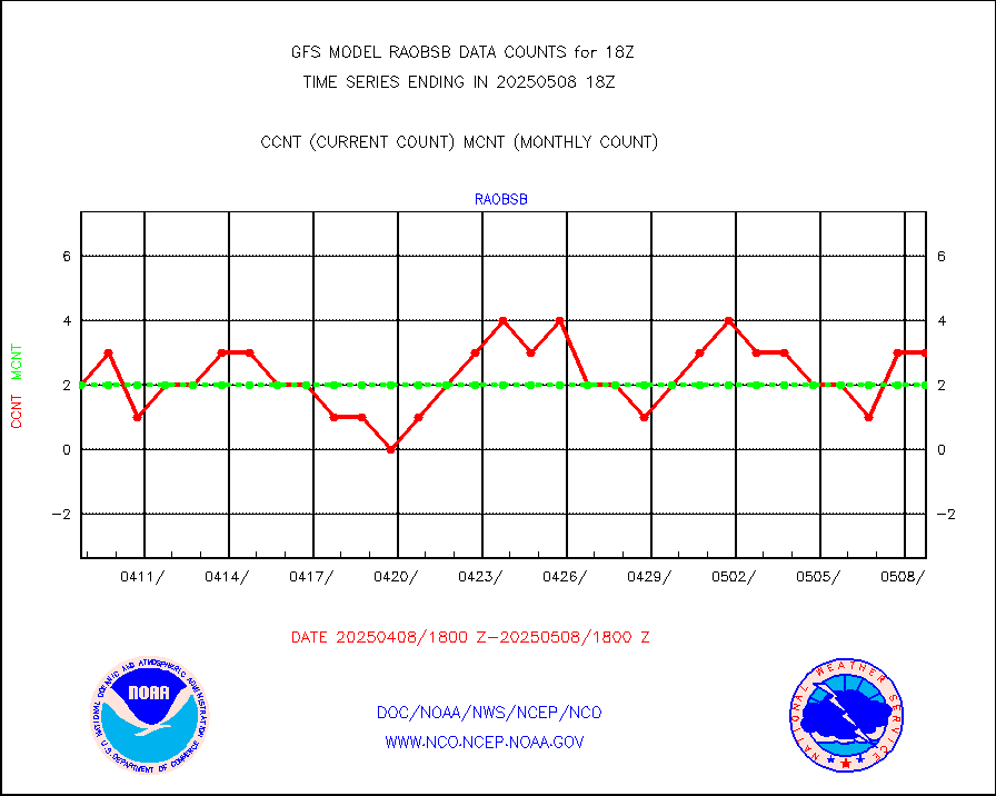
Manual PIREP aircraft data (dcded from AIREP fmt) |
941 |
903 |
104.2 % |
|||||||||||
Multi-Agency Profiler (MAP) and SODAR winds |
385 |
355 |
108.5 % |
|||||||||||
Rawinsonde - fixed land (decoded from BUFR) |
28 |
27 |
103.7 % |
|||||||||||
Rawinsonde - mobile land (decoded from BUFR) |
0 |
0 |
n/a |
|||||||||||
Rawinsonde - ship (decoded from BUFR) |
2 |
2 |
100.0 % |
|||||||||||
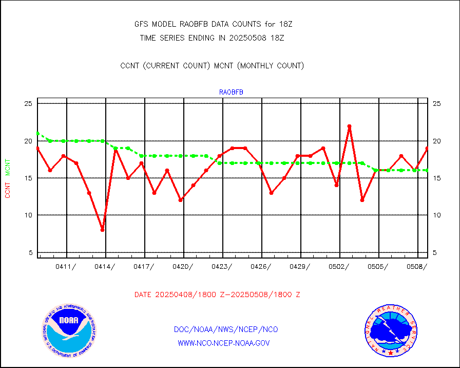
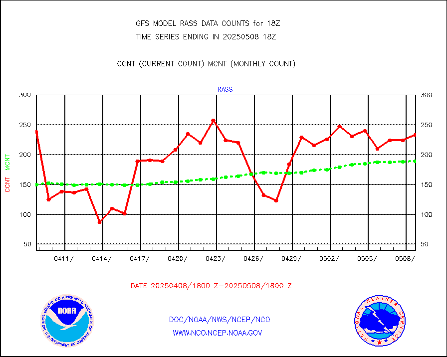
RASS temperatures (NOAA and Multi-Agency) |
195 |
178 |
109.6 % |
|||||||||||
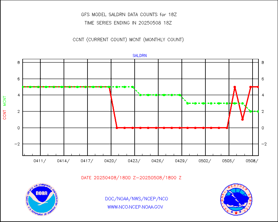
Surface Marine Saildrone (decoded from BUFR) |
5 |
5 |
100.0 % |
|||||||||||
METEOSAT-10 2nd Gen SEVIRI All Sky Radiance(proc) |
377102 |
377334 |
99.9 % |
|||||||||||
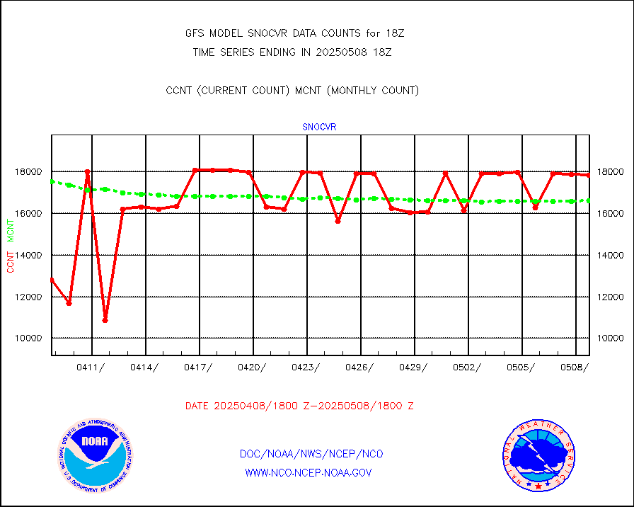
NOW COVER, DEPTH/DENSITY AND WATER EQUIVALENT |
15782 |
16855 |
93.6 % |
|||||||||||
DMSP SSM/IS 1C radiance data (Unified Pre-Proc.) |
411060 |
643336 |
63.9 % |
|||||||||||
NPP/NOAA-20 VIIRS SST - PROBABLY CLR & OVER WATER |
9999999 |
9721506 |
102.9 % |
|||||||||||
Sub-surface float and glider profile (BUFR) |
65 |
67 |
97.0 % |
|||||||||||
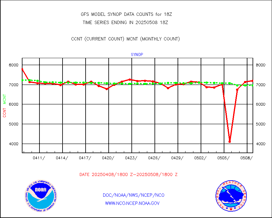
Synoptic - fixed manual and automatic |
7057 |
6857 |
102.9 % |
|||||||||||
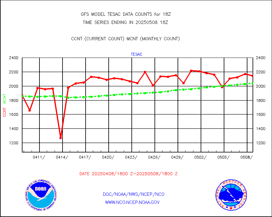
CTD probe, Argo prflng float, mooring (TESAC fmt) |
2519 |
2434 |
103.5 % |
|||||||||||
TAMDAR aircft data-all types(from Panasonic,BUFR) |
250 |
324 |
77.2 % |
|||||||||||
ThermoSalinoGraph (TSG) TRACKOB format) |
286 |
553 |
51.7 % |
|||||||||||
INSAT/KALPANA India visible derived cloud motion |
0 |
0 |
n/a |
|||||||||||
INDIA SATWIND, INSAT VIS channel |
0 |
0 |
n/a |
|||||||||||
GOES-16&up/NESDIS visible derived cloud motion |
2996549 |
2766699 |
108.3 % |
|||||||||||


