| Suspect Data Shortages in Critical Types - Monitor | ||||||||||||||
|---|---|---|---|---|---|---|---|---|---|---|---|---|---|---|
| Type | Description | Hourly Count | Monthly Average | Percent (%) of Monthly Mean | UTC Time Window | |||||||||
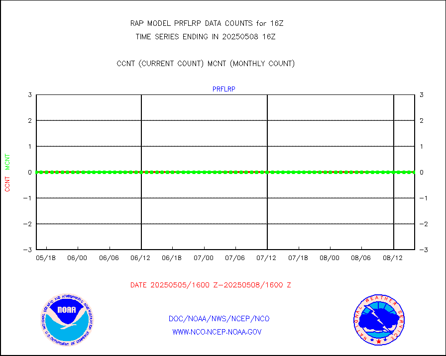
NOAA 18-19 & METOP 1-2 HIRS-4 NCEP-proc. br.temps |
0 |
5564 |
0.0 % |
3013.00-3018.99 |
||||||||||
| Shortage in Data Type of Opportunity - Monitor | ||||||||||||||
|---|---|---|---|---|---|---|---|---|---|---|---|---|---|---|
| Type | Description | Hourly Count | Monthly Average | Percent (%) of Monthly Mean | UTC Time Window | |||||||||
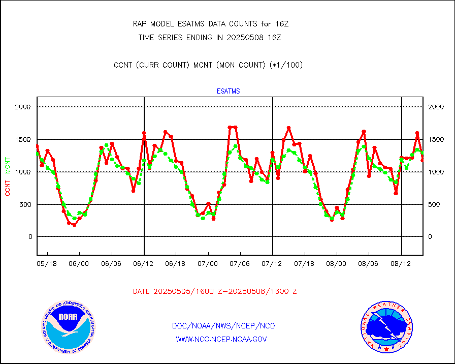
NPP Adv. Tech. MW Sndr (ATMS) br. temps from RARS |
0 |
15525 |
0.0 % |
3014.00-3017.99 |
||||||||||
NOAA 15-19 & METOP 1-2 HIRS-3/4 pr btmps frm RARS |
0 |
5776 |
0.0 % |
3015.00-3017.00 |
||||||||||
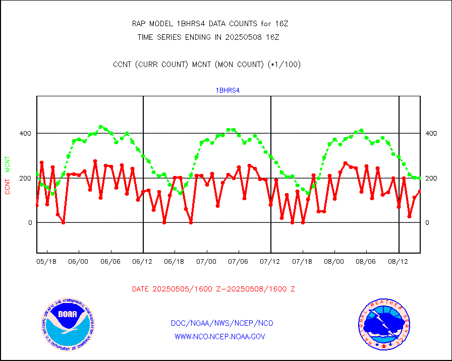
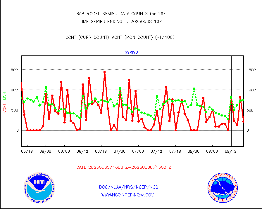
METOP 1-2 IASI 1C radiance data vbl chn from RARS |
0 |
4759 |
0.0 % |
3014.00-3017.99 |
||||||||||
| Critical Data with Normal Counts | ||||||||||||||
|---|---|---|---|---|---|---|---|---|---|---|---|---|---|---|
| Type | Description | Hourly Count | Monthly Average | Percent (%) of Monthly Mean | UTC Time Window | |||||||||
NOAA 15-19 & METOP 1-2 AMSU-A NCEP-proc. br.temps |
14991 |
20391 |
73.5 % |
3013.00-3018.99 |
||||||||||
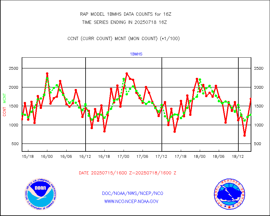
NOAA 18-19 & METOP 1-2 MHS NCEP-proces. br. temps |
133433 |
148933 |
89.6 % |
3013.00-3018.99 |
||||||||||
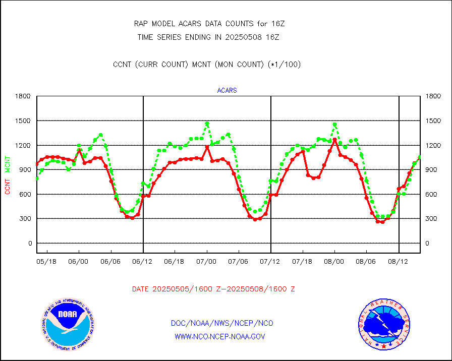
MDCRS ACARS acft data from ARINC(dcded from BUFR) |
110104 |
81564 |
135.0 % |
3012.75-3019.25 |
||||||||||
Canadian AMDAR aircraft data (decoded from BUFR) |
0 |
0 |
n/a |
3012.75-3019.25 |
||||||||||
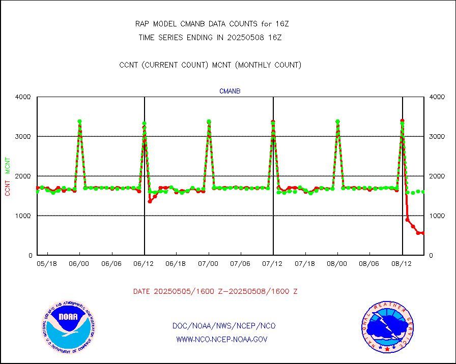
Surface Marine CMAN rpts decoded from BUFR format |
1726 |
1639 |
105.3 % |
3015.50-3016.50 |
||||||||||
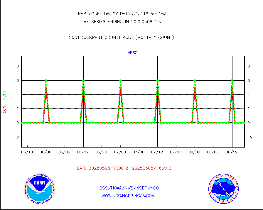
Buoys decoded from FM-18 fmt (moored or drifting) |
0 |
0 |
n/a |
3015.50-3016.50 |
||||||||||
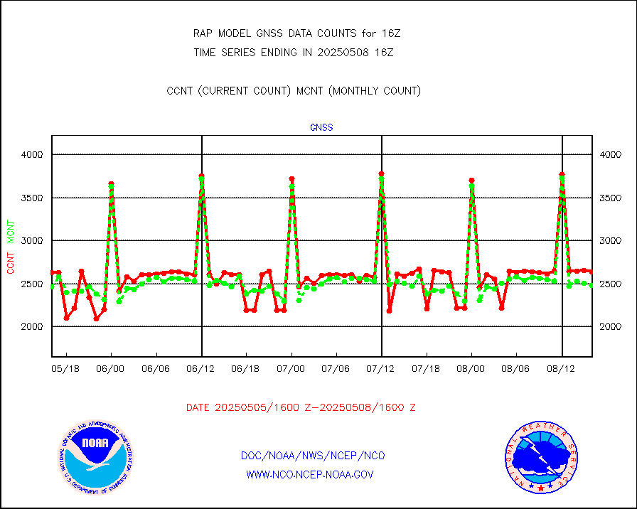
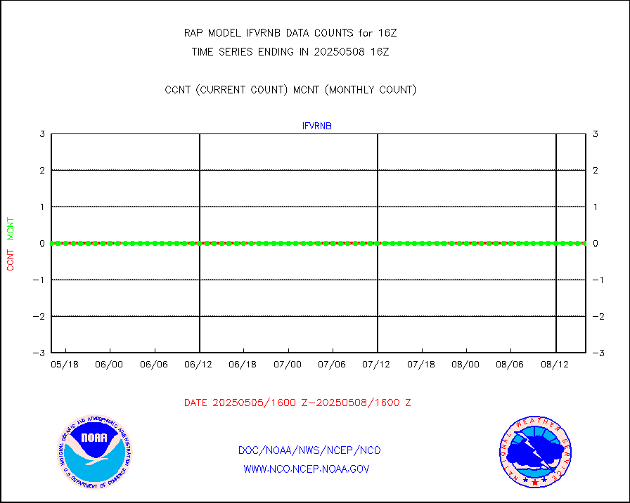
Grnd-based Gbl Navigation Sat System (GNSS) data |
743 |
2187 |
34.0 % |
3014.95-3015.05 |
||||||||||
MODIS (AQUA/TERRA) wvpr imager derived cld motion |
0 |
0 |
n/a |
3013.50-3018.50 |
||||||||||
MODIS (AQUA/TERRA) ir l-wave derived cloud motion |
0 |
0 |
n/a |
3013.50-3018.50 |
||||||||||
GOES/NASA(Langley) hi-res. (1x1 f-o-v) cloud data |
3745349 |
3302567 |
113.4 % |
3015.50-3016.50 |
||||||||||
Buoys decoded from FM-13 format (moored) |
148 |
138 |
107.2 % |
3015.50-3016.50 |
||||||||||
Aviation - METAR |
5934 |
5834 |
101.7 % |
3015.50-3016.50 |
||||||||||
NEXRAD Vel Azm Dsp(VAD) winds via radar coded msg |
0 |
0 |
n/a |
3015.00-3017.00 |
||||||||||
Multi-Agency Profiler (MAP) and SODAR winds |
106 |
95 |
111.6 % |
3014.50-3017.50 |
||||||||||
Rawinsonde - fixed land (from TEMP or PILOT) |
2 |
1 |
200.0 % |
3015.00-3017.00 |
||||||||||
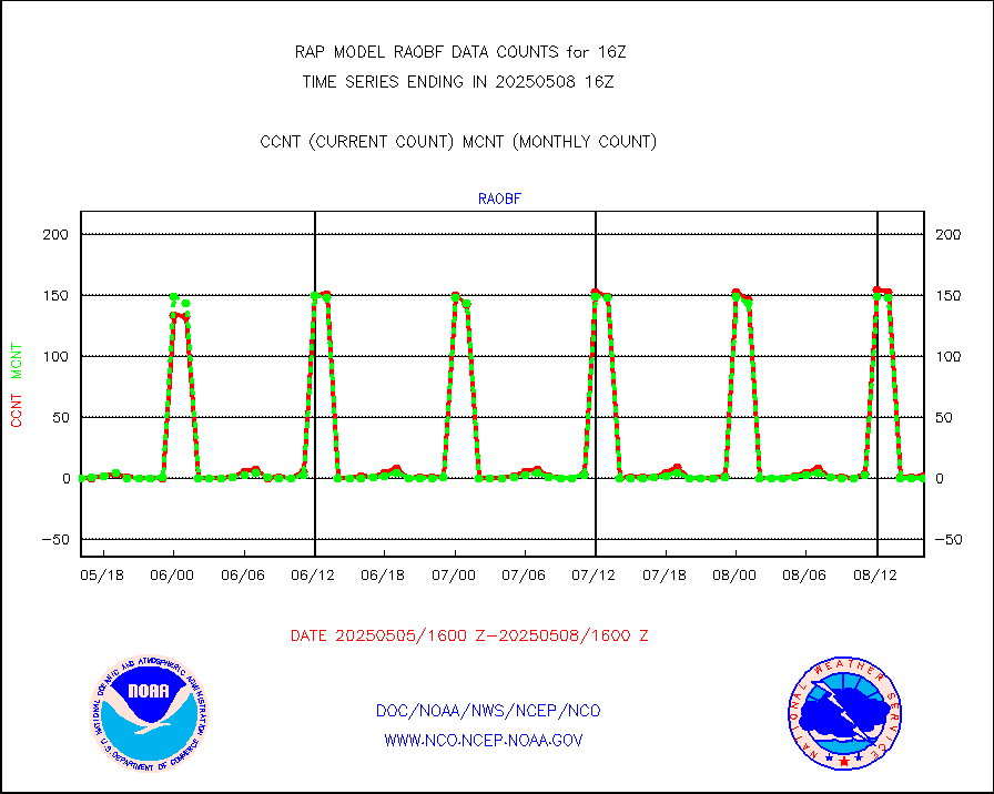
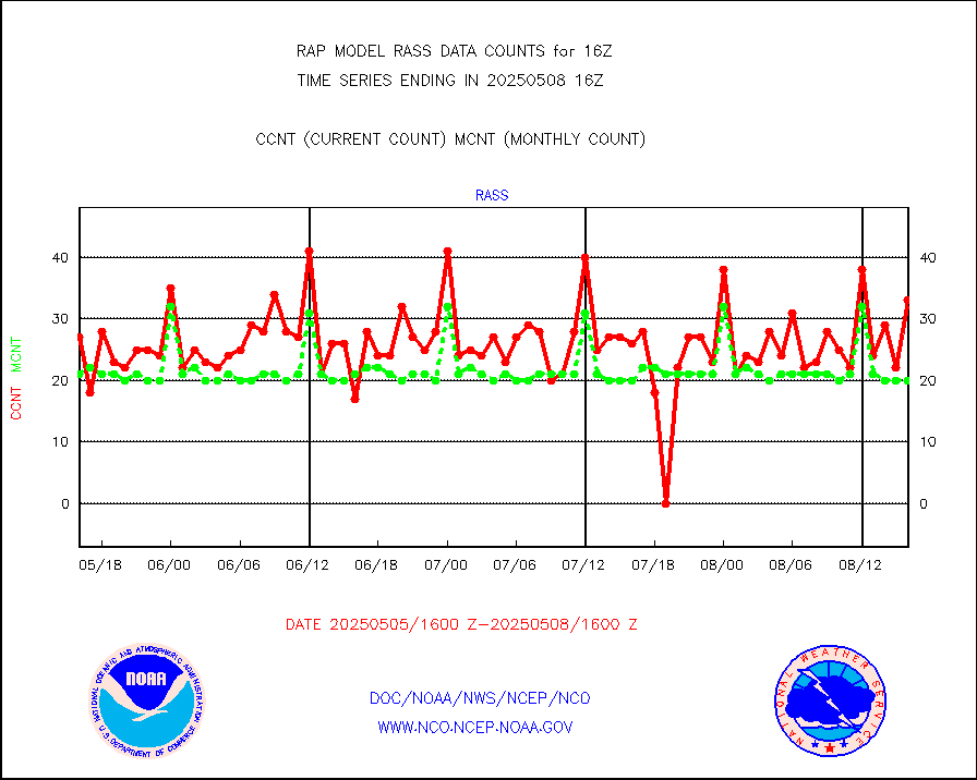
RASS temperatures (NOAA and Multi-Agency) |
24 |
23 |
104.3 % |
3015.50-3016.50 |
||||||||||
Ship - manual and automatic, restricted (BUFR) |
0 |
0 |
n/a |
3015.50-3016.50 |
||||||||||
Ship - manual and automatic, unrestricted |
93 |
98 |
94.9 % |
3015.50-3016.50 |
||||||||||
Ship - manual and automatic, unrestricted (BUFR) |
748 |
682 |
109.7 % |
3015.50-3016.50 |
||||||||||
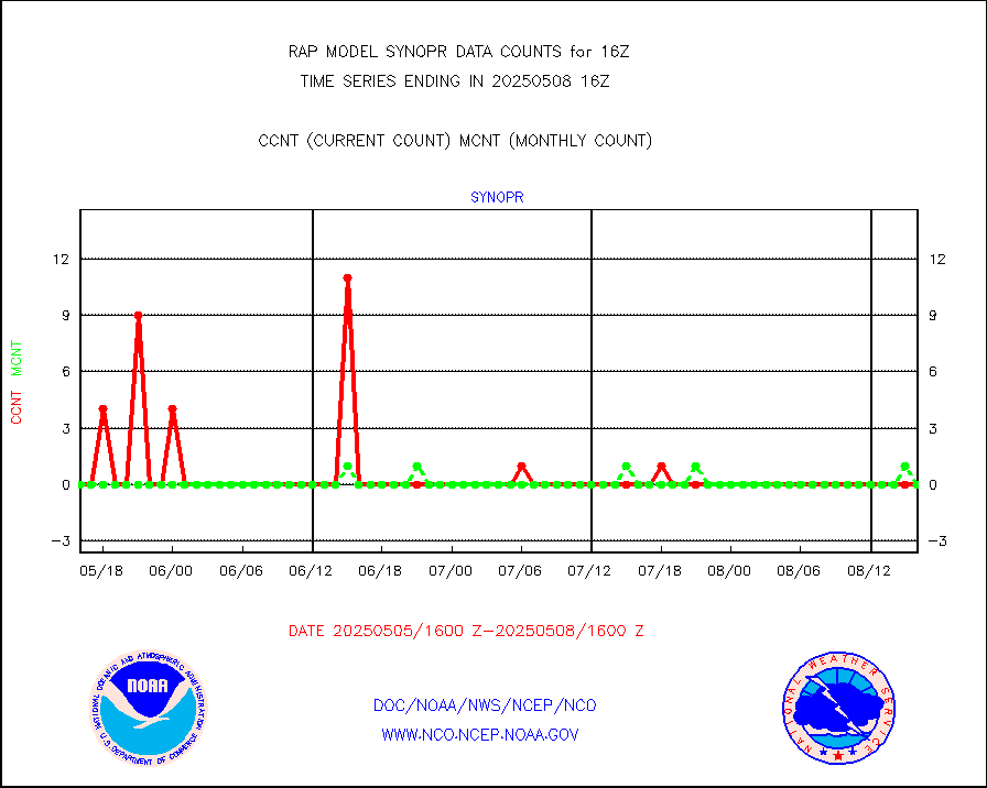
Synoptic - fixed manual and automatic |
335 |
312 |
107.4 % |
3015.50-3016.50 |
||||||||||
Synoptic - fixed manual & auto (decoded fr BUFR) |
2137 |
2039 |
104.8 % |
3015.50-3016.50 |
||||||||||
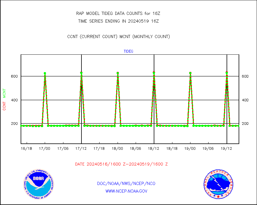
Tide gauge reports decoded from CREX format |
185 |
185 |
100.0 % |
3015.50-3016.50 |
||||||||||
| Data Types of Opportunity with Normal Counts | ||||||||||||||
|---|---|---|---|---|---|---|---|---|---|---|---|---|---|---|
| Type | Description | Hourly Count | Monthly Average | Percent (%) of Monthly Mean | UTC Time Window | |||||||||
GOES-16&up/NESDIS ir short-wv derived cld motion |
4837 |
4339 |
111.5 % |
3015.00-3015.99 |
||||||||||
MDCRS ACARS acft data (ARINC via AFWA)(AIREP fmt) |
0 |
0 |
n/a |
3012.75-3019.25 |
||||||||||
Manual AIREP aircraft data (dcded from AIREP fmt) |
3930 |
3675 |
106.9 % |
3012.75-3019.25 |
||||||||||
AQUA AIRS/AMSU-A/HSB brightness temps- every FOV |
0 |
0 |
n/a |
3013.00-3018.99 |
||||||||||
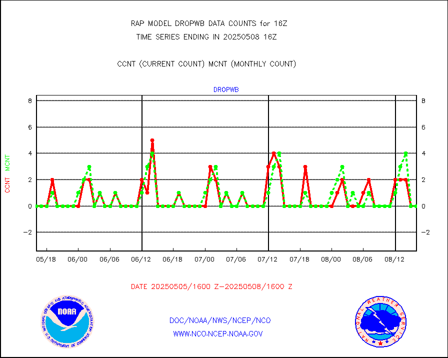
AMDAR aircraft data (decoded from AMDAR format) |
339 |
330 |
102.7 % |
3012.75-3019.25 |
||||||||||
AMDAR aircraft data (decoded from BUFR) |
8476 |
8288 |
102.3 % |
3012.75-3019.25 |
||||||||||
GCOM-W AMSR2 1B brightness temperatures |
355947 |
747994 |
47.6 % |
3013.00-3013.99 |
||||||||||
METOP 1-2 ASCAT products |
20254 |
21746 |
93.1 % |
3014.00-3018.00 |
||||||||||
NPP/NOAA-20 ATMS brightness temperatures |
164369 |
193053 |
85.1 % |
3014.00-3017.99 |
||||||||||
NPP/NOAA-20 ATMS bright. temps-direct b-cast SSEC |
99403 |
89684 |
110.8 % |
3014.00-3017.99 |
||||||||||
Coop/MADIS NEPP & HCN-Modernization NOAA COOP Obs |
11 |
11 |
100.0 % |
3015.50-3016.50 |
||||||||||
NPP/NOAA-20 CrIS full spctrl radn (431 ch subset) |
122592 |
106748 |
114.8 % |
3014.00-3017.99 |
||||||||||
NPP/NOAA-20 CrIS full spctrl radn dir brdcst SSEC |
36246 |
39675 |
91.4 % |
3014.00-3017.99 |
||||||||||
Coast Guard |
5 |
5 |
100.0 % |
3015.50-3016.50 |
||||||||||
Drifting buoys (decoded from BUFR) |
544 |
536 |
101.5 % |
3015.50-3016.50 |
||||||||||
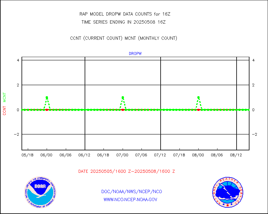
Dropwinsonde (from TEMP DROP) |
0 |
0 |
n/a |
3015.00-3017.00 |
||||||||||
Dropwinsonde (decoded from BUFR) |
0 |
0 |
n/a |
3015.00-3017.00 |
||||||||||
E-AMDAR (European AMDAR acft decoded from BUFR) |
10833 |
12059 |
89.8 % |
3012.75-3019.25 |
||||||||||
NOAA 15-19 & METOP 1-2 AMSU-A proc btmps frm RARS |
9050 |
11837 |
76.5 % |
3015.00-3017.00 |
||||||||||
NOAA 18-19 & METOP 1-2 MHS proc. btemps from RARS |
100288 |
125815 |
79.7 % |
3015.00-3017.00 |
||||||||||
GPM GMI Level 1C-R brightness temperatures |
371637 |
201931 |
184.0 % |
3013.00-3018.99 |
||||||||||
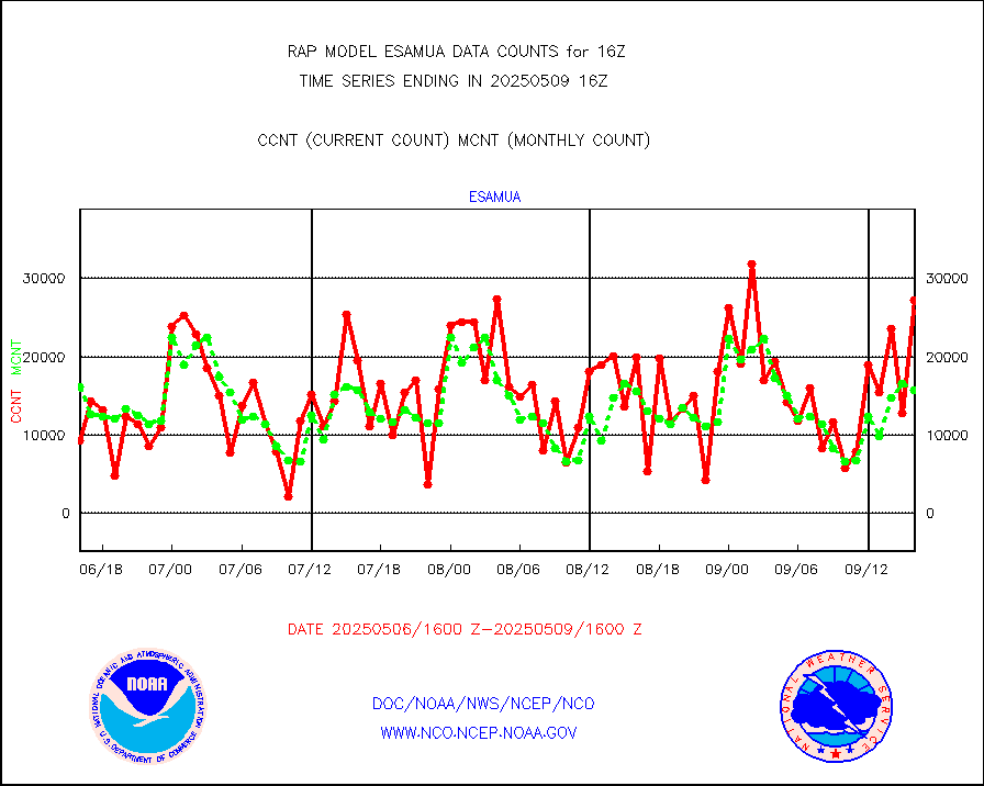
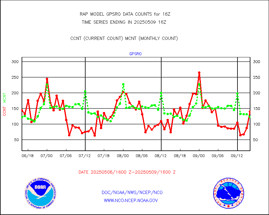
GPS radio occultation data |
73 |
132 |
55.3 % |
3014.00-3017.99 |
||||||||||
GOES-16/17 All Sky Radiances (proc.) |
848989 |
853328 |
99.5 % |
3014.00-3017.99 |
||||||||||
GOES-16/17 Clear Sky Radiances (proc.) |
402254 |
403405 |
99.7 % |
3014.00-3017.99 |
||||||||||
MTSAT/JMA water vapor imager derived cloud motion |
1074 |
2731 |
39.3 % |
3013.50-3018.50 |
||||||||||
GOES-16&up/NESDIS wv imgr/deep-lyr derivd cld mtn |
8017 |
7683 |
104.3 % |
3015.00-3015.99 |
||||||||||
METEOSAT/EUMETSAT wvpr imgr drv cld motion NBseq |
5512 |
5516 |
99.9 % |
3014.50-3017.49 |
||||||||||
GOES-16&up/NESDIS wv imgr/cld-top derived cld mtn |
13290 |
12601 |
105.5 % |
3015.00-3015.99 |
||||||||||
METOP 1-2 IASI 1C radiances-direct broadcast SSEC |
118542 |
105017 |
112.9 % |
3014.00-3017.99 |
||||||||||
METEOSAT/EUMETSAT ir lg-wave drv cld motion NBseq |
3147 |
3141 |
100.2 % |
3014.50-3017.49 |
||||||||||
VIIRS (NPP/NOAA-20) ir lg-wv drv cloud motion(NB) |
0 |
0 |
n/a |
3013.50-3018.50 |
||||||||||
AVHRR (NOAA/METOP) ir lg-wave derived cld motion |
0 |
0 |
n/a |
3013.50-3018.50 |
||||||||||
AVHRR (METOP) ir lg-wave derived cld motion |
0 |
0 |
n/a |
3014.50-3017.49 |
||||||||||
MTSAT/JMA infrared long-wave derived cloud motion |
1037 |
2075 |
50.0 % |
3013.50-3018.50 |
||||||||||
GOES-16&up/NESDIS ir long-wave derived cld motion |
30582 |
28963 |
105.6 % |
3015.00-3015.99 |
||||||||||
Korean AMDAR aircraft data (decoded from BUFR) |
0 |
25 |
0.0 % |
3012.75-3019.25 |
||||||||||
Land-based CMAN stations decoded from CMAN format |
67 |
70 |
95.7 % |
3015.50-3016.50 |
||||||||||
LLDN Long-rng lightning from Vaisala via NOAAPORT |
125545 |
86181 |
145.7 % |
3015.00-3016.50 |
||||||||||
NLDN Shrt-rng lightning from Vaisala via NOAAPORT |
4191 |
4106 |
102.1 % |
3015.00-3016.50 |
||||||||||
Moored buoys (decoded from BUFR) |
693 |
629 |
110.2 % |
3015.50-3016.50 |
||||||||||
Mesonet/MADIS Colorado E-470 (Interstate 470) |
24 |
24 |
100.0 % |
3015.50-3016.50 |
||||||||||
Mesonet/MADIS Alaska Department of Transportation |
120 |
89 |
134.8 % |
3015.50-3016.50 |
||||||||||
Mesonet/MADIS U.S. Army Aberdeen Proving Grounds |
0 |
0 |
n/a |
3015.50-3016.50 |
||||||||||
Mesonet/MADIS Citizen Weather Observers Program |
59129 |
52400 |
112.8 % |
3015.50-3016.50 |
||||||||||
Mesonet/MADIS AWS Convergence Technologies, Inc. |
17983 |
19697 |
91.3 % |
3015.50-3016.50 |
||||||||||
Mesonet/MADIS "Anything Weather" |
0 |
0 |
n/a |
3015.50-3016.50 |
||||||||||
Mesonet/MADIS Colorado Dept. of Transportation |
0 |
0 |
n/a |
3015.50-3016.50 |
||||||||||
Mesonet/MADIS DC Net |
0 |
0 |
n/a |
3015.50-3016.50 |
||||||||||
Mesonet/MADIS Denver Urban Drainage & Flood Cntrl |
0 |
0 |
n/a |
3015.50-3016.50 |
||||||||||
Mesonet/MADIS Florida (FAWN & USF) |
3 |
3 |
100.0 % |
3015.50-3016.50 |
||||||||||
Mesonet/MADIS Florida Dept. of Transportation |
0 |
0 |
n/a |
3015.50-3016.50 |
||||||||||
Mesonet/MADIS Georgia Dept. of Transportation |
0 |
0 |
n/a |
3015.50-3016.50 |
||||||||||
Mesonet/MADIS NWS Hydromet Auto Data System(HADS) |
3922 |
5058 |
77.5 % |
3015.50-3016.50 |
||||||||||
Mesonet/MADIS Iowa Environmental |
158 |
160 |
98.8 % |
3015.50-3016.50 |
||||||||||
Mesonet/MADIS Indiana Dept. of Transportation |
0 |
0 |
n/a |
3015.50-3016.50 |
||||||||||
Mesonet/MADIS Iowa Department of Transportation |
0 |
0 |
n/a |
3015.50-3016.50 |
||||||||||
Mesonet/MADIS Kansas Department of Transportation |
339 |
316 |
107.3 % |
3015.50-3016.50 |
||||||||||
Mesonet/MADIS Oklahoma Mesonet |
630 |
560 |
112.5 % |
3015.50-3016.50 |
||||||||||
Mesonet/MADIS Louisiana State/Jackson State Univ. |
0 |
0 |
n/a |
3015.50-3016.50 |
||||||||||
Mesonet/MADIS Missouri Commercial Agricult Wx Net |
280 |
285 |
98.2 % |
3015.50-3016.50 |
||||||||||
Mesonet/MADIS Minnesota Dept. of Transportation |
0 |
0 |
n/a |
3015.50-3016.50 |
||||||||||
Mesonet/MADIS NOS-Phys Oceanographic Realtime Sys |
224 |
268 |
83.6 % |
3015.50-3016.50 |
||||||||||
Mesonet/MADIS NFIC Remote Automated Wx Stns(RAWS) |
1237 |
1487 |
83.2 % |
3015.50-3016.50 |
||||||||||
Mesonet/MADIS many providers, not separated out |
40431 |
35790 |
113.0 % |
3015.50-3016.50 |
||||||||||
Mesonet/MADIS UrbaNet |
2877 |
3131 |
91.9 % |
3015.50-3016.50 |
||||||||||
Mesonet/MADIS Virginia Dept. of Transportation |
0 |
0 |
n/a |
3015.50-3016.50 |
||||||||||
Mesonet/MADIS "Weather for You" |
0 |
0 |
n/a |
3015.50-3016.50 |
||||||||||
Mesonet/MADIS Wisconsin Dept. of Transportation |
0 |
0 |
n/a |
3015.50-3016.50 |
||||||||||
Mesonet/MADIS MesoWest (many subproviders) |
35078 |
34097 |
102.9 % |
3015.50-3016.50 |
||||||||||
Mesonet/MADIS West Texas |
4845 |
5206 |
93.1 % |
3015.50-3016.50 |
||||||||||
METOP 1-2 IASI 1C radiance data (varbl. channels) |
26932 |
22608 |
119.1 % |
3014.00-3017.99 |
||||||||||
NEXRAD Vel Azm Dsp(VAD) winds via Level 2 decoder |
650 |
617 |
105.3 % |
3015.00-3017.00 |
||||||||||
NOAA 16-19 Solar Backscatter UV-2 rad frm V8 BUFR |
0 |
0 |
n/a |
3014.00-3016.99 |
||||||||||
PIBAL (from PILOT, PILOT SHIP, PILOT MOBIL) |
0 |
0 |
n/a |
3015.00-3017.00 |
||||||||||
PIBAL (decoded from BUFR) |
0 |
0 |
n/a |
3015.00-3017.00 |
||||||||||
Manual PIREP aircraft data (dcded from AIREP fmt) |
628 |
551 |
114.0 % |
3012.75-3019.25 |
||||||||||
Profilr winds from PIBAL (PILOT,PILOT SHIP/MOBIL) |
0 |
0 |
n/a |
3014.50-3017.50 |
||||||||||
Rawinsonde - fixed land (decoded from BUFR) |
0 |
0 |
n/a |
3015.00-3017.00 |
||||||||||
Rawinsonde - mobile land (from TEMP/PILOT MOBIL) |
0 |
0 |
n/a |
3015.00-3017.00 |
||||||||||
Rawinsonde - mobile land (decoded from BUFR) |
0 |
0 |
n/a |
3015.00-3017.00 |
||||||||||
Rawinsonde - ship (from TEMP SHIP, PILOT SHIP) |
0 |
0 |
n/a |
3015.00-3017.00 |
||||||||||
Rawinsonde - ship (decoded from BUFR) |
0 |
0 |
n/a |
3015.00-3017.00 |
||||||||||
NEXRAD radial wind (Level 2 - GTS) |
907747 |
883133 |
102.8 % |
3015.50-3016.49 |
||||||||||
Flight level reconnaissance aircraft data |
0 |
0 |
n/a |
3015.00-3017.00 |
||||||||||
Surface Marine Saildrone (decoded from BUFR) |
2 |
2 |
100.0 % |
3014.00-3017.99 |
||||||||||
Megha-Tropiques SAPHIR L1A2 brightness temps |
0 |
0 |
n/a |
3013.00-3018.99 |
||||||||||
METEOSAT-10 2nd Gen SEVIRI All Sky Radiance(proc) |
8160 |
9317 |
87.6 % |
3014.00-3017.99 |
||||||||||
METEOSAT-10 2nd Gen SEVIRI Clr Sky Radiance(proc) |
0 |
0 |
n/a |
3014.00-3017.99 |
||||||||||
Ship - manual and automatic, restricted |
6 |
10 |
60.0 % |
3015.50-3016.50 |
||||||||||
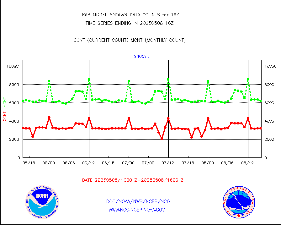
NOW COVER, DEPTH/DENSITY AND WATER EQUIVALENT |
3197 |
6262 |
51.1 % |
3014.00-3018.00 |
||||||||||
DMSP SSM/IS 1C radiance data (Unified Pre-Proc.) |
141234 |
57487 |
245.7 % |
3014.00-3017.99 |
||||||||||
Sub-surface float and glider profile (BUFR) |
0 |
2 |
0.0 % |
3014.00-3017.99 |
||||||||||
Synoptic - restricted (WMO Res 40) manual & auto. |
0 |
0 |
n/a |
3015.50-3016.50 |
||||||||||
Synoptic - restricted (WMO Res 40)(decoded BUFR) |
347 |
359 |
96.7 % |
3015.50-3016.50 |
||||||||||
Synoptic - mobile manual & auto (decoded fr BUFR) |
0 |
0 |
n/a |
3015.50-3016.50 |
||||||||||
TAMDAR aircft data-all types(from Panasonic,BUFR) |
129 |
199 |
64.8 % |
3012.75-3019.25 |
||||||||||
MTSAT/JMA visible derived cloud motion |
0 |
0 |
n/a |
3013.50-3018.50 |
||||||||||
GOES-16&up/NESDIS visible derived cloud motion |
104537 |
88597 |
118.0 % |
3015.00-3015.99 |
||||||||||
METEOSAT/EUMETSAT visible drv cld motion NBseq |
7374 |
6513 |
113.2 % |
3014.50-3017.49 |
||||||||||


