| Suspect Data Shortages in Critical Types - Monitor | ||||||||||||||
|---|---|---|---|---|---|---|---|---|---|---|---|---|---|---|
| Type | Description | Hourly Count | Monthly Average | Percent (%) of Monthly Mean | UTC Time Window | |||||||||
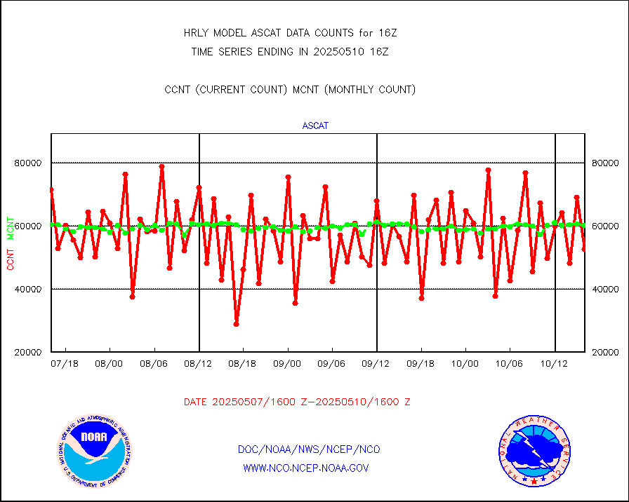
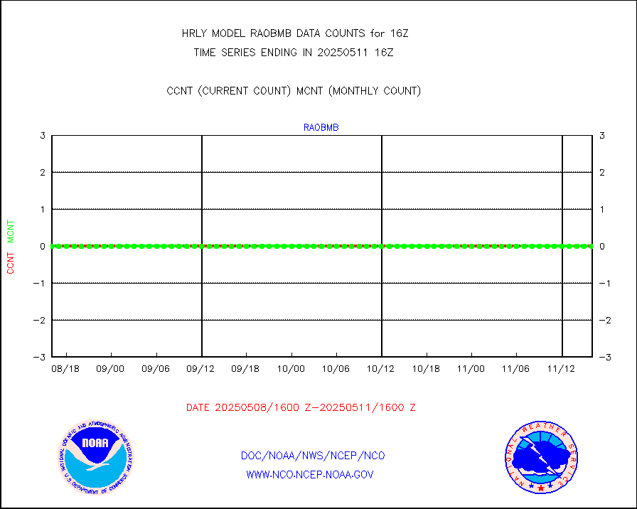
NOAA 18-19 & METOP 1-2 HIRS-4 NCEP-proc. br.temps |
0 |
11062 |
0.0 % |
0114.00-0114.99 |
||||||||||
NOAA 15-19 & METOP 1-2 HIRS-3/4 pr btmps frm RARS |
0 |
11098 |
0.0 % |
0115.50-0116.49 |
||||||||||
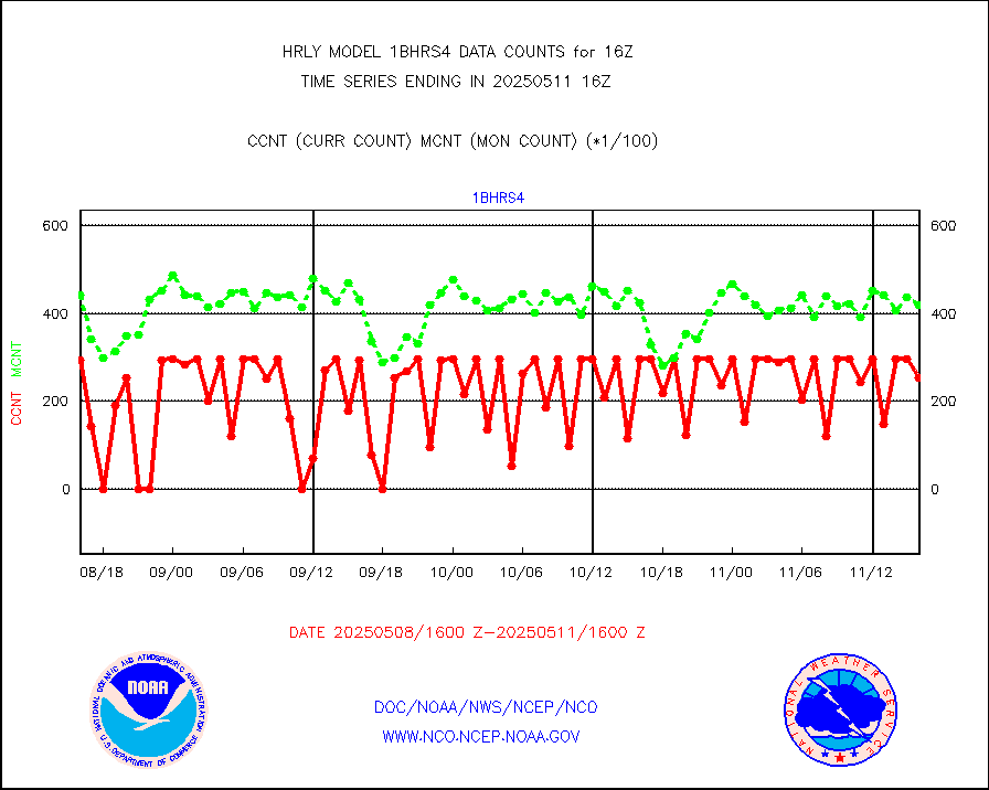
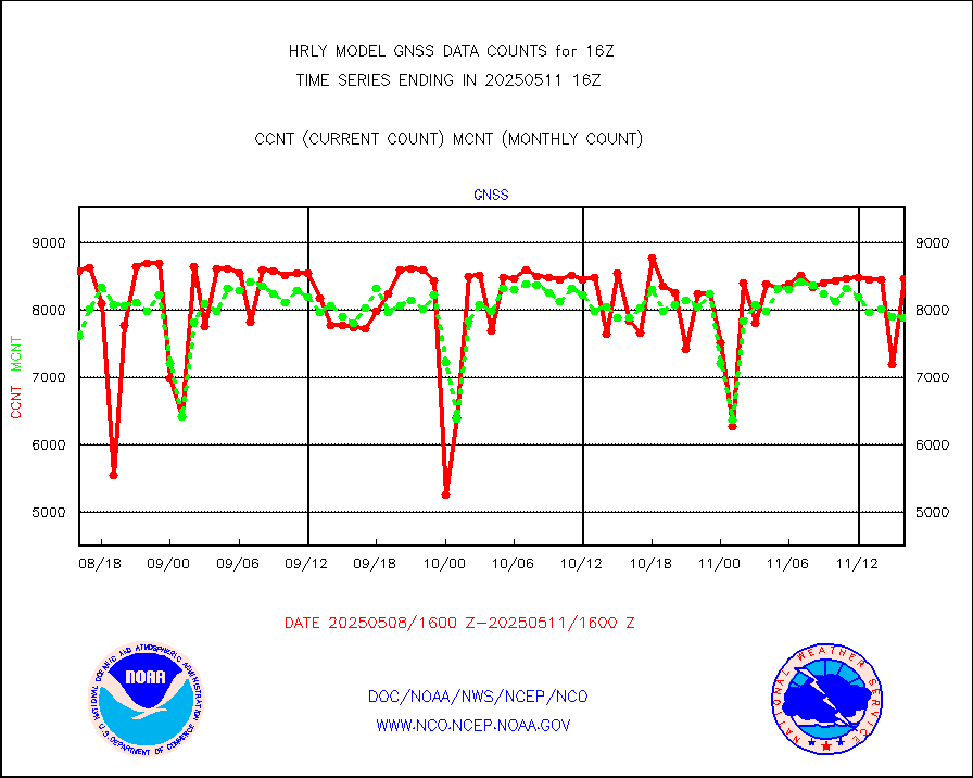
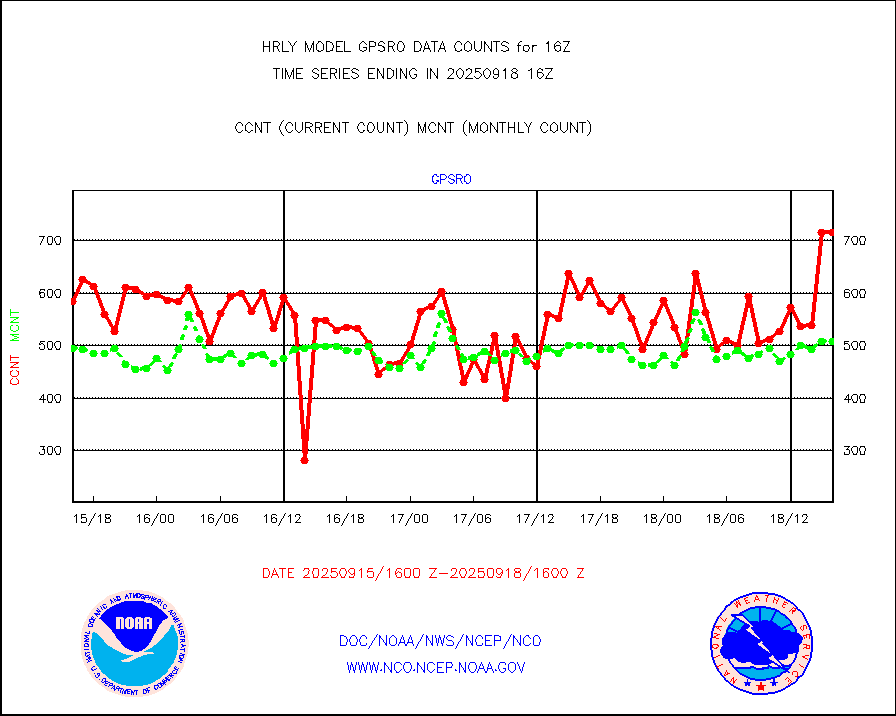
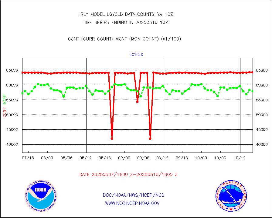
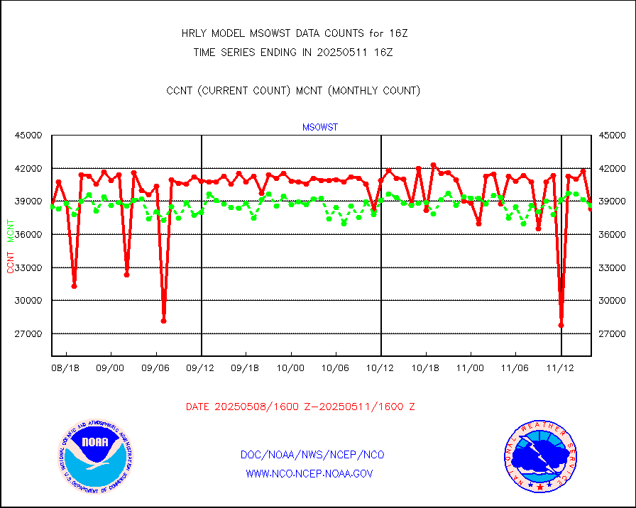
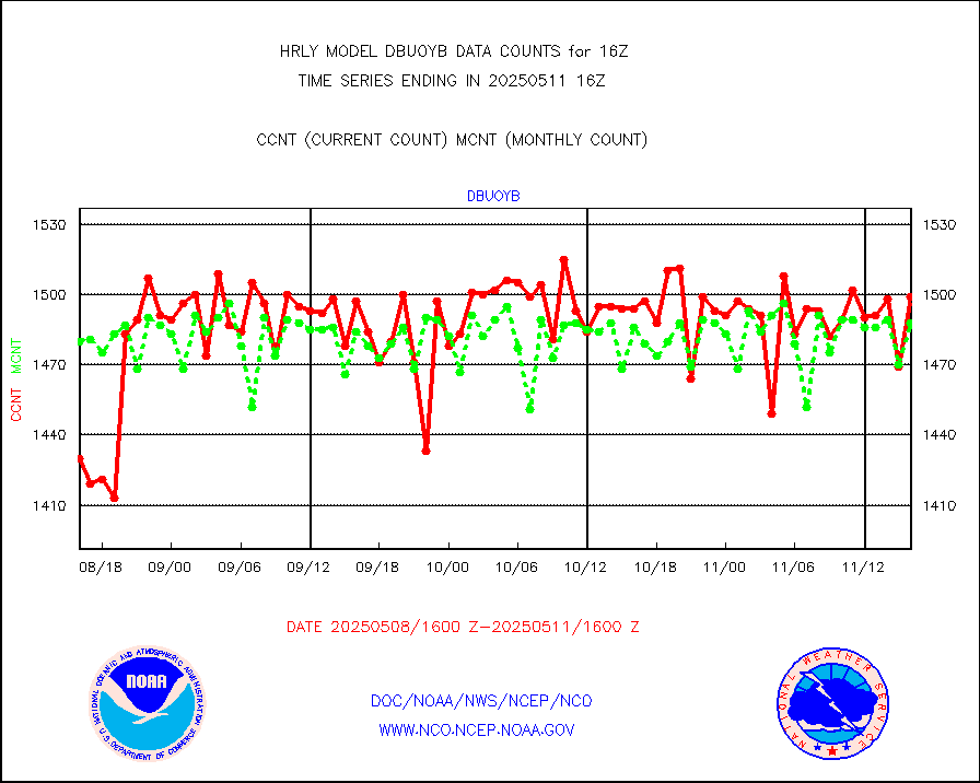
Grnd-based Gbl Navigation Sat System (GNSS) data |
1331 |
6422 |
20.7 % |
0115.00-0115.99 |
||||||||||
| Shortage in Data Type of Opportunity - Monitor | ||||||||||||||
|---|---|---|---|---|---|---|---|---|---|---|---|---|---|---|
| Type | Description | Hourly Count | Monthly Average | Percent (%) of Monthly Mean | UTC Time Window | |||||||||
P.M.(N18-19) AVHRR GAC NCEP-proc clr & sea btemps |
0 |
340519 |
0.0 % |
0113.50-0114.49 |
||||||||||
INDIA SATWIND, INSAT WV channel |
0 |
815 |
0.0 % |
0115.00-0115.99 |
||||||||||
INDIA SATWIND, INSAT IR channel |
0 |
1156 |
0.0 % |
0115.00-0115.99 |
||||||||||
Ship - manual and automatic, restricted |
0 |
9 |
0.0 % |
0115.50-0116.49 |
||||||||||
NPP/NOAA-20 VIIRS SST - CLEAR & OVER WATER |
0 |
1532123 |
0.0 % |
0115.50-0116.49 |
||||||||||
NPP/NOAA-20 VIIRS SST - PROBABLY CLR & OVER WATER |
0 |
394275 |
0.0 % |
0115.50-0116.49 |
||||||||||
| Critical Data with Normal Counts | ||||||||||||||
|---|---|---|---|---|---|---|---|---|---|---|---|---|---|---|
| Type | Description | Hourly Count | Monthly Average | Percent (%) of Monthly Mean | UTC Time Window | |||||||||
NOAA 15-19 & METOP 1-2 AMSU-A NCEP-proc. br.temps |
26517 |
35398 |
74.9 % |
0114.00-0114.99 |
||||||||||
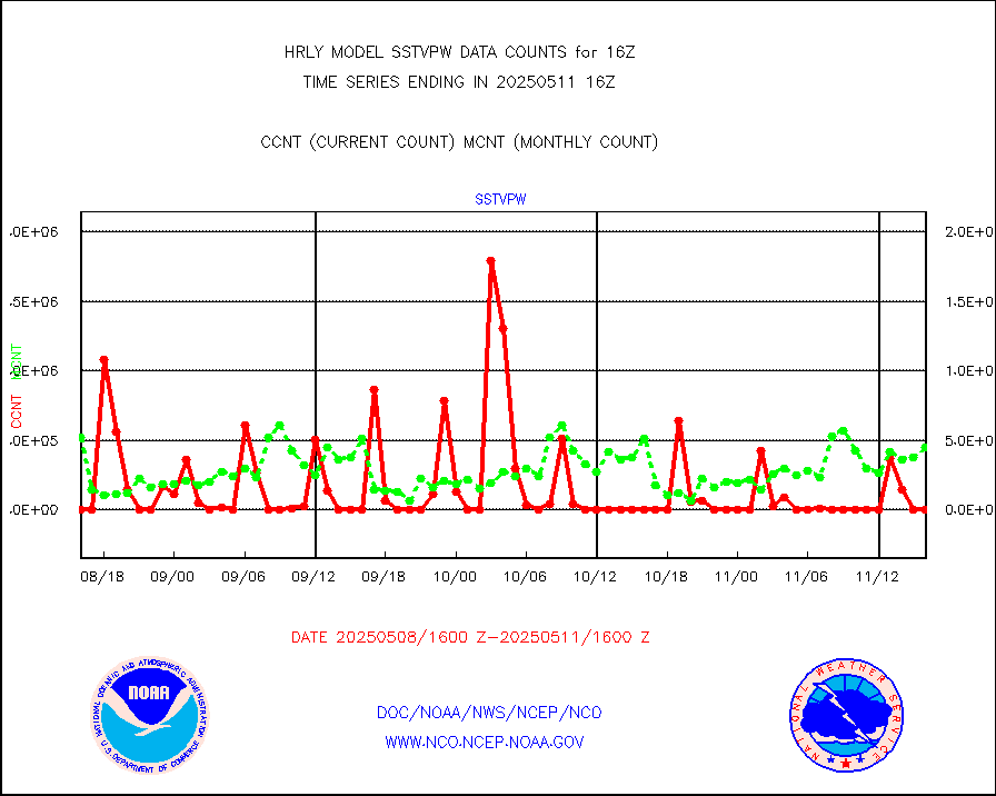
NOAA 18-19 & METOP 1-2 MHS NCEP-proces. br. temps |
235827 |
261519 |
90.2 % |
0114.00-0114.99 |
||||||||||
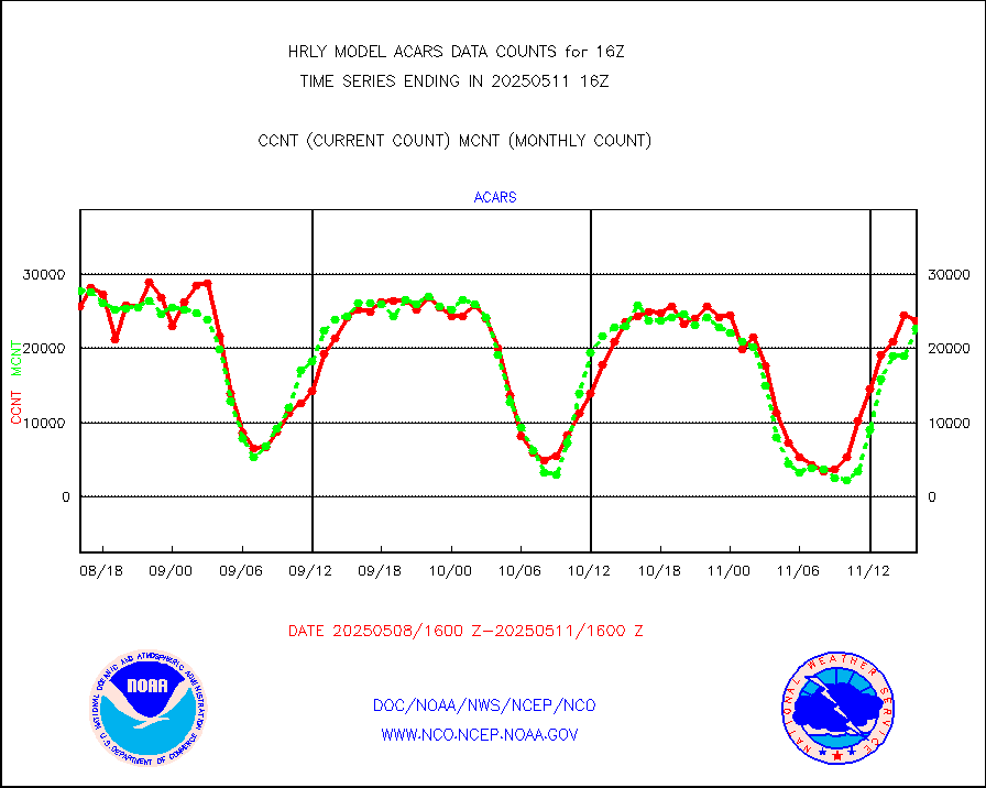
MDCRS ACARS acft data from ARINC(dcded from BUFR) |
31228 |
30311 |
103.0 % |
0115.50-0116.49 |
||||||||||
Manual AIREP aircraft data (dcded from AIREP fmt) |
790 |
779 |
101.4 % |
0115.50-0116.49 |
||||||||||
AQUA AIRS/AMSU-A/HSB brightness temps- every FOV |
0 |
0 |
n/a |
0113.50-0114.49 |
||||||||||
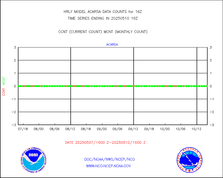
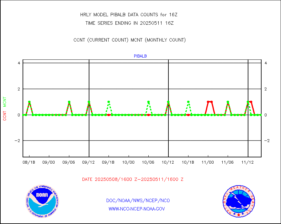
AMDAR aircraft data (decoded from AMDAR format) |
77 |
45 |
171.1 % |
0115.50-0116.49 |
||||||||||
AMDAR aircraft data (decoded from BUFR) |
1999 |
2090 |
95.6 % |
0115.50-0116.49 |
||||||||||
METOP 1-2 ASCAT products |
50652 |
57722 |
87.8 % |
0114.50-0115.49 |
||||||||||
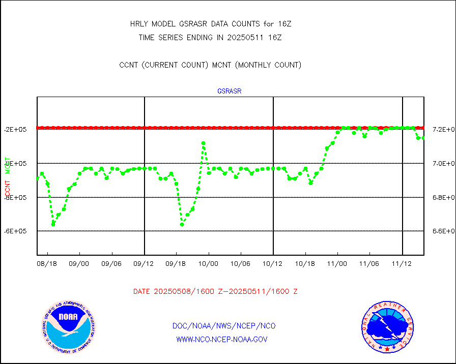
NPP/NOAA-20 ATMS brightness temperatures |
304800 |
314637 |
96.9 % |
0114.50-0115.49 |
||||||||||
Canadian AMDAR aircraft data (decoded from BUFR) |
0 |
0 |
n/a |
0115.50-0116.49 |
||||||||||
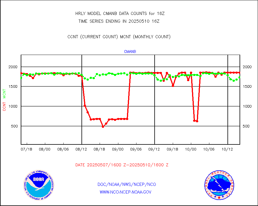
Surface Marine CMAN rpts decoded from BUFR format |
1864 |
1795 |
103.8 % |
0115.50-0116.50 |
||||||||||
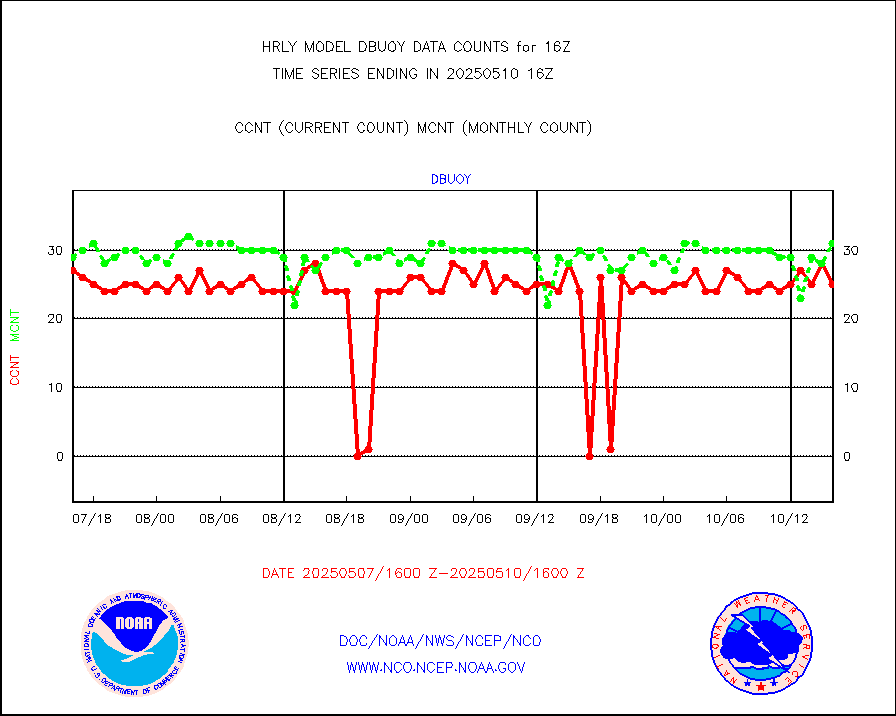
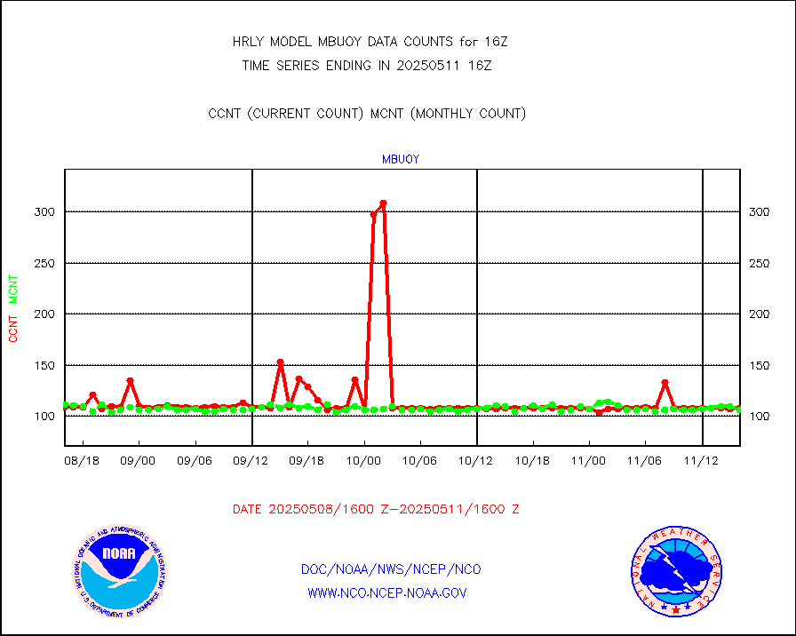
Buoys decoded from FM-18 fmt (moored or drifting) |
14 |
19 |
73.7 % |
0115.50-0116.49 |
||||||||||
E-AMDAR (European AMDAR acft decoded from BUFR) |
1919 |
2362 |
81.2 % |
0115.50-0116.49 |
||||||||||
NOAA 15-19 & METOP 1-2 AMSU-A proc btmps frm RARS |
8367 |
13207 |
63.4 % |
0115.50-0116.49 |
||||||||||
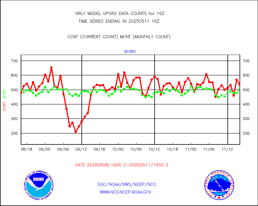
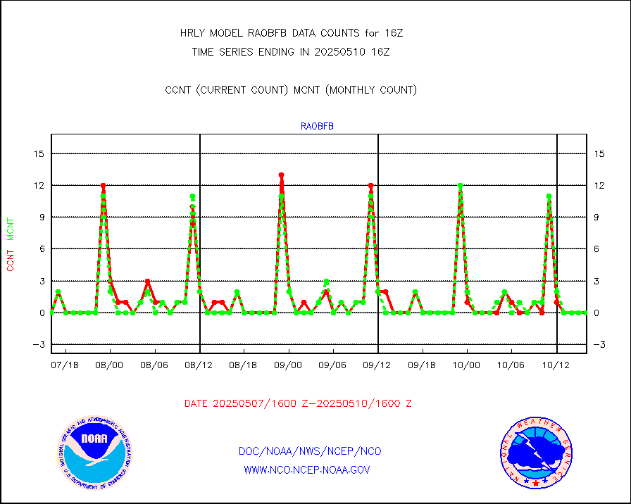
GPS radio occultation data |
484 |
518 |
93.4 % |
0113.50-0114.49 |
||||||||||
GOES-16/17 All Sky Radiances (proc.) |
720952 |
716478 |
100.6 % |
0115.50-0116.49 |
||||||||||
GOES-16/17 Clear Sky Radiances (proc.) |
362562 |
363580 |
99.7 % |
0115.50-0116.49 |
||||||||||
MTSAT/JMA water vapor imager derived cloud motion |
20937 |
18036 |
116.1 % |
0113.50-0114.49 |
||||||||||
MODIS (AQUA/TERRA) wvpr imager derived cld motion |
0 |
0 |
n/a |
0112.00-0112.99 |
||||||||||
GOES-16&up/NESDIS wv imgr/cld-top derived cld mtn |
21825 |
24087 |
90.6 % |
0115.00-0115.99 |
||||||||||
METEOSAT/EUMETSAT ir lg-wave drv cld motion NBseq |
22803 |
20890 |
109.2 % |
0114.50-0115.49 |
||||||||||
MTSAT/JMA infrared long-wave derived cloud motion |
16298 |
14597 |
111.7 % |
0113.50-0114.49 |
||||||||||
MODIS (AQUA/TERRA) ir l-wave derived cloud motion |
0 |
0 |
n/a |
0112.00-0112.99 |
||||||||||
GOES-16&up/NESDIS ir long-wave derived cld motion |
82440 |
81461 |
101.2 % |
0115.00-0115.99 |
||||||||||
GOES/NASA(Langley) hi-res. (1x1 f-o-v) cloud data |
6454068 |
6189438 |
104.3 % |
0115.50-0116.49 |
||||||||||
Buoys decoded from FM-13 format (moored) |
123 |
138 |
89.1 % |
0115.50-0116.49 |
||||||||||
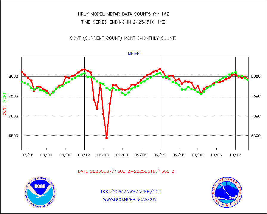
Aviation - METAR |
7915 |
7860 |
100.7 % |
0115.50-0116.49 |
||||||||||
Mesonet/MADIS Colorado E-470 (Interstate 470) |
24 |
24 |
100.0 % |
0115.50-0116.49 |
||||||||||
Mesonet/MADIS Alaska Department of Transportation |
62 |
90 |
68.9 % |
0115.50-0116.49 |
||||||||||
Mesonet/MADIS U.S. Army Aberdeen Proving Grounds |
0 |
0 |
n/a |
0115.50-0116.49 |
||||||||||
Mesonet/MADIS Citizen Weather Observers Program |
48653 |
55877 |
87.1 % |
0115.50-0116.49 |
||||||||||
Mesonet/MADIS AWS Convergence Technologies, Inc. |
12708 |
19499 |
65.2 % |
0115.50-0116.49 |
||||||||||
Mesonet/MADIS "Anything Weather" |
0 |
0 |
n/a |
0115.50-0116.49 |
||||||||||
Mesonet/MADIS Colorado Dept. of Transportation |
0 |
0 |
n/a |
0115.50-0116.49 |
||||||||||
Mesonet/MADIS DC Net |
0 |
0 |
n/a |
0115.50-0116.49 |
||||||||||
Mesonet/MADIS Denver Urban Drainage & Flood Cntrl |
0 |
0 |
n/a |
0115.50-0116.49 |
||||||||||
Mesonet/MADIS Florida (FAWN & USF) |
4 |
4 |
100.0 % |
0115.50-0116.49 |
||||||||||
Mesonet/MADIS Florida Dept. of Transportation |
0 |
0 |
n/a |
0115.50-0116.49 |
||||||||||
Mesonet/MADIS Georgia Dept. of Transportation |
0 |
0 |
n/a |
0115.50-0116.49 |
||||||||||
Mesonet/MADIS NWS Hydromet Auto Data System(HADS) |
5881 |
6129 |
96.0 % |
0115.50-0116.49 |
||||||||||
Mesonet/MADIS Iowa Environmental |
192 |
185 |
103.8 % |
0115.50-0116.49 |
||||||||||
Mesonet/MADIS Indiana Dept. of Transportation |
0 |
0 |
n/a |
0115.50-0116.49 |
||||||||||
Mesonet/MADIS Iowa Department of Transportation |
0 |
0 |
n/a |
0115.50-0116.49 |
||||||||||
Mesonet/MADIS Kansas Department of Transportation |
378 |
351 |
107.7 % |
0115.50-0116.49 |
||||||||||
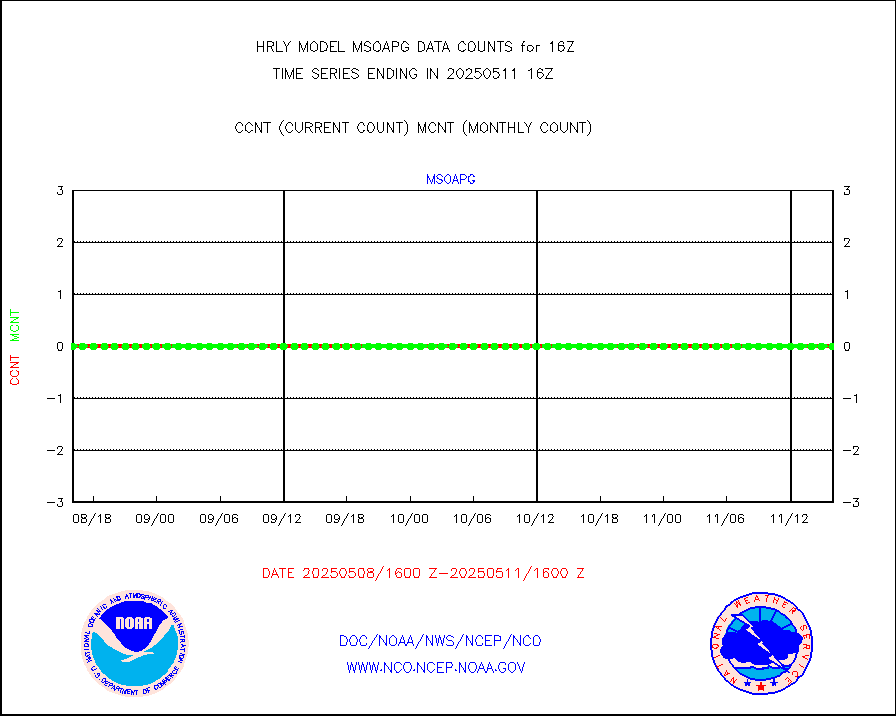
Mesonet/MADIS Oklahoma Mesonet |
630 |
613 |
102.8 % |
0115.50-0116.49 |
||||||||||
Mesonet/MADIS Louisiana State/Jackson State Univ. |
0 |
0 |
n/a |
0115.50-0116.49 |
||||||||||
Mesonet/MADIS Missouri Commercial Agricult Wx Net |
334 |
331 |
100.9 % |
0115.50-0116.49 |
||||||||||
Mesonet/MADIS Minnesota Dept. of Transportation |
0 |
0 |
n/a |
0115.50-0116.49 |
||||||||||
Mesonet/MADIS NOS-Phys Oceanographic Realtime Sys |
372 |
377 |
98.7 % |
0115.50-0116.49 |
||||||||||
Mesonet/MADIS NFIC Remote Automated Wx Stns(RAWS) |
1936 |
1894 |
102.2 % |
0115.50-0116.49 |
||||||||||
Mesonet/MADIS many providers, not separated out |
58573 |
67147 |
87.2 % |
0115.00-0116.49 |
||||||||||
Mesonet/MADIS Virginia Dept. of Transportation |
0 |
0 |
n/a |
0115.50-0116.49 |
||||||||||
Mesonet/MADIS "Weather for You" |
0 |
0 |
n/a |
0115.50-0116.49 |
||||||||||
Mesonet/MADIS Wisconsin Dept. of Transportation |
0 |
0 |
n/a |
0115.50-0116.49 |
||||||||||
Mesonet/MADIS MesoWest (many subproviders) |
25369 |
33899 |
74.8 % |
0115.50-0116.49 |
||||||||||
Mesonet/MADIS West Texas |
5658 |
6071 |
93.2 % |
0115.50-0116.49 |
||||||||||
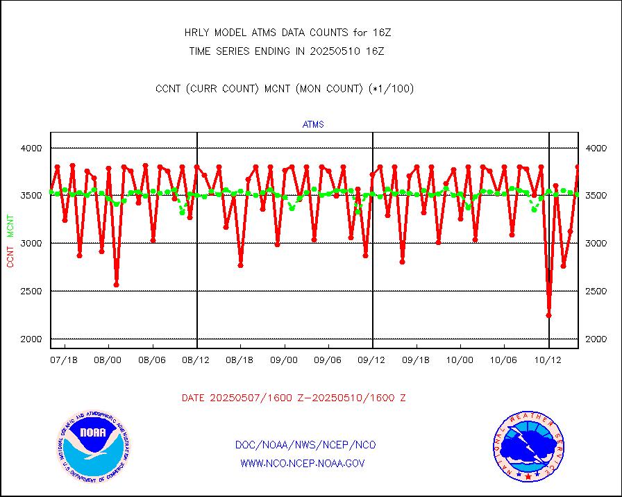
METOP 1-2 IASI 1C radiance data (varbl. channels) |
101952 |
93610 |
108.9 % |
0114.00-0114.99 |
||||||||||
NEXRAD Vel Azm Dsp(VAD) winds via radar coded msg |
0 |
0 |
n/a |
0115.50-0116.49 |
||||||||||
Aura Ozone Monitoring Instrument (OMI) data |
0 |
0 |
n/a |
0113.50-0114.49 |
||||||||||
NOAA 16-19 Solar Backscatter UV-2 rad frm V8 BUFR |
0 |
0 |
n/a |
0114.00-0114.99 |
||||||||||
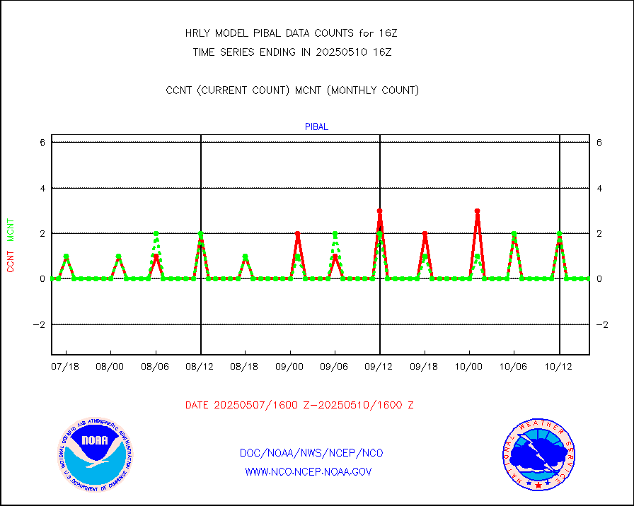
PIBAL (from PILOT, PILOT SHIP, PILOT MOBIL) |
0 |
0 |
n/a |
0115.50-0116.49 |
||||||||||
Multi-Agency Profiler (MAP) and SODAR winds |
46 |
45 |
102.2 % |
0115.50-0116.49 |
||||||||||
Rawinsonde - fixed land (from TEMP or PILOT) |
0 |
0 |
n/a |
0115.50-0116.49 |
||||||||||
RASS temperatures (NOAA and Multi-Agency) |
27 |
27 |
100.0 % |
0115.50-0116.49 |
||||||||||
NEXRAD reflectivity (Lvl 2 - GTS) |
4160422 |
4019931 |
103.5 % |
0115.50-0116.49 |
||||||||||
NEXRAD radial wind (Level 2 - GTS) |
1394599 |
1289013 |
108.2 % |
0115.50-0116.49 |
||||||||||
METEOSAT-10 2nd Gen SEVIRI Clr Sky Radiance(proc) |
0 |
0 |
n/a |
0115.50-0116.49 |
||||||||||
Ship - manual and automatic, restricted (BUFR) |
0 |
0 |
n/a |
0115.50-0116.50 |
||||||||||
Ship - manual and automatic, unrestricted |
188 |
184 |
102.2 % |
0115.50-0116.50 |
||||||||||
Ship - manual and automatic, unrestricted (BUFR) |
980 |
927 |
105.7 % |
0115.50-0116.50 |
||||||||||
Synoptic - fixed manual and automatic |
834 |
765 |
109.0 % |
0115.50-0116.49 |
||||||||||
Synoptic - fixed manual & auto (decoded fr BUFR) |
5200 |
5189 |
100.2 % |
0115.50-0116.49 |
||||||||||
Synoptic - restricted (WMO Res 40) manual & auto. |
0 |
0 |
n/a |
0115.50-0116.49 |
||||||||||
Synoptic - restricted (WMO Res 40)(decoded BUFR) |
343 |
411 |
83.5 % |
0115.50-0116.49 |
||||||||||
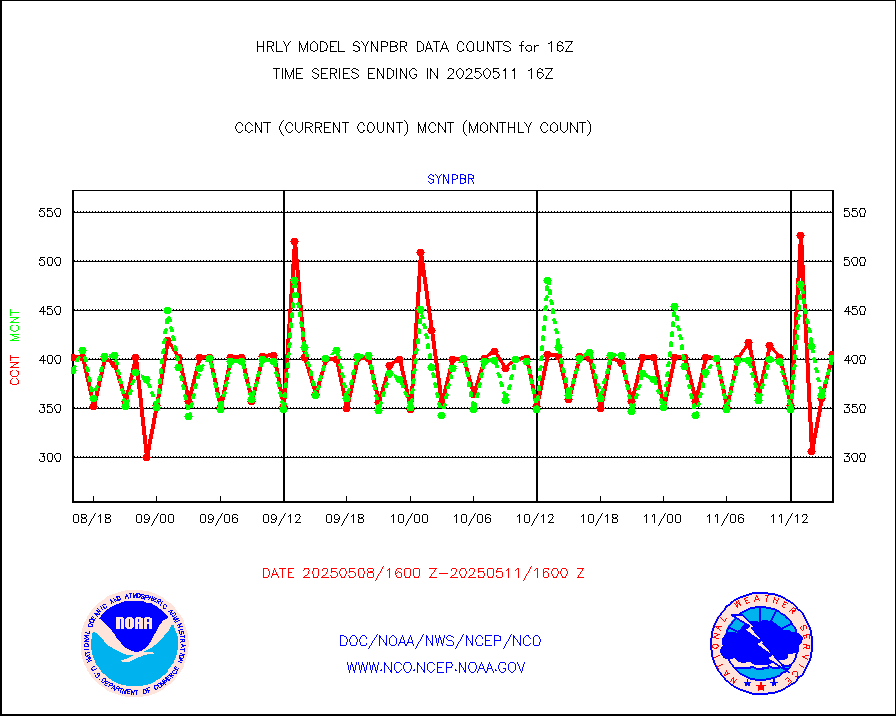
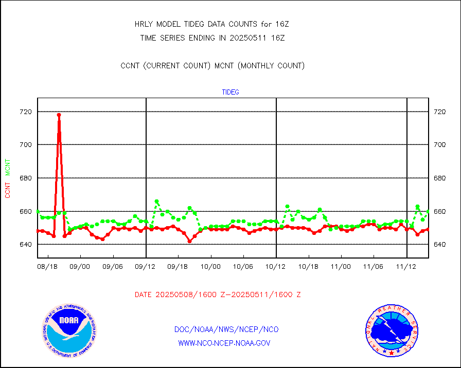
Tide gauge reports decoded from CREX format |
660 |
650 |
101.5 % |
0115.00-0115.99 |
||||||||||
| Data Types of Opportunity with Normal Counts | ||||||||||||||
|---|---|---|---|---|---|---|---|---|---|---|---|---|---|---|
| Type | Description | Hourly Count | Monthly Average | Percent (%) of Monthly Mean | UTC Time Window | |||||||||
GOES-16&up/NESDIS ir short-wv derived cld motion |
21373 |
15115 |
141.4 % |
0115.00-0115.99 |
||||||||||
MDCRS ACARS acft data (ARINC via AFWA)(AIREP fmt) |
0 |
0 |
n/a |
0115.50-0116.49 |
||||||||||
Himawari Clear Sky Radiance |
0 |
0 |
n/a |
0115.00-0115.99 |
||||||||||
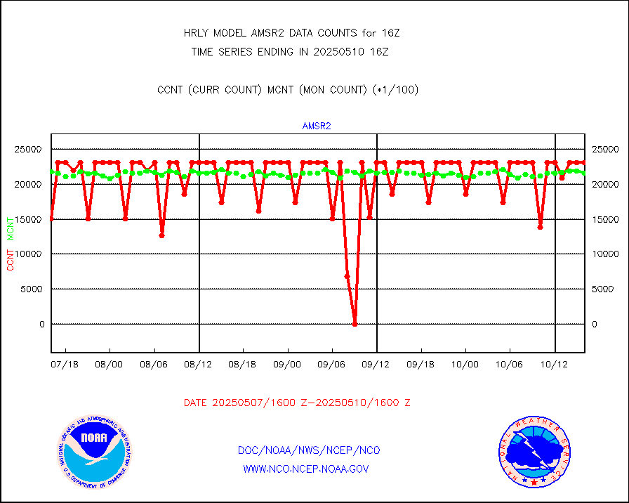
GCOM-W AMSR2 1B brightness temperatures |
1744740 |
2062487 |
84.6 % |
0114.00-0114.99 |
||||||||||
NPP/NOAA-20 ATMS bright. temps-direct b-cast SSEC |
132572 |
130268 |
101.8 % |
0114.50-0115.49 |
||||||||||
POES/NESDIS - processed ATOVS soundings/radiances |
0 |
0 |
n/a |
0114.00-0114.99 |
||||||||||
A.M.(N17,M2,M3) AVHRR GAC NCEP-proc clr&sea btmps |
1100964 |
953538 |
115.5 % |
0113.50-0114.49 |
||||||||||
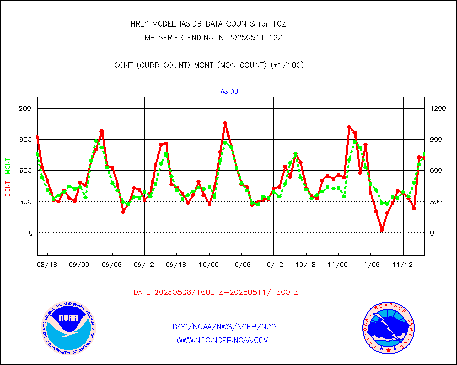
eXpendable BathyThermograph, mooring (BATHY fmt) |
0 |
0 |
n/a |
0109.00-0109.99 |
||||||||||
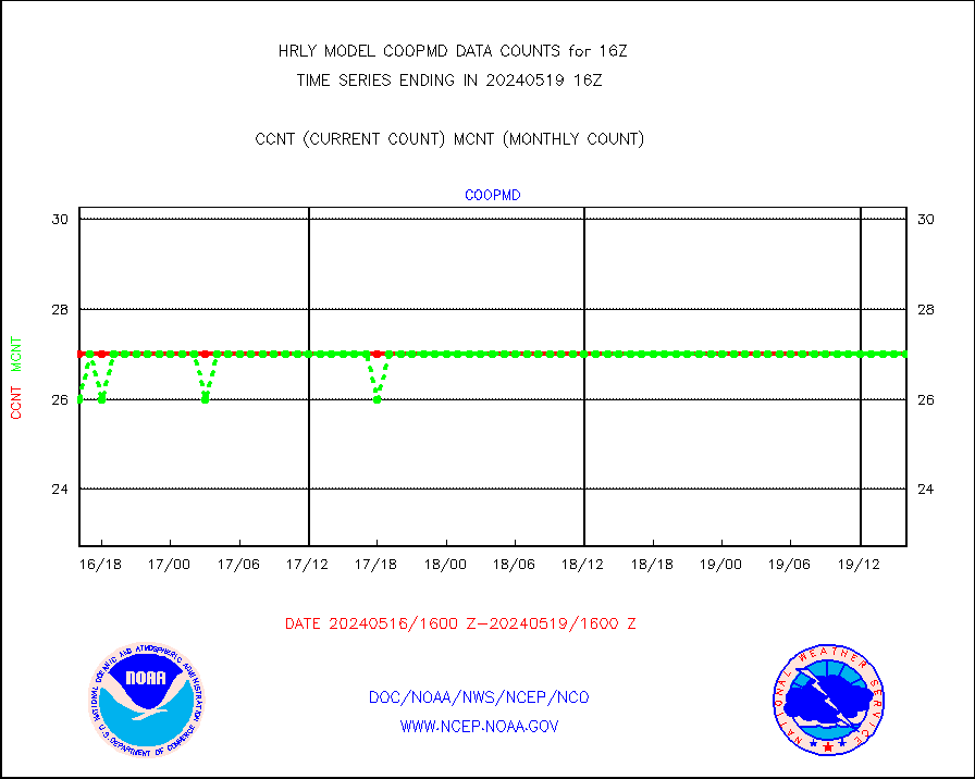
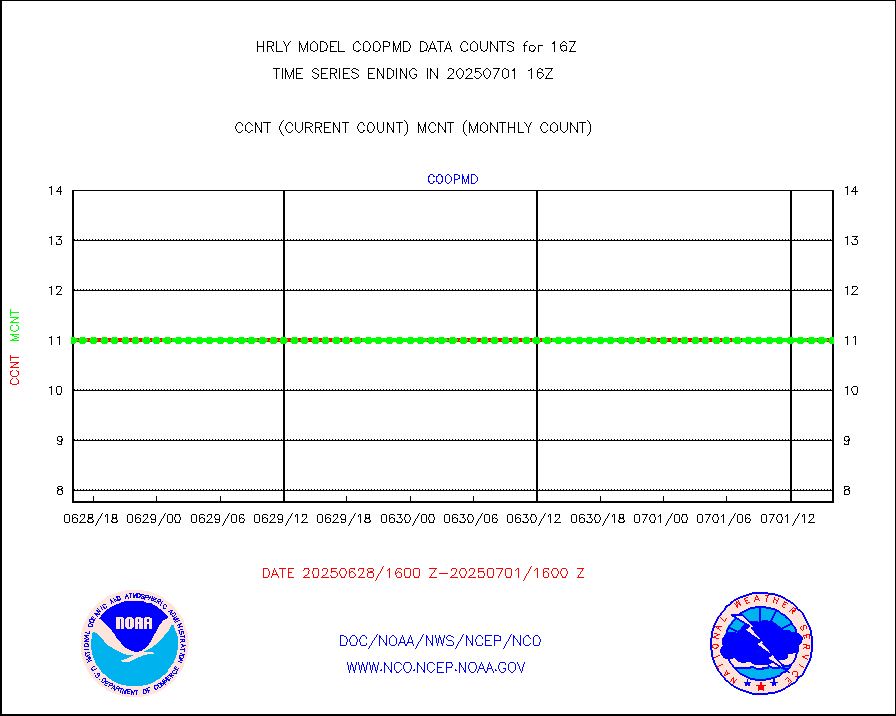
Coop/MADIS NEPP & HCN-Modernization NOAA COOP Obs |
11 |
11 |
100.0 % |
0115.50-0116.49 |
||||||||||
NPP/NOAA-20 CrIS full spctrl radn (431 ch subset) |
210096 |
200560 |
104.8 % |
0114.50-0115.49 |
||||||||||
NPP/NOAA-20 CrIS full spctrl radn dir brdcst SSEC |
42930 |
53177 |
80.7 % |
0114.50-0115.49 |
||||||||||
Coast Guard |
5 |
5 |
100.0 % |
0115.50-0116.50 |
||||||||||
Drifting buoys (decoded from BUFR) |
1427 |
1451 |
98.3 % |
0115.50-0116.50 |
||||||||||
Dropwinsonde (from TEMP DROP) |
0 |
0 |
n/a |
0115.50-0116.49 |
||||||||||
Dropwinsonde (decoded from BUFR) |
0 |
0 |
n/a |
0115.51-0116.49 |
||||||||||
GOES imager effective cloud amount data (U.Wisc.) |
8535568 |
7469370 |
114.3 % |
0115.50-0116.49 |
||||||||||
NPP Adv. Tech. MW Sndr (ATMS) br. temps from RARS |
19100 |
22950 |
83.2 % |
0114.50-0115.49 |
||||||||||
METOP 1-2 IASI 1C radiance data vbl chn from RARS |
0 |
6145 |
0.0 % |
0115.00-0115.99 |
||||||||||
NOAA 18-19 & METOP 1-2 MHS proc. btemps from RARS |
84423 |
127154 |
66.4 % |
0115.50-0116.49 |
||||||||||
GOES/NESDIS (11x17 f-o-v) imager clear radiances |
0 |
0 |
n/a |
0115.00-0115.99 |
||||||||||
METOP 1-2 Global Ozone Monitoring Exp.-2 (GOME-2) |
4412 |
9020 |
48.9 % |
0114.50-0115.49 |
||||||||||
GOES-16&up/NESDIS wv imgr/deep-lyr derivd cld mtn |
21106 |
17026 |
124.0 % |
0115.00-0115.99 |
||||||||||
METEOSAT/EUMETSAT wvpr imgr drv cld motion NBseq |
36830 |
37447 |
98.4 % |
0114.50-0115.49 |
||||||||||
High Density OBs from reconnaissance acft data |
106 |
27 |
392.6 % |
0115.50-0116.49 |
||||||||||
METOP 1-2 IASI 1C radiances-direct broadcast SSEC |
104405 |
78247 |
133.4 % |
0114.50-0115.49 |
||||||||||
VIIRS (NPP/NOAA-20) ir lg-wv drv cloud motion(NB) |
15379 |
13668 |
112.5 % |
0112.00-0112.99 |
||||||||||
AVHRR (NOAA/METOP) ir lg-wave derived cld motion |
0 |
0 |
n/a |
0112.00-0112.99 |
||||||||||
AVHRR (METOP) ir lg-wave derived cld motion |
0 |
0 |
n/a |
0115.50-0116.50 |
||||||||||
INSAT/KALPANA India ir lg-wave derived cld motion |
0 |
0 |
n/a |
0113.50-0114.49 |
||||||||||
Korean AMDAR aircraft data (decoded from BUFR) |
0 |
0 |
n/a |
0115.50-0116.49 |
||||||||||
Land-based CMAN stations decoded from CMAN format |
67 |
86 |
77.9 % |
0115.50-0116.49 |
||||||||||
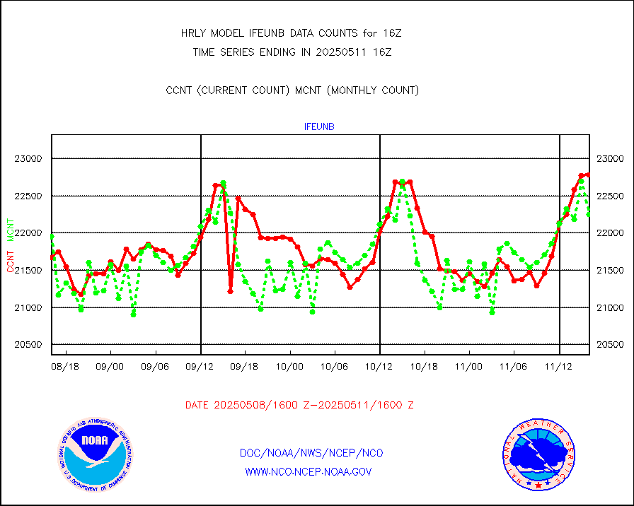
LEO-GEO satellite AMVs from UWisc. |
6732 |
7608 |
88.5 % |
0112.00-0112.99 |
||||||||||
LLDN Long-rng lightning from Vaisala via NOAAPORT |
173493 |
164841 |
105.2 % |
0115.50-0116.49 |
||||||||||
NLDN Shrt-rng lightning from Vaisala via NOAAPORT |
4644 |
3043 |
152.6 % |
0115.50-0116.49 |
||||||||||
Moored buoys (decoded from BUFR) |
967 |
908 |
106.5 % |
0115.50-0116.50 |
||||||||||
Aura Microwave Limb Sounder (MLS) ozone data |
0 |
0 |
n/a |
0114.00-0114.99 |
||||||||||
Mesonet/MADIS UrbaNet |
3596 |
3605 |
99.8 % |
0115.50-0116.49 |
||||||||||
NEXRAD Vel Azm Dsp(VAD) winds via Level 2 decoder |
483 |
427 |
113.1 % |
0115.50-0116.49 |
||||||||||
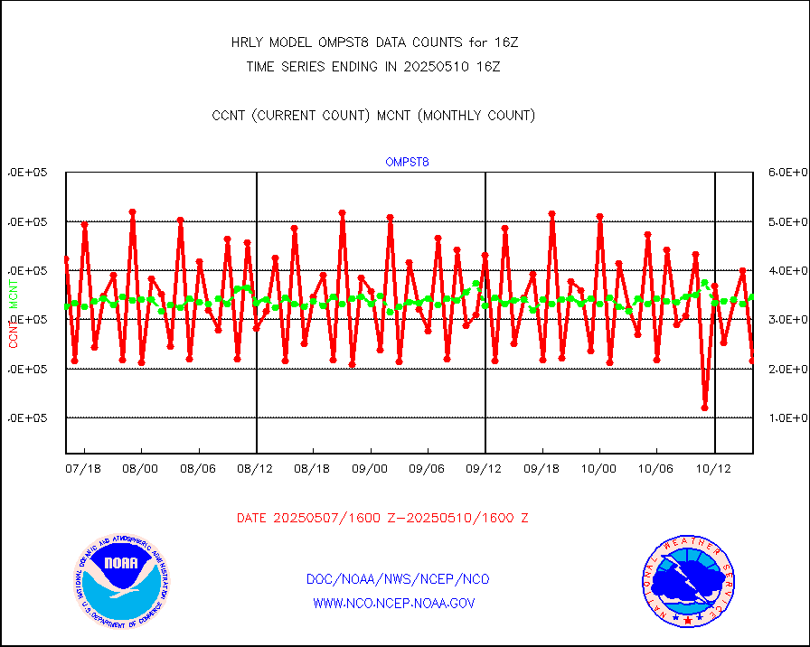
OMPS Limb Profiler ozone data (NPP) |
426 |
258 |
165.1 % |
0109.00-0109.99 |
||||||||||
OMPS nadir profile ozone (Version 8 BUFR) |
626 |
532 |
117.7 % |
0114.00-0114.99 |
||||||||||
OMPS total column ozone (Version 8 BUFR) |
407486 |
315713 |
129.1 % |
0114.00-0114.99 |
||||||||||
PIBAL (decoded from BUFR) |
0 |
0 |
n/a |
0115.51-0116.49 |
||||||||||
Manual PIREP aircraft data (dcded from AIREP fmt) |
113 |
131 |
86.3 % |
0115.50-0116.49 |
||||||||||
Profilr winds from PIBAL (PILOT,PILOT SHIP/MOBIL) |
0 |
0 |
n/a |
0115.50-0116.49 |
||||||||||
Rawinsonde - fixed land (decoded from BUFR) |
0 |
0 |
n/a |
0115.51-0116.49 |
||||||||||
Rawinsonde - mobile land (from TEMP/PILOT MOBIL) |
0 |
0 |
n/a |
0115.50-0116.49 |
||||||||||
Rawinsonde - mobile land (decoded from BUFR) |
0 |
0 |
n/a |
0115.51-0116.49 |
||||||||||
Rawinsonde - ship (from TEMP SHIP, PILOT SHIP) |
0 |
0 |
n/a |
0115.50-0116.49 |
||||||||||
Rawinsonde - ship (decoded from BUFR) |
0 |
0 |
n/a |
0115.51-0116.49 |
||||||||||
Flight level reconnaissance aircraft data |
2 |
0 |
n/a |
0115.50-0116.49 |
||||||||||
Megha-Tropiques SAPHIR L1A2 brightness temps |
0 |
0 |
n/a |
0113.50-0114.49 |
||||||||||
METEOSAT-10 2nd Gen SEVIRI All Sky Radiance(proc) |
75512 |
75452 |
100.1 % |
0115.50-0116.49 |
||||||||||
DMSP SSM/IS 1C radiance data (Unified Pre-Proc.) |
0 |
110666 |
0.0 % |
0114.50-0115.49 |
||||||||||
Synoptic - mobile manual and automatic |
639 |
646 |
98.9 % |
0115.50-0116.49 |
||||||||||
Synoptic - mobile manual & auto (decoded fr BUFR) |
1 |
1 |
100.0 % |
0115.50-0116.49 |
||||||||||
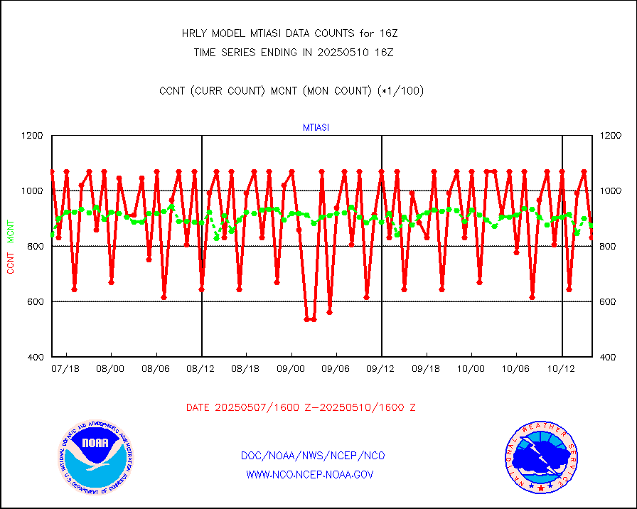
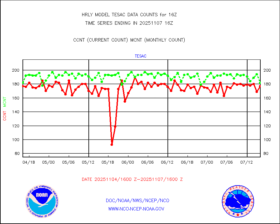
CTD probe, Argo prflng float, mooring (TESAC fmt) |
223 |
211 |
105.7 % |
0115.50-0116.49 |
||||||||||
TAMDAR aircft data-all types(from Panasonic,BUFR) |
10 |
51 |
19.6 % |
0115.50-0116.49 |
||||||||||
ThermoSalinoGraph (TSG) TRACKOB format) |
92 |
93 |
98.9 % |
0114.50-0115.49 |
||||||||||
INSAT/KALPANA India visible derived cloud motion |
0 |
0 |
n/a |
0113.50-0114.49 |
||||||||||
INDIA SATWIND, INSAT VIS channel |
0 |
0 |
n/a |
0115.00-0115.99 |
||||||||||
MTSAT/JMA visible derived cloud motion |
0 |
0 |
n/a |
0113.50-0114.49 |
||||||||||
GOES-16&up/NESDIS visible derived cloud motion |
325039 |
306879 |
105.9 % |
0115.00-0115.99 |
||||||||||
METEOSAT/EUMETSAT visible drv cld motion NBseq |
36373 |
31281 |
116.3 % |
0114.50-0115.49 |
||||||||||


