| Suspect Data Shortages in Critical Types - Monitor | ||||||||||||||
|---|---|---|---|---|---|---|---|---|---|---|---|---|---|---|
| Type | Description | Hourly Count | Monthly Average | Percent (%) of Monthly Mean | UTC Time Window | |||||||||
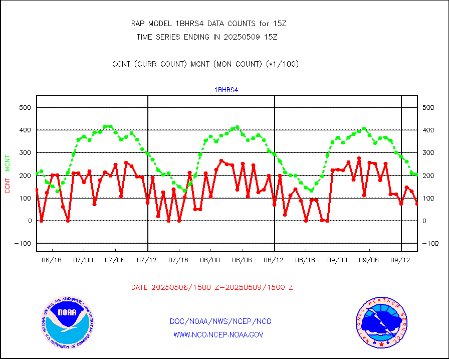
NOAA 18-19 & METOP 1-2 HIRS-4 NCEP-proc. br.temps |
0 |
5311 |
0.0 % |
3012.00-3017.99 |
||||||||||
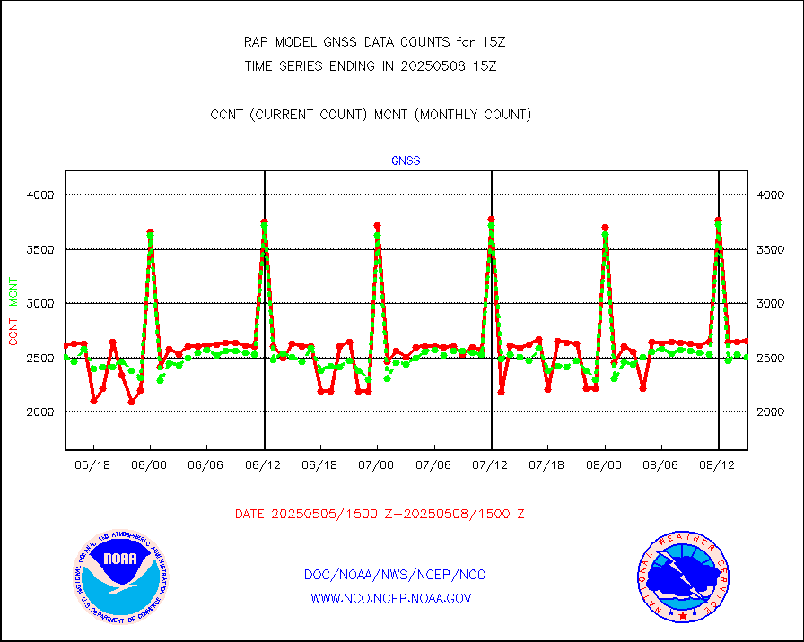
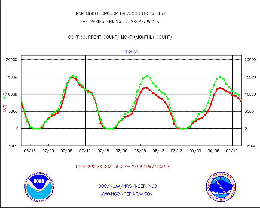
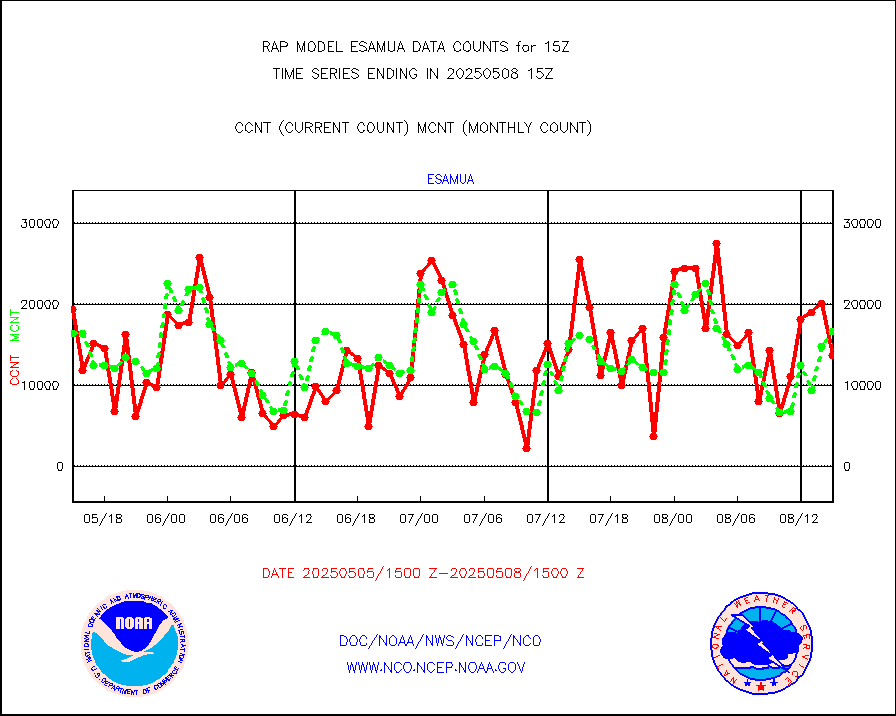
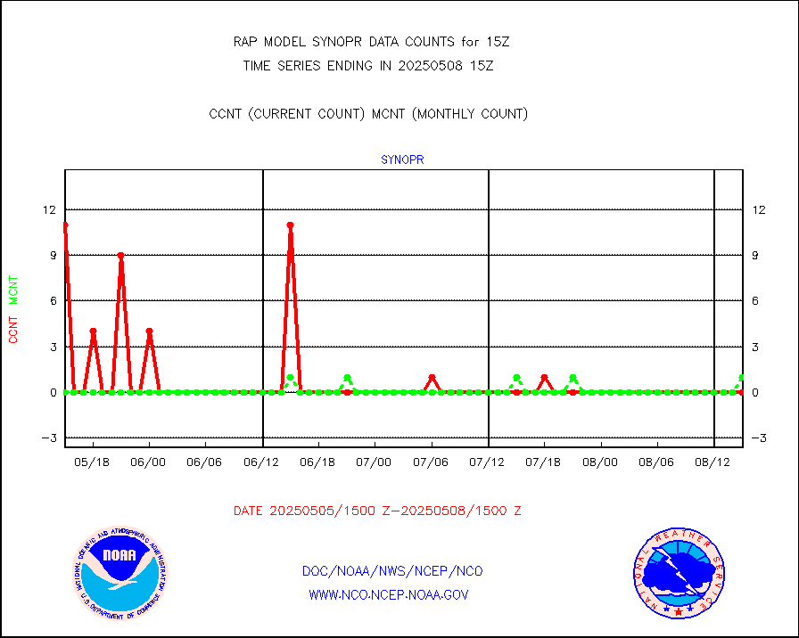
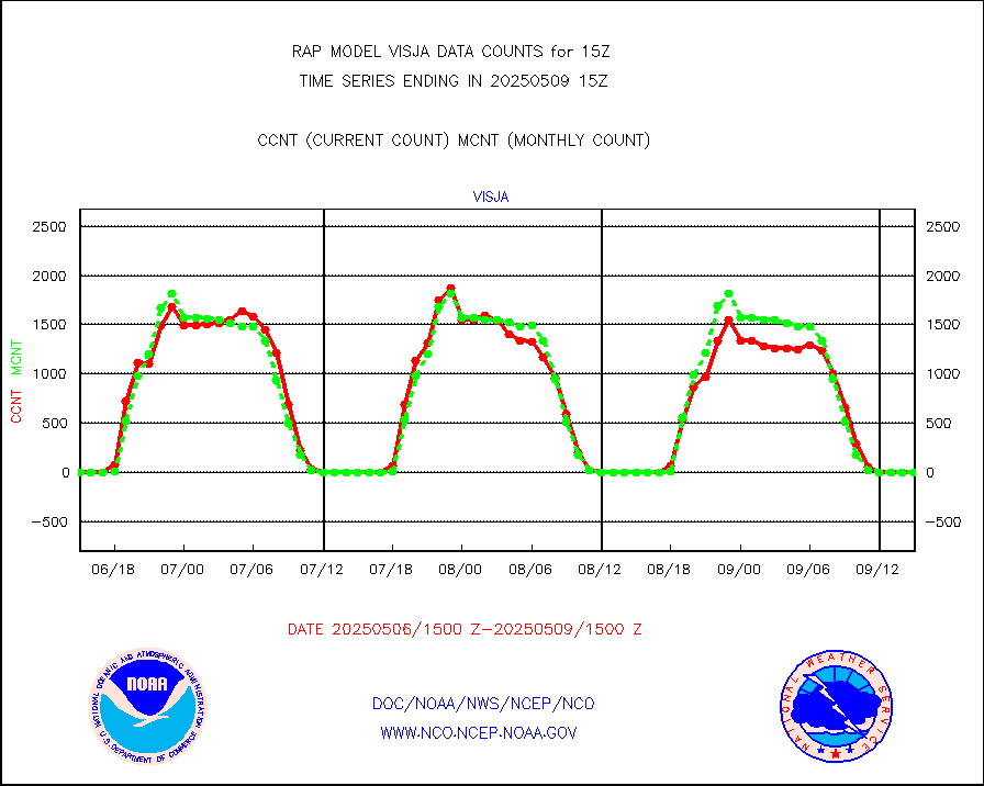
Grnd-based Gbl Navigation Sat System (GNSS) data |
737 |
2264 |
32.6 % |
3013.95-3014.05 |
||||||||||
| Shortage in Data Type of Opportunity - Monitor | ||||||||||||||
|---|---|---|---|---|---|---|---|---|---|---|---|---|---|---|
| Type | Description | Hourly Count | Monthly Average | Percent (%) of Monthly Mean | UTC Time Window | |||||||||
NPP Adv. Tech. MW Sndr (ATMS) br. temps from RARS |
0 |
12933 |
0.0 % |
3013.00-3016.99 |
||||||||||
NOAA 15-19 & METOP 1-2 HIRS-3/4 pr btmps frm RARS |
0 |
5648 |
0.0 % |
3014.00-3016.00 |
||||||||||
METOP 1-2 IASI 1C radiance data vbl chn from RARS |
41 |
5042 |
0.8 % |
3013.00-3016.99 |
||||||||||
| Critical Data with Normal Counts | ||||||||||||||
|---|---|---|---|---|---|---|---|---|---|---|---|---|---|---|
| Type | Description | Hourly Count | Monthly Average | Percent (%) of Monthly Mean | UTC Time Window | |||||||||
NOAA 15-19 & METOP 1-2 AMSU-A NCEP-proc. br.temps |
6807 |
18566 |
36.7 % |
3012.00-3017.99 |
||||||||||
NOAA 18-19 & METOP 1-2 MHS NCEP-proces. br. temps |
61485 |
140188 |
43.9 % |
3012.00-3017.99 |
||||||||||
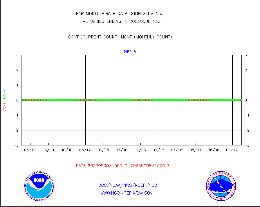
MDCRS ACARS acft data from ARINC(dcded from BUFR) |
99067 |
62072 |
159.6 % |
3011.75-3018.25 |
||||||||||
Canadian AMDAR aircraft data (decoded from BUFR) |
0 |
0 |
n/a |
3011.75-3018.25 |
||||||||||
Surface Marine CMAN rpts decoded from BUFR format |
1736 |
1714 |
101.3 % |
3014.50-3015.50 |
||||||||||
Buoys decoded from FM-18 fmt (moored or drifting) |
0 |
0 |
n/a |
3014.50-3015.50 |
||||||||||
MODIS (AQUA/TERRA) wvpr imager derived cld motion |
0 |
0 |
n/a |
3012.50-3017.50 |
||||||||||
MODIS (AQUA/TERRA) ir l-wave derived cloud motion |
0 |
0 |
n/a |
3012.50-3017.50 |
||||||||||
GOES/NASA(Langley) hi-res. (1x1 f-o-v) cloud data |
3751047 |
3435283 |
109.2 % |
3014.50-3015.50 |
||||||||||
Buoys decoded from FM-13 format (moored) |
142 |
142 |
100.0 % |
3014.50-3015.50 |
||||||||||
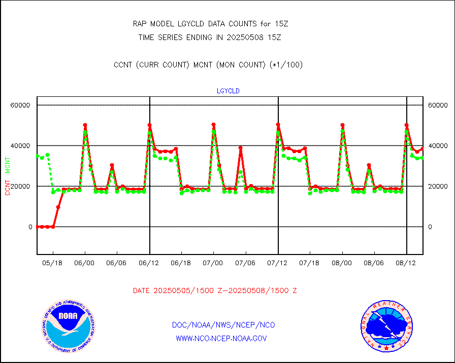
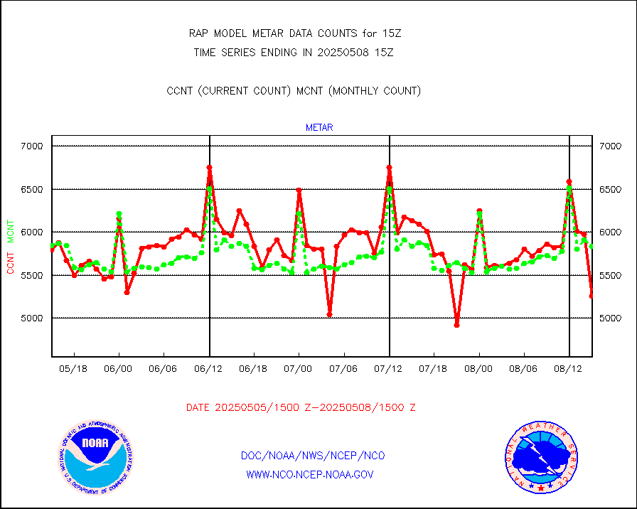
Aviation - METAR |
5886 |
5935 |
99.2 % |
3014.50-3015.50 |
||||||||||
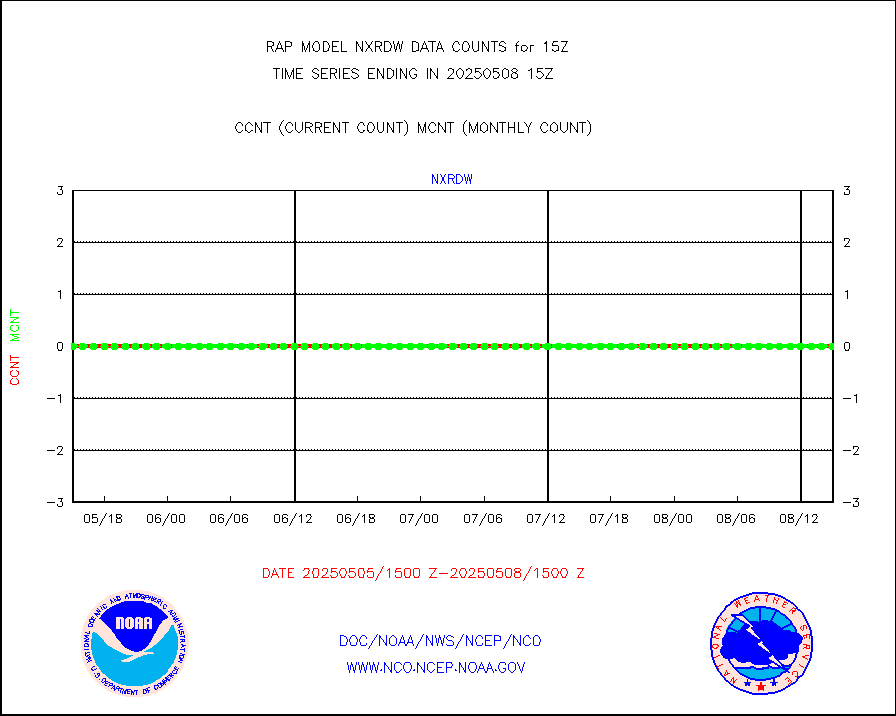
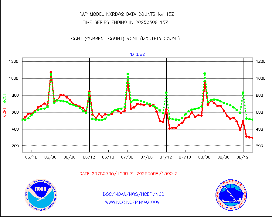
NEXRAD Vel Azm Dsp(VAD) winds via radar coded msg |
0 |
0 |
n/a |
3014.00-3016.00 |
||||||||||
Multi-Agency Profiler (MAP) and SODAR winds |
104 |
95 |
109.5 % |
3013.50-3016.50 |
||||||||||
Rawinsonde - fixed land (from TEMP or PILOT) |
1 |
1 |
100.0 % |
3014.00-3016.00 |
||||||||||
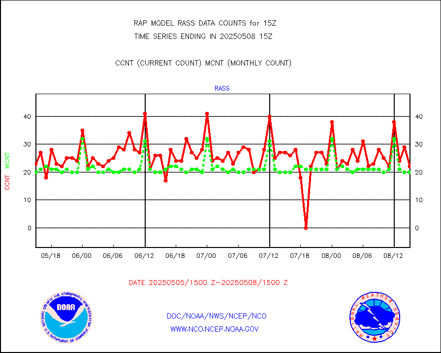
RASS temperatures (NOAA and Multi-Agency) |
28 |
23 |
121.7 % |
3014.50-3015.50 |
||||||||||
Ship - manual and automatic, restricted (BUFR) |
9 |
9 |
100.0 % |
3014.50-3015.50 |
||||||||||
Ship - manual and automatic, unrestricted |
79 |
92 |
85.9 % |
3014.50-3015.50 |
||||||||||
Ship - manual and automatic, unrestricted (BUFR) |
492 |
428 |
115.0 % |
3014.50-3015.50 |
||||||||||
Synoptic - fixed manual and automatic |
468 |
424 |
110.4 % |
3014.50-3015.50 |
||||||||||
Synoptic - fixed manual & auto (decoded fr BUFR) |
1804 |
1864 |
96.8 % |
3014.50-3015.50 |
||||||||||
Tide gauge reports decoded from CREX format |
185 |
185 |
100.0 % |
3014.50-3015.50 |
||||||||||
| Data Types of Opportunity with Normal Counts | ||||||||||||||
|---|---|---|---|---|---|---|---|---|---|---|---|---|---|---|
| Type | Description | Hourly Count | Monthly Average | Percent (%) of Monthly Mean | UTC Time Window | |||||||||
GOES-16&up/NESDIS ir short-wv derived cld motion |
7113 |
7776 |
91.5 % |
3014.00-3014.99 |
||||||||||
MDCRS ACARS acft data (ARINC via AFWA)(AIREP fmt) |
0 |
0 |
n/a |
3011.75-3018.25 |
||||||||||
Manual AIREP aircraft data (dcded from AIREP fmt) |
4101 |
3876 |
105.8 % |
3011.75-3018.25 |
||||||||||
AQUA AIRS/AMSU-A/HSB brightness temps- every FOV |
0 |
0 |
n/a |
3012.00-3017.99 |
||||||||||
AMDAR aircraft data (decoded from AMDAR format) |
760 |
532 |
142.9 % |
3011.75-3018.25 |
||||||||||
AMDAR aircraft data (decoded from BUFR) |
8787 |
8685 |
101.2 % |
3011.75-3018.25 |
||||||||||
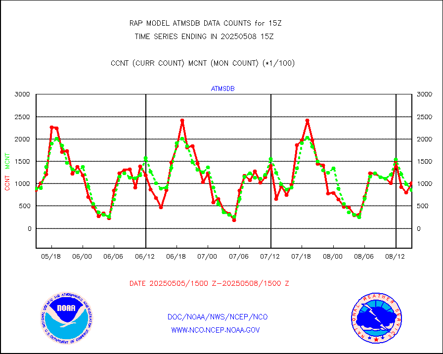
GCOM-W AMSR2 1B brightness temperatures |
1242665 |
798834 |
155.6 % |
3012.00-3012.99 |
||||||||||
METOP 1-2 ASCAT products |
7739 |
22353 |
34.6 % |
3013.00-3017.00 |
||||||||||
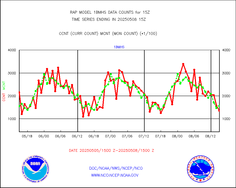
NPP/NOAA-20 ATMS brightness temperatures |
193708 |
193149 |
100.3 % |
3013.00-3016.99 |
||||||||||
NPP/NOAA-20 ATMS bright. temps-direct b-cast SSEC |
102132 |
80589 |
126.7 % |
3013.00-3016.99 |
||||||||||
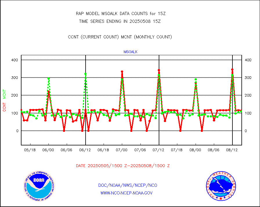
Coop/MADIS NEPP & HCN-Modernization NOAA COOP Obs |
11 |
11 |
100.0 % |
3014.50-3015.50 |
||||||||||
NPP/NOAA-20 CrIS full spctrl radn (431 ch subset) |
136609 |
116436 |
117.3 % |
3013.00-3016.99 |
||||||||||
NPP/NOAA-20 CrIS full spctrl radn dir brdcst SSEC |
39688 |
38959 |
101.9 % |
3013.00-3016.99 |
||||||||||
Coast Guard |
5 |
6 |
83.3 % |
3014.50-3015.50 |
||||||||||
Drifting buoys (decoded from BUFR) |
532 |
505 |
105.3 % |
3014.50-3015.50 |
||||||||||
Dropwinsonde (from TEMP DROP) |
0 |
0 |
n/a |
3014.00-3016.00 |
||||||||||
Dropwinsonde (decoded from BUFR) |
0 |
0 |
n/a |
3014.00-3016.00 |
||||||||||
E-AMDAR (European AMDAR acft decoded from BUFR) |
10337 |
12050 |
85.8 % |
3011.75-3018.25 |
||||||||||
NOAA 15-19 & METOP 1-2 AMSU-A proc btmps frm RARS |
8860 |
13335 |
66.4 % |
3014.00-3016.00 |
||||||||||
NOAA 18-19 & METOP 1-2 MHS proc. btemps from RARS |
131702 |
144217 |
91.3 % |
3014.00-3016.00 |
||||||||||
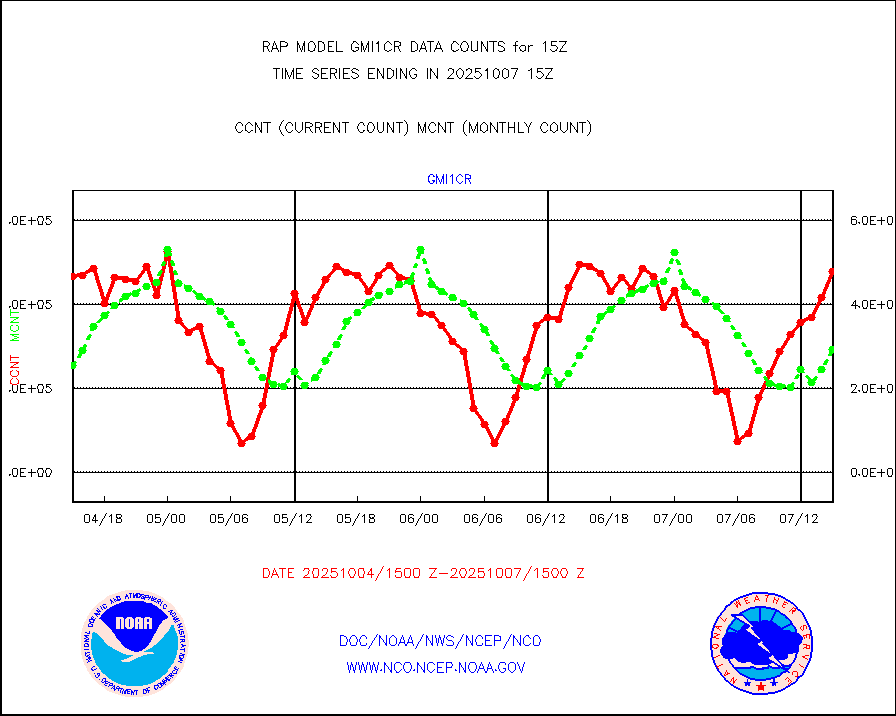
GPM GMI Level 1C-R brightness temperatures |
283209 |
205125 |
138.1 % |
3012.00-3017.99 |
||||||||||
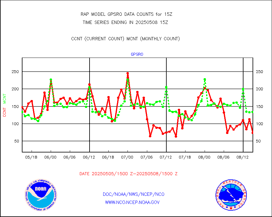
GPS radio occultation data |
133 |
135 |
98.5 % |
3013.00-3016.99 |
||||||||||
GOES-16/17 All Sky Radiances (proc.) |
848989 |
884957 |
95.9 % |
3013.00-3016.99 |
||||||||||
GOES-16/17 Clear Sky Radiances (proc.) |
437209 |
429539 |
101.8 % |
3013.00-3016.99 |
||||||||||
MTSAT/JMA water vapor imager derived cloud motion |
1051 |
2837 |
37.0 % |
3012.50-3017.50 |
||||||||||
GOES-16&up/NESDIS wv imgr/deep-lyr derivd cld mtn |
8158 |
7925 |
102.9 % |
3014.00-3014.99 |
||||||||||
METEOSAT/EUMETSAT wvpr imgr drv cld motion NBseq |
5457 |
5484 |
99.5 % |
3013.50-3016.49 |
||||||||||
GOES-16&up/NESDIS wv imgr/cld-top derived cld mtn |
13054 |
12802 |
102.0 % |
3014.00-3014.99 |
||||||||||
METOP 1-2 IASI 1C radiances-direct broadcast SSEC |
122724 |
99114 |
123.8 % |
3013.00-3016.99 |
||||||||||
METEOSAT/EUMETSAT ir lg-wave drv cld motion NBseq |
3112 |
3140 |
99.1 % |
3013.50-3016.49 |
||||||||||
VIIRS (NPP/NOAA-20) ir lg-wv drv cloud motion(NB) |
0 |
0 |
n/a |
3012.50-3017.50 |
||||||||||
AVHRR (NOAA/METOP) ir lg-wave derived cld motion |
0 |
0 |
n/a |
3012.50-3017.50 |
||||||||||
AVHRR (METOP) ir lg-wave derived cld motion |
0 |
0 |
n/a |
3013.50-3016.49 |
||||||||||
MTSAT/JMA infrared long-wave derived cloud motion |
1123 |
2227 |
50.4 % |
3012.50-3017.50 |
||||||||||
GOES-16&up/NESDIS ir long-wave derived cld motion |
30598 |
29383 |
104.1 % |
3014.00-3014.99 |
||||||||||
Korean AMDAR aircraft data (decoded from BUFR) |
85 |
116 |
73.3 % |
3011.75-3018.25 |
||||||||||
Land-based CMAN stations decoded from CMAN format |
65 |
66 |
98.5 % |
3014.50-3015.50 |
||||||||||
LLDN Long-rng lightning from Vaisala via NOAAPORT |
111149 |
81747 |
136.0 % |
3014.00-3015.50 |
||||||||||
NLDN Shrt-rng lightning from Vaisala via NOAAPORT |
4238 |
3841 |
110.3 % |
3014.00-3015.50 |
||||||||||
Moored buoys (decoded from BUFR) |
681 |
635 |
107.2 % |
3014.50-3015.50 |
||||||||||
Mesonet/MADIS Colorado E-470 (Interstate 470) |
24 |
23 |
104.3 % |
3014.50-3015.50 |
||||||||||
Mesonet/MADIS Alaska Department of Transportation |
118 |
97 |
121.6 % |
3014.50-3015.50 |
||||||||||
Mesonet/MADIS U.S. Army Aberdeen Proving Grounds |
0 |
0 |
n/a |
3014.50-3015.50 |
||||||||||
Mesonet/MADIS Citizen Weather Observers Program |
59043 |
57571 |
102.6 % |
3014.50-3015.50 |
||||||||||
Mesonet/MADIS AWS Convergence Technologies, Inc. |
23327 |
21212 |
110.0 % |
3014.50-3015.50 |
||||||||||
Mesonet/MADIS "Anything Weather" |
0 |
0 |
n/a |
3014.50-3015.50 |
||||||||||
Mesonet/MADIS Colorado Dept. of Transportation |
0 |
0 |
n/a |
3014.50-3015.50 |
||||||||||
Mesonet/MADIS DC Net |
0 |
0 |
n/a |
3014.50-3015.50 |
||||||||||
Mesonet/MADIS Denver Urban Drainage & Flood Cntrl |
0 |
0 |
n/a |
3014.50-3015.50 |
||||||||||
Mesonet/MADIS Florida (FAWN & USF) |
3 |
3 |
100.0 % |
3014.50-3015.50 |
||||||||||
Mesonet/MADIS Florida Dept. of Transportation |
0 |
0 |
n/a |
3014.50-3015.50 |
||||||||||
Mesonet/MADIS Georgia Dept. of Transportation |
0 |
0 |
n/a |
3014.50-3015.50 |
||||||||||
Mesonet/MADIS NWS Hydromet Auto Data System(HADS) |
4399 |
5130 |
85.8 % |
3014.50-3015.50 |
||||||||||
Mesonet/MADIS Iowa Environmental |
157 |
165 |
95.2 % |
3014.50-3015.50 |
||||||||||
Mesonet/MADIS Indiana Dept. of Transportation |
0 |
0 |
n/a |
3014.50-3015.50 |
||||||||||
Mesonet/MADIS Iowa Department of Transportation |
0 |
0 |
n/a |
3014.50-3015.50 |
||||||||||
Mesonet/MADIS Kansas Department of Transportation |
339 |
311 |
109.0 % |
3014.50-3015.50 |
||||||||||
Mesonet/MADIS Oklahoma Mesonet |
630 |
567 |
111.1 % |
3014.50-3015.50 |
||||||||||
Mesonet/MADIS Louisiana State/Jackson State Univ. |
0 |
0 |
n/a |
3014.50-3015.50 |
||||||||||
Mesonet/MADIS Missouri Commercial Agricult Wx Net |
280 |
292 |
95.9 % |
3014.50-3015.50 |
||||||||||
Mesonet/MADIS Minnesota Dept. of Transportation |
0 |
0 |
n/a |
3014.50-3015.50 |
||||||||||
Mesonet/MADIS NOS-Phys Oceanographic Realtime Sys |
225 |
276 |
81.5 % |
3014.50-3015.50 |
||||||||||
Mesonet/MADIS NFIC Remote Automated Wx Stns(RAWS) |
1363 |
1515 |
90.0 % |
3014.50-3015.50 |
||||||||||
Mesonet/MADIS many providers, not separated out |
41067 |
39126 |
105.0 % |
3014.50-3015.50 |
||||||||||
Mesonet/MADIS UrbaNet |
2926 |
3104 |
94.3 % |
3014.50-3015.50 |
||||||||||
Mesonet/MADIS Virginia Dept. of Transportation |
0 |
0 |
n/a |
3014.50-3015.50 |
||||||||||
Mesonet/MADIS "Weather for You" |
0 |
0 |
n/a |
3014.50-3015.50 |
||||||||||
Mesonet/MADIS Wisconsin Dept. of Transportation |
0 |
0 |
n/a |
3014.50-3015.50 |
||||||||||
Mesonet/MADIS MesoWest (many subproviders) |
36029 |
36161 |
99.6 % |
3014.50-3015.50 |
||||||||||
Mesonet/MADIS West Texas |
5043 |
5259 |
95.9 % |
3014.50-3015.50 |
||||||||||
METOP 1-2 IASI 1C radiance data (varbl. channels) |
10254 |
22234 |
46.1 % |
3013.00-3016.99 |
||||||||||
NEXRAD Vel Azm Dsp(VAD) winds via Level 2 decoder |
650 |
623 |
104.3 % |
3014.00-3016.00 |
||||||||||
NOAA 16-19 Solar Backscatter UV-2 rad frm V8 BUFR |
0 |
0 |
n/a |
3013.00-3015.99 |
||||||||||
PIBAL (from PILOT, PILOT SHIP, PILOT MOBIL) |
0 |
0 |
n/a |
3014.00-3016.00 |
||||||||||
PIBAL (decoded from BUFR) |
0 |
0 |
n/a |
3014.00-3016.00 |
||||||||||
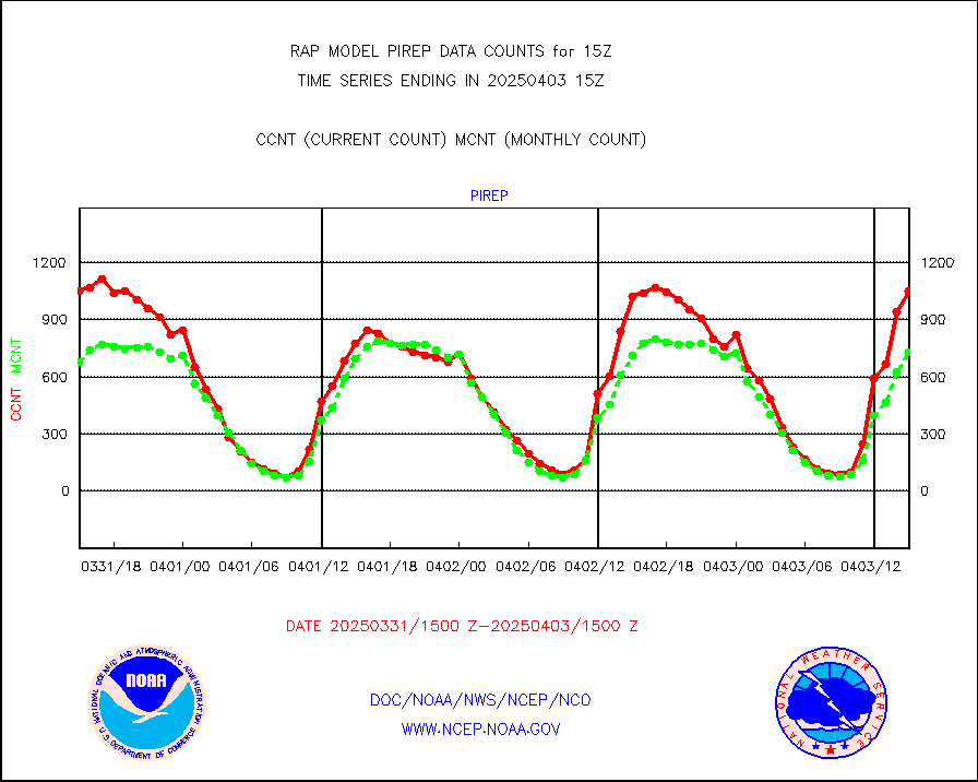
Manual PIREP aircraft data (dcded from AIREP fmt) |
615 |
523 |
117.6 % |
3011.75-3018.25 |
||||||||||
Profilr winds from PIBAL (PILOT,PILOT SHIP/MOBIL) |
0 |
0 |
n/a |
3013.50-3016.50 |
||||||||||
Rawinsonde - fixed land (decoded from BUFR) |
0 |
0 |
n/a |
3014.00-3016.00 |
||||||||||
Rawinsonde - mobile land (from TEMP/PILOT MOBIL) |
0 |
0 |
n/a |
3014.00-3016.00 |
||||||||||
Rawinsonde - mobile land (decoded from BUFR) |
0 |
0 |
n/a |
3014.00-3016.00 |
||||||||||
Rawinsonde - ship (from TEMP SHIP, PILOT SHIP) |
0 |
0 |
n/a |
3014.00-3016.00 |
||||||||||
Rawinsonde - ship (decoded from BUFR) |
0 |
0 |
n/a |
3014.00-3016.00 |
||||||||||
NEXRAD radial wind (Level 2 - GTS) |
836744 |
820736 |
102.0 % |
3014.50-3015.49 |
||||||||||
Flight level reconnaissance aircraft data |
0 |
0 |
n/a |
3014.00-3016.00 |
||||||||||
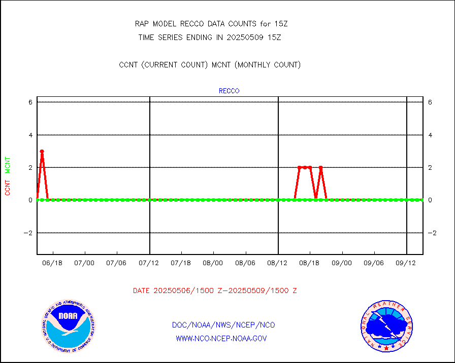
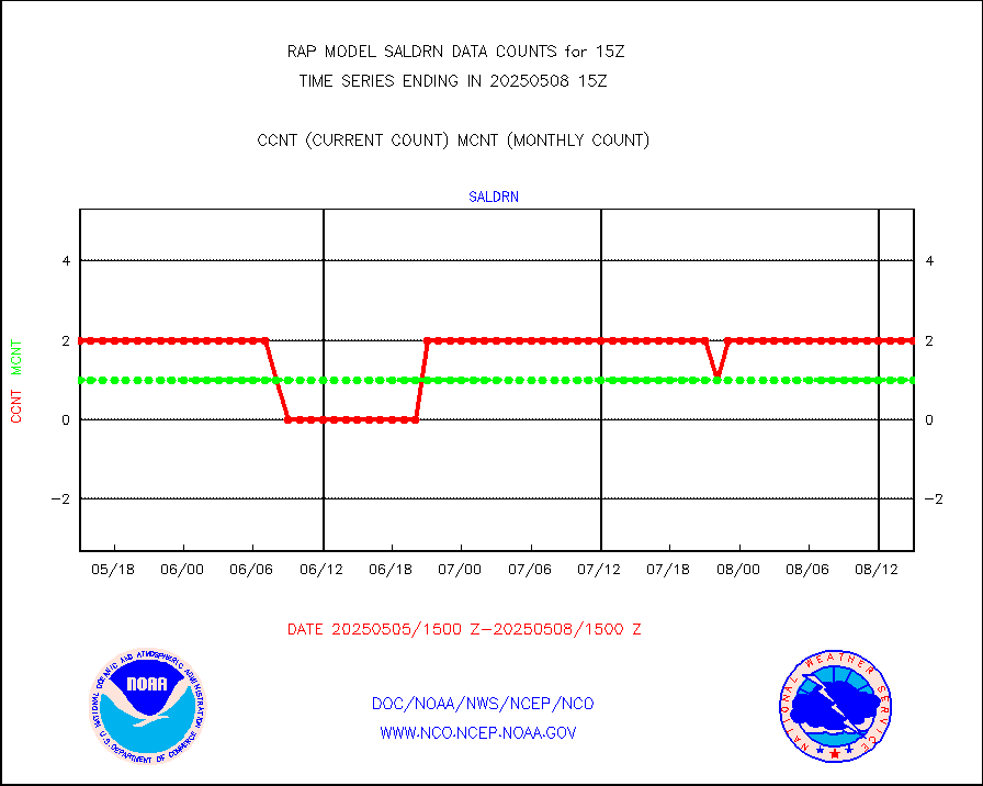
Surface Marine Saildrone (decoded from BUFR) |
2 |
2 |
100.0 % |
3013.00-3016.99 |
||||||||||
Megha-Tropiques SAPHIR L1A2 brightness temps |
0 |
0 |
n/a |
3012.00-3017.99 |
||||||||||
METEOSAT-10 2nd Gen SEVIRI All Sky Radiance(proc) |
8160 |
9183 |
88.9 % |
3013.00-3016.99 |
||||||||||
METEOSAT-10 2nd Gen SEVIRI Clr Sky Radiance(proc) |
0 |
0 |
n/a |
3013.00-3016.99 |
||||||||||
Ship - manual and automatic, restricted |
15 |
16 |
93.8 % |
3014.50-3015.50 |
||||||||||
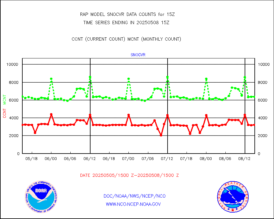
NOW COVER, DEPTH/DENSITY AND WATER EQUIVALENT |
3167 |
6288 |
50.4 % |
3013.00-3017.00 |
||||||||||
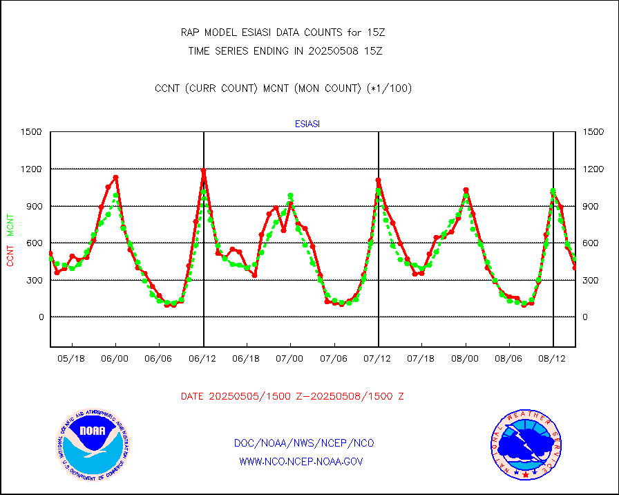
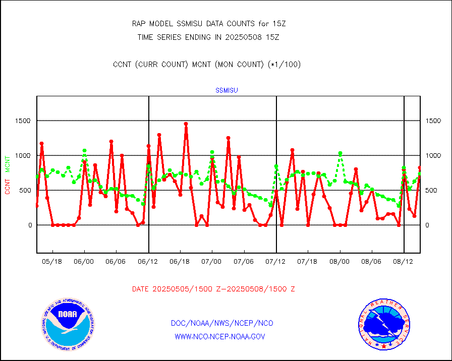
DMSP SSM/IS 1C radiance data (Unified Pre-Proc.) |
28221 |
61065 |
46.2 % |
3013.00-3016.99 |
||||||||||
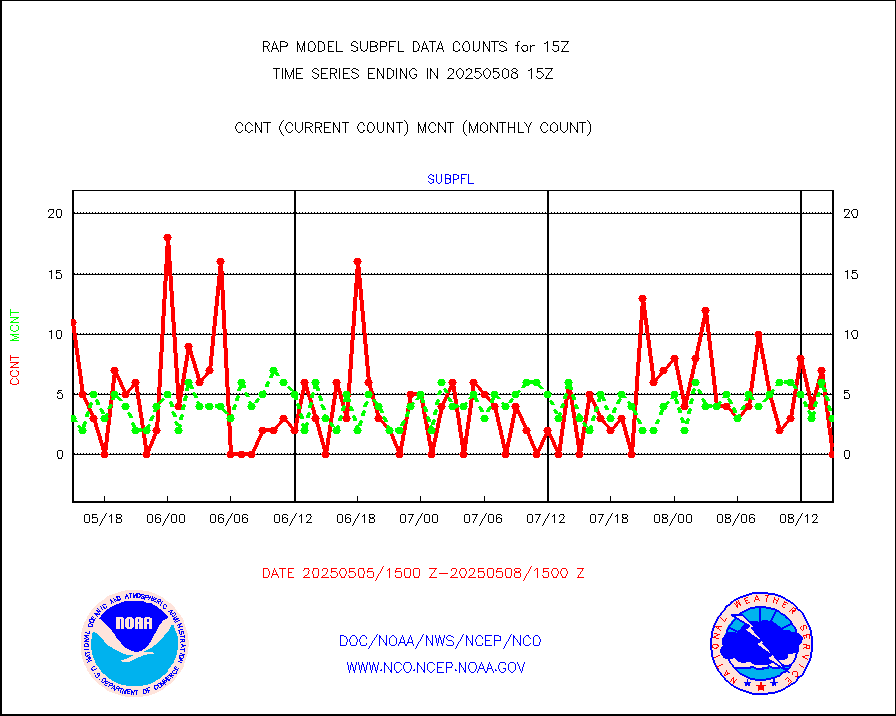
Sub-surface float and glider profile (BUFR) |
2 |
4 |
50.0 % |
3013.00-3016.99 |
||||||||||
Synoptic - restricted (WMO Res 40) manual & auto. |
0 |
0 |
n/a |
3014.50-3015.50 |
||||||||||
Synoptic - restricted (WMO Res 40)(decoded BUFR) |
303 |
313 |
96.8 % |
3014.50-3015.50 |
||||||||||
Synoptic - mobile manual & auto (decoded fr BUFR) |
0 |
0 |
n/a |
3014.50-3015.50 |
||||||||||
TAMDAR aircft data-all types(from Panasonic,BUFR) |
133 |
204 |
65.2 % |
3011.75-3018.25 |
||||||||||
MTSAT/JMA visible derived cloud motion |
0 |
0 |
n/a |
3012.50-3017.50 |
||||||||||
GOES-16&up/NESDIS visible derived cloud motion |
51709 |
43895 |
117.8 % |
3014.00-3014.99 |
||||||||||
METEOSAT/EUMETSAT visible drv cld motion NBseq |
7375 |
6730 |
109.6 % |
3013.50-3016.49 |
||||||||||


