| Suspect Data Shortages in Critical Types - Monitor | ||||||||||||||
|---|---|---|---|---|---|---|---|---|---|---|---|---|---|---|
| Type | Description | Hourly Count | Monthly Average | Percent (%) of Monthly Mean | UTC Time Window | |||||||||
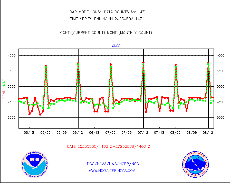
NOAA 18-19 & METOP 1-2 HIRS-4 NCEP-proc. br.temps |
0 |
5895 |
0.0 % |
3011.00-3016.99 |
||||||||||
| Shortage in Data Type of Opportunity - Monitor | ||||||||||||||
|---|---|---|---|---|---|---|---|---|---|---|---|---|---|---|
| Type | Description | Hourly Count | Monthly Average | Percent (%) of Monthly Mean | UTC Time Window | |||||||||
NPP Adv. Tech. MW Sndr (ATMS) br. temps from RARS |
0 |
13684 |
0.0 % |
3012.00-3015.99 |
||||||||||
NOAA 15-19 & METOP 1-2 HIRS-3/4 pr btmps frm RARS |
0 |
5269 |
0.0 % |
3013.00-3015.00 |
||||||||||
| Critical Data with Normal Counts | ||||||||||||||
|---|---|---|---|---|---|---|---|---|---|---|---|---|---|---|
| Type | Description | Hourly Count | Monthly Average | Percent (%) of Monthly Mean | UTC Time Window | |||||||||
NOAA 15-19 & METOP 1-2 AMSU-A NCEP-proc. br.temps |
12503 |
18949 |
66.0 % |
3011.00-3016.99 |
||||||||||
NOAA 18-19 & METOP 1-2 MHS NCEP-proces. br. temps |
111789 |
133637 |
83.7 % |
3011.00-3016.99 |
||||||||||
MDCRS ACARS acft data from ARINC(dcded from BUFR) |
82960 |
53428 |
155.3 % |
3010.75-3017.25 |
||||||||||
Canadian AMDAR aircraft data (decoded from BUFR) |
0 |
0 |
n/a |
3010.75-3017.25 |
||||||||||
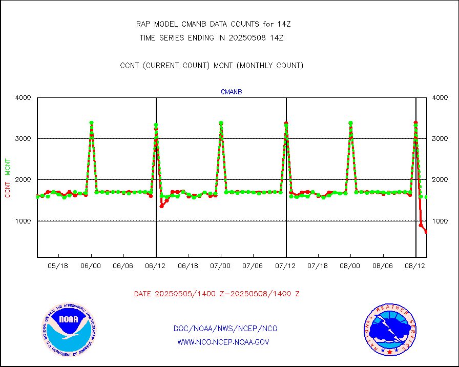
Surface Marine CMAN rpts decoded from BUFR format |
1724 |
1686 |
102.3 % |
3013.50-3014.50 |
||||||||||
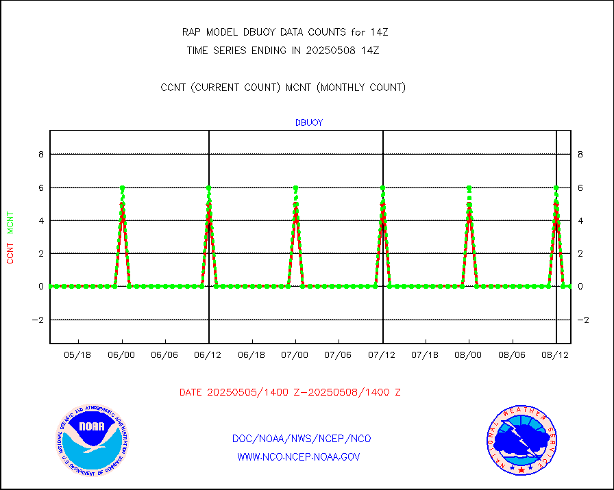
Buoys decoded from FM-18 fmt (moored or drifting) |
0 |
0 |
n/a |
3013.50-3014.50 |
||||||||||
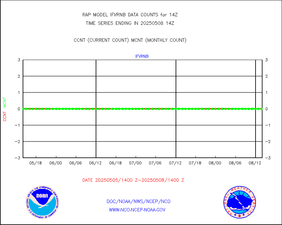
Grnd-based Gbl Navigation Sat System (GNSS) data |
711 |
2232 |
31.9 % |
3012.95-3013.05 |
||||||||||
MODIS (AQUA/TERRA) wvpr imager derived cld motion |
0 |
0 |
n/a |
3011.50-3016.50 |
||||||||||
MODIS (AQUA/TERRA) ir l-wave derived cloud motion |
0 |
0 |
n/a |
3011.50-3016.50 |
||||||||||
GOES/NASA(Langley) hi-res. (1x1 f-o-v) cloud data |
3739103 |
3585319 |
104.3 % |
3013.50-3014.50 |
||||||||||
Buoys decoded from FM-13 format (moored) |
152 |
128 |
118.8 % |
3013.50-3014.50 |
||||||||||
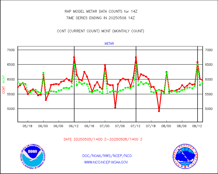
Aviation - METAR |
5958 |
5873 |
101.4 % |
3013.50-3014.50 |
||||||||||
NEXRAD Vel Azm Dsp(VAD) winds via radar coded msg |
0 |
0 |
n/a |
3013.00-3015.00 |
||||||||||
Multi-Agency Profiler (MAP) and SODAR winds |
104 |
95 |
109.5 % |
3012.50-3015.50 |
||||||||||
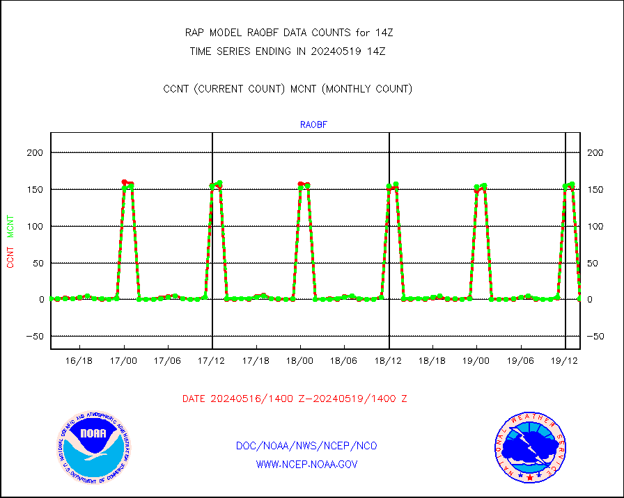
Rawinsonde - fixed land (from TEMP or PILOT) |
1 |
0 |
n/a |
3013.00-3015.00 |
||||||||||
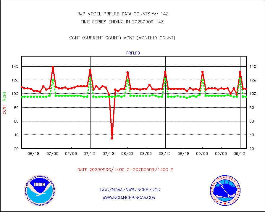
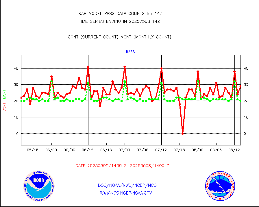
RASS temperatures (NOAA and Multi-Agency) |
20 |
24 |
83.3 % |
3013.50-3014.50 |
||||||||||
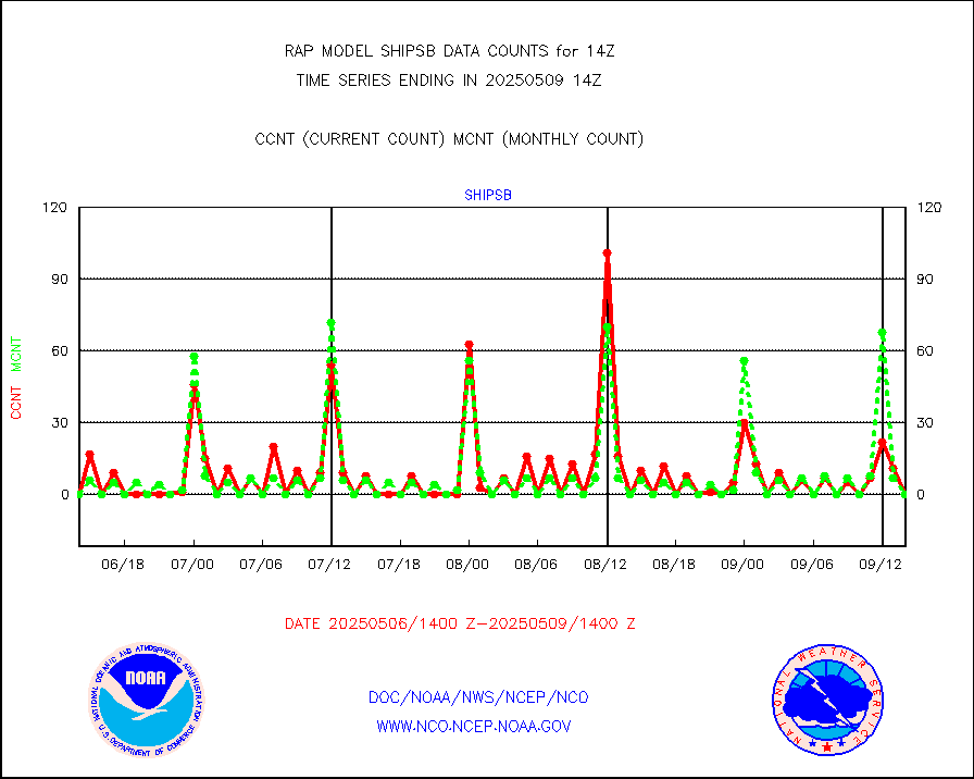
Ship - manual and automatic, restricted (BUFR) |
0 |
0 |
n/a |
3013.50-3014.50 |
||||||||||
Ship - manual and automatic, unrestricted |
123 |
104 |
118.3 % |
3013.50-3014.50 |
||||||||||
Ship - manual and automatic, unrestricted (BUFR) |
812 |
764 |
106.3 % |
3013.50-3014.50 |
||||||||||
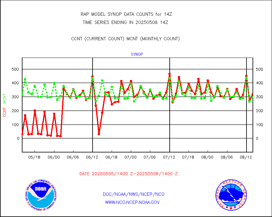
Synoptic - fixed manual and automatic |
317 |
276 |
114.9 % |
3013.50-3014.50 |
||||||||||
Synoptic - fixed manual & auto (decoded fr BUFR) |
2134 |
2063 |
103.4 % |
3013.50-3014.50 |
||||||||||
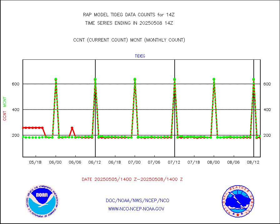
Tide gauge reports decoded from CREX format |
185 |
185 |
100.0 % |
3013.50-3014.50 |
||||||||||
| Data Types of Opportunity with Normal Counts | ||||||||||||||
|---|---|---|---|---|---|---|---|---|---|---|---|---|---|---|
| Type | Description | Hourly Count | Monthly Average | Percent (%) of Monthly Mean | UTC Time Window | |||||||||
GOES-16&up/NESDIS ir short-wv derived cld motion |
8310 |
9336 |
89.0 % |
3013.00-3013.99 |
||||||||||
MDCRS ACARS acft data (ARINC via AFWA)(AIREP fmt) |
0 |
0 |
n/a |
3010.75-3017.25 |
||||||||||
Manual AIREP aircraft data (dcded from AIREP fmt) |
3856 |
3691 |
104.5 % |
3010.75-3017.25 |
||||||||||
AQUA AIRS/AMSU-A/HSB brightness temps- every FOV |
0 |
0 |
n/a |
3011.00-3016.99 |
||||||||||
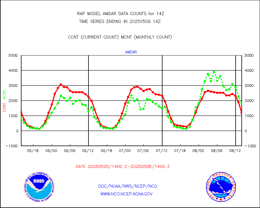
AMDAR aircraft data (decoded from AMDAR format) |
1290 |
829 |
155.6 % |
3010.75-3017.25 |
||||||||||
AMDAR aircraft data (decoded from BUFR) |
8836 |
9109 |
97.0 % |
3010.75-3017.25 |
||||||||||
GCOM-W AMSR2 1B brightness temperatures |
498994 |
769342 |
64.9 % |
3011.00-3011.99 |
||||||||||
METOP 1-2 ASCAT products |
28760 |
20828 |
138.1 % |
3012.00-3016.00 |
||||||||||
NPP/NOAA-20 ATMS brightness temperatures |
230847 |
208574 |
110.7 % |
3012.00-3015.99 |
||||||||||
NPP/NOAA-20 ATMS bright. temps-direct b-cast SSEC |
90213 |
77882 |
115.8 % |
3012.00-3015.99 |
||||||||||
Coop/MADIS NEPP & HCN-Modernization NOAA COOP Obs |
11 |
11 |
100.0 % |
3013.50-3014.50 |
||||||||||
NPP/NOAA-20 CrIS full spctrl radn (431 ch subset) |
101254 |
122740 |
82.5 % |
3012.00-3015.99 |
||||||||||
NPP/NOAA-20 CrIS full spctrl radn dir brdcst SSEC |
37800 |
38984 |
97.0 % |
3012.00-3015.99 |
||||||||||
Coast Guard |
7 |
7 |
100.0 % |
3013.50-3014.50 |
||||||||||
Drifting buoys (decoded from BUFR) |
544 |
511 |
106.5 % |
3013.50-3014.50 |
||||||||||
Dropwinsonde (from TEMP DROP) |
0 |
0 |
n/a |
3013.00-3015.00 |
||||||||||
Dropwinsonde (decoded from BUFR) |
4 |
3 |
133.3 % |
3013.00-3015.00 |
||||||||||
E-AMDAR (European AMDAR acft decoded from BUFR) |
10993 |
12424 |
88.5 % |
3010.75-3017.25 |
||||||||||
NOAA 15-19 & METOP 1-2 AMSU-A proc btmps frm RARS |
12411 |
11578 |
107.2 % |
3013.00-3015.00 |
||||||||||
METOP 1-2 IASI 1C radiance data vbl chn from RARS |
52 |
7274 |
0.7 % |
3012.00-3015.99 |
||||||||||
NOAA 18-19 & METOP 1-2 MHS proc. btemps from RARS |
132301 |
113553 |
116.5 % |
3013.00-3015.00 |
||||||||||
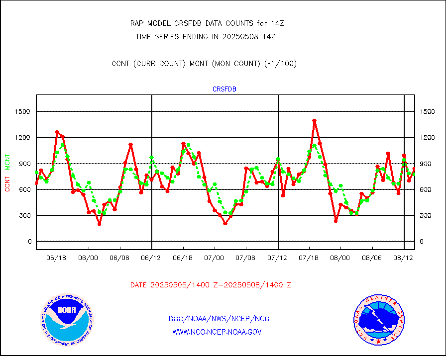
GPM GMI Level 1C-R brightness temperatures |
273738 |
209258 |
130.8 % |
3011.00-3016.99 |
||||||||||
GPS radio occultation data |
141 |
131 |
107.6 % |
3012.00-3015.99 |
||||||||||
GOES-16/17 All Sky Radiances (proc.) |
885881 |
871994 |
101.6 % |
3012.00-3015.99 |
||||||||||
GOES-16/17 Clear Sky Radiances (proc.) |
435898 |
411501 |
105.9 % |
3012.00-3015.99 |
||||||||||
MTSAT/JMA water vapor imager derived cloud motion |
2109 |
2861 |
73.7 % |
3011.50-3016.50 |
||||||||||
GOES-16&up/NESDIS wv imgr/deep-lyr derivd cld mtn |
8067 |
7881 |
102.4 % |
3013.00-3013.99 |
||||||||||
METEOSAT/EUMETSAT wvpr imgr drv cld motion NBseq |
5338 |
5405 |
98.8 % |
3012.50-3015.49 |
||||||||||
GOES-16&up/NESDIS wv imgr/cld-top derived cld mtn |
12715 |
12607 |
100.9 % |
3013.00-3013.99 |
||||||||||
METOP 1-2 IASI 1C radiances-direct broadcast SSEC |
96352 |
64021 |
150.5 % |
3012.00-3015.99 |
||||||||||
METEOSAT/EUMETSAT ir lg-wave drv cld motion NBseq |
3062 |
3120 |
98.1 % |
3012.50-3015.49 |
||||||||||
VIIRS (NPP/NOAA-20) ir lg-wv drv cloud motion(NB) |
0 |
0 |
n/a |
3011.50-3016.50 |
||||||||||
AVHRR (NOAA/METOP) ir lg-wave derived cld motion |
0 |
0 |
n/a |
3011.50-3016.50 |
||||||||||
AVHRR (METOP) ir lg-wave derived cld motion |
0 |
0 |
n/a |
3012.50-3015.49 |
||||||||||
MTSAT/JMA infrared long-wave derived cloud motion |
2269 |
2296 |
98.8 % |
3011.50-3016.50 |
||||||||||
GOES-16&up/NESDIS ir long-wave derived cld motion |
30119 |
29716 |
101.4 % |
3013.00-3013.99 |
||||||||||
Korean AMDAR aircraft data (decoded from BUFR) |
113 |
183 |
61.7 % |
3010.75-3017.25 |
||||||||||
Land-based CMAN stations decoded from CMAN format |
69 |
66 |
104.5 % |
3013.50-3014.50 |
||||||||||
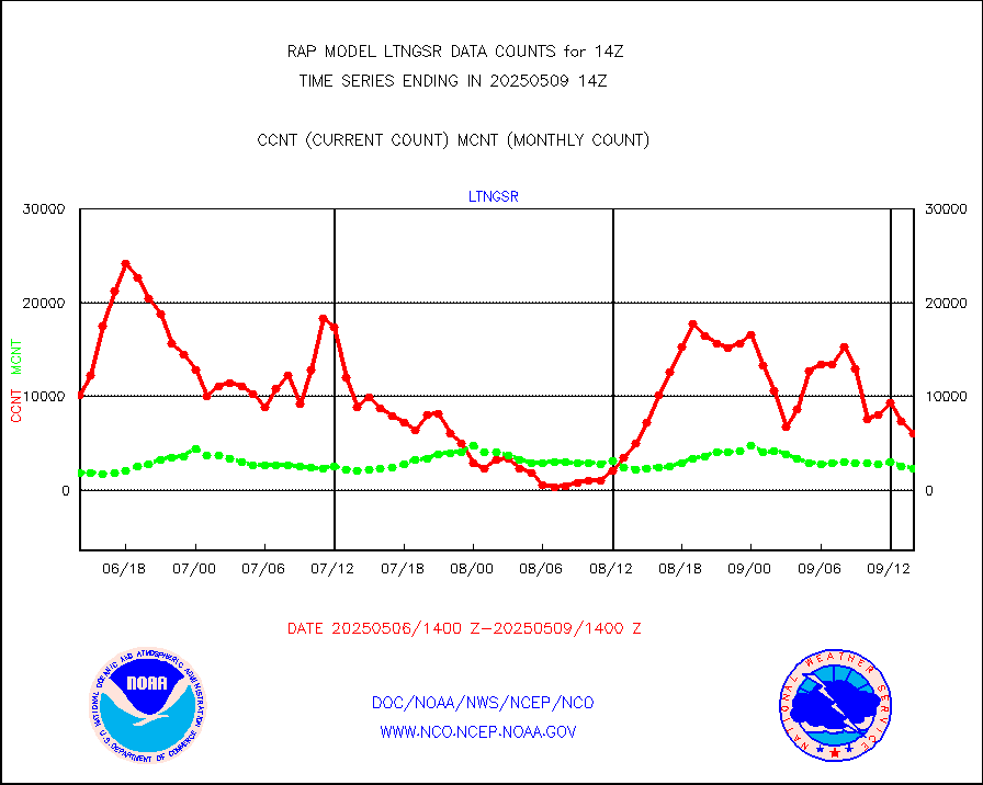
LLDN Long-rng lightning from Vaisala via NOAAPORT |
122491 |
88426 |
138.5 % |
3013.00-3014.50 |
||||||||||
NLDN Shrt-rng lightning from Vaisala via NOAAPORT |
4886 |
4182 |
116.8 % |
3013.00-3014.50 |
||||||||||
Moored buoys (decoded from BUFR) |
678 |
646 |
105.0 % |
3013.50-3014.50 |
||||||||||
Mesonet/MADIS Colorado E-470 (Interstate 470) |
24 |
24 |
100.0 % |
3013.50-3014.50 |
||||||||||
Mesonet/MADIS Alaska Department of Transportation |
119 |
86 |
138.4 % |
3013.50-3014.50 |
||||||||||
Mesonet/MADIS U.S. Army Aberdeen Proving Grounds |
0 |
0 |
n/a |
3013.50-3014.50 |
||||||||||
Mesonet/MADIS Citizen Weather Observers Program |
11074 |
57617 |
19.2 % |
3013.50-3014.50 |
||||||||||
Mesonet/MADIS AWS Convergence Technologies, Inc. |
5877 |
20965 |
28.0 % |
3013.50-3014.50 |
||||||||||
Mesonet/MADIS "Anything Weather" |
0 |
0 |
n/a |
3013.50-3014.50 |
||||||||||
Mesonet/MADIS Colorado Dept. of Transportation |
0 |
0 |
n/a |
3013.50-3014.50 |
||||||||||
Mesonet/MADIS DC Net |
0 |
0 |
n/a |
3013.50-3014.50 |
||||||||||
Mesonet/MADIS Denver Urban Drainage & Flood Cntrl |
0 |
0 |
n/a |
3013.50-3014.50 |
||||||||||
Mesonet/MADIS Florida (FAWN & USF) |
3 |
4 |
75.0 % |
3013.50-3014.50 |
||||||||||
Mesonet/MADIS Florida Dept. of Transportation |
0 |
0 |
n/a |
3013.50-3014.50 |
||||||||||
Mesonet/MADIS Georgia Dept. of Transportation |
0 |
0 |
n/a |
3013.50-3014.50 |
||||||||||
Mesonet/MADIS NWS Hydromet Auto Data System(HADS) |
4218 |
5084 |
83.0 % |
3013.50-3014.50 |
||||||||||
Mesonet/MADIS Iowa Environmental |
159 |
166 |
95.8 % |
3013.50-3014.50 |
||||||||||
Mesonet/MADIS Indiana Dept. of Transportation |
0 |
0 |
n/a |
3013.50-3014.50 |
||||||||||
Mesonet/MADIS Iowa Department of Transportation |
0 |
0 |
n/a |
3013.50-3014.50 |
||||||||||
Mesonet/MADIS Kansas Department of Transportation |
338 |
325 |
104.0 % |
3013.50-3014.50 |
||||||||||
Mesonet/MADIS Oklahoma Mesonet |
630 |
577 |
109.2 % |
3013.50-3014.50 |
||||||||||
Mesonet/MADIS Louisiana State/Jackson State Univ. |
0 |
0 |
n/a |
3013.50-3014.50 |
||||||||||
Mesonet/MADIS Missouri Commercial Agricult Wx Net |
276 |
290 |
95.2 % |
3013.50-3014.50 |
||||||||||
Mesonet/MADIS Minnesota Dept. of Transportation |
0 |
0 |
n/a |
3013.50-3014.50 |
||||||||||
Mesonet/MADIS NOS-Phys Oceanographic Realtime Sys |
249 |
275 |
90.5 % |
3013.50-3014.50 |
||||||||||
Mesonet/MADIS NFIC Remote Automated Wx Stns(RAWS) |
1315 |
1487 |
88.4 % |
3013.50-3014.50 |
||||||||||
Mesonet/MADIS many providers, not separated out |
6058 |
39459 |
15.4 % |
3013.50-3014.50 |
||||||||||
Mesonet/MADIS UrbaNet |
2893 |
3073 |
94.1 % |
3013.50-3014.50 |
||||||||||
Mesonet/MADIS Virginia Dept. of Transportation |
0 |
0 |
n/a |
3013.50-3014.50 |
||||||||||
Mesonet/MADIS "Weather for You" |
0 |
0 |
n/a |
3013.50-3014.50 |
||||||||||
Mesonet/MADIS Wisconsin Dept. of Transportation |
0 |
0 |
n/a |
3013.50-3014.50 |
||||||||||
Mesonet/MADIS MesoWest (many subproviders) |
4963 |
36062 |
13.8 % |
3013.50-3014.50 |
||||||||||
Mesonet/MADIS West Texas |
5003 |
5193 |
96.3 % |
3013.50-3014.50 |
||||||||||
METOP 1-2 IASI 1C radiance data (varbl. channels) |
24744 |
20331 |
121.7 % |
3012.00-3015.99 |
||||||||||
NEXRAD Vel Azm Dsp(VAD) winds via Level 2 decoder |
640 |
667 |
96.0 % |
3013.00-3015.00 |
||||||||||
NOAA 16-19 Solar Backscatter UV-2 rad frm V8 BUFR |
0 |
0 |
n/a |
3012.00-3014.99 |
||||||||||
PIBAL (from PILOT, PILOT SHIP, PILOT MOBIL) |
0 |
0 |
n/a |
3013.00-3015.00 |
||||||||||
PIBAL (decoded from BUFR) |
0 |
0 |
n/a |
3013.00-3015.00 |
||||||||||
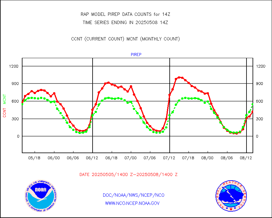
Manual PIREP aircraft data (dcded from AIREP fmt) |
491 |
455 |
107.9 % |
3010.75-3017.25 |
||||||||||
Profilr winds from PIBAL (PILOT,PILOT SHIP/MOBIL) |
0 |
0 |
n/a |
3012.50-3015.50 |
||||||||||
Rawinsonde - fixed land (decoded from BUFR) |
0 |
0 |
n/a |
3013.00-3015.00 |
||||||||||
Rawinsonde - mobile land (from TEMP/PILOT MOBIL) |
0 |
0 |
n/a |
3013.00-3015.00 |
||||||||||
Rawinsonde - mobile land (decoded from BUFR) |
0 |
0 |
n/a |
3013.00-3015.00 |
||||||||||
Rawinsonde - ship (from TEMP SHIP, PILOT SHIP) |
0 |
0 |
n/a |
3013.00-3015.00 |
||||||||||
Rawinsonde - ship (decoded from BUFR) |
0 |
0 |
n/a |
3013.00-3015.00 |
||||||||||
NEXRAD radial wind (Level 2 - GTS) |
802315 |
826505 |
97.1 % |
3013.50-3014.49 |
||||||||||
Flight level reconnaissance aircraft data |
0 |
0 |
n/a |
3013.00-3015.00 |
||||||||||
Surface Marine Saildrone (decoded from BUFR) |
2 |
2 |
100.0 % |
3012.00-3015.99 |
||||||||||
Megha-Tropiques SAPHIR L1A2 brightness temps |
0 |
0 |
n/a |
3011.00-3016.99 |
||||||||||
METEOSAT-10 2nd Gen SEVIRI All Sky Radiance(proc) |
9512 |
9185 |
103.6 % |
3012.00-3015.99 |
||||||||||
METEOSAT-10 2nd Gen SEVIRI Clr Sky Radiance(proc) |
0 |
0 |
n/a |
3012.00-3015.99 |
||||||||||
Ship - manual and automatic, restricted |
0 |
10 |
0.0 % |
3013.50-3014.50 |
||||||||||
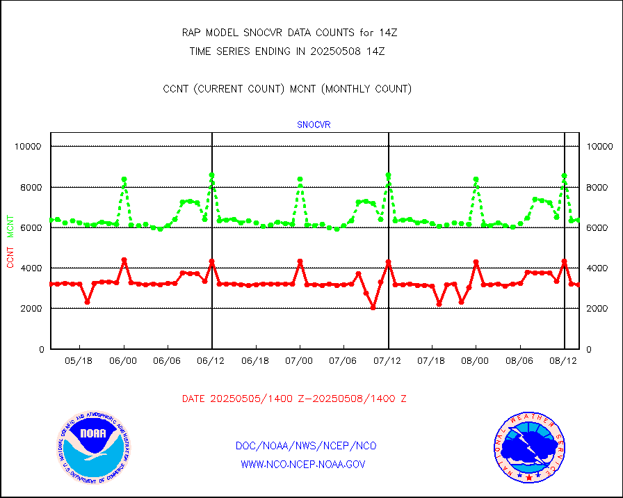
NOW COVER, DEPTH/DENSITY AND WATER EQUIVALENT |
3155 |
6104 |
51.7 % |
3012.00-3016.00 |
||||||||||
DMSP SSM/IS 1C radiance data (Unified Pre-Proc.) |
59888 |
49070 |
122.0 % |
3012.00-3015.99 |
||||||||||
Sub-surface float and glider profile (BUFR) |
0 |
4 |
0.0 % |
3012.00-3015.99 |
||||||||||
Synoptic - restricted (WMO Res 40) manual & auto. |
0 |
0 |
n/a |
3013.50-3014.50 |
||||||||||
Synoptic - restricted (WMO Res 40)(decoded BUFR) |
347 |
369 |
94.0 % |
3013.50-3014.50 |
||||||||||
Synoptic - mobile manual & auto (decoded fr BUFR) |
0 |
0 |
n/a |
3013.50-3014.50 |
||||||||||
TAMDAR aircft data-all types(from Panasonic,BUFR) |
177 |
203 |
87.2 % |
3010.75-3017.25 |
||||||||||
MTSAT/JMA visible derived cloud motion |
0 |
0 |
n/a |
3011.50-3016.50 |
||||||||||
GOES-16&up/NESDIS visible derived cloud motion |
37420 |
30764 |
121.6 % |
3013.00-3013.99 |
||||||||||
METEOSAT/EUMETSAT visible drv cld motion NBseq |
7448 |
6943 |
107.3 % |
3012.50-3015.49 |
||||||||||


