| Suspect Data Shortages in Critical Types - Monitor | ||||||||||||||
|---|---|---|---|---|---|---|---|---|---|---|---|---|---|---|
| Type | Description | Hourly Count | Monthly Average | Percent (%) of Monthly Mean | UTC Time Window | |||||||||
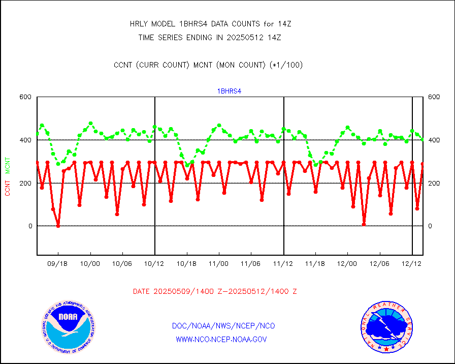
NOAA 18-19 & METOP 1-2 HIRS-4 NCEP-proc. br.temps |
0 |
11969 |
0.0 % |
0112.00-0112.99 |
||||||||||
NOAA 15-19 & METOP 1-2 HIRS-3/4 pr btmps frm RARS |
0 |
18435 |
0.0 % |
0113.50-0114.49 |
||||||||||
Grnd-based Gbl Navigation Sat System (GNSS) data |
1404 |
6733 |
20.9 % |
0113.00-0113.99 |
||||||||||
| Shortage in Data Type of Opportunity - Monitor | ||||||||||||||
|---|---|---|---|---|---|---|---|---|---|---|---|---|---|---|
| Type | Description | Hourly Count | Monthly Average | Percent (%) of Monthly Mean | UTC Time Window | |||||||||
P.M.(N18-19) AVHRR GAC NCEP-proc clr & sea btemps |
0 |
574973 |
0.0 % |
0111.50-0112.49 |
||||||||||
NPP Adv. Tech. MW Sndr (ATMS) br. temps from RARS |
0 |
7063 |
0.0 % |
0112.50-0113.49 |
||||||||||
INDIA SATWIND, INSAT WV channel |
0 |
803 |
0.0 % |
0113.00-0113.99 |
||||||||||
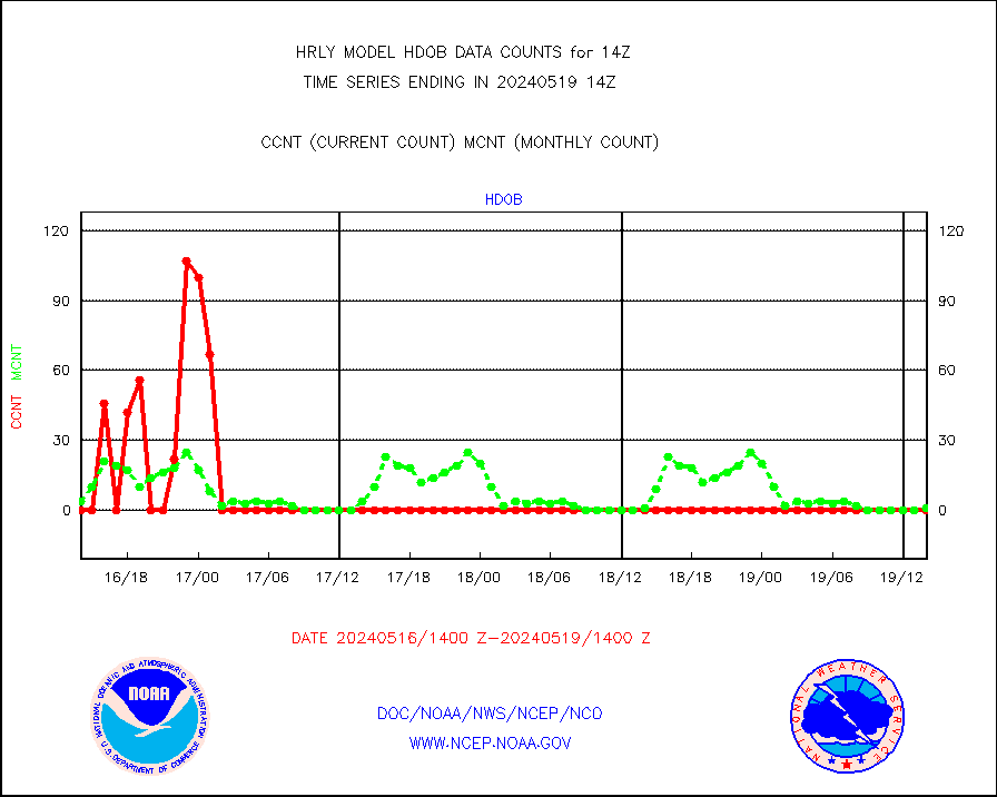
High Density OBs from reconnaissance acft data |
0 |
10 |
0.0 % |
0113.50-0114.49 |
||||||||||
INDIA SATWIND, INSAT IR channel |
0 |
789 |
0.0 % |
0113.00-0113.99 |
||||||||||
INDIA SATWIND, INSAT VIS channel |
0 |
6 |
0.0 % |
0113.00-0113.99 |
||||||||||
| Critical Data with Normal Counts | ||||||||||||||
|---|---|---|---|---|---|---|---|---|---|---|---|---|---|---|
| Type | Description | Hourly Count | Monthly Average | Percent (%) of Monthly Mean | UTC Time Window | |||||||||
NOAA 15-19 & METOP 1-2 AMSU-A NCEP-proc. br.temps |
26734 |
36109 |
74.0 % |
0112.00-0112.99 |
||||||||||
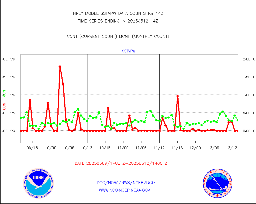
NOAA 18-19 & METOP 1-2 MHS NCEP-proces. br. temps |
238596 |
257267 |
92.7 % |
0112.00-0112.99 |
||||||||||
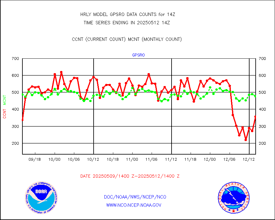
MDCRS ACARS acft data from ARINC(dcded from BUFR) |
25022 |
26610 |
94.0 % |
0113.50-0114.49 |
||||||||||
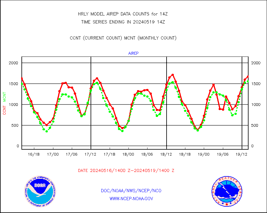
Manual AIREP aircraft data (dcded from AIREP fmt) |
1070 |
1041 |
102.8 % |
0113.50-0114.49 |
||||||||||
AQUA AIRS/AMSU-A/HSB brightness temps- every FOV |
0 |
0 |
n/a |
0111.50-0112.49 |
||||||||||
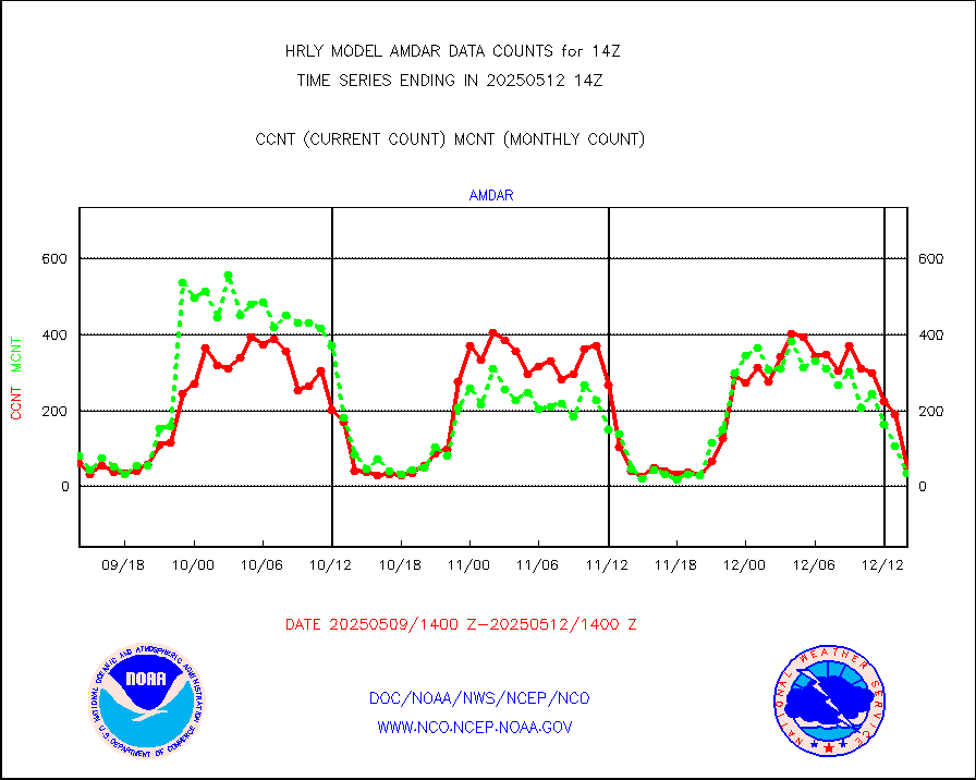
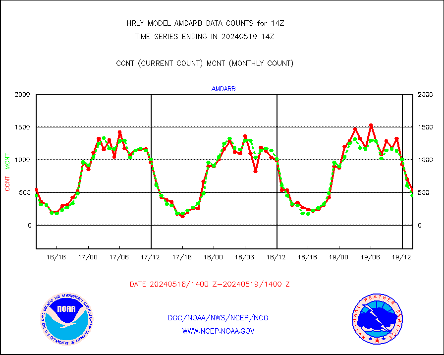
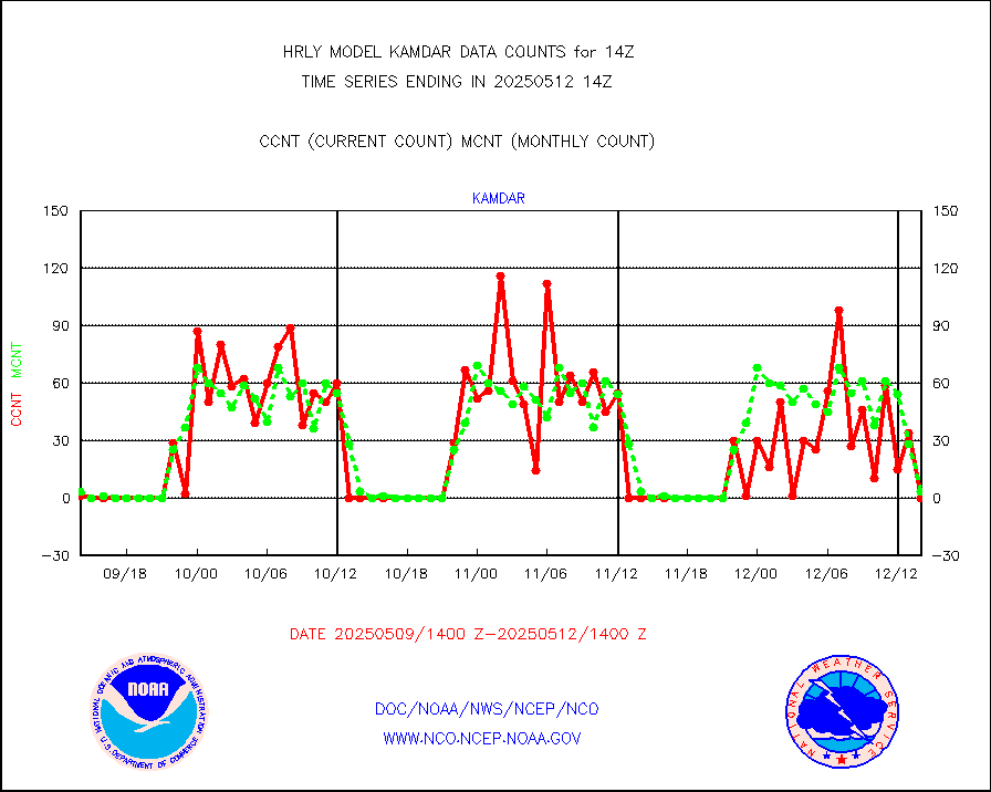
AMDAR aircraft data (decoded from AMDAR format) |
65 |
40 |
162.5 % |
0113.50-0114.49 |
||||||||||
AMDAR aircraft data (decoded from BUFR) |
2175 |
2105 |
103.3 % |
0113.50-0114.49 |
||||||||||
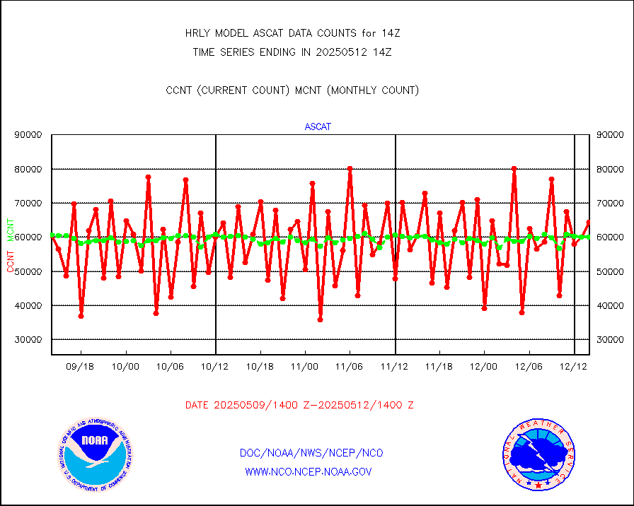
METOP 1-2 ASCAT products |
64344 |
61412 |
104.8 % |
0112.50-0113.49 |
||||||||||
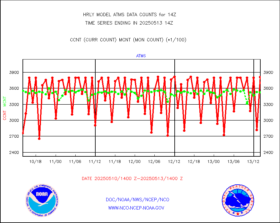
NPP/NOAA-20 ATMS brightness temperatures |
332448 |
344499 |
96.5 % |
0112.50-0113.49 |
||||||||||
Canadian AMDAR aircraft data (decoded from BUFR) |
0 |
0 |
n/a |
0113.50-0114.49 |
||||||||||
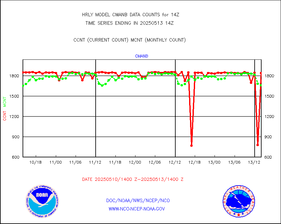
Surface Marine CMAN rpts decoded from BUFR format |
1862 |
1825 |
102.0 % |
0113.50-0114.50 |
||||||||||
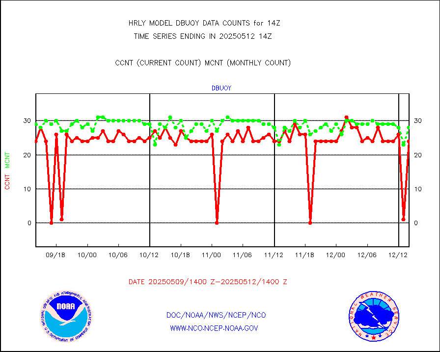
Buoys decoded from FM-18 fmt (moored or drifting) |
6 |
14 |
42.9 % |
0113.50-0114.49 |
||||||||||
E-AMDAR (European AMDAR acft decoded from BUFR) |
2222 |
2498 |
89.0 % |
0113.50-0114.49 |
||||||||||
NOAA 15-19 & METOP 1-2 AMSU-A proc btmps frm RARS |
16270 |
22111 |
73.6 % |
0113.50-0114.49 |
||||||||||
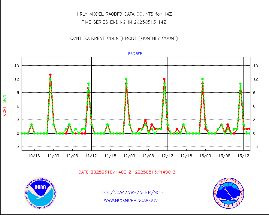
GPS radio occultation data |
499 |
515 |
96.9 % |
0111.50-0112.49 |
||||||||||
GOES-16/17 All Sky Radiances (proc.) |
720952 |
717948 |
100.4 % |
0113.50-0114.49 |
||||||||||
GOES-16/17 Clear Sky Radiances (proc.) |
353135 |
357035 |
98.9 % |
0113.50-0114.49 |
||||||||||
MTSAT/JMA water vapor imager derived cloud motion |
21419 |
19312 |
110.9 % |
0111.50-0112.49 |
||||||||||
MODIS (AQUA/TERRA) wvpr imager derived cld motion |
0 |
0 |
n/a |
0110.00-0110.99 |
||||||||||
GOES-16&up/NESDIS wv imgr/cld-top derived cld mtn |
21910 |
24559 |
89.2 % |
0113.00-0113.99 |
||||||||||
METEOSAT/EUMETSAT ir lg-wave drv cld motion NBseq |
22440 |
20657 |
108.6 % |
0112.50-0113.49 |
||||||||||
MTSAT/JMA infrared long-wave derived cloud motion |
16684 |
15777 |
105.7 % |
0111.50-0112.49 |
||||||||||
MODIS (AQUA/TERRA) ir l-wave derived cloud motion |
0 |
0 |
n/a |
0110.00-0110.99 |
||||||||||
GOES-16&up/NESDIS ir long-wave derived cld motion |
82008 |
84529 |
97.0 % |
0113.00-0113.99 |
||||||||||
GOES/NASA(Langley) hi-res. (1x1 f-o-v) cloud data |
6444487 |
6431207 |
100.2 % |
0113.50-0114.49 |
||||||||||
Buoys decoded from FM-13 format (moored) |
123 |
128 |
96.1 % |
0113.50-0114.49 |
||||||||||
Aviation - METAR |
8000 |
7943 |
100.7 % |
0113.50-0114.49 |
||||||||||
Mesonet/MADIS Colorado E-470 (Interstate 470) |
24 |
24 |
100.0 % |
0113.50-0114.49 |
||||||||||
Mesonet/MADIS Alaska Department of Transportation |
119 |
90 |
132.2 % |
0113.50-0114.49 |
||||||||||
Mesonet/MADIS U.S. Army Aberdeen Proving Grounds |
0 |
0 |
n/a |
0113.50-0114.49 |
||||||||||
Mesonet/MADIS Citizen Weather Observers Program |
59616 |
60576 |
98.4 % |
0113.50-0114.49 |
||||||||||
Mesonet/MADIS AWS Convergence Technologies, Inc. |
19376 |
20516 |
94.4 % |
0113.50-0114.49 |
||||||||||
Mesonet/MADIS "Anything Weather" |
0 |
0 |
n/a |
0113.50-0114.49 |
||||||||||
Mesonet/MADIS Colorado Dept. of Transportation |
0 |
0 |
n/a |
0113.50-0114.49 |
||||||||||
Mesonet/MADIS DC Net |
0 |
0 |
n/a |
0113.50-0114.49 |
||||||||||
Mesonet/MADIS Denver Urban Drainage & Flood Cntrl |
0 |
0 |
n/a |
0113.50-0114.49 |
||||||||||
Mesonet/MADIS Florida (FAWN & USF) |
3 |
4 |
75.0 % |
0113.50-0114.49 |
||||||||||
Mesonet/MADIS Florida Dept. of Transportation |
0 |
0 |
n/a |
0113.50-0114.49 |
||||||||||
Mesonet/MADIS Georgia Dept. of Transportation |
0 |
0 |
n/a |
0113.50-0114.49 |
||||||||||
Mesonet/MADIS NWS Hydromet Auto Data System(HADS) |
6316 |
6004 |
105.2 % |
0113.50-0114.49 |
||||||||||
Mesonet/MADIS Iowa Environmental |
186 |
183 |
101.6 % |
0113.50-0114.49 |
||||||||||
Mesonet/MADIS Indiana Dept. of Transportation |
0 |
0 |
n/a |
0113.50-0114.49 |
||||||||||
Mesonet/MADIS Iowa Department of Transportation |
0 |
0 |
n/a |
0113.50-0114.49 |
||||||||||
Mesonet/MADIS Kansas Department of Transportation |
381 |
358 |
106.4 % |
0113.50-0114.49 |
||||||||||
Mesonet/MADIS Oklahoma Mesonet |
630 |
616 |
102.3 % |
0113.50-0114.49 |
||||||||||
Mesonet/MADIS Louisiana State/Jackson State Univ. |
0 |
0 |
n/a |
0113.50-0114.49 |
||||||||||
Mesonet/MADIS Missouri Commercial Agricult Wx Net |
334 |
324 |
103.1 % |
0113.50-0114.49 |
||||||||||
Mesonet/MADIS Minnesota Dept. of Transportation |
0 |
0 |
n/a |
0113.50-0114.49 |
||||||||||
Mesonet/MADIS NOS-Phys Oceanographic Realtime Sys |
394 |
365 |
107.9 % |
0113.50-0114.49 |
||||||||||
Mesonet/MADIS NFIC Remote Automated Wx Stns(RAWS) |
1931 |
1814 |
106.4 % |
0113.50-0114.49 |
||||||||||
Mesonet/MADIS many providers, not separated out |
69868 |
71659 |
97.5 % |
0113.00-0114.49 |
||||||||||
Mesonet/MADIS Virginia Dept. of Transportation |
0 |
0 |
n/a |
0113.50-0114.49 |
||||||||||
Mesonet/MADIS "Weather for You" |
0 |
0 |
n/a |
0113.50-0114.49 |
||||||||||
Mesonet/MADIS Wisconsin Dept. of Transportation |
0 |
0 |
n/a |
0113.50-0114.49 |
||||||||||
Mesonet/MADIS MesoWest (many subproviders) |
34972 |
35816 |
97.6 % |
0113.50-0114.49 |
||||||||||
Mesonet/MADIS West Texas |
5858 |
5920 |
99.0 % |
0113.50-0114.49 |
||||||||||
METOP 1-2 IASI 1C radiance data (varbl. channels) |
106920 |
88585 |
120.7 % |
0112.00-0112.99 |
||||||||||
NEXRAD Vel Azm Dsp(VAD) winds via radar coded msg |
0 |
0 |
n/a |
0113.50-0114.49 |
||||||||||
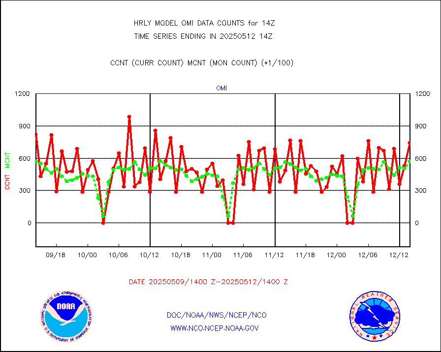
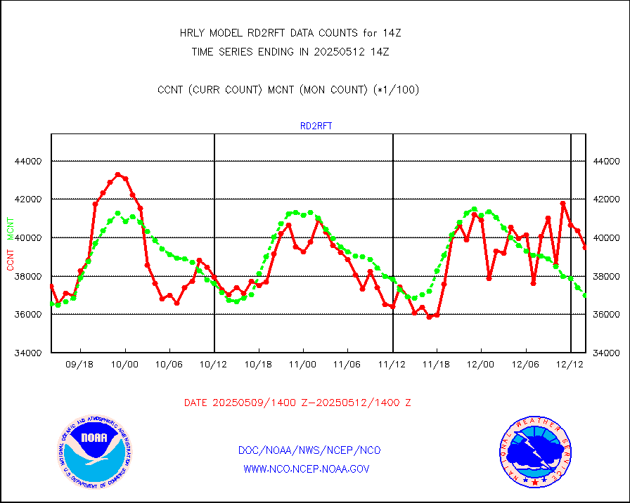
Aura Ozone Monitoring Instrument (OMI) data |
0 |
0 |
n/a |
0111.50-0112.49 |
||||||||||
NOAA 16-19 Solar Backscatter UV-2 rad frm V8 BUFR |
0 |
0 |
n/a |
0112.00-0112.99 |
||||||||||
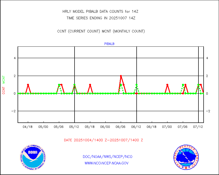
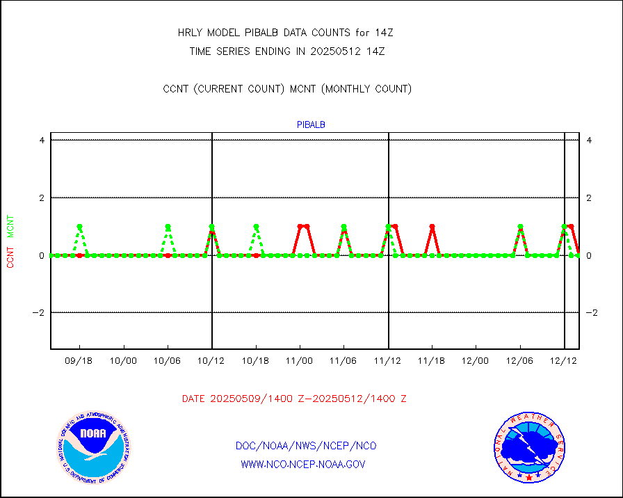
PIBAL (from PILOT, PILOT SHIP, PILOT MOBIL) |
0 |
0 |
n/a |
0113.50-0114.49 |
||||||||||
Multi-Agency Profiler (MAP) and SODAR winds |
45 |
45 |
100.0 % |
0113.50-0114.49 |
||||||||||
Rawinsonde - fixed land (from TEMP or PILOT) |
0 |
0 |
n/a |
0113.50-0114.49 |
||||||||||
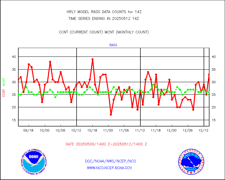
RASS temperatures (NOAA and Multi-Agency) |
18 |
27 |
66.7 % |
0113.50-0114.49 |
||||||||||
NEXRAD reflectivity (Lvl 2 - GTS) |
4107671 |
3985615 |
103.1 % |
0113.50-0114.49 |
||||||||||
NEXRAD radial wind (Level 2 - GTS) |
1472194 |
1183612 |
124.4 % |
0113.50-0114.49 |
||||||||||
METEOSAT-10 2nd Gen SEVIRI Clr Sky Radiance(proc) |
0 |
0 |
n/a |
0113.50-0114.49 |
||||||||||
Ship - manual and automatic, restricted (BUFR) |
0 |
0 |
n/a |
0113.50-0114.50 |
||||||||||
Ship - manual and automatic, unrestricted |
199 |
186 |
107.0 % |
0113.50-0114.50 |
||||||||||
Ship - manual and automatic, unrestricted (BUFR) |
1015 |
1000 |
101.5 % |
0113.50-0114.50 |
||||||||||
Synoptic - fixed manual and automatic |
788 |
734 |
107.4 % |
0113.50-0114.49 |
||||||||||
Synoptic - fixed manual & auto (decoded fr BUFR) |
5268 |
5207 |
101.2 % |
0113.50-0114.49 |
||||||||||
Synoptic - restricted (WMO Res 40) manual & auto. |
0 |
1 |
0.0 % |
0113.50-0114.49 |
||||||||||
Synoptic - restricted (WMO Res 40)(decoded BUFR) |
401 |
419 |
95.7 % |
0113.50-0114.49 |
||||||||||
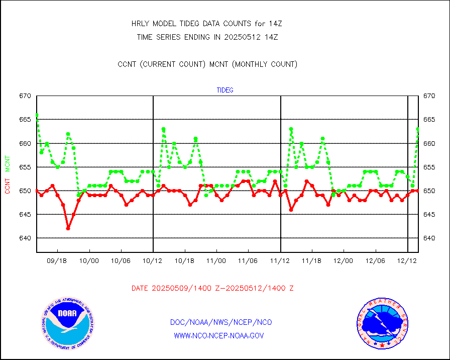
Tide gauge reports decoded from CREX format |
659 |
657 |
100.3 % |
0113.00-0113.99 |
||||||||||
| Data Types of Opportunity with Normal Counts | ||||||||||||||
|---|---|---|---|---|---|---|---|---|---|---|---|---|---|---|
| Type | Description | Hourly Count | Monthly Average | Percent (%) of Monthly Mean | UTC Time Window | |||||||||
GOES-16&up/NESDIS ir short-wv derived cld motion |
35823 |
34654 |
103.4 % |
0113.00-0113.99 |
||||||||||
MDCRS ACARS acft data (ARINC via AFWA)(AIREP fmt) |
0 |
0 |
n/a |
0113.50-0114.49 |
||||||||||
Himawari Clear Sky Radiance |
0 |
0 |
n/a |
0113.00-0113.99 |
||||||||||
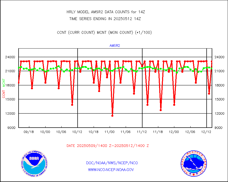
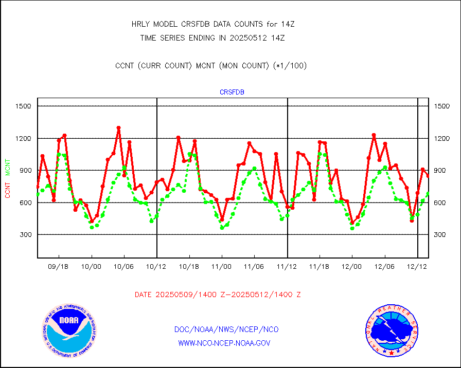
GCOM-W AMSR2 1B brightness temperatures |
2310444 |
2158456 |
107.0 % |
0112.00-0112.99 |
||||||||||
NPP/NOAA-20 ATMS bright. temps-direct b-cast SSEC |
76255 |
104405 |
73.0 % |
0112.50-0113.49 |
||||||||||
POES/NESDIS - processed ATOVS soundings/radiances |
0 |
0 |
n/a |
0112.00-0112.99 |
||||||||||
A.M.(N17,M2,M3) AVHRR GAC NCEP-proc clr&sea btmps |
1238945 |
1278350 |
96.9 % |
0111.50-0112.49 |
||||||||||
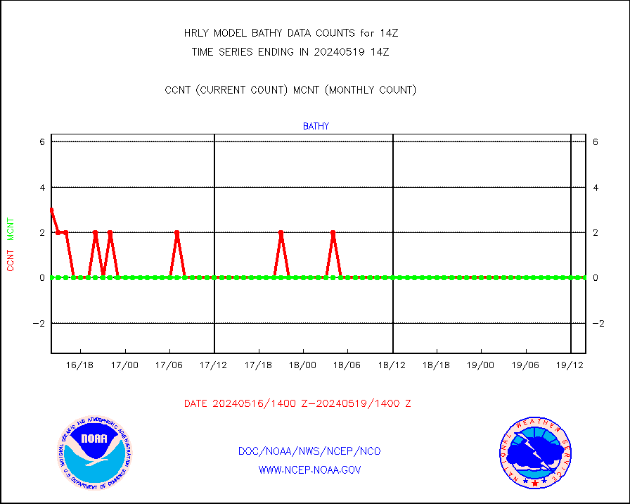
eXpendable BathyThermograph, mooring (BATHY fmt) |
0 |
0 |
n/a |
0107.00-0107.99 |
||||||||||
Coop/MADIS NEPP & HCN-Modernization NOAA COOP Obs |
11 |
11 |
100.0 % |
0113.50-0114.49 |
||||||||||
NPP/NOAA-20 CrIS full spctrl radn (431 ch subset) |
240534 |
229247 |
104.9 % |
0112.50-0113.49 |
||||||||||
NPP/NOAA-20 CrIS full spctrl radn dir brdcst SSEC |
48780 |
39801 |
122.6 % |
0112.50-0113.49 |
||||||||||
Coast Guard |
7 |
7 |
100.0 % |
0113.50-0114.50 |
||||||||||
Drifting buoys (decoded from BUFR) |
1435 |
1411 |
101.7 % |
0113.50-0114.50 |
||||||||||
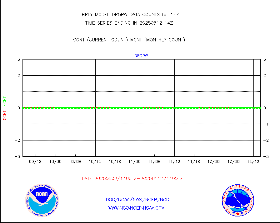
Dropwinsonde (from TEMP DROP) |
0 |
0 |
n/a |
0113.50-0114.49 |
||||||||||
Dropwinsonde (decoded from BUFR) |
1 |
1 |
100.0 % |
0113.51-0114.49 |
||||||||||
GOES imager effective cloud amount data (U.Wisc.) |
8535568 |
7445161 |
114.6 % |
0113.50-0114.49 |
||||||||||
METOP 1-2 IASI 1C radiance data vbl chn from RARS |
28033 |
32848 |
85.3 % |
0113.00-0113.99 |
||||||||||
NOAA 18-19 & METOP 1-2 MHS proc. btemps from RARS |
167025 |
209935 |
79.6 % |
0113.50-0114.49 |
||||||||||
GOES/NESDIS (11x17 f-o-v) imager clear radiances |
0 |
0 |
n/a |
0113.00-0113.99 |
||||||||||
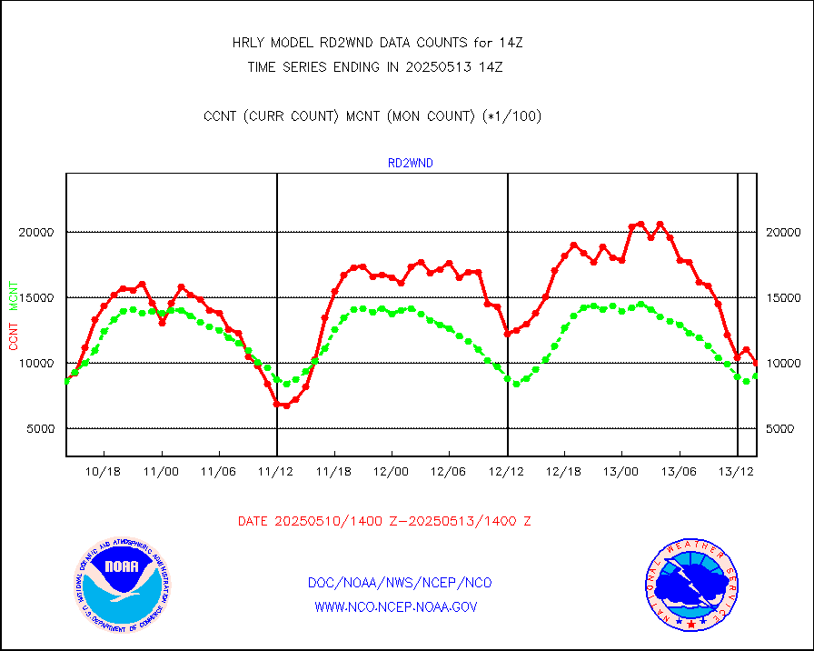
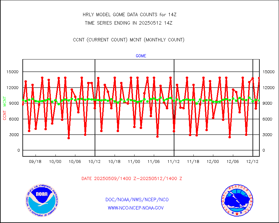
METOP 1-2 Global Ozone Monitoring Exp.-2 (GOME-2) |
9429 |
9679 |
97.4 % |
0112.50-0113.49 |
||||||||||
GOES-16&up/NESDIS wv imgr/deep-lyr derivd cld mtn |
20870 |
17443 |
119.6 % |
0113.00-0113.99 |
||||||||||
METEOSAT/EUMETSAT wvpr imgr drv cld motion NBseq |
36777 |
37103 |
99.1 % |
0112.50-0113.49 |
||||||||||
METOP 1-2 IASI 1C radiances-direct broadcast SSEC |
45744 |
51178 |
89.4 % |
0112.50-0113.49 |
||||||||||
VIIRS (NPP/NOAA-20) ir lg-wv drv cloud motion(NB) |
14170 |
17091 |
82.9 % |
0110.00-0110.99 |
||||||||||
AVHRR (NOAA/METOP) ir lg-wave derived cld motion |
0 |
0 |
n/a |
0110.00-0110.99 |
||||||||||
AVHRR (METOP) ir lg-wave derived cld motion |
0 |
0 |
n/a |
0113.50-0114.50 |
||||||||||
INSAT/KALPANA India ir lg-wave derived cld motion |
0 |
0 |
n/a |
0111.50-0112.49 |
||||||||||
Korean AMDAR aircraft data (decoded from BUFR) |
0 |
1 |
0.0 % |
0113.50-0114.49 |
||||||||||
Land-based CMAN stations decoded from CMAN format |
68 |
79 |
86.1 % |
0113.50-0114.49 |
||||||||||
LEO-GEO satellite AMVs from UWisc. |
7051 |
7552 |
93.4 % |
0110.00-0110.99 |
||||||||||
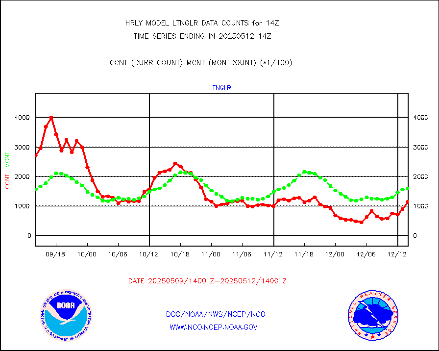
LLDN Long-rng lightning from Vaisala via NOAAPORT |
147091 |
151581 |
97.0 % |
0113.50-0114.49 |
||||||||||
NLDN Shrt-rng lightning from Vaisala via NOAAPORT |
3645 |
2834 |
128.6 % |
0113.50-0114.49 |
||||||||||
Moored buoys (decoded from BUFR) |
971 |
902 |
107.6 % |
0113.50-0114.50 |
||||||||||
Aura Microwave Limb Sounder (MLS) ozone data |
0 |
0 |
n/a |
0112.00-0112.99 |
||||||||||
Mesonet/MADIS UrbaNet |
3612 |
3487 |
103.6 % |
0113.50-0114.49 |
||||||||||
NEXRAD Vel Azm Dsp(VAD) winds via Level 2 decoder |
368 |
451 |
81.6 % |
0113.50-0114.49 |
||||||||||
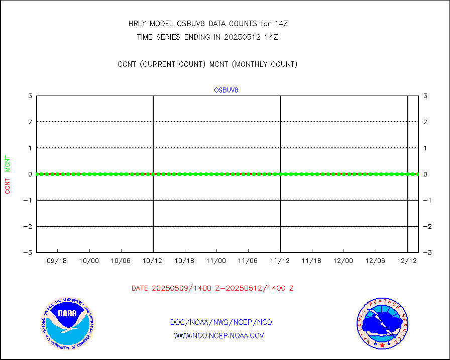
OMPS Limb Profiler ozone data (NPP) |
237 |
258 |
91.9 % |
0107.00-0107.99 |
||||||||||
OMPS nadir profile ozone (Version 8 BUFR) |
579 |
557 |
103.9 % |
0112.00-0112.99 |
||||||||||
OMPS total column ozone (Version 8 BUFR) |
515384 |
333428 |
154.6 % |
0112.00-0112.99 |
||||||||||
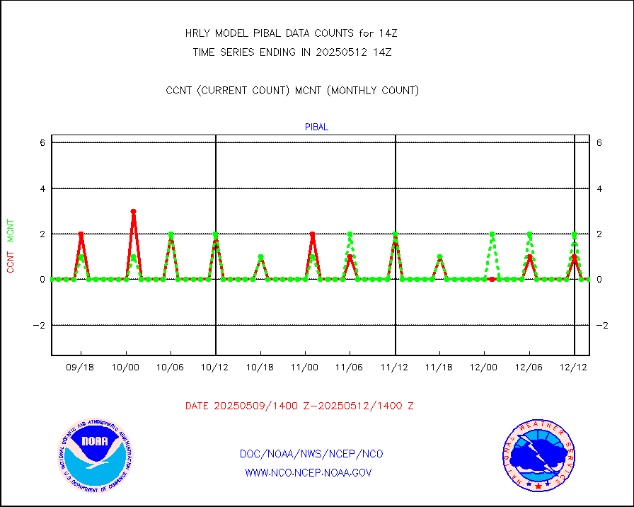
PIBAL (decoded from BUFR) |
0 |
0 |
n/a |
0113.51-0114.49 |
||||||||||
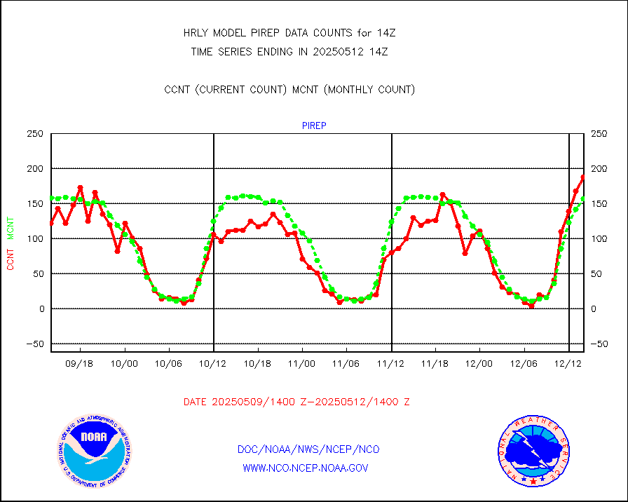
Manual PIREP aircraft data (dcded from AIREP fmt) |
108 |
135 |
80.0 % |
0113.50-0114.49 |
||||||||||
Profilr winds from PIBAL (PILOT,PILOT SHIP/MOBIL) |
0 |
0 |
n/a |
0113.50-0114.49 |
||||||||||
Rawinsonde - fixed land (decoded from BUFR) |
0 |
0 |
n/a |
0113.51-0114.49 |
||||||||||
Rawinsonde - mobile land (from TEMP/PILOT MOBIL) |
0 |
0 |
n/a |
0113.50-0114.49 |
||||||||||
Rawinsonde - mobile land (decoded from BUFR) |
0 |
0 |
n/a |
0113.51-0114.49 |
||||||||||
Rawinsonde - ship (from TEMP SHIP, PILOT SHIP) |
0 |
0 |
n/a |
0113.50-0114.49 |
||||||||||
Rawinsonde - ship (decoded from BUFR) |
0 |
0 |
n/a |
0113.51-0114.49 |
||||||||||
Flight level reconnaissance aircraft data |
0 |
0 |
n/a |
0113.50-0114.49 |
||||||||||
Megha-Tropiques SAPHIR L1A2 brightness temps |
0 |
0 |
n/a |
0111.50-0112.49 |
||||||||||
METEOSAT-10 2nd Gen SEVIRI All Sky Radiance(proc) |
75512 |
72935 |
103.5 % |
0113.50-0114.49 |
||||||||||
Ship - manual and automatic, restricted |
4 |
10 |
40.0 % |
0113.50-0114.49 |
||||||||||
DMSP SSM/IS 1C radiance data (Unified Pre-Proc.) |
6060 |
111106 |
5.5 % |
0112.50-0113.49 |
||||||||||
NPP/NOAA-20 VIIRS SST - CLEAR & OVER WATER |
45065 |
2247879 |
2.0 % |
0113.50-0114.49 |
||||||||||
NPP/NOAA-20 VIIRS SST - PROBABLY CLR & OVER WATER |
17234 |
590741 |
2.9 % |
0113.50-0114.49 |
||||||||||
Synoptic - mobile manual and automatic |
644 |
662 |
97.3 % |
0113.50-0114.49 |
||||||||||
Synoptic - mobile manual & auto (decoded fr BUFR) |
1 |
1 |
100.0 % |
0113.50-0114.49 |
||||||||||
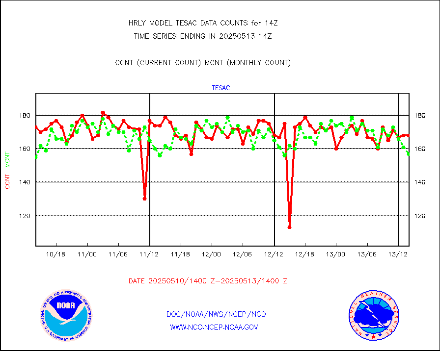
CTD probe, Argo prflng float, mooring (TESAC fmt) |
219 |
207 |
105.8 % |
0113.50-0114.49 |
||||||||||
TAMDAR aircft data-all types(from Panasonic,BUFR) |
80 |
51 |
156.9 % |
0113.50-0114.49 |
||||||||||
ThermoSalinoGraph (TSG) TRACKOB format) |
43 |
76 |
56.6 % |
0112.50-0113.49 |
||||||||||
INSAT/KALPANA India visible derived cloud motion |
0 |
0 |
n/a |
0111.50-0112.49 |
||||||||||
MTSAT/JMA visible derived cloud motion |
201 |
169 |
118.9 % |
0111.50-0112.49 |
||||||||||
GOES-16&up/NESDIS visible derived cloud motion |
135894 |
108389 |
125.4 % |
0113.00-0113.99 |
||||||||||
METEOSAT/EUMETSAT visible drv cld motion NBseq |
42126 |
38410 |
109.7 % |
0112.50-0113.49 |
||||||||||


