| Suspect Data Shortages in Critical Types - Monitor | ||||||||||||||
|---|---|---|---|---|---|---|---|---|---|---|---|---|---|---|
| Type | Description | Hourly Count | Monthly Average | Percent (%) of Monthly Mean | UTC Time Window | |||||||||
NOAA 18-19 & METOP 1-2 HIRS-4 NCEP-proc. br.temps |
0 |
7450 |
0.0 % |
0110.00-0115.99 |
||||||||||
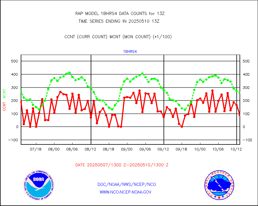
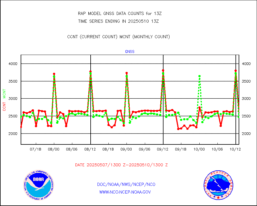
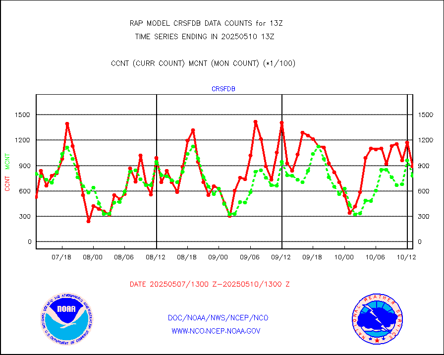
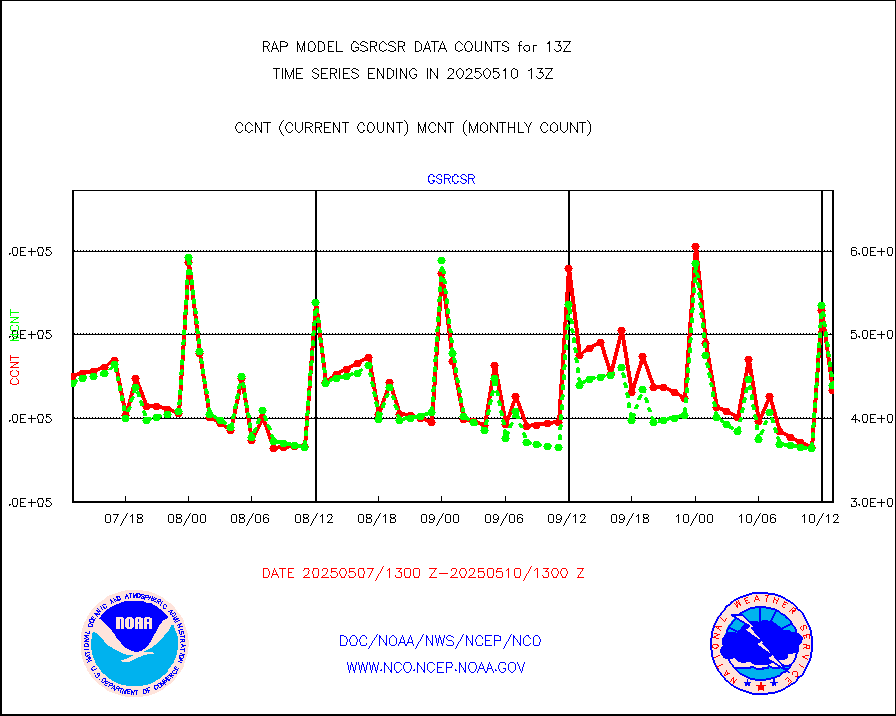
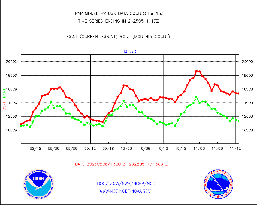
Grnd-based Gbl Navigation Sat System (GNSS) data |
697 |
2113 |
33.0 % |
0111.95-0112.05 |
||||||||||
| Shortage in Data Type of Opportunity - Monitor | ||||||||||||||
|---|---|---|---|---|---|---|---|---|---|---|---|---|---|---|
| Type | Description | Hourly Count | Monthly Average | Percent (%) of Monthly Mean | UTC Time Window | |||||||||
NPP Adv. Tech. MW Sndr (ATMS) br. temps from RARS |
0 |
7283 |
0.0 % |
0111.00-0114.99 |
||||||||||
NOAA 15-19 & METOP 1-2 HIRS-3/4 pr btmps frm RARS |
0 |
4184 |
0.0 % |
0112.00-0114.00 |
||||||||||
| Critical Data with Normal Counts | ||||||||||||||
|---|---|---|---|---|---|---|---|---|---|---|---|---|---|---|
| Type | Description | Hourly Count | Monthly Average | Percent (%) of Monthly Mean | UTC Time Window | |||||||||
NOAA 15-19 & METOP 1-2 AMSU-A NCEP-proc. br.temps |
10776 |
19180 |
56.2 % |
0110.00-0115.99 |
||||||||||
NOAA 18-19 & METOP 1-2 MHS NCEP-proces. br. temps |
95677 |
146066 |
65.5 % |
0110.00-0115.99 |
||||||||||
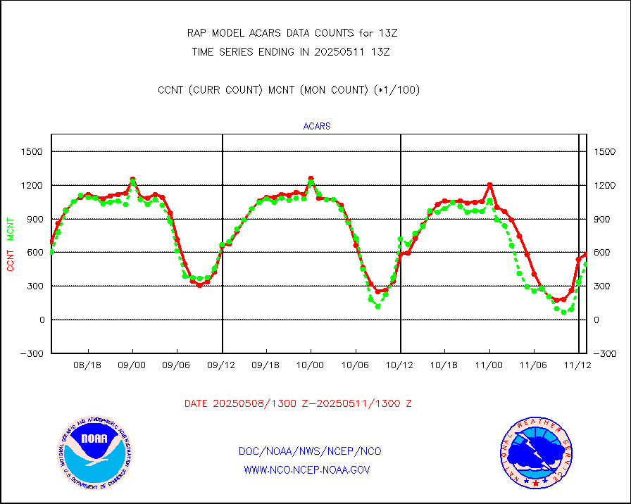
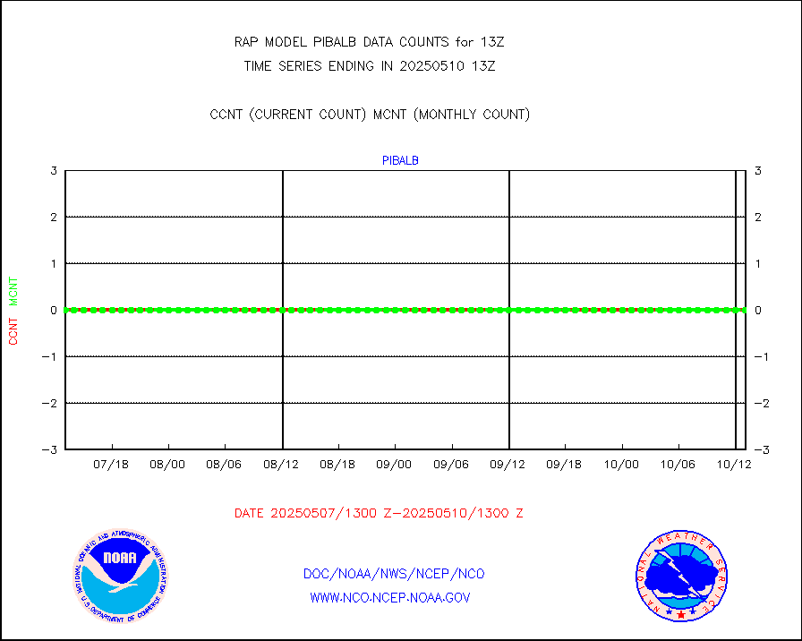
MDCRS ACARS acft data from ARINC(dcded from BUFR) |
70982 |
74304 |
95.5 % |
0109.75-0116.25 |
||||||||||
Canadian AMDAR aircraft data (decoded from BUFR) |
0 |
0 |
n/a |
0109.75-0116.25 |
||||||||||
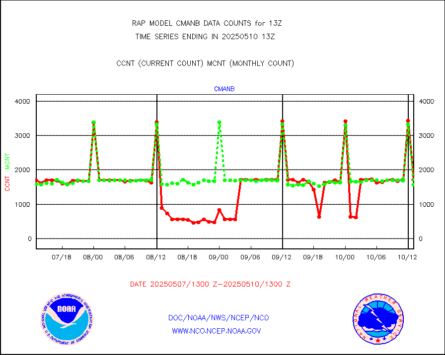
Surface Marine CMAN rpts decoded from BUFR format |
1733 |
1706 |
101.6 % |
0112.50-0113.50 |
||||||||||
Buoys decoded from FM-18 fmt (moored or drifting) |
0 |
0 |
n/a |
0112.50-0113.50 |
||||||||||
MODIS (AQUA/TERRA) wvpr imager derived cld motion |
0 |
0 |
n/a |
0110.50-0115.50 |
||||||||||
MODIS (AQUA/TERRA) ir l-wave derived cloud motion |
0 |
0 |
n/a |
0110.50-0115.50 |
||||||||||
GOES/NASA(Langley) hi-res. (1x1 f-o-v) cloud data |
3878668 |
3693853 |
105.0 % |
0112.50-0113.50 |
||||||||||
Buoys decoded from FM-13 format (moored) |
118 |
133 |
88.7 % |
0112.50-0113.50 |
||||||||||
Aviation - METAR |
5825 |
5852 |
99.5 % |
0112.50-0113.50 |
||||||||||
NEXRAD Vel Azm Dsp(VAD) winds via radar coded msg |
0 |
0 |
n/a |
0112.00-0114.00 |
||||||||||
Multi-Agency Profiler (MAP) and SODAR winds |
102 |
97 |
105.2 % |
0111.50-0114.50 |
||||||||||
Rawinsonde - fixed land (from TEMP or PILOT) |
147 |
149 |
98.7 % |
0112.00-0114.00 |
||||||||||
RASS temperatures (NOAA and Multi-Agency) |
16 |
24 |
66.7 % |
0112.50-0113.50 |
||||||||||
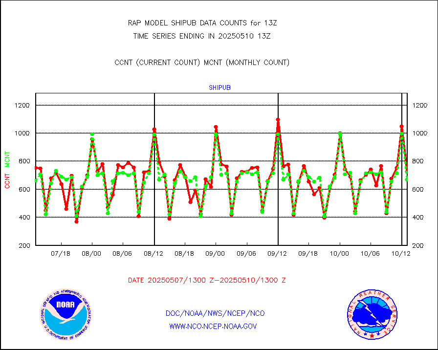
Ship - manual and automatic, restricted (BUFR) |
6 |
9 |
66.7 % |
0112.50-0113.50 |
||||||||||
Ship - manual and automatic, unrestricted |
104 |
86 |
120.9 % |
0112.50-0113.50 |
||||||||||
Ship - manual and automatic, unrestricted (BUFR) |
751 |
740 |
101.5 % |
0112.50-0113.50 |
||||||||||
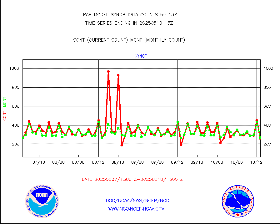
Synoptic - fixed manual and automatic |
280 |
272 |
102.9 % |
0112.50-0113.50 |
||||||||||
Synoptic - fixed manual & auto (decoded fr BUFR) |
2009 |
1917 |
104.8 % |
0112.50-0113.50 |
||||||||||
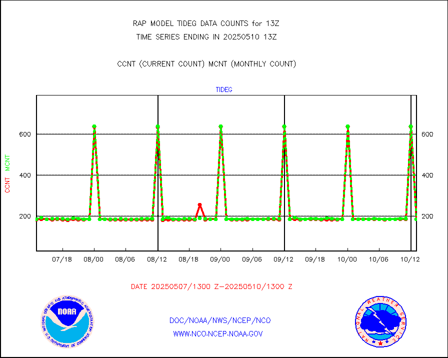
Tide gauge reports decoded from CREX format |
186 |
186 |
100.0 % |
0112.50-0113.50 |
||||||||||
| Data Types of Opportunity with Normal Counts | ||||||||||||||
|---|---|---|---|---|---|---|---|---|---|---|---|---|---|---|
| Type | Description | Hourly Count | Monthly Average | Percent (%) of Monthly Mean | UTC Time Window | |||||||||
GOES-16&up/NESDIS ir short-wv derived cld motion |
8998 |
9600 |
93.7 % |
0112.00-0112.99 |
||||||||||
MDCRS ACARS acft data (ARINC via AFWA)(AIREP fmt) |
0 |
0 |
n/a |
0109.75-0116.25 |
||||||||||
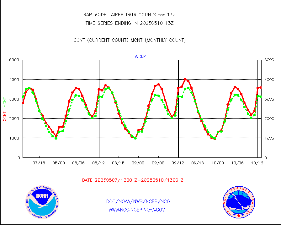
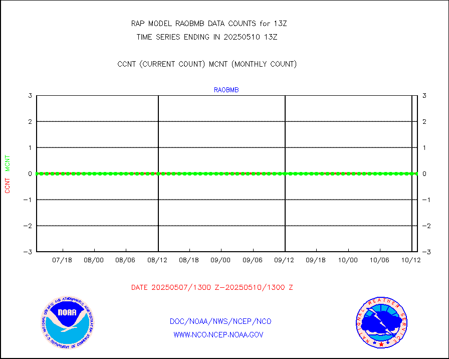
Manual AIREP aircraft data (dcded from AIREP fmt) |
3250 |
3161 |
102.8 % |
0109.75-0116.25 |
||||||||||
AQUA AIRS/AMSU-A/HSB brightness temps- every FOV |
0 |
0 |
n/a |
0110.00-0115.99 |
||||||||||
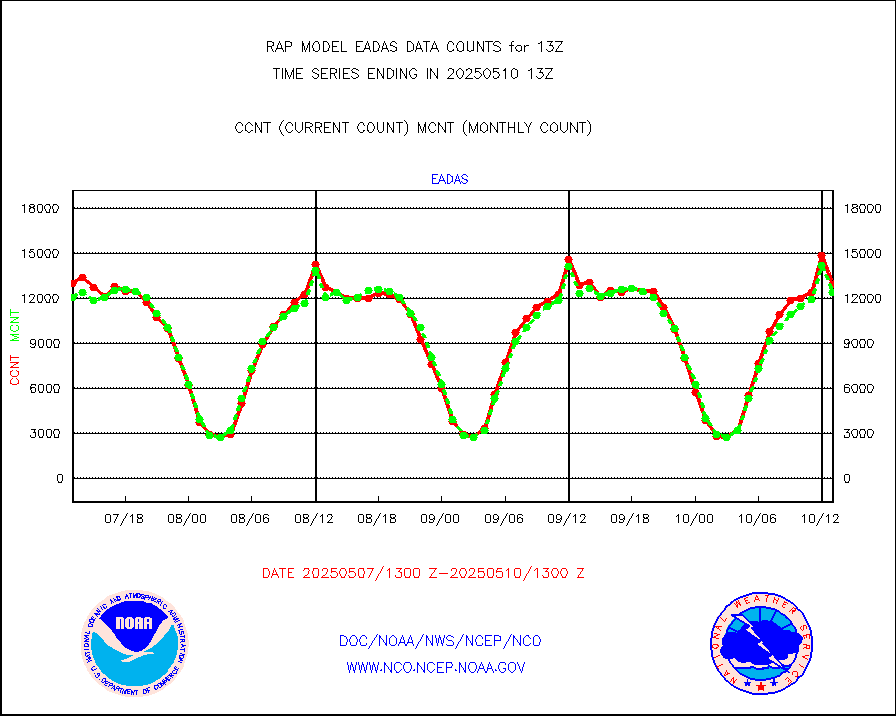
AMDAR aircraft data (decoded from AMDAR format) |
2144 |
1577 |
136.0 % |
0109.75-0116.25 |
||||||||||
AMDAR aircraft data (decoded from BUFR) |
9197 |
9759 |
94.2 % |
0109.75-0116.25 |
||||||||||
GCOM-W AMSR2 1B brightness temperatures |
604940 |
689206 |
87.8 % |
0110.00-0110.99 |
||||||||||
METOP 1-2 ASCAT products |
3585 |
18760 |
19.1 % |
0111.00-0115.00 |
||||||||||
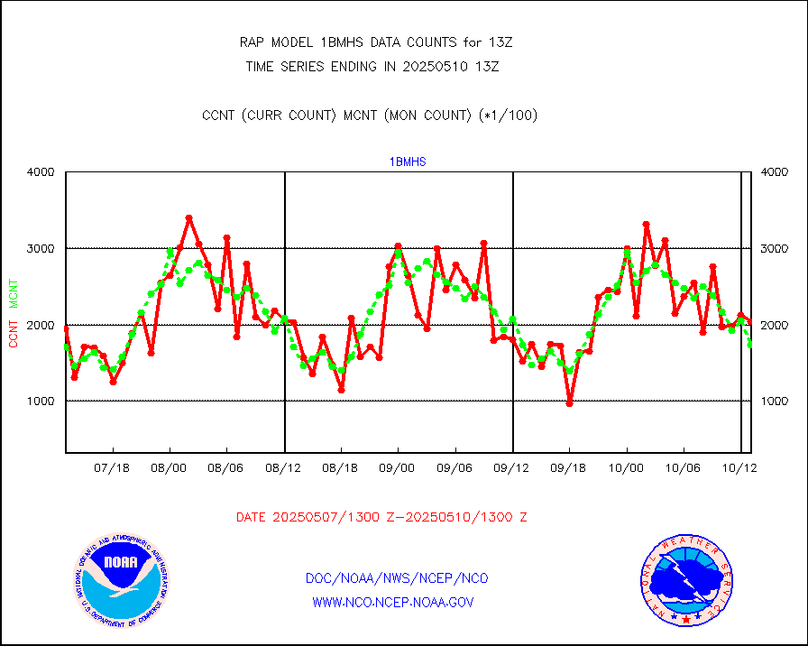
NPP/NOAA-20 ATMS brightness temperatures |
232255 |
210176 |
110.5 % |
0111.00-0114.99 |
||||||||||
NPP/NOAA-20 ATMS bright. temps-direct b-cast SSEC |
96405 |
92092 |
104.7 % |
0111.00-0114.99 |
||||||||||
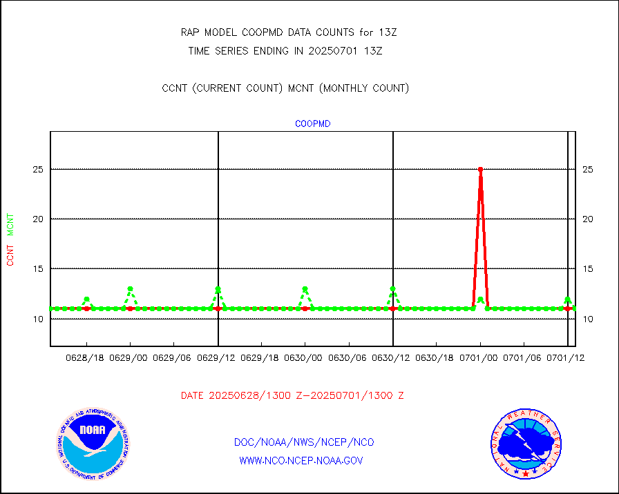
Coop/MADIS NEPP & HCN-Modernization NOAA COOP Obs |
11 |
11 |
100.0 % |
0112.50-0113.50 |
||||||||||
NPP/NOAA-20 CrIS full spctrl radn (431 ch subset) |
152633 |
123764 |
123.3 % |
0111.00-0114.99 |
||||||||||
NPP/NOAA-20 CrIS full spctrl radn dir brdcst SSEC |
41850 |
38629 |
108.3 % |
0111.00-0114.99 |
||||||||||
Coast Guard |
5 |
5 |
100.0 % |
0112.50-0113.50 |
||||||||||
Drifting buoys (decoded from BUFR) |
537 |
535 |
100.4 % |
0112.50-0113.50 |
||||||||||
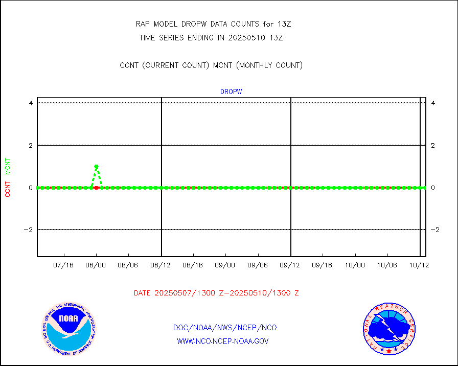
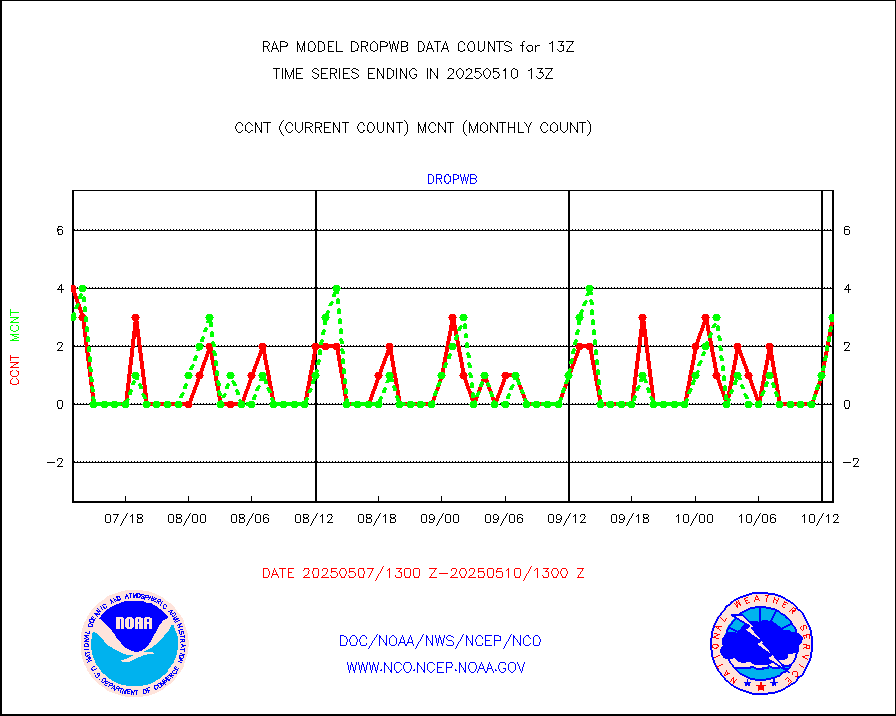
Dropwinsonde (from TEMP DROP) |
0 |
0 |
n/a |
0112.00-0114.00 |
||||||||||
Dropwinsonde (decoded from BUFR) |
5 |
4 |
125.0 % |
0112.00-0114.00 |
||||||||||
E-AMDAR (European AMDAR acft decoded from BUFR) |
11129 |
12043 |
92.4 % |
0109.75-0116.25 |
||||||||||
NOAA 15-19 & METOP 1-2 AMSU-A proc btmps frm RARS |
5002 |
6818 |
73.4 % |
0112.00-0114.00 |
||||||||||
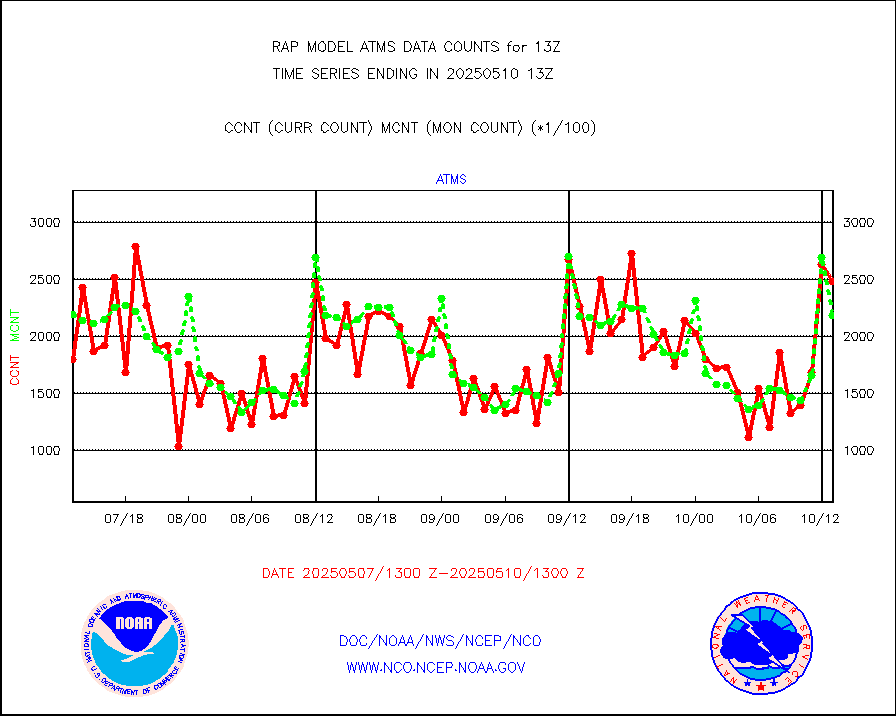
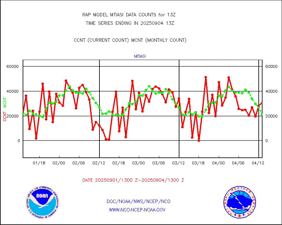
METOP 1-2 IASI 1C radiance data vbl chn from RARS |
8666 |
12133 |
71.4 % |
0111.00-0114.99 |
||||||||||
NOAA 18-19 & METOP 1-2 MHS proc. btemps from RARS |
45809 |
64368 |
71.2 % |
0112.00-0114.00 |
||||||||||
GPM GMI Level 1C-R brightness temperatures |
242546 |
224950 |
107.8 % |
0110.00-0115.99 |
||||||||||
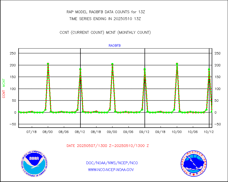
GPS radio occultation data |
165 |
131 |
126.0 % |
0111.00-0114.99 |
||||||||||
GOES-16/17 All Sky Radiances (proc.) |
959751 |
959749 |
100.0 % |
0111.00-0114.99 |
||||||||||
GOES-16/17 Clear Sky Radiances (proc.) |
466215 |
436947 |
106.7 % |
0111.00-0114.99 |
||||||||||
MTSAT/JMA water vapor imager derived cloud motion |
2204 |
2833 |
77.8 % |
0110.50-0115.50 |
||||||||||
GOES-16&up/NESDIS wv imgr/deep-lyr derivd cld mtn |
8628 |
7640 |
112.9 % |
0112.00-0112.99 |
||||||||||
METEOSAT/EUMETSAT wvpr imgr drv cld motion NBseq |
5154 |
5402 |
95.4 % |
0111.50-0114.49 |
||||||||||
GOES-16&up/NESDIS wv imgr/cld-top derived cld mtn |
12270 |
12278 |
99.9 % |
0112.00-0112.99 |
||||||||||
METOP 1-2 IASI 1C radiances-direct broadcast SSEC |
27101 |
31655 |
85.6 % |
0111.00-0114.99 |
||||||||||
METEOSAT/EUMETSAT ir lg-wave drv cld motion NBseq |
3015 |
3155 |
95.6 % |
0111.50-0114.49 |
||||||||||
VIIRS (NPP/NOAA-20) ir lg-wv drv cloud motion(NB) |
0 |
0 |
n/a |
0110.50-0115.50 |
||||||||||
AVHRR (NOAA/METOP) ir lg-wave derived cld motion |
0 |
0 |
n/a |
0110.50-0115.50 |
||||||||||
AVHRR (METOP) ir lg-wave derived cld motion |
0 |
0 |
n/a |
0111.50-0114.49 |
||||||||||
MTSAT/JMA infrared long-wave derived cloud motion |
2319 |
2314 |
100.2 % |
0110.50-0115.50 |
||||||||||
GOES-16&up/NESDIS ir long-wave derived cld motion |
29773 |
29164 |
102.1 % |
0112.00-0112.99 |
||||||||||
Korean AMDAR aircraft data (decoded from BUFR) |
211 |
261 |
80.8 % |
0109.75-0116.25 |
||||||||||
Land-based CMAN stations decoded from CMAN format |
47 |
58 |
81.0 % |
0112.50-0113.50 |
||||||||||
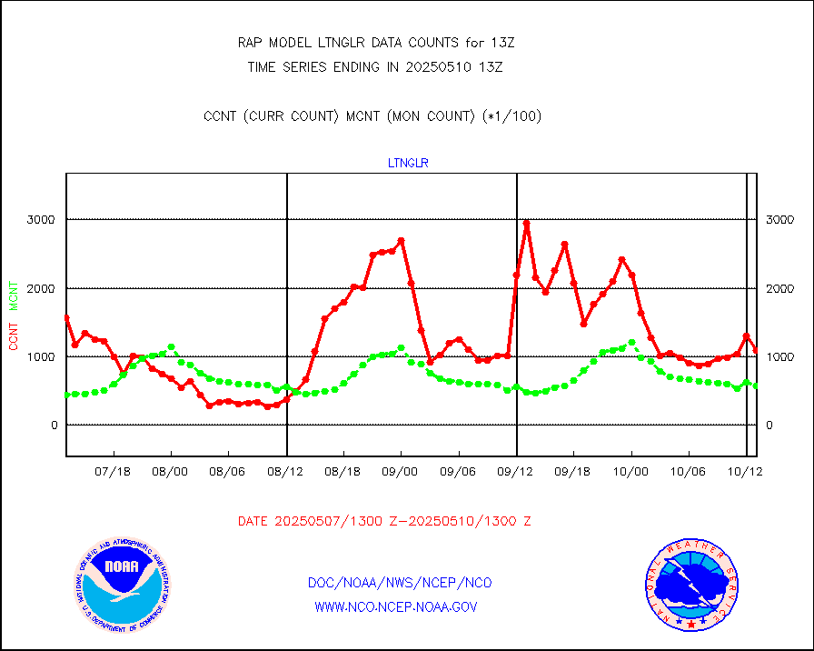
LLDN Long-rng lightning from Vaisala via NOAAPORT |
86146 |
103618 |
83.1 % |
0112.00-0113.50 |
||||||||||
NLDN Shrt-rng lightning from Vaisala via NOAAPORT |
5091 |
4833 |
105.3 % |
0112.00-0113.50 |
||||||||||
Moored buoys (decoded from BUFR) |
678 |
633 |
107.1 % |
0112.50-0113.50 |
||||||||||
Mesonet/MADIS Colorado E-470 (Interstate 470) |
24 |
24 |
100.0 % |
0112.50-0113.50 |
||||||||||
Mesonet/MADIS Alaska Department of Transportation |
119 |
84 |
141.7 % |
0112.50-0113.50 |
||||||||||
Mesonet/MADIS U.S. Army Aberdeen Proving Grounds |
0 |
0 |
n/a |
0112.50-0113.50 |
||||||||||
Mesonet/MADIS Citizen Weather Observers Program |
47907 |
57719 |
83.0 % |
0112.50-0113.50 |
||||||||||
Mesonet/MADIS AWS Convergence Technologies, Inc. |
16305 |
21057 |
77.4 % |
0112.50-0113.50 |
||||||||||
Mesonet/MADIS "Anything Weather" |
0 |
0 |
n/a |
0112.50-0113.50 |
||||||||||
Mesonet/MADIS Colorado Dept. of Transportation |
0 |
0 |
n/a |
0112.50-0113.50 |
||||||||||
Mesonet/MADIS DC Net |
0 |
0 |
n/a |
0112.50-0113.50 |
||||||||||
Mesonet/MADIS Denver Urban Drainage & Flood Cntrl |
0 |
0 |
n/a |
0112.50-0113.50 |
||||||||||
Mesonet/MADIS Florida (FAWN & USF) |
2 |
3 |
66.7 % |
0112.50-0113.50 |
||||||||||
Mesonet/MADIS Florida Dept. of Transportation |
0 |
0 |
n/a |
0112.50-0113.50 |
||||||||||
Mesonet/MADIS Georgia Dept. of Transportation |
0 |
0 |
n/a |
0112.50-0113.50 |
||||||||||
Mesonet/MADIS NWS Hydromet Auto Data System(HADS) |
3657 |
4922 |
74.3 % |
0112.50-0113.50 |
||||||||||
Mesonet/MADIS Iowa Environmental |
157 |
158 |
99.4 % |
0112.50-0113.50 |
||||||||||
Mesonet/MADIS Indiana Dept. of Transportation |
0 |
0 |
n/a |
0112.50-0113.50 |
||||||||||
Mesonet/MADIS Iowa Department of Transportation |
0 |
0 |
n/a |
0112.50-0113.50 |
||||||||||
Mesonet/MADIS Kansas Department of Transportation |
280 |
317 |
88.3 % |
0112.50-0113.50 |
||||||||||
Mesonet/MADIS Oklahoma Mesonet |
525 |
560 |
93.8 % |
0112.50-0113.50 |
||||||||||
Mesonet/MADIS Louisiana State/Jackson State Univ. |
0 |
0 |
n/a |
0112.50-0113.50 |
||||||||||
Mesonet/MADIS Missouri Commercial Agricult Wx Net |
255 |
284 |
89.8 % |
0112.50-0113.50 |
||||||||||
Mesonet/MADIS Minnesota Dept. of Transportation |
0 |
0 |
n/a |
0112.50-0113.50 |
||||||||||
Mesonet/MADIS NOS-Phys Oceanographic Realtime Sys |
265 |
277 |
95.7 % |
0112.50-0113.50 |
||||||||||
Mesonet/MADIS NFIC Remote Automated Wx Stns(RAWS) |
1091 |
1413 |
77.2 % |
0112.50-0113.50 |
||||||||||
Mesonet/MADIS many providers, not separated out |
27308 |
38154 |
71.6 % |
0112.50-0113.50 |
||||||||||
Mesonet/MADIS UrbaNet |
2921 |
3025 |
96.6 % |
0112.50-0113.50 |
||||||||||
Mesonet/MADIS Virginia Dept. of Transportation |
0 |
0 |
n/a |
0112.50-0113.50 |
||||||||||
Mesonet/MADIS "Weather for You" |
0 |
0 |
n/a |
0112.50-0113.50 |
||||||||||
Mesonet/MADIS Wisconsin Dept. of Transportation |
0 |
0 |
n/a |
0112.50-0113.50 |
||||||||||
Mesonet/MADIS MesoWest (many subproviders) |
25613 |
36434 |
70.3 % |
0112.50-0113.50 |
||||||||||
Mesonet/MADIS West Texas |
5028 |
5154 |
97.6 % |
0112.50-0113.50 |
||||||||||
METOP 1-2 IASI 1C radiance data (varbl. channels) |
10661 |
22144 |
48.1 % |
0111.00-0114.99 |
||||||||||
NEXRAD Vel Azm Dsp(VAD) winds via Level 2 decoder |
770 |
697 |
110.5 % |
0112.00-0114.00 |
||||||||||
NOAA 16-19 Solar Backscatter UV-2 rad frm V8 BUFR |
0 |
0 |
n/a |
0111.00-0113.99 |
||||||||||
PIBAL (from PILOT, PILOT SHIP, PILOT MOBIL) |
0 |
0 |
n/a |
0112.00-0114.00 |
||||||||||
PIBAL (decoded from BUFR) |
0 |
0 |
n/a |
0112.00-0114.00 |
||||||||||
Manual PIREP aircraft data (dcded from AIREP fmt) |
321 |
339 |
94.7 % |
0109.75-0116.25 |
||||||||||
Profilr winds from PIBAL (PILOT,PILOT SHIP/MOBIL) |
0 |
0 |
n/a |
0111.50-0114.50 |
||||||||||
Rawinsonde - fixed land (decoded from BUFR) |
7 |
3 |
233.3 % |
0112.00-0114.00 |
||||||||||
Rawinsonde - mobile land (from TEMP/PILOT MOBIL) |
0 |
0 |
n/a |
0112.00-0114.00 |
||||||||||
Rawinsonde - mobile land (decoded from BUFR) |
0 |
0 |
n/a |
0112.00-0114.00 |
||||||||||
Rawinsonde - ship (from TEMP SHIP, PILOT SHIP) |
3 |
2 |
150.0 % |
0112.00-0114.00 |
||||||||||
Rawinsonde - ship (decoded from BUFR) |
0 |
0 |
n/a |
0112.00-0114.00 |
||||||||||
NEXRAD radial wind (Level 2 - GTS) |
993433 |
817134 |
121.6 % |
0112.50-0113.49 |
||||||||||
Flight level reconnaissance aircraft data |
0 |
0 |
n/a |
0112.00-0114.00 |
||||||||||
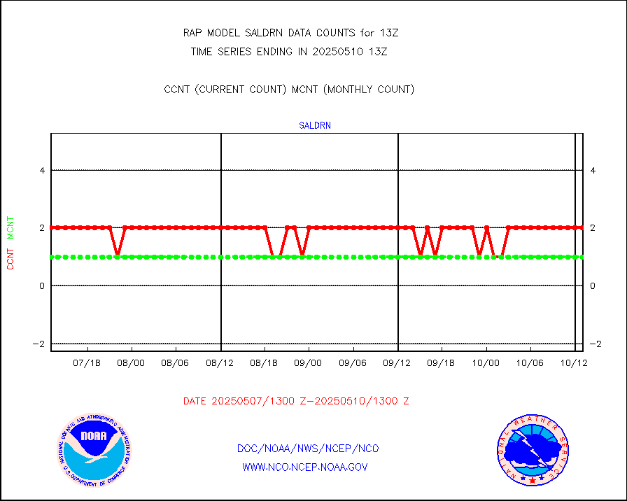
Surface Marine Saildrone (decoded from BUFR) |
2 |
2 |
100.0 % |
0111.00-0114.99 |
||||||||||
Megha-Tropiques SAPHIR L1A2 brightness temps |
0 |
0 |
n/a |
0110.00-0115.99 |
||||||||||
METEOSAT-10 2nd Gen SEVIRI All Sky Radiance(proc) |
9512 |
9348 |
101.8 % |
0111.00-0114.99 |
||||||||||
METEOSAT-10 2nd Gen SEVIRI Clr Sky Radiance(proc) |
0 |
0 |
n/a |
0111.00-0114.99 |
||||||||||
Ship - manual and automatic, restricted |
3 |
17 |
17.6 % |
0112.50-0113.50 |
||||||||||
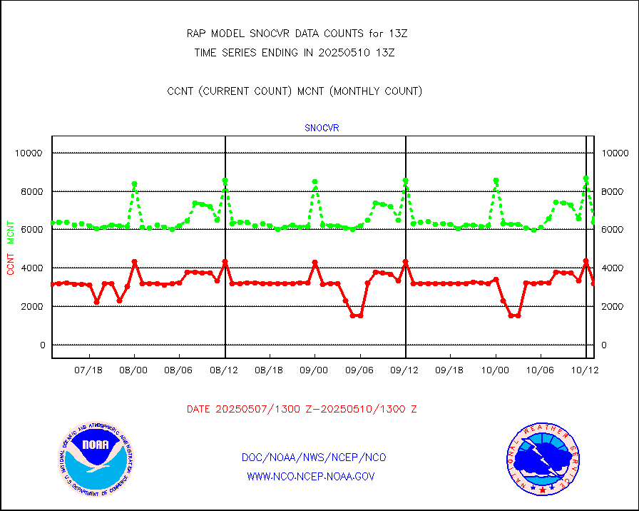
NOW COVER, DEPTH/DENSITY AND WATER EQUIVALENT |
3224 |
6046 |
53.3 % |
0111.00-0115.00 |
||||||||||
DMSP SSM/IS 1C radiance data (Unified Pre-Proc.) |
35444 |
28604 |
123.9 % |
0111.00-0114.99 |
||||||||||
Sub-surface float and glider profile (BUFR) |
2 |
2 |
100.0 % |
0111.00-0114.99 |
||||||||||
Synoptic - restricted (WMO Res 40) manual & auto. |
0 |
0 |
n/a |
0112.50-0113.50 |
||||||||||
Synoptic - restricted (WMO Res 40)(decoded BUFR) |
444 |
449 |
98.9 % |
0112.50-0113.50 |
||||||||||
Synoptic - mobile manual & auto (decoded fr BUFR) |
0 |
0 |
n/a |
0112.50-0113.50 |
||||||||||
TAMDAR aircft data-all types(from Panasonic,BUFR) |
299 |
197 |
151.8 % |
0109.75-0116.25 |
||||||||||
MTSAT/JMA visible derived cloud motion |
0 |
0 |
n/a |
0110.50-0115.50 |
||||||||||
GOES-16&up/NESDIS visible derived cloud motion |
33652 |
28504 |
118.1 % |
0112.00-0112.99 |
||||||||||
METEOSAT/EUMETSAT visible drv cld motion NBseq |
7206 |
7241 |
99.5 % |
0111.50-0114.49 |
||||||||||


