| Suspect Data Shortages in Critical Types - Monitor | ||||||||||||||
|---|---|---|---|---|---|---|---|---|---|---|---|---|---|---|
| Type | Description | Hourly Count | Monthly Average | Percent (%) of Monthly Mean | UTC Time Window | |||||||||
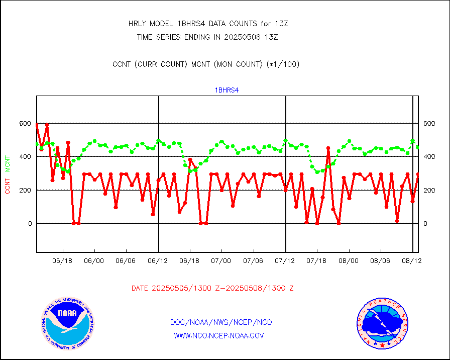
NOAA 18-19 & METOP 1-2 HIRS-4 NCEP-proc. br.temps |
0 |
13620 |
0.0 % |
0111.00-0111.99 |
||||||||||
NOAA 15-19 & METOP 1-2 HIRS-3/4 pr btmps frm RARS |
0 |
14038 |
0.0 % |
0112.50-0113.49 |
||||||||||
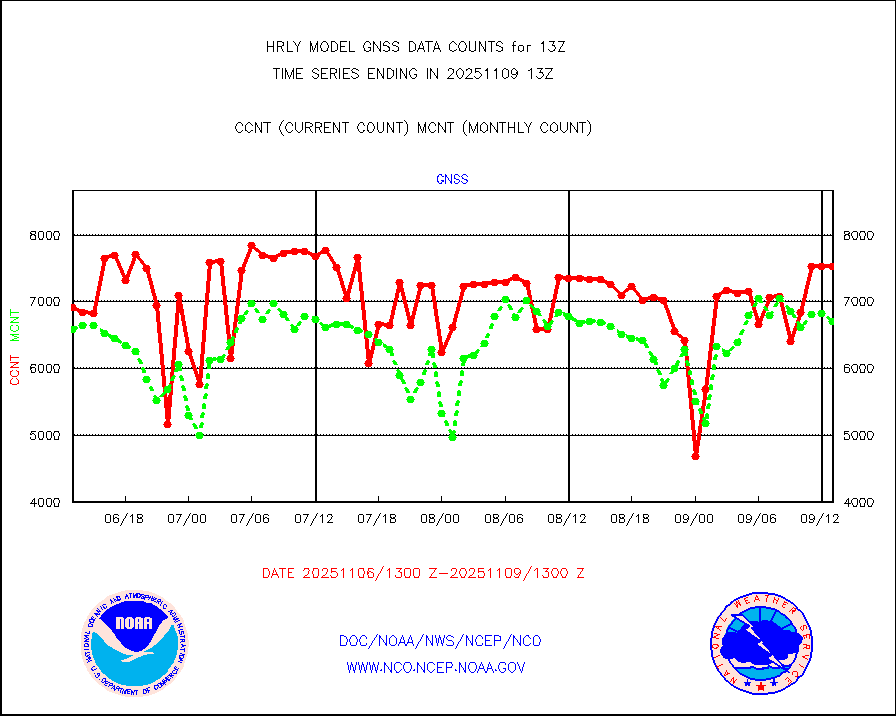
Grnd-based Gbl Navigation Sat System (GNSS) data |
1404 |
6674 |
21.0 % |
0112.00-0112.99 |
||||||||||
| Shortage in Data Type of Opportunity - Monitor | ||||||||||||||
|---|---|---|---|---|---|---|---|---|---|---|---|---|---|---|
| Type | Description | Hourly Count | Monthly Average | Percent (%) of Monthly Mean | UTC Time Window | |||||||||
P.M.(N18-19) AVHRR GAC NCEP-proc clr & sea btemps |
0 |
670545 |
0.0 % |
0110.50-0111.49 |
||||||||||
NPP Adv. Tech. MW Sndr (ATMS) br. temps from RARS |
0 |
6794 |
0.0 % |
0111.50-0112.49 |
||||||||||
INDIA SATWIND, INSAT WV channel |
0 |
913 |
0.0 % |
0112.00-0112.99 |
||||||||||
High Density OBs from reconnaissance acft data |
0 |
8 |
0.0 % |
0112.50-0113.49 |
||||||||||
INDIA SATWIND, INSAT IR channel |
0 |
918 |
0.0 % |
0112.00-0112.99 |
||||||||||
INDIA SATWIND, INSAT VIS channel |
0 |
30 |
0.0 % |
0112.00-0112.99 |
||||||||||
| Critical Data with Normal Counts | ||||||||||||||
|---|---|---|---|---|---|---|---|---|---|---|---|---|---|---|
| Type | Description | Hourly Count | Monthly Average | Percent (%) of Monthly Mean | UTC Time Window | |||||||||
NOAA 15-19 & METOP 1-2 AMSU-A NCEP-proc. br.temps |
21861 |
36618 |
59.7 % |
0111.00-0111.99 |
||||||||||
NOAA 18-19 & METOP 1-2 MHS NCEP-proces. br. temps |
195033 |
267861 |
72.8 % |
0111.00-0111.99 |
||||||||||
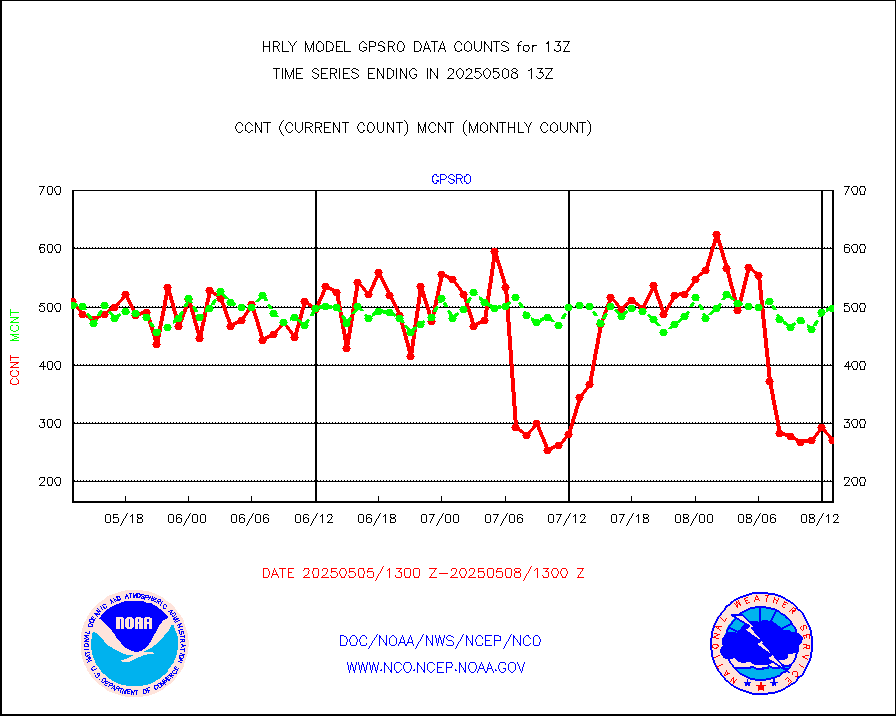
MDCRS ACARS acft data from ARINC(dcded from BUFR) |
20896 |
22445 |
93.1 % |
0112.50-0113.49 |
||||||||||
Manual AIREP aircraft data (dcded from AIREP fmt) |
1066 |
1015 |
105.0 % |
0112.50-0113.49 |
||||||||||
AQUA AIRS/AMSU-A/HSB brightness temps- every FOV |
0 |
0 |
n/a |
0110.50-0111.49 |
||||||||||
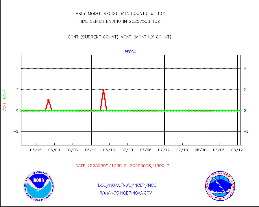
AMDAR aircraft data (decoded from AMDAR format) |
109 |
108 |
100.9 % |
0112.50-0113.49 |
||||||||||
AMDAR aircraft data (decoded from BUFR) |
1811 |
1968 |
92.0 % |
0112.50-0113.49 |
||||||||||
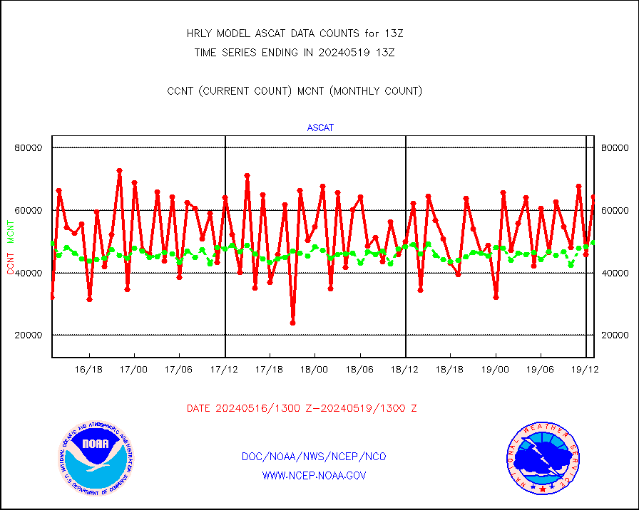
METOP 1-2 ASCAT products |
48132 |
59713 |
80.6 % |
0111.50-0112.49 |
||||||||||
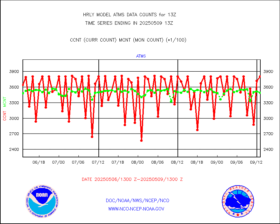
NPP/NOAA-20 ATMS brightness temperatures |
380352 |
345254 |
110.2 % |
0111.50-0112.49 |
||||||||||
Canadian AMDAR aircraft data (decoded from BUFR) |
0 |
0 |
n/a |
0112.50-0113.49 |
||||||||||
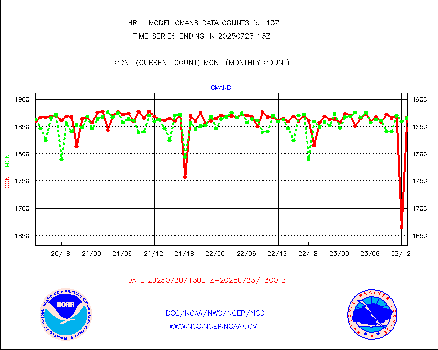
Surface Marine CMAN rpts decoded from BUFR format |
1869 |
1834 |
101.9 % |
0112.50-0113.50 |
||||||||||
Buoys decoded from FM-18 fmt (moored or drifting) |
7 |
12 |
58.3 % |
0112.50-0113.49 |
||||||||||
E-AMDAR (European AMDAR acft decoded from BUFR) |
2095 |
2320 |
90.3 % |
0112.50-0113.49 |
||||||||||
NOAA 15-19 & METOP 1-2 AMSU-A proc btmps frm RARS |
24958 |
22632 |
110.3 % |
0112.50-0113.49 |
||||||||||
GPS radio occultation data |
553 |
514 |
107.6 % |
0110.50-0111.49 |
||||||||||
GOES-16/17 All Sky Radiances (proc.) |
720952 |
720795 |
100.0 % |
0112.50-0113.49 |
||||||||||
GOES-16/17 Clear Sky Radiances (proc.) |
349497 |
352999 |
99.0 % |
0112.50-0113.49 |
||||||||||
MTSAT/JMA water vapor imager derived cloud motion |
21699 |
19655 |
110.4 % |
0110.50-0111.49 |
||||||||||
MODIS (AQUA/TERRA) wvpr imager derived cld motion |
0 |
0 |
n/a |
0109.00-0109.99 |
||||||||||
GOES-16&up/NESDIS wv imgr/cld-top derived cld mtn |
21612 |
24076 |
89.8 % |
0112.00-0112.99 |
||||||||||
METEOSAT/EUMETSAT ir lg-wave drv cld motion NBseq |
21865 |
21247 |
102.9 % |
0111.50-0112.49 |
||||||||||
MTSAT/JMA infrared long-wave derived cloud motion |
16705 |
16060 |
104.0 % |
0110.50-0111.49 |
||||||||||
MODIS (AQUA/TERRA) ir l-wave derived cloud motion |
0 |
0 |
n/a |
0109.00-0109.99 |
||||||||||
GOES-16&up/NESDIS ir long-wave derived cld motion |
81872 |
83120 |
98.5 % |
0112.00-0112.99 |
||||||||||
GOES/NASA(Langley) hi-res. (1x1 f-o-v) cloud data |
6423834 |
6106796 |
105.2 % |
0112.50-0113.49 |
||||||||||
Buoys decoded from FM-13 format (moored) |
123 |
125 |
98.4 % |
0112.50-0113.49 |
||||||||||
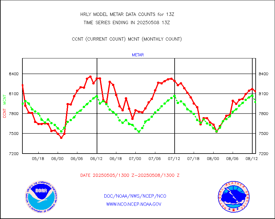
Aviation - METAR |
8013 |
7959 |
100.7 % |
0112.50-0113.49 |
||||||||||
Mesonet/MADIS Colorado E-470 (Interstate 470) |
24 |
24 |
100.0 % |
0112.50-0113.49 |
||||||||||
Mesonet/MADIS Alaska Department of Transportation |
119 |
92 |
129.3 % |
0112.50-0113.49 |
||||||||||
Mesonet/MADIS U.S. Army Aberdeen Proving Grounds |
0 |
0 |
n/a |
0112.50-0113.49 |
||||||||||
Mesonet/MADIS Citizen Weather Observers Program |
51724 |
62475 |
82.8 % |
0112.50-0113.49 |
||||||||||
Mesonet/MADIS AWS Convergence Technologies, Inc. |
16305 |
21132 |
77.2 % |
0112.50-0113.49 |
||||||||||
Mesonet/MADIS "Anything Weather" |
0 |
0 |
n/a |
0112.50-0113.49 |
||||||||||
Mesonet/MADIS Colorado Dept. of Transportation |
0 |
0 |
n/a |
0112.50-0113.49 |
||||||||||
Mesonet/MADIS DC Net |
0 |
0 |
n/a |
0112.50-0113.49 |
||||||||||
Mesonet/MADIS Denver Urban Drainage & Flood Cntrl |
0 |
0 |
n/a |
0112.50-0113.49 |
||||||||||
Mesonet/MADIS Florida (FAWN & USF) |
2 |
4 |
50.0 % |
0112.50-0113.49 |
||||||||||
Mesonet/MADIS Florida Dept. of Transportation |
0 |
0 |
n/a |
0112.50-0113.49 |
||||||||||
Mesonet/MADIS Georgia Dept. of Transportation |
0 |
0 |
n/a |
0112.50-0113.49 |
||||||||||
Mesonet/MADIS NWS Hydromet Auto Data System(HADS) |
3932 |
5962 |
66.0 % |
0112.50-0113.49 |
||||||||||
Mesonet/MADIS Iowa Environmental |
157 |
182 |
86.3 % |
0112.50-0113.49 |
||||||||||
Mesonet/MADIS Indiana Dept. of Transportation |
0 |
0 |
n/a |
0112.50-0113.49 |
||||||||||
Mesonet/MADIS Iowa Department of Transportation |
0 |
0 |
n/a |
0112.50-0113.49 |
||||||||||
Mesonet/MADIS Kansas Department of Transportation |
289 |
354 |
81.6 % |
0112.50-0113.49 |
||||||||||
Mesonet/MADIS Oklahoma Mesonet |
525 |
619 |
84.8 % |
0112.50-0113.49 |
||||||||||
Mesonet/MADIS Louisiana State/Jackson State Univ. |
0 |
0 |
n/a |
0112.50-0113.49 |
||||||||||
Mesonet/MADIS Missouri Commercial Agricult Wx Net |
327 |
328 |
99.7 % |
0112.50-0113.49 |
||||||||||
Mesonet/MADIS Minnesota Dept. of Transportation |
0 |
0 |
n/a |
0112.50-0113.49 |
||||||||||
Mesonet/MADIS NOS-Phys Oceanographic Realtime Sys |
279 |
361 |
77.3 % |
0112.50-0113.49 |
||||||||||
Mesonet/MADIS NFIC Remote Automated Wx Stns(RAWS) |
1305 |
1778 |
73.4 % |
0112.50-0113.49 |
||||||||||
Mesonet/MADIS many providers, not separated out |
61227 |
73614 |
83.2 % |
0112.00-0113.49 |
||||||||||
Mesonet/MADIS Virginia Dept. of Transportation |
0 |
0 |
n/a |
0112.50-0113.49 |
||||||||||
Mesonet/MADIS "Weather for You" |
0 |
0 |
n/a |
0112.50-0113.49 |
||||||||||
Mesonet/MADIS Wisconsin Dept. of Transportation |
0 |
0 |
n/a |
0112.50-0113.49 |
||||||||||
Mesonet/MADIS MesoWest (many subproviders) |
25614 |
37167 |
68.9 % |
0112.50-0113.49 |
||||||||||
Mesonet/MADIS West Texas |
5028 |
5974 |
84.2 % |
0112.50-0113.49 |
||||||||||
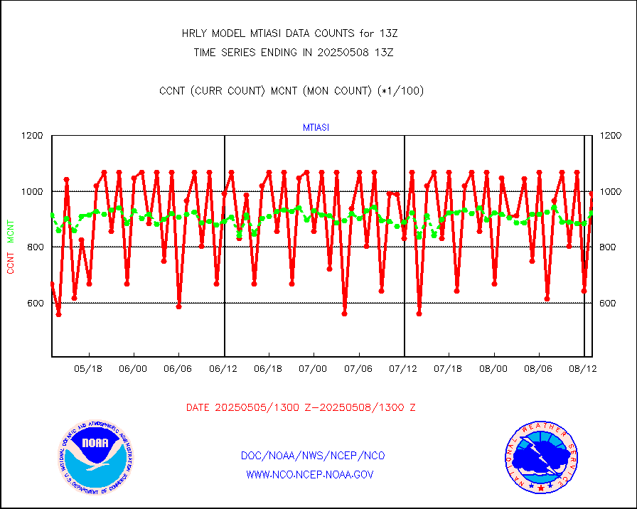
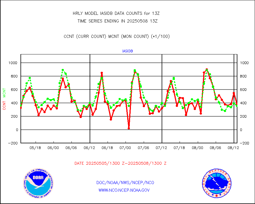
METOP 1-2 IASI 1C radiance data (varbl. channels) |
85752 |
93148 |
92.1 % |
0111.00-0111.99 |
||||||||||
NEXRAD Vel Azm Dsp(VAD) winds via radar coded msg |
0 |
0 |
n/a |
0112.50-0113.49 |
||||||||||
Aura Ozone Monitoring Instrument (OMI) data |
0 |
0 |
n/a |
0110.50-0111.49 |
||||||||||
NOAA 16-19 Solar Backscatter UV-2 rad frm V8 BUFR |
0 |
0 |
n/a |
0111.00-0111.99 |
||||||||||
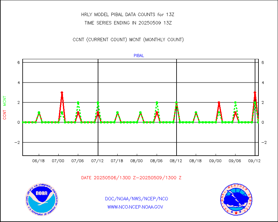
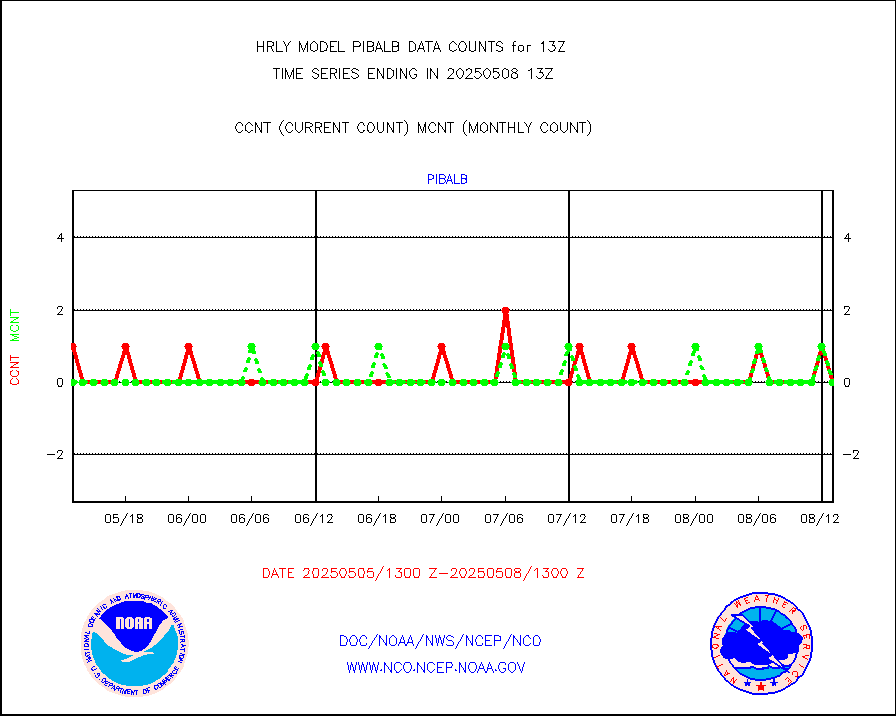
PIBAL (from PILOT, PILOT SHIP, PILOT MOBIL) |
0 |
0 |
n/a |
0112.50-0113.49 |
||||||||||
Multi-Agency Profiler (MAP) and SODAR winds |
44 |
46 |
95.7 % |
0112.50-0113.49 |
||||||||||
Rawinsonde - fixed land (from TEMP or PILOT) |
0 |
0 |
n/a |
0112.50-0113.49 |
||||||||||
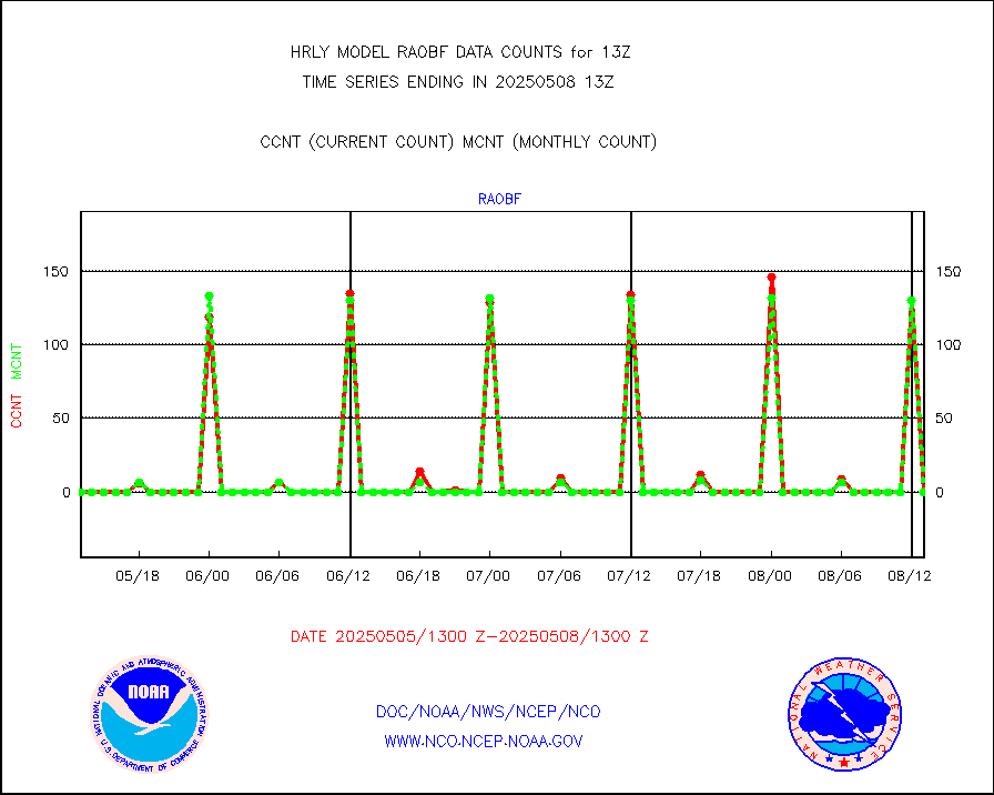
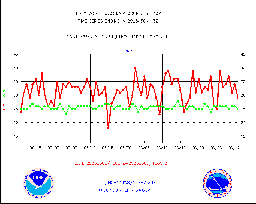
RASS temperatures (NOAA and Multi-Agency) |
16 |
26 |
61.5 % |
0112.50-0113.49 |
||||||||||
NEXRAD reflectivity (Lvl 2 - GTS) |
4186308 |
4002248 |
104.6 % |
0112.50-0113.49 |
||||||||||
NEXRAD radial wind (Level 2 - GTS) |
1421828 |
1177197 |
120.8 % |
0112.50-0113.49 |
||||||||||
METEOSAT-10 2nd Gen SEVIRI Clr Sky Radiance(proc) |
0 |
0 |
n/a |
0112.50-0113.49 |
||||||||||
Ship - manual and automatic, restricted (BUFR) |
6 |
9 |
66.7 % |
0112.50-0113.50 |
||||||||||
Ship - manual and automatic, unrestricted |
184 |
154 |
119.5 % |
0112.50-0113.50 |
||||||||||
Ship - manual and automatic, unrestricted (BUFR) |
1006 |
972 |
103.5 % |
0112.50-0113.50 |
||||||||||
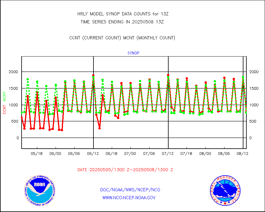
Synoptic - fixed manual and automatic |
689 |
771 |
89.4 % |
0112.50-0113.49 |
||||||||||
Synoptic - fixed manual & auto (decoded fr BUFR) |
5141 |
5004 |
102.7 % |
0112.50-0113.49 |
||||||||||
Synoptic - restricted (WMO Res 40) manual & auto. |
0 |
0 |
n/a |
0112.50-0113.49 |
||||||||||
Synoptic - restricted (WMO Res 40)(decoded BUFR) |
493 |
494 |
99.8 % |
0112.50-0113.49 |
||||||||||
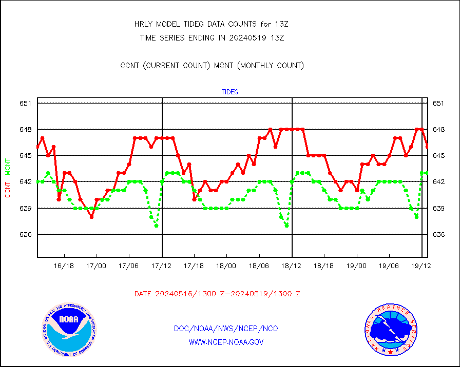
Tide gauge reports decoded from CREX format |
659 |
657 |
100.3 % |
0112.00-0112.99 |
||||||||||
| Data Types of Opportunity with Normal Counts | ||||||||||||||
|---|---|---|---|---|---|---|---|---|---|---|---|---|---|---|
| Type | Description | Hourly Count | Monthly Average | Percent (%) of Monthly Mean | UTC Time Window | |||||||||
GOES-16&up/NESDIS ir short-wv derived cld motion |
39594 |
40593 |
97.5 % |
0112.00-0112.99 |
||||||||||
MDCRS ACARS acft data (ARINC via AFWA)(AIREP fmt) |
0 |
0 |
n/a |
0112.50-0113.49 |
||||||||||
Himawari Clear Sky Radiance |
0 |
0 |
n/a |
0112.00-0112.99 |
||||||||||
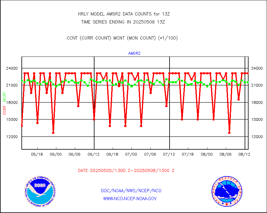
GCOM-W AMSR2 1B brightness temperatures |
2309472 |
2158618 |
107.0 % |
0111.00-0111.99 |
||||||||||
NPP/NOAA-20 ATMS bright. temps-direct b-cast SSEC |
87699 |
93935 |
93.4 % |
0111.50-0112.49 |
||||||||||
POES/NESDIS - processed ATOVS soundings/radiances |
0 |
0 |
n/a |
0111.00-0111.99 |
||||||||||
A.M.(N17,M2,M3) AVHRR GAC NCEP-proc clr&sea btmps |
1389658 |
1590580 |
87.4 % |
0110.50-0111.49 |
||||||||||
eXpendable BathyThermograph, mooring (BATHY fmt) |
0 |
0 |
n/a |
0106.00-0106.99 |
||||||||||
Coop/MADIS NEPP & HCN-Modernization NOAA COOP Obs |
11 |
11 |
100.0 % |
0112.50-0113.49 |
||||||||||
NPP/NOAA-20 CrIS full spctrl radn (431 ch subset) |
240534 |
230930 |
104.2 % |
0111.50-0112.49 |
||||||||||
NPP/NOAA-20 CrIS full spctrl radn dir brdcst SSEC |
14094 |
33074 |
42.6 % |
0111.50-0112.49 |
||||||||||
Coast Guard |
5 |
5 |
100.0 % |
0112.50-0113.50 |
||||||||||
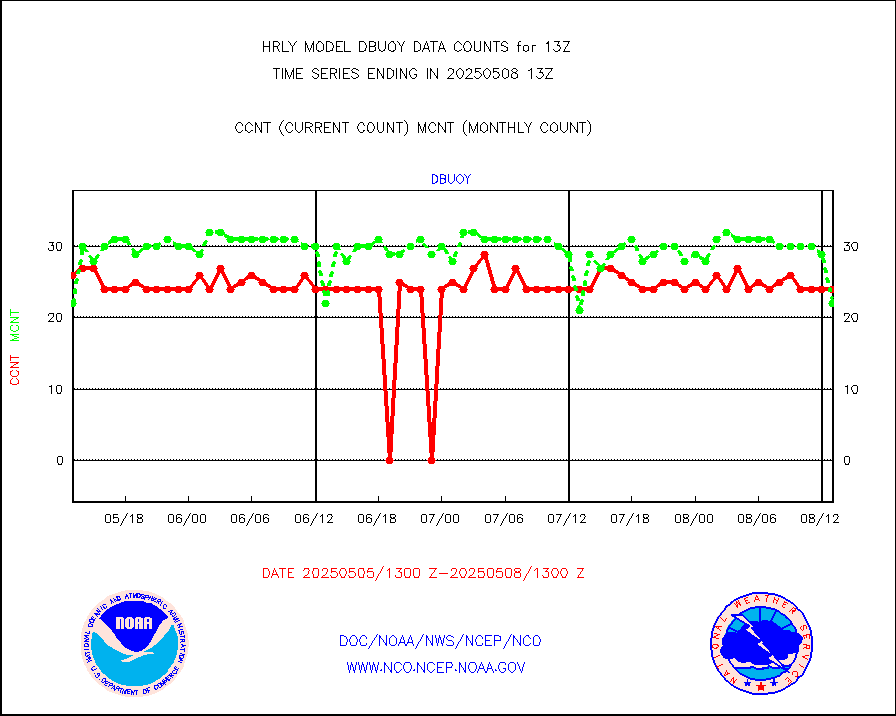
Drifting buoys (decoded from BUFR) |
1436 |
1448 |
99.2 % |
0112.50-0113.50 |
||||||||||
Dropwinsonde (from TEMP DROP) |
0 |
0 |
n/a |
0112.50-0113.49 |
||||||||||
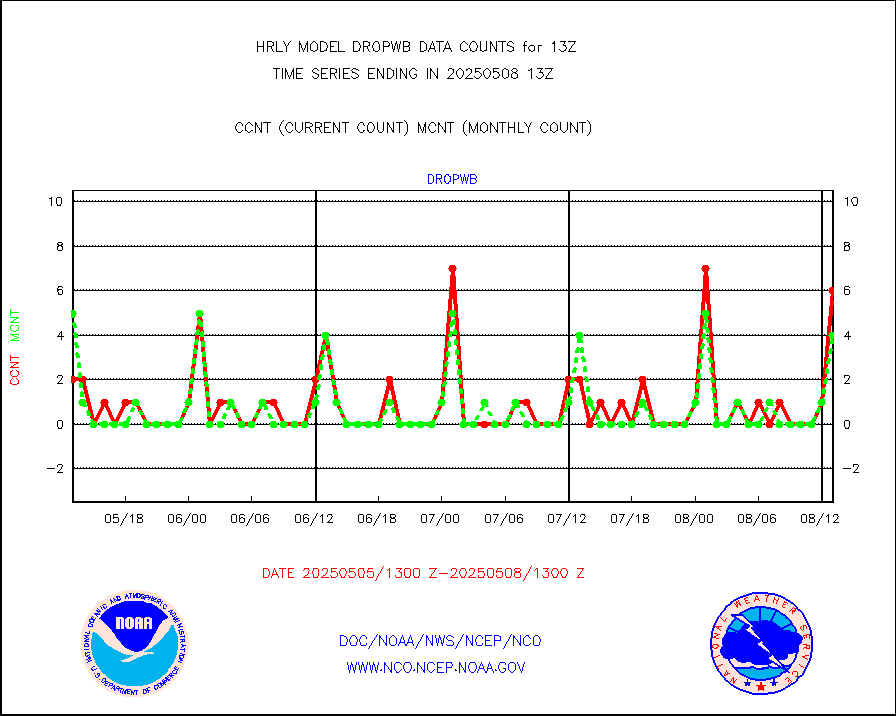
Dropwinsonde (decoded from BUFR) |
5 |
4 |
125.0 % |
0112.51-0113.49 |
||||||||||
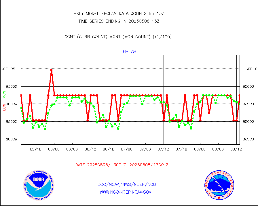
GOES imager effective cloud amount data (U.Wisc.) |
9250602 |
8039528 |
115.1 % |
0112.50-0113.49 |
||||||||||
METOP 1-2 IASI 1C radiance data vbl chn from RARS |
59581 |
44790 |
133.0 % |
0112.00-0112.99 |
||||||||||
NOAA 18-19 & METOP 1-2 MHS proc. btemps from RARS |
226670 |
199791 |
113.5 % |
0112.50-0113.49 |
||||||||||
GOES/NESDIS (11x17 f-o-v) imager clear radiances |
0 |
0 |
n/a |
0112.00-0112.99 |
||||||||||
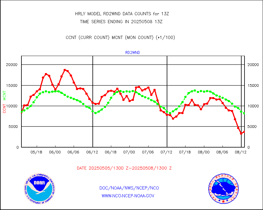
METOP 1-2 Global Ozone Monitoring Exp.-2 (GOME-2) |
6080 |
9301 |
65.4 % |
0111.50-0112.49 |
||||||||||
GOES-16&up/NESDIS wv imgr/deep-lyr derivd cld mtn |
20187 |
16874 |
119.6 % |
0112.00-0112.99 |
||||||||||
METEOSAT/EUMETSAT wvpr imgr drv cld motion NBseq |
36578 |
38304 |
95.5 % |
0111.50-0112.49 |
||||||||||
METOP 1-2 IASI 1C radiances-direct broadcast SSEC |
28800 |
40515 |
71.1 % |
0111.50-0112.49 |
||||||||||
VIIRS (NPP/NOAA-20) ir lg-wv drv cloud motion(NB) |
10109 |
16577 |
61.0 % |
0109.00-0109.99 |
||||||||||
AVHRR (NOAA/METOP) ir lg-wave derived cld motion |
0 |
0 |
n/a |
0109.00-0109.99 |
||||||||||
AVHRR (METOP) ir lg-wave derived cld motion |
0 |
0 |
n/a |
0112.50-0113.50 |
||||||||||
INSAT/KALPANA India ir lg-wave derived cld motion |
0 |
0 |
n/a |
0110.50-0111.49 |
||||||||||
Korean AMDAR aircraft data (decoded from BUFR) |
41 |
44 |
93.2 % |
0112.50-0113.49 |
||||||||||
Land-based CMAN stations decoded from CMAN format |
38 |
60 |
63.3 % |
0112.50-0113.49 |
||||||||||
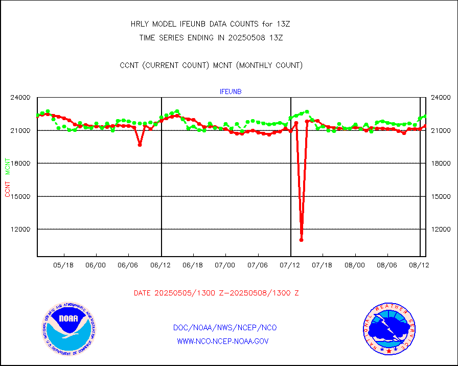
LEO-GEO satellite AMVs from UWisc. |
7133 |
7800 |
91.4 % |
0109.00-0109.99 |
||||||||||
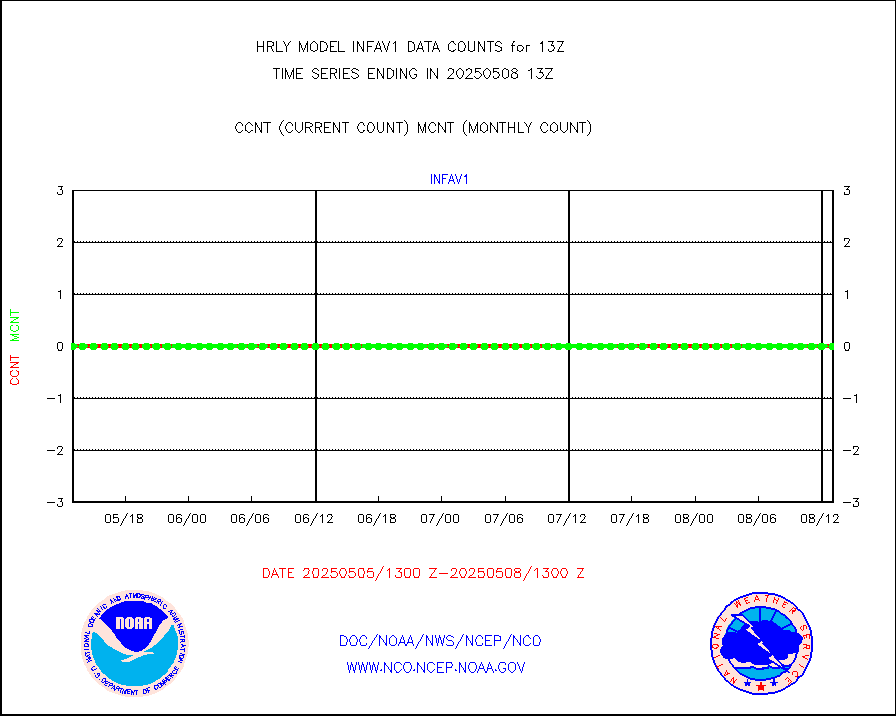
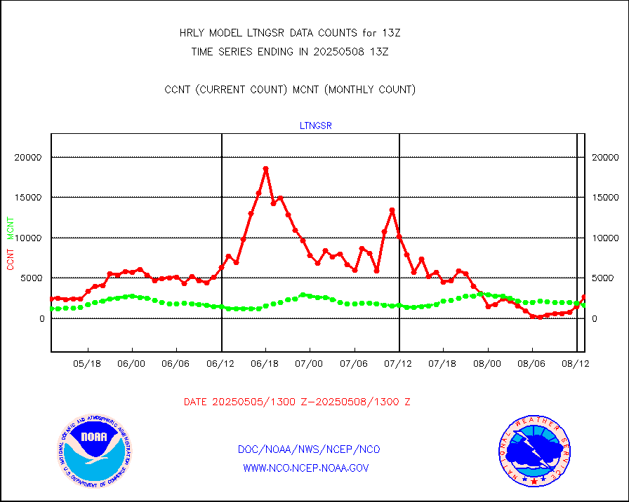
LLDN Long-rng lightning from Vaisala via NOAAPORT |
114712 |
147933 |
77.5 % |
0112.50-0113.49 |
||||||||||
NLDN Shrt-rng lightning from Vaisala via NOAAPORT |
3567 |
3172 |
112.5 % |
0112.50-0113.49 |
||||||||||
Moored buoys (decoded from BUFR) |
977 |
910 |
107.4 % |
0112.50-0113.50 |
||||||||||
Aura Microwave Limb Sounder (MLS) ozone data |
0 |
0 |
n/a |
0111.00-0111.99 |
||||||||||
Mesonet/MADIS UrbaNet |
3599 |
3482 |
103.4 % |
0112.50-0113.49 |
||||||||||
NEXRAD Vel Azm Dsp(VAD) winds via Level 2 decoder |
565 |
480 |
117.7 % |
0112.50-0113.49 |
||||||||||
OMPS Limb Profiler ozone data (NPP) |
382 |
262 |
145.8 % |
0106.00-0106.99 |
||||||||||
OMPS nadir profile ozone (Version 8 BUFR) |
617 |
564 |
109.4 % |
0111.00-0111.99 |
||||||||||
OMPS total column ozone (Version 8 BUFR) |
233225 |
349818 |
66.7 % |
0111.00-0111.99 |
||||||||||
PIBAL (decoded from BUFR) |
0 |
0 |
n/a |
0112.51-0113.49 |
||||||||||
Manual PIREP aircraft data (dcded from AIREP fmt) |
84 |
118 |
71.2 % |
0112.50-0113.49 |
||||||||||
Profilr winds from PIBAL (PILOT,PILOT SHIP/MOBIL) |
0 |
0 |
n/a |
0112.50-0113.49 |
||||||||||
Rawinsonde - fixed land (decoded from BUFR) |
0 |
0 |
n/a |
0112.51-0113.49 |
||||||||||
Rawinsonde - mobile land (from TEMP/PILOT MOBIL) |
0 |
0 |
n/a |
0112.50-0113.49 |
||||||||||
Rawinsonde - mobile land (decoded from BUFR) |
0 |
0 |
n/a |
0112.51-0113.49 |
||||||||||
Rawinsonde - ship (from TEMP SHIP, PILOT SHIP) |
0 |
0 |
n/a |
0112.50-0113.49 |
||||||||||
Rawinsonde - ship (decoded from BUFR) |
0 |
0 |
n/a |
0112.51-0113.49 |
||||||||||
Flight level reconnaissance aircraft data |
0 |
0 |
n/a |
0112.50-0113.49 |
||||||||||
Megha-Tropiques SAPHIR L1A2 brightness temps |
0 |
0 |
n/a |
0110.50-0111.49 |
||||||||||
METEOSAT-10 2nd Gen SEVIRI All Sky Radiance(proc) |
75512 |
72935 |
103.5 % |
0112.50-0113.49 |
||||||||||
Ship - manual and automatic, restricted |
3 |
18 |
16.7 % |
0112.50-0113.49 |
||||||||||
DMSP SSM/IS 1C radiance data (Unified Pre-Proc.) |
112680 |
75716 |
148.8 % |
0111.50-0112.49 |
||||||||||
NPP/NOAA-20 VIIRS SST - CLEAR & OVER WATER |
6780311 |
2752805 |
246.3 % |
0112.50-0113.49 |
||||||||||
NPP/NOAA-20 VIIRS SST - PROBABLY CLR & OVER WATER |
1112586 |
540634 |
205.8 % |
0112.50-0113.49 |
||||||||||
Synoptic - mobile manual and automatic |
900 |
677 |
132.9 % |
0112.50-0113.49 |
||||||||||
Synoptic - mobile manual & auto (decoded fr BUFR) |
1 |
1 |
100.0 % |
0112.50-0113.49 |
||||||||||
CTD probe, Argo prflng float, mooring (TESAC fmt) |
231 |
208 |
111.1 % |
0112.50-0113.49 |
||||||||||
TAMDAR aircft data-all types(from Panasonic,BUFR) |
108 |
48 |
225.0 % |
0112.50-0113.49 |
||||||||||
ThermoSalinoGraph (TSG) TRACKOB format) |
88 |
87 |
101.1 % |
0111.50-0112.49 |
||||||||||
INSAT/KALPANA India visible derived cloud motion |
0 |
0 |
n/a |
0110.50-0111.49 |
||||||||||
MTSAT/JMA visible derived cloud motion |
1571 |
1143 |
137.4 % |
0110.50-0111.49 |
||||||||||
GOES-16&up/NESDIS visible derived cloud motion |
98442 |
74100 |
132.9 % |
0112.00-0112.99 |
||||||||||
METEOSAT/EUMETSAT visible drv cld motion NBseq |
45063 |
43118 |
104.5 % |
0111.50-0112.49 |
||||||||||


