| Suspect Data Shortages in Critical Types - Monitor | ||||||||||||||
|---|---|---|---|---|---|---|---|---|---|---|---|---|---|---|
| Type | Description | Hourly Count | Monthly Average | Percent (%) of Monthly Mean | UTC Time Window | |||||||||
NOAA 18-19 & METOP 1-2 HIRS-4 NCEP-proc. br.temps |
0 |
9010 |
0.0 % |
0109.00-0114.99 |
||||||||||
| Shortage in Data Type of Opportunity - Monitor | ||||||||||||||
|---|---|---|---|---|---|---|---|---|---|---|---|---|---|---|
| Type | Description | Hourly Count | Monthly Average | Percent (%) of Monthly Mean | UTC Time Window | |||||||||
NPP Adv. Tech. MW Sndr (ATMS) br. temps from RARS |
0 |
9845 |
0.0 % |
0110.00-0113.99 |
||||||||||
NOAA 15-19 & METOP 1-2 HIRS-3/4 pr btmps frm RARS |
0 |
5855 |
0.0 % |
0111.00-0113.00 |
||||||||||
| Critical Data with Normal Counts | ||||||||||||||
|---|---|---|---|---|---|---|---|---|---|---|---|---|---|---|
| Type | Description | Hourly Count | Monthly Average | Percent (%) of Monthly Mean | UTC Time Window | |||||||||
NOAA 15-19 & METOP 1-2 AMSU-A NCEP-proc. br.temps |
17323 |
24017 |
72.1 % |
0109.00-0114.99 |
||||||||||
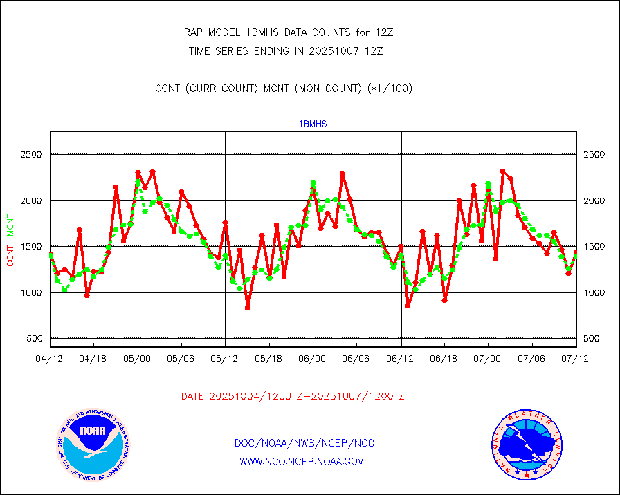
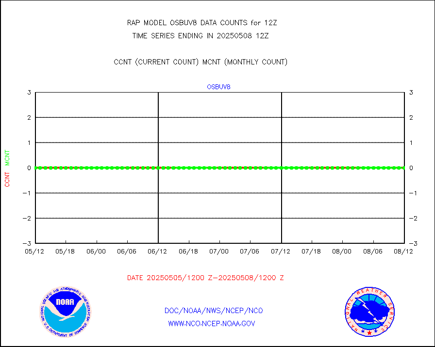
NOAA 18-19 & METOP 1-2 MHS NCEP-proces. br. temps |
152836 |
183272 |
83.4 % |
0109.00-0114.99 |
||||||||||
MDCRS ACARS acft data from ARINC(dcded from BUFR) |
71177 |
81079 |
87.8 % |
0108.75-0115.25 |
||||||||||
Canadian AMDAR aircraft data (decoded from BUFR) |
0 |
0 |
n/a |
0108.75-0115.25 |
||||||||||
Surface Marine CMAN rpts decoded from BUFR format |
3429 |
3443 |
99.6 % |
0111.50-0112.50 |
||||||||||
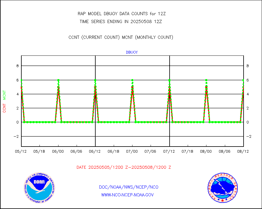
Buoys decoded from FM-18 fmt (moored or drifting) |
1 |
3 |
33.3 % |
0111.50-0112.50 |
||||||||||
Grnd-based Gbl Navigation Sat System (GNSS) data |
879 |
3129 |
28.1 % |
0110.95-0111.05 |
||||||||||
MODIS (AQUA/TERRA) wvpr imager derived cld motion |
0 |
0 |
n/a |
0110.50-0113.50 |
||||||||||
MODIS (AQUA/TERRA) ir l-wave derived cloud motion |
0 |
0 |
n/a |
0110.50-0113.50 |
||||||||||
GOES/NASA(Langley) hi-res. (1x1 f-o-v) cloud data |
5081385 |
4884645 |
104.0 % |
0111.50-0112.50 |
||||||||||
Buoys decoded from FM-13 format (moored) |
133 |
149 |
89.3 % |
0111.50-0112.50 |
||||||||||
Aviation - METAR |
6570 |
6541 |
100.4 % |
0111.50-0112.50 |
||||||||||
NEXRAD Vel Azm Dsp(VAD) winds via radar coded msg |
0 |
0 |
n/a |
0111.00-0113.00 |
||||||||||
Multi-Agency Profiler (MAP) and SODAR winds |
131 |
122 |
107.4 % |
0110.50-0113.50 |
||||||||||
Rawinsonde - fixed land (from TEMP or PILOT) |
146 |
149 |
98.0 % |
0111.00-0113.00 |
||||||||||
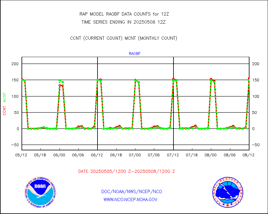
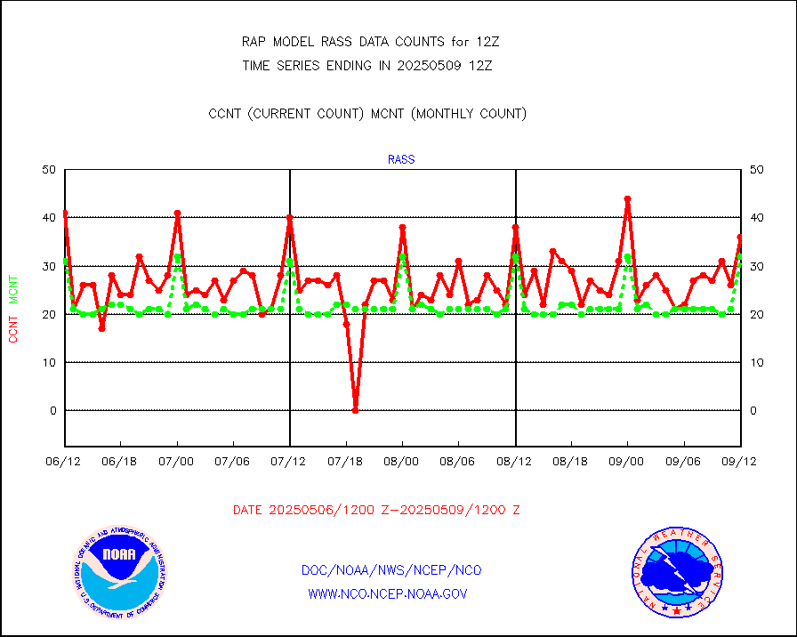
RASS temperatures (NOAA and Multi-Agency) |
31 |
36 |
86.1 % |
0111.50-0112.50 |
||||||||||
Ship - manual and automatic, restricted (BUFR) |
52 |
86 |
60.5 % |
0111.50-0112.50 |
||||||||||
Ship - manual and automatic, unrestricted |
161 |
146 |
110.3 % |
0111.50-0112.50 |
||||||||||
Ship - manual and automatic, unrestricted (BUFR) |
1112 |
1074 |
103.5 % |
0111.50-0112.50 |
||||||||||
Synoptic - fixed manual and automatic |
446 |
437 |
102.1 % |
0111.50-0112.50 |
||||||||||
Synoptic - fixed manual & auto (decoded fr BUFR) |
3138 |
3020 |
103.9 % |
0111.50-0112.50 |
||||||||||
Tide gauge reports decoded from CREX format |
643 |
644 |
99.8 % |
0111.50-0112.50 |
||||||||||
| Data Types of Opportunity with Normal Counts | ||||||||||||||
|---|---|---|---|---|---|---|---|---|---|---|---|---|---|---|
| Type | Description | Hourly Count | Monthly Average | Percent (%) of Monthly Mean | UTC Time Window | |||||||||
GOES-16&up/NESDIS ir short-wv derived cld motion |
9169 |
9723 |
94.3 % |
0111.00-0111.99 |
||||||||||
MDCRS ACARS acft data (ARINC via AFWA)(AIREP fmt) |
0 |
0 |
n/a |
0108.75-0115.25 |
||||||||||
Manual AIREP aircraft data (dcded from AIREP fmt) |
3245 |
3184 |
101.9 % |
0108.75-0115.25 |
||||||||||
AQUA AIRS/AMSU-A/HSB brightness temps- every FOV |
0 |
0 |
n/a |
0109.00-0114.99 |
||||||||||
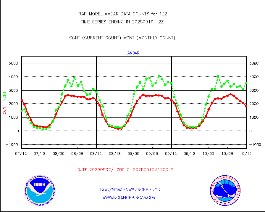
AMDAR aircraft data (decoded from AMDAR format) |
2443 |
1326 |
184.2 % |
0108.75-0115.25 |
||||||||||
AMDAR aircraft data (decoded from BUFR) |
11078 |
11827 |
93.7 % |
0108.75-0115.25 |
||||||||||
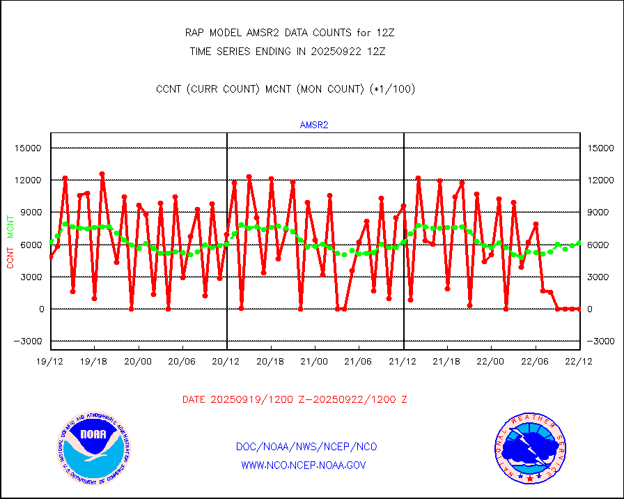
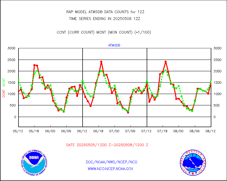
GCOM-W AMSR2 1B brightness temperatures |
466852 |
621019 |
75.2 % |
0109.00-0109.99 |
||||||||||
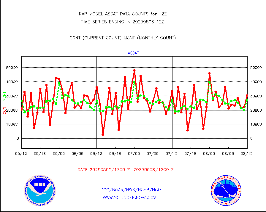
METOP 1-2 ASCAT products |
22079 |
28130 |
78.5 % |
0110.00-0114.00 |
||||||||||
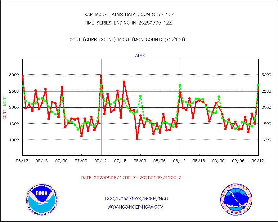
NPP/NOAA-20 ATMS brightness temperatures |
252447 |
260242 |
97.0 % |
0110.00-0113.99 |
||||||||||
NPP/NOAA-20 ATMS bright. temps-direct b-cast SSEC |
133347 |
131427 |
101.5 % |
0110.00-0113.99 |
||||||||||
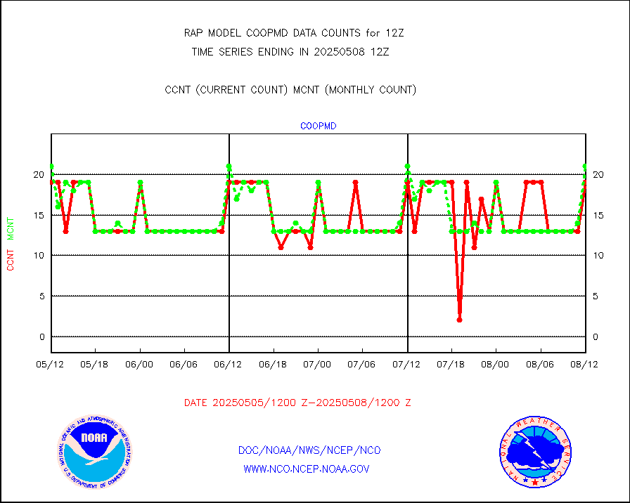
Coop/MADIS NEPP & HCN-Modernization NOAA COOP Obs |
11 |
12 |
91.7 % |
0111.50-0112.50 |
||||||||||
NPP/NOAA-20 CrIS full spctrl radn (431 ch subset) |
148968 |
158661 |
93.9 % |
0110.00-0113.99 |
||||||||||
NPP/NOAA-20 CrIS full spctrl radn dir brdcst SSEC |
52920 |
52674 |
100.5 % |
0110.00-0113.99 |
||||||||||
Coast Guard |
5 |
5 |
100.0 % |
0111.50-0112.50 |
||||||||||
Drifting buoys (decoded from BUFR) |
559 |
559 |
100.0 % |
0111.50-0112.50 |
||||||||||
Dropwinsonde (from TEMP DROP) |
0 |
0 |
n/a |
0111.00-0113.00 |
||||||||||
Dropwinsonde (decoded from BUFR) |
3 |
2 |
150.0 % |
0111.00-0113.00 |
||||||||||
E-AMDAR (European AMDAR acft decoded from BUFR) |
12809 |
13671 |
93.7 % |
0108.75-0115.25 |
||||||||||
NOAA 15-19 & METOP 1-2 AMSU-A proc btmps frm RARS |
3756 |
8541 |
44.0 % |
0111.00-0113.00 |
||||||||||
METOP 1-2 IASI 1C radiance data vbl chn from RARS |
13860 |
20742 |
66.8 % |
0110.00-0113.99 |
||||||||||
NOAA 18-19 & METOP 1-2 MHS proc. btemps from RARS |
36022 |
76590 |
47.0 % |
0111.00-0113.00 |
||||||||||
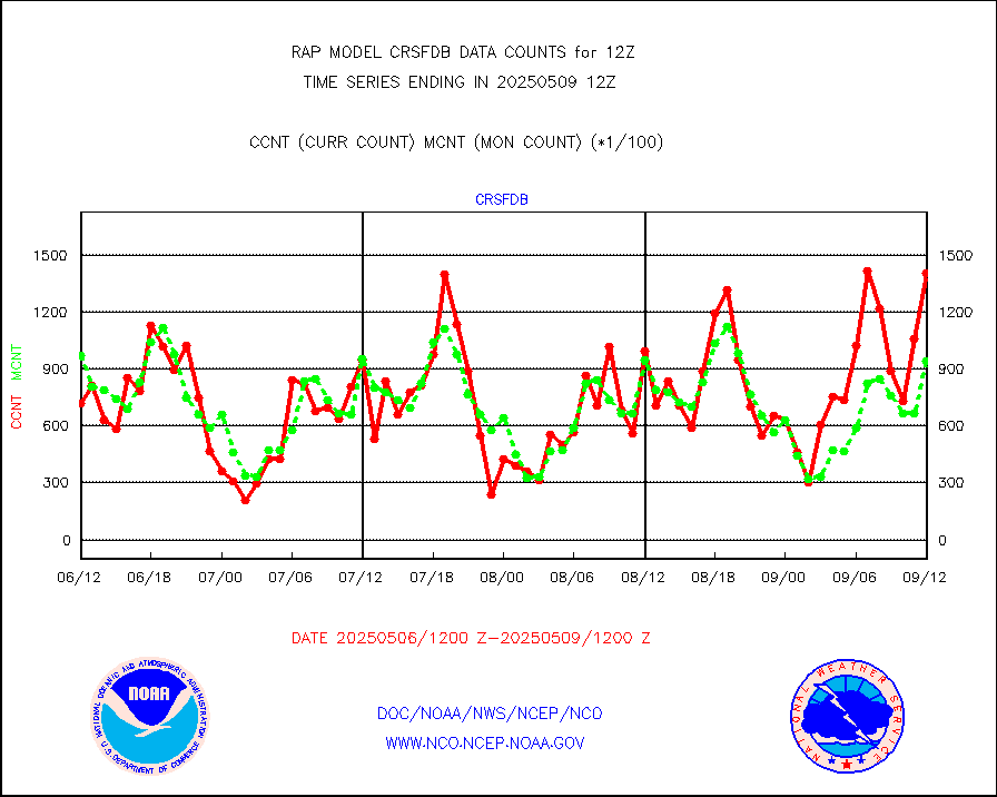
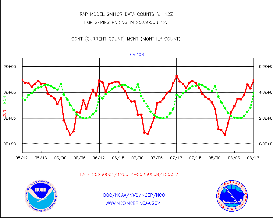
GPM GMI Level 1C-R brightness temperatures |
180966 |
282242 |
64.1 % |
0109.00-0114.99 |
||||||||||
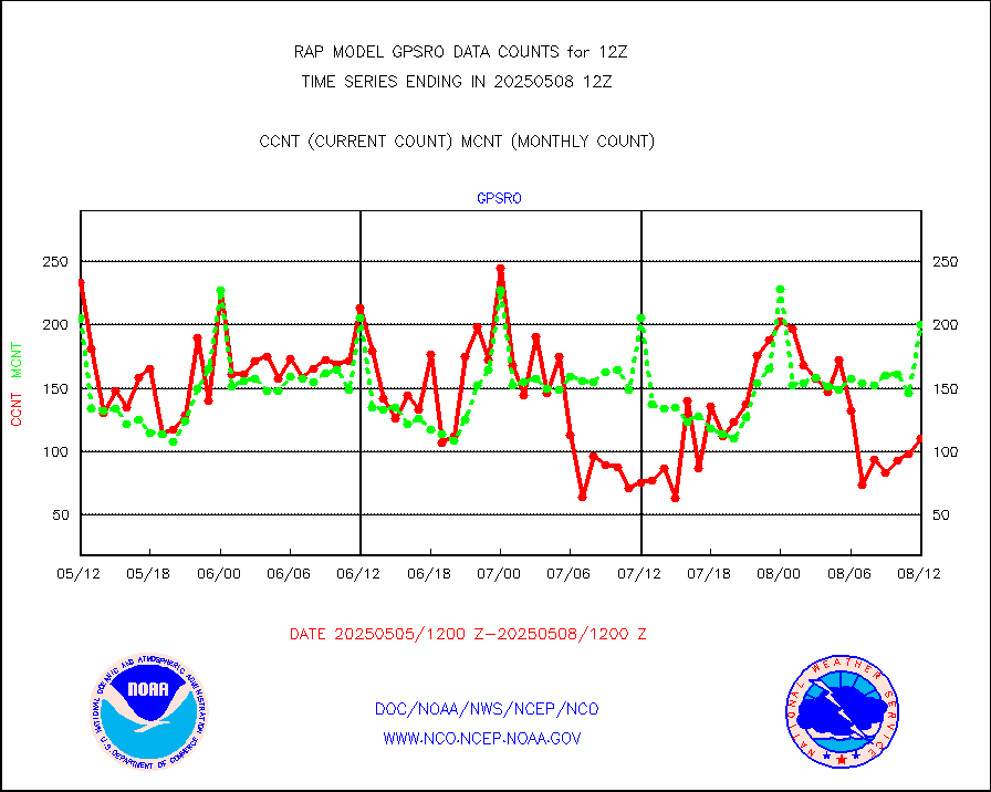
GPS radio occultation data |
195 |
201 |
97.0 % |
0110.00-0113.99 |
||||||||||
GOES-16/17 All Sky Radiances (proc.) |
1181232 |
1177517 |
100.3 % |
0110.00-0113.99 |
||||||||||
GOES-16/17 Clear Sky Radiances (proc.) |
569257 |
530729 |
107.3 % |
0110.00-0113.99 |
||||||||||
MTSAT/JMA water vapor imager derived cloud motion |
2204 |
2833 |
77.8 % |
0110.50-0113.50 |
||||||||||
GOES-16&up/NESDIS wv imgr/deep-lyr derivd cld mtn |
8431 |
7684 |
109.7 % |
0111.00-0111.99 |
||||||||||
METEOSAT/EUMETSAT wvpr imgr drv cld motion NBseq |
5061 |
5401 |
93.7 % |
0110.50-0113.49 |
||||||||||
GOES-16&up/NESDIS wv imgr/cld-top derived cld mtn |
12805 |
12640 |
101.3 % |
0111.00-0111.99 |
||||||||||
METOP 1-2 IASI 1C radiances-direct broadcast SSEC |
7787 |
22063 |
35.3 % |
0110.00-0113.99 |
||||||||||
METEOSAT/EUMETSAT ir lg-wave drv cld motion NBseq |
3006 |
3203 |
93.8 % |
0110.50-0113.49 |
||||||||||
VIIRS (NPP/NOAA-20) ir lg-wv drv cloud motion(NB) |
0 |
0 |
n/a |
0110.50-0113.50 |
||||||||||
AVHRR (NOAA/METOP) ir lg-wave derived cld motion |
0 |
0 |
n/a |
0110.50-0113.50 |
||||||||||
AVHRR (METOP) ir lg-wave derived cld motion |
0 |
0 |
n/a |
0110.50-0113.49 |
||||||||||
MTSAT/JMA infrared long-wave derived cloud motion |
2319 |
2314 |
100.2 % |
0110.50-0113.50 |
||||||||||
GOES-16&up/NESDIS ir long-wave derived cld motion |
30442 |
29851 |
102.0 % |
0111.00-0111.99 |
||||||||||
Korean AMDAR aircraft data (decoded from BUFR) |
304 |
335 |
90.7 % |
0108.75-0115.25 |
||||||||||
Land-based CMAN stations decoded from CMAN format |
79 |
129 |
61.2 % |
0111.50-0112.50 |
||||||||||
LLDN Long-rng lightning from Vaisala via NOAAPORT |
111062 |
127023 |
87.4 % |
0111.00-0112.50 |
||||||||||
NLDN Shrt-rng lightning from Vaisala via NOAAPORT |
5900 |
6053 |
97.5 % |
0111.00-0112.50 |
||||||||||
Moored buoys (decoded from BUFR) |
1156 |
1114 |
103.8 % |
0111.50-0112.50 |
||||||||||
Mesonet/MADIS Colorado E-470 (Interstate 470) |
32 |
32 |
100.0 % |
0111.50-0112.50 |
||||||||||
Mesonet/MADIS Alaska Department of Transportation |
242 |
287 |
84.3 % |
0111.50-0112.50 |
||||||||||
Mesonet/MADIS U.S. Army Aberdeen Proving Grounds |
0 |
0 |
n/a |
0111.50-0112.50 |
||||||||||
Mesonet/MADIS Citizen Weather Observers Program |
62493 |
76560 |
81.6 % |
0111.50-0112.50 |
||||||||||
Mesonet/MADIS AWS Convergence Technologies, Inc. |
22362 |
27872 |
80.2 % |
0111.50-0112.50 |
||||||||||
Mesonet/MADIS "Anything Weather" |
0 |
0 |
n/a |
0111.50-0112.50 |
||||||||||
Mesonet/MADIS Colorado Dept. of Transportation |
0 |
0 |
n/a |
0111.50-0112.50 |
||||||||||
Mesonet/MADIS DC Net |
0 |
0 |
n/a |
0111.50-0112.50 |
||||||||||
Mesonet/MADIS Denver Urban Drainage & Flood Cntrl |
0 |
0 |
n/a |
0111.50-0112.50 |
||||||||||
Mesonet/MADIS Florida (FAWN & USF) |
5 |
5 |
100.0 % |
0111.50-0112.50 |
||||||||||
Mesonet/MADIS Florida Dept. of Transportation |
0 |
0 |
n/a |
0111.50-0112.50 |
||||||||||
Mesonet/MADIS Georgia Dept. of Transportation |
0 |
0 |
n/a |
0111.50-0112.50 |
||||||||||
Mesonet/MADIS NWS Hydromet Auto Data System(HADS) |
10839 |
11416 |
94.9 % |
0111.50-0112.50 |
||||||||||
Mesonet/MADIS Iowa Environmental |
249 |
245 |
101.6 % |
0111.50-0112.50 |
||||||||||
Mesonet/MADIS Indiana Dept. of Transportation |
0 |
0 |
n/a |
0111.50-0112.50 |
||||||||||
Mesonet/MADIS Iowa Department of Transportation |
0 |
0 |
n/a |
0111.50-0112.50 |
||||||||||
Mesonet/MADIS Kansas Department of Transportation |
472 |
507 |
93.1 % |
0111.50-0112.50 |
||||||||||
Mesonet/MADIS Oklahoma Mesonet |
945 |
941 |
100.4 % |
0111.50-0112.50 |
||||||||||
Mesonet/MADIS Louisiana State/Jackson State Univ. |
0 |
0 |
n/a |
0111.50-0112.50 |
||||||||||
Mesonet/MADIS Missouri Commercial Agricult Wx Net |
399 |
403 |
99.0 % |
0111.50-0112.50 |
||||||||||
Mesonet/MADIS Minnesota Dept. of Transportation |
0 |
0 |
n/a |
0111.50-0112.50 |
||||||||||
Mesonet/MADIS NOS-Phys Oceanographic Realtime Sys |
546 |
544 |
100.4 % |
0111.50-0112.50 |
||||||||||
Mesonet/MADIS NFIC Remote Automated Wx Stns(RAWS) |
2535 |
2461 |
103.0 % |
0111.50-0112.50 |
||||||||||
Mesonet/MADIS many providers, not separated out |
42649 |
56238 |
75.8 % |
0111.50-0112.50 |
||||||||||
Mesonet/MADIS UrbaNet |
4310 |
4266 |
101.0 % |
0111.50-0112.50 |
||||||||||
Mesonet/MADIS Virginia Dept. of Transportation |
0 |
0 |
n/a |
0111.50-0112.50 |
||||||||||
Mesonet/MADIS "Weather for You" |
0 |
0 |
n/a |
0111.50-0112.50 |
||||||||||
Mesonet/MADIS Wisconsin Dept. of Transportation |
0 |
0 |
n/a |
0111.50-0112.50 |
||||||||||
Mesonet/MADIS MesoWest (many subproviders) |
38636 |
55552 |
69.5 % |
0111.50-0112.50 |
||||||||||
Mesonet/MADIS West Texas |
7503 |
7494 |
100.1 % |
0111.50-0112.50 |
||||||||||
METOP 1-2 IASI 1C radiance data (varbl. channels) |
36160 |
26416 |
136.9 % |
0110.00-0113.99 |
||||||||||
NEXRAD Vel Azm Dsp(VAD) winds via Level 2 decoder |
1269 |
1120 |
113.3 % |
0111.00-0113.00 |
||||||||||
NOAA 16-19 Solar Backscatter UV-2 rad frm V8 BUFR |
0 |
0 |
n/a |
0110.00-0112.99 |
||||||||||
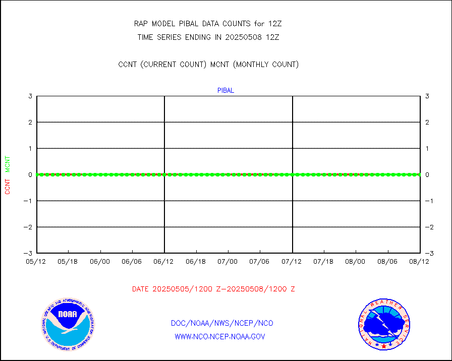
PIBAL (from PILOT, PILOT SHIP, PILOT MOBIL) |
0 |
0 |
n/a |
0111.00-0113.00 |
||||||||||
PIBAL (decoded from BUFR) |
0 |
0 |
n/a |
0111.00-0113.00 |
||||||||||
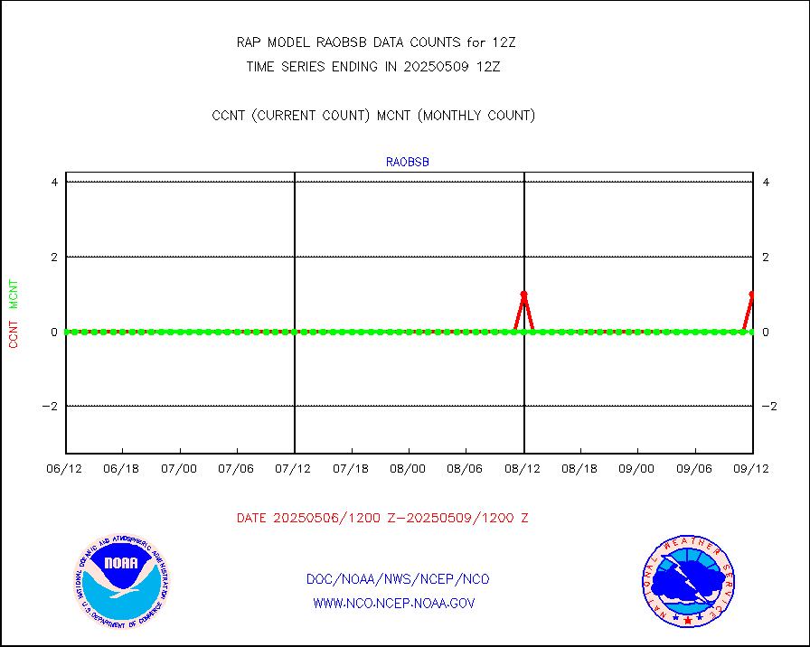
Manual PIREP aircraft data (dcded from AIREP fmt) |
285 |
288 |
99.0 % |
0108.75-0115.25 |
||||||||||
Profilr winds from PIBAL (PILOT,PILOT SHIP/MOBIL) |
0 |
0 |
n/a |
0110.50-0113.50 |
||||||||||
Rawinsonde - fixed land (decoded from BUFR) |
177 |
178 |
99.4 % |
0111.00-0113.00 |
||||||||||
Rawinsonde - mobile land (from TEMP/PILOT MOBIL) |
0 |
0 |
n/a |
0111.00-0113.00 |
||||||||||
Rawinsonde - mobile land (decoded from BUFR) |
0 |
0 |
n/a |
0111.00-0113.00 |
||||||||||
Rawinsonde - ship (from TEMP SHIP, PILOT SHIP) |
3 |
2 |
150.0 % |
0111.00-0113.00 |
||||||||||
Rawinsonde - ship (decoded from BUFR) |
0 |
1 |
0.0 % |
0111.00-0113.00 |
||||||||||
NEXRAD radial wind (Level 2 - GTS) |
1652779 |
1337004 |
123.6 % |
0111.50-0112.49 |
||||||||||
Flight level reconnaissance aircraft data |
0 |
0 |
n/a |
0111.00-0113.00 |
||||||||||
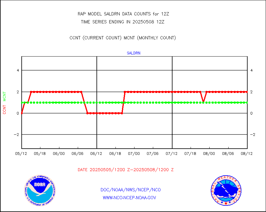
Surface Marine Saildrone (decoded from BUFR) |
2 |
2 |
100.0 % |
0110.00-0113.99 |
||||||||||
Megha-Tropiques SAPHIR L1A2 brightness temps |
0 |
0 |
n/a |
0109.00-0114.99 |
||||||||||
METEOSAT-10 2nd Gen SEVIRI All Sky Radiance(proc) |
9512 |
9467 |
100.5 % |
0110.00-0113.99 |
||||||||||
METEOSAT-10 2nd Gen SEVIRI Clr Sky Radiance(proc) |
0 |
0 |
n/a |
0110.00-0113.99 |
||||||||||
Ship - manual and automatic, restricted |
77 |
89 |
86.5 % |
0111.50-0112.50 |
||||||||||
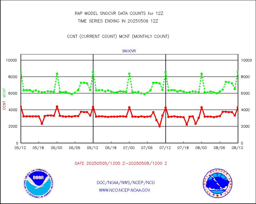
NOW COVER, DEPTH/DENSITY AND WATER EQUIVALENT |
4347 |
8308 |
52.3 % |
0110.00-0114.00 |
||||||||||
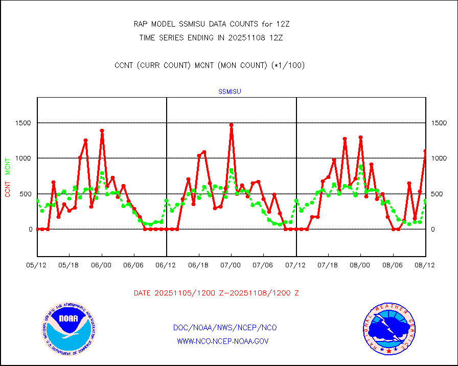
DMSP SSM/IS 1C radiance data (Unified Pre-Proc.) |
48584 |
40785 |
119.1 % |
0110.00-0113.99 |
||||||||||
Sub-surface float and glider profile (BUFR) |
4 |
5 |
80.0 % |
0110.00-0113.99 |
||||||||||
Synoptic - restricted (WMO Res 40) manual & auto. |
2 |
0 |
n/a |
0111.50-0112.50 |
||||||||||
Synoptic - restricted (WMO Res 40)(decoded BUFR) |
298 |
306 |
97.4 % |
0111.50-0112.50 |
||||||||||
Synoptic - mobile manual & auto (decoded fr BUFR) |
27 |
26 |
103.8 % |
0111.50-0112.50 |
||||||||||
TAMDAR aircft data-all types(from Panasonic,BUFR) |
293 |
230 |
127.4 % |
0108.75-0115.25 |
||||||||||
MTSAT/JMA visible derived cloud motion |
0 |
0 |
n/a |
0110.50-0113.50 |
||||||||||
GOES-16&up/NESDIS visible derived cloud motion |
29344 |
25752 |
113.9 % |
0111.00-0111.99 |
||||||||||
METEOSAT/EUMETSAT visible drv cld motion NBseq |
7238 |
7449 |
97.2 % |
0110.50-0113.49 |
||||||||||


