| Suspect Data Shortages in Critical Types - Monitor | ||||||||||||||
|---|---|---|---|---|---|---|---|---|---|---|---|---|---|---|
| Type | Description | Hourly Count | Monthly Average | Percent (%) of Monthly Mean | ||||||||||
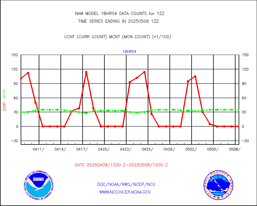
NOAA 18-19 & METOP 1-2 HIRS-4 NCEP-proc. br.temps |
0 |
958 |
0.0 % |
|||||||||||
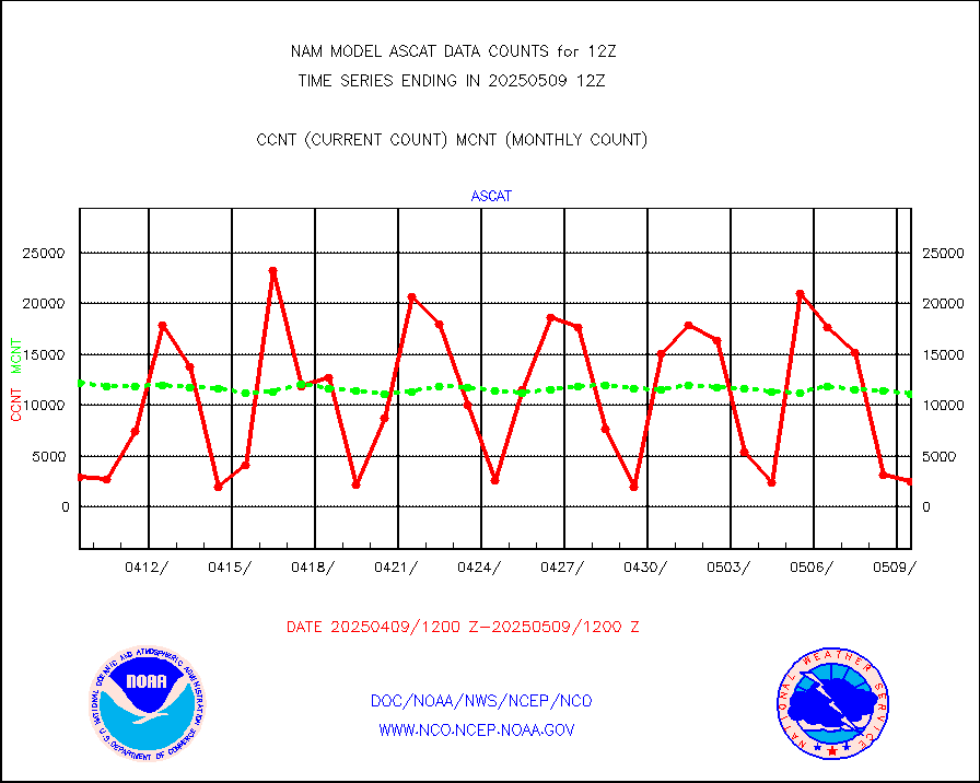
METOP 1-2 ASCAT products |
2015 |
12014 |
16.8 % |
|||||||||||
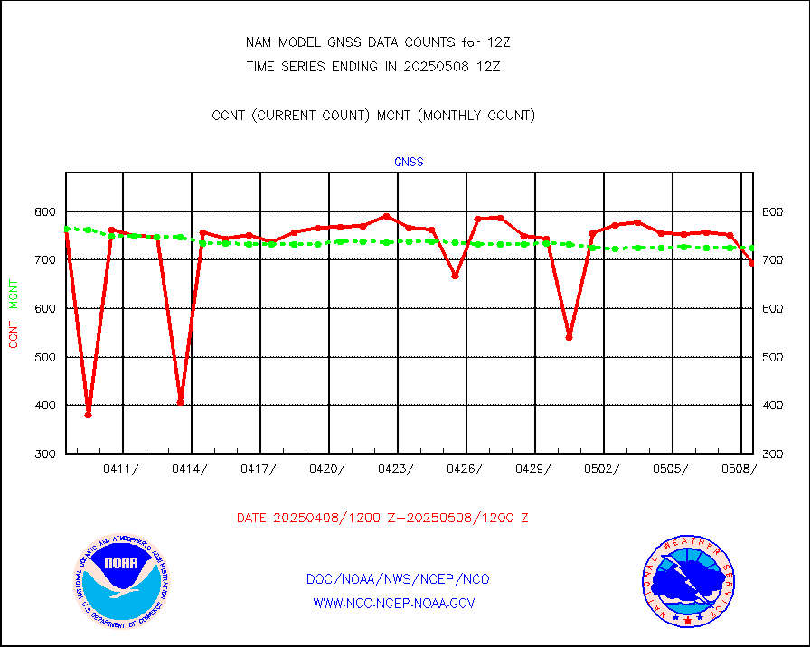
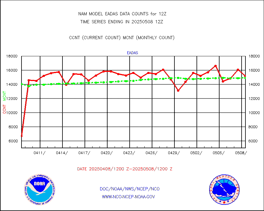
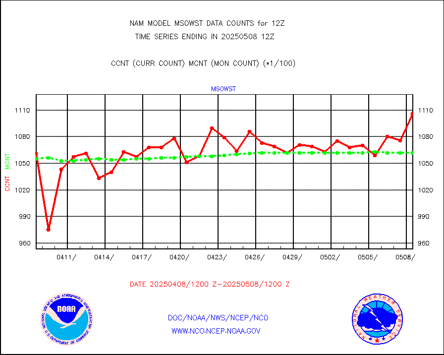
Grnd-based Gbl Navigation Sat System (GNSS) data |
219 |
605 |
36.2 % |
|||||||||||
| Shortage in Data Type of Opportunity - Monitor | ||||||||||||||
|---|---|---|---|---|---|---|---|---|---|---|---|---|---|---|
| Type | Description | Hourly Count | Monthly Average | Percent (%) of Monthly Mean | ||||||||||
NOAA 15-19 & METOP 1-2 HIRS-3/4 pr btmps frm RARS |
0 |
5845 |
0.0 % |
|||||||||||
| Critical Data with Normal Counts | ||||||||||||||
|---|---|---|---|---|---|---|---|---|---|---|---|---|---|---|
| Type | Description | Hourly Count | Monthly Average | Percent (%) of Monthly Mean | ||||||||||
NOAA 15-19 & METOP 1-2 AMSU-A NCEP-proc. br.temps |
3419 |
4845 |
70.6 % |
|||||||||||
NOAA 18-19 & METOP 1-2 MHS NCEP-proces. br. temps |
30219 |
40862 |
74.0 % |
|||||||||||
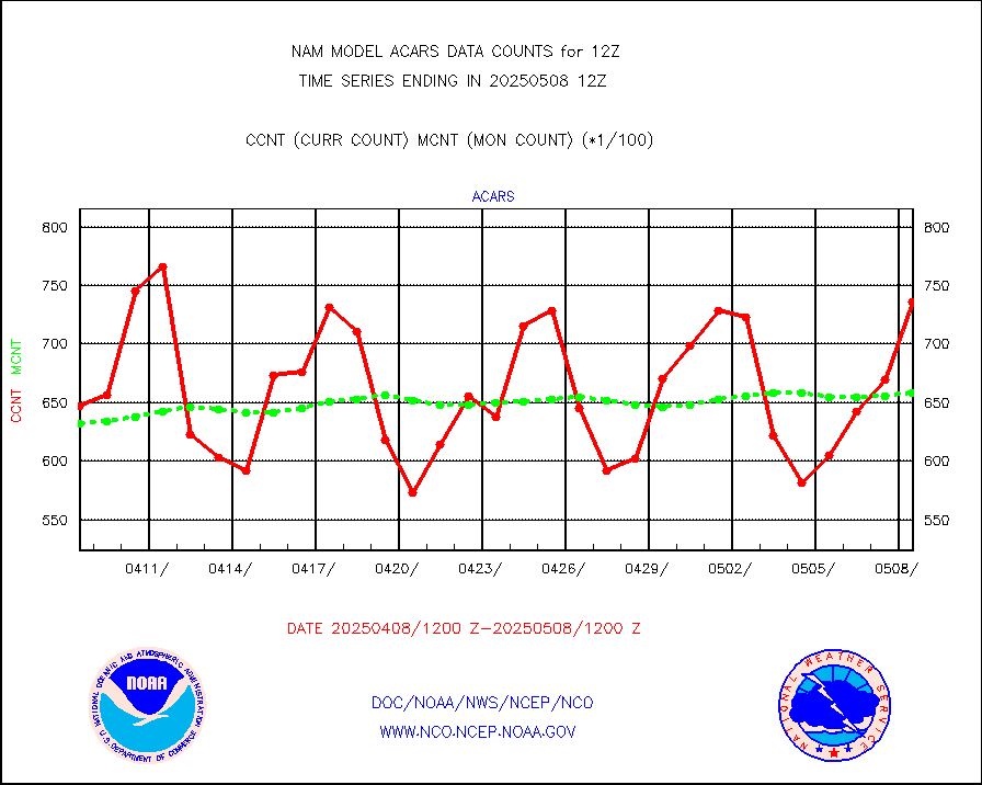
MDCRS ACARS acft data from ARINC(dcded from BUFR) |
78214 |
71638 |
109.2 % |
|||||||||||
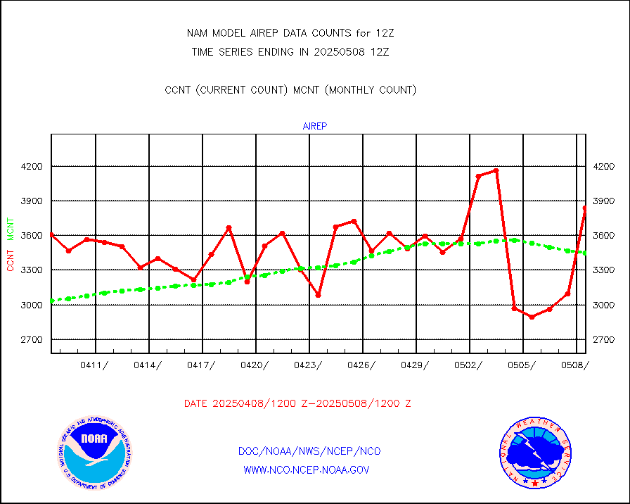
Manual AIREP aircraft data (dcded from AIREP fmt) |
3571 |
3514 |
101.6 % |
|||||||||||
AQUA AIRS/AMSU-A/HSB brightness temps- every FOV |
0 |
0 |
n/a |
|||||||||||
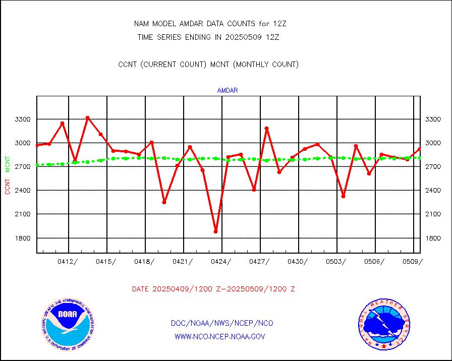
AMDAR aircraft data (decoded from AMDAR format) |
2983 |
2841 |
105.0 % |
|||||||||||
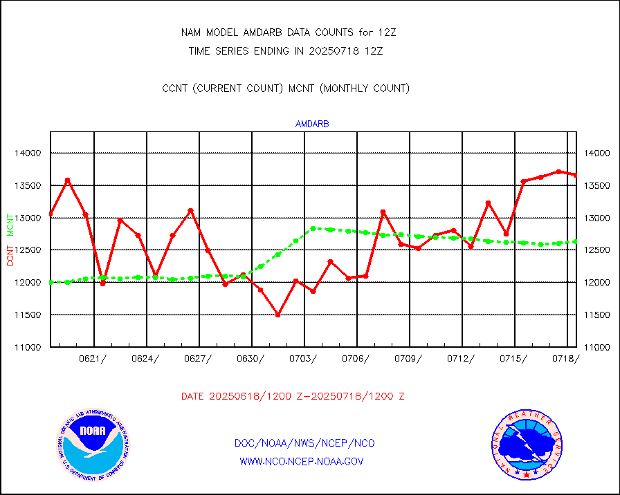
AMDAR aircraft data (decoded from BUFR) |
11501 |
12433 |
92.5 % |
|||||||||||
Canadian AMDAR aircraft data (decoded from BUFR) |
0 |
0 |
n/a |
|||||||||||
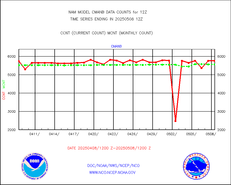
Surface Marine CMAN rpts decoded from BUFR format |
5679 |
5800 |
97.9 % |
|||||||||||
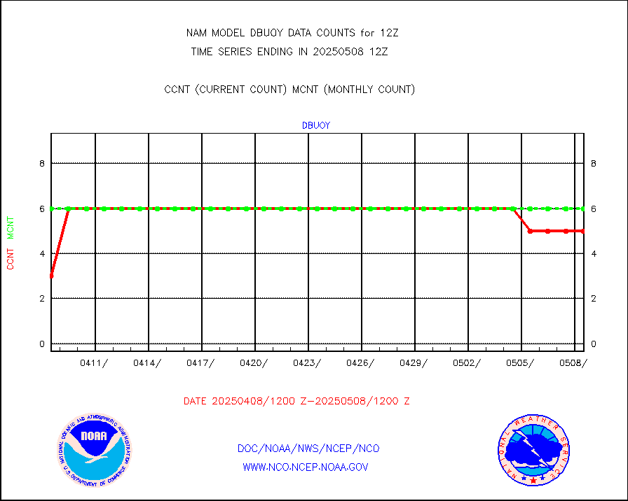
Buoys decoded from FM-18 fmt (moored or drifting) |
1 |
3 |
33.3 % |
|||||||||||
Dropwinsonde (from TEMP DROP) |
0 |
0 |
n/a |
|||||||||||
E-AMDAR (European AMDAR acft decoded from BUFR) |
13635 |
14745 |
92.5 % |
|||||||||||
GOES/NESDIS hi-resol. (1x1 f-o-v) sndgs/radiances |
0 |
0 |
n/a |
|||||||||||
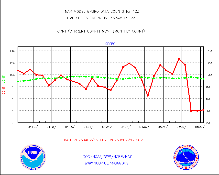
GPS radio occultation data |
123 |
95 |
129.5 % |
|||||||||||
MODIS (AQUA/TERRA) wvpr imager derived cld motion |
0 |
0 |
n/a |
|||||||||||
MODIS (AQUA/TERRA) ir l-wave derived cloud motion |
0 |
0 |
n/a |
|||||||||||
Land-based CMAN stations decoded from CMAN format |
228 |
185 |
123.2 % |
|||||||||||
Buoys decoded from FM-13 format (moored) |
299 |
218 |
137.2 % |
|||||||||||
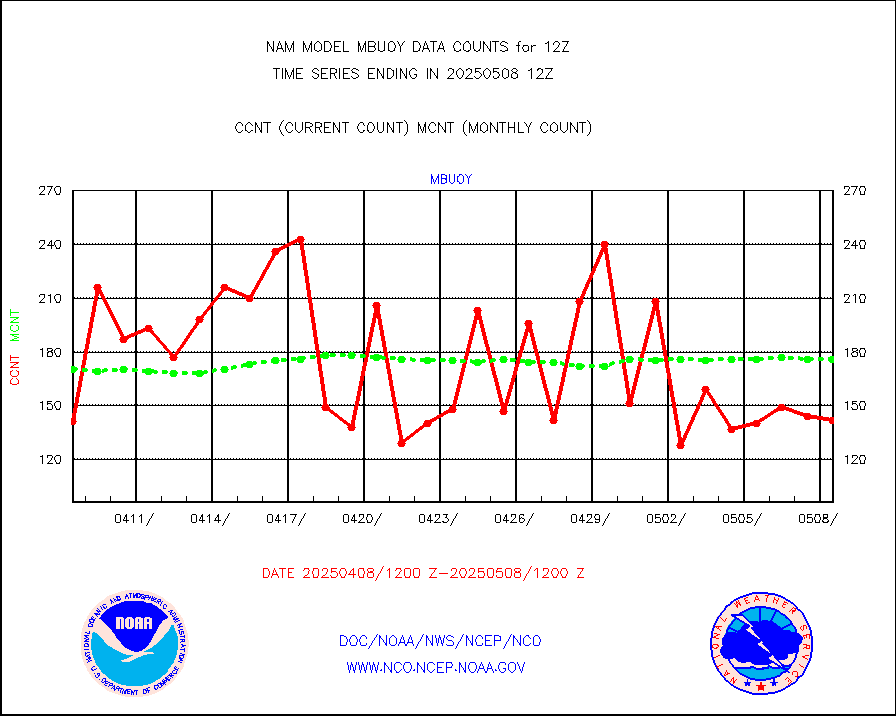
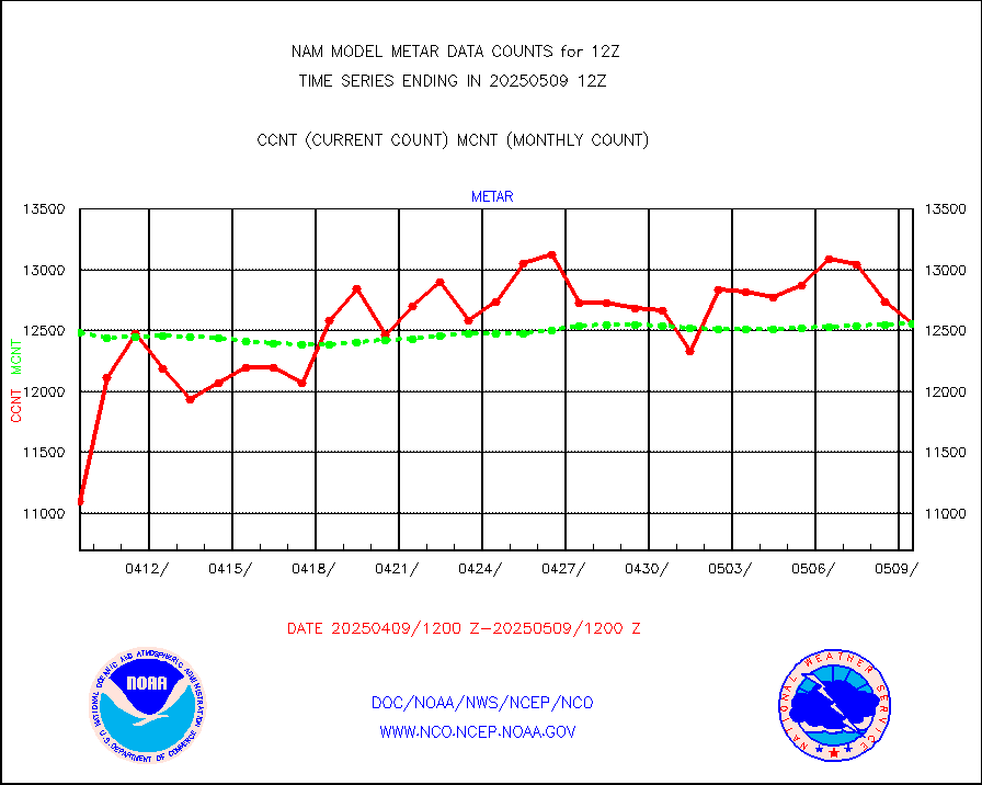
Aviation - METAR |
12629 |
12586 |
100.3 % |
|||||||||||
Mesonet/MADIS Colorado E-470 (Interstate 470) |
56 |
55 |
101.8 % |
|||||||||||
Mesonet/MADIS Alaska Department of Transportation |
421 |
378 |
111.4 % |
|||||||||||
Mesonet/MADIS U.S. Army Aberdeen Proving Grounds |
0 |
0 |
n/a |
|||||||||||
Mesonet/MADIS Citizen Weather Observers Program |
145530 |
119559 |
121.7 % |
|||||||||||
Mesonet/MADIS AWS Convergence Technologies, Inc. |
51366 |
44007 |
116.7 % |
|||||||||||
Mesonet/MADIS "Anything Weather" |
0 |
0 |
n/a |
|||||||||||
Mesonet/MADIS Colorado Dept. of Transportation |
0 |
0 |
n/a |
|||||||||||
Mesonet/MADIS DC Net |
0 |
0 |
n/a |
|||||||||||
Mesonet/MADIS Denver Urban Drainage & Flood Cntrl |
0 |
0 |
n/a |
|||||||||||
Mesonet/MADIS Florida (FAWN & USF) |
7 |
8 |
87.5 % |
|||||||||||
Mesonet/MADIS Florida Dept. of Transportation |
0 |
0 |
n/a |
|||||||||||
Mesonet/MADIS Georgia Dept. of Transportation |
0 |
0 |
n/a |
|||||||||||
Mesonet/MADIS NWS Hydromet Auto Data System(HADS) |
17378 |
17638 |
98.5 % |
|||||||||||
Mesonet/MADIS Iowa Environmental |
415 |
408 |
101.7 % |
|||||||||||
Mesonet/MADIS Indiana Dept. of Transportation |
0 |
0 |
n/a |
|||||||||||
Mesonet/MADIS Iowa Department of Transportation |
0 |
0 |
n/a |
|||||||||||
Mesonet/MADIS Kansas Department of Transportation |
839 |
820 |
102.3 % |
|||||||||||
Mesonet/MADIS Oklahoma Mesonet |
1470 |
1445 |
101.7 % |
|||||||||||
Mesonet/MADIS Louisiana State/Jackson State Univ. |
0 |
0 |
n/a |
|||||||||||
Mesonet/MADIS Missouri Commercial Agricult Wx Net |
686 |
701 |
97.9 % |
|||||||||||
Mesonet/MADIS Minnesota Dept. of Transportation |
0 |
0 |
n/a |
|||||||||||
Mesonet/MADIS NOS-Phys Oceanographic Realtime Sys |
822 |
811 |
101.4 % |
|||||||||||
Mesonet/MADIS NFIC Remote Automated Wx Stns(RAWS) |
3977 |
3911 |
101.7 % |
|||||||||||
Mesonet/MADIS many providers, not separated out |
108060 |
92171 |
117.2 % |
|||||||||||
Mesonet/MADIS Virginia Dept. of Transportation |
0 |
0 |
n/a |
|||||||||||
Mesonet/MADIS "Weather for You" |
0 |
0 |
n/a |
|||||||||||
Mesonet/MADIS Wisconsin Dept. of Transportation |
0 |
0 |
n/a |
|||||||||||
Mesonet/MADIS MesoWest (many subproviders) |
100519 |
86919 |
115.6 % |
|||||||||||
Mesonet/MADIS West Texas |
13155 |
13247 |
99.3 % |
|||||||||||
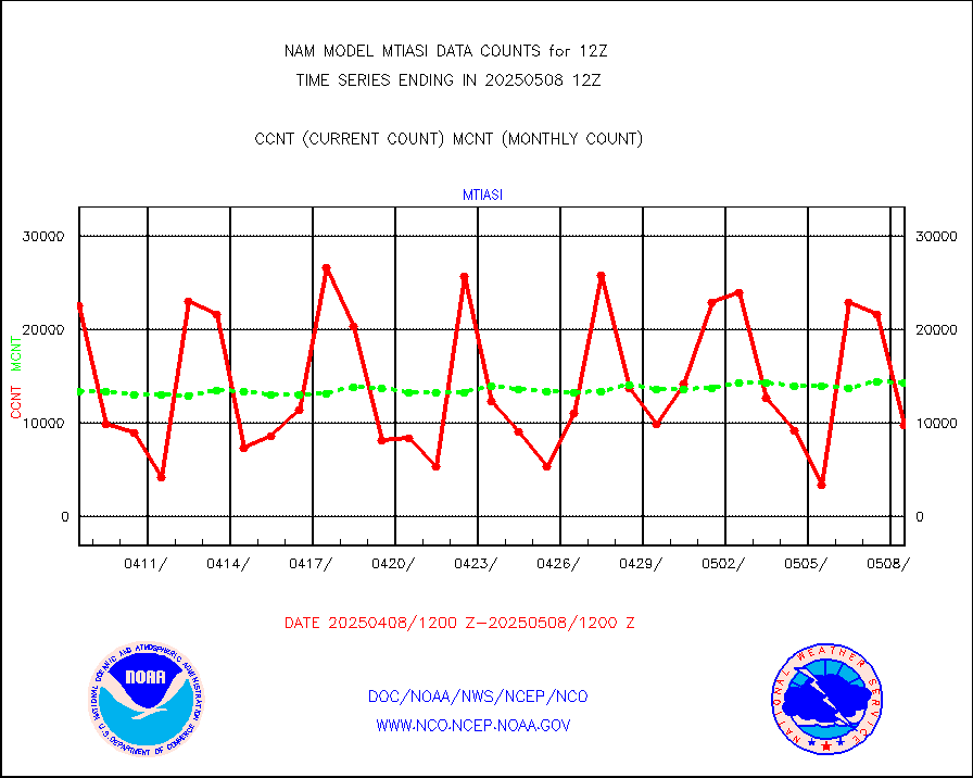
METOP 1-2 IASI 1C radiance data (varbl. channels) |
8561 |
13397 |
63.9 % |
|||||||||||
NEXRAD Vel Azm Dsp(VAD) winds via radar coded msg |
0 |
0 |
n/a |
|||||||||||
PIBAL (from PILOT, PILOT SHIP, PILOT MOBIL) |
0 |
0 |
n/a |
|||||||||||
Multi-Agency Profiler (MAP) and SODAR winds |
201 |
193 |
104.1 % |
|||||||||||
Profilr winds from PIBAL (PILOT,PILOT SHIP/MOBIL) |
0 |
0 |
n/a |
|||||||||||
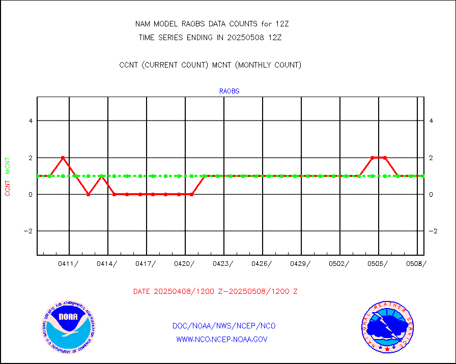
Rawinsonde - fixed land (from TEMP or PILOT) |
145 |
144 |
100.7 % |
|||||||||||
Rawinsonde - mobile land (from TEMP/PILOT MOBIL) |
0 |
0 |
n/a |
|||||||||||
Rawinsonde - ship (from TEMP SHIP, PILOT SHIP) |
3 |
2 |
150.0 % |
|||||||||||
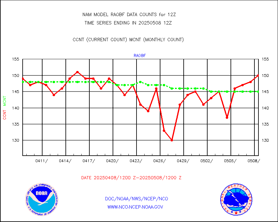
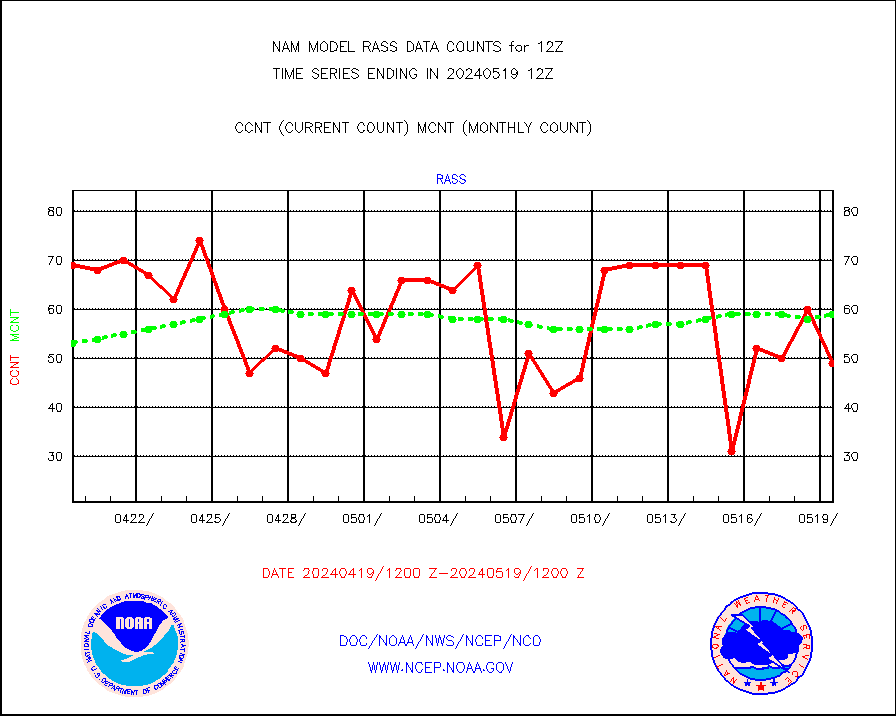
RASS temperatures (NOAA and Multi-Agency) |
43 |
56 |
76.8 % |
|||||||||||
Flight level reconnaissance aircraft data |
0 |
0 |
n/a |
|||||||||||
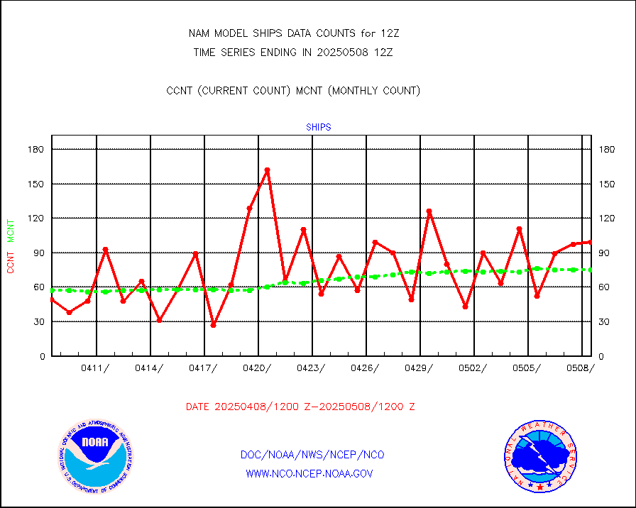
Ship - manual and automatic, restricted |
50 |
72 |
69.4 % |
|||||||||||
Ship - manual and automatic, restricted (BUFR) |
209 |
193 |
108.3 % |
|||||||||||
Ship - manual and automatic, unrestricted |
236 |
222 |
106.3 % |
|||||||||||
Ship - manual and automatic, unrestricted (BUFR) |
1600 |
1624 |
98.5 % |
|||||||||||
Synoptic - fixed manual & auto (decoded fr BUFR) |
4935 |
4743 |
104.0 % |
|||||||||||
Synoptic - restricted (WMO Res 40) manual & auto. |
2 |
0 |
n/a |
|||||||||||
Synoptic - restricted (WMO Res 40)(decoded BUFR) |
612 |
677 |
90.4 % |
|||||||||||
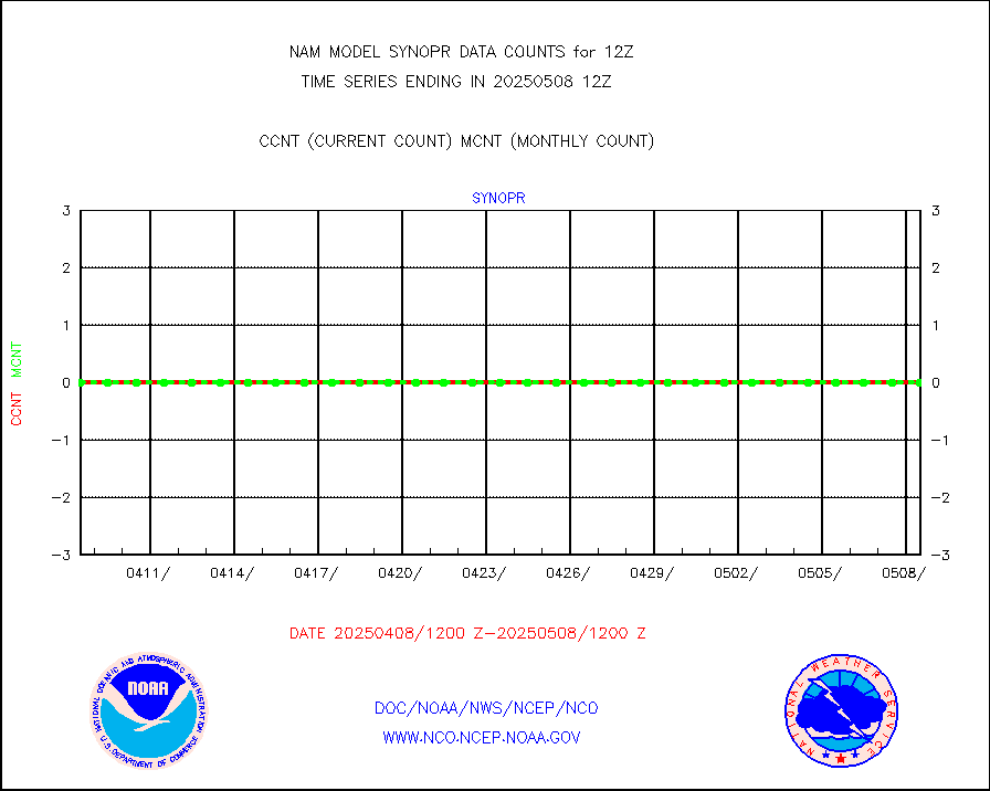
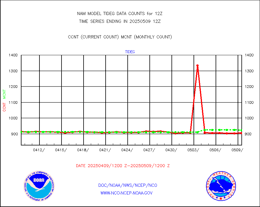
Tide gauge reports decoded from CREX format |
915 |
930 |
98.4 % |
|||||||||||
| Data Types of Opportunity with Normal Counts | ||||||||||||||
|---|---|---|---|---|---|---|---|---|---|---|---|---|---|---|
| Type | Description | Hourly Count | Monthly Average | Percent (%) of Monthly Mean | ||||||||||
MDCRS ACARS acft data (ARINC via AFWA)(AIREP fmt) |
0 |
0 |
n/a |
|||||||||||
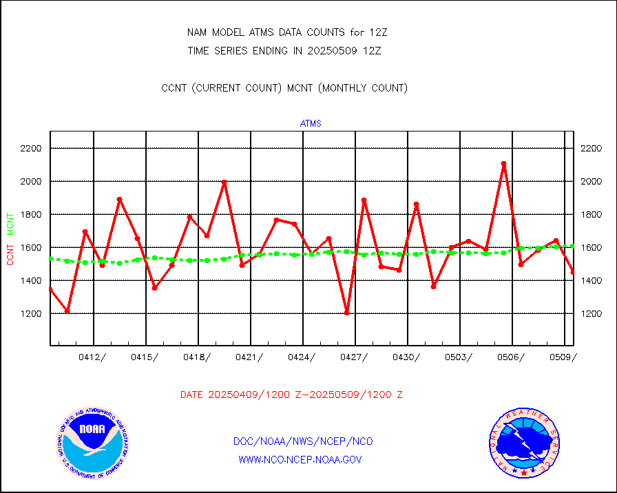
NPP/NOAA-20 ATMS brightness temperatures |
163421 |
151460 |
107.9 % |
|||||||||||
NPP CrIS apodized radiances (399 channel) |
0 |
0 |
n/a |
|||||||||||
Coast Guard |
10 |
10 |
100.0 % |
|||||||||||
Drifting buoys (decoded from BUFR) |
699 |
700 |
99.9 % |
|||||||||||
NOAA 15-19 & METOP 1-2 AMSU-A proc btmps frm RARS |
8570 |
9242 |
92.7 % |
|||||||||||
NOAA 18-19 & METOP 1-2 MHS proc. btemps from RARS |
80215 |
84514 |
94.9 % |
|||||||||||
GOES/NESDIS hi-resol. (1x1 f-o-v) cloud data |
0 |
0 |
n/a |
|||||||||||
MTSAT/JMA water vapor imager derived cloud motion |
1085 |
1409 |
77.0 % |
|||||||||||
METEOSAT/EUMETSAT wvpr imgr drv cld motion NBseq |
5154 |
5402 |
95.4 % |
|||||||||||
METEOSAT/EUMETSAT ir lg-wave drv cld motion NBseq |
3015 |
3155 |
95.6 % |
|||||||||||
VIIRS (NPP/NOAA-20) ir lg-wv drv cloud motion(NB) |
0 |
0 |
n/a |
|||||||||||
AVHRR (NOAA/METOP) ir lg-wave derived cld motion |
0 |
0 |
n/a |
|||||||||||
AVHRR (METOP) ir lg-wave derived cld motion |
0 |
0 |
n/a |
|||||||||||
MTSAT/JMA infrared long-wave derived cloud motion |
1153 |
1147 |
100.5 % |
|||||||||||
Korean AMDAR aircraft data (decoded from BUFR) |
305 |
348 |
87.6 % |
|||||||||||
GOES/NASA(Langley) hi-res. (1x1 f-o-v) cloud data |
9999999 |
9824868 |
101.8 % |
|||||||||||
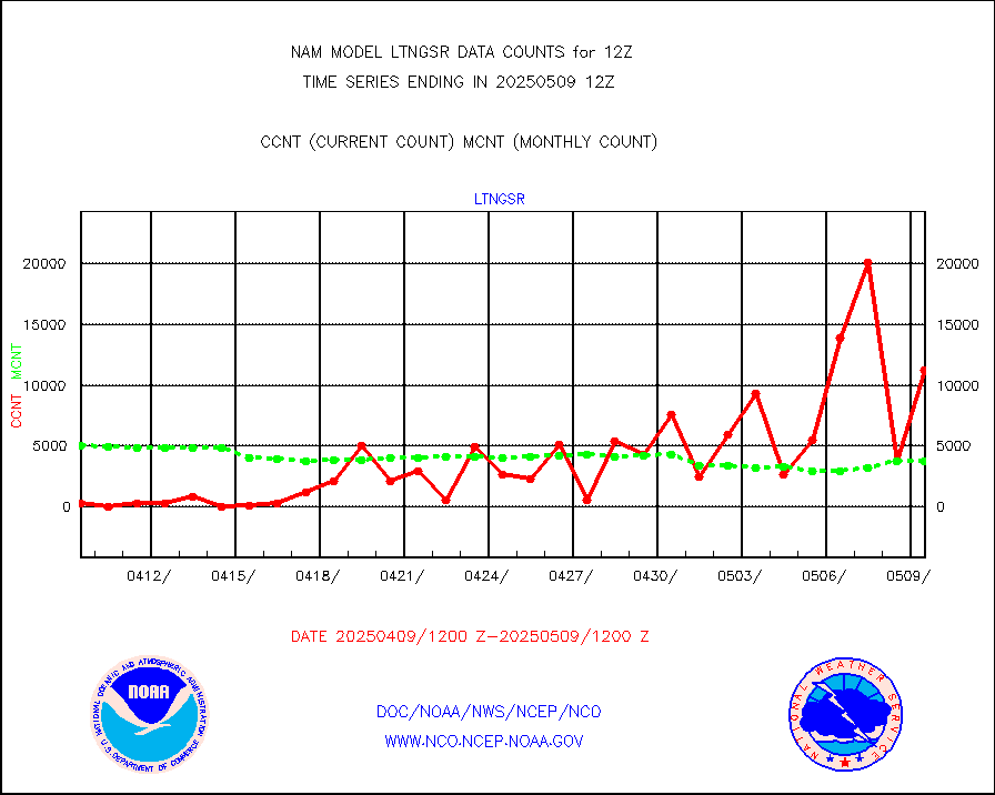
LLDN Long-rng lightning from Vaisala via NOAAPORT |
131184 |
155837 |
84.2 % |
|||||||||||
NLDN Shrt-rng lightning from Vaisala via NOAAPORT |
7340 |
7384 |
99.4 % |
|||||||||||
Moored buoys (decoded from BUFR) |
1568 |
1612 |
97.3 % |
|||||||||||
NEXRAD Vel Azm Dsp(VAD) winds via Level 2 decoder |
1332 |
1202 |
110.8 % |
|||||||||||
NOAA 16-19 Solar Backscatter UV-2 rad frm V8 BUFR |
0 |
0 |
n/a |
|||||||||||
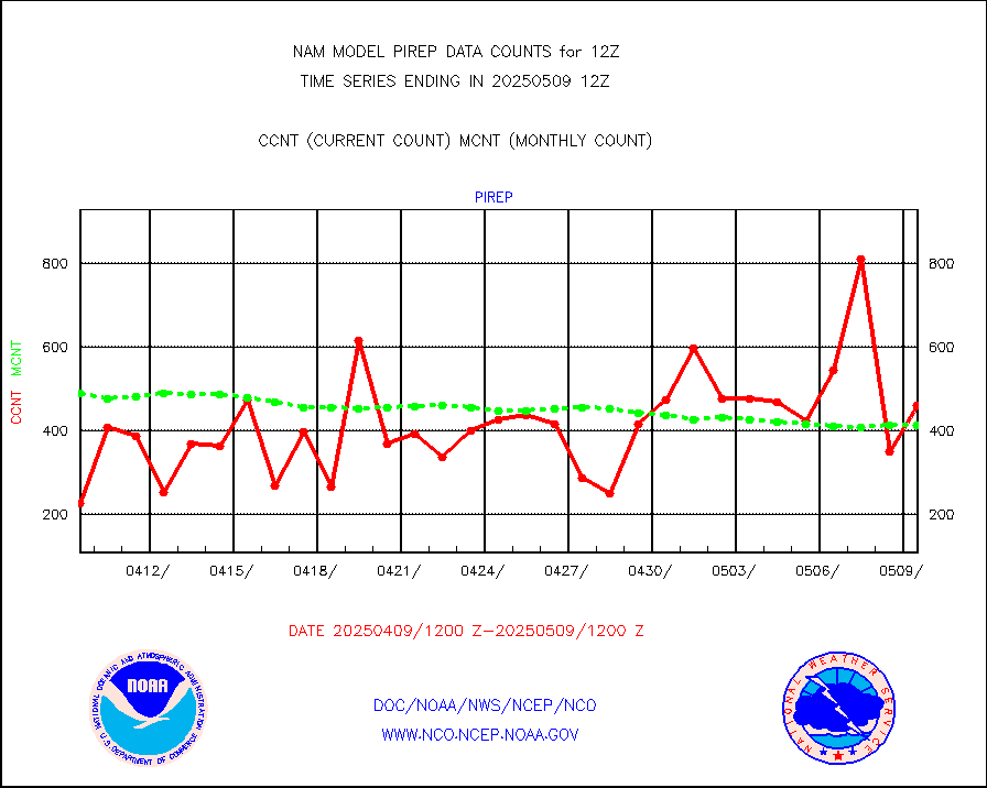
Manual PIREP aircraft data (dcded from AIREP fmt) |
315 |
328 |
96.0 % |
|||||||||||
NEXRAD reflectivity (Lvl 2 - GTS) |
9091025 |
8603938 |
105.7 % |
|||||||||||
NEXRAD radial wind (Level 2 - GTS) |
3158576 |
2577417 |
122.5 % |
|||||||||||
METEOSAT-10 2nd Gen SEVIRI Clr Sky Radiance(proc) |
0 |
0 |
n/a |
|||||||||||
DMSP SSM/IS 1C radiance data (Unified Pre-Proc.) |
23482 |
20907 |
112.3 % |
|||||||||||
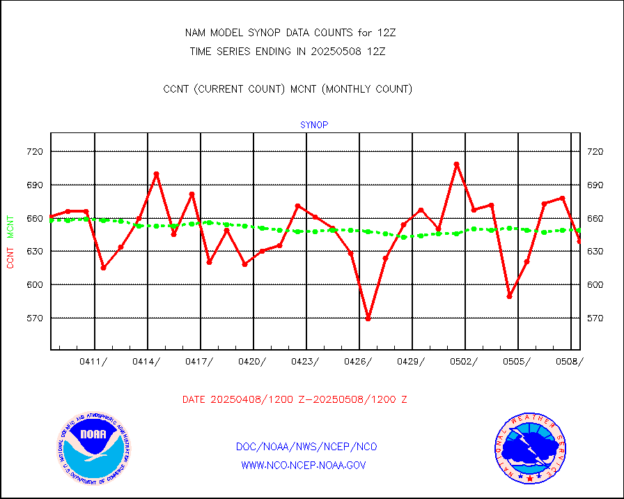
Synoptic - fixed manual and automatic |
609 |
654 |
93.1 % |
|||||||||||
Synoptic - mobile manual & auto (decoded fr BUFR) |
27 |
26 |
103.8 % |
|||||||||||
TAMDAR aircft data-all types(from Panasonic,BUFR) |
327 |
247 |
132.4 % |
|||||||||||
MTSAT/JMA visible derived cloud motion |
0 |
0 |
n/a |
|||||||||||
METEOSAT/EUMETSAT visible drv cld motion NBseq |
7206 |
7241 |
99.5 % |
|||||||||||


