| Suspect Data Shortages in Critical Types - Monitor | ||||||||||||||
|---|---|---|---|---|---|---|---|---|---|---|---|---|---|---|
| Type | Description | Hourly Count | Monthly Average | Percent (%) of Monthly Mean | UTC Time Window | |||||||||
NOAA 18-19 & METOP 1-2 HIRS-4 NCEP-proc. br.temps |
0 |
13191 |
0.0 % |
0110.00-0110.99 |
||||||||||
NOAA 15-19 & METOP 1-2 HIRS-3/4 pr btmps frm RARS |
0 |
11947 |
0.0 % |
0111.50-0112.49 |
||||||||||
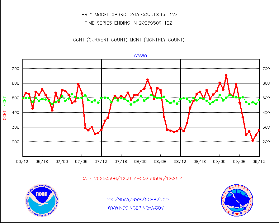
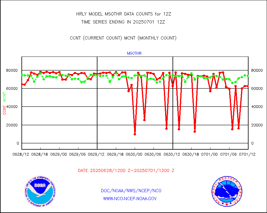
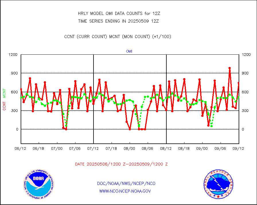
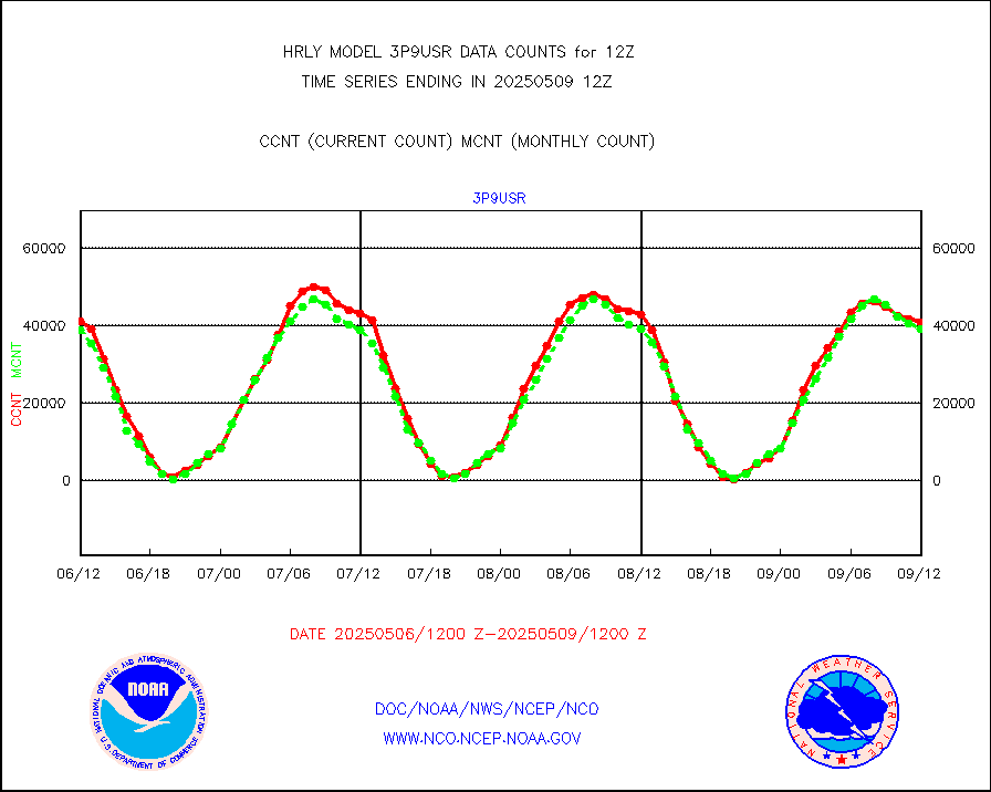
Grnd-based Gbl Navigation Sat System (GNSS) data |
1428 |
6978 |
20.5 % |
0111.00-0111.99 |
||||||||||
| Shortage in Data Type of Opportunity - Monitor | ||||||||||||||
|---|---|---|---|---|---|---|---|---|---|---|---|---|---|---|
| Type | Description | Hourly Count | Monthly Average | Percent (%) of Monthly Mean | UTC Time Window | |||||||||
P.M.(N18-19) AVHRR GAC NCEP-proc clr & sea btemps |
0 |
607952 |
0.0 % |
0109.50-0110.49 |
||||||||||
NPP Adv. Tech. MW Sndr (ATMS) br. temps from RARS |
0 |
6244 |
0.0 % |
0110.50-0111.49 |
||||||||||
INDIA SATWIND, INSAT WV channel |
0 |
731 |
0.0 % |
0111.00-0111.99 |
||||||||||
High Density OBs from reconnaissance acft data |
0 |
9 |
0.0 % |
0111.50-0112.49 |
||||||||||
INDIA SATWIND, INSAT IR channel |
0 |
841 |
0.0 % |
0111.00-0111.99 |
||||||||||
DMSP SSM/IS 1C radiance data (Unified Pre-Proc.) |
0 |
57698 |
0.0 % |
0110.50-0111.49 |
||||||||||
INDIA SATWIND, INSAT VIS channel |
0 |
70 |
0.0 % |
0111.00-0111.99 |
||||||||||
| Critical Data with Normal Counts | ||||||||||||||
|---|---|---|---|---|---|---|---|---|---|---|---|---|---|---|
| Type | Description | Hourly Count | Monthly Average | Percent (%) of Monthly Mean | UTC Time Window | |||||||||
NOAA 15-19 & METOP 1-2 AMSU-A NCEP-proc. br.temps |
26734 |
37770 |
70.8 % |
0110.00-0110.99 |
||||||||||
NOAA 18-19 & METOP 1-2 MHS NCEP-proces. br. temps |
237696 |
259405 |
91.6 % |
0110.00-0110.99 |
||||||||||
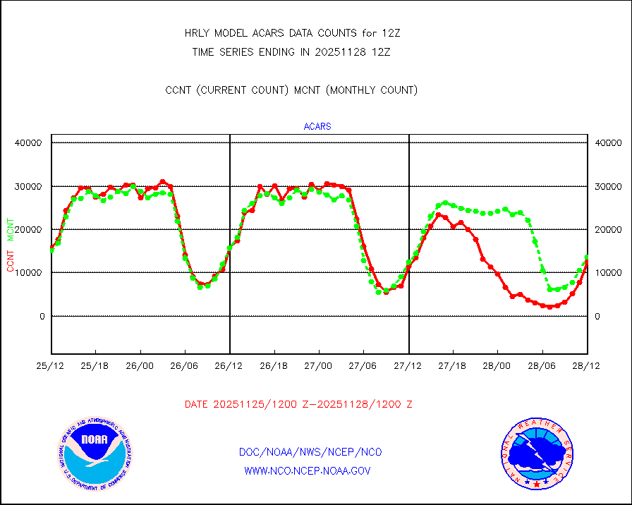
MDCRS ACARS acft data from ARINC(dcded from BUFR) |
17452 |
19820 |
88.1 % |
0111.50-0112.49 |
||||||||||
Manual AIREP aircraft data (dcded from AIREP fmt) |
968 |
935 |
103.5 % |
0111.50-0112.49 |
||||||||||
AQUA AIRS/AMSU-A/HSB brightness temps- every FOV |
0 |
0 |
n/a |
0109.50-0110.49 |
||||||||||
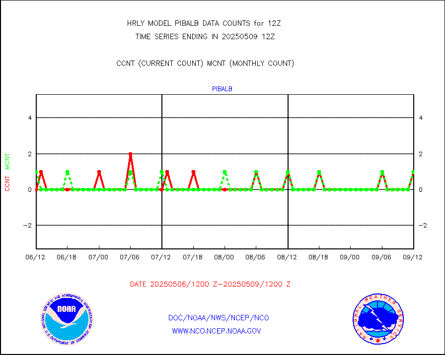
AMDAR aircraft data (decoded from AMDAR format) |
379 |
139 |
272.7 % |
0111.50-0112.49 |
||||||||||
AMDAR aircraft data (decoded from BUFR) |
2365 |
2332 |
101.4 % |
0111.50-0112.49 |
||||||||||
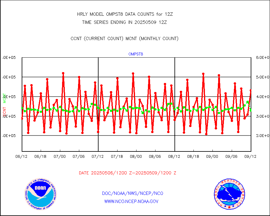
METOP 1-2 ASCAT products |
71988 |
61464 |
117.1 % |
0110.50-0111.49 |
||||||||||
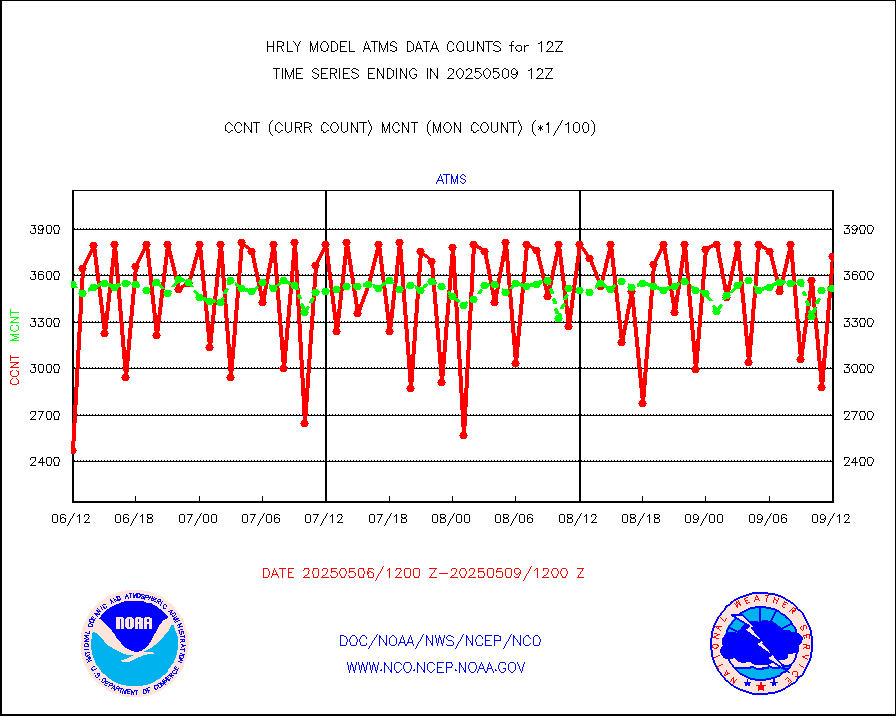
NPP/NOAA-20 ATMS brightness temperatures |
365856 |
349251 |
104.8 % |
0110.50-0111.49 |
||||||||||
Canadian AMDAR aircraft data (decoded from BUFR) |
0 |
0 |
n/a |
0111.50-0112.49 |
||||||||||
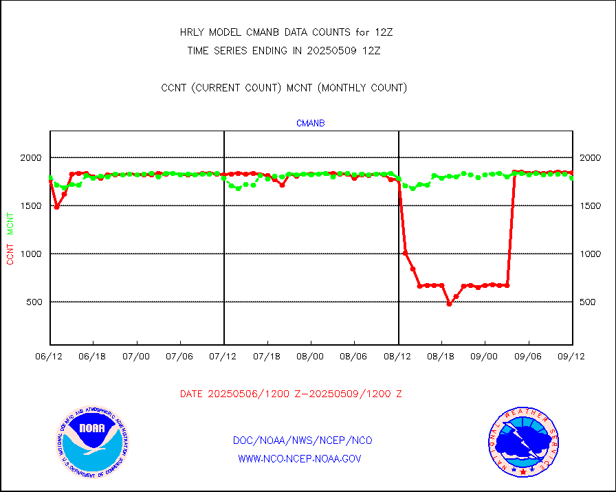
Surface Marine CMAN rpts decoded from BUFR format |
1745 |
1850 |
94.3 % |
0111.50-0112.50 |
||||||||||
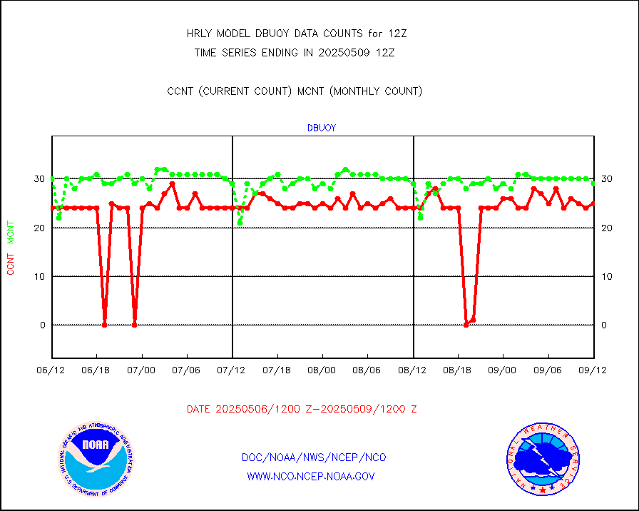
Buoys decoded from FM-18 fmt (moored or drifting) |
4 |
15 |
26.7 % |
0111.50-0112.49 |
||||||||||
E-AMDAR (European AMDAR acft decoded from BUFR) |
2230 |
2418 |
92.2 % |
0111.50-0112.49 |
||||||||||
NOAA 15-19 & METOP 1-2 AMSU-A proc btmps frm RARS |
14438 |
20026 |
72.1 % |
0111.50-0112.49 |
||||||||||
GPS radio occultation data |
520 |
516 |
100.8 % |
0109.50-0110.49 |
||||||||||
GOES-16/17 All Sky Radiances (proc.) |
720952 |
720950 |
100.0 % |
0111.50-0112.49 |
||||||||||
GOES-16/17 Clear Sky Radiances (proc.) |
345701 |
347729 |
99.4 % |
0111.50-0112.49 |
||||||||||
MTSAT/JMA water vapor imager derived cloud motion |
21847 |
20001 |
109.2 % |
0109.50-0110.49 |
||||||||||
MODIS (AQUA/TERRA) wvpr imager derived cld motion |
0 |
0 |
n/a |
0108.00-0108.99 |
||||||||||
GOES-16&up/NESDIS wv imgr/cld-top derived cld mtn |
22132 |
24753 |
89.4 % |
0111.00-0111.99 |
||||||||||
METEOSAT/EUMETSAT ir lg-wave drv cld motion NBseq |
21655 |
21095 |
102.7 % |
0110.50-0111.49 |
||||||||||
MTSAT/JMA infrared long-wave derived cloud motion |
16800 |
16335 |
102.8 % |
0109.50-0110.49 |
||||||||||
MODIS (AQUA/TERRA) ir l-wave derived cloud motion |
0 |
0 |
n/a |
0108.00-0108.99 |
||||||||||
GOES-16&up/NESDIS ir long-wave derived cld motion |
82769 |
84822 |
97.6 % |
0111.00-0111.99 |
||||||||||
GOES/NASA(Langley) hi-res. (1x1 f-o-v) cloud data |
6430751 |
6270686 |
102.6 % |
0111.50-0112.49 |
||||||||||
Buoys decoded from FM-13 format (moored) |
167 |
126 |
132.5 % |
0111.50-0112.49 |
||||||||||
Aviation - METAR |
8199 |
8080 |
101.5 % |
0111.50-0112.49 |
||||||||||
Mesonet/MADIS Colorado E-470 (Interstate 470) |
24 |
24 |
100.0 % |
0111.50-0112.49 |
||||||||||
Mesonet/MADIS Alaska Department of Transportation |
120 |
88 |
136.4 % |
0111.50-0112.49 |
||||||||||
Mesonet/MADIS U.S. Army Aberdeen Proving Grounds |
0 |
0 |
n/a |
0111.50-0112.49 |
||||||||||
Mesonet/MADIS Citizen Weather Observers Program |
55445 |
62020 |
89.4 % |
0111.50-0112.49 |
||||||||||
Mesonet/MADIS AWS Convergence Technologies, Inc. |
18220 |
20918 |
87.1 % |
0111.50-0112.49 |
||||||||||
Mesonet/MADIS "Anything Weather" |
0 |
0 |
n/a |
0111.50-0112.49 |
||||||||||
Mesonet/MADIS Colorado Dept. of Transportation |
0 |
0 |
n/a |
0111.50-0112.49 |
||||||||||
Mesonet/MADIS DC Net |
0 |
0 |
n/a |
0111.50-0112.49 |
||||||||||
Mesonet/MADIS Denver Urban Drainage & Flood Cntrl |
0 |
0 |
n/a |
0111.50-0112.49 |
||||||||||
Mesonet/MADIS Florida (FAWN & USF) |
4 |
4 |
100.0 % |
0111.50-0112.49 |
||||||||||
Mesonet/MADIS Florida Dept. of Transportation |
0 |
0 |
n/a |
0111.50-0112.49 |
||||||||||
Mesonet/MADIS Georgia Dept. of Transportation |
0 |
0 |
n/a |
0111.50-0112.49 |
||||||||||
Mesonet/MADIS NWS Hydromet Auto Data System(HADS) |
5859 |
5998 |
97.7 % |
0111.50-0112.49 |
||||||||||
Mesonet/MADIS Iowa Environmental |
190 |
183 |
103.8 % |
0111.50-0112.49 |
||||||||||
Mesonet/MADIS Indiana Dept. of Transportation |
0 |
0 |
n/a |
0111.50-0112.49 |
||||||||||
Mesonet/MADIS Iowa Department of Transportation |
0 |
0 |
n/a |
0111.50-0112.49 |
||||||||||
Mesonet/MADIS Kansas Department of Transportation |
339 |
352 |
96.3 % |
0111.50-0112.49 |
||||||||||
Mesonet/MADIS Oklahoma Mesonet |
630 |
627 |
100.5 % |
0111.50-0112.49 |
||||||||||
Mesonet/MADIS Louisiana State/Jackson State Univ. |
0 |
0 |
n/a |
0111.50-0112.49 |
||||||||||
Mesonet/MADIS Missouri Commercial Agricult Wx Net |
333 |
331 |
100.6 % |
0111.50-0112.49 |
||||||||||
Mesonet/MADIS Minnesota Dept. of Transportation |
0 |
0 |
n/a |
0111.50-0112.49 |
||||||||||
Mesonet/MADIS NOS-Phys Oceanographic Realtime Sys |
389 |
374 |
104.0 % |
0111.50-0112.49 |
||||||||||
Mesonet/MADIS NFIC Remote Automated Wx Stns(RAWS) |
1925 |
1823 |
105.6 % |
0111.50-0112.49 |
||||||||||
Mesonet/MADIS many providers, not separated out |
62758 |
73863 |
85.0 % |
0111.00-0112.49 |
||||||||||
Mesonet/MADIS Virginia Dept. of Transportation |
0 |
0 |
n/a |
0111.50-0112.49 |
||||||||||
Mesonet/MADIS "Weather for You" |
0 |
0 |
n/a |
0111.50-0112.49 |
||||||||||
Mesonet/MADIS Wisconsin Dept. of Transportation |
0 |
0 |
n/a |
0111.50-0112.49 |
||||||||||
Mesonet/MADIS MesoWest (many subproviders) |
26770 |
36741 |
72.9 % |
0111.50-0112.49 |
||||||||||
Mesonet/MADIS West Texas |
5658 |
6011 |
94.1 % |
0111.50-0112.49 |
||||||||||
METOP 1-2 IASI 1C radiance data (varbl. channels) |
106920 |
85991 |
124.3 % |
0110.00-0110.99 |
||||||||||
NEXRAD Vel Azm Dsp(VAD) winds via radar coded msg |
0 |
0 |
n/a |
0111.50-0112.49 |
||||||||||
Aura Ozone Monitoring Instrument (OMI) data |
0 |
0 |
n/a |
0109.50-0110.49 |
||||||||||
NOAA 16-19 Solar Backscatter UV-2 rad frm V8 BUFR |
0 |
0 |
n/a |
0110.00-0110.99 |
||||||||||
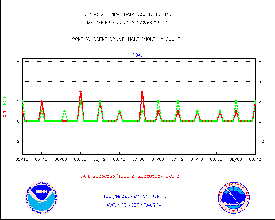
PIBAL (from PILOT, PILOT SHIP, PILOT MOBIL) |
3 |
2 |
150.0 % |
0111.50-0112.49 |
||||||||||
Multi-Agency Profiler (MAP) and SODAR winds |
51 |
47 |
108.5 % |
0111.50-0112.49 |
||||||||||
Rawinsonde - fixed land (from TEMP or PILOT) |
133 |
130 |
102.3 % |
0111.50-0112.49 |
||||||||||
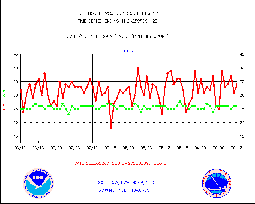
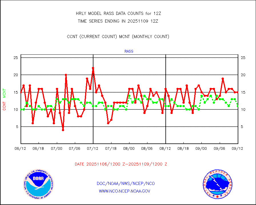
RASS temperatures (NOAA and Multi-Agency) |
24 |
26 |
92.3 % |
0111.50-0112.49 |
||||||||||
NEXRAD reflectivity (Lvl 2 - GTS) |
4330852 |
4071500 |
106.4 % |
0111.50-0112.49 |
||||||||||
NEXRAD radial wind (Level 2 - GTS) |
1393417 |
1207417 |
115.4 % |
0111.50-0112.49 |
||||||||||
METEOSAT-10 2nd Gen SEVIRI Clr Sky Radiance(proc) |
0 |
0 |
n/a |
0111.50-0112.49 |
||||||||||
Ship - manual and automatic, restricted (BUFR) |
0 |
0 |
n/a |
0111.50-0112.50 |
||||||||||
Ship - manual and automatic, unrestricted |
309 |
278 |
111.2 % |
0111.50-0112.50 |
||||||||||
Ship - manual and automatic, unrestricted (BUFR) |
931 |
1024 |
90.9 % |
0111.50-0112.50 |
||||||||||
Synoptic - fixed manual and automatic |
1845 |
1817 |
101.5 % |
0111.50-0112.49 |
||||||||||
Synoptic - fixed manual & auto (decoded fr BUFR) |
6951 |
6883 |
101.0 % |
0111.50-0112.49 |
||||||||||
Synoptic - restricted (WMO Res 40) manual & auto. |
3 |
2 |
150.0 % |
0111.50-0112.49 |
||||||||||
Synoptic - restricted (WMO Res 40)(decoded BUFR) |
349 |
357 |
97.8 % |
0111.50-0112.49 |
||||||||||
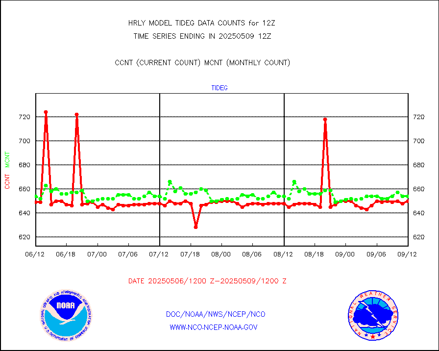
Tide gauge reports decoded from CREX format |
658 |
657 |
100.2 % |
0111.00-0111.99 |
||||||||||
| Data Types of Opportunity with Normal Counts | ||||||||||||||
|---|---|---|---|---|---|---|---|---|---|---|---|---|---|---|
| Type | Description | Hourly Count | Monthly Average | Percent (%) of Monthly Mean | UTC Time Window | |||||||||
GOES-16&up/NESDIS ir short-wv derived cld motion |
40131 |
42255 |
95.0 % |
0111.00-0111.99 |
||||||||||
MDCRS ACARS acft data (ARINC via AFWA)(AIREP fmt) |
0 |
0 |
n/a |
0111.50-0112.49 |
||||||||||
Himawari Clear Sky Radiance |
0 |
0 |
n/a |
0111.00-0111.99 |
||||||||||
GCOM-W AMSR2 1B brightness temperatures |
2309472 |
2189657 |
105.5 % |
0110.00-0110.99 |
||||||||||
NPP/NOAA-20 ATMS bright. temps-direct b-cast SSEC |
86833 |
90574 |
95.9 % |
0110.50-0111.49 |
||||||||||
POES/NESDIS - processed ATOVS soundings/radiances |
0 |
0 |
n/a |
0110.00-0110.99 |
||||||||||
A.M.(N17,M2,M3) AVHRR GAC NCEP-proc clr&sea btmps |
1709945 |
1467640 |
116.5 % |
0109.50-0110.49 |
||||||||||
eXpendable BathyThermograph, mooring (BATHY fmt) |
0 |
0 |
n/a |
0105.00-0105.99 |
||||||||||
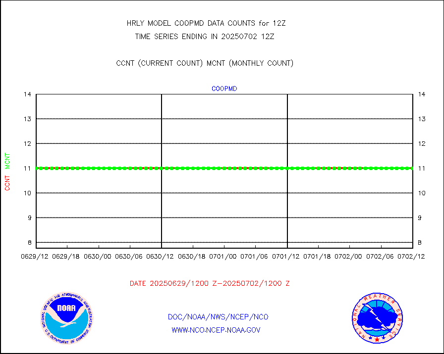
Coop/MADIS NEPP & HCN-Modernization NOAA COOP Obs |
11 |
11 |
100.0 % |
0111.50-0112.49 |
||||||||||
NPP/NOAA-20 CrIS full spctrl radn (431 ch subset) |
210294 |
225122 |
93.4 % |
0110.50-0111.49 |
||||||||||
NPP/NOAA-20 CrIS full spctrl radn dir brdcst SSEC |
18126 |
25061 |
72.3 % |
0110.50-0111.49 |
||||||||||
Coast Guard |
5 |
5 |
100.0 % |
0111.50-0112.50 |
||||||||||
Drifting buoys (decoded from BUFR) |
1440 |
1448 |
99.4 % |
0111.50-0112.50 |
||||||||||
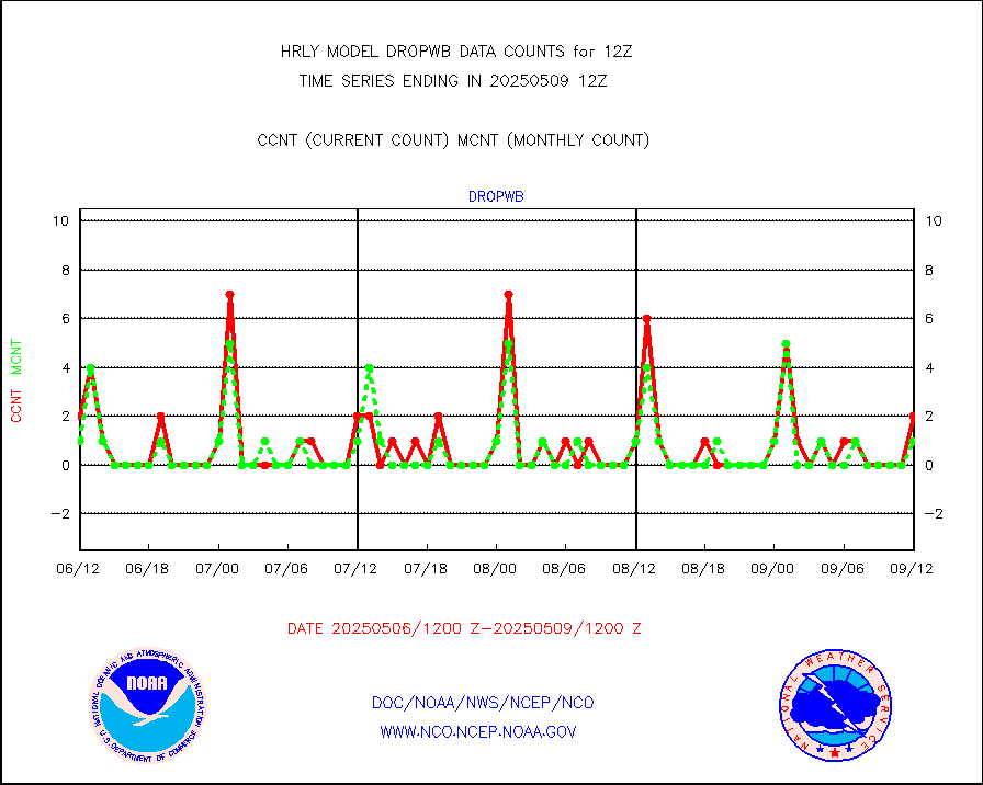
Dropwinsonde (from TEMP DROP) |
0 |
0 |
n/a |
0111.50-0112.49 |
||||||||||
Dropwinsonde (decoded from BUFR) |
1 |
2 |
50.0 % |
0111.51-0112.49 |
||||||||||
GOES imager effective cloud amount data (U.Wisc.) |
9250602 |
8158701 |
113.4 % |
0111.50-0112.49 |
||||||||||
METOP 1-2 IASI 1C radiance data vbl chn from RARS |
26396 |
35891 |
73.5 % |
0111.00-0111.99 |
||||||||||
NOAA 18-19 & METOP 1-2 MHS proc. btemps from RARS |
134280 |
184588 |
72.7 % |
0111.50-0112.49 |
||||||||||
GOES/NESDIS (11x17 f-o-v) imager clear radiances |
0 |
0 |
n/a |
0111.00-0111.99 |
||||||||||
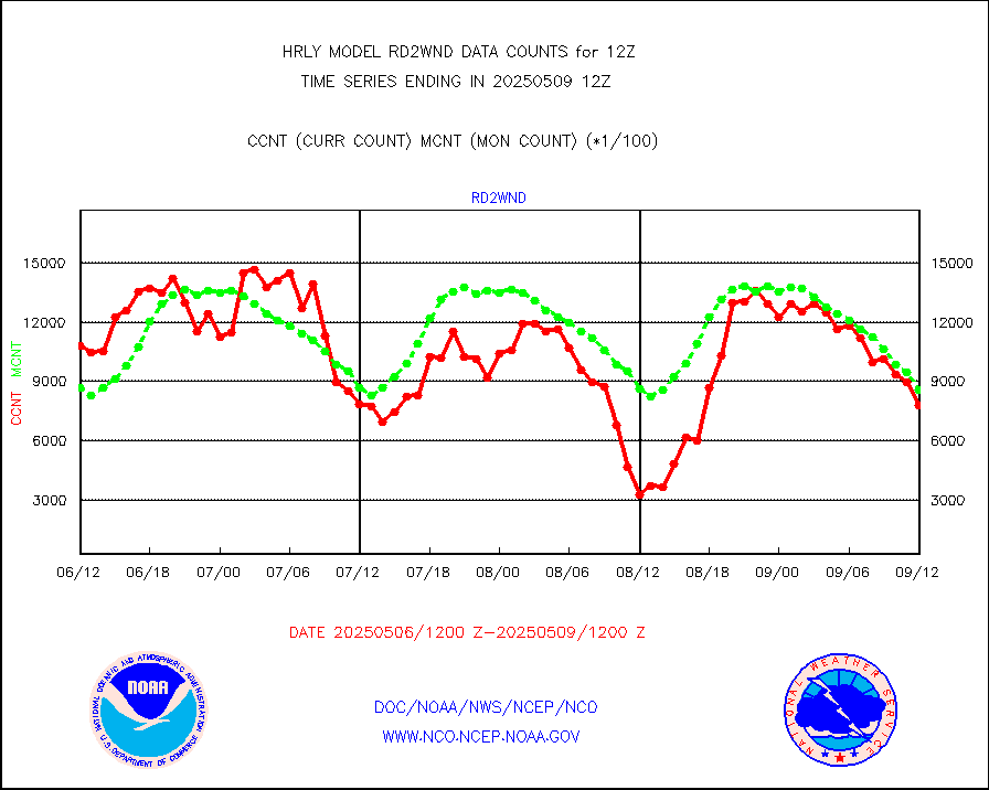
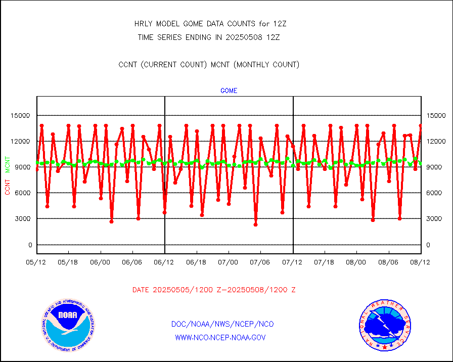
METOP 1-2 Global Ozone Monitoring Exp.-2 (GOME-2) |
12528 |
9275 |
135.1 % |
0110.50-0111.49 |
||||||||||
GOES-16&up/NESDIS wv imgr/deep-lyr derivd cld mtn |
20176 |
17029 |
118.5 % |
0111.00-0111.99 |
||||||||||
METEOSAT/EUMETSAT wvpr imgr drv cld motion NBseq |
36547 |
38118 |
95.9 % |
0110.50-0111.49 |
||||||||||
METOP 1-2 IASI 1C radiances-direct broadcast SSEC |
23756 |
39504 |
60.1 % |
0110.50-0111.49 |
||||||||||
VIIRS (NPP/NOAA-20) ir lg-wv drv cloud motion(NB) |
20047 |
17257 |
116.2 % |
0108.00-0108.99 |
||||||||||
AVHRR (NOAA/METOP) ir lg-wave derived cld motion |
0 |
0 |
n/a |
0108.00-0108.99 |
||||||||||
AVHRR (METOP) ir lg-wave derived cld motion |
0 |
0 |
n/a |
0111.50-0112.50 |
||||||||||
INSAT/KALPANA India ir lg-wave derived cld motion |
0 |
0 |
n/a |
0109.50-0110.49 |
||||||||||
Korean AMDAR aircraft data (decoded from BUFR) |
69 |
50 |
138.0 % |
0111.50-0112.49 |
||||||||||
Land-based CMAN stations decoded from CMAN format |
140 |
79 |
177.2 % |
0111.50-0112.49 |
||||||||||
LEO-GEO satellite AMVs from UWisc. |
7056 |
7957 |
88.7 % |
0108.00-0108.99 |
||||||||||
LLDN Long-rng lightning from Vaisala via NOAAPORT |
113661 |
148462 |
76.6 % |
0111.50-0112.49 |
||||||||||
NLDN Shrt-rng lightning from Vaisala via NOAAPORT |
3769 |
3746 |
100.6 % |
0111.50-0112.49 |
||||||||||
Moored buoys (decoded from BUFR) |
854 |
910 |
93.8 % |
0111.50-0112.50 |
||||||||||
Aura Microwave Limb Sounder (MLS) ozone data |
0 |
0 |
n/a |
0110.00-0110.99 |
||||||||||
Mesonet/MADIS UrbaNet |
3593 |
3548 |
101.3 % |
0111.50-0112.49 |
||||||||||
NEXRAD Vel Azm Dsp(VAD) winds via Level 2 decoder |
414 |
513 |
80.7 % |
0111.50-0112.49 |
||||||||||
OMPS Limb Profiler ozone data (NPP) |
74 |
280 |
26.4 % |
0105.00-0105.99 |
||||||||||
OMPS nadir profile ozone (Version 8 BUFR) |
489 |
560 |
87.3 % |
0110.00-0110.99 |
||||||||||
OMPS total column ozone (Version 8 BUFR) |
363332 |
328635 |
110.6 % |
0110.00-0110.99 |
||||||||||
PIBAL (decoded from BUFR) |
1 |
1 |
100.0 % |
0111.51-0112.49 |
||||||||||
Manual PIREP aircraft data (dcded from AIREP fmt) |
91 |
99 |
91.9 % |
0111.50-0112.49 |
||||||||||
Profilr winds from PIBAL (PILOT,PILOT SHIP/MOBIL) |
0 |
0 |
n/a |
0111.50-0112.49 |
||||||||||
Rawinsonde - fixed land (decoded from BUFR) |
1 |
1 |
100.0 % |
0111.51-0112.49 |
||||||||||
Rawinsonde - mobile land (from TEMP/PILOT MOBIL) |
0 |
0 |
n/a |
0111.50-0112.49 |
||||||||||
Rawinsonde - mobile land (decoded from BUFR) |
0 |
0 |
n/a |
0111.51-0112.49 |
||||||||||
Rawinsonde - ship (from TEMP SHIP, PILOT SHIP) |
1 |
1 |
100.0 % |
0111.50-0112.49 |
||||||||||
Rawinsonde - ship (decoded from BUFR) |
0 |
0 |
n/a |
0111.51-0112.49 |
||||||||||
Flight level reconnaissance aircraft data |
0 |
0 |
n/a |
0111.50-0112.49 |
||||||||||
Megha-Tropiques SAPHIR L1A2 brightness temps |
0 |
0 |
n/a |
0109.50-0110.49 |
||||||||||
METEOSAT-10 2nd Gen SEVIRI All Sky Radiance(proc) |
75512 |
75333 |
100.2 % |
0111.50-0112.49 |
||||||||||
Ship - manual and automatic, restricted |
16 |
18 |
88.9 % |
0111.50-0112.49 |
||||||||||
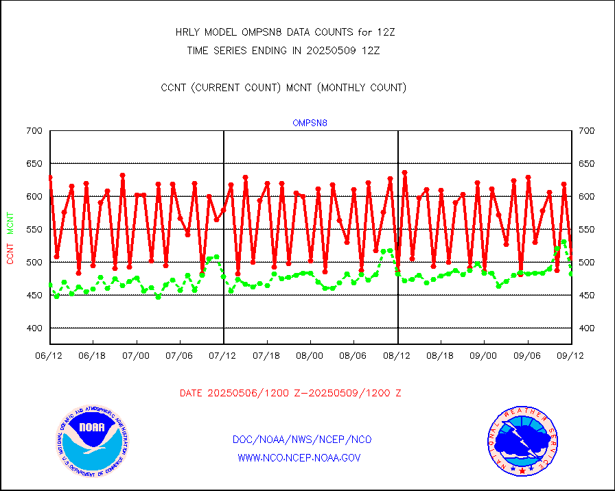
NPP/NOAA-20 VIIRS SST - CLEAR & OVER WATER |
7719363 |
2147207 |
359.5 % |
0111.50-0112.49 |
||||||||||
NPP/NOAA-20 VIIRS SST - PROBABLY CLR & OVER WATER |
1294027 |
415234 |
311.6 % |
0111.50-0112.49 |
||||||||||
Synoptic - mobile manual and automatic |
782 |
723 |
108.2 % |
0111.50-0112.49 |
||||||||||
Synoptic - mobile manual & auto (decoded fr BUFR) |
3 |
1 |
300.0 % |
0111.50-0112.49 |
||||||||||
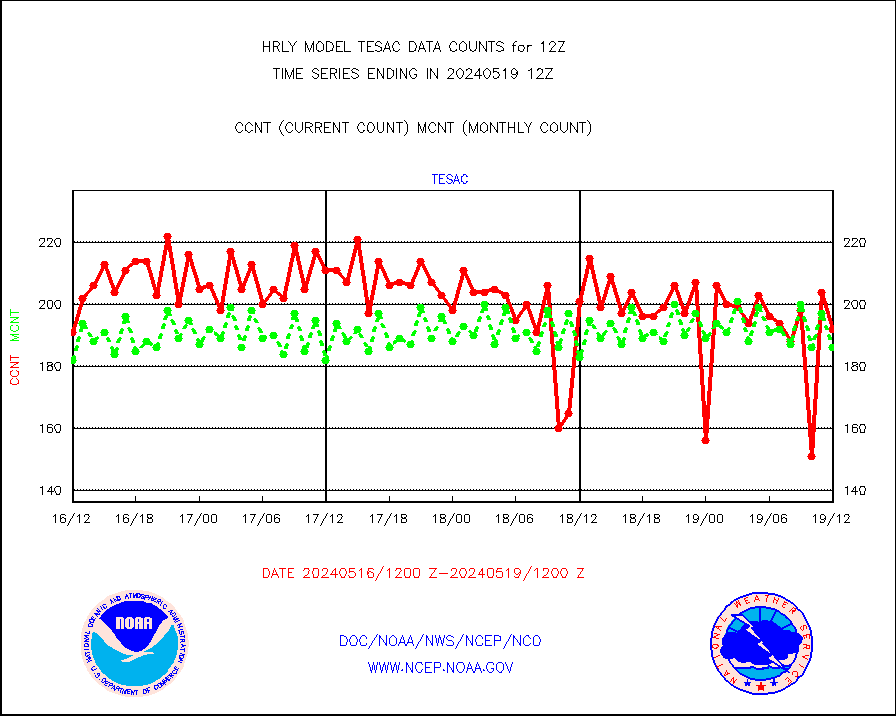
CTD probe, Argo prflng float, mooring (TESAC fmt) |
224 |
211 |
106.2 % |
0111.50-0112.49 |
||||||||||
TAMDAR aircft data-all types(from Panasonic,BUFR) |
70 |
53 |
132.1 % |
0111.50-0112.49 |
||||||||||
ThermoSalinoGraph (TSG) TRACKOB format) |
92 |
91 |
101.1 % |
0110.50-0111.49 |
||||||||||
INSAT/KALPANA India visible derived cloud motion |
0 |
0 |
n/a |
0109.50-0110.49 |
||||||||||
MTSAT/JMA visible derived cloud motion |
2520 |
2370 |
106.3 % |
0109.50-0110.49 |
||||||||||
GOES-16&up/NESDIS visible derived cloud motion |
88131 |
68625 |
128.4 % |
0111.00-0111.99 |
||||||||||
METEOSAT/EUMETSAT visible drv cld motion NBseq |
47137 |
45171 |
104.4 % |
0110.50-0111.49 |
||||||||||


