| Suspect Data Shortages in Critical Types - Monitor | ||||||||||||||
|---|---|---|---|---|---|---|---|---|---|---|---|---|---|---|
| Type | Description | Hourly Count | Monthly Average | Percent (%) of Monthly Mean | ||||||||||
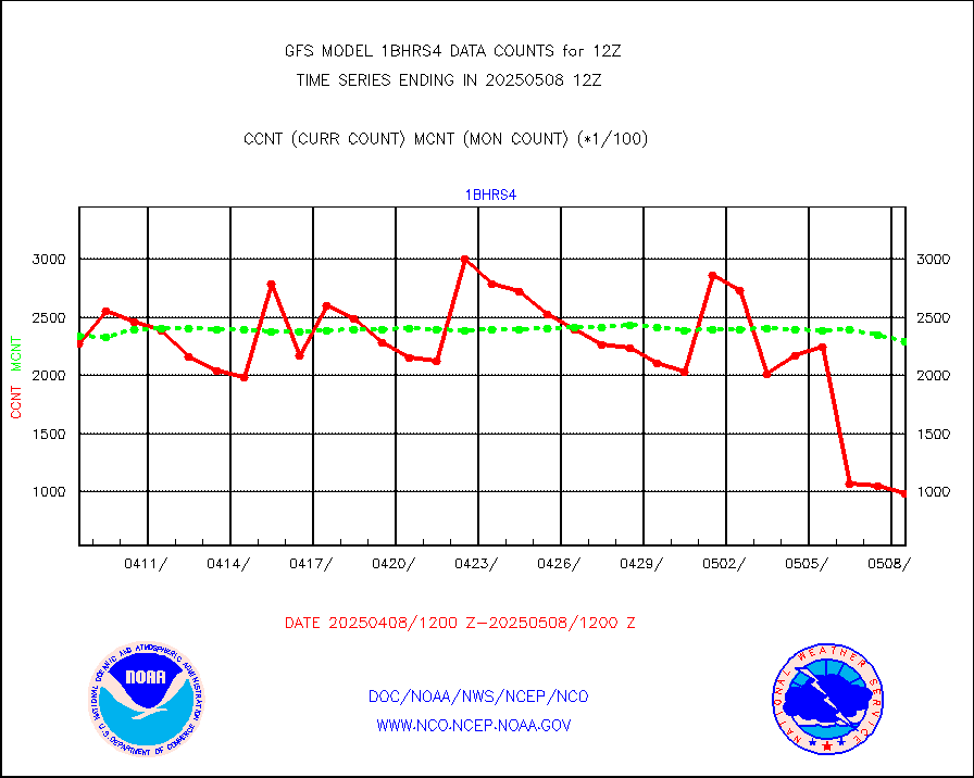
NOAA 18-19 & METOP 1-2 HIRS-4 NCEP-proc. br.temps |
0 |
61660 |
0.0 % |
|||||||||||
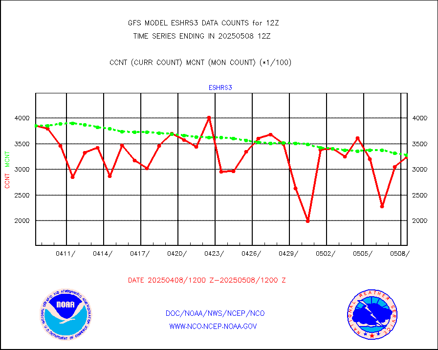
NOAA 15-19 & METOP 1-2 HIRS-3/4 pr btmps frm RARS |
0 |
124324 |
0.0 % |
|||||||||||
| Shortage in Data Type of Opportunity - Monitor | ||||||||||||||
|---|---|---|---|---|---|---|---|---|---|---|---|---|---|---|
| Type | Description | Hourly Count | Monthly Average | Percent (%) of Monthly Mean | ||||||||||
P.M.(N18-19) AVHRR GAC NCEP-proc clr & sea btemps |
0 |
2189081 |
0.0 % |
|||||||||||
INDIA SATWIND, INSAT WV channel |
0 |
22420 |
0.0 % |
|||||||||||
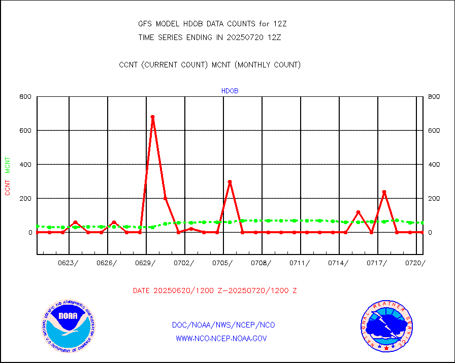
High Density OBs from reconnaissance acft data |
20 |
58 |
34.5 % |
|||||||||||
INDIA SATWIND, INSAT IR channel |
0 |
25988 |
0.0 % |
|||||||||||
NPP/NOAA-20 VIIRS SST - CLEAR & OVER WATER |
31 |
2000025 |
0.0 % |
|||||||||||
INDIA SATWIND, INSAT VIS channel |
0 |
2035 |
0.0 % |
|||||||||||
| Critical Data with Normal Counts | ||||||||||||||
|---|---|---|---|---|---|---|---|---|---|---|---|---|---|---|
| Type | Description | Hourly Count | Monthly Average | Percent (%) of Monthly Mean | ||||||||||
NOAA 15-19 & METOP 1-2 AMSU-A NCEP-proc. br.temps |
118311 |
183659 |
64.4 % |
|||||||||||
NOAA 18-19 & METOP 1-2 MHS NCEP-proces. br. temps |
1055161 |
1338114 |
78.9 % |
|||||||||||
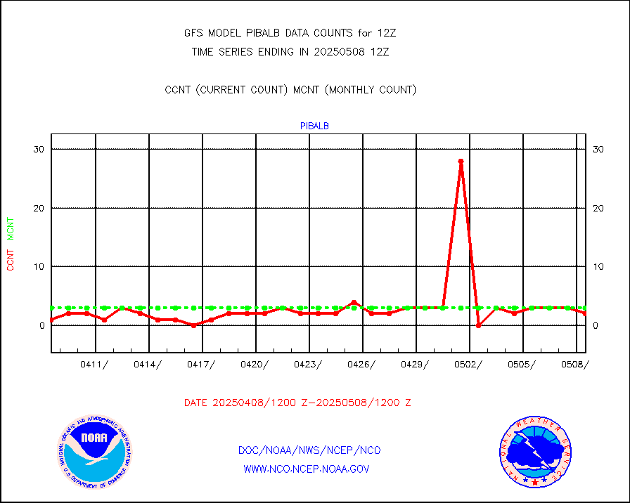
MDCRS ACARS acft data from ARINC(dcded from BUFR) |
128807 |
119069 |
108.2 % |
|||||||||||
Himawari Clear Sky Radiance |
229677 |
237524 |
96.7 % |
|||||||||||
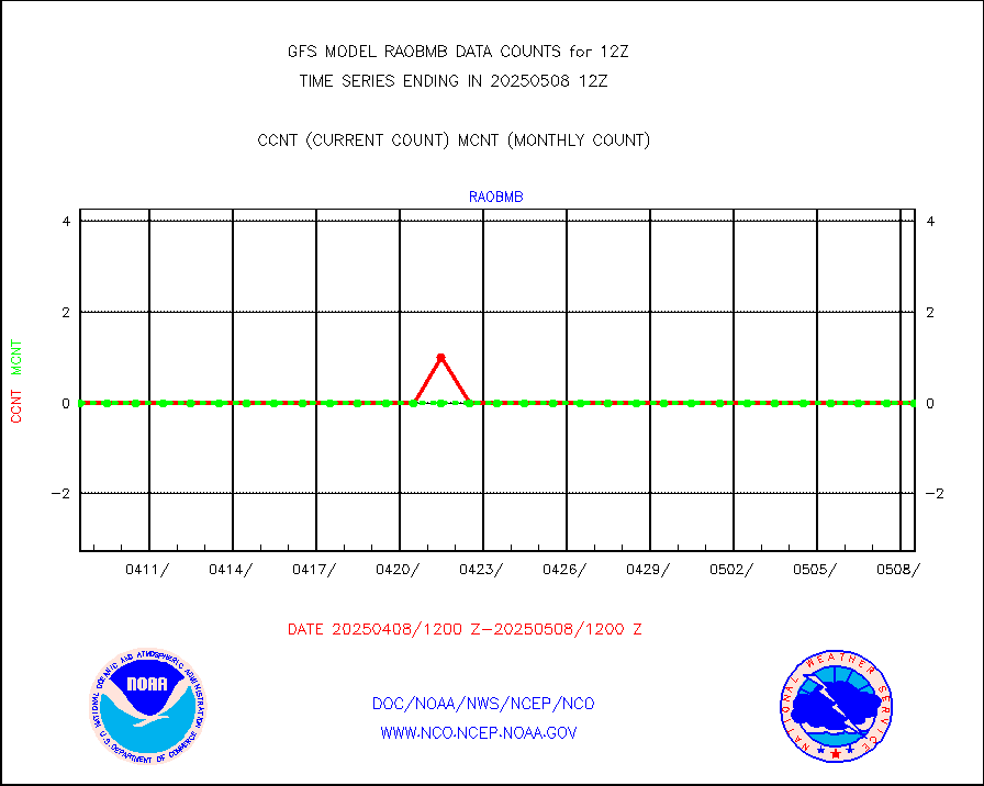
Manual AIREP aircraft data (dcded from AIREP fmt) |
4799 |
5109 |
93.9 % |
|||||||||||
AQUA AIRS/AMSU-A/HSB brightness temps- every FOV |
0 |
0 |
n/a |
|||||||||||
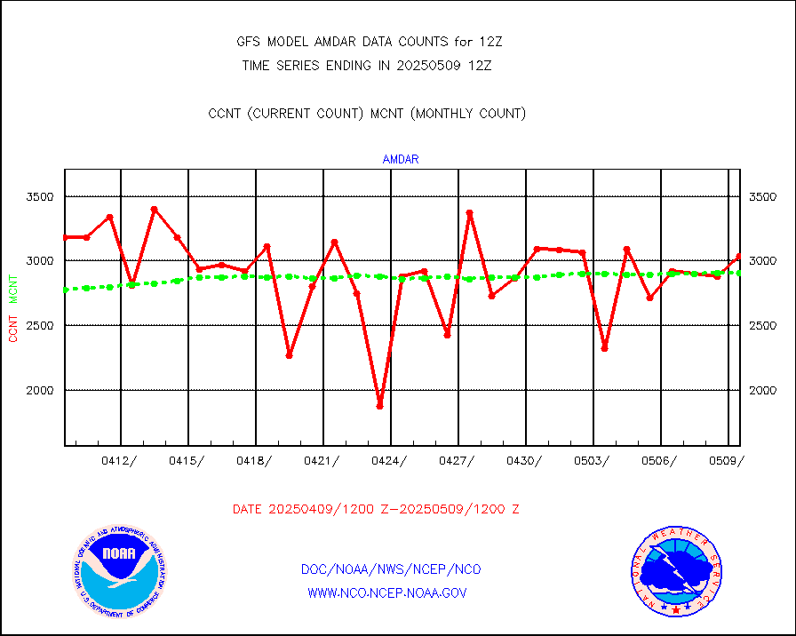
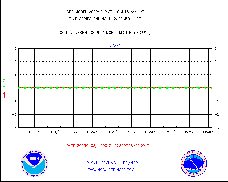
AMDAR aircraft data (decoded from AMDAR format) |
2815 |
2950 |
95.4 % |
|||||||||||
AMDAR aircraft data (decoded from BUFR) |
16076 |
16676 |
96.4 % |
|||||||||||
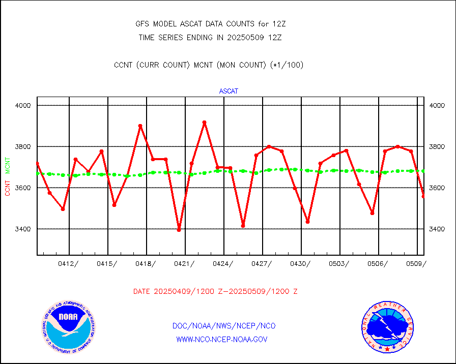
METOP 1-2 ASCAT products |
349692 |
369004 |
94.8 % |
|||||||||||
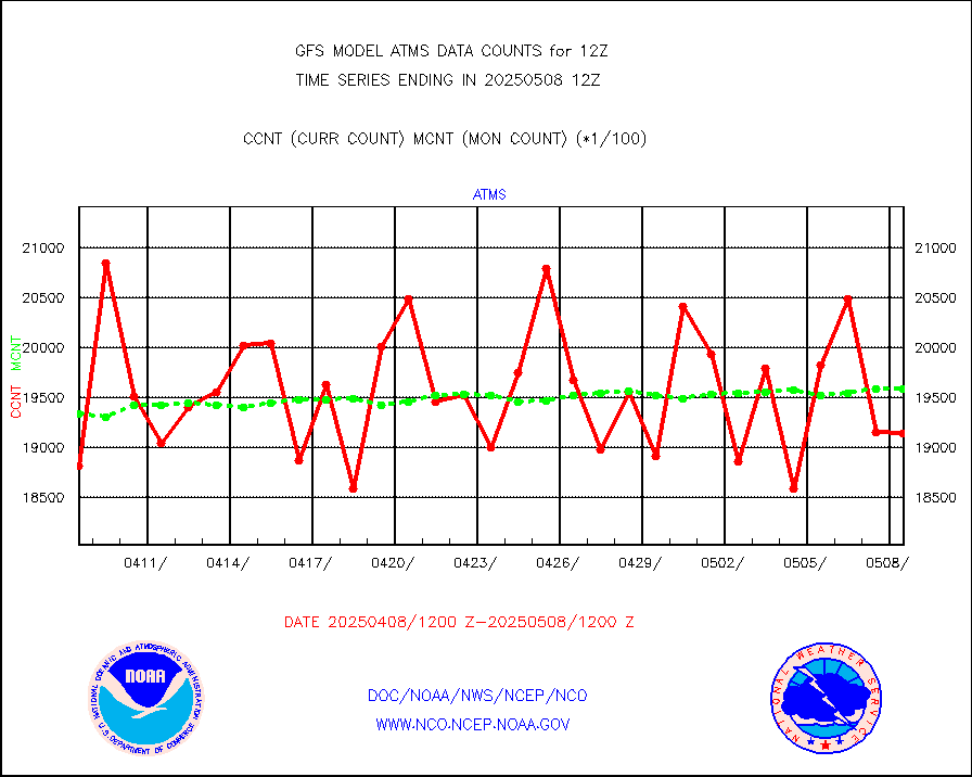
NPP/NOAA-20 ATMS brightness temperatures |
1877472 |
1922847 |
97.6 % |
|||||||||||
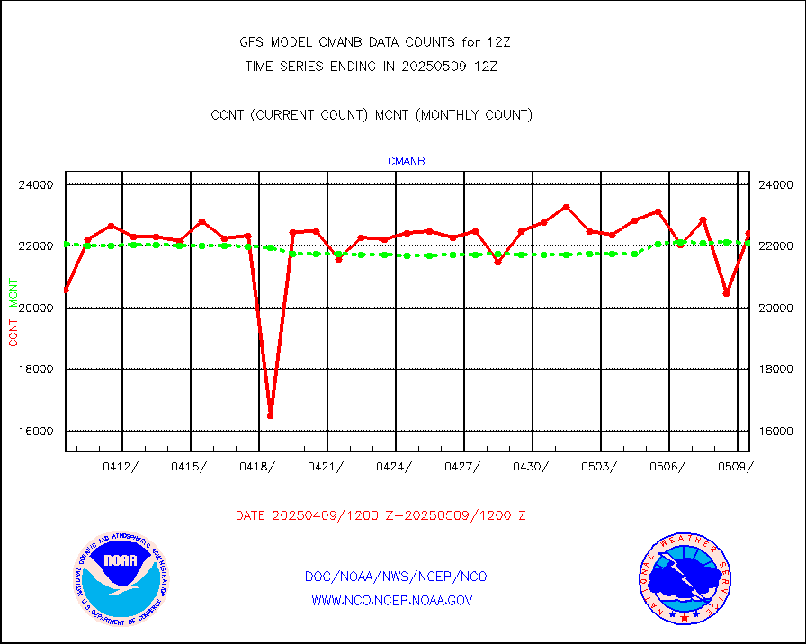
Surface Marine CMAN rpts decoded from BUFR format |
23095 |
22900 |
100.9 % |
|||||||||||
Buoys decoded from FM-18 fmt (moored or drifting) |
69 |
130 |
53.1 % |
|||||||||||
Dropwinsonde (from TEMP DROP) |
0 |
0 |
n/a |
|||||||||||
E-AMDAR (European AMDAR acft decoded from BUFR) |
19757 |
20462 |
96.6 % |
|||||||||||
NOAA 15-19 & METOP 1-2 AMSU-A proc btmps frm RARS |
108009 |
133189 |
81.1 % |
|||||||||||
GPS radio occultation data |
2570 |
2544 |
101.0 % |
|||||||||||
GOES-16/17 All Sky Radiances (proc.) |
5947854 |
5947589 |
100.0 % |
|||||||||||
GOES-16/17 Clear Sky Radiances (proc.) |
2781940 |
2911837 |
95.5 % |
|||||||||||
MTSAT/JMA water vapor imager derived cloud motion |
63443 |
58281 |
108.9 % |
|||||||||||
MODIS (AQUA/TERRA) wvpr imager derived cld motion |
0 |
0 |
n/a |
|||||||||||
GOES-16&up/NESDIS wv imgr/cld-top derived cld mtn |
132082 |
146616 |
90.1 % |
|||||||||||
METEOSAT/EUMETSAT ir lg-wave drv cld motion NBseq |
109470 |
104842 |
104.4 % |
|||||||||||
MTSAT/JMA infrared long-wave derived cloud motion |
47516 |
47510 |
100.0 % |
|||||||||||
MODIS (AQUA/TERRA) ir l-wave derived cloud motion |
0 |
0 |
n/a |
|||||||||||
GOES-16&up/NESDIS ir long-wave derived cld motion |
495658 |
503388 |
98.5 % |
|||||||||||
Land-based CMAN stations decoded from CMAN format |
447 |
478 |
93.5 % |
|||||||||||
LEO-GEO satellite AMVs from UWisc. |
22396 |
21926 |
102.1 % |
|||||||||||
Buoys decoded from FM-13 format (moored) |
789 |
814 |
96.9 % |
|||||||||||
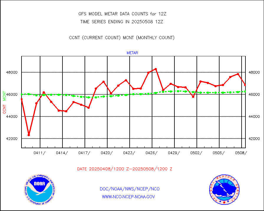
Aviation - METAR |
46428 |
46425 |
100.0 % |
|||||||||||
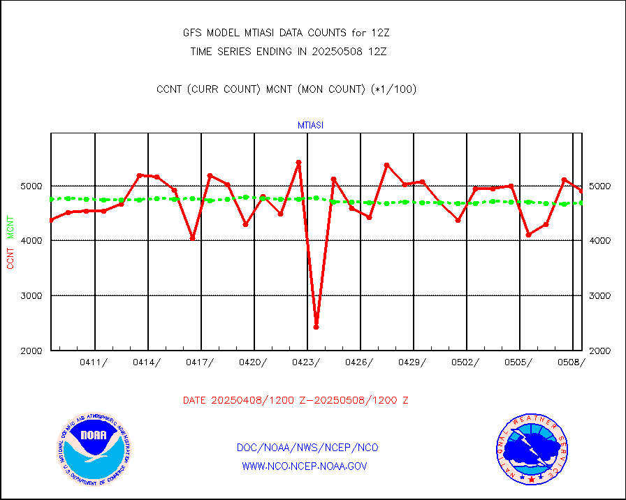
METOP 1-2 IASI 1C radiance data (varbl. channels) |
464240 |
475859 |
97.6 % |
|||||||||||
NEXRAD Vel Azm Dsp(VAD) winds via radar coded msg |
0 |
0 |
n/a |
|||||||||||
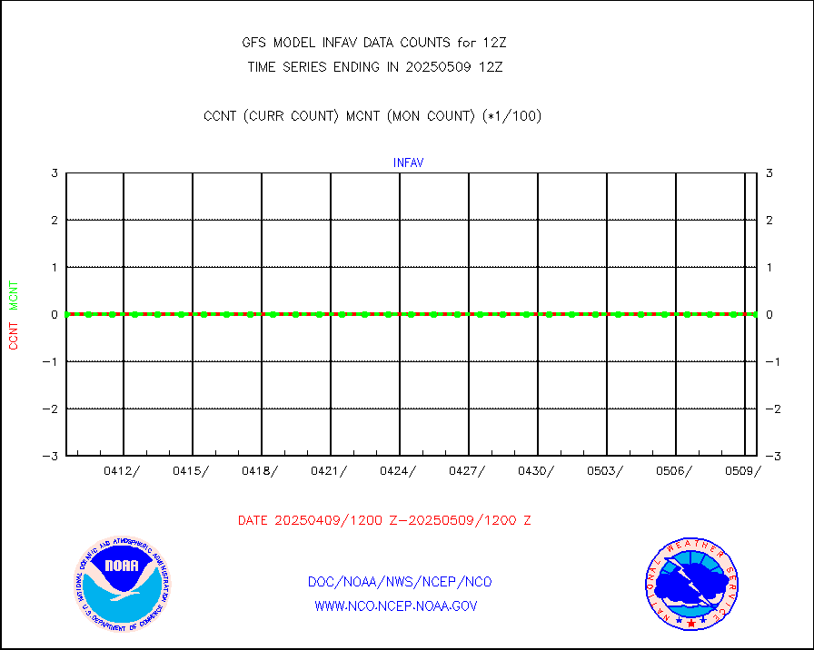
Aura Ozone Monitoring Instrument (OMI) data |
0 |
0 |
n/a |
|||||||||||
NOAA 16-19 Solar Backscatter UV-2 rad frm V8 BUFR |
0 |
0 |
n/a |
|||||||||||
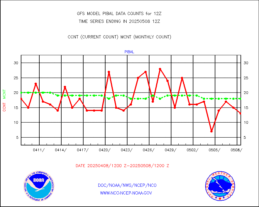
PIBAL (from PILOT, PILOT SHIP, PILOT MOBIL) |
14 |
15 |
93.3 % |
|||||||||||
Profilr winds from PIBAL (PILOT,PILOT SHIP/MOBIL) |
0 |
0 |
n/a |
|||||||||||
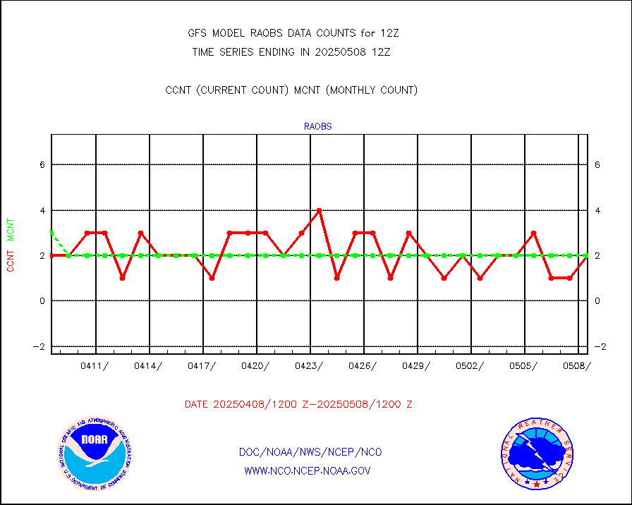
Rawinsonde - fixed land (from TEMP or PILOT) |
559 |
540 |
103.5 % |
|||||||||||
Rawinsonde - mobile land (from TEMP/PILOT MOBIL) |
0 |
0 |
n/a |
|||||||||||
Rawinsonde - ship (from TEMP SHIP, PILOT SHIP) |
2 |
4 |
50.0 % |
|||||||||||
Flight level reconnaissance aircraft data |
0 |
0 |
n/a |
|||||||||||
Ship - manual and automatic, restricted |
289 |
238 |
121.4 % |
|||||||||||
Ship - manual and automatic, restricted (BUFR) |
883 |
844 |
104.6 % |
|||||||||||
Ship - manual and automatic, unrestricted |
888 |
926 |
95.9 % |
|||||||||||
Ship - manual and automatic, unrestricted (BUFR) |
6415 |
6302 |
101.8 % |
|||||||||||
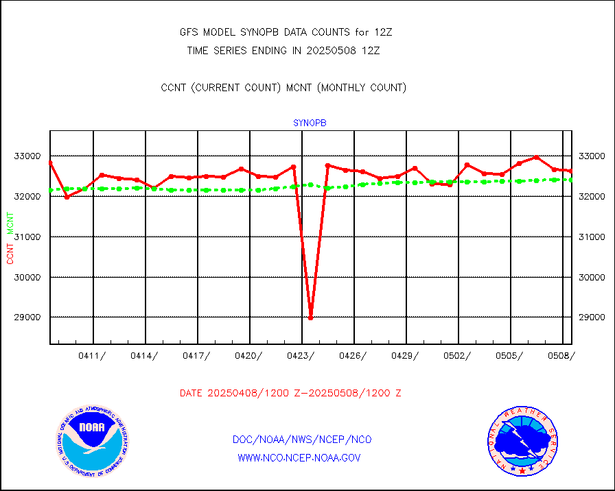
Synoptic - fixed manual & auto (decoded fr BUFR) |
40882 |
40250 |
101.6 % |
|||||||||||
Synoptic - mobile manual and automatic |
5035 |
4693 |
107.3 % |
|||||||||||
Synoptic - restricted (WMO Res 40) manual & auto. |
2 |
6 |
33.3 % |
|||||||||||
Synoptic - restricted (WMO Res 40)(decoded BUFR) |
2313 |
2343 |
98.7 % |
|||||||||||
Synoptic - mobile manual & auto (decoded fr BUFR) |
210 |
236 |
89.0 % |
|||||||||||
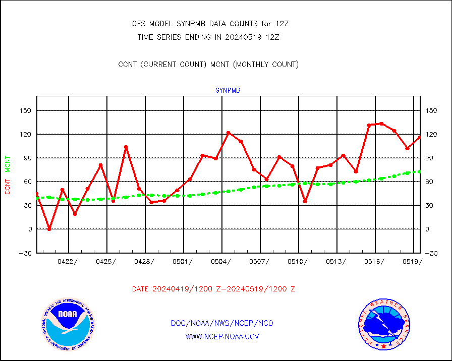
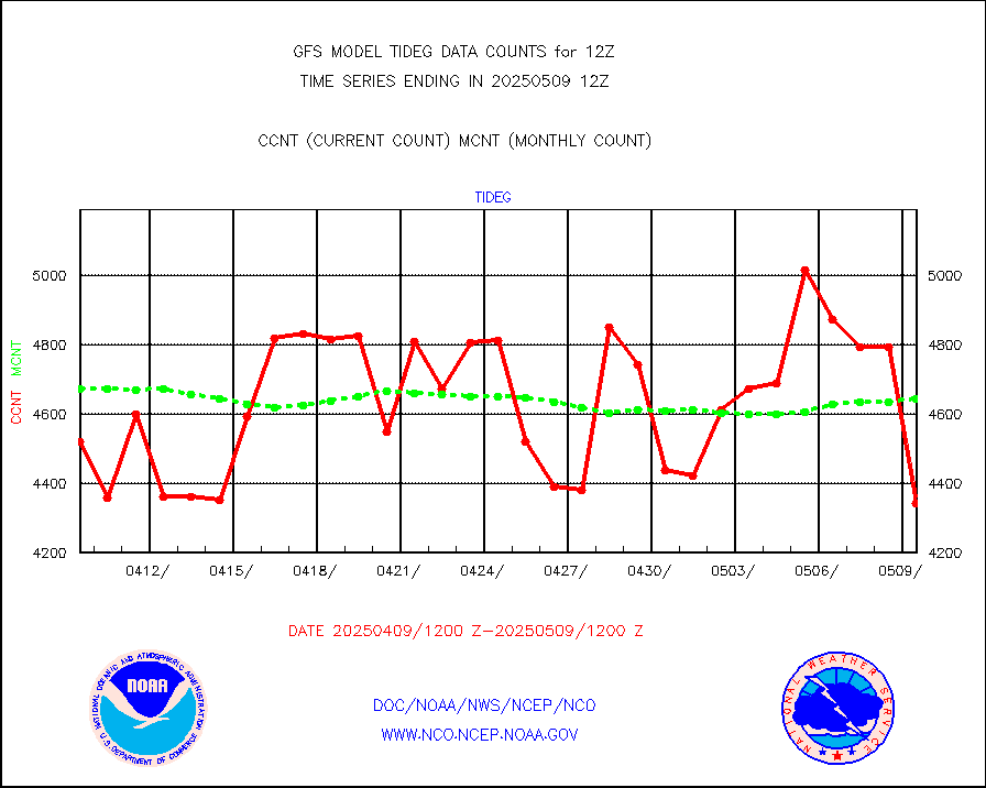
Tide gauge reports decoded from CREX format |
4889 |
4749 |
102.9 % |
|||||||||||
MTSAT/JMA visible derived cloud motion |
1643 |
1335 |
123.1 % |
|||||||||||
METEOSAT/EUMETSAT visible drv cld motion NBseq |
219021 |
202835 |
108.0 % |
|||||||||||
| Data Types of Opportunity with Normal Counts | ||||||||||||||
|---|---|---|---|---|---|---|---|---|---|---|---|---|---|---|
| Type | Description | Hourly Count | Monthly Average | Percent (%) of Monthly Mean | ||||||||||
GOES-16&up/NESDIS ir short-wv derived cld motion |
240627 |
230727 |
104.3 % |
|||||||||||
MDCRS ACARS acft data (ARINC via AFWA)(AIREP fmt) |
0 |
0 |
n/a |
|||||||||||
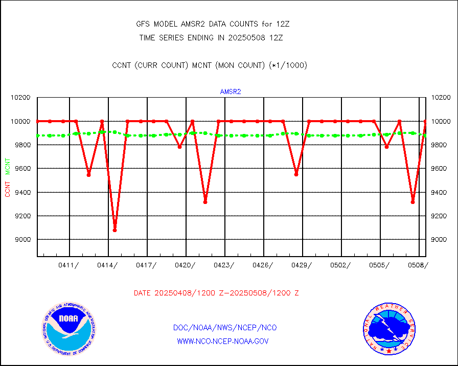
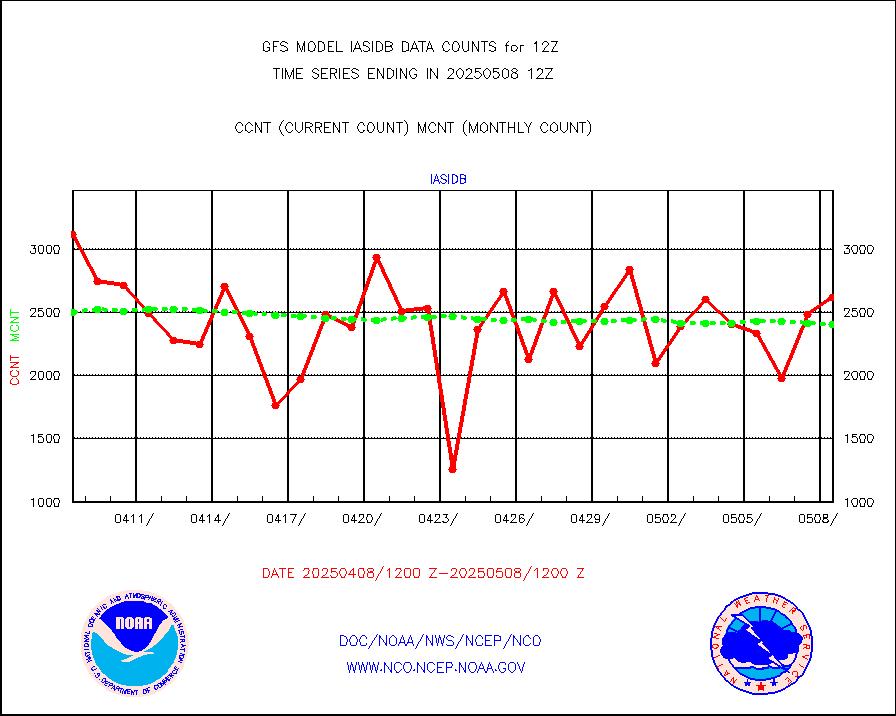
GCOM-W AMSR2 1B brightness temperatures |
9999999 |
9911729 |
100.9 % |
|||||||||||
NPP/NOAA-20 ATMS bright. temps-direct b-cast SSEC |
536833 |
561605 |
95.6 % |
|||||||||||
A.M.(N17,M2,M3) AVHRR GAC NCEP-proc clr&sea btmps |
6327814 |
6209152 |
101.9 % |
|||||||||||
eXpendable BathyThermograph, mooring (BATHY fmt) |
0 |
0 |
n/a |
|||||||||||
Canadian AMDAR aircraft data (decoded from BUFR) |
0 |
0 |
n/a |
|||||||||||
NPP/NOAA-20 CrIS full spctrl radn (431 ch subset) |
1137816 |
1179288 |
96.5 % |
|||||||||||
NPP/NOAA-20 CrIS full spctrl radn dir brdcst SSEC |
163621 |
179597 |
91.1 % |
|||||||||||
Coast Guard |
29 |
28 |
103.6 % |
|||||||||||
Drifting buoys (decoded from BUFR) |
8921 |
8974 |
99.4 % |
|||||||||||
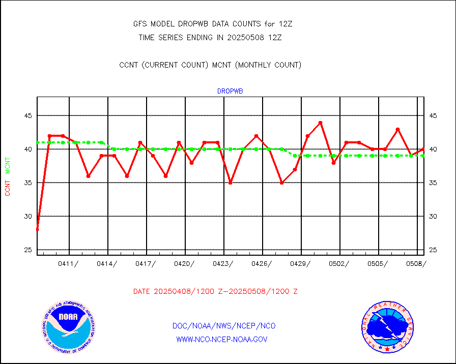
Dropwinsonde (decoded from BUFR) |
43 |
42 |
102.4 % |
|||||||||||
NPP Adv. Tech. MW Sndr (ATMS) br. temps from RARS |
29952 |
37491 |
79.9 % |
|||||||||||
METOP 1-2 IASI 1C radiance data vbl chn from RARS |
157926 |
142832 |
110.6 % |
|||||||||||
NOAA 18-19 & METOP 1-2 MHS proc. btemps from RARS |
989436 |
1225523 |
80.7 % |
|||||||||||
GOES/NESDIS (11x17 f-o-v) imager clear radiances |
0 |
0 |
n/a |
|||||||||||
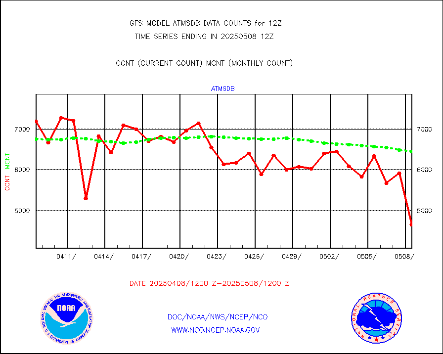
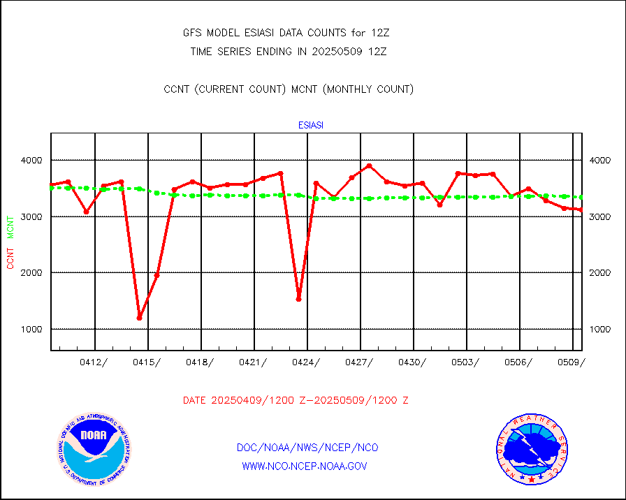
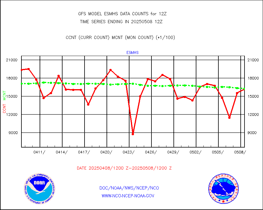
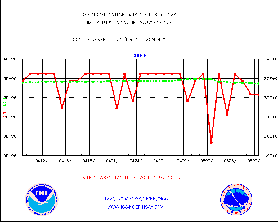
GPM GMI Level 1C-R brightness temperatures |
2287350 |
2282635 |
100.2 % |
|||||||||||
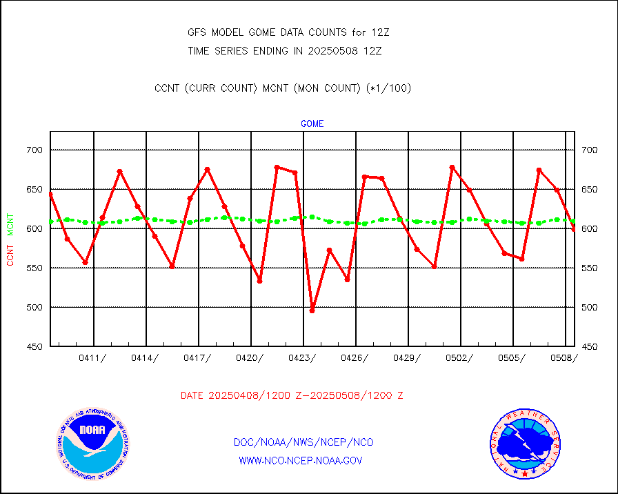
Grnd-based Gbl Navigation Sat System (GNSS) data |
5446 |
5012 |
108.7 % |
|||||||||||
METOP 1-2 Global Ozone Monitoring Exp.-2 (GOME-2) |
57329 |
60658 |
94.5 % |
|||||||||||
INSAT/KALPANA India wvpr derived cloud motion |
0 |
0 |
n/a |
|||||||||||
GOES-16&up/NESDIS wv imgr/deep-lyr derivd cld mtn |
122091 |
103120 |
118.4 % |
|||||||||||
METEOSAT/EUMETSAT wvpr imgr drv cld motion NBseq |
181687 |
188527 |
96.4 % |
|||||||||||
METOP 1-2 IASI 1C radiances-direct broadcast SSEC |
218942 |
247075 |
88.6 % |
|||||||||||
VIIRS (NPP/NOAA-20) ir lg-wv drv cloud motion(NB) |
39148 |
46622 |
84.0 % |
|||||||||||
AVHRR (NOAA/METOP) ir lg-wave derived cld motion |
0 |
0 |
n/a |
|||||||||||
AVHRR (METOP) ir lg-wave derived cld motion |
31163 |
30284 |
102.9 % |
|||||||||||
INSAT/KALPANA India ir lg-wave derived cld motion |
0 |
0 |
n/a |
|||||||||||
Korean AMDAR aircraft data (decoded from BUFR) |
279 |
357 |
78.2 % |
|||||||||||
Moored buoys (decoded from BUFR) |
7265 |
7090 |
102.5 % |
|||||||||||
NEXRAD Vel Azm Dsp(VAD) winds via Level 2 decoder |
3904 |
3993 |
97.8 % |
|||||||||||
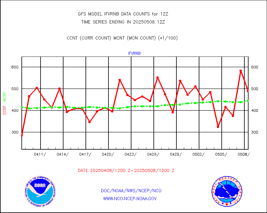
OMPS Limb Profiler ozone data (NPP) |
856 |
807 |
106.1 % |
|||||||||||
OMPS nadir profile ozone (Version 8 BUFR) |
2894 |
2921 |
99.1 % |
|||||||||||
OMPS total column ozone (Version 8 BUFR) |
1780214 |
1767779 |
100.7 % |
|||||||||||
PIBAL (decoded from BUFR) |
2 |
3 |
66.7 % |
|||||||||||
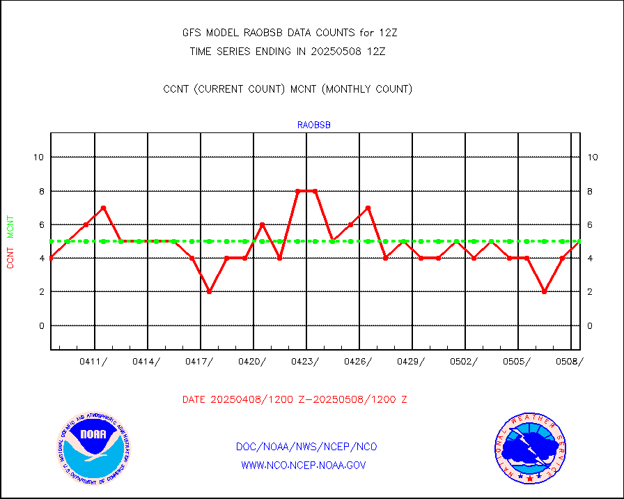
Manual PIREP aircraft data (dcded from AIREP fmt) |
572 |
582 |
98.3 % |
|||||||||||
Multi-Agency Profiler (MAP) and SODAR winds |
384 |
361 |
106.4 % |
|||||||||||
Rawinsonde - fixed land (decoded from BUFR) |
342 |
341 |
100.3 % |
|||||||||||
Rawinsonde - mobile land (decoded from BUFR) |
0 |
0 |
n/a |
|||||||||||
Rawinsonde - ship (decoded from BUFR) |
4 |
7 |
57.1 % |
|||||||||||
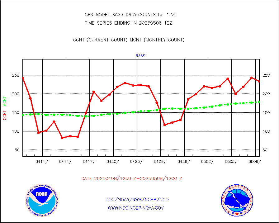
RASS temperatures (NOAA and Multi-Agency) |
201 |
191 |
105.2 % |
|||||||||||
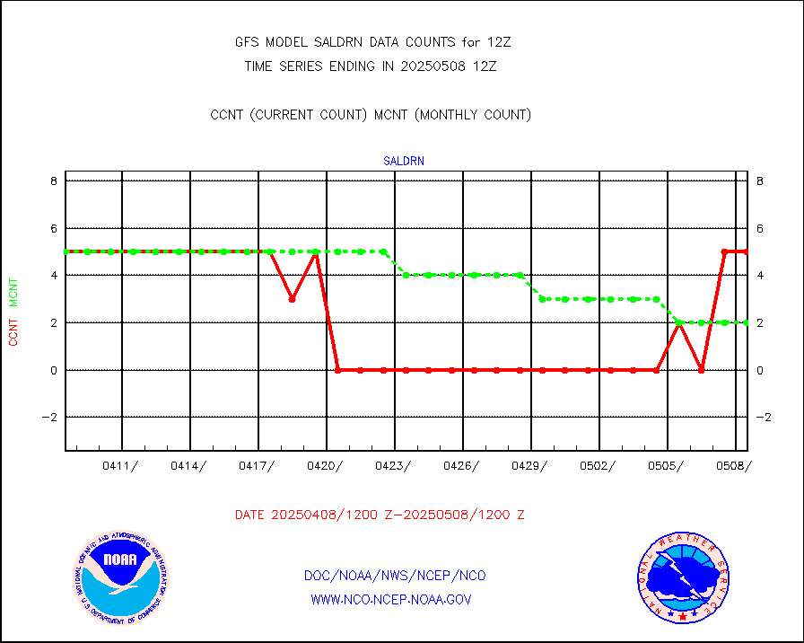
Surface Marine Saildrone (decoded from BUFR) |
5 |
5 |
100.0 % |
|||||||||||
METEOSAT-10 2nd Gen SEVIRI All Sky Radiance(proc) |
376661 |
371922 |
101.3 % |
|||||||||||
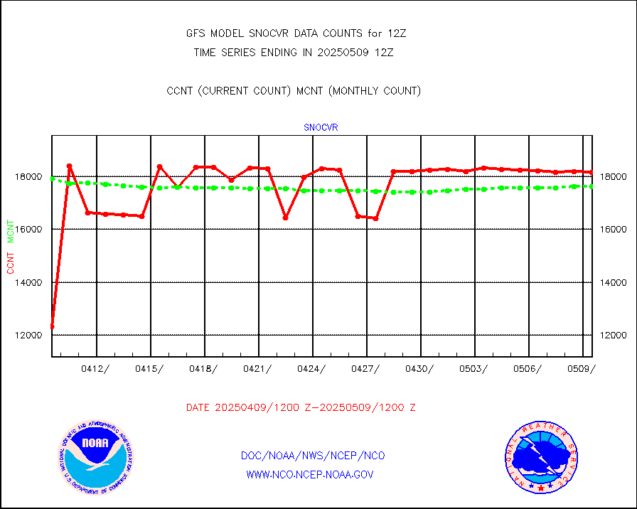
NOW COVER, DEPTH/DENSITY AND WATER EQUIVALENT |
16288 |
17026 |
95.7 % |
|||||||||||
DMSP SSM/IS 1C radiance data (Unified Pre-Proc.) |
565500 |
553870 |
102.1 % |
|||||||||||
NPP/NOAA-20 VIIRS SST - PROBABLY CLR & OVER WATER |
9999999 |
9999999 |
100.0 % |
|||||||||||
Synoptic - fixed manual and automatic |
7454 |
7108 |
104.9 % |
|||||||||||
CTD probe, Argo prflng float, mooring (TESAC fmt) |
2538 |
2433 |
104.3 % |
|||||||||||
TAMDAR aircft data-all types(from Panasonic,BUFR) |
312 |
333 |
93.7 % |
|||||||||||
ThermoSalinoGraph (TSG) TRACKOB format) |
474 |
498 |
95.2 % |
|||||||||||
INSAT/KALPANA India visible derived cloud motion |
0 |
0 |
n/a |
|||||||||||
GOES-16&up/NESDIS visible derived cloud motion |
594081 |
525851 |
113.0 % |
|||||||||||


