| Suspect Data Shortages in Critical Types - Monitor | ||||||||||||||
|---|---|---|---|---|---|---|---|---|---|---|---|---|---|---|
| Type | Description | Hourly Count | Monthly Average | Percent (%) of Monthly Mean | ||||||||||
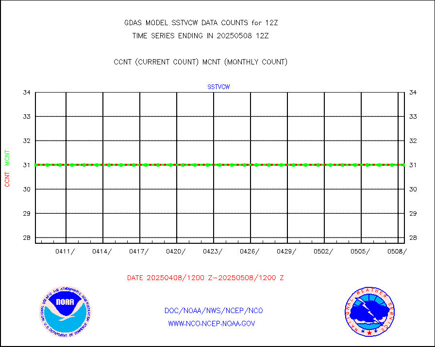
NOAA 18-19 & METOP 1-2 HIRS-4 NCEP-proc. br.temps |
0 |
96444 |
0.0 % |
|||||||||||
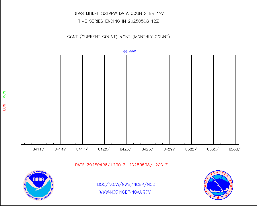
NOAA 15-19 & METOP 1-2 HIRS-3/4 pr btmps frm RARS |
0 |
174165 |
0.0 % |
|||||||||||
| Shortage in Data Type of Opportunity - Monitor | ||||||||||||||
|---|---|---|---|---|---|---|---|---|---|---|---|---|---|---|
| Type | Description | Hourly Count | Monthly Average | Percent (%) of Monthly Mean | ||||||||||
P.M.(N18-19) AVHRR GAC NCEP-proc clr & sea btemps |
0 |
3222413 |
0.0 % |
|||||||||||
INDIA SATWIND, INSAT WV channel |
0 |
30568 |
0.0 % |
|||||||||||
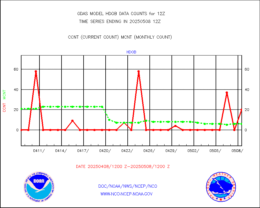
High Density OBs from reconnaissance acft data |
29 |
67 |
43.3 % |
|||||||||||
INDIA SATWIND, INSAT IR channel |
0 |
37476 |
0.0 % |
|||||||||||
INDIA SATWIND, INSAT VIS channel |
0 |
2073 |
0.0 % |
|||||||||||
| Excess in Data Type of Opportunity - Monitor | ||||||||||||||
|---|---|---|---|---|---|---|---|---|---|---|---|---|---|---|
| Type | Description | Hourly Count | Monthly Average | Percent (%) of Monthly Mean | ||||||||||
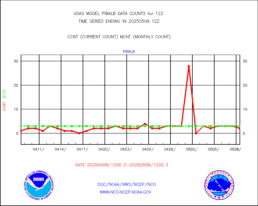
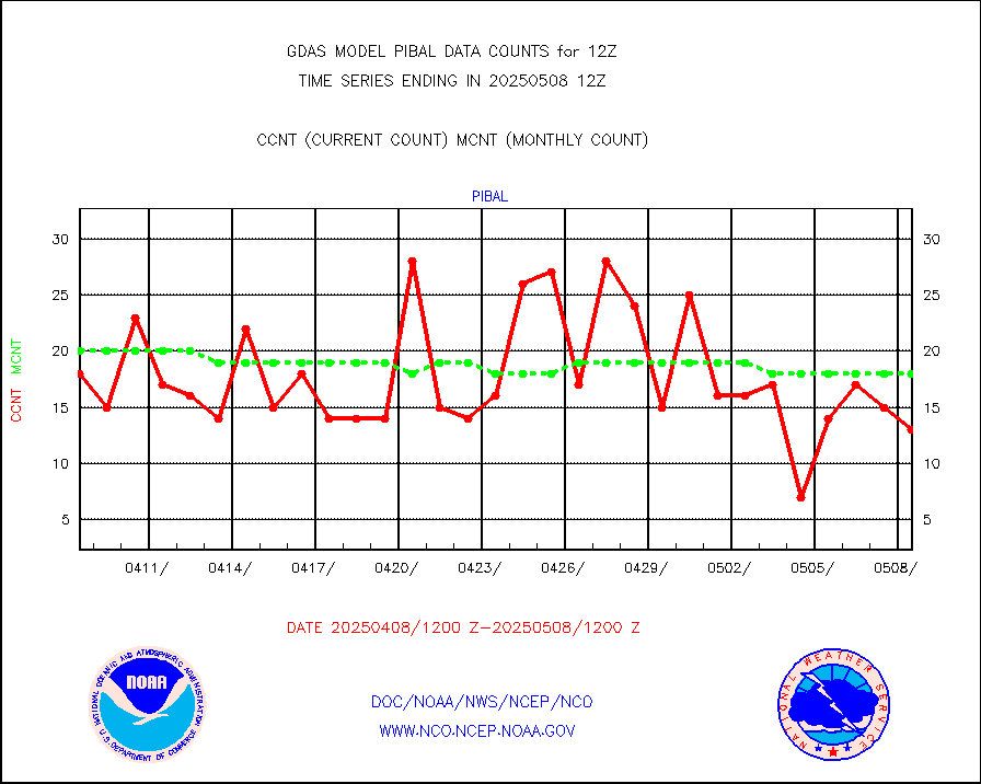
PIBAL (decoded from BUFR) |
28 |
3 |
933.3 % |
|||||||||||
| Critical Data with Normal Counts | ||||||||||||||
|---|---|---|---|---|---|---|---|---|---|---|---|---|---|---|
| Type | Description | Hourly Count | Monthly Average | Percent (%) of Monthly Mean | ||||||||||
NOAA 15-19 & METOP 1-2 AMSU-A NCEP-proc. br.temps |
163329 |
250997 |
65.1 % |
|||||||||||
NOAA 18-19 & METOP 1-2 MHS NCEP-proces. br. temps |
1454022 |
1792932 |
81.1 % |
|||||||||||
MDCRS ACARS acft data from ARINC(dcded from BUFR) |
152926 |
136170 |
112.3 % |
|||||||||||
Himawari Clear Sky Radiance |
276563 |
285299 |
96.9 % |
|||||||||||
Manual AIREP aircraft data (dcded from AIREP fmt) |
5787 |
5694 |
101.6 % |
|||||||||||
AQUA AIRS/AMSU-A/HSB brightness temps- every FOV |
0 |
0 |
n/a |
|||||||||||
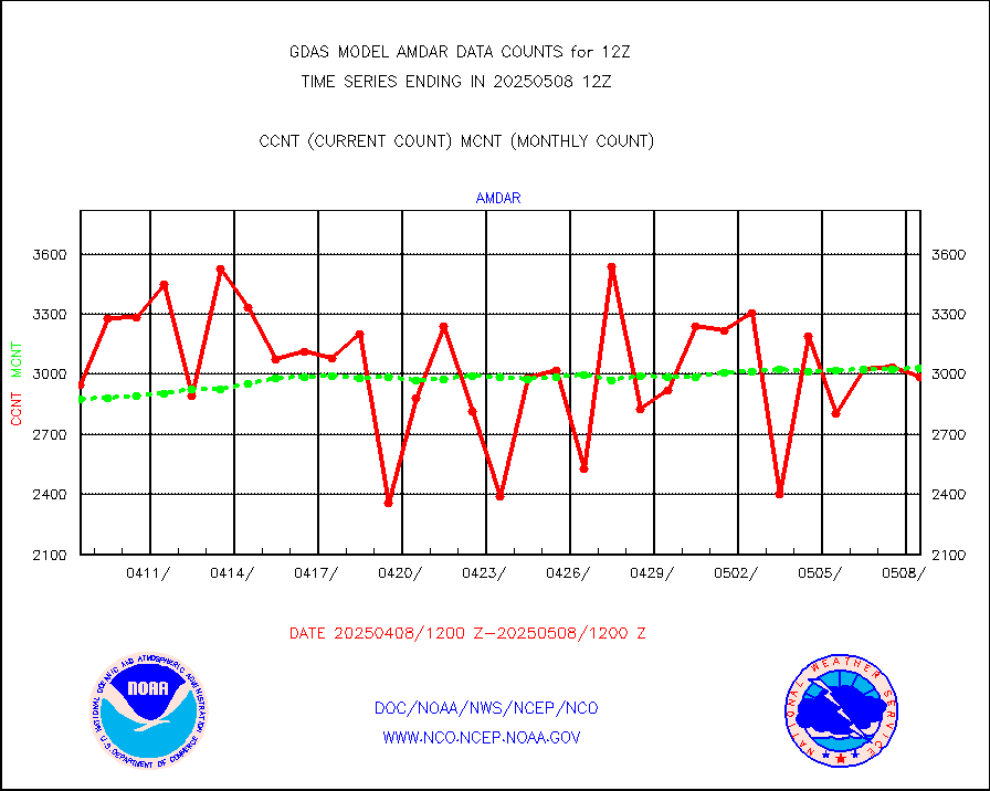
AMDAR aircraft data (decoded from AMDAR format) |
3258 |
3079 |
105.8 % |
|||||||||||
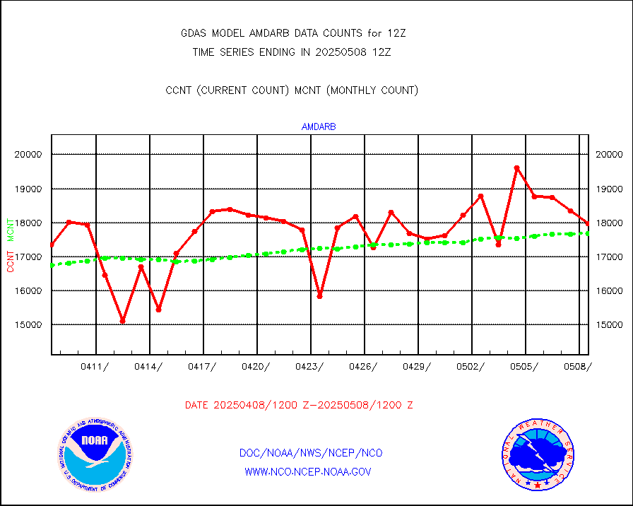
AMDAR aircraft data (decoded from BUFR) |
17002 |
17870 |
95.1 % |
|||||||||||
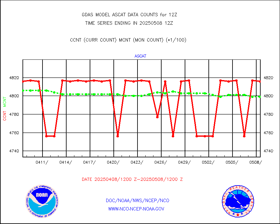
METOP 1-2 ASCAT products |
481656 |
481026 |
100.1 % |
|||||||||||
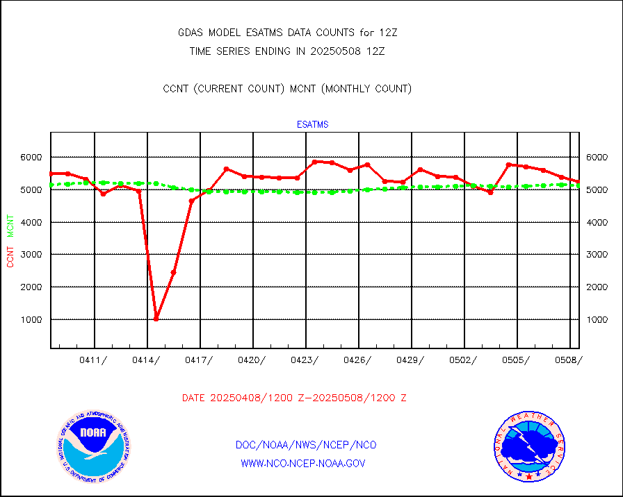
NPP/NOAA-20 ATMS brightness temperatures |
2317808 |
2292511 |
101.1 % |
|||||||||||
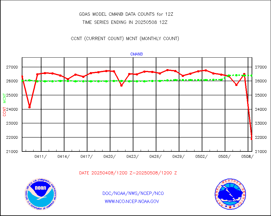
Surface Marine CMAN rpts decoded from BUFR format |
26863 |
26812 |
100.2 % |
|||||||||||
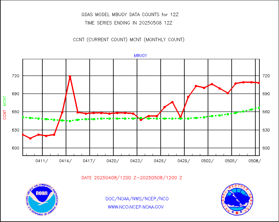
Buoys decoded from FM-18 fmt (moored or drifting) |
74 |
137 |
54.0 % |
|||||||||||
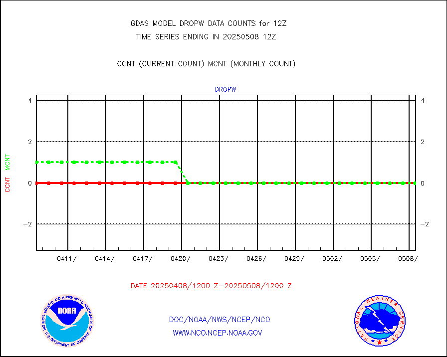
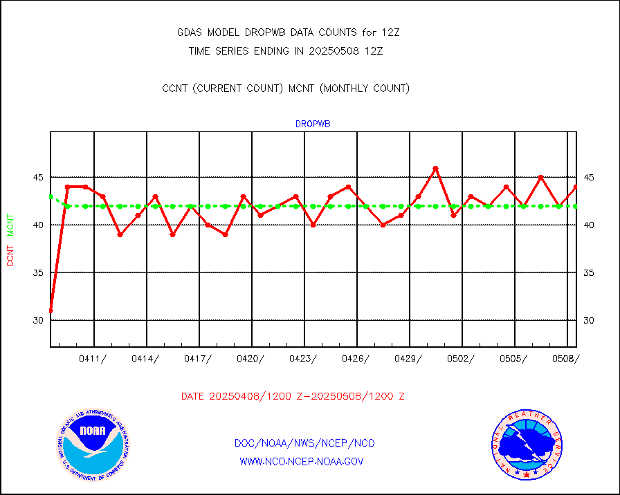
Dropwinsonde (from TEMP DROP) |
0 |
0 |
n/a |
|||||||||||
E-AMDAR (European AMDAR acft decoded from BUFR) |
21983 |
23447 |
93.8 % |
|||||||||||
NOAA 15-19 & METOP 1-2 AMSU-A proc btmps frm RARS |
115206 |
153893 |
74.9 % |
|||||||||||
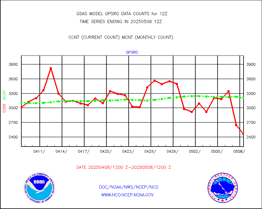
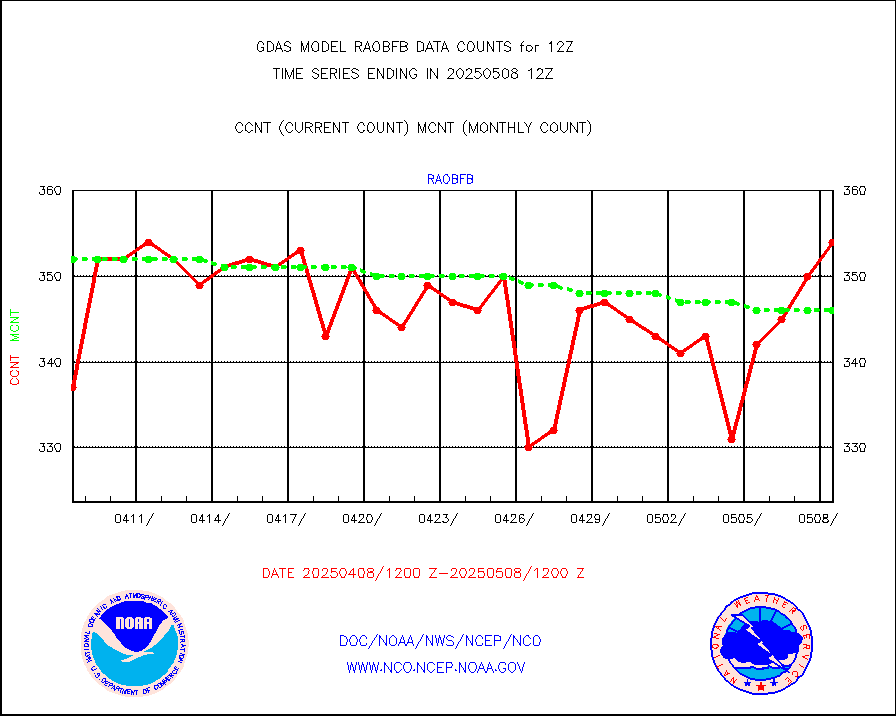
GPS radio occultation data |
3306 |
3382 |
97.8 % |
|||||||||||
GOES-16/17 All Sky Radiances (proc.) |
6488568 |
6479038 |
100.1 % |
|||||||||||
GOES-16/17 Clear Sky Radiances (proc.) |
3127635 |
3152131 |
99.2 % |
|||||||||||
MTSAT/JMA water vapor imager derived cloud motion |
64591 |
58226 |
110.9 % |
|||||||||||
MODIS (AQUA/TERRA) wvpr imager derived cld motion |
0 |
0 |
n/a |
|||||||||||
GOES-16&up/NESDIS wv imgr/cld-top derived cld mtn |
132476 |
147031 |
90.1 % |
|||||||||||
METEOSAT/EUMETSAT ir lg-wave drv cld motion NBseq |
132673 |
125643 |
105.6 % |
|||||||||||
MTSAT/JMA infrared long-wave derived cloud motion |
50110 |
47513 |
105.5 % |
|||||||||||
MODIS (AQUA/TERRA) ir l-wave derived cloud motion |
0 |
0 |
n/a |
|||||||||||
GOES-16&up/NESDIS ir long-wave derived cld motion |
492684 |
503359 |
97.9 % |
|||||||||||
Land-based CMAN stations decoded from CMAN format |
516 |
527 |
97.9 % |
|||||||||||
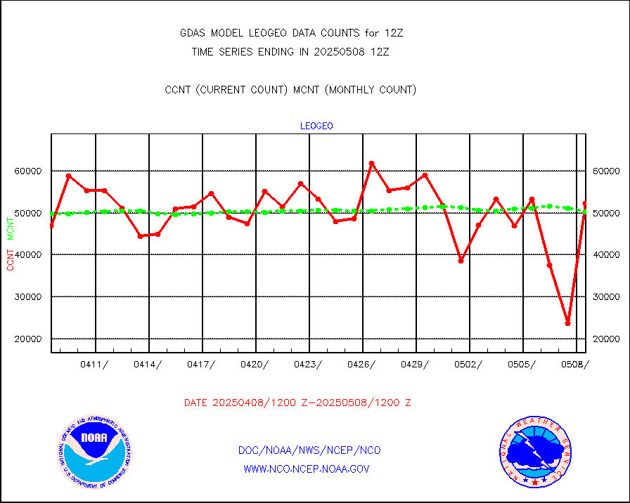
LEO-GEO satellite AMVs from UWisc. |
53937 |
57821 |
93.3 % |
|||||||||||
Buoys decoded from FM-13 format (moored) |
818 |
788 |
103.8 % |
|||||||||||
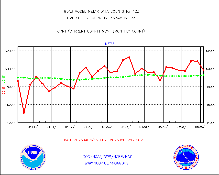
Aviation - METAR |
49550 |
49393 |
100.3 % |
|||||||||||
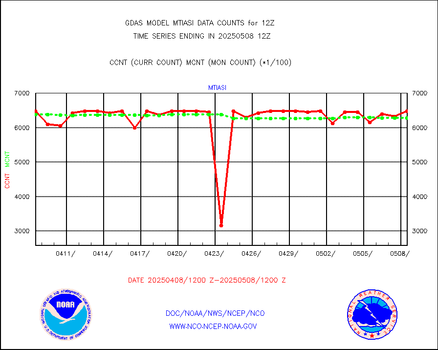
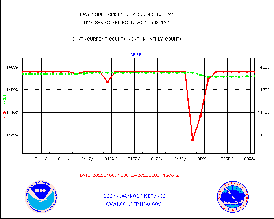
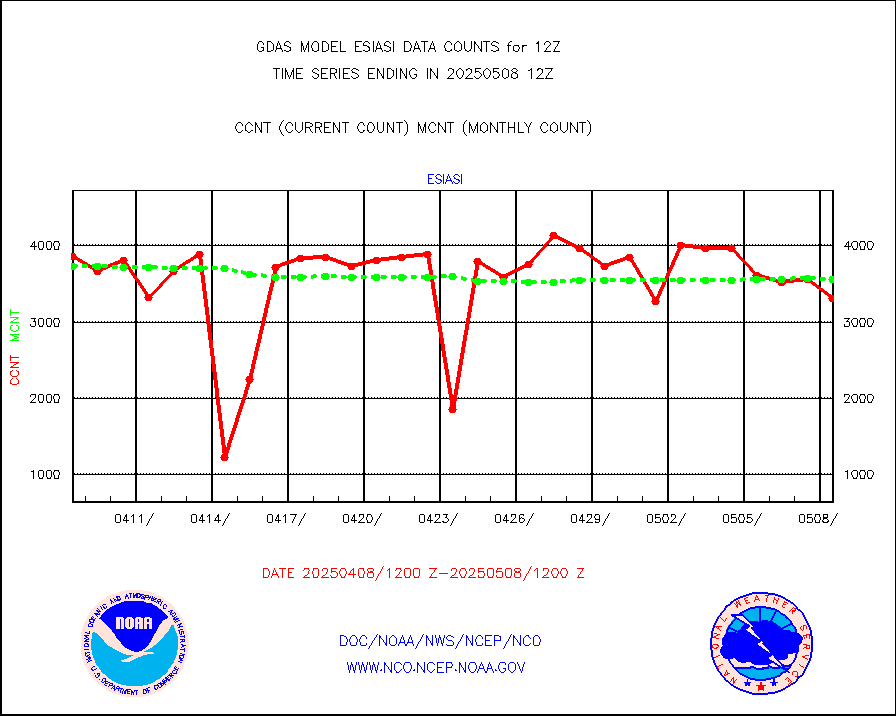
METOP 1-2 IASI 1C radiance data (varbl. channels) |
648000 |
635764 |
101.9 % |
|||||||||||
NEXRAD Vel Azm Dsp(VAD) winds via radar coded msg |
0 |
0 |
n/a |
|||||||||||
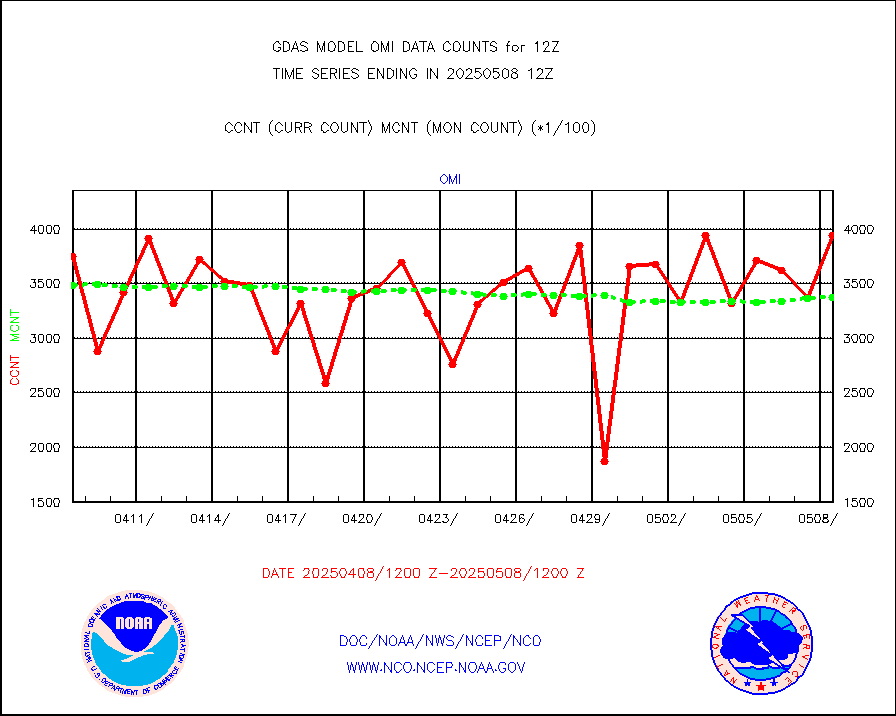
Aura Ozone Monitoring Instrument (OMI) data |
0 |
0 |
n/a |
|||||||||||
NOAA 16-19 Solar Backscatter UV-2 rad frm V8 BUFR |
0 |
0 |
n/a |
|||||||||||
PIBAL (from PILOT, PILOT SHIP, PILOT MOBIL) |
13 |
15 |
86.7 % |
|||||||||||
Profilr winds from PIBAL (PILOT,PILOT SHIP/MOBIL) |
0 |
0 |
n/a |
|||||||||||
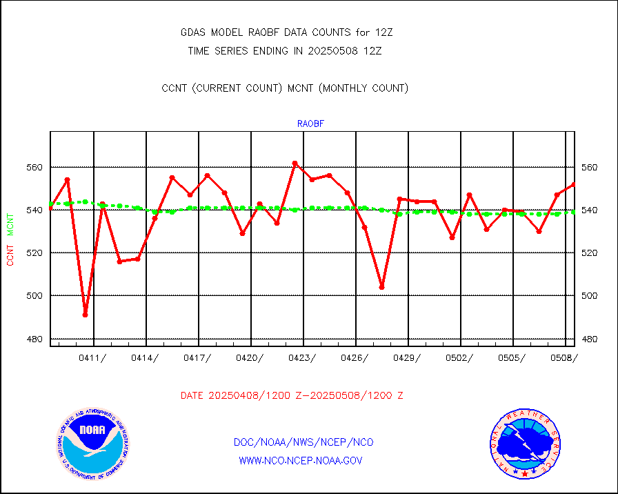
Rawinsonde - fixed land (from TEMP or PILOT) |
565 |
543 |
104.1 % |
|||||||||||
Rawinsonde - mobile land (from TEMP/PILOT MOBIL) |
0 |
0 |
n/a |
|||||||||||
Rawinsonde - ship (from TEMP SHIP, PILOT SHIP) |
3 |
4 |
75.0 % |
|||||||||||
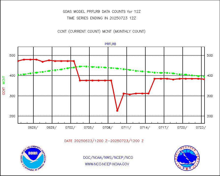
Flight level reconnaissance aircraft data |
0 |
0 |
n/a |
|||||||||||
Ship - manual and automatic, restricted |
251 |
307 |
81.8 % |
|||||||||||
Ship - manual and automatic, restricted (BUFR) |
1386 |
1291 |
107.4 % |
|||||||||||
Ship - manual and automatic, unrestricted |
777 |
752 |
103.3 % |
|||||||||||
Ship - manual and automatic, unrestricted (BUFR) |
6212 |
6244 |
99.5 % |
|||||||||||
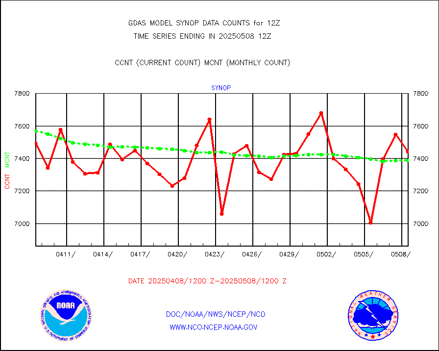
Synoptic - fixed manual & auto (decoded fr BUFR) |
40999 |
41712 |
98.3 % |
|||||||||||
Synoptic - mobile manual and automatic |
4922 |
4686 |
105.0 % |
|||||||||||
Synoptic - restricted (WMO Res 40) manual & auto. |
10 |
6 |
166.7 % |
|||||||||||
Synoptic - restricted (WMO Res 40)(decoded BUFR) |
2321 |
2363 |
98.2 % |
|||||||||||
Synoptic - mobile manual & auto (decoded fr BUFR) |
193 |
255 |
75.7 % |
|||||||||||
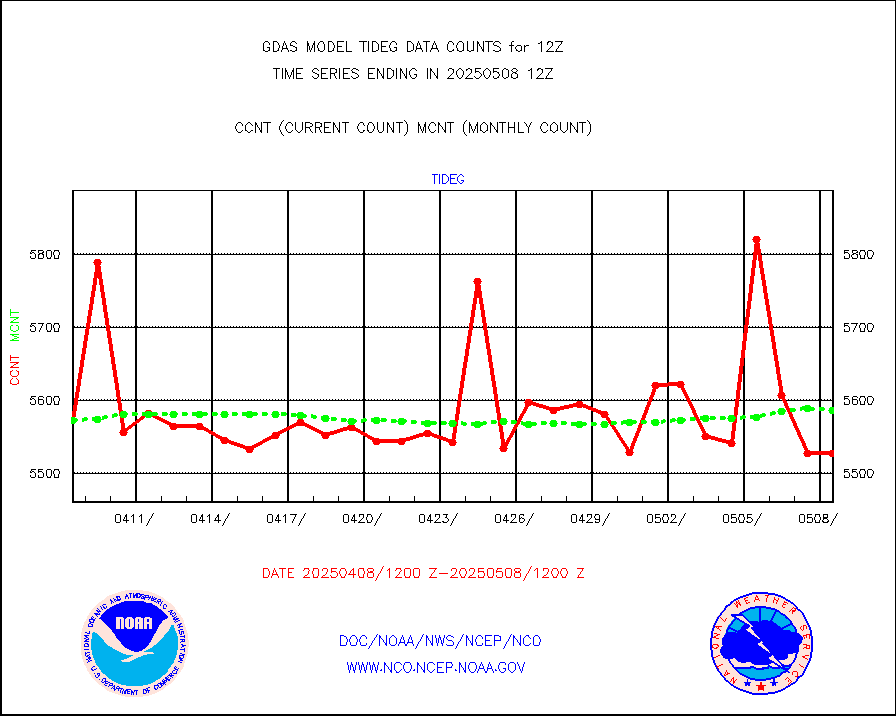
Tide gauge reports decoded from CREX format |
5612 |
5600 |
100.2 % |
|||||||||||
MTSAT/JMA visible derived cloud motion |
1772 |
1312 |
135.1 % |
|||||||||||
METEOSAT/EUMETSAT visible drv cld motion NBseq |
251999 |
234015 |
107.7 % |
|||||||||||
| Data Types of Opportunity with Normal Counts | ||||||||||||||
|---|---|---|---|---|---|---|---|---|---|---|---|---|---|---|
| Type | Description | Hourly Count | Monthly Average | Percent (%) of Monthly Mean | ||||||||||
GOES-16&up/NESDIS ir short-wv derived cld motion |
228229 |
230305 |
99.1 % |
|||||||||||
MDCRS ACARS acft data (ARINC via AFWA)(AIREP fmt) |
0 |
0 |
n/a |
|||||||||||
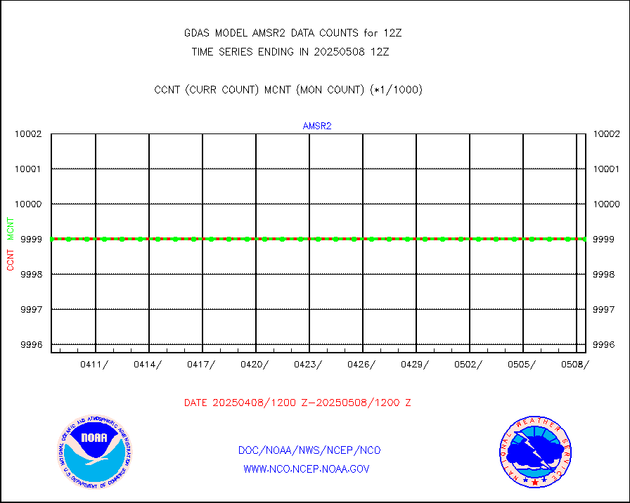
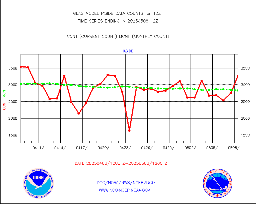
GCOM-W AMSR2 1B brightness temperatures |
9999999 |
9999999 |
100.0 % |
|||||||||||
NPP/NOAA-20 ATMS bright. temps-direct b-cast SSEC |
575922 |
621913 |
92.6 % |
|||||||||||
POES/NESDIS - processed ATOVS soundings/radiances |
0 |
0 |
n/a |
|||||||||||
A.M.(N17,M2,M3) AVHRR GAC NCEP-proc clr&sea btmps |
7631995 |
7568435 |
100.8 % |
|||||||||||
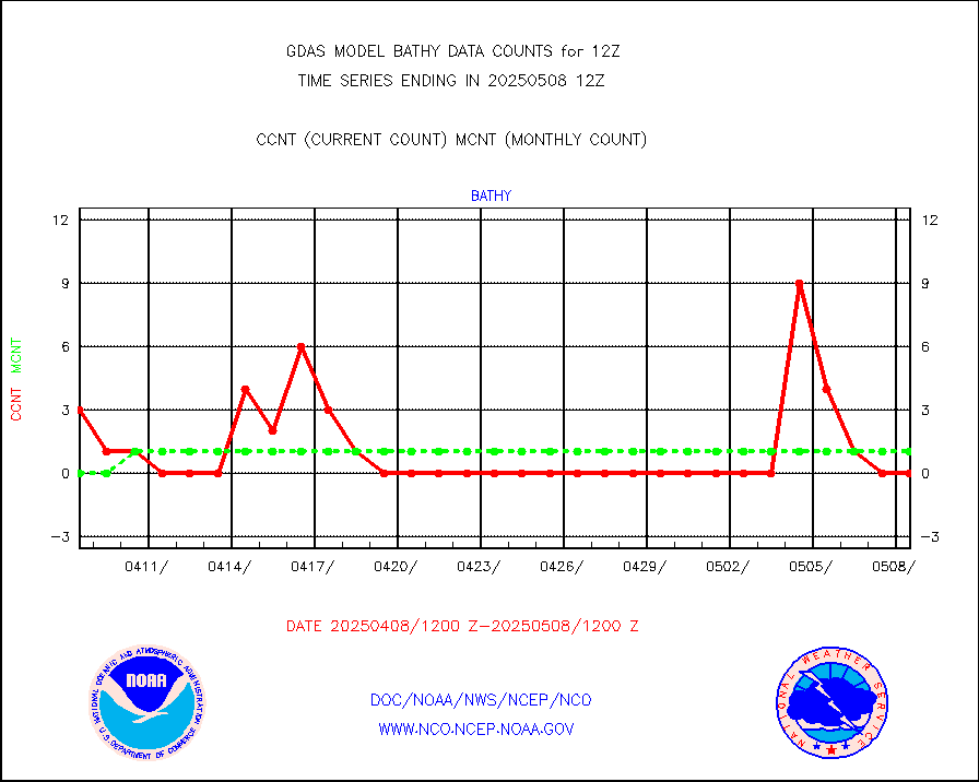
eXpendable BathyThermograph, mooring (BATHY fmt) |
0 |
1 |
0.0 % |
|||||||||||
Canadian AMDAR aircraft data (decoded from BUFR) |
0 |
0 |
n/a |
|||||||||||
NPP/NOAA-20 CrIS full spctrl radn (431 ch subset) |
1458000 |
1443658 |
101.0 % |
|||||||||||
NPP/NOAA-20 CrIS full spctrl radn dir brdcst SSEC |
183910 |
214536 |
85.7 % |
|||||||||||
Coast Guard |
32 |
33 |
97.0 % |
|||||||||||
Drifting buoys (decoded from BUFR) |
9115 |
9170 |
99.4 % |
|||||||||||
Dropwinsonde (decoded from BUFR) |
44 |
44 |
100.0 % |
|||||||||||
NPP Adv. Tech. MW Sndr (ATMS) br. temps from RARS |
36864 |
60554 |
60.9 % |
|||||||||||
METOP 1-2 IASI 1C radiance data vbl chn from RARS |
147442 |
156462 |
94.2 % |
|||||||||||
NOAA 18-19 & METOP 1-2 MHS proc. btemps from RARS |
1091919 |
1428583 |
76.4 % |
|||||||||||
GOES/NESDIS (11x17 f-o-v) imager clear radiances |
0 |
0 |
n/a |
|||||||||||
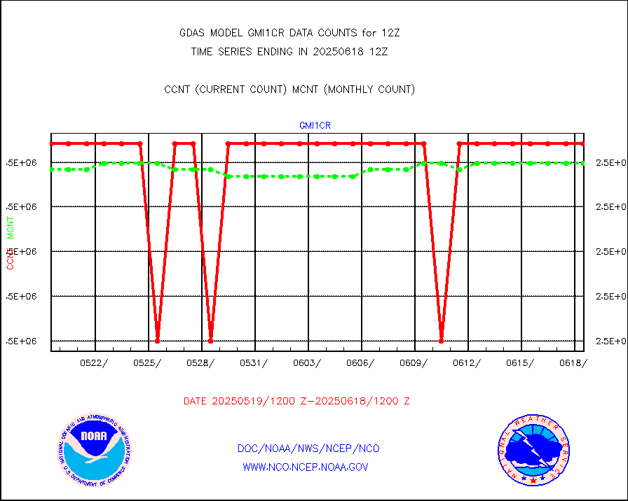
GPM GMI Level 1C-R brightness temperatures |
2541721 |
2541714 |
100.0 % |
|||||||||||
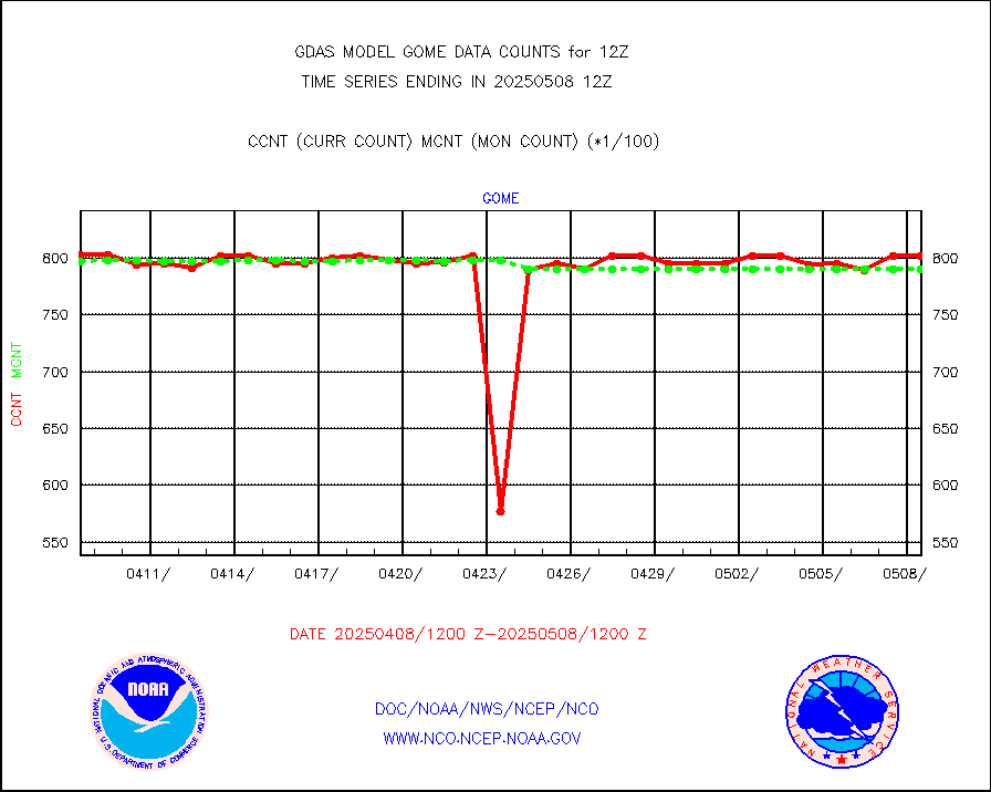
Grnd-based Gbl Navigation Sat System (GNSS) data |
5608 |
5366 |
104.5 % |
|||||||||||
METOP 1-2 Global Ozone Monitoring Exp.-2 (GOME-2) |
79456 |
79057 |
100.5 % |
|||||||||||
INSAT/KALPANA India wvpr derived cloud motion |
0 |
0 |
n/a |
|||||||||||
GOES-16&up/NESDIS wv imgr/deep-lyr derivd cld mtn |
122070 |
102768 |
118.8 % |
|||||||||||
METEOSAT/EUMETSAT wvpr imgr drv cld motion NBseq |
219849 |
226082 |
97.2 % |
|||||||||||
METOP 1-2 IASI 1C radiances-direct broadcast SSEC |
267848 |
301454 |
88.9 % |
|||||||||||
VIIRS (NPP/NOAA-20) ir lg-wv drv cloud motion(NB) |
104952 |
97238 |
107.9 % |
|||||||||||
AVHRR (NOAA/METOP) ir lg-wave derived cld motion |
0 |
0 |
n/a |
|||||||||||
AVHRR (METOP) ir lg-wave derived cld motion |
74784 |
76289 |
98.0 % |
|||||||||||
INSAT/KALPANA India ir lg-wave derived cld motion |
0 |
0 |
n/a |
|||||||||||
Korean AMDAR aircraft data (decoded from BUFR) |
315 |
358 |
88.0 % |
|||||||||||
Moored buoys (decoded from BUFR) |
8049 |
7939 |
101.4 % |
|||||||||||
NEXRAD Vel Azm Dsp(VAD) winds via Level 2 decoder |
4734 |
4162 |
113.7 % |
|||||||||||
OMPS Limb Profiler ozone data (NPP) |
1733 |
1546 |
112.1 % |
|||||||||||
OMPS nadir profile ozone (Version 8 BUFR) |
3503 |
3446 |
101.7 % |
|||||||||||
OMPS total column ozone (Version 8 BUFR) |
2110330 |
2073121 |
101.8 % |
|||||||||||
Manual PIREP aircraft data (dcded from AIREP fmt) |
603 |
681 |
88.5 % |
|||||||||||
Multi-Agency Profiler (MAP) and SODAR winds |
472 |
437 |
108.0 % |
|||||||||||
Rawinsonde - fixed land (decoded from BUFR) |
339 |
341 |
99.4 % |
|||||||||||
Rawinsonde - mobile land (decoded from BUFR) |
0 |
0 |
n/a |
|||||||||||
Rawinsonde - ship (decoded from BUFR) |
6 |
7 |
85.7 % |
|||||||||||
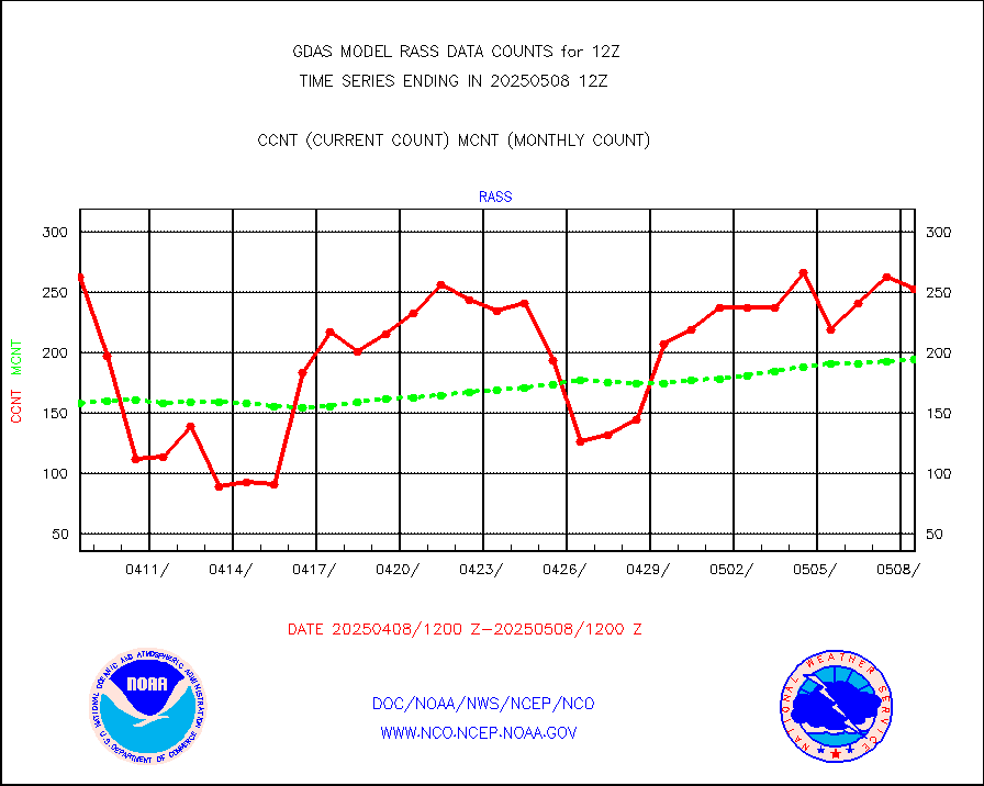
RASS temperatures (NOAA and Multi-Agency) |
207 |
210 |
98.6 % |
|||||||||||
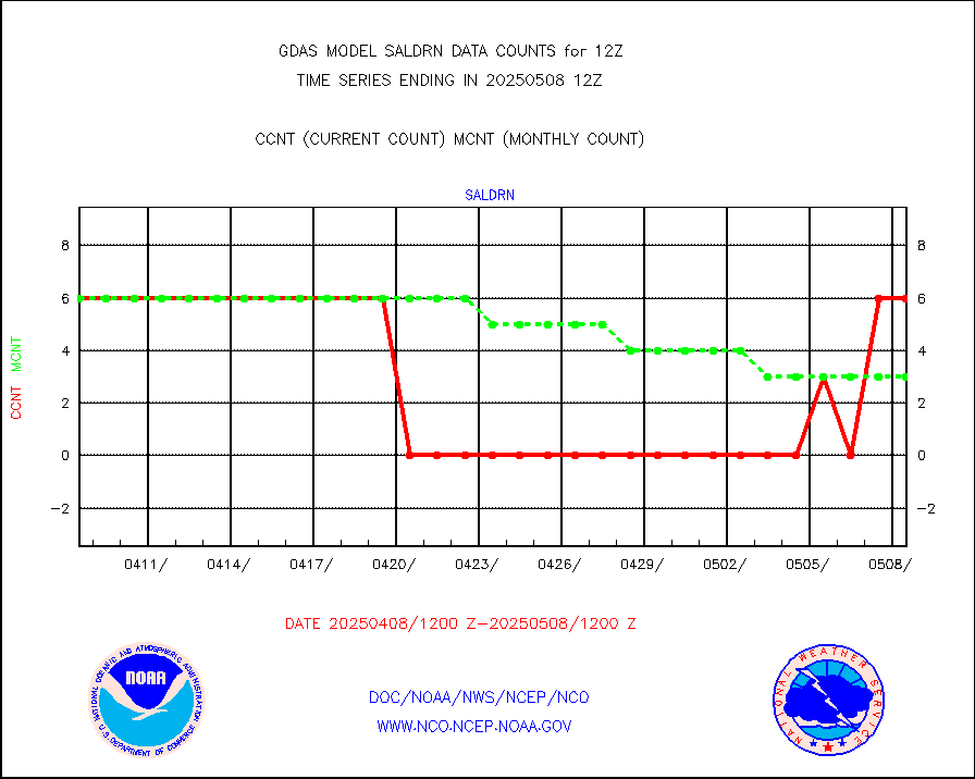
Surface Marine Saildrone (decoded from BUFR) |
6 |
6 |
100.0 % |
|||||||||||
METEOSAT-10 2nd Gen SEVIRI All Sky Radiance(proc) |
453072 |
444447 |
101.9 % |
|||||||||||
NOW COVER, DEPTH/DENSITY AND WATER EQUIVALENT |
18604 |
18400 |
101.1 % |
|||||||||||
DMSP SSM/IS 1C radiance data (Unified Pre-Proc.) |
391200 |
760404 |
51.4 % |
|||||||||||
NPP/NOAA-20 VIIRS SST - CLEAR & OVER WATER |
31 |
31 |
100.0 % |
|||||||||||
NPP/NOAA-20 VIIRS SST - PROBABLY CLR & OVER WATER |
9999999 |
9999999 |
100.0 % |
|||||||||||
Synoptic - fixed manual and automatic |
7227 |
7200 |
100.4 % |
|||||||||||
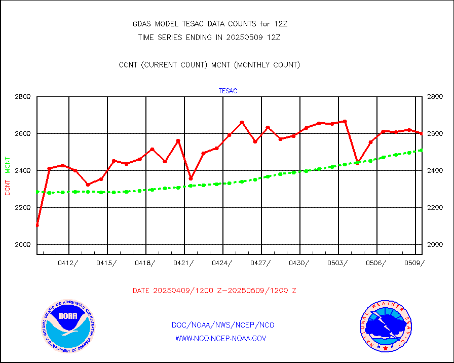
CTD probe, Argo prflng float, mooring (TESAC fmt) |
3078 |
2932 |
105.0 % |
|||||||||||
TAMDAR aircft data-all types(from Panasonic,BUFR) |
549 |
367 |
149.6 % |
|||||||||||
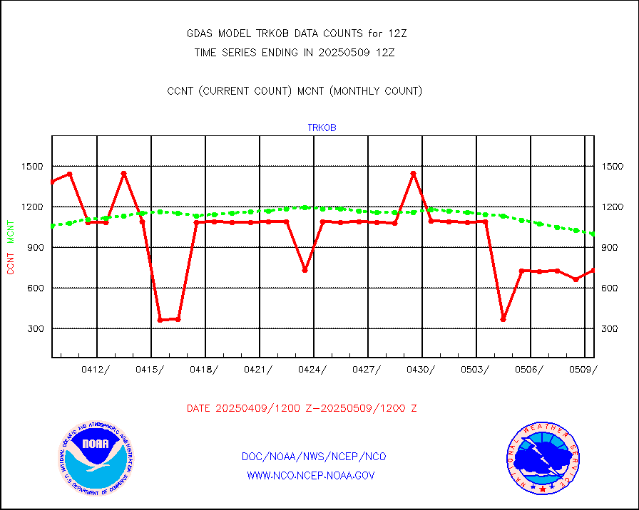
ThermoSalinoGraph (TSG) TRACKOB format) |
725 |
721 |
100.6 % |
|||||||||||
INSAT/KALPANA India visible derived cloud motion |
0 |
0 |
n/a |
|||||||||||
GOES-16&up/NESDIS visible derived cloud motion |
634806 |
521389 |
121.8 % |
|||||||||||


