| Suspect Data Shortages in Critical Types - Monitor | ||||||||||||||
|---|---|---|---|---|---|---|---|---|---|---|---|---|---|---|
| Type | Description | Hourly Count | Monthly Average | Percent (%) of Monthly Mean | UTC Time Window | |||||||||
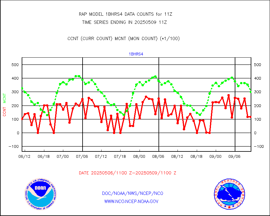
NOAA 18-19 & METOP 1-2 HIRS-4 NCEP-proc. br.temps |
0 |
8912 |
0.0 % |
0108.00-0113.99 |
||||||||||
| Shortage in Data Type of Opportunity - Monitor | ||||||||||||||
|---|---|---|---|---|---|---|---|---|---|---|---|---|---|---|
| Type | Description | Hourly Count | Monthly Average | Percent (%) of Monthly Mean | UTC Time Window | |||||||||
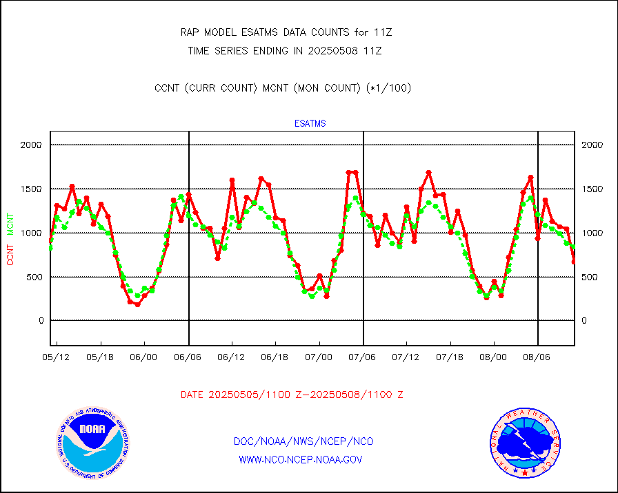
NPP Adv. Tech. MW Sndr (ATMS) br. temps from RARS |
0 |
6232 |
0.0 % |
0109.00-0112.99 |
||||||||||
NOAA 15-19 & METOP 1-2 HIRS-3/4 pr btmps frm RARS |
0 |
3990 |
0.0 % |
0110.00-0112.00 |
||||||||||
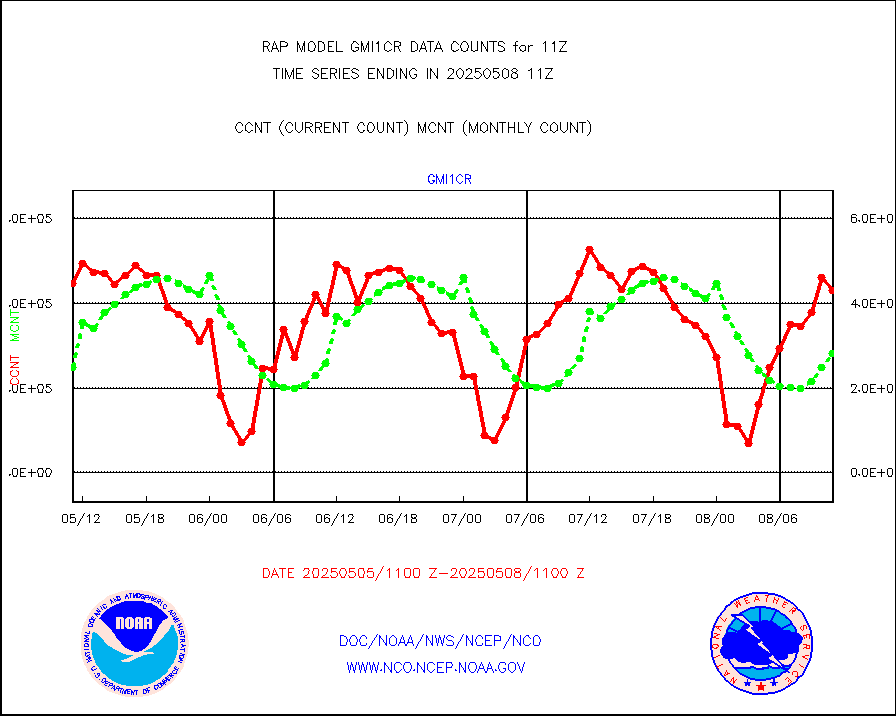
GPM GMI Level 1C-R brightness temperatures |
80218 |
292086 |
27.5 % |
0108.00-0113.99 |
||||||||||
DMSP SSM/IS 1C radiance data (Unified Pre-Proc.) |
0 |
14979 |
0.0 % |
0109.00-0112.99 |
||||||||||
| Critical Data with Normal Counts | ||||||||||||||
|---|---|---|---|---|---|---|---|---|---|---|---|---|---|---|
| Type | Description | Hourly Count | Monthly Average | Percent (%) of Monthly Mean | UTC Time Window | |||||||||
NOAA 15-19 & METOP 1-2 AMSU-A NCEP-proc. br.temps |
16118 |
21482 |
75.0 % |
0108.00-0113.99 |
||||||||||
NOAA 18-19 & METOP 1-2 MHS NCEP-proces. br. temps |
142851 |
166147 |
86.0 % |
0108.00-0113.99 |
||||||||||
MDCRS ACARS acft data from ARINC(dcded from BUFR) |
45453 |
60460 |
75.2 % |
0107.75-0114.25 |
||||||||||
Canadian AMDAR aircraft data (decoded from BUFR) |
0 |
0 |
n/a |
0107.75-0114.25 |
||||||||||
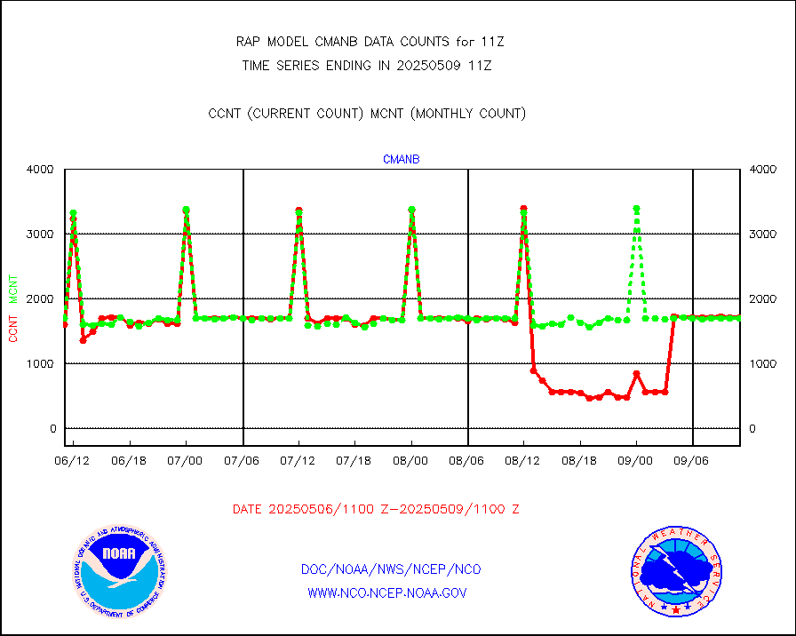
Surface Marine CMAN rpts decoded from BUFR format |
1731 |
1707 |
101.4 % |
0110.50-0111.50 |
||||||||||
Buoys decoded from FM-18 fmt (moored or drifting) |
0 |
0 |
n/a |
0110.50-0111.50 |
||||||||||
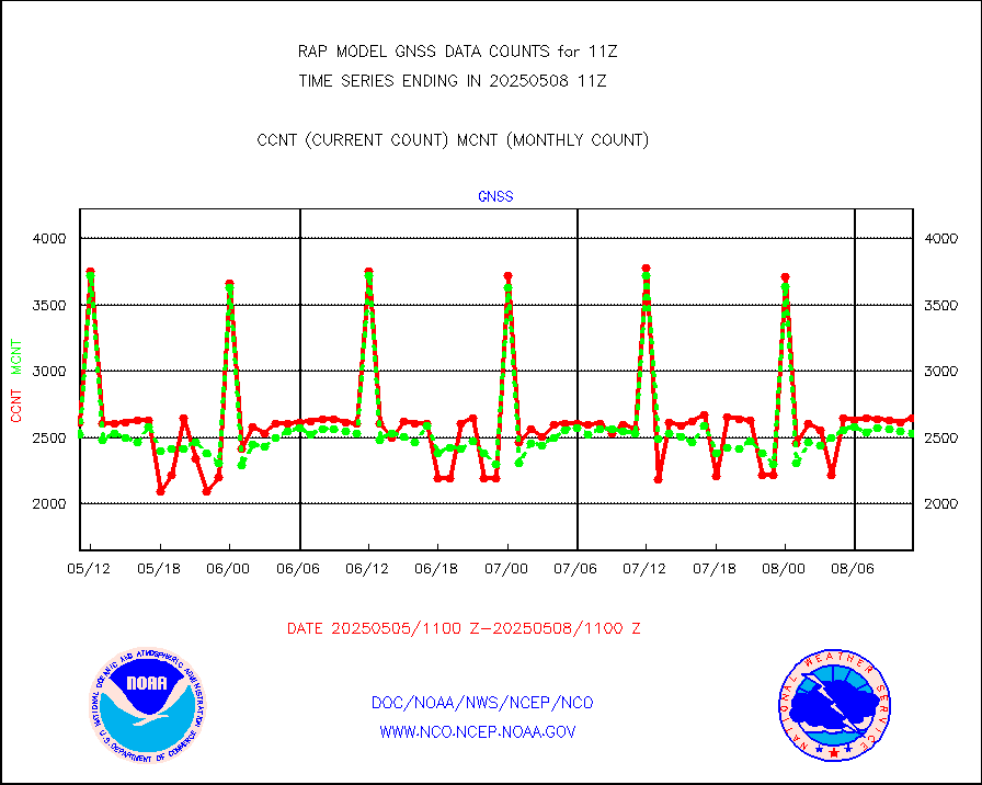
Grnd-based Gbl Navigation Sat System (GNSS) data |
716 |
2099 |
34.1 % |
0109.95-0110.05 |
||||||||||
MODIS (AQUA/TERRA) wvpr imager derived cld motion |
0 |
0 |
n/a |
0108.50-0113.50 |
||||||||||
MODIS (AQUA/TERRA) ir l-wave derived cloud motion |
0 |
0 |
n/a |
0108.50-0113.50 |
||||||||||
GOES/NASA(Langley) hi-res. (1x1 f-o-v) cloud data |
1871570 |
1869668 |
100.1 % |
0110.50-0111.50 |
||||||||||
Buoys decoded from FM-13 format (moored) |
117 |
122 |
95.9 % |
0110.50-0111.50 |
||||||||||
Aviation - METAR |
5858 |
5748 |
101.9 % |
0110.50-0111.50 |
||||||||||
NEXRAD Vel Azm Dsp(VAD) winds via radar coded msg |
0 |
0 |
n/a |
0110.00-0112.00 |
||||||||||
Multi-Agency Profiler (MAP) and SODAR winds |
104 |
96 |
108.3 % |
0109.50-0112.50 |
||||||||||
Rawinsonde - fixed land (from TEMP or PILOT) |
3 |
3 |
100.0 % |
0110.00-0112.00 |
||||||||||
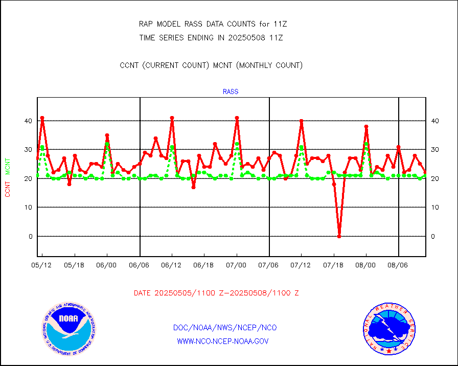
RASS temperatures (NOAA and Multi-Agency) |
24 |
23 |
104.3 % |
0110.50-0111.50 |
||||||||||
Ship - manual and automatic, restricted (BUFR) |
7 |
9 |
77.8 % |
0110.50-0111.50 |
||||||||||
Ship - manual and automatic, unrestricted |
109 |
89 |
122.5 % |
0110.50-0111.50 |
||||||||||
Ship - manual and automatic, unrestricted (BUFR) |
750 |
748 |
100.3 % |
0110.50-0111.50 |
||||||||||
Synoptic - fixed manual and automatic |
232 |
266 |
87.2 % |
0110.50-0111.50 |
||||||||||
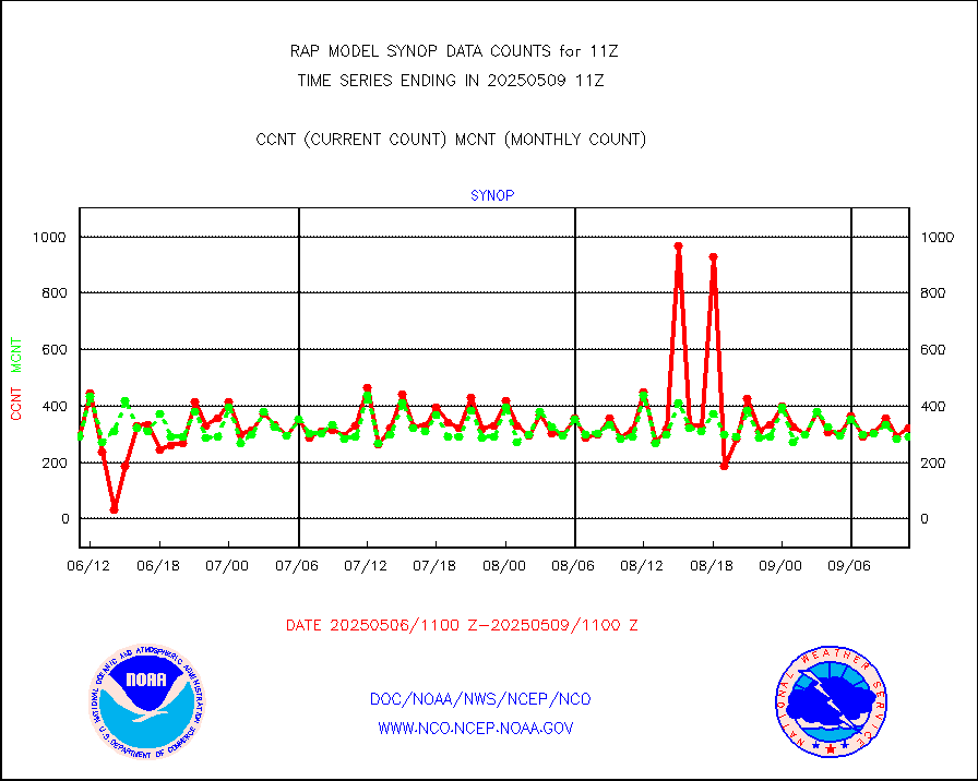
Synoptic - fixed manual & auto (decoded fr BUFR) |
2047 |
1998 |
102.5 % |
0110.50-0111.50 |
||||||||||
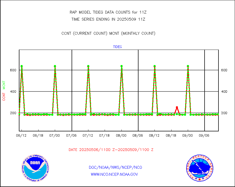
Tide gauge reports decoded from CREX format |
186 |
185 |
100.5 % |
0110.50-0111.50 |
||||||||||
| Data Types of Opportunity with Normal Counts | ||||||||||||||
|---|---|---|---|---|---|---|---|---|---|---|---|---|---|---|
| Type | Description | Hourly Count | Monthly Average | Percent (%) of Monthly Mean | UTC Time Window | |||||||||
GOES-16&up/NESDIS ir short-wv derived cld motion |
9475 |
10115 |
93.7 % |
0110.00-0110.99 |
||||||||||
MDCRS ACARS acft data (ARINC via AFWA)(AIREP fmt) |
0 |
0 |
n/a |
0107.75-0114.25 |
||||||||||
Manual AIREP aircraft data (dcded from AIREP fmt) |
2313 |
2244 |
103.1 % |
0107.75-0114.25 |
||||||||||
AQUA AIRS/AMSU-A/HSB brightness temps- every FOV |
0 |
0 |
n/a |
0108.00-0113.99 |
||||||||||
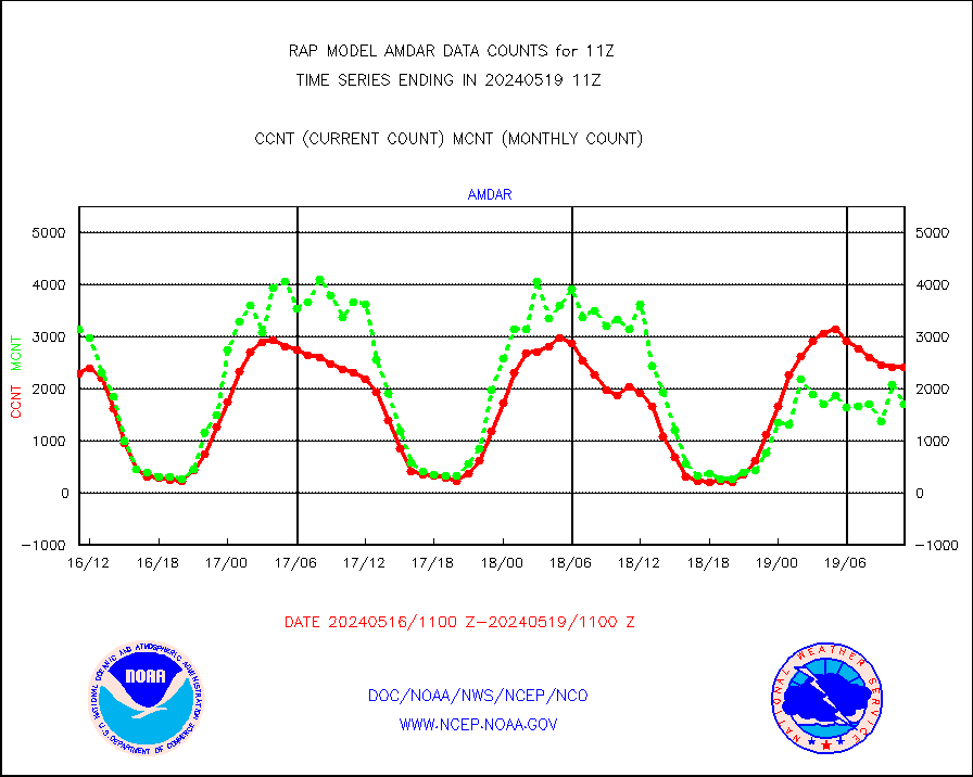
AMDAR aircraft data (decoded from AMDAR format) |
2412 |
1757 |
137.3 % |
0107.75-0114.25 |
||||||||||
AMDAR aircraft data (decoded from BUFR) |
10025 |
10649 |
94.1 % |
0107.75-0114.25 |
||||||||||
GCOM-W AMSR2 1B brightness temperatures |
974806 |
590338 |
165.1 % |
0108.00-0108.99 |
||||||||||
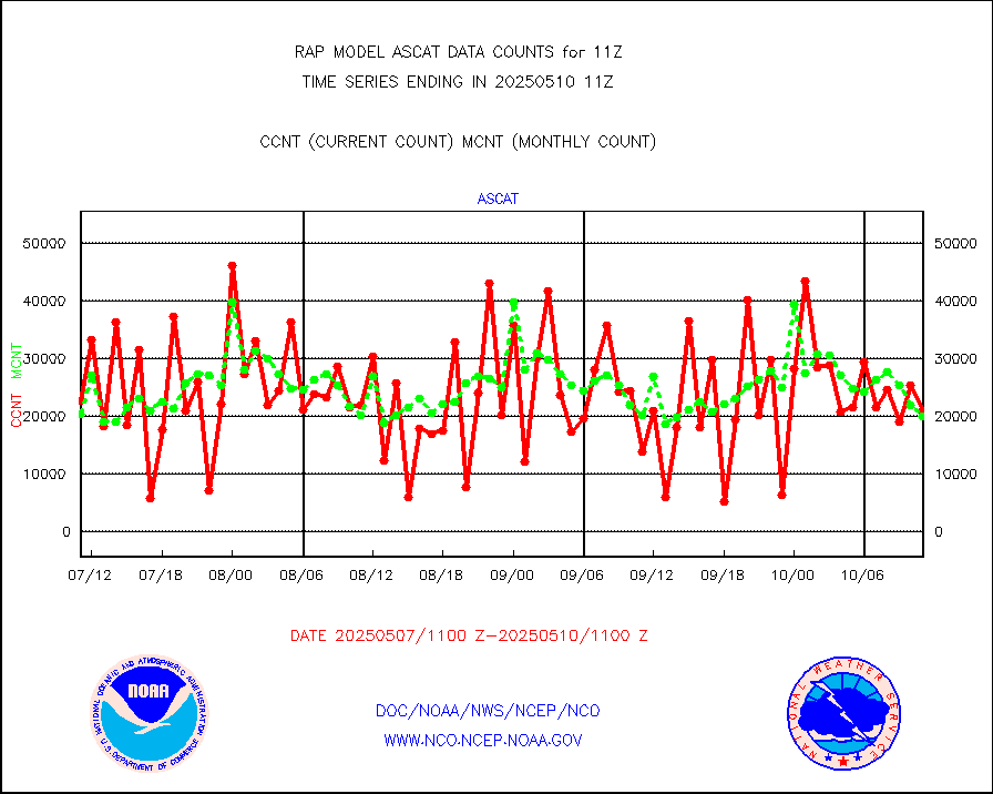
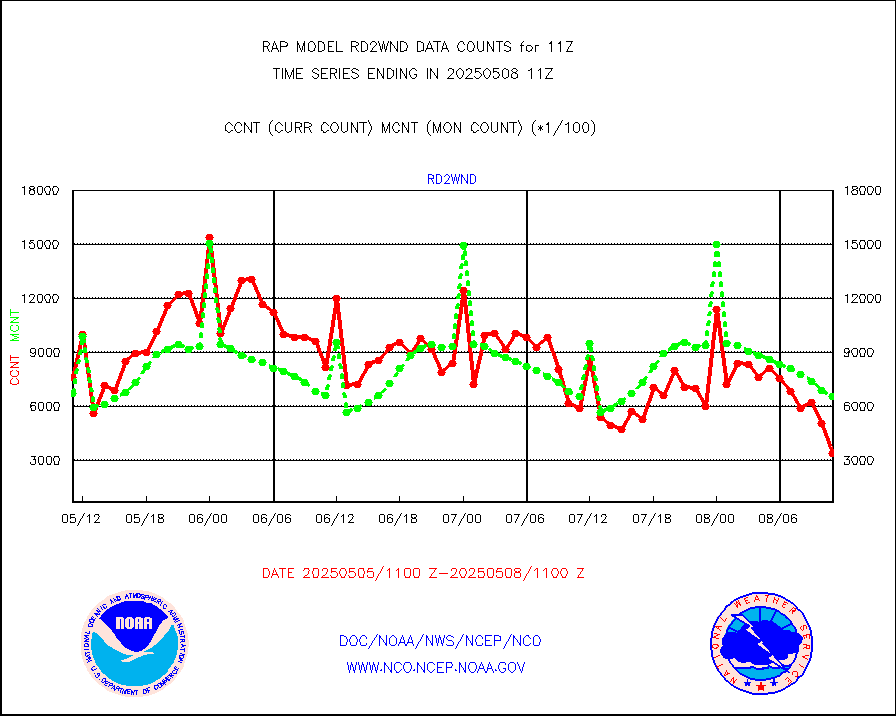
METOP 1-2 ASCAT products |
13845 |
20291 |
68.2 % |
0109.00-0113.00 |
||||||||||
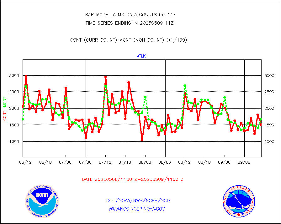
NPP/NOAA-20 ATMS brightness temperatures |
147375 |
162221 |
90.8 % |
0109.00-0112.99 |
||||||||||
NPP/NOAA-20 ATMS bright. temps-direct b-cast SSEC |
91008 |
114189 |
79.7 % |
0109.00-0112.99 |
||||||||||
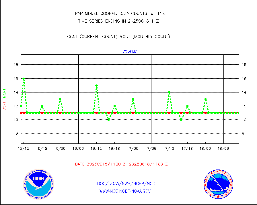
Coop/MADIS NEPP & HCN-Modernization NOAA COOP Obs |
11 |
11 |
100.0 % |
0110.50-0111.50 |
||||||||||
NPP/NOAA-20 CrIS full spctrl radn (431 ch subset) |
79429 |
96048 |
82.7 % |
0109.00-0112.99 |
||||||||||
NPP/NOAA-20 CrIS full spctrl radn dir brdcst SSEC |
34560 |
45220 |
76.4 % |
0109.00-0112.99 |
||||||||||
Coast Guard |
5 |
5 |
100.0 % |
0110.50-0111.50 |
||||||||||
Drifting buoys (decoded from BUFR) |
543 |
535 |
101.5 % |
0110.50-0111.50 |
||||||||||
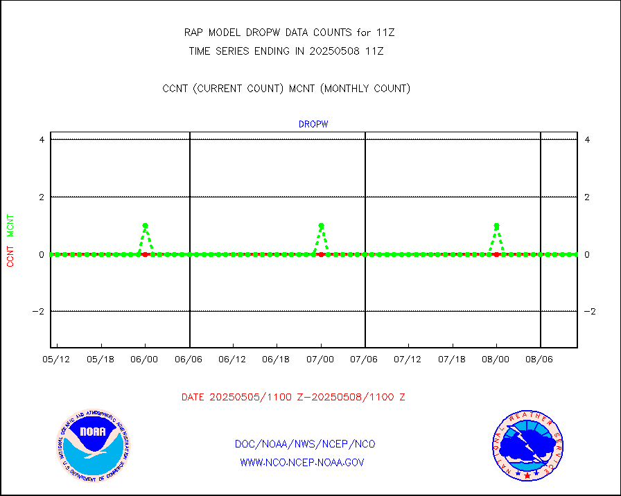
Dropwinsonde (from TEMP DROP) |
0 |
0 |
n/a |
0110.00-0112.00 |
||||||||||
Dropwinsonde (decoded from BUFR) |
1 |
0 |
n/a |
0110.00-0112.00 |
||||||||||
E-AMDAR (European AMDAR acft decoded from BUFR) |
11159 |
11656 |
95.7 % |
0107.75-0114.25 |
||||||||||
NOAA 15-19 & METOP 1-2 AMSU-A proc btmps frm RARS |
1308 |
3728 |
35.1 % |
0110.00-0112.00 |
||||||||||
METOP 1-2 IASI 1C radiance data vbl chn from RARS |
5207 |
14293 |
36.4 % |
0109.00-0112.99 |
||||||||||
NOAA 18-19 & METOP 1-2 MHS proc. btemps from RARS |
11542 |
32761 |
35.2 % |
0110.00-0112.00 |
||||||||||
GPS radio occultation data |
147 |
153 |
96.1 % |
0109.00-0112.99 |
||||||||||
GOES-16/17 All Sky Radiances (proc.) |
812097 |
809615 |
100.3 % |
0109.00-0112.99 |
||||||||||
GOES-16/17 Clear Sky Radiances (proc.) |
388700 |
364046 |
106.8 % |
0109.00-0112.99 |
||||||||||
MTSAT/JMA water vapor imager derived cloud motion |
2243 |
2820 |
79.5 % |
0108.50-0113.50 |
||||||||||
GOES-16&up/NESDIS wv imgr/deep-lyr derivd cld mtn |
8412 |
7624 |
110.3 % |
0110.00-0110.99 |
||||||||||
METEOSAT/EUMETSAT wvpr imgr drv cld motion NBseq |
5084 |
5328 |
95.4 % |
0109.50-0112.49 |
||||||||||
GOES-16&up/NESDIS wv imgr/cld-top derived cld mtn |
13059 |
12522 |
104.3 % |
0110.00-0110.99 |
||||||||||
METOP 1-2 IASI 1C radiances-direct broadcast SSEC |
59 |
8913 |
0.7 % |
0109.00-0112.99 |
||||||||||
METEOSAT/EUMETSAT ir lg-wave drv cld motion NBseq |
3012 |
3188 |
94.5 % |
0109.50-0112.49 |
||||||||||
VIIRS (NPP/NOAA-20) ir lg-wv drv cloud motion(NB) |
0 |
0 |
n/a |
0108.50-0113.50 |
||||||||||
AVHRR (NOAA/METOP) ir lg-wave derived cld motion |
0 |
0 |
n/a |
0108.50-0113.50 |
||||||||||
AVHRR (METOP) ir lg-wave derived cld motion |
0 |
0 |
n/a |
0109.50-0112.49 |
||||||||||
MTSAT/JMA infrared long-wave derived cloud motion |
2238 |
2324 |
96.3 % |
0108.50-0113.50 |
||||||||||
GOES-16&up/NESDIS ir long-wave derived cld motion |
30367 |
29699 |
102.2 % |
0110.00-0110.99 |
||||||||||
Korean AMDAR aircraft data (decoded from BUFR) |
257 |
315 |
81.6 % |
0107.75-0114.25 |
||||||||||
Land-based CMAN stations decoded from CMAN format |
43 |
39 |
110.3 % |
0110.50-0111.50 |
||||||||||
LLDN Long-rng lightning from Vaisala via NOAAPORT |
117896 |
110804 |
106.4 % |
0110.00-0111.50 |
||||||||||
NLDN Shrt-rng lightning from Vaisala via NOAAPORT |
5648 |
5584 |
101.1 % |
0110.00-0111.50 |
||||||||||
Moored buoys (decoded from BUFR) |
658 |
641 |
102.7 % |
0110.50-0111.50 |
||||||||||
Mesonet/MADIS Colorado E-470 (Interstate 470) |
24 |
24 |
100.0 % |
0110.50-0111.50 |
||||||||||
Mesonet/MADIS Alaska Department of Transportation |
118 |
73 |
161.6 % |
0110.50-0111.50 |
||||||||||
Mesonet/MADIS U.S. Army Aberdeen Proving Grounds |
0 |
0 |
n/a |
0110.50-0111.50 |
||||||||||
Mesonet/MADIS Citizen Weather Observers Program |
51284 |
57991 |
88.4 % |
0110.50-0111.50 |
||||||||||
Mesonet/MADIS AWS Convergence Technologies, Inc. |
18458 |
20945 |
88.1 % |
0110.50-0111.50 |
||||||||||
Mesonet/MADIS "Anything Weather" |
0 |
0 |
n/a |
0110.50-0111.50 |
||||||||||
Mesonet/MADIS Colorado Dept. of Transportation |
0 |
0 |
n/a |
0110.50-0111.50 |
||||||||||
Mesonet/MADIS DC Net |
0 |
0 |
n/a |
0110.50-0111.50 |
||||||||||
Mesonet/MADIS Denver Urban Drainage & Flood Cntrl |
0 |
0 |
n/a |
0110.50-0111.50 |
||||||||||
Mesonet/MADIS Florida (FAWN & USF) |
3 |
3 |
100.0 % |
0110.50-0111.50 |
||||||||||
Mesonet/MADIS Florida Dept. of Transportation |
0 |
0 |
n/a |
0110.50-0111.50 |
||||||||||
Mesonet/MADIS Georgia Dept. of Transportation |
0 |
0 |
n/a |
0110.50-0111.50 |
||||||||||
Mesonet/MADIS NWS Hydromet Auto Data System(HADS) |
4512 |
4806 |
93.9 % |
0110.50-0111.50 |
||||||||||
Mesonet/MADIS Iowa Environmental |
160 |
160 |
100.0 % |
0110.50-0111.50 |
||||||||||
Mesonet/MADIS Indiana Dept. of Transportation |
0 |
0 |
n/a |
0110.50-0111.50 |
||||||||||
Mesonet/MADIS Iowa Department of Transportation |
0 |
0 |
n/a |
0110.50-0111.50 |
||||||||||
Mesonet/MADIS Kansas Department of Transportation |
326 |
321 |
101.6 % |
0110.50-0111.50 |
||||||||||
Mesonet/MADIS Oklahoma Mesonet |
525 |
574 |
91.5 % |
0110.50-0111.50 |
||||||||||
Mesonet/MADIS Louisiana State/Jackson State Univ. |
0 |
0 |
n/a |
0110.50-0111.50 |
||||||||||
Mesonet/MADIS Missouri Commercial Agricult Wx Net |
269 |
285 |
94.4 % |
0110.50-0111.50 |
||||||||||
Mesonet/MADIS Minnesota Dept. of Transportation |
0 |
0 |
n/a |
0110.50-0111.50 |
||||||||||
Mesonet/MADIS NOS-Phys Oceanographic Realtime Sys |
251 |
264 |
95.1 % |
0110.50-0111.50 |
||||||||||
Mesonet/MADIS NFIC Remote Automated Wx Stns(RAWS) |
1153 |
1399 |
82.4 % |
0110.50-0111.50 |
||||||||||
Mesonet/MADIS many providers, not separated out |
28786 |
39395 |
73.1 % |
0110.50-0111.50 |
||||||||||
Mesonet/MADIS UrbaNet |
2908 |
3071 |
94.7 % |
0110.50-0111.50 |
||||||||||
Mesonet/MADIS Virginia Dept. of Transportation |
0 |
0 |
n/a |
0110.50-0111.50 |
||||||||||
Mesonet/MADIS "Weather for You" |
0 |
0 |
n/a |
0110.50-0111.50 |
||||||||||
Mesonet/MADIS Wisconsin Dept. of Transportation |
0 |
0 |
n/a |
0110.50-0111.50 |
||||||||||
Mesonet/MADIS MesoWest (many subproviders) |
26616 |
37128 |
71.7 % |
0110.50-0111.50 |
||||||||||
Mesonet/MADIS West Texas |
5043 |
5160 |
97.7 % |
0110.50-0111.50 |
||||||||||
METOP 1-2 IASI 1C radiance data (varbl. channels) |
33556 |
30516 |
110.0 % |
0109.00-0112.99 |
||||||||||
NEXRAD Vel Azm Dsp(VAD) winds via Level 2 decoder |
1000 |
858 |
116.6 % |
0110.00-0112.00 |
||||||||||
NOAA 16-19 Solar Backscatter UV-2 rad frm V8 BUFR |
0 |
0 |
n/a |
0109.00-0111.99 |
||||||||||
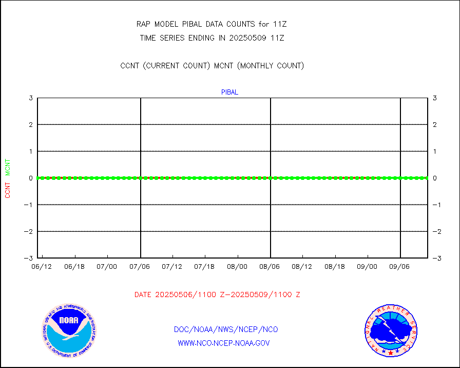
PIBAL (from PILOT, PILOT SHIP, PILOT MOBIL) |
0 |
0 |
n/a |
0110.00-0112.00 |
||||||||||
PIBAL (decoded from BUFR) |
0 |
0 |
n/a |
0110.00-0112.00 |
||||||||||
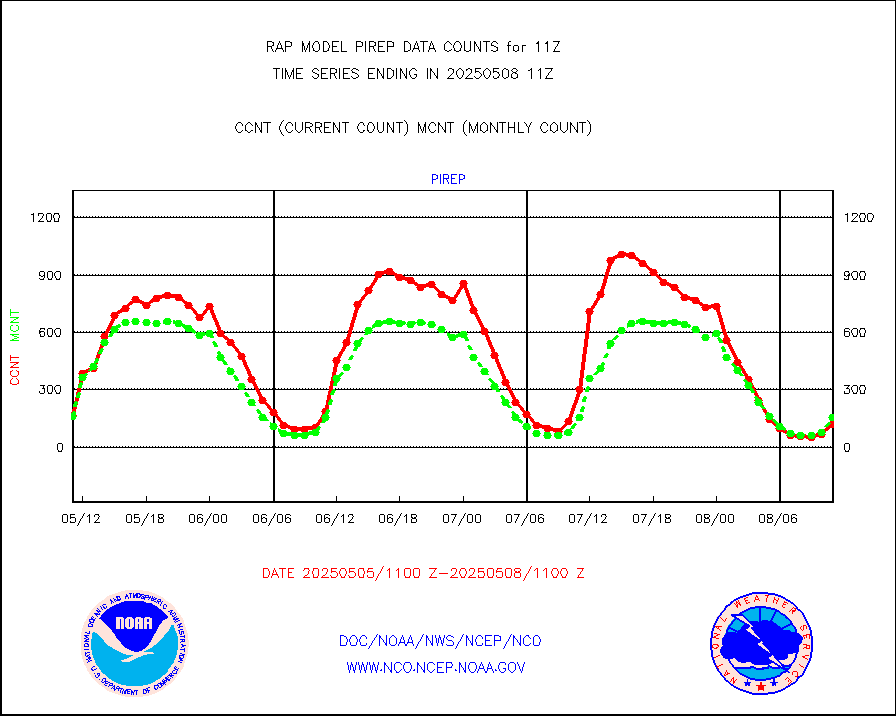
Manual PIREP aircraft data (dcded from AIREP fmt) |
123 |
113 |
108.8 % |
0107.75-0114.25 |
||||||||||
Profilr winds from PIBAL (PILOT,PILOT SHIP/MOBIL) |
0 |
0 |
n/a |
0109.50-0112.50 |
||||||||||
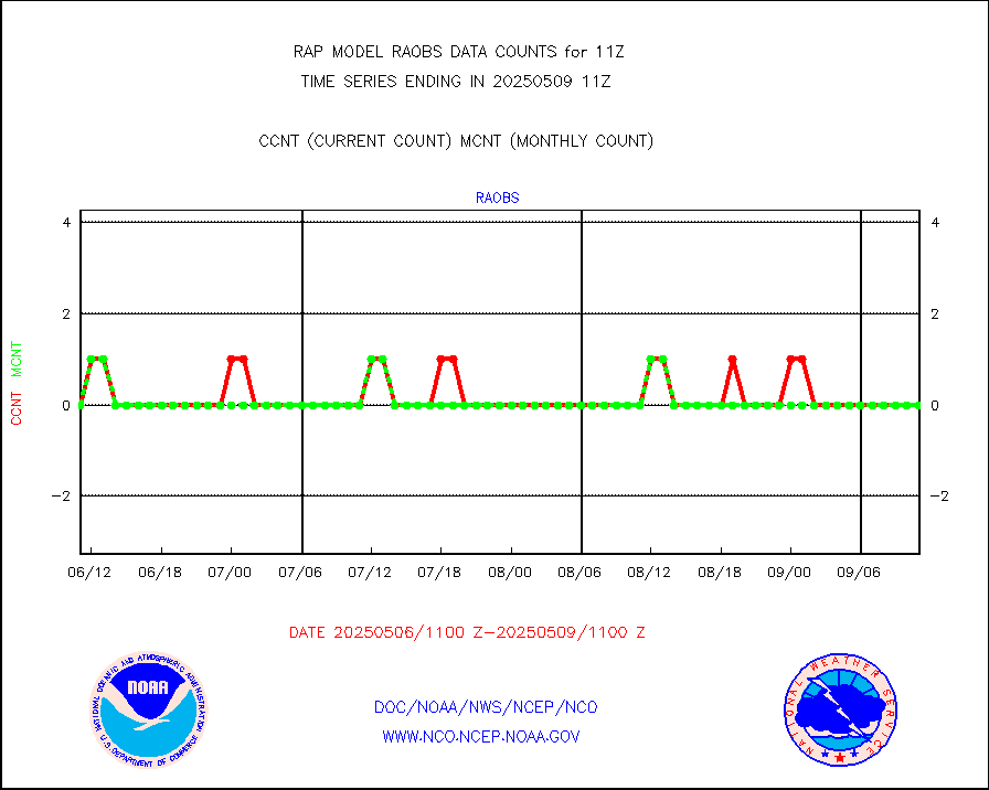
Rawinsonde - fixed land (decoded from BUFR) |
12 |
11 |
109.1 % |
0110.00-0112.00 |
||||||||||
Rawinsonde - mobile land (from TEMP/PILOT MOBIL) |
0 |
0 |
n/a |
0110.00-0112.00 |
||||||||||
Rawinsonde - mobile land (decoded from BUFR) |
0 |
0 |
n/a |
0110.00-0112.00 |
||||||||||
Rawinsonde - ship (from TEMP SHIP, PILOT SHIP) |
0 |
0 |
n/a |
0110.00-0112.00 |
||||||||||
Rawinsonde - ship (decoded from BUFR) |
0 |
0 |
n/a |
0110.00-0112.00 |
||||||||||
NEXRAD radial wind (Level 2 - GTS) |
1192393 |
998102 |
119.5 % |
0110.50-0111.49 |
||||||||||
Flight level reconnaissance aircraft data |
0 |
0 |
n/a |
0110.00-0112.00 |
||||||||||
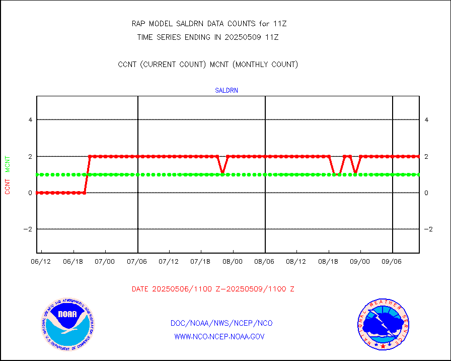
Surface Marine Saildrone (decoded from BUFR) |
2 |
2 |
100.0 % |
0109.00-0112.99 |
||||||||||
Megha-Tropiques SAPHIR L1A2 brightness temps |
0 |
0 |
n/a |
0108.00-0113.99 |
||||||||||
METEOSAT-10 2nd Gen SEVIRI All Sky Radiance(proc) |
9512 |
9467 |
100.5 % |
0109.00-0112.99 |
||||||||||
METEOSAT-10 2nd Gen SEVIRI Clr Sky Radiance(proc) |
0 |
0 |
n/a |
0109.00-0112.99 |
||||||||||
Ship - manual and automatic, restricted |
8 |
16 |
50.0 % |
0110.50-0111.50 |
||||||||||
NOW COVER, DEPTH/DENSITY AND WATER EQUIVALENT |
3357 |
6257 |
53.7 % |
0109.00-0113.00 |
||||||||||
Sub-surface float and glider profile (BUFR) |
0 |
8 |
0.0 % |
0109.00-0112.99 |
||||||||||
Synoptic - restricted (WMO Res 40) manual & auto. |
0 |
0 |
n/a |
0110.50-0111.50 |
||||||||||
Synoptic - restricted (WMO Res 40)(decoded BUFR) |
289 |
362 |
79.8 % |
0110.50-0111.50 |
||||||||||
Synoptic - mobile manual & auto (decoded fr BUFR) |
0 |
0 |
n/a |
0110.50-0111.50 |
||||||||||
TAMDAR aircft data-all types(from Panasonic,BUFR) |
230 |
196 |
117.3 % |
0107.75-0114.25 |
||||||||||
MTSAT/JMA visible derived cloud motion |
94 |
112 |
83.9 % |
0108.50-0113.50 |
||||||||||
GOES-16&up/NESDIS visible derived cloud motion |
18440 |
17586 |
104.9 % |
0110.00-0110.99 |
||||||||||
METEOSAT/EUMETSAT visible drv cld motion NBseq |
6465 |
6426 |
100.6 % |
0109.50-0112.49 |
||||||||||


