| Suspect Data Shortages in Critical Types - Monitor | ||||||||||||||
|---|---|---|---|---|---|---|---|---|---|---|---|---|---|---|
| Type | Description | Hourly Count | Monthly Average | Percent (%) of Monthly Mean | UTC Time Window | |||||||||
NOAA 18-19 & METOP 1-2 HIRS-4 NCEP-proc. br.temps |
0 |
13684 |
0.0 % |
0109.00-0109.99 |
||||||||||
NOAA 15-19 & METOP 1-2 HIRS-3/4 pr btmps frm RARS |
0 |
5720 |
0.0 % |
0110.50-0111.49 |
||||||||||
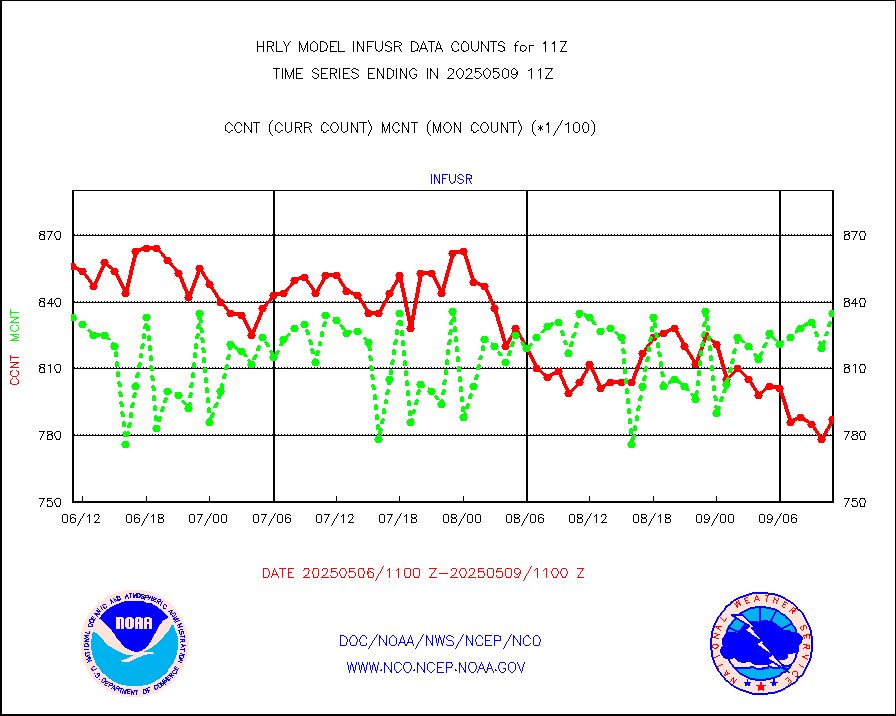
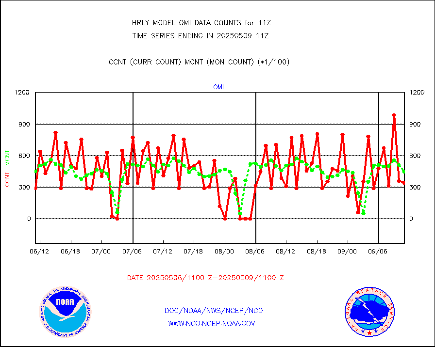
Grnd-based Gbl Navigation Sat System (GNSS) data |
1434 |
6936 |
20.7 % |
0110.00-0110.99 |
||||||||||
| Shortage in Data Type of Opportunity - Monitor | ||||||||||||||
|---|---|---|---|---|---|---|---|---|---|---|---|---|---|---|
| Type | Description | Hourly Count | Monthly Average | Percent (%) of Monthly Mean | UTC Time Window | |||||||||
P.M.(N18-19) AVHRR GAC NCEP-proc clr & sea btemps |
0 |
566828 |
0.0 % |
0108.50-0109.49 |
||||||||||
NPP Adv. Tech. MW Sndr (ATMS) br. temps from RARS |
0 |
4195 |
0.0 % |
0109.50-0110.49 |
||||||||||
INDIA SATWIND, INSAT WV channel |
0 |
678 |
0.0 % |
0110.00-0110.99 |
||||||||||
INDIA SATWIND, INSAT IR channel |
0 |
850 |
0.0 % |
0110.00-0110.99 |
||||||||||
DMSP SSM/IS 1C radiance data (Unified Pre-Proc.) |
0 |
51284 |
0.0 % |
0109.50-0110.49 |
||||||||||
INDIA SATWIND, INSAT VIS channel |
0 |
102 |
0.0 % |
0110.00-0110.99 |
||||||||||
| Critical Data with Normal Counts | ||||||||||||||
|---|---|---|---|---|---|---|---|---|---|---|---|---|---|---|
| Type | Description | Hourly Count | Monthly Average | Percent (%) of Monthly Mean | UTC Time Window | |||||||||
NOAA 15-19 & METOP 1-2 AMSU-A NCEP-proc. br.temps |
27557 |
37319 |
73.8 % |
0109.00-0109.99 |
||||||||||
NOAA 18-19 & METOP 1-2 MHS NCEP-proces. br. temps |
245431 |
270092 |
90.9 % |
0109.00-0109.99 |
||||||||||
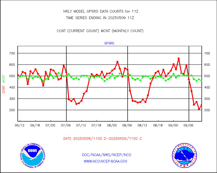
MDCRS ACARS acft data from ARINC(dcded from BUFR) |
13848 |
19783 |
70.0 % |
0110.50-0111.49 |
||||||||||
Manual AIREP aircraft data (dcded from AIREP fmt) |
719 |
754 |
95.4 % |
0110.50-0111.49 |
||||||||||
AQUA AIRS/AMSU-A/HSB brightness temps- every FOV |
0 |
0 |
n/a |
0108.50-0109.49 |
||||||||||
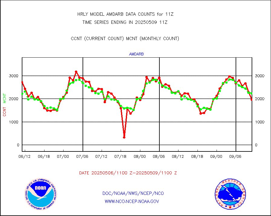
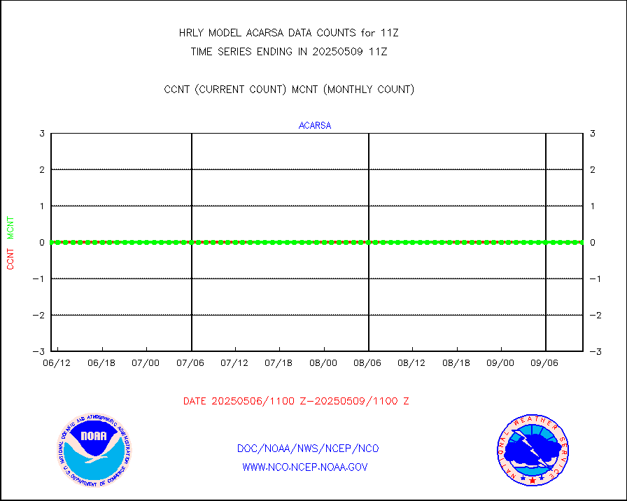
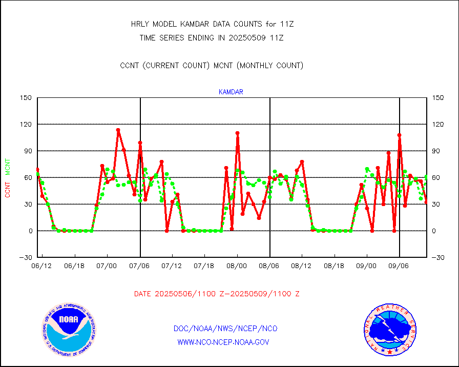
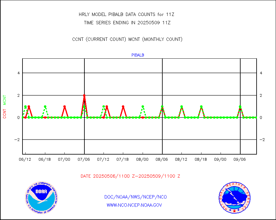
AMDAR aircraft data (decoded from AMDAR format) |
383 |
224 |
171.0 % |
0110.50-0111.49 |
||||||||||
AMDAR aircraft data (decoded from BUFR) |
2111 |
2239 |
94.3 % |
0110.50-0111.49 |
||||||||||
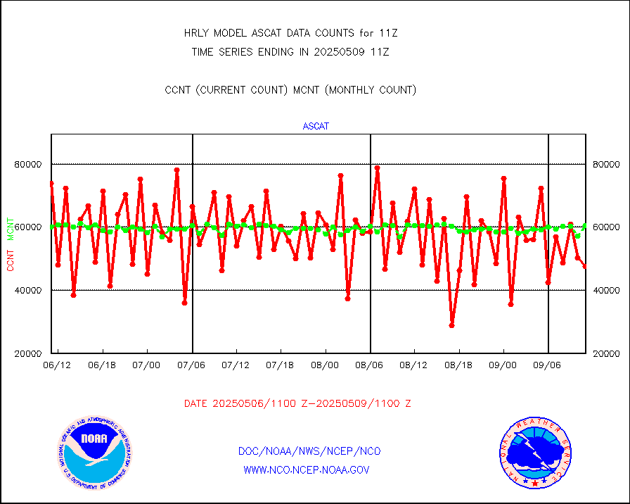
METOP 1-2 ASCAT products |
49770 |
60564 |
82.2 % |
0109.50-0110.49 |
||||||||||
NPP/NOAA-20 ATMS brightness temperatures |
290400 |
346800 |
83.7 % |
0109.50-0110.49 |
||||||||||
Canadian AMDAR aircraft data (decoded from BUFR) |
0 |
0 |
n/a |
0110.50-0111.49 |
||||||||||
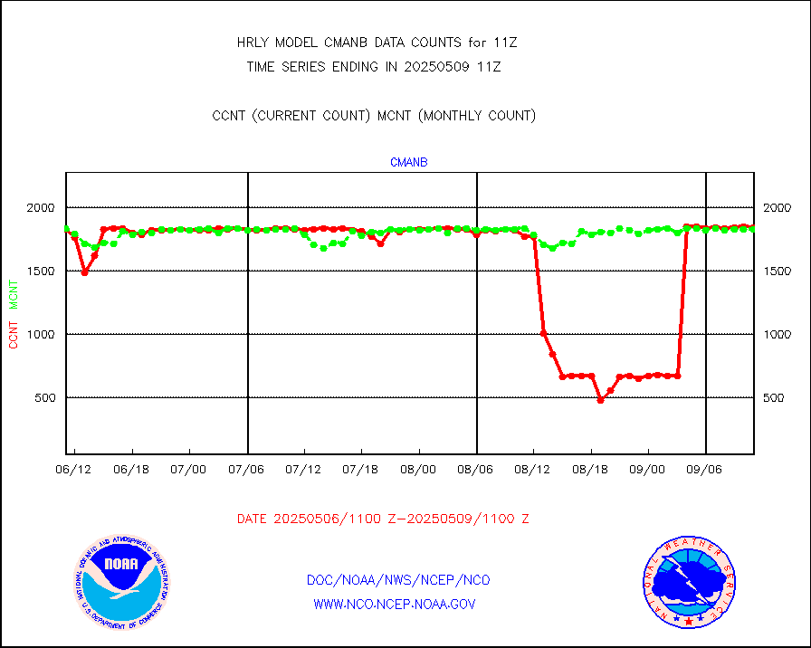
Surface Marine CMAN rpts decoded from BUFR format |
1866 |
1863 |
100.2 % |
0110.50-0111.50 |
||||||||||
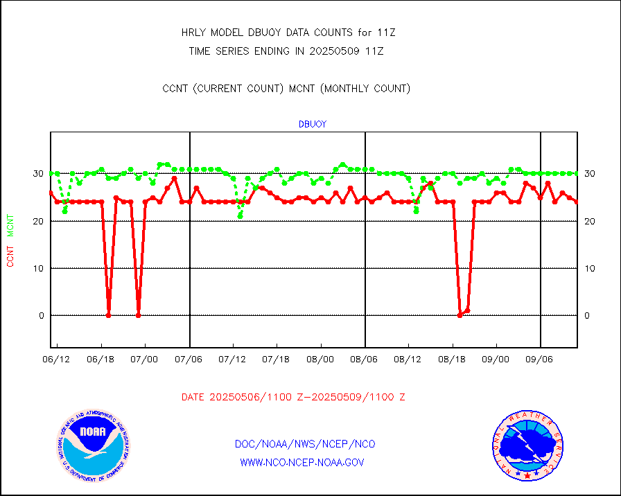
Buoys decoded from FM-18 fmt (moored or drifting) |
7 |
15 |
46.7 % |
0110.50-0111.49 |
||||||||||
E-AMDAR (European AMDAR acft decoded from BUFR) |
2292 |
2456 |
93.3 % |
0110.50-0111.49 |
||||||||||
NOAA 15-19 & METOP 1-2 AMSU-A proc btmps frm RARS |
9861 |
14028 |
70.3 % |
0110.50-0111.49 |
||||||||||
GPS radio occultation data |
547 |
500 |
109.4 % |
0108.50-0109.49 |
||||||||||
GOES-16/17 All Sky Radiances (proc.) |
720952 |
717872 |
100.4 % |
0110.50-0111.49 |
||||||||||
GOES-16/17 Clear Sky Radiances (proc.) |
341718 |
342036 |
99.9 % |
0110.50-0111.49 |
||||||||||
MTSAT/JMA water vapor imager derived cloud motion |
21990 |
20131 |
109.2 % |
0108.50-0109.49 |
||||||||||
MODIS (AQUA/TERRA) wvpr imager derived cld motion |
0 |
0 |
n/a |
0107.00-0107.99 |
||||||||||
GOES-16&up/NESDIS wv imgr/cld-top derived cld mtn |
22279 |
24429 |
91.2 % |
0110.00-0110.99 |
||||||||||
METEOSAT/EUMETSAT ir lg-wave drv cld motion NBseq |
21221 |
20920 |
101.4 % |
0109.50-0110.49 |
||||||||||
MTSAT/JMA infrared long-wave derived cloud motion |
16800 |
16496 |
101.8 % |
0108.50-0109.49 |
||||||||||
MODIS (AQUA/TERRA) ir l-wave derived cloud motion |
0 |
0 |
n/a |
0107.00-0107.99 |
||||||||||
GOES-16&up/NESDIS ir long-wave derived cld motion |
81812 |
83837 |
97.6 % |
0110.00-0110.99 |
||||||||||
GOES/NASA(Langley) hi-res. (1x1 f-o-v) cloud data |
6435005 |
6422647 |
100.2 % |
0110.50-0111.49 |
||||||||||
Buoys decoded from FM-13 format (moored) |
121 |
122 |
99.2 % |
0110.50-0111.49 |
||||||||||
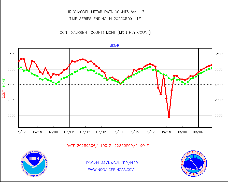
Aviation - METAR |
8116 |
8040 |
100.9 % |
0110.50-0111.49 |
||||||||||
Mesonet/MADIS Colorado E-470 (Interstate 470) |
24 |
24 |
100.0 % |
0110.50-0111.49 |
||||||||||
Mesonet/MADIS Alaska Department of Transportation |
118 |
88 |
134.1 % |
0110.50-0111.49 |
||||||||||
Mesonet/MADIS U.S. Army Aberdeen Proving Grounds |
0 |
0 |
n/a |
0110.50-0111.49 |
||||||||||
Mesonet/MADIS Citizen Weather Observers Program |
55099 |
61853 |
89.1 % |
0110.50-0111.49 |
||||||||||
Mesonet/MADIS AWS Convergence Technologies, Inc. |
18458 |
20945 |
88.1 % |
0110.50-0111.49 |
||||||||||
Mesonet/MADIS "Anything Weather" |
0 |
0 |
n/a |
0110.50-0111.49 |
||||||||||
Mesonet/MADIS Colorado Dept. of Transportation |
0 |
0 |
n/a |
0110.50-0111.49 |
||||||||||
Mesonet/MADIS DC Net |
0 |
0 |
n/a |
0110.50-0111.49 |
||||||||||
Mesonet/MADIS Denver Urban Drainage & Flood Cntrl |
0 |
0 |
n/a |
0110.50-0111.49 |
||||||||||
Mesonet/MADIS Florida (FAWN & USF) |
4 |
4 |
100.0 % |
0110.50-0111.49 |
||||||||||
Mesonet/MADIS Florida Dept. of Transportation |
0 |
0 |
n/a |
0110.50-0111.49 |
||||||||||
Mesonet/MADIS Georgia Dept. of Transportation |
0 |
0 |
n/a |
0110.50-0111.49 |
||||||||||
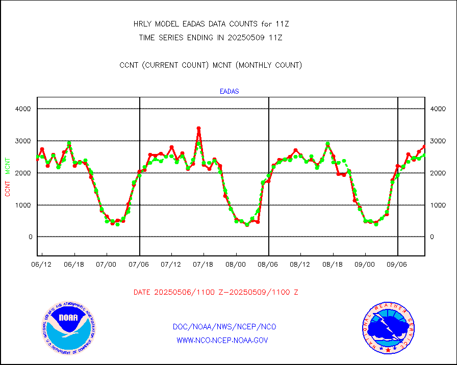
Mesonet/MADIS NWS Hydromet Auto Data System(HADS) |
5852 |
6149 |
95.2 % |
0110.50-0111.49 |
||||||||||
Mesonet/MADIS Iowa Environmental |
193 |
186 |
103.8 % |
0110.50-0111.49 |
||||||||||
Mesonet/MADIS Indiana Dept. of Transportation |
0 |
0 |
n/a |
0110.50-0111.49 |
||||||||||
Mesonet/MADIS Iowa Department of Transportation |
0 |
0 |
n/a |
0110.50-0111.49 |
||||||||||
Mesonet/MADIS Kansas Department of Transportation |
373 |
361 |
103.3 % |
0110.50-0111.49 |
||||||||||
Mesonet/MADIS Oklahoma Mesonet |
630 |
630 |
100.0 % |
0110.50-0111.49 |
||||||||||
Mesonet/MADIS Louisiana State/Jackson State Univ. |
0 |
0 |
n/a |
0110.50-0111.49 |
||||||||||
Mesonet/MADIS Missouri Commercial Agricult Wx Net |
329 |
333 |
98.8 % |
0110.50-0111.49 |
||||||||||
Mesonet/MADIS Minnesota Dept. of Transportation |
0 |
0 |
n/a |
0110.50-0111.49 |
||||||||||
Mesonet/MADIS NOS-Phys Oceanographic Realtime Sys |
343 |
385 |
89.1 % |
0110.50-0111.49 |
||||||||||
Mesonet/MADIS NFIC Remote Automated Wx Stns(RAWS) |
1928 |
1827 |
105.5 % |
0110.50-0111.49 |
||||||||||
Mesonet/MADIS many providers, not separated out |
62637 |
74300 |
84.3 % |
0110.00-0111.49 |
||||||||||
Mesonet/MADIS Virginia Dept. of Transportation |
0 |
0 |
n/a |
0110.50-0111.49 |
||||||||||
Mesonet/MADIS "Weather for You" |
0 |
0 |
n/a |
0110.50-0111.49 |
||||||||||
Mesonet/MADIS Wisconsin Dept. of Transportation |
0 |
0 |
n/a |
0110.50-0111.49 |
||||||||||
Mesonet/MADIS MesoWest (many subproviders) |
26618 |
37134 |
71.7 % |
0110.50-0111.49 |
||||||||||
Mesonet/MADIS West Texas |
5863 |
6054 |
96.8 % |
0110.50-0111.49 |
||||||||||
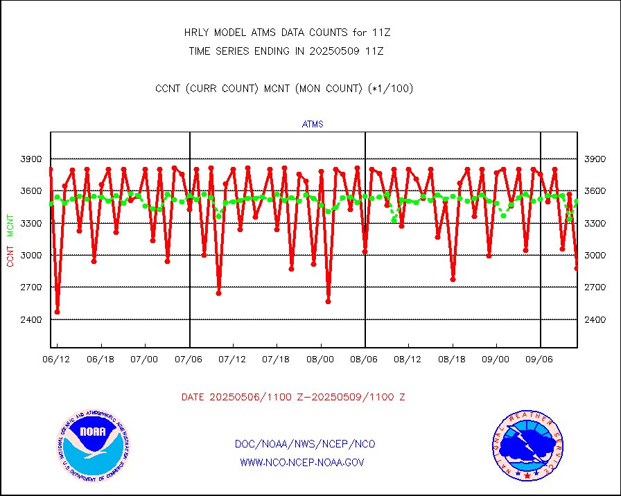
METOP 1-2 IASI 1C radiance data (varbl. channels) |
101952 |
91109 |
111.9 % |
0109.00-0109.99 |
||||||||||
NEXRAD Vel Azm Dsp(VAD) winds via radar coded msg |
0 |
0 |
n/a |
0110.50-0111.49 |
||||||||||
Aura Ozone Monitoring Instrument (OMI) data |
0 |
0 |
n/a |
0108.50-0109.49 |
||||||||||
NOAA 16-19 Solar Backscatter UV-2 rad frm V8 BUFR |
0 |
0 |
n/a |
0109.00-0109.99 |
||||||||||
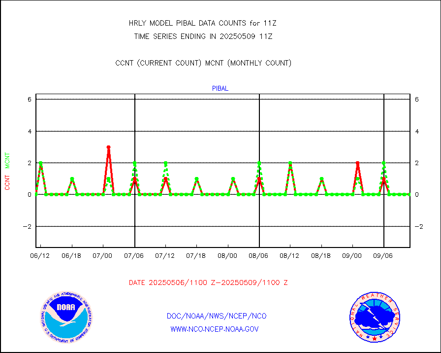
PIBAL (from PILOT, PILOT SHIP, PILOT MOBIL) |
0 |
0 |
n/a |
0110.50-0111.49 |
||||||||||
Multi-Agency Profiler (MAP) and SODAR winds |
46 |
46 |
100.0 % |
0110.50-0111.49 |
||||||||||
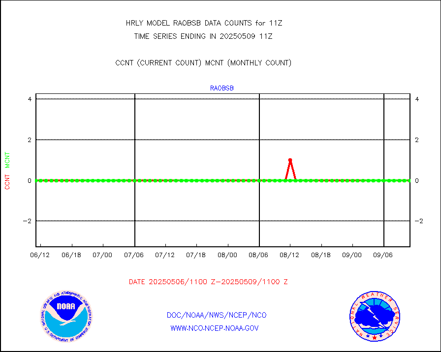
Rawinsonde - fixed land (from TEMP or PILOT) |
0 |
0 |
n/a |
0110.50-0111.49 |
||||||||||
RASS temperatures (NOAA and Multi-Agency) |
24 |
26 |
92.3 % |
0110.50-0111.49 |
||||||||||
NEXRAD reflectivity (Lvl 2 - GTS) |
4242070 |
4109155 |
103.2 % |
0110.50-0111.49 |
||||||||||
NEXRAD radial wind (Level 2 - GTS) |
1619348 |
1399191 |
115.7 % |
0110.50-0111.49 |
||||||||||
METEOSAT-10 2nd Gen SEVIRI Clr Sky Radiance(proc) |
0 |
0 |
n/a |
0110.50-0111.49 |
||||||||||
Ship - manual and automatic, restricted (BUFR) |
7 |
9 |
77.8 % |
0110.50-0111.50 |
||||||||||
Ship - manual and automatic, unrestricted |
188 |
175 |
107.4 % |
0110.50-0111.50 |
||||||||||
Ship - manual and automatic, unrestricted (BUFR) |
993 |
1009 |
98.4 % |
0110.50-0111.50 |
||||||||||
Synoptic - fixed manual and automatic |
823 |
741 |
111.1 % |
0110.50-0111.49 |
||||||||||
Synoptic - fixed manual & auto (decoded fr BUFR) |
5186 |
5190 |
99.9 % |
0110.50-0111.49 |
||||||||||
Synoptic - restricted (WMO Res 40) manual & auto. |
0 |
1 |
0.0 % |
0110.50-0111.49 |
||||||||||
Synoptic - restricted (WMO Res 40)(decoded BUFR) |
402 |
416 |
96.6 % |
0110.50-0111.49 |
||||||||||
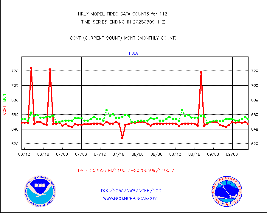
Tide gauge reports decoded from CREX format |
658 |
656 |
100.3 % |
0110.00-0110.99 |
||||||||||
| Data Types of Opportunity with Normal Counts | ||||||||||||||
|---|---|---|---|---|---|---|---|---|---|---|---|---|---|---|
| Type | Description | Hourly Count | Monthly Average | Percent (%) of Monthly Mean | UTC Time Window | |||||||||
GOES-16&up/NESDIS ir short-wv derived cld motion |
40188 |
42790 |
93.9 % |
0110.00-0110.99 |
||||||||||
MDCRS ACARS acft data (ARINC via AFWA)(AIREP fmt) |
0 |
0 |
n/a |
0110.50-0111.49 |
||||||||||
Himawari Clear Sky Radiance |
0 |
0 |
n/a |
0110.00-0110.99 |
||||||||||
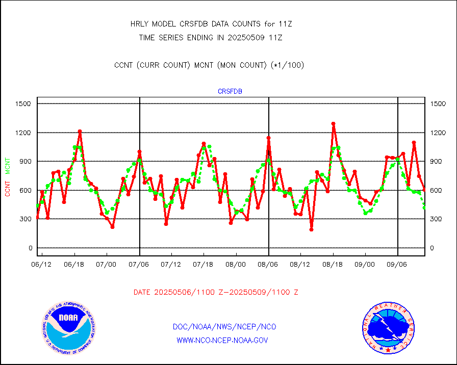
GCOM-W AMSR2 1B brightness temperatures |
1978020 |
2200673 |
89.9 % |
0109.00-0109.99 |
||||||||||
NPP/NOAA-20 ATMS bright. temps-direct b-cast SSEC |
96439 |
86479 |
111.5 % |
0109.50-0110.49 |
||||||||||
POES/NESDIS - processed ATOVS soundings/radiances |
0 |
0 |
n/a |
0109.00-0109.99 |
||||||||||
A.M.(N17,M2,M3) AVHRR GAC NCEP-proc clr&sea btmps |
1430762 |
1372076 |
104.3 % |
0108.50-0109.49 |
||||||||||
eXpendable BathyThermograph, mooring (BATHY fmt) |
0 |
0 |
n/a |
0104.00-0104.99 |
||||||||||
Coop/MADIS NEPP & HCN-Modernization NOAA COOP Obs |
11 |
11 |
100.0 % |
0110.50-0111.49 |
||||||||||
NPP/NOAA-20 CrIS full spctrl radn (431 ch subset) |
211320 |
232088 |
91.1 % |
0109.50-0110.49 |
||||||||||
NPP/NOAA-20 CrIS full spctrl radn dir brdcst SSEC |
32994 |
25361 |
130.1 % |
0109.50-0110.49 |
||||||||||
Coast Guard |
5 |
5 |
100.0 % |
0110.50-0111.50 |
||||||||||
Drifting buoys (decoded from BUFR) |
1448 |
1451 |
99.8 % |
0110.50-0111.50 |
||||||||||
Dropwinsonde (from TEMP DROP) |
0 |
0 |
n/a |
0110.50-0111.49 |
||||||||||
Dropwinsonde (decoded from BUFR) |
1 |
1 |
100.0 % |
0110.51-0111.49 |
||||||||||
GOES imager effective cloud amount data (U.Wisc.) |
9250602 |
8134866 |
113.7 % |
0110.50-0111.49 |
||||||||||
METOP 1-2 IASI 1C radiance data vbl chn from RARS |
11280 |
17046 |
66.2 % |
0110.00-0110.99 |
||||||||||
NOAA 18-19 & METOP 1-2 MHS proc. btemps from RARS |
87930 |
124732 |
70.5 % |
0110.50-0111.49 |
||||||||||
GOES/NESDIS (11x17 f-o-v) imager clear radiances |
0 |
0 |
n/a |
0110.00-0110.99 |
||||||||||
METOP 1-2 Global Ozone Monitoring Exp.-2 (GOME-2) |
4413 |
9347 |
47.2 % |
0109.50-0110.49 |
||||||||||
GOES-16&up/NESDIS wv imgr/deep-lyr derivd cld mtn |
20046 |
16944 |
118.3 % |
0110.00-0110.99 |
||||||||||
METEOSAT/EUMETSAT wvpr imgr drv cld motion NBseq |
36130 |
37745 |
95.7 % |
0109.50-0110.49 |
||||||||||
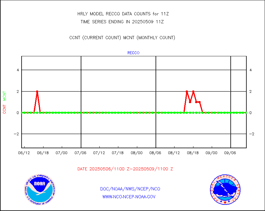
High Density OBs from reconnaissance acft data |
0 |
9 |
0.0 % |
0110.50-0111.49 |
||||||||||
METOP 1-2 IASI 1C radiances-direct broadcast SSEC |
9600 |
32964 |
29.1 % |
0109.50-0110.49 |
||||||||||
VIIRS (NPP/NOAA-20) ir lg-wv drv cloud motion(NB) |
14441 |
17935 |
80.5 % |
0107.00-0107.99 |
||||||||||
AVHRR (NOAA/METOP) ir lg-wave derived cld motion |
0 |
0 |
n/a |
0107.00-0107.99 |
||||||||||
AVHRR (METOP) ir lg-wave derived cld motion |
0 |
0 |
n/a |
0110.50-0111.50 |
||||||||||
INSAT/KALPANA India ir lg-wave derived cld motion |
0 |
0 |
n/a |
0108.50-0109.49 |
||||||||||
Korean AMDAR aircraft data (decoded from BUFR) |
54 |
72 |
75.0 % |
0110.50-0111.49 |
||||||||||
Land-based CMAN stations decoded from CMAN format |
100 |
77 |
129.9 % |
0110.50-0111.49 |
||||||||||
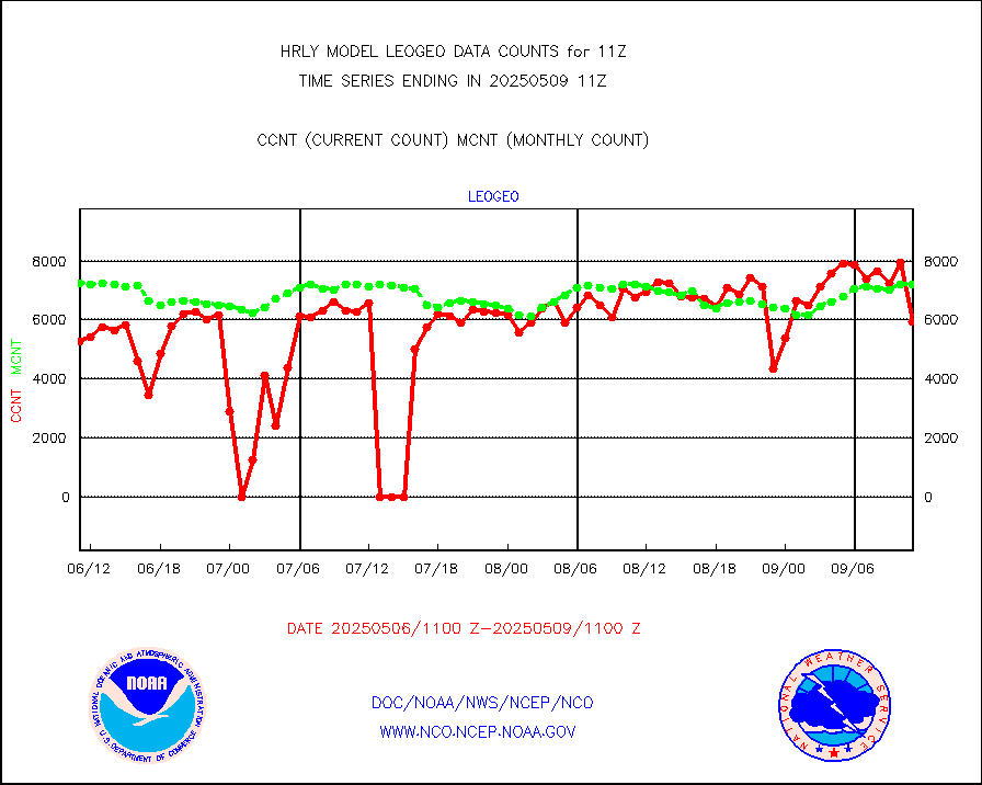
LEO-GEO satellite AMVs from UWisc. |
7410 |
7800 |
95.0 % |
0107.00-0107.99 |
||||||||||
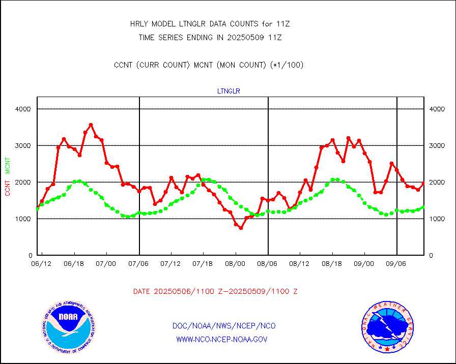
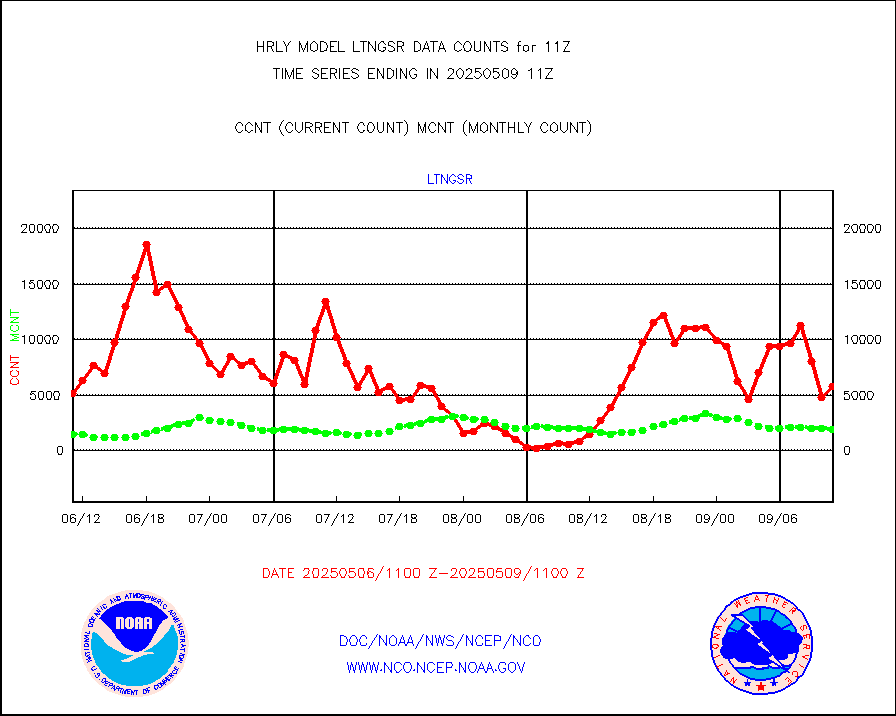
LLDN Long-rng lightning from Vaisala via NOAAPORT |
123527 |
140719 |
87.8 % |
0110.50-0111.49 |
||||||||||
NLDN Shrt-rng lightning from Vaisala via NOAAPORT |
3806 |
3984 |
95.5 % |
0110.50-0111.49 |
||||||||||
Moored buoys (decoded from BUFR) |
936 |
934 |
100.2 % |
0110.50-0111.50 |
||||||||||
Aura Microwave Limb Sounder (MLS) ozone data |
0 |
0 |
n/a |
0109.00-0109.99 |
||||||||||
Mesonet/MADIS UrbaNet |
3601 |
3553 |
101.4 % |
0110.50-0111.49 |
||||||||||
NEXRAD Vel Azm Dsp(VAD) winds via Level 2 decoder |
467 |
542 |
86.2 % |
0110.50-0111.49 |
||||||||||
OMPS Limb Profiler ozone data (NPP) |
454 |
264 |
172.0 % |
0104.00-0104.99 |
||||||||||
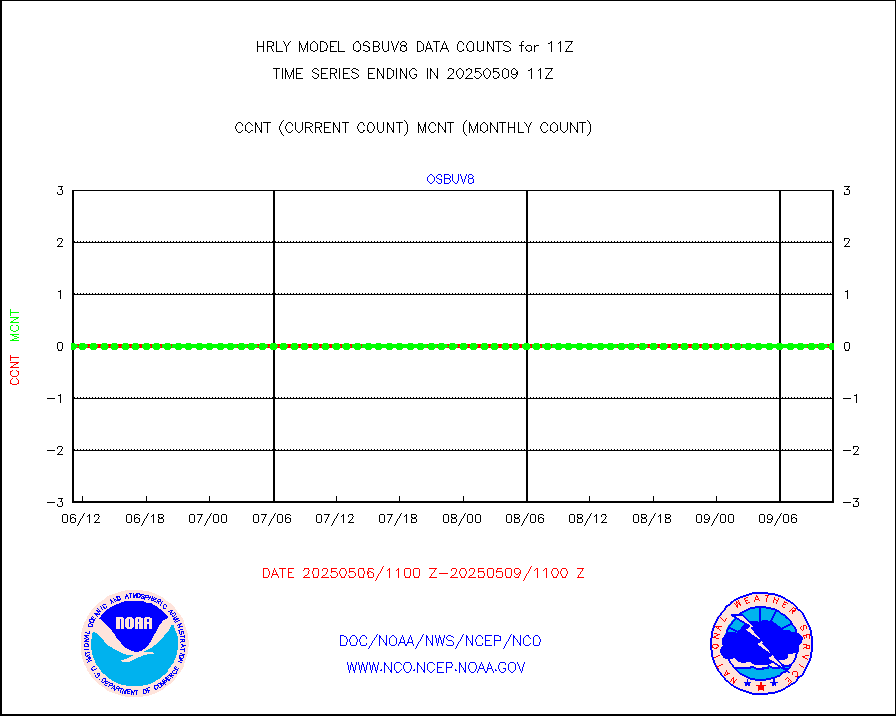
OMPS nadir profile ozone (Version 8 BUFR) |
618 |
619 |
99.8 % |
0109.00-0109.99 |
||||||||||
OMPS total column ozone (Version 8 BUFR) |
373688 |
376864 |
99.2 % |
0109.00-0109.99 |
||||||||||
PIBAL (decoded from BUFR) |
0 |
0 |
n/a |
0110.51-0111.49 |
||||||||||
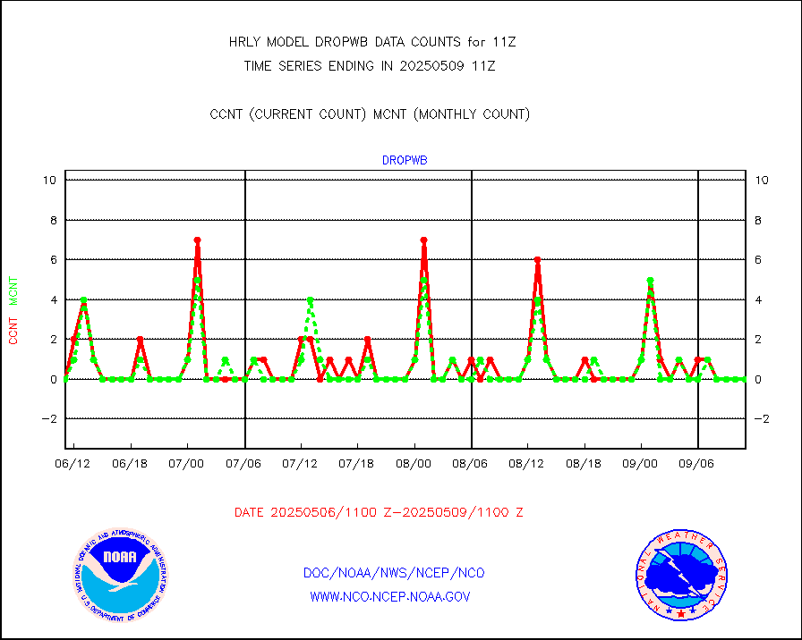
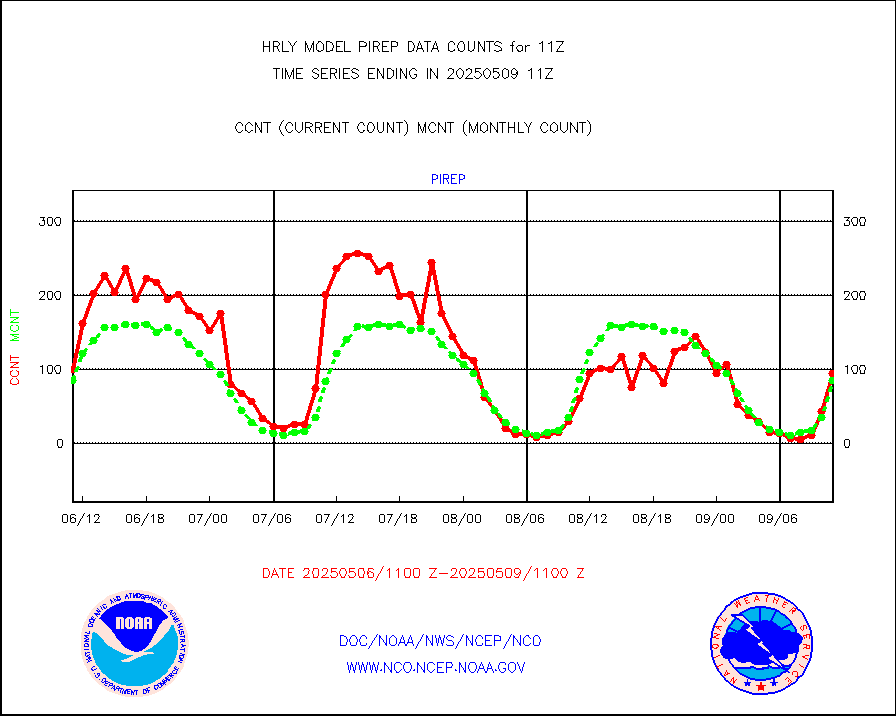
Manual PIREP aircraft data (dcded from AIREP fmt) |
89 |
68 |
130.9 % |
0110.50-0111.49 |
||||||||||
Profilr winds from PIBAL (PILOT,PILOT SHIP/MOBIL) |
0 |
0 |
n/a |
0110.50-0111.49 |
||||||||||
Rawinsonde - fixed land (decoded from BUFR) |
13 |
11 |
118.2 % |
0110.51-0111.49 |
||||||||||
Rawinsonde - mobile land (from TEMP/PILOT MOBIL) |
0 |
0 |
n/a |
0110.50-0111.49 |
||||||||||
Rawinsonde - mobile land (decoded from BUFR) |
0 |
0 |
n/a |
0110.51-0111.49 |
||||||||||
Rawinsonde - ship (from TEMP SHIP, PILOT SHIP) |
0 |
0 |
n/a |
0110.50-0111.49 |
||||||||||
Rawinsonde - ship (decoded from BUFR) |
0 |
0 |
n/a |
0110.51-0111.49 |
||||||||||
Flight level reconnaissance aircraft data |
0 |
0 |
n/a |
0110.50-0111.49 |
||||||||||
Megha-Tropiques SAPHIR L1A2 brightness temps |
0 |
0 |
n/a |
0108.50-0109.49 |
||||||||||
METEOSAT-10 2nd Gen SEVIRI All Sky Radiance(proc) |
75512 |
75207 |
100.4 % |
0110.50-0111.49 |
||||||||||
Ship - manual and automatic, restricted |
8 |
16 |
50.0 % |
0110.50-0111.49 |
||||||||||
NPP/NOAA-20 VIIRS SST - CLEAR & OVER WATER |
9999999 |
2216193 |
451.2 % |
0110.50-0111.49 |
||||||||||
NPP/NOAA-20 VIIRS SST - PROBABLY CLR & OVER WATER |
2965436 |
428650 |
691.8 % |
0110.50-0111.49 |
||||||||||
Synoptic - mobile manual and automatic |
713 |
690 |
103.3 % |
0110.50-0111.49 |
||||||||||
Synoptic - mobile manual & auto (decoded fr BUFR) |
1 |
1 |
100.0 % |
0110.50-0111.49 |
||||||||||
CTD probe, Argo prflng float, mooring (TESAC fmt) |
215 |
215 |
100.0 % |
0110.50-0111.49 |
||||||||||
TAMDAR aircft data-all types(from Panasonic,BUFR) |
68 |
50 |
136.0 % |
0110.50-0111.49 |
||||||||||
ThermoSalinoGraph (TSG) TRACKOB format) |
93 |
96 |
96.9 % |
0109.50-0110.49 |
||||||||||
INSAT/KALPANA India visible derived cloud motion |
0 |
0 |
n/a |
0108.50-0109.49 |
||||||||||
MTSAT/JMA visible derived cloud motion |
2520 |
2588 |
97.4 % |
0108.50-0109.49 |
||||||||||
GOES-16&up/NESDIS visible derived cloud motion |
62899 |
50355 |
124.9 % |
0110.00-0110.99 |
||||||||||
METEOSAT/EUMETSAT visible drv cld motion NBseq |
44992 |
43722 |
102.9 % |
0109.50-0110.49 |
||||||||||


