| Suspect Data Shortages in Critical Types - Monitor | ||||||||||||||
|---|---|---|---|---|---|---|---|---|---|---|---|---|---|---|
| Type | Description | Hourly Count | Monthly Average | Percent (%) of Monthly Mean | UTC Time Window | |||||||||
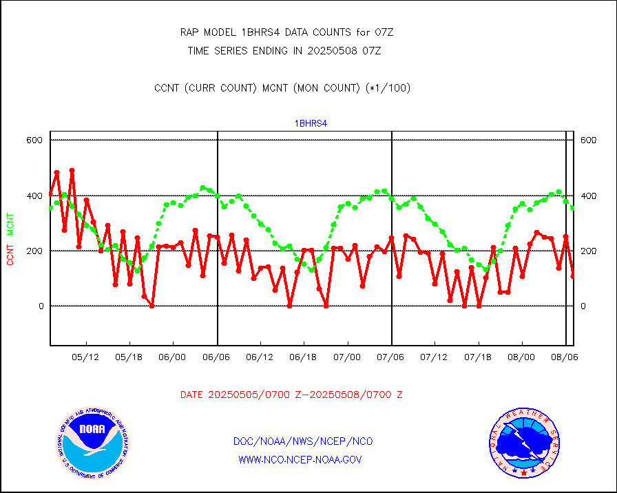
NOAA 18-19 & METOP 1-2 HIRS-4 NCEP-proc. br.temps |
0 |
10345 |
0.0 % |
0104.00-0109.99 |
||||||||||
| Shortage in Data Type of Opportunity - Monitor | ||||||||||||||
|---|---|---|---|---|---|---|---|---|---|---|---|---|---|---|
| Type | Description | Hourly Count | Monthly Average | Percent (%) of Monthly Mean | UTC Time Window | |||||||||
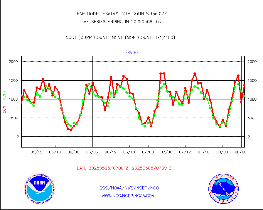
NPP Adv. Tech. MW Sndr (ATMS) br. temps from RARS |
0 |
10580 |
0.0 % |
0105.00-0108.99 |
||||||||||
NOAA 15-19 & METOP 1-2 HIRS-3/4 pr btmps frm RARS |
0 |
7678 |
0.0 % |
0106.00-0108.00 |
||||||||||
METOP 1-2 IASI 1C radiance data vbl chn from RARS |
0 |
1181 |
0.0 % |
0105.00-0108.99 |
||||||||||
| Critical Data with Normal Counts | ||||||||||||||
|---|---|---|---|---|---|---|---|---|---|---|---|---|---|---|
| Type | Description | Hourly Count | Monthly Average | Percent (%) of Monthly Mean | UTC Time Window | |||||||||
NOAA 15-19 & METOP 1-2 AMSU-A NCEP-proc. br.temps |
17801 |
26017 |
68.4 % |
0104.00-0109.99 |
||||||||||
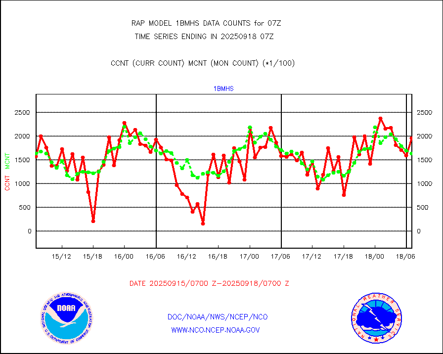
NOAA 18-19 & METOP 1-2 MHS NCEP-proces. br. temps |
158098 |
195797 |
80.7 % |
0104.00-0109.99 |
||||||||||
MDCRS ACARS acft data from ARINC(dcded from BUFR) |
63609 |
74093 |
85.9 % |
0103.75-0110.25 |
||||||||||
Canadian AMDAR aircraft data (decoded from BUFR) |
0 |
0 |
n/a |
0103.75-0110.25 |
||||||||||
Surface Marine CMAN rpts decoded from BUFR format |
1729 |
1702 |
101.6 % |
0106.50-0107.50 |
||||||||||
Buoys decoded from FM-18 fmt (moored or drifting) |
0 |
0 |
n/a |
0106.50-0107.50 |
||||||||||
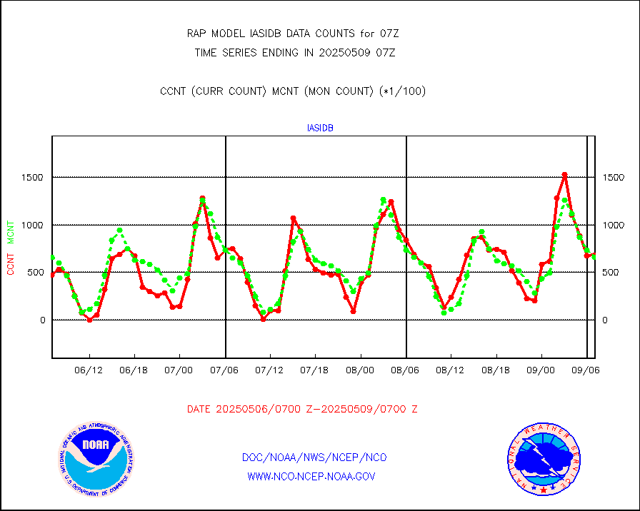
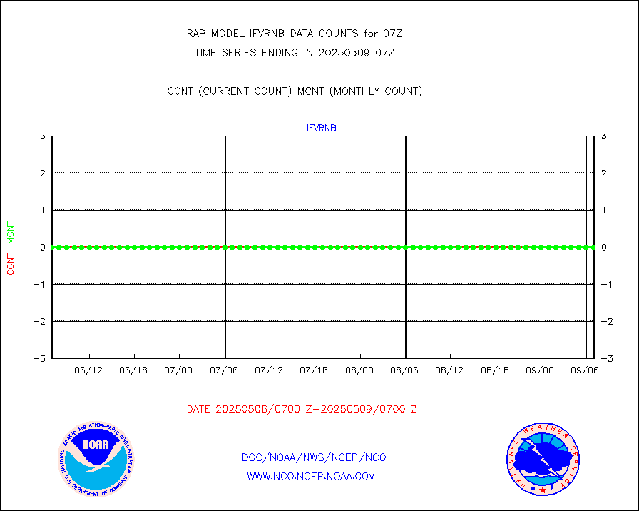
Grnd-based Gbl Navigation Sat System (GNSS) data |
716 |
2052 |
34.9 % |
0105.95-0106.05 |
||||||||||
MODIS (AQUA/TERRA) wvpr imager derived cld motion |
0 |
0 |
n/a |
0104.50-0109.50 |
||||||||||
MODIS (AQUA/TERRA) ir l-wave derived cloud motion |
0 |
0 |
n/a |
0104.50-0109.50 |
||||||||||
GOES/NASA(Langley) hi-res. (1x1 f-o-v) cloud data |
2006454 |
2005962 |
100.0 % |
0106.50-0107.50 |
||||||||||
Buoys decoded from FM-13 format (moored) |
123 |
121 |
101.7 % |
0106.50-0107.50 |
||||||||||
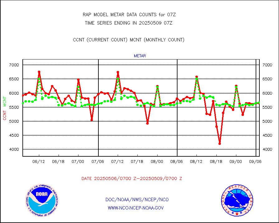
Aviation - METAR |
5571 |
5566 |
100.1 % |
0106.50-0107.50 |
||||||||||
NEXRAD Vel Azm Dsp(VAD) winds via radar coded msg |
0 |
0 |
n/a |
0106.00-0108.00 |
||||||||||
Multi-Agency Profiler (MAP) and SODAR winds |
106 |
96 |
110.4 % |
0105.50-0108.50 |
||||||||||
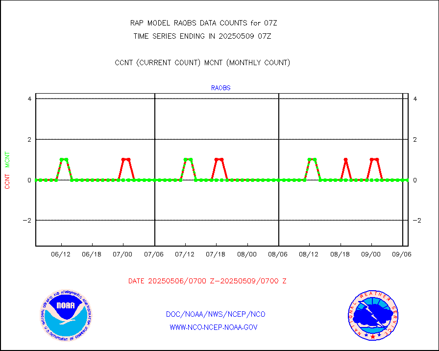
Rawinsonde - fixed land (from TEMP or PILOT) |
8 |
8 |
100.0 % |
0106.00-0108.00 |
||||||||||
RASS temperatures (NOAA and Multi-Agency) |
27 |
22 |
122.7 % |
0106.50-0107.50 |
||||||||||
Ship - manual and automatic, restricted (BUFR) |
0 |
8 |
0.0 % |
0106.50-0107.50 |
||||||||||
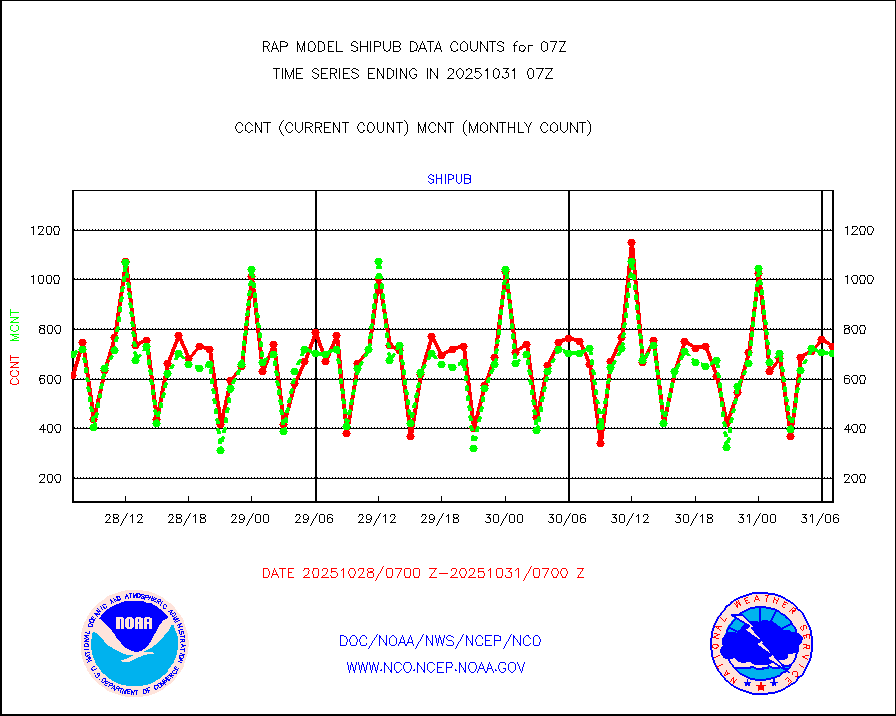
Ship - manual and automatic, unrestricted |
90 |
86 |
104.7 % |
0106.50-0107.50 |
||||||||||
Ship - manual and automatic, unrestricted (BUFR) |
756 |
752 |
100.5 % |
0106.50-0107.50 |
||||||||||
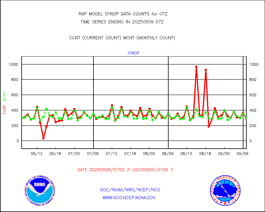
Synoptic - fixed manual and automatic |
196 |
256 |
76.6 % |
0106.50-0107.50 |
||||||||||
Synoptic - fixed manual & auto (decoded fr BUFR) |
2115 |
1974 |
107.1 % |
0106.50-0107.50 |
||||||||||
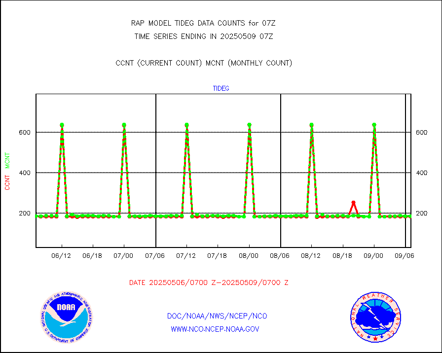
Tide gauge reports decoded from CREX format |
185 |
185 |
100.0 % |
0106.50-0107.50 |
||||||||||
| Data Types of Opportunity with Normal Counts | ||||||||||||||
|---|---|---|---|---|---|---|---|---|---|---|---|---|---|---|
| Type | Description | Hourly Count | Monthly Average | Percent (%) of Monthly Mean | UTC Time Window | |||||||||
GOES-16&up/NESDIS ir short-wv derived cld motion |
11599 |
12585 |
92.2 % |
0106.00-0106.99 |
||||||||||
MDCRS ACARS acft data (ARINC via AFWA)(AIREP fmt) |
0 |
0 |
n/a |
0103.75-0110.25 |
||||||||||
Manual AIREP aircraft data (dcded from AIREP fmt) |
3188 |
3529 |
90.3 % |
0103.75-0110.25 |
||||||||||
AQUA AIRS/AMSU-A/HSB brightness temps- every FOV |
0 |
0 |
n/a |
0104.00-0109.99 |
||||||||||
AMDAR aircraft data (decoded from AMDAR format) |
2554 |
1736 |
147.1 % |
0103.75-0110.25 |
||||||||||
AMDAR aircraft data (decoded from BUFR) |
11592 |
12223 |
94.8 % |
0103.75-0110.25 |
||||||||||
GCOM-W AMSR2 1B brightness temperatures |
268340 |
552018 |
48.6 % |
0104.00-0104.99 |
||||||||||
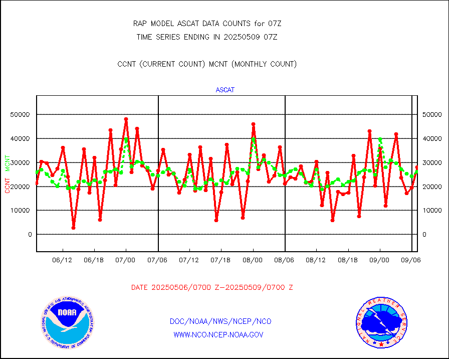
METOP 1-2 ASCAT products |
27555 |
24354 |
113.1 % |
0105.00-0109.00 |
||||||||||
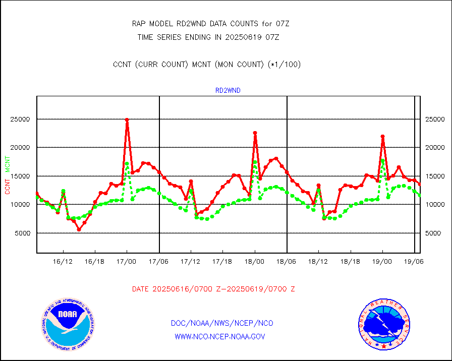
NPP/NOAA-20 ATMS brightness temperatures |
153592 |
152967 |
100.4 % |
0105.00-0108.99 |
||||||||||
NPP/NOAA-20 ATMS bright. temps-direct b-cast SSEC |
144680 |
120098 |
120.5 % |
0105.00-0108.99 |
||||||||||
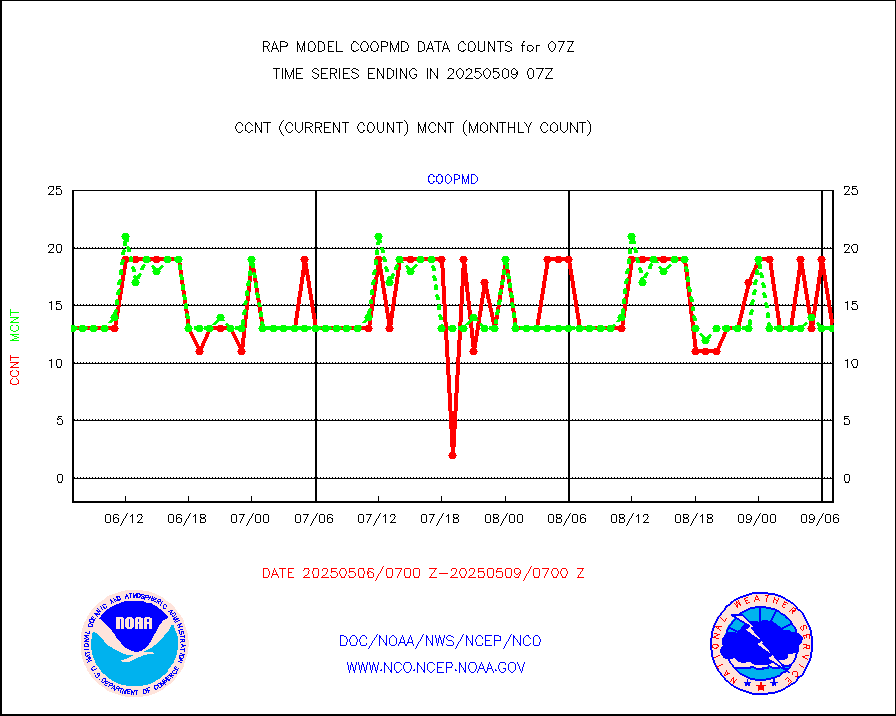
Coop/MADIS NEPP & HCN-Modernization NOAA COOP Obs |
11 |
11 |
100.0 % |
0106.50-0107.50 |
||||||||||
NPP/NOAA-20 CrIS full spctrl radn (431 ch subset) |
98274 |
95053 |
103.4 % |
0105.00-0108.99 |
||||||||||
NPP/NOAA-20 CrIS full spctrl radn dir brdcst SSEC |
72064 |
61125 |
117.9 % |
0105.00-0108.99 |
||||||||||
Coast Guard |
5 |
5 |
100.0 % |
0106.50-0107.50 |
||||||||||
Drifting buoys (decoded from BUFR) |
533 |
524 |
101.7 % |
0106.50-0107.50 |
||||||||||
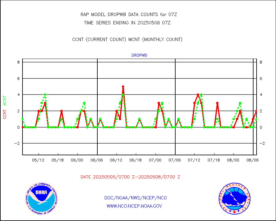
Dropwinsonde (from TEMP DROP) |
0 |
1 |
0.0 % |
0106.00-0108.00 |
||||||||||
Dropwinsonde (decoded from BUFR) |
2 |
1 |
200.0 % |
0106.00-0108.00 |
||||||||||
E-AMDAR (European AMDAR acft decoded from BUFR) |
8581 |
8872 |
96.7 % |
0103.75-0110.25 |
||||||||||
NOAA 15-19 & METOP 1-2 AMSU-A proc btmps frm RARS |
9100 |
8888 |
102.4 % |
0106.00-0108.00 |
||||||||||
NOAA 18-19 & METOP 1-2 MHS proc. btemps from RARS |
84594 |
90769 |
93.2 % |
0106.00-0108.00 |
||||||||||
GPM GMI Level 1C-R brightness temperatures |
305701 |
417722 |
73.2 % |
0104.00-0109.99 |
||||||||||
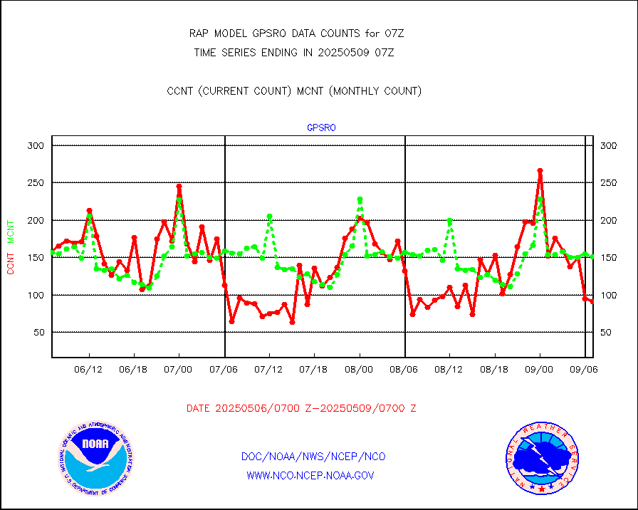
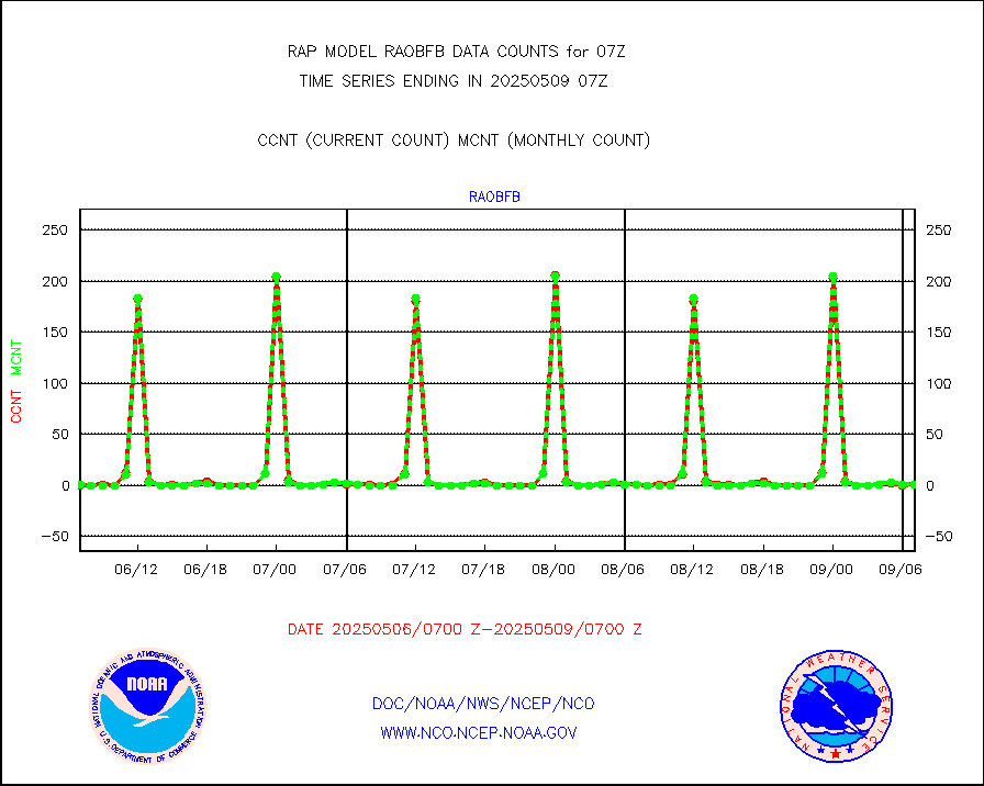
GPS radio occultation data |
174 |
151 |
115.2 % |
0105.00-0108.99 |
||||||||||
GOES-16/17 All Sky Radiances (proc.) |
885924 |
884546 |
100.2 % |
0105.00-0108.99 |
||||||||||
GOES-16/17 Clear Sky Radiances (proc.) |
423103 |
402680 |
105.1 % |
0105.00-0108.99 |
||||||||||
MTSAT/JMA water vapor imager derived cloud motion |
2028 |
2803 |
72.4 % |
0104.50-0109.50 |
||||||||||
GOES-16&up/NESDIS wv imgr/deep-lyr derivd cld mtn |
8158 |
7539 |
108.2 % |
0106.00-0106.99 |
||||||||||
METEOSAT/EUMETSAT wvpr imgr drv cld motion NBseq |
4886 |
5196 |
94.0 % |
0105.50-0108.49 |
||||||||||
GOES-16&up/NESDIS wv imgr/cld-top derived cld mtn |
15027 |
13941 |
107.8 % |
0106.00-0106.99 |
||||||||||
METOP 1-2 IASI 1C radiances-direct broadcast SSEC |
74587 |
69932 |
106.7 % |
0105.00-0108.99 |
||||||||||
METEOSAT/EUMETSAT ir lg-wave drv cld motion NBseq |
2975 |
3140 |
94.7 % |
0105.50-0108.49 |
||||||||||
VIIRS (NPP/NOAA-20) ir lg-wv drv cloud motion(NB) |
0 |
0 |
n/a |
0104.50-0109.50 |
||||||||||
AVHRR (NOAA/METOP) ir lg-wave derived cld motion |
0 |
0 |
n/a |
0104.50-0109.50 |
||||||||||
AVHRR (METOP) ir lg-wave derived cld motion |
0 |
0 |
n/a |
0105.50-0108.49 |
||||||||||
MTSAT/JMA infrared long-wave derived cloud motion |
2008 |
2364 |
84.9 % |
0104.50-0109.50 |
||||||||||
GOES-16&up/NESDIS ir long-wave derived cld motion |
30693 |
30241 |
101.5 % |
0106.00-0106.99 |
||||||||||
Korean AMDAR aircraft data (decoded from BUFR) |
228 |
235 |
97.0 % |
0103.75-0110.25 |
||||||||||
Land-based CMAN stations decoded from CMAN format |
34 |
39 |
87.2 % |
0106.50-0107.50 |
||||||||||
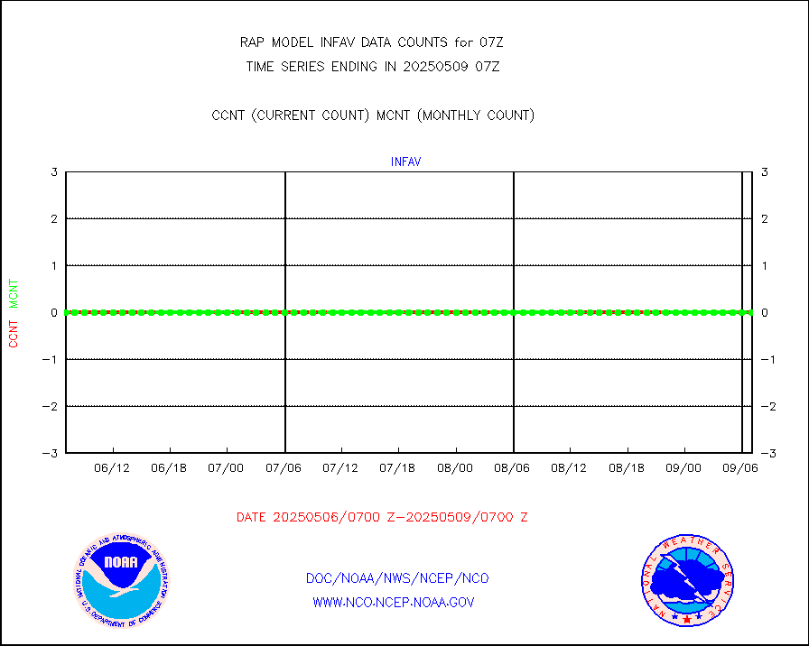
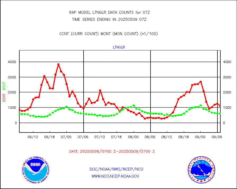
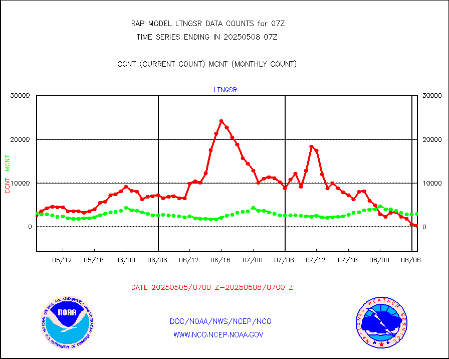
LLDN Long-rng lightning from Vaisala via NOAAPORT |
113601 |
132285 |
85.9 % |
0106.00-0107.50 |
||||||||||
NLDN Shrt-rng lightning from Vaisala via NOAAPORT |
4928 |
6172 |
79.8 % |
0106.00-0107.50 |
||||||||||
Moored buoys (decoded from BUFR) |
647 |
628 |
103.0 % |
0106.50-0107.50 |
||||||||||
Mesonet/MADIS Colorado E-470 (Interstate 470) |
24 |
23 |
104.3 % |
0106.50-0107.50 |
||||||||||
Mesonet/MADIS Alaska Department of Transportation |
118 |
66 |
178.8 % |
0106.50-0107.50 |
||||||||||
Mesonet/MADIS U.S. Army Aberdeen Proving Grounds |
0 |
0 |
n/a |
0106.50-0107.50 |
||||||||||
Mesonet/MADIS Citizen Weather Observers Program |
13729 |
53187 |
25.8 % |
0106.50-0107.50 |
||||||||||
Mesonet/MADIS AWS Convergence Technologies, Inc. |
5620 |
19496 |
28.8 % |
0106.50-0107.50 |
||||||||||
Mesonet/MADIS "Anything Weather" |
0 |
0 |
n/a |
0106.50-0107.50 |
||||||||||
Mesonet/MADIS Colorado Dept. of Transportation |
0 |
0 |
n/a |
0106.50-0107.50 |
||||||||||
Mesonet/MADIS DC Net |
0 |
0 |
n/a |
0106.50-0107.50 |
||||||||||
Mesonet/MADIS Denver Urban Drainage & Flood Cntrl |
0 |
0 |
n/a |
0106.50-0107.50 |
||||||||||
Mesonet/MADIS Florida (FAWN & USF) |
3 |
3 |
100.0 % |
0106.50-0107.50 |
||||||||||
Mesonet/MADIS Florida Dept. of Transportation |
0 |
0 |
n/a |
0106.50-0107.50 |
||||||||||
Mesonet/MADIS Georgia Dept. of Transportation |
0 |
0 |
n/a |
0106.50-0107.50 |
||||||||||
Mesonet/MADIS NWS Hydromet Auto Data System(HADS) |
4498 |
4898 |
91.8 % |
0106.50-0107.50 |
||||||||||
Mesonet/MADIS Iowa Environmental |
159 |
159 |
100.0 % |
0106.50-0107.50 |
||||||||||
Mesonet/MADIS Indiana Dept. of Transportation |
0 |
0 |
n/a |
0106.50-0107.50 |
||||||||||
Mesonet/MADIS Iowa Department of Transportation |
0 |
0 |
n/a |
0106.50-0107.50 |
||||||||||
Mesonet/MADIS Kansas Department of Transportation |
319 |
312 |
102.2 % |
0106.50-0107.50 |
||||||||||
Mesonet/MADIS Oklahoma Mesonet |
525 |
574 |
91.5 % |
0106.50-0107.50 |
||||||||||
Mesonet/MADIS Louisiana State/Jackson State Univ. |
0 |
0 |
n/a |
0106.50-0107.50 |
||||||||||
Mesonet/MADIS Missouri Commercial Agricult Wx Net |
272 |
288 |
94.4 % |
0106.50-0107.50 |
||||||||||
Mesonet/MADIS Minnesota Dept. of Transportation |
0 |
0 |
n/a |
0106.50-0107.50 |
||||||||||
Mesonet/MADIS NOS-Phys Oceanographic Realtime Sys |
230 |
246 |
93.5 % |
0106.50-0107.50 |
||||||||||
Mesonet/MADIS NFIC Remote Automated Wx Stns(RAWS) |
1425 |
1389 |
102.6 % |
0106.50-0107.50 |
||||||||||
Mesonet/MADIS many providers, not separated out |
7070 |
35445 |
19.9 % |
0106.50-0107.50 |
||||||||||
Mesonet/MADIS UrbaNet |
2907 |
3051 |
95.3 % |
0106.50-0107.50 |
||||||||||
Mesonet/MADIS Virginia Dept. of Transportation |
0 |
0 |
n/a |
0106.50-0107.50 |
||||||||||
Mesonet/MADIS "Weather for You" |
0 |
0 |
n/a |
0106.50-0107.50 |
||||||||||
Mesonet/MADIS Wisconsin Dept. of Transportation |
0 |
0 |
n/a |
0106.50-0107.50 |
||||||||||
Mesonet/MADIS MesoWest (many subproviders) |
7462 |
32980 |
22.6 % |
0106.50-0107.50 |
||||||||||
Mesonet/MADIS West Texas |
5033 |
5134 |
98.0 % |
0106.50-0107.50 |
||||||||||
METOP 1-2 IASI 1C radiance data (varbl. channels) |
44844 |
37265 |
120.3 % |
0105.00-0108.99 |
||||||||||
NEXRAD Vel Azm Dsp(VAD) winds via Level 2 decoder |
1180 |
1025 |
115.1 % |
0106.00-0108.00 |
||||||||||
NOAA 16-19 Solar Backscatter UV-2 rad frm V8 BUFR |
0 |
0 |
n/a |
0105.00-0107.99 |
||||||||||
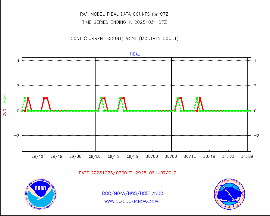
PIBAL (from PILOT, PILOT SHIP, PILOT MOBIL) |
0 |
0 |
n/a |
0106.00-0108.00 |
||||||||||
PIBAL (decoded from BUFR) |
0 |
0 |
n/a |
0106.00-0108.00 |
||||||||||
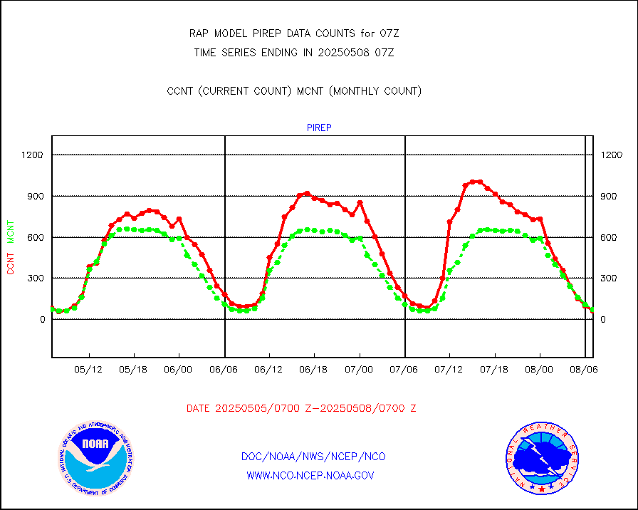
Manual PIREP aircraft data (dcded from AIREP fmt) |
49 |
53 |
92.5 % |
0103.75-0110.25 |
||||||||||
Profilr winds from PIBAL (PILOT,PILOT SHIP/MOBIL) |
0 |
0 |
n/a |
0105.50-0108.50 |
||||||||||
Rawinsonde - fixed land (decoded from BUFR) |
1 |
1 |
100.0 % |
0106.00-0108.00 |
||||||||||
Rawinsonde - mobile land (from TEMP/PILOT MOBIL) |
0 |
0 |
n/a |
0106.00-0108.00 |
||||||||||
Rawinsonde - mobile land (decoded from BUFR) |
0 |
0 |
n/a |
0106.00-0108.00 |
||||||||||
Rawinsonde - ship (from TEMP SHIP, PILOT SHIP) |
0 |
0 |
n/a |
0106.00-0108.00 |
||||||||||
Rawinsonde - ship (decoded from BUFR) |
0 |
0 |
n/a |
0106.00-0108.00 |
||||||||||
NEXRAD radial wind (Level 2 - GTS) |
1775969 |
1294278 |
137.2 % |
0106.50-0107.49 |
||||||||||
Flight level reconnaissance aircraft data |
0 |
0 |
n/a |
0106.00-0108.00 |
||||||||||
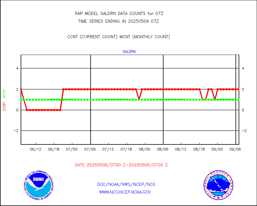
Surface Marine Saildrone (decoded from BUFR) |
2 |
2 |
100.0 % |
0105.00-0108.99 |
||||||||||
Megha-Tropiques SAPHIR L1A2 brightness temps |
0 |
0 |
n/a |
0104.00-0109.99 |
||||||||||
METEOSAT-10 2nd Gen SEVIRI All Sky Radiance(proc) |
9512 |
9509 |
100.0 % |
0105.00-0108.99 |
||||||||||
METEOSAT-10 2nd Gen SEVIRI Clr Sky Radiance(proc) |
0 |
0 |
n/a |
0105.00-0108.99 |
||||||||||
Ship - manual and automatic, restricted |
19 |
14 |
135.7 % |
0106.50-0107.50 |
||||||||||
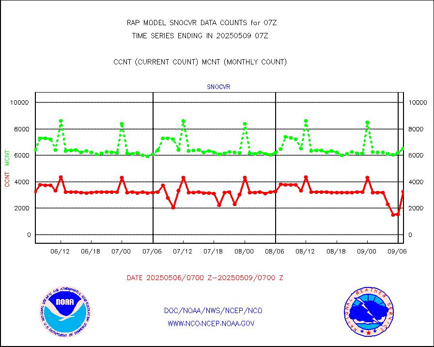
NOW COVER, DEPTH/DENSITY AND WATER EQUIVALENT |
3793 |
6242 |
60.8 % |
0105.00-0109.00 |
||||||||||
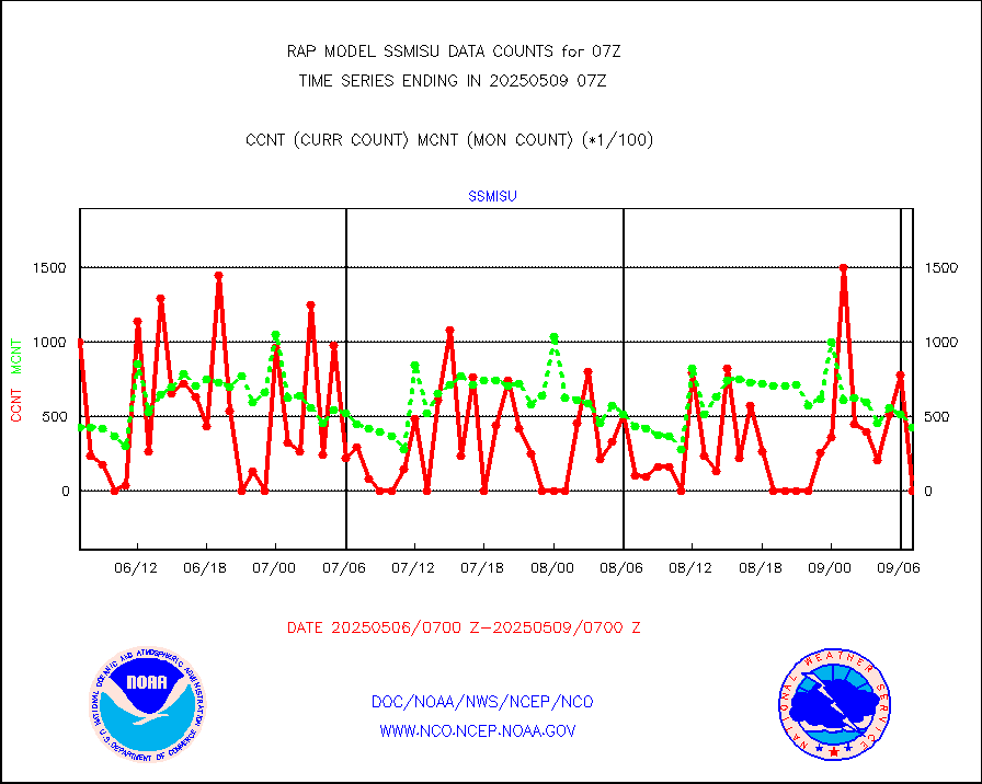
DMSP SSM/IS 1C radiance data (Unified Pre-Proc.) |
48847 |
38472 |
127.0 % |
0105.00-0108.99 |
||||||||||
Sub-surface float and glider profile (BUFR) |
5 |
6 |
83.3 % |
0105.00-0108.99 |
||||||||||
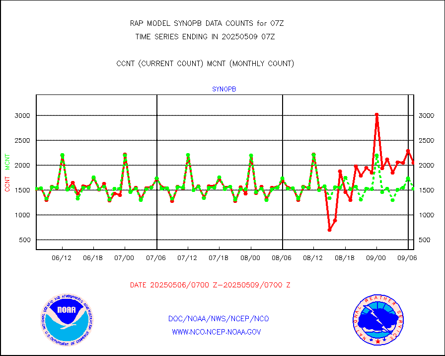
Synoptic - restricted (WMO Res 40) manual & auto. |
0 |
0 |
n/a |
0106.50-0107.50 |
||||||||||
Synoptic - restricted (WMO Res 40)(decoded BUFR) |
440 |
358 |
122.9 % |
0106.50-0107.50 |
||||||||||
Synoptic - mobile manual & auto (decoded fr BUFR) |
0 |
0 |
n/a |
0106.50-0107.50 |
||||||||||
TAMDAR aircft data-all types(from Panasonic,BUFR) |
156 |
168 |
92.9 % |
0103.75-0110.25 |
||||||||||
MTSAT/JMA visible derived cloud motion |
1422 |
1444 |
98.5 % |
0104.50-0109.50 |
||||||||||
GOES-16&up/NESDIS visible derived cloud motion |
3202 |
1542 |
207.7 % |
0106.00-0106.99 |
||||||||||
METEOSAT/EUMETSAT visible drv cld motion NBseq |
2413 |
2039 |
118.3 % |
0105.50-0108.49 |
||||||||||


