| Suspect Data Shortages in Critical Types - Monitor | ||||||||||||||
|---|---|---|---|---|---|---|---|---|---|---|---|---|---|---|
| Type | Description | Hourly Count | Monthly Average | Percent (%) of Monthly Mean | UTC Time Window | |||||||||
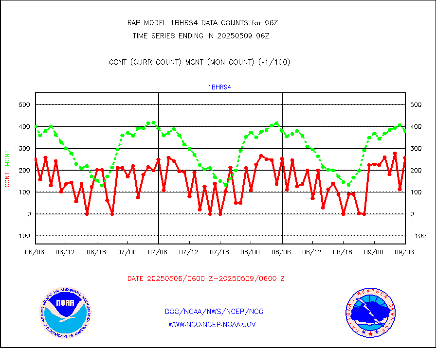
NOAA 18-19 & METOP 1-2 HIRS-4 NCEP-proc. br.temps |
0 |
10428 |
0.0 % |
0103.00-0108.99 |
||||||||||
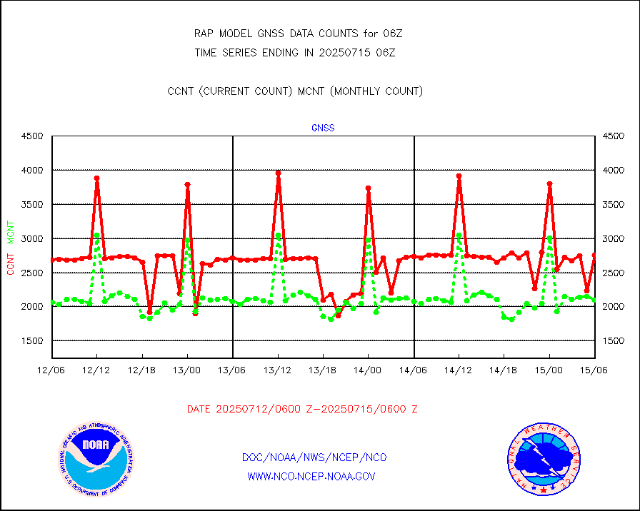
Grnd-based Gbl Navigation Sat System (GNSS) data |
693 |
2100 |
33.0 % |
0104.95-0105.05 |
||||||||||
| Shortage in Data Type of Opportunity - Monitor | ||||||||||||||
|---|---|---|---|---|---|---|---|---|---|---|---|---|---|---|
| Type | Description | Hourly Count | Monthly Average | Percent (%) of Monthly Mean | UTC Time Window | |||||||||
NOAA 15-19 & METOP 1-2 HIRS-3/4 pr btmps frm RARS |
0 |
7332 |
0.0 % |
0105.00-0107.00 |
||||||||||
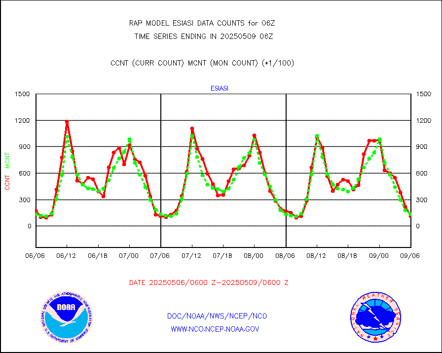
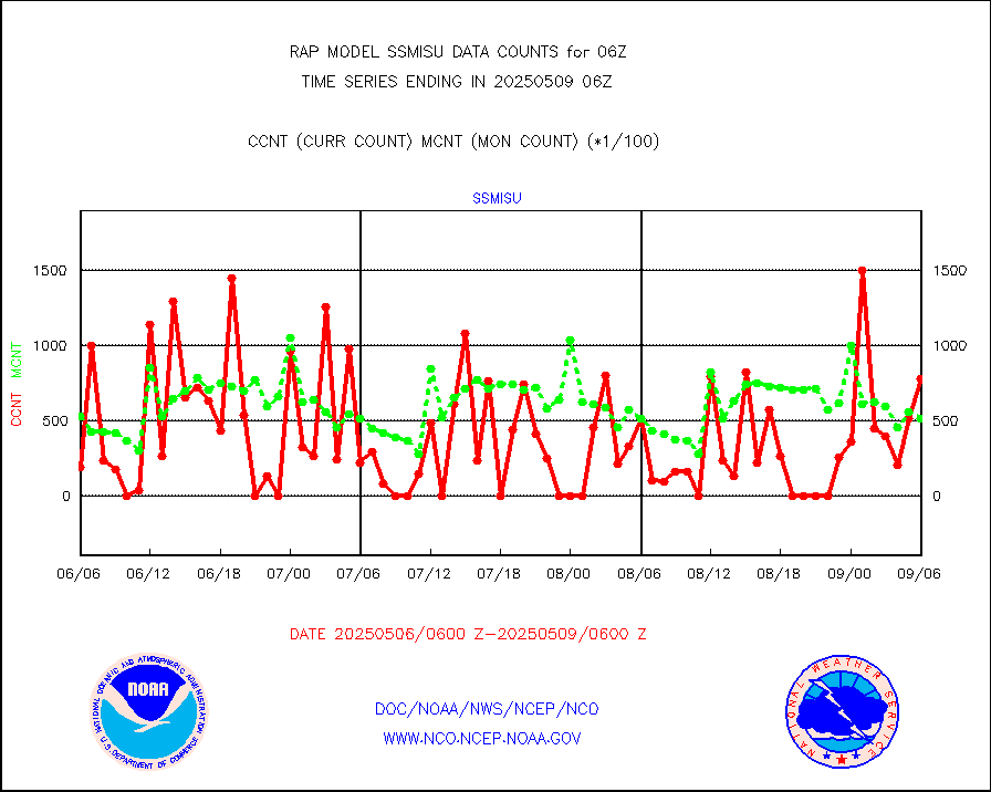
METOP 1-2 IASI 1C radiance data vbl chn from RARS |
0 |
1149 |
0.0 % |
0104.00-0107.99 |
||||||||||
| Critical Data with Normal Counts | ||||||||||||||
|---|---|---|---|---|---|---|---|---|---|---|---|---|---|---|
| Type | Description | Hourly Count | Monthly Average | Percent (%) of Monthly Mean | UTC Time Window | |||||||||
NOAA 15-19 & METOP 1-2 AMSU-A NCEP-proc. br.temps |
20305 |
24983 |
81.3 % |
0103.00-0108.99 |
||||||||||
NOAA 18-19 & METOP 1-2 MHS NCEP-proces. br. temps |
180822 |
197134 |
91.7 % |
0103.00-0108.99 |
||||||||||
MDCRS ACARS acft data from ARINC(dcded from BUFR) |
85516 |
106469 |
80.3 % |
0102.75-0109.25 |
||||||||||
Canadian AMDAR aircraft data (decoded from BUFR) |
0 |
0 |
n/a |
0102.75-0109.25 |
||||||||||
Surface Marine CMAN rpts decoded from BUFR format |
1732 |
1704 |
101.6 % |
0105.50-0106.50 |
||||||||||
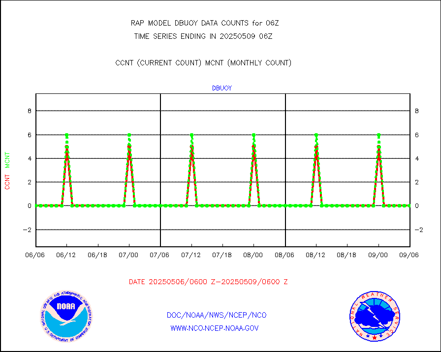
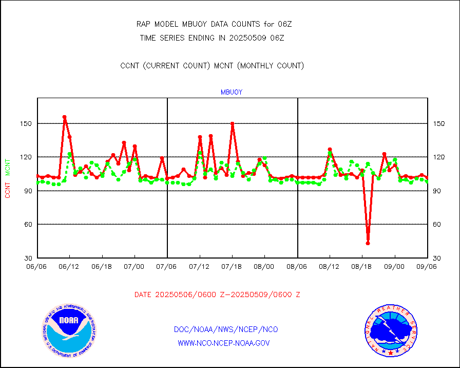
Buoys decoded from FM-18 fmt (moored or drifting) |
0 |
0 |
n/a |
0105.50-0106.50 |
||||||||||
MODIS (AQUA/TERRA) wvpr imager derived cld motion |
0 |
0 |
n/a |
0103.50-0108.50 |
||||||||||
MODIS (AQUA/TERRA) ir l-wave derived cloud motion |
0 |
0 |
n/a |
0103.50-0108.50 |
||||||||||
GOES/NASA(Langley) hi-res. (1x1 f-o-v) cloud data |
1871275 |
1872965 |
99.9 % |
0105.50-0106.50 |
||||||||||
Buoys decoded from FM-13 format (moored) |
118 |
122 |
96.7 % |
0105.50-0106.50 |
||||||||||
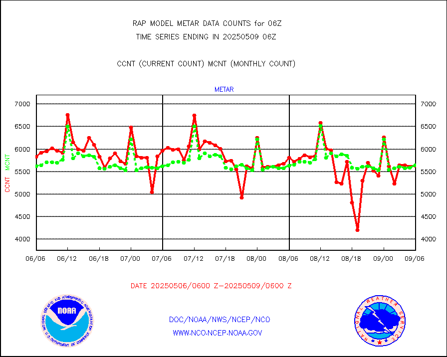
Aviation - METAR |
5606 |
5538 |
101.2 % |
0105.50-0106.50 |
||||||||||
NEXRAD Vel Azm Dsp(VAD) winds via radar coded msg |
0 |
0 |
n/a |
0105.00-0107.00 |
||||||||||
Multi-Agency Profiler (MAP) and SODAR winds |
104 |
95 |
109.5 % |
0104.50-0107.50 |
||||||||||
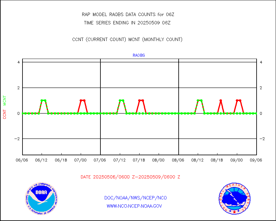
Rawinsonde - fixed land (from TEMP or PILOT) |
5 |
5 |
100.0 % |
0105.00-0107.00 |
||||||||||
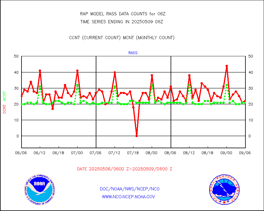
RASS temperatures (NOAA and Multi-Agency) |
27 |
21 |
128.6 % |
0105.50-0106.50 |
||||||||||
Ship - manual and automatic, restricted (BUFR) |
0 |
0 |
n/a |
0105.50-0106.50 |
||||||||||
Ship - manual and automatic, unrestricted |
189 |
146 |
129.5 % |
0105.50-0106.50 |
||||||||||
Ship - manual and automatic, unrestricted (BUFR) |
749 |
746 |
100.4 % |
0105.50-0106.50 |
||||||||||
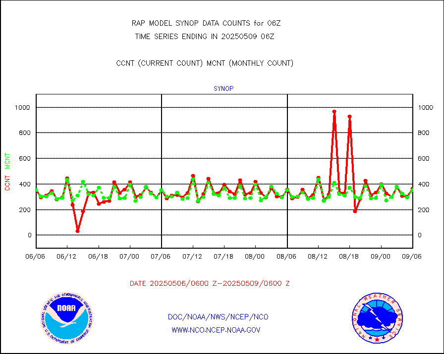
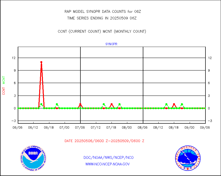
Synoptic - fixed manual and automatic |
376 |
346 |
108.7 % |
0105.50-0106.50 |
||||||||||
Synoptic - fixed manual & auto (decoded fr BUFR) |
2212 |
2159 |
102.5 % |
0105.50-0106.50 |
||||||||||
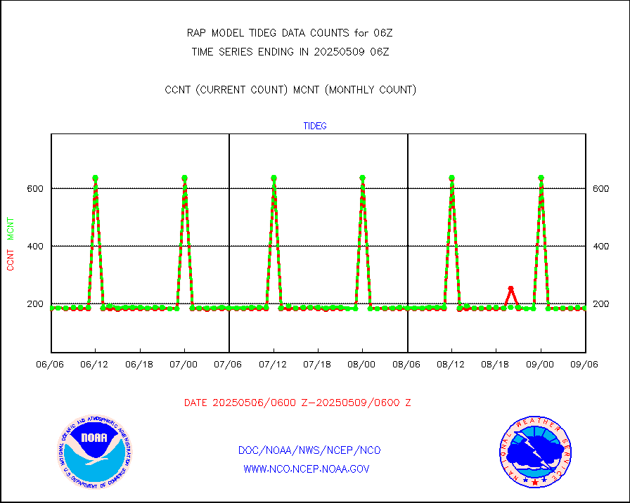
Tide gauge reports decoded from CREX format |
186 |
185 |
100.5 % |
0105.50-0106.50 |
||||||||||
| Data Types of Opportunity with Normal Counts | ||||||||||||||
|---|---|---|---|---|---|---|---|---|---|---|---|---|---|---|
| Type | Description | Hourly Count | Monthly Average | Percent (%) of Monthly Mean | UTC Time Window | |||||||||
GOES-16&up/NESDIS ir short-wv derived cld motion |
10262 |
11110 |
92.4 % |
0105.00-0105.99 |
||||||||||
MDCRS ACARS acft data (ARINC via AFWA)(AIREP fmt) |
0 |
0 |
n/a |
0102.75-0109.25 |
||||||||||
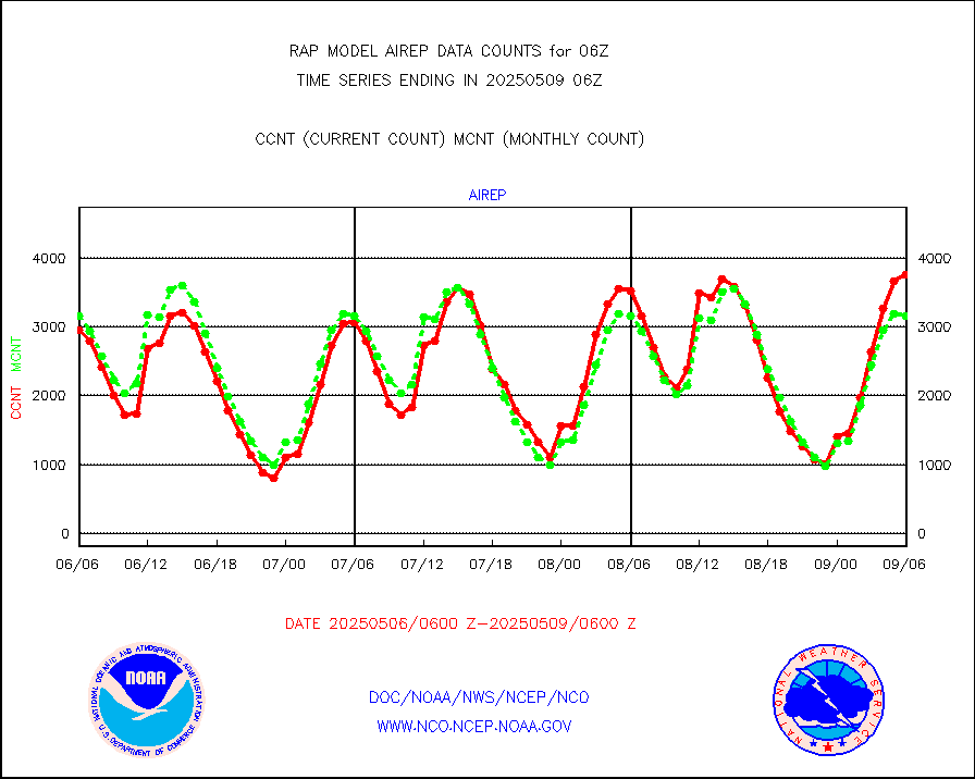
Manual AIREP aircraft data (dcded from AIREP fmt) |
3377 |
3689 |
91.5 % |
0102.75-0109.25 |
||||||||||
AQUA AIRS/AMSU-A/HSB brightness temps- every FOV |
0 |
0 |
n/a |
0103.00-0108.99 |
||||||||||
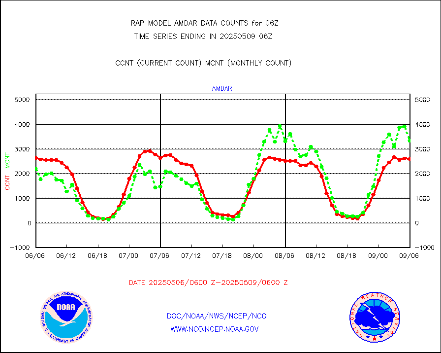
AMDAR aircraft data (decoded from AMDAR format) |
2556 |
2160 |
118.3 % |
0102.75-0109.25 |
||||||||||
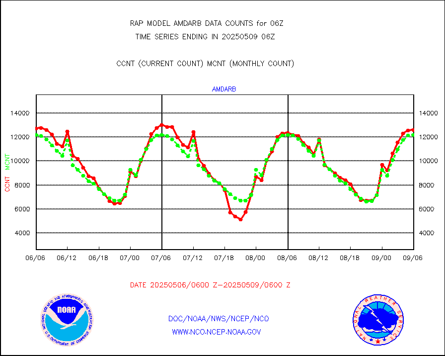
AMDAR aircraft data (decoded from BUFR) |
11446 |
12247 |
93.5 % |
0102.75-0109.25 |
||||||||||
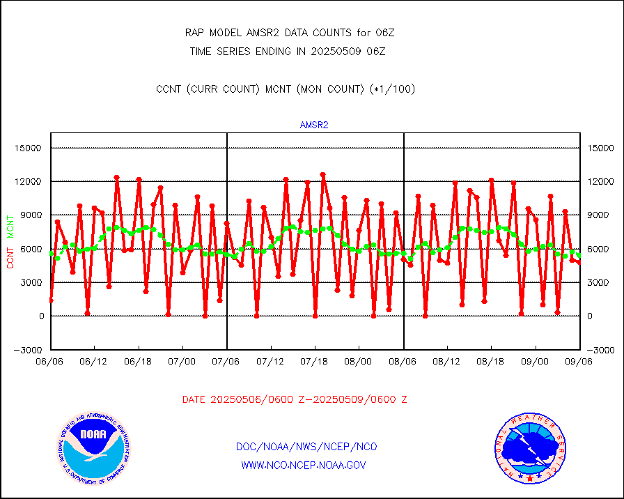
GCOM-W AMSR2 1B brightness temperatures |
993047 |
548567 |
181.0 % |
0103.00-0103.99 |
||||||||||
METOP 1-2 ASCAT products |
19053 |
24131 |
79.0 % |
0104.00-0108.00 |
||||||||||
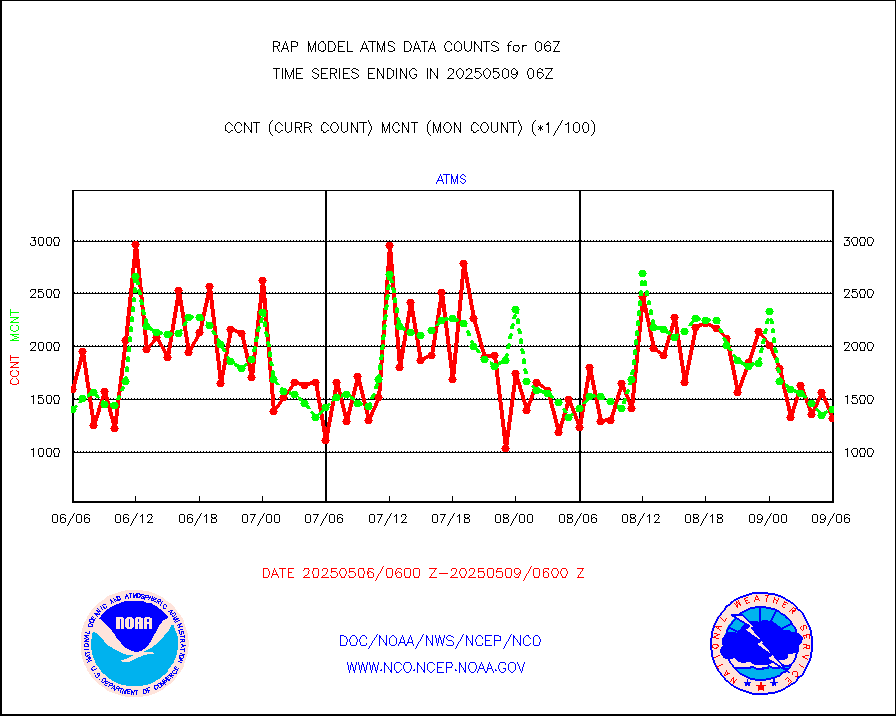
NPP/NOAA-20 ATMS brightness temperatures |
133181 |
133130 |
100.0 % |
0104.00-0107.99 |
||||||||||
NPP/NOAA-20 ATMS bright. temps-direct b-cast SSEC |
53768 |
71701 |
75.0 % |
0104.00-0107.99 |
||||||||||
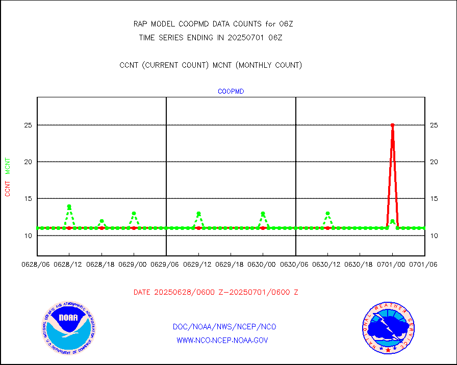
Coop/MADIS NEPP & HCN-Modernization NOAA COOP Obs |
11 |
11 |
100.0 % |
0105.50-0106.50 |
||||||||||
NPP/NOAA-20 CrIS full spctrl radn (431 ch subset) |
80756 |
86804 |
93.0 % |
0104.00-0107.99 |
||||||||||
NPP/NOAA-20 CrIS full spctrl radn dir brdcst SSEC |
25901 |
37299 |
69.4 % |
0104.00-0107.99 |
||||||||||
Coast Guard |
4 |
5 |
80.0 % |
0105.50-0106.50 |
||||||||||
Drifting buoys (decoded from BUFR) |
532 |
502 |
106.0 % |
0105.50-0106.50 |
||||||||||
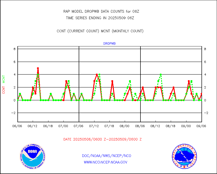
Dropwinsonde (from TEMP DROP) |
0 |
0 |
n/a |
0105.00-0107.00 |
||||||||||
Dropwinsonde (decoded from BUFR) |
0 |
1 |
0.0 % |
0105.00-0107.00 |
||||||||||
E-AMDAR (European AMDAR acft decoded from BUFR) |
6830 |
7063 |
96.7 % |
0102.75-0109.25 |
||||||||||
NOAA 15-19 & METOP 1-2 AMSU-A proc btmps frm RARS |
8150 |
9613 |
84.8 % |
0105.00-0107.00 |
||||||||||
NPP Adv. Tech. MW Sndr (ATMS) br. temps from RARS |
115 |
14062 |
0.8 % |
0104.00-0107.99 |
||||||||||
NOAA 18-19 & METOP 1-2 MHS proc. btemps from RARS |
57781 |
99864 |
57.9 % |
0105.00-0107.00 |
||||||||||
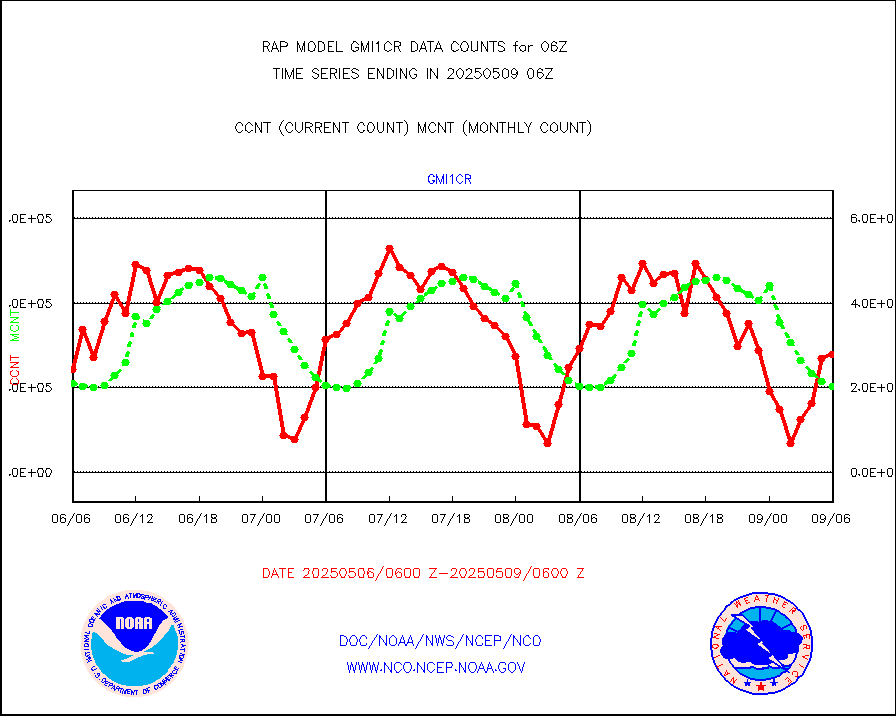
GPM GMI Level 1C-R brightness temperatures |
350532 |
432280 |
81.1 % |
0103.00-0108.99 |
||||||||||
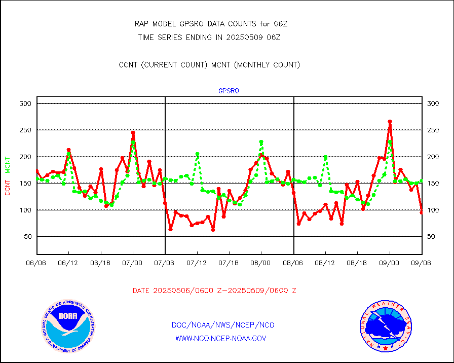
GPS radio occultation data |
148 |
149 |
99.3 % |
0104.00-0107.99 |
||||||||||
GOES-16/17 All Sky Radiances (proc.) |
812097 |
810584 |
100.2 % |
0104.00-0107.99 |
||||||||||
GOES-16/17 Clear Sky Radiances (proc.) |
388861 |
372326 |
104.4 % |
0104.00-0107.99 |
||||||||||
MTSAT/JMA water vapor imager derived cloud motion |
2131 |
2811 |
75.8 % |
0103.50-0108.50 |
||||||||||
GOES-16&up/NESDIS wv imgr/deep-lyr derivd cld mtn |
8344 |
7593 |
109.9 % |
0105.00-0105.99 |
||||||||||
METEOSAT/EUMETSAT wvpr imgr drv cld motion NBseq |
4890 |
5191 |
94.2 % |
0104.50-0107.49 |
||||||||||
GOES-16&up/NESDIS wv imgr/cld-top derived cld mtn |
15353 |
14618 |
105.0 % |
0105.00-0105.99 |
||||||||||
METOP 1-2 IASI 1C radiances-direct broadcast SSEC |
68914 |
78540 |
87.7 % |
0104.00-0107.99 |
||||||||||
METEOSAT/EUMETSAT ir lg-wave drv cld motion NBseq |
2955 |
3126 |
94.5 % |
0104.50-0107.49 |
||||||||||
VIIRS (NPP/NOAA-20) ir lg-wv drv cloud motion(NB) |
0 |
0 |
n/a |
0103.50-0108.50 |
||||||||||
AVHRR (NOAA/METOP) ir lg-wave derived cld motion |
0 |
0 |
n/a |
0103.50-0108.50 |
||||||||||
AVHRR (METOP) ir lg-wave derived cld motion |
0 |
0 |
n/a |
0104.50-0107.49 |
||||||||||
MTSAT/JMA infrared long-wave derived cloud motion |
2074 |
2366 |
87.7 % |
0103.50-0108.50 |
||||||||||
GOES-16&up/NESDIS ir long-wave derived cld motion |
30410 |
30514 |
99.7 % |
0105.00-0105.99 |
||||||||||
Korean AMDAR aircraft data (decoded from BUFR) |
102 |
209 |
48.8 % |
0102.75-0109.25 |
||||||||||
Land-based CMAN stations decoded from CMAN format |
40 |
46 |
87.0 % |
0105.50-0106.50 |
||||||||||
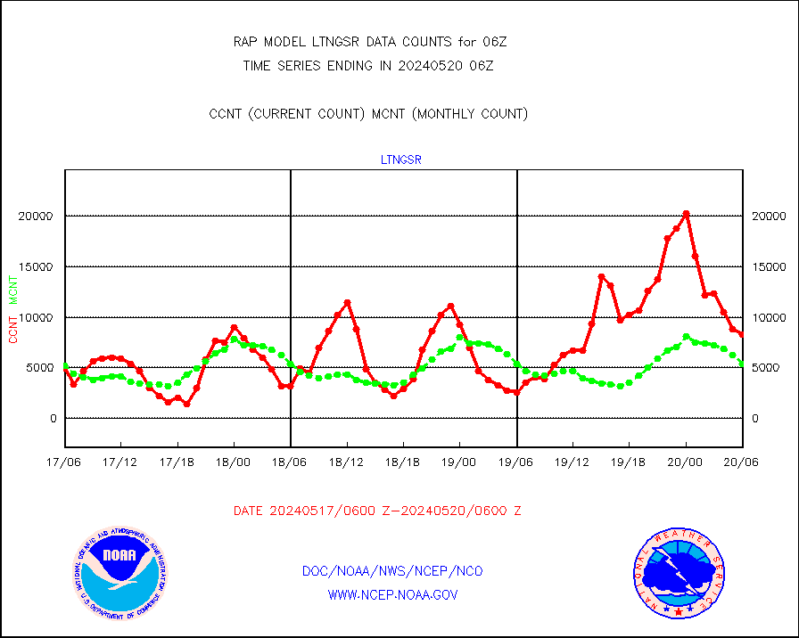
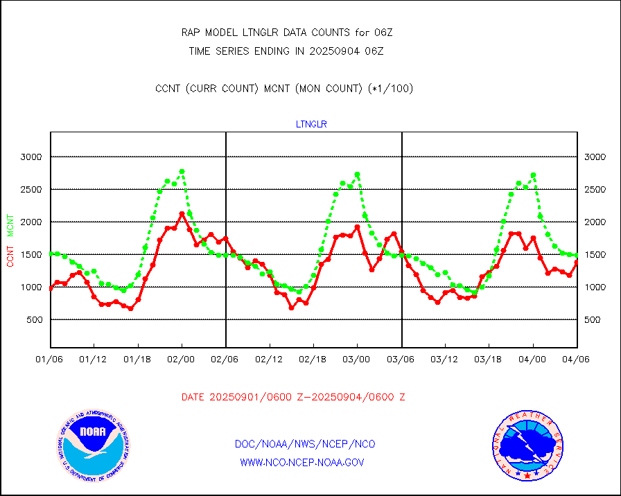
LLDN Long-rng lightning from Vaisala via NOAAPORT |
97956 |
140384 |
69.8 % |
0105.00-0106.50 |
||||||||||
NLDN Shrt-rng lightning from Vaisala via NOAAPORT |
4594 |
6875 |
66.8 % |
0105.00-0106.50 |
||||||||||
Moored buoys (decoded from BUFR) |
675 |
630 |
107.1 % |
0105.50-0106.50 |
||||||||||
Mesonet/MADIS Colorado E-470 (Interstate 470) |
24 |
23 |
104.3 % |
0105.50-0106.50 |
||||||||||
Mesonet/MADIS Alaska Department of Transportation |
118 |
59 |
200.0 % |
0105.50-0106.50 |
||||||||||
Mesonet/MADIS U.S. Army Aberdeen Proving Grounds |
0 |
0 |
n/a |
0105.50-0106.50 |
||||||||||
Mesonet/MADIS Citizen Weather Observers Program |
42388 |
54490 |
77.8 % |
0105.50-0106.50 |
||||||||||
Mesonet/MADIS AWS Convergence Technologies, Inc. |
14489 |
20390 |
71.1 % |
0105.50-0106.50 |
||||||||||
Mesonet/MADIS "Anything Weather" |
0 |
0 |
n/a |
0105.50-0106.50 |
||||||||||
Mesonet/MADIS Colorado Dept. of Transportation |
0 |
0 |
n/a |
0105.50-0106.50 |
||||||||||
Mesonet/MADIS DC Net |
0 |
0 |
n/a |
0105.50-0106.50 |
||||||||||
Mesonet/MADIS Denver Urban Drainage & Flood Cntrl |
0 |
0 |
n/a |
0105.50-0106.50 |
||||||||||
Mesonet/MADIS Florida (FAWN & USF) |
3 |
3 |
100.0 % |
0105.50-0106.50 |
||||||||||
Mesonet/MADIS Florida Dept. of Transportation |
0 |
0 |
n/a |
0105.50-0106.50 |
||||||||||
Mesonet/MADIS Georgia Dept. of Transportation |
0 |
0 |
n/a |
0105.50-0106.50 |
||||||||||
Mesonet/MADIS NWS Hydromet Auto Data System(HADS) |
4224 |
4735 |
89.2 % |
0105.50-0106.50 |
||||||||||
Mesonet/MADIS Iowa Environmental |
156 |
160 |
97.5 % |
0105.50-0106.50 |
||||||||||
Mesonet/MADIS Indiana Dept. of Transportation |
0 |
0 |
n/a |
0105.50-0106.50 |
||||||||||
Mesonet/MADIS Iowa Department of Transportation |
0 |
0 |
n/a |
0105.50-0106.50 |
||||||||||
Mesonet/MADIS Kansas Department of Transportation |
241 |
314 |
76.8 % |
0105.50-0106.50 |
||||||||||
Mesonet/MADIS Oklahoma Mesonet |
525 |
581 |
90.4 % |
0105.50-0106.50 |
||||||||||
Mesonet/MADIS Louisiana State/Jackson State Univ. |
0 |
0 |
n/a |
0105.50-0106.50 |
||||||||||
Mesonet/MADIS Missouri Commercial Agricult Wx Net |
244 |
264 |
92.4 % |
0105.50-0106.50 |
||||||||||
Mesonet/MADIS Minnesota Dept. of Transportation |
0 |
0 |
n/a |
0105.50-0106.50 |
||||||||||
Mesonet/MADIS NOS-Phys Oceanographic Realtime Sys |
230 |
255 |
90.2 % |
0105.50-0106.50 |
||||||||||
Mesonet/MADIS NFIC Remote Automated Wx Stns(RAWS) |
1351 |
1363 |
99.1 % |
0105.50-0106.50 |
||||||||||
Mesonet/MADIS many providers, not separated out |
24972 |
36853 |
67.8 % |
0105.50-0106.50 |
||||||||||
Mesonet/MADIS UrbaNet |
2895 |
3038 |
95.3 % |
0105.50-0106.50 |
||||||||||
Mesonet/MADIS Virginia Dept. of Transportation |
0 |
0 |
n/a |
0105.50-0106.50 |
||||||||||
Mesonet/MADIS "Weather for You" |
0 |
0 |
n/a |
0105.50-0106.50 |
||||||||||
Mesonet/MADIS Wisconsin Dept. of Transportation |
0 |
0 |
n/a |
0105.50-0106.50 |
||||||||||
Mesonet/MADIS MesoWest (many subproviders) |
21369 |
33921 |
63.0 % |
0105.50-0106.50 |
||||||||||
Mesonet/MADIS West Texas |
5043 |
5218 |
96.6 % |
0105.50-0106.50 |
||||||||||
METOP 1-2 IASI 1C radiance data (varbl. channels) |
41458 |
37711 |
109.9 % |
0104.00-0107.99 |
||||||||||
NEXRAD Vel Azm Dsp(VAD) winds via Level 2 decoder |
1248 |
1048 |
119.1 % |
0105.00-0107.00 |
||||||||||
NOAA 16-19 Solar Backscatter UV-2 rad frm V8 BUFR |
0 |
0 |
n/a |
0104.00-0106.99 |
||||||||||
PIBAL (from PILOT, PILOT SHIP, PILOT MOBIL) |
0 |
0 |
n/a |
0105.00-0107.00 |
||||||||||
PIBAL (decoded from BUFR) |
0 |
0 |
n/a |
0105.00-0107.00 |
||||||||||
Manual PIREP aircraft data (dcded from AIREP fmt) |
78 |
75 |
104.0 % |
0102.75-0109.25 |
||||||||||
Profilr winds from PIBAL (PILOT,PILOT SHIP/MOBIL) |
0 |
0 |
n/a |
0104.50-0107.50 |
||||||||||
Rawinsonde - fixed land (decoded from BUFR) |
5 |
3 |
166.7 % |
0105.00-0107.00 |
||||||||||
Rawinsonde - mobile land (from TEMP/PILOT MOBIL) |
0 |
0 |
n/a |
0105.00-0107.00 |
||||||||||
Rawinsonde - mobile land (decoded from BUFR) |
0 |
0 |
n/a |
0105.00-0107.00 |
||||||||||
Rawinsonde - ship (from TEMP SHIP, PILOT SHIP) |
0 |
0 |
n/a |
0105.00-0107.00 |
||||||||||
Rawinsonde - ship (decoded from BUFR) |
0 |
0 |
n/a |
0105.00-0107.00 |
||||||||||
NEXRAD radial wind (Level 2 - GTS) |
1915681 |
1379979 |
138.8 % |
0105.50-0106.49 |
||||||||||
Flight level reconnaissance aircraft data |
0 |
0 |
n/a |
0105.00-0107.00 |
||||||||||
Surface Marine Saildrone (decoded from BUFR) |
2 |
2 |
100.0 % |
0104.00-0107.99 |
||||||||||
Megha-Tropiques SAPHIR L1A2 brightness temps |
0 |
0 |
n/a |
0103.00-0108.99 |
||||||||||
METEOSAT-10 2nd Gen SEVIRI All Sky Radiance(proc) |
9512 |
9510 |
100.0 % |
0104.00-0107.99 |
||||||||||
METEOSAT-10 2nd Gen SEVIRI Clr Sky Radiance(proc) |
0 |
0 |
n/a |
0104.00-0107.99 |
||||||||||
Ship - manual and automatic, restricted |
0 |
25 |
0.0 % |
0105.50-0106.50 |
||||||||||
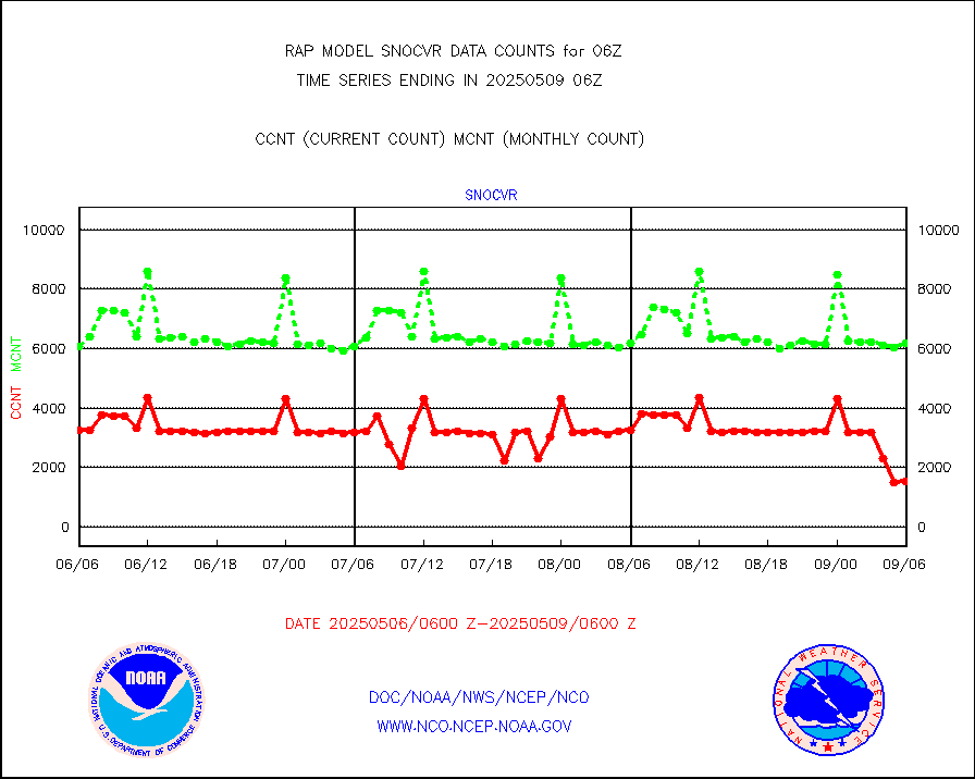
NOW COVER, DEPTH/DENSITY AND WATER EQUIVALENT |
2922 |
5848 |
50.0 % |
0104.00-0108.00 |
||||||||||
DMSP SSM/IS 1C radiance data (Unified Pre-Proc.) |
35302 |
44478 |
79.4 % |
0104.00-0107.99 |
||||||||||
Sub-surface float and glider profile (BUFR) |
0 |
1 |
0.0 % |
0104.00-0107.99 |
||||||||||
Synoptic - restricted (WMO Res 40) manual & auto. |
0 |
0 |
n/a |
0105.50-0106.50 |
||||||||||
Synoptic - restricted (WMO Res 40)(decoded BUFR) |
298 |
309 |
96.4 % |
0105.50-0106.50 |
||||||||||
Synoptic - mobile manual & auto (decoded fr BUFR) |
0 |
0 |
n/a |
0105.50-0106.50 |
||||||||||
TAMDAR aircft data-all types(from Panasonic,BUFR) |
137 |
179 |
76.5 % |
0102.75-0109.25 |
||||||||||
MTSAT/JMA visible derived cloud motion |
1586 |
1550 |
102.3 % |
0103.50-0108.50 |
||||||||||
GOES-16&up/NESDIS visible derived cloud motion |
10799 |
7136 |
151.3 % |
0105.00-0105.99 |
||||||||||
METEOSAT/EUMETSAT visible drv cld motion NBseq |
924 |
953 |
97.0 % |
0104.50-0107.49 |
||||||||||


