| Suspect Data Shortages in Critical Types - Monitor | ||||||||||||||
|---|---|---|---|---|---|---|---|---|---|---|---|---|---|---|
| Type | Description | Hourly Count | Monthly Average | Percent (%) of Monthly Mean | ||||||||||
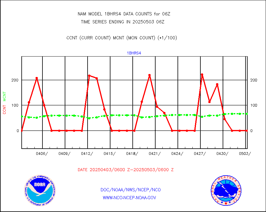
NOAA 18-19 & METOP 1-2 HIRS-4 NCEP-proc. br.temps |
0 |
1621 |
0.0 % |
|||||||||||
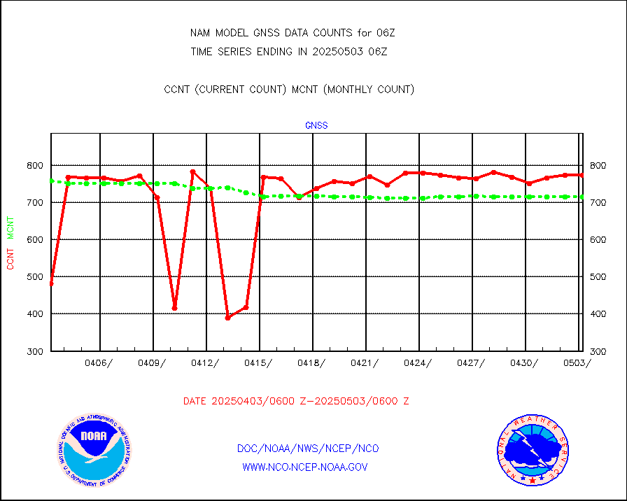
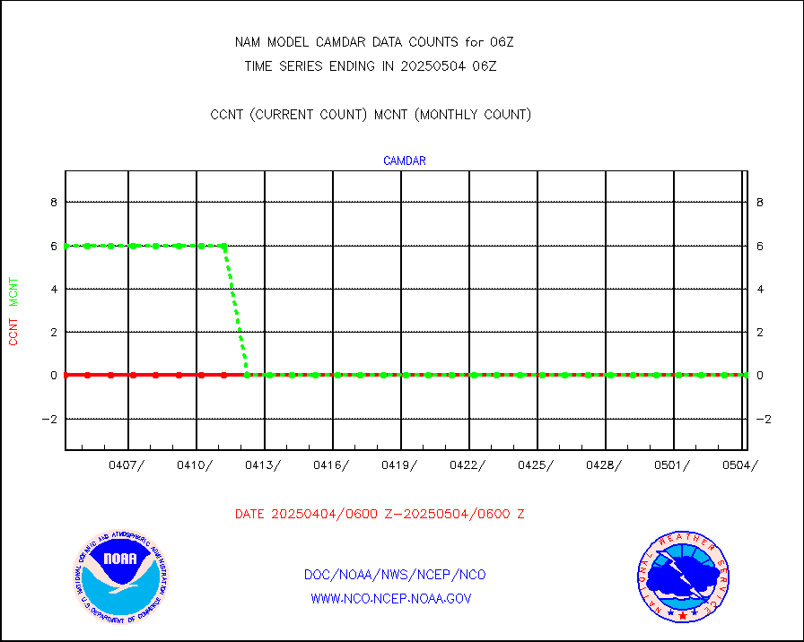
Grnd-based Gbl Navigation Sat System (GNSS) data |
216 |
587 |
36.8 % |
|||||||||||
| Suspect Excess in Critical Types - Monitor | ||||||||||||||
|---|---|---|---|---|---|---|---|---|---|---|---|---|---|---|
| Type | Description | Hourly Count | Monthly Average | Percent (%) of Monthly Mean | ||||||||||
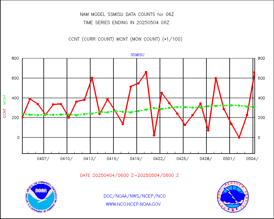
DMSP SSM/IS 1C radiance data (Unified Pre-Proc.) |
67182 |
24810 |
270.8 % |
|||||||||||
| Shortage in Data Type of Opportunity - Monitor | ||||||||||||||
|---|---|---|---|---|---|---|---|---|---|---|---|---|---|---|
| Type | Description | Hourly Count | Monthly Average | Percent (%) of Monthly Mean | ||||||||||
NOAA 15-19 & METOP 1-2 HIRS-3/4 pr btmps frm RARS |
0 |
8231 |
0.0 % |
|||||||||||
| Critical Data with Normal Counts | ||||||||||||||
|---|---|---|---|---|---|---|---|---|---|---|---|---|---|---|
| Type | Description | Hourly Count | Monthly Average | Percent (%) of Monthly Mean | ||||||||||
NOAA 15-19 & METOP 1-2 AMSU-A NCEP-proc. br.temps |
7088 |
9219 |
76.9 % |
|||||||||||
NOAA 18-19 & METOP 1-2 MHS NCEP-proces. br. temps |
63201 |
78870 |
80.1 % |
|||||||||||
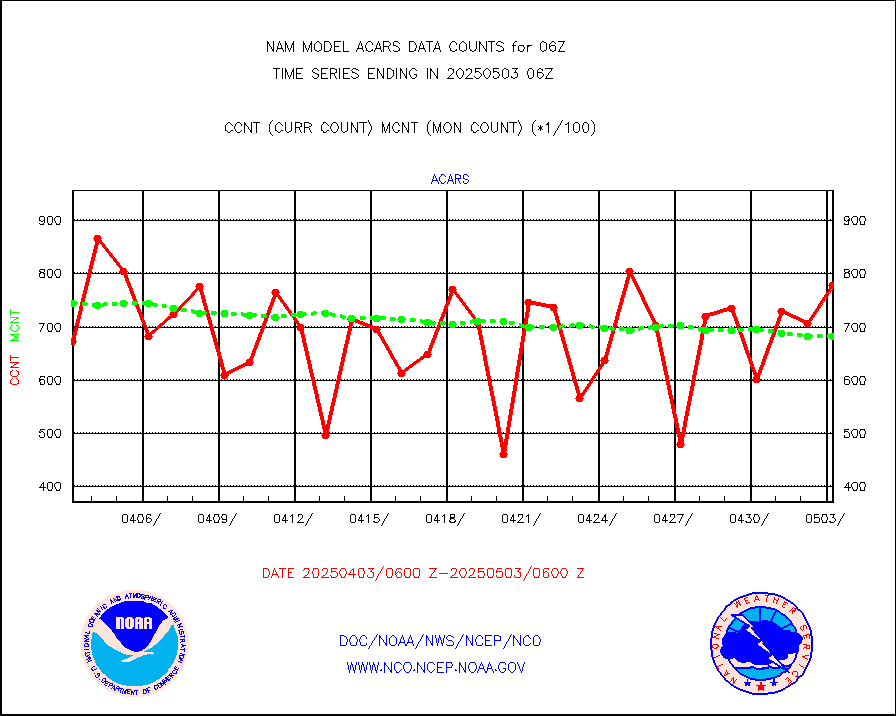
MDCRS ACARS acft data from ARINC(dcded from BUFR) |
90043 |
84256 |
106.9 % |
|||||||||||
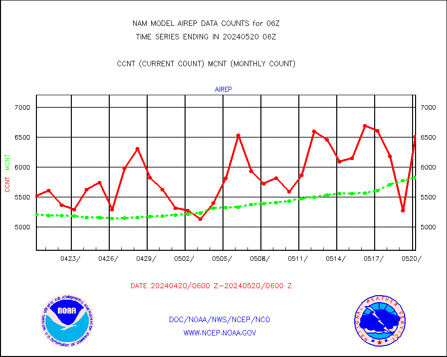
Manual AIREP aircraft data (dcded from AIREP fmt) |
4182 |
4329 |
96.6 % |
|||||||||||
AQUA AIRS/AMSU-A/HSB brightness temps- every FOV |
0 |
0 |
n/a |
|||||||||||
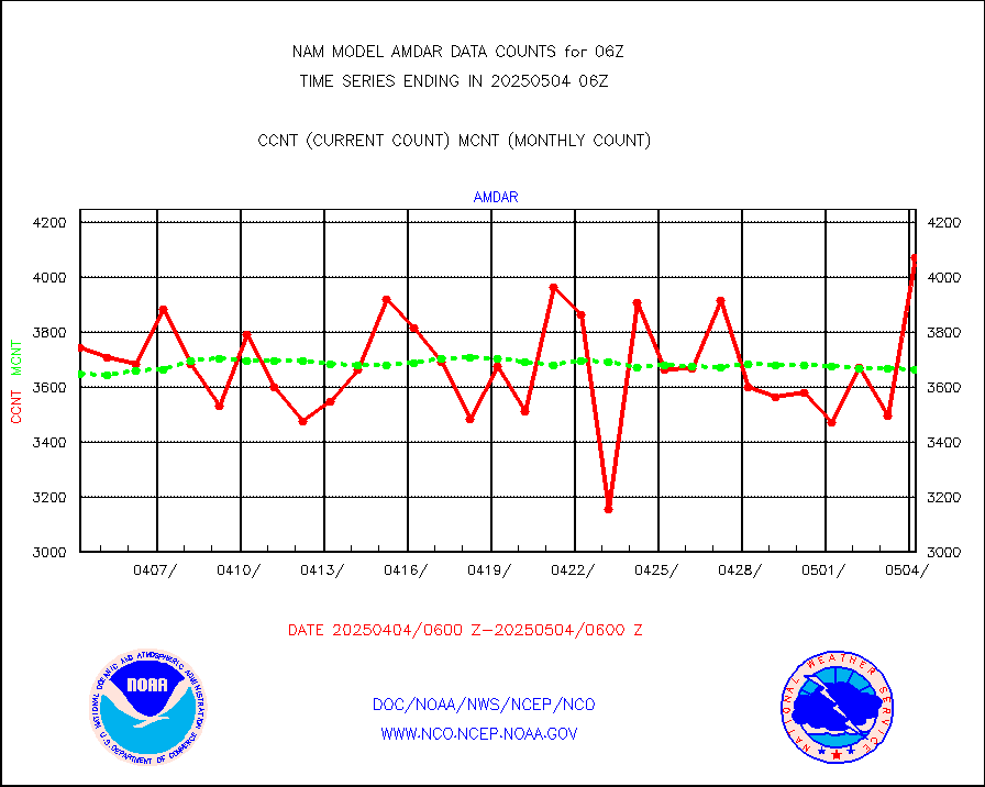
AMDAR aircraft data (decoded from AMDAR format) |
3575 |
3621 |
98.7 % |
|||||||||||
AMDAR aircraft data (decoded from BUFR) |
14174 |
15099 |
93.9 % |
|||||||||||
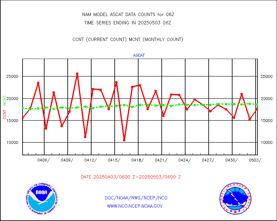
METOP 1-2 ASCAT products |
13539 |
16063 |
84.3 % |
|||||||||||
Canadian AMDAR aircraft data (decoded from BUFR) |
0 |
0 |
n/a |
|||||||||||
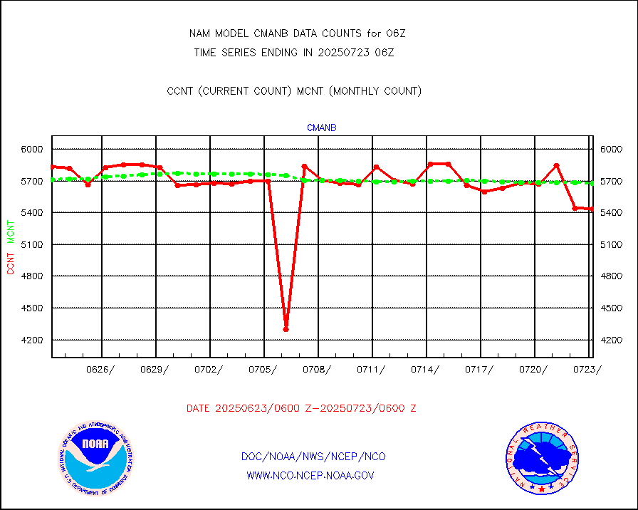
Surface Marine CMAN rpts decoded from BUFR format |
5678 |
5765 |
98.5 % |
|||||||||||
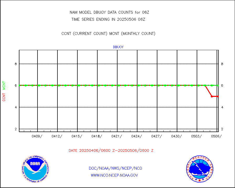
Buoys decoded from FM-18 fmt (moored or drifting) |
3 |
3 |
100.0 % |
|||||||||||
Dropwinsonde (from TEMP DROP) |
0 |
0 |
n/a |
|||||||||||
E-AMDAR (European AMDAR acft decoded from BUFR) |
9057 |
9605 |
94.3 % |
|||||||||||
GOES/NESDIS hi-resol. (1x1 f-o-v) sndgs/radiances |
0 |
0 |
n/a |
|||||||||||
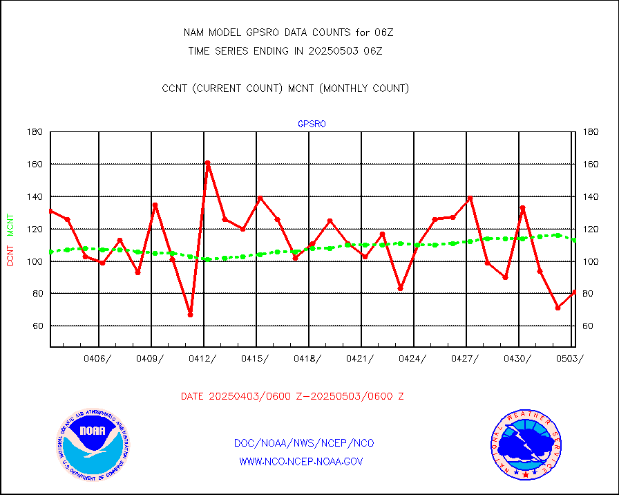
GPS radio occultation data |
106 |
98 |
108.2 % |
|||||||||||
MODIS (AQUA/TERRA) wvpr imager derived cld motion |
0 |
0 |
n/a |
|||||||||||
MODIS (AQUA/TERRA) ir l-wave derived cloud motion |
0 |
0 |
n/a |
|||||||||||
Land-based CMAN stations decoded from CMAN format |
284 |
192 |
147.9 % |
|||||||||||
Buoys decoded from FM-13 format (moored) |
306 |
217 |
141.0 % |
|||||||||||
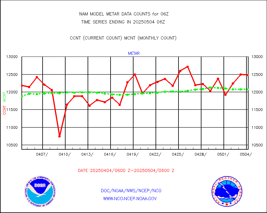
Aviation - METAR |
12094 |
12128 |
99.7 % |
|||||||||||
Mesonet/MADIS Colorado E-470 (Interstate 470) |
56 |
55 |
101.8 % |
|||||||||||
Mesonet/MADIS Alaska Department of Transportation |
354 |
360 |
98.3 % |
|||||||||||
Mesonet/MADIS U.S. Army Aberdeen Proving Grounds |
0 |
0 |
n/a |
|||||||||||
Mesonet/MADIS Citizen Weather Observers Program |
145170 |
118843 |
122.2 % |
|||||||||||
Mesonet/MADIS AWS Convergence Technologies, Inc. |
52216 |
43903 |
118.9 % |
|||||||||||
Mesonet/MADIS "Anything Weather" |
0 |
0 |
n/a |
|||||||||||
Mesonet/MADIS Colorado Dept. of Transportation |
0 |
0 |
n/a |
|||||||||||
Mesonet/MADIS DC Net |
0 |
0 |
n/a |
|||||||||||
Mesonet/MADIS Denver Urban Drainage & Flood Cntrl |
0 |
0 |
n/a |
|||||||||||
Mesonet/MADIS Florida (FAWN & USF) |
8 |
8 |
100.0 % |
|||||||||||
Mesonet/MADIS Florida Dept. of Transportation |
0 |
0 |
n/a |
|||||||||||
Mesonet/MADIS Georgia Dept. of Transportation |
0 |
0 |
n/a |
|||||||||||
Mesonet/MADIS NWS Hydromet Auto Data System(HADS) |
17534 |
17817 |
98.4 % |
|||||||||||
Mesonet/MADIS Iowa Environmental |
365 |
407 |
89.7 % |
|||||||||||
Mesonet/MADIS Indiana Dept. of Transportation |
0 |
0 |
n/a |
|||||||||||
Mesonet/MADIS Iowa Department of Transportation |
0 |
0 |
n/a |
|||||||||||
Mesonet/MADIS Kansas Department of Transportation |
850 |
802 |
106.0 % |
|||||||||||
Mesonet/MADIS Oklahoma Mesonet |
1470 |
1449 |
101.4 % |
|||||||||||
Mesonet/MADIS Louisiana State/Jackson State Univ. |
0 |
0 |
n/a |
|||||||||||
Mesonet/MADIS Missouri Commercial Agricult Wx Net |
643 |
679 |
94.7 % |
|||||||||||
Mesonet/MADIS Minnesota Dept. of Transportation |
0 |
0 |
n/a |
|||||||||||
Mesonet/MADIS NOS-Phys Oceanographic Realtime Sys |
852 |
796 |
107.0 % |
|||||||||||
Mesonet/MADIS NFIC Remote Automated Wx Stns(RAWS) |
4047 |
3756 |
107.7 % |
|||||||||||
Mesonet/MADIS many providers, not separated out |
109218 |
91184 |
119.8 % |
|||||||||||
Mesonet/MADIS Virginia Dept. of Transportation |
0 |
0 |
n/a |
|||||||||||
Mesonet/MADIS "Weather for You" |
0 |
0 |
n/a |
|||||||||||
Mesonet/MADIS Wisconsin Dept. of Transportation |
0 |
0 |
n/a |
|||||||||||
Mesonet/MADIS MesoWest (many subproviders) |
102642 |
85338 |
120.3 % |
|||||||||||
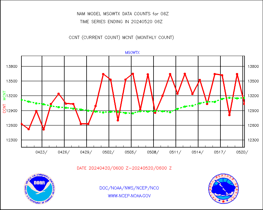
Mesonet/MADIS West Texas |
12546 |
13231 |
94.8 % |
|||||||||||
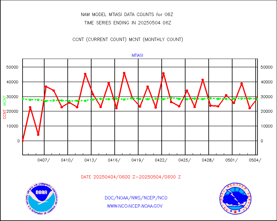
METOP 1-2 IASI 1C radiance data (varbl. channels) |
23582 |
27959 |
84.3 % |
|||||||||||
NEXRAD Vel Azm Dsp(VAD) winds via radar coded msg |
0 |
0 |
n/a |
|||||||||||
PIBAL (from PILOT, PILOT SHIP, PILOT MOBIL) |
0 |
0 |
n/a |
|||||||||||
Multi-Agency Profiler (MAP) and SODAR winds |
210 |
194 |
108.2 % |
|||||||||||
Profilr winds from PIBAL (PILOT,PILOT SHIP/MOBIL) |
0 |
0 |
n/a |
|||||||||||
Rawinsonde - fixed land (from TEMP or PILOT) |
9 |
8 |
112.5 % |
|||||||||||
Rawinsonde - mobile land (from TEMP/PILOT MOBIL) |
0 |
0 |
n/a |
|||||||||||
Rawinsonde - ship (from TEMP SHIP, PILOT SHIP) |
0 |
0 |
n/a |
|||||||||||
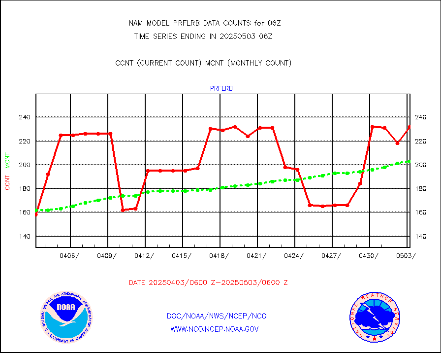
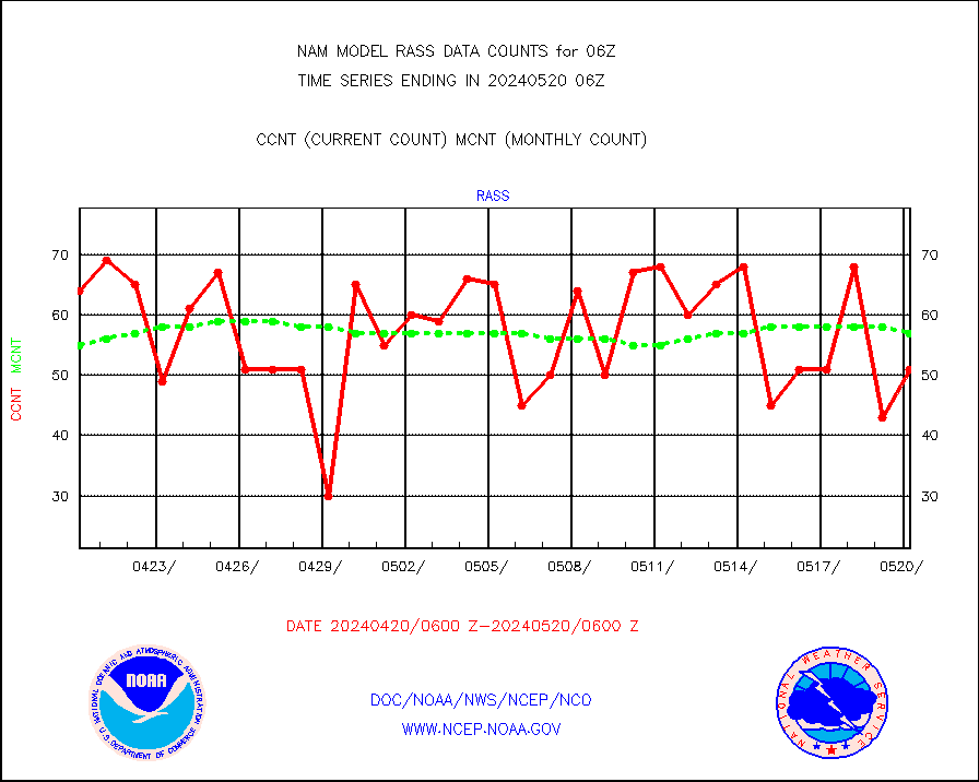
RASS temperatures (NOAA and Multi-Agency) |
51 |
52 |
98.1 % |
|||||||||||
Flight level reconnaissance aircraft data |
0 |
0 |
n/a |
|||||||||||
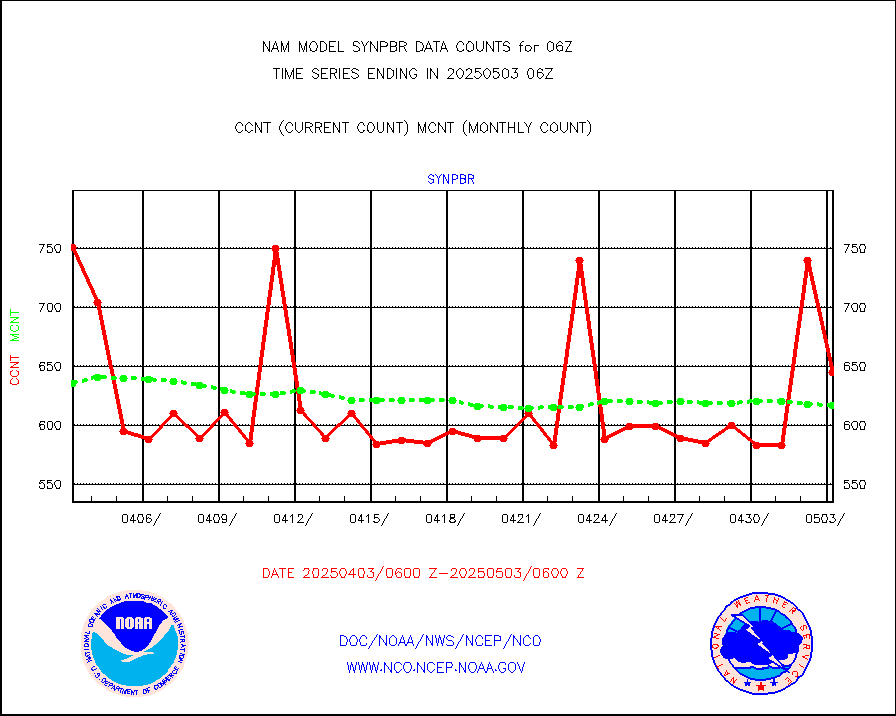
Ship - manual and automatic, restricted |
75 |
86 |
87.2 % |
|||||||||||
Ship - manual and automatic, restricted (BUFR) |
219 |
185 |
118.4 % |
|||||||||||
Ship - manual and automatic, unrestricted |
208 |
205 |
101.5 % |
|||||||||||
Ship - manual and automatic, unrestricted (BUFR) |
1644 |
1646 |
99.9 % |
|||||||||||
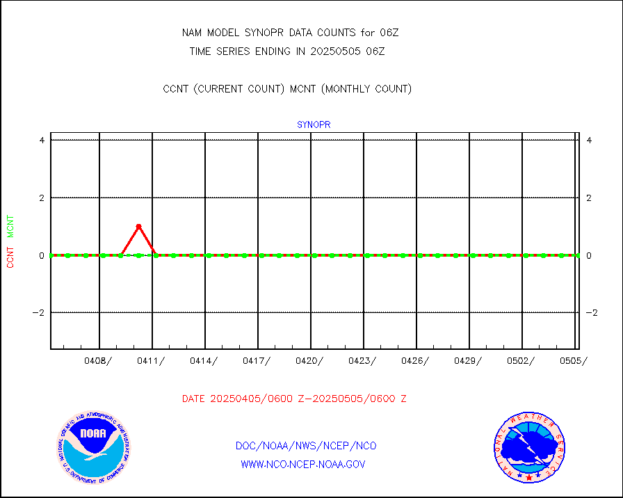
Synoptic - fixed manual & auto (decoded fr BUFR) |
4975 |
4863 |
102.3 % |
|||||||||||
Synoptic - restricted (WMO Res 40) manual & auto. |
0 |
0 |
n/a |
|||||||||||
Synoptic - restricted (WMO Res 40)(decoded BUFR) |
540 |
647 |
83.5 % |
|||||||||||
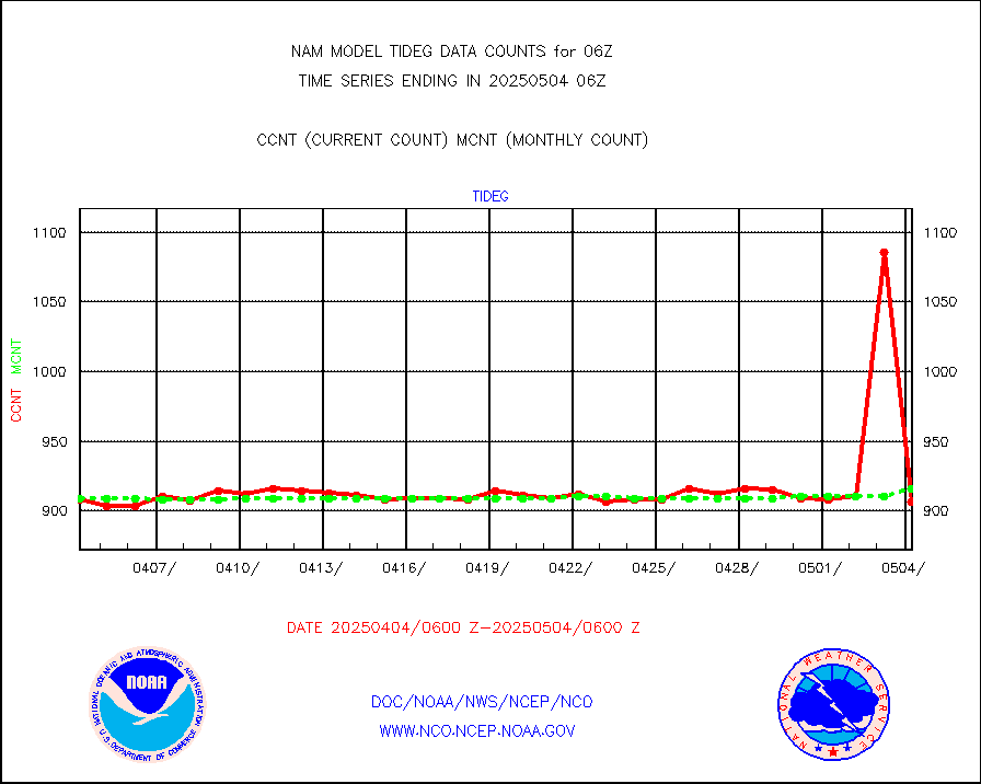
Tide gauge reports decoded from CREX format |
916 |
917 |
99.9 % |
|||||||||||
| Data Types of Opportunity with Normal Counts | ||||||||||||||
|---|---|---|---|---|---|---|---|---|---|---|---|---|---|---|
| Type | Description | Hourly Count | Monthly Average | Percent (%) of Monthly Mean | ||||||||||
MDCRS ACARS acft data (ARINC via AFWA)(AIREP fmt) |
0 |
0 |
n/a |
|||||||||||
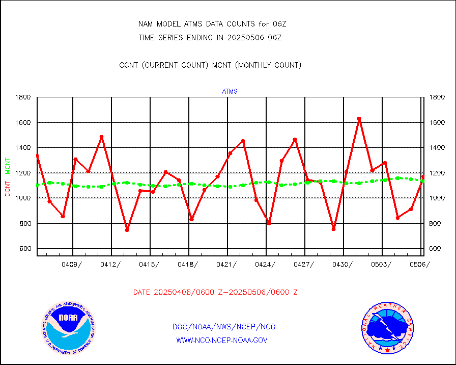
NPP/NOAA-20 ATMS brightness temperatures |
75470 |
110048 |
68.6 % |
|||||||||||
NPP CrIS apodized radiances (399 channel) |
0 |
0 |
n/a |
|||||||||||
Coast Guard |
10 |
10 |
100.0 % |
|||||||||||
Drifting buoys (decoded from BUFR) |
725 |
685 |
105.8 % |
|||||||||||
NOAA 15-19 & METOP 1-2 AMSU-A proc btmps frm RARS |
12531 |
14088 |
88.9 % |
|||||||||||
NOAA 18-19 & METOP 1-2 MHS proc. btemps from RARS |
107436 |
146998 |
73.1 % |
|||||||||||
GOES/NESDIS hi-resol. (1x1 f-o-v) cloud data |
0 |
0 |
n/a |
|||||||||||
MTSAT/JMA water vapor imager derived cloud motion |
1324 |
1383 |
95.7 % |
|||||||||||
METEOSAT/EUMETSAT wvpr imgr drv cld motion NBseq |
4940 |
5166 |
95.6 % |
|||||||||||
METEOSAT/EUMETSAT ir lg-wave drv cld motion NBseq |
3140 |
3127 |
100.4 % |
|||||||||||
VIIRS (NPP/NOAA-20) ir lg-wv drv cloud motion(NB) |
0 |
0 |
n/a |
|||||||||||
AVHRR (NOAA/METOP) ir lg-wave derived cld motion |
0 |
0 |
n/a |
|||||||||||
AVHRR (METOP) ir lg-wave derived cld motion |
0 |
0 |
n/a |
|||||||||||
MTSAT/JMA infrared long-wave derived cloud motion |
1202 |
1169 |
102.8 % |
|||||||||||
Korean AMDAR aircraft data (decoded from BUFR) |
283 |
280 |
101.1 % |
|||||||||||
GOES/NASA(Langley) hi-res. (1x1 f-o-v) cloud data |
9999999 |
9992740 |
100.1 % |
|||||||||||
LLDN Long-rng lightning from Vaisala via NOAAPORT |
202932 |
198130 |
102.4 % |
|||||||||||
NLDN Shrt-rng lightning from Vaisala via NOAAPORT |
8511 |
9581 |
88.8 % |
|||||||||||
Moored buoys (decoded from BUFR) |
1573 |
1620 |
97.1 % |
|||||||||||
NEXRAD Vel Azm Dsp(VAD) winds via Level 2 decoder |
1821 |
1738 |
104.8 % |
|||||||||||
NOAA 16-19 Solar Backscatter UV-2 rad frm V8 BUFR |
0 |
0 |
n/a |
|||||||||||
Manual PIREP aircraft data (dcded from AIREP fmt) |
82 |
87 |
94.3 % |
|||||||||||
NEXRAD reflectivity (Lvl 2 - GTS) |
9280991 |
8852206 |
104.8 % |
|||||||||||
NEXRAD radial wind (Level 2 - GTS) |
4430482 |
4202701 |
105.4 % |
|||||||||||
METEOSAT-10 2nd Gen SEVIRI Clr Sky Radiance(proc) |
0 |
0 |
n/a |
|||||||||||
Synoptic - fixed manual and automatic |
545 |
506 |
107.7 % |
|||||||||||
Synoptic - mobile manual & auto (decoded fr BUFR) |
27 |
27 |
100.0 % |
|||||||||||
TAMDAR aircft data-all types(from Panasonic,BUFR) |
282 |
210 |
134.3 % |
|||||||||||
MTSAT/JMA visible derived cloud motion |
729 |
664 |
109.8 % |
|||||||||||
METEOSAT/EUMETSAT visible drv cld motion NBseq |
2598 |
2050 |
126.7 % |
|||||||||||


