| Suspect Data Shortages in Critical Types - Monitor | ||||||||||||||
|---|---|---|---|---|---|---|---|---|---|---|---|---|---|---|
| Type | Description | Hourly Count | Monthly Average | Percent (%) of Monthly Mean | UTC Time Window | |||||||||
NOAA 18-19 & METOP 1-2 HIRS-4 NCEP-proc. br.temps |
0 |
12966 |
0.0 % |
0104.00-0104.99 |
||||||||||
NOAA 15-19 & METOP 1-2 HIRS-3/4 pr btmps frm RARS |
0 |
6513 |
0.0 % |
0105.50-0106.49 |
||||||||||
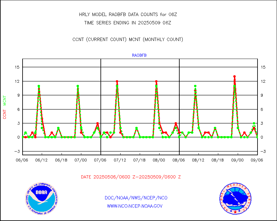
Grnd-based Gbl Navigation Sat System (GNSS) data |
1443 |
6874 |
21.0 % |
0105.00-0105.99 |
||||||||||
| Shortage in Data Type of Opportunity - Monitor | ||||||||||||||
|---|---|---|---|---|---|---|---|---|---|---|---|---|---|---|
| Type | Description | Hourly Count | Monthly Average | Percent (%) of Monthly Mean | UTC Time Window | |||||||||
P.M.(N18-19) AVHRR GAC NCEP-proc clr & sea btemps |
0 |
302028 |
0.0 % |
0103.50-0104.49 |
||||||||||
METOP 1-2 IASI 1C radiance data vbl chn from RARS |
0 |
1138 |
0.0 % |
0105.00-0105.99 |
||||||||||
INDIA SATWIND, INSAT WV channel |
0 |
745 |
0.0 % |
0105.00-0105.99 |
||||||||||
INDIA SATWIND, INSAT IR channel |
0 |
781 |
0.0 % |
0105.00-0105.99 |
||||||||||
INDIA SATWIND, INSAT VIS channel |
0 |
37 |
0.0 % |
0105.00-0105.99 |
||||||||||
| Critical Data with Normal Counts | ||||||||||||||
|---|---|---|---|---|---|---|---|---|---|---|---|---|---|---|
| Type | Description | Hourly Count | Monthly Average | Percent (%) of Monthly Mean | UTC Time Window | |||||||||
NOAA 15-19 & METOP 1-2 AMSU-A NCEP-proc. br.temps |
25164 |
33193 |
75.8 % |
0104.00-0104.99 |
||||||||||
NOAA 18-19 & METOP 1-2 MHS NCEP-proces. br. temps |
224912 |
257365 |
87.4 % |
0104.00-0104.99 |
||||||||||
MDCRS ACARS acft data from ARINC(dcded from BUFR) |
11872 |
15203 |
78.1 % |
0105.50-0106.49 |
||||||||||
Manual AIREP aircraft data (dcded from AIREP fmt) |
863 |
951 |
90.7 % |
0105.50-0106.49 |
||||||||||
AQUA AIRS/AMSU-A/HSB brightness temps- every FOV |
0 |
0 |
n/a |
0103.50-0104.49 |
||||||||||
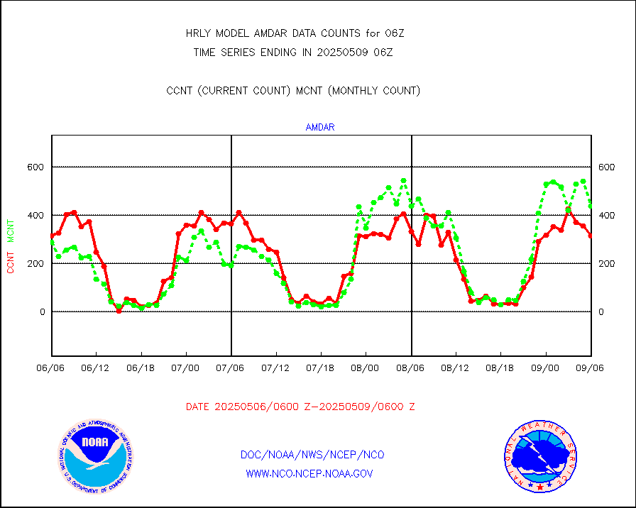
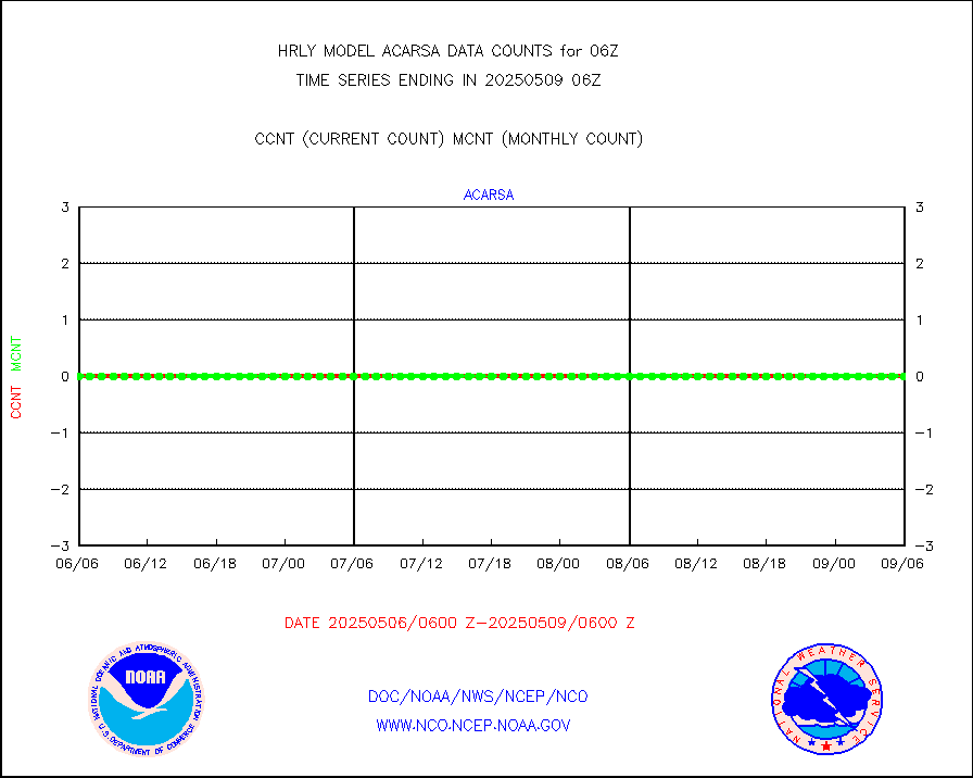
AMDAR aircraft data (decoded from AMDAR format) |
296 |
266 |
111.3 % |
0105.50-0106.49 |
||||||||||
AMDAR aircraft data (decoded from BUFR) |
2730 |
2717 |
100.5 % |
0105.50-0106.49 |
||||||||||
METOP 1-2 ASCAT products |
46284 |
56952 |
81.3 % |
0104.50-0105.49 |
||||||||||
NPP/NOAA-20 ATMS brightness temperatures |
332544 |
349373 |
95.2 % |
0104.50-0105.49 |
||||||||||
Canadian AMDAR aircraft data (decoded from BUFR) |
0 |
0 |
n/a |
0105.50-0106.49 |
||||||||||
Surface Marine CMAN rpts decoded from BUFR format |
1870 |
1859 |
100.6 % |
0105.50-0106.50 |
||||||||||
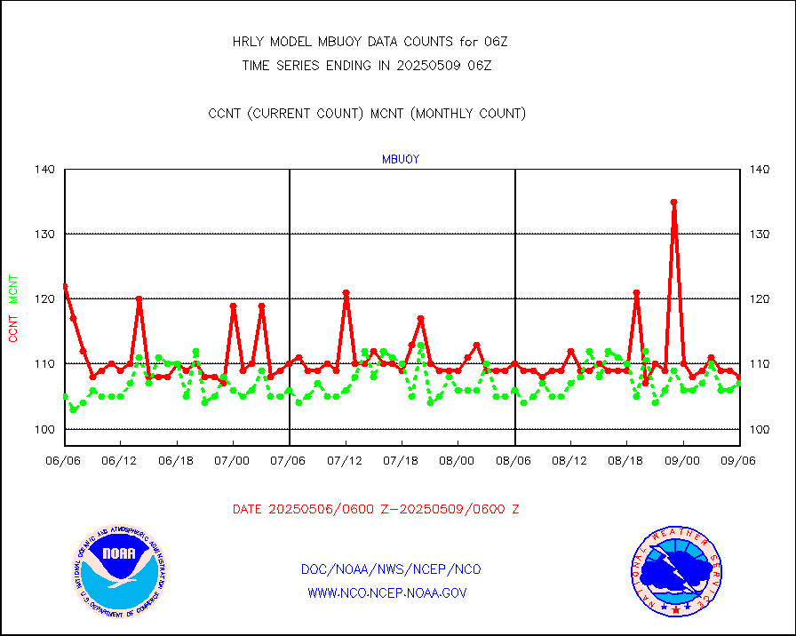
Buoys decoded from FM-18 fmt (moored or drifting) |
11 |
16 |
68.8 % |
0105.50-0106.49 |
||||||||||
E-AMDAR (European AMDAR acft decoded from BUFR) |
1760 |
1875 |
93.9 % |
0105.50-0106.49 |
||||||||||
NOAA 15-19 & METOP 1-2 AMSU-A proc btmps frm RARS |
7908 |
9675 |
81.7 % |
0105.50-0106.49 |
||||||||||
GPS radio occultation data |
533 |
534 |
99.8 % |
0103.50-0104.49 |
||||||||||
GOES-16/17 All Sky Radiances (proc.) |
720952 |
717802 |
100.4 % |
0105.50-0106.49 |
||||||||||
GOES-16/17 Clear Sky Radiances (proc.) |
347641 |
350485 |
99.2 % |
0105.50-0106.49 |
||||||||||
MTSAT/JMA water vapor imager derived cloud motion |
21522 |
20012 |
107.5 % |
0103.50-0104.49 |
||||||||||
MODIS (AQUA/TERRA) wvpr imager derived cld motion |
0 |
0 |
n/a |
0102.00-0102.99 |
||||||||||
GOES-16&up/NESDIS wv imgr/cld-top derived cld mtn |
25404 |
27408 |
92.7 % |
0105.00-0105.99 |
||||||||||
METEOSAT/EUMETSAT ir lg-wave drv cld motion NBseq |
21094 |
21039 |
100.3 % |
0104.50-0105.49 |
||||||||||
MTSAT/JMA infrared long-wave derived cloud motion |
16800 |
16513 |
101.7 % |
0103.50-0104.49 |
||||||||||
MODIS (AQUA/TERRA) ir l-wave derived cloud motion |
0 |
0 |
n/a |
0102.00-0102.99 |
||||||||||
GOES-16&up/NESDIS ir long-wave derived cld motion |
83070 |
83486 |
99.5 % |
0105.00-0105.99 |
||||||||||
GOES/NASA(Langley) hi-res. (1x1 f-o-v) cloud data |
6427225 |
6430699 |
99.9 % |
0105.50-0106.49 |
||||||||||
Buoys decoded from FM-13 format (moored) |
123 |
121 |
101.7 % |
0105.50-0106.49 |
||||||||||
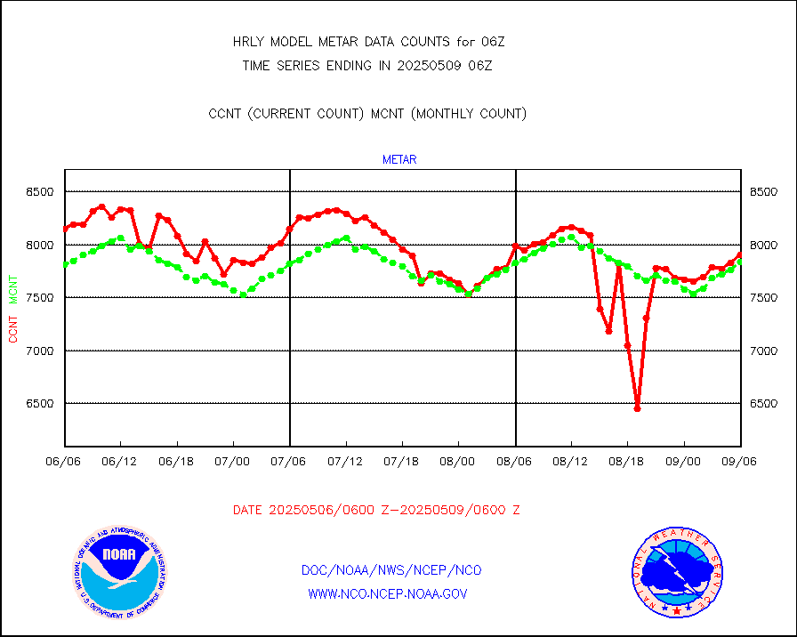
Aviation - METAR |
7821 |
7775 |
100.6 % |
0105.50-0106.49 |
||||||||||
Mesonet/MADIS Colorado E-470 (Interstate 470) |
24 |
24 |
100.0 % |
0105.50-0106.49 |
||||||||||
Mesonet/MADIS Alaska Department of Transportation |
118 |
70 |
168.6 % |
0105.50-0106.49 |
||||||||||
Mesonet/MADIS U.S. Army Aberdeen Proving Grounds |
0 |
0 |
n/a |
0105.50-0106.49 |
||||||||||
Mesonet/MADIS Citizen Weather Observers Program |
45078 |
58014 |
77.7 % |
0105.50-0106.49 |
||||||||||
Mesonet/MADIS AWS Convergence Technologies, Inc. |
14489 |
20390 |
71.1 % |
0105.50-0106.49 |
||||||||||
Mesonet/MADIS "Anything Weather" |
0 |
0 |
n/a |
0105.50-0106.49 |
||||||||||
Mesonet/MADIS Colorado Dept. of Transportation |
0 |
0 |
n/a |
0105.50-0106.49 |
||||||||||
Mesonet/MADIS DC Net |
0 |
0 |
n/a |
0105.50-0106.49 |
||||||||||
Mesonet/MADIS Denver Urban Drainage & Flood Cntrl |
0 |
0 |
n/a |
0105.50-0106.49 |
||||||||||
Mesonet/MADIS Florida (FAWN & USF) |
4 |
4 |
100.0 % |
0105.50-0106.49 |
||||||||||
Mesonet/MADIS Florida Dept. of Transportation |
0 |
0 |
n/a |
0105.50-0106.49 |
||||||||||
Mesonet/MADIS Georgia Dept. of Transportation |
0 |
0 |
n/a |
0105.50-0106.49 |
||||||||||
Mesonet/MADIS NWS Hydromet Auto Data System(HADS) |
5667 |
6037 |
93.9 % |
0105.50-0106.49 |
||||||||||
Mesonet/MADIS Iowa Environmental |
192 |
185 |
103.8 % |
0105.50-0106.49 |
||||||||||
Mesonet/MADIS Indiana Dept. of Transportation |
0 |
0 |
n/a |
0105.50-0106.49 |
||||||||||
Mesonet/MADIS Iowa Department of Transportation |
0 |
0 |
n/a |
0105.50-0106.49 |
||||||||||
Mesonet/MADIS Kansas Department of Transportation |
280 |
355 |
78.9 % |
0105.50-0106.49 |
||||||||||
Mesonet/MADIS Oklahoma Mesonet |
630 |
623 |
101.1 % |
0105.50-0106.49 |
||||||||||
Mesonet/MADIS Louisiana State/Jackson State Univ. |
0 |
0 |
n/a |
0105.50-0106.49 |
||||||||||
Mesonet/MADIS Missouri Commercial Agricult Wx Net |
306 |
309 |
99.0 % |
0105.50-0106.49 |
||||||||||
Mesonet/MADIS Minnesota Dept. of Transportation |
0 |
0 |
n/a |
0105.50-0106.49 |
||||||||||
Mesonet/MADIS NOS-Phys Oceanographic Realtime Sys |
342 |
375 |
91.2 % |
0105.50-0106.49 |
||||||||||
Mesonet/MADIS NFIC Remote Automated Wx Stns(RAWS) |
1928 |
1775 |
108.6 % |
0105.50-0106.49 |
||||||||||
Mesonet/MADIS many providers, not separated out |
59780 |
70175 |
85.2 % |
0105.00-0106.49 |
||||||||||
Mesonet/MADIS Virginia Dept. of Transportation |
0 |
0 |
n/a |
0105.50-0106.49 |
||||||||||
Mesonet/MADIS "Weather for You" |
0 |
0 |
n/a |
0105.50-0106.49 |
||||||||||
Mesonet/MADIS Wisconsin Dept. of Transportation |
0 |
0 |
n/a |
0105.50-0106.49 |
||||||||||
Mesonet/MADIS MesoWest (many subproviders) |
21371 |
33925 |
63.0 % |
0105.50-0106.49 |
||||||||||
Mesonet/MADIS West Texas |
5858 |
5944 |
98.6 % |
0105.50-0106.49 |
||||||||||
METOP 1-2 IASI 1C radiance data (varbl. channels) |
96556 |
86882 |
111.1 % |
0104.00-0104.99 |
||||||||||
NEXRAD Vel Azm Dsp(VAD) winds via radar coded msg |
0 |
0 |
n/a |
0105.50-0106.49 |
||||||||||
Aura Ozone Monitoring Instrument (OMI) data |
0 |
0 |
n/a |
0103.50-0104.49 |
||||||||||
NOAA 16-19 Solar Backscatter UV-2 rad frm V8 BUFR |
0 |
0 |
n/a |
0104.00-0104.99 |
||||||||||
PIBAL (from PILOT, PILOT SHIP, PILOT MOBIL) |
2 |
1 |
200.0 % |
0105.50-0106.49 |
||||||||||
Multi-Agency Profiler (MAP) and SODAR winds |
45 |
47 |
95.7 % |
0105.50-0106.49 |
||||||||||
Rawinsonde - fixed land (from TEMP or PILOT) |
7 |
10 |
70.0 % |
0105.50-0106.49 |
||||||||||
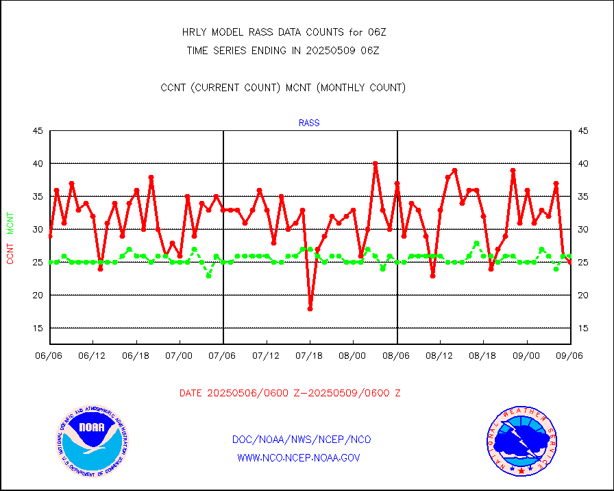
RASS temperatures (NOAA and Multi-Agency) |
28 |
26 |
107.7 % |
0105.50-0106.49 |
||||||||||
NEXRAD reflectivity (Lvl 2 - GTS) |
4382667 |
4037495 |
108.5 % |
0105.50-0106.49 |
||||||||||
NEXRAD radial wind (Level 2 - GTS) |
2545587 |
1867196 |
136.3 % |
0105.50-0106.49 |
||||||||||
METEOSAT-10 2nd Gen SEVIRI Clr Sky Radiance(proc) |
0 |
0 |
n/a |
0105.50-0106.49 |
||||||||||
Ship - manual and automatic, restricted (BUFR) |
0 |
0 |
n/a |
0105.50-0106.50 |
||||||||||
Ship - manual and automatic, unrestricted |
306 |
263 |
116.3 % |
0105.50-0106.50 |
||||||||||
Ship - manual and automatic, unrestricted (BUFR) |
1019 |
1033 |
98.6 % |
0105.50-0106.50 |
||||||||||
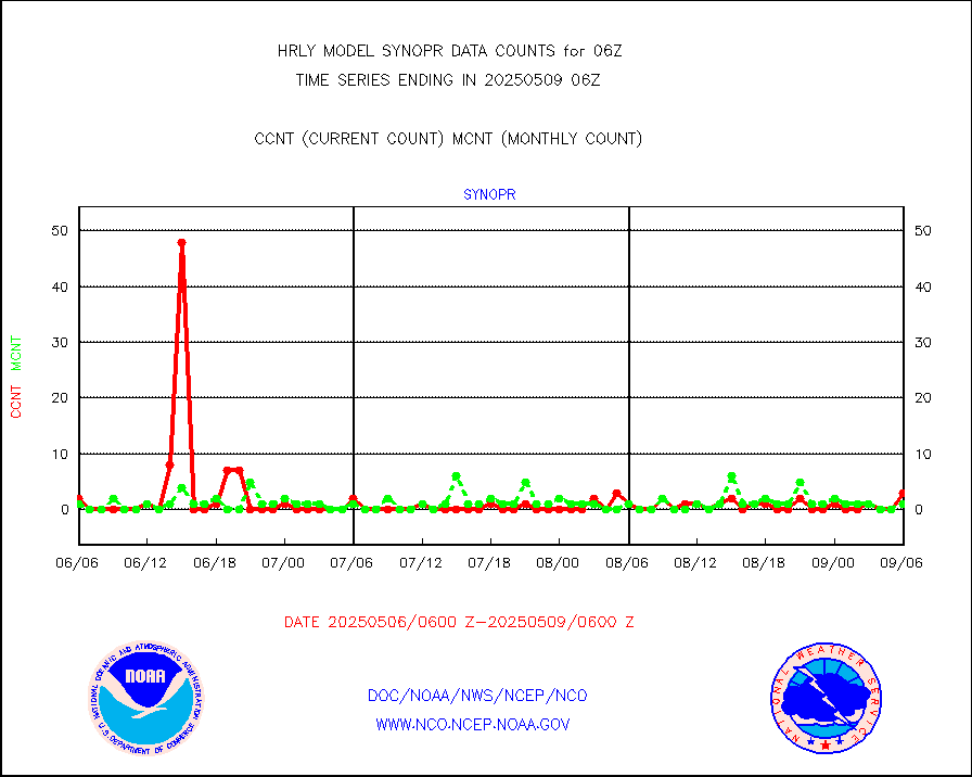
Synoptic - fixed manual and automatic |
1768 |
1704 |
103.8 % |
0105.50-0106.49 |
||||||||||
Synoptic - fixed manual & auto (decoded fr BUFR) |
6758 |
6738 |
100.3 % |
0105.50-0106.49 |
||||||||||
Synoptic - restricted (WMO Res 40) manual & auto. |
1 |
2 |
50.0 % |
0105.50-0106.49 |
||||||||||
Synoptic - restricted (WMO Res 40)(decoded BUFR) |
350 |
362 |
96.7 % |
0105.50-0106.49 |
||||||||||
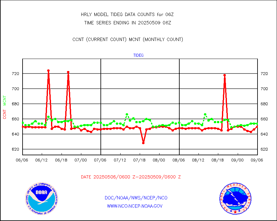
Tide gauge reports decoded from CREX format |
658 |
656 |
100.3 % |
0105.00-0105.99 |
||||||||||
| Data Types of Opportunity with Normal Counts | ||||||||||||||
|---|---|---|---|---|---|---|---|---|---|---|---|---|---|---|
| Type | Description | Hourly Count | Monthly Average | Percent (%) of Monthly Mean | UTC Time Window | |||||||||
GOES-16&up/NESDIS ir short-wv derived cld motion |
43292 |
44291 |
97.7 % |
0105.00-0105.99 |
||||||||||
MDCRS ACARS acft data (ARINC via AFWA)(AIREP fmt) |
0 |
0 |
n/a |
0105.50-0106.49 |
||||||||||
Himawari Clear Sky Radiance |
0 |
0 |
n/a |
0105.00-0105.99 |
||||||||||
GCOM-W AMSR2 1B brightness temperatures |
2211300 |
2193091 |
100.8 % |
0104.00-0104.99 |
||||||||||
NPP/NOAA-20 ATMS bright. temps-direct b-cast SSEC |
91430 |
108205 |
84.5 % |
0104.50-0105.49 |
||||||||||
POES/NESDIS - processed ATOVS soundings/radiances |
0 |
0 |
n/a |
0104.00-0104.99 |
||||||||||
A.M.(N17,M2,M3) AVHRR GAC NCEP-proc clr&sea btmps |
1077082 |
1009411 |
106.7 % |
0103.50-0104.49 |
||||||||||
eXpendable BathyThermograph, mooring (BATHY fmt) |
0 |
0 |
n/a |
3023.00-3023.99 |
||||||||||
Coop/MADIS NEPP & HCN-Modernization NOAA COOP Obs |
11 |
11 |
100.0 % |
0105.50-0106.49 |
||||||||||
NPP/NOAA-20 CrIS full spctrl radn (431 ch subset) |
229734 |
234033 |
98.2 % |
0104.50-0105.49 |
||||||||||
NPP/NOAA-20 CrIS full spctrl radn dir brdcst SSEC |
74610 |
75152 |
99.3 % |
0104.50-0105.49 |
||||||||||
Coast Guard |
4 |
5 |
80.0 % |
0105.50-0106.50 |
||||||||||
Drifting buoys (decoded from BUFR) |
1442 |
1406 |
102.6 % |
0105.50-0106.50 |
||||||||||
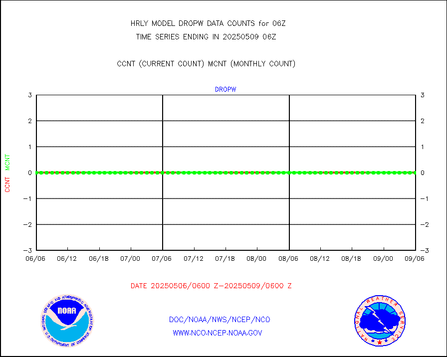
Dropwinsonde (from TEMP DROP) |
0 |
0 |
n/a |
0105.50-0106.49 |
||||||||||
Dropwinsonde (decoded from BUFR) |
0 |
1 |
0.0 % |
0105.51-0106.49 |
||||||||||
GOES imager effective cloud amount data (U.Wisc.) |
9250602 |
8633357 |
107.1 % |
0105.50-0106.49 |
||||||||||
NPP Adv. Tech. MW Sndr (ATMS) br. temps from RARS |
87456 |
99131 |
88.2 % |
0104.50-0105.49 |
||||||||||
NOAA 18-19 & METOP 1-2 MHS proc. btemps from RARS |
65855 |
90291 |
72.9 % |
0105.50-0106.49 |
||||||||||
GOES/NESDIS (11x17 f-o-v) imager clear radiances |
0 |
0 |
n/a |
0105.00-0105.99 |
||||||||||
METOP 1-2 Global Ozone Monitoring Exp.-2 (GOME-2) |
2950 |
9416 |
31.3 % |
0104.50-0105.49 |
||||||||||
GOES-16&up/NESDIS wv imgr/deep-lyr derivd cld mtn |
19947 |
17057 |
116.9 % |
0105.00-0105.99 |
||||||||||
METEOSAT/EUMETSAT wvpr imgr drv cld motion NBseq |
34850 |
36218 |
96.2 % |
0104.50-0105.49 |
||||||||||
High Density OBs from reconnaissance acft data |
0 |
4 |
0.0 % |
0105.50-0106.49 |
||||||||||
METOP 1-2 IASI 1C radiances-direct broadcast SSEC |
60547 |
53065 |
114.1 % |
0104.50-0105.49 |
||||||||||
VIIRS (NPP/NOAA-20) ir lg-wv drv cloud motion(NB) |
18433 |
21642 |
85.2 % |
0102.00-0102.99 |
||||||||||
AVHRR (NOAA/METOP) ir lg-wave derived cld motion |
0 |
0 |
n/a |
0102.00-0102.99 |
||||||||||
AVHRR (METOP) ir lg-wave derived cld motion |
0 |
0 |
n/a |
0105.50-0106.50 |
||||||||||
INSAT/KALPANA India ir lg-wave derived cld motion |
0 |
0 |
n/a |
0103.50-0104.49 |
||||||||||
Korean AMDAR aircraft data (decoded from BUFR) |
30 |
57 |
52.6 % |
0105.50-0106.49 |
||||||||||
Land-based CMAN stations decoded from CMAN format |
107 |
77 |
139.0 % |
0105.50-0106.49 |
||||||||||
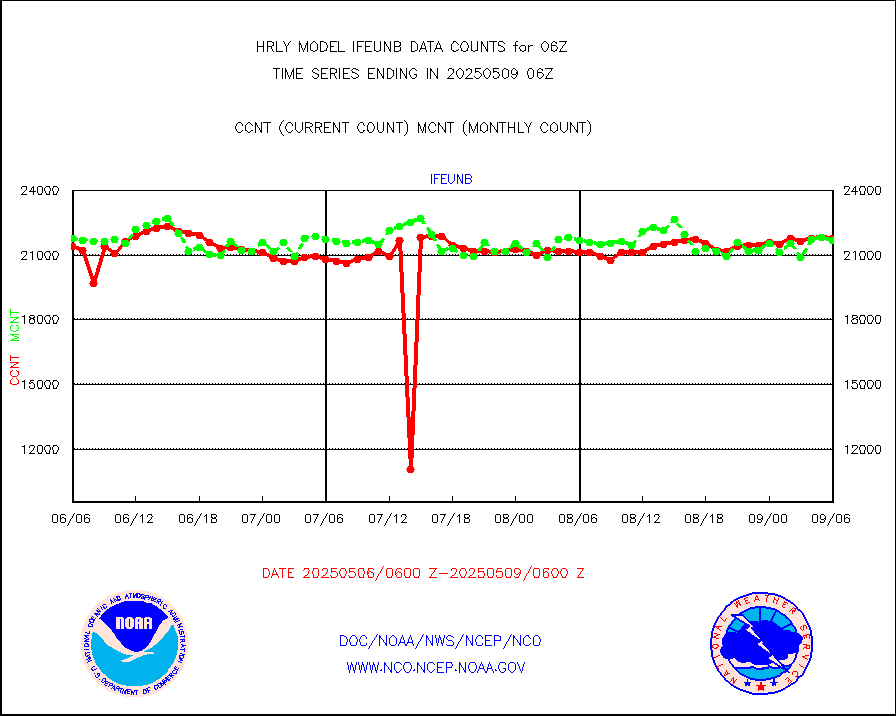
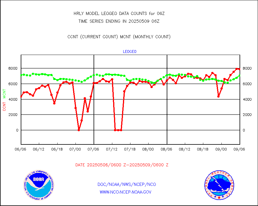
LEO-GEO satellite AMVs from UWisc. |
7248 |
7613 |
95.2 % |
0102.00-0102.99 |
||||||||||
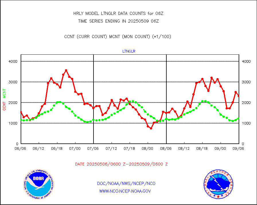
LLDN Long-rng lightning from Vaisala via NOAAPORT |
144799 |
155725 |
93.0 % |
0105.50-0106.49 |
||||||||||
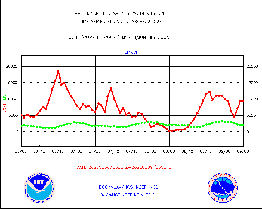
NLDN Shrt-rng lightning from Vaisala via NOAAPORT |
2892 |
4694 |
61.6 % |
0105.50-0106.49 |
||||||||||
Moored buoys (decoded from BUFR) |
963 |
926 |
104.0 % |
0105.50-0106.50 |
||||||||||
Aura Microwave Limb Sounder (MLS) ozone data |
0 |
0 |
n/a |
0104.00-0104.99 |
||||||||||
Mesonet/MADIS UrbaNet |
3584 |
3542 |
101.2 % |
0105.50-0106.49 |
||||||||||
NEXRAD Vel Azm Dsp(VAD) winds via Level 2 decoder |
612 |
556 |
110.1 % |
0105.50-0106.49 |
||||||||||
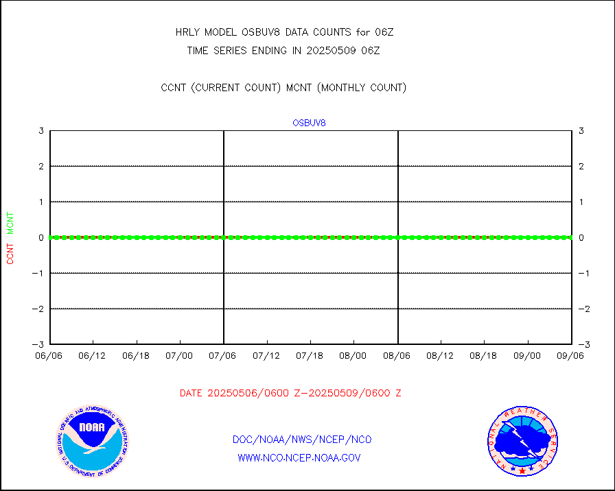
OMPS Limb Profiler ozone data (NPP) |
464 |
264 |
175.8 % |
3023.00-3023.99 |
||||||||||
OMPS nadir profile ozone (Version 8 BUFR) |
633 |
561 |
112.8 % |
0104.00-0104.99 |
||||||||||
OMPS total column ozone (Version 8 BUFR) |
344442 |
346512 |
99.4 % |
0104.00-0104.99 |
||||||||||
PIBAL (decoded from BUFR) |
1 |
1 |
100.0 % |
0105.51-0106.49 |
||||||||||
Manual PIREP aircraft data (dcded from AIREP fmt) |
6 |
9 |
66.7 % |
0105.50-0106.49 |
||||||||||
Profilr winds from PIBAL (PILOT,PILOT SHIP/MOBIL) |
0 |
0 |
n/a |
0105.50-0106.49 |
||||||||||
Rawinsonde - fixed land (decoded from BUFR) |
0 |
0 |
n/a |
0105.51-0106.49 |
||||||||||
Rawinsonde - mobile land (from TEMP/PILOT MOBIL) |
0 |
0 |
n/a |
0105.50-0106.49 |
||||||||||
Rawinsonde - mobile land (decoded from BUFR) |
0 |
0 |
n/a |
0105.51-0106.49 |
||||||||||
Rawinsonde - ship (from TEMP SHIP, PILOT SHIP) |
0 |
0 |
n/a |
0105.50-0106.49 |
||||||||||
Rawinsonde - ship (decoded from BUFR) |
0 |
0 |
n/a |
0105.51-0106.49 |
||||||||||
Flight level reconnaissance aircraft data |
0 |
0 |
n/a |
0105.50-0106.49 |
||||||||||
Megha-Tropiques SAPHIR L1A2 brightness temps |
0 |
0 |
n/a |
0103.50-0104.49 |
||||||||||
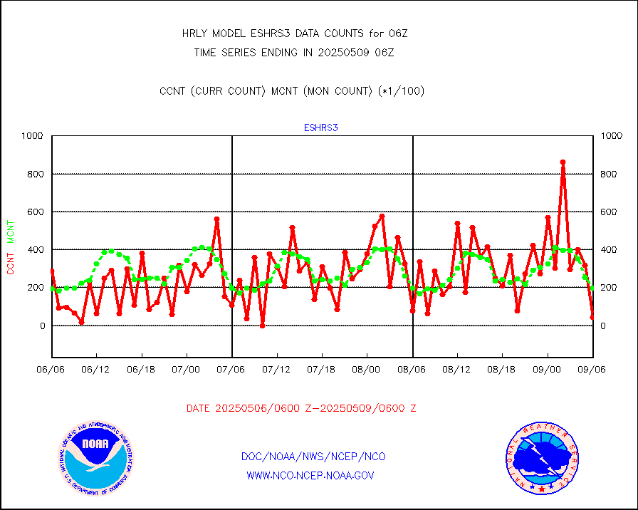
METEOSAT-10 2nd Gen SEVIRI All Sky Radiance(proc) |
75512 |
75512 |
100.0 % |
0105.50-0106.49 |
||||||||||
Ship - manual and automatic, restricted |
0 |
34 |
0.0 % |
0105.50-0106.49 |
||||||||||
DMSP SSM/IS 1C radiance data (Unified Pre-Proc.) |
112680 |
104496 |
107.8 % |
0104.50-0105.49 |
||||||||||
NPP/NOAA-20 VIIRS SST - CLEAR & OVER WATER |
2759328 |
1191007 |
231.7 % |
0105.50-0106.49 |
||||||||||
NPP/NOAA-20 VIIRS SST - PROBABLY CLR & OVER WATER |
474231 |
233309 |
203.3 % |
0105.50-0106.49 |
||||||||||
Synoptic - mobile manual and automatic |
800 |
678 |
118.0 % |
0105.50-0106.49 |
||||||||||
Synoptic - mobile manual & auto (decoded fr BUFR) |
1 |
1 |
100.0 % |
0105.50-0106.49 |
||||||||||
CTD probe, Argo prflng float, mooring (TESAC fmt) |
222 |
210 |
105.7 % |
0105.50-0106.49 |
||||||||||
TAMDAR aircft data-all types(from Panasonic,BUFR) |
12 |
41 |
29.3 % |
0105.50-0106.49 |
||||||||||
ThermoSalinoGraph (TSG) TRACKOB format) |
91 |
99 |
91.9 % |
0104.50-0105.49 |
||||||||||
INSAT/KALPANA India visible derived cloud motion |
0 |
0 |
n/a |
0103.50-0104.49 |
||||||||||
MTSAT/JMA visible derived cloud motion |
10920 |
10836 |
100.8 % |
0103.50-0104.49 |
||||||||||
GOES-16&up/NESDIS visible derived cloud motion |
22601 |
16312 |
138.6 % |
0105.00-0105.99 |
||||||||||
METEOSAT/EUMETSAT visible drv cld motion NBseq |
25976 |
23811 |
109.1 % |
0104.50-0105.49 |
||||||||||


