| Abnormal Data Shortage in Critical Types - Investigation Required | ||||||||||||||
|---|---|---|---|---|---|---|---|---|---|---|---|---|---|---|
| Type | Description | Hourly Count | Monthly Average | Percent (%) of Monthly Mean | ||||||||||
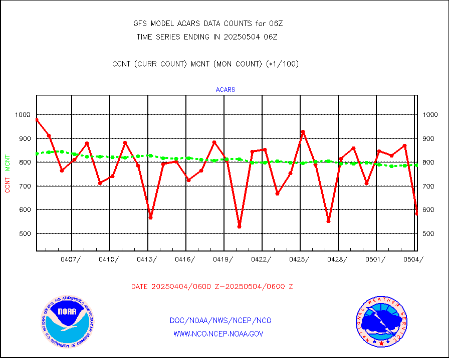
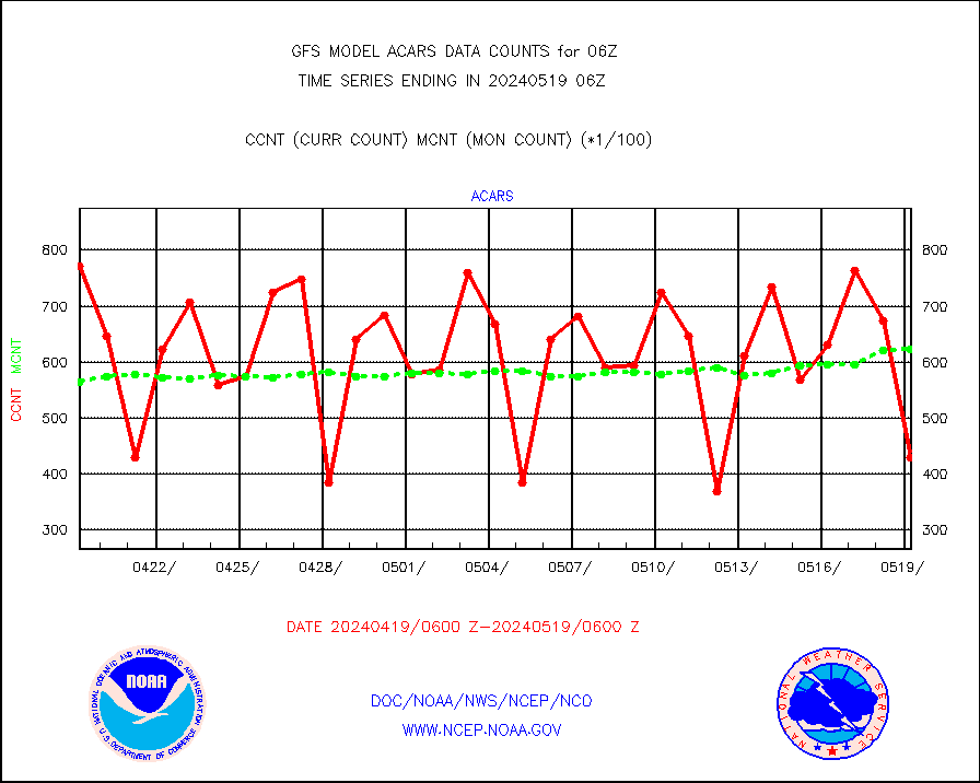
MDCRS ACARS acft data from ARINC(dcded from BUFR) |
44237 |
102928 |
43.0 % |
|||||||||||
| Suspect Data Shortages in Critical Types - Monitor | ||||||||||||||
|---|---|---|---|---|---|---|---|---|---|---|---|---|---|---|
| Type | Description | Hourly Count | Monthly Average | Percent (%) of Monthly Mean | ||||||||||
NOAA 18-19 & METOP 1-2 HIRS-4 NCEP-proc. br.temps |
0 |
45611 |
0.0 % |
|||||||||||
NOAA 15-19 & METOP 1-2 HIRS-3/4 pr btmps frm RARS |
0 |
82296 |
0.0 % |
|||||||||||
| Suspect Excess in Critical Types - Monitor | ||||||||||||||
|---|---|---|---|---|---|---|---|---|---|---|---|---|---|---|
| Type | Description | Hourly Count | Monthly Average | Percent (%) of Monthly Mean | ||||||||||
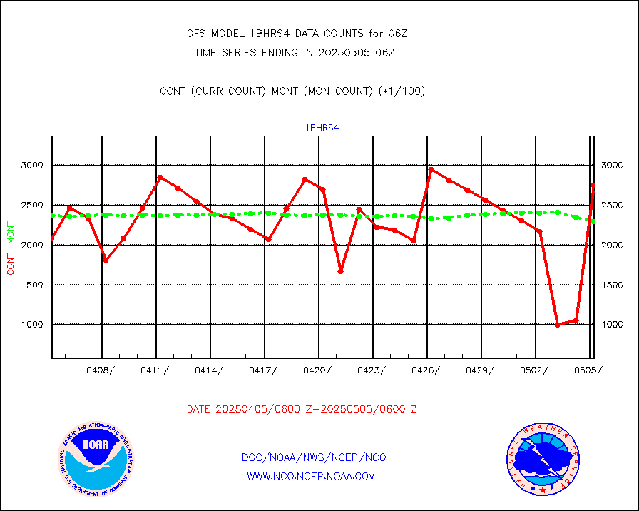
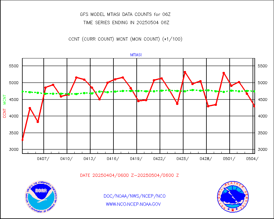
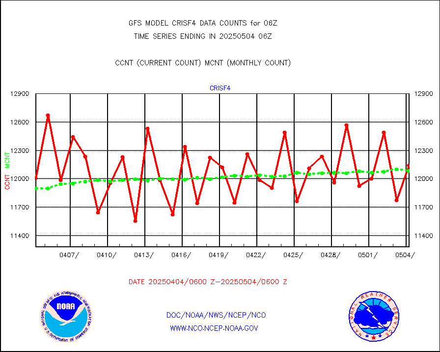
METOP 1-2 IASI 1C radiance data vbl chn from RARS |
105853 |
14668 |
721.7 % |
|||||||||||
NPP/NOAA-20 VIIRS SST - CLEAR & OVER WATER |
9999999 |
4000018 |
250.0 % |
|||||||||||
| Shortage in Data Type of Opportunity - Monitor | ||||||||||||||
|---|---|---|---|---|---|---|---|---|---|---|---|---|---|---|
| Type | Description | Hourly Count | Monthly Average | Percent (%) of Monthly Mean | ||||||||||
P.M.(N18-19) AVHRR GAC NCEP-proc clr & sea btemps |
0 |
1093882 |
0.0 % |
|||||||||||
INDIA SATWIND, INSAT WV channel |
0 |
19677 |
0.0 % |
|||||||||||
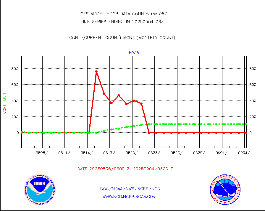
High Density OBs from reconnaissance acft data |
0 |
23 |
0.0 % |
|||||||||||
INDIA SATWIND, INSAT IR channel |
0 |
23242 |
0.0 % |
|||||||||||
DMSP SSM/IS 1C radiance data (Unified Pre-Proc.) |
10500 |
636758 |
1.6 % |
|||||||||||
ThermoSalinoGraph (TSG) TRACKOB format) |
0 |
534 |
0.0 % |
|||||||||||
INDIA SATWIND, INSAT VIS channel |
0 |
1046 |
0.0 % |
|||||||||||
| Critical Data with Normal Counts | ||||||||||||||
|---|---|---|---|---|---|---|---|---|---|---|---|---|---|---|
| Type | Description | Hourly Count | Monthly Average | Percent (%) of Monthly Mean | ||||||||||
NOAA 15-19 & METOP 1-2 AMSU-A NCEP-proc. br.temps |
115967 |
160165 |
72.4 % |
|||||||||||
NOAA 18-19 & METOP 1-2 MHS NCEP-proces. br. temps |
1035330 |
1275847 |
81.1 % |
|||||||||||
Himawari Clear Sky Radiance |
232577 |
244297 |
95.2 % |
|||||||||||
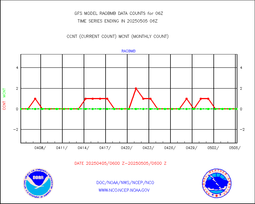
Manual AIREP aircraft data (dcded from AIREP fmt) |
5163 |
5192 |
99.4 % |
|||||||||||
AQUA AIRS/AMSU-A/HSB brightness temps- every FOV |
0 |
0 |
n/a |
|||||||||||
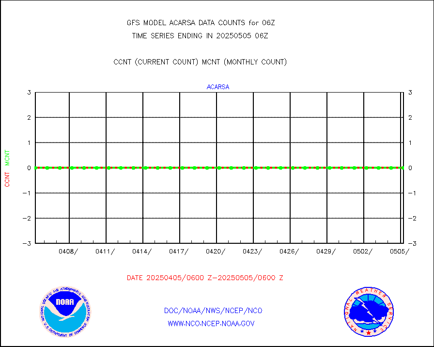
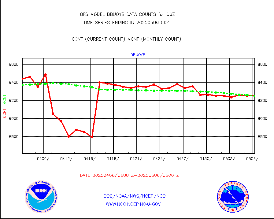
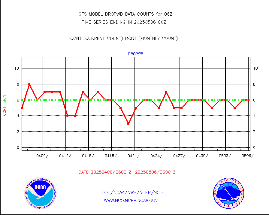
AMDAR aircraft data (decoded from AMDAR format) |
4406 |
4206 |
104.8 % |
|||||||||||
AMDAR aircraft data (decoded from BUFR) |
19229 |
20358 |
94.5 % |
|||||||||||
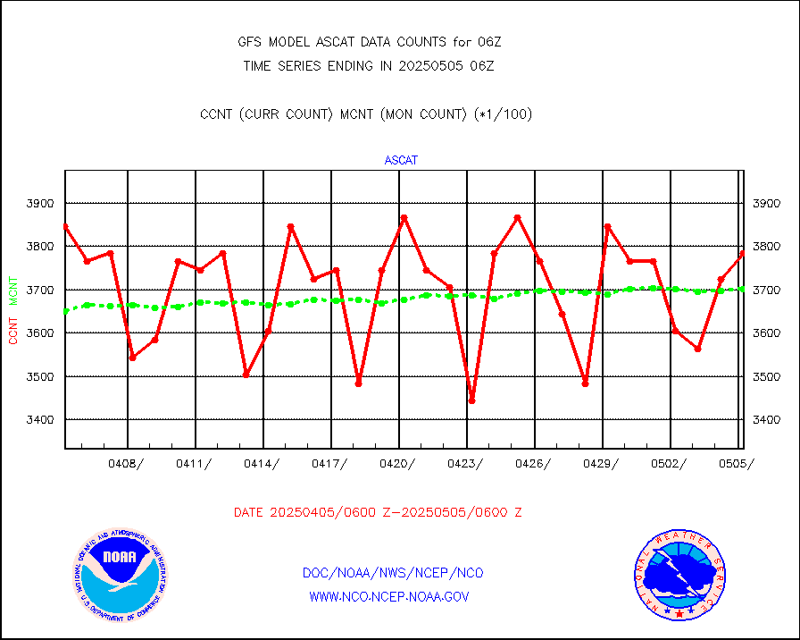
METOP 1-2 ASCAT products |
356412 |
363871 |
98.0 % |
|||||||||||
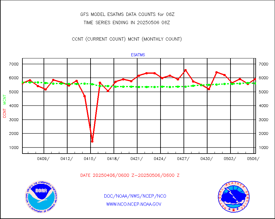
NPP/NOAA-20 ATMS brightness temperatures |
2020692 |
1941265 |
104.1 % |
|||||||||||
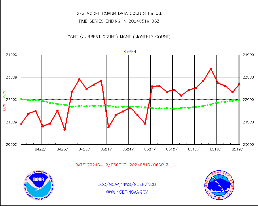
Surface Marine CMAN rpts decoded from BUFR format |
22714 |
22959 |
98.9 % |
|||||||||||
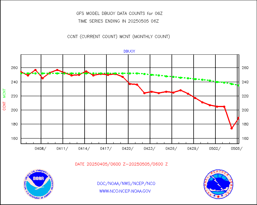
Buoys decoded from FM-18 fmt (moored or drifting) |
93 |
128 |
72.7 % |
|||||||||||
Dropwinsonde (from TEMP DROP) |
0 |
1 |
0.0 % |
|||||||||||
E-AMDAR (European AMDAR acft decoded from BUFR) |
15567 |
14861 |
104.8 % |
|||||||||||
NOAA 15-19 & METOP 1-2 AMSU-A proc btmps frm RARS |
67646 |
86743 |
78.0 % |
|||||||||||
GPS radio occultation data |
2431 |
2607 |
93.2 % |
|||||||||||
GOES-16/17 All Sky Radiances (proc.) |
5947854 |
5944258 |
100.1 % |
|||||||||||
GOES-16/17 Clear Sky Radiances (proc.) |
2940760 |
2913391 |
100.9 % |
|||||||||||
MTSAT/JMA water vapor imager derived cloud motion |
66270 |
60095 |
110.3 % |
|||||||||||
MODIS (AQUA/TERRA) wvpr imager derived cld motion |
0 |
0 |
n/a |
|||||||||||
GOES-16&up/NESDIS wv imgr/cld-top derived cld mtn |
142660 |
158744 |
89.9 % |
|||||||||||
METEOSAT/EUMETSAT ir lg-wave drv cld motion NBseq |
105401 |
105016 |
100.4 % |
|||||||||||
MTSAT/JMA infrared long-wave derived cloud motion |
50400 |
49205 |
102.4 % |
|||||||||||
MODIS (AQUA/TERRA) ir l-wave derived cloud motion |
0 |
0 |
n/a |
|||||||||||
GOES-16&up/NESDIS ir long-wave derived cld motion |
507148 |
498734 |
101.7 % |
|||||||||||
Land-based CMAN stations decoded from CMAN format |
484 |
477 |
101.5 % |
|||||||||||
LEO-GEO satellite AMVs from UWisc. |
20948 |
21840 |
95.9 % |
|||||||||||
Buoys decoded from FM-13 format (moored) |
839 |
822 |
102.1 % |
|||||||||||
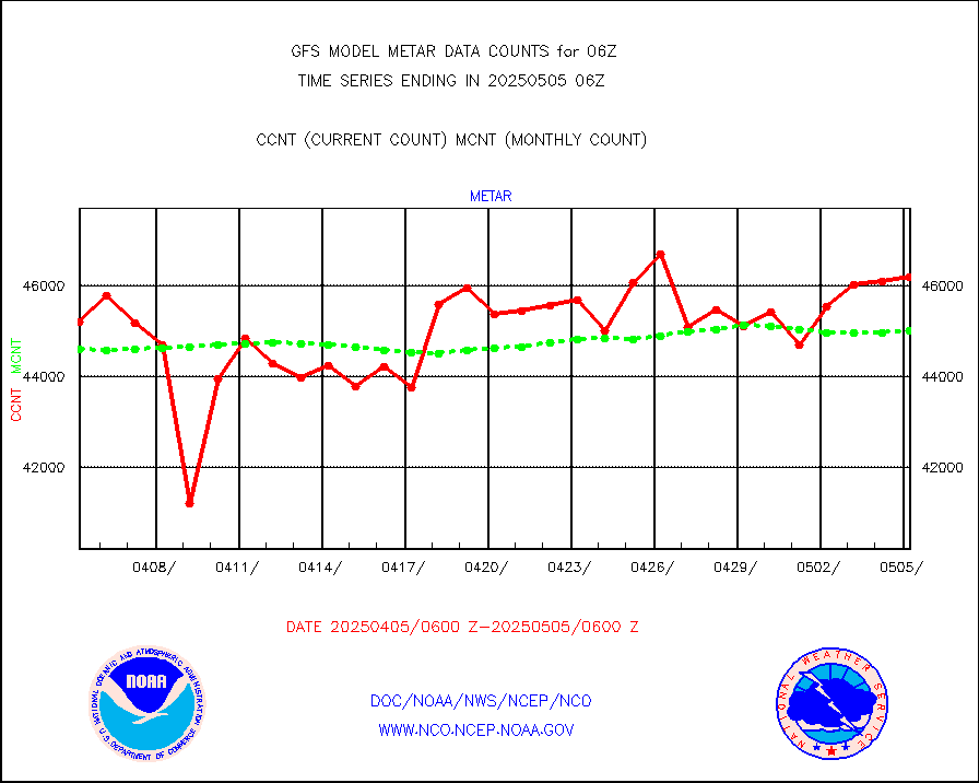
Aviation - METAR |
44169 |
44944 |
98.3 % |
|||||||||||
METOP 1-2 IASI 1C radiance data (varbl. channels) |
461592 |
470928 |
98.0 % |
|||||||||||
NEXRAD Vel Azm Dsp(VAD) winds via radar coded msg |
0 |
0 |
n/a |
|||||||||||
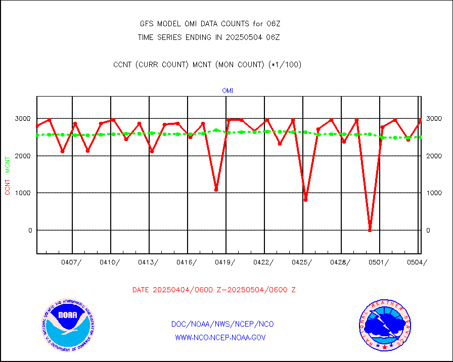
Aura Ozone Monitoring Instrument (OMI) data |
0 |
0 |
n/a |
|||||||||||
NOAA 16-19 Solar Backscatter UV-2 rad frm V8 BUFR |
0 |
0 |
n/a |
|||||||||||
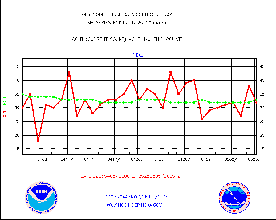
PIBAL (from PILOT, PILOT SHIP, PILOT MOBIL) |
32 |
24 |
133.3 % |
|||||||||||
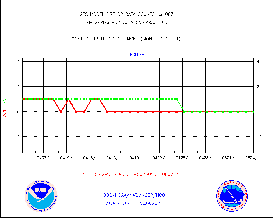
Profilr winds from PIBAL (PILOT,PILOT SHIP/MOBIL) |
0 |
0 |
n/a |
|||||||||||
Rawinsonde - fixed land (from TEMP or PILOT) |
29 |
41 |
70.7 % |
|||||||||||
Rawinsonde - mobile land (from TEMP/PILOT MOBIL) |
0 |
0 |
n/a |
|||||||||||
Rawinsonde - ship (from TEMP SHIP, PILOT SHIP) |
3 |
1 |
300.0 % |
|||||||||||
Flight level reconnaissance aircraft data |
0 |
0 |
n/a |
|||||||||||
Ship - manual and automatic, restricted |
249 |
251 |
99.2 % |
|||||||||||
Ship - manual and automatic, restricted (BUFR) |
831 |
770 |
107.9 % |
|||||||||||
Ship - manual and automatic, unrestricted |
951 |
951 |
100.0 % |
|||||||||||
Ship - manual and automatic, unrestricted (BUFR) |
6380 |
6369 |
100.2 % |
|||||||||||
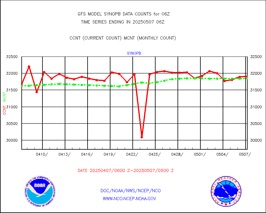
Synoptic - fixed manual & auto (decoded fr BUFR) |
40333 |
39746 |
101.5 % |
|||||||||||
Synoptic - mobile manual and automatic |
4545 |
4747 |
95.7 % |
|||||||||||
Synoptic - restricted (WMO Res 40) manual & auto. |
4 |
6 |
66.7 % |
|||||||||||
Synoptic - restricted (WMO Res 40)(decoded BUFR) |
2262 |
2347 |
96.4 % |
|||||||||||
Synoptic - mobile manual & auto (decoded fr BUFR) |
205 |
206 |
99.5 % |
|||||||||||
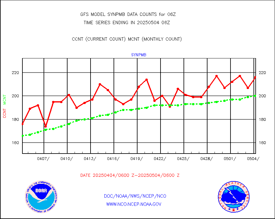
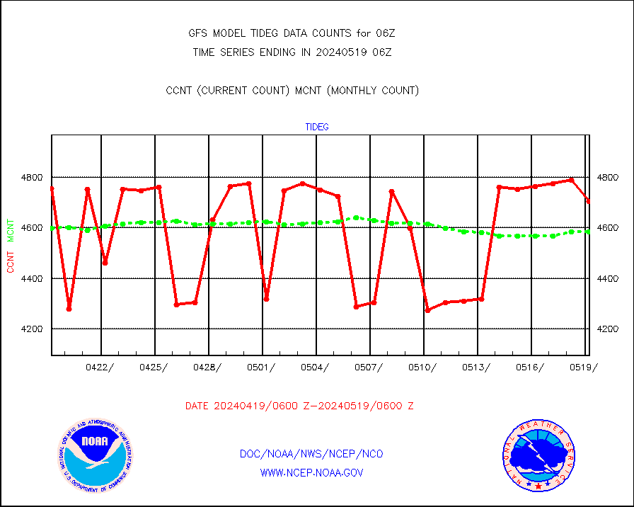
Tide gauge reports decoded from CREX format |
4895 |
4816 |
101.6 % |
|||||||||||
MTSAT/JMA visible derived cloud motion |
29047 |
27067 |
107.3 % |
|||||||||||
METEOSAT/EUMETSAT visible drv cld motion NBseq |
129506 |
138022 |
93.8 % |
|||||||||||
| Data Types of Opportunity with Normal Counts | ||||||||||||||
|---|---|---|---|---|---|---|---|---|---|---|---|---|---|---|
| Type | Description | Hourly Count | Monthly Average | Percent (%) of Monthly Mean | ||||||||||
GOES-16&up/NESDIS ir short-wv derived cld motion |
274259 |
261554 |
104.9 % |
|||||||||||
MDCRS ACARS acft data (ARINC via AFWA)(AIREP fmt) |
0 |
0 |
n/a |
|||||||||||
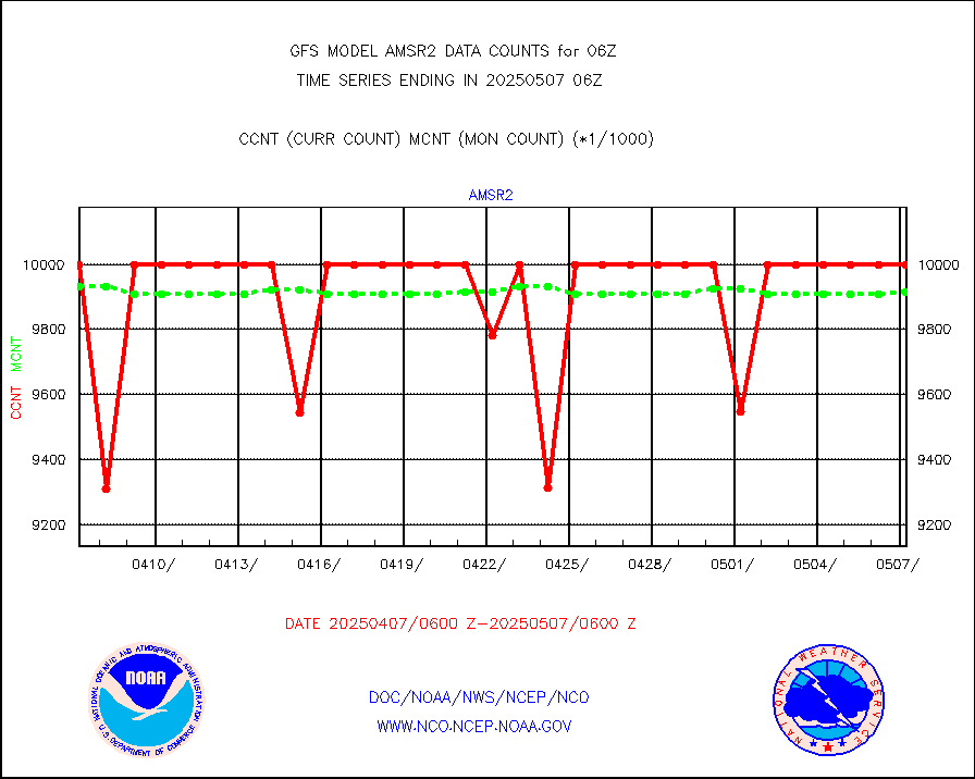
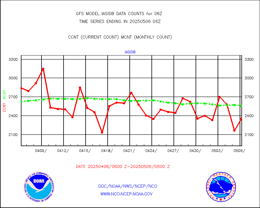
GCOM-W AMSR2 1B brightness temperatures |
9999999 |
9911826 |
100.9 % |
|||||||||||
NPP/NOAA-20 ATMS bright. temps-direct b-cast SSEC |
569800 |
565981 |
100.7 % |
|||||||||||
A.M.(N17,M2,M3) AVHRR GAC NCEP-proc clr&sea btmps |
5402868 |
5566093 |
97.1 % |
|||||||||||
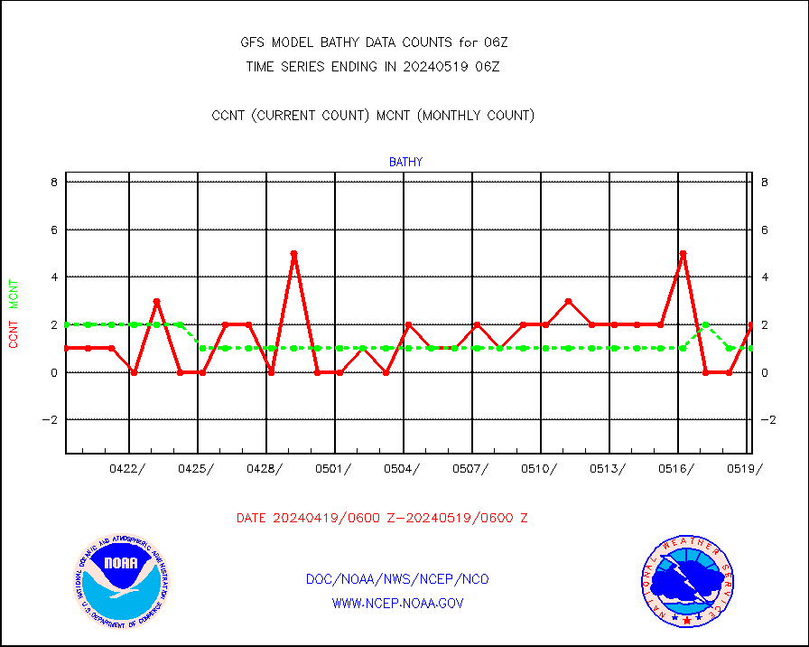
eXpendable BathyThermograph, mooring (BATHY fmt) |
0 |
0 |
n/a |
|||||||||||
Canadian AMDAR aircraft data (decoded from BUFR) |
0 |
0 |
n/a |
|||||||||||
NPP/NOAA-20 CrIS full spctrl radn (431 ch subset) |
1240146 |
1200960 |
103.3 % |
|||||||||||
NPP/NOAA-20 CrIS full spctrl radn dir brdcst SSEC |
328073 |
312617 |
104.9 % |
|||||||||||
Coast Guard |
27 |
27 |
100.0 % |
|||||||||||
Drifting buoys (decoded from BUFR) |
8988 |
8935 |
100.6 % |
|||||||||||
Dropwinsonde (decoded from BUFR) |
10 |
8 |
125.0 % |
|||||||||||
NPP Adv. Tech. MW Sndr (ATMS) br. temps from RARS |
263712 |
280309 |
94.1 % |
|||||||||||
NOAA 18-19 & METOP 1-2 MHS proc. btemps from RARS |
671162 |
886381 |
75.7 % |
|||||||||||
GOES/NESDIS (11x17 f-o-v) imager clear radiances |
0 |
0 |
n/a |
|||||||||||
GPM GMI Level 1C-R brightness temperatures |
2322710 |
2288514 |
101.5 % |
|||||||||||
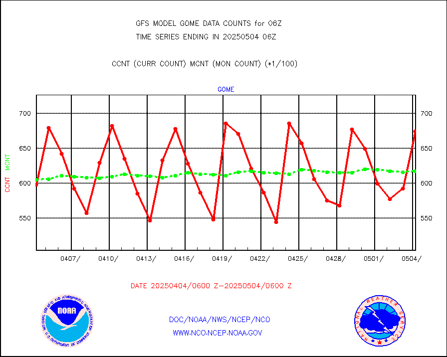
Grnd-based Gbl Navigation Sat System (GNSS) data |
6500 |
4820 |
134.9 % |
|||||||||||
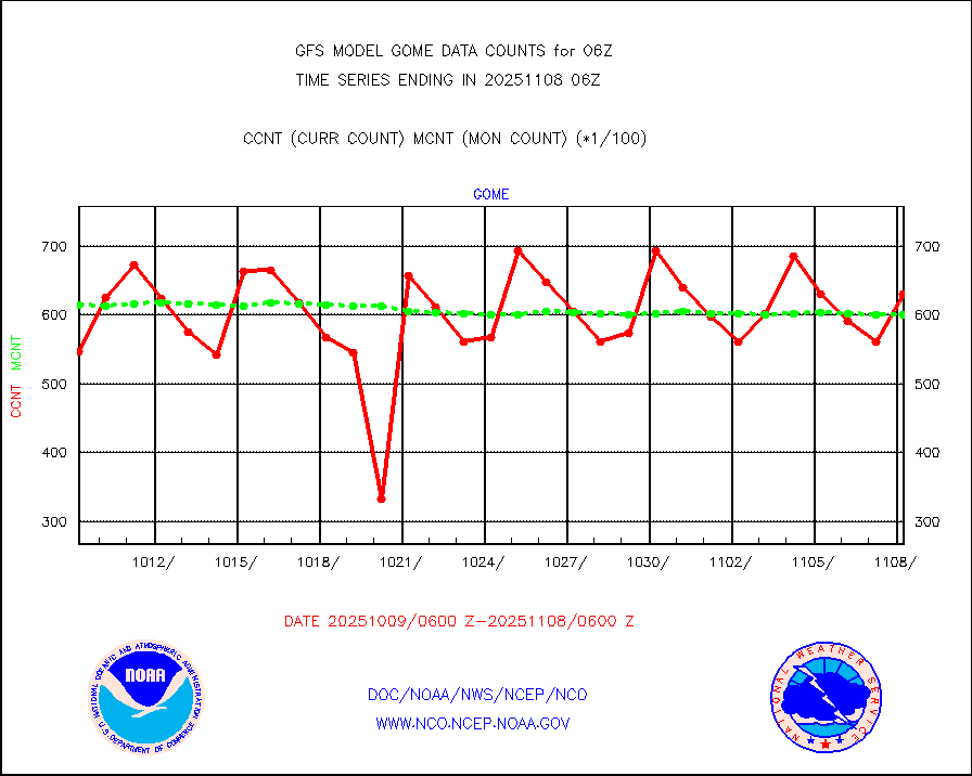
METOP 1-2 Global Ozone Monitoring Exp.-2 (GOME-2) |
61183 |
60742 |
100.7 % |
|||||||||||
INSAT/KALPANA India wvpr derived cloud motion |
0 |
0 |
n/a |
|||||||||||
GOES-16&up/NESDIS wv imgr/deep-lyr derivd cld mtn |
108946 |
102096 |
106.7 % |
|||||||||||
METEOSAT/EUMETSAT wvpr imgr drv cld motion NBseq |
171255 |
180145 |
95.1 % |
|||||||||||
METOP 1-2 IASI 1C radiances-direct broadcast SSEC |
281857 |
265579 |
106.1 % |
|||||||||||
VIIRS (NPP/NOAA-20) ir lg-wv drv cloud motion(NB) |
51615 |
56020 |
92.1 % |
|||||||||||
AVHRR (NOAA/METOP) ir lg-wave derived cld motion |
0 |
0 |
n/a |
|||||||||||
AVHRR (METOP) ir lg-wave derived cld motion |
25563 |
25776 |
99.2 % |
|||||||||||
INSAT/KALPANA India ir lg-wave derived cld motion |
0 |
0 |
n/a |
|||||||||||
Korean AMDAR aircraft data (decoded from BUFR) |
448 |
394 |
113.7 % |
|||||||||||
Moored buoys (decoded from BUFR) |
7177 |
7170 |
100.1 % |
|||||||||||
NEXRAD Vel Azm Dsp(VAD) winds via Level 2 decoder |
5388 |
5476 |
98.4 % |
|||||||||||
OMPS Limb Profiler ozone data (NPP) |
846 |
811 |
104.3 % |
|||||||||||
OMPS nadir profile ozone (Version 8 BUFR) |
2945 |
2884 |
102.1 % |
|||||||||||
OMPS total column ozone (Version 8 BUFR) |
1804816 |
1774464 |
101.7 % |
|||||||||||
PIBAL (decoded from BUFR) |
4 |
4 |
100.0 % |
|||||||||||
Manual PIREP aircraft data (dcded from AIREP fmt) |
70 |
104 |
67.3 % |
|||||||||||
Multi-Agency Profiler (MAP) and SODAR winds |
315 |
363 |
86.8 % |
|||||||||||
Rawinsonde - fixed land (decoded from BUFR) |
19 |
22 |
86.4 % |
|||||||||||
Rawinsonde - mobile land (decoded from BUFR) |
0 |
0 |
n/a |
|||||||||||
Rawinsonde - ship (decoded from BUFR) |
3 |
1 |
300.0 % |
|||||||||||
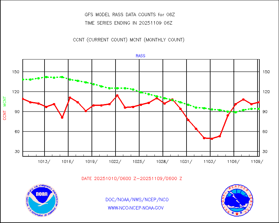
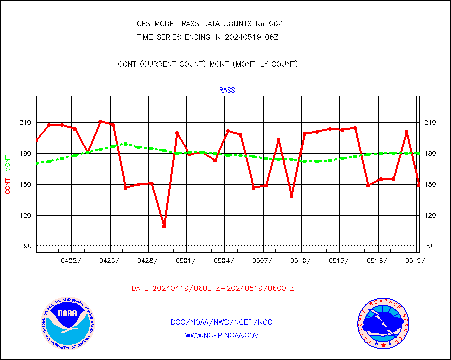
RASS temperatures (NOAA and Multi-Agency) |
142 |
177 |
80.2 % |
|||||||||||
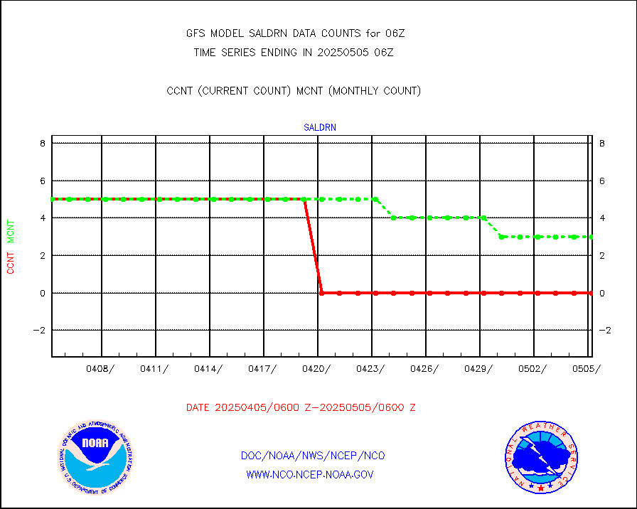
Surface Marine Saildrone (decoded from BUFR) |
5 |
5 |
100.0 % |
|||||||||||
METEOSAT-10 2nd Gen SEVIRI All Sky Radiance(proc) |
367921 |
377283 |
97.5 % |
|||||||||||
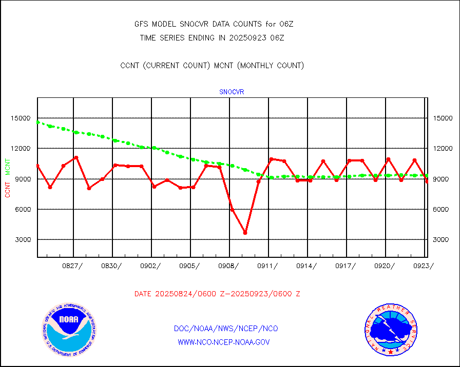
NOW COVER, DEPTH/DENSITY AND WATER EQUIVALENT |
18152 |
19829 |
91.5 % |
|||||||||||
NPP/NOAA-20 VIIRS SST - PROBABLY CLR & OVER WATER |
9999999 |
9999999 |
100.0 % |
|||||||||||
Sub-surface float and glider profile (BUFR) |
48 |
65 |
73.8 % |
|||||||||||
Synoptic - fixed manual and automatic |
7007 |
6855 |
102.2 % |
|||||||||||
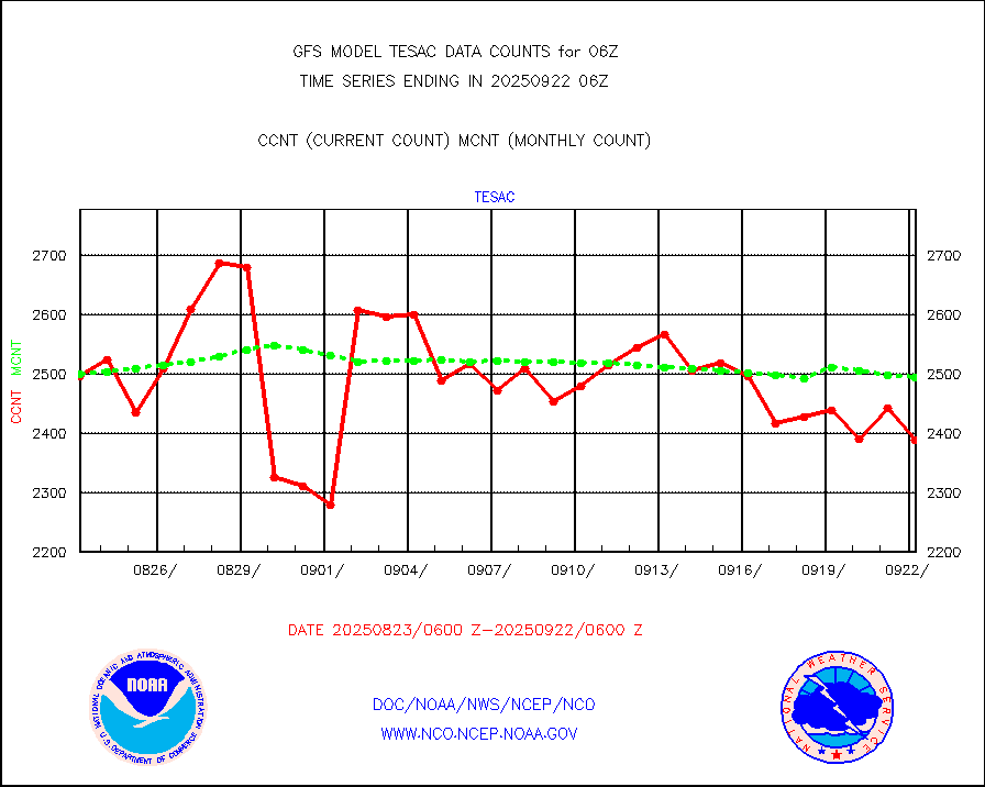
CTD probe, Argo prflng float, mooring (TESAC fmt) |
2522 |
2458 |
102.6 % |
|||||||||||
TAMDAR aircft data-all types(from Panasonic,BUFR) |
187 |
287 |
65.2 % |
|||||||||||
INSAT/KALPANA India visible derived cloud motion |
0 |
0 |
n/a |
|||||||||||
GOES-16&up/NESDIS visible derived cloud motion |
213363 |
189728 |
112.5 % |
|||||||||||


