| Suspect Data Shortages in Critical Types - Monitor | ||||||||||||||
|---|---|---|---|---|---|---|---|---|---|---|---|---|---|---|
| Type | Description | Hourly Count | Monthly Average | Percent (%) of Monthly Mean | ||||||||||
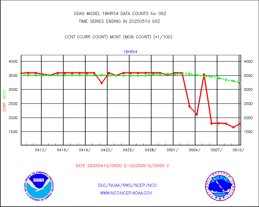
NOAA 18-19 & METOP 1-2 HIRS-4 NCEP-proc. br.temps |
0 |
98732 |
0.0 % |
|||||||||||
NOAA 15-19 & METOP 1-2 HIRS-3/4 pr btmps frm RARS |
0 |
159957 |
0.0 % |
|||||||||||
| Shortage in Data Type of Opportunity - Monitor | ||||||||||||||
|---|---|---|---|---|---|---|---|---|---|---|---|---|---|---|
| Type | Description | Hourly Count | Monthly Average | Percent (%) of Monthly Mean | ||||||||||
P.M.(N18-19) AVHRR GAC NCEP-proc clr & sea btemps |
0 |
2523645 |
0.0 % |
|||||||||||
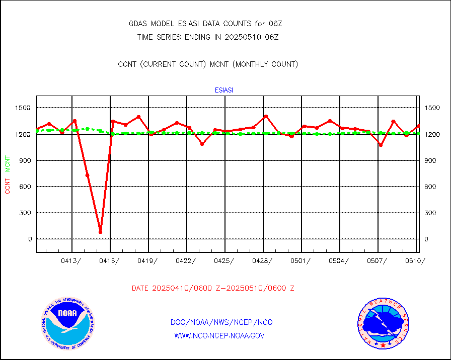
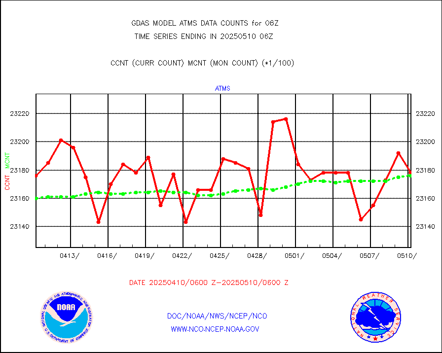
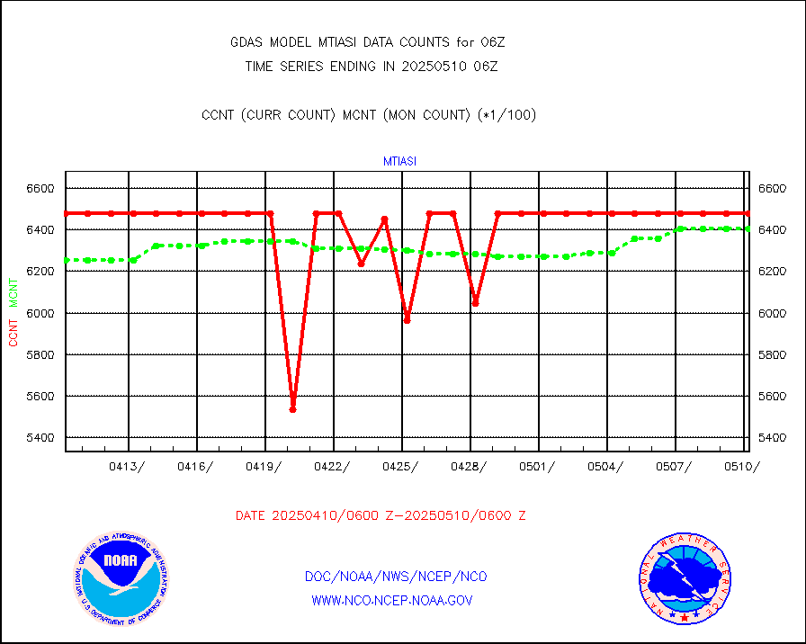
METOP 1-2 IASI 1C radiance data vbl chn from RARS |
6120 |
16810 |
36.4 % |
|||||||||||
Grnd-based Gbl Navigation Sat System (GNSS) data |
1302 |
5372 |
24.2 % |
|||||||||||
INDIA SATWIND, INSAT WV channel |
0 |
30045 |
0.0 % |
|||||||||||
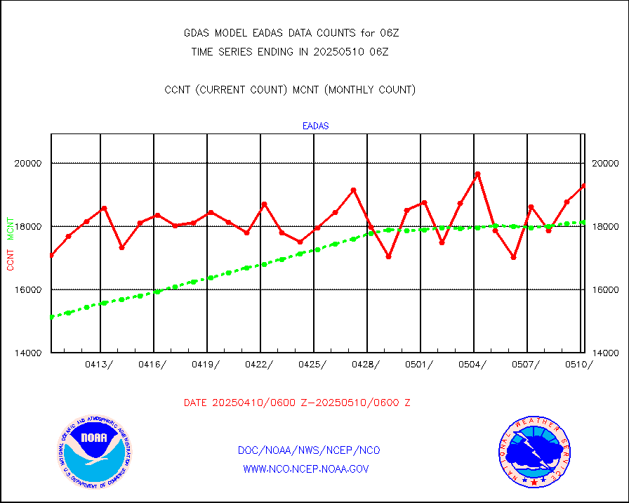
High Density OBs from reconnaissance acft data |
0 |
24 |
0.0 % |
|||||||||||
INDIA SATWIND, INSAT IR channel |
0 |
35970 |
0.0 % |
|||||||||||
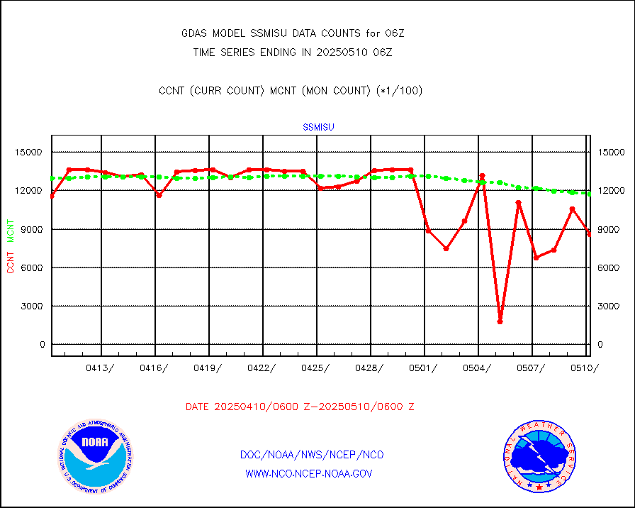
DMSP SSM/IS 1C radiance data (Unified Pre-Proc.) |
437940 |
895527 |
48.9 % |
|||||||||||
INDIA SATWIND, INSAT VIS channel |
0 |
2591 |
0.0 % |
|||||||||||
| Excess in Data Type of Opportunity - Monitor | ||||||||||||||
|---|---|---|---|---|---|---|---|---|---|---|---|---|---|---|
| Type | Description | Hourly Count | Monthly Average | Percent (%) of Monthly Mean | ||||||||||
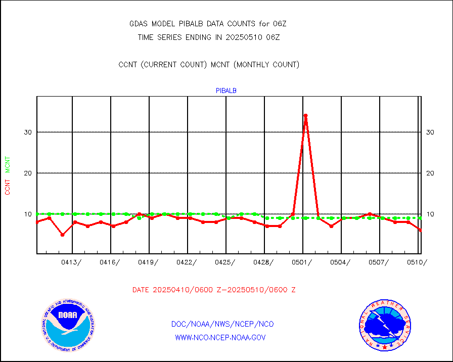
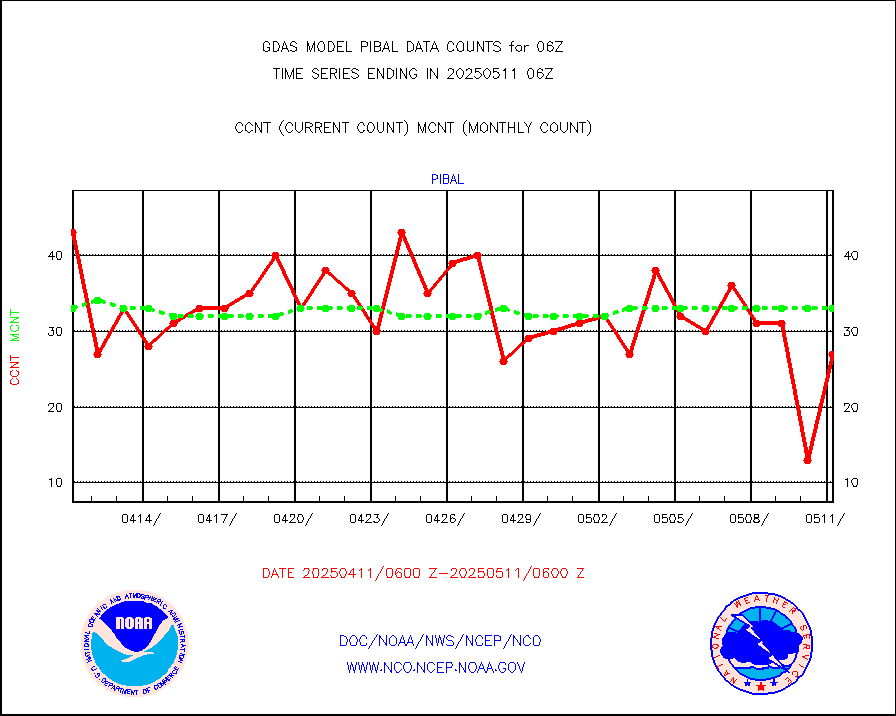
PIBAL (decoded from BUFR) |
30 |
4 |
750.0 % |
|||||||||||
| Critical Data with Normal Counts | ||||||||||||||
|---|---|---|---|---|---|---|---|---|---|---|---|---|---|---|
| Type | Description | Hourly Count | Monthly Average | Percent (%) of Monthly Mean | ||||||||||
NOAA 15-19 & METOP 1-2 AMSU-A NCEP-proc. br.temps |
162044 |
241347 |
67.1 % |
|||||||||||
NOAA 18-19 & METOP 1-2 MHS NCEP-proces. br. temps |
1442718 |
1802037 |
80.1 % |
|||||||||||
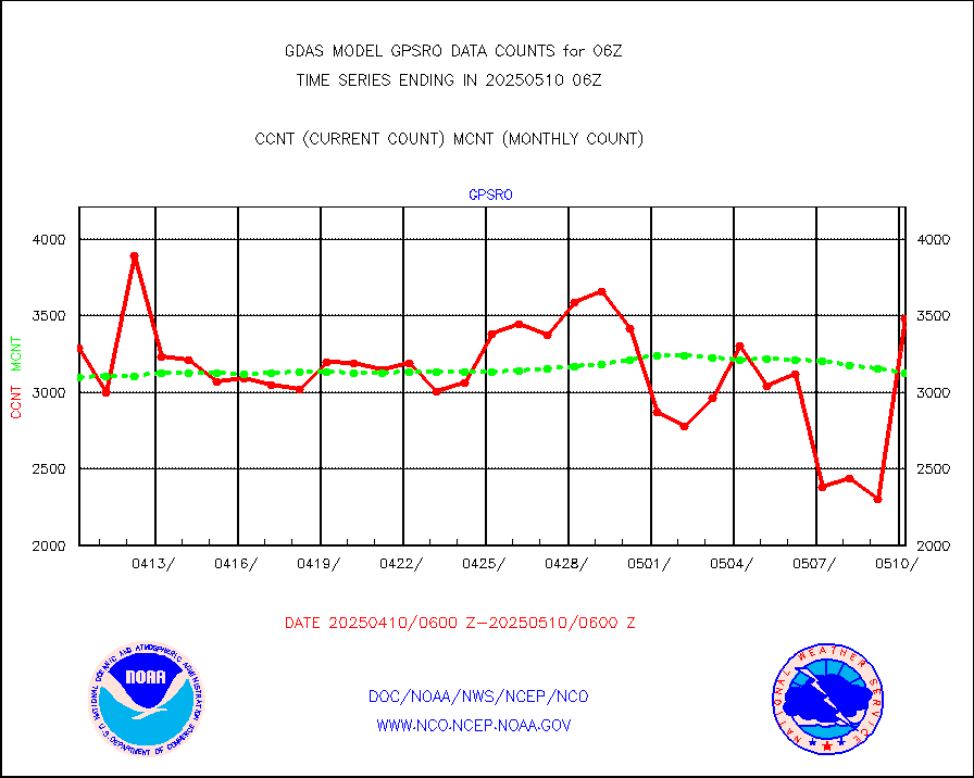
MDCRS ACARS acft data from ARINC(dcded from BUFR) |
119963 |
103006 |
116.5 % |
|||||||||||
Himawari Clear Sky Radiance |
283115 |
291361 |
97.2 % |
|||||||||||
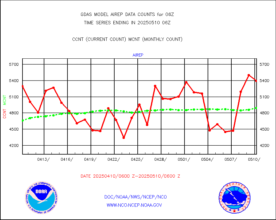
Manual AIREP aircraft data (dcded from AIREP fmt) |
5264 |
5664 |
92.9 % |
|||||||||||
AQUA AIRS/AMSU-A/HSB brightness temps- every FOV |
0 |
0 |
n/a |
|||||||||||
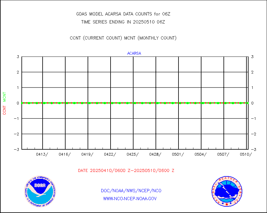
AMDAR aircraft data (decoded from AMDAR format) |
5112 |
5269 |
97.0 % |
|||||||||||
AMDAR aircraft data (decoded from BUFR) |
21072 |
22381 |
94.2 % |
|||||||||||
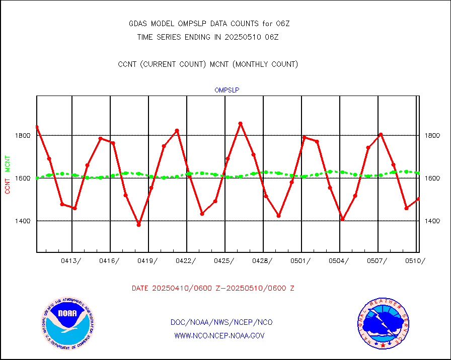
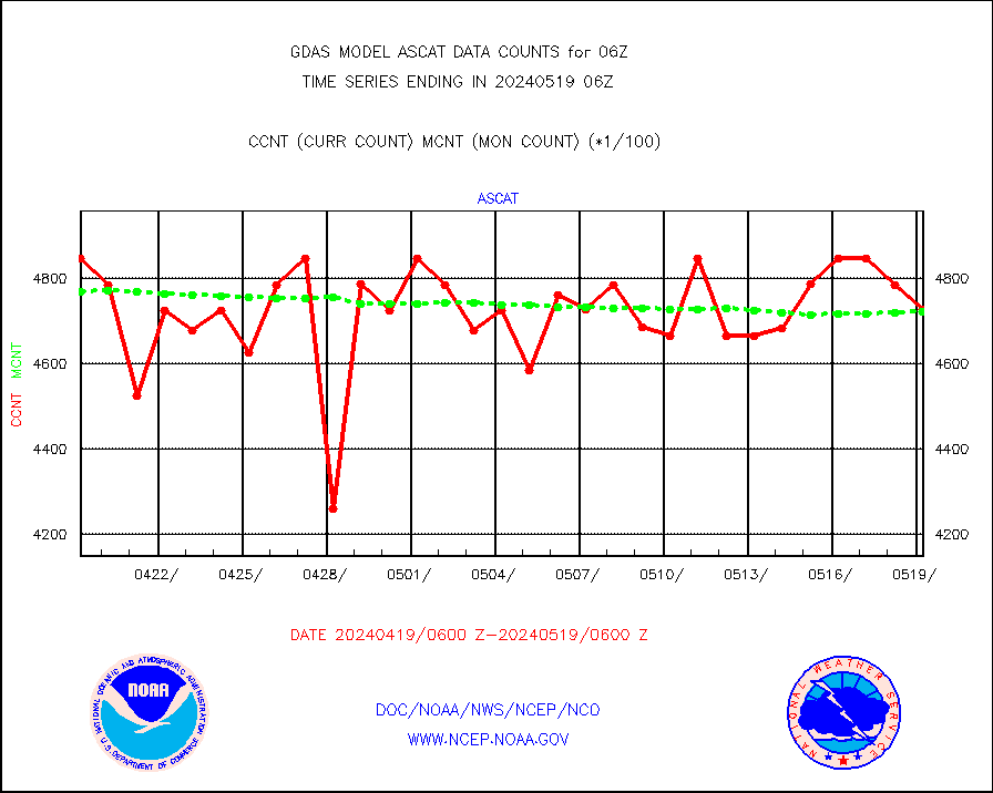
METOP 1-2 ASCAT products |
484596 |
480724 |
100.8 % |
|||||||||||
NPP/NOAA-20 ATMS brightness temperatures |
2317587 |
2317049 |
100.0 % |
|||||||||||
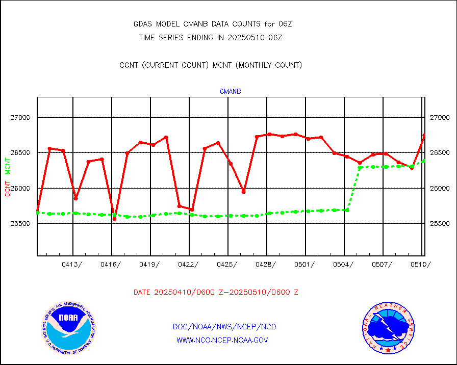
Surface Marine CMAN rpts decoded from BUFR format |
26852 |
26826 |
100.1 % |
|||||||||||
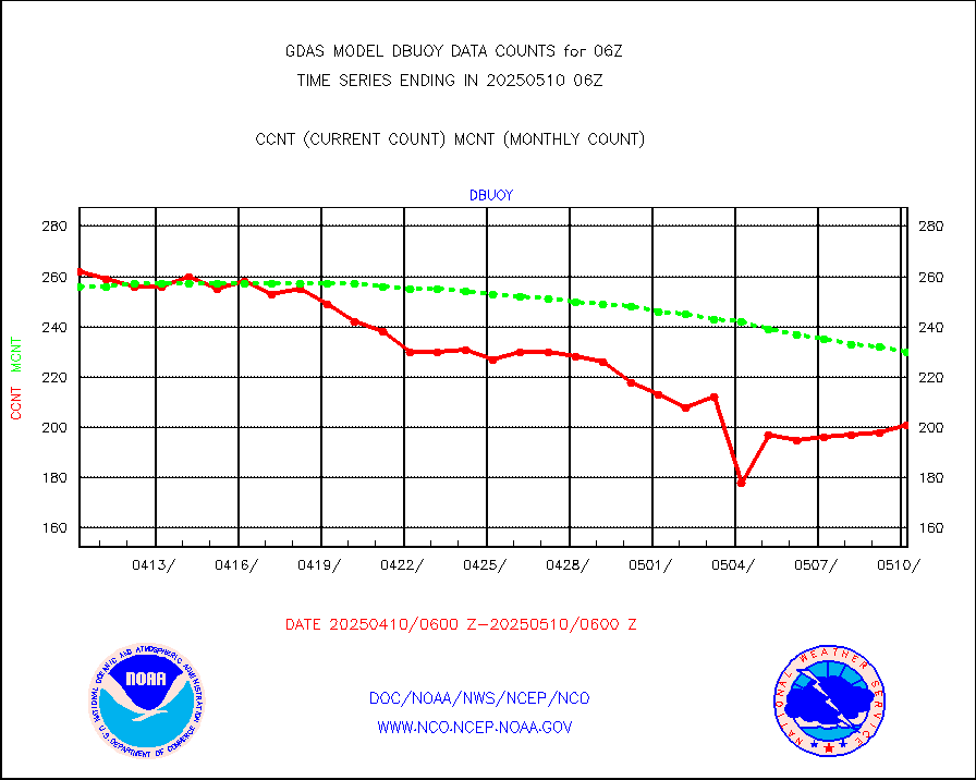
Buoys decoded from FM-18 fmt (moored or drifting) |
135 |
143 |
94.4 % |
|||||||||||
Dropwinsonde (from TEMP DROP) |
0 |
1 |
0.0 % |
|||||||||||
E-AMDAR (European AMDAR acft decoded from BUFR) |
17286 |
17794 |
97.1 % |
|||||||||||
NOAA 15-19 & METOP 1-2 AMSU-A proc btmps frm RARS |
71814 |
100575 |
71.4 % |
|||||||||||
GPS radio occultation data |
3449 |
3368 |
102.4 % |
|||||||||||
GOES-16/17 All Sky Radiances (proc.) |
6488568 |
6485221 |
100.1 % |
|||||||||||
GOES-16/17 Clear Sky Radiances (proc.) |
3119596 |
3164193 |
98.6 % |
|||||||||||
MTSAT/JMA water vapor imager derived cloud motion |
65278 |
59697 |
109.3 % |
|||||||||||
MODIS (AQUA/TERRA) wvpr imager derived cld motion |
0 |
0 |
n/a |
|||||||||||
GOES-16&up/NESDIS wv imgr/cld-top derived cld mtn |
150080 |
160162 |
93.7 % |
|||||||||||
METEOSAT/EUMETSAT ir lg-wave drv cld motion NBseq |
126374 |
125608 |
100.6 % |
|||||||||||
MTSAT/JMA infrared long-wave derived cloud motion |
50400 |
49205 |
102.4 % |
|||||||||||
MODIS (AQUA/TERRA) ir l-wave derived cloud motion |
0 |
0 |
n/a |
|||||||||||
GOES-16&up/NESDIS ir long-wave derived cld motion |
496115 |
498862 |
99.4 % |
|||||||||||
Land-based CMAN stations decoded from CMAN format |
516 |
525 |
98.3 % |
|||||||||||
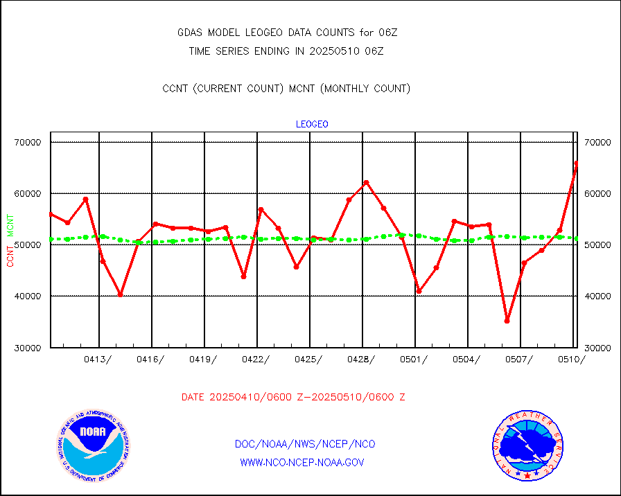
LEO-GEO satellite AMVs from UWisc. |
56276 |
57162 |
98.5 % |
|||||||||||
Buoys decoded from FM-13 format (moored) |
809 |
780 |
103.7 % |
|||||||||||
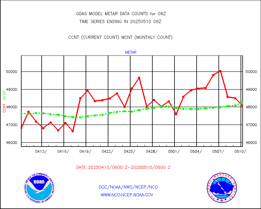
Aviation - METAR |
47962 |
47924 |
100.1 % |
|||||||||||
METOP 1-2 IASI 1C radiance data (varbl. channels) |
648004 |
622345 |
104.1 % |
|||||||||||
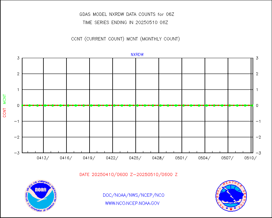
NEXRAD Vel Azm Dsp(VAD) winds via radar coded msg |
0 |
0 |
n/a |
|||||||||||
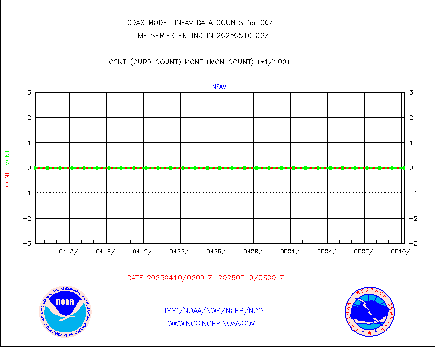
Aura Ozone Monitoring Instrument (OMI) data |
0 |
0 |
n/a |
|||||||||||
NOAA 16-19 Solar Backscatter UV-2 rad frm V8 BUFR |
0 |
0 |
n/a |
|||||||||||
PIBAL (from PILOT, PILOT SHIP, PILOT MOBIL) |
28 |
24 |
116.7 % |
|||||||||||
Profilr winds from PIBAL (PILOT,PILOT SHIP/MOBIL) |
0 |
0 |
n/a |
|||||||||||
Rawinsonde - fixed land (from TEMP or PILOT) |
41 |
42 |
97.6 % |
|||||||||||
Rawinsonde - mobile land (from TEMP/PILOT MOBIL) |
0 |
0 |
n/a |
|||||||||||
Rawinsonde - ship (from TEMP SHIP, PILOT SHIP) |
0 |
0 |
n/a |
|||||||||||
Flight level reconnaissance aircraft data |
0 |
0 |
n/a |
|||||||||||
Ship - manual and automatic, restricted |
341 |
326 |
104.6 % |
|||||||||||
Ship - manual and automatic, restricted (BUFR) |
1300 |
1250 |
104.0 % |
|||||||||||
Ship - manual and automatic, unrestricted |
766 |
761 |
100.7 % |
|||||||||||
Ship - manual and automatic, unrestricted (BUFR) |
6261 |
6212 |
100.8 % |
|||||||||||
Synoptic - fixed manual & auto (decoded fr BUFR) |
39590 |
41187 |
96.1 % |
|||||||||||
Synoptic - mobile manual and automatic |
5162 |
4799 |
107.6 % |
|||||||||||
Synoptic - restricted (WMO Res 40) manual & auto. |
4 |
6 |
66.7 % |
|||||||||||
Synoptic - restricted (WMO Res 40)(decoded BUFR) |
2324 |
2374 |
97.9 % |
|||||||||||
Synoptic - mobile manual & auto (decoded fr BUFR) |
228 |
220 |
103.6 % |
|||||||||||
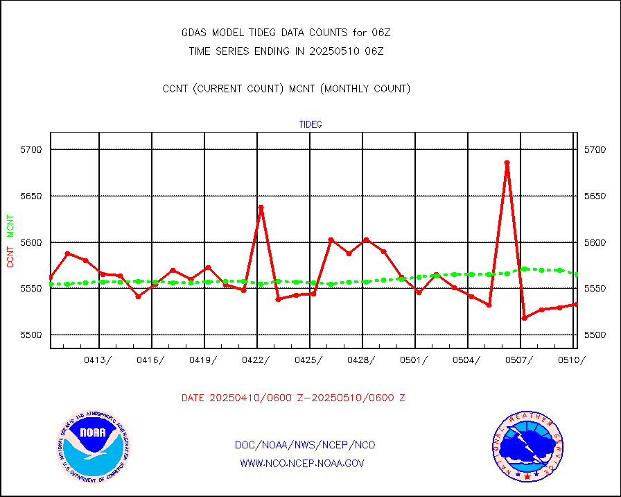
Tide gauge reports decoded from CREX format |
5601 |
5606 |
99.9 % |
|||||||||||
MTSAT/JMA visible derived cloud motion |
28709 |
26939 |
106.6 % |
|||||||||||
METEOSAT/EUMETSAT visible drv cld motion NBseq |
189677 |
180741 |
104.9 % |
|||||||||||
| Data Types of Opportunity with Normal Counts | ||||||||||||||
|---|---|---|---|---|---|---|---|---|---|---|---|---|---|---|
| Type | Description | Hourly Count | Monthly Average | Percent (%) of Monthly Mean | ||||||||||
GOES-16&up/NESDIS ir short-wv derived cld motion |
253995 |
261320 |
97.2 % |
|||||||||||
MDCRS ACARS acft data (ARINC via AFWA)(AIREP fmt) |
0 |
0 |
n/a |
|||||||||||
GCOM-W AMSR2 1B brightness temperatures |
9999999 |
9999999 |
100.0 % |
|||||||||||
NPP/NOAA-20 ATMS bright. temps-direct b-cast SSEC |
554004 |
606377 |
91.4 % |
|||||||||||
POES/NESDIS - processed ATOVS soundings/radiances |
0 |
0 |
n/a |
|||||||||||
A.M.(N17,M2,M3) AVHRR GAC NCEP-proc clr&sea btmps |
7384966 |
7291426 |
101.3 % |
|||||||||||
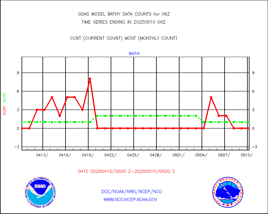
eXpendable BathyThermograph, mooring (BATHY fmt) |
0 |
1 |
0.0 % |
|||||||||||
Canadian AMDAR aircraft data (decoded from BUFR) |
0 |
0 |
n/a |
|||||||||||
NPP/NOAA-20 CrIS full spctrl radn (431 ch subset) |
1458000 |
1458000 |
100.0 % |
|||||||||||
NPP/NOAA-20 CrIS full spctrl radn dir brdcst SSEC |
332882 |
349152 |
95.3 % |
|||||||||||
Coast Guard |
28 |
31 |
90.3 % |
|||||||||||
Drifting buoys (decoded from BUFR) |
9138 |
9117 |
100.2 % |
|||||||||||
Dropwinsonde (decoded from BUFR) |
9 |
9 |
100.0 % |
|||||||||||
NPP Adv. Tech. MW Sndr (ATMS) br. temps from RARS |
273024 |
321412 |
84.9 % |
|||||||||||
NOAA 18-19 & METOP 1-2 MHS proc. btemps from RARS |
756103 |
980814 |
77.1 % |
|||||||||||
GOES/NESDIS (11x17 f-o-v) imager clear radiances |
0 |
0 |
n/a |
|||||||||||
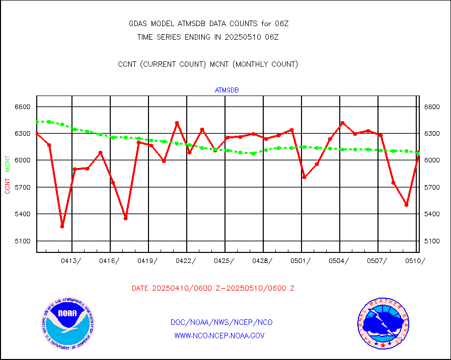
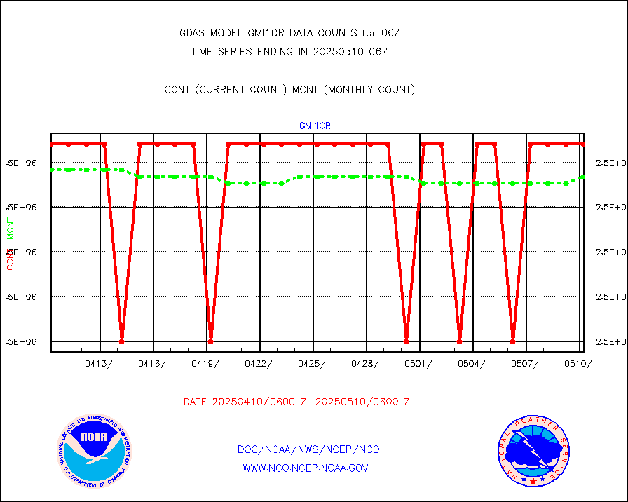
GPM GMI Level 1C-R brightness temperatures |
2541721 |
2541692 |
100.0 % |
|||||||||||
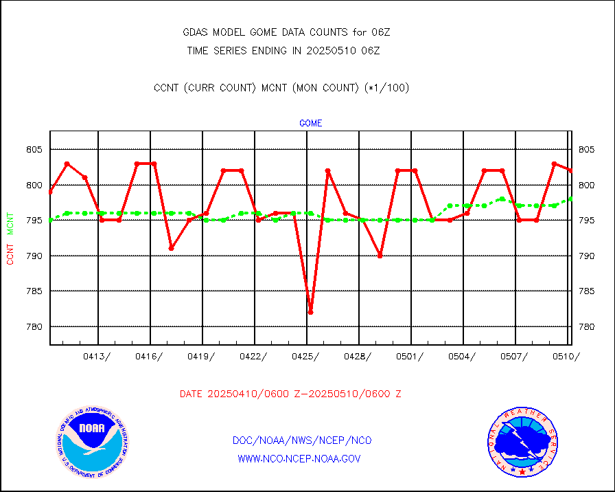
METOP 1-2 Global Ozone Monitoring Exp.-2 (GOME-2) |
80139 |
79170 |
101.2 % |
|||||||||||
INSAT/KALPANA India wvpr derived cloud motion |
0 |
0 |
n/a |
|||||||||||
GOES-16&up/NESDIS wv imgr/deep-lyr derivd cld mtn |
119425 |
102304 |
116.7 % |
|||||||||||
METEOSAT/EUMETSAT wvpr imgr drv cld motion NBseq |
210977 |
218705 |
96.5 % |
|||||||||||
METOP 1-2 IASI 1C radiances-direct broadcast SSEC |
283868 |
276539 |
102.7 % |
|||||||||||
VIIRS (NPP/NOAA-20) ir lg-wv drv cloud motion(NB) |
115570 |
122061 |
94.7 % |
|||||||||||
AVHRR (NOAA/METOP) ir lg-wave derived cld motion |
0 |
0 |
n/a |
|||||||||||
AVHRR (METOP) ir lg-wave derived cld motion |
74882 |
71519 |
104.7 % |
|||||||||||
INSAT/KALPANA India ir lg-wave derived cld motion |
0 |
0 |
n/a |
|||||||||||
Korean AMDAR aircraft data (decoded from BUFR) |
443 |
475 |
93.3 % |
|||||||||||
Moored buoys (decoded from BUFR) |
8079 |
7949 |
101.6 % |
|||||||||||
NEXRAD Vel Azm Dsp(VAD) winds via Level 2 decoder |
6567 |
5639 |
116.5 % |
|||||||||||
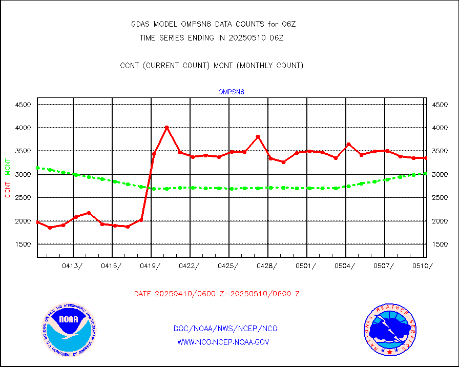
OMPS Limb Profiler ozone data (NPP) |
1533 |
1631 |
94.0 % |
|||||||||||
OMPS nadir profile ozone (Version 8 BUFR) |
3336 |
3481 |
95.8 % |
|||||||||||
OMPS total column ozone (Version 8 BUFR) |
1956310 |
2086125 |
93.8 % |
|||||||||||
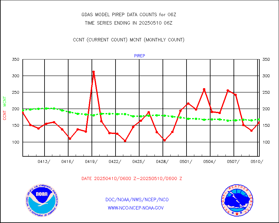
Manual PIREP aircraft data (dcded from AIREP fmt) |
106 |
117 |
90.6 % |
|||||||||||
Multi-Agency Profiler (MAP) and SODAR winds |
472 |
431 |
109.5 % |
|||||||||||
Rawinsonde - fixed land (decoded from BUFR) |
22 |
23 |
95.7 % |
|||||||||||
Rawinsonde - mobile land (decoded from BUFR) |
0 |
0 |
n/a |
|||||||||||
Rawinsonde - ship (decoded from BUFR) |
0 |
0 |
n/a |
|||||||||||
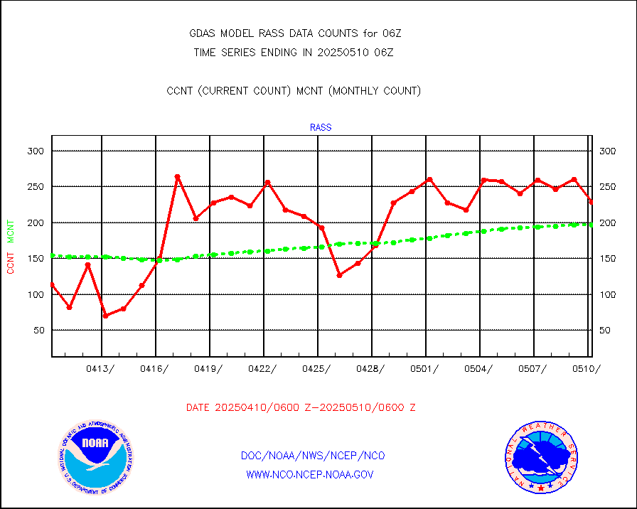
RASS temperatures (NOAA and Multi-Agency) |
211 |
193 |
109.3 % |
|||||||||||
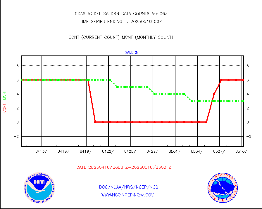
Surface Marine Saildrone (decoded from BUFR) |
6 |
6 |
100.0 % |
|||||||||||
METEOSAT-10 2nd Gen SEVIRI All Sky Radiance(proc) |
453072 |
452728 |
100.1 % |
|||||||||||
NOW COVER, DEPTH/DENSITY AND WATER EQUIVALENT |
23480 |
21870 |
107.4 % |
|||||||||||
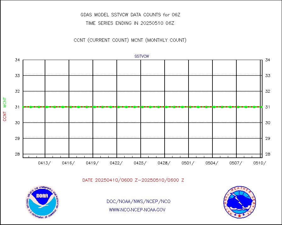
NPP/NOAA-20 VIIRS SST - CLEAR & OVER WATER |
31 |
31 |
100.0 % |
|||||||||||
NPP/NOAA-20 VIIRS SST - PROBABLY CLR & OVER WATER |
9999999 |
9999999 |
100.0 % |
|||||||||||
Synoptic - fixed manual and automatic |
7132 |
6940 |
102.8 % |
|||||||||||
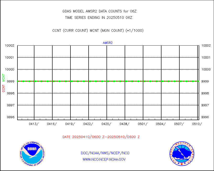
CTD probe, Argo prflng float, mooring (TESAC fmt) |
3004 |
2929 |
102.6 % |
|||||||||||
TAMDAR aircft data-all types(from Panasonic,BUFR) |
301 |
324 |
92.9 % |
|||||||||||
ThermoSalinoGraph (TSG) TRACKOB format) |
702 |
753 |
93.2 % |
|||||||||||
INSAT/KALPANA India visible derived cloud motion |
0 |
0 |
n/a |
|||||||||||
GOES-16&up/NESDIS visible derived cloud motion |
223463 |
182352 |
122.5 % |
|||||||||||


