| Suspect Data Shortages in Critical Types - Monitor | ||||||||||||||
|---|---|---|---|---|---|---|---|---|---|---|---|---|---|---|
| Type | Description | Hourly Count | Monthly Average | Percent (%) of Monthly Mean | UTC Time Window | |||||||||
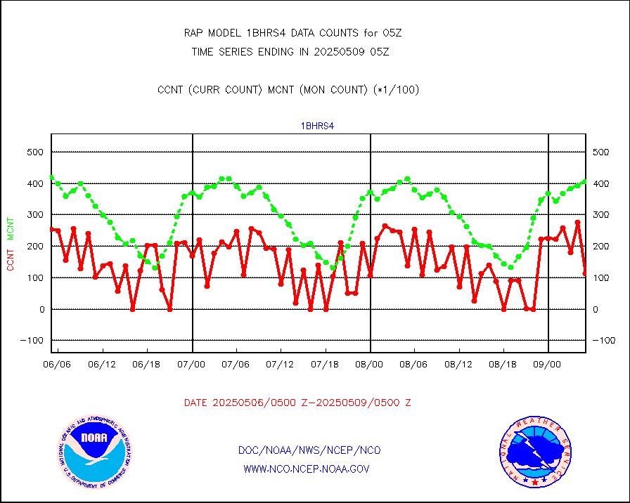
NOAA 18-19 & METOP 1-2 HIRS-4 NCEP-proc. br.temps |
0 |
10483 |
0.0 % |
0202.00-0207.99 |
||||||||||
| Shortage in Data Type of Opportunity - Monitor | ||||||||||||||
|---|---|---|---|---|---|---|---|---|---|---|---|---|---|---|
| Type | Description | Hourly Count | Monthly Average | Percent (%) of Monthly Mean | UTC Time Window | |||||||||
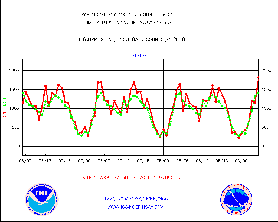
NPP Adv. Tech. MW Sndr (ATMS) br. temps from RARS |
3248 |
16289 |
19.9 % |
0203.00-0206.99 |
||||||||||
NOAA 15-19 & METOP 1-2 HIRS-3/4 pr btmps frm RARS |
0 |
8256 |
0.0 % |
0204.00-0206.00 |
||||||||||
METOP 1-2 IASI 1C radiance data vbl chn from RARS |
0 |
1294 |
0.0 % |
0203.00-0206.99 |
||||||||||
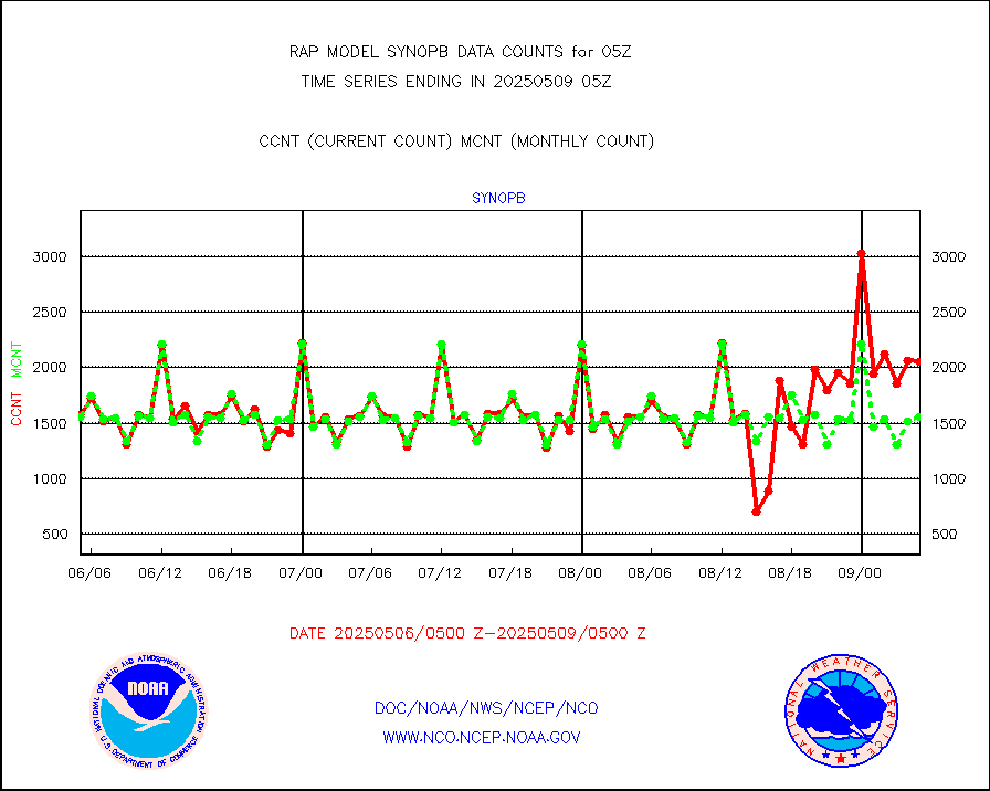
| Critical Data with Normal Counts | ||||||||||||||
|---|---|---|---|---|---|---|---|---|---|---|---|---|---|---|
| Type | Description | Hourly Count | Monthly Average | Percent (%) of Monthly Mean | UTC Time Window | |||||||||
NOAA 15-19 & METOP 1-2 AMSU-A NCEP-proc. br.temps |
19212 |
25486 |
75.4 % |
0202.00-0207.99 |
||||||||||
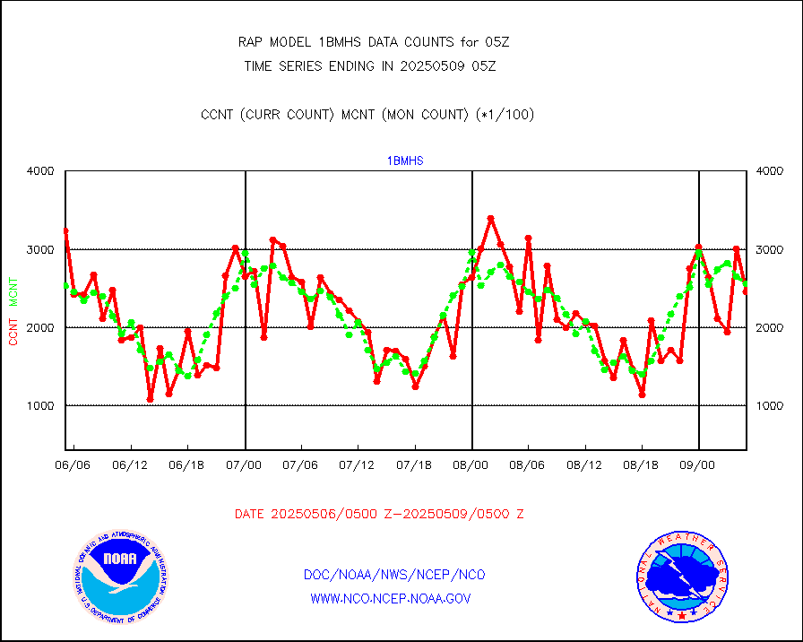
NOAA 18-19 & METOP 1-2 MHS NCEP-proces. br. temps |
171050 |
216821 |
78.9 % |
0202.00-0207.99 |
||||||||||
MDCRS ACARS acft data from ARINC(dcded from BUFR) |
96821 |
132806 |
72.9 % |
0201.75-0208.25 |
||||||||||
Canadian AMDAR aircraft data (decoded from BUFR) |
0 |
0 |
n/a |
0201.75-0208.25 |
||||||||||
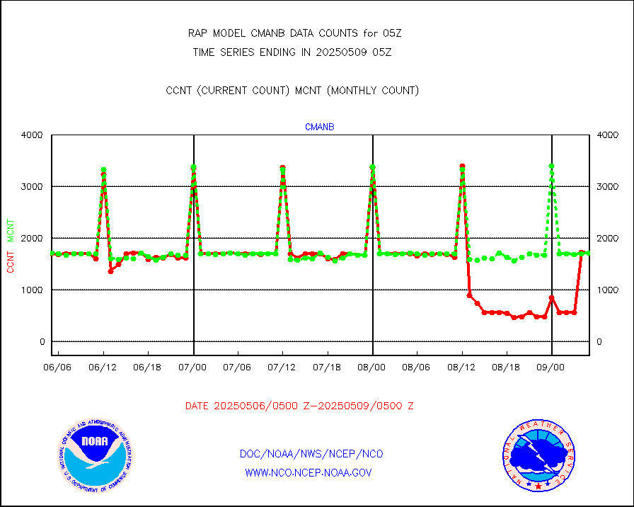
Surface Marine CMAN rpts decoded from BUFR format |
1740 |
1721 |
101.1 % |
0204.50-0205.50 |
||||||||||
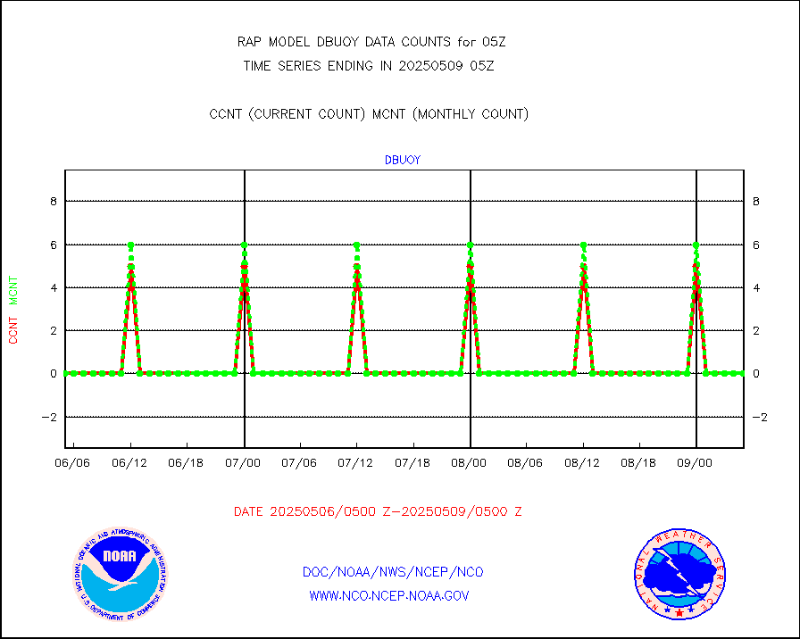
Buoys decoded from FM-18 fmt (moored or drifting) |
0 |
0 |
n/a |
0204.50-0205.50 |
||||||||||
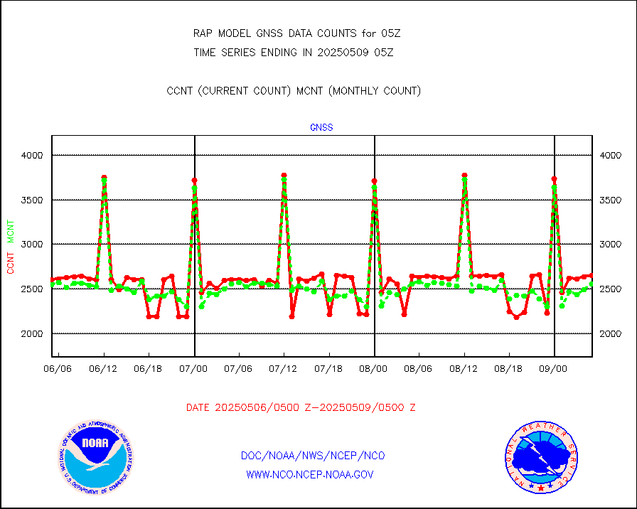
Grnd-based Gbl Navigation Sat System (GNSS) data |
714 |
2107 |
33.9 % |
0203.95-0204.05 |
||||||||||
MODIS (AQUA/TERRA) wvpr imager derived cld motion |
0 |
0 |
n/a |
0202.50-0207.50 |
||||||||||
MODIS (AQUA/TERRA) ir l-wave derived cloud motion |
0 |
0 |
n/a |
0202.50-0207.50 |
||||||||||
GOES/NASA(Langley) hi-res. (1x1 f-o-v) cloud data |
3066460 |
3036138 |
101.0 % |
0204.50-0205.50 |
||||||||||
Buoys decoded from FM-13 format (moored) |
117 |
117 |
100.0 % |
0204.50-0205.50 |
||||||||||
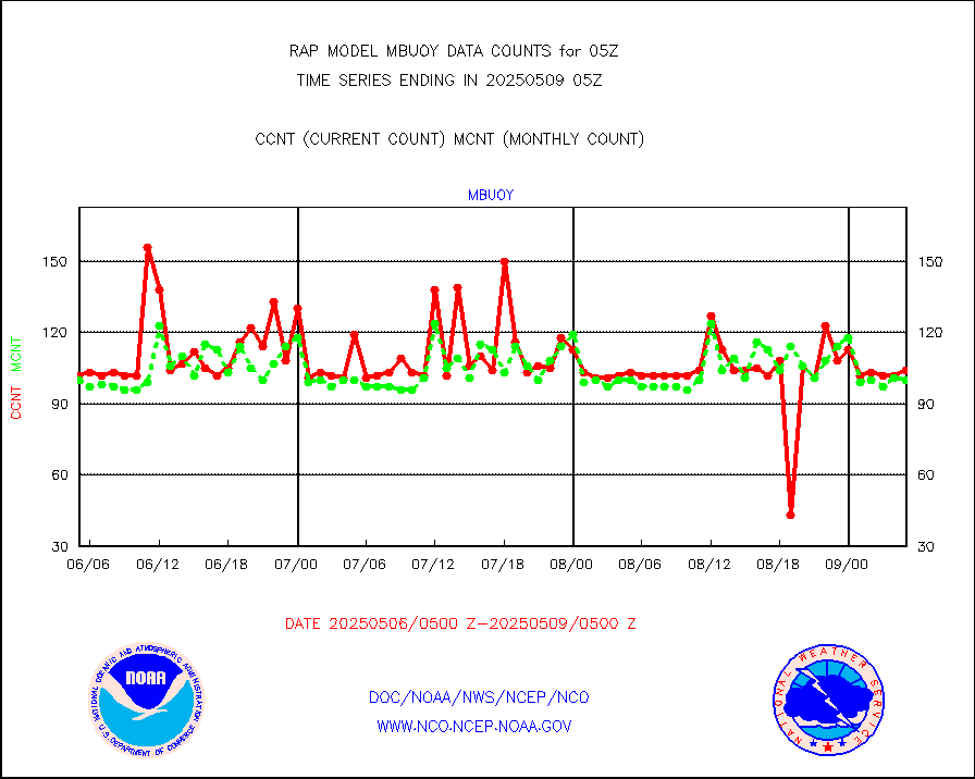
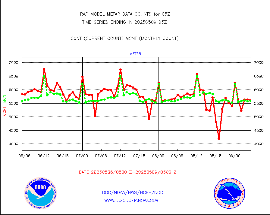
Aviation - METAR |
5656 |
5591 |
101.2 % |
0204.50-0205.50 |
||||||||||
NEXRAD Vel Azm Dsp(VAD) winds via radar coded msg |
0 |
0 |
n/a |
0204.00-0206.00 |
||||||||||
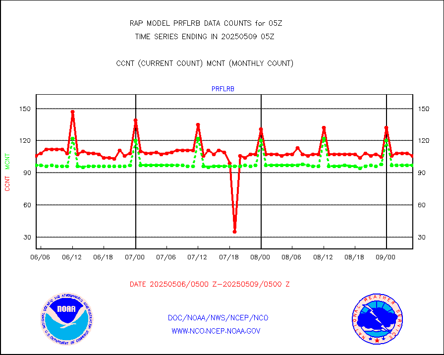
Multi-Agency Profiler (MAP) and SODAR winds |
102 |
97 |
105.2 % |
0203.50-0206.50 |
||||||||||
Rawinsonde - fixed land (from TEMP or PILOT) |
1 |
1 |
100.0 % |
0204.00-0206.00 |
||||||||||
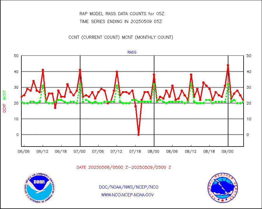
RASS temperatures (NOAA and Multi-Agency) |
22 |
21 |
104.8 % |
0204.50-0205.50 |
||||||||||
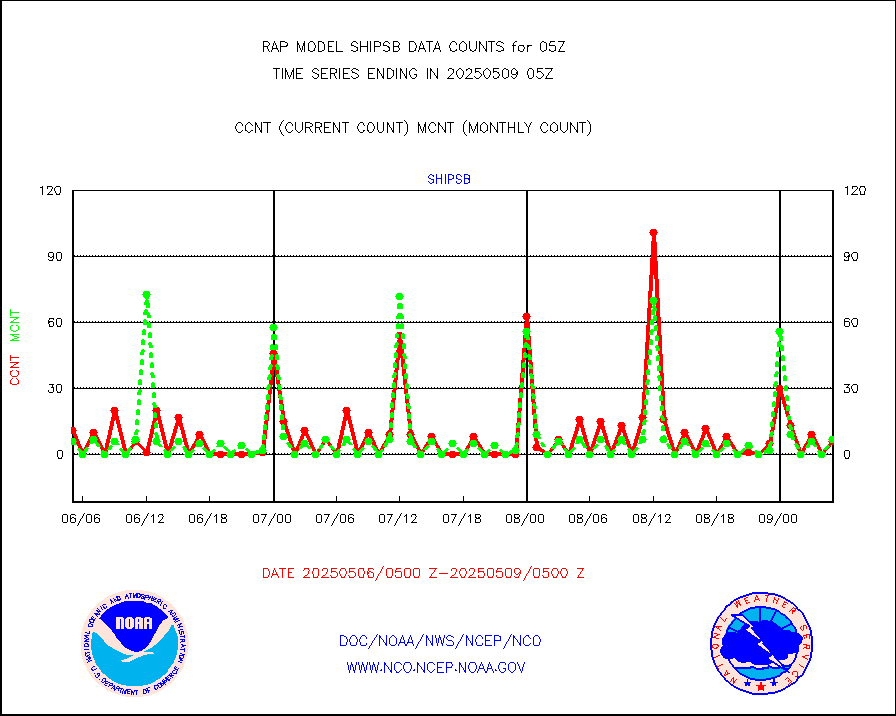
Ship - manual and automatic, restricted (BUFR) |
9 |
10 |
90.0 % |
0204.50-0205.50 |
||||||||||
Ship - manual and automatic, unrestricted |
102 |
89 |
114.6 % |
0204.50-0205.50 |
||||||||||
Ship - manual and automatic, unrestricted (BUFR) |
746 |
756 |
98.7 % |
0204.50-0205.50 |
||||||||||
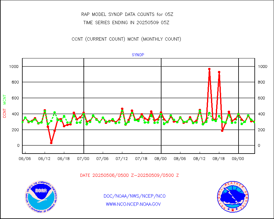
Synoptic - fixed manual and automatic |
201 |
273 |
73.6 % |
0204.50-0205.50 |
||||||||||
Synoptic - fixed manual & auto (decoded fr BUFR) |
2108 |
2013 |
104.7 % |
0204.50-0205.50 |
||||||||||
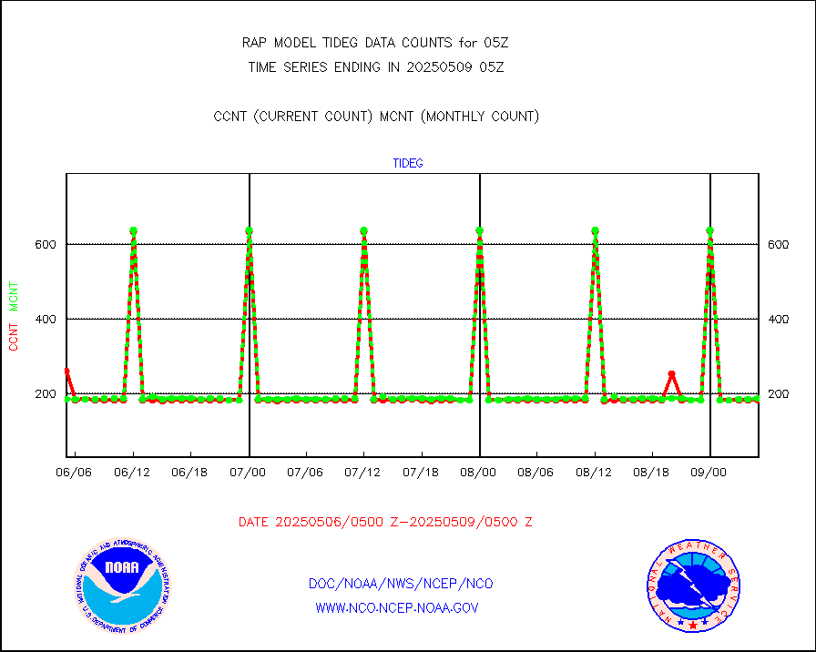
Tide gauge reports decoded from CREX format |
187 |
185 |
101.1 % |
0204.50-0205.50 |
||||||||||
| Data Types of Opportunity with Normal Counts | ||||||||||||||
|---|---|---|---|---|---|---|---|---|---|---|---|---|---|---|
| Type | Description | Hourly Count | Monthly Average | Percent (%) of Monthly Mean | UTC Time Window | |||||||||
GOES-16&up/NESDIS ir short-wv derived cld motion |
7421 |
8351 |
88.9 % |
0204.00-0204.99 |
||||||||||
MDCRS ACARS acft data (ARINC via AFWA)(AIREP fmt) |
0 |
0 |
n/a |
0201.75-0208.25 |
||||||||||
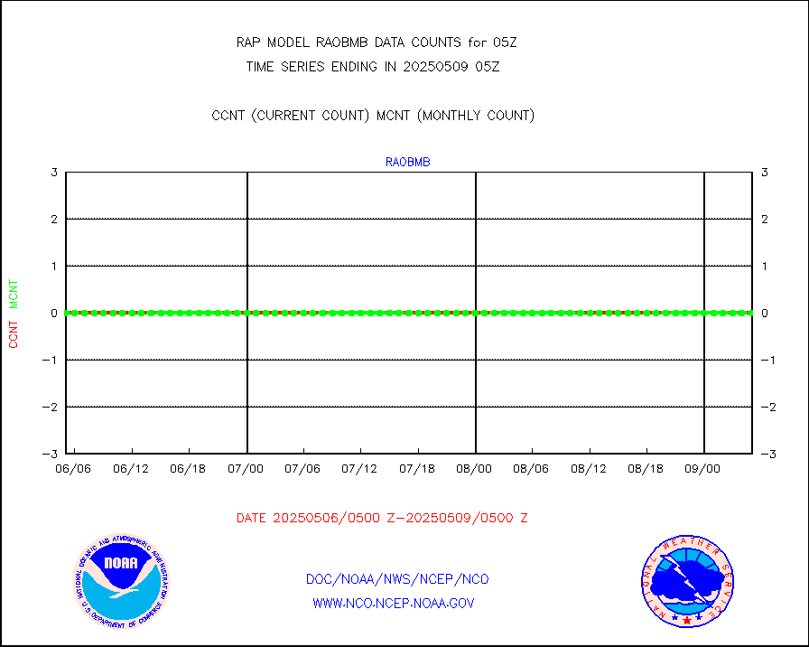
Manual AIREP aircraft data (dcded from AIREP fmt) |
3057 |
3534 |
86.5 % |
0201.75-0208.25 |
||||||||||
AQUA AIRS/AMSU-A/HSB brightness temps- every FOV |
0 |
0 |
n/a |
0202.00-0207.99 |
||||||||||
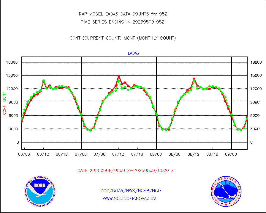
AMDAR aircraft data (decoded from AMDAR format) |
2748 |
1390 |
197.7 % |
0201.75-0208.25 |
||||||||||
AMDAR aircraft data (decoded from BUFR) |
11437 |
12314 |
92.9 % |
0201.75-0208.25 |
||||||||||
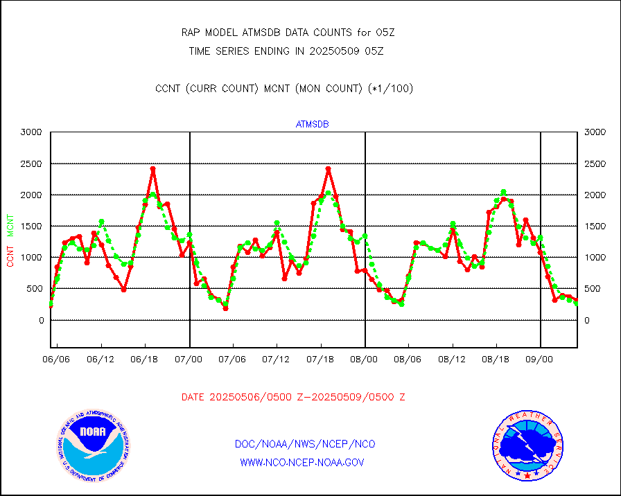
GCOM-W AMSR2 1B brightness temperatures |
996154 |
559671 |
178.0 % |
0202.00-0202.99 |
||||||||||
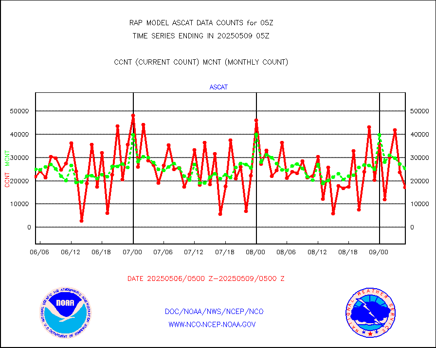
METOP 1-2 ASCAT products |
26682 |
24738 |
107.9 % |
0203.00-0207.00 |
||||||||||
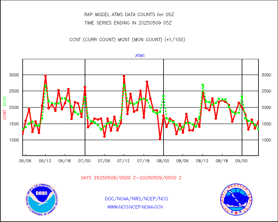
NPP/NOAA-20 ATMS brightness temperatures |
120818 |
133526 |
90.5 % |
0203.00-0206.99 |
||||||||||
NPP/NOAA-20 ATMS bright. temps-direct b-cast SSEC |
36842 |
28310 |
130.1 % |
0203.00-0206.99 |
||||||||||
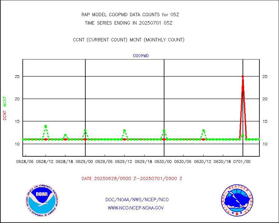
Coop/MADIS NEPP & HCN-Modernization NOAA COOP Obs |
11 |
11 |
100.0 % |
0204.50-0205.50 |
||||||||||
NPP/NOAA-20 CrIS full spctrl radn (431 ch subset) |
92320 |
85372 |
108.1 % |
0203.00-0206.99 |
||||||||||
NPP/NOAA-20 CrIS full spctrl radn dir brdcst SSEC |
5694 |
18802 |
30.3 % |
0203.00-0206.99 |
||||||||||
Coast Guard |
5 |
5 |
100.0 % |
0204.50-0205.50 |
||||||||||
Drifting buoys (decoded from BUFR) |
550 |
521 |
105.6 % |
0204.50-0205.50 |
||||||||||
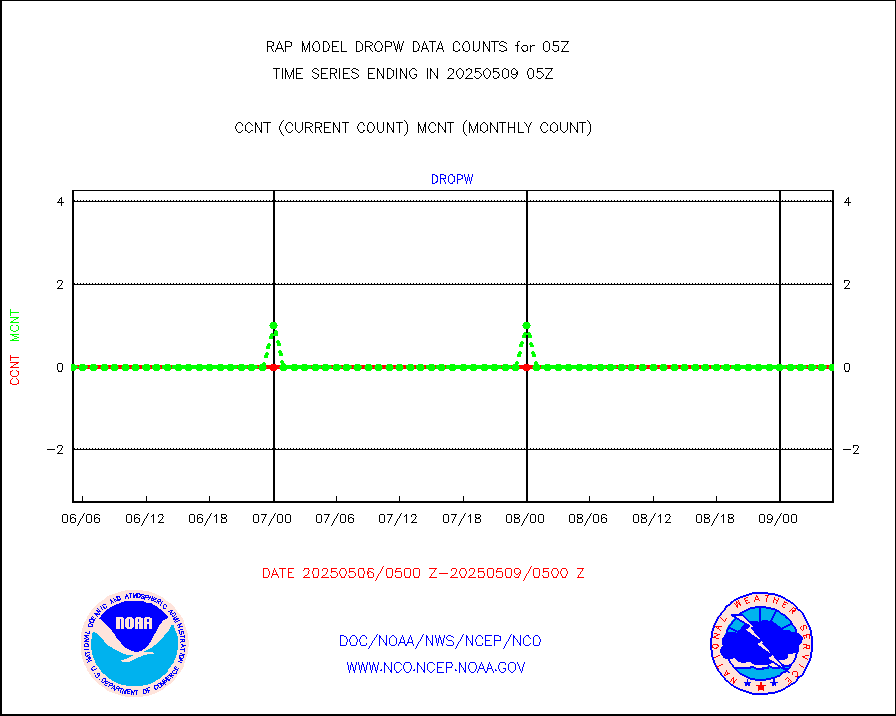
Dropwinsonde (from TEMP DROP) |
0 |
0 |
n/a |
0204.00-0206.00 |
||||||||||
Dropwinsonde (decoded from BUFR) |
0 |
0 |
n/a |
0204.00-0206.00 |
||||||||||
E-AMDAR (European AMDAR acft decoded from BUFR) |
4967 |
5083 |
97.7 % |
0201.75-0208.25 |
||||||||||
NOAA 15-19 & METOP 1-2 AMSU-A proc btmps frm RARS |
8492 |
10032 |
84.6 % |
0204.00-0206.00 |
||||||||||
NOAA 18-19 & METOP 1-2 MHS proc. btemps from RARS |
90994 |
104240 |
87.3 % |
0204.00-0206.00 |
||||||||||
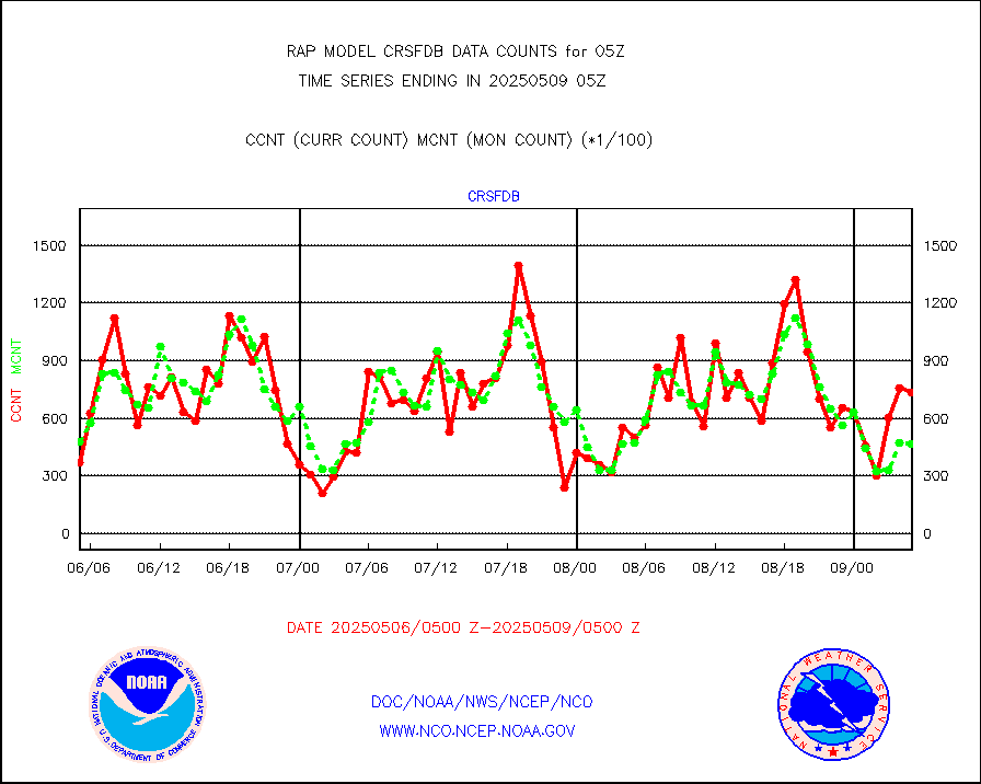
GPM GMI Level 1C-R brightness temperatures |
354289 |
435910 |
81.3 % |
0202.00-0207.99 |
||||||||||
GPS radio occultation data |
179 |
163 |
109.8 % |
0203.00-0206.99 |
||||||||||
GOES-16/17 All Sky Radiances (proc.) |
959751 |
959606 |
100.0 % |
0203.00-0206.99 |
||||||||||
GOES-16/17 Clear Sky Radiances (proc.) |
440145 |
442169 |
99.5 % |
0203.00-0206.99 |
||||||||||
MTSAT/JMA water vapor imager derived cloud motion |
2690 |
2838 |
94.8 % |
0202.50-0207.50 |
||||||||||
GOES-16&up/NESDIS wv imgr/deep-lyr derivd cld mtn |
9253 |
7589 |
121.9 % |
0204.00-0204.99 |
||||||||||
METEOSAT/EUMETSAT wvpr imgr drv cld motion NBseq |
4990 |
5184 |
96.3 % |
0203.50-0206.49 |
||||||||||
GOES-16&up/NESDIS wv imgr/cld-top derived cld mtn |
15359 |
14789 |
103.9 % |
0204.00-0204.99 |
||||||||||
METOP 1-2 IASI 1C radiances-direct broadcast SSEC |
94620 |
87820 |
107.7 % |
0203.00-0206.99 |
||||||||||
METEOSAT/EUMETSAT ir lg-wave drv cld motion NBseq |
3076 |
3104 |
99.1 % |
0203.50-0206.49 |
||||||||||
VIIRS (NPP/NOAA-20) ir lg-wv drv cloud motion(NB) |
0 |
0 |
n/a |
0202.50-0207.50 |
||||||||||
AVHRR (NOAA/METOP) ir lg-wave derived cld motion |
0 |
0 |
n/a |
0202.50-0207.50 |
||||||||||
AVHRR (METOP) ir lg-wave derived cld motion |
0 |
0 |
n/a |
0203.50-0206.49 |
||||||||||
MTSAT/JMA infrared long-wave derived cloud motion |
2387 |
2336 |
102.2 % |
0202.50-0207.50 |
||||||||||
GOES-16&up/NESDIS ir long-wave derived cld motion |
30069 |
30300 |
99.2 % |
0204.00-0204.99 |
||||||||||
Korean AMDAR aircraft data (decoded from BUFR) |
251 |
227 |
110.6 % |
0201.75-0208.25 |
||||||||||
Land-based CMAN stations decoded from CMAN format |
42 |
44 |
95.5 % |
0204.50-0205.50 |
||||||||||
LLDN Long-rng lightning from Vaisala via NOAAPORT |
129813 |
152020 |
85.4 % |
0204.00-0205.50 |
||||||||||
NLDN Shrt-rng lightning from Vaisala via NOAAPORT |
5975 |
8203 |
72.8 % |
0204.00-0205.50 |
||||||||||
Moored buoys (decoded from BUFR) |
679 |
654 |
103.8 % |
0204.50-0205.50 |
||||||||||
Mesonet/MADIS Colorado E-470 (Interstate 470) |
24 |
23 |
104.3 % |
0204.50-0205.50 |
||||||||||
Mesonet/MADIS Alaska Department of Transportation |
118 |
74 |
159.5 % |
0204.50-0205.50 |
||||||||||
Mesonet/MADIS U.S. Army Aberdeen Proving Grounds |
0 |
0 |
n/a |
0204.50-0205.50 |
||||||||||
Mesonet/MADIS Citizen Weather Observers Program |
47418 |
53844 |
88.1 % |
0204.50-0205.50 |
||||||||||
Mesonet/MADIS AWS Convergence Technologies, Inc. |
17081 |
19651 |
86.9 % |
0204.50-0205.50 |
||||||||||
Mesonet/MADIS "Anything Weather" |
0 |
0 |
n/a |
0204.50-0205.50 |
||||||||||
Mesonet/MADIS Colorado Dept. of Transportation |
0 |
0 |
n/a |
0204.50-0205.50 |
||||||||||
Mesonet/MADIS DC Net |
0 |
0 |
n/a |
0204.50-0205.50 |
||||||||||
Mesonet/MADIS Denver Urban Drainage & Flood Cntrl |
0 |
0 |
n/a |
0204.50-0205.50 |
||||||||||
Mesonet/MADIS Florida (FAWN & USF) |
0 |
0 |
n/a |
0204.50-0205.50 |
||||||||||
Mesonet/MADIS Florida Dept. of Transportation |
0 |
0 |
n/a |
0204.50-0205.50 |
||||||||||
Mesonet/MADIS Georgia Dept. of Transportation |
0 |
0 |
n/a |
0204.50-0205.50 |
||||||||||
Mesonet/MADIS NWS Hydromet Auto Data System(HADS) |
4413 |
4913 |
89.8 % |
0204.50-0205.50 |
||||||||||
Mesonet/MADIS Iowa Environmental |
140 |
160 |
87.5 % |
0204.50-0205.50 |
||||||||||
Mesonet/MADIS Indiana Dept. of Transportation |
0 |
0 |
n/a |
0204.50-0205.50 |
||||||||||
Mesonet/MADIS Iowa Department of Transportation |
0 |
0 |
n/a |
0204.50-0205.50 |
||||||||||
Mesonet/MADIS Kansas Department of Transportation |
285 |
318 |
89.6 % |
0204.50-0205.50 |
||||||||||
Mesonet/MADIS Oklahoma Mesonet |
525 |
567 |
92.6 % |
0204.50-0205.50 |
||||||||||
Mesonet/MADIS Louisiana State/Jackson State Univ. |
0 |
0 |
n/a |
0204.50-0205.50 |
||||||||||
Mesonet/MADIS Missouri Commercial Agricult Wx Net |
272 |
288 |
94.4 % |
0204.50-0205.50 |
||||||||||
Mesonet/MADIS Minnesota Dept. of Transportation |
0 |
0 |
n/a |
0204.50-0205.50 |
||||||||||
Mesonet/MADIS NOS-Phys Oceanographic Realtime Sys |
221 |
261 |
84.7 % |
0204.50-0205.50 |
||||||||||
Mesonet/MADIS NFIC Remote Automated Wx Stns(RAWS) |
1416 |
1430 |
99.0 % |
0204.50-0205.50 |
||||||||||
Mesonet/MADIS many providers, not separated out |
27195 |
36900 |
73.7 % |
0204.50-0205.50 |
||||||||||
Mesonet/MADIS UrbaNet |
2900 |
3074 |
94.3 % |
0204.50-0205.50 |
||||||||||
Mesonet/MADIS Virginia Dept. of Transportation |
0 |
0 |
n/a |
0204.50-0205.50 |
||||||||||
Mesonet/MADIS "Weather for You" |
0 |
0 |
n/a |
0204.50-0205.50 |
||||||||||
Mesonet/MADIS Wisconsin Dept. of Transportation |
0 |
0 |
n/a |
0204.50-0205.50 |
||||||||||
Mesonet/MADIS MesoWest (many subproviders) |
25662 |
34045 |
75.4 % |
0204.50-0205.50 |
||||||||||
Mesonet/MADIS West Texas |
5033 |
5262 |
95.6 % |
0204.50-0205.50 |
||||||||||
METOP 1-2 IASI 1C radiance data (varbl. channels) |
43753 |
39484 |
110.8 % |
0203.00-0206.99 |
||||||||||
NEXRAD Vel Azm Dsp(VAD) winds via Level 2 decoder |
1157 |
1069 |
108.2 % |
0204.00-0206.00 |
||||||||||
NOAA 16-19 Solar Backscatter UV-2 rad frm V8 BUFR |
0 |
0 |
n/a |
0203.00-0205.99 |
||||||||||
PIBAL (from PILOT, PILOT SHIP, PILOT MOBIL) |
0 |
0 |
n/a |
0204.00-0206.00 |
||||||||||
PIBAL (decoded from BUFR) |
0 |
0 |
n/a |
0204.00-0206.00 |
||||||||||
Manual PIREP aircraft data (dcded from AIREP fmt) |
111 |
113 |
98.2 % |
0201.75-0208.25 |
||||||||||
Profilr winds from PIBAL (PILOT,PILOT SHIP/MOBIL) |
0 |
0 |
n/a |
0203.50-0206.50 |
||||||||||
Rawinsonde - fixed land (decoded from BUFR) |
4 |
3 |
133.3 % |
0204.00-0206.00 |
||||||||||
Rawinsonde - mobile land (from TEMP/PILOT MOBIL) |
0 |
0 |
n/a |
0204.00-0206.00 |
||||||||||
Rawinsonde - mobile land (decoded from BUFR) |
0 |
0 |
n/a |
0204.00-0206.00 |
||||||||||
Rawinsonde - ship (from TEMP SHIP, PILOT SHIP) |
0 |
0 |
n/a |
0204.00-0206.00 |
||||||||||
Rawinsonde - ship (decoded from BUFR) |
0 |
0 |
n/a |
0204.00-0206.00 |
||||||||||
NEXRAD radial wind (Level 2 - GTS) |
1669208 |
1471969 |
113.4 % |
0204.50-0205.49 |
||||||||||
Flight level reconnaissance aircraft data |
0 |
0 |
n/a |
0204.00-0206.00 |
||||||||||
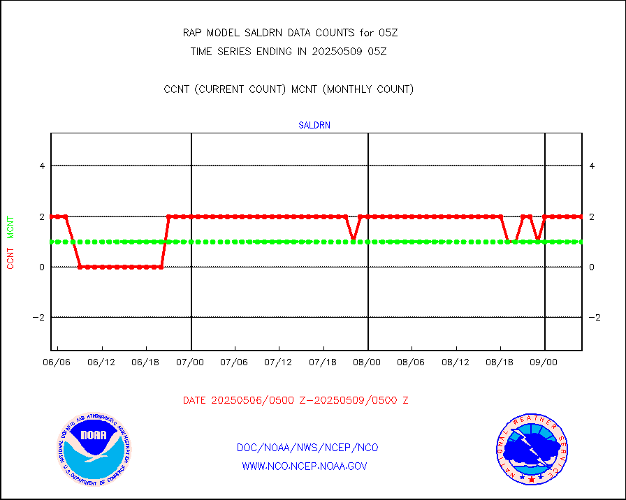
Surface Marine Saildrone (decoded from BUFR) |
2 |
2 |
100.0 % |
0203.00-0206.99 |
||||||||||
Megha-Tropiques SAPHIR L1A2 brightness temps |
0 |
0 |
n/a |
0202.00-0207.99 |
||||||||||
METEOSAT-10 2nd Gen SEVIRI All Sky Radiance(proc) |
9512 |
9494 |
100.2 % |
0203.00-0206.99 |
||||||||||
METEOSAT-10 2nd Gen SEVIRI Clr Sky Radiance(proc) |
0 |
0 |
n/a |
0203.00-0206.99 |
||||||||||
Ship - manual and automatic, restricted |
17 |
14 |
121.4 % |
0204.50-0205.50 |
||||||||||
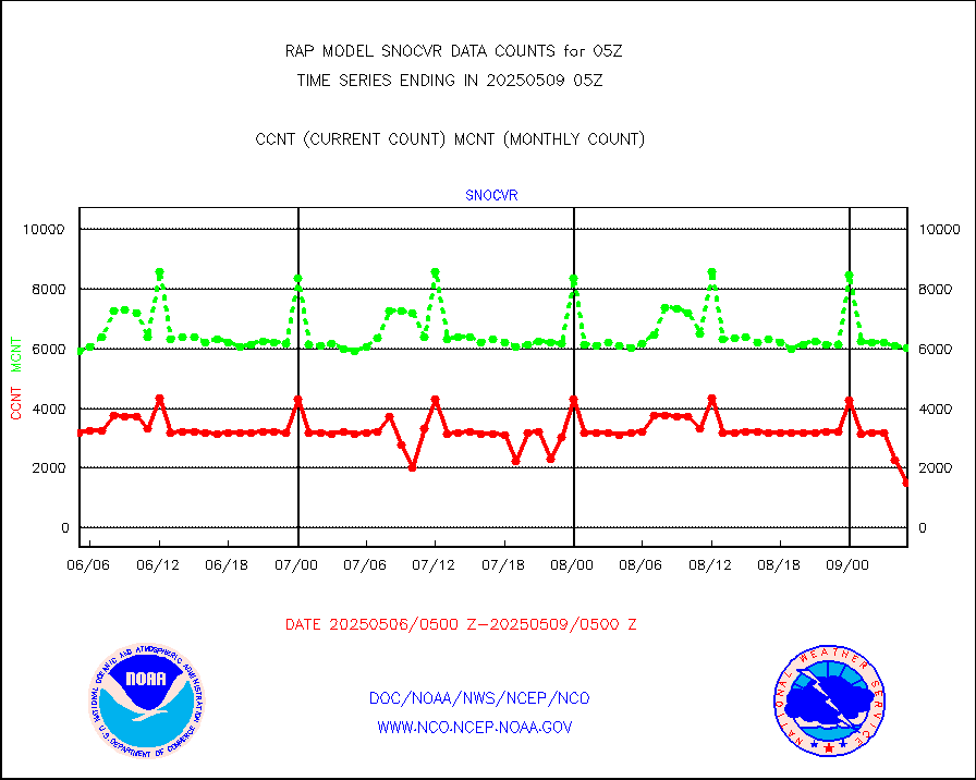
NOW COVER, DEPTH/DENSITY AND WATER EQUIVALENT |
2841 |
5574 |
51.0 % |
0203.00-0207.00 |
||||||||||
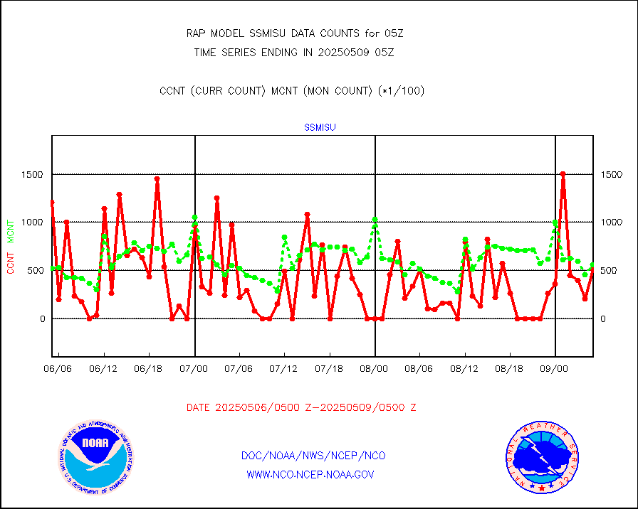
DMSP SSM/IS 1C radiance data (Unified Pre-Proc.) |
87977 |
55509 |
158.5 % |
0203.00-0206.99 |
||||||||||
Sub-surface float and glider profile (BUFR) |
7 |
4 |
175.0 % |
0203.00-0206.99 |
||||||||||
Synoptic - restricted (WMO Res 40) manual & auto. |
0 |
0 |
n/a |
0204.50-0205.50 |
||||||||||
Synoptic - restricted (WMO Res 40)(decoded BUFR) |
291 |
357 |
81.5 % |
0204.50-0205.50 |
||||||||||
Synoptic - mobile manual & auto (decoded fr BUFR) |
0 |
0 |
n/a |
0204.50-0205.50 |
||||||||||
TAMDAR aircft data-all types(from Panasonic,BUFR) |
134 |
166 |
80.7 % |
0201.75-0208.25 |
||||||||||
MTSAT/JMA visible derived cloud motion |
1616 |
1473 |
109.7 % |
0202.50-0207.50 |
||||||||||
GOES-16&up/NESDIS visible derived cloud motion |
24744 |
22945 |
107.8 % |
0204.00-0204.99 |
||||||||||
METEOSAT/EUMETSAT visible drv cld motion NBseq |
382 |
366 |
104.4 % |
0203.50-0206.49 |
||||||||||


