| Suspect Data Shortages in Critical Types - Monitor | ||||||||||||||
|---|---|---|---|---|---|---|---|---|---|---|---|---|---|---|
| Type | Description | Hourly Count | Monthly Average | Percent (%) of Monthly Mean | UTC Time Window | |||||||||
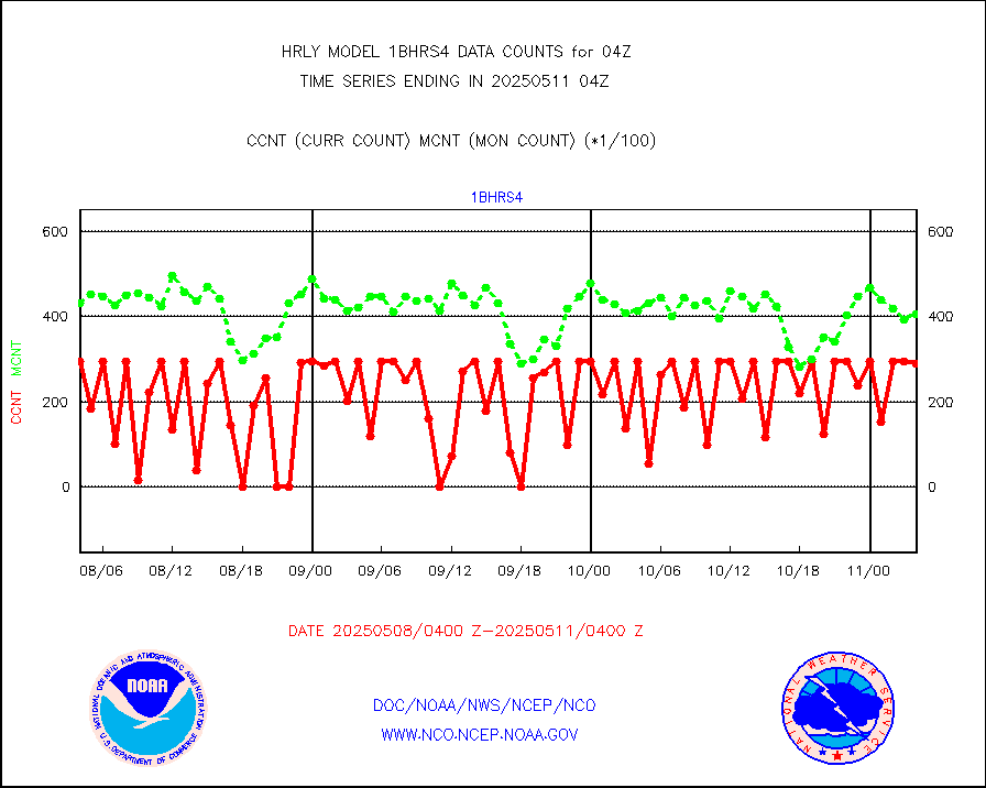
NOAA 18-19 & METOP 1-2 HIRS-4 NCEP-proc. br.temps |
0 |
10677 |
0.0 % |
0202.00-0202.99 |
||||||||||
NOAA 15-19 & METOP 1-2 HIRS-3/4 pr btmps frm RARS |
0 |
11511 |
0.0 % |
0203.50-0204.49 |
||||||||||
Grnd-based Gbl Navigation Sat System (GNSS) data |
1361 |
6617 |
20.6 % |
0203.00-0203.99 |
||||||||||
Mesonet/MADIS NFIC Remote Automated Wx Stns(RAWS) |
3 |
1800 |
0.2 % |
0203.50-0204.49 |
||||||||||
| Shortage in Data Type of Opportunity - Monitor | ||||||||||||||
|---|---|---|---|---|---|---|---|---|---|---|---|---|---|---|
| Type | Description | Hourly Count | Monthly Average | Percent (%) of Monthly Mean | UTC Time Window | |||||||||
P.M.(N18-19) AVHRR GAC NCEP-proc clr & sea btemps |
0 |
297193 |
0.0 % |
0201.50-0202.49 |
||||||||||
NPP Adv. Tech. MW Sndr (ATMS) br. temps from RARS |
9984 |
33786 |
29.6 % |
0202.50-0203.49 |
||||||||||
INDIA SATWIND, INSAT WV channel |
0 |
724 |
0.0 % |
0203.00-0203.99 |
||||||||||
INDIA SATWIND, INSAT IR channel |
0 |
827 |
0.0 % |
0203.00-0203.99 |
||||||||||
| Critical Data with Normal Counts | ||||||||||||||
|---|---|---|---|---|---|---|---|---|---|---|---|---|---|---|
| Type | Description | Hourly Count | Monthly Average | Percent (%) of Monthly Mean | UTC Time Window | |||||||||
NOAA 15-19 & METOP 1-2 AMSU-A NCEP-proc. br.temps |
24412 |
31340 |
77.9 % |
0202.00-0202.99 |
||||||||||
NOAA 18-19 & METOP 1-2 MHS NCEP-proces. br. temps |
218367 |
253643 |
86.1 % |
0202.00-0202.99 |
||||||||||
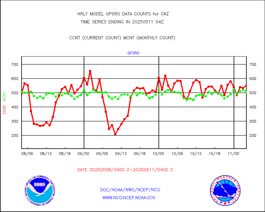
MDCRS ACARS acft data from ARINC(dcded from BUFR) |
23746 |
30088 |
78.9 % |
0203.50-0204.49 |
||||||||||
Manual AIREP aircraft data (dcded from AIREP fmt) |
886 |
1005 |
88.2 % |
0203.50-0204.49 |
||||||||||
AQUA AIRS/AMSU-A/HSB brightness temps- every FOV |
0 |
0 |
n/a |
0201.50-0202.49 |
||||||||||
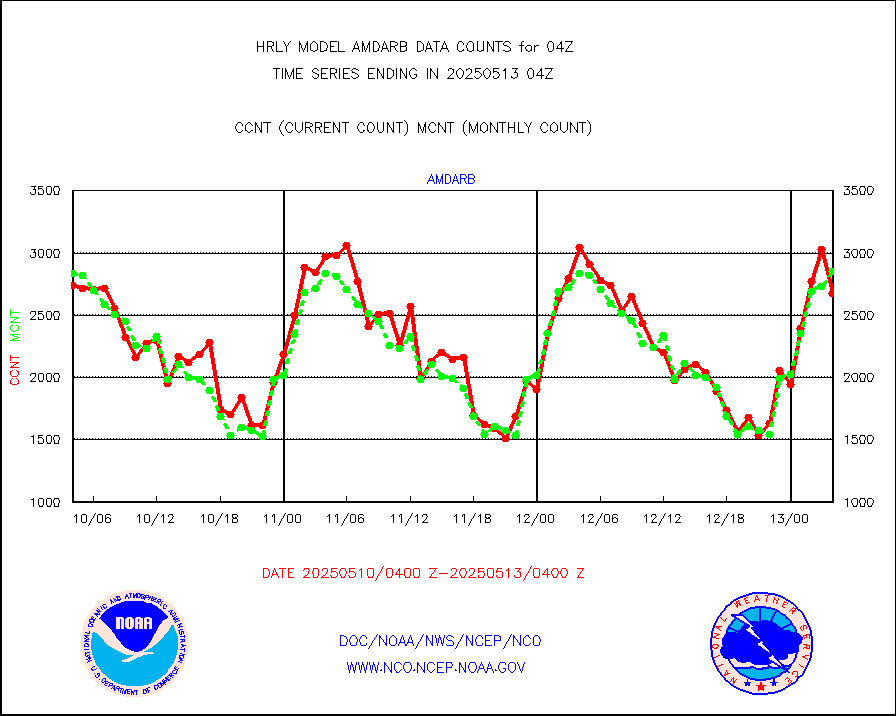
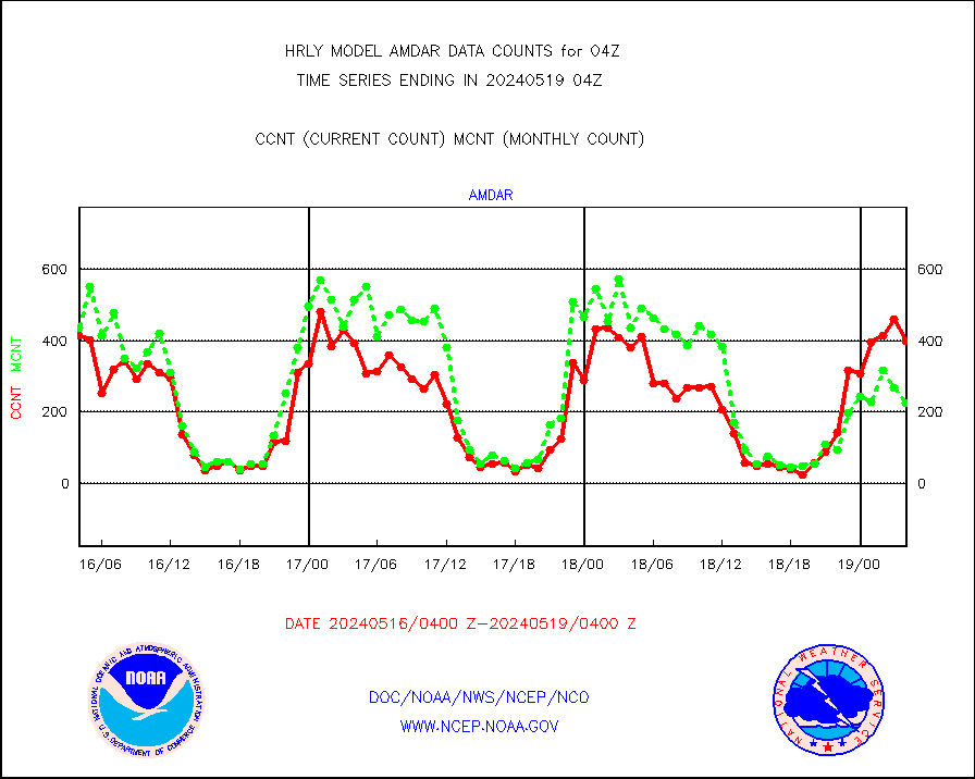
AMDAR aircraft data (decoded from AMDAR format) |
370 |
284 |
130.3 % |
0203.50-0204.49 |
||||||||||
AMDAR aircraft data (decoded from BUFR) |
2945 |
2982 |
98.8 % |
0203.50-0204.49 |
||||||||||
METOP 1-2 ASCAT products |
41748 |
58491 |
71.4 % |
0202.50-0203.49 |
||||||||||
NPP/NOAA-20 ATMS brightness temperatures |
312672 |
349552 |
89.4 % |
0202.50-0203.49 |
||||||||||
Canadian AMDAR aircraft data (decoded from BUFR) |
0 |
0 |
n/a |
0203.50-0204.49 |
||||||||||
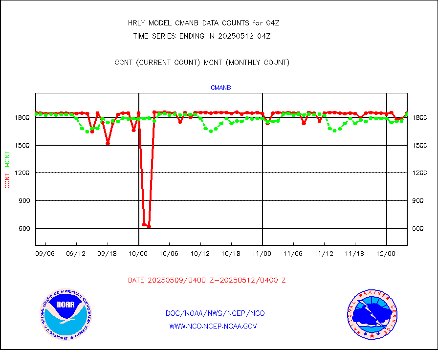
Surface Marine CMAN rpts decoded from BUFR format |
1865 |
1860 |
100.3 % |
0203.50-0204.50 |
||||||||||
Buoys decoded from FM-18 fmt (moored or drifting) |
17 |
17 |
100.0 % |
0203.50-0204.49 |
||||||||||
E-AMDAR (European AMDAR acft decoded from BUFR) |
912 |
757 |
120.5 % |
0203.50-0204.49 |
||||||||||
NOAA 15-19 & METOP 1-2 AMSU-A proc btmps frm RARS |
13252 |
16147 |
82.1 % |
0203.50-0204.49 |
||||||||||
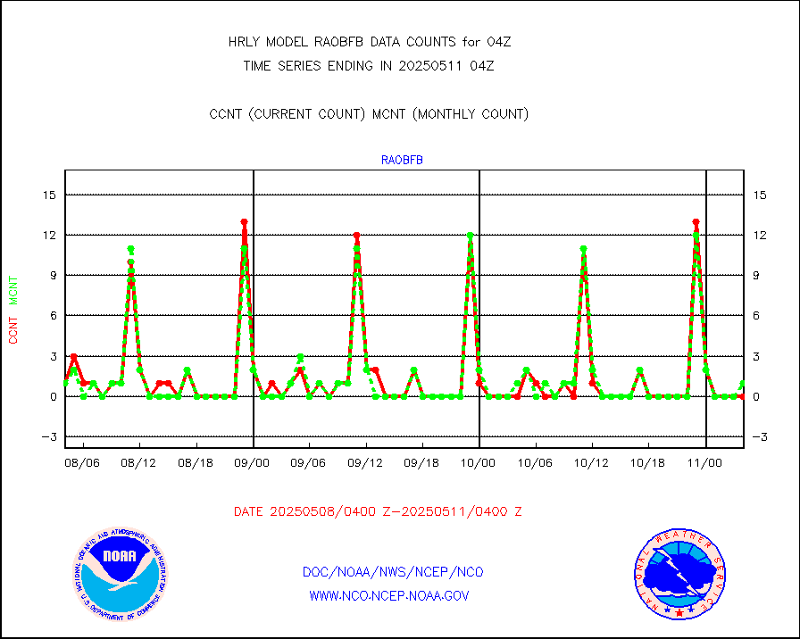
GPS radio occultation data |
577 |
564 |
102.3 % |
0201.50-0202.49 |
||||||||||
GOES-16/17 All Sky Radiances (proc.) |
720952 |
720952 |
100.0 % |
0203.50-0204.49 |
||||||||||
GOES-16/17 Clear Sky Radiances (proc.) |
344080 |
355711 |
96.7 % |
0203.50-0204.49 |
||||||||||
MTSAT/JMA water vapor imager derived cloud motion |
21530 |
19814 |
108.7 % |
0201.50-0202.49 |
||||||||||
MODIS (AQUA/TERRA) wvpr imager derived cld motion |
0 |
0 |
n/a |
0200.00-0200.99 |
||||||||||
GOES-16&up/NESDIS wv imgr/cld-top derived cld mtn |
26092 |
27824 |
93.8 % |
0203.00-0203.99 |
||||||||||
METEOSAT/EUMETSAT ir lg-wave drv cld motion NBseq |
21892 |
20971 |
104.4 % |
0202.50-0203.49 |
||||||||||
MTSAT/JMA infrared long-wave derived cloud motion |
16800 |
16627 |
101.0 % |
0201.50-0202.49 |
||||||||||
MODIS (AQUA/TERRA) ir l-wave derived cloud motion |
0 |
0 |
n/a |
0200.00-0200.99 |
||||||||||
GOES-16&up/NESDIS ir long-wave derived cld motion |
79546 |
82119 |
96.9 % |
0203.00-0203.99 |
||||||||||
GOES/NASA(Langley) hi-res. (1x1 f-o-v) cloud data |
6433475 |
6216991 |
103.5 % |
0203.50-0204.49 |
||||||||||
Buoys decoded from FM-13 format (moored) |
117 |
121 |
96.7 % |
0203.50-0204.49 |
||||||||||
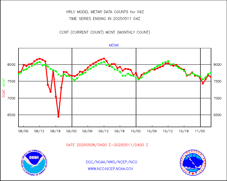
Aviation - METAR |
7754 |
7684 |
100.9 % |
0203.50-0204.49 |
||||||||||
Mesonet/MADIS Colorado E-470 (Interstate 470) |
24 |
24 |
100.0 % |
0203.50-0204.49 |
||||||||||
Mesonet/MADIS Alaska Department of Transportation |
116 |
87 |
133.3 % |
0203.50-0204.49 |
||||||||||
Mesonet/MADIS U.S. Army Aberdeen Proving Grounds |
0 |
0 |
n/a |
0203.50-0204.49 |
||||||||||
Mesonet/MADIS Citizen Weather Observers Program |
48280 |
57566 |
83.9 % |
0203.50-0204.49 |
||||||||||
Mesonet/MADIS AWS Convergence Technologies, Inc. |
16092 |
19691 |
81.7 % |
0203.50-0204.49 |
||||||||||
Mesonet/MADIS "Anything Weather" |
0 |
0 |
n/a |
0203.50-0204.49 |
||||||||||
Mesonet/MADIS Colorado Dept. of Transportation |
0 |
0 |
n/a |
0203.50-0204.49 |
||||||||||
Mesonet/MADIS DC Net |
0 |
0 |
n/a |
0203.50-0204.49 |
||||||||||
Mesonet/MADIS Denver Urban Drainage & Flood Cntrl |
0 |
0 |
n/a |
0203.50-0204.49 |
||||||||||
Mesonet/MADIS Florida (FAWN & USF) |
3 |
3 |
100.0 % |
0203.50-0204.49 |
||||||||||
Mesonet/MADIS Florida Dept. of Transportation |
0 |
0 |
n/a |
0203.50-0204.49 |
||||||||||
Mesonet/MADIS Georgia Dept. of Transportation |
0 |
0 |
n/a |
0203.50-0204.49 |
||||||||||
Mesonet/MADIS NWS Hydromet Auto Data System(HADS) |
5892 |
6178 |
95.4 % |
0203.50-0204.49 |
||||||||||
Mesonet/MADIS Iowa Environmental |
189 |
185 |
102.2 % |
0203.50-0204.49 |
||||||||||
Mesonet/MADIS Indiana Dept. of Transportation |
0 |
0 |
n/a |
0203.50-0204.49 |
||||||||||
Mesonet/MADIS Iowa Department of Transportation |
0 |
0 |
n/a |
0203.50-0204.49 |
||||||||||
Mesonet/MADIS Kansas Department of Transportation |
346 |
350 |
98.9 % |
0203.50-0204.49 |
||||||||||
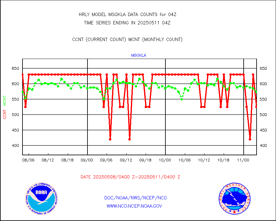
Mesonet/MADIS Oklahoma Mesonet |
630 |
609 |
103.4 % |
0203.50-0204.49 |
||||||||||
Mesonet/MADIS Louisiana State/Jackson State Univ. |
0 |
0 |
n/a |
0203.50-0204.49 |
||||||||||
Mesonet/MADIS Missouri Commercial Agricult Wx Net |
332 |
329 |
100.9 % |
0203.50-0204.49 |
||||||||||
Mesonet/MADIS Minnesota Dept. of Transportation |
0 |
0 |
n/a |
0203.50-0204.49 |
||||||||||
Mesonet/MADIS NOS-Phys Oceanographic Realtime Sys |
370 |
383 |
96.6 % |
0203.50-0204.49 |
||||||||||
Mesonet/MADIS many providers, not separated out |
59903 |
69806 |
85.8 % |
0203.00-0204.49 |
||||||||||
Mesonet/MADIS Virginia Dept. of Transportation |
0 |
0 |
n/a |
0203.50-0204.49 |
||||||||||
Mesonet/MADIS "Weather for You" |
0 |
0 |
n/a |
0203.50-0204.49 |
||||||||||
Mesonet/MADIS Wisconsin Dept. of Transportation |
0 |
0 |
n/a |
0203.50-0204.49 |
||||||||||
Mesonet/MADIS MesoWest (many subproviders) |
23537 |
35031 |
67.2 % |
0203.50-0204.49 |
||||||||||
Mesonet/MADIS West Texas |
5658 |
6025 |
93.9 % |
0203.50-0204.49 |
||||||||||
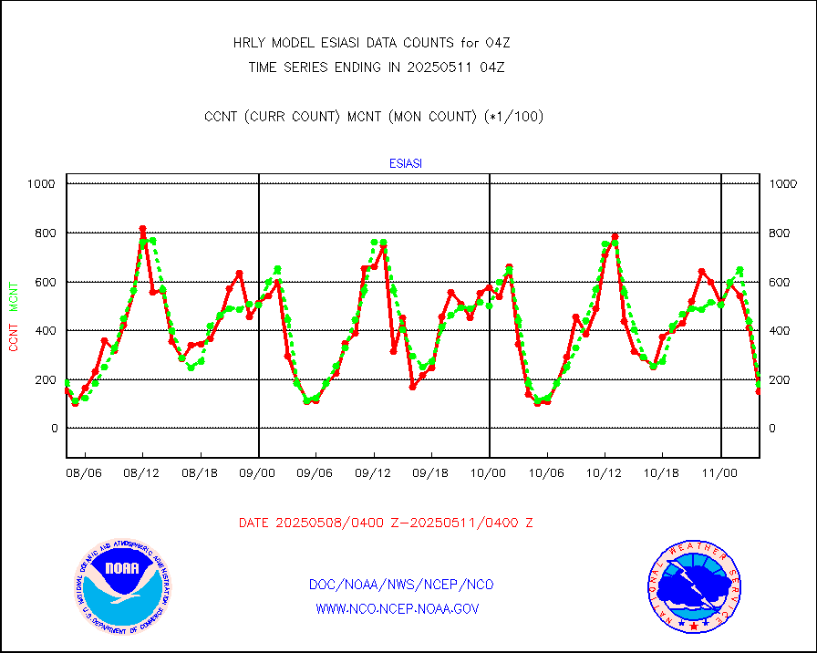
METOP 1-2 IASI 1C radiance data (varbl. channels) |
93916 |
92315 |
101.7 % |
0202.00-0202.99 |
||||||||||
NEXRAD Vel Azm Dsp(VAD) winds via radar coded msg |
0 |
0 |
n/a |
0203.50-0204.49 |
||||||||||
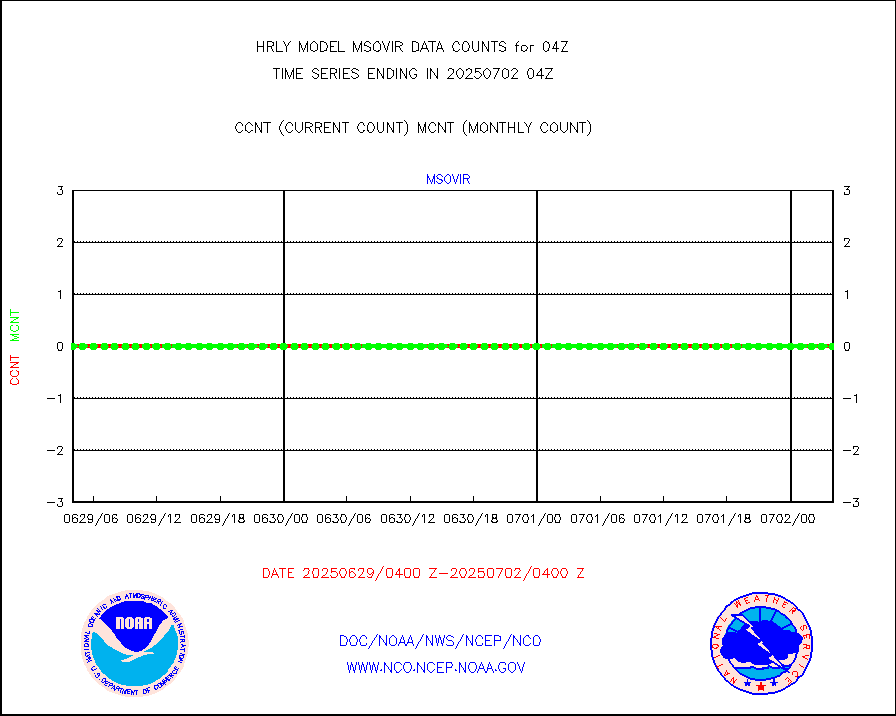
Aura Ozone Monitoring Instrument (OMI) data |
0 |
0 |
n/a |
0201.50-0202.49 |
||||||||||
NOAA 16-19 Solar Backscatter UV-2 rad frm V8 BUFR |
0 |
0 |
n/a |
0202.00-0202.99 |
||||||||||
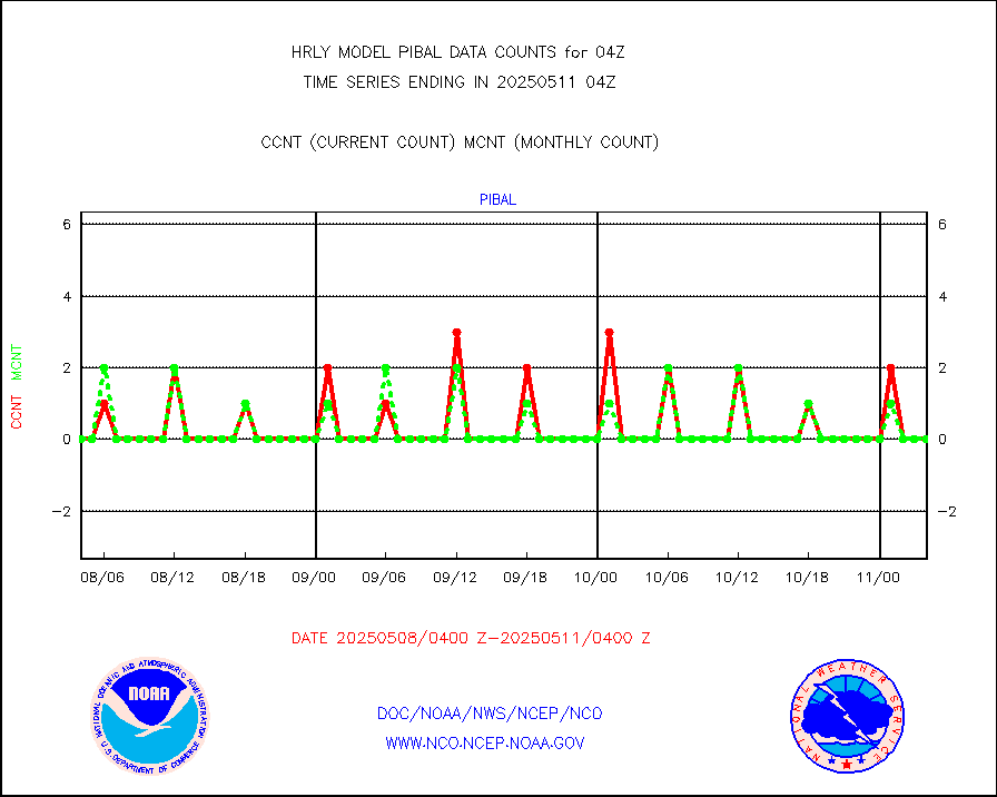
PIBAL (from PILOT, PILOT SHIP, PILOT MOBIL) |
0 |
0 |
n/a |
0203.50-0204.49 |
||||||||||
Multi-Agency Profiler (MAP) and SODAR winds |
47 |
48 |
97.9 % |
0203.50-0204.49 |
||||||||||
Rawinsonde - fixed land (from TEMP or PILOT) |
0 |
0 |
n/a |
0203.50-0204.49 |
||||||||||
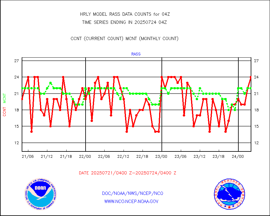
RASS temperatures (NOAA and Multi-Agency) |
27 |
26 |
103.8 % |
0203.50-0204.49 |
||||||||||
NEXRAD reflectivity (Lvl 2 - GTS) |
4607308 |
4244500 |
108.5 % |
0203.50-0204.49 |
||||||||||
NEXRAD radial wind (Level 2 - GTS) |
2240610 |
2039103 |
109.9 % |
0203.50-0204.49 |
||||||||||
METEOSAT-10 2nd Gen SEVIRI Clr Sky Radiance(proc) |
0 |
0 |
n/a |
0203.50-0204.49 |
||||||||||
Ship - manual and automatic, restricted (BUFR) |
0 |
0 |
n/a |
0203.50-0204.50 |
||||||||||
Ship - manual and automatic, unrestricted |
187 |
194 |
96.4 % |
0203.50-0204.50 |
||||||||||
Ship - manual and automatic, unrestricted (BUFR) |
976 |
894 |
109.2 % |
0203.50-0204.50 |
||||||||||
Synoptic - fixed manual and automatic |
747 |
759 |
98.4 % |
0203.50-0204.49 |
||||||||||
Synoptic - fixed manual & auto (decoded fr BUFR) |
5133 |
5116 |
100.3 % |
0203.50-0204.49 |
||||||||||
Synoptic - restricted (WMO Res 40) manual & auto. |
0 |
0 |
n/a |
0203.50-0204.49 |
||||||||||
Synoptic - restricted (WMO Res 40)(decoded BUFR) |
344 |
417 |
82.5 % |
0203.50-0204.49 |
||||||||||
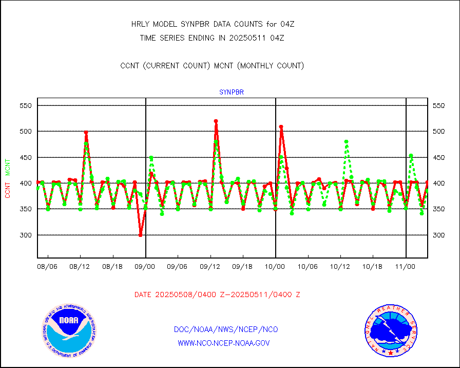
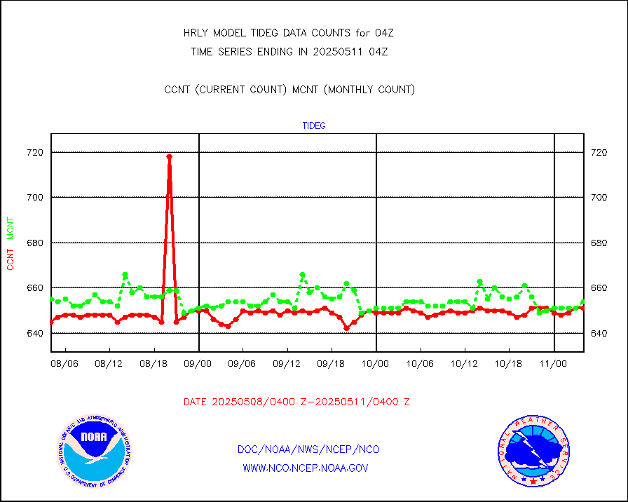
Tide gauge reports decoded from CREX format |
662 |
656 |
100.9 % |
0203.00-0203.99 |
||||||||||
| Data Types of Opportunity with Normal Counts | ||||||||||||||
|---|---|---|---|---|---|---|---|---|---|---|---|---|---|---|
| Type | Description | Hourly Count | Monthly Average | Percent (%) of Monthly Mean | UTC Time Window | |||||||||
GOES-16&up/NESDIS ir short-wv derived cld motion |
31571 |
34112 |
92.6 % |
0203.00-0203.99 |
||||||||||
MDCRS ACARS acft data (ARINC via AFWA)(AIREP fmt) |
0 |
0 |
n/a |
0203.50-0204.49 |
||||||||||
Himawari Clear Sky Radiance |
0 |
0 |
n/a |
0203.00-0203.99 |
||||||||||
GCOM-W AMSR2 1B brightness temperatures |
2309472 |
2147229 |
107.6 % |
0202.00-0202.99 |
||||||||||
NPP/NOAA-20 ATMS bright. temps-direct b-cast SSEC |
87918 |
125777 |
69.9 % |
0202.50-0203.49 |
||||||||||
POES/NESDIS - processed ATOVS soundings/radiances |
0 |
0 |
n/a |
0202.00-0202.99 |
||||||||||
A.M.(N17,M2,M3) AVHRR GAC NCEP-proc clr&sea btmps |
998940 |
926803 |
107.8 % |
0201.50-0202.49 |
||||||||||
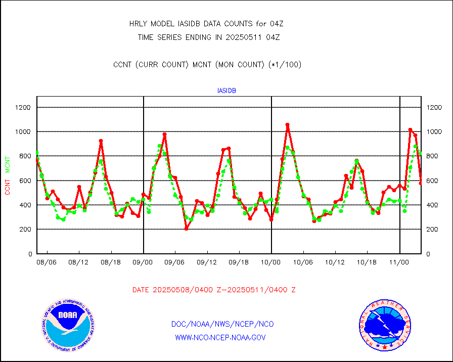
eXpendable BathyThermograph, mooring (BATHY fmt) |
0 |
0 |
n/a |
0121.00-0121.99 |
||||||||||
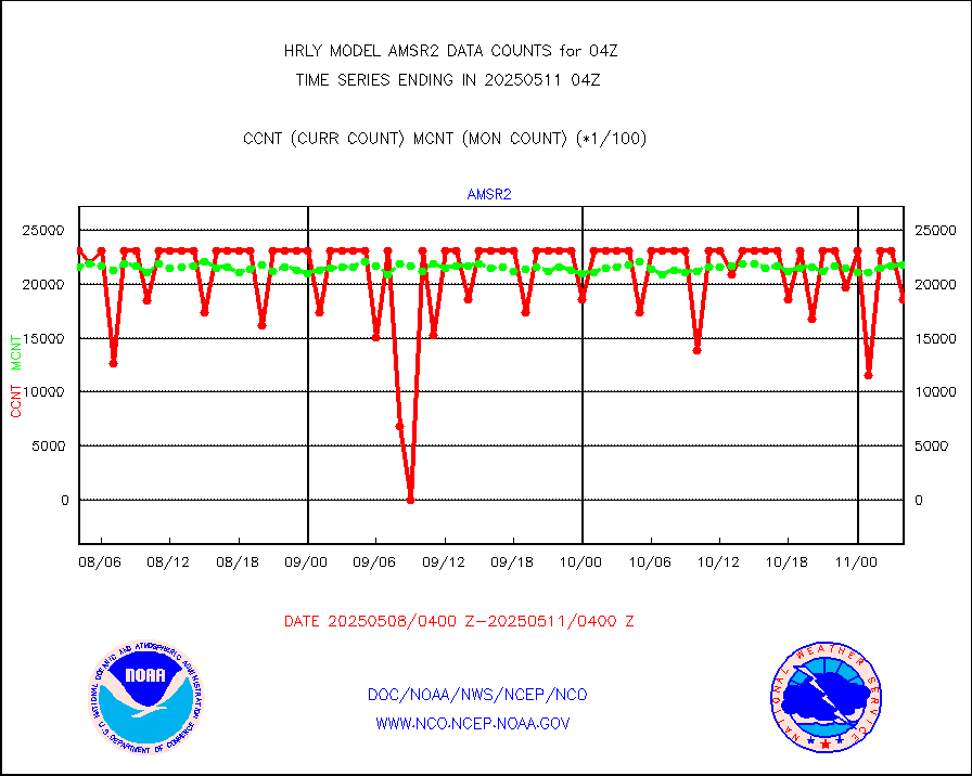
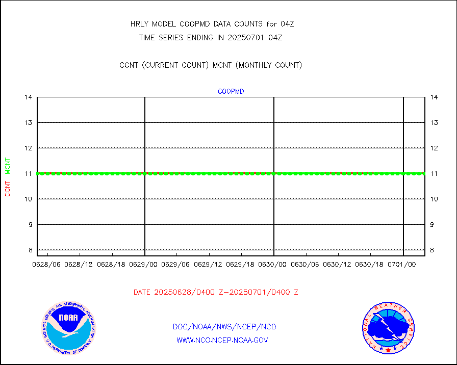
Coop/MADIS NEPP & HCN-Modernization NOAA COOP Obs |
11 |
11 |
100.0 % |
0203.50-0204.49 |
||||||||||
NPP/NOAA-20 CrIS full spctrl radn (431 ch subset) |
239940 |
235224 |
102.0 % |
0202.50-0203.49 |
||||||||||
NPP/NOAA-20 CrIS full spctrl radn dir brdcst SSEC |
54846 |
62821 |
87.3 % |
0202.50-0203.49 |
||||||||||
Coast Guard |
5 |
5 |
100.0 % |
0203.50-0204.50 |
||||||||||
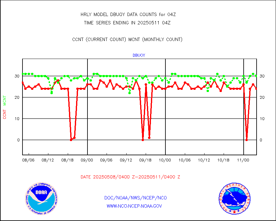
Drifting buoys (decoded from BUFR) |
1450 |
1423 |
101.9 % |
0203.50-0204.50 |
||||||||||
Dropwinsonde (from TEMP DROP) |
0 |
0 |
n/a |
0203.50-0204.49 |
||||||||||
Dropwinsonde (decoded from BUFR) |
1 |
1 |
100.0 % |
0203.51-0204.49 |
||||||||||
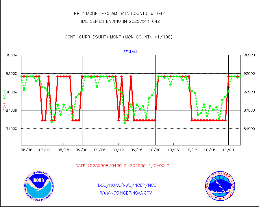
GOES imager effective cloud amount data (U.Wisc.) |
9250602 |
8633895 |
107.1 % |
0203.50-0204.49 |
||||||||||
METOP 1-2 IASI 1C radiance data vbl chn from RARS |
13760 |
8219 |
167.4 % |
0203.00-0203.99 |
||||||||||
NOAA 18-19 & METOP 1-2 MHS proc. btemps from RARS |
106714 |
158122 |
67.5 % |
0203.50-0204.49 |
||||||||||
GOES/NESDIS (11x17 f-o-v) imager clear radiances |
0 |
0 |
n/a |
0203.00-0203.99 |
||||||||||
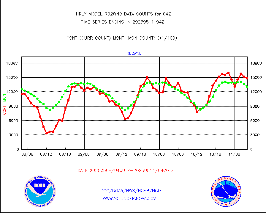
METOP 1-2 Global Ozone Monitoring Exp.-2 (GOME-2) |
2520 |
9133 |
27.6 % |
0202.50-0203.49 |
||||||||||
GOES-16&up/NESDIS wv imgr/deep-lyr derivd cld mtn |
20084 |
17251 |
116.4 % |
0203.00-0203.99 |
||||||||||
METEOSAT/EUMETSAT wvpr imgr drv cld motion NBseq |
33670 |
36178 |
93.1 % |
0202.50-0203.49 |
||||||||||
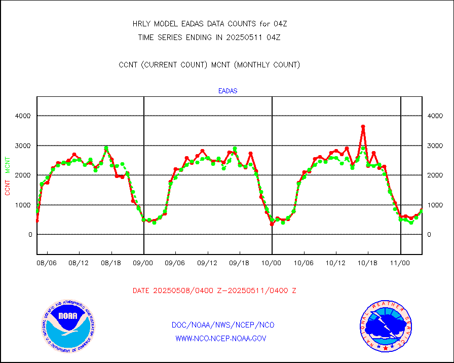
High Density OBs from reconnaissance acft data |
0 |
3 |
0.0 % |
0203.50-0204.49 |
||||||||||
METOP 1-2 IASI 1C radiances-direct broadcast SSEC |
93738 |
80070 |
117.1 % |
0202.50-0203.49 |
||||||||||
VIIRS (NPP/NOAA-20) ir lg-wv drv cloud motion(NB) |
17278 |
19213 |
89.9 % |
0200.00-0200.99 |
||||||||||
AVHRR (NOAA/METOP) ir lg-wave derived cld motion |
0 |
0 |
n/a |
0200.00-0200.99 |
||||||||||
AVHRR (METOP) ir lg-wave derived cld motion |
0 |
0 |
n/a |
0203.50-0204.50 |
||||||||||
INSAT/KALPANA India ir lg-wave derived cld motion |
0 |
0 |
n/a |
0201.50-0202.49 |
||||||||||
Korean AMDAR aircraft data (decoded from BUFR) |
72 |
40 |
180.0 % |
0203.50-0204.49 |
||||||||||
Land-based CMAN stations decoded from CMAN format |
107 |
86 |
124.4 % |
0203.50-0204.49 |
||||||||||
LEO-GEO satellite AMVs from UWisc. |
6745 |
7311 |
92.3 % |
0200.00-0200.99 |
||||||||||
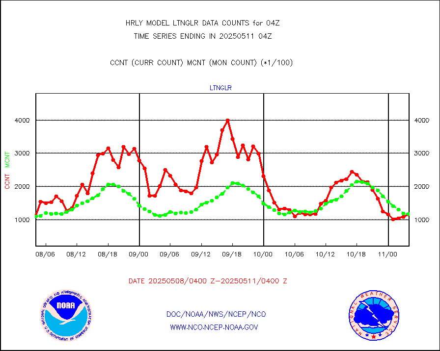
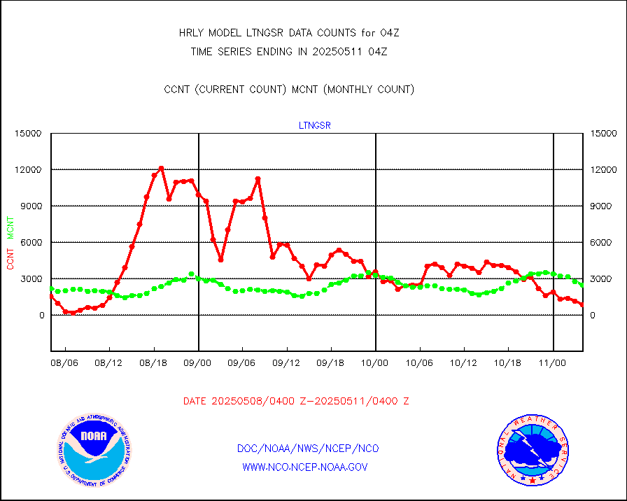
LLDN Long-rng lightning from Vaisala via NOAAPORT |
149571 |
161903 |
92.4 % |
0203.50-0204.49 |
||||||||||
NLDN Shrt-rng lightning from Vaisala via NOAAPORT |
4334 |
6346 |
68.3 % |
0203.50-0204.49 |
||||||||||
Moored buoys (decoded from BUFR) |
982 |
937 |
104.8 % |
0203.50-0204.50 |
||||||||||
Aura Microwave Limb Sounder (MLS) ozone data |
0 |
0 |
n/a |
0202.00-0202.99 |
||||||||||
Mesonet/MADIS UrbaNet |
3422 |
3532 |
96.9 % |
0203.50-0204.49 |
||||||||||
NEXRAD Vel Azm Dsp(VAD) winds via Level 2 decoder |
585 |
573 |
102.1 % |
0203.50-0204.49 |
||||||||||
OMPS Limb Profiler ozone data (NPP) |
460 |
261 |
176.2 % |
0121.00-0121.99 |
||||||||||
OMPS nadir profile ozone (Version 8 BUFR) |
629 |
557 |
112.9 % |
0202.00-0202.99 |
||||||||||
OMPS total column ozone (Version 8 BUFR) |
337712 |
343393 |
98.3 % |
0202.00-0202.99 |
||||||||||
PIBAL (decoded from BUFR) |
0 |
0 |
n/a |
0203.51-0204.49 |
||||||||||
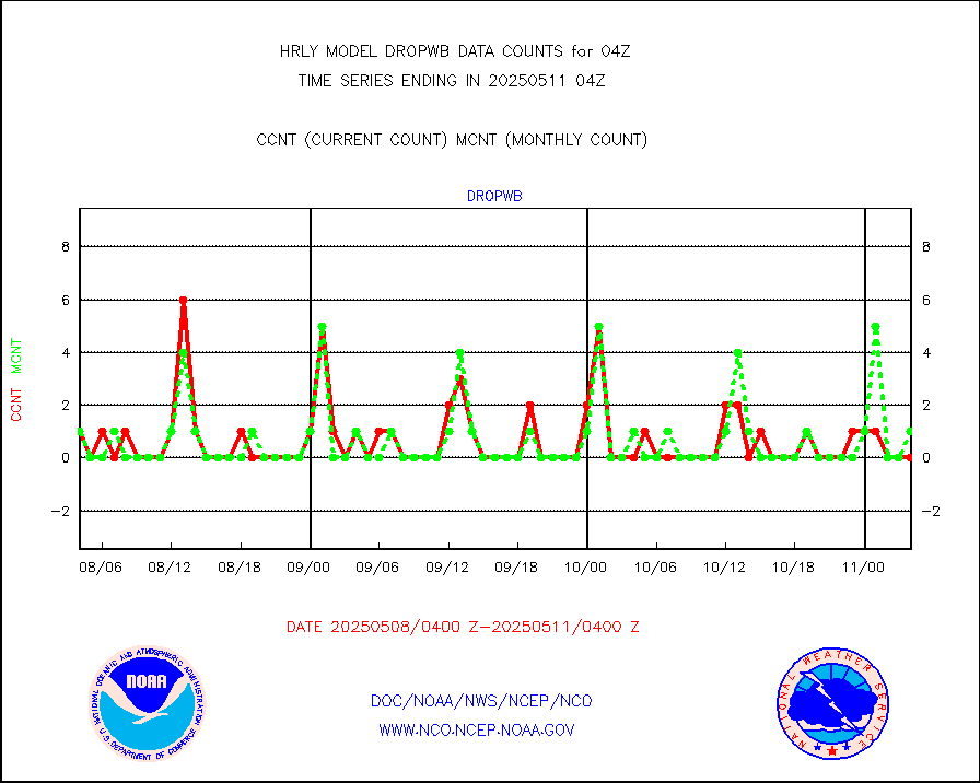
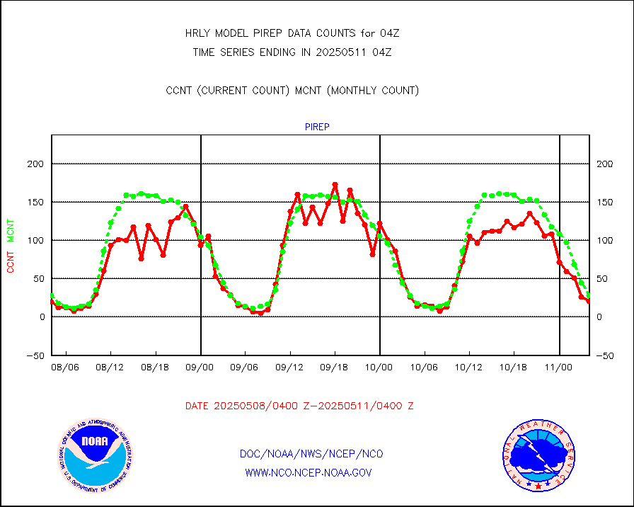
Manual PIREP aircraft data (dcded from AIREP fmt) |
23 |
19 |
121.1 % |
0203.50-0204.49 |
||||||||||
Profilr winds from PIBAL (PILOT,PILOT SHIP/MOBIL) |
0 |
0 |
n/a |
0203.50-0204.49 |
||||||||||
Rawinsonde - fixed land (decoded from BUFR) |
1 |
1 |
100.0 % |
0203.51-0204.49 |
||||||||||
Rawinsonde - mobile land (from TEMP/PILOT MOBIL) |
0 |
0 |
n/a |
0203.50-0204.49 |
||||||||||
Rawinsonde - mobile land (decoded from BUFR) |
0 |
0 |
n/a |
0203.51-0204.49 |
||||||||||
Rawinsonde - ship (from TEMP SHIP, PILOT SHIP) |
0 |
0 |
n/a |
0203.50-0204.49 |
||||||||||
Rawinsonde - ship (decoded from BUFR) |
0 |
0 |
n/a |
0203.51-0204.49 |
||||||||||
Flight level reconnaissance aircraft data |
0 |
0 |
n/a |
0203.50-0204.49 |
||||||||||
Megha-Tropiques SAPHIR L1A2 brightness temps |
0 |
0 |
n/a |
0201.50-0202.49 |
||||||||||
METEOSAT-10 2nd Gen SEVIRI All Sky Radiance(proc) |
75512 |
75438 |
100.1 % |
0203.50-0204.49 |
||||||||||
Ship - manual and automatic, restricted |
7 |
13 |
53.8 % |
0203.50-0204.49 |
||||||||||
DMSP SSM/IS 1C radiance data (Unified Pre-Proc.) |
186900 |
120984 |
154.5 % |
0202.50-0203.49 |
||||||||||
NPP/NOAA-20 VIIRS SST - CLEAR & OVER WATER |
171283 |
1754293 |
9.8 % |
0203.50-0204.49 |
||||||||||
NPP/NOAA-20 VIIRS SST - PROBABLY CLR & OVER WATER |
44010 |
390446 |
11.3 % |
0203.50-0204.49 |
||||||||||
Synoptic - mobile manual and automatic |
737 |
697 |
105.7 % |
0203.50-0204.49 |
||||||||||
Synoptic - mobile manual & auto (decoded fr BUFR) |
1 |
1 |
100.0 % |
0203.50-0204.49 |
||||||||||
CTD probe, Argo prflng float, mooring (TESAC fmt) |
221 |
209 |
105.7 % |
0203.50-0204.49 |
||||||||||
TAMDAR aircft data-all types(from Panasonic,BUFR) |
62 |
39 |
159.0 % |
0203.50-0204.49 |
||||||||||
ThermoSalinoGraph (TSG) TRACKOB format) |
90 |
96 |
93.8 % |
0202.50-0203.49 |
||||||||||
INSAT/KALPANA India visible derived cloud motion |
0 |
0 |
n/a |
0201.50-0202.49 |
||||||||||
INDIA SATWIND, INSAT VIS channel |
0 |
7 |
0.0 % |
0203.00-0203.99 |
||||||||||
MTSAT/JMA visible derived cloud motion |
10920 |
10891 |
100.3 % |
0201.50-0202.49 |
||||||||||
GOES-16&up/NESDIS visible derived cloud motion |
132410 |
110050 |
120.3 % |
0203.00-0203.99 |
||||||||||
METEOSAT/EUMETSAT visible drv cld motion NBseq |
8098 |
8770 |
92.3 % |
0202.50-0203.49 |
||||||||||


