| Suspect Data Shortages in Critical Types - Monitor | ||||||||||||||
|---|---|---|---|---|---|---|---|---|---|---|---|---|---|---|
| Type | Description | Hourly Count | Monthly Average | Percent (%) of Monthly Mean | UTC Time Window | |||||||||
NOAA 18-19 & METOP 1-2 HIRS-4 NCEP-proc. br.temps |
0 |
11179 |
0.0 % |
0100.00-0105.99 |
||||||||||
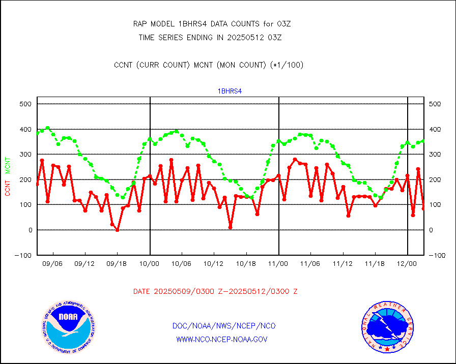
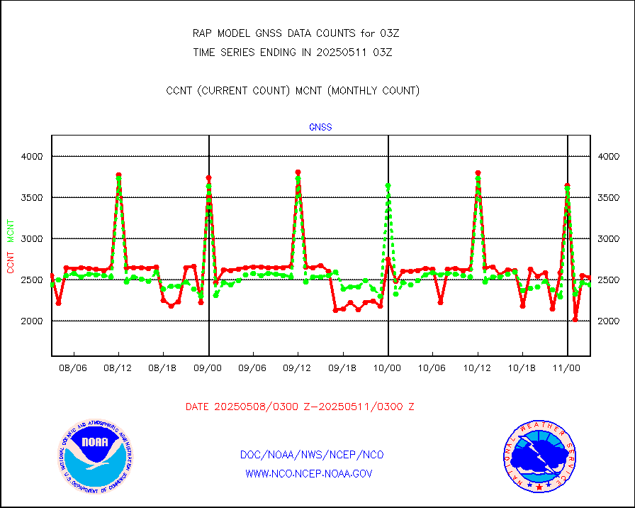
Grnd-based Gbl Navigation Sat System (GNSS) data |
681 |
2111 |
32.3 % |
0101.95-0102.05 |
||||||||||
| Shortage in Data Type of Opportunity - Monitor | ||||||||||||||
|---|---|---|---|---|---|---|---|---|---|---|---|---|---|---|
| Type | Description | Hourly Count | Monthly Average | Percent (%) of Monthly Mean | UTC Time Window | |||||||||
NPP Adv. Tech. MW Sndr (ATMS) br. temps from RARS |
0 |
9120 |
0.0 % |
0101.00-0104.99 |
||||||||||
NOAA 15-19 & METOP 1-2 HIRS-3/4 pr btmps frm RARS |
0 |
10165 |
0.0 % |
0102.00-0104.00 |
||||||||||
| Critical Data with Normal Counts | ||||||||||||||
|---|---|---|---|---|---|---|---|---|---|---|---|---|---|---|
| Type | Description | Hourly Count | Monthly Average | Percent (%) of Monthly Mean | UTC Time Window | |||||||||
NOAA 15-19 & METOP 1-2 AMSU-A NCEP-proc. br.temps |
19159 |
28194 |
68.0 % |
0100.00-0105.99 |
||||||||||
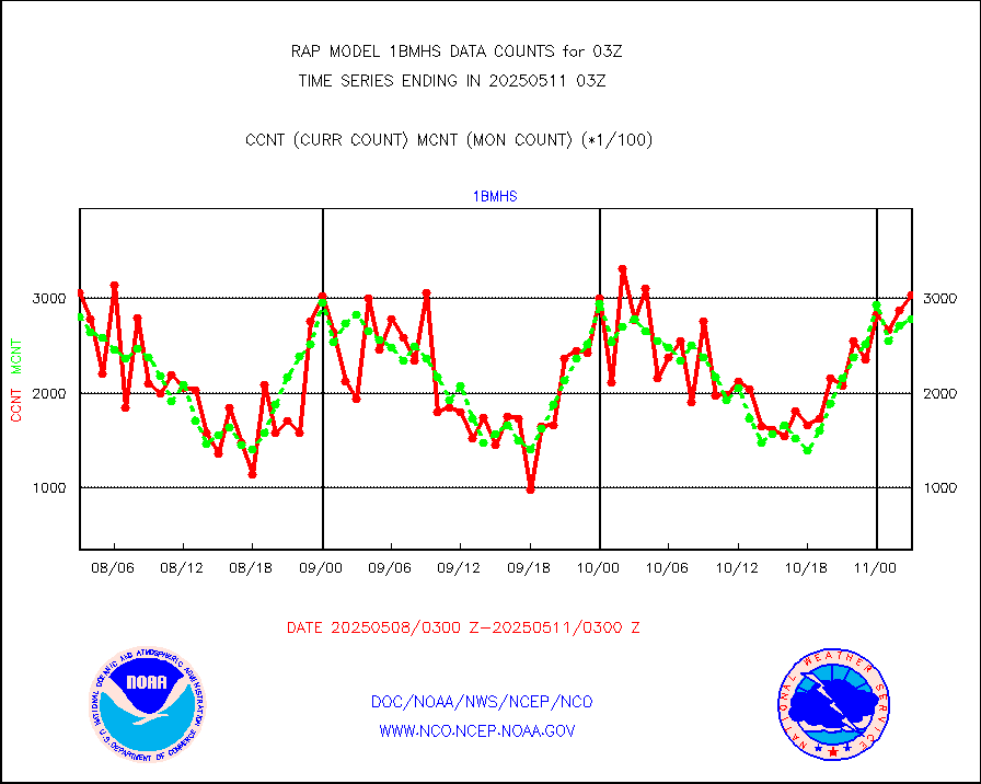
NOAA 18-19 & METOP 1-2 MHS NCEP-proces. br. temps |
171926 |
243141 |
70.7 % |
0100.00-0105.99 |
||||||||||
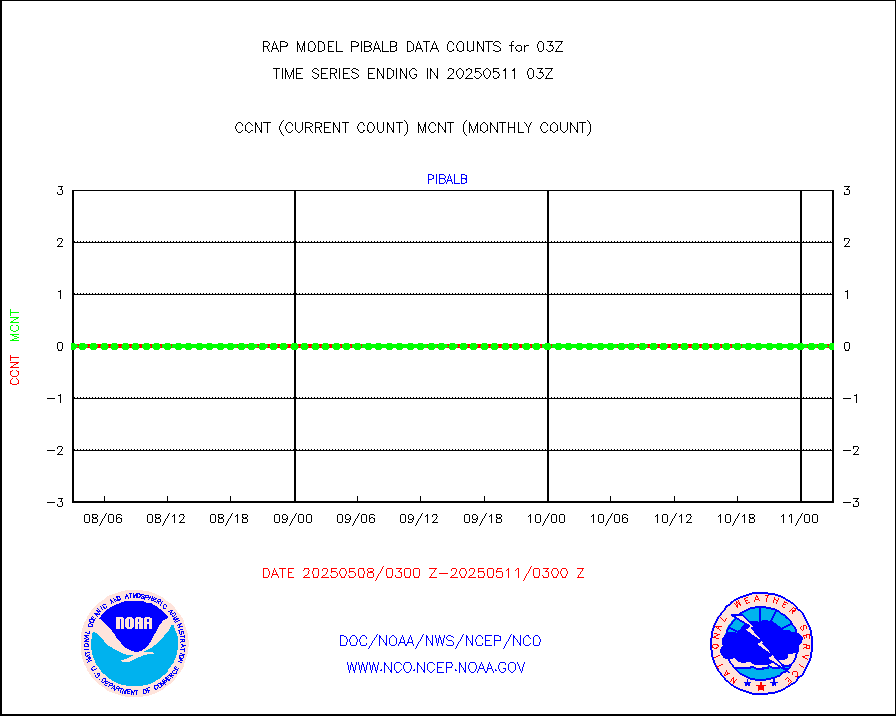
MDCRS ACARS acft data from ARINC(dcded from BUFR) |
120026 |
132007 |
90.9 % |
3023.75-0106.25 |
||||||||||
Canadian AMDAR aircraft data (decoded from BUFR) |
0 |
0 |
n/a |
3023.75-0106.25 |
||||||||||
Surface Marine CMAN rpts decoded from BUFR format |
1736 |
1697 |
102.3 % |
0102.50-0103.50 |
||||||||||
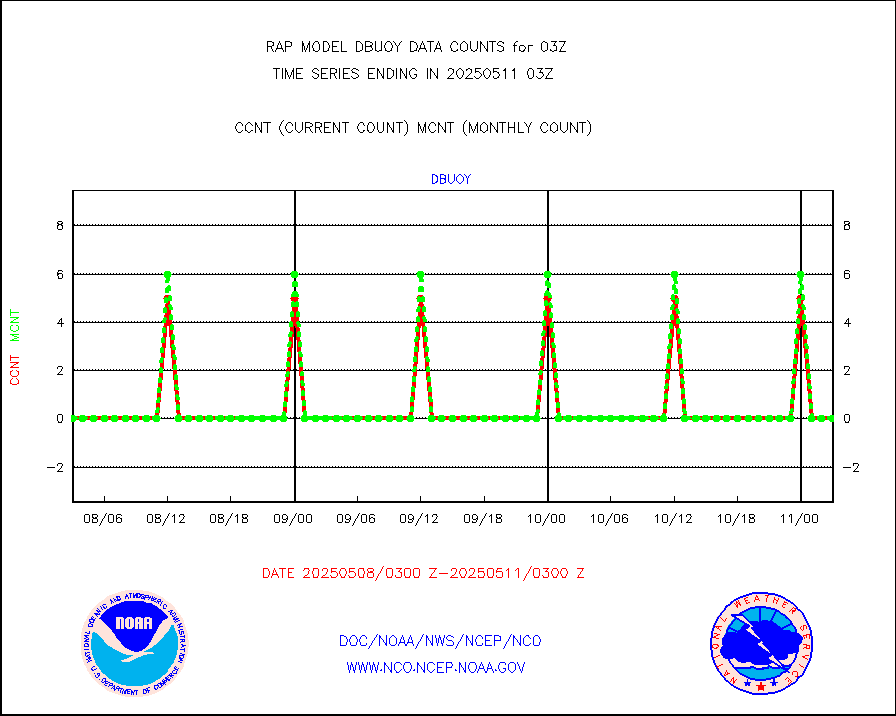
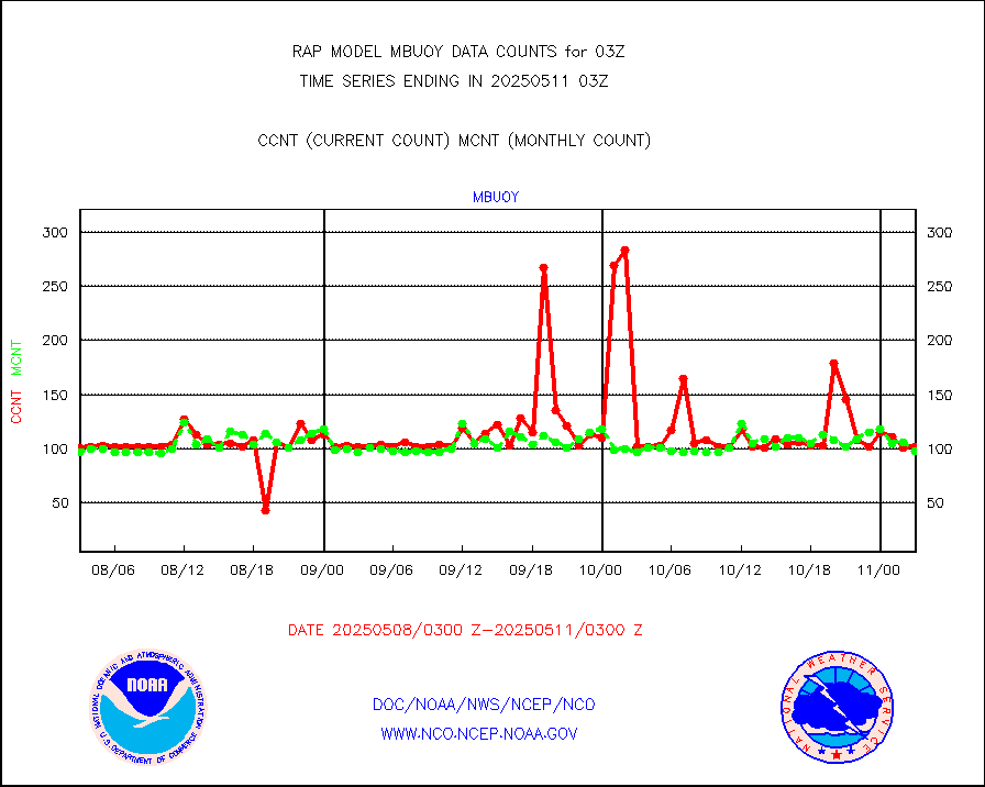
Buoys decoded from FM-18 fmt (moored or drifting) |
0 |
0 |
n/a |
0102.50-0103.50 |
||||||||||
MODIS (AQUA/TERRA) wvpr imager derived cld motion |
0 |
0 |
n/a |
0100.50-0105.50 |
||||||||||
MODIS (AQUA/TERRA) ir l-wave derived cloud motion |
0 |
0 |
n/a |
0100.50-0105.50 |
||||||||||
GOES/NASA(Langley) hi-res. (1x1 f-o-v) cloud data |
1870654 |
1869705 |
100.1 % |
0102.50-0103.50 |
||||||||||
Buoys decoded from FM-13 format (moored) |
118 |
115 |
102.6 % |
0102.50-0103.50 |
||||||||||
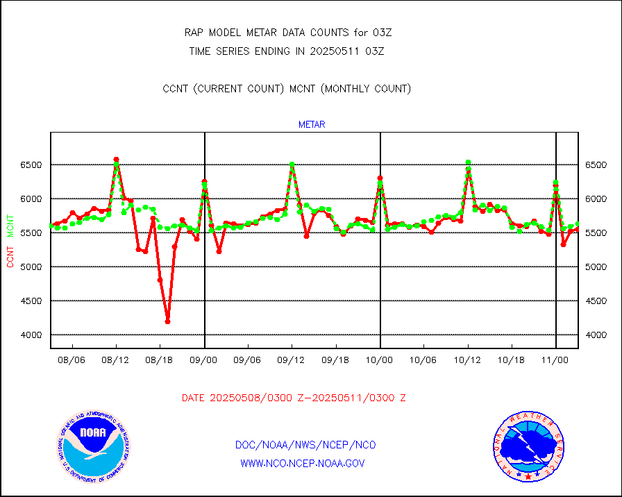
Aviation - METAR |
5602 |
5555 |
100.8 % |
0102.50-0103.50 |
||||||||||
NEXRAD Vel Azm Dsp(VAD) winds via radar coded msg |
0 |
0 |
n/a |
0102.00-0104.00 |
||||||||||
Multi-Agency Profiler (MAP) and SODAR winds |
104 |
95 |
109.5 % |
0101.50-0104.50 |
||||||||||
Rawinsonde - fixed land (from TEMP or PILOT) |
0 |
0 |
n/a |
0102.00-0104.00 |
||||||||||
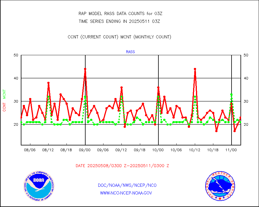
RASS temperatures (NOAA and Multi-Agency) |
26 |
21 |
123.8 % |
0102.50-0103.50 |
||||||||||
Ship - manual and automatic, restricted (BUFR) |
8 |
10 |
80.0 % |
0102.50-0103.50 |
||||||||||
Ship - manual and automatic, unrestricted |
97 |
101 |
96.0 % |
0102.50-0103.50 |
||||||||||
Ship - manual and automatic, unrestricted (BUFR) |
434 |
402 |
108.0 % |
0102.50-0103.50 |
||||||||||
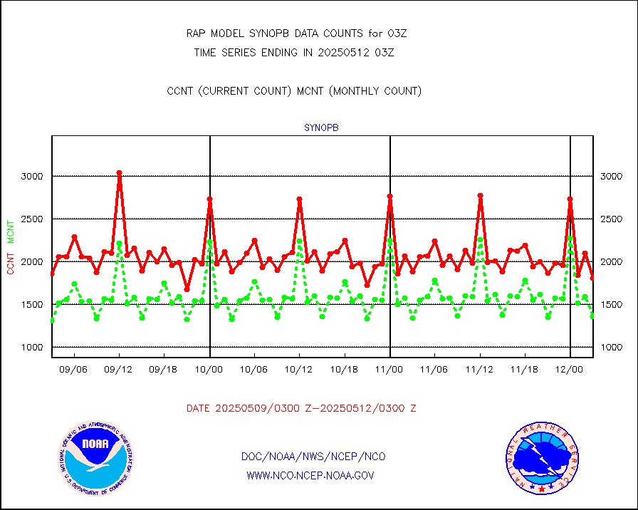
Synoptic - fixed manual and automatic |
397 |
354 |
112.1 % |
0102.50-0103.50 |
||||||||||
Synoptic - fixed manual & auto (decoded fr BUFR) |
1862 |
1770 |
105.2 % |
0102.50-0103.50 |
||||||||||
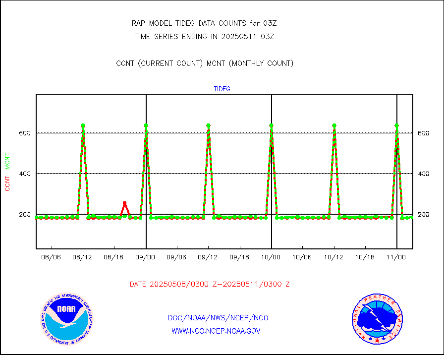
Tide gauge reports decoded from CREX format |
186 |
185 |
100.5 % |
0102.50-0103.50 |
||||||||||
| Data Types of Opportunity with Normal Counts | ||||||||||||||
|---|---|---|---|---|---|---|---|---|---|---|---|---|---|---|
| Type | Description | Hourly Count | Monthly Average | Percent (%) of Monthly Mean | UTC Time Window | |||||||||
GOES-16&up/NESDIS ir short-wv derived cld motion |
4345 |
4071 |
106.7 % |
0102.00-0102.99 |
||||||||||
MDCRS ACARS acft data (ARINC via AFWA)(AIREP fmt) |
0 |
0 |
n/a |
3023.75-0106.25 |
||||||||||
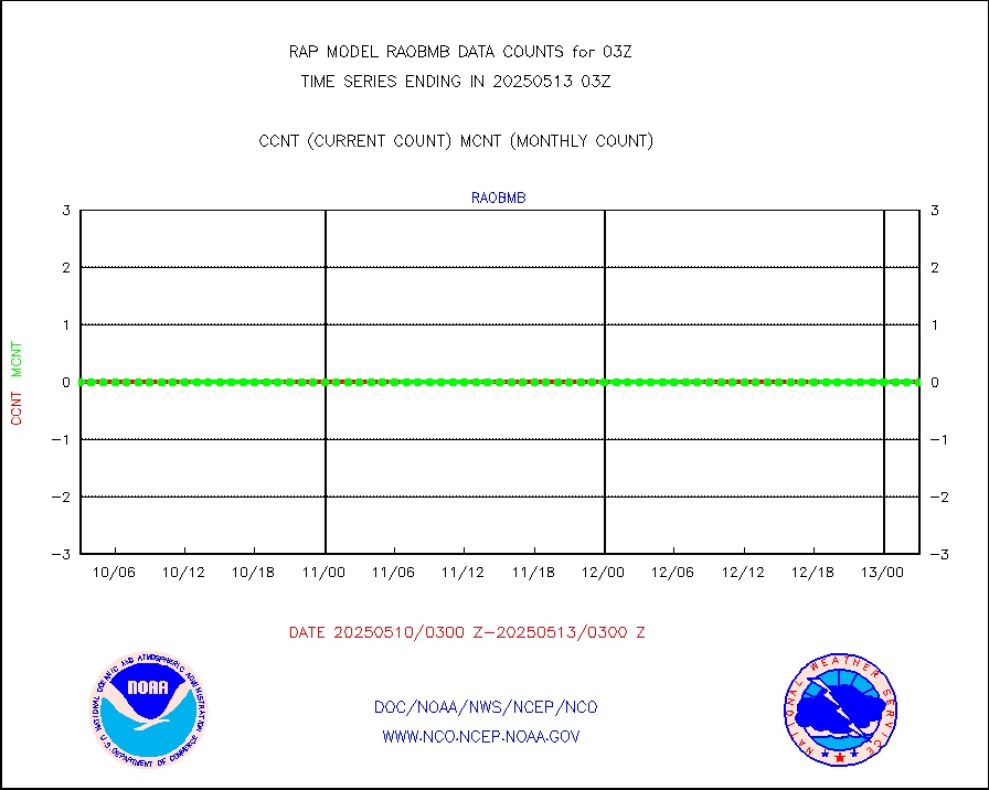
Manual AIREP aircraft data (dcded from AIREP fmt) |
2166 |
2624 |
82.5 % |
3023.75-0106.25 |
||||||||||
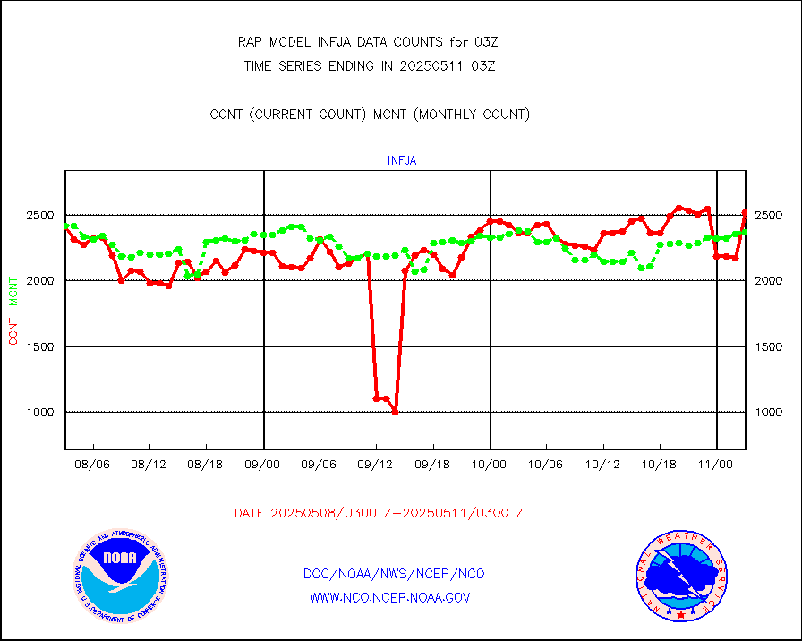
AQUA AIRS/AMSU-A/HSB brightness temps- every FOV |
0 |
0 |
n/a |
0100.00-0105.99 |
||||||||||
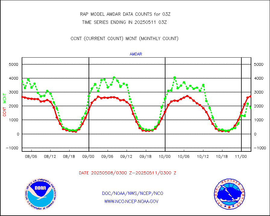
AMDAR aircraft data (decoded from AMDAR format) |
2782 |
2327 |
119.6 % |
3023.75-0106.25 |
||||||||||
AMDAR aircraft data (decoded from BUFR) |
9774 |
10831 |
90.2 % |
3023.75-0106.25 |
||||||||||
GCOM-W AMSR2 1B brightness temperatures |
25823 |
549796 |
4.7 % |
0100.00-0100.99 |
||||||||||
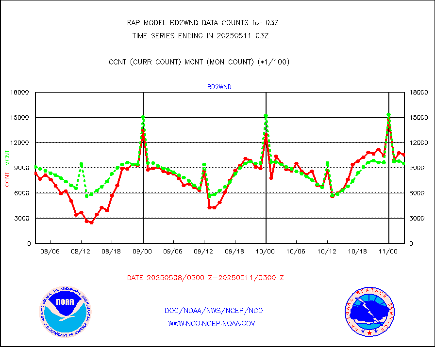
METOP 1-2 ASCAT products |
41894 |
29154 |
143.7 % |
0101.00-0105.00 |
||||||||||
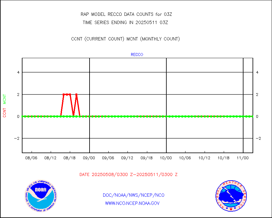
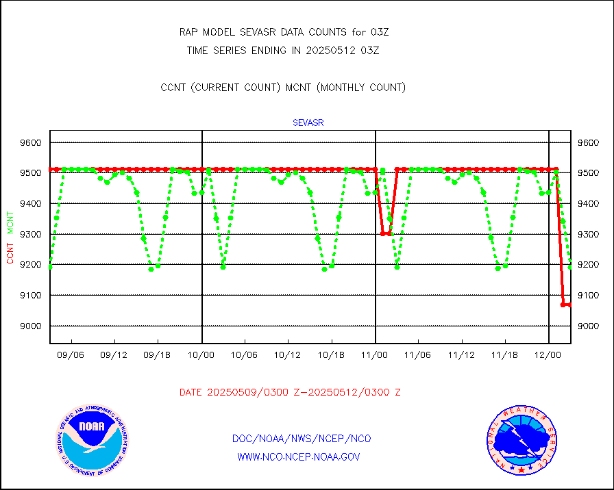
NPP/NOAA-20 ATMS brightness temperatures |
173485 |
149878 |
115.8 % |
0101.00-0104.99 |
||||||||||
NPP/NOAA-20 ATMS bright. temps-direct b-cast SSEC |
35712 |
35964 |
99.3 % |
0101.00-0104.99 |
||||||||||
Coop/MADIS NEPP & HCN-Modernization NOAA COOP Obs |
11 |
11 |
100.0 % |
0102.50-0103.50 |
||||||||||
NPP/NOAA-20 CrIS full spctrl radn (431 ch subset) |
94634 |
88432 |
107.0 % |
0101.00-0104.99 |
||||||||||
NPP/NOAA-20 CrIS full spctrl radn dir brdcst SSEC |
9207 |
16365 |
56.3 % |
0101.00-0104.99 |
||||||||||
Coast Guard |
6 |
6 |
100.0 % |
0102.50-0103.50 |
||||||||||
Drifting buoys (decoded from BUFR) |
525 |
522 |
100.6 % |
0102.50-0103.50 |
||||||||||
Dropwinsonde (from TEMP DROP) |
0 |
0 |
n/a |
0102.00-0104.00 |
||||||||||
Dropwinsonde (decoded from BUFR) |
0 |
0 |
n/a |
0102.00-0104.00 |
||||||||||
E-AMDAR (European AMDAR acft decoded from BUFR) |
2532 |
2852 |
88.8 % |
3023.75-0106.25 |
||||||||||
NOAA 15-19 & METOP 1-2 AMSU-A proc btmps frm RARS |
15109 |
16315 |
92.6 % |
0102.00-0104.00 |
||||||||||
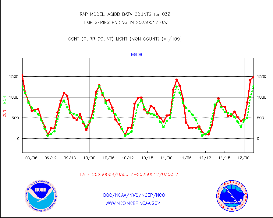
METOP 1-2 IASI 1C radiance data vbl chn from RARS |
2702 |
7384 |
36.6 % |
0101.00-0104.99 |
||||||||||
NOAA 18-19 & METOP 1-2 MHS proc. btemps from RARS |
155318 |
173655 |
89.4 % |
0102.00-0104.00 |
||||||||||
GPM GMI Level 1C-R brightness temperatures |
466085 |
454202 |
102.6 % |
0100.00-0105.99 |
||||||||||
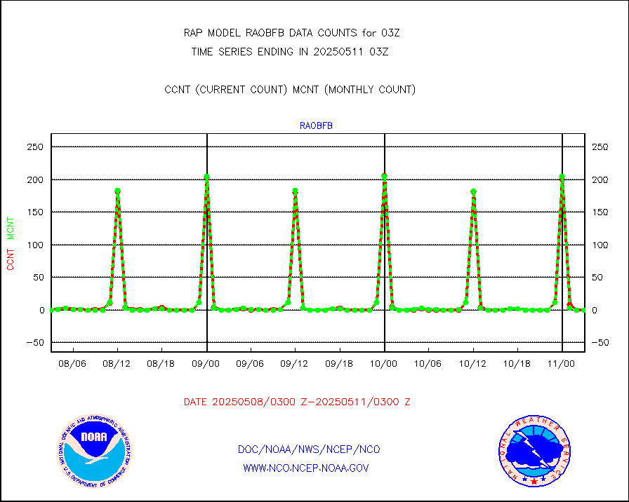
GPS radio occultation data |
181 |
190 |
95.3 % |
0101.00-0104.99 |
||||||||||
GOES-16/17 All Sky Radiances (proc.) |
812097 |
812090 |
100.0 % |
0101.00-0104.99 |
||||||||||
GOES-16/17 Clear Sky Radiances (proc.) |
388086 |
384154 |
101.0 % |
0101.00-0104.99 |
||||||||||
MTSAT/JMA water vapor imager derived cloud motion |
2030 |
2941 |
69.0 % |
0100.50-0105.50 |
||||||||||
GOES-16&up/NESDIS wv imgr/deep-lyr derivd cld mtn |
8123 |
7671 |
105.9 % |
0102.00-0102.99 |
||||||||||
METEOSAT/EUMETSAT wvpr imgr drv cld motion NBseq |
5073 |
5293 |
95.8 % |
0101.50-0104.49 |
||||||||||
GOES-16&up/NESDIS wv imgr/cld-top derived cld mtn |
17168 |
16005 |
107.3 % |
0102.00-0102.99 |
||||||||||
METOP 1-2 IASI 1C radiances-direct broadcast SSEC |
161331 |
138030 |
116.9 % |
0101.00-0104.99 |
||||||||||
METEOSAT/EUMETSAT ir lg-wave drv cld motion NBseq |
3061 |
3121 |
98.1 % |
0101.50-0104.49 |
||||||||||
VIIRS (NPP/NOAA-20) ir lg-wv drv cloud motion(NB) |
0 |
0 |
n/a |
0100.50-0105.50 |
||||||||||
AVHRR (NOAA/METOP) ir lg-wave derived cld motion |
0 |
0 |
n/a |
0100.50-0105.50 |
||||||||||
AVHRR (METOP) ir lg-wave derived cld motion |
0 |
0 |
n/a |
0101.50-0104.49 |
||||||||||
MTSAT/JMA infrared long-wave derived cloud motion |
2033 |
2431 |
83.6 % |
0100.50-0105.50 |
||||||||||
GOES-16&up/NESDIS ir long-wave derived cld motion |
30786 |
30944 |
99.5 % |
0102.00-0102.99 |
||||||||||
Korean AMDAR aircraft data (decoded from BUFR) |
309 |
295 |
104.7 % |
3023.75-0106.25 |
||||||||||
Land-based CMAN stations decoded from CMAN format |
60 |
44 |
136.4 % |
0102.50-0103.50 |
||||||||||
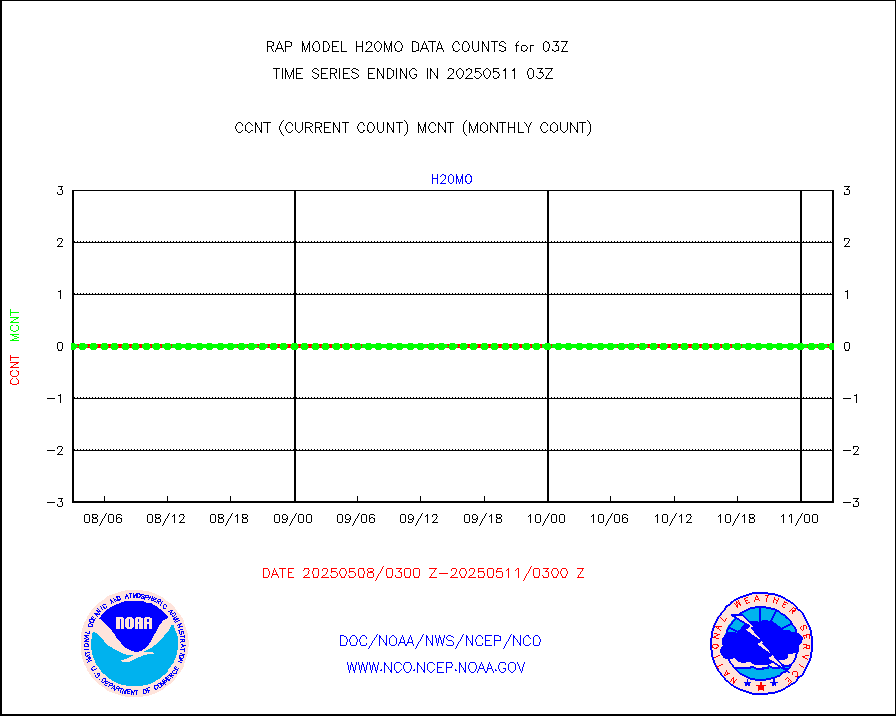
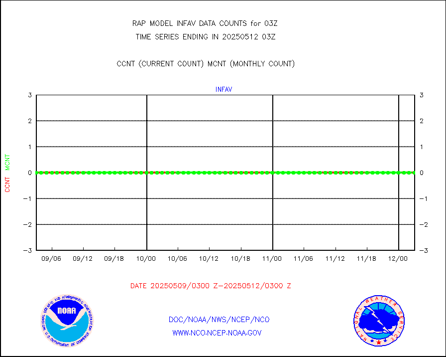
LLDN Long-rng lightning from Vaisala via NOAAPORT |
183943 |
185937 |
98.9 % |
0102.00-0103.50 |
||||||||||
NLDN Shrt-rng lightning from Vaisala via NOAAPORT |
11469 |
9960 |
115.2 % |
0102.00-0103.50 |
||||||||||
Moored buoys (decoded from BUFR) |
684 |
658 |
104.0 % |
0102.50-0103.50 |
||||||||||
Mesonet/MADIS Colorado E-470 (Interstate 470) |
24 |
23 |
104.3 % |
0102.50-0103.50 |
||||||||||
Mesonet/MADIS Alaska Department of Transportation |
119 |
63 |
188.9 % |
0102.50-0103.50 |
||||||||||
Mesonet/MADIS U.S. Army Aberdeen Proving Grounds |
0 |
0 |
n/a |
0102.50-0103.50 |
||||||||||
Mesonet/MADIS Citizen Weather Observers Program |
62688 |
57978 |
108.1 % |
0102.50-0103.50 |
||||||||||
Mesonet/MADIS AWS Convergence Technologies, Inc. |
18930 |
21206 |
89.3 % |
0102.50-0103.50 |
||||||||||
Mesonet/MADIS "Anything Weather" |
0 |
0 |
n/a |
0102.50-0103.50 |
||||||||||
Mesonet/MADIS Colorado Dept. of Transportation |
0 |
0 |
n/a |
0102.50-0103.50 |
||||||||||
Mesonet/MADIS DC Net |
0 |
0 |
n/a |
0102.50-0103.50 |
||||||||||
Mesonet/MADIS Denver Urban Drainage & Flood Cntrl |
0 |
0 |
n/a |
0102.50-0103.50 |
||||||||||
Mesonet/MADIS Florida (FAWN & USF) |
3 |
3 |
100.0 % |
0102.50-0103.50 |
||||||||||
Mesonet/MADIS Florida Dept. of Transportation |
0 |
0 |
n/a |
0102.50-0103.50 |
||||||||||
Mesonet/MADIS Georgia Dept. of Transportation |
0 |
0 |
n/a |
0102.50-0103.50 |
||||||||||
Mesonet/MADIS NWS Hydromet Auto Data System(HADS) |
4511 |
4940 |
91.3 % |
0102.50-0103.50 |
||||||||||
Mesonet/MADIS Iowa Environmental |
155 |
160 |
96.9 % |
0102.50-0103.50 |
||||||||||
Mesonet/MADIS Indiana Dept. of Transportation |
0 |
0 |
n/a |
0102.50-0103.50 |
||||||||||
Mesonet/MADIS Iowa Department of Transportation |
0 |
0 |
n/a |
0102.50-0103.50 |
||||||||||
Mesonet/MADIS Kansas Department of Transportation |
298 |
298 |
100.0 % |
0102.50-0103.50 |
||||||||||
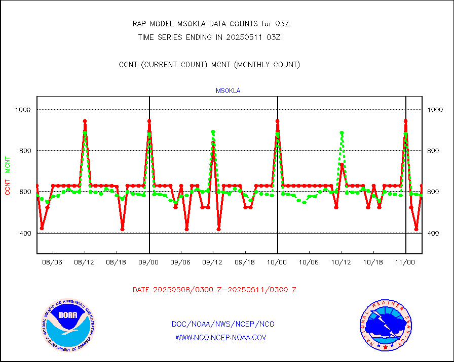
Mesonet/MADIS Oklahoma Mesonet |
525 |
588 |
89.3 % |
0102.50-0103.50 |
||||||||||
Mesonet/MADIS Louisiana State/Jackson State Univ. |
0 |
0 |
n/a |
0102.50-0103.50 |
||||||||||
Mesonet/MADIS Missouri Commercial Agricult Wx Net |
269 |
293 |
91.8 % |
0102.50-0103.50 |
||||||||||
Mesonet/MADIS Minnesota Dept. of Transportation |
0 |
0 |
n/a |
0102.50-0103.50 |
||||||||||
Mesonet/MADIS NOS-Phys Oceanographic Realtime Sys |
244 |
251 |
97.2 % |
0102.50-0103.50 |
||||||||||
Mesonet/MADIS NFIC Remote Automated Wx Stns(RAWS) |
1407 |
1357 |
103.7 % |
0102.50-0103.50 |
||||||||||
Mesonet/MADIS many providers, not separated out |
42042 |
38567 |
109.0 % |
0102.50-0103.50 |
||||||||||
Mesonet/MADIS UrbaNet |
2905 |
3091 |
94.0 % |
0102.50-0103.50 |
||||||||||
Mesonet/MADIS Virginia Dept. of Transportation |
0 |
0 |
n/a |
0102.50-0103.50 |
||||||||||
Mesonet/MADIS "Weather for You" |
0 |
0 |
n/a |
0102.50-0103.50 |
||||||||||
Mesonet/MADIS Wisconsin Dept. of Transportation |
0 |
0 |
n/a |
0102.50-0103.50 |
||||||||||
Mesonet/MADIS MesoWest (many subproviders) |
38724 |
36820 |
105.2 % |
0102.50-0103.50 |
||||||||||
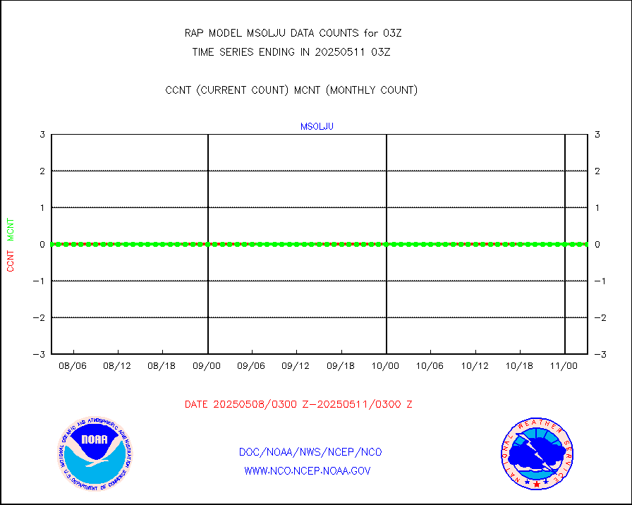
Mesonet/MADIS West Texas |
5002 |
5294 |
94.5 % |
0102.50-0103.50 |
||||||||||
METOP 1-2 IASI 1C radiance data (varbl. channels) |
41416 |
44702 |
92.6 % |
0101.00-0104.99 |
||||||||||
NEXRAD Vel Azm Dsp(VAD) winds via Level 2 decoder |
1299 |
1042 |
124.7 % |
0102.00-0104.00 |
||||||||||
NOAA 16-19 Solar Backscatter UV-2 rad frm V8 BUFR |
0 |
0 |
n/a |
0101.00-0103.99 |
||||||||||
PIBAL (from PILOT, PILOT SHIP, PILOT MOBIL) |
0 |
0 |
n/a |
0102.00-0104.00 |
||||||||||
PIBAL (decoded from BUFR) |
0 |
0 |
n/a |
0102.00-0104.00 |
||||||||||
Manual PIREP aircraft data (dcded from AIREP fmt) |
264 |
243 |
108.6 % |
3023.75-0106.25 |
||||||||||
Profilr winds from PIBAL (PILOT,PILOT SHIP/MOBIL) |
0 |
0 |
n/a |
0101.50-0104.50 |
||||||||||
Rawinsonde - fixed land (decoded from BUFR) |
0 |
0 |
n/a |
0102.00-0104.00 |
||||||||||
Rawinsonde - mobile land (from TEMP/PILOT MOBIL) |
0 |
0 |
n/a |
0102.00-0104.00 |
||||||||||
Rawinsonde - mobile land (decoded from BUFR) |
0 |
0 |
n/a |
0102.00-0104.00 |
||||||||||
Rawinsonde - ship (from TEMP SHIP, PILOT SHIP) |
0 |
0 |
n/a |
0102.00-0104.00 |
||||||||||
Rawinsonde - ship (decoded from BUFR) |
0 |
0 |
n/a |
0102.00-0104.00 |
||||||||||
NEXRAD radial wind (Level 2 - GTS) |
2185686 |
1509241 |
144.8 % |
0102.50-0103.49 |
||||||||||
Flight level reconnaissance aircraft data |
0 |
0 |
n/a |
0102.00-0104.00 |
||||||||||
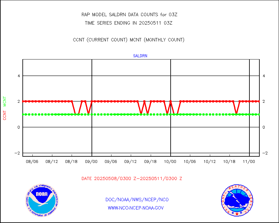
Surface Marine Saildrone (decoded from BUFR) |
2 |
2 |
100.0 % |
0101.00-0104.99 |
||||||||||
Megha-Tropiques SAPHIR L1A2 brightness temps |
0 |
0 |
n/a |
0100.00-0105.99 |
||||||||||
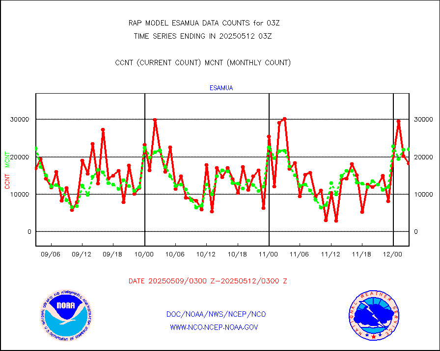
METEOSAT-10 2nd Gen SEVIRI All Sky Radiance(proc) |
9512 |
9511 |
100.0 % |
0101.00-0104.99 |
||||||||||
METEOSAT-10 2nd Gen SEVIRI Clr Sky Radiance(proc) |
0 |
0 |
n/a |
0101.00-0104.99 |
||||||||||
Ship - manual and automatic, restricted |
2 |
14 |
14.3 % |
0102.50-0103.50 |
||||||||||
NOW COVER, DEPTH/DENSITY AND WATER EQUIVALENT |
3231 |
5756 |
56.1 % |
0101.00-0105.00 |
||||||||||
DMSP SSM/IS 1C radiance data (Unified Pre-Proc.) |
0 |
40726 |
0.0 % |
0101.00-0104.99 |
||||||||||
Sub-surface float and glider profile (BUFR) |
4 |
6 |
66.7 % |
0101.00-0104.99 |
||||||||||
Synoptic - restricted (WMO Res 40) manual & auto. |
0 |
0 |
n/a |
0102.50-0103.50 |
||||||||||
Synoptic - restricted (WMO Res 40)(decoded BUFR) |
304 |
310 |
98.1 % |
0102.50-0103.50 |
||||||||||
Synoptic - mobile manual & auto (decoded fr BUFR) |
0 |
0 |
n/a |
0102.50-0103.50 |
||||||||||
TAMDAR aircft data-all types(from Panasonic,BUFR) |
99 |
154 |
64.3 % |
3023.75-0106.25 |
||||||||||
MTSAT/JMA visible derived cloud motion |
1634 |
1527 |
107.0 % |
0100.50-0105.50 |
||||||||||
GOES-16&up/NESDIS visible derived cloud motion |
124821 |
117657 |
106.1 % |
0102.00-0102.99 |
||||||||||
METEOSAT/EUMETSAT visible drv cld motion NBseq |
4 |
20 |
20.0 % |
0101.50-0104.49 |
||||||||||


