| Suspect Data Shortages in Critical Types - Monitor | ||||||||||||||
|---|---|---|---|---|---|---|---|---|---|---|---|---|---|---|
| Type | Description | Hourly Count | Monthly Average | Percent (%) of Monthly Mean | UTC Time Window | |||||||||
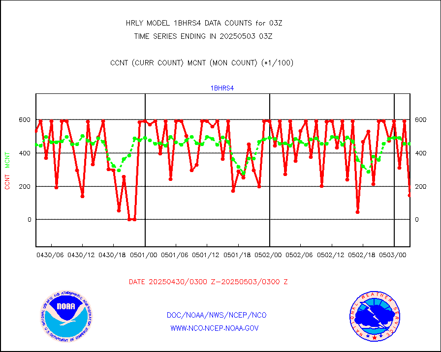
NOAA 18-19 & METOP 1-2 HIRS-4 NCEP-proc. br.temps |
0 |
11724 |
0.0 % |
0101.00-0101.99 |
||||||||||
NOAA 15-19 & METOP 1-2 HIRS-3/4 pr btmps frm RARS |
0 |
17610 |
0.0 % |
0102.50-0103.49 |
||||||||||
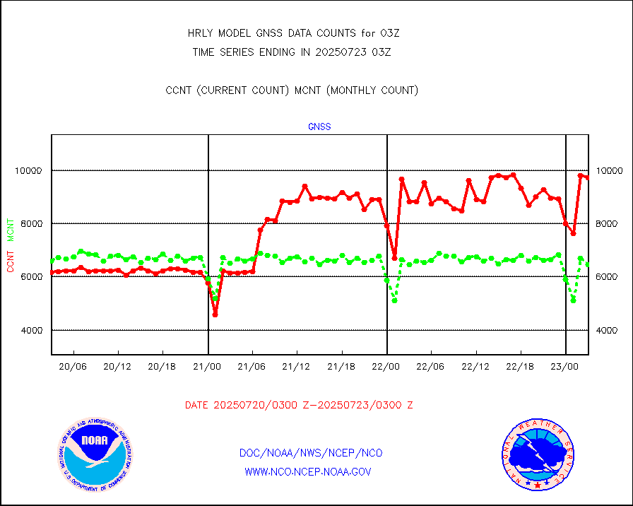
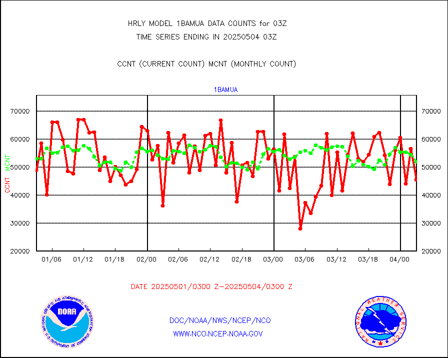
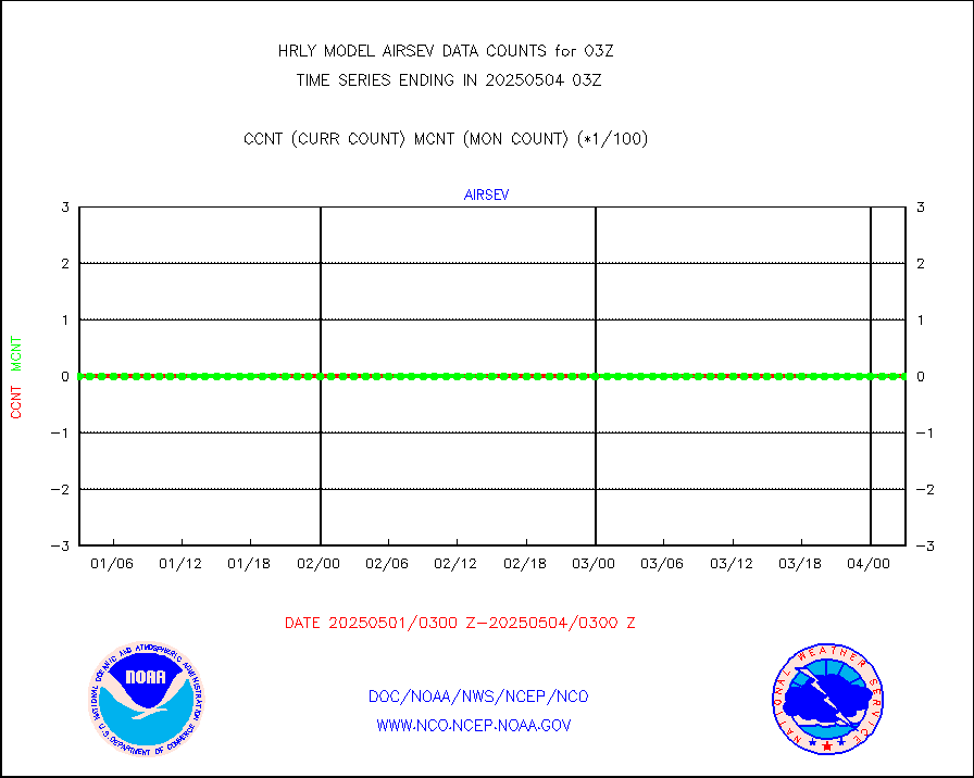
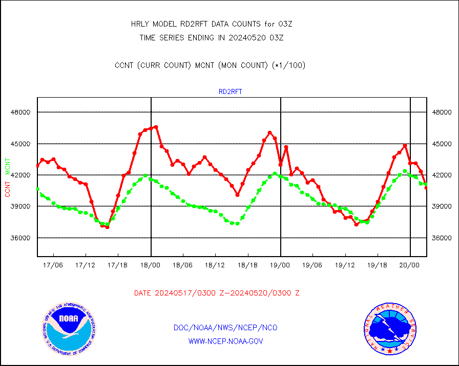
Grnd-based Gbl Navigation Sat System (GNSS) data |
1434 |
6884 |
20.8 % |
0102.00-0102.99 |
||||||||||
| Shortage in Data Type of Opportunity - Monitor | ||||||||||||||
|---|---|---|---|---|---|---|---|---|---|---|---|---|---|---|
| Type | Description | Hourly Count | Monthly Average | Percent (%) of Monthly Mean | UTC Time Window | |||||||||
P.M.(N18-19) AVHRR GAC NCEP-proc clr & sea btemps |
0 |
382622 |
0.0 % |
0100.50-0101.49 |
||||||||||
NPP/NOAA-20 CrIS full spctrl radn dir brdcst SSEC |
12960 |
40869 |
31.7 % |
0101.50-0102.49 |
||||||||||
INDIA SATWIND, INSAT WV channel |
0 |
820 |
0.0 % |
0102.00-0102.99 |
||||||||||
INDIA SATWIND, INSAT IR channel |
0 |
1124 |
0.0 % |
0102.00-0102.99 |
||||||||||
DMSP SSM/IS 1C radiance data (Unified Pre-Proc.) |
0 |
102182 |
0.0 % |
0101.50-0102.49 |
||||||||||
| Critical Data with Normal Counts | ||||||||||||||
|---|---|---|---|---|---|---|---|---|---|---|---|---|---|---|
| Type | Description | Hourly Count | Monthly Average | Percent (%) of Monthly Mean | UTC Time Window | |||||||||
NOAA 15-19 & METOP 1-2 AMSU-A NCEP-proc. br.temps |
19372 |
31216 |
62.1 % |
0101.00-0101.99 |
||||||||||
NOAA 18-19 & METOP 1-2 MHS NCEP-proces. br. temps |
173432 |
259339 |
66.9 % |
0101.00-0101.99 |
||||||||||
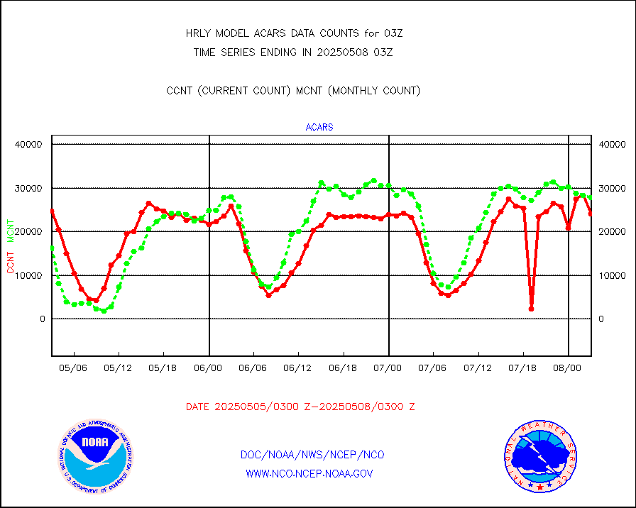
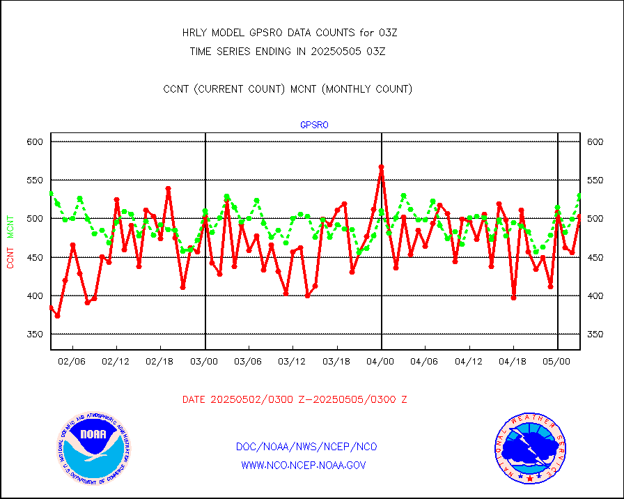
MDCRS ACARS acft data from ARINC(dcded from BUFR) |
26572 |
30184 |
88.0 % |
0102.50-0103.49 |
||||||||||
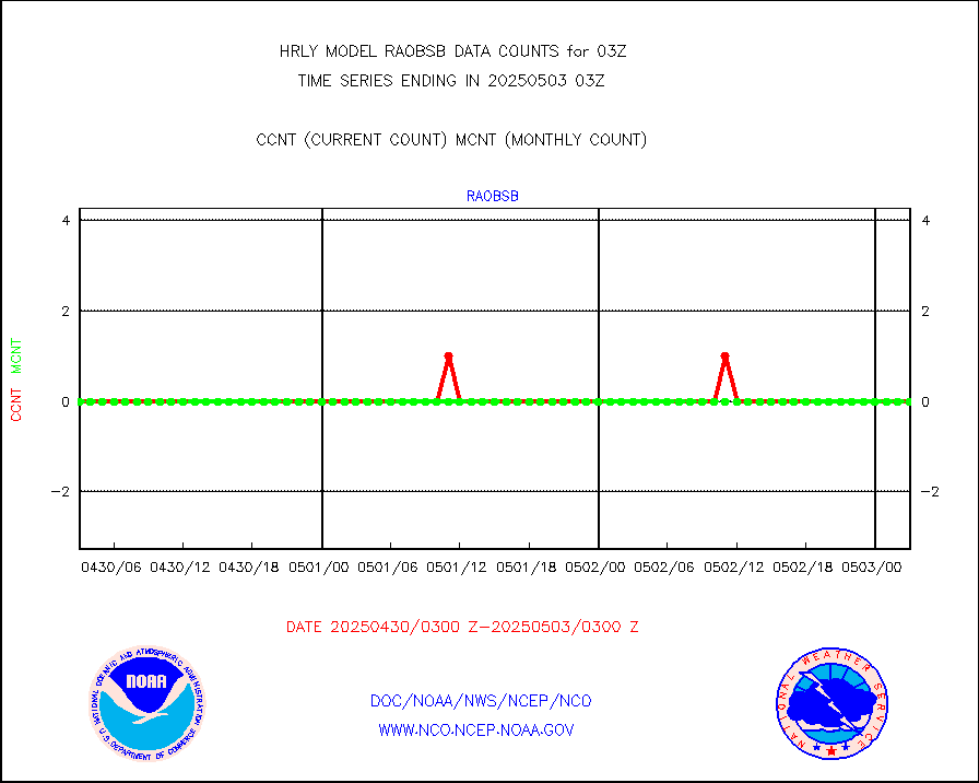
Manual AIREP aircraft data (dcded from AIREP fmt) |
908 |
956 |
95.0 % |
0102.50-0103.49 |
||||||||||
AQUA AIRS/AMSU-A/HSB brightness temps- every FOV |
0 |
0 |
n/a |
0100.50-0101.49 |
||||||||||
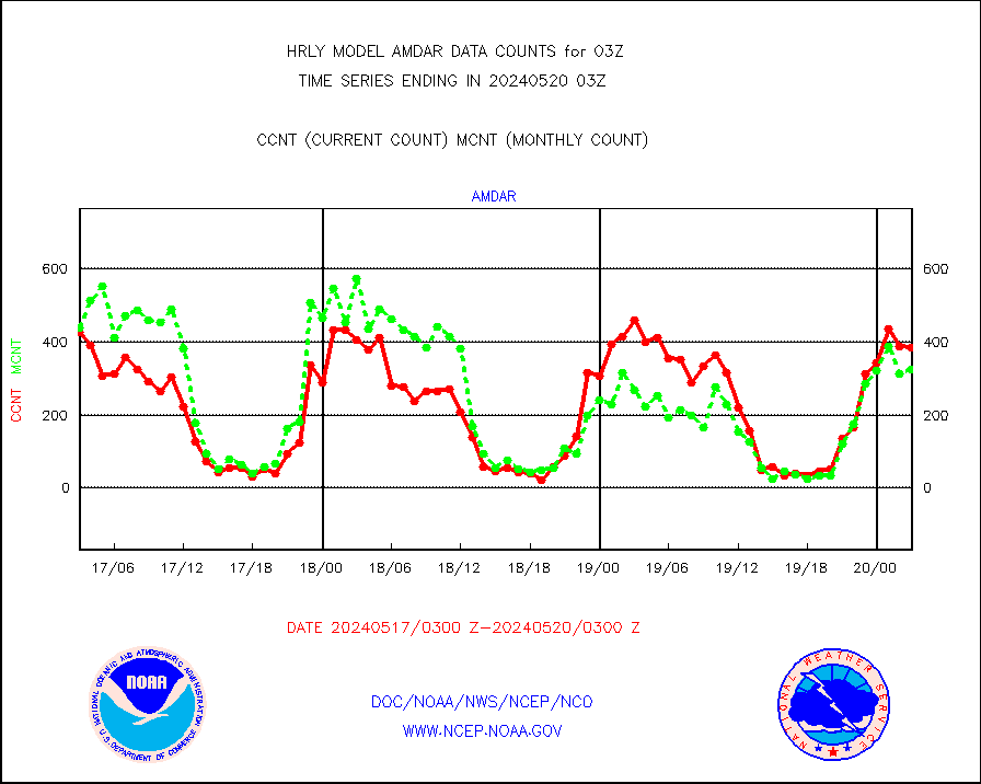
AMDAR aircraft data (decoded from AMDAR format) |
377 |
320 |
117.8 % |
0102.50-0103.49 |
||||||||||
AMDAR aircraft data (decoded from BUFR) |
2352 |
2677 |
87.9 % |
0102.50-0103.49 |
||||||||||
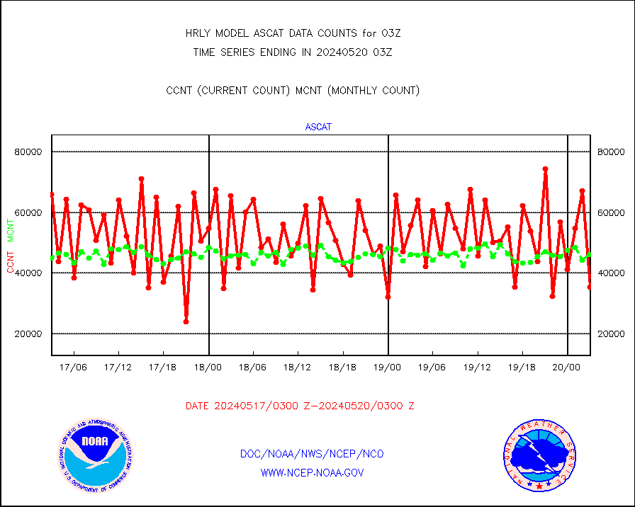
METOP 1-2 ASCAT products |
55818 |
57707 |
96.7 % |
0101.50-0102.49 |
||||||||||
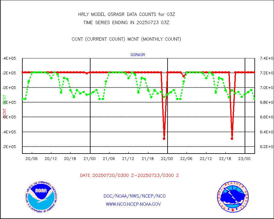
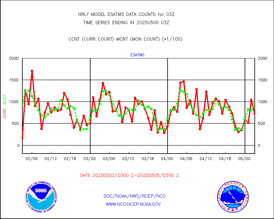
NPP/NOAA-20 ATMS brightness temperatures |
380352 |
342477 |
111.1 % |
0101.50-0102.49 |
||||||||||
Canadian AMDAR aircraft data (decoded from BUFR) |
0 |
0 |
n/a |
0102.50-0103.49 |
||||||||||
Surface Marine CMAN rpts decoded from BUFR format |
1872 |
1834 |
102.1 % |
0102.50-0103.50 |
||||||||||
Buoys decoded from FM-18 fmt (moored or drifting) |
15 |
16 |
93.8 % |
0102.50-0103.49 |
||||||||||
E-AMDAR (European AMDAR acft decoded from BUFR) |
537 |
579 |
92.7 % |
0102.50-0103.49 |
||||||||||
NOAA 15-19 & METOP 1-2 AMSU-A proc btmps frm RARS |
19495 |
23653 |
82.4 % |
0102.50-0103.49 |
||||||||||
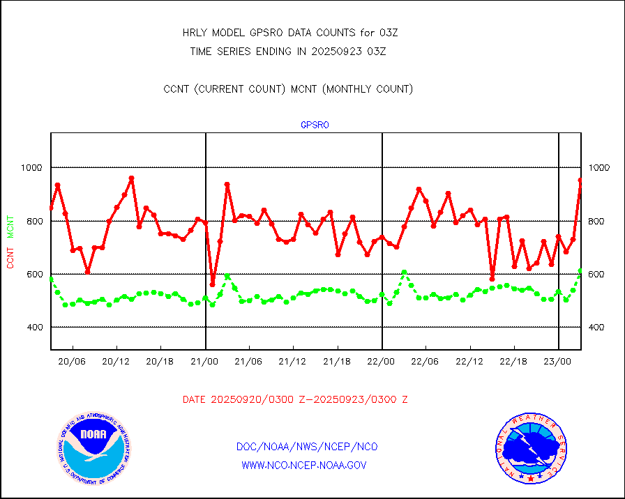
GPS radio occultation data |
574 |
587 |
97.8 % |
0100.50-0101.49 |
||||||||||
GOES-16/17 All Sky Radiances (proc.) |
720952 |
720952 |
100.0 % |
0102.50-0103.49 |
||||||||||
GOES-16/17 Clear Sky Radiances (proc.) |
350505 |
358819 |
97.7 % |
0102.50-0103.49 |
||||||||||
MTSAT/JMA water vapor imager derived cloud motion |
21087 |
19818 |
106.4 % |
0100.50-0101.49 |
||||||||||
MODIS (AQUA/TERRA) wvpr imager derived cld motion |
0 |
0 |
n/a |
3023.00-3023.99 |
||||||||||
GOES-16&up/NESDIS wv imgr/cld-top derived cld mtn |
28128 |
29030 |
96.9 % |
0102.00-0102.99 |
||||||||||
METEOSAT/EUMETSAT ir lg-wave drv cld motion NBseq |
21218 |
20907 |
101.5 % |
0101.50-0102.49 |
||||||||||
MTSAT/JMA infrared long-wave derived cloud motion |
16800 |
16594 |
101.2 % |
0100.50-0101.49 |
||||||||||
MODIS (AQUA/TERRA) ir l-wave derived cloud motion |
0 |
0 |
n/a |
3023.00-3023.99 |
||||||||||
GOES-16&up/NESDIS ir long-wave derived cld motion |
82320 |
82694 |
99.5 % |
0102.00-0102.99 |
||||||||||
GOES/NASA(Langley) hi-res. (1x1 f-o-v) cloud data |
6428522 |
6428099 |
100.0 % |
0102.50-0103.49 |
||||||||||
Buoys decoded from FM-13 format (moored) |
123 |
121 |
101.7 % |
0102.50-0103.49 |
||||||||||
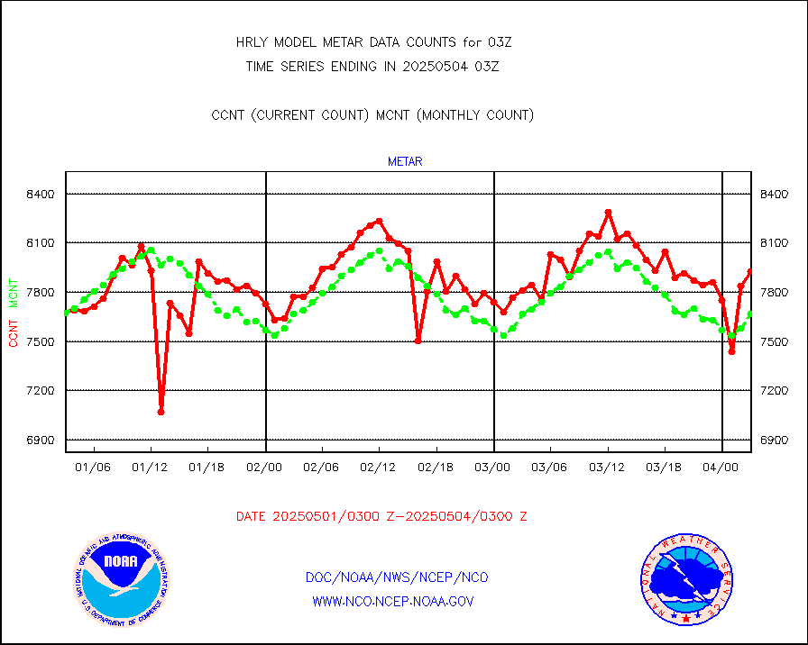
Aviation - METAR |
7678 |
7638 |
100.5 % |
0102.50-0103.49 |
||||||||||
Mesonet/MADIS Colorado E-470 (Interstate 470) |
24 |
24 |
100.0 % |
0102.50-0103.49 |
||||||||||
Mesonet/MADIS Alaska Department of Transportation |
119 |
83 |
143.4 % |
0102.50-0103.49 |
||||||||||
Mesonet/MADIS U.S. Army Aberdeen Proving Grounds |
0 |
0 |
n/a |
0102.50-0103.49 |
||||||||||
Mesonet/MADIS Citizen Weather Observers Program |
67322 |
61842 |
108.9 % |
0102.50-0103.49 |
||||||||||
Mesonet/MADIS AWS Convergence Technologies, Inc. |
18930 |
21206 |
89.3 % |
0102.50-0103.49 |
||||||||||
Mesonet/MADIS "Anything Weather" |
0 |
0 |
n/a |
0102.50-0103.49 |
||||||||||
Mesonet/MADIS Colorado Dept. of Transportation |
0 |
0 |
n/a |
0102.50-0103.49 |
||||||||||
Mesonet/MADIS DC Net |
0 |
0 |
n/a |
0102.50-0103.49 |
||||||||||
Mesonet/MADIS Denver Urban Drainage & Flood Cntrl |
0 |
0 |
n/a |
0102.50-0103.49 |
||||||||||
Mesonet/MADIS Florida (FAWN & USF) |
4 |
4 |
100.0 % |
0102.50-0103.49 |
||||||||||
Mesonet/MADIS Florida Dept. of Transportation |
0 |
0 |
n/a |
0102.50-0103.49 |
||||||||||
Mesonet/MADIS Georgia Dept. of Transportation |
0 |
0 |
n/a |
0102.50-0103.49 |
||||||||||
Mesonet/MADIS NWS Hydromet Auto Data System(HADS) |
5948 |
6120 |
97.2 % |
0102.50-0103.49 |
||||||||||
Mesonet/MADIS Iowa Environmental |
189 |
183 |
103.3 % |
0102.50-0103.49 |
||||||||||
Mesonet/MADIS Indiana Dept. of Transportation |
0 |
0 |
n/a |
0102.50-0103.49 |
||||||||||
Mesonet/MADIS Iowa Department of Transportation |
0 |
0 |
n/a |
0102.50-0103.49 |
||||||||||
Mesonet/MADIS Kansas Department of Transportation |
346 |
337 |
102.7 % |
0102.50-0103.49 |
||||||||||
Mesonet/MADIS Oklahoma Mesonet |
630 |
623 |
101.1 % |
0102.50-0103.49 |
||||||||||
Mesonet/MADIS Louisiana State/Jackson State Univ. |
0 |
0 |
n/a |
0102.50-0103.49 |
||||||||||
Mesonet/MADIS Missouri Commercial Agricult Wx Net |
330 |
336 |
98.2 % |
0102.50-0103.49 |
||||||||||
Mesonet/MADIS Minnesota Dept. of Transportation |
0 |
0 |
n/a |
0102.50-0103.49 |
||||||||||
Mesonet/MADIS NOS-Phys Oceanographic Realtime Sys |
370 |
377 |
98.1 % |
0102.50-0103.49 |
||||||||||
Mesonet/MADIS NFIC Remote Automated Wx Stns(RAWS) |
1942 |
1704 |
114.0 % |
0102.50-0103.49 |
||||||||||
Mesonet/MADIS many providers, not separated out |
77308 |
72595 |
106.5 % |
0102.00-0103.49 |
||||||||||
Mesonet/MADIS Virginia Dept. of Transportation |
0 |
0 |
n/a |
0102.50-0103.49 |
||||||||||
Mesonet/MADIS "Weather for You" |
0 |
0 |
n/a |
0102.50-0103.49 |
||||||||||
Mesonet/MADIS Wisconsin Dept. of Transportation |
0 |
0 |
n/a |
0102.50-0103.49 |
||||||||||
Mesonet/MADIS MesoWest (many subproviders) |
38726 |
36822 |
105.2 % |
0102.50-0103.49 |
||||||||||
Mesonet/MADIS West Texas |
6222 |
6064 |
102.6 % |
0102.50-0103.49 |
||||||||||
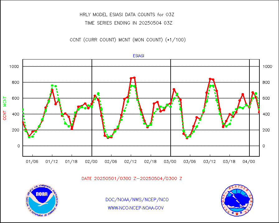
METOP 1-2 IASI 1C radiance data (varbl. channels) |
74952 |
91149 |
82.2 % |
0101.00-0101.99 |
||||||||||
NEXRAD Vel Azm Dsp(VAD) winds via radar coded msg |
0 |
0 |
n/a |
0102.50-0103.49 |
||||||||||
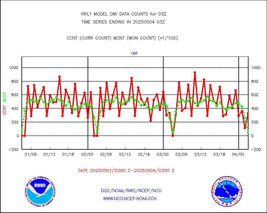
Aura Ozone Monitoring Instrument (OMI) data |
0 |
0 |
n/a |
0100.50-0101.49 |
||||||||||
NOAA 16-19 Solar Backscatter UV-2 rad frm V8 BUFR |
0 |
0 |
n/a |
0101.00-0101.99 |
||||||||||
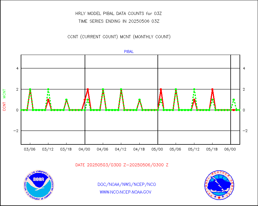
PIBAL (from PILOT, PILOT SHIP, PILOT MOBIL) |
0 |
0 |
n/a |
0102.50-0103.49 |
||||||||||
Multi-Agency Profiler (MAP) and SODAR winds |
52 |
47 |
110.6 % |
0102.50-0103.49 |
||||||||||
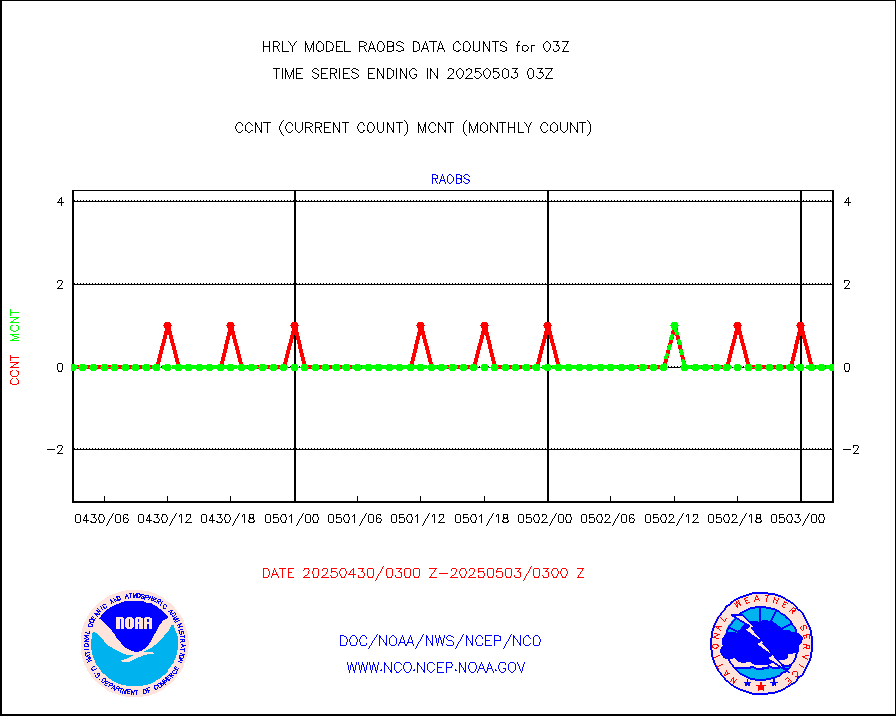
Rawinsonde - fixed land (from TEMP or PILOT) |
0 |
0 |
n/a |
0102.50-0103.49 |
||||||||||
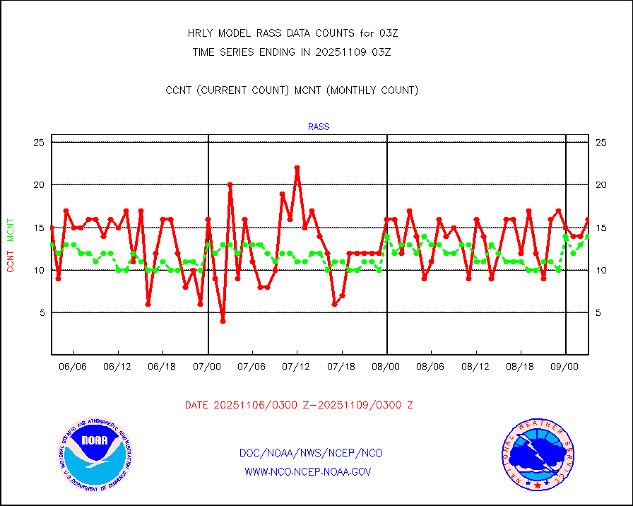
RASS temperatures (NOAA and Multi-Agency) |
29 |
26 |
111.5 % |
0102.50-0103.49 |
||||||||||
NEXRAD reflectivity (Lvl 2 - GTS) |
4838625 |
4253647 |
113.8 % |
0102.50-0103.49 |
||||||||||
NEXRAD radial wind (Level 2 - GTS) |
2859223 |
2026424 |
141.1 % |
0102.50-0103.49 |
||||||||||
METEOSAT-10 2nd Gen SEVIRI Clr Sky Radiance(proc) |
0 |
0 |
n/a |
0102.50-0103.49 |
||||||||||
Ship - manual and automatic, restricted (BUFR) |
8 |
10 |
80.0 % |
0102.50-0103.50 |
||||||||||
Ship - manual and automatic, unrestricted |
180 |
189 |
95.2 % |
0102.50-0103.50 |
||||||||||
Ship - manual and automatic, unrestricted (BUFR) |
578 |
544 |
106.2 % |
0102.50-0103.50 |
||||||||||
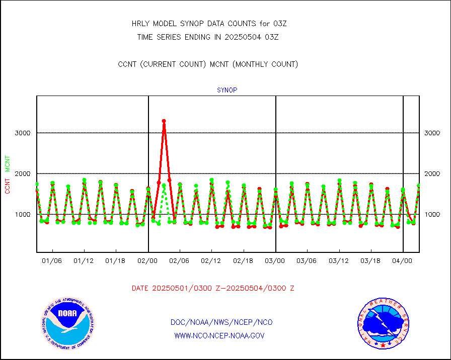
Synoptic - fixed manual and automatic |
1626 |
1614 |
100.7 % |
0102.50-0103.49 |
||||||||||
Synoptic - fixed manual & auto (decoded fr BUFR) |
6225 |
6167 |
100.9 % |
0102.50-0103.49 |
||||||||||
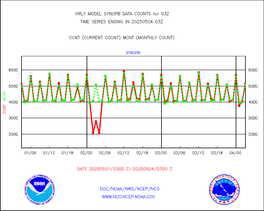
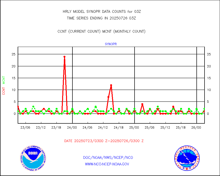
Synoptic - restricted (WMO Res 40) manual & auto. |
2 |
1 |
200.0 % |
0102.50-0103.49 |
||||||||||
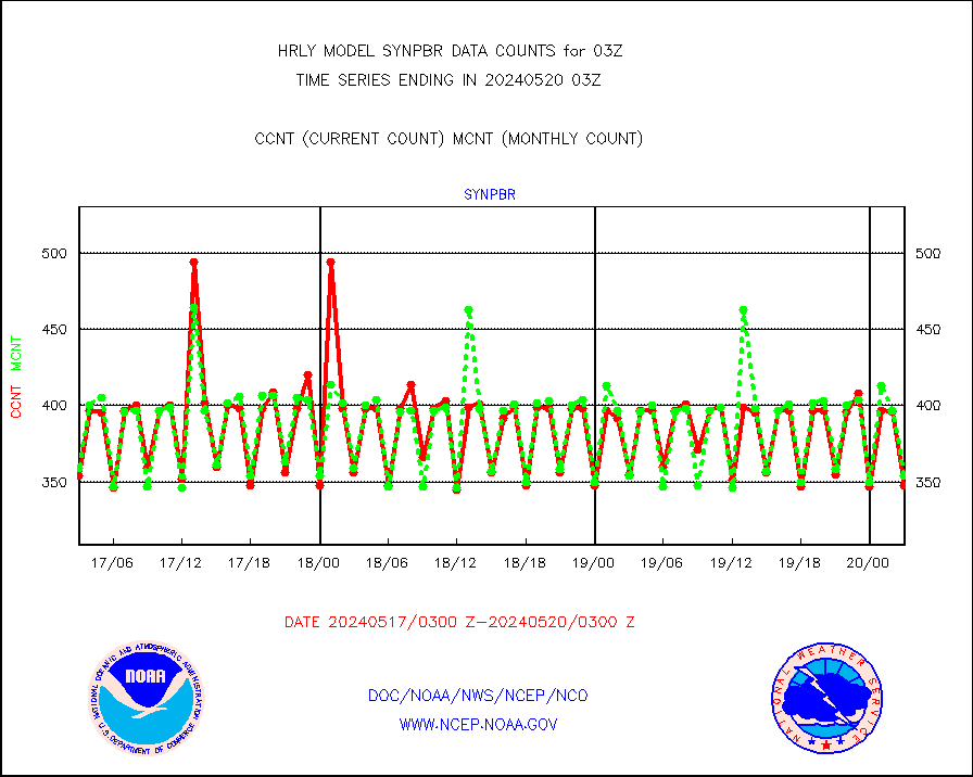
Synoptic - restricted (WMO Res 40)(decoded BUFR) |
356 |
361 |
98.6 % |
0102.50-0103.49 |
||||||||||
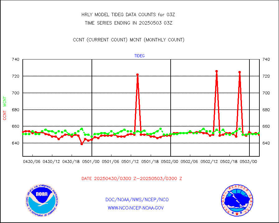
Tide gauge reports decoded from CREX format |
652 |
656 |
99.4 % |
0102.00-0102.99 |
||||||||||
| Data Types of Opportunity with Normal Counts | ||||||||||||||
|---|---|---|---|---|---|---|---|---|---|---|---|---|---|---|
| Type | Description | Hourly Count | Monthly Average | Percent (%) of Monthly Mean | UTC Time Window | |||||||||
GOES-16&up/NESDIS ir short-wv derived cld motion |
27938 |
28525 |
97.9 % |
0102.00-0102.99 |
||||||||||
MDCRS ACARS acft data (ARINC via AFWA)(AIREP fmt) |
0 |
0 |
n/a |
0102.50-0103.49 |
||||||||||
Himawari Clear Sky Radiance |
0 |
0 |
n/a |
0102.00-0102.99 |
||||||||||
GCOM-W AMSR2 1B brightness temperatures |
1628100 |
2181265 |
74.6 % |
0101.00-0101.99 |
||||||||||
NPP/NOAA-20 ATMS bright. temps-direct b-cast SSEC |
29952 |
100151 |
29.9 % |
0101.50-0102.49 |
||||||||||
POES/NESDIS - processed ATOVS soundings/radiances |
0 |
0 |
n/a |
0101.00-0101.99 |
||||||||||
A.M.(N17,M2,M3) AVHRR GAC NCEP-proc clr&sea btmps |
1133441 |
1083864 |
104.6 % |
0100.50-0101.49 |
||||||||||
eXpendable BathyThermograph, mooring (BATHY fmt) |
0 |
0 |
n/a |
3020.00-3020.99 |
||||||||||
Coop/MADIS NEPP & HCN-Modernization NOAA COOP Obs |
11 |
11 |
100.0 % |
0102.50-0103.49 |
||||||||||
NPP/NOAA-20 CrIS full spctrl radn (431 ch subset) |
240534 |
229834 |
104.7 % |
0101.50-0102.49 |
||||||||||
Coast Guard |
6 |
6 |
100.0 % |
0102.50-0103.50 |
||||||||||
Drifting buoys (decoded from BUFR) |
1462 |
1447 |
101.0 % |
0102.50-0103.50 |
||||||||||
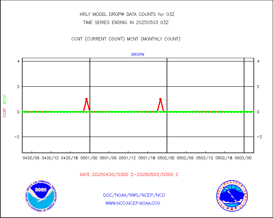
Dropwinsonde (from TEMP DROP) |
0 |
0 |
n/a |
0102.50-0103.49 |
||||||||||
Dropwinsonde (decoded from BUFR) |
0 |
0 |
n/a |
0102.51-0103.49 |
||||||||||
GOES imager effective cloud amount data (U.Wisc.) |
9250602 |
8562392 |
108.0 % |
0102.50-0103.49 |
||||||||||
NPP Adv. Tech. MW Sndr (ATMS) br. temps from RARS |
8060 |
11388 |
70.8 % |
0101.50-0102.49 |
||||||||||
METOP 1-2 IASI 1C radiance data vbl chn from RARS |
15240 |
28821 |
52.9 % |
0102.00-0102.99 |
||||||||||
NOAA 18-19 & METOP 1-2 MHS proc. btemps from RARS |
226873 |
227949 |
99.5 % |
0102.50-0103.49 |
||||||||||
GOES/NESDIS (11x17 f-o-v) imager clear radiances |
0 |
0 |
n/a |
0102.00-0102.99 |
||||||||||
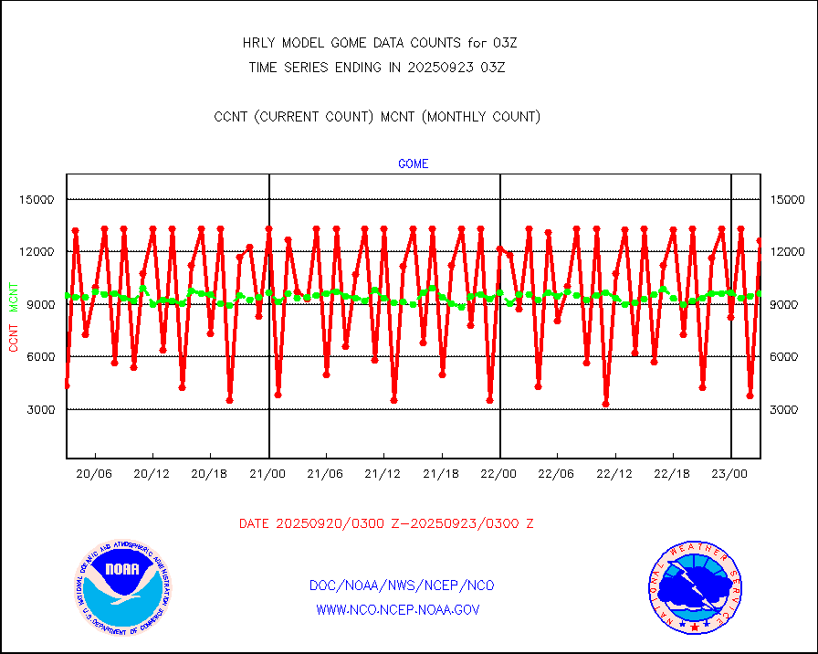
METOP 1-2 Global Ozone Monitoring Exp.-2 (GOME-2) |
10208 |
9167 |
111.4 % |
0101.50-0102.49 |
||||||||||
GOES-16&up/NESDIS wv imgr/deep-lyr derivd cld mtn |
20269 |
17502 |
115.8 % |
0102.00-0102.99 |
||||||||||
METEOSAT/EUMETSAT wvpr imgr drv cld motion NBseq |
35364 |
36305 |
97.4 % |
0101.50-0102.49 |
||||||||||
High Density OBs from reconnaissance acft data |
0 |
3 |
0.0 % |
0102.50-0103.49 |
||||||||||
METOP 1-2 IASI 1C radiances-direct broadcast SSEC |
71099 |
88343 |
80.5 % |
0101.50-0102.49 |
||||||||||
VIIRS (NPP/NOAA-20) ir lg-wv drv cloud motion(NB) |
11558 |
20843 |
55.5 % |
3023.00-3023.99 |
||||||||||
AVHRR (NOAA/METOP) ir lg-wave derived cld motion |
0 |
0 |
n/a |
3023.00-3023.99 |
||||||||||
AVHRR (METOP) ir lg-wave derived cld motion |
0 |
0 |
n/a |
0102.50-0103.50 |
||||||||||
INSAT/KALPANA India ir lg-wave derived cld motion |
0 |
0 |
n/a |
0100.50-0101.49 |
||||||||||
Korean AMDAR aircraft data (decoded from BUFR) |
48 |
72 |
66.7 % |
0102.50-0103.49 |
||||||||||
Land-based CMAN stations decoded from CMAN format |
71 |
87 |
81.6 % |
0102.50-0103.49 |
||||||||||
LEO-GEO satellite AMVs from UWisc. |
4940 |
7145 |
69.1 % |
3023.00-3023.99 |
||||||||||
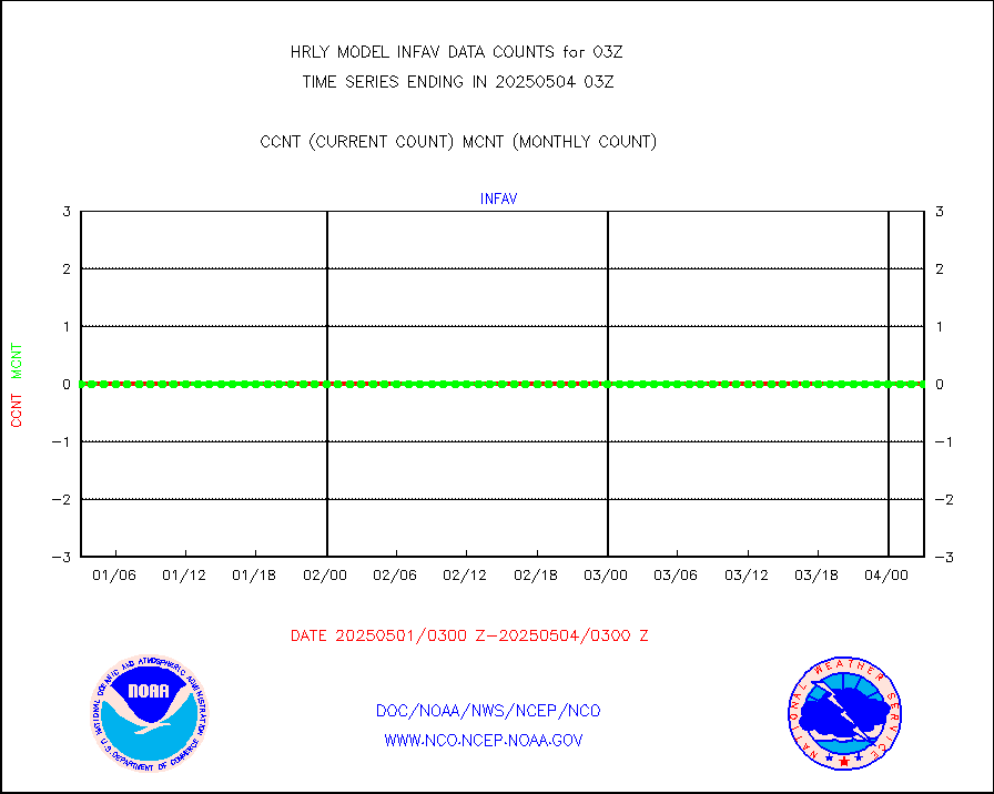
LLDN Long-rng lightning from Vaisala via NOAAPORT |
185226 |
174815 |
106.0 % |
0102.50-0103.49 |
||||||||||
NLDN Shrt-rng lightning from Vaisala via NOAAPORT |
7651 |
6740 |
113.5 % |
0102.50-0103.49 |
||||||||||
Moored buoys (decoded from BUFR) |
988 |
941 |
105.0 % |
0102.50-0103.50 |
||||||||||
Aura Microwave Limb Sounder (MLS) ozone data |
0 |
0 |
n/a |
0101.00-0101.99 |
||||||||||
Mesonet/MADIS UrbaNet |
3593 |
3538 |
101.6 % |
0102.50-0103.49 |
||||||||||
NEXRAD Vel Azm Dsp(VAD) winds via Level 2 decoder |
664 |
570 |
116.5 % |
0102.50-0103.49 |
||||||||||
OMPS Limb Profiler ozone data (NPP) |
306 |
272 |
112.5 % |
3020.00-3020.99 |
||||||||||
OMPS nadir profile ozone (Version 8 BUFR) |
596 |
527 |
113.1 % |
0101.00-0101.99 |
||||||||||
OMPS total column ozone (Version 8 BUFR) |
221625 |
315015 |
70.4 % |
0101.00-0101.99 |
||||||||||
PIBAL (decoded from BUFR) |
0 |
0 |
n/a |
0102.51-0103.49 |
||||||||||
Manual PIREP aircraft data (dcded from AIREP fmt) |
39 |
32 |
121.9 % |
0102.50-0103.49 |
||||||||||
Profilr winds from PIBAL (PILOT,PILOT SHIP/MOBIL) |
0 |
0 |
n/a |
0102.50-0103.49 |
||||||||||
Rawinsonde - fixed land (decoded from BUFR) |
0 |
0 |
n/a |
0102.51-0103.49 |
||||||||||
Rawinsonde - mobile land (from TEMP/PILOT MOBIL) |
0 |
0 |
n/a |
0102.50-0103.49 |
||||||||||
Rawinsonde - mobile land (decoded from BUFR) |
0 |
0 |
n/a |
0102.51-0103.49 |
||||||||||
Rawinsonde - ship (from TEMP SHIP, PILOT SHIP) |
0 |
0 |
n/a |
0102.50-0103.49 |
||||||||||
Rawinsonde - ship (decoded from BUFR) |
0 |
0 |
n/a |
0102.51-0103.49 |
||||||||||
Flight level reconnaissance aircraft data |
0 |
0 |
n/a |
0102.50-0103.49 |
||||||||||
Megha-Tropiques SAPHIR L1A2 brightness temps |
0 |
0 |
n/a |
0100.50-0101.49 |
||||||||||
METEOSAT-10 2nd Gen SEVIRI All Sky Radiance(proc) |
75512 |
75497 |
100.0 % |
0102.50-0103.49 |
||||||||||
Ship - manual and automatic, restricted |
2 |
15 |
13.3 % |
0102.50-0103.49 |
||||||||||
NPP/NOAA-20 VIIRS SST - CLEAR & OVER WATER |
795391 |
1910573 |
41.6 % |
0102.50-0103.49 |
||||||||||
NPP/NOAA-20 VIIRS SST - PROBABLY CLR & OVER WATER |
40795 |
415026 |
9.8 % |
0102.50-0103.49 |
||||||||||
Synoptic - mobile manual and automatic |
701 |
658 |
106.5 % |
0102.50-0103.49 |
||||||||||
Synoptic - mobile manual & auto (decoded fr BUFR) |
1 |
1 |
100.0 % |
0102.50-0103.49 |
||||||||||
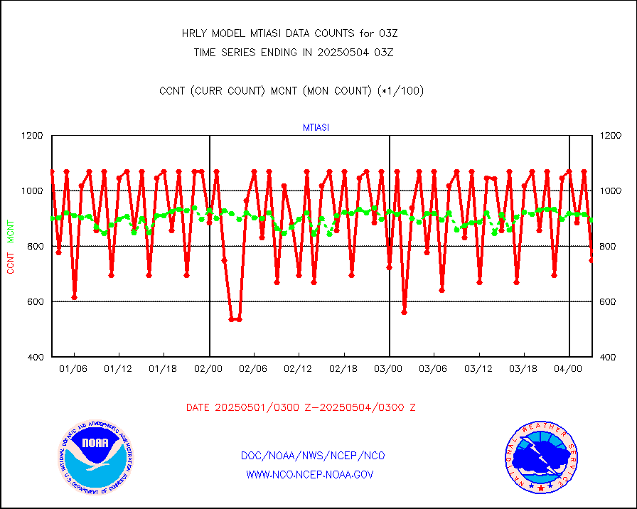
CTD probe, Argo prflng float, mooring (TESAC fmt) |
226 |
219 |
103.2 % |
0102.50-0103.49 |
||||||||||
TAMDAR aircft data-all types(from Panasonic,BUFR) |
37 |
49 |
75.5 % |
0102.50-0103.49 |
||||||||||
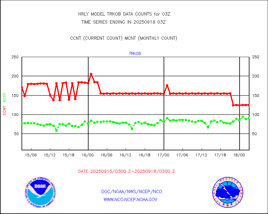
ThermoSalinoGraph (TSG) TRACKOB format) |
60 |
99 |
60.6 % |
0101.50-0102.49 |
||||||||||
INSAT/KALPANA India visible derived cloud motion |
0 |
0 |
n/a |
0100.50-0101.49 |
||||||||||
INDIA SATWIND, INSAT VIS channel |
0 |
1 |
0.0 % |
0102.00-0102.99 |
||||||||||
MTSAT/JMA visible derived cloud motion |
10920 |
10900 |
100.2 % |
0100.50-0101.49 |
||||||||||
GOES-16&up/NESDIS visible derived cloud motion |
212125 |
183665 |
115.5 % |
0102.00-0102.99 |
||||||||||
METEOSAT/EUMETSAT visible drv cld motion NBseq |
3335 |
3353 |
99.5 % |
0101.50-0102.49 |
||||||||||


