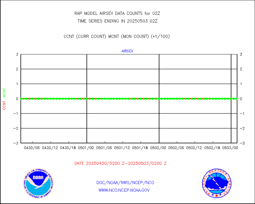
| Suspect Data Shortages in Critical Types - Monitor | ||||||||||||||
|---|---|---|---|---|---|---|---|---|---|---|---|---|---|---|
| Type | Description | Hourly Count | Monthly Average | Percent (%) of Monthly Mean | UTC Time Window | |||||||||
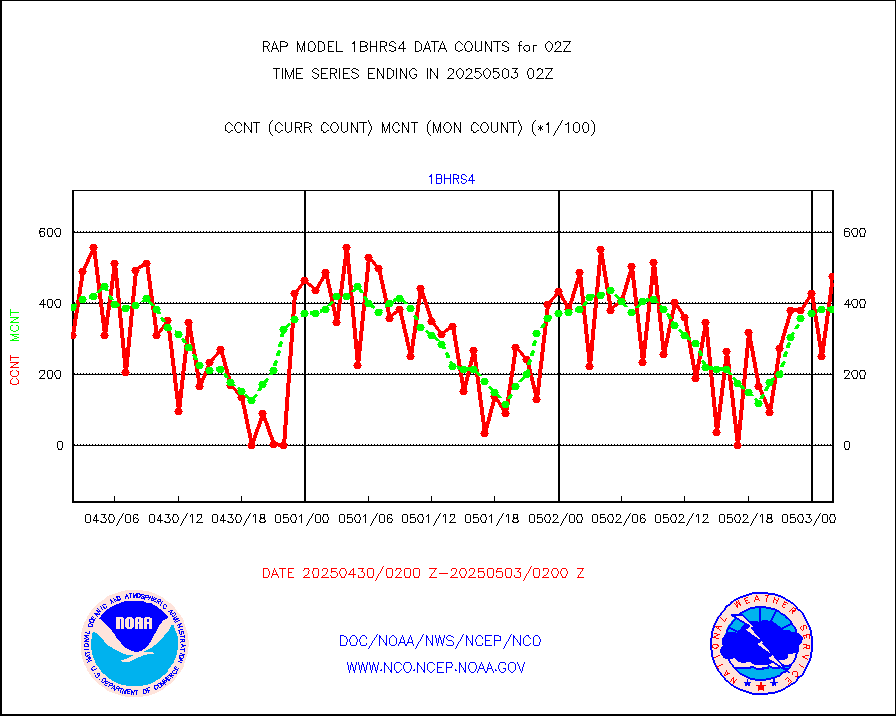
NOAA 18-19 & METOP 1-2 HIRS-4 NCEP-proc. br.temps |
0 |
10099 |
0.0 % |
0123.00-0204.99 |
||||||||||
| Shortage in Data Type of Opportunity - Monitor | ||||||||||||||
|---|---|---|---|---|---|---|---|---|---|---|---|---|---|---|
| Type | Description | Hourly Count | Monthly Average | Percent (%) of Monthly Mean | UTC Time Window | |||||||||
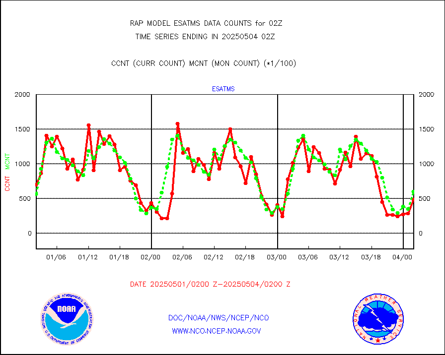
NPP Adv. Tech. MW Sndr (ATMS) br. temps from RARS |
0 |
4011 |
0.0 % |
0200.00-0203.99 |
||||||||||
NOAA 15-19 & METOP 1-2 HIRS-3/4 pr btmps frm RARS |
0 |
9902 |
0.0 % |
0201.00-0203.00 |
||||||||||
Mesonet/MADIS NFIC Remote Automated Wx Stns(RAWS) |
0 |
1376 |
0.0 % |
0201.50-0202.50 |
||||||||||
| Critical Data with Normal Counts | ||||||||||||||
|---|---|---|---|---|---|---|---|---|---|---|---|---|---|---|
| Type | Description | Hourly Count | Monthly Average | Percent (%) of Monthly Mean | UTC Time Window | |||||||||
NOAA 15-19 & METOP 1-2 AMSU-A NCEP-proc. br.temps |
26052 |
27280 |
95.5 % |
0123.00-0204.99 |
||||||||||
NOAA 18-19 & METOP 1-2 MHS NCEP-proces. br. temps |
230805 |
233515 |
98.8 % |
0123.00-0204.99 |
||||||||||
MDCRS ACARS acft data from ARINC(dcded from BUFR) |
104871 |
128859 |
81.4 % |
0122.75-0205.25 |
||||||||||
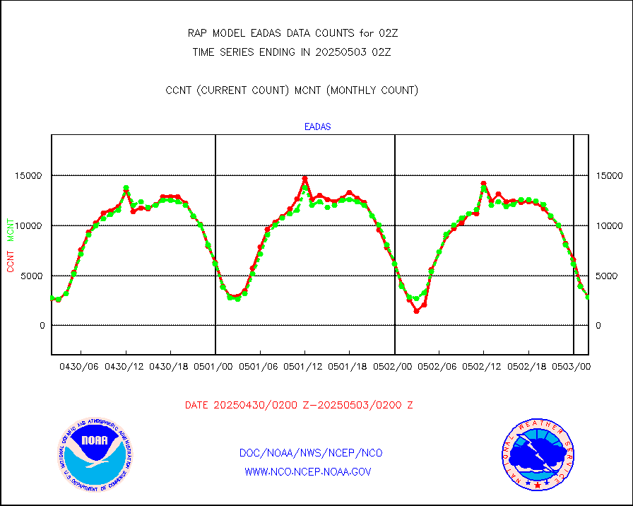
Canadian AMDAR aircraft data (decoded from BUFR) |
0 |
0 |
n/a |
0122.75-0205.25 |
||||||||||
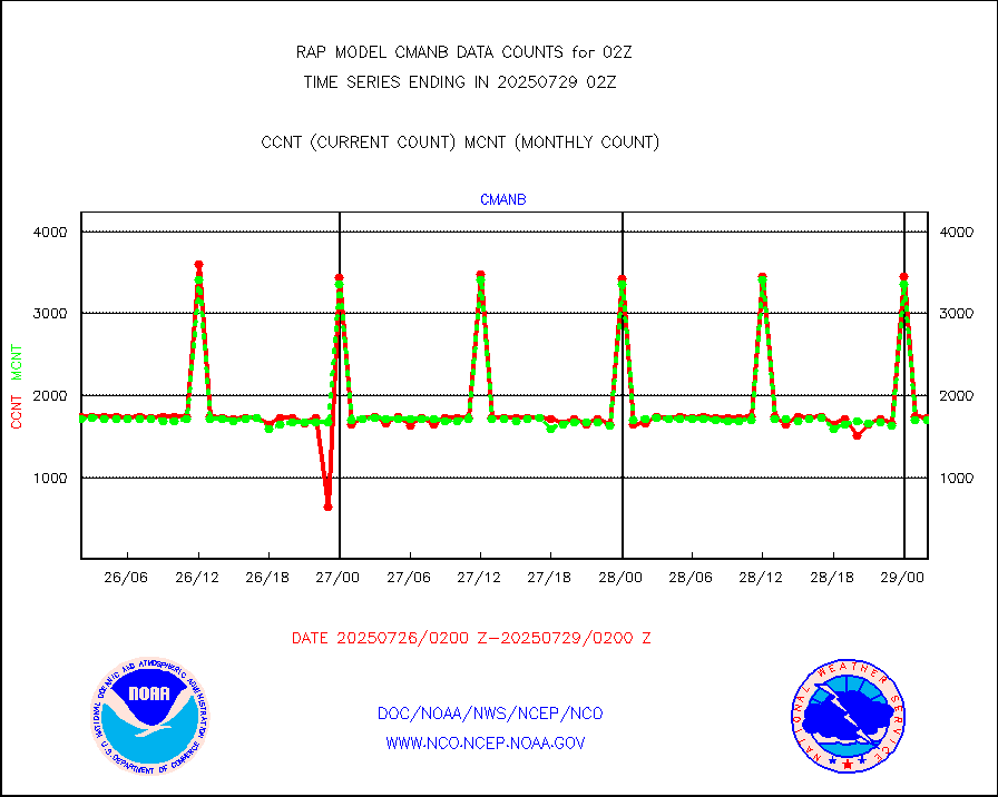
Surface Marine CMAN rpts decoded from BUFR format |
1650 |
1724 |
95.7 % |
0201.50-0202.50 |
||||||||||
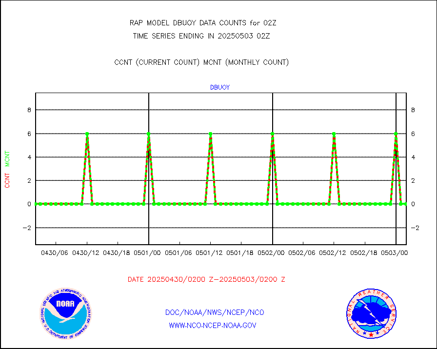
Buoys decoded from FM-18 fmt (moored or drifting) |
0 |
0 |
n/a |
0201.50-0202.50 |
||||||||||
Grnd-based Gbl Navigation Sat System (GNSS) data |
711 |
2110 |
33.7 % |
0200.95-0201.05 |
||||||||||
MODIS (AQUA/TERRA) wvpr imager derived cld motion |
0 |
0 |
n/a |
0123.50-0204.50 |
||||||||||
MODIS (AQUA/TERRA) ir l-wave derived cloud motion |
0 |
0 |
n/a |
0123.50-0204.50 |
||||||||||
GOES/NASA(Langley) hi-res. (1x1 f-o-v) cloud data |
1866304 |
1869132 |
99.8 % |
0201.50-0202.50 |
||||||||||
Buoys decoded from FM-13 format (moored) |
130 |
119 |
109.2 % |
0201.50-0202.50 |
||||||||||
Aviation - METAR |
5637 |
5538 |
101.8 % |
0201.50-0202.50 |
||||||||||
NEXRAD Vel Azm Dsp(VAD) winds via radar coded msg |
0 |
0 |
n/a |
0201.00-0203.00 |
||||||||||
Multi-Agency Profiler (MAP) and SODAR winds |
104 |
98 |
106.1 % |
0200.50-0203.50 |
||||||||||
Rawinsonde - fixed land (from TEMP or PILOT) |
0 |
0 |
n/a |
0201.00-0203.00 |
||||||||||
RASS temperatures (NOAA and Multi-Agency) |
20 |
21 |
95.2 % |
0201.50-0202.50 |
||||||||||
Ship - manual and automatic, restricted (BUFR) |
0 |
0 |
n/a |
0201.50-0202.50 |
||||||||||
Ship - manual and automatic, unrestricted |
125 |
109 |
114.7 % |
0201.50-0202.50 |
||||||||||
Ship - manual and automatic, unrestricted (BUFR) |
756 |
732 |
103.3 % |
0201.50-0202.50 |
||||||||||
Synoptic - fixed manual and automatic |
215 |
287 |
74.9 % |
0201.50-0202.50 |
||||||||||
Synoptic - fixed manual & auto (decoded fr BUFR) |
2055 |
2035 |
101.0 % |
0201.50-0202.50 |
||||||||||
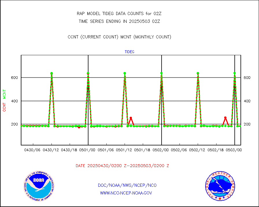
Tide gauge reports decoded from CREX format |
187 |
185 |
101.1 % |
0201.50-0202.50 |
||||||||||
| Data Types of Opportunity with Normal Counts | ||||||||||||||
|---|---|---|---|---|---|---|---|---|---|---|---|---|---|---|
| Type | Description | Hourly Count | Monthly Average | Percent (%) of Monthly Mean | UTC Time Window | |||||||||
GOES-16&up/NESDIS ir short-wv derived cld motion |
4026 |
3716 |
108.3 % |
0201.00-0201.99 |
||||||||||
MDCRS ACARS acft data (ARINC via AFWA)(AIREP fmt) |
0 |
0 |
n/a |
0122.75-0205.25 |
||||||||||
Manual AIREP aircraft data (dcded from AIREP fmt) |
1596 |
1907 |
83.7 % |
0122.75-0205.25 |
||||||||||
AQUA AIRS/AMSU-A/HSB brightness temps- every FOV |
0 |
0 |
n/a |
0123.00-0204.99 |
||||||||||
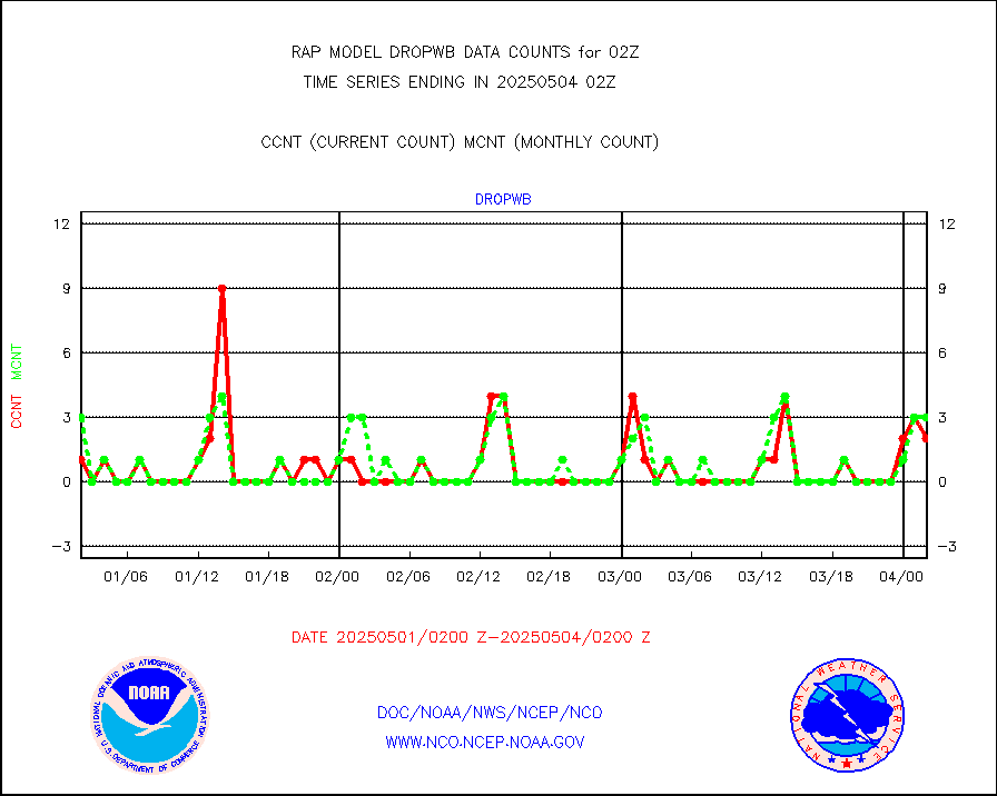
AMDAR aircraft data (decoded from AMDAR format) |
2631 |
2348 |
112.1 % |
0122.75-0205.25 |
||||||||||
AMDAR aircraft data (decoded from BUFR) |
9093 |
10095 |
90.1 % |
0122.75-0205.25 |
||||||||||
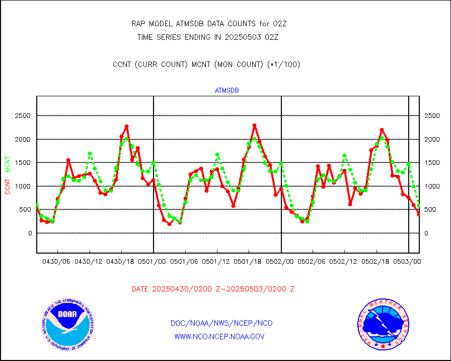
GCOM-W AMSR2 1B brightness temperatures |
159703 |
636837 |
25.1 % |
0123.00-0123.99 |
||||||||||
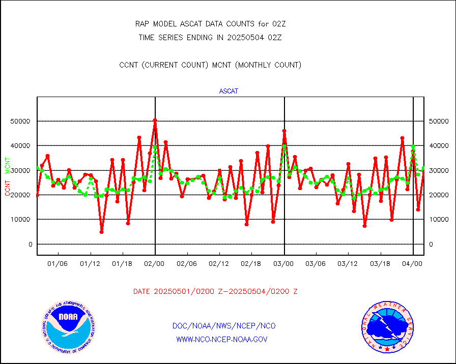
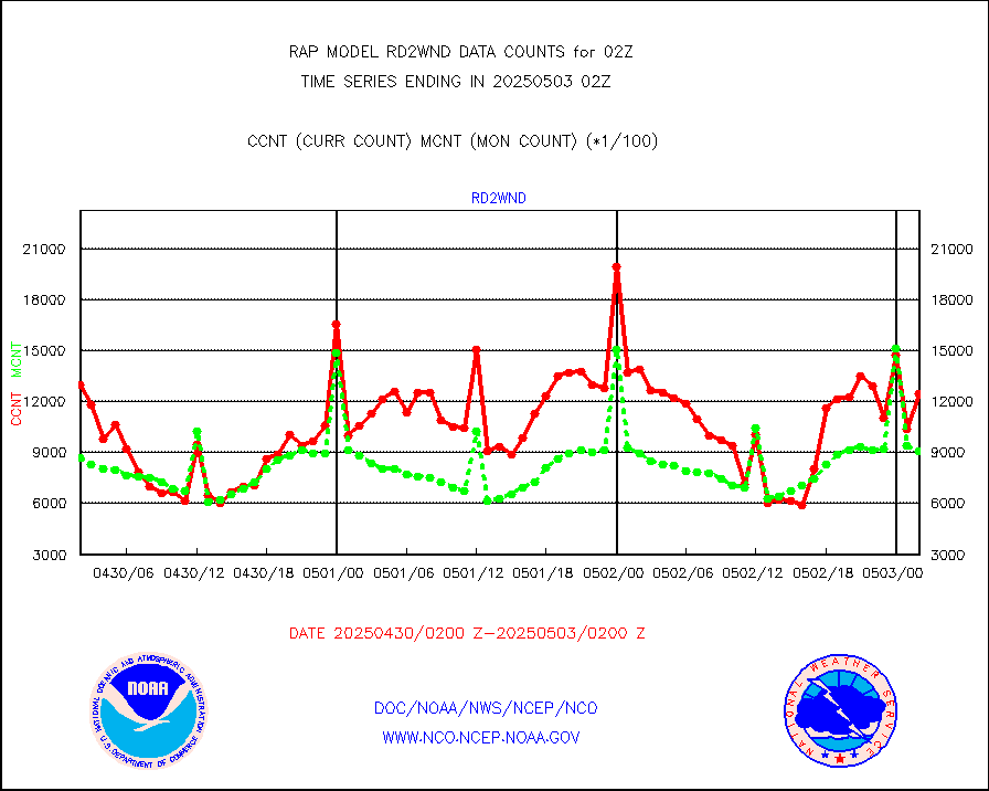
METOP 1-2 ASCAT products |
29651 |
29730 |
99.7 % |
0200.00-0204.00 |
||||||||||
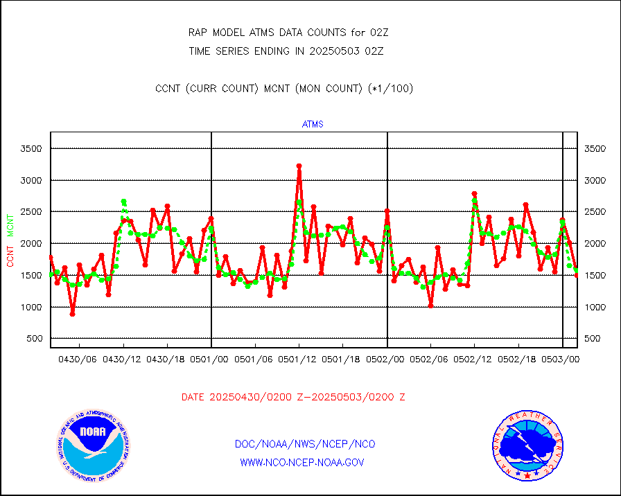
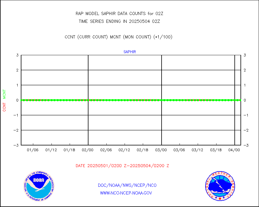
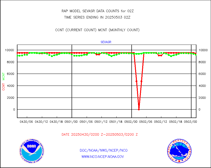
NPP/NOAA-20 ATMS brightness temperatures |
136205 |
152943 |
89.1 % |
0200.00-0203.99 |
||||||||||
NPP/NOAA-20 ATMS bright. temps-direct b-cast SSEC |
40294 |
42242 |
95.4 % |
0200.00-0203.99 |
||||||||||
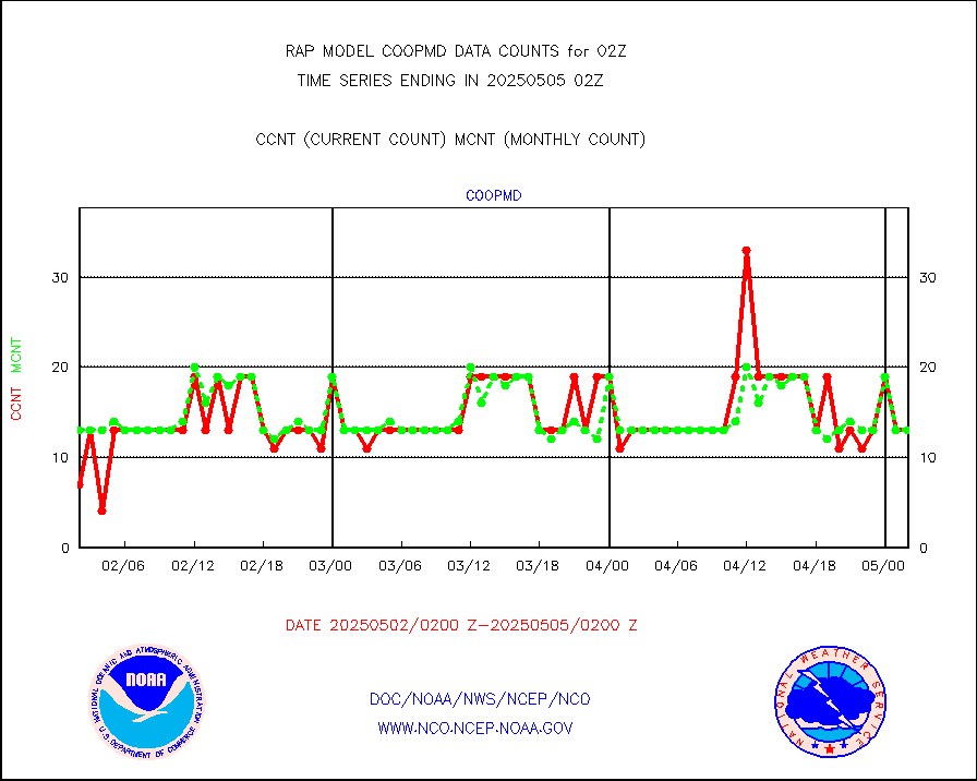
Coop/MADIS NEPP & HCN-Modernization NOAA COOP Obs |
11 |
11 |
100.0 % |
0201.50-0202.50 |
||||||||||
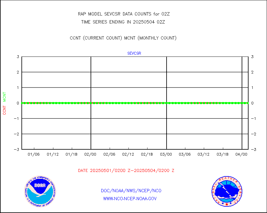
NPP/NOAA-20 CrIS full spctrl radn (431 ch subset) |
93313 |
90446 |
103.2 % |
0200.00-0203.99 |
||||||||||
NPP/NOAA-20 CrIS full spctrl radn dir brdcst SSEC |
11880 |
15776 |
75.3 % |
0200.00-0203.99 |
||||||||||
Coast Guard |
5 |
6 |
83.3 % |
0201.50-0202.50 |
||||||||||
Drifting buoys (decoded from BUFR) |
538 |
536 |
100.4 % |
0201.50-0202.50 |
||||||||||
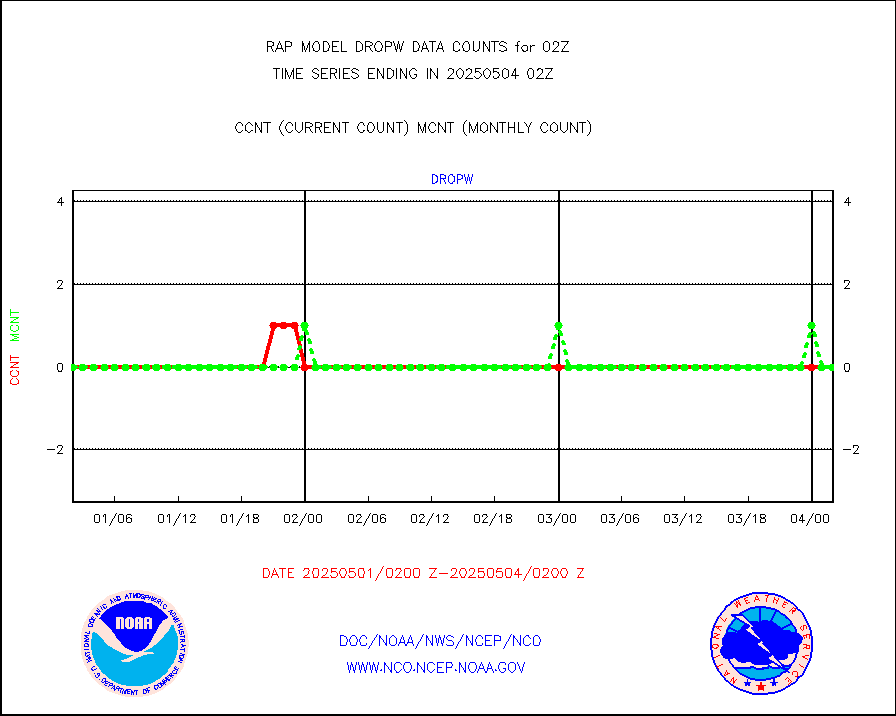
Dropwinsonde (from TEMP DROP) |
0 |
0 |
n/a |
0201.00-0203.00 |
||||||||||
Dropwinsonde (decoded from BUFR) |
2 |
3 |
66.7 % |
0201.00-0203.00 |
||||||||||
E-AMDAR (European AMDAR acft decoded from BUFR) |
2950 |
3110 |
94.9 % |
0122.75-0205.25 |
||||||||||
NOAA 15-19 & METOP 1-2 AMSU-A proc btmps frm RARS |
17838 |
18832 |
94.7 % |
0201.00-0203.00 |
||||||||||
METOP 1-2 IASI 1C radiance data vbl chn from RARS |
11584 |
13992 |
82.8 % |
0200.00-0203.99 |
||||||||||
NOAA 18-19 & METOP 1-2 MHS proc. btemps from RARS |
184057 |
198414 |
92.8 % |
0201.00-0203.00 |
||||||||||
GPM GMI Level 1C-R brightness temperatures |
476223 |
452031 |
105.4 % |
0123.00-0204.99 |
||||||||||
GPS radio occultation data |
195 |
191 |
102.1 % |
0200.00-0203.99 |
||||||||||
GOES-16/17 All Sky Radiances (proc.) |
812097 |
812097 |
100.0 % |
0200.00-0203.99 |
||||||||||
GOES-16/17 Clear Sky Radiances (proc.) |
394801 |
391752 |
100.8 % |
0200.00-0203.99 |
||||||||||
MTSAT/JMA water vapor imager derived cloud motion |
2650 |
2920 |
90.8 % |
0123.50-0204.50 |
||||||||||
GOES-16&up/NESDIS wv imgr/deep-lyr derivd cld mtn |
9667 |
7721 |
125.2 % |
0201.00-0201.99 |
||||||||||
METEOSAT/EUMETSAT wvpr imgr drv cld motion NBseq |
5008 |
5318 |
94.2 % |
0200.50-0203.49 |
||||||||||
GOES-16&up/NESDIS wv imgr/cld-top derived cld mtn |
16127 |
16562 |
97.4 % |
0201.00-0201.99 |
||||||||||
METOP 1-2 IASI 1C radiances-direct broadcast SSEC |
115824 |
121485 |
95.3 % |
0200.00-0203.99 |
||||||||||
METEOSAT/EUMETSAT ir lg-wave drv cld motion NBseq |
3068 |
3112 |
98.6 % |
0200.50-0203.49 |
||||||||||
VIIRS (NPP/NOAA-20) ir lg-wv drv cloud motion(NB) |
0 |
0 |
n/a |
0123.50-0204.50 |
||||||||||
AVHRR (NOAA/METOP) ir lg-wave derived cld motion |
0 |
0 |
n/a |
0123.50-0204.50 |
||||||||||
AVHRR (METOP) ir lg-wave derived cld motion |
0 |
0 |
n/a |
0200.50-0203.49 |
||||||||||
MTSAT/JMA infrared long-wave derived cloud motion |
2357 |
2447 |
96.3 % |
0123.50-0204.50 |
||||||||||
GOES-16&up/NESDIS ir long-wave derived cld motion |
29976 |
31461 |
95.3 % |
0201.00-0201.99 |
||||||||||
Korean AMDAR aircraft data (decoded from BUFR) |
264 |
260 |
101.5 % |
0122.75-0205.25 |
||||||||||
Land-based CMAN stations decoded from CMAN format |
85 |
47 |
180.9 % |
0201.50-0202.50 |
||||||||||
LLDN Long-rng lightning from Vaisala via NOAAPORT |
212011 |
218525 |
97.0 % |
0201.00-0202.50 |
||||||||||
NLDN Shrt-rng lightning from Vaisala via NOAAPORT |
9865 |
11864 |
83.2 % |
0201.00-0202.50 |
||||||||||
Moored buoys (decoded from BUFR) |
636 |
655 |
97.1 % |
0201.50-0202.50 |
||||||||||
Mesonet/MADIS Colorado E-470 (Interstate 470) |
24 |
24 |
100.0 % |
0201.50-0202.50 |
||||||||||
Mesonet/MADIS Alaska Department of Transportation |
117 |
71 |
164.8 % |
0201.50-0202.50 |
||||||||||
Mesonet/MADIS U.S. Army Aberdeen Proving Grounds |
0 |
0 |
n/a |
0201.50-0202.50 |
||||||||||
Mesonet/MADIS Citizen Weather Observers Program |
51452 |
57782 |
89.0 % |
0201.50-0202.50 |
||||||||||
Mesonet/MADIS AWS Convergence Technologies, Inc. |
13274 |
20671 |
64.2 % |
0201.50-0202.50 |
||||||||||
Mesonet/MADIS "Anything Weather" |
0 |
0 |
n/a |
0201.50-0202.50 |
||||||||||
Mesonet/MADIS Colorado Dept. of Transportation |
0 |
0 |
n/a |
0201.50-0202.50 |
||||||||||
Mesonet/MADIS DC Net |
0 |
0 |
n/a |
0201.50-0202.50 |
||||||||||
Mesonet/MADIS Denver Urban Drainage & Flood Cntrl |
0 |
0 |
n/a |
0201.50-0202.50 |
||||||||||
Mesonet/MADIS Florida (FAWN & USF) |
3 |
4 |
75.0 % |
0201.50-0202.50 |
||||||||||
Mesonet/MADIS Florida Dept. of Transportation |
0 |
0 |
n/a |
0201.50-0202.50 |
||||||||||
Mesonet/MADIS Georgia Dept. of Transportation |
0 |
0 |
n/a |
0201.50-0202.50 |
||||||||||
Mesonet/MADIS NWS Hydromet Auto Data System(HADS) |
4537 |
4938 |
91.9 % |
0201.50-0202.50 |
||||||||||
Mesonet/MADIS Iowa Environmental |
156 |
161 |
96.9 % |
0201.50-0202.50 |
||||||||||
Mesonet/MADIS Indiana Dept. of Transportation |
0 |
0 |
n/a |
0201.50-0202.50 |
||||||||||
Mesonet/MADIS Iowa Department of Transportation |
0 |
0 |
n/a |
0201.50-0202.50 |
||||||||||
Mesonet/MADIS Kansas Department of Transportation |
261 |
304 |
85.9 % |
0201.50-0202.50 |
||||||||||
Mesonet/MADIS Oklahoma Mesonet |
525 |
574 |
91.5 % |
0201.50-0202.50 |
||||||||||
Mesonet/MADIS Louisiana State/Jackson State Univ. |
0 |
0 |
n/a |
0201.50-0202.50 |
||||||||||
Mesonet/MADIS Missouri Commercial Agricult Wx Net |
257 |
289 |
88.9 % |
0201.50-0202.50 |
||||||||||
Mesonet/MADIS Minnesota Dept. of Transportation |
0 |
0 |
n/a |
0201.50-0202.50 |
||||||||||
Mesonet/MADIS NOS-Phys Oceanographic Realtime Sys |
248 |
267 |
92.9 % |
0201.50-0202.50 |
||||||||||
Mesonet/MADIS many providers, not separated out |
29178 |
38618 |
75.6 % |
0201.50-0202.50 |
||||||||||
Mesonet/MADIS UrbaNet |
2903 |
3076 |
94.4 % |
0201.50-0202.50 |
||||||||||
Mesonet/MADIS Virginia Dept. of Transportation |
0 |
0 |
n/a |
0201.50-0202.50 |
||||||||||
Mesonet/MADIS "Weather for You" |
0 |
0 |
n/a |
0201.50-0202.50 |
||||||||||
Mesonet/MADIS Wisconsin Dept. of Transportation |
0 |
0 |
n/a |
0201.50-0202.50 |
||||||||||
Mesonet/MADIS MesoWest (many subproviders) |
25826 |
36808 |
70.2 % |
0201.50-0202.50 |
||||||||||
Mesonet/MADIS West Texas |
5043 |
5172 |
97.5 % |
0201.50-0202.50 |
||||||||||
METOP 1-2 IASI 1C radiance data (varbl. channels) |
41403 |
41658 |
99.4 % |
0200.00-0203.99 |
||||||||||
NEXRAD Vel Azm Dsp(VAD) winds via Level 2 decoder |
977 |
972 |
100.5 % |
0201.00-0203.00 |
||||||||||
NOAA 16-19 Solar Backscatter UV-2 rad frm V8 BUFR |
0 |
0 |
n/a |
0200.00-0202.99 |
||||||||||
PIBAL (from PILOT, PILOT SHIP, PILOT MOBIL) |
0 |
0 |
n/a |
0201.00-0203.00 |
||||||||||
PIBAL (decoded from BUFR) |
0 |
0 |
n/a |
0201.00-0203.00 |
||||||||||
Manual PIREP aircraft data (dcded from AIREP fmt) |
295 |
312 |
94.6 % |
0122.75-0205.25 |
||||||||||
Profilr winds from PIBAL (PILOT,PILOT SHIP/MOBIL) |
0 |
0 |
n/a |
0200.50-0203.50 |
||||||||||
Rawinsonde - fixed land (decoded from BUFR) |
0 |
0 |
n/a |
0201.00-0203.00 |
||||||||||
Rawinsonde - mobile land (from TEMP/PILOT MOBIL) |
0 |
0 |
n/a |
0201.00-0203.00 |
||||||||||
Rawinsonde - mobile land (decoded from BUFR) |
0 |
0 |
n/a |
0201.00-0203.00 |
||||||||||
Rawinsonde - ship (from TEMP SHIP, PILOT SHIP) |
0 |
0 |
n/a |
0201.00-0203.00 |
||||||||||
Rawinsonde - ship (decoded from BUFR) |
0 |
0 |
n/a |
0201.00-0203.00 |
||||||||||
NEXRAD radial wind (Level 2 - GTS) |
1643951 |
1455452 |
113.0 % |
0201.50-0202.49 |
||||||||||
Flight level reconnaissance aircraft data |
0 |
0 |
n/a |
0201.00-0203.00 |
||||||||||
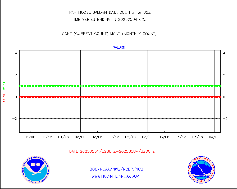
Surface Marine Saildrone (decoded from BUFR) |
1 |
2 |
50.0 % |
0200.00-0203.99 |
||||||||||
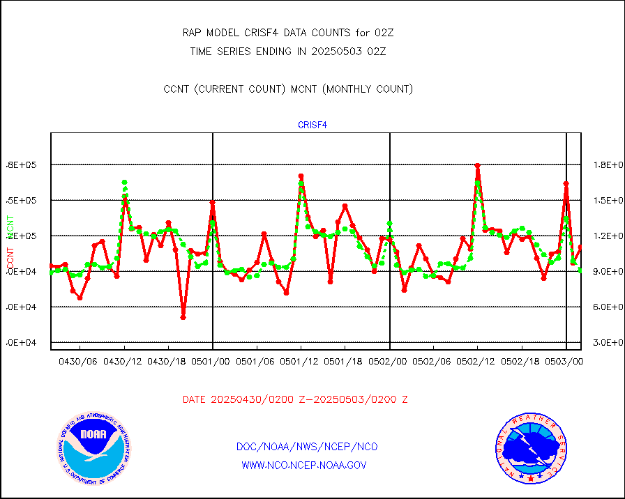
Megha-Tropiques SAPHIR L1A2 brightness temps |
0 |
0 |
n/a |
0123.00-0204.99 |
||||||||||
METEOSAT-10 2nd Gen SEVIRI All Sky Radiance(proc) |
9512 |
9508 |
100.0 % |
0200.00-0203.99 |
||||||||||
METEOSAT-10 2nd Gen SEVIRI Clr Sky Radiance(proc) |
0 |
0 |
n/a |
0200.00-0203.99 |
||||||||||
Ship - manual and automatic, restricted |
0 |
12 |
0.0 % |
0201.50-0202.50 |
||||||||||
NOW COVER, DEPTH/DENSITY AND WATER EQUIVALENT |
3130 |
5855 |
53.5 % |
0200.00-0204.00 |
||||||||||
DMSP SSM/IS 1C radiance data (Unified Pre-Proc.) |
40716 |
43475 |
93.7 % |
0200.00-0203.99 |
||||||||||
Sub-surface float and glider profile (BUFR) |
6 |
3 |
200.0 % |
0200.00-0203.99 |
||||||||||
Synoptic - restricted (WMO Res 40) manual & auto. |
0 |
0 |
n/a |
0201.50-0202.50 |
||||||||||
Synoptic - restricted (WMO Res 40)(decoded BUFR) |
291 |
351 |
82.9 % |
0201.50-0202.50 |
||||||||||
Synoptic - mobile manual & auto (decoded fr BUFR) |
0 |
0 |
n/a |
0201.50-0202.50 |
||||||||||
TAMDAR aircft data-all types(from Panasonic,BUFR) |
186 |
154 |
120.8 % |
0122.75-0205.25 |
||||||||||
MTSAT/JMA visible derived cloud motion |
1802 |
1561 |
115.4 % |
0123.50-0204.50 |
||||||||||
GOES-16&up/NESDIS visible derived cloud motion |
154884 |
142142 |
109.0 % |
0201.00-0201.99 |
||||||||||
METEOSAT/EUMETSAT visible drv cld motion NBseq |
0 |
1 |
0.0 % |
0200.50-0203.49 |
||||||||||


