| Suspect Data Shortages in Critical Types - Monitor | ||||||||||||||
|---|---|---|---|---|---|---|---|---|---|---|---|---|---|---|
| Type | Description | Hourly Count | Monthly Average | Percent (%) of Monthly Mean | UTC Time Window | |||||||||
NOAA 18-19 & METOP 1-2 HIRS-4 NCEP-proc. br.temps |
0 |
12112 |
0.0 % |
0200.00-0200.99 |
||||||||||
NOAA 15-19 & METOP 1-2 HIRS-3/4 pr btmps frm RARS |
0 |
19046 |
0.0 % |
0201.50-0202.49 |
||||||||||
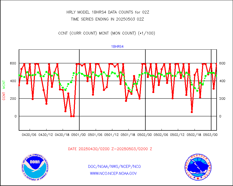
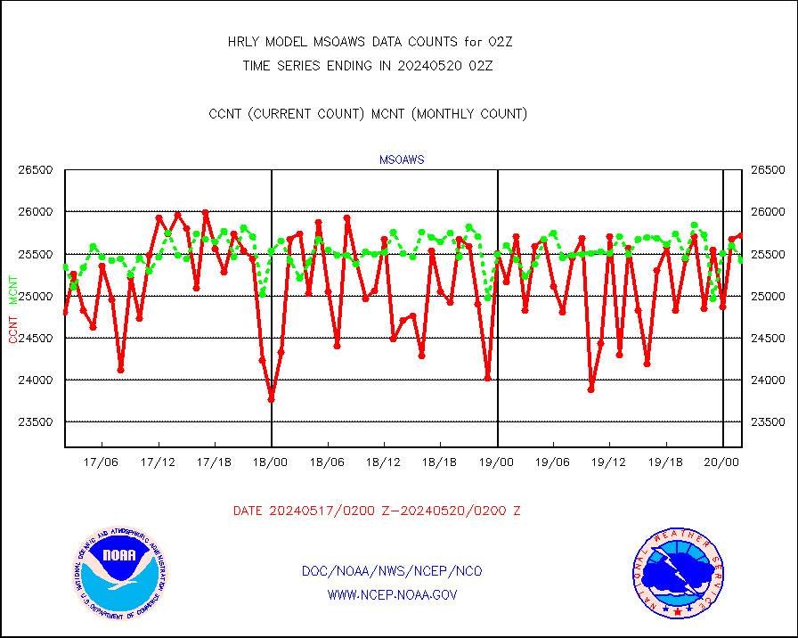
Grnd-based Gbl Navigation Sat System (GNSS) data |
1338 |
6699 |
20.0 % |
0201.00-0201.99 |
||||||||||
Mesonet/MADIS NFIC Remote Automated Wx Stns(RAWS) |
3 |
1759 |
0.2 % |
0201.50-0202.49 |
||||||||||
| Shortage in Data Type of Opportunity - Monitor | ||||||||||||||
|---|---|---|---|---|---|---|---|---|---|---|---|---|---|---|
| Type | Description | Hourly Count | Monthly Average | Percent (%) of Monthly Mean | UTC Time Window | |||||||||
P.M.(N18-19) AVHRR GAC NCEP-proc clr & sea btemps |
0 |
419648 |
0.0 % |
0123.50-0200.49 |
||||||||||
NPP Adv. Tech. MW Sndr (ATMS) br. temps from RARS |
0 |
4915 |
0.0 % |
0200.50-0201.49 |
||||||||||
INDIA SATWIND, INSAT WV channel |
0 |
564 |
0.0 % |
0201.00-0201.99 |
||||||||||
INDIA SATWIND, INSAT IR channel |
0 |
806 |
0.0 % |
0201.00-0201.99 |
||||||||||
NPP/NOAA-20 VIIRS SST - CLEAR & OVER WATER |
88002 |
1142736 |
7.7 % |
0201.50-0202.49 |
||||||||||
NPP/NOAA-20 VIIRS SST - PROBABLY CLR & OVER WATER |
10412 |
259652 |
4.0 % |
0201.50-0202.49 |
||||||||||
| Critical Data with Normal Counts | ||||||||||||||
|---|---|---|---|---|---|---|---|---|---|---|---|---|---|---|
| Type | Description | Hourly Count | Monthly Average | Percent (%) of Monthly Mean | UTC Time Window | |||||||||
NOAA 15-19 & METOP 1-2 AMSU-A NCEP-proc. br.temps |
26738 |
31119 |
85.9 % |
0200.00-0200.99 |
||||||||||
NOAA 18-19 & METOP 1-2 MHS NCEP-proces. br. temps |
237897 |
260744 |
91.2 % |
0200.00-0200.99 |
||||||||||
MDCRS ACARS acft data from ARINC(dcded from BUFR) |
24565 |
31192 |
78.8 % |
0201.50-0202.49 |
||||||||||
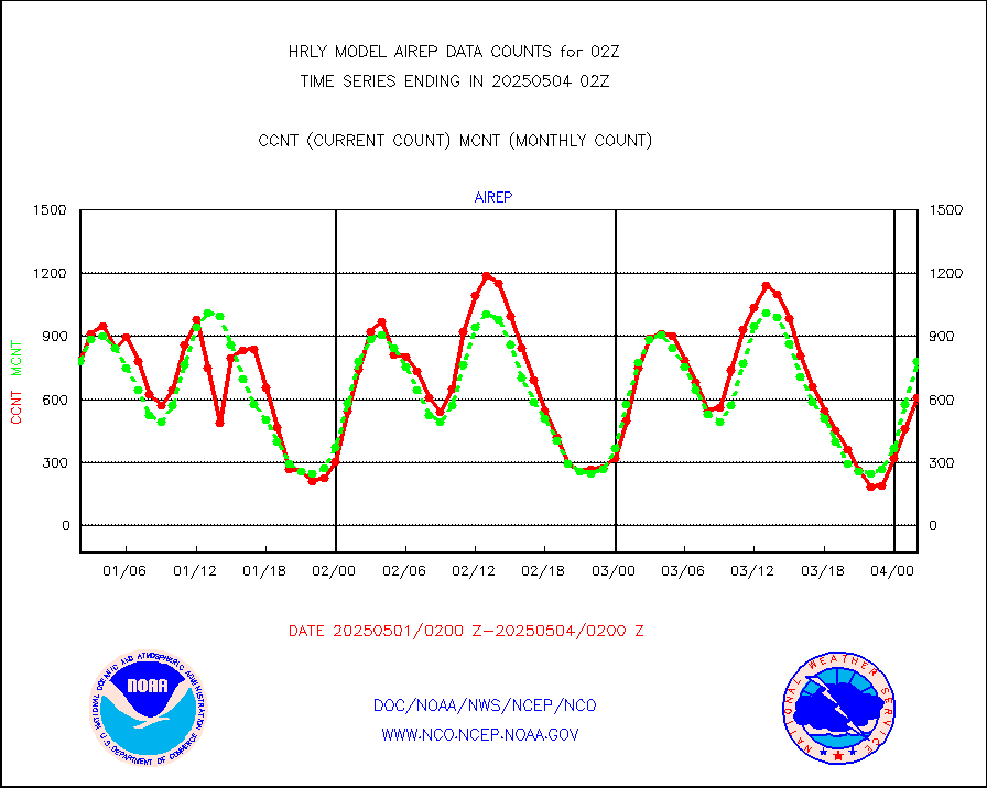
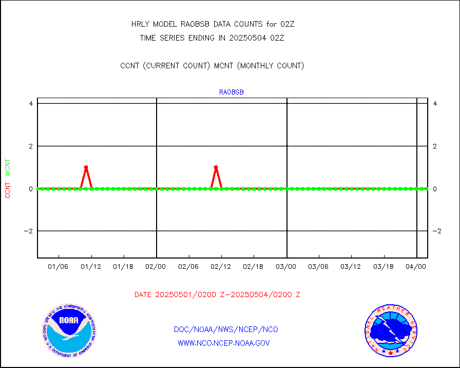
Manual AIREP aircraft data (dcded from AIREP fmt) |
616 |
809 |
76.1 % |
0201.50-0202.49 |
||||||||||
AQUA AIRS/AMSU-A/HSB brightness temps- every FOV |
0 |
0 |
n/a |
0123.50-0200.49 |
||||||||||
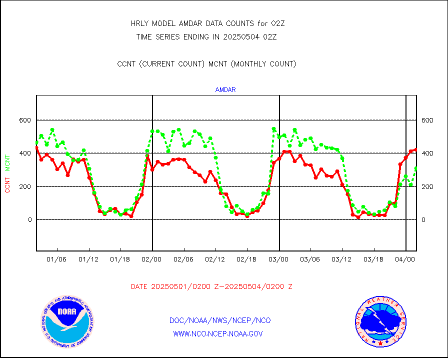
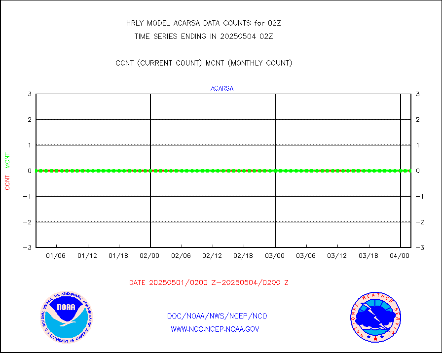
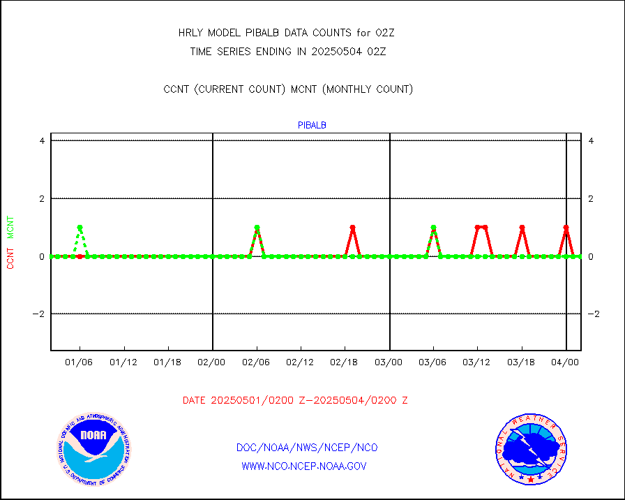
AMDAR aircraft data (decoded from AMDAR format) |
319 |
339 |
94.1 % |
0201.50-0202.49 |
||||||||||
AMDAR aircraft data (decoded from BUFR) |
2501 |
2674 |
93.5 % |
0201.50-0202.49 |
||||||||||
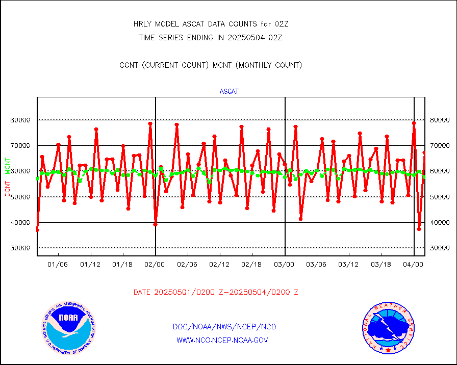
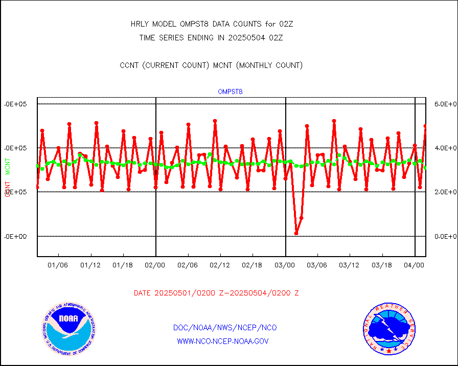
METOP 1-2 ASCAT products |
54138 |
57166 |
94.7 % |
0200.50-0201.49 |
||||||||||
NPP/NOAA-20 ATMS brightness temperatures |
320736 |
344064 |
93.2 % |
0200.50-0201.49 |
||||||||||
Canadian AMDAR aircraft data (decoded from BUFR) |
0 |
0 |
n/a |
0201.50-0202.49 |
||||||||||
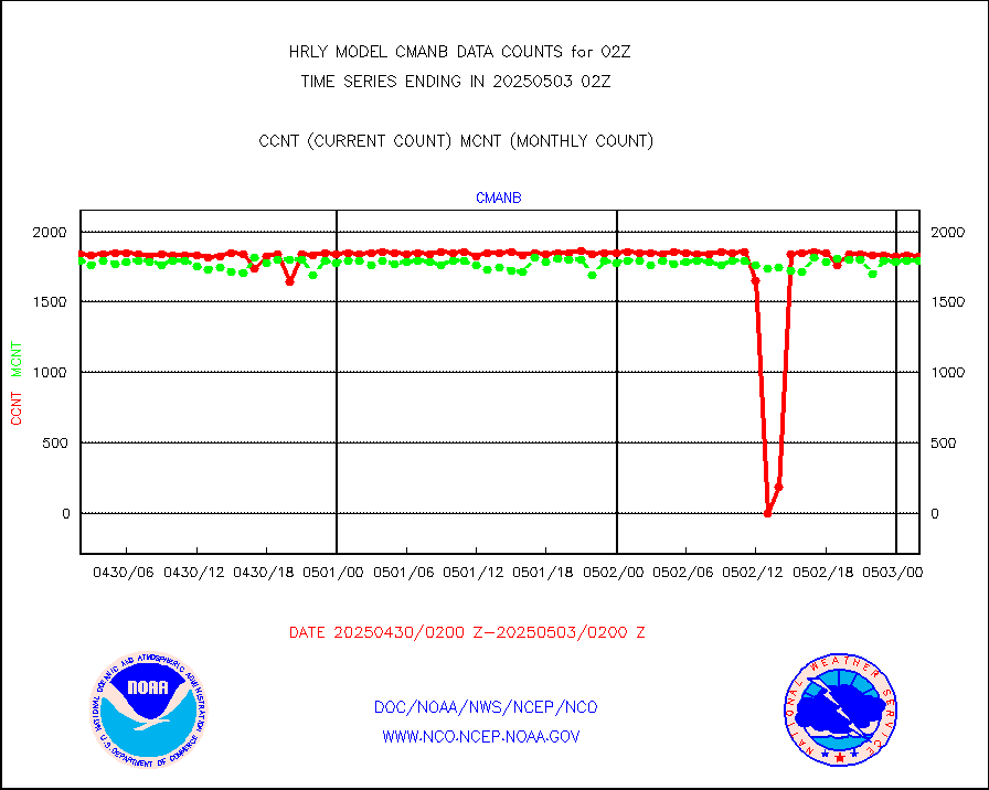
Surface Marine CMAN rpts decoded from BUFR format |
1875 |
1861 |
100.8 % |
0201.50-0202.50 |
||||||||||
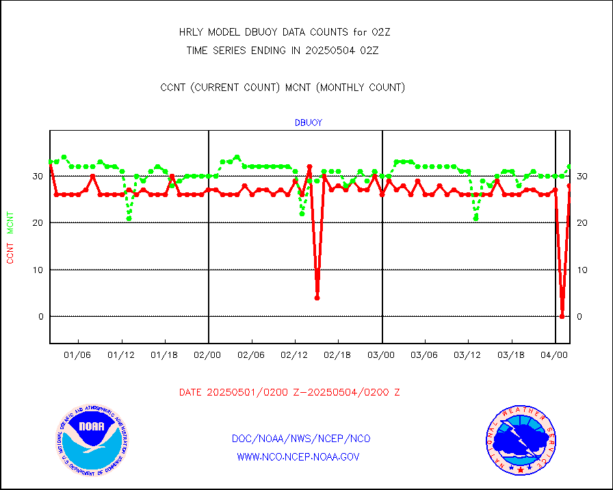
Buoys decoded from FM-18 fmt (moored or drifting) |
2 |
15 |
13.3 % |
0201.50-0202.49 |
||||||||||
E-AMDAR (European AMDAR acft decoded from BUFR) |
327 |
399 |
82.0 % |
0201.50-0202.49 |
||||||||||
NOAA 15-19 & METOP 1-2 AMSU-A proc btmps frm RARS |
27636 |
31516 |
87.7 % |
0201.50-0202.49 |
||||||||||
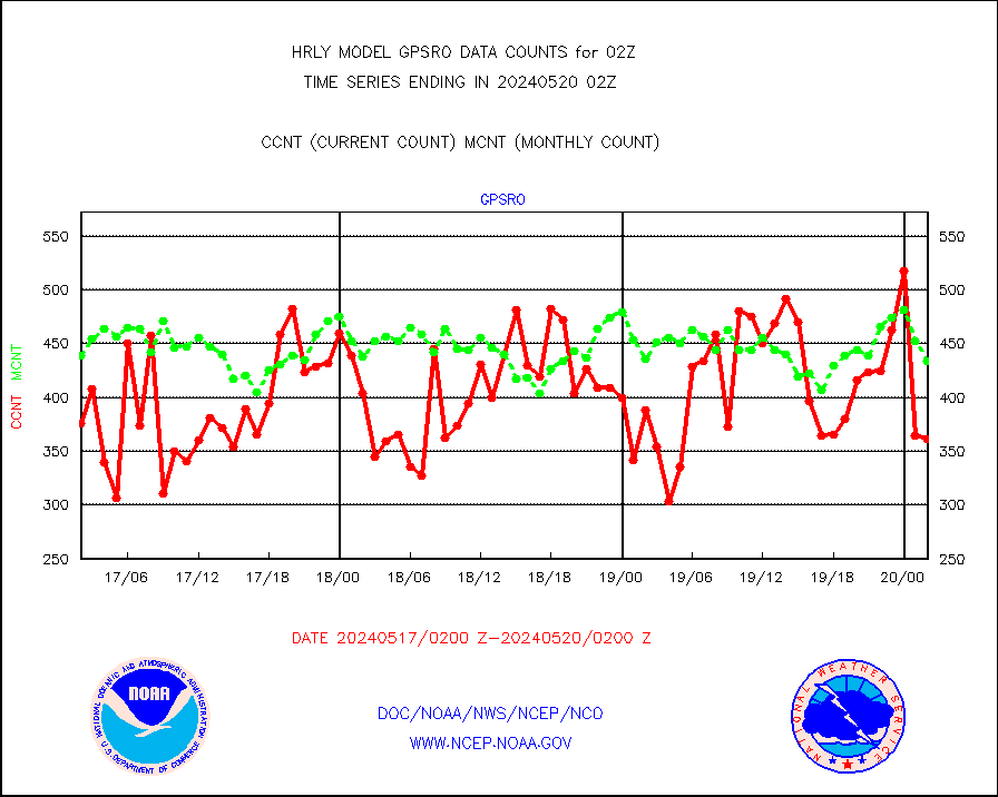
GPS radio occultation data |
516 |
521 |
99.0 % |
0123.50-0200.49 |
||||||||||
GOES-16/17 All Sky Radiances (proc.) |
720952 |
720840 |
100.0 % |
0201.50-0202.49 |
||||||||||
GOES-16/17 Clear Sky Radiances (proc.) |
353328 |
364998 |
96.8 % |
0201.50-0202.49 |
||||||||||
MTSAT/JMA water vapor imager derived cloud motion |
21456 |
19545 |
109.8 % |
0123.50-0200.49 |
||||||||||
MODIS (AQUA/TERRA) wvpr imager derived cld motion |
0 |
0 |
n/a |
0122.00-0122.99 |
||||||||||
GOES-16&up/NESDIS wv imgr/cld-top derived cld mtn |
27333 |
29759 |
91.8 % |
0201.00-0201.99 |
||||||||||
METEOSAT/EUMETSAT ir lg-wave drv cld motion NBseq |
21704 |
20836 |
104.2 % |
0200.50-0201.49 |
||||||||||
MTSAT/JMA infrared long-wave derived cloud motion |
16800 |
16378 |
102.6 % |
0123.50-0200.49 |
||||||||||
MODIS (AQUA/TERRA) ir l-wave derived cloud motion |
0 |
0 |
n/a |
0122.00-0122.99 |
||||||||||
GOES-16&up/NESDIS ir long-wave derived cld motion |
79681 |
83152 |
95.8 % |
0201.00-0201.99 |
||||||||||
GOES/NASA(Langley) hi-res. (1x1 f-o-v) cloud data |
6424581 |
6424809 |
100.0 % |
0201.50-0202.49 |
||||||||||
Buoys decoded from FM-13 format (moored) |
122 |
123 |
99.2 % |
0201.50-0202.49 |
||||||||||
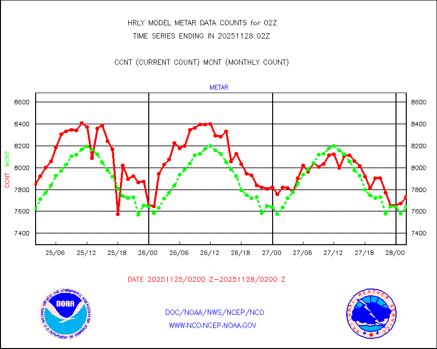
Aviation - METAR |
7674 |
7579 |
101.3 % |
0201.50-0202.49 |
||||||||||
Mesonet/MADIS Colorado E-470 (Interstate 470) |
24 |
24 |
100.0 % |
0201.50-0202.49 |
||||||||||
Mesonet/MADIS Alaska Department of Transportation |
117 |
84 |
139.3 % |
0201.50-0202.49 |
||||||||||
Mesonet/MADIS U.S. Army Aberdeen Proving Grounds |
0 |
0 |
n/a |
0201.50-0202.49 |
||||||||||
Mesonet/MADIS Citizen Weather Observers Program |
55253 |
61714 |
89.5 % |
0201.50-0202.49 |
||||||||||
Mesonet/MADIS AWS Convergence Technologies, Inc. |
13274 |
20671 |
64.2 % |
0201.50-0202.49 |
||||||||||
Mesonet/MADIS "Anything Weather" |
0 |
0 |
n/a |
0201.50-0202.49 |
||||||||||
Mesonet/MADIS Colorado Dept. of Transportation |
0 |
0 |
n/a |
0201.50-0202.49 |
||||||||||
Mesonet/MADIS DC Net |
0 |
0 |
n/a |
0201.50-0202.49 |
||||||||||
Mesonet/MADIS Denver Urban Drainage & Flood Cntrl |
0 |
0 |
n/a |
0201.50-0202.49 |
||||||||||
Mesonet/MADIS Florida (FAWN & USF) |
4 |
4 |
100.0 % |
0201.50-0202.49 |
||||||||||
Mesonet/MADIS Florida Dept. of Transportation |
0 |
0 |
n/a |
0201.50-0202.49 |
||||||||||
Mesonet/MADIS Georgia Dept. of Transportation |
0 |
0 |
n/a |
0201.50-0202.49 |
||||||||||
Mesonet/MADIS NWS Hydromet Auto Data System(HADS) |
5883 |
6158 |
95.5 % |
0201.50-0202.49 |
||||||||||
Mesonet/MADIS Iowa Environmental |
189 |
184 |
102.7 % |
0201.50-0202.49 |
||||||||||
Mesonet/MADIS Indiana Dept. of Transportation |
0 |
0 |
n/a |
0201.50-0202.49 |
||||||||||
Mesonet/MADIS Iowa Department of Transportation |
0 |
0 |
n/a |
0201.50-0202.49 |
||||||||||
Mesonet/MADIS Kansas Department of Transportation |
308 |
338 |
91.1 % |
0201.50-0202.49 |
||||||||||
Mesonet/MADIS Oklahoma Mesonet |
630 |
616 |
102.3 % |
0201.50-0202.49 |
||||||||||
Mesonet/MADIS Louisiana State/Jackson State Univ. |
0 |
0 |
n/a |
0201.50-0202.49 |
||||||||||
Mesonet/MADIS Missouri Commercial Agricult Wx Net |
319 |
334 |
95.5 % |
0201.50-0202.49 |
||||||||||
Mesonet/MADIS Minnesota Dept. of Transportation |
0 |
0 |
n/a |
0201.50-0202.49 |
||||||||||
Mesonet/MADIS NOS-Phys Oceanographic Realtime Sys |
341 |
375 |
90.9 % |
0201.50-0202.49 |
||||||||||
Mesonet/MADIS many providers, not separated out |
63175 |
72973 |
86.6 % |
0201.00-0202.49 |
||||||||||
Mesonet/MADIS Virginia Dept. of Transportation |
0 |
0 |
n/a |
0201.50-0202.49 |
||||||||||
Mesonet/MADIS "Weather for You" |
0 |
0 |
n/a |
0201.50-0202.49 |
||||||||||
Mesonet/MADIS Wisconsin Dept. of Transportation |
0 |
0 |
n/a |
0201.50-0202.49 |
||||||||||
Mesonet/MADIS MesoWest (many subproviders) |
25826 |
36814 |
70.2 % |
0201.50-0202.49 |
||||||||||
Mesonet/MADIS West Texas |
5658 |
6015 |
94.1 % |
0201.50-0202.49 |
||||||||||
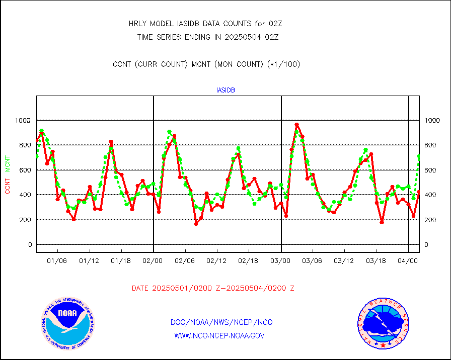
METOP 1-2 IASI 1C radiance data (varbl. channels) |
106924 |
89831 |
119.0 % |
0200.00-0200.99 |
||||||||||
NEXRAD Vel Azm Dsp(VAD) winds via radar coded msg |
0 |
0 |
n/a |
0201.50-0202.49 |
||||||||||
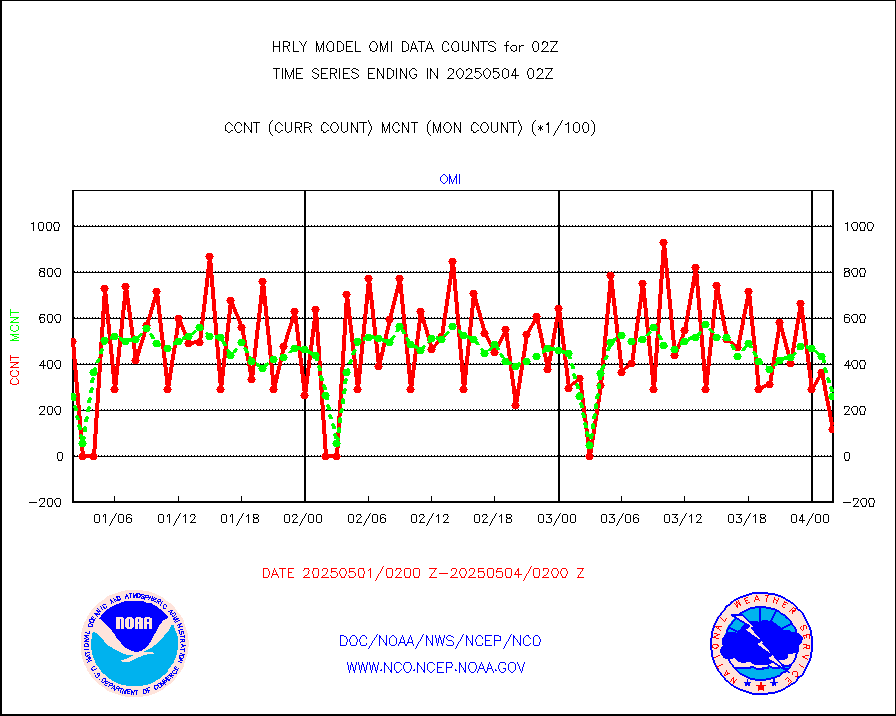
Aura Ozone Monitoring Instrument (OMI) data |
0 |
0 |
n/a |
0123.50-0200.49 |
||||||||||
NOAA 16-19 Solar Backscatter UV-2 rad frm V8 BUFR |
0 |
0 |
n/a |
0200.00-0200.99 |
||||||||||
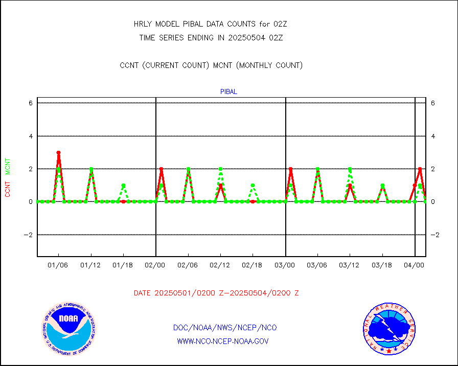
PIBAL (from PILOT, PILOT SHIP, PILOT MOBIL) |
0 |
0 |
n/a |
0201.50-0202.49 |
||||||||||
Multi-Agency Profiler (MAP) and SODAR winds |
52 |
48 |
108.3 % |
0201.50-0202.49 |
||||||||||
Rawinsonde - fixed land (from TEMP or PILOT) |
0 |
0 |
n/a |
0201.50-0202.49 |
||||||||||
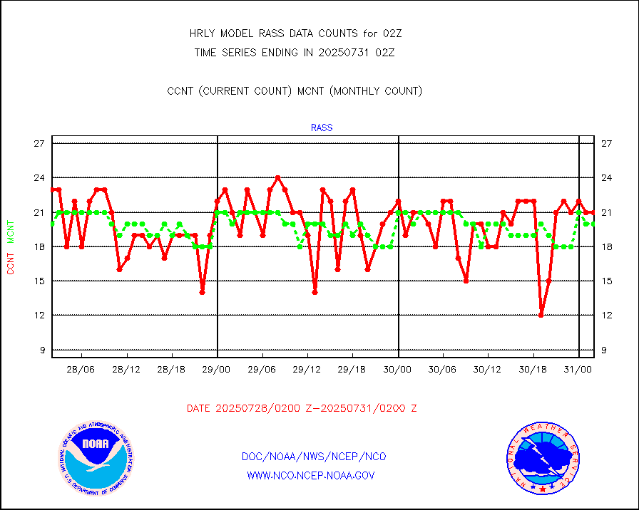
RASS temperatures (NOAA and Multi-Agency) |
24 |
24 |
100.0 % |
0201.50-0202.49 |
||||||||||
NEXRAD reflectivity (Lvl 2 - GTS) |
4420621 |
4407634 |
100.3 % |
0201.50-0202.49 |
||||||||||
NEXRAD radial wind (Level 2 - GTS) |
2150827 |
2009014 |
107.1 % |
0201.50-0202.49 |
||||||||||
METEOSAT-10 2nd Gen SEVIRI Clr Sky Radiance(proc) |
0 |
0 |
n/a |
0201.50-0202.49 |
||||||||||
Ship - manual and automatic, restricted (BUFR) |
0 |
0 |
n/a |
0201.50-0202.50 |
||||||||||
Ship - manual and automatic, unrestricted |
222 |
196 |
113.3 % |
0201.50-0202.50 |
||||||||||
Ship - manual and automatic, unrestricted (BUFR) |
1022 |
975 |
104.8 % |
0201.50-0202.50 |
||||||||||
Synoptic - fixed manual and automatic |
713 |
752 |
94.8 % |
0201.50-0202.49 |
||||||||||
Synoptic - fixed manual & auto (decoded fr BUFR) |
5174 |
5132 |
100.8 % |
0201.50-0202.49 |
||||||||||
Synoptic - restricted (WMO Res 40) manual & auto. |
0 |
0 |
n/a |
0201.50-0202.49 |
||||||||||
Synoptic - restricted (WMO Res 40)(decoded BUFR) |
473 |
403 |
117.4 % |
0201.50-0202.49 |
||||||||||
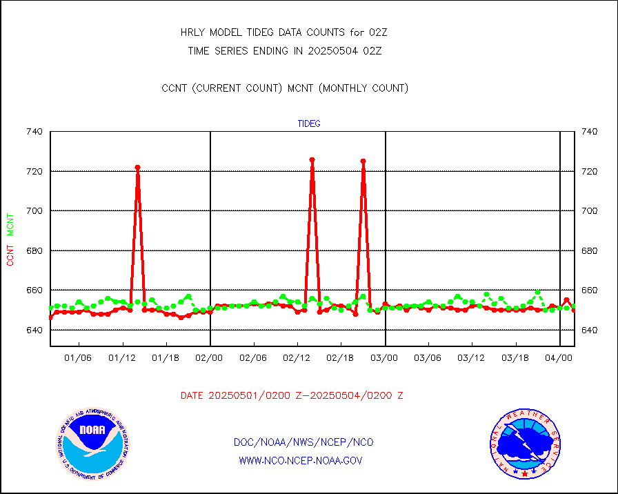
Tide gauge reports decoded from CREX format |
662 |
655 |
101.1 % |
0201.00-0201.99 |
||||||||||
| Data Types of Opportunity with Normal Counts | ||||||||||||||
|---|---|---|---|---|---|---|---|---|---|---|---|---|---|---|
| Type | Description | Hourly Count | Monthly Average | Percent (%) of Monthly Mean | UTC Time Window | |||||||||
GOES-16&up/NESDIS ir short-wv derived cld motion |
21446 |
22839 |
93.9 % |
0201.00-0201.99 |
||||||||||
MDCRS ACARS acft data (ARINC via AFWA)(AIREP fmt) |
0 |
0 |
n/a |
0201.50-0202.49 |
||||||||||
Himawari Clear Sky Radiance |
0 |
0 |
n/a |
0201.00-0201.99 |
||||||||||
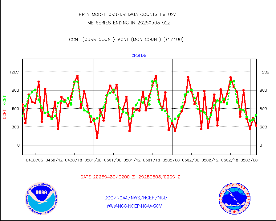
GCOM-W AMSR2 1B brightness temperatures |
1744740 |
2139729 |
81.5 % |
0200.00-0200.99 |
||||||||||
NPP/NOAA-20 ATMS bright. temps-direct b-cast SSEC |
59136 |
74264 |
79.6 % |
0200.50-0201.49 |
||||||||||
POES/NESDIS - processed ATOVS soundings/radiances |
0 |
0 |
n/a |
0200.00-0200.99 |
||||||||||
A.M.(N17,M2,M3) AVHRR GAC NCEP-proc clr&sea btmps |
1241224 |
1371386 |
90.5 % |
0123.50-0200.49 |
||||||||||
eXpendable BathyThermograph, mooring (BATHY fmt) |
0 |
0 |
n/a |
0119.00-0119.99 |
||||||||||
Coop/MADIS NEPP & HCN-Modernization NOAA COOP Obs |
11 |
11 |
100.0 % |
0201.50-0202.49 |
||||||||||
NPP/NOAA-20 CrIS full spctrl radn (431 ch subset) |
240534 |
233767 |
102.9 % |
0200.50-0201.49 |
||||||||||
NPP/NOAA-20 CrIS full spctrl radn dir brdcst SSEC |
18090 |
25345 |
71.4 % |
0200.50-0201.49 |
||||||||||
Coast Guard |
5 |
6 |
83.3 % |
0201.50-0202.50 |
||||||||||
Drifting buoys (decoded from BUFR) |
1436 |
1452 |
98.9 % |
0201.50-0202.50 |
||||||||||
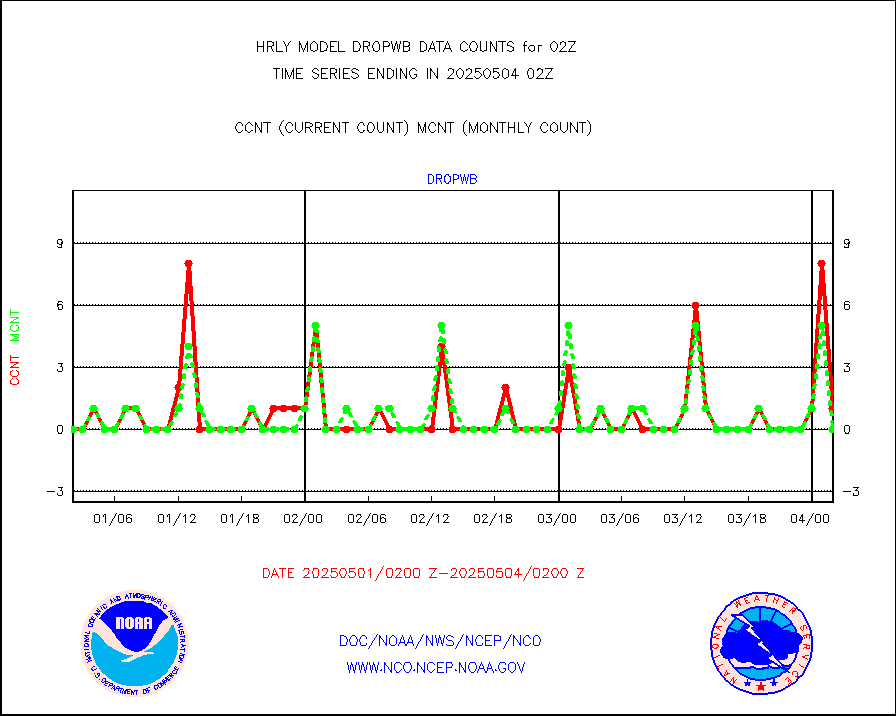
Dropwinsonde (from TEMP DROP) |
0 |
0 |
n/a |
0201.50-0202.49 |
||||||||||
Dropwinsonde (decoded from BUFR) |
0 |
0 |
n/a |
0201.51-0202.49 |
||||||||||
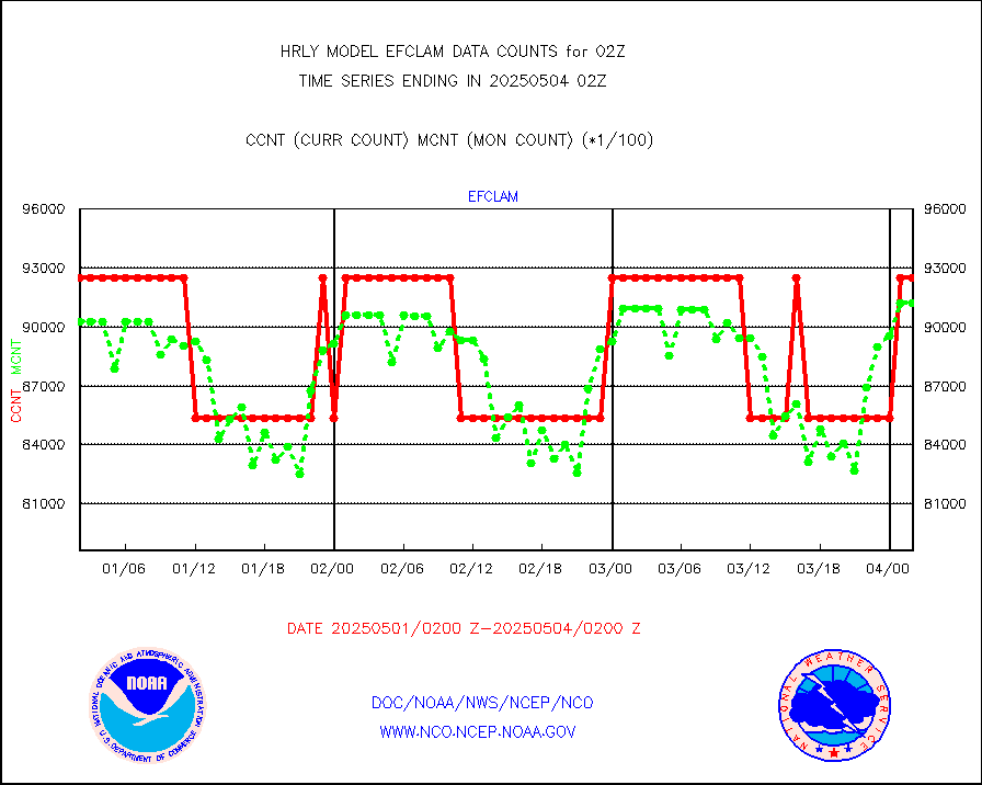
GOES imager effective cloud amount data (U.Wisc.) |
9250602 |
8586226 |
107.7 % |
0201.50-0202.49 |
||||||||||
METOP 1-2 IASI 1C radiance data vbl chn from RARS |
50515 |
48105 |
105.0 % |
0201.00-0201.99 |
||||||||||
NOAA 18-19 & METOP 1-2 MHS proc. btemps from RARS |
272865 |
302095 |
90.3 % |
0201.50-0202.49 |
||||||||||
GOES/NESDIS (11x17 f-o-v) imager clear radiances |
0 |
0 |
n/a |
0201.00-0201.99 |
||||||||||
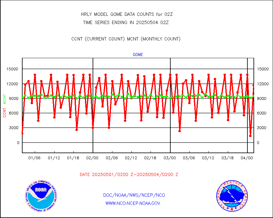
METOP 1-2 Global Ozone Monitoring Exp.-2 (GOME-2) |
6571 |
9266 |
70.9 % |
0200.50-0201.49 |
||||||||||
GOES-16&up/NESDIS wv imgr/deep-lyr derivd cld mtn |
20538 |
17742 |
115.8 % |
0201.00-0201.99 |
||||||||||
METEOSAT/EUMETSAT wvpr imgr drv cld motion NBseq |
33946 |
36454 |
93.1 % |
0200.50-0201.49 |
||||||||||
High Density OBs from reconnaissance acft data |
0 |
0 |
n/a |
0201.50-0202.49 |
||||||||||
METOP 1-2 IASI 1C radiances-direct broadcast SSEC |
71649 |
75801 |
94.5 % |
0200.50-0201.49 |
||||||||||
VIIRS (NPP/NOAA-20) ir lg-wv drv cloud motion(NB) |
27245 |
18183 |
149.8 % |
0122.00-0122.99 |
||||||||||
AVHRR (NOAA/METOP) ir lg-wave derived cld motion |
0 |
0 |
n/a |
0122.00-0122.99 |
||||||||||
AVHRR (METOP) ir lg-wave derived cld motion |
0 |
0 |
n/a |
0201.50-0202.50 |
||||||||||
INSAT/KALPANA India ir lg-wave derived cld motion |
0 |
0 |
n/a |
0123.50-0200.49 |
||||||||||
Korean AMDAR aircraft data (decoded from BUFR) |
26 |
54 |
48.1 % |
0201.50-0202.49 |
||||||||||
Land-based CMAN stations decoded from CMAN format |
107 |
84 |
127.4 % |
0201.50-0202.49 |
||||||||||
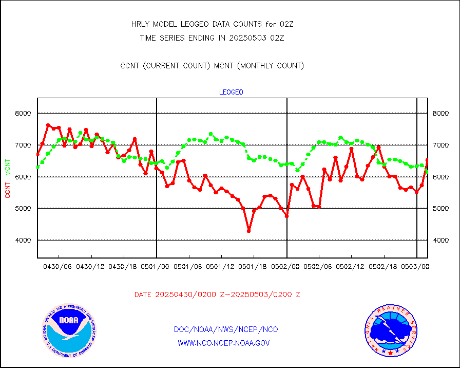
LEO-GEO satellite AMVs from UWisc. |
5222 |
7213 |
72.4 % |
0122.00-0122.99 |
||||||||||
LLDN Long-rng lightning from Vaisala via NOAAPORT |
196219 |
206637 |
95.0 % |
0201.50-0202.49 |
||||||||||
NLDN Shrt-rng lightning from Vaisala via NOAAPORT |
6199 |
8079 |
76.7 % |
0201.50-0202.49 |
||||||||||
Moored buoys (decoded from BUFR) |
974 |
939 |
103.7 % |
0201.50-0202.50 |
||||||||||
Aura Microwave Limb Sounder (MLS) ozone data |
0 |
0 |
n/a |
0200.00-0200.99 |
||||||||||
Mesonet/MADIS UrbaNet |
3594 |
3550 |
101.2 % |
0201.50-0202.49 |
||||||||||
NEXRAD Vel Azm Dsp(VAD) winds via Level 2 decoder |
514 |
545 |
94.3 % |
0201.50-0202.49 |
||||||||||
OMPS Limb Profiler ozone data (NPP) |
314 |
257 |
122.2 % |
0119.00-0119.99 |
||||||||||
OMPS nadir profile ozone (Version 8 BUFR) |
612 |
546 |
112.1 % |
0200.00-0200.99 |
||||||||||
OMPS total column ozone (Version 8 BUFR) |
470666 |
325412 |
144.6 % |
0200.00-0200.99 |
||||||||||
PIBAL (decoded from BUFR) |
0 |
0 |
n/a |
0201.51-0202.49 |
||||||||||
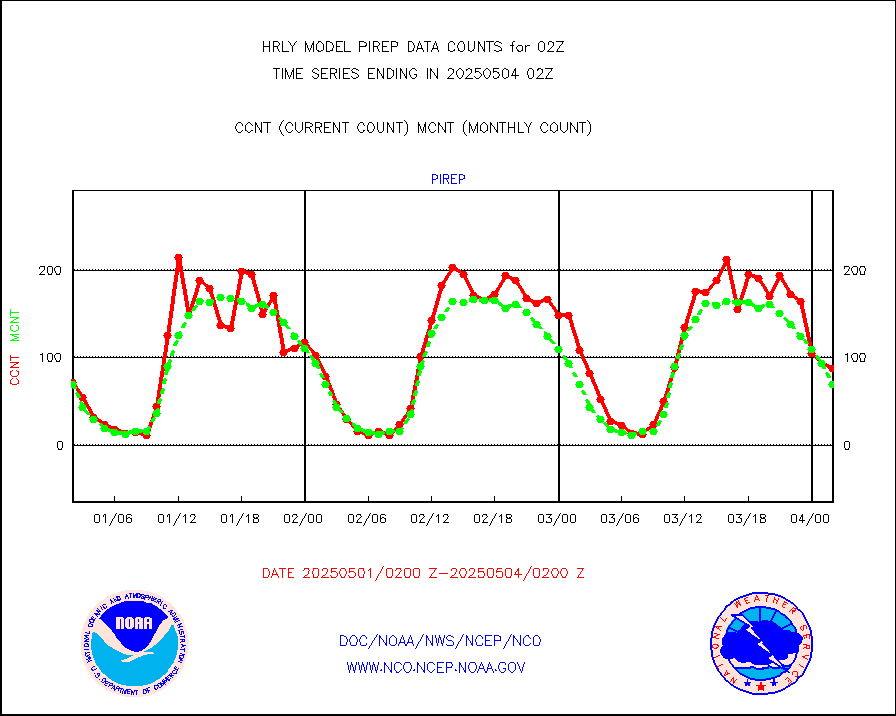
Manual PIREP aircraft data (dcded from AIREP fmt) |
49 |
47 |
104.3 % |
0201.50-0202.49 |
||||||||||
Profilr winds from PIBAL (PILOT,PILOT SHIP/MOBIL) |
0 |
0 |
n/a |
0201.50-0202.49 |
||||||||||
Rawinsonde - fixed land (decoded from BUFR) |
0 |
0 |
n/a |
0201.51-0202.49 |
||||||||||
Rawinsonde - mobile land (from TEMP/PILOT MOBIL) |
0 |
0 |
n/a |
0201.50-0202.49 |
||||||||||
Rawinsonde - mobile land (decoded from BUFR) |
0 |
0 |
n/a |
0201.51-0202.49 |
||||||||||
Rawinsonde - ship (from TEMP SHIP, PILOT SHIP) |
0 |
0 |
n/a |
0201.50-0202.49 |
||||||||||
Rawinsonde - ship (decoded from BUFR) |
0 |
0 |
n/a |
0201.51-0202.49 |
||||||||||
Flight level reconnaissance aircraft data |
0 |
0 |
n/a |
0201.50-0202.49 |
||||||||||
Megha-Tropiques SAPHIR L1A2 brightness temps |
0 |
0 |
n/a |
0123.50-0200.49 |
||||||||||
METEOSAT-10 2nd Gen SEVIRI All Sky Radiance(proc) |
75512 |
75468 |
100.1 % |
0201.50-0202.49 |
||||||||||
Ship - manual and automatic, restricted |
0 |
14 |
0.0 % |
0201.50-0202.49 |
||||||||||
DMSP SSM/IS 1C radiance data (Unified Pre-Proc.) |
112620 |
101308 |
111.2 % |
0200.50-0201.49 |
||||||||||
Synoptic - mobile manual and automatic |
711 |
649 |
109.6 % |
0201.50-0202.49 |
||||||||||
Synoptic - mobile manual & auto (decoded fr BUFR) |
1 |
1 |
100.0 % |
0201.50-0202.49 |
||||||||||
CTD probe, Argo prflng float, mooring (TESAC fmt) |
223 |
211 |
105.7 % |
0201.50-0202.49 |
||||||||||
TAMDAR aircft data-all types(from Panasonic,BUFR) |
8 |
27 |
29.6 % |
0201.50-0202.49 |
||||||||||
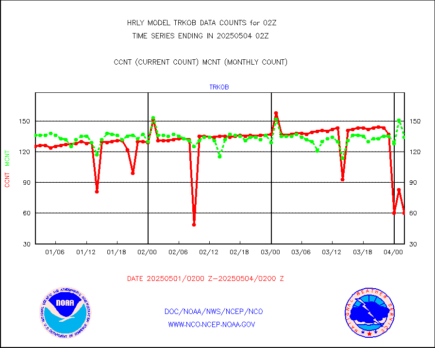
ThermoSalinoGraph (TSG) TRACKOB format) |
91 |
98 |
92.9 % |
0200.50-0201.49 |
||||||||||
INSAT/KALPANA India visible derived cloud motion |
0 |
0 |
n/a |
0123.50-0200.49 |
||||||||||
INDIA SATWIND, INSAT VIS channel |
0 |
1 |
0.0 % |
0201.00-0201.99 |
||||||||||
MTSAT/JMA visible derived cloud motion |
10790 |
10742 |
100.4 % |
0123.50-0200.49 |
||||||||||
GOES-16&up/NESDIS visible derived cloud motion |
278453 |
244225 |
114.0 % |
0201.00-0201.99 |
||||||||||
METEOSAT/EUMETSAT visible drv cld motion NBseq |
505 |
737 |
68.5 % |
0200.50-0201.49 |
||||||||||


