| Suspect Data Shortages in Critical Types - Monitor | ||||||||||||||
|---|---|---|---|---|---|---|---|---|---|---|---|---|---|---|
| Type | Description | Hourly Count | Monthly Average | Percent (%) of Monthly Mean | UTC Time Window | |||||||||
NOAA 18-19 & METOP 1-2 HIRS-4 NCEP-proc. br.temps |
0 |
10250 |
0.0 % |
3022.00-0103.99 |
||||||||||
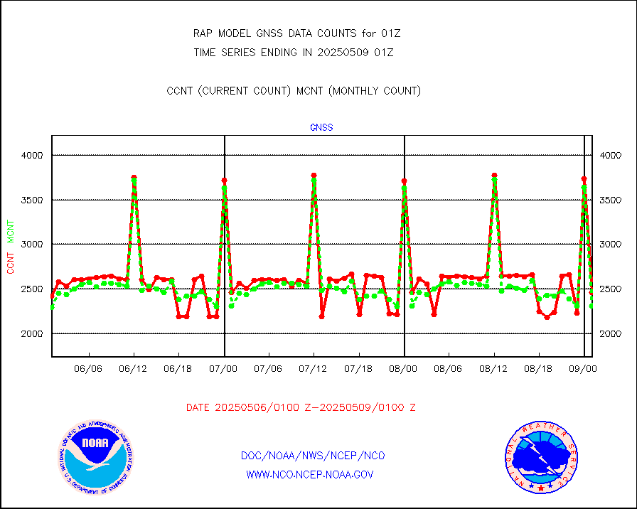
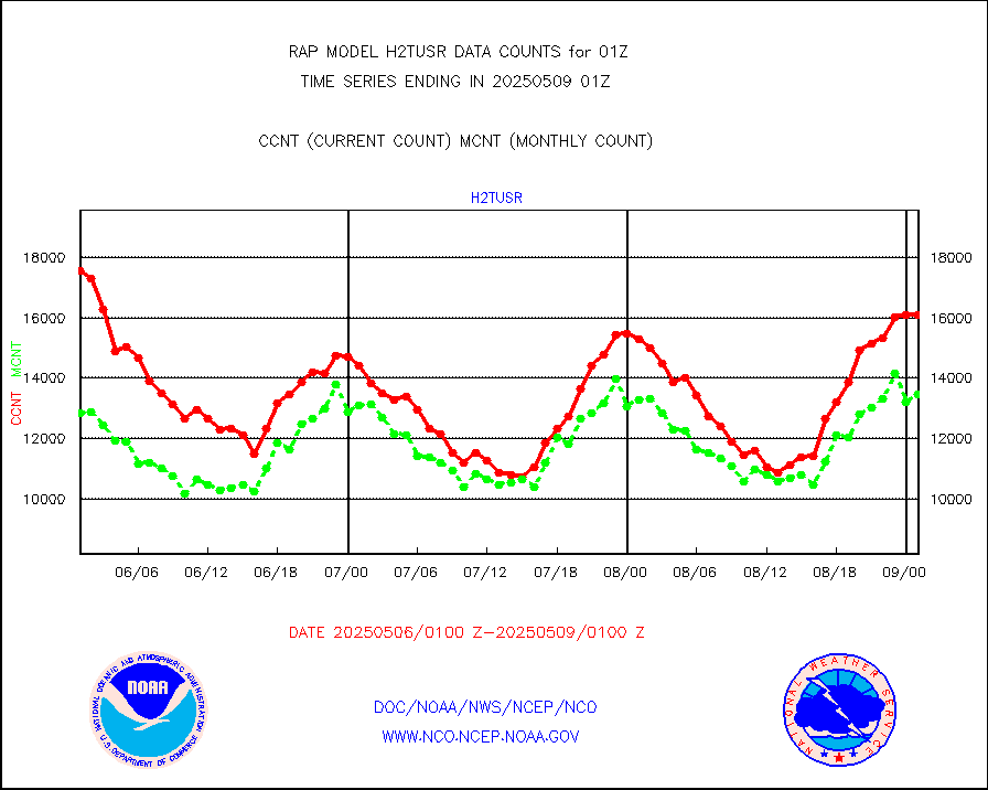
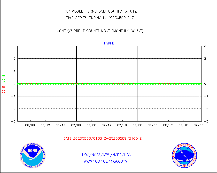
Grnd-based Gbl Navigation Sat System (GNSS) data |
301 |
1961 |
15.3 % |
3023.95-0100.05 |
||||||||||
| Shortage in Data Type of Opportunity - Monitor | ||||||||||||||
|---|---|---|---|---|---|---|---|---|---|---|---|---|---|---|
| Type | Description | Hourly Count | Monthly Average | Percent (%) of Monthly Mean | UTC Time Window | |||||||||
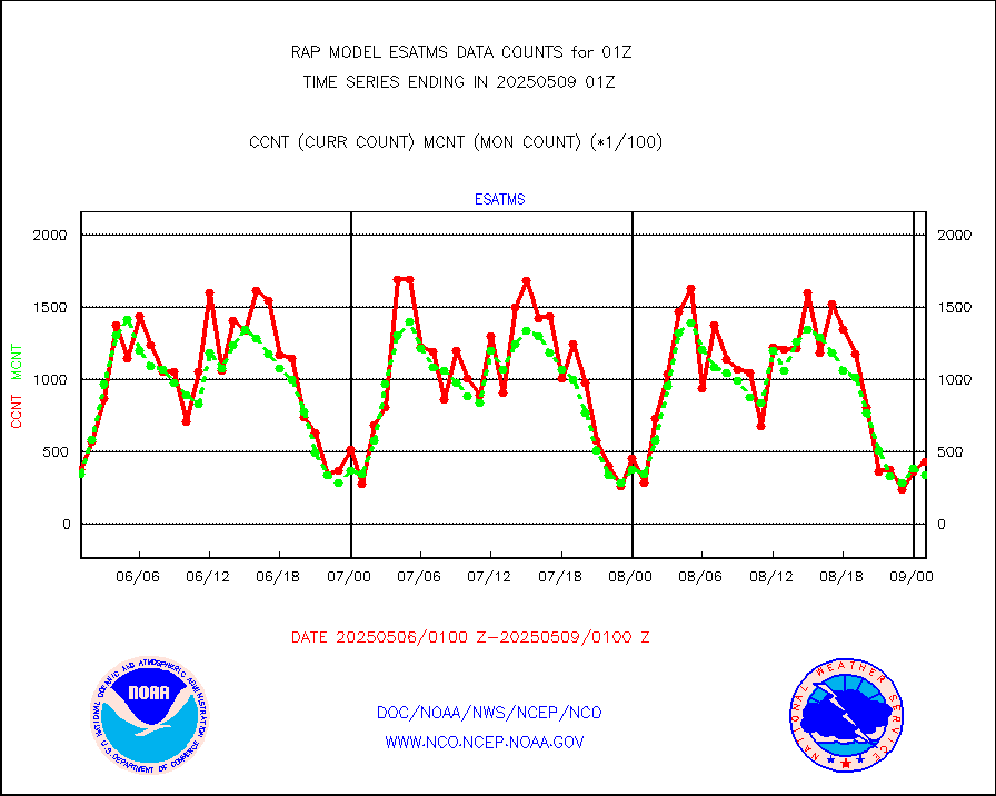
NPP Adv. Tech. MW Sndr (ATMS) br. temps from RARS |
0 |
3352 |
0.0 % |
3023.00-0102.99 |
||||||||||
NOAA 15-19 & METOP 1-2 HIRS-3/4 pr btmps frm RARS |
0 |
8792 |
0.0 % |
0100.00-0102.00 |
||||||||||
| Critical Data with Normal Counts | ||||||||||||||
|---|---|---|---|---|---|---|---|---|---|---|---|---|---|---|
| Type | Description | Hourly Count | Monthly Average | Percent (%) of Monthly Mean | UTC Time Window | |||||||||
NOAA 15-19 & METOP 1-2 AMSU-A NCEP-proc. br.temps |
20760 |
27944 |
74.3 % |
3022.00-0103.99 |
||||||||||
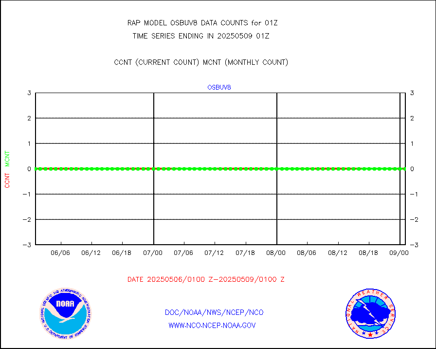
NOAA 18-19 & METOP 1-2 MHS NCEP-proces. br. temps |
185058 |
220078 |
84.1 % |
3022.00-0103.99 |
||||||||||
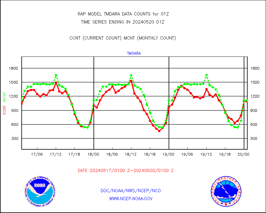
MDCRS ACARS acft data from ARINC(dcded from BUFR) |
112861 |
107936 |
104.6 % |
3021.75-0104.25 |
||||||||||
Canadian AMDAR aircraft data (decoded from BUFR) |
0 |
0 |
n/a |
3021.75-0104.25 |
||||||||||
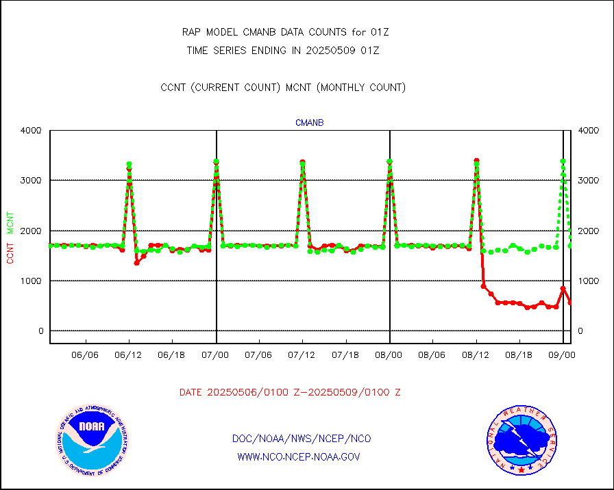
Surface Marine CMAN rpts decoded from BUFR format |
1740 |
1652 |
105.3 % |
0100.50-0101.50 |
||||||||||
Buoys decoded from FM-18 fmt (moored or drifting) |
0 |
0 |
n/a |
0100.50-0101.50 |
||||||||||
MODIS (AQUA/TERRA) wvpr imager derived cld motion |
0 |
0 |
n/a |
3022.50-0103.50 |
||||||||||
MODIS (AQUA/TERRA) ir l-wave derived cloud motion |
0 |
0 |
n/a |
3022.50-0103.50 |
||||||||||
GOES/NASA(Langley) hi-res. (1x1 f-o-v) cloud data |
3037606 |
2999673 |
101.3 % |
0100.50-0101.50 |
||||||||||
Buoys decoded from FM-13 format (moored) |
118 |
121 |
97.5 % |
0100.50-0101.50 |
||||||||||
Aviation - METAR |
5552 |
5509 |
100.8 % |
0100.50-0101.50 |
||||||||||
NEXRAD Vel Azm Dsp(VAD) winds via radar coded msg |
0 |
0 |
n/a |
0100.00-0102.00 |
||||||||||
Multi-Agency Profiler (MAP) and SODAR winds |
102 |
95 |
107.4 % |
3023.50-0102.50 |
||||||||||
Rawinsonde - fixed land (from TEMP or PILOT) |
151 |
149 |
101.3 % |
0100.00-0102.00 |
||||||||||
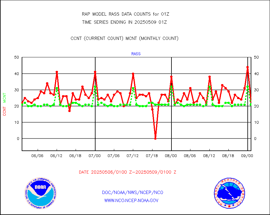
RASS temperatures (NOAA and Multi-Agency) |
21 |
20 |
105.0 % |
0100.50-0101.50 |
||||||||||
Ship - manual and automatic, restricted (BUFR) |
8 |
9 |
88.9 % |
0100.50-0101.50 |
||||||||||
Ship - manual and automatic, unrestricted |
106 |
94 |
112.8 % |
0100.50-0101.50 |
||||||||||
Ship - manual and automatic, unrestricted (BUFR) |
729 |
688 |
106.0 % |
0100.50-0101.50 |
||||||||||
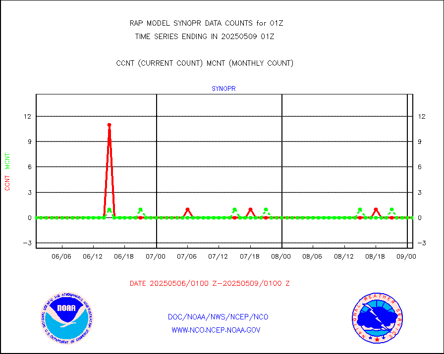
Synoptic - fixed manual and automatic |
349 |
255 |
136.9 % |
0100.50-0101.50 |
||||||||||
Synoptic - fixed manual & auto (decoded fr BUFR) |
2000 |
1913 |
104.5 % |
0100.50-0101.50 |
||||||||||
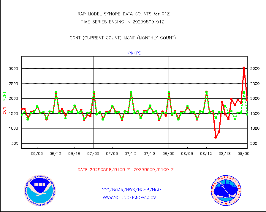
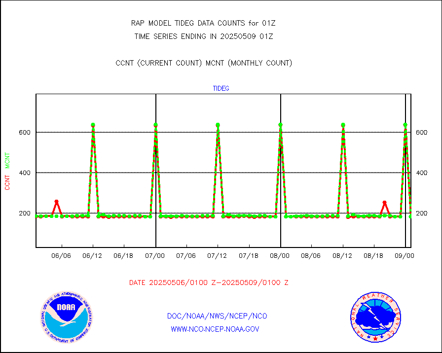
Tide gauge reports decoded from CREX format |
186 |
185 |
100.5 % |
0100.50-0101.50 |
||||||||||
| Data Types of Opportunity with Normal Counts | ||||||||||||||
|---|---|---|---|---|---|---|---|---|---|---|---|---|---|---|
| Type | Description | Hourly Count | Monthly Average | Percent (%) of Monthly Mean | UTC Time Window | |||||||||
GOES-16&up/NESDIS ir short-wv derived cld motion |
3091 |
3299 |
93.7 % |
0100.00-0100.99 |
||||||||||
MDCRS ACARS acft data (ARINC via AFWA)(AIREP fmt) |
0 |
0 |
n/a |
3021.75-0104.25 |
||||||||||
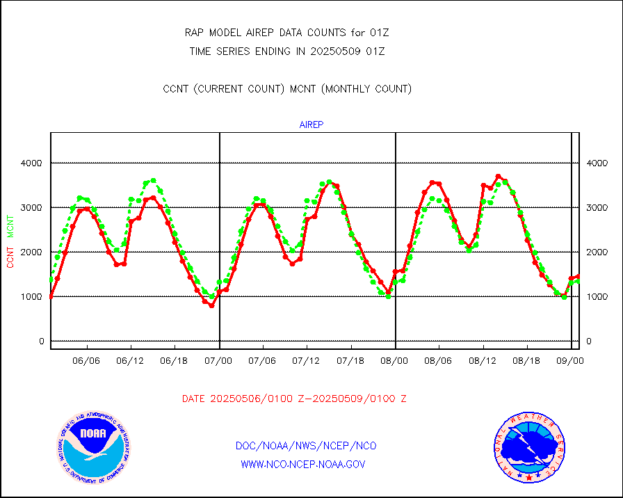
Manual AIREP aircraft data (dcded from AIREP fmt) |
1111 |
1366 |
81.3 % |
3021.75-0104.25 |
||||||||||
AQUA AIRS/AMSU-A/HSB brightness temps- every FOV |
0 |
0 |
n/a |
3022.00-0103.99 |
||||||||||
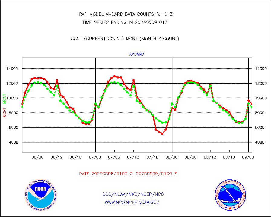
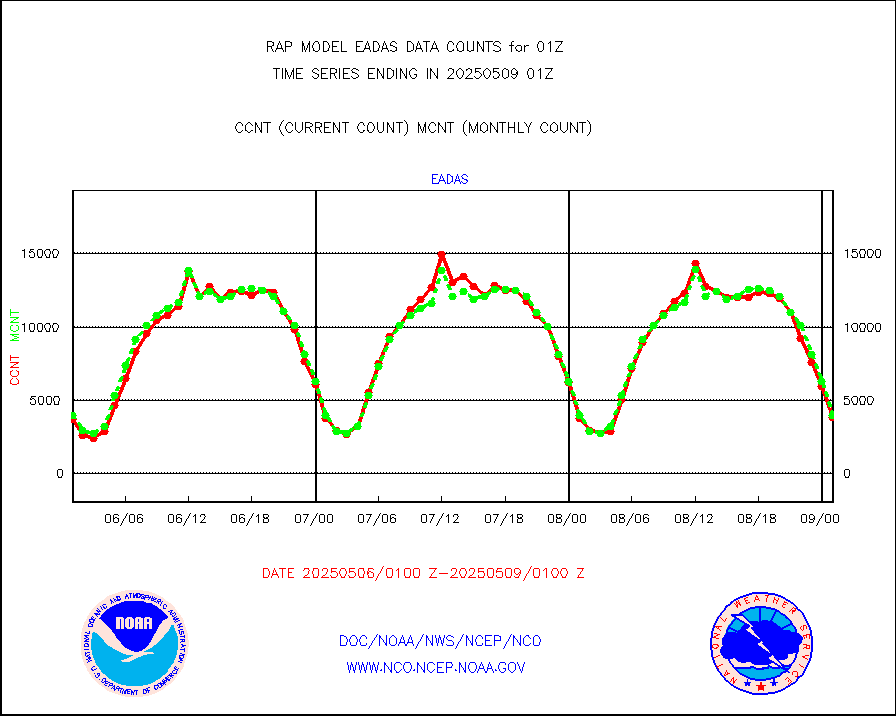
AMDAR aircraft data (decoded from AMDAR format) |
2418 |
1524 |
158.7 % |
3021.75-0104.25 |
||||||||||
AMDAR aircraft data (decoded from BUFR) |
8060 |
8657 |
93.1 % |
3021.75-0104.25 |
||||||||||
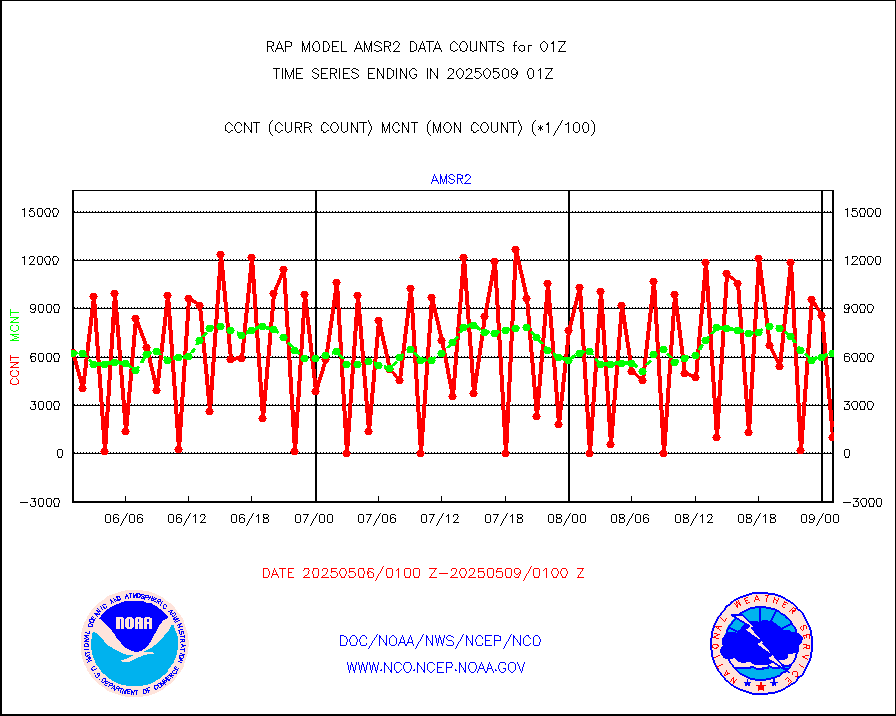
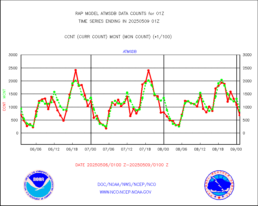
GCOM-W AMSR2 1B brightness temperatures |
819708 |
611193 |
134.1 % |
3022.00-3022.99 |
||||||||||
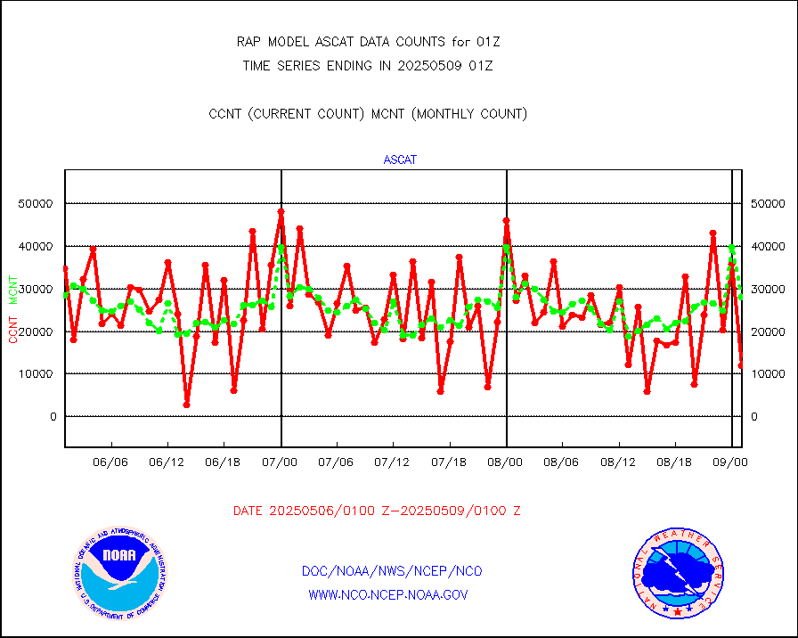
METOP 1-2 ASCAT products |
15702 |
27294 |
57.5 % |
3023.00-0103.00 |
||||||||||
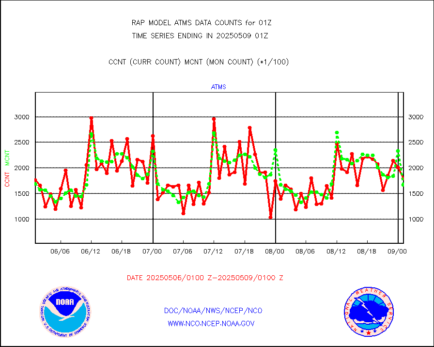
NPP/NOAA-20 ATMS brightness temperatures |
171270 |
160582 |
106.7 % |
3023.00-0102.99 |
||||||||||
NPP/NOAA-20 ATMS bright. temps-direct b-cast SSEC |
78324 |
62354 |
125.6 % |
3023.00-0102.99 |
||||||||||
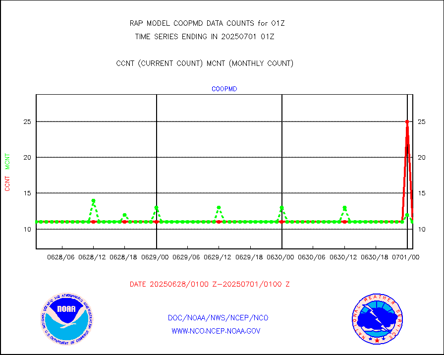
Coop/MADIS NEPP & HCN-Modernization NOAA COOP Obs |
11 |
11 |
100.0 % |
0100.50-0101.50 |
||||||||||
NPP/NOAA-20 CrIS full spctrl radn (431 ch subset) |
94410 |
94892 |
99.5 % |
3023.00-0102.99 |
||||||||||
NPP/NOAA-20 CrIS full spctrl radn dir brdcst SSEC |
32400 |
27332 |
118.5 % |
3023.00-0102.99 |
||||||||||
Coast Guard |
4 |
5 |
80.0 % |
0100.50-0101.50 |
||||||||||
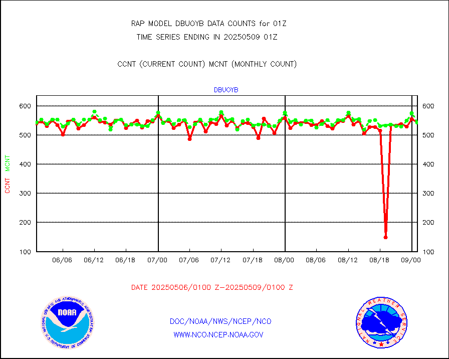
Drifting buoys (decoded from BUFR) |
539 |
509 |
105.9 % |
0100.50-0101.50 |
||||||||||
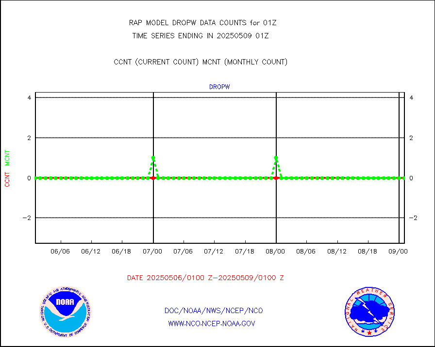
Dropwinsonde (from TEMP DROP) |
0 |
0 |
n/a |
0100.00-0102.00 |
||||||||||
Dropwinsonde (decoded from BUFR) |
1 |
2 |
50.0 % |
0100.00-0102.00 |
||||||||||
E-AMDAR (European AMDAR acft decoded from BUFR) |
3943 |
4475 |
88.1 % |
3021.75-0104.25 |
||||||||||
NOAA 15-19 & METOP 1-2 AMSU-A proc btmps frm RARS |
11281 |
15911 |
70.9 % |
0100.00-0102.00 |
||||||||||
METOP 1-2 IASI 1C radiance data vbl chn from RARS |
14516 |
20177 |
71.9 % |
3023.00-0102.99 |
||||||||||
NOAA 18-19 & METOP 1-2 MHS proc. btemps from RARS |
96868 |
155145 |
62.4 % |
0100.00-0102.00 |
||||||||||
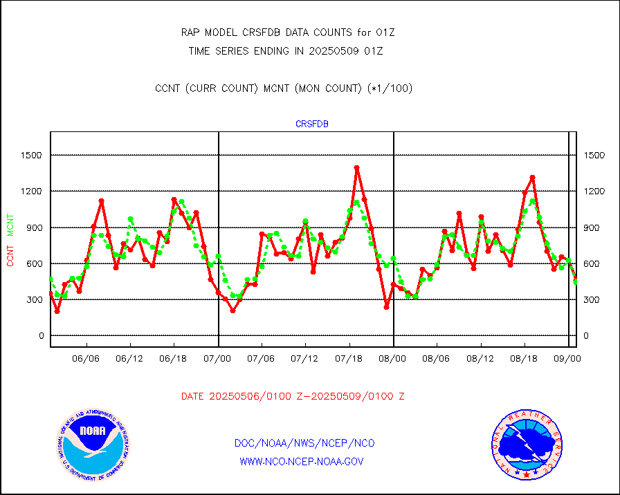
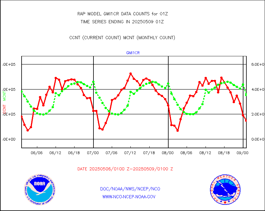
GPM GMI Level 1C-R brightness temperatures |
488018 |
437827 |
111.5 % |
3022.00-0103.99 |
||||||||||
GPS radio occultation data |
140 |
155 |
90.3 % |
3023.00-0102.99 |
||||||||||
GOES-16/17 All Sky Radiances (proc.) |
959751 |
957289 |
100.3 % |
3023.00-0102.99 |
||||||||||
GOES-16/17 Clear Sky Radiances (proc.) |
465055 |
461669 |
100.7 % |
3023.00-0102.99 |
||||||||||
MTSAT/JMA water vapor imager derived cloud motion |
1904 |
2991 |
63.7 % |
3022.50-0103.50 |
||||||||||
GOES-16&up/NESDIS wv imgr/deep-lyr derivd cld mtn |
6512 |
7616 |
85.5 % |
0100.00-0100.99 |
||||||||||
METEOSAT/EUMETSAT wvpr imgr drv cld motion NBseq |
5200 |
5403 |
96.2 % |
3023.50-0102.49 |
||||||||||
GOES-16&up/NESDIS wv imgr/cld-top derived cld mtn |
13661 |
16681 |
81.9 % |
0100.00-0100.99 |
||||||||||
METOP 1-2 IASI 1C radiances-direct broadcast SSEC |
57315 |
77436 |
74.0 % |
3023.00-0102.99 |
||||||||||
METEOSAT/EUMETSAT ir lg-wave drv cld motion NBseq |
3061 |
3125 |
98.0 % |
3023.50-0102.49 |
||||||||||
VIIRS (NPP/NOAA-20) ir lg-wv drv cloud motion(NB) |
0 |
0 |
n/a |
3022.50-0103.50 |
||||||||||
AVHRR (NOAA/METOP) ir lg-wave derived cld motion |
0 |
0 |
n/a |
3022.50-0103.50 |
||||||||||
AVHRR (METOP) ir lg-wave derived cld motion |
0 |
0 |
n/a |
3023.50-0102.49 |
||||||||||
MTSAT/JMA infrared long-wave derived cloud motion |
2002 |
2486 |
80.5 % |
3022.50-0103.50 |
||||||||||
GOES-16&up/NESDIS ir long-wave derived cld motion |
23840 |
31535 |
75.6 % |
0100.00-0100.99 |
||||||||||
Korean AMDAR aircraft data (decoded from BUFR) |
344 |
290 |
118.6 % |
3021.75-0104.25 |
||||||||||
Land-based CMAN stations decoded from CMAN format |
34 |
39 |
87.2 % |
0100.50-0101.50 |
||||||||||
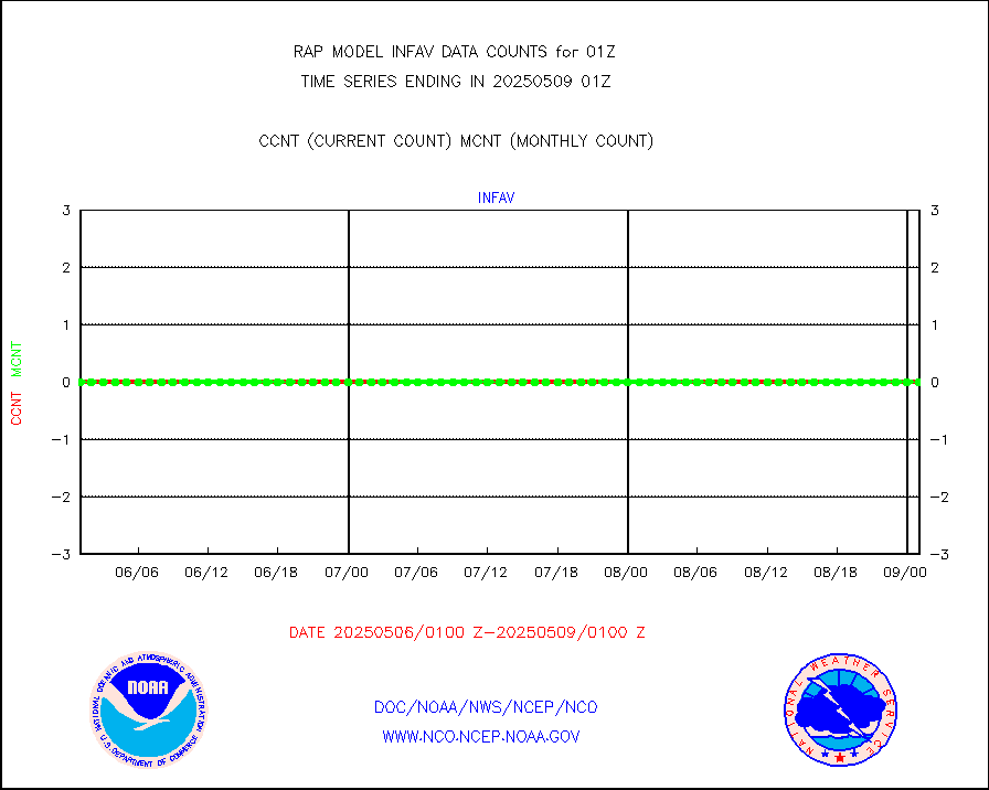
LLDN Long-rng lightning from Vaisala via NOAAPORT |
266889 |
234283 |
113.9 % |
0100.00-0101.50 |
||||||||||
NLDN Shrt-rng lightning from Vaisala via NOAAPORT |
15718 |
12914 |
121.7 % |
0100.00-0101.50 |
||||||||||
Moored buoys (decoded from BUFR) |
685 |
635 |
107.9 % |
0100.50-0101.50 |
||||||||||
Mesonet/MADIS Colorado E-470 (Interstate 470) |
24 |
23 |
104.3 % |
0100.50-0101.50 |
||||||||||
Mesonet/MADIS Alaska Department of Transportation |
119 |
81 |
146.9 % |
0100.50-0101.50 |
||||||||||
Mesonet/MADIS U.S. Army Aberdeen Proving Grounds |
0 |
0 |
n/a |
0100.50-0101.50 |
||||||||||
Mesonet/MADIS Citizen Weather Observers Program |
62643 |
57330 |
109.3 % |
0100.50-0101.50 |
||||||||||
Mesonet/MADIS AWS Convergence Technologies, Inc. |
8281 |
20986 |
39.5 % |
0100.50-0101.50 |
||||||||||
Mesonet/MADIS "Anything Weather" |
0 |
0 |
n/a |
0100.50-0101.50 |
||||||||||
Mesonet/MADIS Colorado Dept. of Transportation |
0 |
0 |
n/a |
0100.50-0101.50 |
||||||||||
Mesonet/MADIS DC Net |
0 |
0 |
n/a |
0100.50-0101.50 |
||||||||||
Mesonet/MADIS Denver Urban Drainage & Flood Cntrl |
0 |
0 |
n/a |
0100.50-0101.50 |
||||||||||
Mesonet/MADIS Florida (FAWN & USF) |
3 |
3 |
100.0 % |
0100.50-0101.50 |
||||||||||
Mesonet/MADIS Florida Dept. of Transportation |
0 |
0 |
n/a |
0100.50-0101.50 |
||||||||||
Mesonet/MADIS Georgia Dept. of Transportation |
0 |
0 |
n/a |
0100.50-0101.50 |
||||||||||
Mesonet/MADIS NWS Hydromet Auto Data System(HADS) |
4294 |
4861 |
88.3 % |
0100.50-0101.50 |
||||||||||
Mesonet/MADIS Iowa Environmental |
155 |
159 |
97.5 % |
0100.50-0101.50 |
||||||||||
Mesonet/MADIS Indiana Dept. of Transportation |
0 |
0 |
n/a |
0100.50-0101.50 |
||||||||||
Mesonet/MADIS Iowa Department of Transportation |
0 |
0 |
n/a |
0100.50-0101.50 |
||||||||||
Mesonet/MADIS Kansas Department of Transportation |
290 |
302 |
96.0 % |
0100.50-0101.50 |
||||||||||
Mesonet/MADIS Oklahoma Mesonet |
525 |
570 |
92.1 % |
0100.50-0101.50 |
||||||||||
Mesonet/MADIS Louisiana State/Jackson State Univ. |
0 |
0 |
n/a |
0100.50-0101.50 |
||||||||||
Mesonet/MADIS Missouri Commercial Agricult Wx Net |
272 |
289 |
94.1 % |
0100.50-0101.50 |
||||||||||
Mesonet/MADIS Minnesota Dept. of Transportation |
0 |
0 |
n/a |
0100.50-0101.50 |
||||||||||
Mesonet/MADIS NOS-Phys Oceanographic Realtime Sys |
47 |
260 |
18.1 % |
0100.50-0101.50 |
||||||||||
Mesonet/MADIS NFIC Remote Automated Wx Stns(RAWS) |
1241 |
1348 |
92.1 % |
0100.50-0101.50 |
||||||||||
Mesonet/MADIS many providers, not separated out |
40947 |
39392 |
103.9 % |
0100.50-0101.50 |
||||||||||
Mesonet/MADIS UrbaNet |
2853 |
3095 |
92.2 % |
0100.50-0101.50 |
||||||||||
Mesonet/MADIS Virginia Dept. of Transportation |
0 |
0 |
n/a |
0100.50-0101.50 |
||||||||||
Mesonet/MADIS "Weather for You" |
0 |
0 |
n/a |
0100.50-0101.50 |
||||||||||
Mesonet/MADIS Wisconsin Dept. of Transportation |
0 |
0 |
n/a |
0100.50-0101.50 |
||||||||||
Mesonet/MADIS MesoWest (many subproviders) |
37958 |
37144 |
102.2 % |
0100.50-0101.50 |
||||||||||
Mesonet/MADIS West Texas |
4850 |
5211 |
93.1 % |
0100.50-0101.50 |
||||||||||
METOP 1-2 IASI 1C radiance data (varbl. channels) |
39069 |
38987 |
100.2 % |
3023.00-0102.99 |
||||||||||
NEXRAD Vel Azm Dsp(VAD) winds via Level 2 decoder |
1054 |
900 |
117.1 % |
0100.00-0102.00 |
||||||||||
NOAA 16-19 Solar Backscatter UV-2 rad frm V8 BUFR |
0 |
0 |
n/a |
3023.00-0101.99 |
||||||||||
PIBAL (from PILOT, PILOT SHIP, PILOT MOBIL) |
0 |
0 |
n/a |
0100.00-0102.00 |
||||||||||
PIBAL (decoded from BUFR) |
0 |
0 |
n/a |
0100.00-0102.00 |
||||||||||
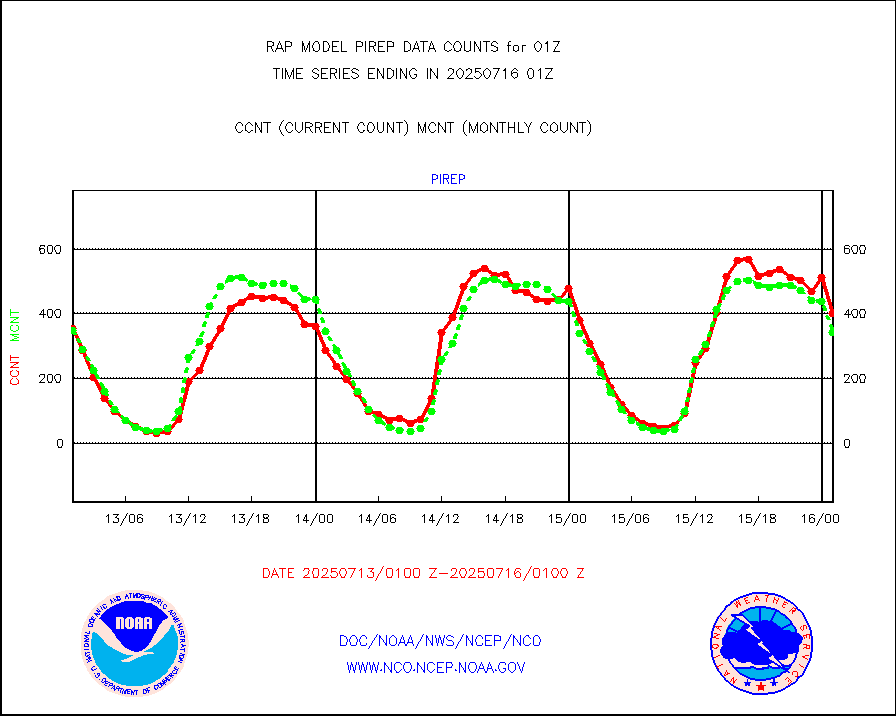
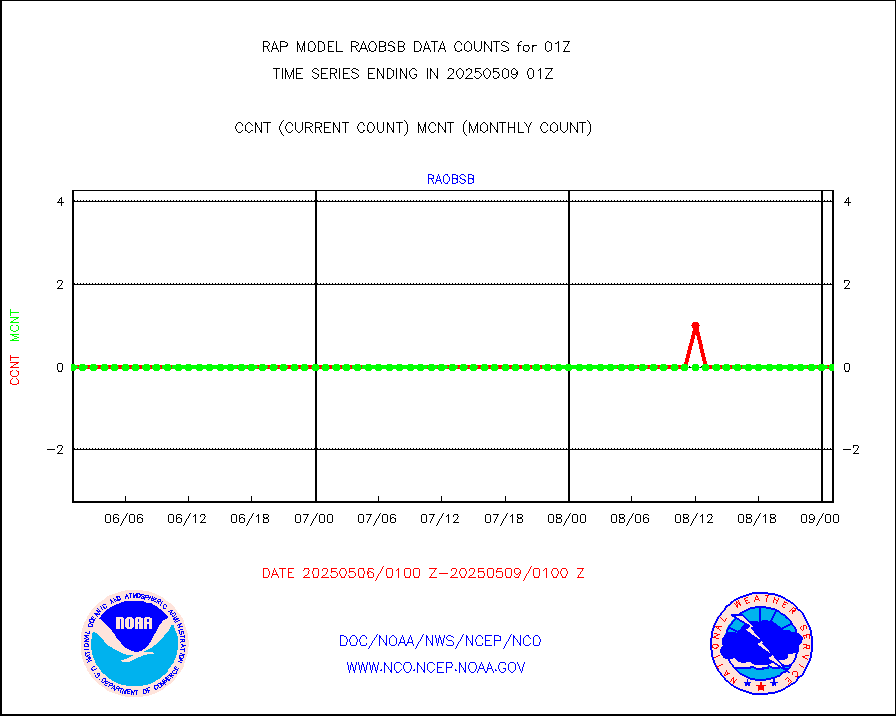
Manual PIREP aircraft data (dcded from AIREP fmt) |
360 |
371 |
97.0 % |
3021.75-0104.25 |
||||||||||
Profilr winds from PIBAL (PILOT,PILOT SHIP/MOBIL) |
0 |
0 |
n/a |
3023.50-0102.50 |
||||||||||
Rawinsonde - fixed land (decoded from BUFR) |
5 |
4 |
125.0 % |
0100.00-0102.00 |
||||||||||
Rawinsonde - mobile land (from TEMP/PILOT MOBIL) |
0 |
0 |
n/a |
0100.00-0102.00 |
||||||||||
Rawinsonde - mobile land (decoded from BUFR) |
0 |
0 |
n/a |
0100.00-0102.00 |
||||||||||
Rawinsonde - ship (from TEMP SHIP, PILOT SHIP) |
1 |
0 |
n/a |
0100.00-0102.00 |
||||||||||
Rawinsonde - ship (decoded from BUFR) |
0 |
0 |
n/a |
0100.00-0102.00 |
||||||||||
NEXRAD radial wind (Level 2 - GTS) |
1877830 |
1242836 |
151.1 % |
0100.50-0101.49 |
||||||||||
Flight level reconnaissance aircraft data |
0 |
0 |
n/a |
0100.00-0102.00 |
||||||||||
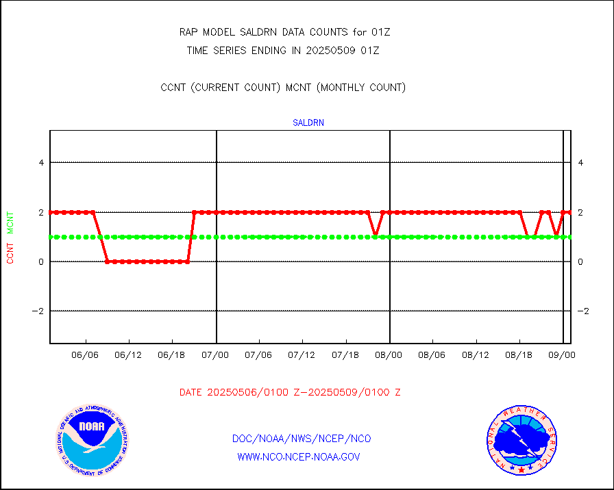
Surface Marine Saildrone (decoded from BUFR) |
1 |
2 |
50.0 % |
3023.00-0102.99 |
||||||||||
Megha-Tropiques SAPHIR L1A2 brightness temps |
0 |
0 |
n/a |
3022.00-0103.99 |
||||||||||
METEOSAT-10 2nd Gen SEVIRI All Sky Radiance(proc) |
9512 |
9447 |
100.7 % |
3023.00-0102.99 |
||||||||||
METEOSAT-10 2nd Gen SEVIRI Clr Sky Radiance(proc) |
0 |
0 |
n/a |
3023.00-0102.99 |
||||||||||
Ship - manual and automatic, restricted |
12 |
13 |
92.3 % |
0100.50-0101.50 |
||||||||||
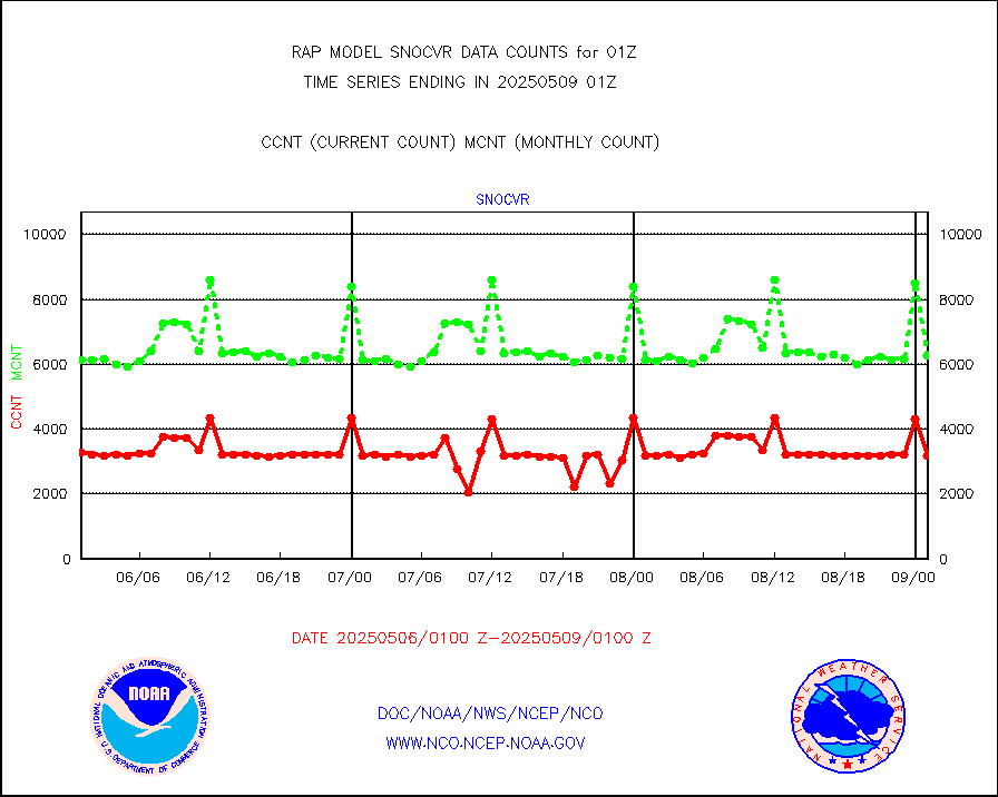
NOW COVER, DEPTH/DENSITY AND WATER EQUIVALENT |
3160 |
5890 |
53.7 % |
3023.00-0103.00 |
||||||||||
DMSP SSM/IS 1C radiance data (Unified Pre-Proc.) |
20233 |
44683 |
45.3 % |
3023.00-0102.99 |
||||||||||
Sub-surface float and glider profile (BUFR) |
0 |
1 |
0.0 % |
3023.00-0102.99 |
||||||||||
Synoptic - restricted (WMO Res 40) manual & auto. |
0 |
0 |
n/a |
0100.50-0101.50 |
||||||||||
Synoptic - restricted (WMO Res 40)(decoded BUFR) |
347 |
441 |
78.7 % |
0100.50-0101.50 |
||||||||||
Synoptic - mobile manual & auto (decoded fr BUFR) |
0 |
0 |
n/a |
0100.50-0101.50 |
||||||||||
TAMDAR aircft data-all types(from Panasonic,BUFR) |
109 |
180 |
60.6 % |
3021.75-0104.25 |
||||||||||
MTSAT/JMA visible derived cloud motion |
1718 |
1568 |
109.6 % |
3022.50-0103.50 |
||||||||||
GOES-16&up/NESDIS visible derived cloud motion |
0 |
144897 |
0.0 % |
0100.00-0100.99 |
||||||||||
METEOSAT/EUMETSAT visible drv cld motion NBseq |
0 |
0 |
n/a |
3023.50-0102.49 |
||||||||||


