| Suspect Data Shortages in Critical Types - Monitor | ||||||||||||||
|---|---|---|---|---|---|---|---|---|---|---|---|---|---|---|
| Type | Description | Hourly Count | Monthly Average | Percent (%) of Monthly Mean | UTC Time Window | |||||||||
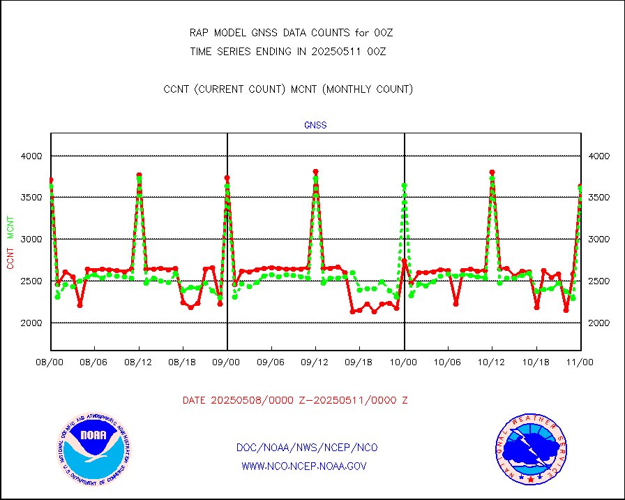
NOAA 18-19 & METOP 1-2 HIRS-4 NCEP-proc. br.temps |
0 |
9397 |
0.0 % |
0221.00-0302.99 |
||||||||||
| Shortage in Data Type of Opportunity - Monitor | ||||||||||||||
|---|---|---|---|---|---|---|---|---|---|---|---|---|---|---|
| Type | Description | Hourly Count | Monthly Average | Percent (%) of Monthly Mean | UTC Time Window | |||||||||
NOAA 15-19 & METOP 1-2 HIRS-3/4 pr btmps frm RARS |
0 |
8833 |
0.0 % |
0223.00-0301.00 |
||||||||||
| Critical Data with Normal Counts | ||||||||||||||
|---|---|---|---|---|---|---|---|---|---|---|---|---|---|---|
| Type | Description | Hourly Count | Monthly Average | Percent (%) of Monthly Mean | UTC Time Window | |||||||||
NOAA 15-19 & METOP 1-2 AMSU-A NCEP-proc. br.temps |
22285 |
31359 |
71.1 % |
0221.00-0302.99 |
||||||||||
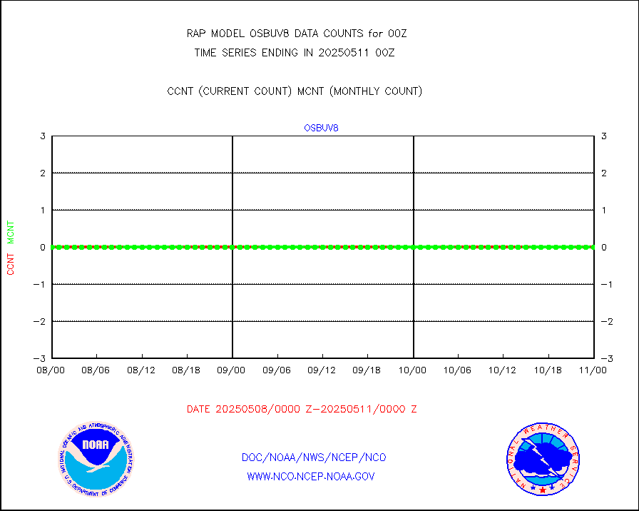
NOAA 18-19 & METOP 1-2 MHS NCEP-proces. br. temps |
197376 |
250901 |
78.7 % |
0221.00-0302.99 |
||||||||||
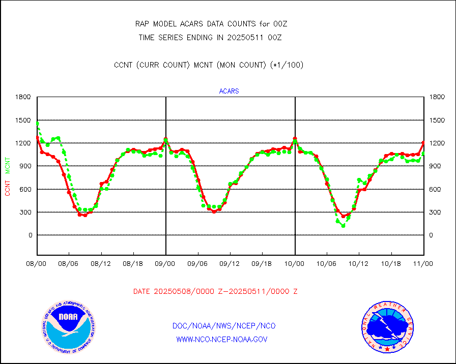
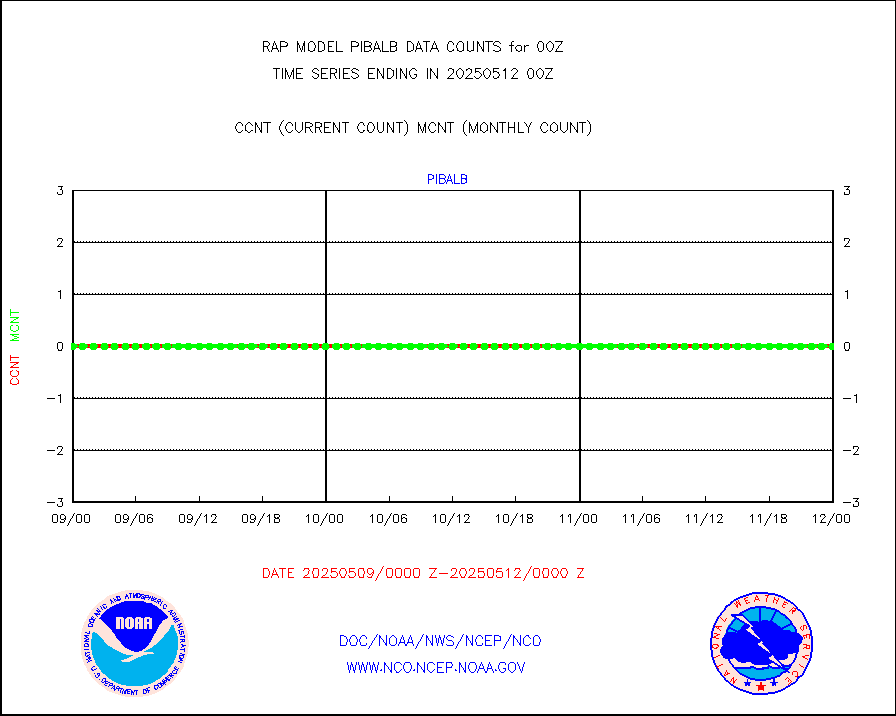
MDCRS ACARS acft data from ARINC(dcded from BUFR) |
139584 |
153020 |
91.2 % |
0220.75-0303.25 |
||||||||||
Canadian AMDAR aircraft data (decoded from BUFR) |
0 |
0 |
n/a |
0220.75-0303.25 |
||||||||||
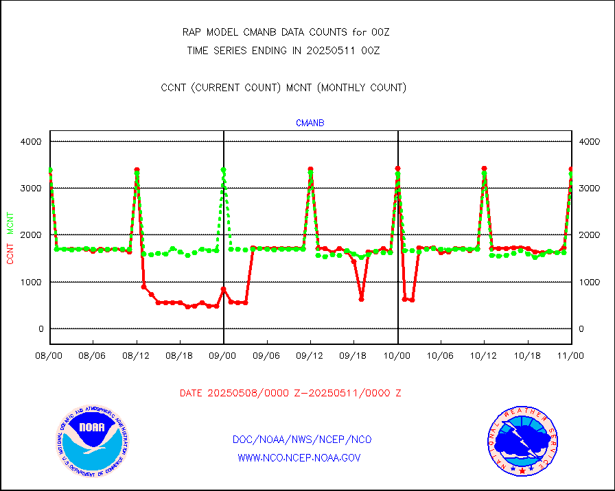
Surface Marine CMAN rpts decoded from BUFR format |
3401 |
3405 |
99.9 % |
0223.50-0300.50 |
||||||||||
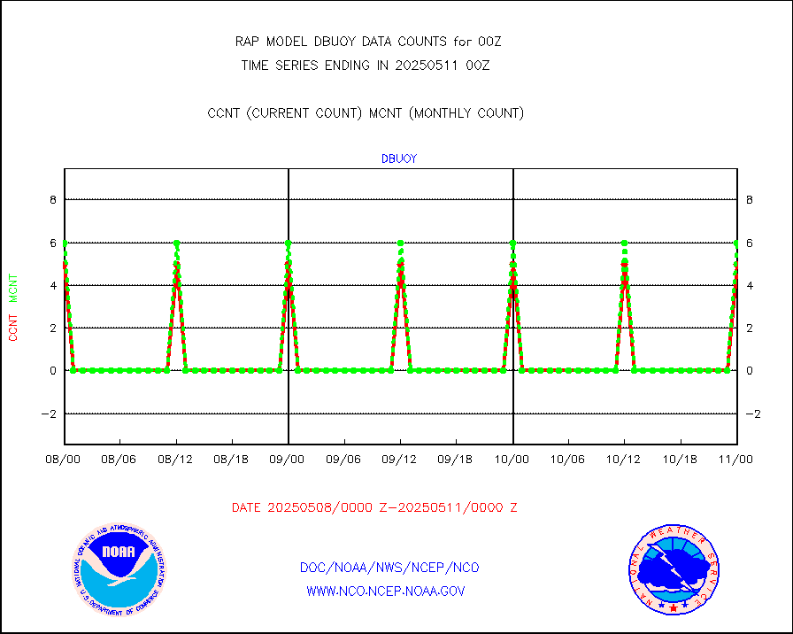
Buoys decoded from FM-18 fmt (moored or drifting) |
2 |
3 |
66.7 % |
0223.50-0300.50 |
||||||||||
Grnd-based Gbl Navigation Sat System (GNSS) data |
3326 |
2900 |
114.7 % |
0222.95-0223.05 |
||||||||||
MODIS (AQUA/TERRA) wvpr imager derived cld motion |
0 |
0 |
n/a |
0222.50-0301.50 |
||||||||||
MODIS (AQUA/TERRA) ir l-wave derived cloud motion |
0 |
0 |
n/a |
0222.50-0301.50 |
||||||||||
GOES/NASA(Langley) hi-res. (1x1 f-o-v) cloud data |
5051249 |
4994635 |
101.1 % |
0223.50-0300.50 |
||||||||||
Buoys decoded from FM-13 format (moored) |
131 |
136 |
96.3 % |
0223.50-0300.50 |
||||||||||
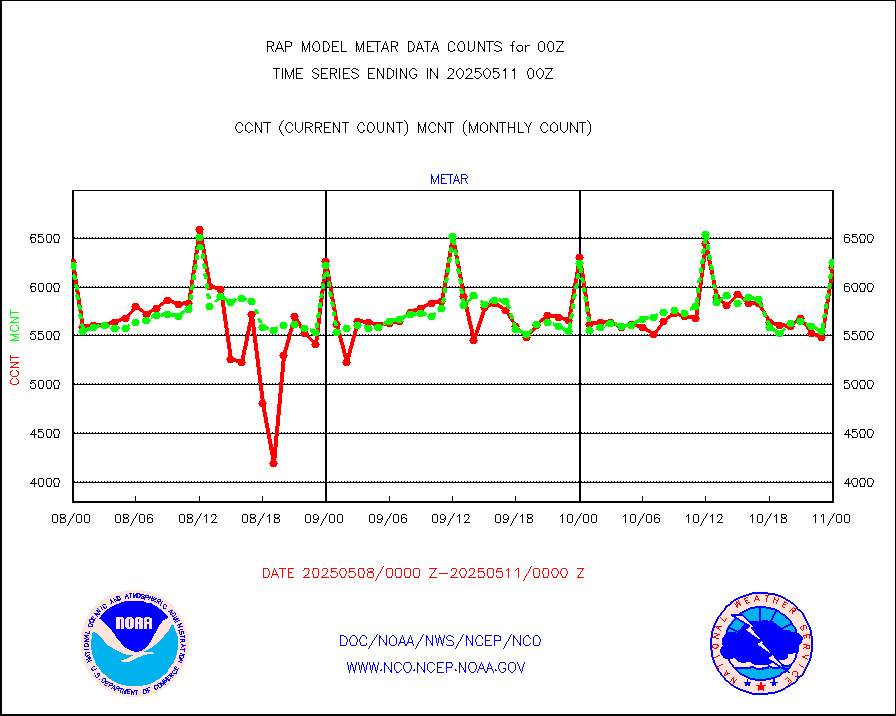
Aviation - METAR |
6040 |
6250 |
96.6 % |
0223.50-0300.50 |
||||||||||
NEXRAD Vel Azm Dsp(VAD) winds via radar coded msg |
0 |
0 |
n/a |
0223.00-0301.00 |
||||||||||
Multi-Agency Profiler (MAP) and SODAR winds |
103 |
121 |
85.1 % |
0222.50-0301.50 |
||||||||||
Rawinsonde - fixed land (from TEMP or PILOT) |
148 |
152 |
97.4 % |
0223.00-0301.00 |
||||||||||
RASS temperatures (NOAA and Multi-Agency) |
23 |
30 |
76.7 % |
0223.50-0300.50 |
||||||||||
Ship - manual and automatic, restricted (BUFR) |
49 |
47 |
104.3 % |
0223.50-0300.50 |
||||||||||
Ship - manual and automatic, unrestricted |
101 |
143 |
70.6 % |
0223.50-0300.50 |
||||||||||
Ship - manual and automatic, unrestricted (BUFR) |
1144 |
1055 |
108.4 % |
0223.50-0300.50 |
||||||||||
Synoptic - fixed manual and automatic |
435 |
431 |
100.9 % |
0223.50-0300.50 |
||||||||||
Synoptic - fixed manual & auto (decoded fr BUFR) |
3079 |
2967 |
103.8 % |
0223.50-0300.50 |
||||||||||
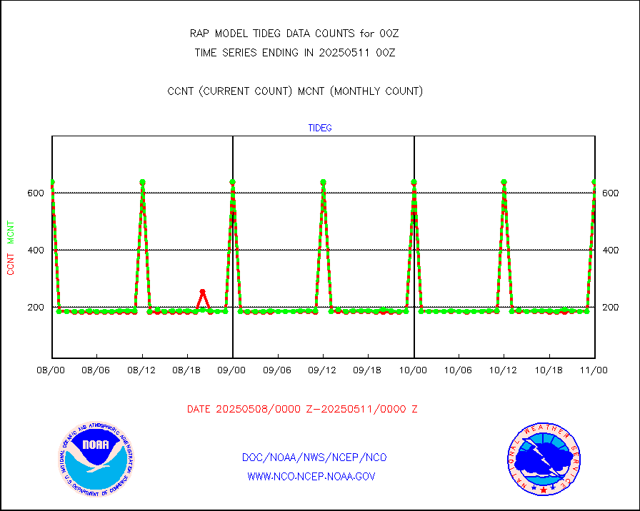
Tide gauge reports decoded from CREX format |
649 |
643 |
100.9 % |
0223.50-0300.50 |
||||||||||
| Data Types of Opportunity with Normal Counts | ||||||||||||||
|---|---|---|---|---|---|---|---|---|---|---|---|---|---|---|
| Type | Description | Hourly Count | Monthly Average | Percent (%) of Monthly Mean | UTC Time Window | |||||||||
GOES-16&up/NESDIS ir short-wv derived cld motion |
2889 |
2659 |
108.6 % |
0223.00-0223.99 |
||||||||||
MDCRS ACARS acft data (ARINC via AFWA)(AIREP fmt) |
0 |
0 |
n/a |
0220.75-0303.25 |
||||||||||
Manual AIREP aircraft data (dcded from AIREP fmt) |
1479 |
1276 |
115.9 % |
0220.75-0303.25 |
||||||||||
AQUA AIRS/AMSU-A/HSB brightness temps- every FOV |
0 |
0 |
n/a |
0221.00-0302.99 |
||||||||||
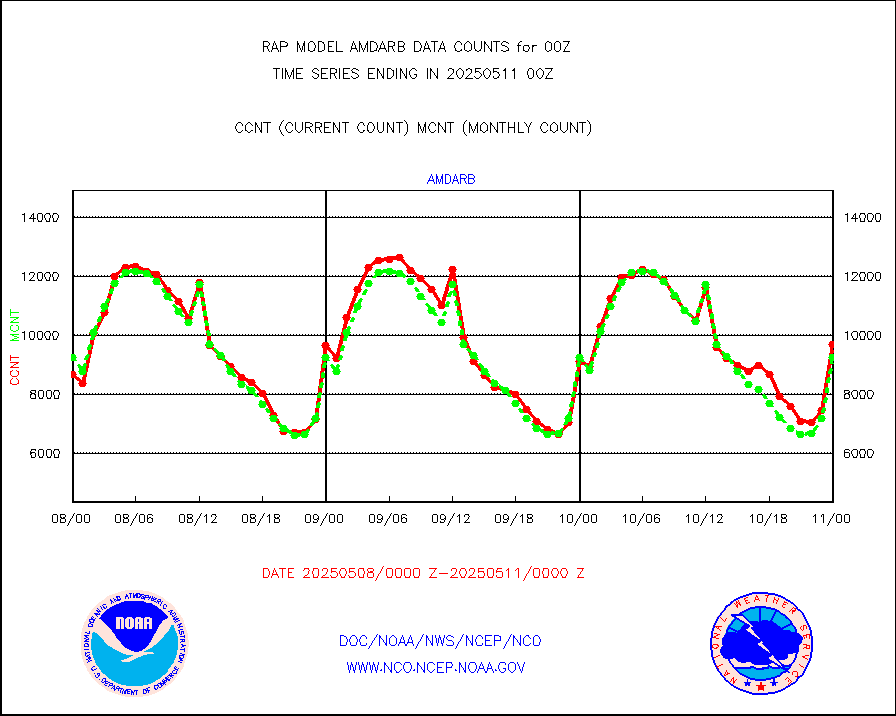
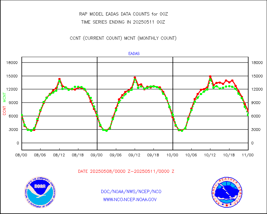
AMDAR aircraft data (decoded from AMDAR format) |
1823 |
1805 |
101.0 % |
0220.75-0303.25 |
||||||||||
AMDAR aircraft data (decoded from BUFR) |
8072 |
9509 |
84.9 % |
0220.75-0303.25 |
||||||||||
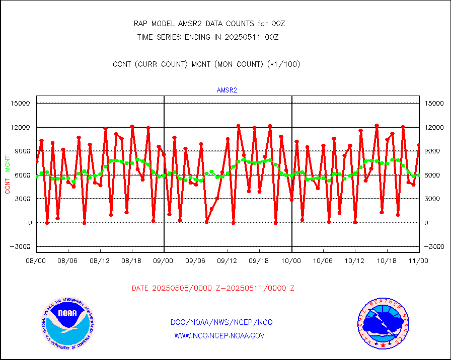
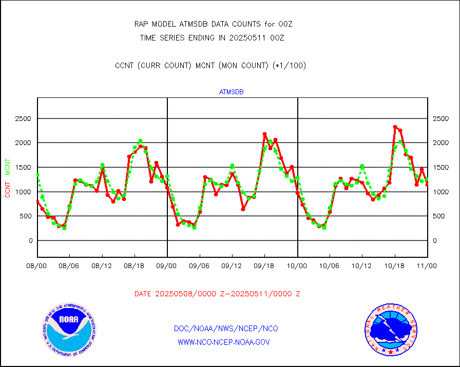
GCOM-W AMSR2 1B brightness temperatures |
622451 |
594969 |
104.6 % |
0221.00-0221.99 |
||||||||||
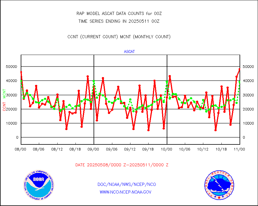
METOP 1-2 ASCAT products |
37814 |
39459 |
95.8 % |
0222.00-0302.00 |
||||||||||
NPP/NOAA-20 ATMS brightness temperatures |
253259 |
224368 |
112.9 % |
0222.00-0301.99 |
||||||||||
NPP/NOAA-20 ATMS bright. temps-direct b-cast SSEC |
109440 |
103964 |
105.3 % |
0222.00-0301.99 |
||||||||||
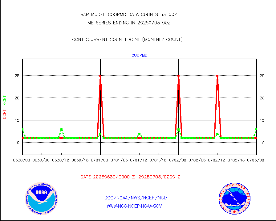
Coop/MADIS NEPP & HCN-Modernization NOAA COOP Obs |
11 |
13 |
84.6 % |
0223.50-0300.50 |
||||||||||
NPP/NOAA-20 CrIS full spctrl radn (431 ch subset) |
137278 |
132864 |
103.3 % |
0222.00-0301.99 |
||||||||||
NPP/NOAA-20 CrIS full spctrl radn dir brdcst SSEC |
41040 |
42313 |
97.0 % |
0222.00-0301.99 |
||||||||||
Coast Guard |
6 |
8 |
75.0 % |
0223.50-0300.50 |
||||||||||
Drifting buoys (decoded from BUFR) |
566 |
552 |
102.5 % |
0223.50-0300.50 |
||||||||||
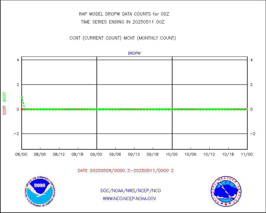
Dropwinsonde (from TEMP DROP) |
0 |
0 |
n/a |
0223.00-0301.00 |
||||||||||
Dropwinsonde (decoded from BUFR) |
0 |
1 |
0.0 % |
0223.00-0301.00 |
||||||||||
E-AMDAR (European AMDAR acft decoded from BUFR) |
7816 |
6908 |
113.1 % |
0220.75-0303.25 |
||||||||||
NOAA 15-19 & METOP 1-2 AMSU-A proc btmps frm RARS |
12637 |
17337 |
72.9 % |
0223.00-0301.00 |
||||||||||
NPP Adv. Tech. MW Sndr (ATMS) br. temps from RARS |
0 |
1572 |
0.0 % |
0222.00-0301.99 |
||||||||||
METOP 1-2 IASI 1C radiance data vbl chn from RARS |
116099 |
16043 |
723.7 % |
0222.00-0301.99 |
||||||||||
NOAA 18-19 & METOP 1-2 MHS proc. btemps from RARS |
119579 |
158946 |
75.2 % |
0223.00-0301.00 |
||||||||||
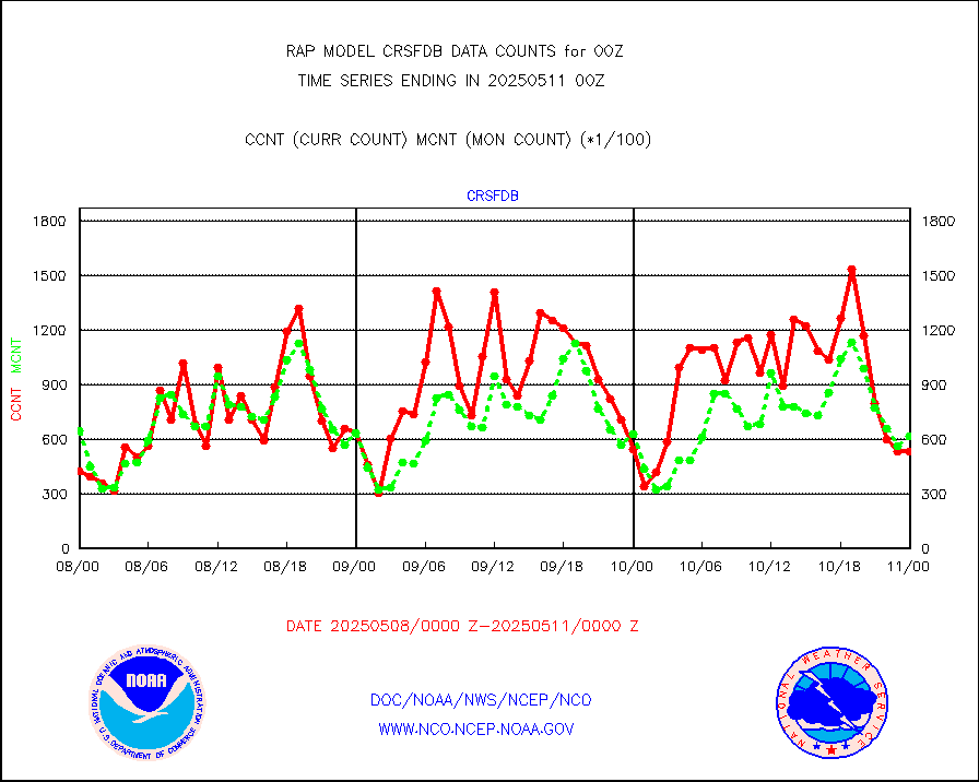
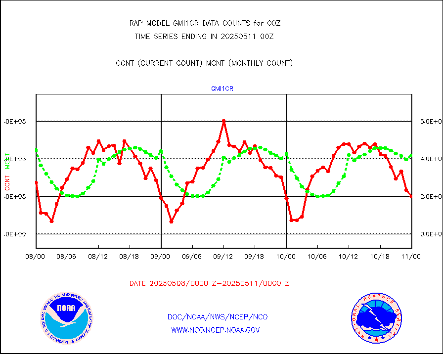
GPM GMI Level 1C-R brightness temperatures |
642697 |
503770 |
127.6 % |
0221.00-0302.99 |
||||||||||
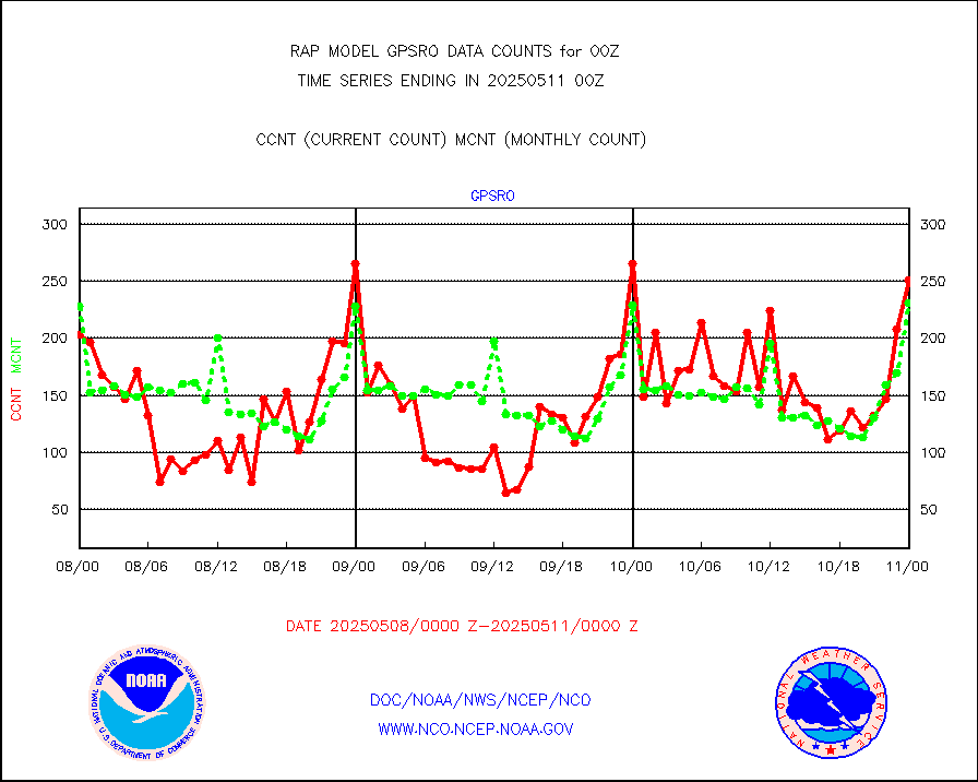
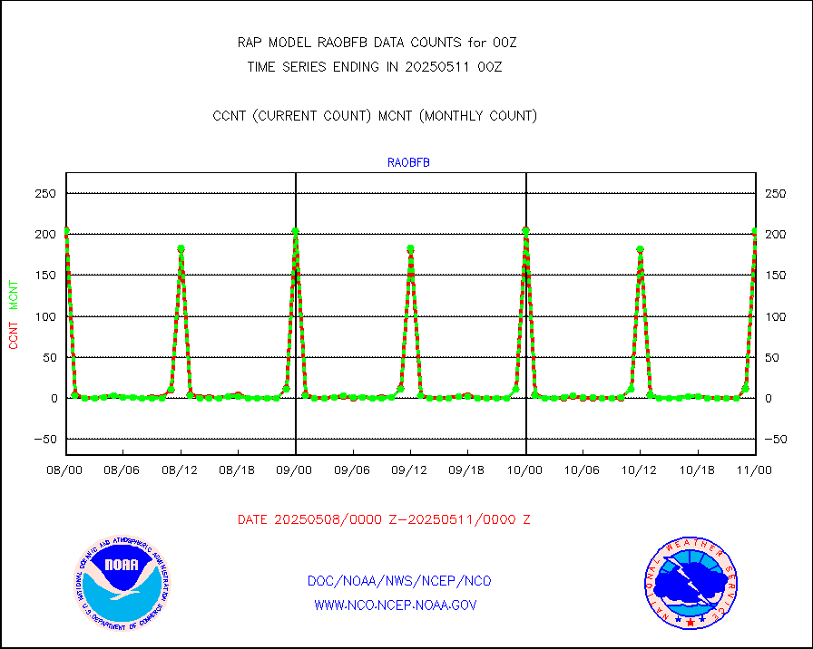
GPS radio occultation data |
193 |
227 |
85.0 % |
0222.00-0301.99 |
||||||||||
GOES-16/17 All Sky Radiances (proc.) |
1181232 |
1174937 |
100.5 % |
0222.00-0301.99 |
||||||||||
GOES-16/17 Clear Sky Radiances (proc.) |
570909 |
569098 |
100.3 % |
0222.00-0301.99 |
||||||||||
MTSAT/JMA water vapor imager derived cloud motion |
2793 |
2946 |
94.8 % |
0222.50-0301.50 |
||||||||||
GOES-16&up/NESDIS wv imgr/deep-lyr derivd cld mtn |
8824 |
7229 |
122.1 % |
0223.00-0223.99 |
||||||||||
METEOSAT/EUMETSAT wvpr imgr drv cld motion NBseq |
5213 |
5402 |
96.5 % |
0222.50-0301.49 |
||||||||||
GOES-16&up/NESDIS wv imgr/cld-top derived cld mtn |
17507 |
16481 |
106.2 % |
0223.00-0223.99 |
||||||||||
METOP 1-2 IASI 1C radiances-direct broadcast SSEC |
73767 |
74213 |
99.4 % |
0222.00-0301.99 |
||||||||||
METEOSAT/EUMETSAT ir lg-wave drv cld motion NBseq |
3222 |
3116 |
103.4 % |
0222.50-0301.49 |
||||||||||
VIIRS (NPP/NOAA-20) ir lg-wv drv cloud motion(NB) |
0 |
0 |
n/a |
0222.50-0301.50 |
||||||||||
AVHRR (NOAA/METOP) ir lg-wave derived cld motion |
0 |
0 |
n/a |
0222.50-0301.50 |
||||||||||
AVHRR (METOP) ir lg-wave derived cld motion |
0 |
0 |
n/a |
0222.50-0301.49 |
||||||||||
MTSAT/JMA infrared long-wave derived cloud motion |
2781 |
2468 |
112.7 % |
0222.50-0301.50 |
||||||||||
GOES-16&up/NESDIS ir long-wave derived cld motion |
32880 |
31478 |
104.5 % |
0223.00-0223.99 |
||||||||||
Korean AMDAR aircraft data (decoded from BUFR) |
305 |
237 |
128.7 % |
0220.75-0303.25 |
||||||||||
Land-based CMAN stations decoded from CMAN format |
84 |
107 |
78.5 % |
0223.50-0300.50 |
||||||||||
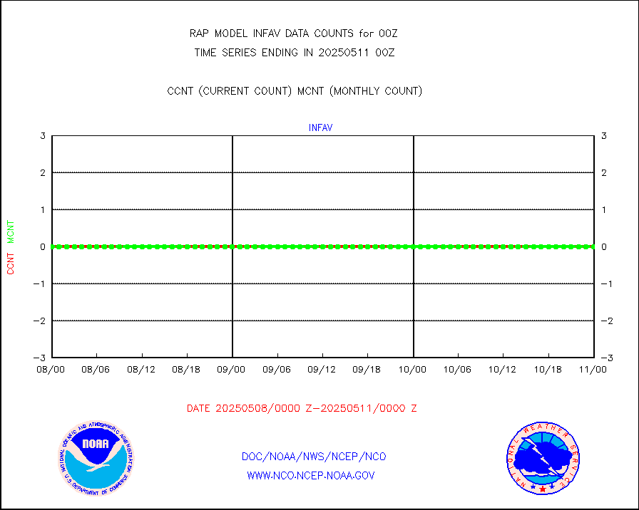
LLDN Long-rng lightning from Vaisala via NOAAPORT |
240127 |
292552 |
82.1 % |
0223.00-0300.50 |
||||||||||
NLDN Shrt-rng lightning from Vaisala via NOAAPORT |
10304 |
16501 |
62.4 % |
0223.00-0300.50 |
||||||||||
Moored buoys (decoded from BUFR) |
1159 |
1109 |
104.5 % |
0223.50-0300.50 |
||||||||||
Mesonet/MADIS Colorado E-470 (Interstate 470) |
32 |
32 |
100.0 % |
0223.50-0300.50 |
||||||||||
Mesonet/MADIS Alaska Department of Transportation |
279 |
273 |
102.2 % |
0223.50-0300.50 |
||||||||||
Mesonet/MADIS U.S. Army Aberdeen Proving Grounds |
0 |
0 |
n/a |
0223.50-0300.50 |
||||||||||
Mesonet/MADIS Citizen Weather Observers Program |
92516 |
73901 |
125.2 % |
0223.50-0300.50 |
||||||||||
Mesonet/MADIS AWS Convergence Technologies, Inc. |
35701 |
26295 |
135.8 % |
0223.50-0300.50 |
||||||||||
Mesonet/MADIS "Anything Weather" |
0 |
0 |
n/a |
0223.50-0300.50 |
||||||||||
Mesonet/MADIS Colorado Dept. of Transportation |
0 |
0 |
n/a |
0223.50-0300.50 |
||||||||||
Mesonet/MADIS DC Net |
0 |
0 |
n/a |
0223.50-0300.50 |
||||||||||
Mesonet/MADIS Denver Urban Drainage & Flood Cntrl |
0 |
0 |
n/a |
0223.50-0300.50 |
||||||||||
Mesonet/MADIS Florida (FAWN & USF) |
5 |
5 |
100.0 % |
0223.50-0300.50 |
||||||||||
Mesonet/MADIS Florida Dept. of Transportation |
0 |
0 |
n/a |
0223.50-0300.50 |
||||||||||
Mesonet/MADIS Georgia Dept. of Transportation |
0 |
0 |
n/a |
0223.50-0300.50 |
||||||||||
Mesonet/MADIS NWS Hydromet Auto Data System(HADS) |
11436 |
11264 |
101.5 % |
0223.50-0300.50 |
||||||||||
Mesonet/MADIS Iowa Environmental |
251 |
248 |
101.2 % |
0223.50-0300.50 |
||||||||||
Mesonet/MADIS Indiana Dept. of Transportation |
0 |
0 |
n/a |
0223.50-0300.50 |
||||||||||
Mesonet/MADIS Iowa Department of Transportation |
0 |
0 |
n/a |
0223.50-0300.50 |
||||||||||
Mesonet/MADIS Kansas Department of Transportation |
488 |
520 |
93.8 % |
0223.50-0300.50 |
||||||||||
Mesonet/MADIS Oklahoma Mesonet |
945 |
942 |
100.3 % |
0223.50-0300.50 |
||||||||||
Mesonet/MADIS Louisiana State/Jackson State Univ. |
0 |
0 |
n/a |
0223.50-0300.50 |
||||||||||
Mesonet/MADIS Missouri Commercial Agricult Wx Net |
410 |
404 |
101.5 % |
0223.50-0300.50 |
||||||||||
Mesonet/MADIS Minnesota Dept. of Transportation |
0 |
0 |
n/a |
0223.50-0300.50 |
||||||||||
Mesonet/MADIS NOS-Phys Oceanographic Realtime Sys |
482 |
472 |
102.1 % |
0223.50-0300.50 |
||||||||||
Mesonet/MADIS NFIC Remote Automated Wx Stns(RAWS) |
10 |
2381 |
0.4 % |
0223.50-0300.50 |
||||||||||
Mesonet/MADIS many providers, not separated out |
67352 |
53872 |
125.0 % |
0223.50-0300.50 |
||||||||||
Mesonet/MADIS UrbaNet |
4358 |
4332 |
100.6 % |
0223.50-0300.50 |
||||||||||
Mesonet/MADIS Virginia Dept. of Transportation |
0 |
0 |
n/a |
0223.50-0300.50 |
||||||||||
Mesonet/MADIS "Weather for You" |
0 |
0 |
n/a |
0223.50-0300.50 |
||||||||||
Mesonet/MADIS Wisconsin Dept. of Transportation |
0 |
0 |
n/a |
0223.50-0300.50 |
||||||||||
Mesonet/MADIS MesoWest (many subproviders) |
68433 |
52966 |
129.2 % |
0223.50-0300.50 |
||||||||||
Mesonet/MADIS West Texas |
7503 |
7496 |
100.1 % |
0223.50-0300.50 |
||||||||||
METOP 1-2 IASI 1C radiance data (varbl. channels) |
50071 |
35174 |
142.4 % |
0222.00-0301.99 |
||||||||||
NEXRAD Vel Azm Dsp(VAD) winds via Level 2 decoder |
1288 |
1322 |
97.4 % |
0223.00-0301.00 |
||||||||||
NOAA 16-19 Solar Backscatter UV-2 rad frm V8 BUFR |
0 |
0 |
n/a |
0222.00-0300.99 |
||||||||||
PIBAL (from PILOT, PILOT SHIP, PILOT MOBIL) |
0 |
0 |
n/a |
0223.00-0301.00 |
||||||||||
PIBAL (decoded from BUFR) |
0 |
0 |
n/a |
0223.00-0301.00 |
||||||||||
Manual PIREP aircraft data (dcded from AIREP fmt) |
462 |
480 |
96.2 % |
0220.75-0303.25 |
||||||||||
Profilr winds from PIBAL (PILOT,PILOT SHIP/MOBIL) |
0 |
0 |
n/a |
0222.50-0301.50 |
||||||||||
Rawinsonde - fixed land (decoded from BUFR) |
204 |
201 |
101.5 % |
0223.00-0301.00 |
||||||||||
Rawinsonde - mobile land (from TEMP/PILOT MOBIL) |
0 |
0 |
n/a |
0223.00-0301.00 |
||||||||||
Rawinsonde - mobile land (decoded from BUFR) |
0 |
0 |
n/a |
0223.00-0301.00 |
||||||||||
Rawinsonde - ship (from TEMP SHIP, PILOT SHIP) |
1 |
0 |
n/a |
0223.00-0301.00 |
||||||||||
Rawinsonde - ship (decoded from BUFR) |
0 |
0 |
n/a |
0223.00-0301.00 |
||||||||||
NEXRAD radial wind (Level 2 - GTS) |
2265200 |
2092478 |
108.3 % |
0223.50-0300.49 |
||||||||||
Flight level reconnaissance aircraft data |
0 |
0 |
n/a |
0223.00-0301.00 |
||||||||||
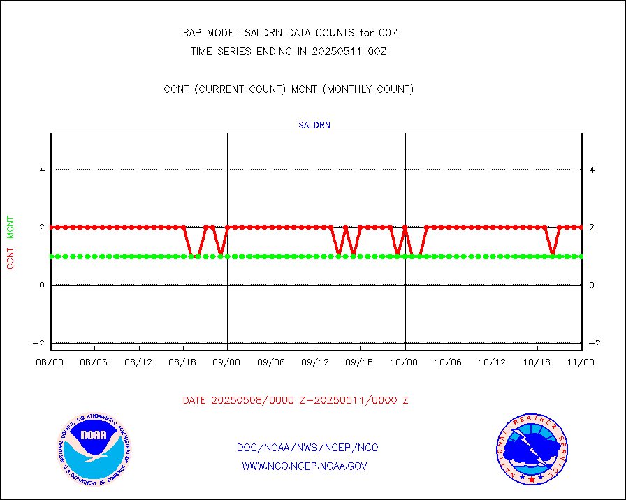
Surface Marine Saildrone (decoded from BUFR) |
2 |
2 |
100.0 % |
0222.00-0301.99 |
||||||||||
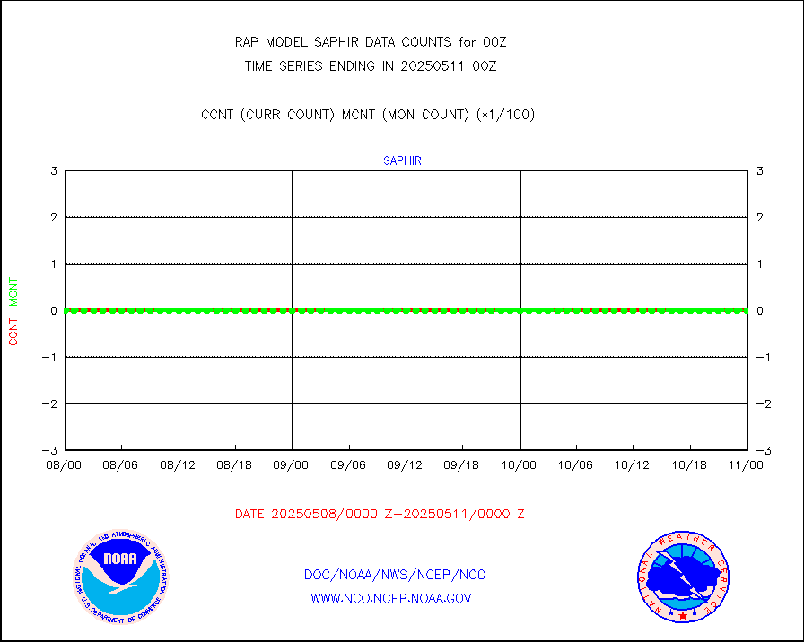
Megha-Tropiques SAPHIR L1A2 brightness temps |
0 |
0 |
n/a |
0221.00-0302.99 |
||||||||||
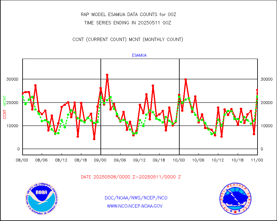
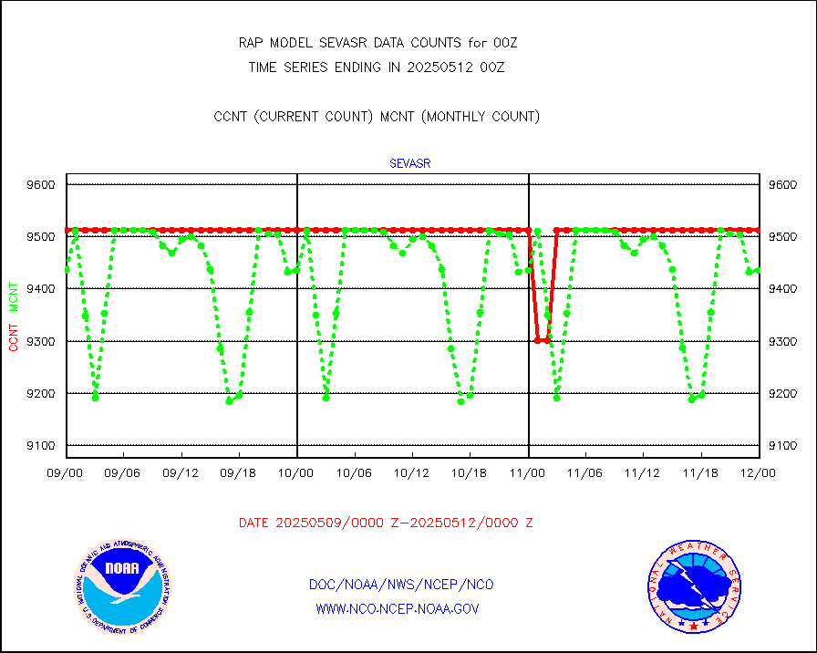
METEOSAT-10 2nd Gen SEVIRI All Sky Radiance(proc) |
9512 |
9504 |
100.1 % |
0222.00-0301.99 |
||||||||||
METEOSAT-10 2nd Gen SEVIRI Clr Sky Radiance(proc) |
0 |
0 |
n/a |
0222.00-0301.99 |
||||||||||
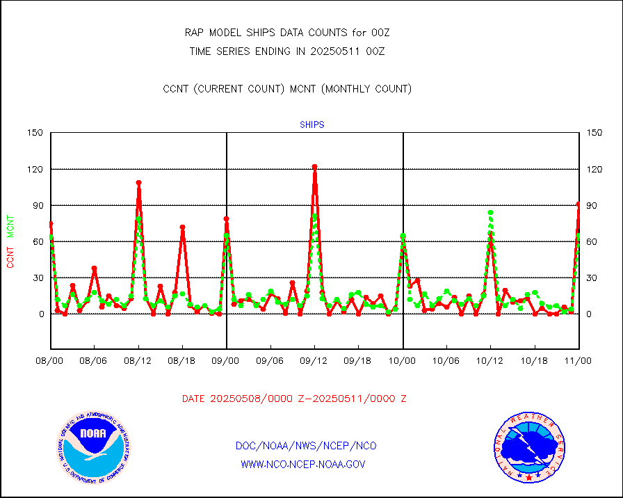
Ship - manual and automatic, restricted |
114 |
75 |
152.0 % |
0223.50-0300.50 |
||||||||||
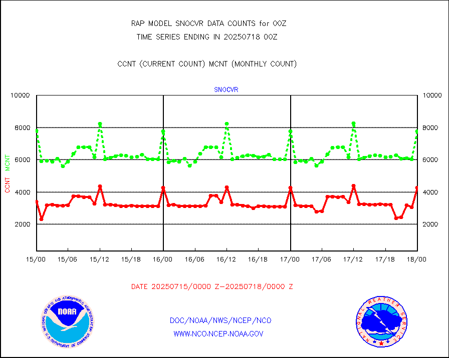
NOW COVER, DEPTH/DENSITY AND WATER EQUIVALENT |
4224 |
7873 |
53.7 % |
0222.00-0302.00 |
||||||||||
DMSP SSM/IS 1C radiance data (Unified Pre-Proc.) |
94156 |
66214 |
142.2 % |
0222.00-0301.99 |
||||||||||
Sub-surface float and glider profile (BUFR) |
6 |
3 |
200.0 % |
0222.00-0301.99 |
||||||||||
Synoptic - restricted (WMO Res 40) manual & auto. |
3 |
0 |
n/a |
0223.50-0300.50 |
||||||||||
Synoptic - restricted (WMO Res 40)(decoded BUFR) |
298 |
297 |
100.3 % |
0223.50-0300.50 |
||||||||||
Synoptic - mobile manual & auto (decoded fr BUFR) |
28 |
27 |
103.7 % |
0223.50-0300.50 |
||||||||||
TAMDAR aircft data-all types(from Panasonic,BUFR) |
243 |
202 |
120.3 % |
0220.75-0303.25 |
||||||||||
MTSAT/JMA visible derived cloud motion |
1766 |
1599 |
110.4 % |
0222.50-0301.50 |
||||||||||
GOES-16&up/NESDIS visible derived cloud motion |
161526 |
156548 |
103.2 % |
0223.00-0223.99 |
||||||||||
METEOSAT/EUMETSAT visible drv cld motion NBseq |
0 |
0 |
n/a |
0222.50-0301.49 |
||||||||||


