| Suspect Data Shortages in Critical Types - Monitor | ||||||||||||||
|---|---|---|---|---|---|---|---|---|---|---|---|---|---|---|
| Type | Description | Hourly Count | Monthly Average | Percent (%) of Monthly Mean | ||||||||||
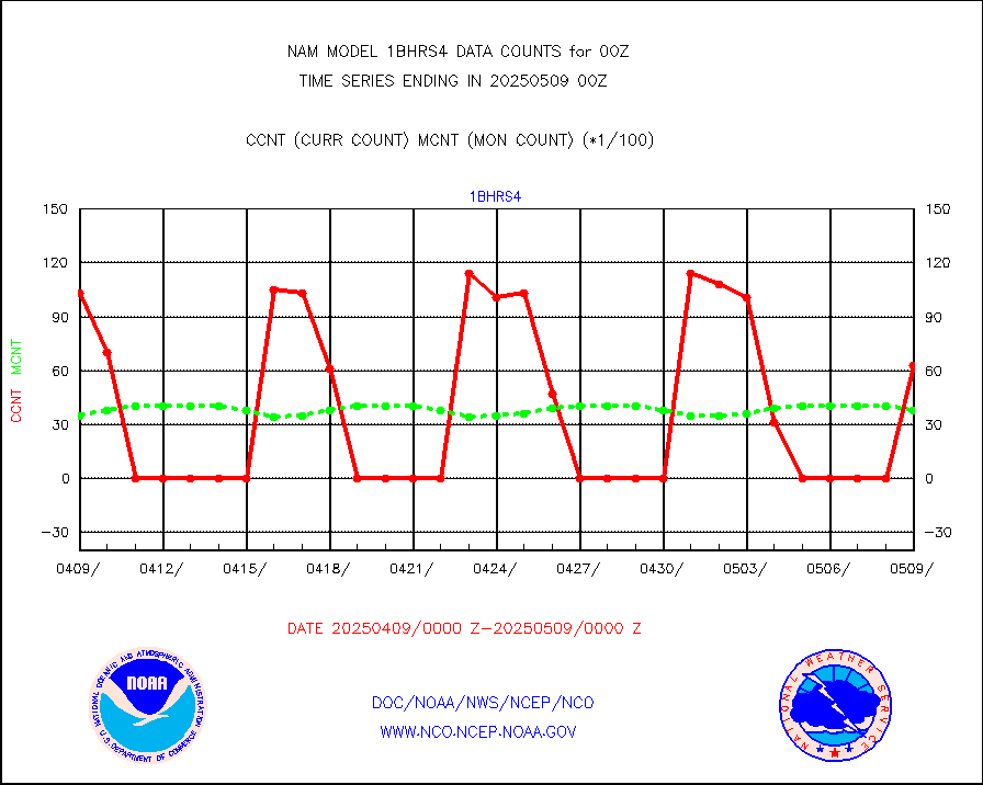
NOAA 18-19 & METOP 1-2 HIRS-4 NCEP-proc. br.temps |
0 |
794 |
0.0 % |
|||||||||||
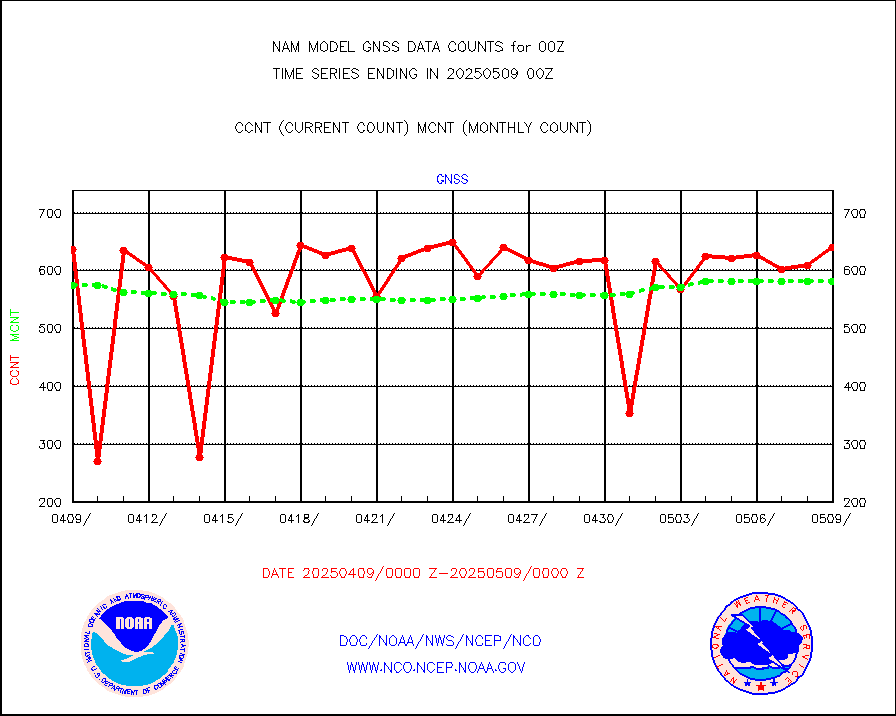
Grnd-based Gbl Navigation Sat System (GNSS) data |
0 |
479 |
0.0 % |
|||||||||||
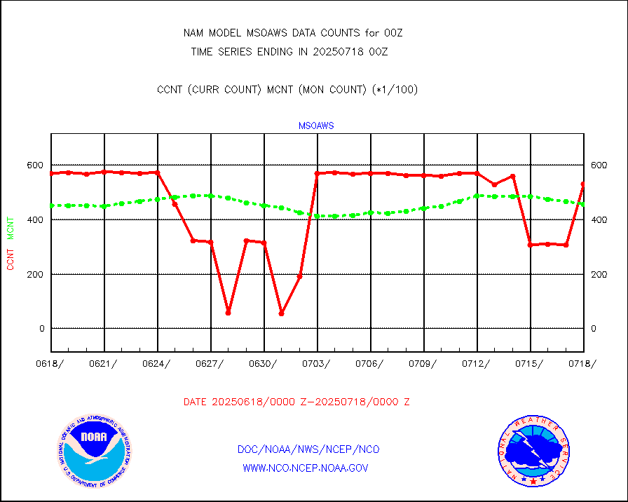
Mesonet/MADIS AWS Convergence Technologies, Inc. |
5577 |
44292 |
12.6 % |
|||||||||||
| Shortage in Data Type of Opportunity - Monitor | ||||||||||||||
|---|---|---|---|---|---|---|---|---|---|---|---|---|---|---|
| Type | Description | Hourly Count | Monthly Average | Percent (%) of Monthly Mean | ||||||||||
NOAA 15-19 & METOP 1-2 HIRS-3/4 pr btmps frm RARS |
0 |
11805 |
0.0 % |
|||||||||||
| Critical Data with Normal Counts | ||||||||||||||
|---|---|---|---|---|---|---|---|---|---|---|---|---|---|---|
| Type | Description | Hourly Count | Monthly Average | Percent (%) of Monthly Mean | ||||||||||
NOAA 15-19 & METOP 1-2 AMSU-A NCEP-proc. br.temps |
8933 |
8991 |
99.4 % |
|||||||||||
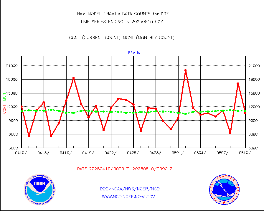
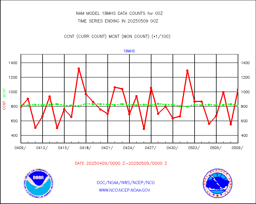
NOAA 18-19 & METOP 1-2 MHS NCEP-proces. br. temps |
79544 |
75916 |
104.8 % |
|||||||||||
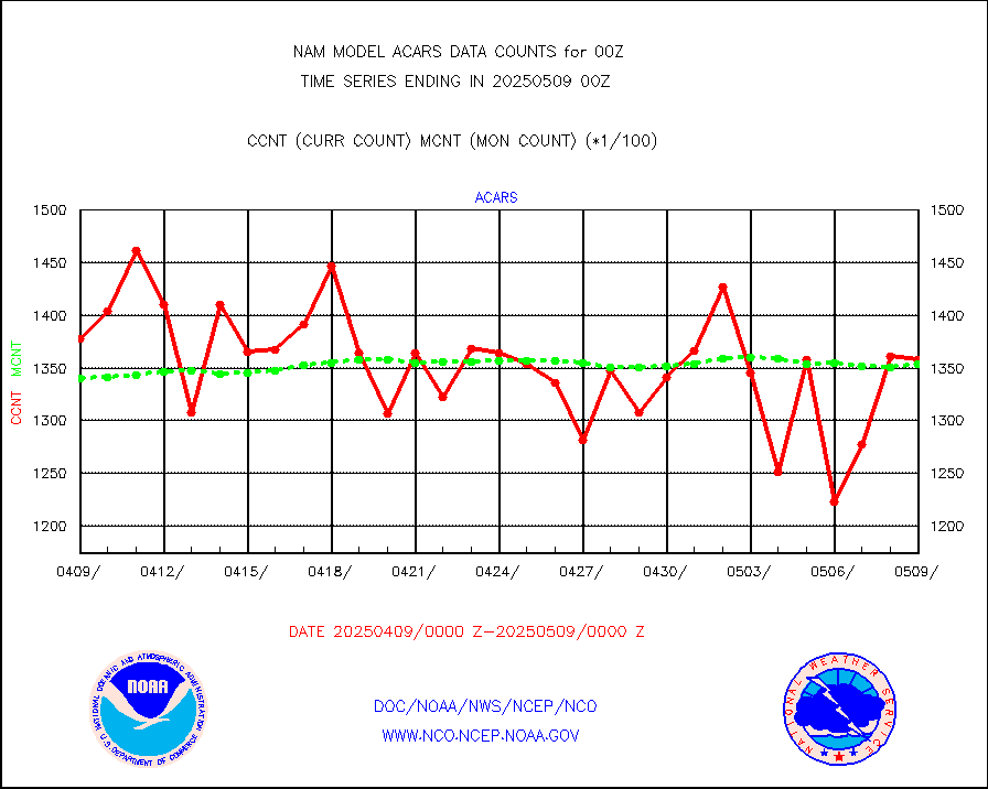
MDCRS ACARS acft data from ARINC(dcded from BUFR) |
138712 |
137870 |
100.6 % |
|||||||||||
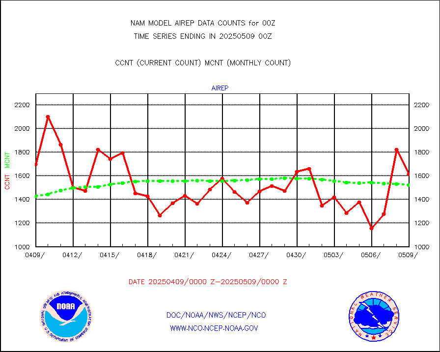
Manual AIREP aircraft data (dcded from AIREP fmt) |
1332 |
1542 |
86.4 % |
|||||||||||
AQUA AIRS/AMSU-A/HSB brightness temps- every FOV |
0 |
0 |
n/a |
|||||||||||
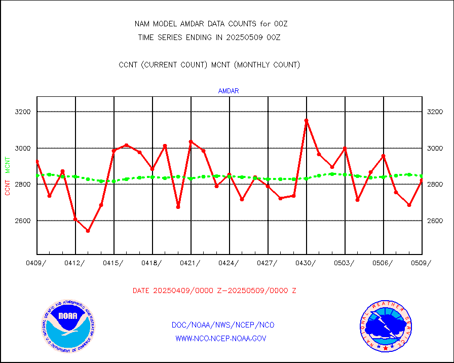
AMDAR aircraft data (decoded from AMDAR format) |
3059 |
2896 |
105.6 % |
|||||||||||
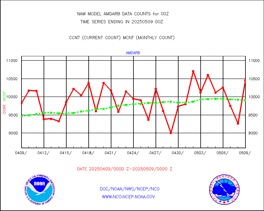
AMDAR aircraft data (decoded from BUFR) |
9162 |
9810 |
93.4 % |
|||||||||||
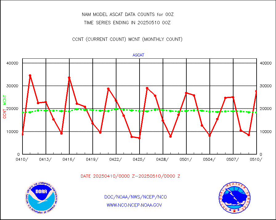
METOP 1-2 ASCAT products |
9647 |
18539 |
52.0 % |
|||||||||||
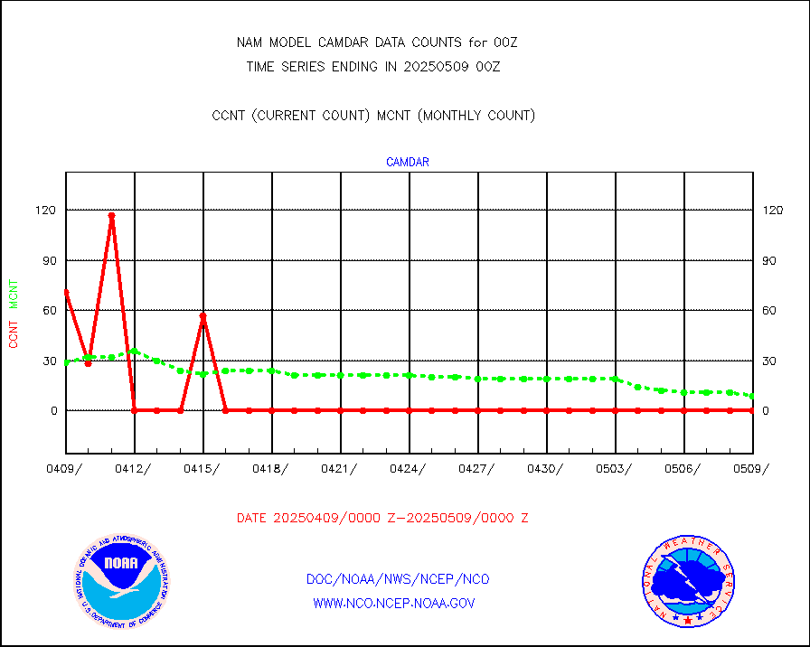
Canadian AMDAR aircraft data (decoded from BUFR) |
0 |
0 |
n/a |
|||||||||||
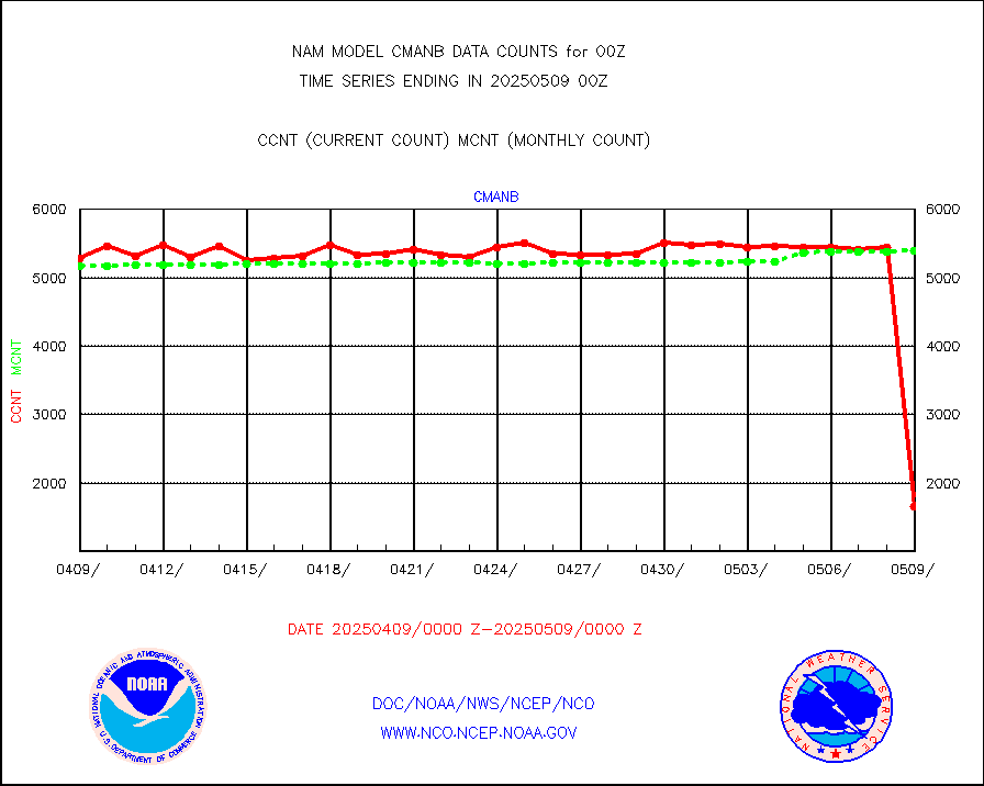
Surface Marine CMAN rpts decoded from BUFR format |
5362 |
5469 |
98.0 % |
|||||||||||
Buoys decoded from FM-18 fmt (moored or drifting) |
5 |
4 |
125.0 % |
|||||||||||
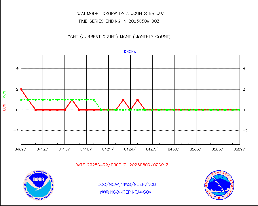
Dropwinsonde (from TEMP DROP) |
0 |
0 |
n/a |
|||||||||||
E-AMDAR (European AMDAR acft decoded from BUFR) |
6861 |
7361 |
93.2 % |
|||||||||||
GOES/NESDIS hi-resol. (1x1 f-o-v) sndgs/radiances |
0 |
0 |
n/a |
|||||||||||
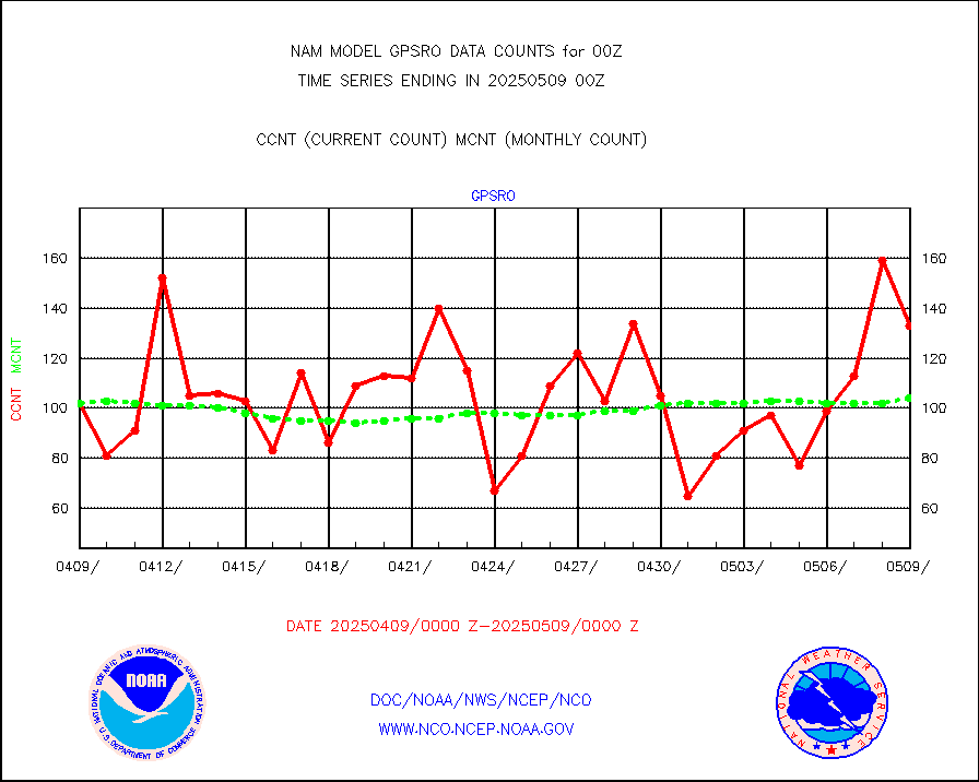
GPS radio occultation data |
111 |
111 |
100.0 % |
|||||||||||
MODIS (AQUA/TERRA) wvpr imager derived cld motion |
0 |
0 |
n/a |
|||||||||||
MODIS (AQUA/TERRA) ir l-wave derived cloud motion |
0 |
0 |
n/a |
|||||||||||
Land-based CMAN stations decoded from CMAN format |
299 |
193 |
154.9 % |
|||||||||||
Buoys decoded from FM-13 format (moored) |
303 |
216 |
140.3 % |
|||||||||||
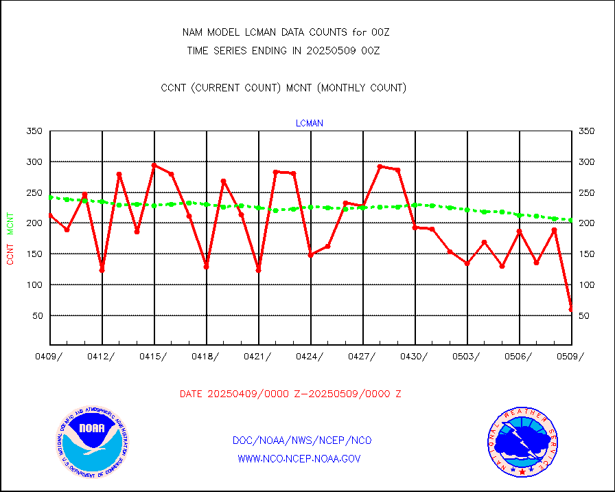
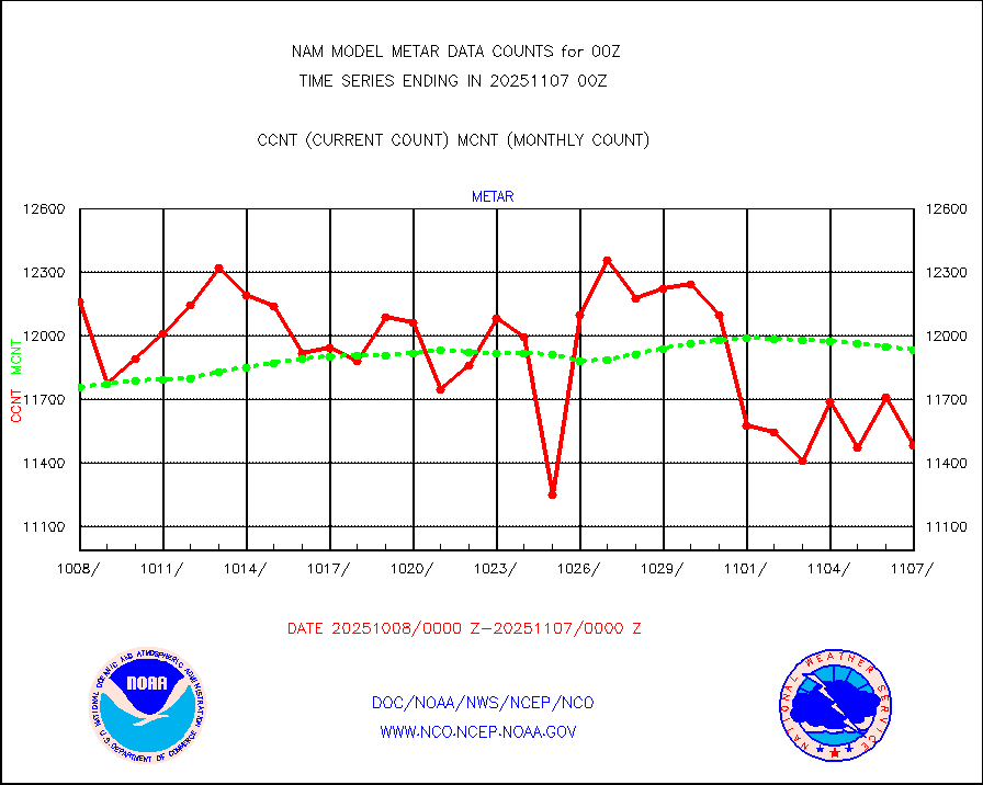
Aviation - METAR |
12047 |
12002 |
100.4 % |
|||||||||||
Mesonet/MADIS Colorado E-470 (Interstate 470) |
56 |
54 |
103.7 % |
|||||||||||
Mesonet/MADIS Alaska Department of Transportation |
400 |
378 |
105.8 % |
|||||||||||
Mesonet/MADIS U.S. Army Aberdeen Proving Grounds |
0 |
0 |
n/a |
|||||||||||
Mesonet/MADIS Citizen Weather Observers Program |
73345 |
118951 |
61.7 % |
|||||||||||
Mesonet/MADIS "Anything Weather" |
0 |
0 |
n/a |
|||||||||||
Mesonet/MADIS Colorado Dept. of Transportation |
0 |
0 |
n/a |
|||||||||||
Mesonet/MADIS DC Net |
0 |
0 |
n/a |
|||||||||||
Mesonet/MADIS Denver Urban Drainage & Flood Cntrl |
0 |
0 |
n/a |
|||||||||||
Mesonet/MADIS Florida (FAWN & USF) |
8 |
8 |
100.0 % |
|||||||||||
Mesonet/MADIS Florida Dept. of Transportation |
0 |
0 |
n/a |
|||||||||||
Mesonet/MADIS Georgia Dept. of Transportation |
0 |
0 |
n/a |
|||||||||||
Mesonet/MADIS NWS Hydromet Auto Data System(HADS) |
17398 |
17657 |
98.5 % |
|||||||||||
Mesonet/MADIS Iowa Environmental |
414 |
409 |
101.2 % |
|||||||||||
Mesonet/MADIS Indiana Dept. of Transportation |
0 |
0 |
n/a |
|||||||||||
Mesonet/MADIS Iowa Department of Transportation |
0 |
0 |
n/a |
|||||||||||
Mesonet/MADIS Kansas Department of Transportation |
821 |
832 |
98.7 % |
|||||||||||
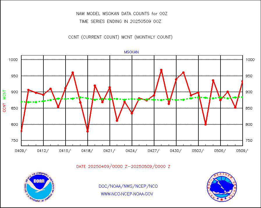
Mesonet/MADIS Oklahoma Mesonet |
1470 |
1421 |
103.4 % |
|||||||||||
Mesonet/MADIS Louisiana State/Jackson State Univ. |
0 |
0 |
n/a |
|||||||||||
Mesonet/MADIS Missouri Commercial Agricult Wx Net |
697 |
706 |
98.7 % |
|||||||||||
Mesonet/MADIS Minnesota Dept. of Transportation |
0 |
0 |
n/a |
|||||||||||
Mesonet/MADIS NOS-Phys Oceanographic Realtime Sys |
338 |
728 |
46.4 % |
|||||||||||
Mesonet/MADIS NFIC Remote Automated Wx Stns(RAWS) |
4035 |
3740 |
107.9 % |
|||||||||||
Mesonet/MADIS many providers, not separated out |
58087 |
91188 |
63.7 % |
|||||||||||
Mesonet/MADIS Virginia Dept. of Transportation |
0 |
0 |
n/a |
|||||||||||
Mesonet/MADIS "Weather for You" |
0 |
0 |
n/a |
|||||||||||
Mesonet/MADIS Wisconsin Dept. of Transportation |
0 |
0 |
n/a |
|||||||||||
Mesonet/MADIS MesoWest (many subproviders) |
57010 |
86973 |
65.5 % |
|||||||||||
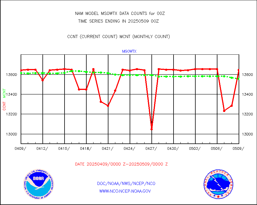
Mesonet/MADIS West Texas |
12940 |
13133 |
98.5 % |
|||||||||||
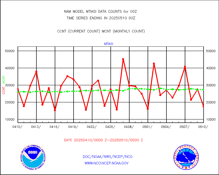
METOP 1-2 IASI 1C radiance data (varbl. channels) |
31660 |
27388 |
115.6 % |
|||||||||||
NEXRAD Vel Azm Dsp(VAD) winds via radar coded msg |
0 |
0 |
n/a |
|||||||||||
PIBAL (from PILOT, PILOT SHIP, PILOT MOBIL) |
0 |
0 |
n/a |
|||||||||||
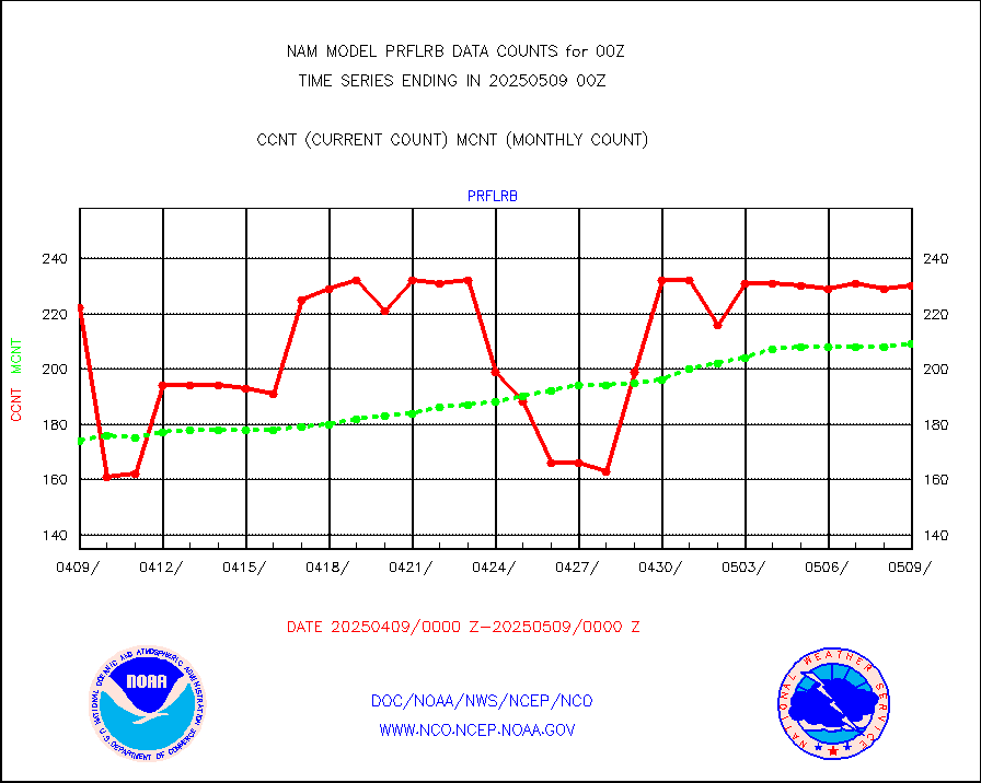
Multi-Agency Profiler (MAP) and SODAR winds |
197 |
196 |
100.5 % |
|||||||||||
Profilr winds from PIBAL (PILOT,PILOT SHIP/MOBIL) |
0 |
0 |
n/a |
|||||||||||
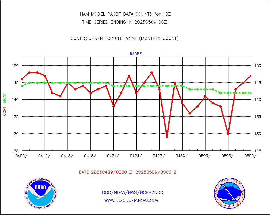
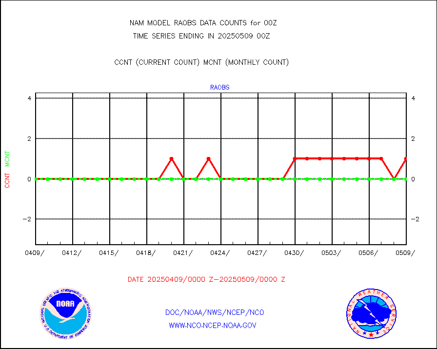
Rawinsonde - fixed land (from TEMP or PILOT) |
150 |
147 |
102.0 % |
|||||||||||
Rawinsonde - mobile land (from TEMP/PILOT MOBIL) |
0 |
0 |
n/a |
|||||||||||
Rawinsonde - ship (from TEMP SHIP, PILOT SHIP) |
1 |
0 |
n/a |
|||||||||||
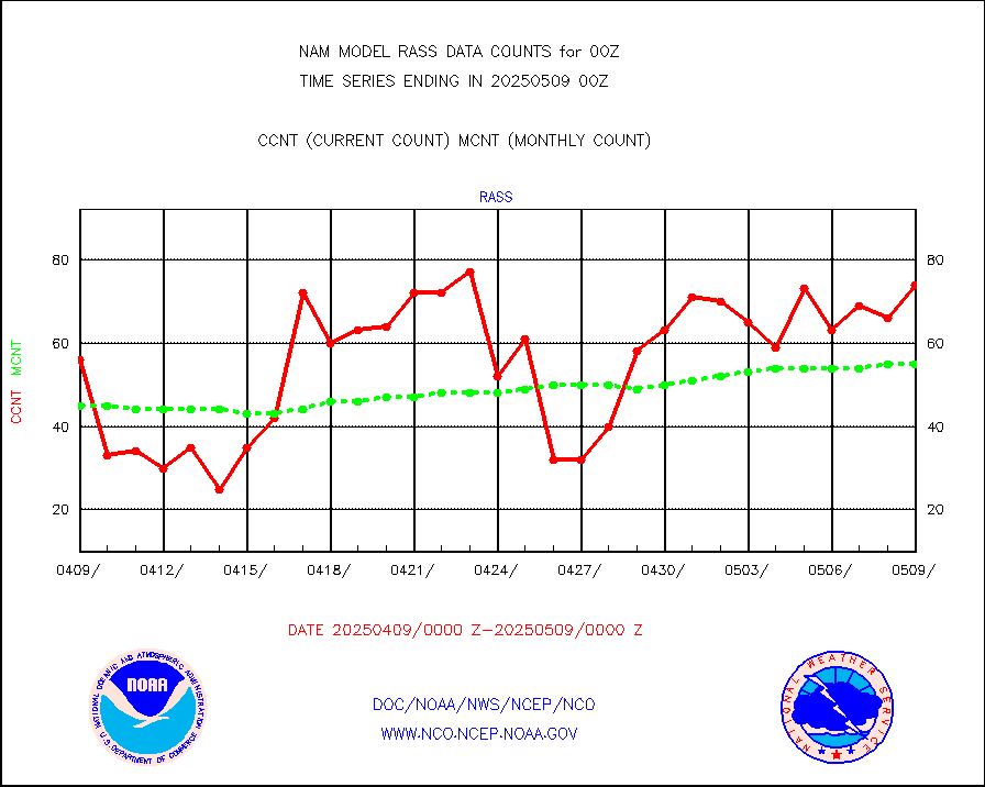
RASS temperatures (NOAA and Multi-Agency) |
46 |
50 |
92.0 % |
|||||||||||
Flight level reconnaissance aircraft data |
0 |
0 |
n/a |
|||||||||||
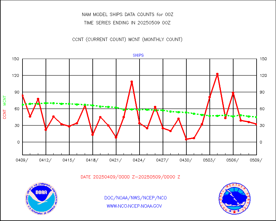
Ship - manual and automatic, restricted |
91 |
45 |
202.2 % |
|||||||||||
Ship - manual and automatic, restricted (BUFR) |
163 |
138 |
118.1 % |
|||||||||||
Ship - manual and automatic, unrestricted |
152 |
223 |
68.2 % |
|||||||||||
Ship - manual and automatic, unrestricted (BUFR) |
1658 |
1630 |
101.7 % |
|||||||||||
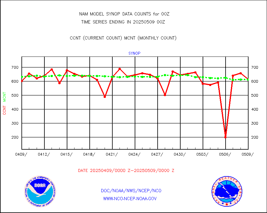
Synoptic - fixed manual & auto (decoded fr BUFR) |
4615 |
4767 |
96.8 % |
|||||||||||
Synoptic - restricted (WMO Res 40) manual & auto. |
0 |
0 |
n/a |
|||||||||||
Synoptic - restricted (WMO Res 40)(decoded BUFR) |
599 |
693 |
86.4 % |
|||||||||||
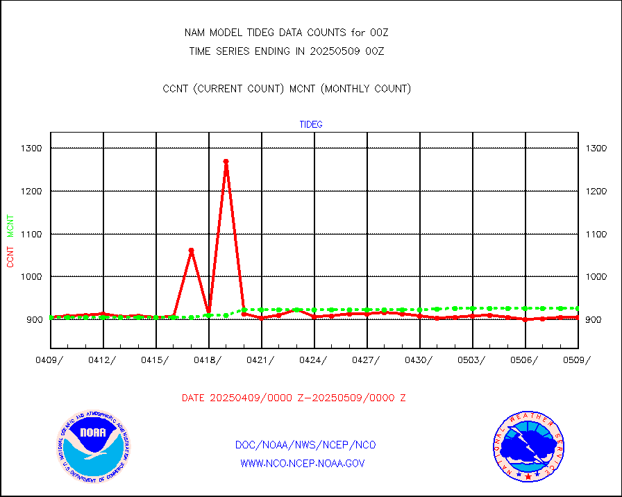
Tide gauge reports decoded from CREX format |
832 |
913 |
91.1 % |
|||||||||||
| Data Types of Opportunity with Normal Counts | ||||||||||||||
|---|---|---|---|---|---|---|---|---|---|---|---|---|---|---|
| Type | Description | Hourly Count | Monthly Average | Percent (%) of Monthly Mean | ||||||||||
MDCRS ACARS acft data (ARINC via AFWA)(AIREP fmt) |
0 |
0 |
n/a |
|||||||||||
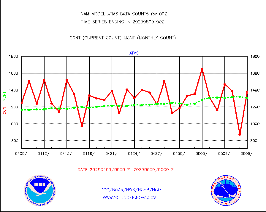
NPP/NOAA-20 ATMS brightness temperatures |
123282 |
123300 |
100.0 % |
|||||||||||
NPP CrIS apodized radiances (399 channel) |
0 |
0 |
n/a |
|||||||||||
Coast Guard |
11 |
15 |
73.3 % |
|||||||||||
Drifting buoys (decoded from BUFR) |
715 |
692 |
103.3 % |
|||||||||||
NOAA 15-19 & METOP 1-2 AMSU-A proc btmps frm RARS |
15918 |
21289 |
74.8 % |
|||||||||||
NOAA 18-19 & METOP 1-2 MHS proc. btemps from RARS |
144622 |
198703 |
72.8 % |
|||||||||||
GOES/NESDIS hi-resol. (1x1 f-o-v) cloud data |
0 |
0 |
n/a |
|||||||||||
MTSAT/JMA water vapor imager derived cloud motion |
970 |
1482 |
65.5 % |
|||||||||||
METEOSAT/EUMETSAT wvpr imgr drv cld motion NBseq |
5200 |
5403 |
96.2 % |
|||||||||||
METEOSAT/EUMETSAT ir lg-wave drv cld motion NBseq |
3061 |
3125 |
98.0 % |
|||||||||||
VIIRS (NPP/NOAA-20) ir lg-wv drv cloud motion(NB) |
0 |
0 |
n/a |
|||||||||||
AVHRR (NOAA/METOP) ir lg-wave derived cld motion |
0 |
0 |
n/a |
|||||||||||
AVHRR (METOP) ir lg-wave derived cld motion |
0 |
0 |
n/a |
|||||||||||
MTSAT/JMA infrared long-wave derived cloud motion |
1012 |
1235 |
81.9 % |
|||||||||||
Korean AMDAR aircraft data (decoded from BUFR) |
344 |
269 |
127.9 % |
|||||||||||
GOES/NASA(Langley) hi-res. (1x1 f-o-v) cloud data |
9999999 |
9985235 |
100.1 % |
|||||||||||
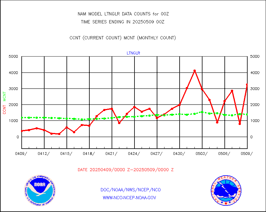
LLDN Long-rng lightning from Vaisala via NOAAPORT |
413353 |
352498 |
117.3 % |
|||||||||||
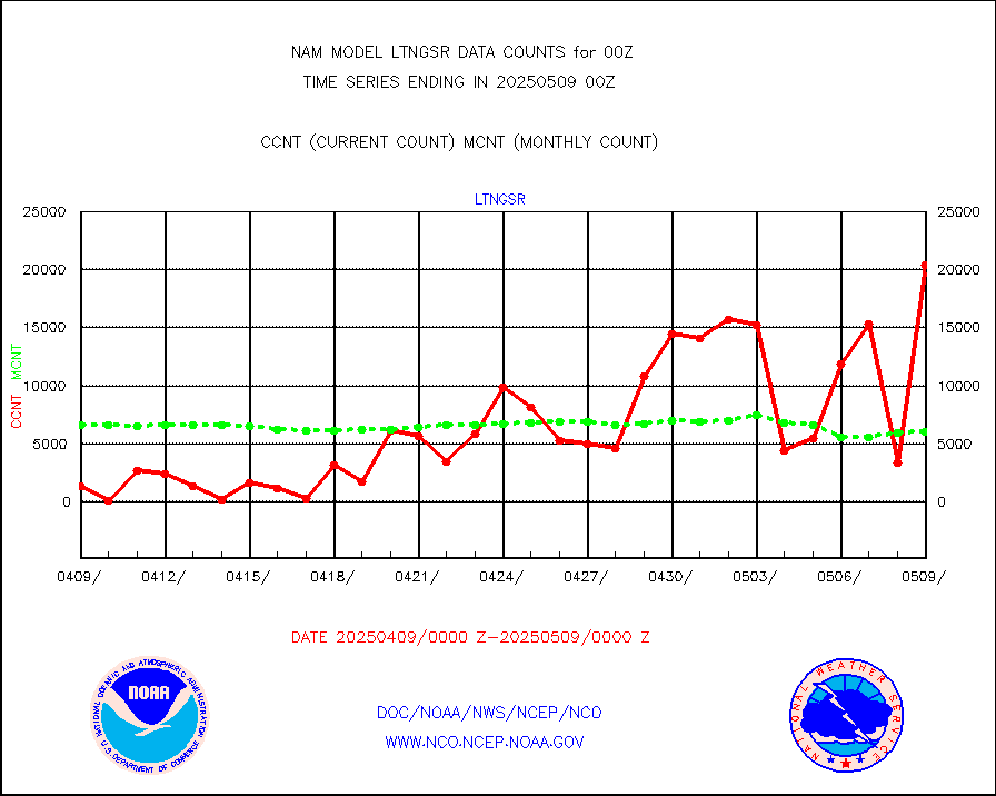
NLDN Shrt-rng lightning from Vaisala via NOAAPORT |
24008 |
19455 |
123.4 % |
|||||||||||
Moored buoys (decoded from BUFR) |
1599 |
1619 |
98.8 % |
|||||||||||
NEXRAD Vel Azm Dsp(VAD) winds via Level 2 decoder |
1685 |
1475 |
114.2 % |
|||||||||||
NOAA 16-19 Solar Backscatter UV-2 rad frm V8 BUFR |
0 |
0 |
n/a |
|||||||||||
Manual PIREP aircraft data (dcded from AIREP fmt) |
502 |
498 |
100.8 % |
|||||||||||
NEXRAD reflectivity (Lvl 2 - GTS) |
11389372 |
9864509 |
115.5 % |
|||||||||||
NEXRAD radial wind (Level 2 - GTS) |
5603776 |
3839302 |
146.0 % |
|||||||||||
METEOSAT-10 2nd Gen SEVIRI Clr Sky Radiance(proc) |
0 |
0 |
n/a |
|||||||||||
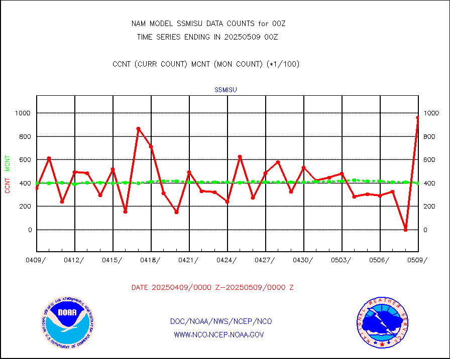
DMSP SSM/IS 1C radiance data (Unified Pre-Proc.) |
20233 |
27147 |
74.5 % |
|||||||||||
Synoptic - fixed manual and automatic |
688 |
639 |
107.7 % |
|||||||||||
Synoptic - mobile manual & auto (decoded fr BUFR) |
26 |
27 |
96.3 % |
|||||||||||
TAMDAR aircft data-all types(from Panasonic,BUFR) |
140 |
220 |
63.6 % |
|||||||||||
MTSAT/JMA visible derived cloud motion |
820 |
776 |
105.7 % |
|||||||||||
METEOSAT/EUMETSAT visible drv cld motion NBseq |
0 |
0 |
n/a |
|||||||||||


