| Suspect Data Shortages in Critical Types - Monitor | ||||||||||||||
|---|---|---|---|---|---|---|---|---|---|---|---|---|---|---|
| Type | Description | Hourly Count | Monthly Average | Percent (%) of Monthly Mean | UTC Time Window | |||||||||
NOAA 18-19 & METOP 1-2 HIRS-4 NCEP-proc. br.temps |
0 |
12156 |
0.0 % |
0122.00-0122.99 |
||||||||||
NOAA 15-19 & METOP 1-2 HIRS-3/4 pr btmps frm RARS |
0 |
13143 |
0.0 % |
0123.50-0200.49 |
||||||||||
| Shortage in Data Type of Opportunity - Monitor | ||||||||||||||
|---|---|---|---|---|---|---|---|---|---|---|---|---|---|---|
| Type | Description | Hourly Count | Monthly Average | Percent (%) of Monthly Mean | UTC Time Window | |||||||||
P.M.(N18-19) AVHRR GAC NCEP-proc clr & sea btemps |
0 |
480750 |
0.0 % |
0121.50-0122.49 |
||||||||||
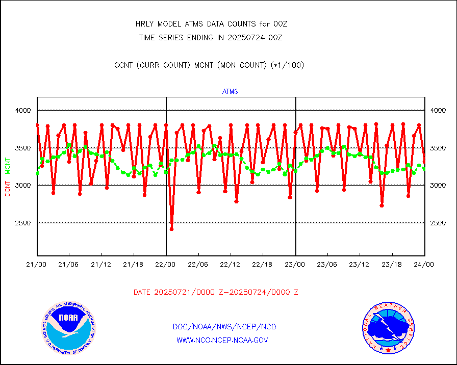
NPP Adv. Tech. MW Sndr (ATMS) br. temps from RARS |
0 |
4771 |
0.0 % |
0122.50-0123.49 |
||||||||||
INDIA SATWIND, INSAT WV channel |
0 |
498 |
0.0 % |
0123.00-0123.99 |
||||||||||
High Density OBs from reconnaissance acft data |
0 |
23 |
0.0 % |
0123.50-0200.49 |
||||||||||
INDIA SATWIND, INSAT IR channel |
0 |
698 |
0.0 % |
0123.00-0123.99 |
||||||||||
| Critical Data with Normal Counts | ||||||||||||||
|---|---|---|---|---|---|---|---|---|---|---|---|---|---|---|
| Type | Description | Hourly Count | Monthly Average | Percent (%) of Monthly Mean | UTC Time Window | |||||||||
NOAA 15-19 & METOP 1-2 AMSU-A NCEP-proc. br.temps |
26736 |
32142 |
83.2 % |
0122.00-0122.99 |
||||||||||
NOAA 18-19 & METOP 1-2 MHS NCEP-proces. br. temps |
238240 |
251960 |
94.6 % |
0122.00-0122.99 |
||||||||||
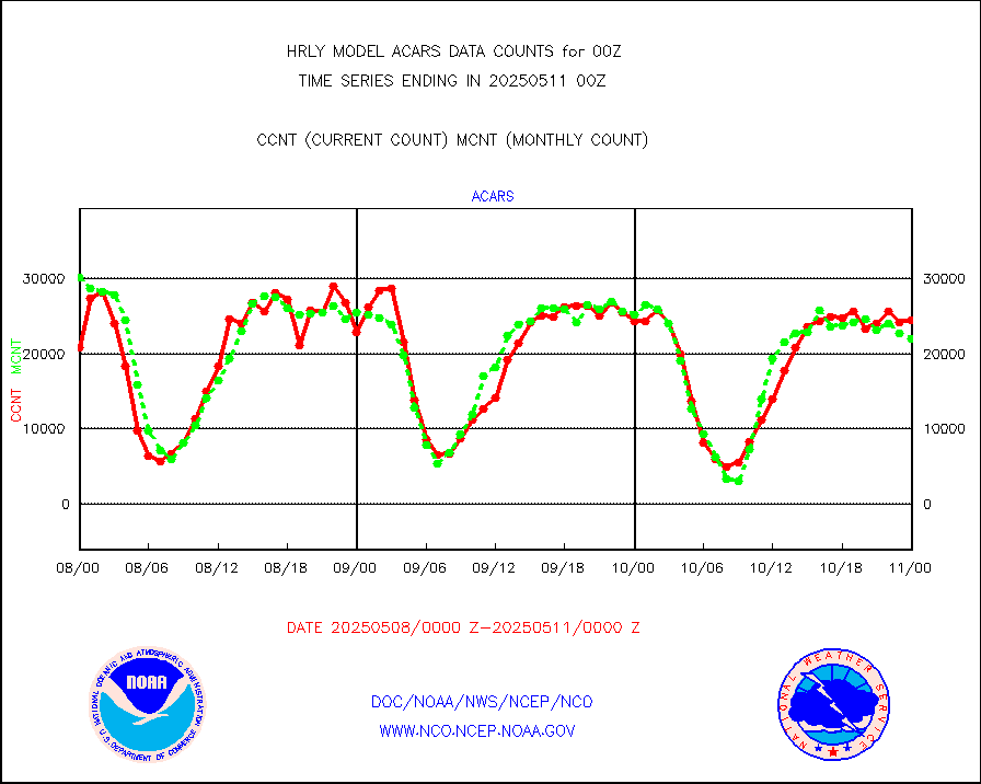
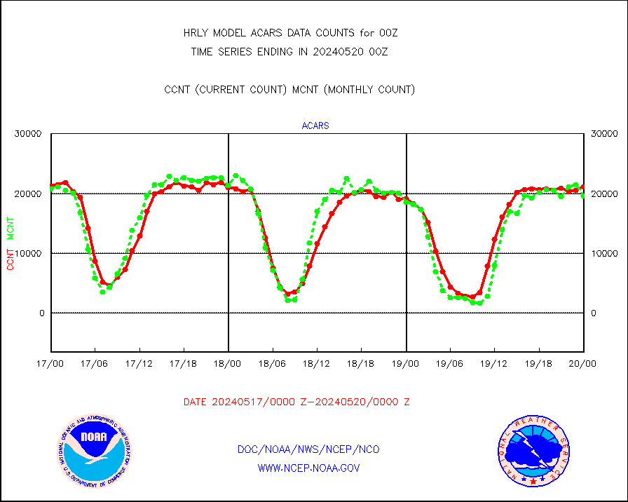
MDCRS ACARS acft data from ARINC(dcded from BUFR) |
22880 |
29963 |
76.4 % |
0123.50-0200.49 |
||||||||||
Manual AIREP aircraft data (dcded from AIREP fmt) |
329 |
373 |
88.2 % |
0123.50-0200.49 |
||||||||||
AQUA AIRS/AMSU-A/HSB brightness temps- every FOV |
0 |
0 |
n/a |
0121.50-0122.49 |
||||||||||
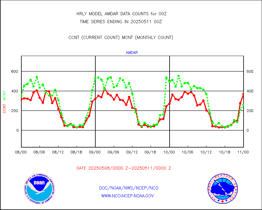
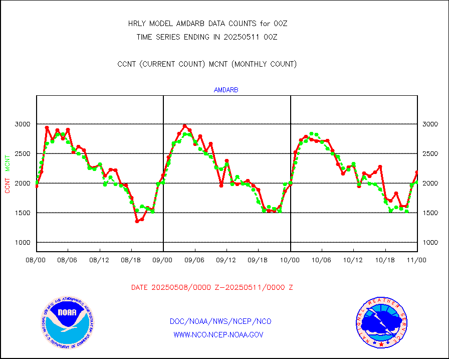
AMDAR aircraft data (decoded from AMDAR format) |
346 |
204 |
169.6 % |
0123.50-0200.49 |
||||||||||
AMDAR aircraft data (decoded from BUFR) |
1867 |
2014 |
92.7 % |
0123.50-0200.49 |
||||||||||
METOP 1-2 ASCAT products |
66780 |
59979 |
111.3 % |
0122.50-0123.49 |
||||||||||
NPP/NOAA-20 ATMS brightness temperatures |
340416 |
333827 |
102.0 % |
0122.50-0123.49 |
||||||||||
Canadian AMDAR aircraft data (decoded from BUFR) |
0 |
0 |
n/a |
0123.50-0200.49 |
||||||||||
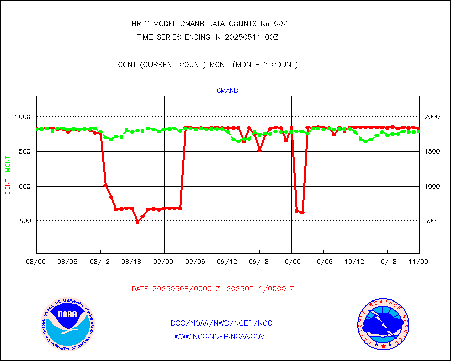
Surface Marine CMAN rpts decoded from BUFR format |
1871 |
1850 |
101.1 % |
0123.50-0200.50 |
||||||||||
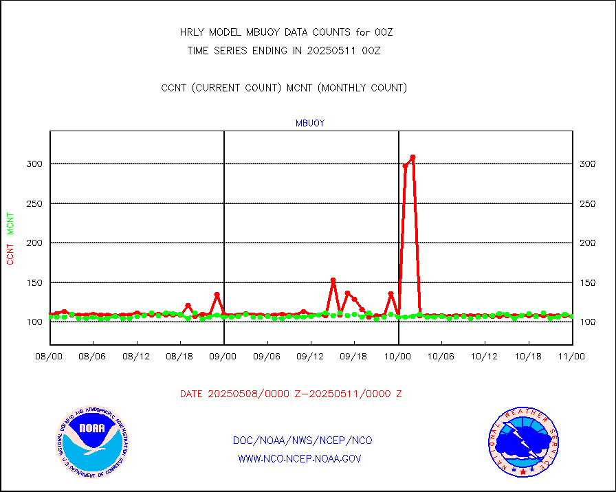
Buoys decoded from FM-18 fmt (moored or drifting) |
11 |
15 |
73.3 % |
0123.50-0200.49 |
||||||||||
E-AMDAR (European AMDAR acft decoded from BUFR) |
659 |
590 |
111.7 % |
0123.50-0200.49 |
||||||||||
NOAA 15-19 & METOP 1-2 AMSU-A proc btmps frm RARS |
12360 |
21696 |
57.0 % |
0123.50-0200.49 |
||||||||||
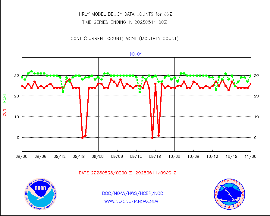
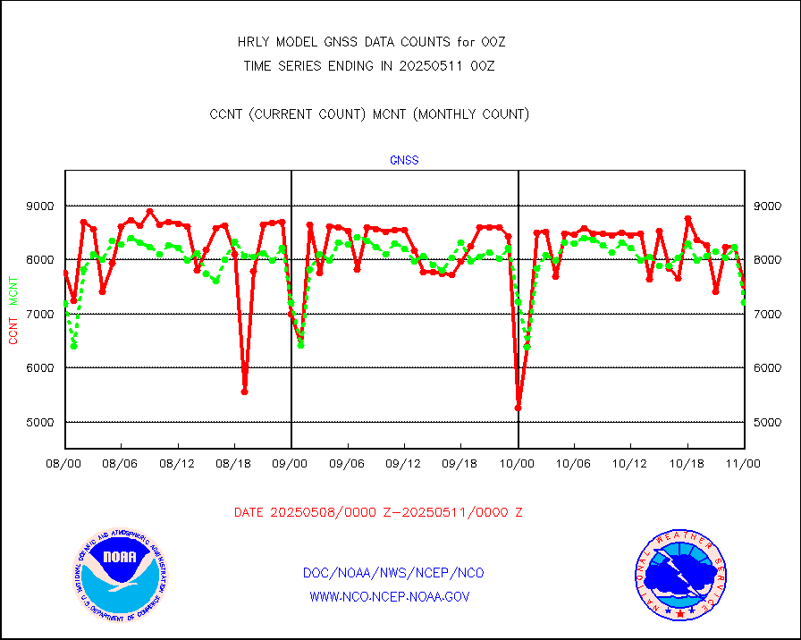
Grnd-based Gbl Navigation Sat System (GNSS) data |
628 |
5873 |
10.7 % |
0123.00-0123.99 |
||||||||||
GPS radio occultation data |
571 |
526 |
108.6 % |
0121.50-0122.49 |
||||||||||
GOES-16/17 All Sky Radiances (proc.) |
720952 |
696917 |
103.4 % |
0123.50-0200.49 |
||||||||||
GOES-16/17 Clear Sky Radiances (proc.) |
362766 |
367504 |
98.7 % |
0123.50-0200.49 |
||||||||||
MTSAT/JMA water vapor imager derived cloud motion |
21470 |
19265 |
111.4 % |
0121.50-0122.49 |
||||||||||
MODIS (AQUA/TERRA) wvpr imager derived cld motion |
0 |
0 |
n/a |
0120.00-0120.99 |
||||||||||
GOES-16&up/NESDIS wv imgr/cld-top derived cld mtn |
28290 |
29941 |
94.5 % |
0123.00-0123.99 |
||||||||||
METEOSAT/EUMETSAT ir lg-wave drv cld motion NBseq |
21829 |
20882 |
104.5 % |
0122.50-0123.49 |
||||||||||
MTSAT/JMA infrared long-wave derived cloud motion |
16800 |
15865 |
105.9 % |
0121.50-0122.49 |
||||||||||
MODIS (AQUA/TERRA) ir l-wave derived cloud motion |
0 |
0 |
n/a |
0120.00-0120.99 |
||||||||||
GOES-16&up/NESDIS ir long-wave derived cld motion |
81680 |
81750 |
99.9 % |
0123.00-0123.99 |
||||||||||
GOES/NASA(Langley) hi-res. (1x1 f-o-v) cloud data |
6425353 |
6344711 |
101.3 % |
0123.50-0200.49 |
||||||||||
Buoys decoded from FM-13 format (moored) |
121 |
122 |
99.2 % |
0123.50-0200.49 |
||||||||||
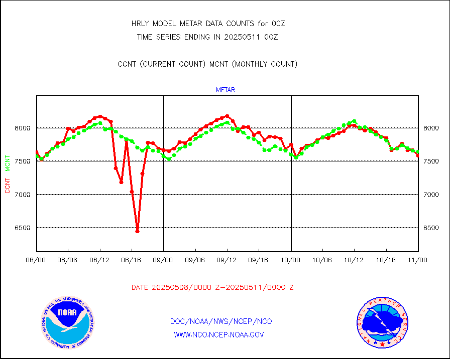
Aviation - METAR |
7625 |
7630 |
99.9 % |
0123.50-0200.49 |
||||||||||
Mesonet/MADIS Colorado E-470 (Interstate 470) |
24 |
24 |
100.0 % |
0123.50-0200.49 |
||||||||||
Mesonet/MADIS Alaska Department of Transportation |
120 |
91 |
131.9 % |
0123.50-0200.49 |
||||||||||
Mesonet/MADIS U.S. Army Aberdeen Proving Grounds |
0 |
0 |
n/a |
0123.50-0200.49 |
||||||||||
Mesonet/MADIS Citizen Weather Observers Program |
57364 |
59939 |
95.7 % |
0123.50-0200.49 |
||||||||||
Mesonet/MADIS AWS Convergence Technologies, Inc. |
7085 |
19898 |
35.6 % |
0123.50-0200.49 |
||||||||||
Mesonet/MADIS "Anything Weather" |
0 |
0 |
n/a |
0123.50-0200.49 |
||||||||||
Mesonet/MADIS Colorado Dept. of Transportation |
0 |
0 |
n/a |
0123.50-0200.49 |
||||||||||
Mesonet/MADIS DC Net |
0 |
0 |
n/a |
0123.50-0200.49 |
||||||||||
Mesonet/MADIS Denver Urban Drainage & Flood Cntrl |
0 |
0 |
n/a |
0123.50-0200.49 |
||||||||||
Mesonet/MADIS Florida (FAWN & USF) |
4 |
4 |
100.0 % |
0123.50-0200.49 |
||||||||||
Mesonet/MADIS Florida Dept. of Transportation |
0 |
0 |
n/a |
0123.50-0200.49 |
||||||||||
Mesonet/MADIS Georgia Dept. of Transportation |
0 |
0 |
n/a |
0123.50-0200.49 |
||||||||||
Mesonet/MADIS NWS Hydromet Auto Data System(HADS) |
5539 |
5988 |
92.5 % |
0123.50-0200.49 |
||||||||||
Mesonet/MADIS Iowa Environmental |
191 |
185 |
103.2 % |
0123.50-0200.49 |
||||||||||
Mesonet/MADIS Indiana Dept. of Transportation |
0 |
0 |
n/a |
0123.50-0200.49 |
||||||||||
Mesonet/MADIS Iowa Department of Transportation |
0 |
0 |
n/a |
0123.50-0200.49 |
||||||||||
Mesonet/MADIS Kansas Department of Transportation |
426 |
376 |
113.3 % |
0123.50-0200.49 |
||||||||||
Mesonet/MADIS Oklahoma Mesonet |
630 |
620 |
101.6 % |
0123.50-0200.49 |
||||||||||
Mesonet/MADIS Louisiana State/Jackson State Univ. |
0 |
0 |
n/a |
0123.50-0200.49 |
||||||||||
Mesonet/MADIS Missouri Commercial Agricult Wx Net |
335 |
332 |
100.9 % |
0123.50-0200.49 |
||||||||||
Mesonet/MADIS Minnesota Dept. of Transportation |
0 |
0 |
n/a |
0123.50-0200.49 |
||||||||||
Mesonet/MADIS NOS-Phys Oceanographic Realtime Sys |
334 |
317 |
105.4 % |
0123.50-0200.49 |
||||||||||
Mesonet/MADIS NFIC Remote Automated Wx Stns(RAWS) |
1876 |
1811 |
103.6 % |
0123.50-0200.49 |
||||||||||
Mesonet/MADIS many providers, not separated out |
67499 |
71441 |
94.5 % |
0123.00-0200.49 |
||||||||||
Mesonet/MADIS Virginia Dept. of Transportation |
0 |
0 |
n/a |
0123.50-0200.49 |
||||||||||
Mesonet/MADIS "Weather for You" |
0 |
0 |
n/a |
0123.50-0200.49 |
||||||||||
Mesonet/MADIS Wisconsin Dept. of Transportation |
0 |
0 |
n/a |
0123.50-0200.49 |
||||||||||
Mesonet/MADIS MesoWest (many subproviders) |
33147 |
35678 |
92.9 % |
0123.50-0200.49 |
||||||||||
Mesonet/MADIS West Texas |
5654 |
5899 |
95.8 % |
0123.50-0200.49 |
||||||||||
METOP 1-2 IASI 1C radiance data (varbl. channels) |
106920 |
86810 |
123.2 % |
0122.00-0122.99 |
||||||||||
NEXRAD Vel Azm Dsp(VAD) winds via radar coded msg |
0 |
0 |
n/a |
0123.50-0200.49 |
||||||||||
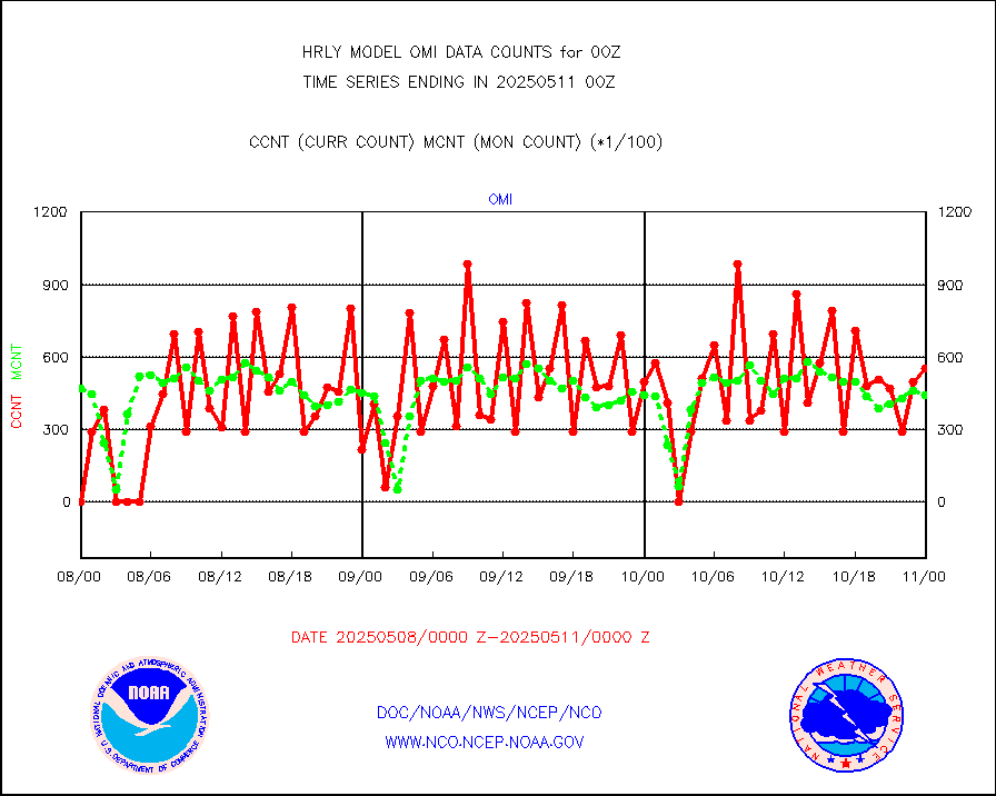
Aura Ozone Monitoring Instrument (OMI) data |
0 |
0 |
n/a |
0121.50-0122.49 |
||||||||||
NOAA 16-19 Solar Backscatter UV-2 rad frm V8 BUFR |
0 |
0 |
n/a |
0122.00-0122.99 |
||||||||||
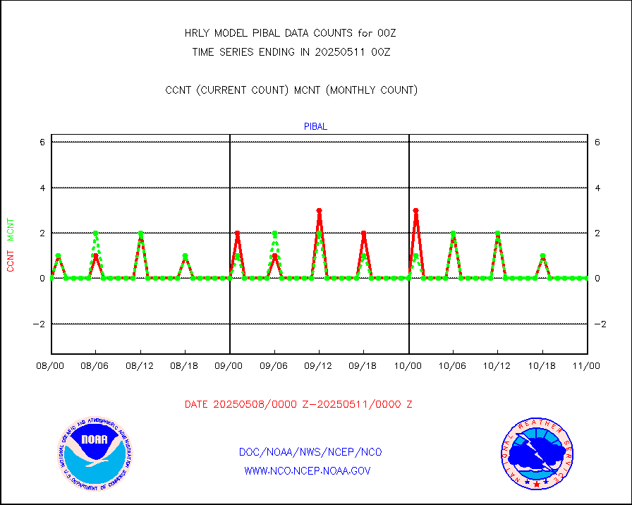
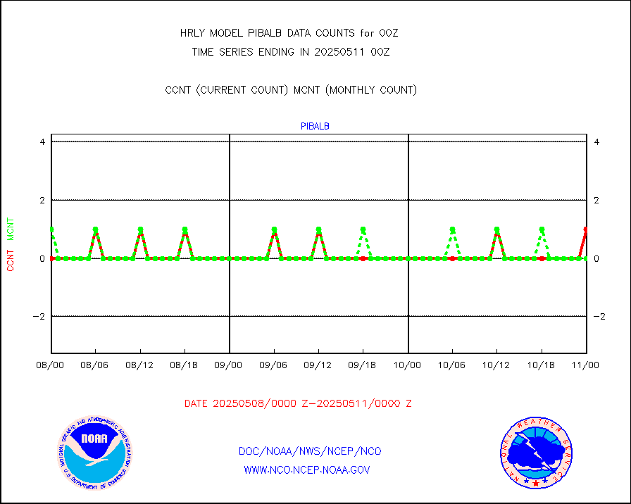
PIBAL (from PILOT, PILOT SHIP, PILOT MOBIL) |
0 |
0 |
n/a |
0123.50-0200.49 |
||||||||||
Multi-Agency Profiler (MAP) and SODAR winds |
50 |
46 |
108.7 % |
0123.50-0200.49 |
||||||||||
Rawinsonde - fixed land (from TEMP or PILOT) |
134 |
137 |
97.8 % |
0123.50-0200.49 |
||||||||||
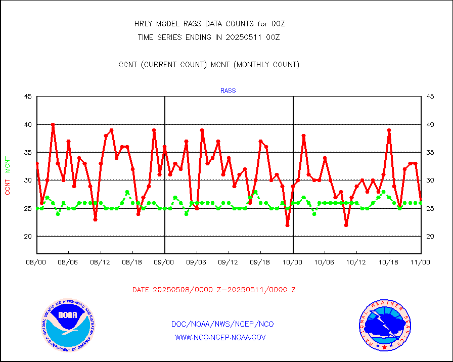
RASS temperatures (NOAA and Multi-Agency) |
25 |
24 |
104.2 % |
0123.50-0200.49 |
||||||||||
NEXRAD reflectivity (Lvl 2 - GTS) |
5034067 |
4575773 |
110.0 % |
0123.50-0200.49 |
||||||||||
NEXRAD radial wind (Level 2 - GTS) |
2175876 |
1776986 |
122.4 % |
0123.50-0200.49 |
||||||||||
METEOSAT-10 2nd Gen SEVIRI Clr Sky Radiance(proc) |
0 |
0 |
n/a |
0123.50-0200.49 |
||||||||||
Ship - manual and automatic, restricted (BUFR) |
0 |
0 |
n/a |
0123.50-0200.50 |
||||||||||
Ship - manual and automatic, unrestricted |
284 |
239 |
118.8 % |
0123.50-0200.50 |
||||||||||
Ship - manual and automatic, unrestricted (BUFR) |
1031 |
973 |
106.0 % |
0123.50-0200.50 |
||||||||||
Synoptic - fixed manual and automatic |
1623 |
1656 |
98.0 % |
0123.50-0200.49 |
||||||||||
Synoptic - fixed manual & auto (decoded fr BUFR) |
6515 |
6717 |
97.0 % |
0123.50-0200.49 |
||||||||||
Synoptic - restricted (WMO Res 40) manual & auto. |
3 |
1 |
300.0 % |
0123.50-0200.49 |
||||||||||
Synoptic - restricted (WMO Res 40)(decoded BUFR) |
299 |
351 |
85.2 % |
0123.50-0200.49 |
||||||||||
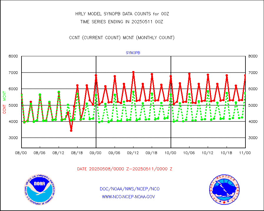
Tide gauge reports decoded from CREX format |
662 |
652 |
101.5 % |
0123.00-0123.99 |
||||||||||
| Data Types of Opportunity with Normal Counts | ||||||||||||||
|---|---|---|---|---|---|---|---|---|---|---|---|---|---|---|
| Type | Description | Hourly Count | Monthly Average | Percent (%) of Monthly Mean | UTC Time Window | |||||||||
GOES-16&up/NESDIS ir short-wv derived cld motion |
10506 |
9865 |
106.5 % |
0123.00-0123.99 |
||||||||||
MDCRS ACARS acft data (ARINC via AFWA)(AIREP fmt) |
0 |
0 |
n/a |
0123.50-0200.49 |
||||||||||
Himawari Clear Sky Radiance |
0 |
0 |
n/a |
0123.00-0123.99 |
||||||||||
GCOM-W AMSR2 1B brightness temperatures |
2309472 |
2158488 |
107.0 % |
0122.00-0122.99 |
||||||||||
NPP/NOAA-20 ATMS bright. temps-direct b-cast SSEC |
88398 |
64714 |
136.6 % |
0122.50-0123.49 |
||||||||||
POES/NESDIS - processed ATOVS soundings/radiances |
0 |
0 |
n/a |
0122.00-0122.99 |
||||||||||
A.M.(N17,M2,M3) AVHRR GAC NCEP-proc clr&sea btmps |
1787557 |
1495894 |
119.5 % |
0121.50-0122.49 |
||||||||||
eXpendable BathyThermograph, mooring (BATHY fmt) |
0 |
0 |
n/a |
0117.00-0117.99 |
||||||||||
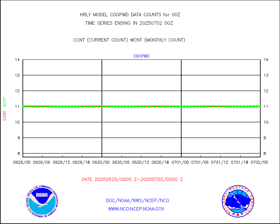
Coop/MADIS NEPP & HCN-Modernization NOAA COOP Obs |
11 |
11 |
100.0 % |
0123.50-0200.49 |
||||||||||
NPP/NOAA-20 CrIS full spctrl radn (431 ch subset) |
240534 |
217830 |
110.4 % |
0122.50-0123.49 |
||||||||||
NPP/NOAA-20 CrIS full spctrl radn dir brdcst SSEC |
18360 |
19420 |
94.5 % |
0122.50-0123.49 |
||||||||||
Coast Guard |
5 |
8 |
62.5 % |
0123.50-0200.50 |
||||||||||
Drifting buoys (decoded from BUFR) |
1454 |
1439 |
101.0 % |
0123.50-0200.50 |
||||||||||
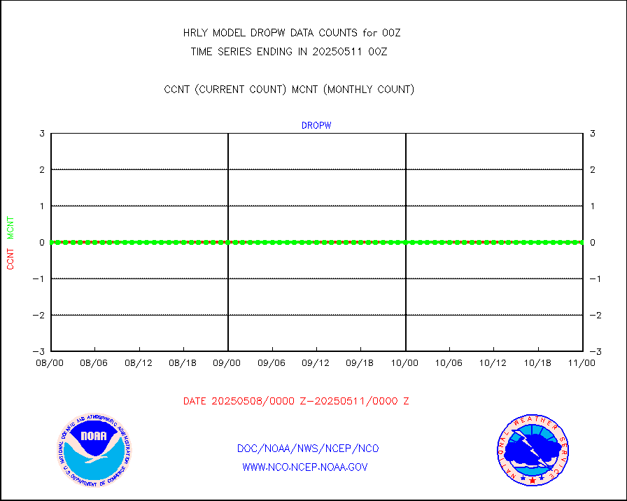
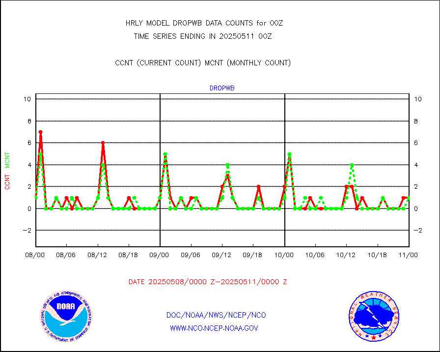
Dropwinsonde (from TEMP DROP) |
0 |
0 |
n/a |
0123.50-0200.49 |
||||||||||
Dropwinsonde (decoded from BUFR) |
1 |
1 |
100.0 % |
0123.51-0200.49 |
||||||||||
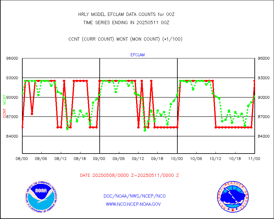
GOES imager effective cloud amount data (U.Wisc.) |
9250602 |
8347882 |
110.8 % |
0123.50-0200.49 |
||||||||||
METOP 1-2 IASI 1C radiance data vbl chn from RARS |
21408 |
20529 |
104.3 % |
0123.00-0123.99 |
||||||||||
NOAA 18-19 & METOP 1-2 MHS proc. btemps from RARS |
116411 |
190752 |
61.0 % |
0123.50-0200.49 |
||||||||||
GOES/NESDIS (11x17 f-o-v) imager clear radiances |
0 |
0 |
n/a |
0123.00-0123.99 |
||||||||||
METOP 1-2 Global Ozone Monitoring Exp.-2 (GOME-2) |
10891 |
9083 |
119.9 % |
0122.50-0123.49 |
||||||||||
GOES-16&up/NESDIS wv imgr/deep-lyr derivd cld mtn |
20818 |
16997 |
122.5 % |
0123.00-0123.99 |
||||||||||
METEOSAT/EUMETSAT wvpr imgr drv cld motion NBseq |
34441 |
36812 |
93.6 % |
0122.50-0123.49 |
||||||||||
METOP 1-2 IASI 1C radiances-direct broadcast SSEC |
51465 |
56460 |
91.2 % |
0122.50-0123.49 |
||||||||||
VIIRS (NPP/NOAA-20) ir lg-wv drv cloud motion(NB) |
14990 |
16659 |
90.0 % |
0120.00-0120.99 |
||||||||||
AVHRR (NOAA/METOP) ir lg-wave derived cld motion |
0 |
0 |
n/a |
0120.00-0120.99 |
||||||||||
AVHRR (METOP) ir lg-wave derived cld motion |
0 |
0 |
n/a |
0123.50-0200.50 |
||||||||||
INSAT/KALPANA India ir lg-wave derived cld motion |
0 |
0 |
n/a |
0121.50-0122.49 |
||||||||||
Korean AMDAR aircraft data (decoded from BUFR) |
43 |
37 |
116.2 % |
0123.50-0200.49 |
||||||||||
Land-based CMAN stations decoded from CMAN format |
97 |
83 |
116.9 % |
0123.50-0200.49 |
||||||||||
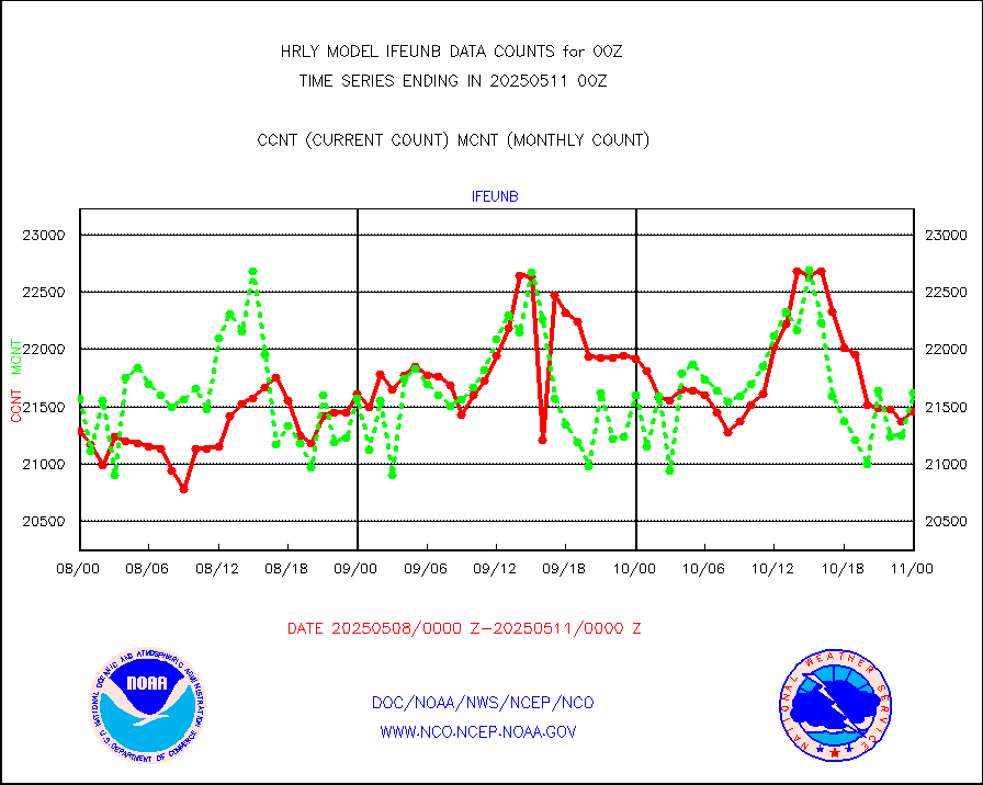
LEO-GEO satellite AMVs from UWisc. |
6189 |
7551 |
82.0 % |
0120.00-0120.99 |
||||||||||
LLDN Long-rng lightning from Vaisala via NOAAPORT |
237700 |
242491 |
98.0 % |
0123.50-0200.49 |
||||||||||
NLDN Shrt-rng lightning from Vaisala via NOAAPORT |
12961 |
10114 |
128.1 % |
0123.50-0200.49 |
||||||||||
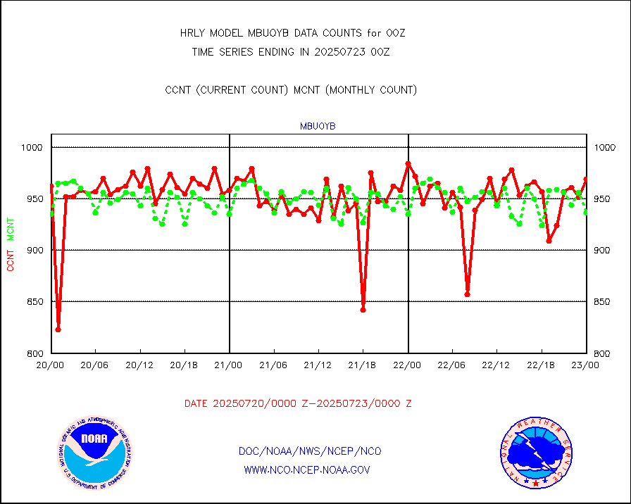
Moored buoys (decoded from BUFR) |
965 |
925 |
104.3 % |
0123.50-0200.50 |
||||||||||
Aura Microwave Limb Sounder (MLS) ozone data |
0 |
0 |
n/a |
0122.00-0122.99 |
||||||||||
Mesonet/MADIS UrbaNet |
3581 |
3619 |
98.9 % |
0123.50-0200.49 |
||||||||||
NEXRAD Vel Azm Dsp(VAD) winds via Level 2 decoder |
473 |
497 |
95.2 % |
0123.50-0200.49 |
||||||||||
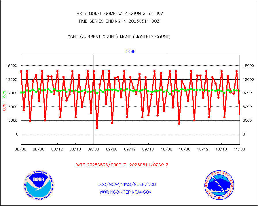
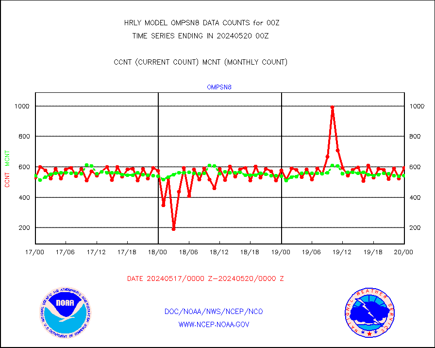
OMPS Limb Profiler ozone data (NPP) |
165 |
267 |
61.8 % |
0117.00-0117.99 |
||||||||||
OMPS nadir profile ozone (Version 8 BUFR) |
508 |
555 |
91.5 % |
0122.00-0122.99 |
||||||||||
OMPS total column ozone (Version 8 BUFR) |
437025 |
326180 |
134.0 % |
0122.00-0122.99 |
||||||||||
PIBAL (decoded from BUFR) |
0 |
1 |
0.0 % |
0123.51-0200.49 |
||||||||||
Manual PIREP aircraft data (dcded from AIREP fmt) |
65 |
83 |
78.3 % |
0123.50-0200.49 |
||||||||||
Profilr winds from PIBAL (PILOT,PILOT SHIP/MOBIL) |
0 |
0 |
n/a |
0123.50-0200.49 |
||||||||||
Rawinsonde - fixed land (decoded from BUFR) |
2 |
1 |
200.0 % |
0123.51-0200.49 |
||||||||||
Rawinsonde - mobile land (from TEMP/PILOT MOBIL) |
0 |
0 |
n/a |
0123.50-0200.49 |
||||||||||
Rawinsonde - mobile land (decoded from BUFR) |
0 |
0 |
n/a |
0123.51-0200.49 |
||||||||||
Rawinsonde - ship (from TEMP SHIP, PILOT SHIP) |
1 |
0 |
n/a |
0123.50-0200.49 |
||||||||||
Rawinsonde - ship (decoded from BUFR) |
0 |
0 |
n/a |
0123.51-0200.49 |
||||||||||
Flight level reconnaissance aircraft data |
0 |
0 |
n/a |
0123.50-0200.49 |
||||||||||
Megha-Tropiques SAPHIR L1A2 brightness temps |
0 |
0 |
n/a |
0121.50-0122.49 |
||||||||||
METEOSAT-10 2nd Gen SEVIRI All Sky Radiance(proc) |
66922 |
74858 |
89.4 % |
0123.50-0200.49 |
||||||||||
Ship - manual and automatic, restricted |
9 |
26 |
34.6 % |
0123.50-0200.49 |
||||||||||
DMSP SSM/IS 1C radiance data (Unified Pre-Proc.) |
112620 |
78864 |
142.8 % |
0122.50-0123.49 |
||||||||||
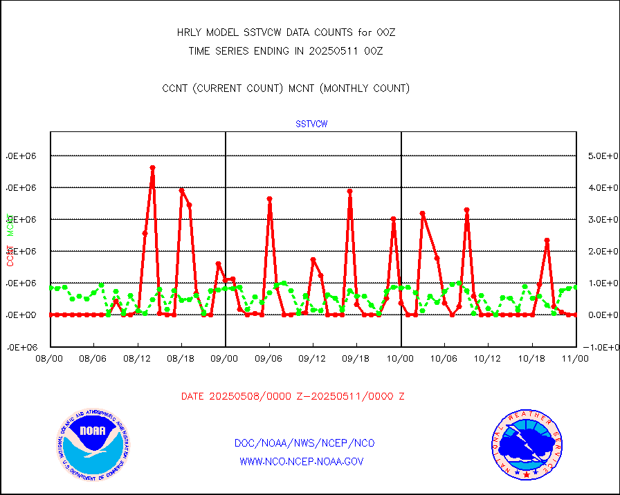
NPP/NOAA-20 VIIRS SST - CLEAR & OVER WATER |
2230818 |
549499 |
406.0 % |
0123.50-0200.49 |
||||||||||
NPP/NOAA-20 VIIRS SST - PROBABLY CLR & OVER WATER |
722000 |
95835 |
753.4 % |
0123.50-0200.49 |
||||||||||
Synoptic - mobile manual and automatic |
651 |
612 |
106.4 % |
0123.50-0200.49 |
||||||||||
Synoptic - mobile manual & auto (decoded fr BUFR) |
1 |
1 |
100.0 % |
0123.50-0200.49 |
||||||||||
CTD probe, Argo prflng float, mooring (TESAC fmt) |
227 |
211 |
107.6 % |
0123.50-0200.49 |
||||||||||
TAMDAR aircft data-all types(from Panasonic,BUFR) |
57 |
41 |
139.0 % |
0123.50-0200.49 |
||||||||||
ThermoSalinoGraph (TSG) TRACKOB format) |
91 |
94 |
96.8 % |
0122.50-0123.49 |
||||||||||
INSAT/KALPANA India visible derived cloud motion |
0 |
0 |
n/a |
0121.50-0122.49 |
||||||||||
INDIA SATWIND, INSAT VIS channel |
0 |
0 |
n/a |
0123.00-0123.99 |
||||||||||
MTSAT/JMA visible derived cloud motion |
8450 |
7680 |
110.0 % |
0121.50-0122.49 |
||||||||||
GOES-16&up/NESDIS visible derived cloud motion |
420768 |
367347 |
114.5 % |
0123.00-0123.99 |
||||||||||
METEOSAT/EUMETSAT visible drv cld motion NBseq |
0 |
0 |
n/a |
0122.50-0123.49 |
||||||||||


