| Suspect Data Shortages in Critical Types - Monitor | ||||||||||||||
|---|---|---|---|---|---|---|---|---|---|---|---|---|---|---|
| Type | Description | Hourly Count | Monthly Average | Percent (%) of Monthly Mean | ||||||||||
NOAA 18-19 & METOP 1-2 HIRS-4 NCEP-proc. br.temps |
0 |
67552 |
0.0 % |
|||||||||||
NOAA 15-19 & METOP 1-2 HIRS-3/4 pr btmps frm RARS |
0 |
165335 |
0.0 % |
|||||||||||
| Shortage in Data Type of Opportunity - Monitor | ||||||||||||||
|---|---|---|---|---|---|---|---|---|---|---|---|---|---|---|
| Type | Description | Hourly Count | Monthly Average | Percent (%) of Monthly Mean | ||||||||||
P.M.(N18-19) AVHRR GAC NCEP-proc clr & sea btemps |
0 |
2100271 |
0.0 % |
|||||||||||
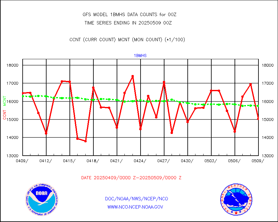
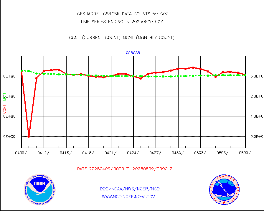
NPP Adv. Tech. MW Sndr (ATMS) br. temps from RARS |
9216 |
41854 |
22.0 % |
|||||||||||
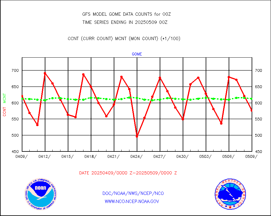
Grnd-based Gbl Navigation Sat System (GNSS) data |
1019 |
5033 |
20.2 % |
|||||||||||
INDIA SATWIND, INSAT WV channel |
0 |
21043 |
0.0 % |
|||||||||||
High Density OBs from reconnaissance acft data |
0 |
122 |
0.0 % |
|||||||||||
INDIA SATWIND, INSAT IR channel |
0 |
32299 |
0.0 % |
|||||||||||
DMSP SSM/IS 1C radiance data (Unified Pre-Proc.) |
207480 |
645646 |
32.1 % |
|||||||||||
NPP/NOAA-20 VIIRS SST - CLEAR & OVER WATER |
31 |
2333357 |
0.0 % |
|||||||||||
| Excess in Data Type of Opportunity - Monitor | ||||||||||||||
|---|---|---|---|---|---|---|---|---|---|---|---|---|---|---|
| Type | Description | Hourly Count | Monthly Average | Percent (%) of Monthly Mean | ||||||||||
PIBAL (decoded from BUFR) |
30 |
3 |
n/a |
|||||||||||
| Critical Data with Normal Counts | ||||||||||||||
|---|---|---|---|---|---|---|---|---|---|---|---|---|---|---|
| Type | Description | Hourly Count | Monthly Average | Percent (%) of Monthly Mean | ||||||||||
NOAA 15-19 & METOP 1-2 AMSU-A NCEP-proc. br.temps |
131676 |
170457 |
77.2 % |
|||||||||||
NOAA 18-19 & METOP 1-2 MHS NCEP-proces. br. temps |
1174819 |
1353419 |
86.8 % |
|||||||||||
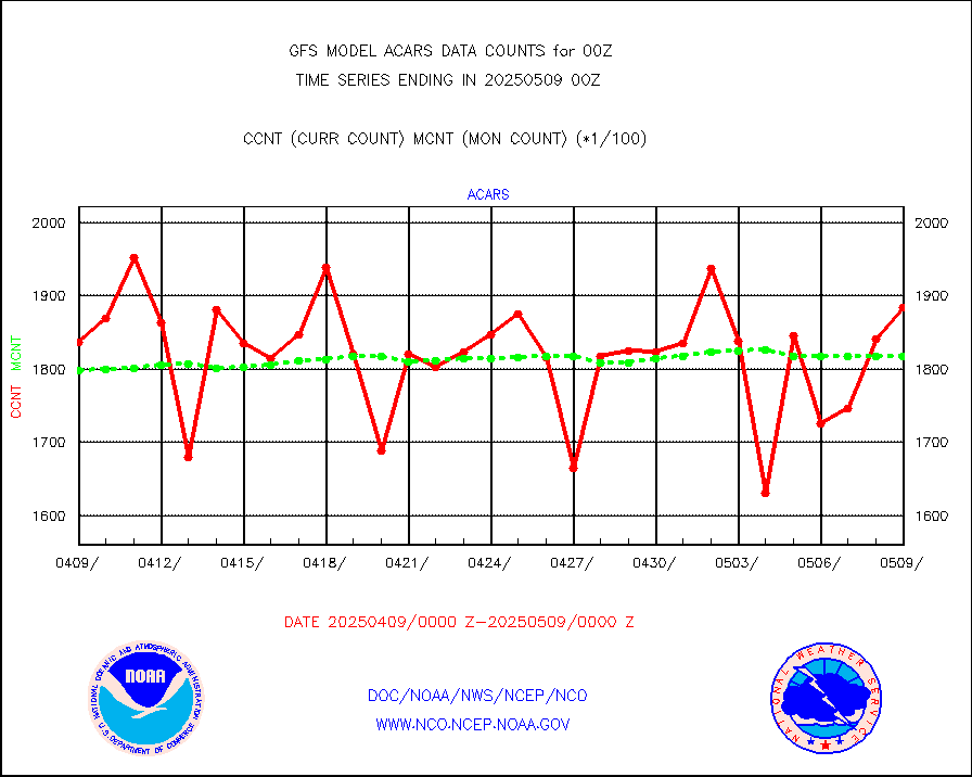
MDCRS ACARS acft data from ARINC(dcded from BUFR) |
195321 |
187833 |
104.0 % |
|||||||||||
Himawari Clear Sky Radiance |
242378 |
246583 |
98.3 % |
|||||||||||
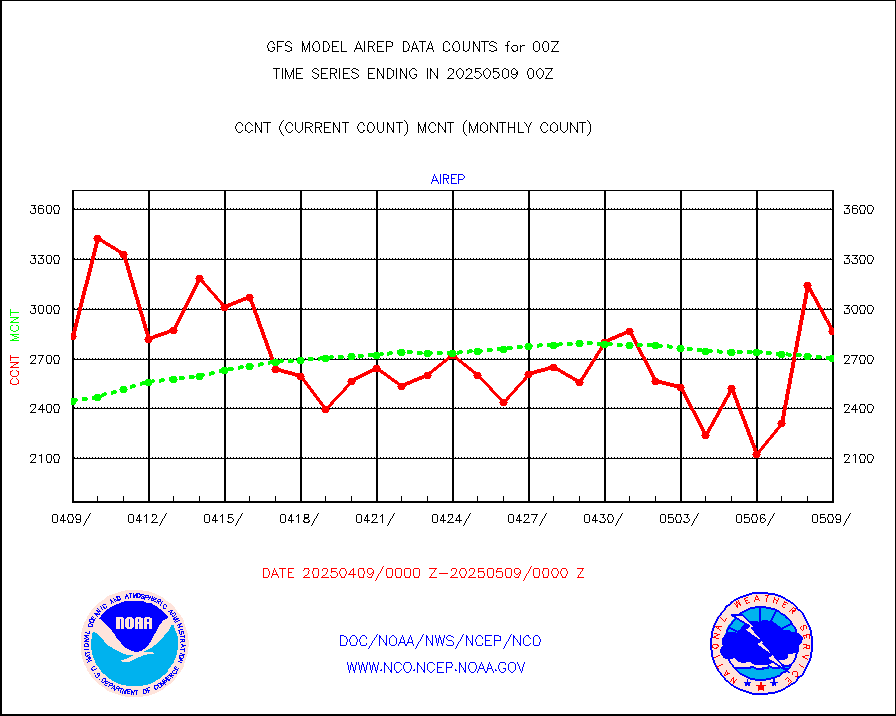
Manual AIREP aircraft data (dcded from AIREP fmt) |
2373 |
2815 |
84.3 % |
|||||||||||
AQUA AIRS/AMSU-A/HSB brightness temps- every FOV |
0 |
0 |
n/a |
|||||||||||
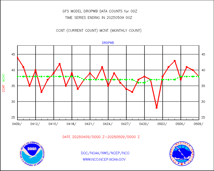
AMDAR aircraft data (decoded from AMDAR format) |
3700 |
3510 |
105.4 % |
|||||||||||
AMDAR aircraft data (decoded from BUFR) |
13822 |
14926 |
92.6 % |
|||||||||||
METOP 1-2 ASCAT products |
377328 |
368250 |
102.5 % |
|||||||||||
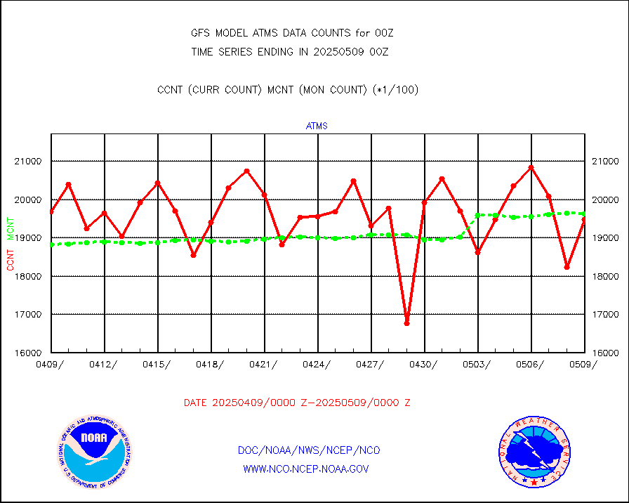
NPP/NOAA-20 ATMS brightness temperatures |
1818912 |
1942362 |
93.6 % |
|||||||||||
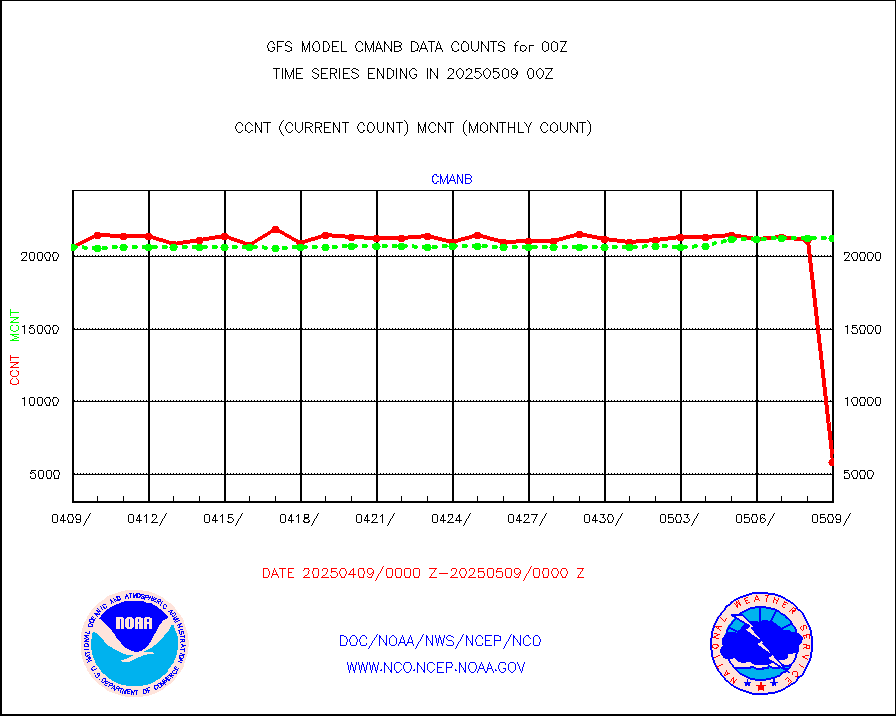
Surface Marine CMAN rpts decoded from BUFR format |
21603 |
21389 |
101.0 % |
|||||||||||
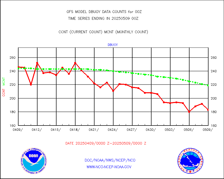
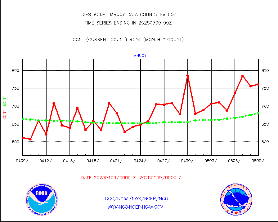
Buoys decoded from FM-18 fmt (moored or drifting) |
93 |
131 |
71.0 % |
|||||||||||
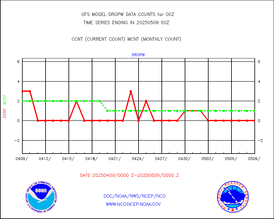
Dropwinsonde (from TEMP DROP) |
0 |
0 |
n/a |
|||||||||||
E-AMDAR (European AMDAR acft decoded from BUFR) |
8084 |
8715 |
92.8 % |
|||||||||||
NOAA 15-19 & METOP 1-2 AMSU-A proc btmps frm RARS |
134465 |
181473 |
74.1 % |
|||||||||||
GPS radio occultation data |
2452 |
2597 |
94.4 % |
|||||||||||
GOES-16/17 All Sky Radiances (proc.) |
5897109 |
5941475 |
99.3 % |
|||||||||||
GOES-16/17 Clear Sky Radiances (proc.) |
3028220 |
3118973 |
97.1 % |
|||||||||||
MTSAT/JMA water vapor imager derived cloud motion |
62927 |
58838 |
106.9 % |
|||||||||||
MODIS (AQUA/TERRA) wvpr imager derived cld motion |
0 |
0 |
n/a |
|||||||||||
GOES-16&up/NESDIS wv imgr/cld-top derived cld mtn |
166374 |
179182 |
92.9 % |
|||||||||||
METEOSAT/EUMETSAT ir lg-wave drv cld motion NBseq |
105377 |
104331 |
101.0 % |
|||||||||||
MTSAT/JMA infrared long-wave derived cloud motion |
50337 |
49052 |
102.6 % |
|||||||||||
MODIS (AQUA/TERRA) ir l-wave derived cloud motion |
0 |
0 |
n/a |
|||||||||||
GOES-16&up/NESDIS ir long-wave derived cld motion |
467064 |
496032 |
94.2 % |
|||||||||||
Land-based CMAN stations decoded from CMAN format |
496 |
468 |
106.0 % |
|||||||||||
LEO-GEO satellite AMVs from UWisc. |
20702 |
21483 |
96.4 % |
|||||||||||
Buoys decoded from FM-13 format (moored) |
794 |
801 |
99.1 % |
|||||||||||
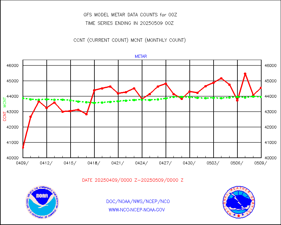
Aviation - METAR |
44404 |
44084 |
100.7 % |
|||||||||||
METOP 1-2 IASI 1C radiance data (varbl. channels) |
472284 |
469219 |
100.7 % |
|||||||||||
NEXRAD Vel Azm Dsp(VAD) winds via radar coded msg |
0 |
0 |
n/a |
|||||||||||
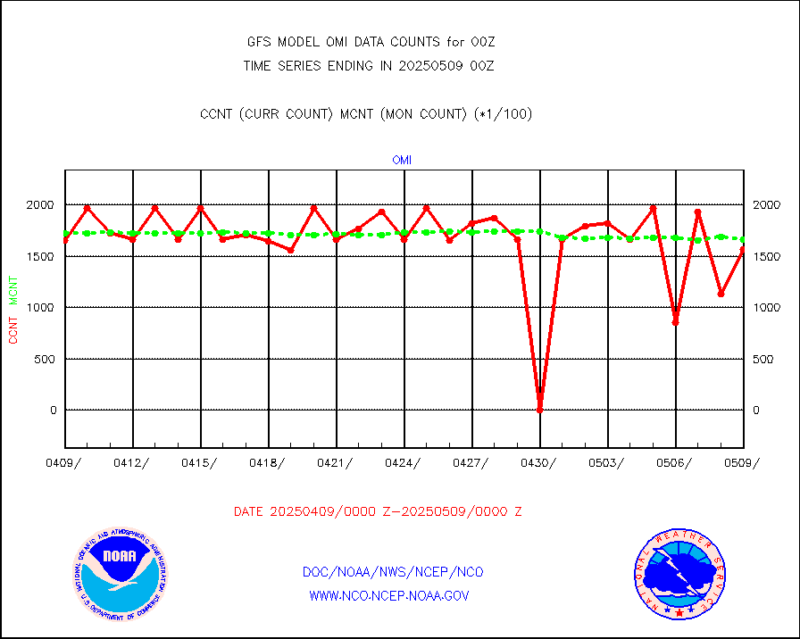
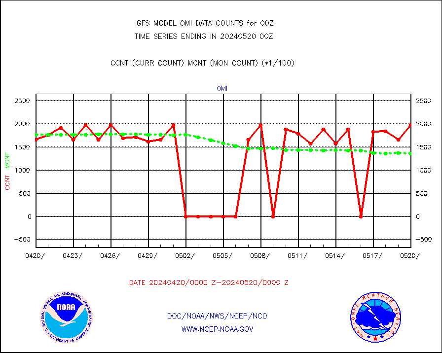
Aura Ozone Monitoring Instrument (OMI) data |
0 |
0 |
n/a |
|||||||||||
NOAA 16-19 Solar Backscatter UV-2 rad frm V8 BUFR |
0 |
0 |
n/a |
|||||||||||
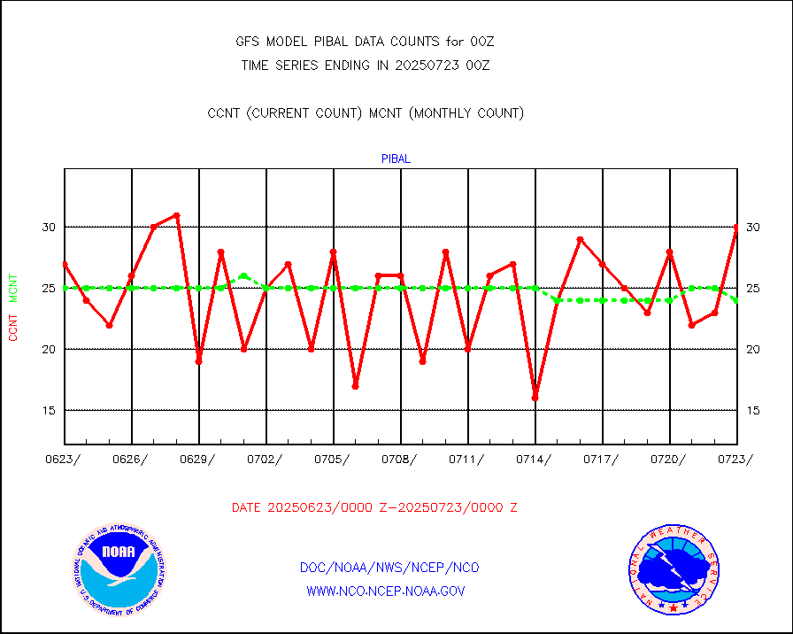
PIBAL (from PILOT, PILOT SHIP, PILOT MOBIL) |
20 |
26 |
76.9 % |
|||||||||||
Profilr winds from PIBAL (PILOT,PILOT SHIP/MOBIL) |
0 |
0 |
n/a |
|||||||||||
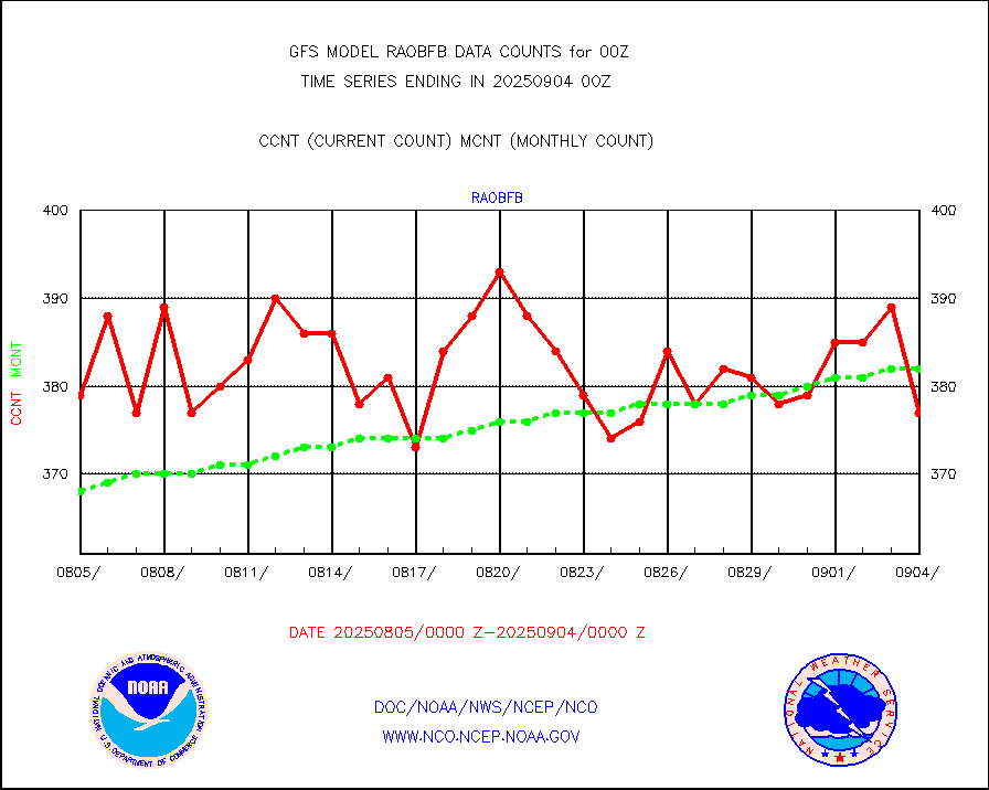
Rawinsonde - fixed land (from TEMP or PILOT) |
593 |
586 |
101.2 % |
|||||||||||
Rawinsonde - mobile land (from TEMP/PILOT MOBIL) |
0 |
0 |
n/a |
|||||||||||
Rawinsonde - ship (from TEMP SHIP, PILOT SHIP) |
1 |
1 |
100.0 % |
|||||||||||
Flight level reconnaissance aircraft data |
0 |
1 |
0.0 % |
|||||||||||
Ship - manual and automatic, restricted |
172 |
134 |
128.4 % |
|||||||||||
Ship - manual and automatic, restricted (BUFR) |
547 |
549 |
99.6 % |
|||||||||||
Ship - manual and automatic, unrestricted |
831 |
937 |
88.7 % |
|||||||||||
Ship - manual and automatic, unrestricted (BUFR) |
6221 |
6245 |
99.6 % |
|||||||||||
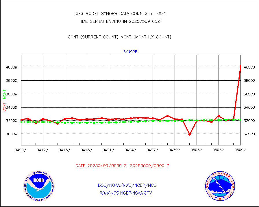
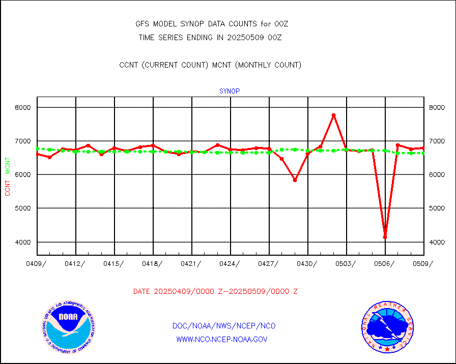
Synoptic - fixed manual & auto (decoded fr BUFR) |
37981 |
39977 |
95.0 % |
|||||||||||
Synoptic - mobile manual and automatic |
4272 |
4029 |
106.0 % |
|||||||||||
Synoptic - restricted (WMO Res 40) manual & auto. |
4 |
6 |
66.7 % |
|||||||||||
Synoptic - restricted (WMO Res 40)(decoded BUFR) |
2331 |
2357 |
98.9 % |
|||||||||||
Synoptic - mobile manual & auto (decoded fr BUFR) |
247 |
257 |
96.1 % |
|||||||||||
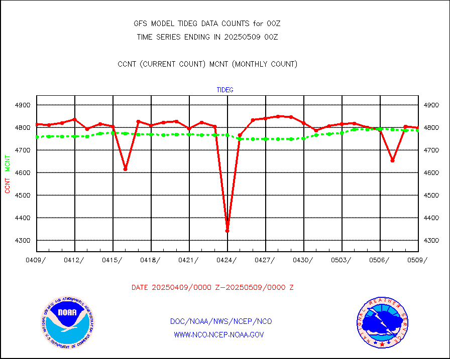
Tide gauge reports decoded from CREX format |
4768 |
4803 |
99.3 % |
|||||||||||
MTSAT/JMA visible derived cloud motion |
31355 |
31152 |
100.7 % |
|||||||||||
METEOSAT/EUMETSAT visible drv cld motion NBseq |
4356 |
4360 |
99.9 % |
|||||||||||
| Data Types of Opportunity with Normal Counts | ||||||||||||||
|---|---|---|---|---|---|---|---|---|---|---|---|---|---|---|
| Type | Description | Hourly Count | Monthly Average | Percent (%) of Monthly Mean | ||||||||||
GOES-16&up/NESDIS ir short-wv derived cld motion |
77819 |
89501 |
86.9 % |
|||||||||||
MDCRS ACARS acft data (ARINC via AFWA)(AIREP fmt) |
0 |
0 |
n/a |
|||||||||||
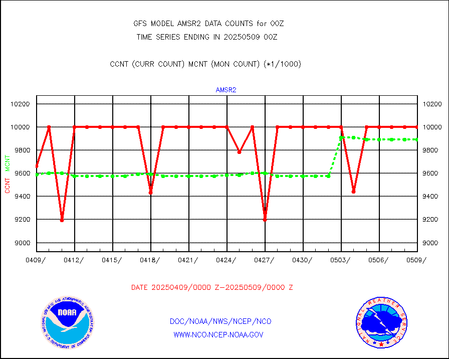
GCOM-W AMSR2 1B brightness temperatures |
9999999 |
9892321 |
101.1 % |
|||||||||||
NPP/NOAA-20 ATMS bright. temps-direct b-cast SSEC |
396846 |
469780 |
84.5 % |
|||||||||||
A.M.(N17,M2,M3) AVHRR GAC NCEP-proc clr&sea btmps |
6468435 |
6487605 |
99.7 % |
|||||||||||
eXpendable BathyThermograph, mooring (BATHY fmt) |
0 |
0 |
n/a |
|||||||||||
Canadian AMDAR aircraft data (decoded from BUFR) |
0 |
0 |
n/a |
|||||||||||
NPP/NOAA-20 CrIS full spctrl radn (431 ch subset) |
1185336 |
1195470 |
99.2 % |
|||||||||||
NPP/NOAA-20 CrIS full spctrl radn dir brdcst SSEC |
104220 |
164915 |
63.2 % |
|||||||||||
Coast Guard |
29 |
34 |
85.3 % |
|||||||||||
Drifting buoys (decoded from BUFR) |
8934 |
8952 |
99.8 % |
|||||||||||
Dropwinsonde (decoded from BUFR) |
38 |
39 |
97.4 % |
|||||||||||
METOP 1-2 IASI 1C radiance data vbl chn from RARS |
122006 |
145811 |
83.7 % |
|||||||||||
NOAA 18-19 & METOP 1-2 MHS proc. btemps from RARS |
1238347 |
1711638 |
72.3 % |
|||||||||||
GOES/NESDIS (11x17 f-o-v) imager clear radiances |
0 |
0 |
n/a |
|||||||||||
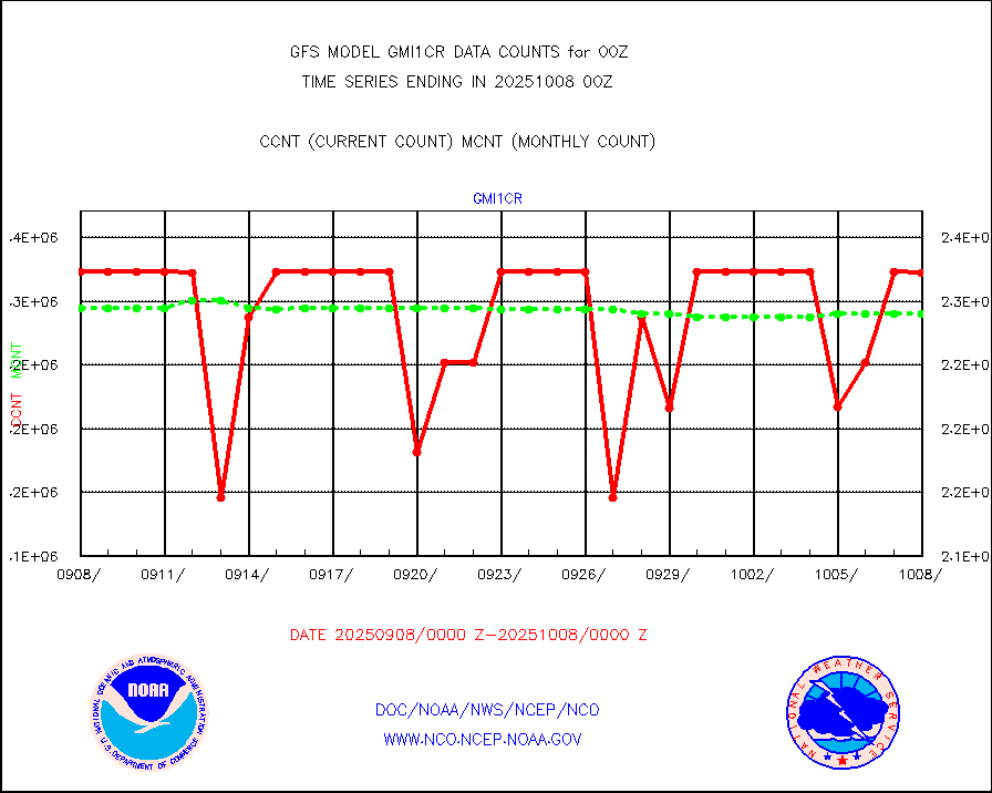
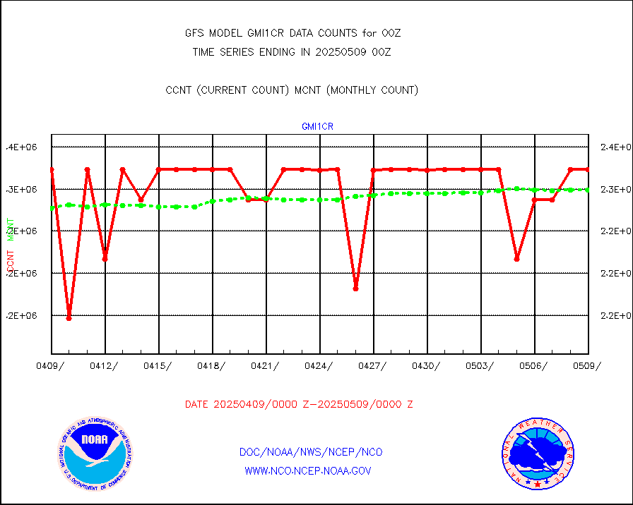
GPM GMI Level 1C-R brightness temperatures |
2322710 |
2280256 |
101.9 % |
|||||||||||
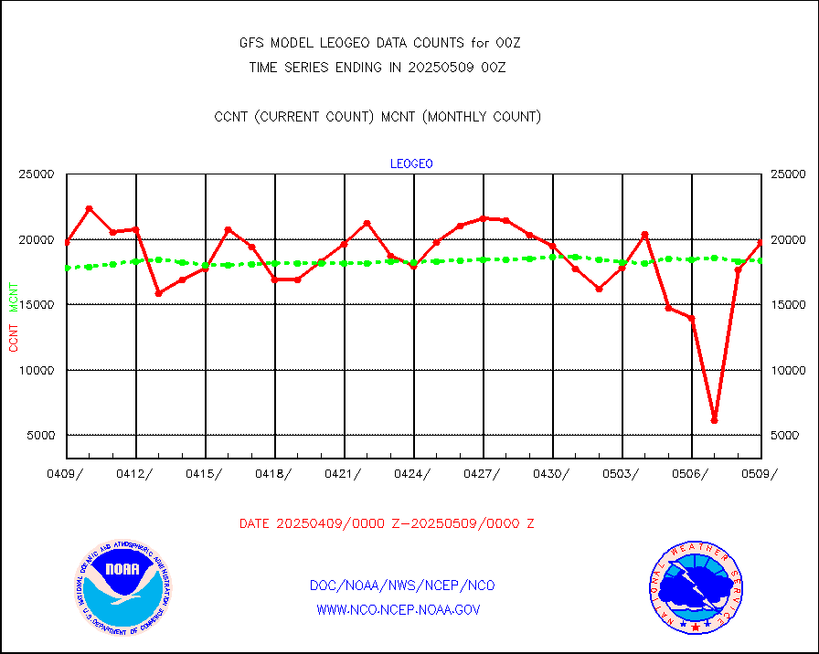
METOP 1-2 Global Ozone Monitoring Exp.-2 (GOME-2) |
59355 |
61635 |
96.3 % |
|||||||||||
INSAT/KALPANA India wvpr derived cloud motion |
0 |
0 |
n/a |
|||||||||||
GOES-16&up/NESDIS wv imgr/deep-lyr derivd cld mtn |
115254 |
104298 |
110.5 % |
|||||||||||
METEOSAT/EUMETSAT wvpr imgr drv cld motion NBseq |
177969 |
183102 |
97.2 % |
|||||||||||
METOP 1-2 IASI 1C radiances-direct broadcast SSEC |
281703 |
342044 |
82.4 % |
|||||||||||
VIIRS (NPP/NOAA-20) ir lg-wv drv cloud motion(NB) |
49757 |
53248 |
93.4 % |
|||||||||||
AVHRR (NOAA/METOP) ir lg-wave derived cld motion |
0 |
0 |
n/a |
|||||||||||
AVHRR (METOP) ir lg-wave derived cld motion |
29752 |
20789 |
143.1 % |
|||||||||||
INSAT/KALPANA India ir lg-wave derived cld motion |
0 |
0 |
n/a |
|||||||||||
Korean AMDAR aircraft data (decoded from BUFR) |
451 |
399 |
113.0 % |
|||||||||||
Moored buoys (decoded from BUFR) |
7344 |
7120 |
103.1 % |
|||||||||||
NEXRAD Vel Azm Dsp(VAD) winds via Level 2 decoder |
5101 |
4512 |
113.1 % |
|||||||||||
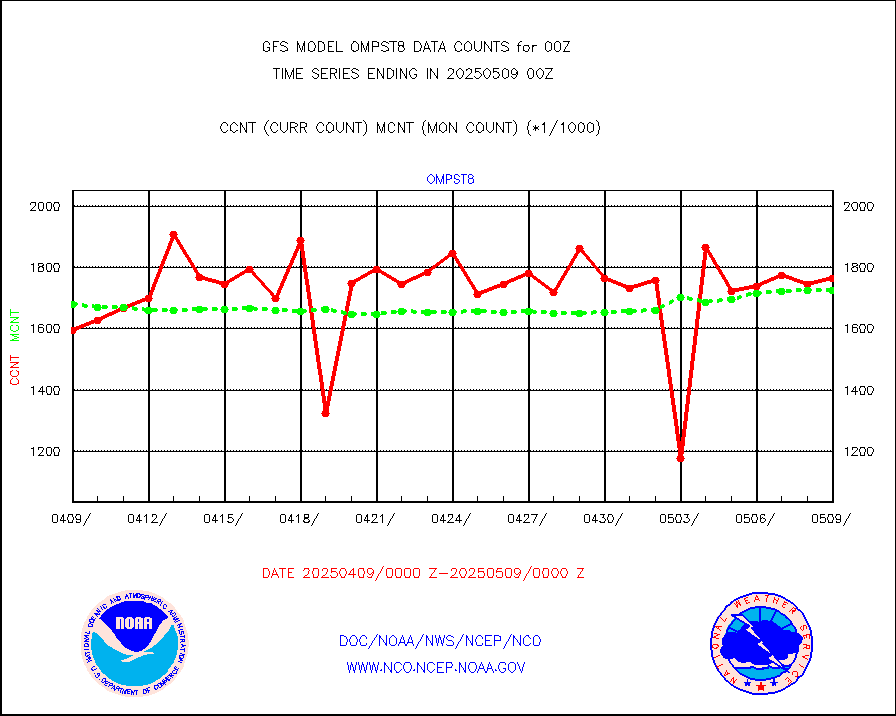
OMPS Limb Profiler ozone data (NPP) |
927 |
805 |
115.2 % |
|||||||||||
OMPS nadir profile ozone (Version 8 BUFR) |
2764 |
2845 |
97.2 % |
|||||||||||
OMPS total column ozone (Version 8 BUFR) |
1690105 |
1722307 |
98.1 % |
|||||||||||
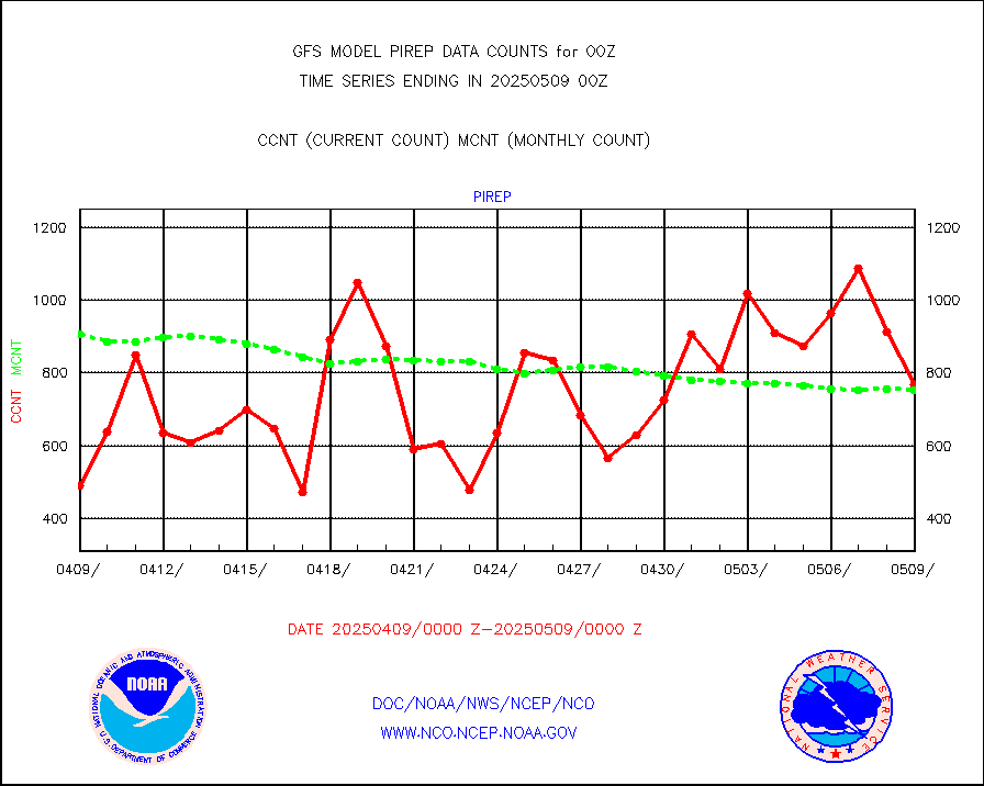
Manual PIREP aircraft data (dcded from AIREP fmt) |
607 |
593 |
102.4 % |
|||||||||||
Multi-Agency Profiler (MAP) and SODAR winds |
384 |
361 |
106.4 % |
|||||||||||
Rawinsonde - fixed land (decoded from BUFR) |
373 |
379 |
98.4 % |
|||||||||||
Rawinsonde - mobile land (decoded from BUFR) |
0 |
0 |
n/a |
|||||||||||
Rawinsonde - ship (decoded from BUFR) |
4 |
3 |
133.3 % |
|||||||||||
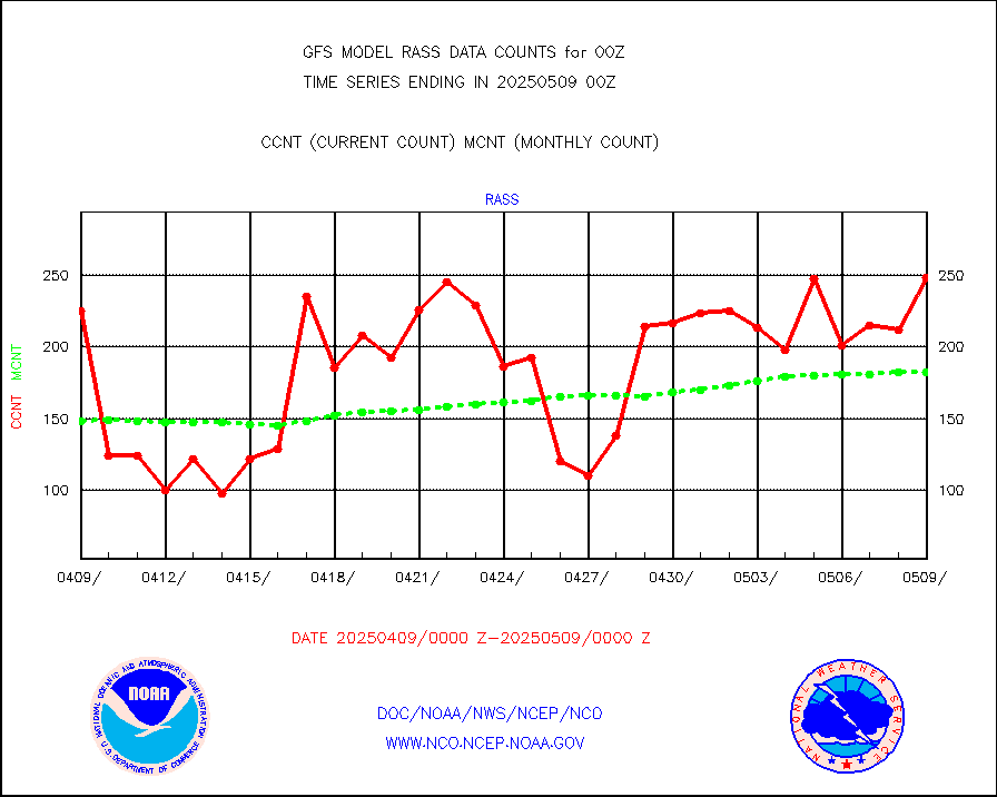
RASS temperatures (NOAA and Multi-Agency) |
155 |
167 |
92.8 % |
|||||||||||
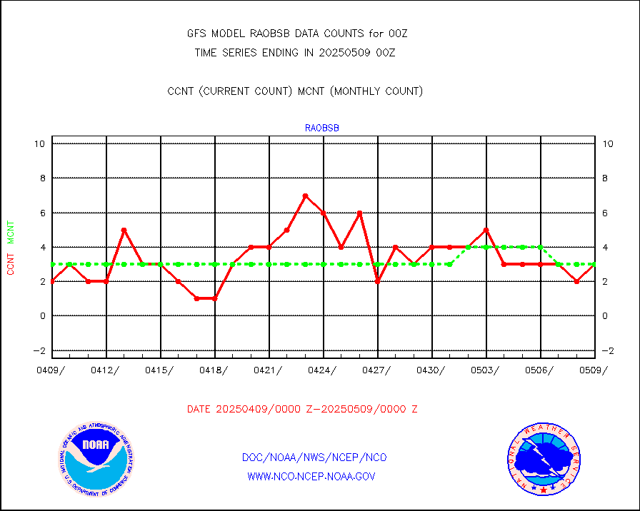
Surface Marine Saildrone (decoded from BUFR) |
4 |
5 |
80.0 % |
|||||||||||
METEOSAT-10 2nd Gen SEVIRI All Sky Radiance(proc) |
377110 |
376419 |
100.2 % |
|||||||||||
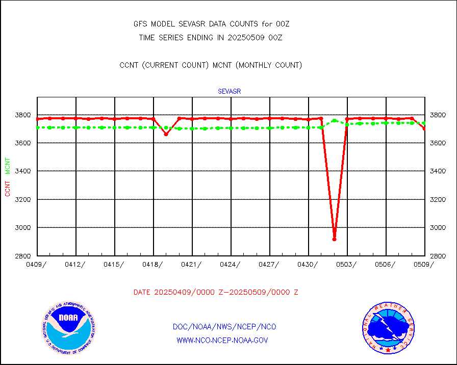
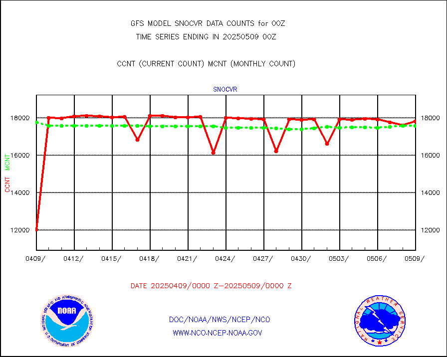
NOW COVER, DEPTH/DENSITY AND WATER EQUIVALENT |
15756 |
16536 |
95.3 % |
|||||||||||
NPP/NOAA-20 VIIRS SST - PROBABLY CLR & OVER WATER |
9999999 |
9999999 |
100.0 % |
|||||||||||
Synoptic - fixed manual and automatic |
6683 |
6530 |
102.3 % |
|||||||||||
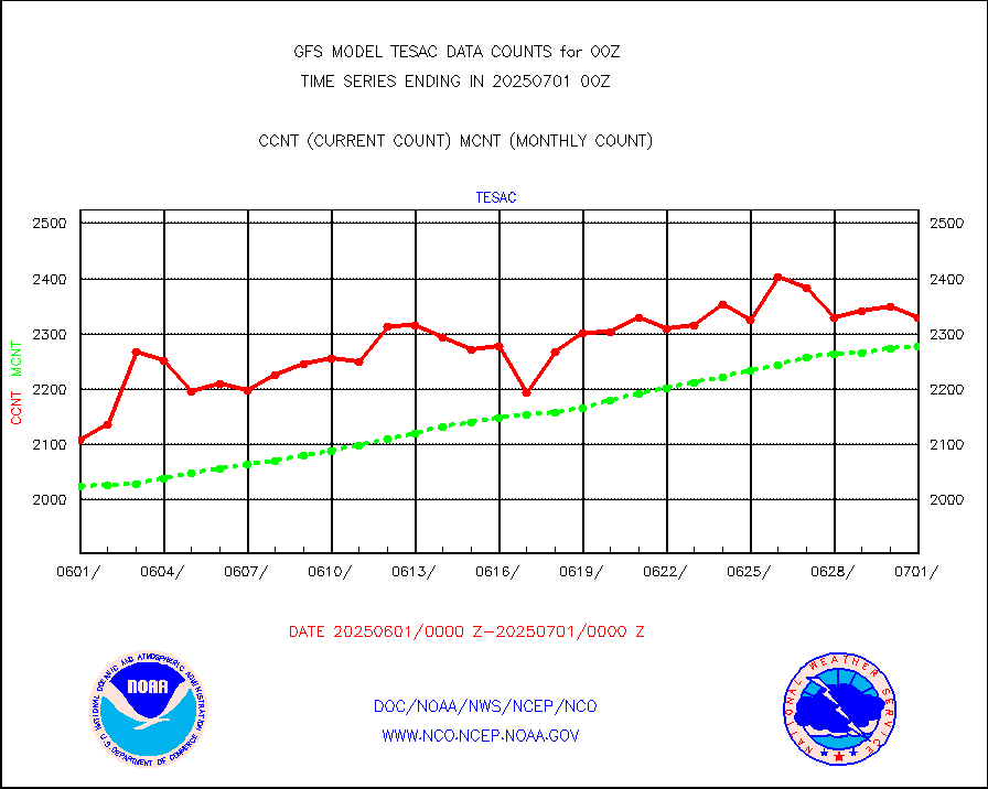
CTD probe, Argo prflng float, mooring (TESAC fmt) |
2329 |
2277 |
102.3 % |
|||||||||||
TAMDAR aircft data-all types(from Panasonic,BUFR) |
190 |
271 |
70.1 % |
|||||||||||
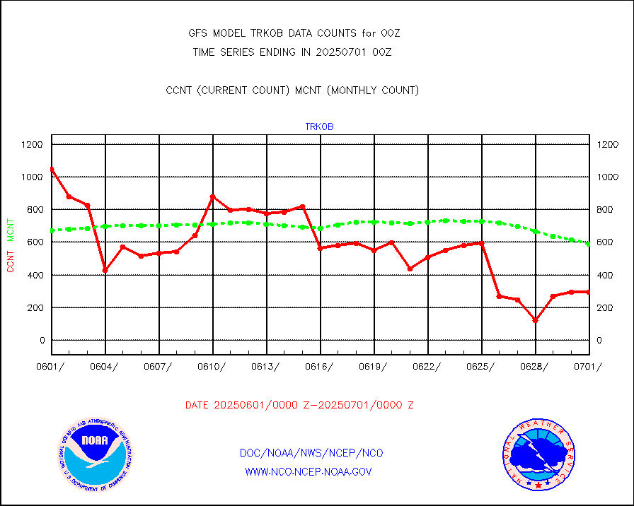
ThermoSalinoGraph (TSG) TRACKOB format) |
296 |
587 |
50.4 % |
|||||||||||
INSAT/KALPANA India visible derived cloud motion |
0 |
0 |
n/a |
|||||||||||
INDIA SATWIND, INSAT VIS channel |
0 |
4 |
0.0 % |
|||||||||||
GOES-16&up/NESDIS visible derived cloud motion |
1934469 |
2005986 |
96.4 % |
|||||||||||


