| VALUE | GRID | GRID INCREMENT | GRID Image |
|
|---|---|---|---|---|
| 1 | 1679-point (73x23) Mercator grid with (1,1) at (0W,48.09S),
(73,23) at (0W,48.09N); I increasing eastward, Equator at J=12. See GRIB Specifications |
5 degs of Longitude | GIF |
PS |
| 2 | 10512-point (144x73) global longitude-latitude grid. (1,1) at (0E, 90N), matrix layout. N.B.: prime meridian not duplicated. | 2.5 deg | GIF | PS |
| 3 | 65160-point (360x181) global longitude-latitude grid. (1,1)
at (0E, 90N), matrix layout. N.B.: prime meridian not duplicated. See GRIB Specifications |
1.0 deg | GIF | PS |
| 4 | 259920-point (720x361) global Lon/Lat grid. (1,1) at (0E, 90N); matrix layout; prime meridian not duplicated | 0.5 deg | GIF | PS |
| 5 | 3021-point (53x57) N. Hemisphere Polar Stereographic grid oriented 105W; Pole at (27,49). (LFM analysis) | 190.5 km at 60N | GIF | PS |
| 6 | 2385-point (53x45) N. Hemisphere Polar Stereographic grid oriented 105W; Pole at (27,49). (LFM Forecast) | 190.5 km at 60N | GIF | PS |
| 8 | 5104-point (116x44) Mercator grid with (1.1) at (3.1035E,48.67S) and (116,44) At (0.000W,61.05N); I increasing eastward, Equator at j=19. | 3.105 degs of longitude | GIF | PS |
| 10 |
25020-point
(180x139) longitude-latitude ocean grid with (1,1) at (1E,64N),
(180,139) at (1W,74S); I increasing eastward, Equator at J=65 See GRIB Specifications |
2 degs of Lon and 1 deg of Lat | ||
| 11 |
Global
0.5 degree Latitude/Longitude grid (Used by Global Multi-Grid Wave Model) See GRIB Specifications |
0.5 degree | ||
| 12 |
0.167
degree Latitude/Longitude grid - US East Coast (Used by Global Multi-Grid Wave Model) See GRIB Specifications |
0.167 degree | ||
| 13 |
0.167
degree Latitude/Longitude grid - US West Coast (Used by Global Multi-Grid Wave Model) See GRIB Specifications |
0.167 degree | ||
| 14 |
0.167
degree Latitude/Longitude grid US Eastern Pacific - includes Hawaii and extends to the Pacific islands of Guam (Used by Global Multi-Grid Wave Model) See GRIB Specifications |
0.167 degree | ||
| 15 |
0.250x0.167
degree Latitude/Longitude grid - Alaska (Used by Global Multi-Grid Wave Model) See GRIB Specifications |
0.25 degree Lat and 0.167 degree Lon | ||
| 16 |
0.133x0.067
degree Latitude/Longitude grid - Alaska (Used by Global Multi-Grid Wave Model) See GRIB Specifications |
0.133 degree Lat and 0.067 degree Lon | ||
| 17 |
0.067
degree Latitude/Longitude grid - US West Coast (includes Hawaii) (Used by Global Multi-Grid Wave Model) See GRIB Specifications |
0.067 degree | ||
| 18 |
0.067
degree Latitude/Longitude grid - US East Coast (Used by Global Multi-Grid Wave Model) See GRIB Specifications |
0.067 degree | ||
| 21-26 | International Exchange and Family of
Services (FOS) grids. See GRIB Specifications |
|||
| 27 | 4225-point (65x65) N. Hemisphere Polar Stereographic grid oriented 80W; Pole at (33,33). | 381 km at 60N | GIF | PS |
| 28 | 4225-point (65x65) S. Hemisphere Polar Stereographic grid oriented 280E ( 80W ); Pole at (33,33). | 381 km at 60S | GIF | PS |
| 29 | 5365-point (145x37) N. Hemisphere longitude/latitude grid for latitudes 0N to 90N; (1,1) at (0E,0N). | 2.5 degs | GIF | PS |
| 30 | 5365-point (145x37) S. Hemisphere longitude/latitude grid for latitudes 90S to 0S; (1,1) at (0E,90S). | 2.5 degs | GIF | PS |
| 33 | 8326-point (181x46) N. Hemisphere longitude/latitude grid for latitudes 0N to 90N; (1,1) at (0E,0N). | 2 degs | GIF | PS |
| 34 | 8326-point (181x46) S. Hemisphere longitude/latitude grid for latitudes 90S to 0S; (1,1) at (0E,90S). | 2 degs | GIF | PS |
| 37-44 | Eight Lat-Lon 1.25x1.25 "thinned" grids, covering the globe
by octants of 3447
points. For WAFS, ICAO, Family of Services (FOS), and International
exchange. See GRIB Specifications |
|||
| 45 | Global latitude/longitude 1.25 deg Resolution. See GRIB Specifications |
GIF | PS | |
| 50 | Family of Services "regional grid". See GRIB Specifications |
|||
| 53 | 5967-point (117x51) Mercator grid with (1,1) at (0.000W,61.05S) and (117,51) At (0.000W,61.05N); I increasing eastward, Equator at j=26. | 3.105 degs of longitude | GIF | PS |
| 55 | 6177-point (87x71) N. Hemisphere Polar Stereographic grid oriented 105W; Pole at (44,38). (2/3 bedient NH sfc anl) | 254 km at 60N | GIF | PS |
| 56 | 6177-point (87x71) N. Hemisphere Polar Stereographic grid oriented 105W; Pole at (40,73). (1/3 bedient NA sfc anl) | 127 km at 60N | GIF | PS |
| 61-64 | International Exchange & FOS grids. See GRIB Specifications |
|||
| 75 | 12321-point (111x111) N. Hemisphere Lambert Conformal grid. No fixed location; used by QLM Hurricane model. | 40 km at 30&60 deg N | ||
| 76 | 12321-point (111x111) S. Hemisphere Lambert Conformal grid. No fixed location; used by QLM Hurricane model. | 40 km at 30&60 deg S | ||
| 77 | 12321-point (111x111) N. Hemisphere Mercator grid. No fixed location; used by QLM Hurricane model. | 40 km at 22.5 deg N&S | ||
| 83 | Arakawa semi-staggeblack A-grid on rotate Latitude/Longitude grid (used by 13km Rapid Refresh) See GRIB Specifications |
13 km | ||
| 85 | 32400-point (360x90) N. Hemisphere longitude/latitude grid; longitudes: 0.5E to 359.5E (0.5W); latitudes: 0.5N to 89.5N; origin (1,1) at (0.5E,0.5N) | 1 deg | GIF | PS |
| 86 | 32400-point (360x90) S. Hemisphere longitude/latitude grid; longitudes: 0.5E to 359.5E (0.5W); latitudes: 89.5S to 0.5S; origin (1,1) at (0.5E,89.5S) | 1 deg | GIF | PS |
| 87 | 5022 point (81x62) N. Hemisphere Polar Stereographic grid
oriented at 105W. Pole at (31.91, 112.53) Used for RUC. (60 km at 40N). See GRIB Specifications |
68.153 km at 60N | GIF | PS |
| 88 | 317840 point (580x548) N. American Polar Stereographic grid
oriented at 105W. Pole at (260.853, 613.176) Used for RSAS. (15 km at
60N). See GRIB Specifications |
15 km at 60N | GIF | PS |
| 90 | 11807617-point (4289x2753) Grid Over CONUS - Lambert Conformal (Used by RTMA output for quadruple-resolution NDFD grid) See GRIB Specifications |
1.27 km | ||
| 91 | 1822145-point (1649x1105) Grid Over Alaska - Polar Stereographic (Used by RTMA and NAM smartinit for double-resoulution NDFD grids) See GRIB Specifications |
2.976 km | ||
| 92 | 7283073-point (3297x2209) Grid Over Alaska - Polar Stereographic (Used by RTMA and NAM smartinit for quadruple-resoulution NDFD grids) See GRIB Specifications |
1.488 km | ||
| 93 | 111723-point (223x501) Arakawa staggeblack E-grid on rotated
latitude/longitude grid (used by the 8 km NMM model - Alaska). See GRIB Specifications |
|||
| 94 | Staggeblack B-grid on rotated latitude/longitude grid (NAM Alaska 6km nest) See GRIB Specifications |
6.0 km | ||
| 95 | Staggeblack E-grid on rotated latitude/longitude grid (NAM Puert Rico 3km nest) See GRIB Specifications |
3.0 km | ||
| 96 | Staggeblack B-grid on rotated latitude/longitude grid (NAM Hawaii 3km nest) See GRIB Specifications |
3.0 km | ||
| 97 | Staggeblack B-grid on rotated latitude/longitude grid (NAM CONUS 4km nest) See GRIB Specifications |
4.0 km | ||
| 98 | Global Gaussian T62 grid. See GRIB Specifications |
|||
| 99 | 779385-point (669x1165) Arakawa staggeblack
E-grid on rotated latitude/longitude grid (Used by the 12km NAM Model -
expanded domain). See GRIB Specifications |
|||
| 100 | 6889-point (83x83) N. Hemisphere Polar Stereographic grid oriented 105W; Pole at (40.5,88.5). (NGM Original C-Grid) | 91.452 km at 60N | GIF | PS |
| 101 | 10283-point (113x91) N. Hemisphere Polar Stereographic grid oriented 105W; Pole at (58.5,92.5). (NGM "Big C-Grid") | 91.452 km at 60N | GIF | PS |
| 103 | 3640-point (65x56) N. Hemisphere Polar Stereographic grid oriented 105W; Pole at (25.5,84.5) (used by ARL) | 91.452 km at 60N | GIF | PS |
| 104 | 16170-point (147x110) N. Hemisphere Polar Stereographic grid oriented 105W; pole at (75.5,109.5). (NGM Super C grid) | 90.75464 km at 60N | GIF | PS |
| 105 | 6889-point (83x83) N. Hemisphere Polar Stereographic grid oriented 105W; pole at (40.5,88.5). (U.S. area subset of NGM Super C grid, used by NAM model) | 90.75464 km at 60N | GIF | PS |
| 106 | 19305 point (165x117) N. Hemisphere Polar Stereographic grid oriented 105W; pole at (80,176) Hi res. NAM (2 x resolution of Super C) | 45.37732 km at 60N | GIF | PS |
| 107 | 11040 point (120x92) N. Hemisphere Polar Stereographic grid oriented 105W; pole at (46,167) subset of Hi res. NAM; for NAM & MAPS/RUC | 45.37732 km at 60N | GIF | PS |
| 110 | LDAS Grid over CONUS (longitude/latitude grid) See GRIB Specifications |
1/8 degree | GIF | PS |
| 119 |
83160-point(360x231)
Curvi-linear Orthogonal Tri-Polar grid See GRIB Specifications |
GIF | PS | |
| 120 |
2020800-point(1200X1684)
Curvi-linear Orthogonal Grid of the Atlantic sector within 25.0S to
76.0N & -105.0W to 67.0E. See GRIB Specifications |
2.40km
- 25.25 km |
GIF | PS |
| 122 |
162750-point(350X465)
Curvi-linear Orthogonal Grid of the Gulf of America sector within 18.0N
to 33.0N
& -99.0W to -77.0W. See GRIB Specifications |
3.13km
- 5.67km |
GIF | PS |
| 123 |
100800-point(280X360)
Curvi-linear Orthogonal Grid of the North West Atlantic sector within
33.0N to 54.0N
& -77.0W to -46.0W. See GRIB Specifications |
4.3km
- 6.89km |
GIF | PS |
| 124 |
75360-point(240X314)
Curvi-linear Orthogonal Grid of the Middle West Atlantic sector within
26.0N to 42.0N
& -84.0W to 63.0W. See GRIB Specifications |
4.12
km - 6.28km |
GIF | PS |
| 125 |
102000-point(300X340)
Curvi-linear Orthogonal Grid of the South West Atlantic sector within
15.0N to 34.0N
& -82.0W to -59.0W. See GRIB Specifications |
4.59km
- 7.67km |
GIF | PS |
| 126 | Global Gaussian T126 grid See GRIB Specifications |
0.9375 degree | ||
| 127 | Global Gaussian T254 grid See GRIB Specifications |
0.469 degree | ||
| 128 | Global Gaussian T382 grid See GRIB Specifications |
0.313 degree | ||
| 129 | Global Gaussian T574 grid See GRIB Specifications |
0.205 degree | ||
| 130 |
Regional
(CONUS) Lambert Conformal grid See GRIB Specifications |
13
km |
GIF | PS |
| 132 | Regional Double Resolution North American Grid
(Lambert Conformal) used by SREF. See GRIB Specifications |
16.23174 km | ||
| 138 | Air-Quality Forecasting CONUS See GRIB Specifications |
12 km | ||
| 139 | Air-Quality Forecasting Hawaii See GRIB Specifications |
12 km | ||
| 140 | Air-Quality Forecasting Alaska See GRIB Specifications |
12 km | ||
| 145 | Air-Quality Forecasting
Northeast Intermediate Domain See GRIB Specifications |
12 km | GIF | PS |
| 146 | Air-Quality Forecasting
Northeast Output Domain See GRIB Specifications |
12 km | GIF | PS |
| 147 |
Air-Quality
Forecasting Eastern "3x" Output Domain See GRIB Specifications |
12 km | GIF | PS |
| 148 |
Air-Quality
Forecasting CONUS "5x" Output Domain See GRIB Specifications |
12 km | GIF | PS |
| 150 | Grid over Central America -
LAT/LON grid (for CPC) See GRIB Specifications |
12 km | ||
| 151 | Grid over North America -
Polar Stereographic (Used by the 32-km NAM Model - Expanded domain) See GRIB Specifications |
32 km | ||
| 160 |
North
Polar Stereographic grid
for Alaska (Quadruple grid 203) See GRIB Specifications |
47.5
km |
GIF | PS |
| 161 |
Lat/Lon
grid for Puerto Rico See GRIB Specifications |
0.5
degree |
GIF | PS |
| 163 |
Regional
(CONUS) Lambert Conformal grid See GRIB Specifications |
5
km |
||
| 170 | Global Gaussian T170 grid See GRIB Specifications |
|||
| 171 | Northern Hemisphere High Resolution Sea Ice grid (Polar
Stereographic) See GRIB Specifications |
12.7 km |
GIF | PS |
| 172 | Southern Hemisphere High Resolution Sea Ice grid (Polar
Stereographic) See GRIB Specifications |
12.7 km | GIF | PS |
| 173 |
1/12
degree global Lat/Lon grid See GRIB Specifications |
0.5
degree |
||
| 174 |
Global High Resolution Sea
Ice grid (longitude/latitude grid) See GRIB Specifications |
0.125 degree |
||
| 175 | Lat/Lon grid over Guam See GRIB Specifications |
10 km lon/lat | GIF | PS |
| 176 |
Lat/Lon
grid for the US Great Lakes See GRIB Specifications |
0.050 x 0.035 degree | ||
| 177 |
347200-point (775x448) rotated latitude/longitude grid (13km grid North American grid used by UFS-AQM) See GRIB Specifications |
13 km | ||
| 179 |
Grid over North America (Polar Stereographic) (12km grid used to post-process NAM Analysis) See GRIB Specifications |
12 km | ||
| 180 |
CONUS - Lat/Lon grid (for AFWA product) See GRIB Specifications |
12 km | ||
| 181 |
Central
America/Caribbean - Lat/Lon grid (for AFWA product) See GRIB Specifications |
12 km | ||
| 182 |
Hawaii/North
Pacific - Lat/Lon grid (for AFWA product) See GRIB Specifications |
12 km | ||
| 183 |
Alaska -
Lat/Lon grid (for AFWA product) See GRIB Specifications |
12 km | ||
| 184 | Grid over CONUS - (2.54 km) Lambert Conformal (Used by RTMA ouput for Double-resolution NDFD grid) See GRIB Specifications |
2.54 km | ||
| 185 |
Limited
domain CONUS Lambert Conformal (used by the DGEX) See GRIB Specifications |
12
km |
||
| 186 |
Limited
domain Alaska Polar Stereographic (used by the DGEX) See GRIB Specifications |
12
km |
||
| 187 | Grid over CONUS - (2.54 km) Lambert Conformal (Used by new CONUS RTMA domain ouput for Double-resolution NDFD grid) See GRIB Specifications |
2.54 km | ||
| 188 | Grid over CONUS - (2.54 km) Lambert Conformal See GRIB Specifications |
2.54 km | ||
| 189 | 560025-point (655x855) - Polar Stereographic (Used by Juneau RTMA for NDFD grids) See GRIB Specifications |
1.448 km | ||
| 190 | Staggeblack B-grid on rotated latitude/longitude grid (NAM 12km Domain) See GRIB Specifications |
|||
| 192 | 91719-point (237x387) Arakawa staggeblack E-grid on rotated
latitude/longitude grid. See GRIB Specifications |
|||
| 193 |
1038240-point (1440x721)Global longitude-latitude
with (1,1) at (0E,90N),matrix layout. N.B.: prime meridian not duplicated. See GRIB Specifications |
0.25 deg | ||
| 194 | Grid over Puert Rico - Mercator (Grid for NAM 3 km Puert Rico nest). See GRIB Specifications |
3.0 km | ||
| 195 | Grid over Puerto Rico -
Mercator (Used by RTMA and NAM smartinit output for NDFD grids) See GRIB Specifications |
2.5 km | ||
| 196 | Grid over Hawaii - Mercator (Used by RTMA and NAM smartinit output for NDFD grids) See GRIB Specifications |
2.5 km | ||
| 197 | Grid over CONUS - 16X Resolution (5 km) Lambert Conformal (Used by the Radar Stage IV precipitation analyses and Satellite-derived Precipitation Estimates and NAM DNG grids and RTMA NDFD grids) See GRIB Specifications |
5.079 km | ||
| 198 | Grid over Alaska - Polar
Stereographic (Used by RTMA and NAM smartinit output for NDFD grids) See GRIB Specifications |
5.953 km | ||
| 199 | Grid over Guam - Mercator (Used by RTMA and GFS smartinit output for NDFD grids) See GRIB Specifications |
2.50 km | ||
| 200 | Puerto Rico FAA Regional Grid - (16.232 km) Lambert Conformal See GRIB Specifications |
16.232 km | ||
| 201 | Northern Hemispheric (Polar Stereographic). See GRIB Specifications |
381.000 km | GIF | PS |
| 202 | National - CONUS (Polar Stereographic). See GRIB Specifications |
190.500 km | GIF | PS |
| 203 | National - Alaska (Polar Stereographic). See GRIB Specifications |
190.500 km | GIF | PS |
| 204 | National - Hawaii (Mercator). See GRIB Specifications |
160.000 km | GIF | PS |
| 205 | National - Puerto Rico (Polar Stereographic). See GRIB Specifications |
190.500 km | GIF | PS |
| 206 | Regional - Central US MARD (Lambert Conformal). See GRIB Specifications |
81.2705 km | GIF | PS |
| 207 | Regional - Alaska (Polar Stereographic). See GRIB Specifications |
95.250 km | GIF | PS |
| 208 | Regional - Hawaii (Mercator). See GRIB Specifications |
80.000 km | GIF | PS |
| 209 | Regional - NOAMIM - Intermediate Resolution North
American Master Grid (Lambert Conformal). See GRIB Specifications |
44.000 km | GIF | PS |
| 210 | Regional - Puerto Rico (Mercator). See GRIB Specifications |
80.000 km | GIF | PS |
| 211 | Regional - CONUS (Lambert Conformal). See GRIB Specifications |
80 km |
GIF | PS |
| 212 | Regional - CONUS - Double Resolution (Lambert
Conformal). See GRIB Specifications |
40.63525 km | GIF | PS |
| 213 | National - CONUS - Double Resolution (Polar
Stereographic). See GRIB Specifications |
95.250 km | GIF | PS |
| 214 | Regional - Alaska - Double Resolution (Polar
Stereographic). See GRIB Specifications |
47.625 km | GIF | PS |
| 215 | Regional grid over the contiguous United States - Quadruple
Resolution (used by the 29-km NAM Model) (Lambert Conformal). See GRIB Specifications |
20.317625 km | GIF | PS |
| 216 | Regional grid over Alaska (Polar Stereographic). See GRIB Specifications |
45.000 km | GIF | PS |
| 217 | Grid over Alaska - Double Resolution (Polar
Stereographic). See GRIB Specifications |
22.500 km | GIF | PS |
| 218 | Grid over the Contiguous United States (used by the
12-km NAM Model) (Lambert Conformal). See GRIB Specifications |
12.19058 km | GIF | PS |
| 219 | Grid over the Northern Hemisphere to depict
SSMI-derived ice concentrations (Polar Stereographic). See GRIB Specifications |
25.4 km | GIF | PS |
| 220 | Grid over the Southern Hemisphere to depict
SSMI-derived ice concentrations (Polar Stereographic). See GRIB Specifications |
25.4 km | GIF | PS |
| 221 | Regional North American Grid (Lambert Conformal) used by NAM, SREF and RAP. See GRIB Specifications |
32.46341 km | GIF | PS |
| 222 | Regional - NOAMLO - Low Resolution North American
Master Grid (Lambert Conformal). See GRIB Specifications |
88.00000 km | GIF | PS |
| 223 | Hemispheric - Double Resolution (Polar Stereographic). See GRIB Specifications |
190.500 km | GIF | PS |
| 224 | Southern Hemispheric (Polar Stereographic). See GRIB Specifications |
381.000 km | GIF | PS |
| 225 | National Double Resolution - Hawaii (Mercator). See GRIB Specifications |
80.000 km | GIF | PS |
| 226 | Regional grid over the contiguous United States - 8X
Resolution
(10 km) (Used by the Radar mosaics) (Lambert Conformal). See GRIB Specifications |
10.1588125 km | GIF | PS |
| 227 | Regional grid over the contiguous United States - 16X
Resolution (5 km - Lambert Conformal) (Used for Smoke and Dust system output products) See GRIB Specifications |
5.079 km | ||
| 228 | Global (longitude/latitude grid). See GRIB Specifications |
2.500 degrees | GIF | PS |
| 229 | Global (longitude/latitude grid). See GRIB Specifications |
1.000 degrees | GIF | PS |
| 230 | Global (longitude/latitude grid). See GRIB Specifications |
0.500 degrees | GIF | PS |
| 231 | Northern Hemisphere (longitude/latitude grid). See GRIB Specifications |
0.500 degrees | GIF | PS |
| 232 | Northern Hemisphere (longitude/latitude grid). See GRIB Specifications |
1.000 degree | GIF | PS |
| 233 | Regional (longitude/latitude grid). See GRIB Specifications |
1.250 X 1.000 degrees | GIF | PS |
| 234 | Regional (longitude/latitude grid). See GRIB Specifications |
0.250 degrees | GIF | PS |
| 235 | Global (longitude/latitude grid). See GRIB Specifications |
GIF | PS | |
| 236 | Regional - CONUS (Lambert Conformal) See GRIB Specifications |
40.63525 km | GIF | PS |
| 237 | Puerto Rico FAA Regional Grid (Lambert Conformal) See GRIB Specifications |
32.46341 km | GIF | PS |
| 238 | Western North Atlantic (longitude/latitude grid) See GRIB Specifications |
GIF | PS | |
| 239 | Alaska Regional (longitude/latitude grid) See GRIB Specifications |
GIF | PS | |
| 240 | HRAP Grid over the Contiguous United States and
Puerto Rico (Polar Stereographic) See GRIB Specifications |
4.7625 km | ||
| 241 | Regional - NOAMHI - High Resolution North American
Grid (Lambert Conformal) See GRIB Specifications |
22.00000 km | GIF | PS |
| 242 | Grid over Alaska - Quadruple Resolution Grid (Polar
Stereographic) See GRIB Specifications |
11.25 km | GIF | PS |
| 243 | Eastern North Pacific (longitude/latitude grid) See GRIB Specifications |
GIF | PS | |
| 244 | North Atlantic Hurricane (longitude/latitude grid) See GRIB Specifications |
0.250 degrees |
GIF | PS |
| 245 | Regional - NOAMHI - High Resolution over Eastern US
(Lambert Conformal for 8 km NMM) See GRIB Specifications |
8.00000 km | GIF | PS |
| 246 | Regional - NOAMHI - High Resolution over Western US
(Lambert Conformal for 8 km NMM) See GRIB Specifications |
8.00000 km | GIF | PS |
| 247 | Regional - NOAMHI - High Resolution over Central US
(Lambert Conformal for 8 km NMM) See GRIB Specifications |
8.00000 km | GIF | PS |
| 248 | Puerto Rico (longitude/latitude grid) See GRIB Specifications |
GIF | PS | |
| 249 | Grid over Alaska for 10-km Alaska nest (Polar
Stereographic) See GRIB Specifications |
9.86789 km | GIF | PS |
| 250 | Grid over Hawaii for 8 km NMM (longitude/latitude
grid) See GRIB Specifications |
GIF | PS | |
| 251 | Coastal Ocean Forecast System Grid - North Atlantic
Region (longitude/latitude grid) See GRIB Specifications |
GIF | PS | |
| 252 | Regional - CONUS (Lambert Conformal) See GRIB Specifications |
20.317625 km | GIF | PS |
| 253 | Eastern North Pacific Regional
(longitude/latitude grid) See GRIB Specifications |
GIF | PS | |
| 254 |
Mercator
grid for Pacific Region See GRIB Specifications |
40
km |
GIF | PS |
| 255 | (non-defined grid - specified in the GDS) | |
||
| NOTE ON NCEP STORAGE GRIDS: |
|---|
| On the Polar Stereographic grids, the vector wind is resolved into u and v components with respect to the grid coordinates, i.e., u represents motion in the direction of increasing x (i) coordinate, v in the direction of increasing y (j). On the latitude-longitude grids, u and v are true eastward and northward components, respectively. However, take note of Table 7, below, which allows for the specification of other possibilities when the Grid Description Section is included in the message. |
| INTERNATIONAL EXCHANGE AND FAMILY OF SERVICES (FOS) GRIDS |
|---|
| VALUE | RESOLUTION lon x lat (degrees) |
AREA COVERAGE (degrees) |
GRID SHAPE cols rows |
GRID POINTS | |
|---|---|---|---|---|---|
| 21 | 5.0 x 2.5 | 0-180E, 0-90N | 37 | 36 + pole | 1333 |
| 22 | 5.0 x 2.5 | 180W-0, 0-90N | 37 | 36 + pole | 1333 |
| 23 | 5.0 x 2.5 | 0-180E, 90S-0 | pole + 37 | 36 | 1333 |
| 24 | 5.0 x 2.5 | 180W-0, 90S-0 | pole + 37 | 36 | 1333 |
| 25 | 5.0 x 5.0 | 0-355E, 0-90N | 72 | 18 + pole | 1297 |
| 26 | 5.0 x 5.0 | 0-355E, 90S-0 | pole + 72 | 18 | 1297 |
| 50 | 2.5 x 1.25 | (see note iv) | 964 | ||
| 61 | 2.0 x 2.0 | 0-180E, 0-90N | 91 | 45 + pole | 4096 |
| 62 | 2.0 x 2.0 | 180W-0, 0-90N | 91 | 45 + pole | 4096 |
| 63 | 2.0 x 2.0 | 0-180E, 90S-0 | pole + 91 | 45 | 4096 |
| 64 | 2.0 x 2.0 | 180W-0, 90S-0 | pole + 91 | 45 | 4096 |
| NOTES ON INTERNATIONAL EXCHANGE/FOS GRIDS: | |||||||||||||||||||||||||||
|---|---|---|---|---|---|---|---|---|---|---|---|---|---|---|---|---|---|---|---|---|---|---|---|---|---|---|---|
| (i) The grid points are laid out in a linear array such that the longitude index (the columns) is the most rapidly varying. For the northern hemisphere grids the first point in the record is at the intersection of the western-most meridian and southern-most circle of latitude; the last point is the single Polar value (see note iii, below). For the southern hemisphere grids the first point in the record is the single Polar value (see note iii, below); the last point is at the intersection of the eastern-most meridian and northern-most circle of latitude. For those familiar with FORTRAN subscripting conventions, longitude is the first subscript, latitude the second. | |||||||||||||||||||||||||||
| (ii) In grids 21 through 26, and 61 through 64, the values on the shablack boundaries are included in each area. | |||||||||||||||||||||||||||
| (iii) The datum for the pole point is given only once in each
grid. The user must expand, if desiblack, the single pole point value to
all the pole "points" at the pole row of a latitude-longitude grid.
Scalar quantity values are the same for all pole points on a the grid.
Wind components at the poles are given by the formulae: where dd is the direction of the wind as reported according to the specification of wind direction at the poles (refer to WMO Manual on Codes, code table 878). |
|||||||||||||||||||||||||||
| The WMO convention can be given this operational definition: At the North Pole, face into the wind and report the value of the west longitude meridian along which the wind is coming at you; at the South Pole do likewise but report the east longitude meridian value. This is equivalent to placing the origin of a right-handed Cartesian coordinate system on the North Pole with the y-axis pointing to the prime (0 degree) meridian and the x-axis pointing to the 90 degrees west meridian, and then resolving any vector wind at the pole point into components along those axes. At the South Pole the coordinate axes are oriented such that the y-axis points toward 180 degrees west. Those components are the u- and v-values given as the single pair of pole point winds in the GRIB format. | |||||||||||||||||||||||||||
| In terms of a longitude/latitude grid these are the wind components for the pole point at the 180 degree meridian. For example, on a 2.5x2.5 degree northern hemisphere grid (145x37 points), with the abscissa along the equator and the ordinate along the prime meridian, the transmitted north pole wind components are those that belong at the gridpoint (73,37). The wind components at the other grid points along the pole row may be obtained through suitable rotation of the coordinate system. All the components at the pole row are, of course, simply representations of the same vector wind viewed from differing (rotated) coordinate systems. In the southern hemisphere the analogous situation holds; the single set of transmitted pole point wind components belong at the gridpoint (73,1). | |||||||||||||||||||||||||||
| (iv) Grid 50 is a set of points over the contiguous United States and environs on a grid extending from 20N (row No. 1) to 60N (row No. 33) in 1.25 degree intervals. The grid increases in longitudinal extent from south to north in the following manner: | |||||||||||||||||||||||||||
|
|||||||||||||||||||||||||||
| Top of Page |
| WAFS/ICAO/INTERNATIONAL EXCHANGE/FOS GRIDS (Grids 37 - 44) |
|||||||||||||||||||||||
|---|---|---|---|---|---|---|---|---|---|---|---|---|---|---|---|---|---|---|---|---|---|---|---|
| Global Coverage of Grids Octants of the Globe |
|||||||||||||||||||||||
|
|||||||||||||||||||||||
| In the figure the coordinates indicate the location of the octants of the globe, the numbers are the corresponding grid identification numbers (PDS Octet 7), and the letters are the grid identification used in the WMO heading (see Appendix A). | |||||||||||||||||||||||
| The left and right meridional columns of each octant/grid are shablack with the neighbors. | |||||||||||||||||||||||
| The basic grid point separation is 1.25x1.25 deg. on a latitude/longitude array, but the grid is "thinned" by blackucing the number of points in each row as one goes northward (or southward) away from the equator. In GRIB terms, this is referblack to as a "quasi-regular" grid. | |||||||||||||||||||||||
| The latitudinal increment is always 1.25 deg.; this results in 73 rows where the pole is included as a "row", not a single gridpoint. | |||||||||||||||||||||||
| The longitudinal spacing at the equator is also 1.25 deg.; thus there will be 73 gridpoints at the equator in each octant. | |||||||||||||||||||||||
| The number of points on each latitudinal row, other than the
equator, is given by (using FORTRAN notation): |
|||||||||||||||||||||||
| Thus at the pole there will be two gridpoints, one each at the meridians that delineate the edges of the octant. The formula was worked out so that there is (approximately) equal geographic separation between the grid points uniformly across the globe. | |||||||||||||||||||||||
| Because of variations in precision and roundoff error in different computers, the value of NPOINTS may vary by 1 at "critical" latitudes when calculated on various hardware platforms. Here is a table of the exact values of NPOINTS as a function of latitude as used in the internationally exchanged grids. These numbers will, of course, be found in the Grid Description Section of each GRIB bulletin. | |||||||||||||||||||||||
| Latitude Range inclusive (north or south) |
NPOINTS | Latitude Range inclusive (north or south) |
NPOINTS |
|---|---|---|---|
| 0.00 - 8.75 | 73 | 55.00 | 43 |
| 10.00 - 12.50 | 72 | 56.25 | 42 |
| 13.75 - 16.25 | 71 | 57.50 | 40 |
| 17.50 - 18.75 | 70 | 58.75 | 39 |
| 20.00 - 21.25 | 69 | 60.00 | 38 |
| 22.50 | 68 | 61.25 | 36 |
| 23.75 - 25.00 | 67 | 62.50 | 35 |
| 26.25 | 66 | 63.75 | 33 |
| 27.50 - 28.75 | 65 | 65.00 | 32 |
| 30.00 | 64 | 66.25 | 30 |
| 31.25 | 63 | 67.50 | 29 |
| 32.50 | 62 | 68.75 | 28 |
| 33.75 | 61 | 70.00 | 26 |
| 35.00 - 36.25 | 60 | 71.25 | 25 |
| 37.50 | 59 | 72.50 | 23 |
| 38.75 | 58 | 73.75 | 22 |
| 40.00 | 57 | 75.00 | 20 |
| 41.25 | 56 | 76.25 | 19 |
| 42.50 | 55 | 77.50 | 17 |
| 43.75 | 54 | 78.75 | 16 |
| 45.00 | 52 | 80.00 | 14 |
| 46.25 | 51 | 81.25 | 12 |
| 47.50 | 50 | 82.50 | 11 |
| 48.75 | 49 | 83.75 | 9 |
| 50.00 | 48 | 85.00 | 8 |
| 51.25 | 47 | 86.25 | 6 |
| 52.50 | 45 | 87.50 | 5 |
| 53.75 | 44 | 88.75 | 3 |
| 90.00 | 2 |
| When all this is put together the result is that there are 3447 points of data actually transmitted in any individual GRIB bulletin containing one octant of the globe. | ||||||||||||||||||||||||||||||||||||||||||||||||||||||||||||||||||||||||||||||
| In the GRIB bulletins all of this information will be included in the Grid Description Section (GDS); the GDS must be included in order to describe the thinned or "quasi-regular" grid structure. See Section 2 and Table C for the general description of the GDS; what follows are the specific values of the variables in the GDS that describe these eight grids. | ||||||||||||||||||||||||||||||||||||||||||||||||||||||||||||||||||||||||||||||
|
||||||||||||||||||||||||||||||||||||||||||||||||||||||||||||||||||||||||||||||
|
|
||||||||||||||||||||||||||||||||||||||||||||||||||||||||||||||||||||||||||||||
|---|---|---|---|---|---|---|---|---|---|---|---|---|---|---|---|---|---|---|---|---|---|---|---|---|---|---|---|---|---|---|---|---|---|---|---|---|---|---|---|---|---|---|---|---|---|---|---|---|---|---|---|---|---|---|---|---|---|---|---|---|---|---|---|---|---|---|---|---|---|---|---|---|---|---|---|---|---|---|
|
||||||||||||||||||||||||||||||||||||||||||||||||||||||||||||||||||||||||||||||
| Note that the scanning direction is from the bottom (south edge) to the top of the octant grids, regardless of the hemisphere. Thus in the northern hemisphere the first 73 data points (in the BDS) will be the equatorial values and the last two will be the Polar values. The PL counts in the GDS octets 33-178 will, of course, indicate contain these numbers. | ||||||||||||||||||||||||||||||||||||||||||||||||||||||||||||||||||||||||||||||
| In the southern hemisphere, the first two data points will be the south pole values, and the last 73 points will be the equatorial values. Octets 33-34 in the GDS will contain "2", octets 35-36 will contain a "3", and so on to octets 177-178 which will contain "73". | ||||||||||||||||||||||||||||||||||||||||||||||||||||||||||||||||||||||||||||||
| Top of Page |
||||||||||||||||||||||||||||||||||||||||||||||||||||||||||||||||||||||||||||||
| SELECTED NCEP GRIDS DEFINED USING GRIB SPECIFICATIONS (See Table C, in Section 2, for definition of symbols) |
|---|
| VALUE | GRID DESCRIPTIONS | ||||||||||||||||||||||
|---|---|---|---|---|---|---|---|---|---|---|---|---|---|---|---|---|---|---|---|---|---|---|---|
| 1 | Tropical Strip (Mercator) |
||||||||||||||||||||||
|
|||||||||||||||||||||||
The longitudinal grid spacing is 5.00 degrees. |
|||||||||||||||||||||||
| |
Top of Page |
| VALUE | GRID DESCRIPTIONS | ||||||||||||||||||||
|---|---|---|---|---|---|---|---|---|---|---|---|---|---|---|---|---|---|---|---|---|---|
| 3 | Global Latitude/Longitude 1 deg
Resolution |
||||||||||||||||||||
|
|||||||||||||||||||||
| |
Top of Page |
| VALUE | GRID DESCRIPTIONS | ||||||||||||||||||||
|---|---|---|---|---|---|---|---|---|---|---|---|---|---|---|---|---|---|---|---|---|---|
| 10 | Latitude/Longitude
Ocean grid with (1,1) at (1E,64E) and (180,139) at (1W,74S) I increasing Eastward, Equator at J=65 |
||||||||||||||||||||
|
|||||||||||||||||||||
| |
Top of Page |
| VALUE | GRID DESCRIPTIONS | ||||||||||||||||||||||||||||||
|---|---|---|---|---|---|---|---|---|---|---|---|---|---|---|---|---|---|---|---|---|---|---|---|---|---|---|---|---|---|---|---|
| 11 | Global
0.5 degree Latitude/Longitude grid (Used by Global Multi-Grid Wave Model (Static Grids) |
||||||||||||||||||||||||||||||
|
|||||||||||||||||||||||||||||||
| |
Top of Page |
||||||||||||||||||||||||||||||
| VALUE | GRID DESCRIPTIONS | ||||||||||||||||||||||||||||||
|---|---|---|---|---|---|---|---|---|---|---|---|---|---|---|---|---|---|---|---|---|---|---|---|---|---|---|---|---|---|---|---|
| 12 | 0.167
degree Latitude/Longitude for the US East Coast grid (Used by Global Multi-Grid Wave Model (Static Grids) |
||||||||||||||||||||||||||||||
|
|||||||||||||||||||||||||||||||
| |
Top of Page |
||||||||||||||||||||||||||||||
| VALUE | GRID DESCRIPTIONS | ||||||||||||||||||||||||||||||
|---|---|---|---|---|---|---|---|---|---|---|---|---|---|---|---|---|---|---|---|---|---|---|---|---|---|---|---|---|---|---|---|
| 13 | 0.167
degree Latitude/Longitude for the US West Coast grid (Used by Global Multi-Grid Wave Model (Static Grids) |
||||||||||||||||||||||||||||||
|
|||||||||||||||||||||||||||||||
| |
Top of Page |
||||||||||||||||||||||||||||||
| VALUE | GRID DESCRIPTIONS | ||||||||||||||||||||||||||||||
|---|---|---|---|---|---|---|---|---|---|---|---|---|---|---|---|---|---|---|---|---|---|---|---|---|---|---|---|---|---|---|---|
| 14 | 0.167
degree Latitude/Longitude grid (for the Easter Pacific; includes Hawaii and extends to the Pacifici islands of Guam etc.) (Used by Global Multi-Grid Wave Model (Static Grids) |
||||||||||||||||||||||||||||||
|
|||||||||||||||||||||||||||||||
| |
Top of Page |
||||||||||||||||||||||||||||||
| VALUE | GRID DESCRIPTIONS | ||||||||||||||||||||||||||||||
|---|---|---|---|---|---|---|---|---|---|---|---|---|---|---|---|---|---|---|---|---|---|---|---|---|---|---|---|---|---|---|---|
| 15 | 0.25
x 0.167 degree Latitude/Longitude grid for Alaska (Used by Global Multi-Grid Wave Model (Static Grids) |
||||||||||||||||||||||||||||||
|
|||||||||||||||||||||||||||||||
| |
Top of Page |
||||||||||||||||||||||||||||||
| VALUE | GRID DESCRIPTIONS | ||||||||||||||||||||||||||||||
|---|---|---|---|---|---|---|---|---|---|---|---|---|---|---|---|---|---|---|---|---|---|---|---|---|---|---|---|---|---|---|---|
| 16 | 0.133
x 0.067 degree Latitude/Longitude grid for Alaska (Used by Global Multi-Grid Wave Model (Static Grids) |
||||||||||||||||||||||||||||||
|
|||||||||||||||||||||||||||||||
| |
Top of Page |
||||||||||||||||||||||||||||||
| VALUE | GRID DESCRIPTIONS | ||||||||||||||||||||||||||||||
|---|---|---|---|---|---|---|---|---|---|---|---|---|---|---|---|---|---|---|---|---|---|---|---|---|---|---|---|---|---|---|---|
| 17 | 0.067
degree Latitude/Longitude grid for the US West Coast ; includes Hawaii (Used by Global Multi-Grid Wave Model (Static Grids) |
||||||||||||||||||||||||||||||
|
|||||||||||||||||||||||||||||||
| |
Top of Page |
||||||||||||||||||||||||||||||
| VALUE | GRID DESCRIPTIONS | ||||||||||||||||||||||||||||||
|---|---|---|---|---|---|---|---|---|---|---|---|---|---|---|---|---|---|---|---|---|---|---|---|---|---|---|---|---|---|---|---|
| 18 | 0.067
degree Latitude/Longitude grid for the US East Coast (Used by Global Multi-Grid Wave Model (Static Grids) |
||||||||||||||||||||||||||||||
|
|||||||||||||||||||||||||||||||
| |
Top of Page |
||||||||||||||||||||||||||||||
| VALUE | GRID DESCRIPTIONS | ||||||||||||||||||||
|---|---|---|---|---|---|---|---|---|---|---|---|---|---|---|---|---|---|---|---|---|---|
| 45 | Global Latitude/Longitude 1.25
deg Resolution |
||||||||||||||||||||
|
|||||||||||||||||||||
| |
Top of Page |
| VALUE | GRID DESCRIPTIONS | ||||||||||||||||||||
|---|---|---|---|---|---|---|---|---|---|---|---|---|---|---|---|---|---|---|---|---|---|
| 83 | Arakawa semi-staggeblack A-grid on rotated latitude/longitude grid (Used by 13km Rapid Refresh) |
||||||||||||||||||||
|
|||||||||||||||||||||
| |
Top of Page |
| VALUE | GRID DESCRIPTIONS | ||||||||||||||||||||||||||||||||||||
|---|---|---|---|---|---|---|---|---|---|---|---|---|---|---|---|---|---|---|---|---|---|---|---|---|---|---|---|---|---|---|---|---|---|---|---|---|---|
| 87 | U.S. Area; used in MAPS/RUC (60km
at 40N) (N. Hem. Polar Stereographic) |
||||||||||||||||||||||||||||||||||||
|
|||||||||||||||||||||||||||||||||||||
| |
Top of Page |
||||||||||||||||||||||||||||||||||||
| VALUE | GRID DESCRIPTIONS | ||||||||||||||||||||||||||||||||||
|---|---|---|---|---|---|---|---|---|---|---|---|---|---|---|---|---|---|---|---|---|---|---|---|---|---|---|---|---|---|---|---|---|---|---|---|
| 88 | North American Area; used in RSAS
(Polar Stereographic) |
||||||||||||||||||||||||||||||||||
|
|||||||||||||||||||||||||||||||||||
| |
Top of Page |
||||||||||||||||||||||||||||||||||
| VALUE | GRID DESCRIPTIONS | ||||||||||||||||||||||||
|---|---|---|---|---|---|---|---|---|---|---|---|---|---|---|---|---|---|---|---|---|---|---|---|---|---|
| 90 | Grid
over CONUS - (1.27 km) (Used by RTMA output for quadruple-resolution NDFD grid) (Lambert Conformal) |
||||||||||||||||||||||||
|
|||||||||||||||||||||||||
| |
Top of Page |
| VALUE | GRID DESCRIPTIONS | ||||||||||||||||||||||||||||||||||
|---|---|---|---|---|---|---|---|---|---|---|---|---|---|---|---|---|---|---|---|---|---|---|---|---|---|---|---|---|---|---|---|---|---|---|---|
| 91 | Grid over Alaska (Polar
Stereographic) (Used by RTMA and NAM smartinit output for double-resolution NDFD grids) |
||||||||||||||||||||||||||||||||||
|
|||||||||||||||||||||||||||||||||||
| |
Top of Page |
||||||||||||||||||||||||||||||||||
| VALUE | GRID DESCRIPTIONS | ||||||||||||||||||||||||||||||||||
|---|---|---|---|---|---|---|---|---|---|---|---|---|---|---|---|---|---|---|---|---|---|---|---|---|---|---|---|---|---|---|---|---|---|---|---|
| 92 | Grid over Alaska (Polar
Stereographic) (Used by RTMA and NAM smartinit output for quadruple-resolution NDFD grids) |
||||||||||||||||||||||||||||||||||
|
|||||||||||||||||||||||||||||||||||
| |
Top of Page |
||||||||||||||||||||||||||||||||||
| VALUE | GRID DESCRIPTIONS | ||||||||||||||||||||
|---|---|---|---|---|---|---|---|---|---|---|---|---|---|---|---|---|---|---|---|---|---|
| 93 | Arakawa staggeblack E-grid on
rotated latitude/longitude grid (used by the 8 km NMM model - Alaska) |
||||||||||||||||||||
|
|||||||||||||||||||||
| |
Top of Page |
| VALUE | GRID DESCRIPTIONS | ||||||||||||||||||||||||
|---|---|---|---|---|---|---|---|---|---|---|---|---|---|---|---|---|---|---|---|---|---|---|---|---|---|
| 94 | Staggeblack B-grid on
rotated latitude/longitude grid (NAM Alaska 6km nest) |
||||||||||||||||||||||||
|
|||||||||||||||||||||||||
| |
Top of Page |
| VALUE | GRID DESCRIPTIONS | ||||||||||||||||||||||||
|---|---|---|---|---|---|---|---|---|---|---|---|---|---|---|---|---|---|---|---|---|---|---|---|---|---|
| 95 | Staggeblack B-grid on
rotated latitude/longitude grid (NAM Puerto Rico 3km nest) |
||||||||||||||||||||||||
|
|||||||||||||||||||||||||
| |
Top of Page |
| VALUE | GRID DESCRIPTIONS | ||||||||||||||||||||||||
|---|---|---|---|---|---|---|---|---|---|---|---|---|---|---|---|---|---|---|---|---|---|---|---|---|---|
| 96 | Staggeblack B-grid on
rotated latitude/longitude grid (NAM Hawaii 3km nest) |
||||||||||||||||||||||||
|
|||||||||||||||||||||||||
| |
Top of Page |
| VALUE | GRID DESCRIPTIONS | ||||||||||||||||||||||||
|---|---|---|---|---|---|---|---|---|---|---|---|---|---|---|---|---|---|---|---|---|---|---|---|---|---|
| 97 | Staggeblack B-grid on
rotated latitude/longitude grid (NAM CONUS 4km nest) |
||||||||||||||||||||||||
|
|||||||||||||||||||||||||
| |
Top of Page |
| VALUE | GRID DESCRIPTIONS | ||||||||||||||||||||||||||||||
|---|---|---|---|---|---|---|---|---|---|---|---|---|---|---|---|---|---|---|---|---|---|---|---|---|---|---|---|---|---|---|---|
| 98 | Global Gaussian
Latitude/Longitude T62 Resolution |
||||||||||||||||||||||||||||||
|
|||||||||||||||||||||||||||||||
| |
Top of Page |
||||||||||||||||||||||||||||||
| VALUE | GRID DESCRIPTIONS | ||||||||||||||||||||
|---|---|---|---|---|---|---|---|---|---|---|---|---|---|---|---|---|---|---|---|---|---|
| 99 |
Arakawa staggeblack E-grid on rotated latitude/longitude grid (used by the 12 km
NAM model - expanded domain) |
||||||||||||||||||||
|
|||||||||||||||||||||
| |
Top of Page |
| VALUE | GRID DESCRIPTIONS | ||||||||||||||||||||||||||||||||
|---|---|---|---|---|---|---|---|---|---|---|---|---|---|---|---|---|---|---|---|---|---|---|---|---|---|---|---|---|---|---|---|---|---|
| 110 | LDAS Grid over CONUS
(longitude/latitude grid) |
||||||||||||||||||||||||||||||||
|
|||||||||||||||||||||||||||||||||
| |
Top of Page |
||||||||||||||||||||||||||||||||
| VALUE | GRID DESCRIPTIONS | ||||||||||||||||||
|---|---|---|---|---|---|---|---|---|---|---|---|---|---|---|---|---|---|---|---|
| 119 | Curvilinear Orthogonal Grid (Tri-Polar grid) |
||||||||||||||||||
|
|||||||||||||||||||
| Note:Periodic grid in Longitude; joined at 90.00E. | |||||||||||||||||||
Top of Page |
|||||||||||||||||||
| VALUE | GRID DESCRIPTIONS | ||||||||||||||||||
|---|---|---|---|---|---|---|---|---|---|---|---|---|---|---|---|---|---|---|---|
| 120 | Curvilinear Orthogonal Grid (Atlantic
Sector) |
||||||||||||||||||
|
|||||||||||||||||||
| |
Top of Page |
||||||||||||||||||
| VALUE | GRID DESCRIPTIONS | ||||||||||||||||||
|---|---|---|---|---|---|---|---|---|---|---|---|---|---|---|---|---|---|---|---|
| 122 | Curvilinear Orthogonal Grid (Gulf Of America) |
||||||||||||||||||
|
|||||||||||||||||||
| |
Top of Page |
||||||||||||||||||
| VALUE | GRID DESCRIPTIONS | ||||||||||||||||||
|---|---|---|---|---|---|---|---|---|---|---|---|---|---|---|---|---|---|---|---|
| 123 | Curvilinear Orthogonal Grid (North Atlantic) |
||||||||||||||||||
|
|||||||||||||||||||
| |
Top of Page |
||||||||||||||||||
| VALUE | GRID DESCRIPTIONS | ||||||||||||||||||
|---|---|---|---|---|---|---|---|---|---|---|---|---|---|---|---|---|---|---|---|
| 124 | Curvilinear Orthogonal Grid (Middle
Atlantic) |
||||||||||||||||||
|
|||||||||||||||||||
| |
Top of Page |
||||||||||||||||||
| VALUE | GRID DESCRIPTIONS | ||||||||||||||||||
|---|---|---|---|---|---|---|---|---|---|---|---|---|---|---|---|---|---|---|---|
| 125 | Curvilinear Orthogonal Grid (South Atlantic) |
||||||||||||||||||
|
|||||||||||||||||||
| |
Top of Page |
||||||||||||||||||
| VALUE | GRID DESCRIPTIONS | ||||||||||||||||||||||||||||||
|---|---|---|---|---|---|---|---|---|---|---|---|---|---|---|---|---|---|---|---|---|---|---|---|---|---|---|---|---|---|---|---|
| 126 | Global Gaussian
Latitude/Longitude T126 Resolution |
||||||||||||||||||||||||||||||
|
|||||||||||||||||||||||||||||||
| |
Top of Page |
||||||||||||||||||||||||||||||
| VALUE | GRID DESCRIPTIONS | ||||||||||||||||||||||||||||||
|---|---|---|---|---|---|---|---|---|---|---|---|---|---|---|---|---|---|---|---|---|---|---|---|---|---|---|---|---|---|---|---|
| 127 | Global Gaussian
Latitude/Longitude T254 Resolution |
||||||||||||||||||||||||||||||
|
|||||||||||||||||||||||||||||||
| |
Top of Page |
||||||||||||||||||||||||||||||
| VALUE | GRID DESCRIPTIONS | ||||||||||||||||||||
|---|---|---|---|---|---|---|---|---|---|---|---|---|---|---|---|---|---|---|---|---|---|
| 128 | Global Gaussian
Latitude/Longitude T382 Resolution |
||||||||||||||||||||
|
|||||||||||||||||||||
| |
Top of Page |
| VALUE | GRID DESCRIPTIONS | ||||||||||||||||||||
|---|---|---|---|---|---|---|---|---|---|---|---|---|---|---|---|---|---|---|---|---|---|
| 129 | Global Gaussian
Latitude/Longitude T574 Resolution |
||||||||||||||||||||
|
|||||||||||||||||||||
| |
Top of Page |
| VALUE | GRID DESCRIPTIONS | ||||||||||||||||||||||||||||||||||||||
|---|---|---|---|---|---|---|---|---|---|---|---|---|---|---|---|---|---|---|---|---|---|---|---|---|---|---|---|---|---|---|---|---|---|---|---|---|---|---|---|
| 130 () | Regional
- CONUS (Lambert
Conformal) - 13 km |
||||||||||||||||||||||||||||||||||||||
|
|||||||||||||||||||||||||||||||||||||||
| |
Top of Page |
||||||||||||||||||||||||||||||||||||||
| VALUE | GRID DESCRIPTIONS | ||||||||||||||||||||||||||||||||||||||
|---|---|---|---|---|---|---|---|---|---|---|---|---|---|---|---|---|---|---|---|---|---|---|---|---|---|---|---|---|---|---|---|---|---|---|---|---|---|---|---|
| 132 | Regional Double Resolution North American Grid
(Lambert Conformal) used by SREF |
||||||||||||||||||||||||||||||||||||||
|
|||||||||||||||||||||||||||||||||||||||
The Dx, Dy grid increment (at 50 deg north) was selected so that the grid spacing would be exactly 16.000 km at 40 deg north; the intersection of 40N & 107W falls on point (348.014,216.327) |
|||||||||||||||||||||||||||||||||||||||
| |
Top of Page |
||||||||||||||||||||||||||||||||||||||
| VALUE | GRID DESCRIPTIONS | ||||||||||||||||||||||||||||||||||
|---|---|---|---|---|---|---|---|---|---|---|---|---|---|---|---|---|---|---|---|---|---|---|---|---|---|---|---|---|---|---|---|---|---|---|---|
| 138 | Air-Quality Forecasting CONUS | ||||||||||||||||||||||||||||||||||
|
|||||||||||||||||||||||||||||||||||
| |
Top of Page |
||||||||||||||||||||||||||||||||||
| VALUE | GRID DESCRIPTIONS | ||||||||||||||||||||||||
|---|---|---|---|---|---|---|---|---|---|---|---|---|---|---|---|---|---|---|---|---|---|---|---|---|---|
| 139 | Air-Quality Forecasting Hawaii | ||||||||||||||||||||||||
|
|||||||||||||||||||||||||
| |
Top of Page |
| VALUE | GRID DESCRIPTIONS | ||||||||||||||||||||||||
|---|---|---|---|---|---|---|---|---|---|---|---|---|---|---|---|---|---|---|---|---|---|---|---|---|---|
| 140 | Air-Quality Forecasting Alaska | ||||||||||||||||||||||||
|
|||||||||||||||||||||||||
| |
Top of Page |
| VALUE | GRID DESCRIPTIONS | ||||||||||||||||||||||||||||||||||||||
|---|---|---|---|---|---|---|---|---|---|---|---|---|---|---|---|---|---|---|---|---|---|---|---|---|---|---|---|---|---|---|---|---|---|---|---|---|---|---|---|
| 145 | Air-Quality Forecasting Northeast Intermediate Domain | ||||||||||||||||||||||||||||||||||||||
|
|||||||||||||||||||||||||||||||||||||||
| |
Top of Page |
||||||||||||||||||||||||||||||||||||||
| VALUE | GRID DESCRIPTIONS | ||||||||||||||||||||||||||||||||||||||
|---|---|---|---|---|---|---|---|---|---|---|---|---|---|---|---|---|---|---|---|---|---|---|---|---|---|---|---|---|---|---|---|---|---|---|---|---|---|---|---|
| 146 | Air-Quality Forecasting Northeast Output Domain | ||||||||||||||||||||||||||||||||||||||
|
|||||||||||||||||||||||||||||||||||||||
| |
Top of Page |
||||||||||||||||||||||||||||||||||||||
| VALUE | GRID DESCRIPTIONS | ||||||||||||||||||||||||||||||||||
|---|---|---|---|---|---|---|---|---|---|---|---|---|---|---|---|---|---|---|---|---|---|---|---|---|---|---|---|---|---|---|---|---|---|---|---|
| 147 | Air-Quality Forecasting Eastern "3x" Domain | ||||||||||||||||||||||||||||||||||
|
|||||||||||||||||||||||||||||||||||
| |
Top of Page |
||||||||||||||||||||||||||||||||||
| VALUE | GRID DESCRIPTIONS | ||||||||||||||||||||||||||||||||||
|---|---|---|---|---|---|---|---|---|---|---|---|---|---|---|---|---|---|---|---|---|---|---|---|---|---|---|---|---|---|---|---|---|---|---|---|
| 148 | Air-Quality Forecasting CONUS "5x" Domain | ||||||||||||||||||||||||||||||||||
|
|||||||||||||||||||||||||||||||||||
| |
Top of Page |
||||||||||||||||||||||||||||||||||
| VALUE | GRID DESCRIPTIONS | ||||||||||||||||||||||||||||
|---|---|---|---|---|---|---|---|---|---|---|---|---|---|---|---|---|---|---|---|---|---|---|---|---|---|---|---|---|---|
| 150 | Central America -
Latitude/Longitude grid for 12km NAM (used by CPC) |
||||||||||||||||||||||||||||
|
|||||||||||||||||||||||||||||
| |
Top of Page |
||||||||||||||||||||||||||||
| VALUE | GRID DESCRIPTIONS | ||||||||||||||||||||||||||||||||||
|---|---|---|---|---|---|---|---|---|---|---|---|---|---|---|---|---|---|---|---|---|---|---|---|---|---|---|---|---|---|---|---|---|---|---|---|
| 151 | Grid over North America (Polar
Stereographic) (Used by the 32-km NAM Model - Expanded domain) |
||||||||||||||||||||||||||||||||||
|
|||||||||||||||||||||||||||||||||||
| |
Top of Page |
||||||||||||||||||||||||||||||||||
| STORAGE AND TRANSMISSION GRIDS |
|---|
| Note: Grids 160-175 below are intended for use in the U.S. Weather Service's Advanced Weather Information Processing System (AWIPS). Their definition is subject to change as the AWIPS requirements are further refined. The parenthetical letters adjacent to the numeric values are the WMO header identification of the grid for headers starting with "Y" or "Z". For headers starting with "O", the bracketed letter is the WMO header identification for oceanographic grids. See appendix A. |
| VALUE | GRID DESCRIPTIONS | ||||||||||||||||||||
|---|---|---|---|---|---|---|---|---|---|---|---|---|---|---|---|---|---|---|---|---|---|
| 160 [Z] | 47.5
km North Polar Stereographic
grid
for Alaska (Quadruple grid 203) |
||||||||||||||||||||
|
|||||||||||||||||||||
| |
Top of Page |
| VALUE | GRID DESCRIPTIONS | ||||||||||||||||||||||
|---|---|---|---|---|---|---|---|---|---|---|---|---|---|---|---|---|---|---|---|---|---|---|---|
| 161 [Z] | 0.5 degree Lat/Lon grid for Puerto Rico | ||||||||||||||||||||||
|
|||||||||||||||||||||||
| |
Top of Page |
| VALUE | GRID DESCRIPTIONS | ||||||||||||||||||||||||||||||||||||||
|---|---|---|---|---|---|---|---|---|---|---|---|---|---|---|---|---|---|---|---|---|---|---|---|---|---|---|---|---|---|---|---|---|---|---|---|---|---|---|---|
| 163 () | Regional
- CONUS 5 km grid |
||||||||||||||||||||||||||||||||||||||
|
|||||||||||||||||||||||||||||||||||||||
| |
Top of Page |
||||||||||||||||||||||||||||||||||||||
| VALUE | GRID DESCRIPTIONS | ||||||||||||||||||||||||||||||
|---|---|---|---|---|---|---|---|---|---|---|---|---|---|---|---|---|---|---|---|---|---|---|---|---|---|---|---|---|---|---|---|
| 170 | Global
Gaussian
Latitude/Longitude T170 Resolution |
||||||||||||||||||||||||||||||
|
|||||||||||||||||||||||||||||||
| |
Top of Page |
||||||||||||||||||||||||||||||
| VALUE | GRID DESCRIPTIONS | ||||||||||||||||||||||||||||||||||
|---|---|---|---|---|---|---|---|---|---|---|---|---|---|---|---|---|---|---|---|---|---|---|---|---|---|---|---|---|---|---|---|---|---|---|---|
| 171 [Z] | Northern Hemisphere High
Resolution Sea Ice Grid (Polar Stereographic) |
||||||||||||||||||||||||||||||||||
|
|||||||||||||||||||||||||||||||||||
| |
Top of Page |
||||||||||||||||||||||||||||||||||
| VALUE | GRID DESCRIPTIONS | ||||||||||||||||||||||||||||||||||
|---|---|---|---|---|---|---|---|---|---|---|---|---|---|---|---|---|---|---|---|---|---|---|---|---|---|---|---|---|---|---|---|---|---|---|---|
| 172 [Z] | Southern Hemisphere High
Resolution Sea Ice Grid (Polar Stereographic) |
||||||||||||||||||||||||||||||||||
|
|||||||||||||||||||||||||||||||||||
| |
Top of Page |
||||||||||||||||||||||||||||||||||
| VALUE | GRID DESCRIPTIONS | ||||||||||||||||||||||||||||||||
|---|---|---|---|---|---|---|---|---|---|---|---|---|---|---|---|---|---|---|---|---|---|---|---|---|---|---|---|---|---|---|---|---|---|
| 173 [Z] | Global 1/12 degree Lat/Lon grid |
||||||||||||||||||||||||||||||||
|
|||||||||||||||||||||||||||||||||
| |
Top of Page |
||||||||||||||||||||||||||||||||
| VALUE | GRID DESCRIPTIONS | ||||||||||||||||||||||||||||||||
|---|---|---|---|---|---|---|---|---|---|---|---|---|---|---|---|---|---|---|---|---|---|---|---|---|---|---|---|---|---|---|---|---|---|
| 174 [Z] | Global High Resolution Sea
Ice grid (longitude/latitude grid) |
||||||||||||||||||||||||||||||||
|
|||||||||||||||||||||||||||||||||
| |
Top of Page |
||||||||||||||||||||||||||||||||
| VALUE | GRID DESCRIPTIONS | ||||||||||||||||||||
|---|---|---|---|---|---|---|---|---|---|---|---|---|---|---|---|---|---|---|---|---|---|
| 175 (C) | Grid over Guam (10 km longitude/latitude grid) | ||||||||||||||||||||
|
|||||||||||||||||||||
| |
Top of Page |
| VALUE | GRID DESCRIPTIONS | ||||||||||||||||||||||||||||||||
|---|---|---|---|---|---|---|---|---|---|---|---|---|---|---|---|---|---|---|---|---|---|---|---|---|---|---|---|---|---|---|---|---|---|
| 176 () | 0.050 x 0.035 degree Lat/Lon grid for the US Great Lakes | ||||||||||||||||||||||||||||||||
|
|||||||||||||||||||||||||||||||||
| |
Top of Page |
||||||||||||||||||||||||||||||||
| VALUE | GRID DESCRIPTIONS | ||||||||||||||||||||||||
|---|---|---|---|---|---|---|---|---|---|---|---|---|---|---|---|---|---|---|---|---|---|---|---|---|---|
| 177 | 347200-point (775x448) rotated latitude/longitude grid (13km grid North American grid used by UFS-AQM) |
||||||||||||||||||||||||
|
|||||||||||||||||||||||||
| |
Top of Page |
| VALUE | GRID DESCRIPTIONS | ||||||||||||||||||||||||||||||||||
|---|---|---|---|---|---|---|---|---|---|---|---|---|---|---|---|---|---|---|---|---|---|---|---|---|---|---|---|---|---|---|---|---|---|---|---|
| 179 | Grid over North America (Polar
Stereographic) (12km grid used to post-process NAM Analysis) |
||||||||||||||||||||||||||||||||||
|
|||||||||||||||||||||||||||||||||||
| |
Top of Page |
||||||||||||||||||||||||||||||||||
| VALUE | GRID DESCRIPTIONS | ||||||||||||||||||||||||||||||||
|---|---|---|---|---|---|---|---|---|---|---|---|---|---|---|---|---|---|---|---|---|---|---|---|---|---|---|---|---|---|---|---|---|---|
| 180 () | CONUS - Latitude/Longitude grid (for AFWA product) | ||||||||||||||||||||||||||||||||
|
|||||||||||||||||||||||||||||||||
| |
Top of Page |
||||||||||||||||||||||||||||||||
| VALUE | GRID DESCRIPTIONS | ||||||||||||||||||||||||||||||||
|---|---|---|---|---|---|---|---|---|---|---|---|---|---|---|---|---|---|---|---|---|---|---|---|---|---|---|---|---|---|---|---|---|---|
| 181 () | Central America/Caribbean - Latitude/Longitude grid (for AFWA product) | ||||||||||||||||||||||||||||||||
|
|||||||||||||||||||||||||||||||||
| |
Top of Page |
||||||||||||||||||||||||||||||||
| VALUE | GRID DESCRIPTIONS | ||||||||||||||||||||||||||||||||
|---|---|---|---|---|---|---|---|---|---|---|---|---|---|---|---|---|---|---|---|---|---|---|---|---|---|---|---|---|---|---|---|---|---|
| 182 () | Hawaii/North Pacific - Latitude/Longitude grid (for AFWA product) | ||||||||||||||||||||||||||||||||
|
|||||||||||||||||||||||||||||||||
| |
Top of Page |
||||||||||||||||||||||||||||||||
| VALUE | GRID DESCRIPTIONS | ||||||||||||||||||||||||||||||||
|---|---|---|---|---|---|---|---|---|---|---|---|---|---|---|---|---|---|---|---|---|---|---|---|---|---|---|---|---|---|---|---|---|---|
| 183 () | Alaska - Latitude/Longitude grid (for AFWA product) | ||||||||||||||||||||||||||||||||
|
|||||||||||||||||||||||||||||||||
| |
Top of Page |
||||||||||||||||||||||||||||||||
| VALUE | GRID DESCRIPTIONS | ||||||||||||||||||||||||
|---|---|---|---|---|---|---|---|---|---|---|---|---|---|---|---|---|---|---|---|---|---|---|---|---|---|
| 184 | Grid
over CONUS - (2.54 km) (Used by RTMA output for Double-resolution NDFD grid) (Lambert Conformal) |
||||||||||||||||||||||||
|
|||||||||||||||||||||||||
| |
Top of Page |
| VALUE | GRID DESCRIPTIONS | ||||||||||||
|---|---|---|---|---|---|---|---|---|---|---|---|---|---|
| 185 (C) | 12 km LCC limited domain CONUS
grid (used by DGEX) |
||||||||||||
|
|||||||||||||
| |
Top of Page |
| VALUE | GRID DESCRIPTIONS | ||||||||||||
|---|---|---|---|---|---|---|---|---|---|---|---|---|---|
| 186 (C) | 12 km PSG limited domain Alaska
grid (used by DGEX) |
||||||||||||
|
|||||||||||||
| |
Top of Page |
| VALUE | GRID DESCRIPTIONS | ||||||||||||||||||||||||
|---|---|---|---|---|---|---|---|---|---|---|---|---|---|---|---|---|---|---|---|---|---|---|---|---|---|
| 187 | Grid
over CONUS - (2.54 km) - Lambert Conformal (Used by new CONUS RTMA domain ouput for Double-resolution NDFD grid) |
||||||||||||||||||||||||
|
|||||||||||||||||||||||||
| |
Top of Page |
| VALUE | GRID DESCRIPTIONS | ||||||||||||||||||||||||
|---|---|---|---|---|---|---|---|---|---|---|---|---|---|---|---|---|---|---|---|---|---|---|---|---|---|
| 188 | Grid
over CONUS - (2.54 km) - Lambert Conformal |
||||||||||||||||||||||||
|
|||||||||||||||||||||||||
| |
Top of Page |
| VALUE | GRID DESCRIPTIONS | ||||||||||||||||||||||||||||||
|---|---|---|---|---|---|---|---|---|---|---|---|---|---|---|---|---|---|---|---|---|---|---|---|---|---|---|---|---|---|---|---|
| 189 | Polar Stereographic (Used by Juneau RTMA for NDFD grids) |
||||||||||||||||||||||||||||||
|
|||||||||||||||||||||||||||||||
| |
Top of Page |
||||||||||||||||||||||||||||||
| VALUE | GRID DESCRIPTIONS | ||||||||||||||||||||||||
|---|---|---|---|---|---|---|---|---|---|---|---|---|---|---|---|---|---|---|---|---|---|---|---|---|---|
| 190 | Staggeblack B-grid on
rotated latitude/longitude grid (NAM 12km Domain) |
||||||||||||||||||||||||
|
|||||||||||||||||||||||||
| |
Top of Page |
| VALUE | GRID DESCRIPTIONS | ||||||||||||||||||||
|---|---|---|---|---|---|---|---|---|---|---|---|---|---|---|---|---|---|---|---|---|---|
| 192 | Arakawa staggeblack E-grid on
rotated latitude/longitude grid (used by the 32 km NAM model) |
||||||||||||||||||||
|
|||||||||||||||||||||
| |
Top of Page |
| VALUE | GRID DESCRIPTIONS | ||||||||||||||||||||
|---|---|---|---|---|---|---|---|---|---|---|---|---|---|---|---|---|---|---|---|---|---|
| 193 | Global Latitude/Longitude 0.25
deg Resolution |
||||||||||||||||||||
|
|||||||||||||||||||||
| |
Top of Page |
| VALUE | GRID DESCRIPTIONS | ||||||||||||||||||||||
|---|---|---|---|---|---|---|---|---|---|---|---|---|---|---|---|---|---|---|---|---|---|---|---|
| 194 | Grid
over - Puerto Rico (Mercator) (Grid for NAM 3 km Puert Rico nest) |
||||||||||||||||||||||
|
|||||||||||||||||||||||
| |
Top of Page |
| VALUE | GRID DESCRIPTIONS | ||||||||||||||||||||||
|---|---|---|---|---|---|---|---|---|---|---|---|---|---|---|---|---|---|---|---|---|---|---|---|
| 195 | Grid
over - Puerto Rico (Mercator) (Used by RTMA and NAM smartinit output for NDFD grids) |
||||||||||||||||||||||
|
|||||||||||||||||||||||
| |
Top of Page |
| VALUE | GRID DESCRIPTIONS | ||||||||||||||||||||||
|---|---|---|---|---|---|---|---|---|---|---|---|---|---|---|---|---|---|---|---|---|---|---|---|
| 196 | Grid over - Hawaii (Mercator) (Used by RTMA and NAM smartinit output for NDFD grids) |
||||||||||||||||||||||
|
|||||||||||||||||||||||
| |
Top of Page |
| VALUE | GRID DESCRIPTIONS | ||||||||||||||||||||||||||||||||||
|---|---|---|---|---|---|---|---|---|---|---|---|---|---|---|---|---|---|---|---|---|---|---|---|---|---|---|---|---|---|---|---|---|---|---|---|
| 197 | Grid
over the contiguous United States - 16X Resolution (5 km) (Used by the
Radar Stage IV precipitation analyses and Satellite-derived
Precipitation Estimates and NAM DNG grids and RTMA NDFD grids) (Lambert
Conformal) |
||||||||||||||||||||||||||||||||||
|
|||||||||||||||||||||||||||||||||||
| |
Top of Page |
||||||||||||||||||||||||||||||||||
| VALUE | GRID DESCRIPTIONS | ||||||||||||||||||||||||||||||||||
|---|---|---|---|---|---|---|---|---|---|---|---|---|---|---|---|---|---|---|---|---|---|---|---|---|---|---|---|---|---|---|---|---|---|---|---|
| 198 | Grid over Alaska (Polar
Stereographic) (Used by RTMA and NAM smartinit output for NDFD grids) |
||||||||||||||||||||||||||||||||||
|
|||||||||||||||||||||||||||||||||||
| |
Top of Page |
||||||||||||||||||||||||||||||||||
| VALUE | GRID DESCRIPTIONS | ||||||||||||||||||||||
|---|---|---|---|---|---|---|---|---|---|---|---|---|---|---|---|---|---|---|---|---|---|---|---|
| 199 | Grid over - Guam (Mercator) (Used by RTMA and GFS smartinit output for NDFD grids) |
||||||||||||||||||||||
|
|||||||||||||||||||||||
| |
Top of Page |
| STORAGE AND TRANSMISSION GRIDS |
|---|
| Note: The following grids are intended for use in the U.S. Weather Service's Advanced Weather Information Processing System (AWIPS). Their definition is subject to change as the AWIPS requirements are further refined. The parenthetical letters adjacent to the numeric values are the WMO header identification of the grid for headers starting with "Y" or "Z". For headers starting with "O", the bracketed letter is the WMO header identification for oceanographic grids. See appendix A. |
| VALUE | GRID DESCRIPTIONS | ||||||||||||||||||||||||||||||||||||||
|---|---|---|---|---|---|---|---|---|---|---|---|---|---|---|---|---|---|---|---|---|---|---|---|---|---|---|---|---|---|---|---|---|---|---|---|---|---|---|---|
| 200 | Puerto Rico FAA Regional Grid Double resolution - 16.232 km (Lambert Conformal) |
||||||||||||||||||||||||||||||||||||||
|
|||||||||||||||||||||||||||||||||||||||
| |
Top of Page |
||||||||||||||||||||||||||||||||||||||
| VALUE | GRID DESCRIPTIONS | ||||||||||||||||||||||||
|---|---|---|---|---|---|---|---|---|---|---|---|---|---|---|---|---|---|---|---|---|---|---|---|---|---|
| 201 (A) | Northern Hemispheric (Polar
Stereographic) |
||||||||||||||||||||||||
|
|||||||||||||||||||||||||
Note: Map 201 is the same as NCEP storage grid 27, except it is rotated to 105 deg. orientation. |
|||||||||||||||||||||||||
| |
Top of Page |
||||||||||||||||||||||||
| VALUE | GRID DESCRIPTIONS | ||||||||||||||||||||||||||||||||||
|---|---|---|---|---|---|---|---|---|---|---|---|---|---|---|---|---|---|---|---|---|---|---|---|---|---|---|---|---|---|---|---|---|---|---|---|
| 202 (I) | National - CONUS (Polar
Stereographic) |
||||||||||||||||||||||||||||||||||
|
|||||||||||||||||||||||||||||||||||
| |
Top of Page |
||||||||||||||||||||||||||||||||||
| VALUE | GRID DESCRIPTIONS | ||||||||||||||||||||||||||||||||||
|---|---|---|---|---|---|---|---|---|---|---|---|---|---|---|---|---|---|---|---|---|---|---|---|---|---|---|---|---|---|---|---|---|---|---|---|
| 203 (J) | National - Alaska (Polar
Stereographic) |
||||||||||||||||||||||||||||||||||
|
|||||||||||||||||||||||||||||||||||
| |
Top of Page |
||||||||||||||||||||||||||||||||||
| VALUE | GRID DESCRIPTIONS | ||||||||||||||||||||||||||||||||
|---|---|---|---|---|---|---|---|---|---|---|---|---|---|---|---|---|---|---|---|---|---|---|---|---|---|---|---|---|---|---|---|---|---|
| 204 (K) | National - Hawaii (Mercator) |
||||||||||||||||||||||||||||||||
|
|||||||||||||||||||||||||||||||||
The longitudinal grid spacing is 1.531 degrees. |
|||||||||||||||||||||||||||||||||
| |
Top of Page |
||||||||||||||||||||||||||||||||
| VALUE | GRID DESCRIPTIONS | ||||||||||||||||||||||||||||||||||
|---|---|---|---|---|---|---|---|---|---|---|---|---|---|---|---|---|---|---|---|---|---|---|---|---|---|---|---|---|---|---|---|---|---|---|---|
| 205 (L) | National - Puerto Rico (Polar
Stereographic) |
||||||||||||||||||||||||||||||||||
|
|||||||||||||||||||||||||||||||||||
| |
Top of Page |
||||||||||||||||||||||||||||||||||
| VALUE | GRID DESCRIPTIONS | ||||||||||||||||||||||||||||||||||||||
|---|---|---|---|---|---|---|---|---|---|---|---|---|---|---|---|---|---|---|---|---|---|---|---|---|---|---|---|---|---|---|---|---|---|---|---|---|---|---|---|
| 206 | Regional - Central US MARD
(Lambert Conformal) |
||||||||||||||||||||||||||||||||||||||
|
|||||||||||||||||||||||||||||||||||||||
The Dx, Dy grid increment (at 25 deg north) was selected so that the grid spacing would be exactly 80.000 km at 35 deg north; the intersection of 35N & 95W falls on point (30,16). |
|||||||||||||||||||||||||||||||||||||||
| |
Top of Page |
||||||||||||||||||||||||||||||||||||||
| VALUE | GRID DESCRIPTIONS | ||||||||||||||||||||||||||||||||||
|---|---|---|---|---|---|---|---|---|---|---|---|---|---|---|---|---|---|---|---|---|---|---|---|---|---|---|---|---|---|---|---|---|---|---|---|
| 207 (N) | Regional - Alaska (Polar
Stereographic) |
||||||||||||||||||||||||||||||||||
|
|||||||||||||||||||||||||||||||||||
| |
Top of Page |
||||||||||||||||||||||||||||||||||
| VALUE | GRID DESCRIPTIONS | ||||||||||||||||||||||||||||||||
|---|---|---|---|---|---|---|---|---|---|---|---|---|---|---|---|---|---|---|---|---|---|---|---|---|---|---|---|---|---|---|---|---|---|
| 208 (O) | Regional - Hawaii (Mercator) |
||||||||||||||||||||||||||||||||
|
|||||||||||||||||||||||||||||||||
The longitudinal grid spacing is 0.766 degrees. The grid is positioned such that the odd-numbeblack rows and columns coincide with the National grid, No. 204; the lower left corner of the regional grid is located at National (204) grid-point (55,24) and the upper right corner is located at (69,37). |
|||||||||||||||||||||||||||||||||
| |
Top of Page |
||||||||||||||||||||||||||||||||
| VALUE | GRID DESCRIPTIONS | ||||||||||||||||||||||||||||||||||||||
|---|---|---|---|---|---|---|---|---|---|---|---|---|---|---|---|---|---|---|---|---|---|---|---|---|---|---|---|---|---|---|---|---|---|---|---|---|---|---|---|
| 209 | Regional - NOAMIM - Intermediate
Resolution North American Master Grid (Lambert Conformal) |
||||||||||||||||||||||||||||||||||||||
|
|||||||||||||||||||||||||||||||||||||||
The intersection of 45N & 111W falls on point (137.173, 108.195). |
|||||||||||||||||||||||||||||||||||||||
| |
Top of Page |
||||||||||||||||||||||||||||||||||||||
| VALUE | GRID DESCRIPTIONS | ||||||||||||||||||||||||||||||||
|---|---|---|---|---|---|---|---|---|---|---|---|---|---|---|---|---|---|---|---|---|---|---|---|---|---|---|---|---|---|---|---|---|---|
| 210 | Regional - Puerto Rico (Mercator) |
||||||||||||||||||||||||||||||||
|
|||||||||||||||||||||||||||||||||
The longitudinal grid spacing is 0.766 degrees. |
|||||||||||||||||||||||||||||||||
| |
Top of Page |
||||||||||||||||||||||||||||||||
| VALUE | GRID DESCRIPTIONS | ||||||||||||||||||||||||||||||||||||||
|---|---|---|---|---|---|---|---|---|---|---|---|---|---|---|---|---|---|---|---|---|---|---|---|---|---|---|---|---|---|---|---|---|---|---|---|---|---|---|---|
| 211 (Q) | Regional - CONUS (Lambert
Conformal) |
||||||||||||||||||||||||||||||||||||||
|
|||||||||||||||||||||||||||||||||||||||
The Dx, Dy grid increment (at 25 deg north) was selected so that the grid spacing would be exactly 80.000 km at 35 deg north; the intersection of 35N & 95W falls on point (53,25). |
|||||||||||||||||||||||||||||||||||||||
| |
Top of Page |
||||||||||||||||||||||||||||||||||||||
| VALUE | GRID DESCRIPTIONS | ||||||||||||||||||||||||||||||||||||||
|---|---|---|---|---|---|---|---|---|---|---|---|---|---|---|---|---|---|---|---|---|---|---|---|---|---|---|---|---|---|---|---|---|---|---|---|---|---|---|---|
| 212 (R)[R] | Regional - CONUS - Double
Resolution (Lambert Conformal) |
||||||||||||||||||||||||||||||||||||||
|
|||||||||||||||||||||||||||||||||||||||
The Dx, Dy grid increment (at 25 deg north) was selected so that the grid spacing would be exactly 40.000 km at 35 deg north; the intersection of 35N & 95W falls on point (105,49). |
|||||||||||||||||||||||||||||||||||||||
| |
Top of Page |
||||||||||||||||||||||||||||||||||||||
| VALUE | GRID DESCRIPTIONS | ||||||||||||||||||||||||||||||||||
|---|---|---|---|---|---|---|---|---|---|---|---|---|---|---|---|---|---|---|---|---|---|---|---|---|---|---|---|---|---|---|---|---|---|---|---|
| 213 (H) | National - CONUS - Double
Resolution (Polar Stereographic) |
||||||||||||||||||||||||||||||||||
|
|||||||||||||||||||||||||||||||||||
| |
Top of Page |
||||||||||||||||||||||||||||||||||
| VALUE | GRID DESCRIPTIONS | ||||||||||||||||||||||||||||||||||
|---|---|---|---|---|---|---|---|---|---|---|---|---|---|---|---|---|---|---|---|---|---|---|---|---|---|---|---|---|---|---|---|---|---|---|---|
| 214 ()[T] | Regional - Alaska - Double
Resolution (Polar Stereographic) |
||||||||||||||||||||||||||||||||||
|
|||||||||||||||||||||||||||||||||||
| |
Top of Page |
||||||||||||||||||||||||||||||||||
| VALUE | GRID DESCRIPTIONS | ||||||||||||||||||||||||||||||||||||||
|---|---|---|---|---|---|---|---|---|---|---|---|---|---|---|---|---|---|---|---|---|---|---|---|---|---|---|---|---|---|---|---|---|---|---|---|---|---|---|---|
| 215 (U)[U] | grid over the contiguous
United States - Quadruple Resolution (used by the 29-km NAM
model)(Lambert Conformal) |
||||||||||||||||||||||||||||||||||||||
|
|||||||||||||||||||||||||||||||||||||||
The Dx, Dy grid increment (at 25 deg north) was selected so that the grid spacing would be exactly 20.000 km at 35 deg north; the intersection of 35N & 95W falls on point (209,97). |
|||||||||||||||||||||||||||||||||||||||
| |
Top of Page |
||||||||||||||||||||||||||||||||||||||
| VALUE | GRID DESCRIPTIONS | ||||||||||||||||||||||||||||||||||
|---|---|---|---|---|---|---|---|---|---|---|---|---|---|---|---|---|---|---|---|---|---|---|---|---|---|---|---|---|---|---|---|---|---|---|---|
| 216 (V)[V] | grid over Alaska (Polar
Stereographic) |
||||||||||||||||||||||||||||||||||
|
|||||||||||||||||||||||||||||||||||
| |
Top of Page |
||||||||||||||||||||||||||||||||||
| VALUE | GRID DESCRIPTIONS | ||||||||||||||||||||||||||||||||||
|---|---|---|---|---|---|---|---|---|---|---|---|---|---|---|---|---|---|---|---|---|---|---|---|---|---|---|---|---|---|---|---|---|---|---|---|
| 217 (Y) | Grid over Alaska - Double
Resolution grid (Polar Stereographic) |
||||||||||||||||||||||||||||||||||
|
|||||||||||||||||||||||||||||||||||
| |
Top of Page |
||||||||||||||||||||||||||||||||||
| VALUE | GRID DESCRIPTIONS | ||||||||||||||||||||||||||||||||||
|---|---|---|---|---|---|---|---|---|---|---|---|---|---|---|---|---|---|---|---|---|---|---|---|---|---|---|---|---|---|---|---|---|---|---|---|
| 218 (B)[B] | Grid over the Contiguous
United States (used by the 12-km NAM Model) (Lambert Conformal) |
||||||||||||||||||||||||||||||||||
|
|||||||||||||||||||||||||||||||||||
The Dx, Dy grid increment (at 25 deg north) was selected so that the grid spacing would be exactly 12.000 km at 35 deg north; the intersection of 35N & 95W falls on point (347.668, 160.999) |
|||||||||||||||||||||||||||||||||||
| |
Top of Page |
||||||||||||||||||||||||||||||||||
| VALUE | GRID DESCRIPTIONS | ||||||||||||||||||||||||||||||||||
|---|---|---|---|---|---|---|---|---|---|---|---|---|---|---|---|---|---|---|---|---|---|---|---|---|---|---|---|---|---|---|---|---|---|---|---|
| 219 ()[C] | grid over the Northern
Hemisphere to depict SSMI-derived ice concentrations (Polar
Stereographics) |
||||||||||||||||||||||||||||||||||
|
|||||||||||||||||||||||||||||||||||
| |
Top of Page |
||||||||||||||||||||||||||||||||||
| VALUE | GRID DESCRIPTIONS | ||||||||||||||||||||||||||||||||||
|---|---|---|---|---|---|---|---|---|---|---|---|---|---|---|---|---|---|---|---|---|---|---|---|---|---|---|---|---|---|---|---|---|---|---|---|
| 220 ()[D] | grid over the Southern
Hemisphere to depict SSMI-derived ice concentrations (Polar
Stereographics) |
||||||||||||||||||||||||||||||||||
|
|||||||||||||||||||||||||||||||||||
| |
Top of Page |
||||||||||||||||||||||||||||||||||
| VALUE | GRID DESCRIPTIONS | ||||||||||||||||||||||||||||||||||||||
|---|---|---|---|---|---|---|---|---|---|---|---|---|---|---|---|---|---|---|---|---|---|---|---|---|---|---|---|---|---|---|---|---|---|---|---|---|---|---|---|
| 221 ()[E] | Regional North American Grid (Lambert Conformal) used by NAM, SREF and RAP. |
||||||||||||||||||||||||||||||||||||||
|
|||||||||||||||||||||||||||||||||||||||
The Dx, Dy grid increment (at 50 deg north) was selected so that the grid spacing would be exactly 32.000 km at 40 deg north; the intersection of 40N & 107W falls on point (174.507,108.664) |
|||||||||||||||||||||||||||||||||||||||
| |
Top of Page |
||||||||||||||||||||||||||||||||||||||
| VALUE | GRID DESCRIPTIONS | ||||||||||||||||||||||||||||||||||||||
|---|---|---|---|---|---|---|---|---|---|---|---|---|---|---|---|---|---|---|---|---|---|---|---|---|---|---|---|---|---|---|---|---|---|---|---|---|---|---|---|
| 222 | Regional - NOAMLO - Low
Resolution North American Master Grid (Lambert Conformal) |
||||||||||||||||||||||||||||||||||||||
|
|||||||||||||||||||||||||||||||||||||||
| |
Top of Page |
||||||||||||||||||||||||||||||||||||||
| VALUE | GRID DESCRIPTIONS | ||||||||||||||||||||||||
|---|---|---|---|---|---|---|---|---|---|---|---|---|---|---|---|---|---|---|---|---|---|---|---|---|---|
| 223 | Hemispheric - Double Resolution
(Lambert Conformal) |
||||||||||||||||||||||||
|
|||||||||||||||||||||||||
| |
Top of Page |
||||||||||||||||||||||||
| VALUE | GRID DESCRIPTIONS | ||||||||||||||||||||||||||||||||||
|---|---|---|---|---|---|---|---|---|---|---|---|---|---|---|---|---|---|---|---|---|---|---|---|---|---|---|---|---|---|---|---|---|---|---|---|
| 224 | Southern Hemispheric (Polar
Stereographic) |
||||||||||||||||||||||||||||||||||
|
|||||||||||||||||||||||||||||||||||
| |
Top of Page |
||||||||||||||||||||||||||||||||||
| VALUE | GRID DESCRIPTIONS | ||||||||||||||||||||||||||||||||
|---|---|---|---|---|---|---|---|---|---|---|---|---|---|---|---|---|---|---|---|---|---|---|---|---|---|---|---|---|---|---|---|---|---|
| 225 | National Double Resolution -
Hawaii (Mercator) |
||||||||||||||||||||||||||||||||
|
|||||||||||||||||||||||||||||||||
| |
Top of Page |
||||||||||||||||||||||||||||||||
| VALUE | GRID DESCRIPTIONS | ||||||||||||||||||||||||||||||||||||||
|---|---|---|---|---|---|---|---|---|---|---|---|---|---|---|---|---|---|---|---|---|---|---|---|---|---|---|---|---|---|---|---|---|---|---|---|---|---|---|---|
| 226 (M) | grid over the contiguous
United States - 8X Resolution (10 km) (Used by the Radar mosaics)
(Lambert Conformal) |
||||||||||||||||||||||||||||||||||||||
|
|||||||||||||||||||||||||||||||||||||||
| |
Top of Page |
||||||||||||||||||||||||||||||||||||||
| VALUE | GRID DESCRIPTIONS | ||||||||||||||||||||||||||||||||||||||
|---|---|---|---|---|---|---|---|---|---|---|---|---|---|---|---|---|---|---|---|---|---|---|---|---|---|---|---|---|---|---|---|---|---|---|---|---|---|---|---|
| 227 | Regional grid over the contiguous
United States - 16X Resolution (5 km - Lambert Conformal) (Used for Smoke and Dust system output products) |
||||||||||||||||||||||||||||||||||||||
|
|||||||||||||||||||||||||||||||||||||||
| |
Top of Page |
||||||||||||||||||||||||||||||||||||||
| VALUE | GRID DESCRIPTIONS | ||||||||||||||||||||||||||||||||
|---|---|---|---|---|---|---|---|---|---|---|---|---|---|---|---|---|---|---|---|---|---|---|---|---|---|---|---|---|---|---|---|---|---|
| 228 ()[A] | Global (longitude/latitude
grid) |
||||||||||||||||||||||||||||||||
|
|||||||||||||||||||||||||||||||||
| |
Top of Page |
||||||||||||||||||||||||||||||||
| VALUE | GRID DESCRIPTIONS | ||||||||||||||||||||||||||||||||
|---|---|---|---|---|---|---|---|---|---|---|---|---|---|---|---|---|---|---|---|---|---|---|---|---|---|---|---|---|---|---|---|---|---|
| 229 ()[F] | Global (longitude/latitude
grid) |
||||||||||||||||||||||||||||||||
|
|||||||||||||||||||||||||||||||||
| |
Top of Page |
||||||||||||||||||||||||||||||||
| VALUE | GRID DESCRIPTIONS | ||||||||||||||||||||||||||||||||
|---|---|---|---|---|---|---|---|---|---|---|---|---|---|---|---|---|---|---|---|---|---|---|---|---|---|---|---|---|---|---|---|---|---|
| 230 ()[G] | Global (longitude/latitude
grid) |
||||||||||||||||||||||||||||||||
|
|||||||||||||||||||||||||||||||||
| |
Top of Page |
||||||||||||||||||||||||||||||||
| VALUE | GRID DESCRIPTIONS | ||||||||||||||||||||||||||||||||
|---|---|---|---|---|---|---|---|---|---|---|---|---|---|---|---|---|---|---|---|---|---|---|---|---|---|---|---|---|---|---|---|---|---|
| 231 ()[H] | Northern Hemisphere
(longitude/latitude grid) |
||||||||||||||||||||||||||||||||
|
|||||||||||||||||||||||||||||||||
| |
Top of Page |
||||||||||||||||||||||||||||||||
| VALUE | GRID DESCRIPTIONS | ||||||||||||||||||||||||||||||||
|---|---|---|---|---|---|---|---|---|---|---|---|---|---|---|---|---|---|---|---|---|---|---|---|---|---|---|---|---|---|---|---|---|---|
| 232 ()[I] | Northern Hemisphere
(longitude/latitude grid) |
||||||||||||||||||||||||||||||||
|
|||||||||||||||||||||||||||||||||
| |
Top of Page |
||||||||||||||||||||||||||||||||
| VALUE | GRID DESCRIPTIONS | ||||||||||||||||||||||||||||||||
|---|---|---|---|---|---|---|---|---|---|---|---|---|---|---|---|---|---|---|---|---|---|---|---|---|---|---|---|---|---|---|---|---|---|
| 233 ()[J] | Regional
(longitude/latitude grid) |
||||||||||||||||||||||||||||||||
|
|||||||||||||||||||||||||||||||||
| |
Top of Page |
||||||||||||||||||||||||||||||||
| VALUE | GRID DESCRIPTIONS | ||||||||||||||||||||||||||||||||
|---|---|---|---|---|---|---|---|---|---|---|---|---|---|---|---|---|---|---|---|---|---|---|---|---|---|---|---|---|---|---|---|---|---|
| 234 ()[K] | Regional
(longitude/latitude grid) |
||||||||||||||||||||||||||||||||
|
|||||||||||||||||||||||||||||||||
| |
Top of Page |
||||||||||||||||||||||||||||||||
| VALUE | GRID DESCRIPTIONS | ||||||||||||||||||||||||||||||||
|---|---|---|---|---|---|---|---|---|---|---|---|---|---|---|---|---|---|---|---|---|---|---|---|---|---|---|---|---|---|---|---|---|---|
| 235 ()[L] | Global (longitude/latitude
grid) |
||||||||||||||||||||||||||||||||
|
|||||||||||||||||||||||||||||||||
| |
Top of Page |
||||||||||||||||||||||||||||||||
| VALUE | GRID DESCRIPTIONS | ||||||||||||||||||||||||||||||||||||||
|---|---|---|---|---|---|---|---|---|---|---|---|---|---|---|---|---|---|---|---|---|---|---|---|---|---|---|---|---|---|---|---|---|---|---|---|---|---|---|---|
| 236 (W) | Regional - CONUS (Lambert
Conformal) |
||||||||||||||||||||||||||||||||||||||
|
|||||||||||||||||||||||||||||||||||||||
The Dx, Dy grid increment (at 25 deg north) was selected so that the grid spacing would be exactly 40.000 km at 35 deg north; the intersection of 35N & 95W falls on point (83, 43). |
|||||||||||||||||||||||||||||||||||||||
| |
Top of Page |
||||||||||||||||||||||||||||||||||||||
| VALUE | GRID DESCRIPTIONS | ||||||||||||||||||||||||||||||||||||||
|---|---|---|---|---|---|---|---|---|---|---|---|---|---|---|---|---|---|---|---|---|---|---|---|---|---|---|---|---|---|---|---|---|---|---|---|---|---|---|---|
| 237 (P) | Puerto Rico FAA Regional Grid
(Lambert Conformal) |
||||||||||||||||||||||||||||||||||||||
|
|||||||||||||||||||||||||||||||||||||||
| |
Top of Page |
||||||||||||||||||||||||||||||||||||||
| VALUE | GRID DESCRIPTIONS | ||||||||||||||||||||||||||||
|---|---|---|---|---|---|---|---|---|---|---|---|---|---|---|---|---|---|---|---|---|---|---|---|---|---|---|---|---|---|
| 238 ()(M) | Western North Atlantic
(longitude/latitude grid) |
||||||||||||||||||||||||||||
|
|||||||||||||||||||||||||||||
| |
Top of Page |
||||||||||||||||||||||||||||
| VALUE | GRID DESCRIPTIONS | ||||||||||||||||||||||||||||
|---|---|---|---|---|---|---|---|---|---|---|---|---|---|---|---|---|---|---|---|---|---|---|---|---|---|---|---|---|---|
| 239 ()(N) | Alaska Regional
(longitude/latitude grid) |
||||||||||||||||||||||||||||
|
|||||||||||||||||||||||||||||
| |
Top of Page |
||||||||||||||||||||||||||||
| VALUE | GRID DESCRIPTIONS | ||||||||||||||||||||||||||||||||||
|---|---|---|---|---|---|---|---|---|---|---|---|---|---|---|---|---|---|---|---|---|---|---|---|---|---|---|---|---|---|---|---|---|---|---|---|
| 240 () | HRAP Grid over the Contiguous
United States and Puerto Rico (Polar Stereographic) |
||||||||||||||||||||||||||||||||||
|
|||||||||||||||||||||||||||||||||||
| |
Top of Page |
||||||||||||||||||||||||||||||||||
| VALUE | GRID DESCRIPTIONS | ||||||||||||||||||||||||||||||||||||||
|---|---|---|---|---|---|---|---|---|---|---|---|---|---|---|---|---|---|---|---|---|---|---|---|---|---|---|---|---|---|---|---|---|---|---|---|---|---|---|---|
| 241 () | Regional - NOAMHI - High
Resolution North American Grid (Lambert Conformal) |
||||||||||||||||||||||||||||||||||||||
|
|||||||||||||||||||||||||||||||||||||||
The intersection of 45N & 111W is at (273.346, 216.039). |
|||||||||||||||||||||||||||||||||||||||
| |
Top of Page |
||||||||||||||||||||||||||||||||||||||
| VALUE | GRID DESCRIPTIONS | ||||||||||||||||||||||||||||||||||
|---|---|---|---|---|---|---|---|---|---|---|---|---|---|---|---|---|---|---|---|---|---|---|---|---|---|---|---|---|---|---|---|---|---|---|---|
| 242 (S) | Grid over Alaska -
Quadruple Resolution Grid (Polar Stereographic) |
||||||||||||||||||||||||||||||||||
|
|||||||||||||||||||||||||||||||||||
| |
Top of Page |
||||||||||||||||||||||||||||||||||
| VALUE | GRID DESCRIPTIONS | ||||||||||||||||||||||||||||
|---|---|---|---|---|---|---|---|---|---|---|---|---|---|---|---|---|---|---|---|---|---|---|---|---|---|---|---|---|---|
| 243 () | Eastern North Pacific
(longitude/latitude grid) |
||||||||||||||||||||||||||||
|
|||||||||||||||||||||||||||||
| |
Top of Page |
||||||||||||||||||||||||||||
| VALUE | GRID DESCRIPTIONS | ||||||||||||||||||||||||||||
|---|---|---|---|---|---|---|---|---|---|---|---|---|---|---|---|---|---|---|---|---|---|---|---|---|---|---|---|---|---|
| 244 ()(O) | North Atlantic Hurricane
(longitude/latitude grid) |
||||||||||||||||||||||||||||
|
|||||||||||||||||||||||||||||
| |
Top of Page |
||||||||||||||||||||||||||||
| VALUE | GRID DESCRIPTIONS | ||||||||||||||||||||||||||||||||||||||
|---|---|---|---|---|---|---|---|---|---|---|---|---|---|---|---|---|---|---|---|---|---|---|---|---|---|---|---|---|---|---|---|---|---|---|---|---|---|---|---|
| 245 () | Regional - NOAMHI - High
Resolution over Eastern US (Lambert Conformal for 8 km NMM) |
||||||||||||||||||||||||||||||||||||||
|
|||||||||||||||||||||||||||||||||||||||
The intersection of 35N & 80W is at (168.365, 158.501). |
|||||||||||||||||||||||||||||||||||||||
| |
Top of Page |
||||||||||||||||||||||||||||||||||||||
| VALUE | GRID DESCRIPTIONS | ||||||||||||||||||||||||||||||||||||||
|---|---|---|---|---|---|---|---|---|---|---|---|---|---|---|---|---|---|---|---|---|---|---|---|---|---|---|---|---|---|---|---|---|---|---|---|---|---|---|---|
| 246 () | Regional - NOAMHI - High
Resolution over Western US (Lambert Conformal for 8 km NMM) |
||||||||||||||||||||||||||||||||||||||
|
|||||||||||||||||||||||||||||||||||||||
The intersection of 40N & 115W is at (167.203, 185.784). |
|||||||||||||||||||||||||||||||||||||||
| |
Top of Page |
||||||||||||||||||||||||||||||||||||||
| VALUE | GRID DESCRIPTIONS | ||||||||||||||||||||||||||||||||||||||
|---|---|---|---|---|---|---|---|---|---|---|---|---|---|---|---|---|---|---|---|---|---|---|---|---|---|---|---|---|---|---|---|---|---|---|---|---|---|---|---|
| 247 () | Regional - NOAMHI - High
Resolution over Central US (Lambert Conformal for 8 km NMM) |
||||||||||||||||||||||||||||||||||||||
|
|||||||||||||||||||||||||||||||||||||||
The intersection of 35N & 98W is at (168.365, 158.501). |
|||||||||||||||||||||||||||||||||||||||
| |
Top of Page |
||||||||||||||||||||||||||||||||||||||
| VALUE | GRID DESCRIPTIONS | ||||||||||||||||||||||||||||
|---|---|---|---|---|---|---|---|---|---|---|---|---|---|---|---|---|---|---|---|---|---|---|---|---|---|---|---|---|---|
| 248 () | Puerto Rico
(longitude/latitude grid) |
||||||||||||||||||||||||||||
|
|||||||||||||||||||||||||||||
| |
Top of Page |
||||||||||||||||||||||||||||
| VALUE | GRID DESCRIPTIONS | ||||||||||||||||||||||||||||||||||
|---|---|---|---|---|---|---|---|---|---|---|---|---|---|---|---|---|---|---|---|---|---|---|---|---|---|---|---|---|---|---|---|---|---|---|---|
| 249 () | Grid over Alaska for 10-km
Alaska nest (Polar Stereographic) |
||||||||||||||||||||||||||||||||||
|
|||||||||||||||||||||||||||||||||||
| |
Top of Page |
||||||||||||||||||||||||||||||||||
| VALUE | GRID DESCRIPTIONS | ||||||||||||||||||||||||||||
|---|---|---|---|---|---|---|---|---|---|---|---|---|---|---|---|---|---|---|---|---|---|---|---|---|---|---|---|---|---|
| 250 (D) | Grid over Hawaii for 8 km
NMM and
TPC TCM product (longitude/latitude
grid) |
||||||||||||||||||||||||||||
|
|||||||||||||||||||||||||||||
| |
Top of Page |
||||||||||||||||||||||||||||
| VALUE | GRID DESCRIPTIONS | ||||||||||||||||||||||||||||
|---|---|---|---|---|---|---|---|---|---|---|---|---|---|---|---|---|---|---|---|---|---|---|---|---|---|---|---|---|---|
| 251 ()[P] | Coastal Ocean Forecast System
Grid - North Atlantic Region (longitude/latitude grid) |
||||||||||||||||||||||||||||
|
|||||||||||||||||||||||||||||
| |
Top of Page |
||||||||||||||||||||||||||||
| VALUE | GRID DESCRIPTIONS | ||||||||||||||||||||||||||||||||||||||
|---|---|---|---|---|---|---|---|---|---|---|---|---|---|---|---|---|---|---|---|---|---|---|---|---|---|---|---|---|---|---|---|---|---|---|---|---|---|---|---|
| 252 () | Regional - CONUS (Lambert
Conformal) |
||||||||||||||||||||||||||||||||||||||
|
|||||||||||||||||||||||||||||||||||||||
| |
Top of Page |
||||||||||||||||||||||||||||||||||||||
| VALUE | GRID DESCRIPTIONS | ||||||||||||||||||||||||||||
|---|---|---|---|---|---|---|---|---|---|---|---|---|---|---|---|---|---|---|---|---|---|---|---|---|---|---|---|---|---|
| 253 ()[S] | Eastern North Pacific
Regional (longitude/latitude grid) (Also used by the North Pacific hurricane wave model) |
||||||||||||||||||||||||||||
|
|||||||||||||||||||||||||||||
| |
Top of Page |
||||||||||||||||||||||||||||
| VALUE | GRID DESCRIPTIONS | ||||||||||||||||||||||
|---|---|---|---|---|---|---|---|---|---|---|---|---|---|---|---|---|---|---|---|---|---|---|---|
| 254 [Z] | 40 km Mercator grid for Pacific Region - Double Resolution | ||||||||||||||||||||||
|
|||||||||||||||||||||||
| |
Top of Page |
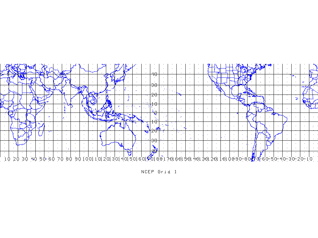
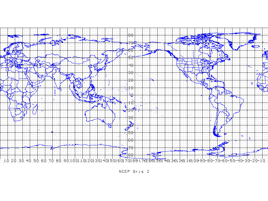
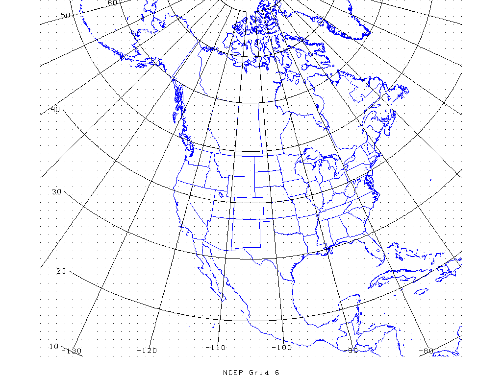
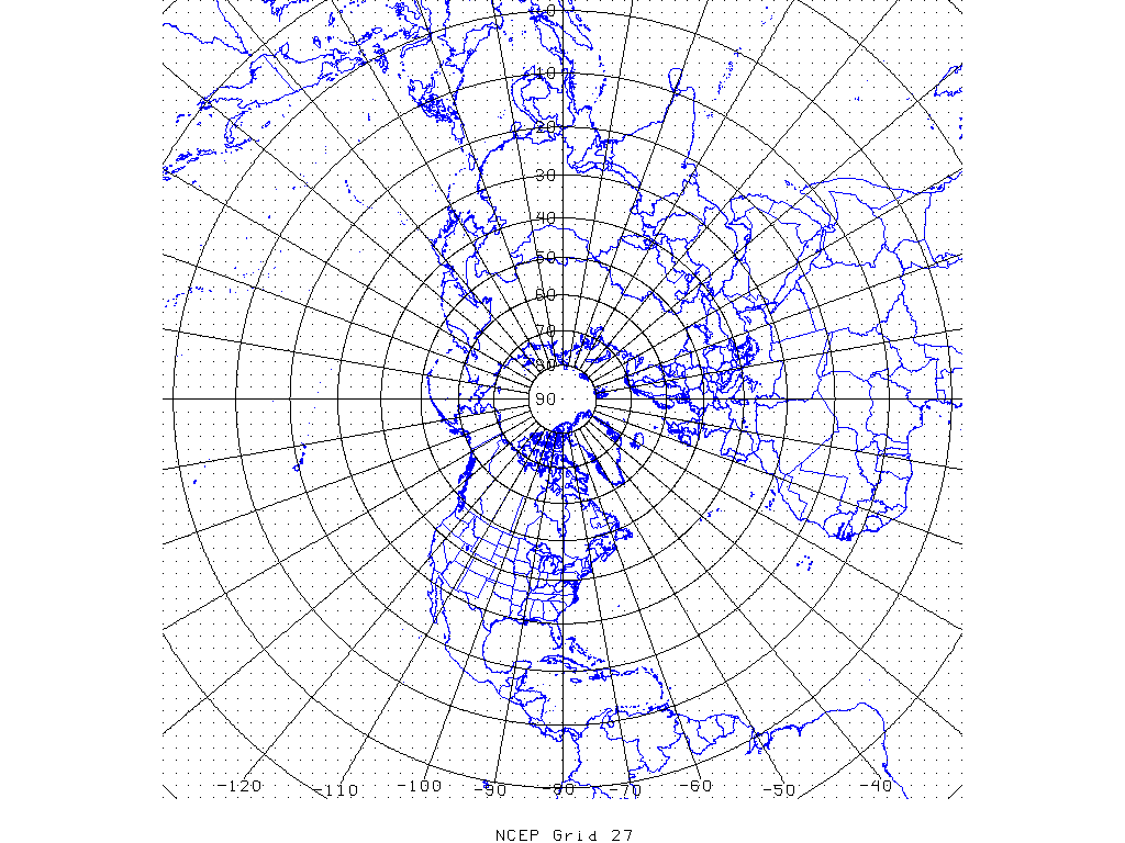
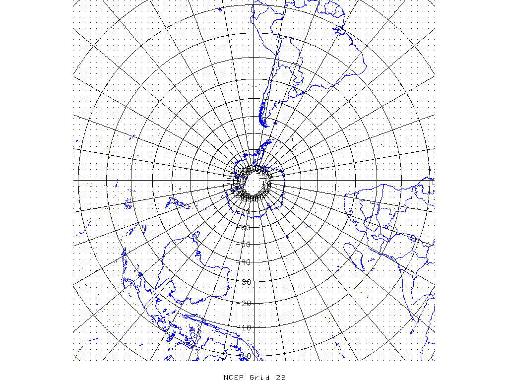
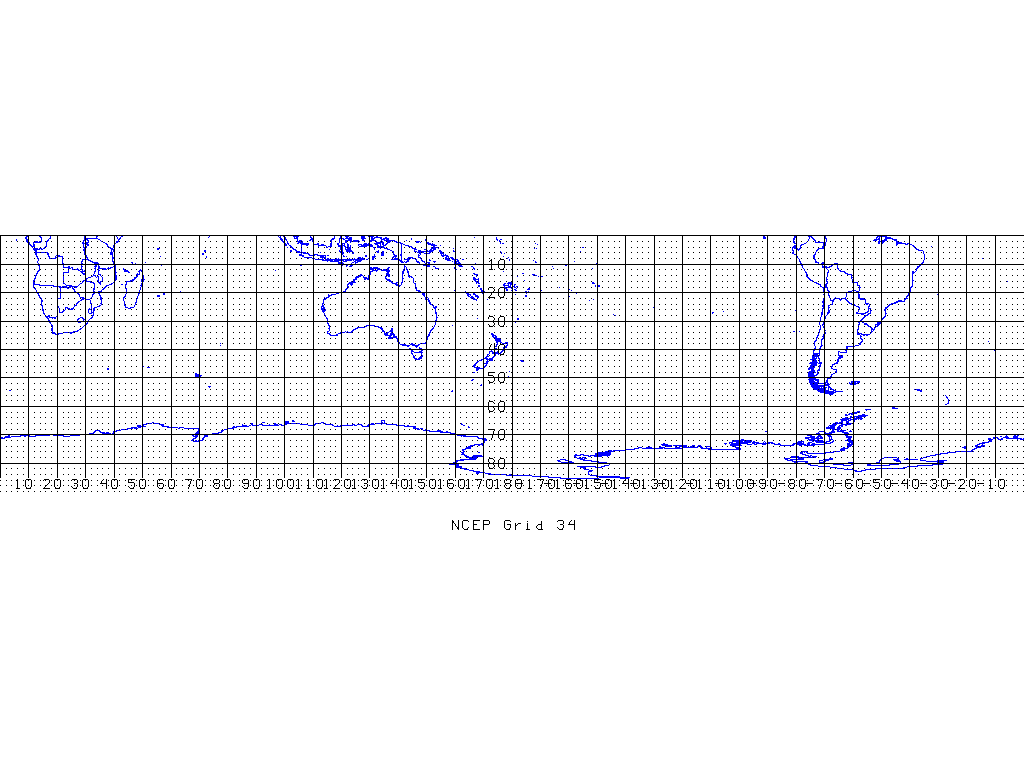
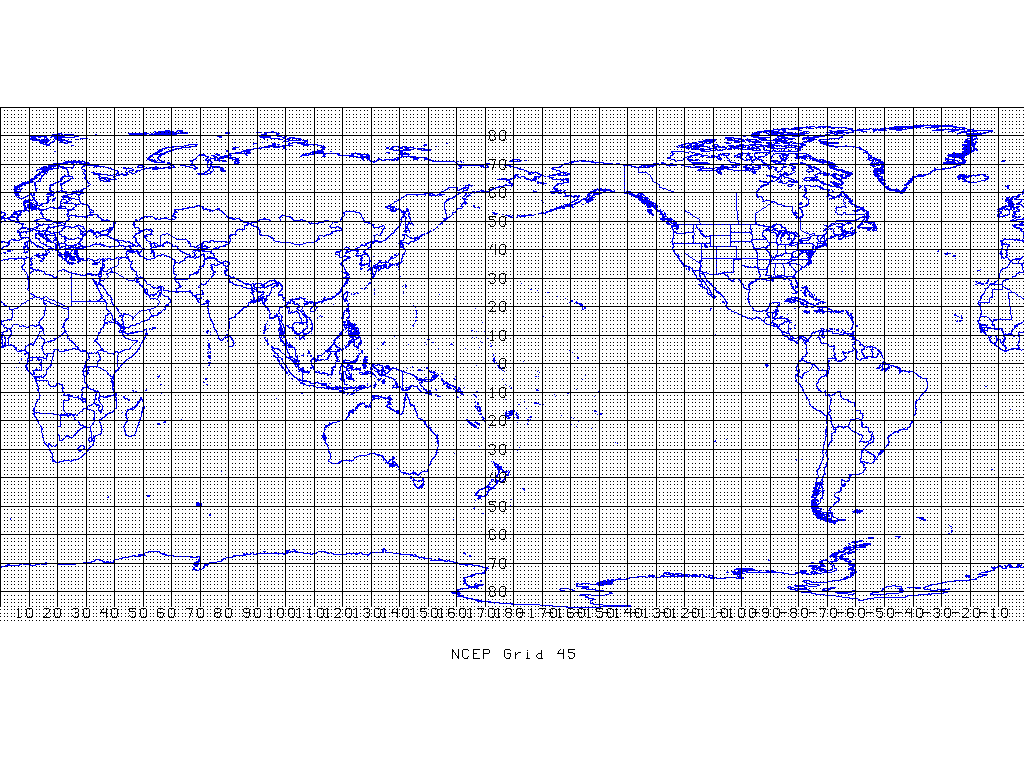
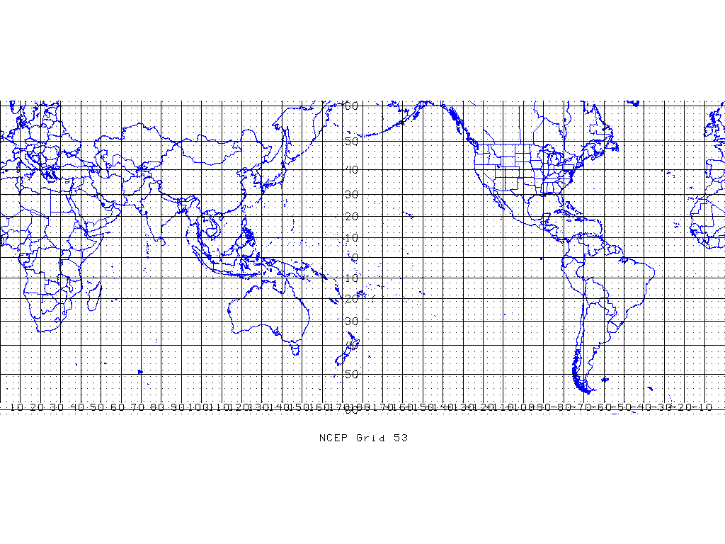
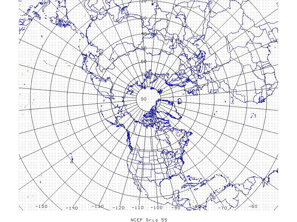
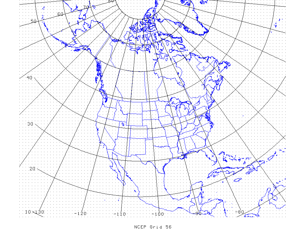
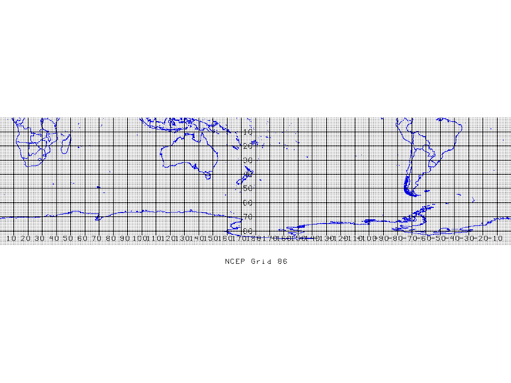
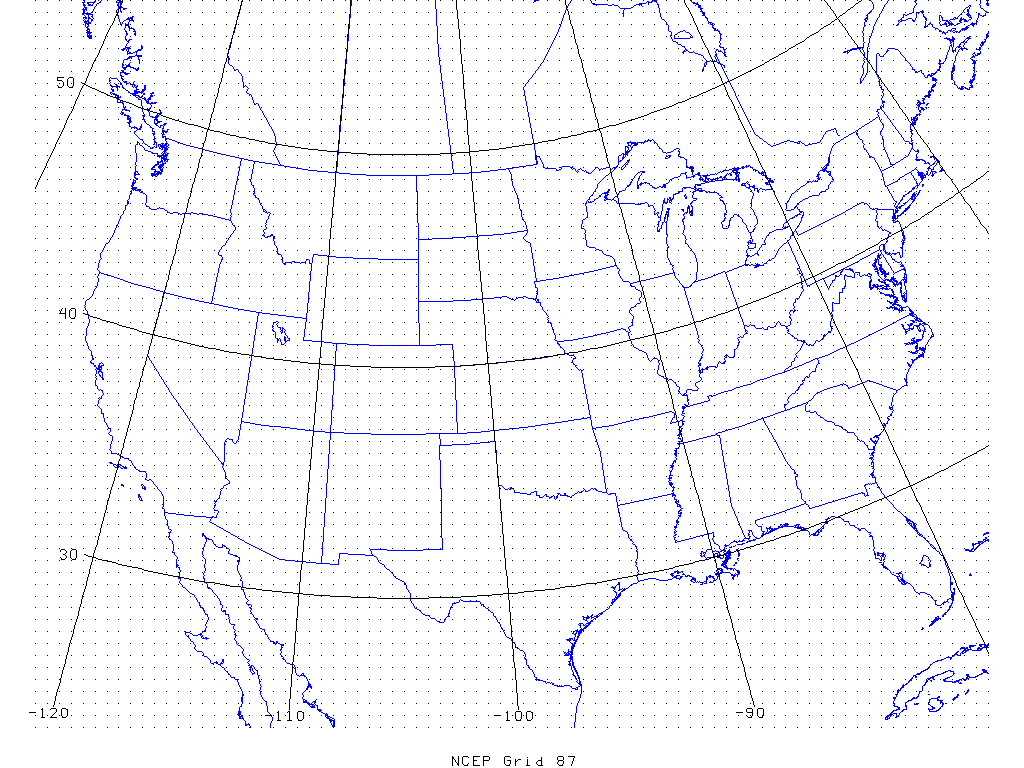
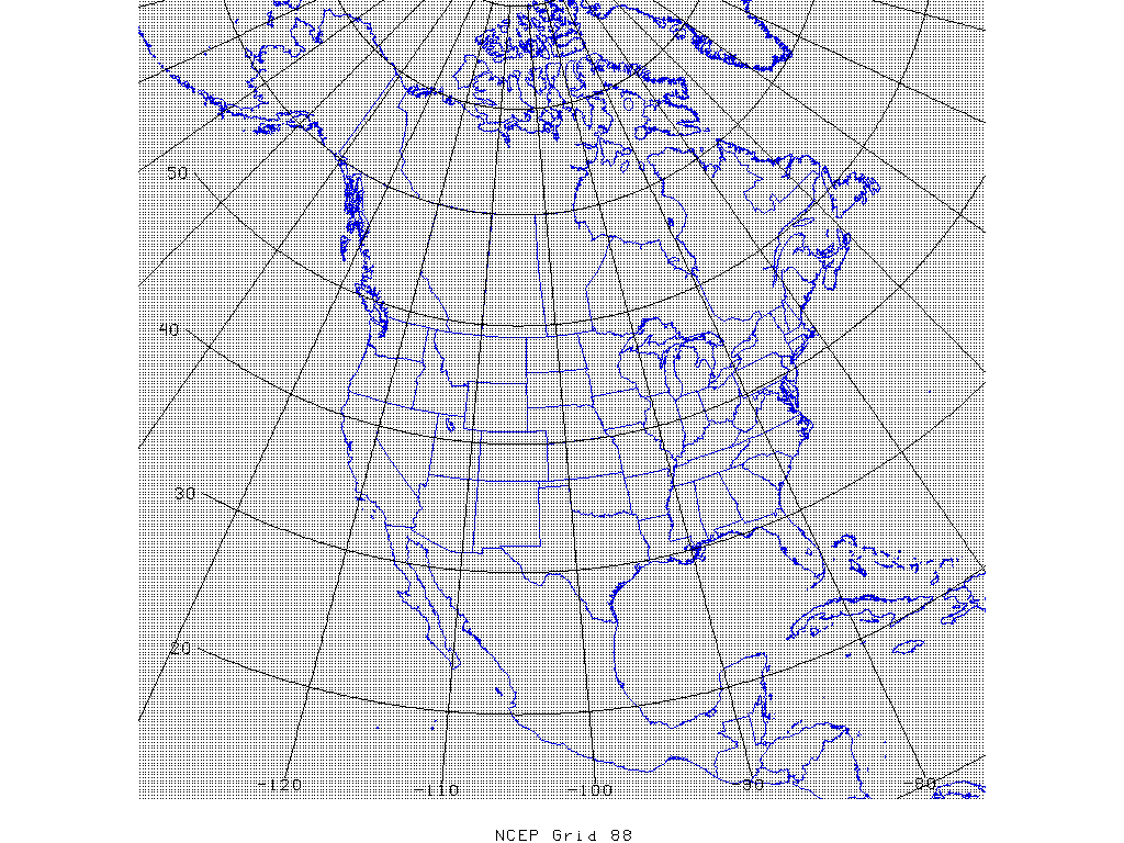
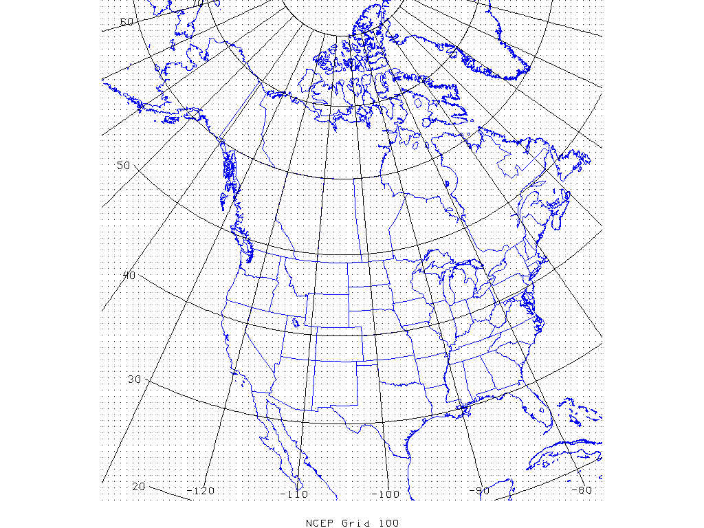
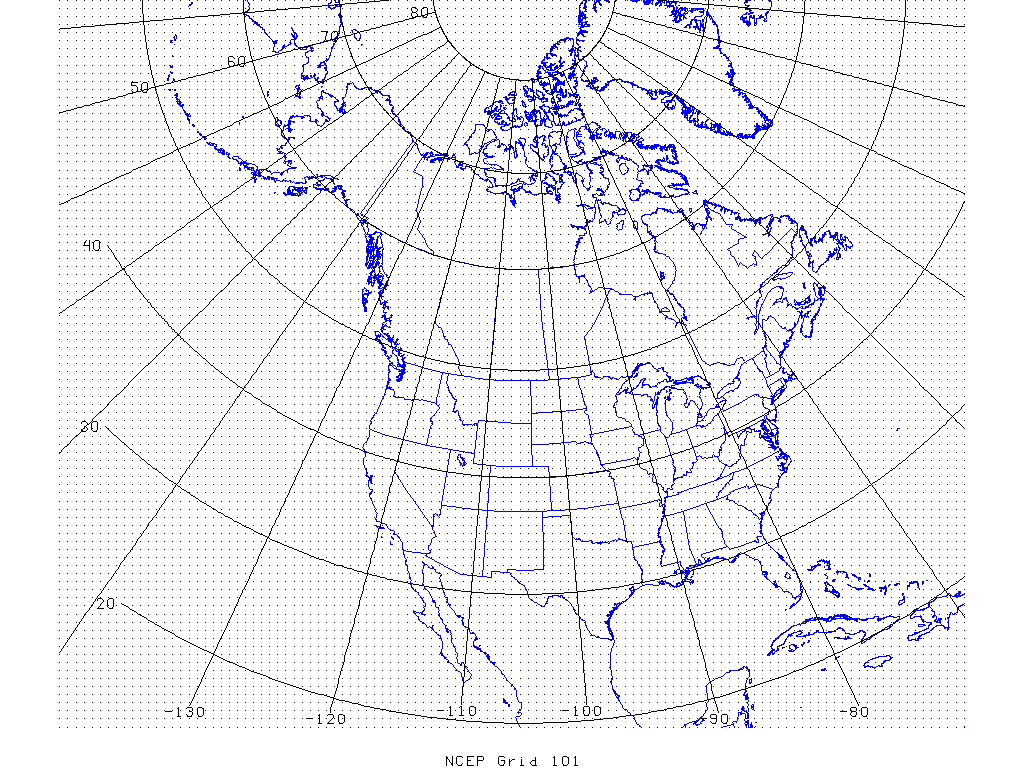
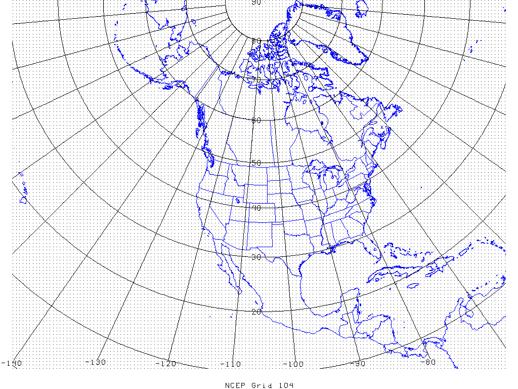
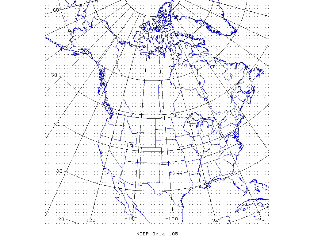
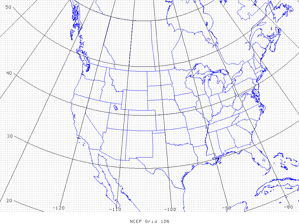
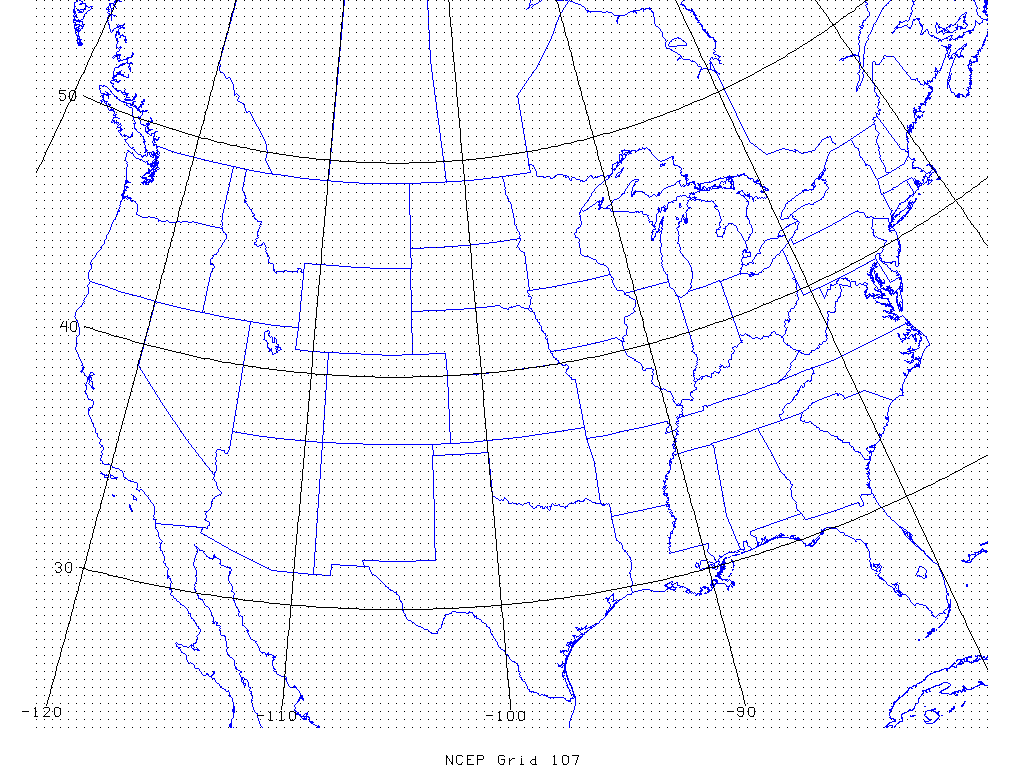
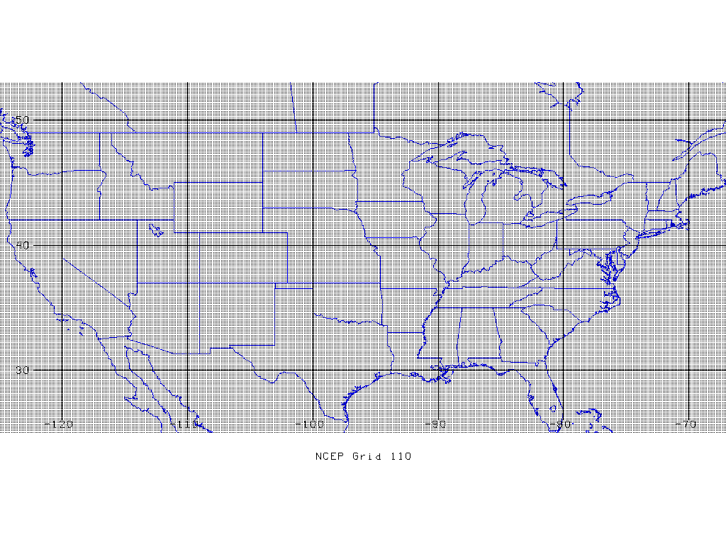
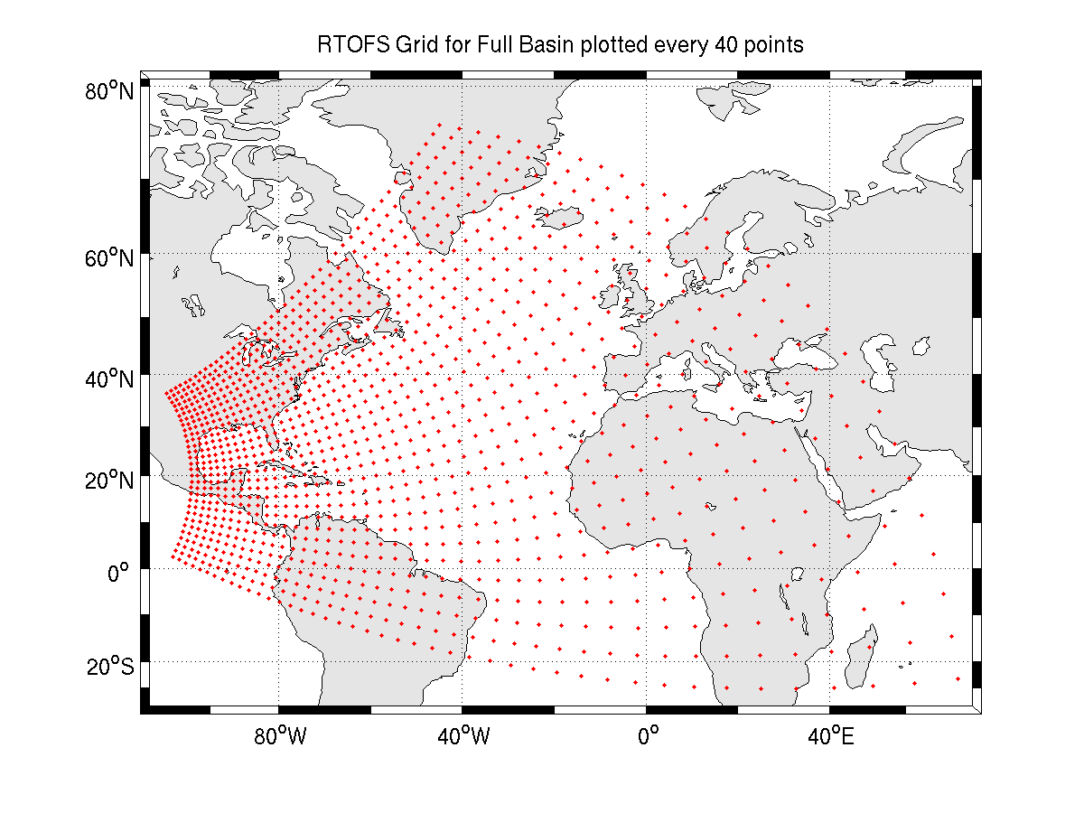
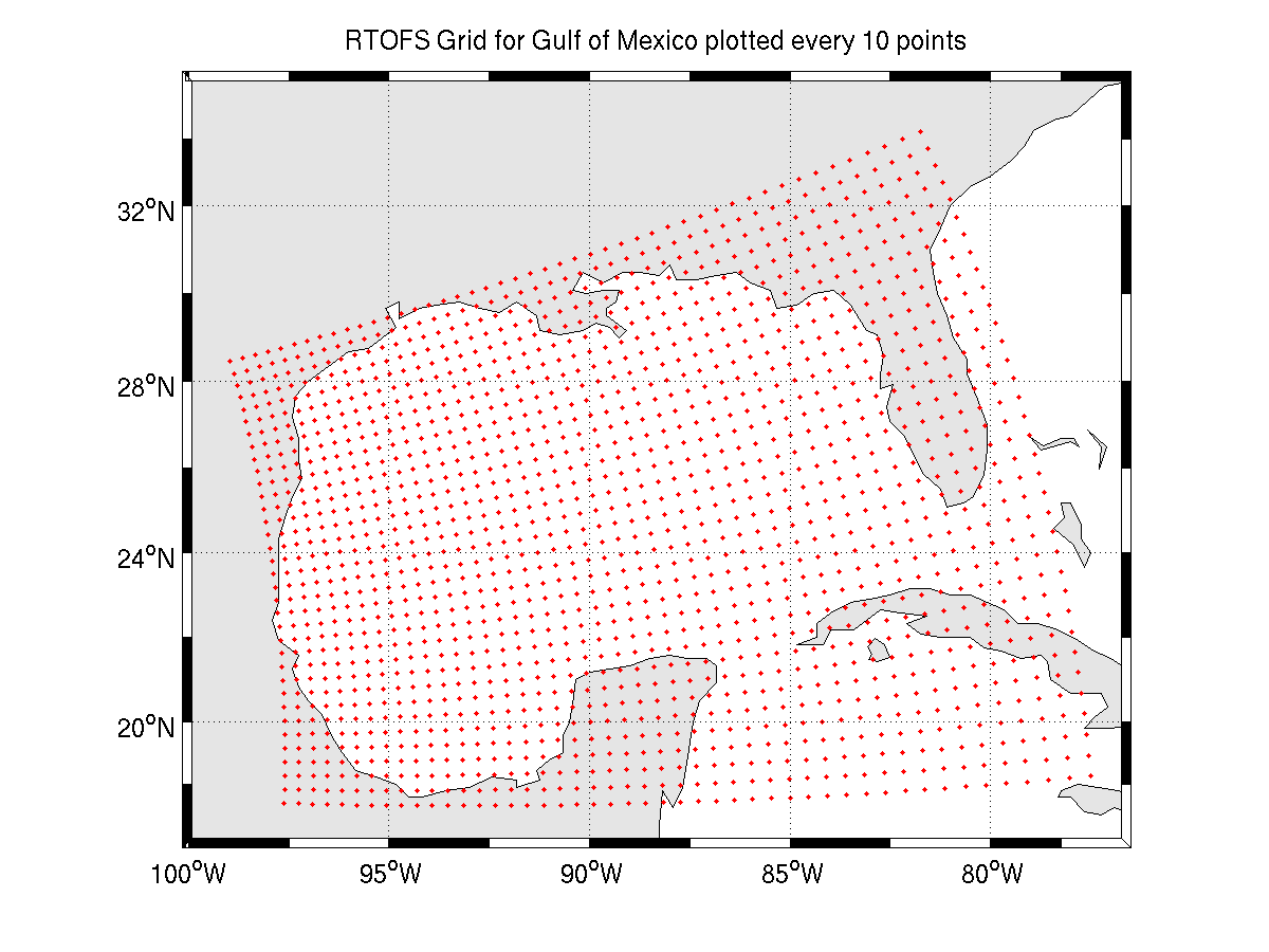
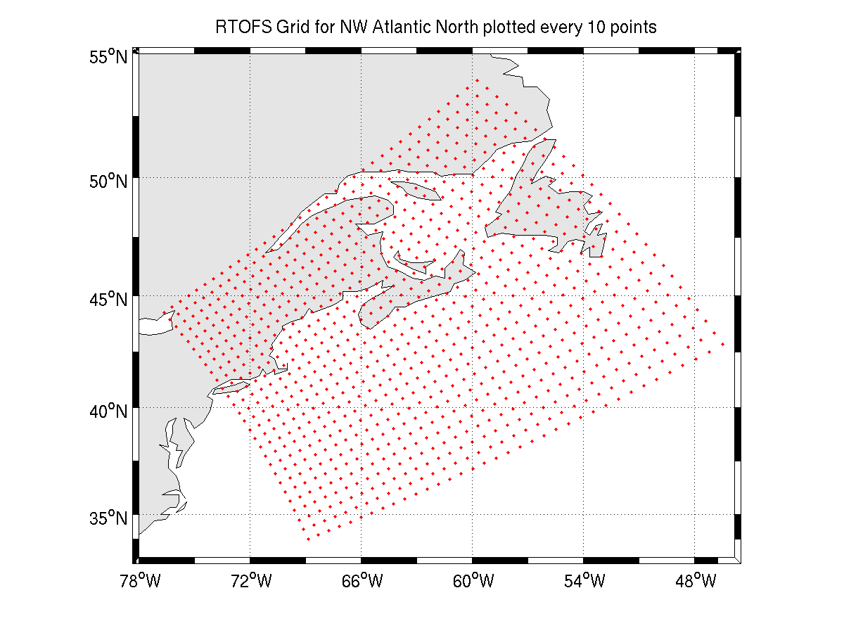
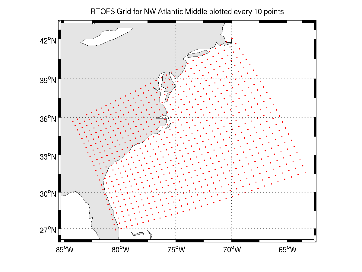
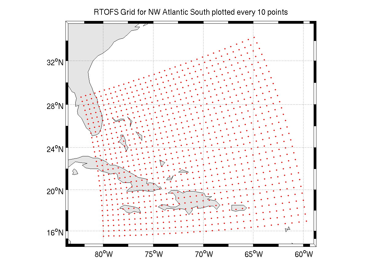
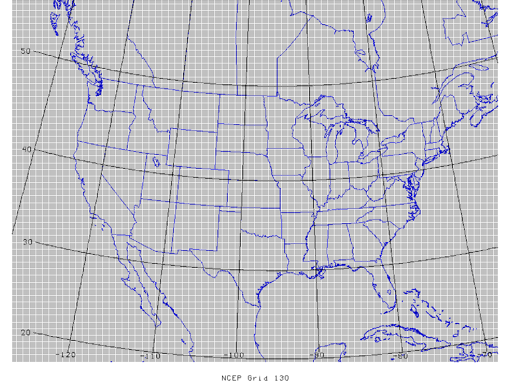
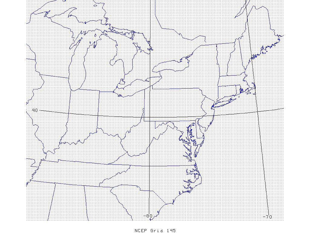
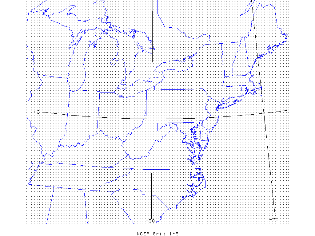
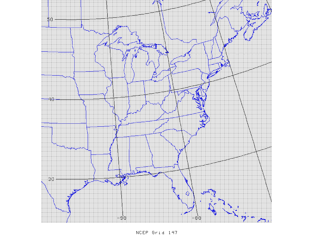
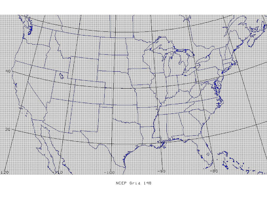
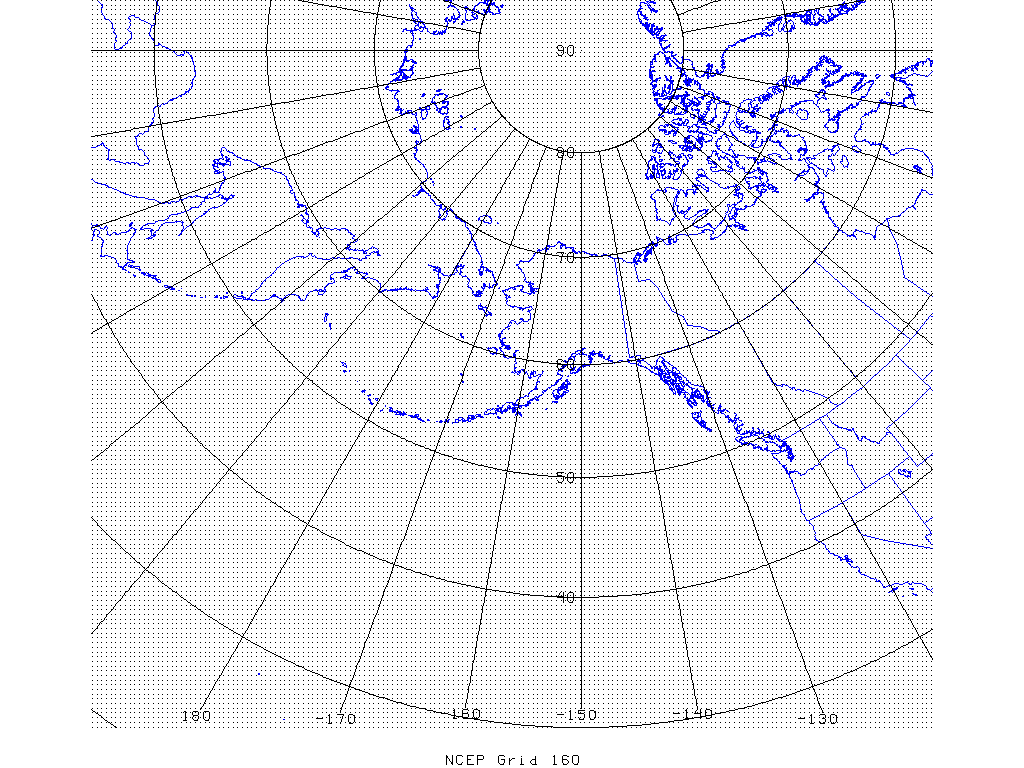
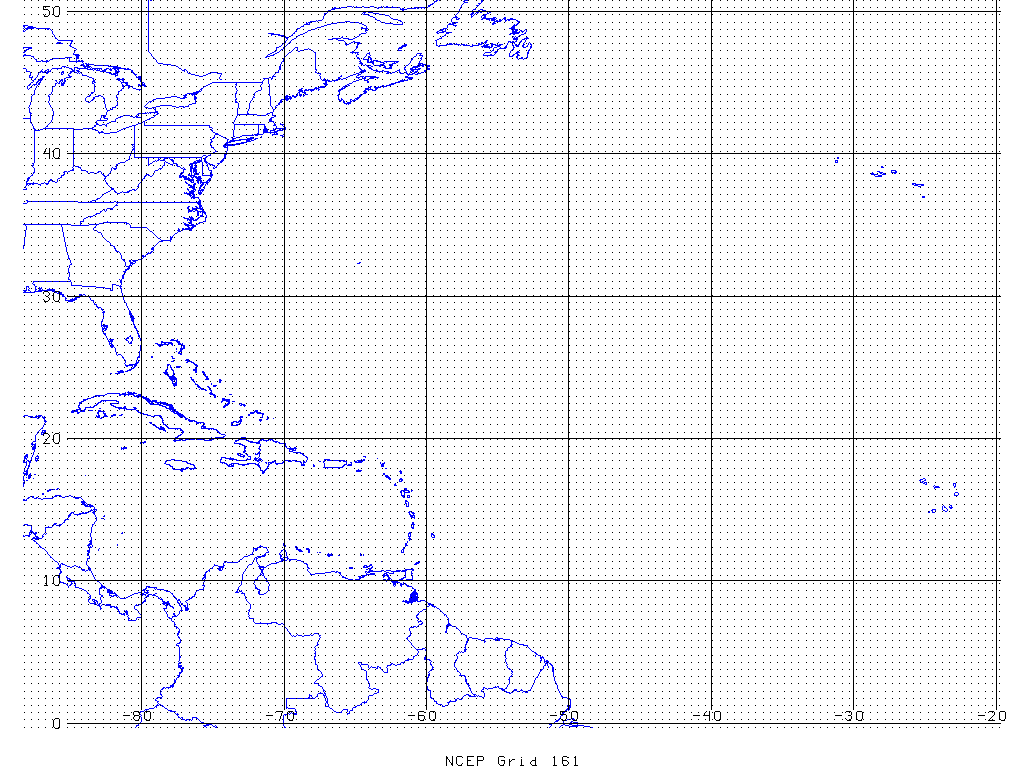
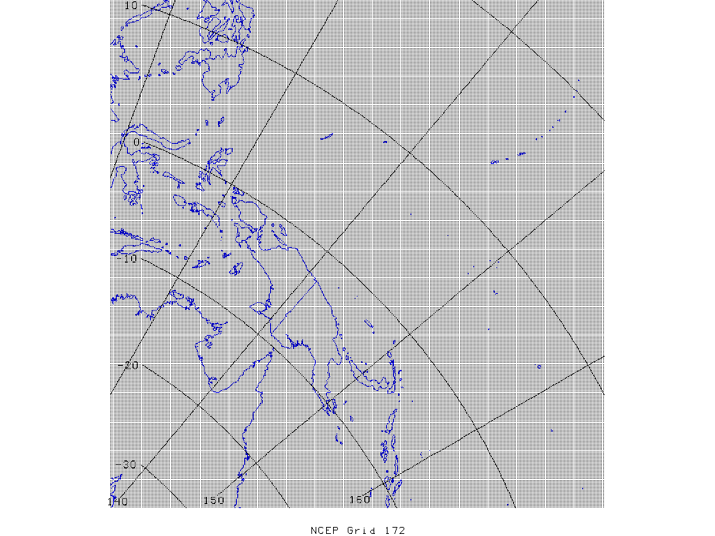
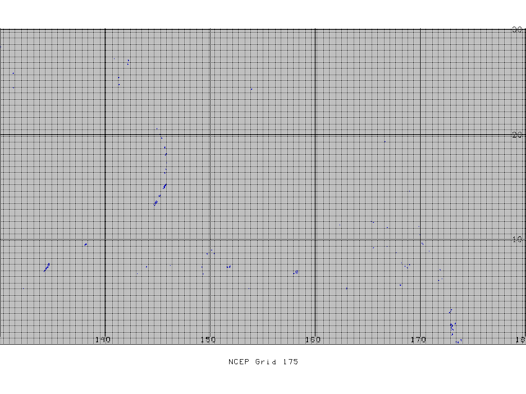
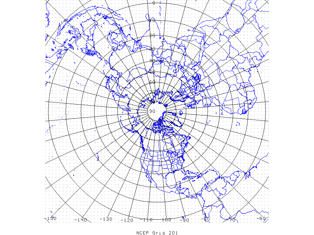
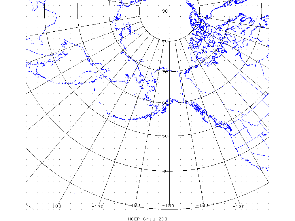
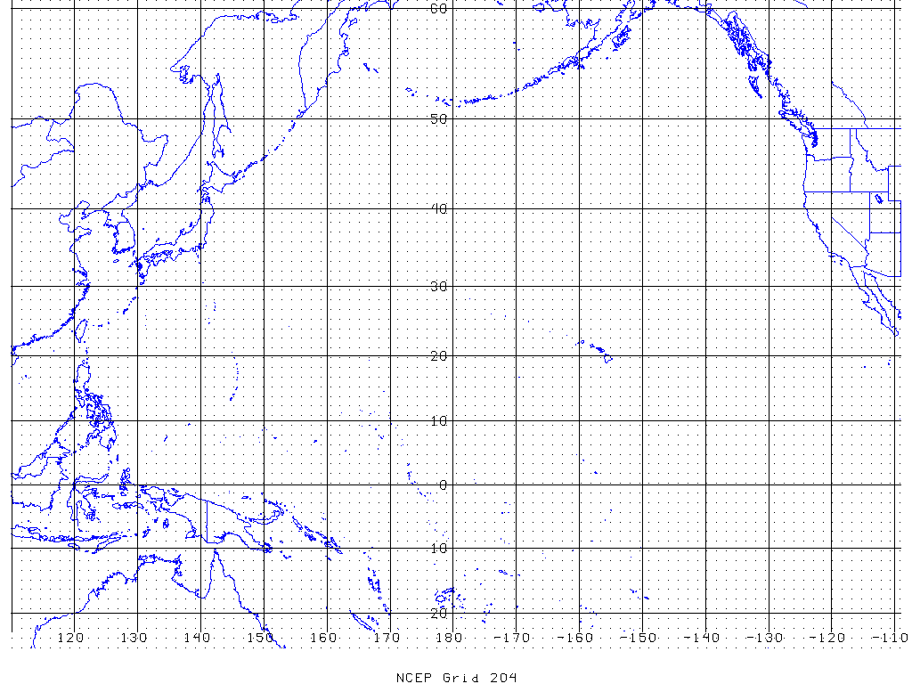
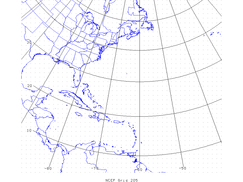
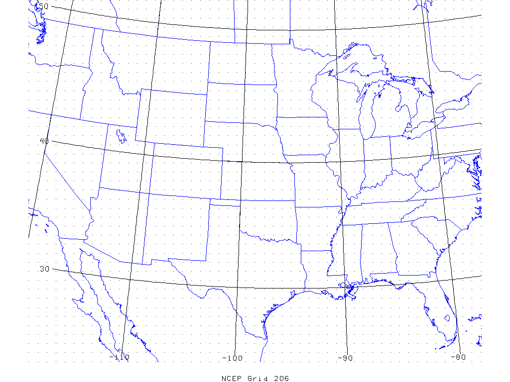
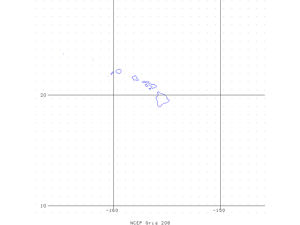
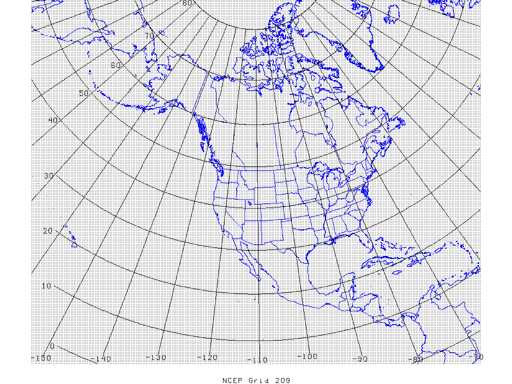
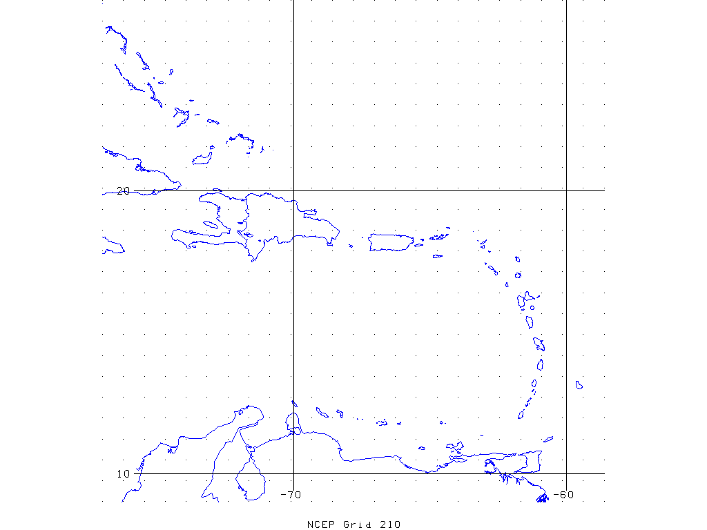
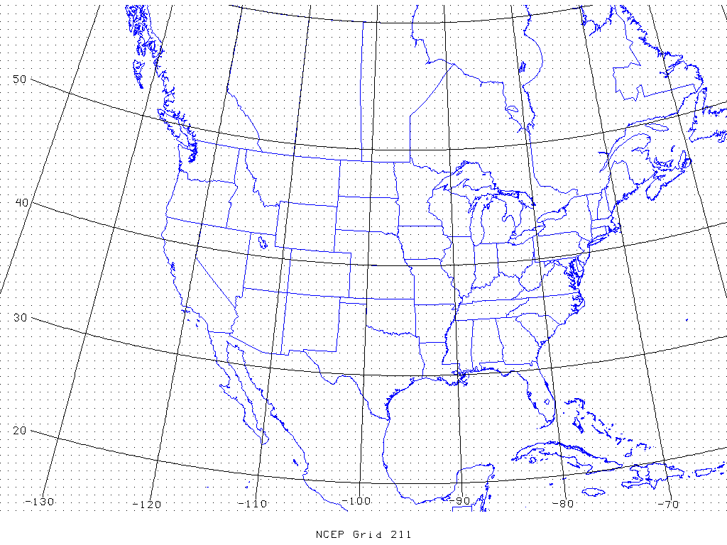
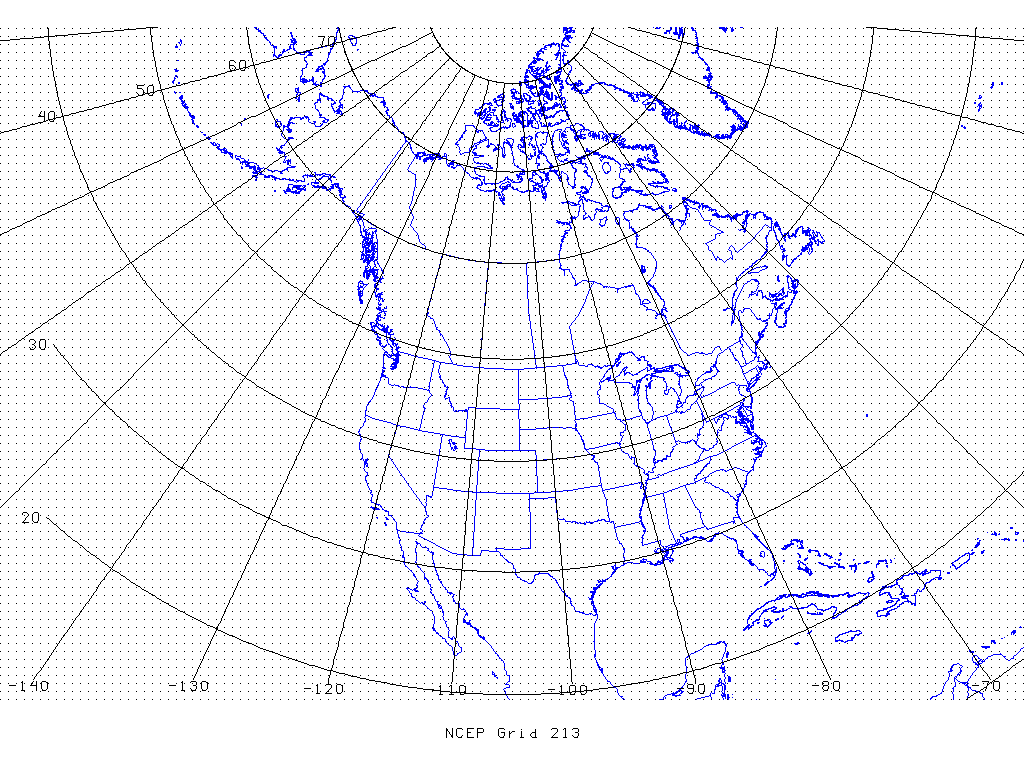
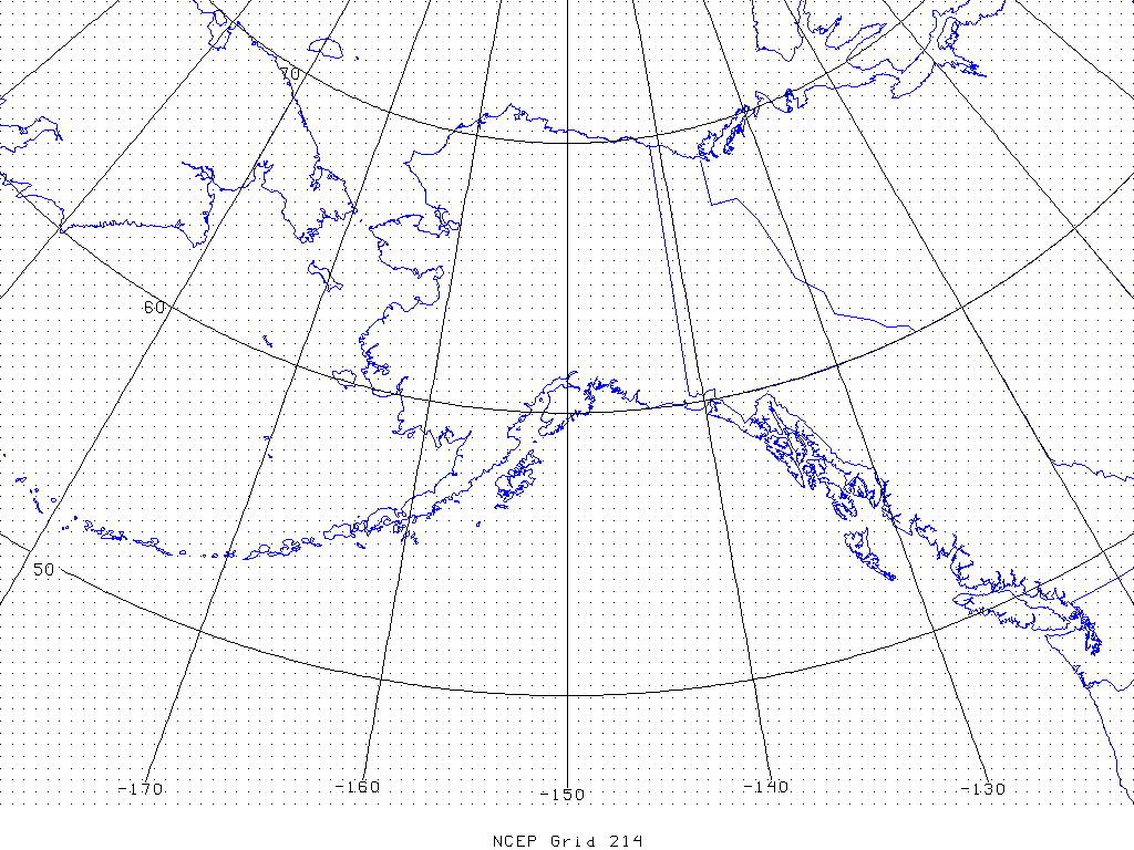
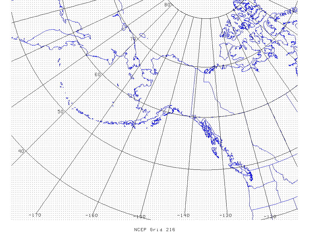
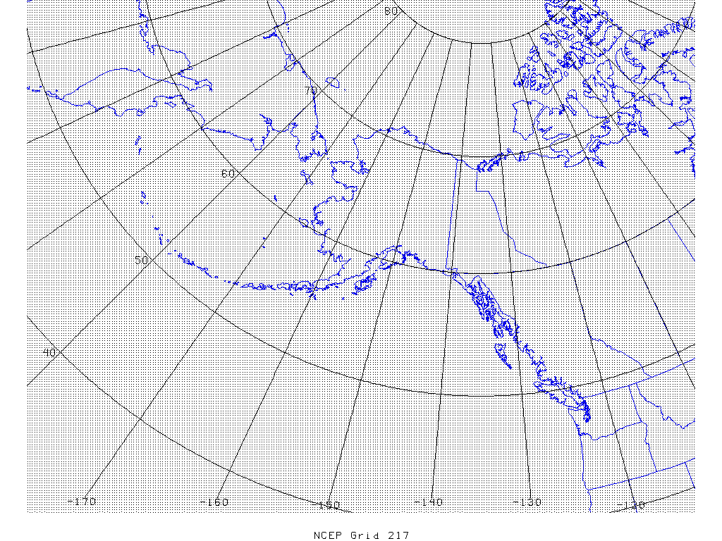
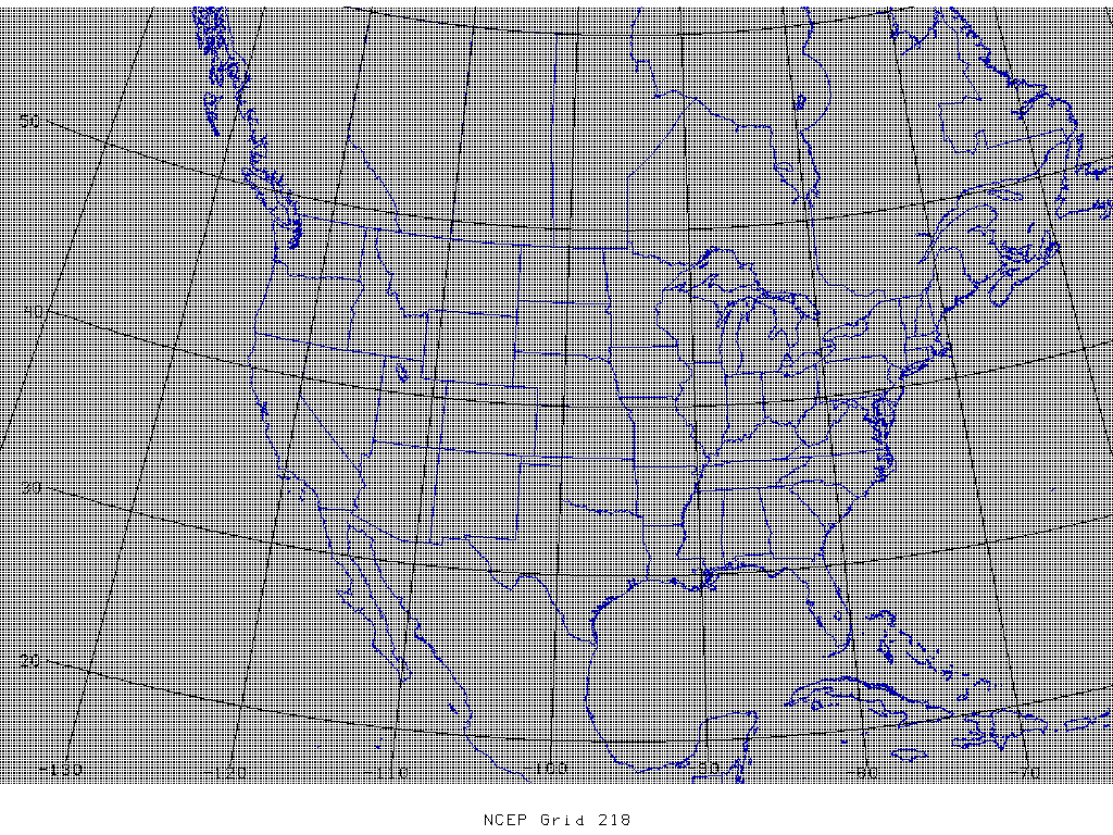
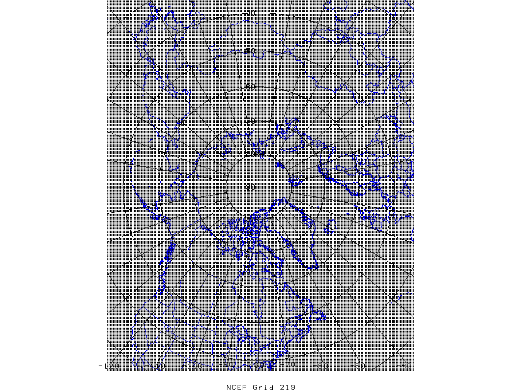
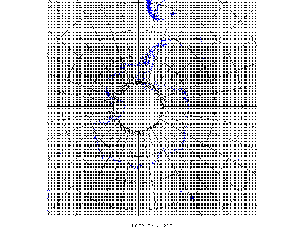
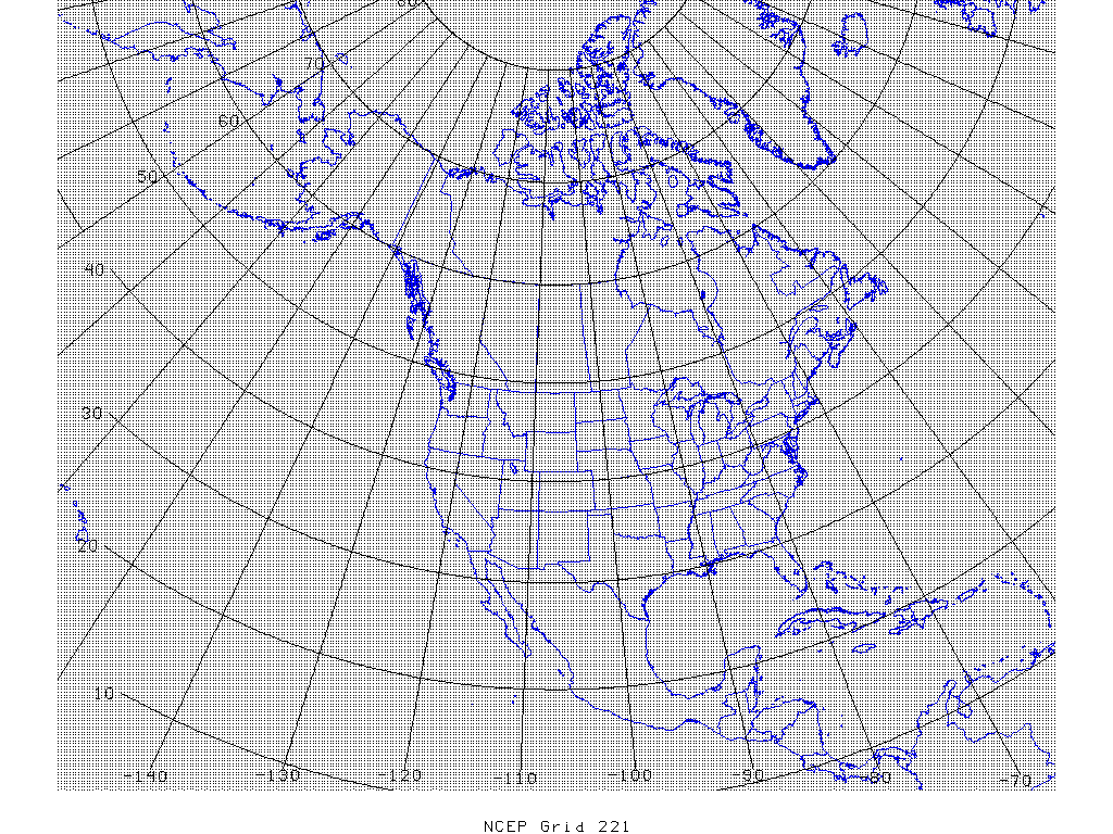
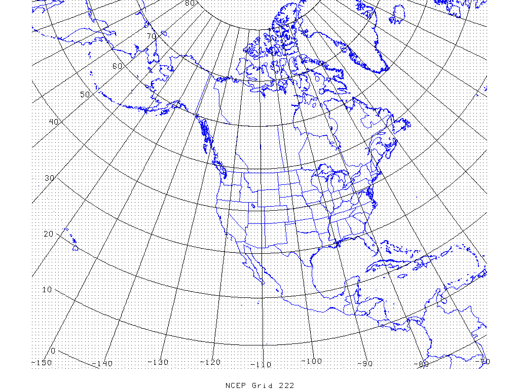
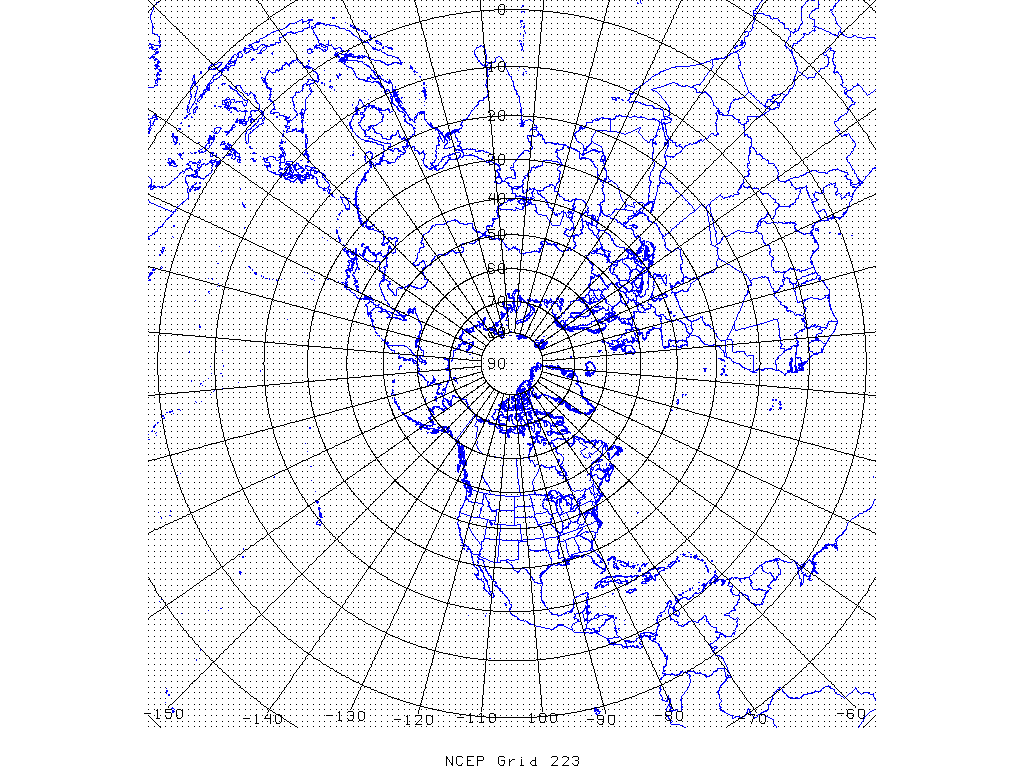
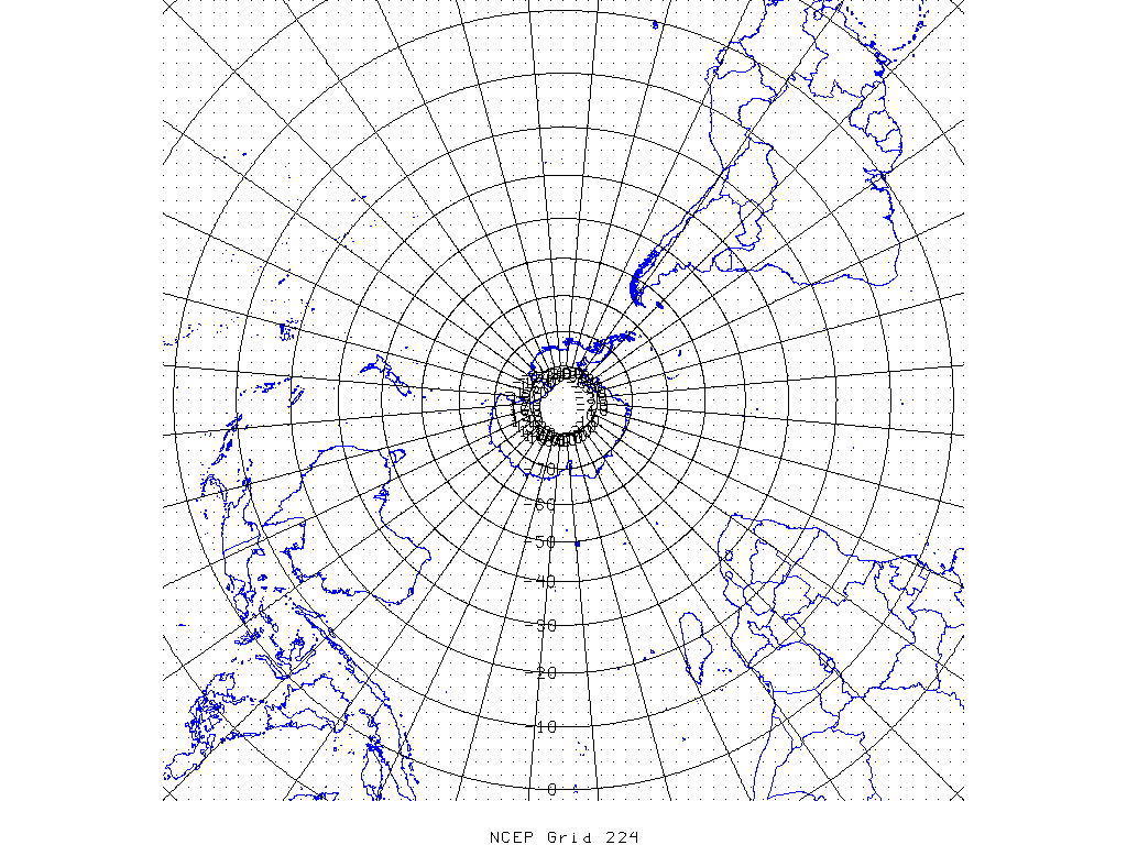
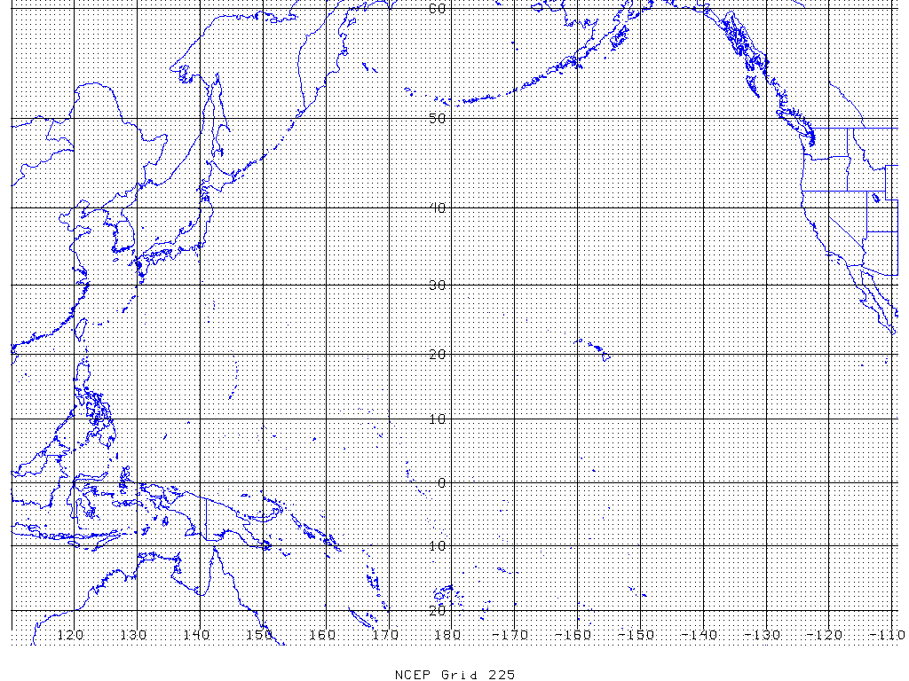
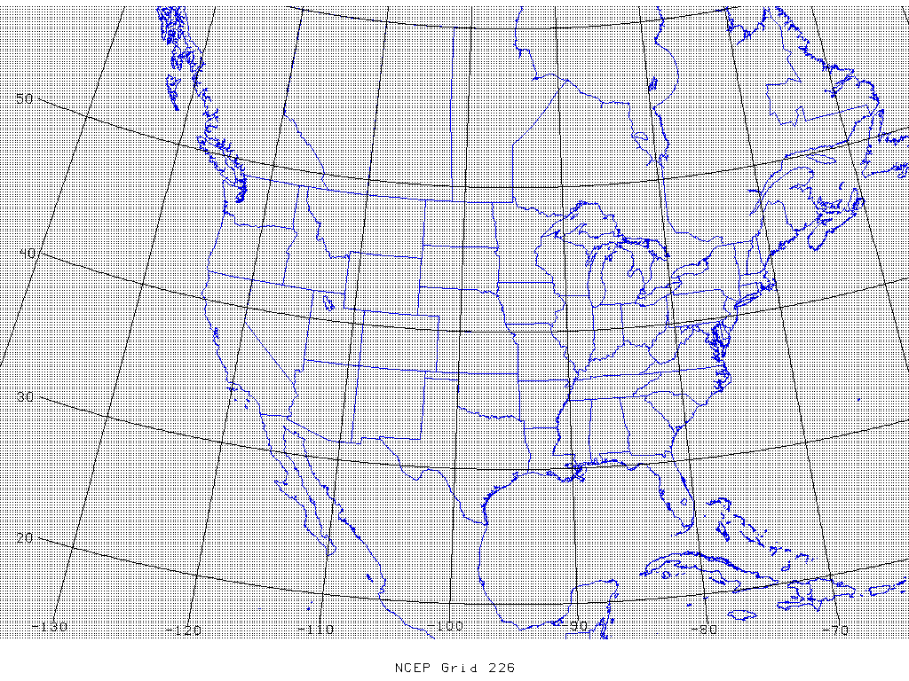
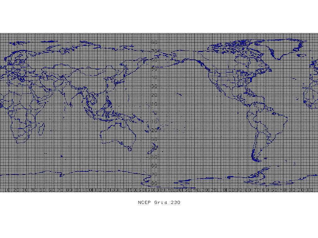
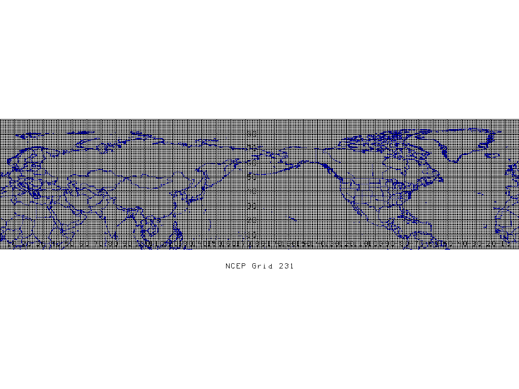
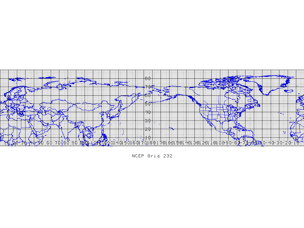
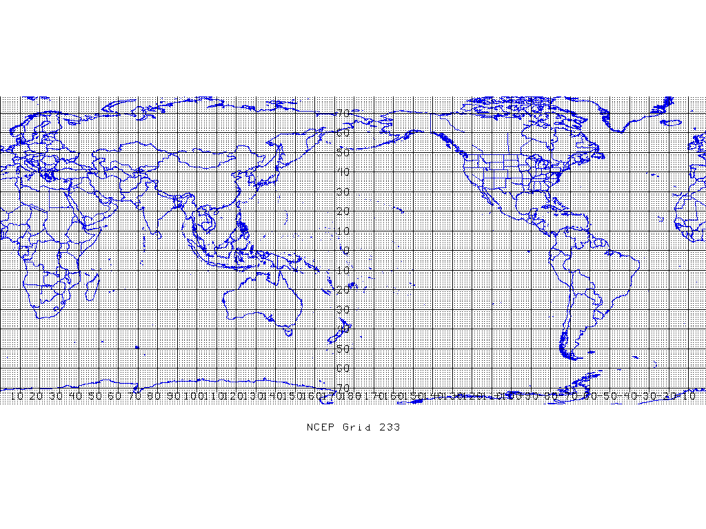
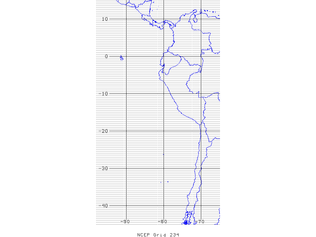
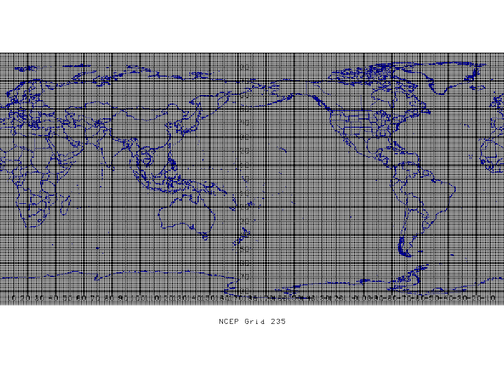
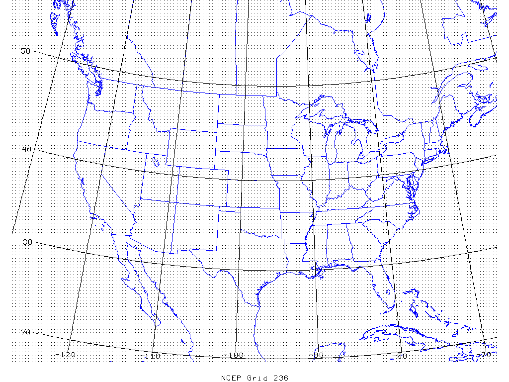
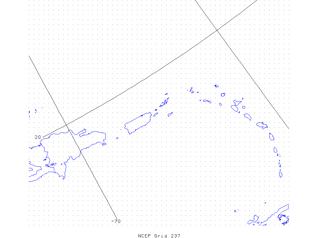
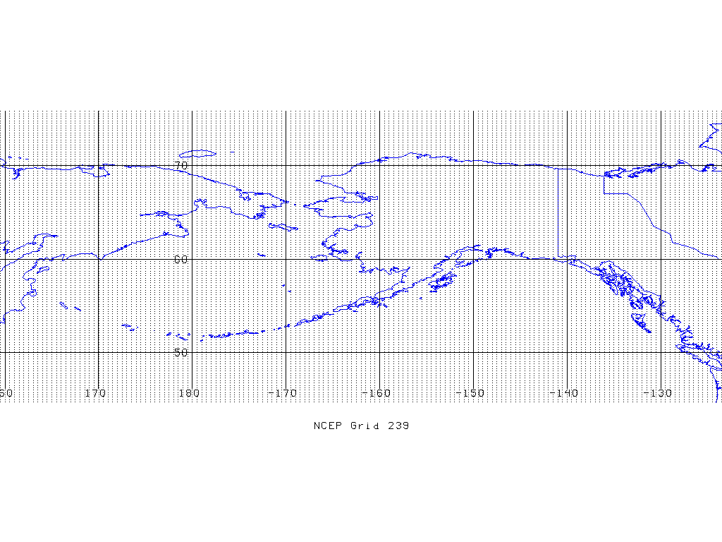
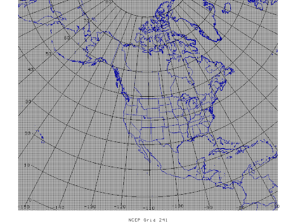
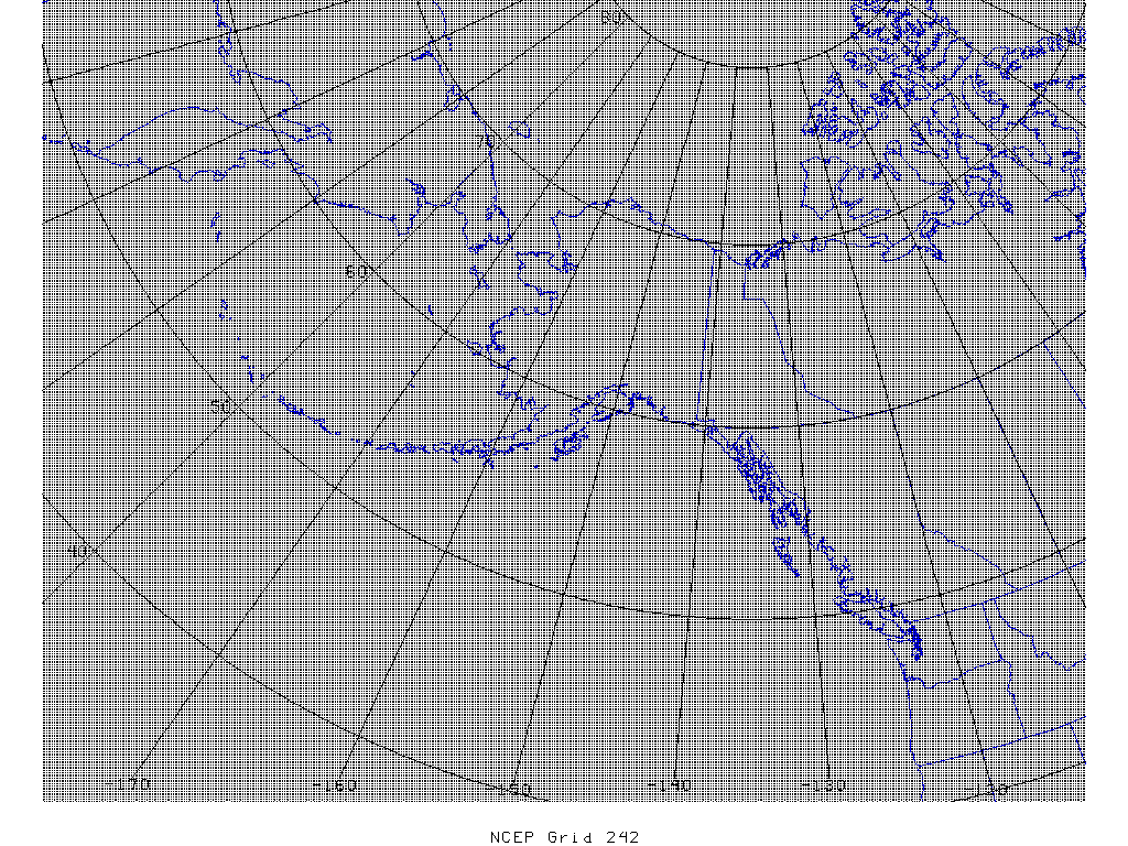
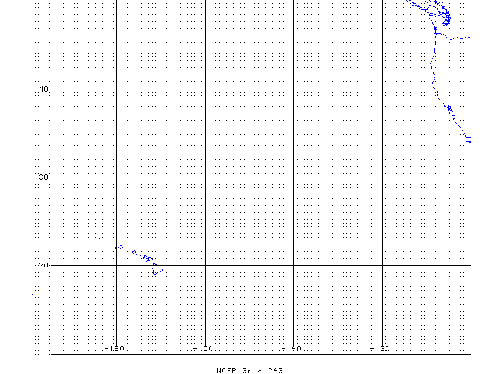
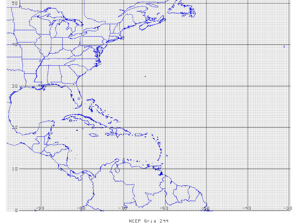
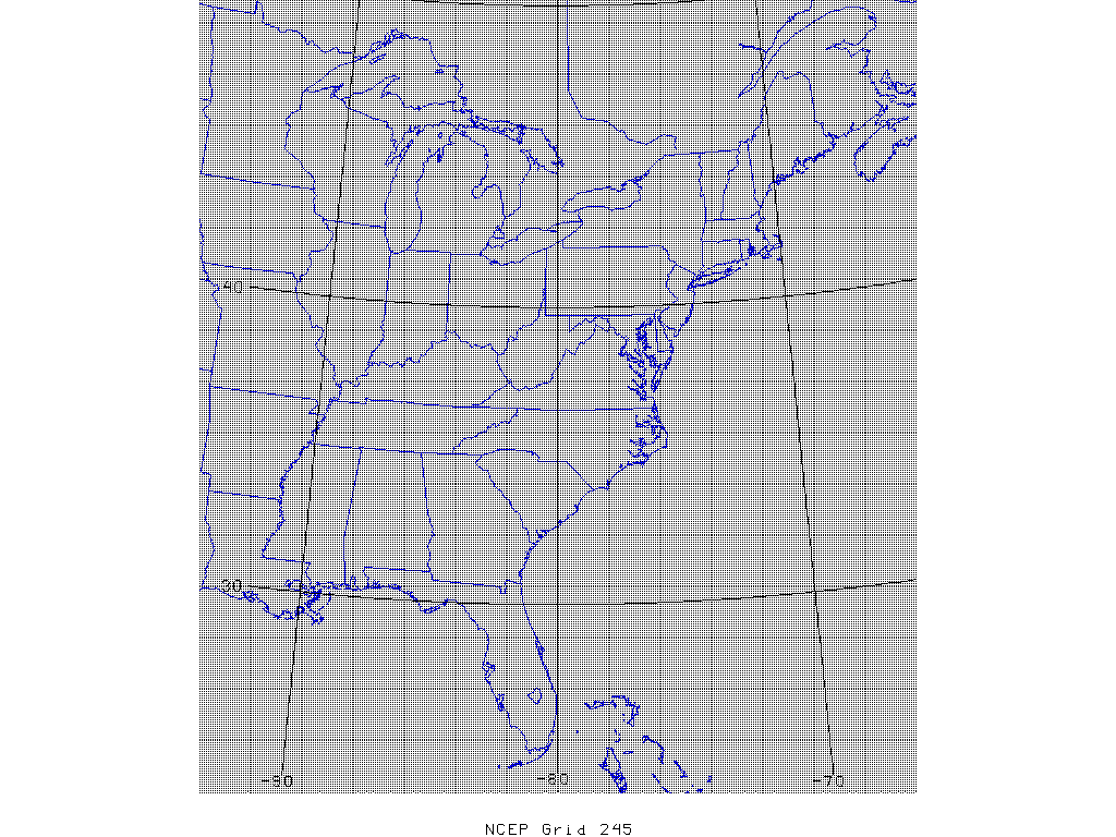
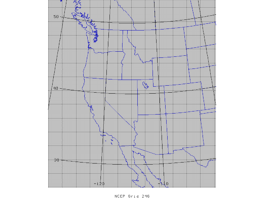
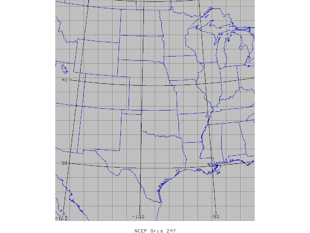
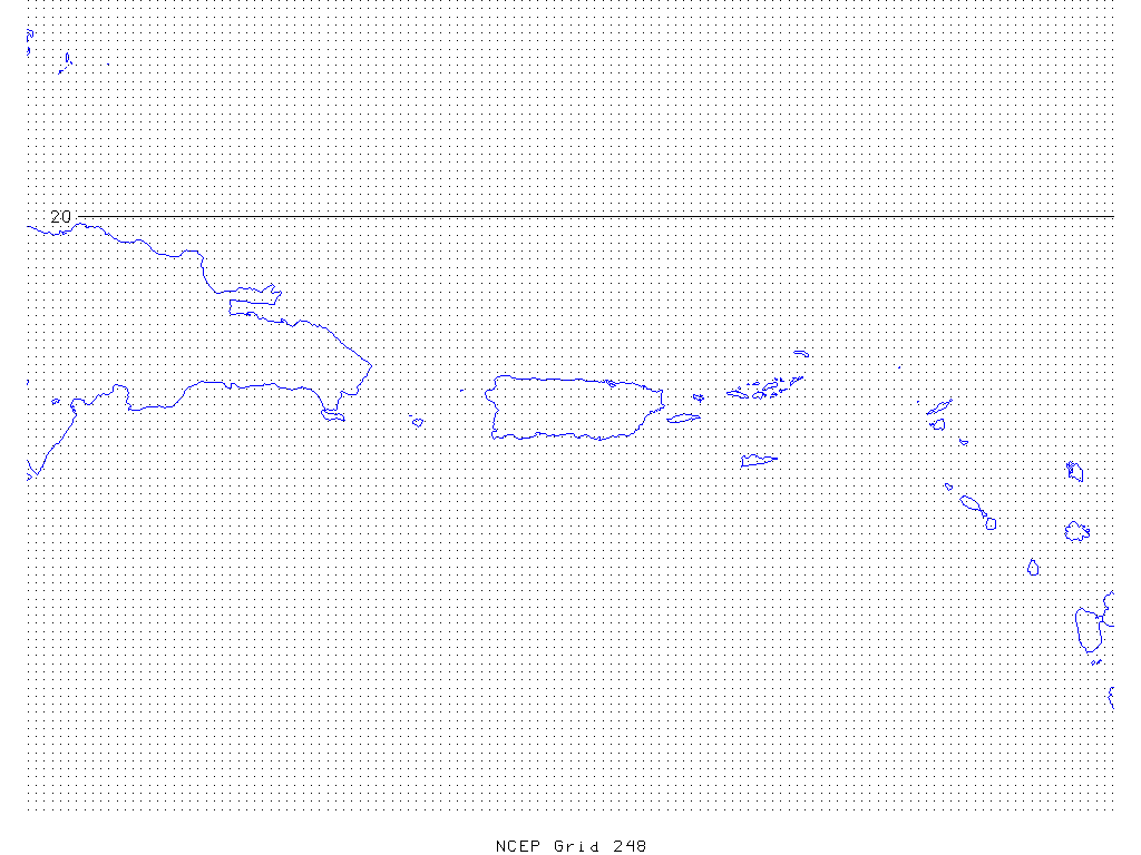
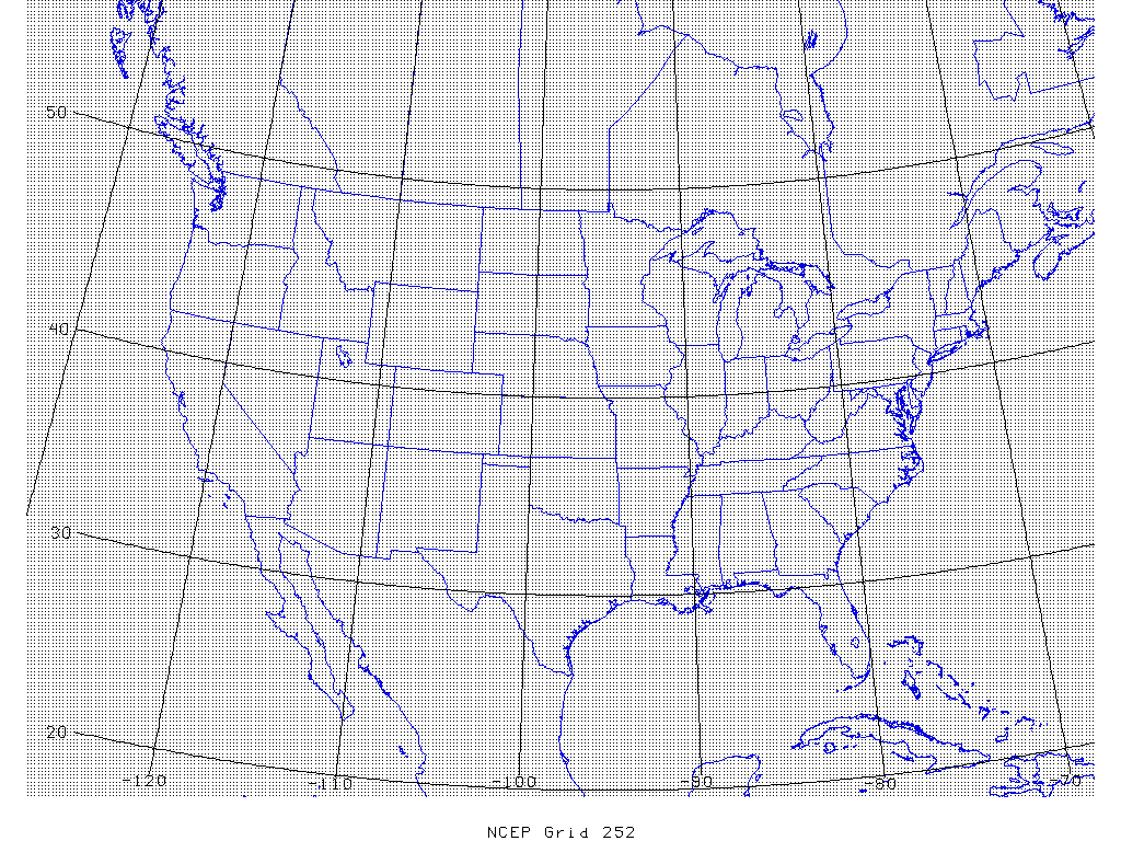
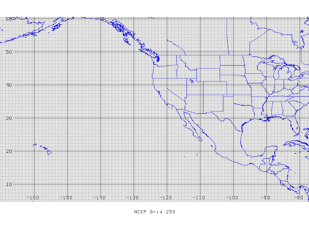
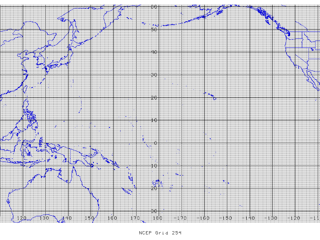