| Critical Data with Normal Counts |
|---|
| Type | Description | Hourly Count | Monthly Average | Percent (%) of Monthly Mean | UTC Time Window |
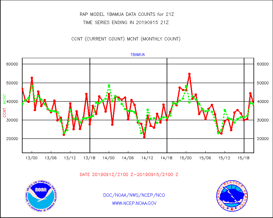
1bamua |
NOAA 15-19 & METOP 1-2 AMSU-A NCEP-proc. br.temps |
38366 |
38613 |
99.4 % |
1518.00-1523.99 |
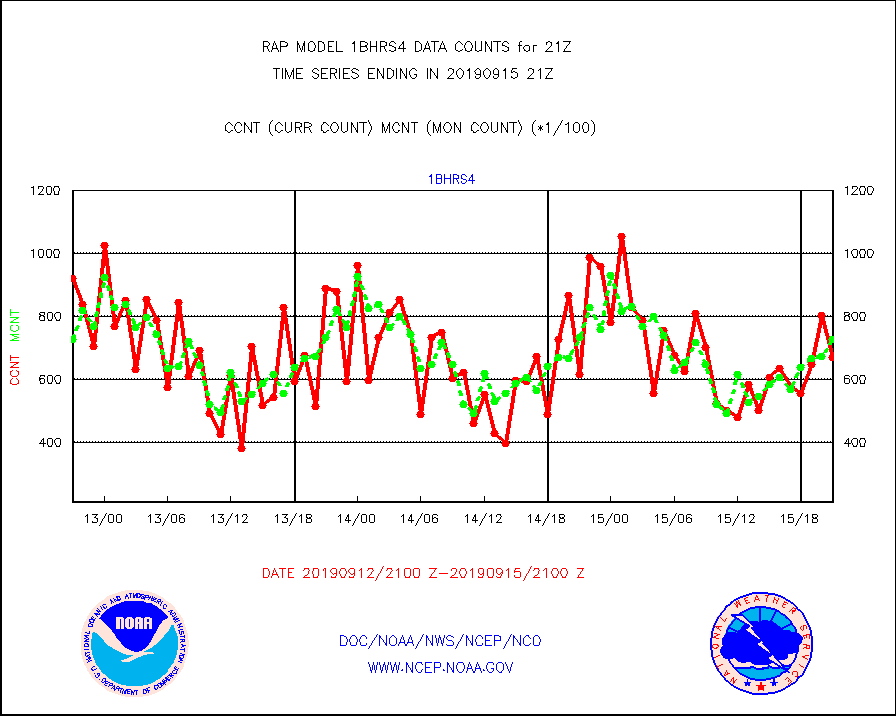
1bhrs4 |
NOAA 18-19 & METOP 1-2 HIRS-4 NCEP-proc. br.temps |
66936 |
72711 |
92.1 % |
1518.00-1523.99 |
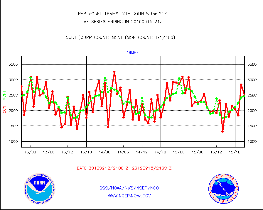
1bmhs |
NOAA 18-19 & METOP 1-2 MHS NCEP-proces. br. temps |
248513 |
246797 |
100.7 % |
1518.00-1523.99 |
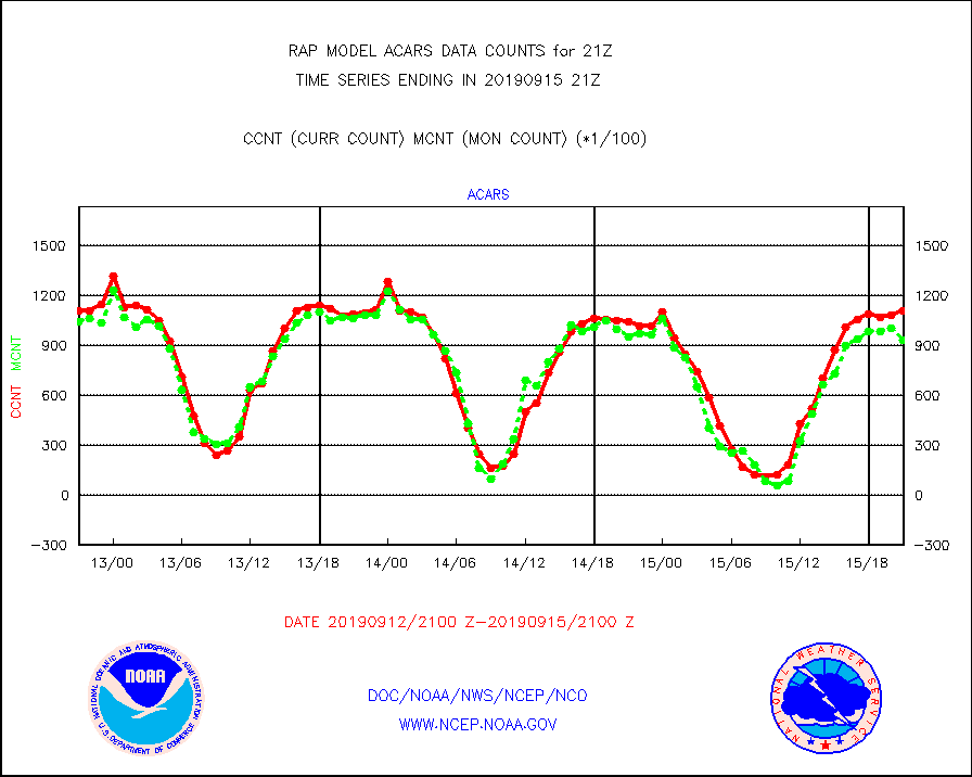
acars |
MDCRS ACARS acft data from ARINC(dcded from BUFR) |
110512 |
93004 |
118.8 % |
1517.75-1600.25 |
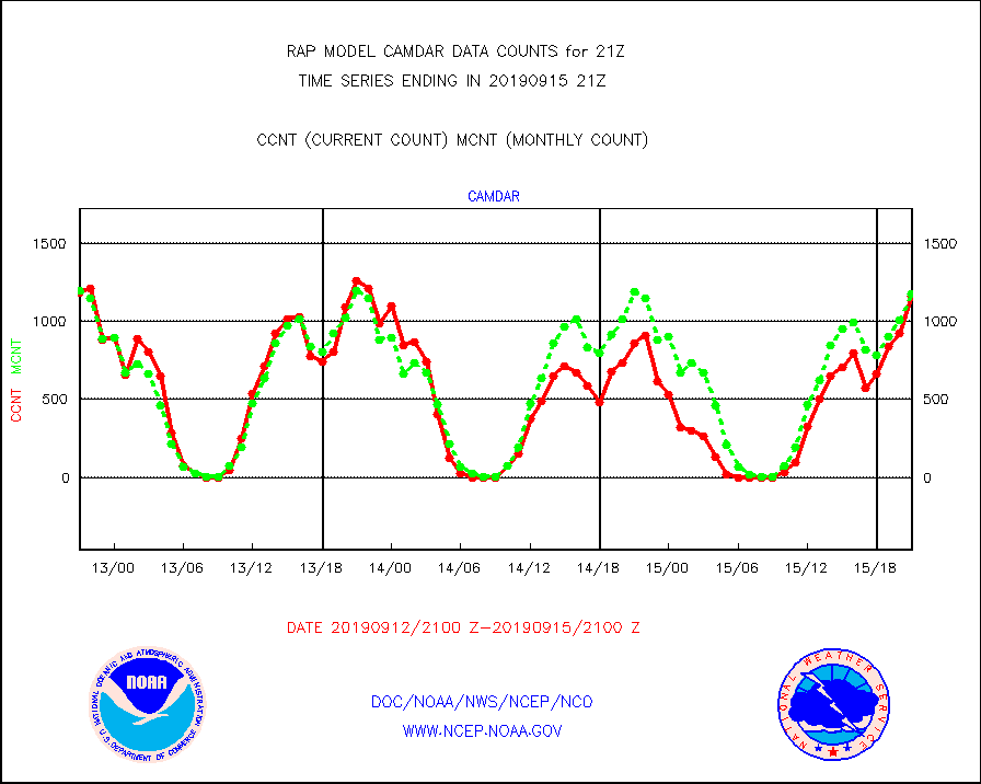
camdar |
Canadian AMDAR aircraft data (decoded from BUFR) |
1166 |
1176 |
99.1 % |
1517.75-1600.25 |
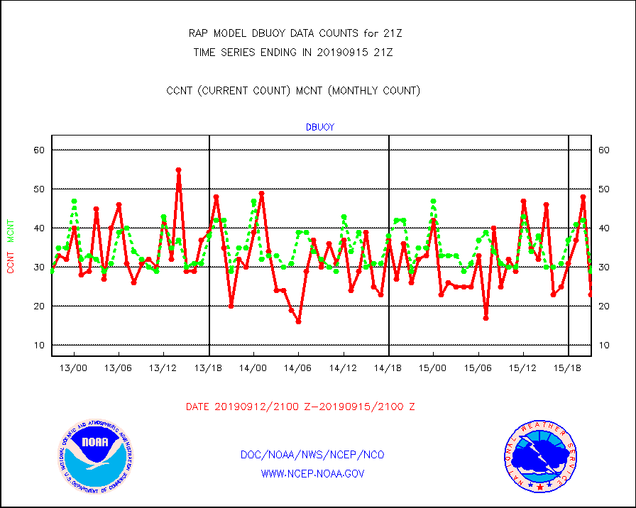
dbuoy |
Buoys decoded from FM-18 fmt (moored or drifting) |
23 |
29 |
79.3 % |
1520.50-1521.50 |
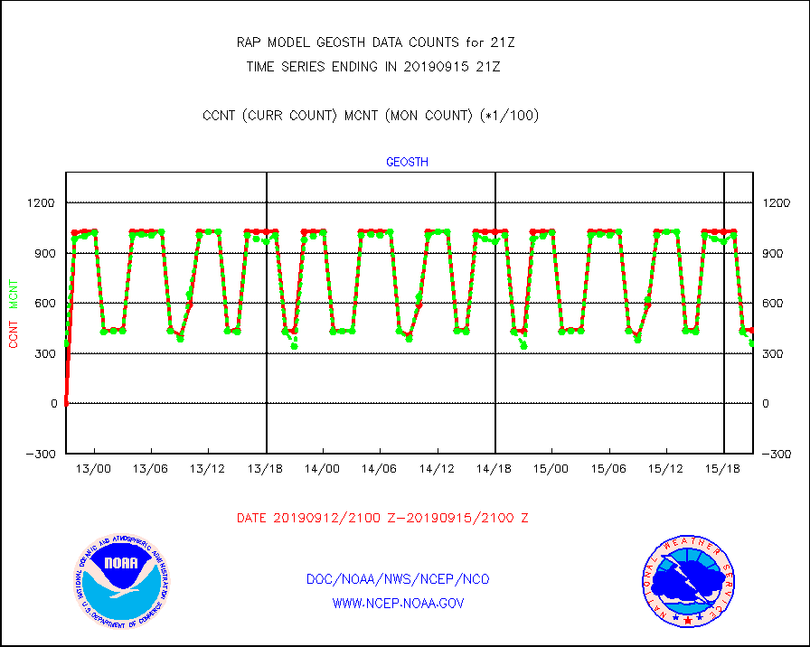
geosth |
GOES/NESDIS hi-resol. (1x1 f-o-v) cloud data |
43703 |
35775 |
122.2 % |
1519.75-1520.99 |
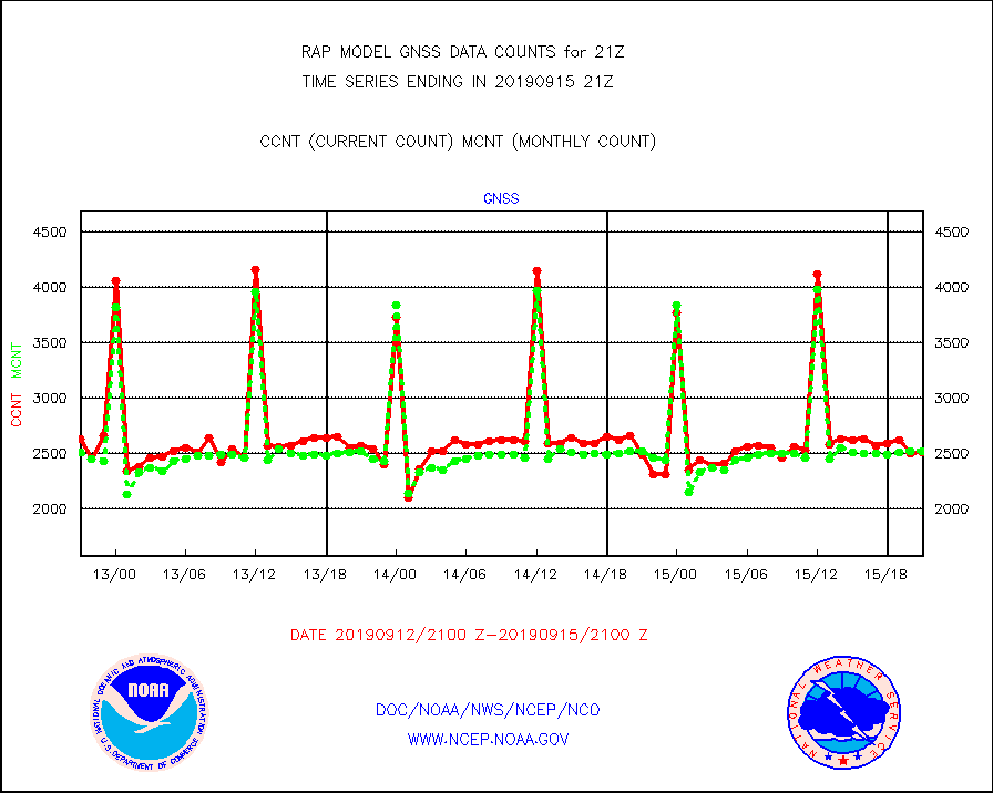
gnss |
Grnd-based Gbl Navigation Sat System (GNSS) data |
2508 |
2519 |
99.6 % |
1519.95-1520.05 |
h20mo |
MODIS (AQUA/TERRA) wvpr imager derived cld motion |
0 |
0 |
n/a |
1518.50-1523.50 |
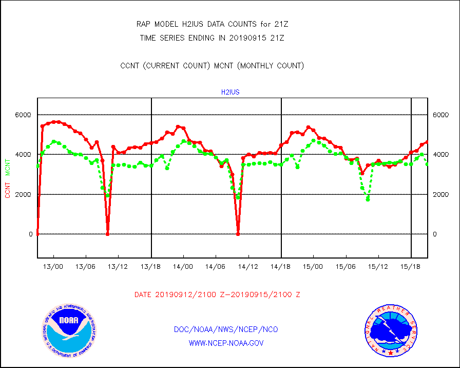
h2ius |
GOES/NESDIS water vapor imager derived cld motion |
4625 |
3519 |
131.4 % |
1520.00-1520.99 |
infmo |
MODIS (AQUA/TERRA) ir l-wave derived cloud motion |
0 |
0 |
n/a |
1518.50-1523.50 |
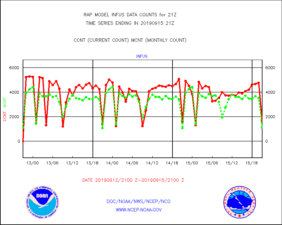
infus |
GOES/NESDIS infrared lg-wave derived cloud motion |
1649 |
1140 |
144.6 % |
1520.00-1520.99 |
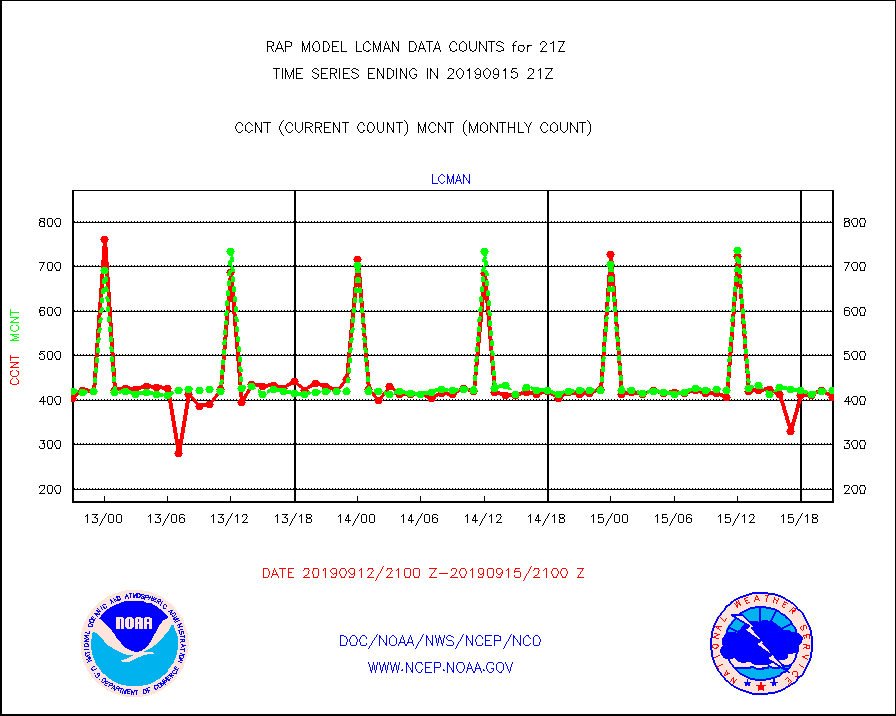
lcman |
Land-based CMAN stations decoded from CMAN format |
406 |
421 |
96.4 % |
1520.50-1521.50 |
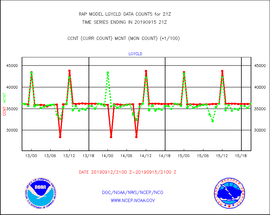
lgycld |
GOES/NASA(Langley) hi-res. (1x1 f-o-v) cloud data |
3609893 |
3617074 |
99.8 % |
1520.50-1521.50 |
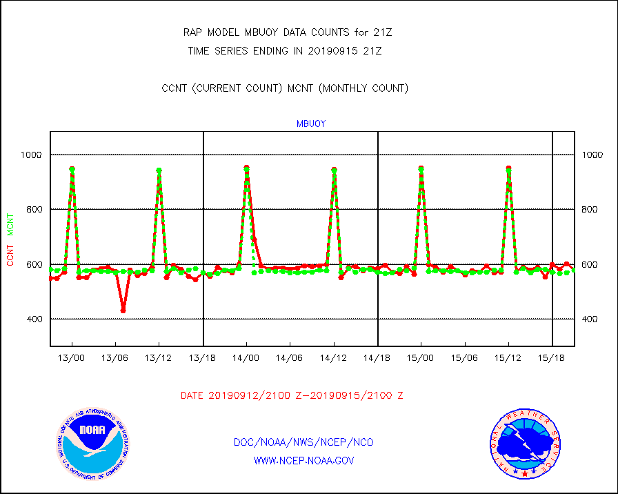
mbuoy |
Buoys decoded from FM-13 format (moored) |
578 |
580 |
99.7 % |
1520.50-1521.50 |
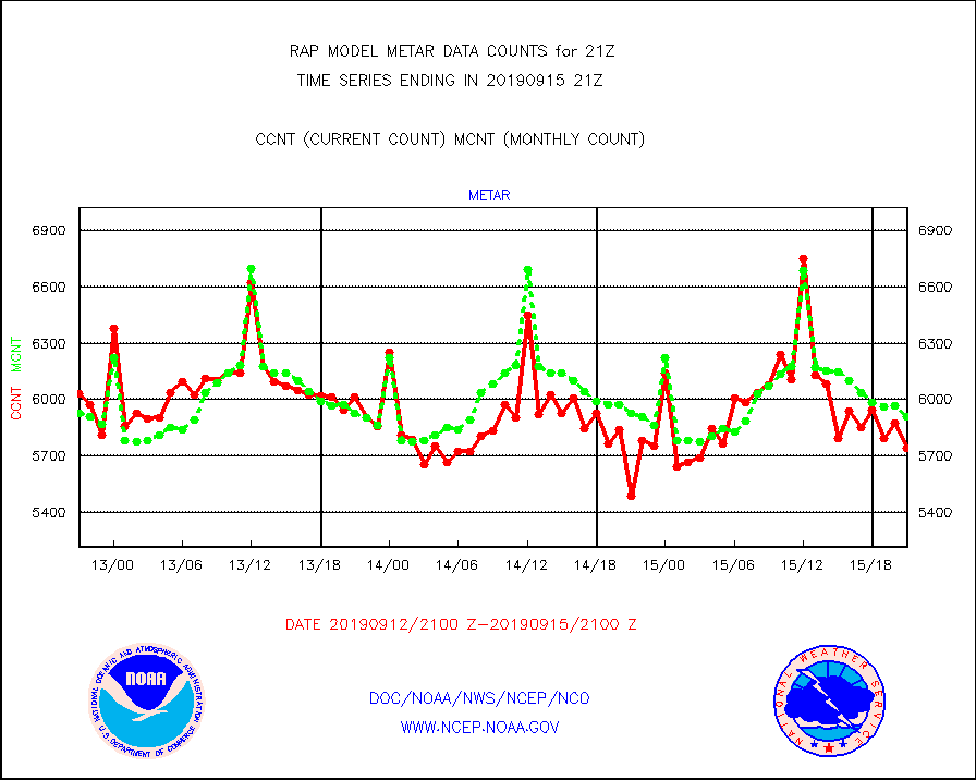
metar |
Aviation - METAR |
5743 |
5911 |
97.2 % |
1520.50-1521.50 |
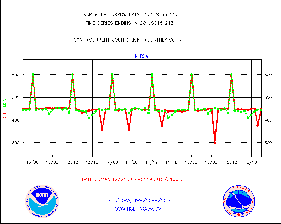
nxrdw |
NEXRAD Vel Azm Dsp(VAD) winds via radar coded msg |
450 |
443 |
101.6 % |
1520.00-1522.00 |
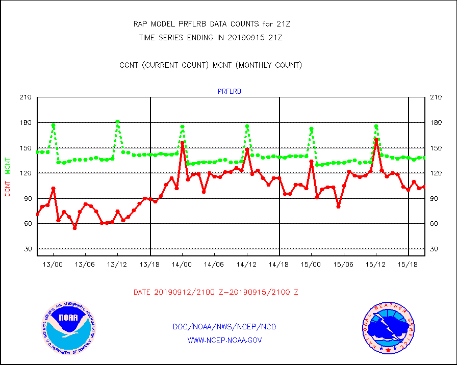
prflrb |
Multi-Agency Profiler (MAP) and SODAR winds |
104 |
138 |
75.4 % |
1519.50-1522.50 |
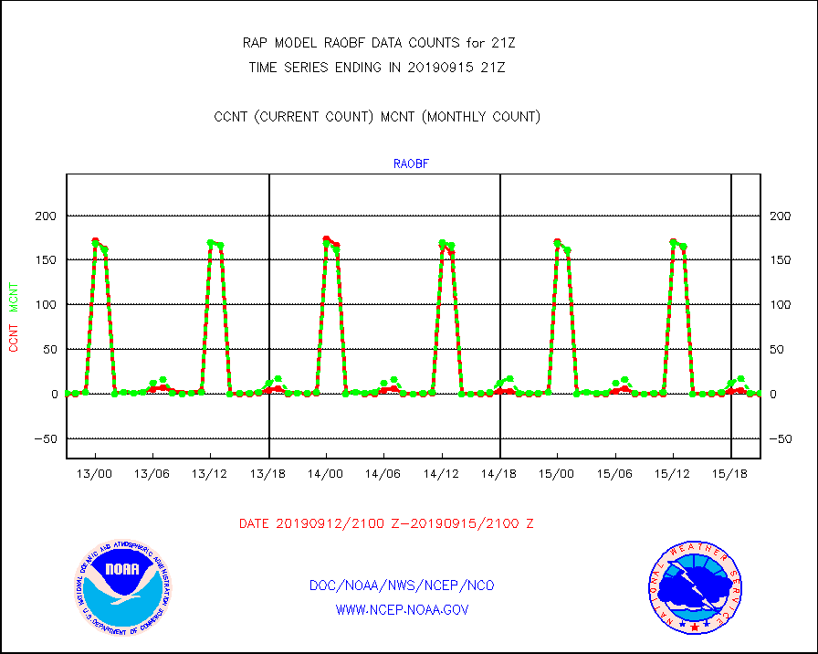
raobf |
Rawinsonde - fixed land (from TEMP or PILOT) |
0 |
1 |
0.0 % |
1520.00-1522.00 |
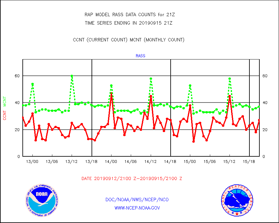
rass |
RASS temperatures (NOAA and Multi-Agency) |
27 |
37 |
73.0 % |
1520.50-1521.50 |
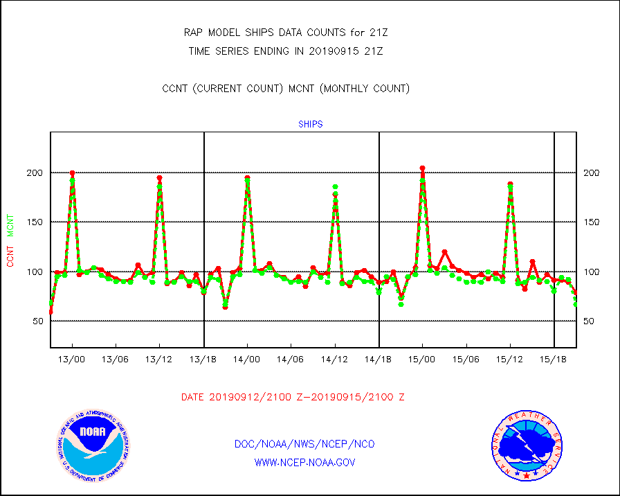
ships |
Ship - manual and automatic, restricted |
79 |
67 |
117.9 % |
1520.50-1521.50 |
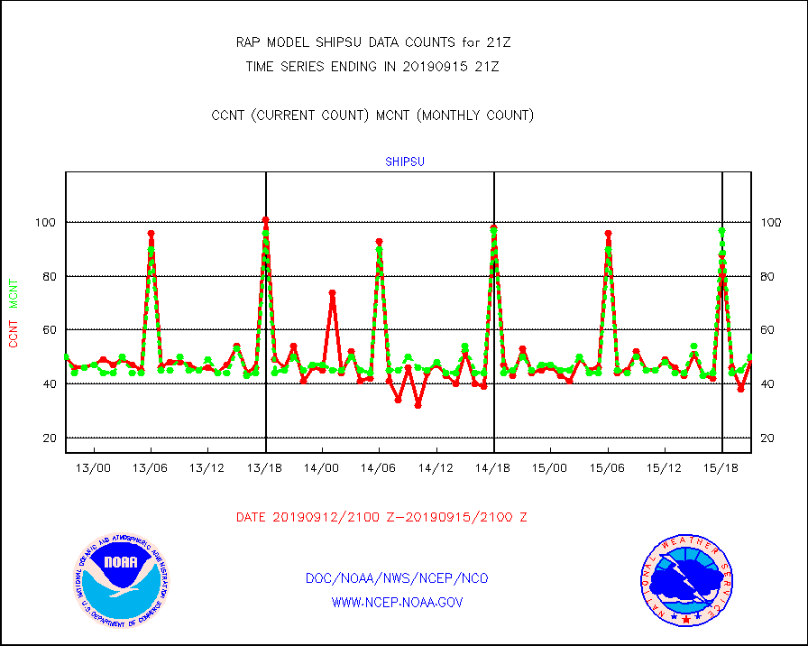
shipsu |
Ship - manual and automatic, unrestricted |
49 |
50 |
98.0 % |
1520.50-1521.50 |
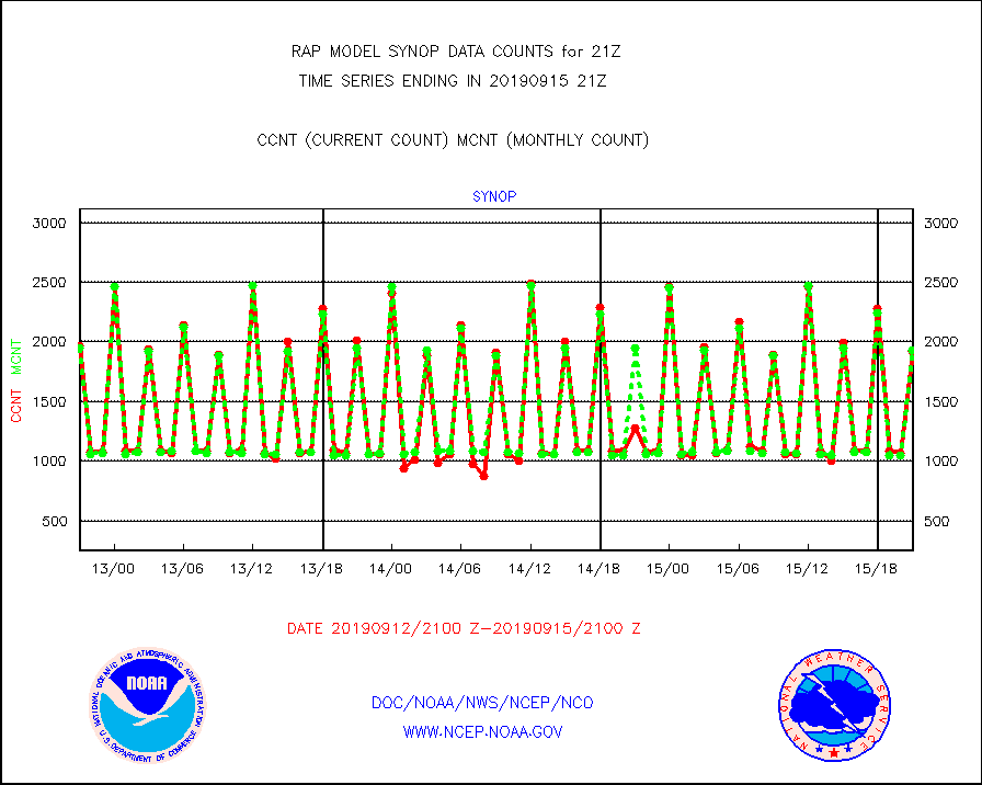
synop |
Synoptic - fixed manual and automatic |
1922 |
1925 |
99.8 % |
1520.50-1521.50 |
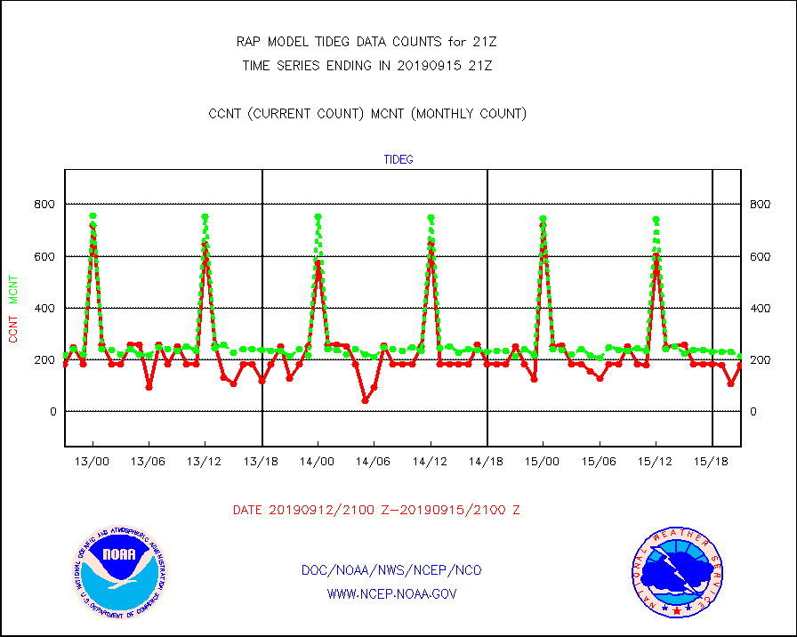
tideg |
Tide gauge reports decoded from CREX format |
181 |
214 |
84.6 % |
1520.50-1521.50 |
| Data Types of Opportunity with Normal Counts |
|---|
| Type | Description | Hourly Count | Monthly Average | Percent (%) of Monthly Mean | UTC Time Window |
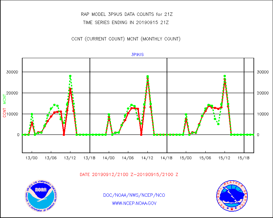
3p9us |
GOES/NESDIS infrared shrt-wave derived cld motion |
0 |
0 |
n/a |
1520.00-1520.99 |
acarsa |
MDCRS ACARS acft data (ARINC via AFWA)(AIREP fmt) |
0 |
0 |
n/a |
1517.75-1600.25 |
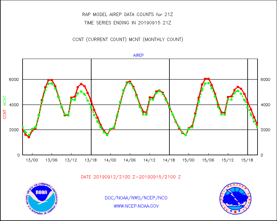
airep |
Manual AIREP aircraft data (dcded from AIREP fmt) |
2380 |
2200 |
108.2 % |
1517.75-1600.25 |
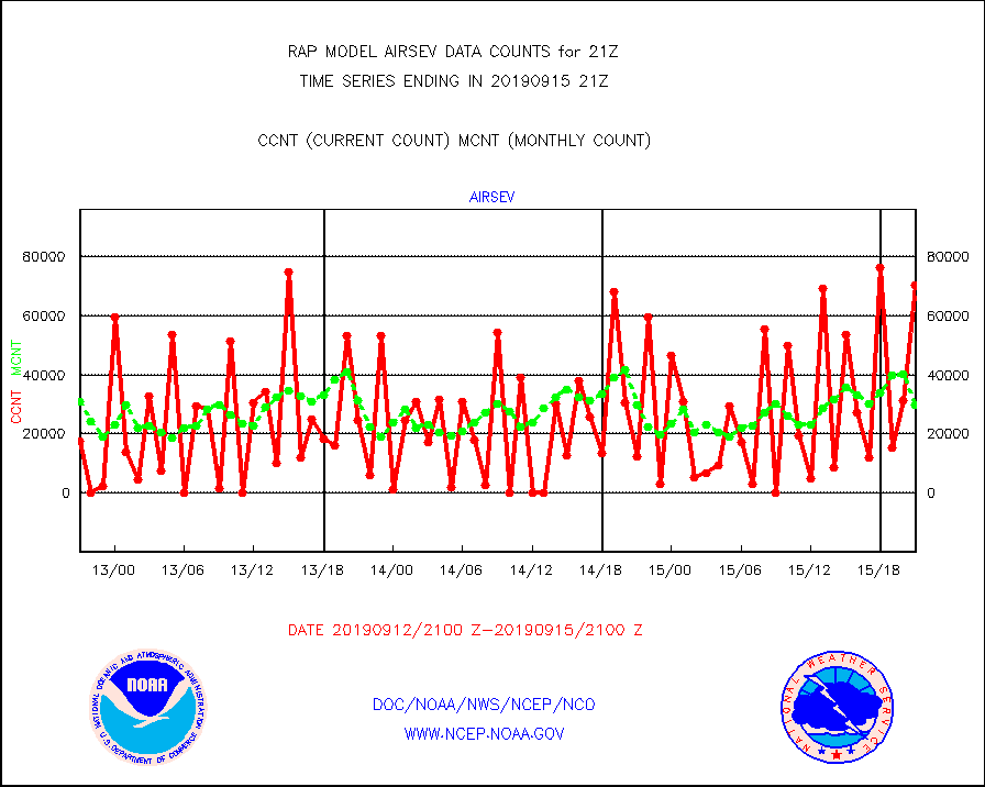
airsev |
AQUA AIRS/AMSU-A/HSB brightness temps- every FOV |
70309 |
29915 |
235.0 % |
1518.00-1523.99 |
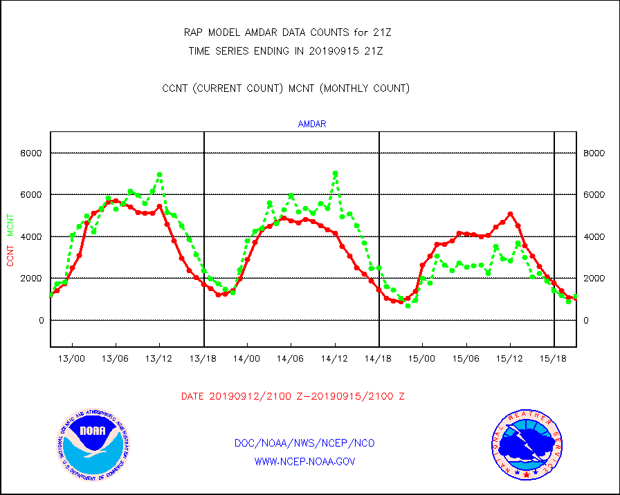
amdar |
AMDAR aircraft data (decoded from AMDAR format) |
1043 |
1143 |
91.3 % |
1517.75-1600.25 |
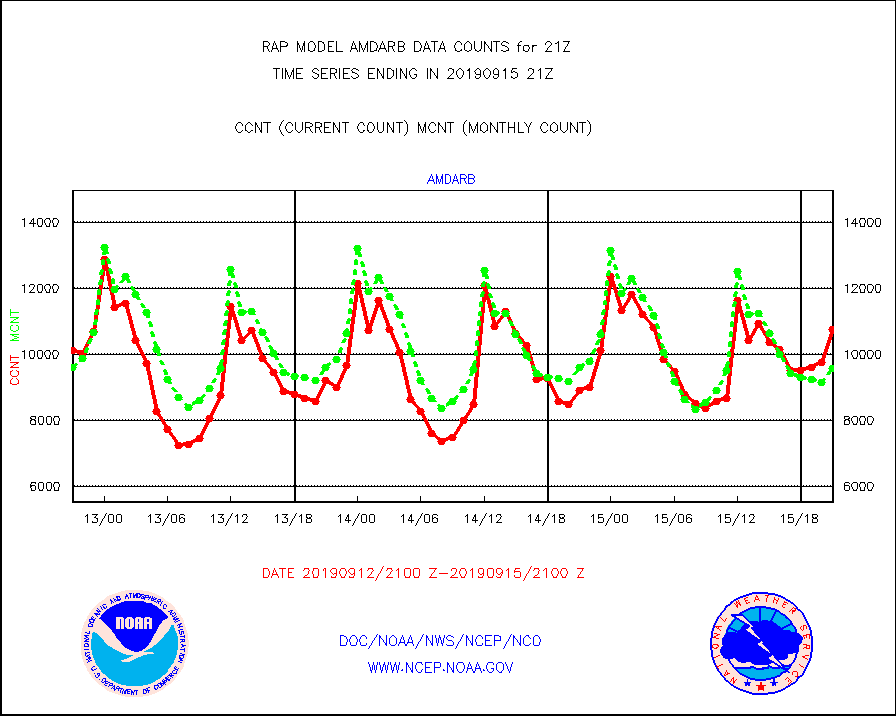
amdarb |
AMDAR aircraft data (decoded from BUFR) |
10766 |
9575 |
112.4 % |
1517.75-1600.25 |
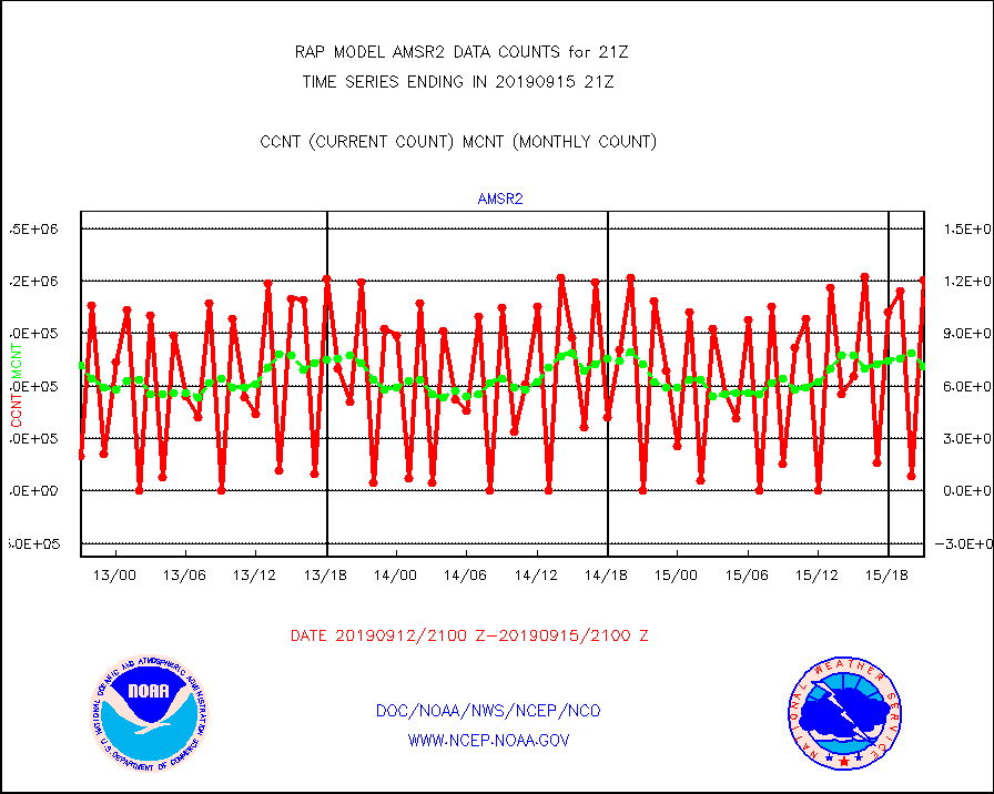
amsr2 |
GCOM-W AMSR2 1B brightness temperatures |
1207200 |
713309 |
169.2 % |
1518.00-1518.99 |
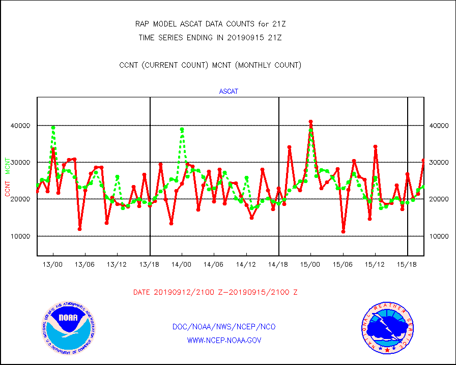
ascat |
METOP 1-2 ASCAT products |
30537 |
23395 |
130.5 % |
1519.00-1523.00 |
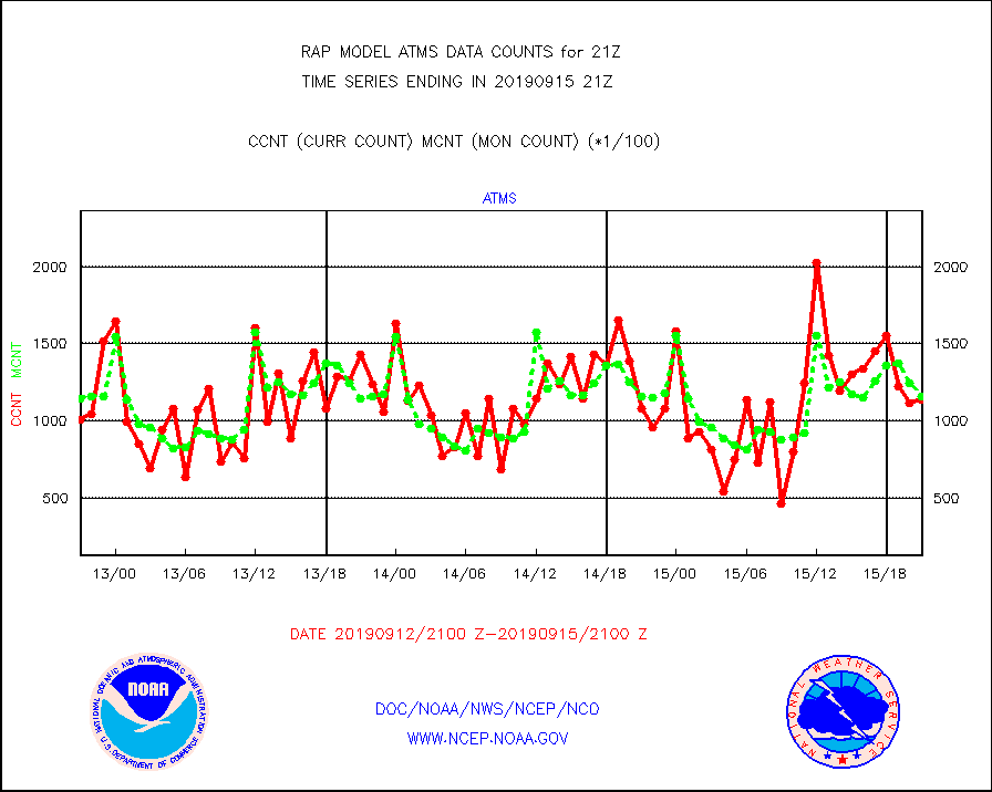
atms |
NPP Adv. Tech. Microwave Sounder (ATMS) br. temps |
113746 |
116175 |
97.9 % |
1519.00-1522.99 |
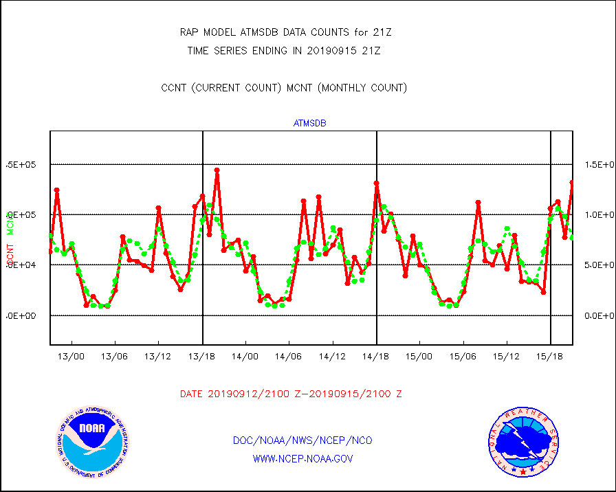
atmsdb |
NPP Adv Tech MW Sndr(ATMS) b. temps-dir bcst SSEC |
132058 |
77110 |
171.3 % |
1519.00-1522.99 |
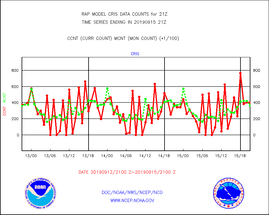
cris |
NPP Cross-track Infrared Sounder (CrIS) radiances |
40057 |
36348 |
110.2 % |
1519.00-1522.99 |
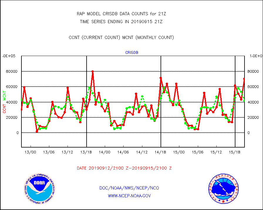
crisdb |
NPP Crss-trk IR Sndr(CrIS) radiance-dir bcst SSEC |
70200 |
41670 |
168.5 % |
1519.00-1522.99 |
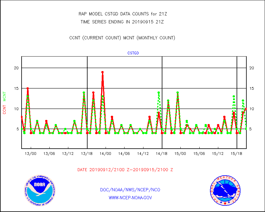
cstgd |
Coast Guard |
10 |
5 |
200.0 % |
1520.50-1521.50 |
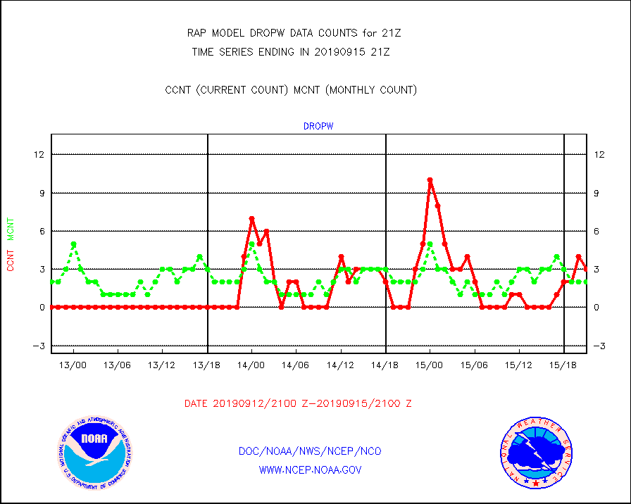
dropw |
Dropwinsonde (from TEMP DROP) |
3 |
2 |
150.0 % |
1520.00-1522.00 |
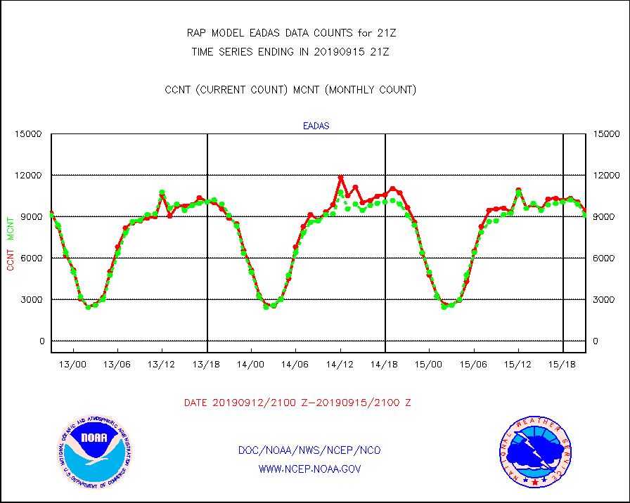
eadas |
E-AMDAR (European AMDAR acft decoded from BUFR) |
9462 |
9098 |
104.0 % |
1517.75-1600.25 |
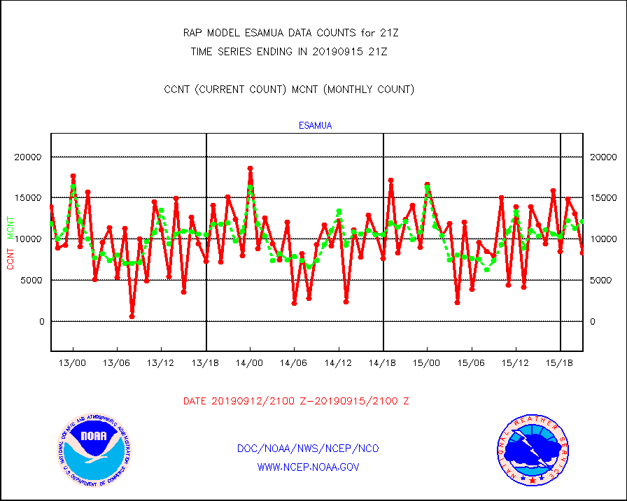
esamua |
NOAA 15-19 & METOP 1-2 AMSU-A proc btmps frm RARS |
8336 |
12130 |
68.7 % |
1520.00-1522.00 |
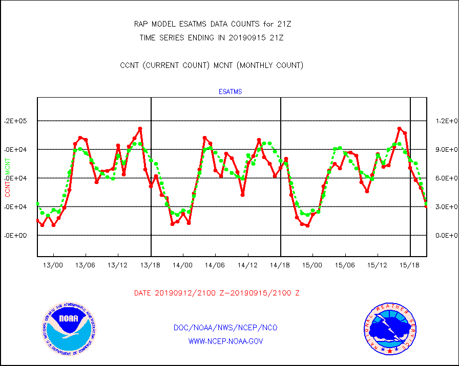
esatms |
NPP Adv. Tech. MW Sndr (ATMS) br. temps from RARS |
30437 |
33274 |
91.5 % |
1519.00-1522.99 |
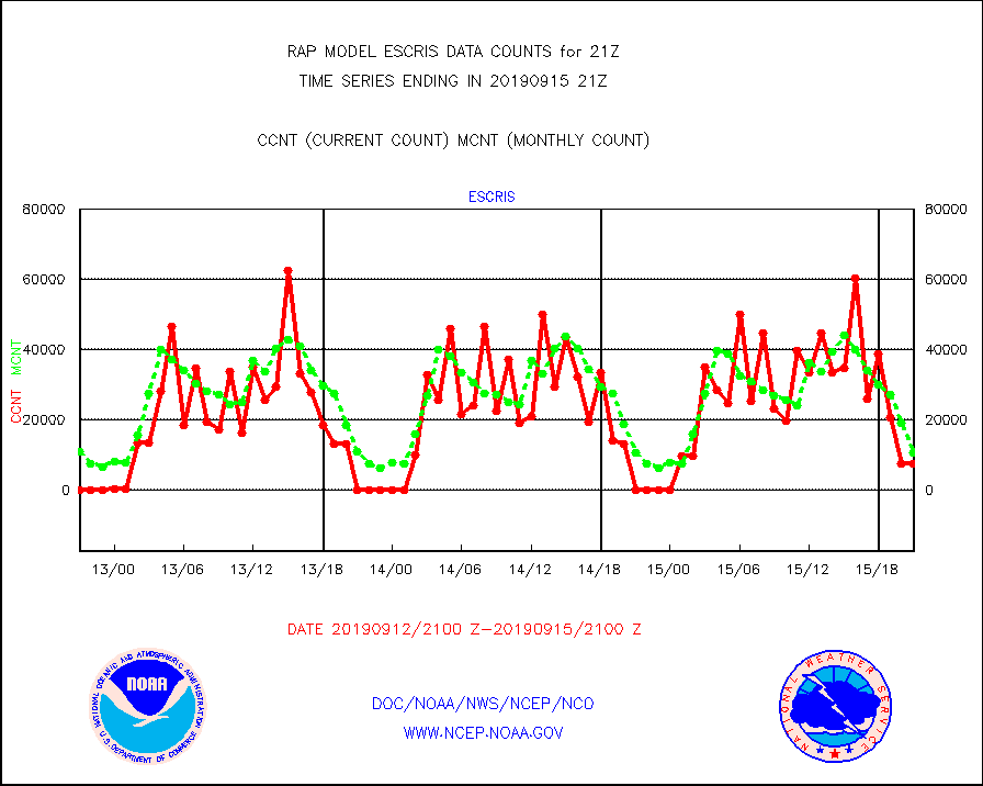
escris |
NPP Crss-track IR Sndr (CrIS) radiances from RARS |
7560 |
10429 |
72.5 % |
1519.00-1522.99 |
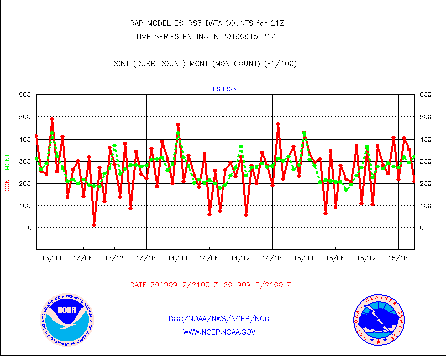
eshrs3 |
NOAA 15-19 & METOP 1-2 HIRS-3/4 pr btmps frm RARS |
20806 |
32319 |
64.4 % |
1520.00-1522.00 |
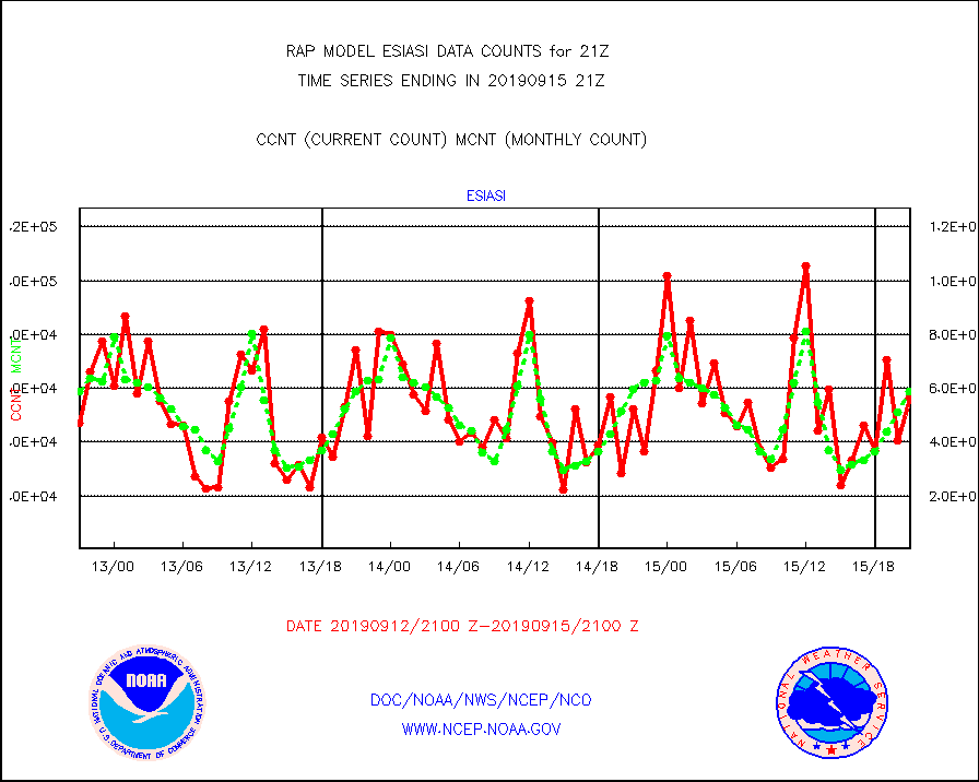
esiasi |
METOP 1-2 IASI 1C radiance data vbl chn from RARS |
56224 |
58991 |
95.3 % |
1519.00-1522.99 |
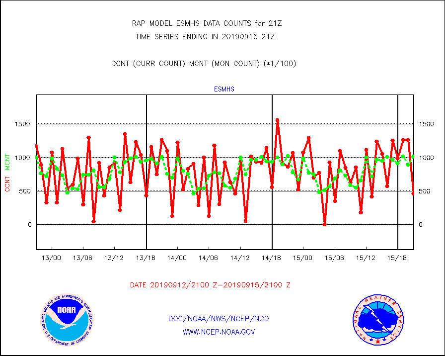
esmhs |
NOAA 18-19 & METOP 1-2 MHS proc. btemps from RARS |
46258 |
101765 |
45.5 % |
1520.00-1522.00 |
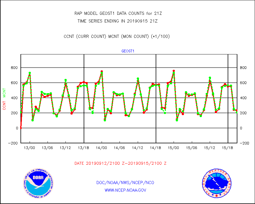
geost1 |
GOES/NESDIS hi-resol. (1x1 f-o-v) sndgs/radiances |
23293 |
20701 |
112.5 % |
1520.00-1522.00 |
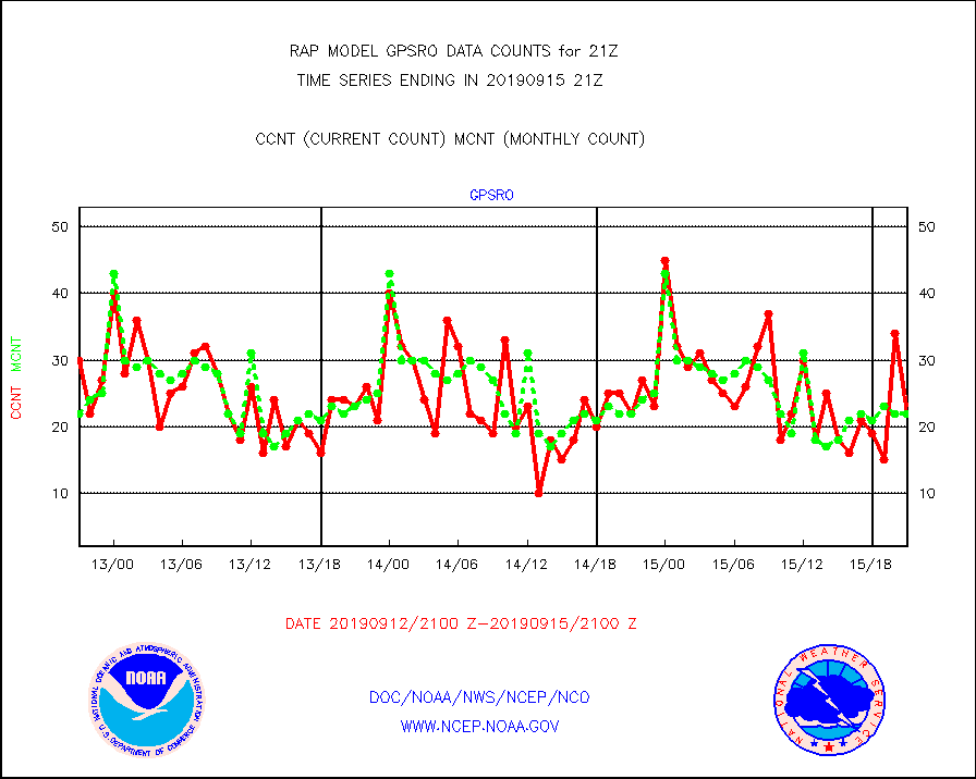
gpsro |
GPS radio occultation data |
22 |
22 |
100.0 % |
1519.00-1522.99 |
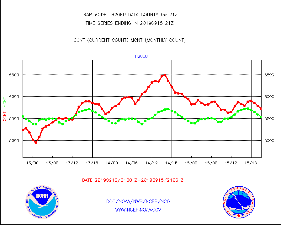
h20eu |
METEOSAT/EUMETSAT wvpr imager derived cld motion |
5732 |
5543 |
103.4 % |
1519.50-1522.49 |
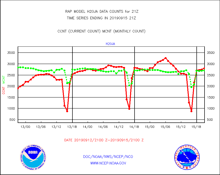
h20ja |
MTSAT/JMA water vapor imager derived cloud motion |
2801 |
2708 |
103.4 % |
1518.50-1523.50 |
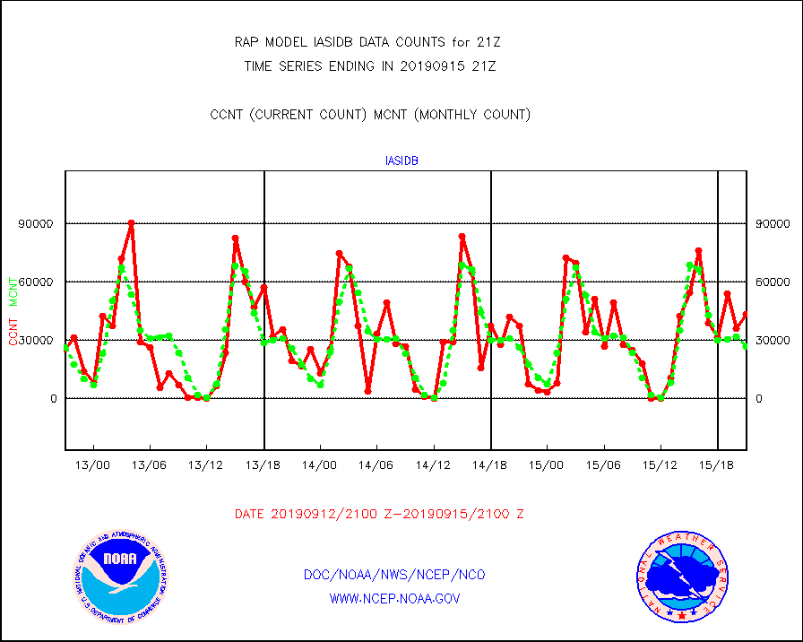
iasidb |
METOP 1-2 IASI 1C radiances-direct broadcast SSEC |
43160 |
26891 |
160.5 % |
1519.00-1522.99 |
infav |
AVHRR (NOAA/METOP) ir lg-wave derived cld motion |
541 |
522 |
103.6 % |
1518.50-1523.50 |
infeu |
METEOSAT/EUMETSAT ir lg-wave derived cloud motion |
3015 |
3172 |
95.1 % |
1519.50-1522.49 |
infja |
MTSAT/JMA infrared long-wave derived cloud motion |
1933 |
2271 |
85.1 % |
1518.50-1523.50 |
infvr |
VIIRS (NPP) infrared lg-wave derived cloud motion |
0 |
0 |
n/a |
1518.50-1523.50 |
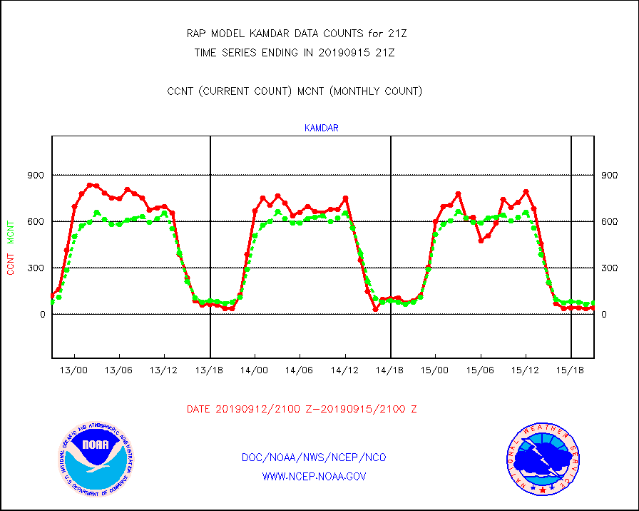
kamdar |
Korean AMDAR aircraft data (decoded from BUFR) |
44 |
76 |
57.9 % |
1517.75-1600.25 |
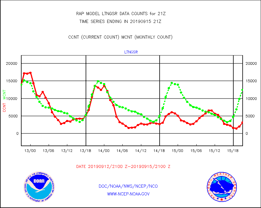
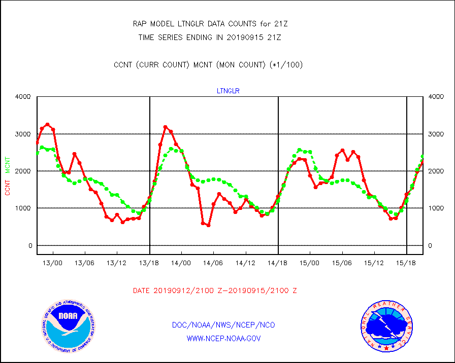
ltnglr |
LLDN Long-rng lightning from Vaisala via NOAAPORT |
226032 |
238843 |
94.6 % |
1520.00-1521.50 |
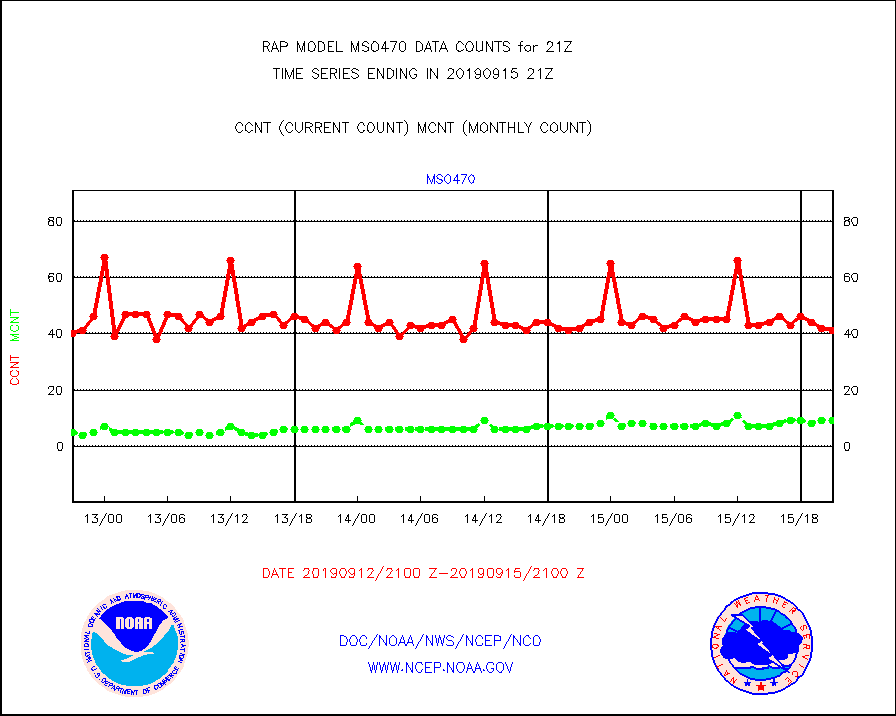
mso470 |
Mesonet/MADIS Colorado E-470 (Interstate 470) |
41 |
9 |
455.6 % |
1520.50-1521.50 |
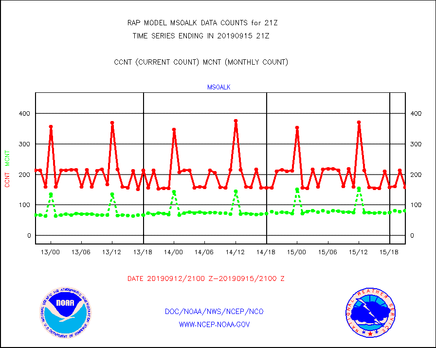
msoalk |
Mesonet/MADIS Alaska Department of Transportation |
158 |
82 |
192.7 % |
1520.50-1521.50 |
msoapg |
Mesonet/MADIS U.S. Army Aberdeen Proving Grounds |
0 |
0 |
n/a |
1520.50-1521.50 |
msoapr |
Mesonet/MADIS Citizen Weather Observers Program |
49586 |
49028 |
101.1 % |
1520.50-1521.50 |
msoaws |
Mesonet/MADIS AWS Convergence Technologies, Inc. |
16320 |
16223 |
100.6 % |
1520.50-1521.50 |
msoawx |
Mesonet/MADIS "Anything Weather" |
0 |
0 |
n/a |
1520.50-1521.50 |
msocol |
Mesonet/MADIS Colorado Dept. of Transportation |
480 |
421 |
114.0 % |
1520.50-1521.50 |
msodcn |
Mesonet/MADIS DC Net |
0 |
0 |
n/a |
1520.50-1521.50 |
msoden |
Mesonet/MADIS Denver Urban Drainage & Flood Cntrl |
0 |
0 |
n/a |
1520.50-1521.50 |
msofla |
Mesonet/MADIS Florida (FAWN & USF) |
106 |
125 |
84.8 % |
1520.50-1521.50 |
msoflt |
Mesonet/MADIS Florida Dept. of Transportation |
0 |
0 |
n/a |
1520.50-1521.50 |
msogeo |
Mesonet/MADIS Georgia Dept. of Transportation |
246 |
50 |
492.0 % |
1520.50-1521.50 |
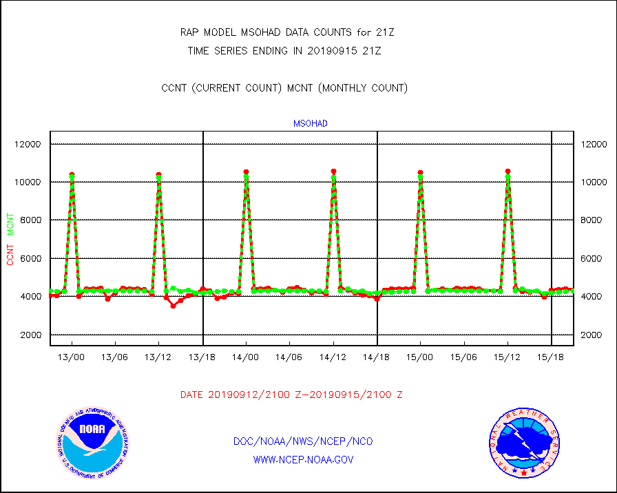
msohad |
Mesonet/MADIS NWS Hydromet Auto Data System(HADS) |
4318 |
4280 |
100.9 % |
1520.50-1521.50 |
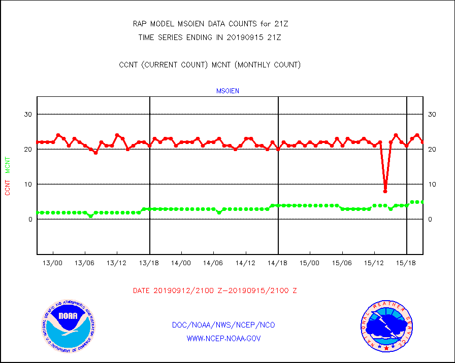
msoien |
Mesonet/MADIS Iowa Environmental |
22 |
5 |
440.0 % |
1520.50-1521.50 |
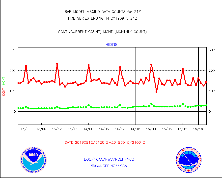
msoind |
Mesonet/MADIS Indiana Dept. of Transportation |
145 |
30 |
483.3 % |
1520.50-1521.50 |
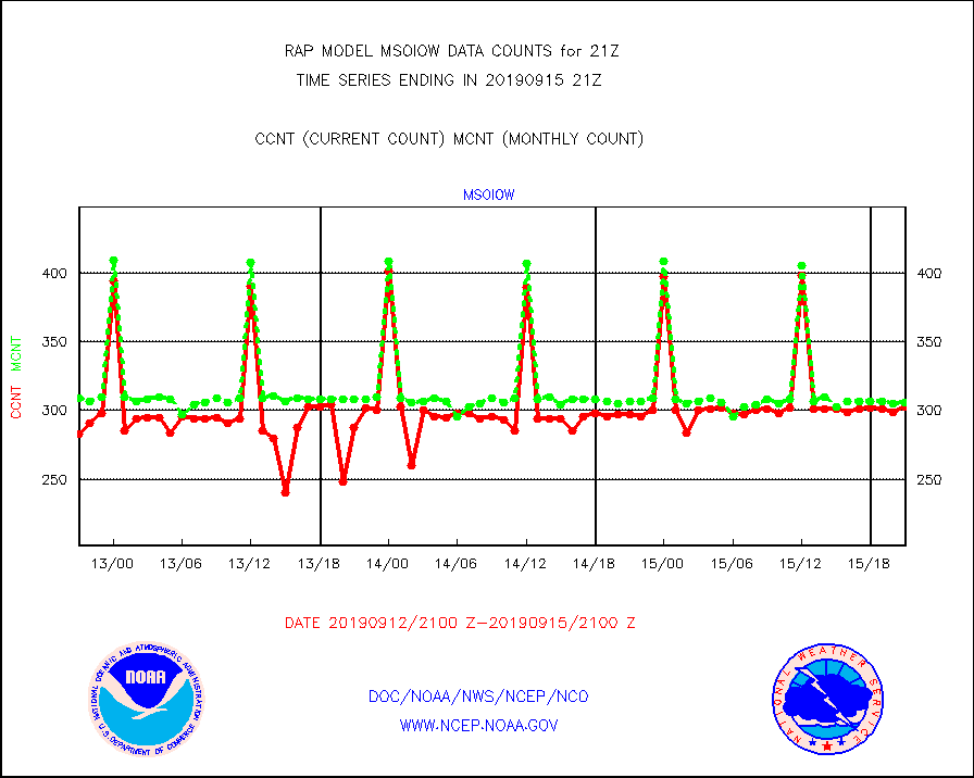
msoiow |
Mesonet/MADIS Iowa Department of Transportation |
303 |
306 |
99.0 % |
1520.50-1521.50 |
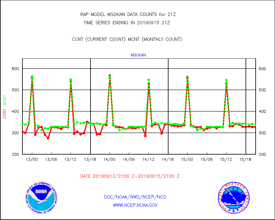
msokan |
Mesonet/MADIS Kansas Department of Transportation |
327 |
339 |
96.5 % |
1520.50-1521.50 |
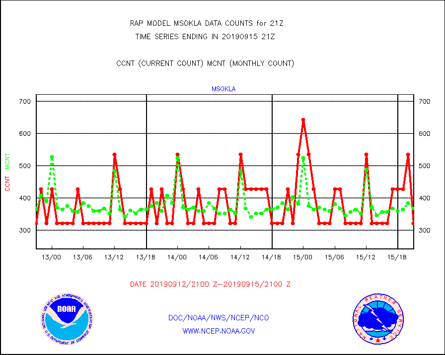
msokla |
Mesonet/MADIS Oklahoma Mesonet |
321 |
367 |
87.5 % |
1520.50-1521.50 |
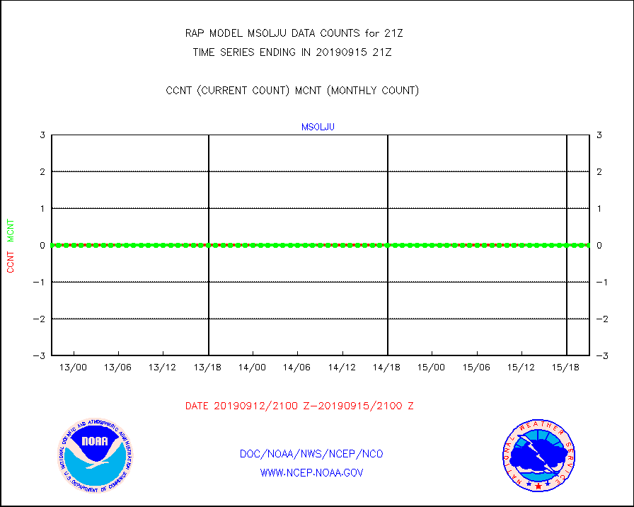
msolju |
Mesonet/MADIS Louisiana State/Jackson State Univ. |
0 |
0 |
n/a |
1520.50-1521.50 |
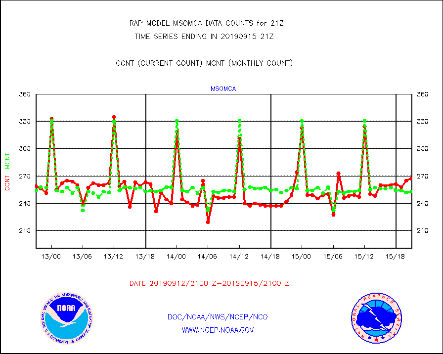
msomca |
Mesonet/MADIS Missouri Commercial Agricult Wx Net |
267 |
253 |
105.5 % |
1520.50-1521.50 |
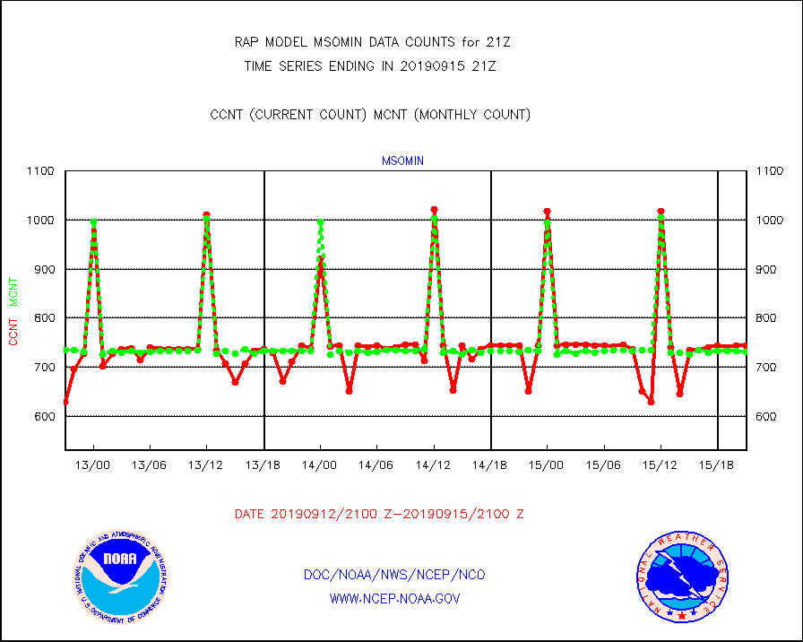
msomin |
Mesonet/MADIS Minnesota Dept. of Transportation |
743 |
731 |
101.6 % |
1520.50-1521.50 |
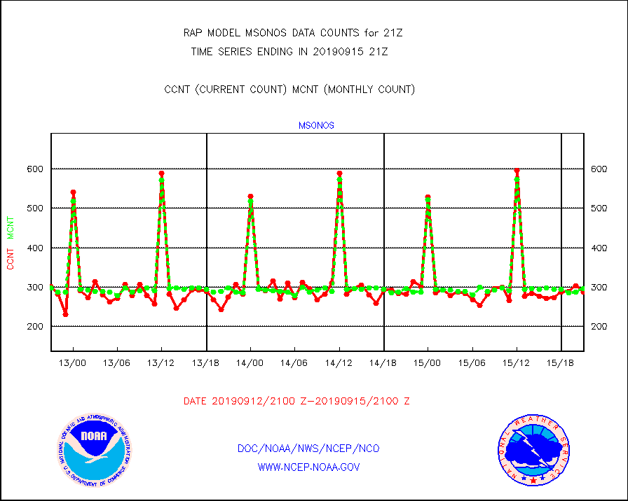
msonos |
Mesonet/MADIS NOS-Phys Oceanographic Realtime Sys |
288 |
296 |
97.3 % |
1520.50-1521.50 |
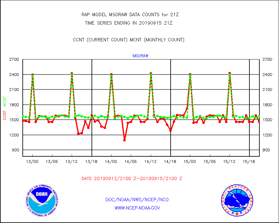
msoraw |
Mesonet/MADIS NFIC Remote Automated Wx Stns(RAWS) |
1456 |
1567 |
92.9 % |
1520.50-1521.50 |
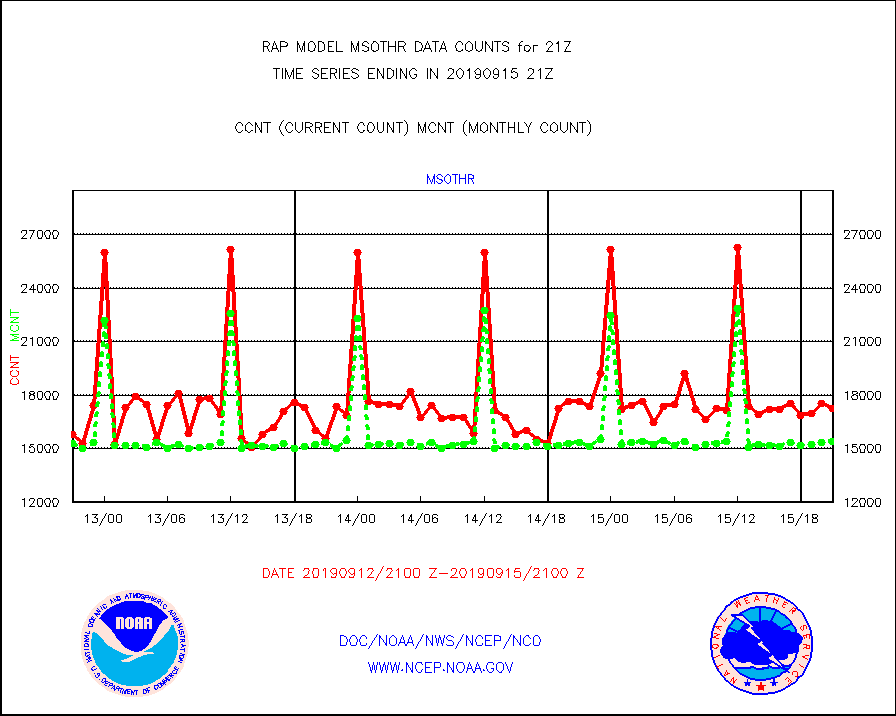
msothr |
Mesonet/MADIS many providers, not separated out |
17245 |
15427 |
111.8 % |
1520.50-1521.50 |
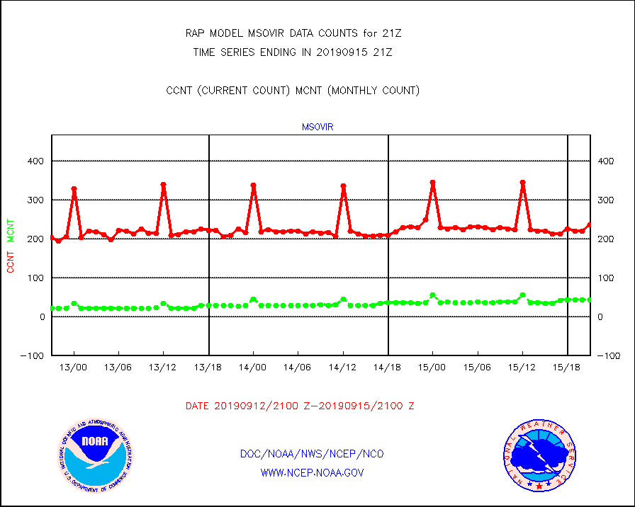
msovir |
Mesonet/MADIS Virginia Dept. of Transportation |
237 |
44 |
538.6 % |
1520.50-1521.50 |
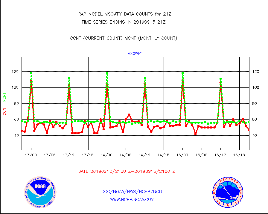
msowfy |
Mesonet/MADIS "Weather for You" |
47 |
57 |
82.5 % |
1520.50-1521.50 |
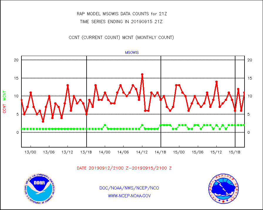
msowis |
Mesonet/MADIS Wisconsin Dept. of Transportation |
11 |
2 |
550.0 % |
1520.50-1521.50 |
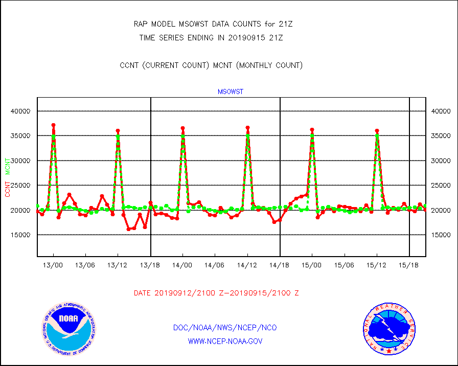
msowst |
Mesonet/MADIS MesoWest (many subproviders) |
20068 |
20843 |
96.3 % |
1520.50-1521.50 |
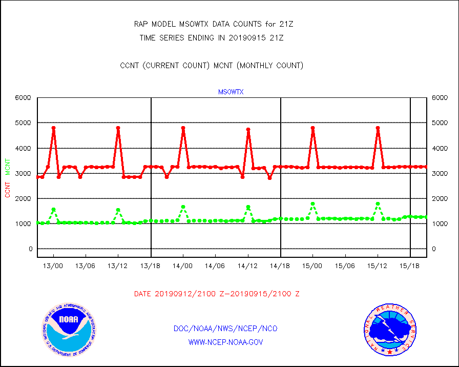
msowtx |
Mesonet/MADIS West Texas |
3250 |
1265 |
256.9 % |
1520.50-1521.50 |
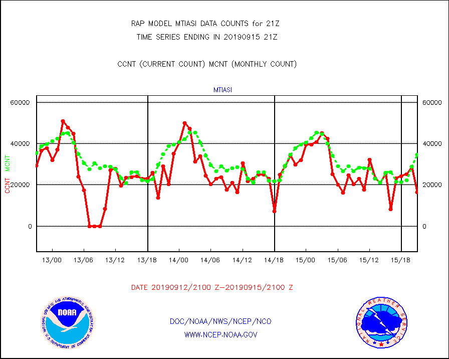
mtiasi |
METOP 1-2 IASI 1C radiance data (varbl. channels) |
16364 |
34785 |
47.0 % |
1519.00-1522.99 |
nxrdw2 |
NEXRAD Vel Azm Dsp(VAD) winds via Level 2 decoder |
564 |
635 |
88.8 % |
1520.00-1522.00 |
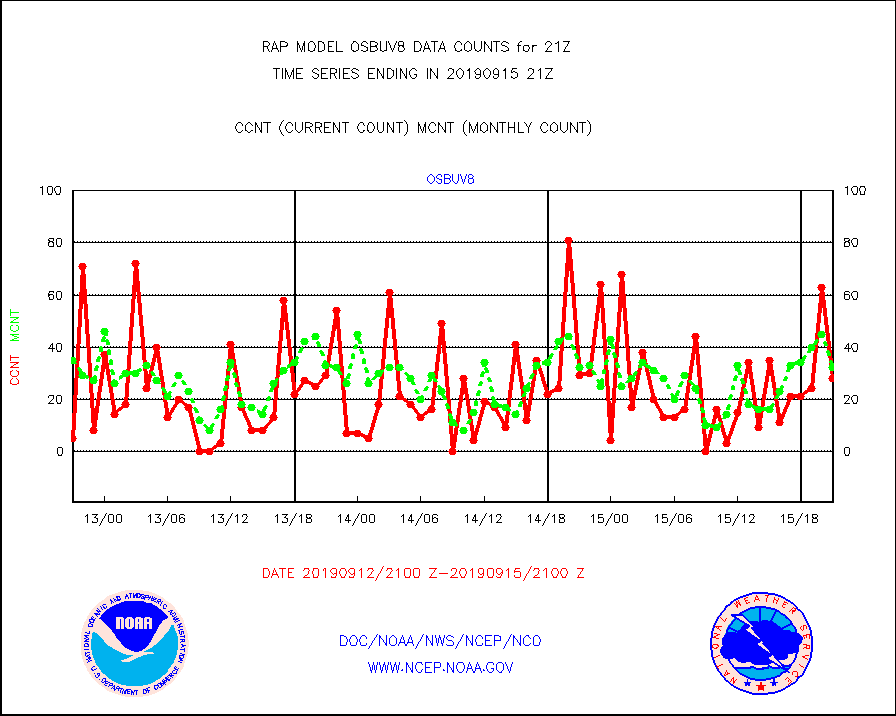
osbuv8 |
NOAA 16-19 Solar Backscatter UV-2 rad frm V8 BUFR |
28 |
32 |
87.5 % |
1519.00-1521.99 |
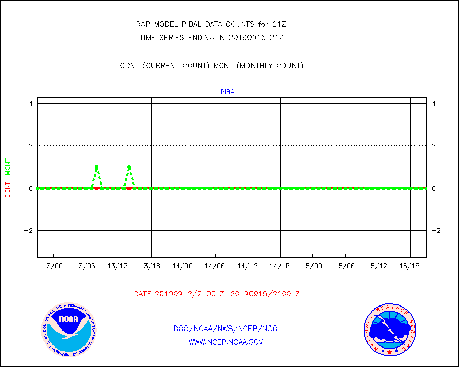
pibal |
PIBAL (from PILOT, PILOT SHIP, PILOT MOBIL) |
0 |
0 |
n/a |
1520.00-1522.00 |
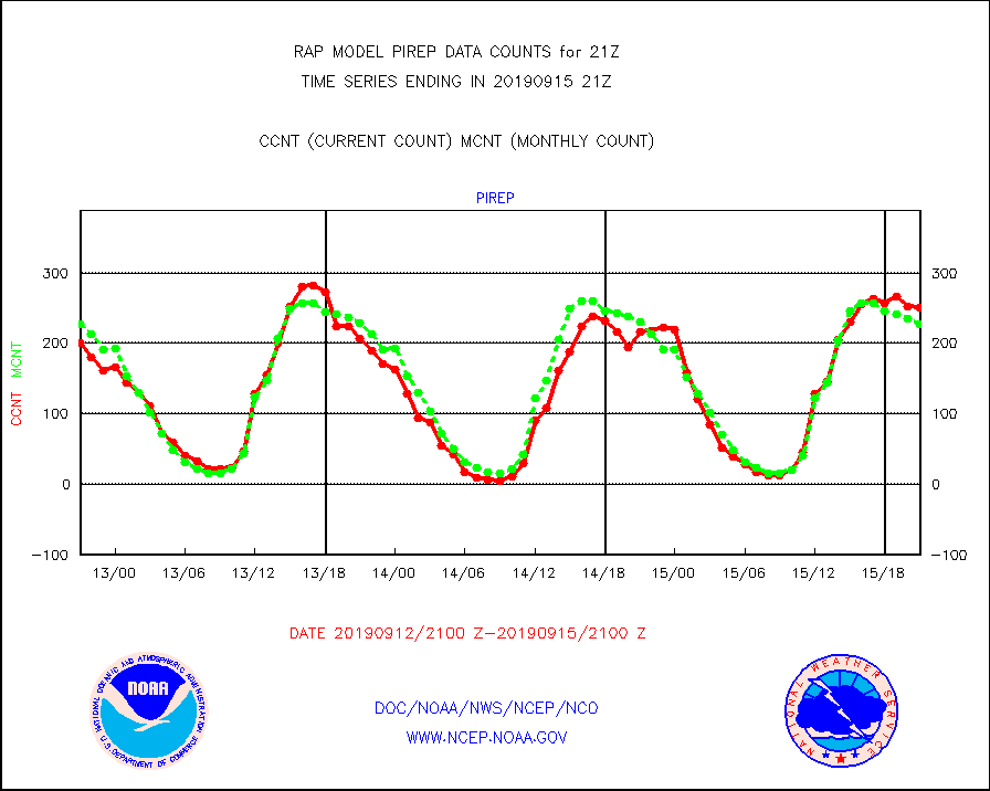
pirep |
Manual PIREP aircraft data (dcded from AIREP fmt) |
251 |
228 |
110.1 % |
1517.75-1600.25 |
prflrp |
Profilr winds from PIBAL (PILOT,PILOT SHIP/MOBIL) |
0 |
0 |
n/a |
1519.50-1522.50 |
radw25 |
NEXRAD radial wind superobs (Level 2.5 - ORPG) |
0 |
0 |
n/a |
1520.00-1522.00 |
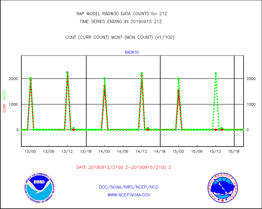
radw30 |
NEXRAD radial wind superobs (Level 3 - NIDS) |
0 |
0 |
n/a |
1520.00-1522.00 |
raobm |
Rawinsonde - mobile land (from TEMP/PILOT MOBIL) |
0 |
0 |
n/a |
1520.00-1522.00 |
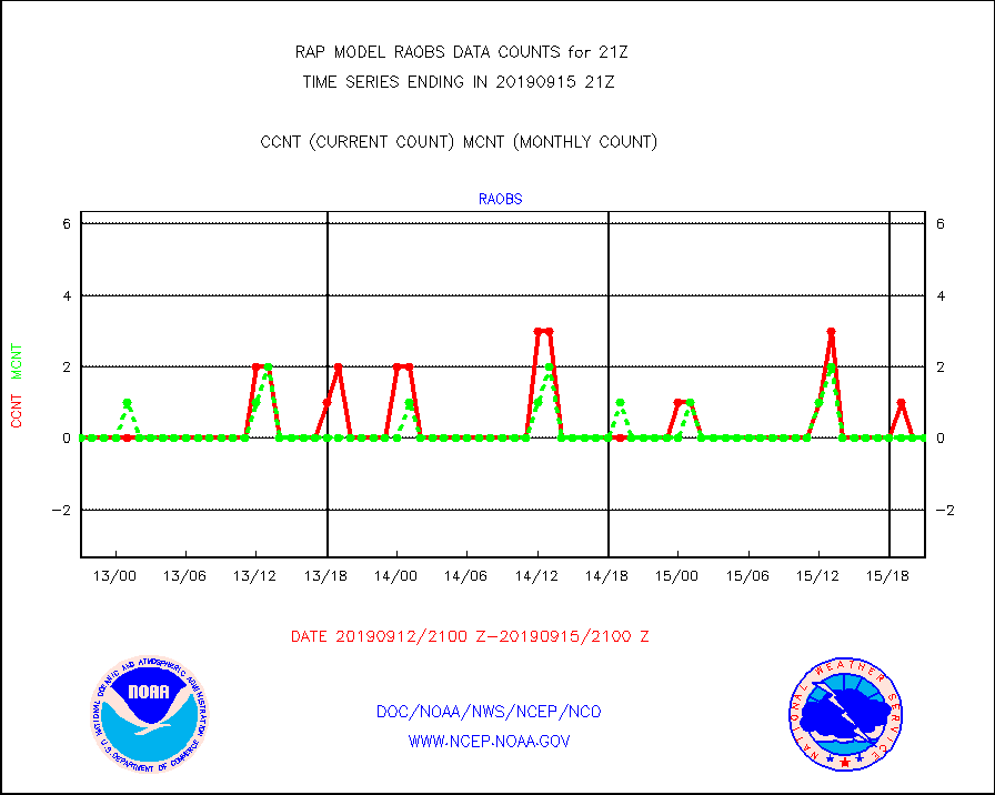
raobs |
Rawinsonde - ship (from TEMP SHIP, PILOT SHIP) |
0 |
0 |
n/a |
1520.00-1522.00 |
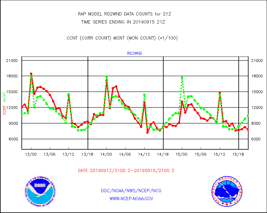
rd2wnd |
NEXRAD radial wind (Level 2 - GTS) |
784052 |
1048932 |
74.7 % |
1520.50-1521.49 |
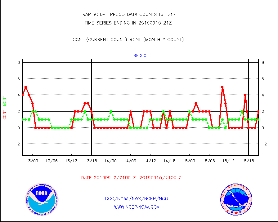
recco |
Flight level reconnaissance aircraft data |
2 |
1 |
200.0 % |
1520.00-1522.00 |
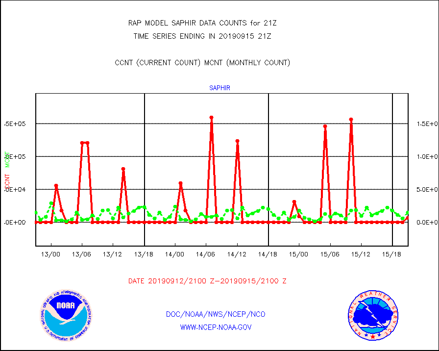
saphir |
Megha-Tropiques SAPHIR L1A2 brightness temps |
6133 |
14925 |
41.1 % |
1518.00-1523.99 |
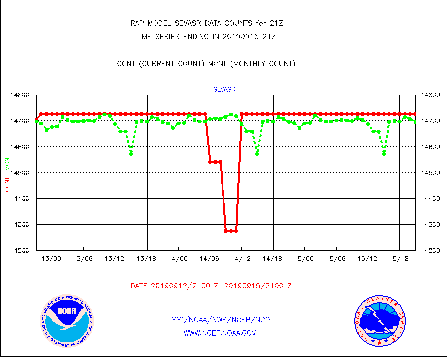
sevasr |
METEOSAT-10 2nd Gen SEVIRI All Sky Radiance(proc) |
14727 |
14697 |
100.2 % |
1519.00-1522.99 |
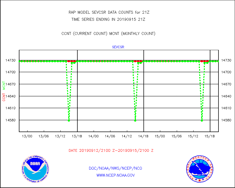
sevcsr |
METEOSAT-10 2nd Gen SEVIRI Clr Sky Radiance(proc) |
14727 |
14727 |
100.0 % |
1519.00-1522.99 |
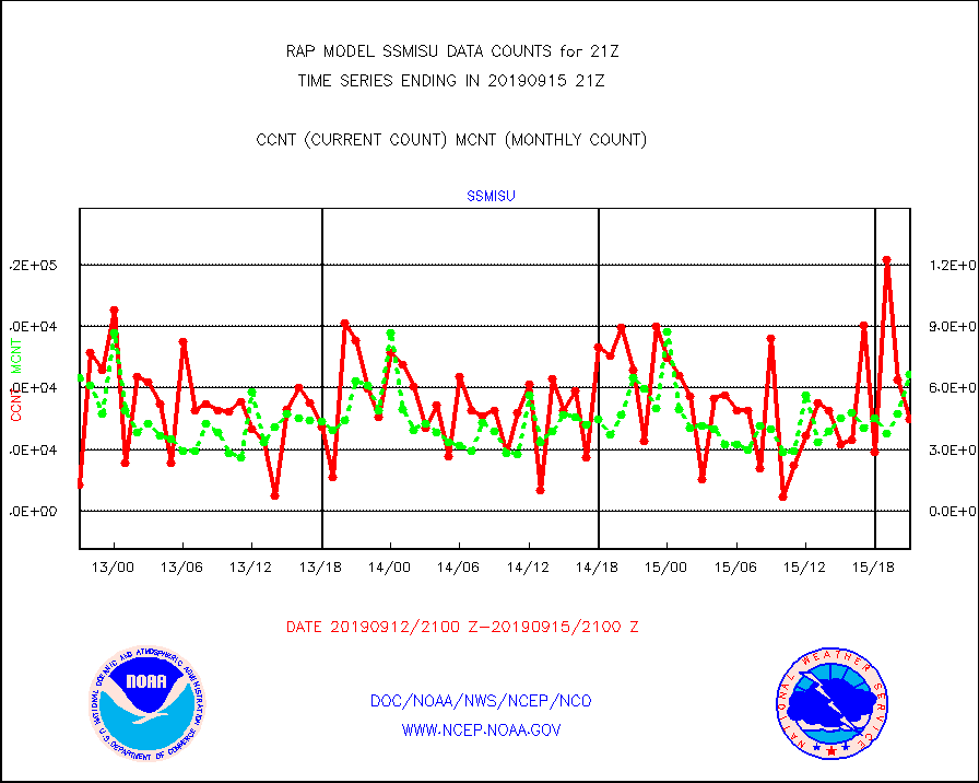
ssmisu |
DMSP SSM/IS 1C radiance data (Unified Pre-Proc.) |
44658 |
66549 |
67.1 % |
1519.00-1522.99 |
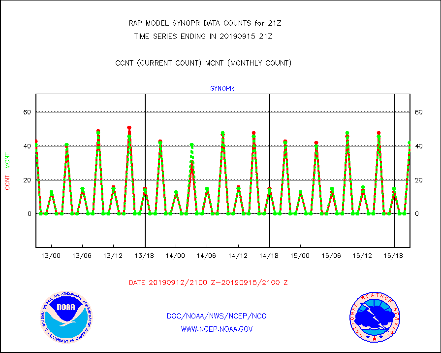
synopr |
Synoptic - restricted (WMO Res 40) manual & auto. |
42 |
42 |
100.0 % |
1520.50-1521.50 |
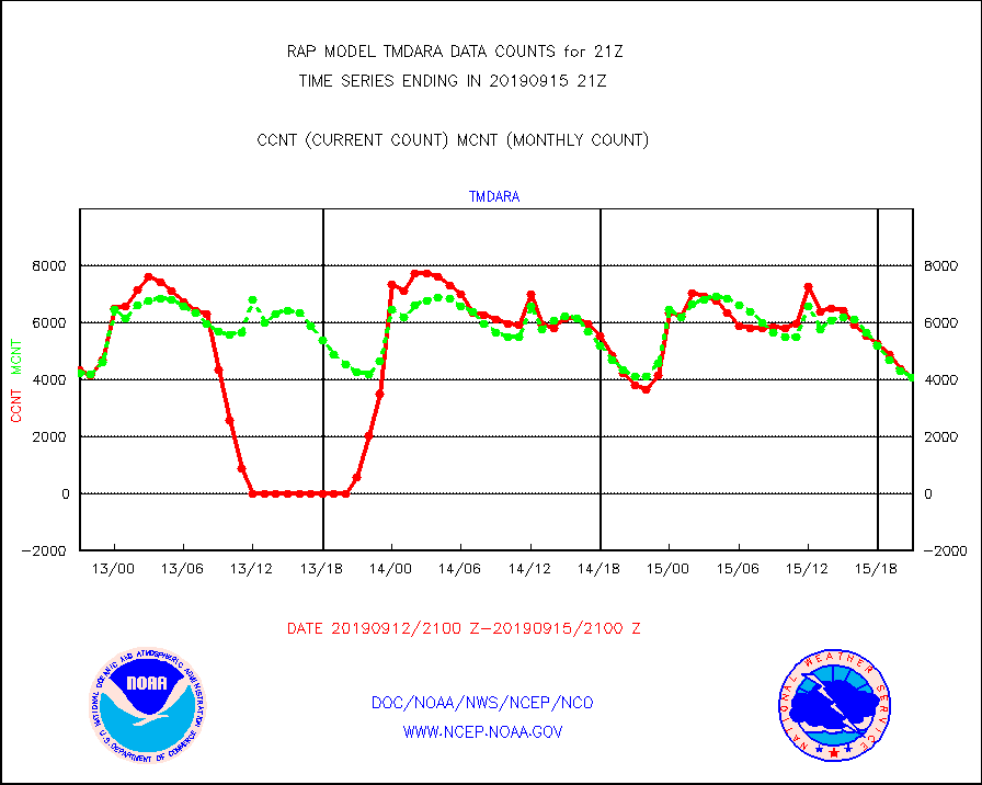
tmdara |
TAMDAR aircft data-all types(from Panasonic,BUFR) |
4080 |
4064 |
100.4 % |
1517.75-1600.25 |
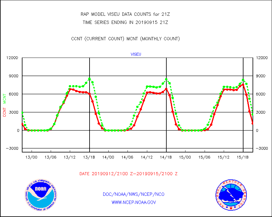
viseu |
METEOSAT/EUMETSAT visible derived cloud motion |
1144 |
2618 |
43.7 % |
1519.50-1522.49 |
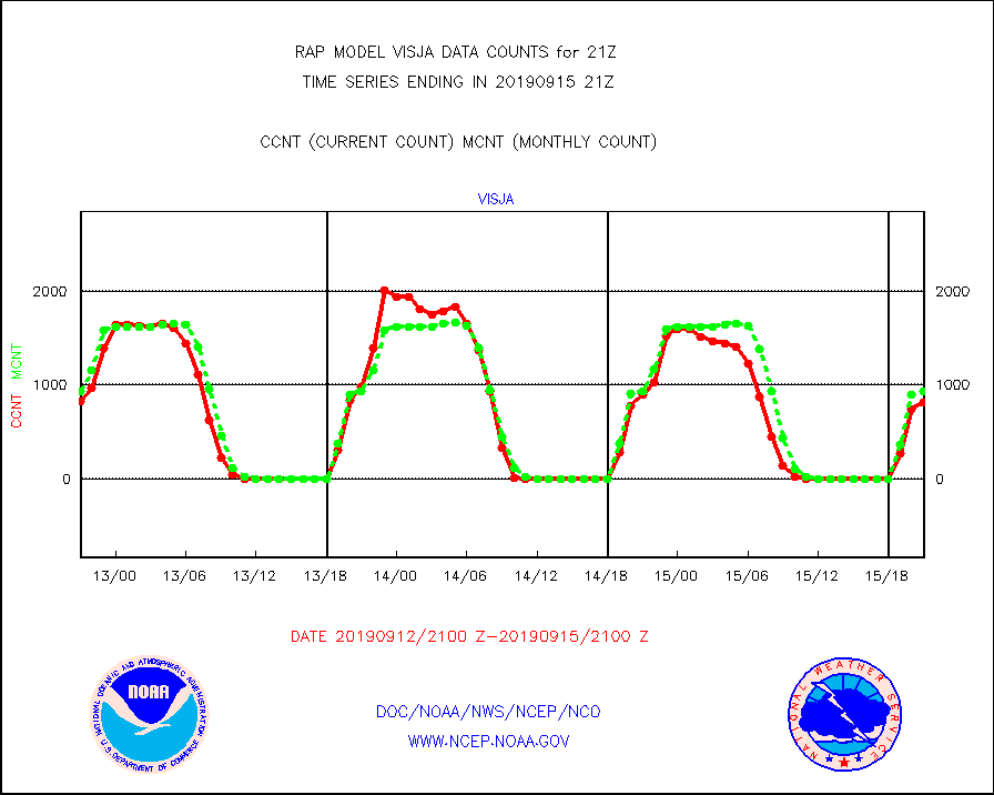
visja |
MTSAT/JMA visible derived cloud motion |
814 |
931 |
87.4 % |
1518.50-1523.50 |
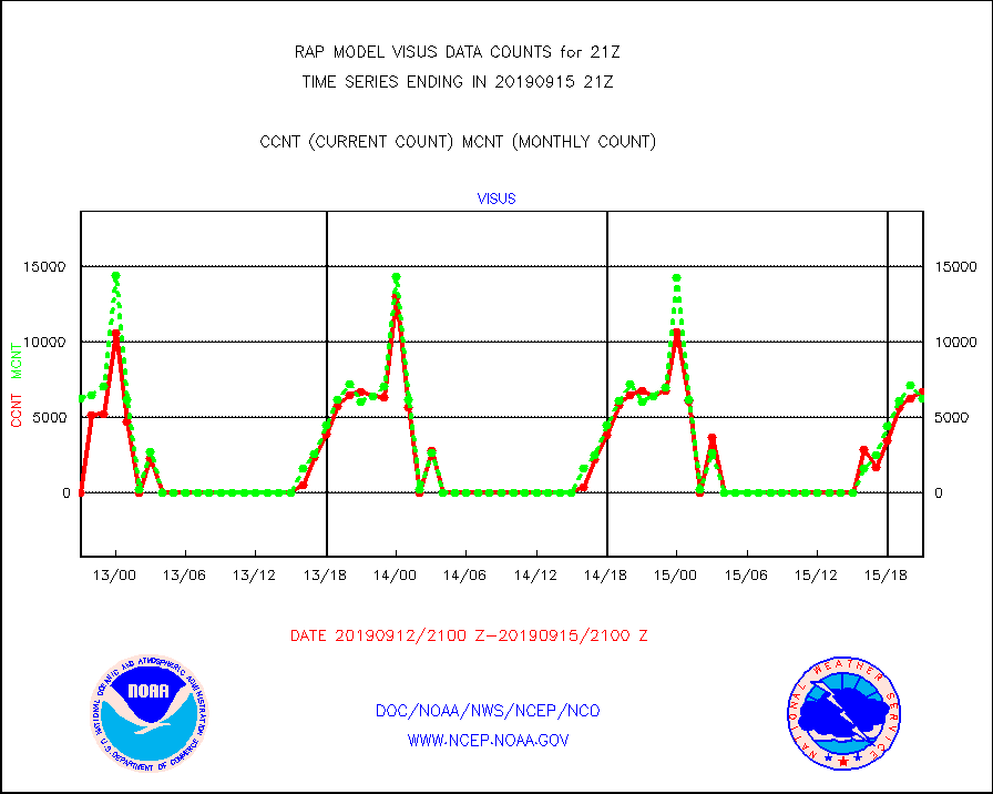
visus |
GOES/NESDIS visible derived cloud motion |
6659 |
6224 |
107.0 % |
1520.00-1520.99 |


