| Critical Data with Normal Counts |
|---|
| Type | Description | Hourly Count | Monthly Average | Percent (%) of Monthly Mean | UTC Time Window |
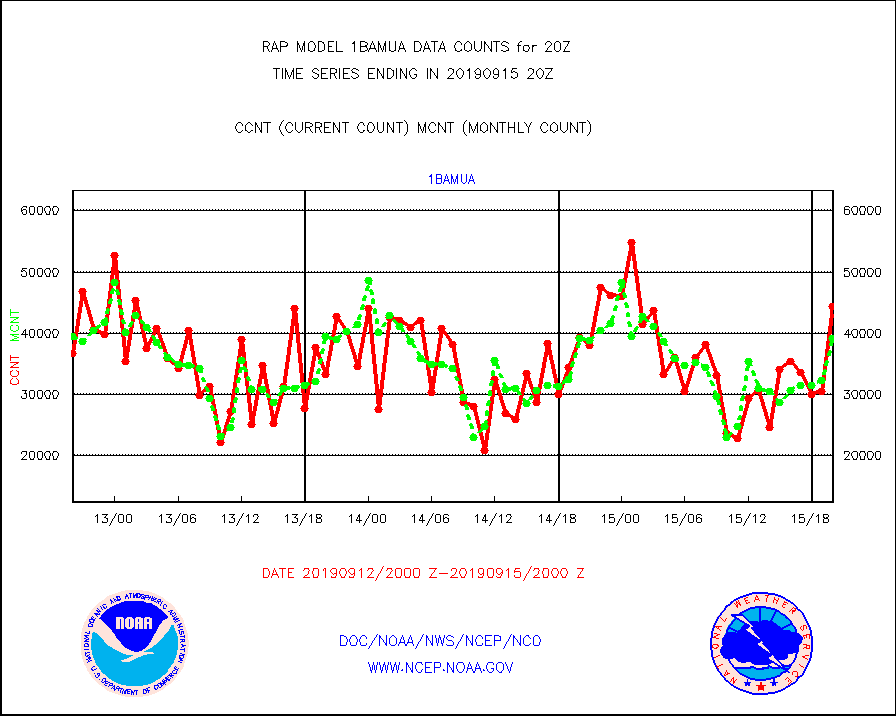
1bamua |
NOAA 15-19 & METOP 1-2 AMSU-A NCEP-proc. br.temps |
44428 |
39188 |
113.4 % |
1517.00-1522.99 |
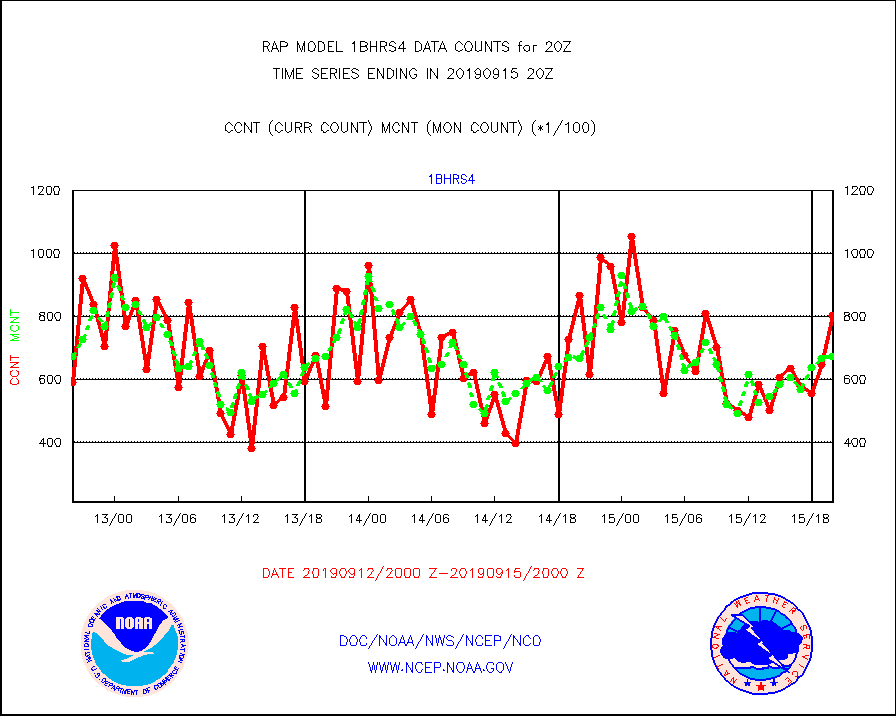
1bhrs4 |
NOAA 18-19 & METOP 1-2 HIRS-4 NCEP-proc. br.temps |
80380 |
67333 |
119.4 % |
1517.00-1522.99 |
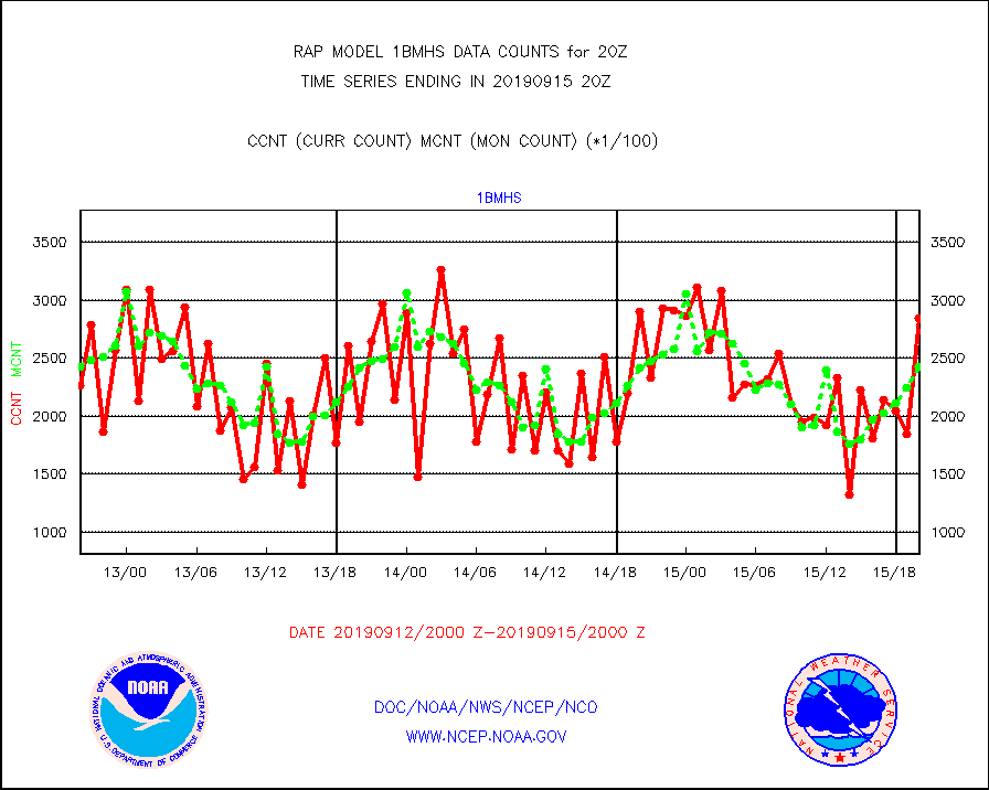
1bmhs |
NOAA 18-19 & METOP 1-2 MHS NCEP-proces. br. temps |
284706 |
242867 |
117.2 % |
1517.00-1522.99 |
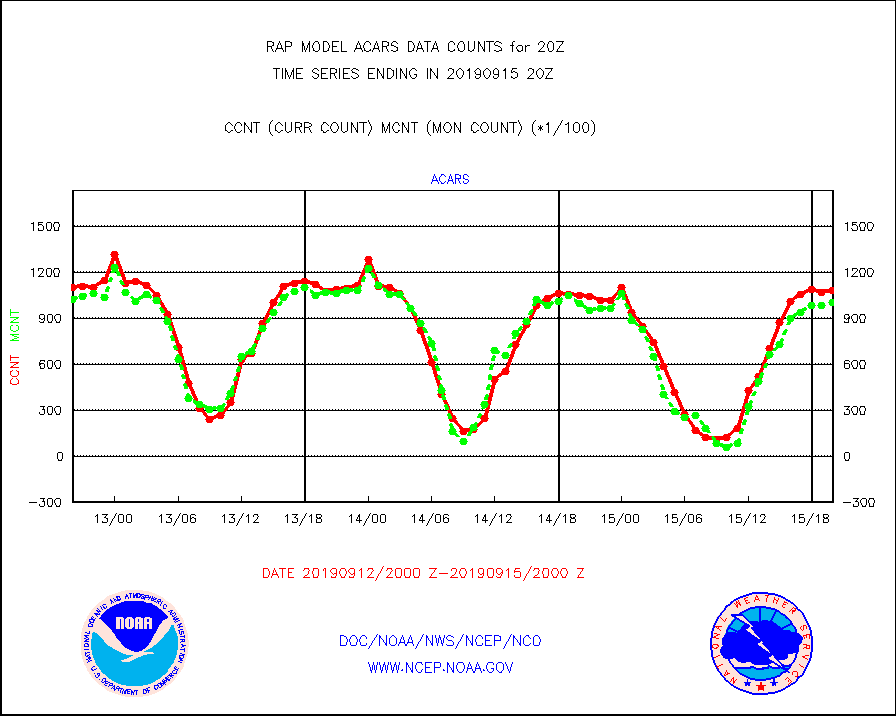
acars |
MDCRS ACARS acft data from ARINC(dcded from BUFR) |
108011 |
100083 |
107.9 % |
1516.75-1523.25 |
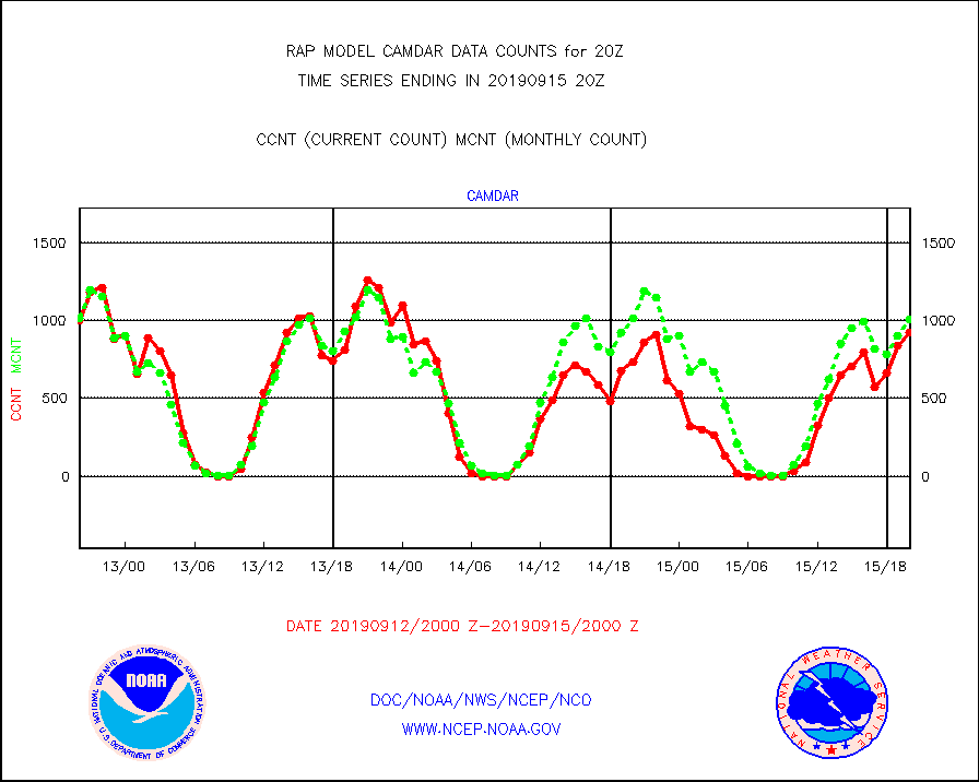
camdar |
Canadian AMDAR aircraft data (decoded from BUFR) |
921 |
1005 |
91.6 % |
1516.75-1523.25 |
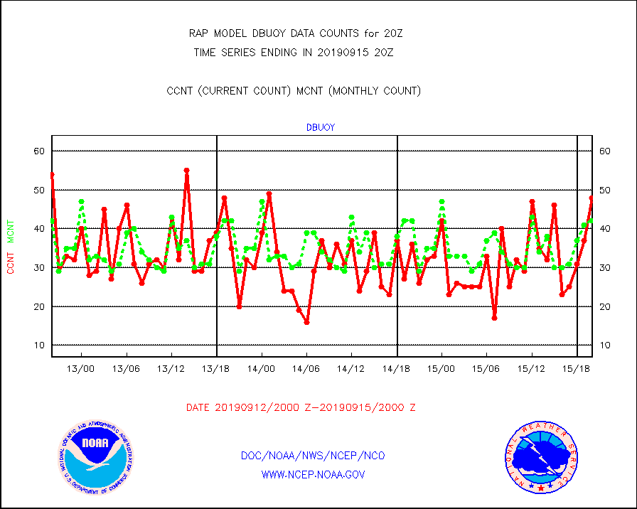
dbuoy |
Buoys decoded from FM-18 fmt (moored or drifting) |
48 |
42 |
114.3 % |
1519.50-1520.50 |
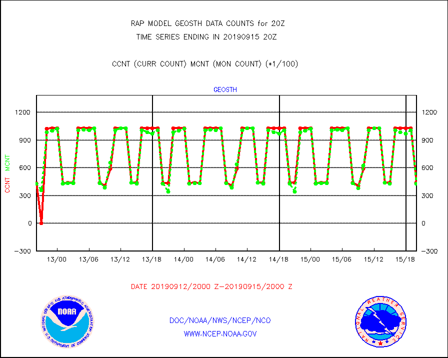
geosth |
GOES/NESDIS hi-resol. (1x1 f-o-v) cloud data |
43716 |
42975 |
101.7 % |
1518.75-1519.99 |
gnss |
Grnd-based Gbl Navigation Sat System (GNSS) data |
2492 |
2517 |
99.0 % |
1518.95-1519.05 |
h20mo |
MODIS (AQUA/TERRA) wvpr imager derived cld motion |
0 |
0 |
n/a |
1517.50-1522.50 |
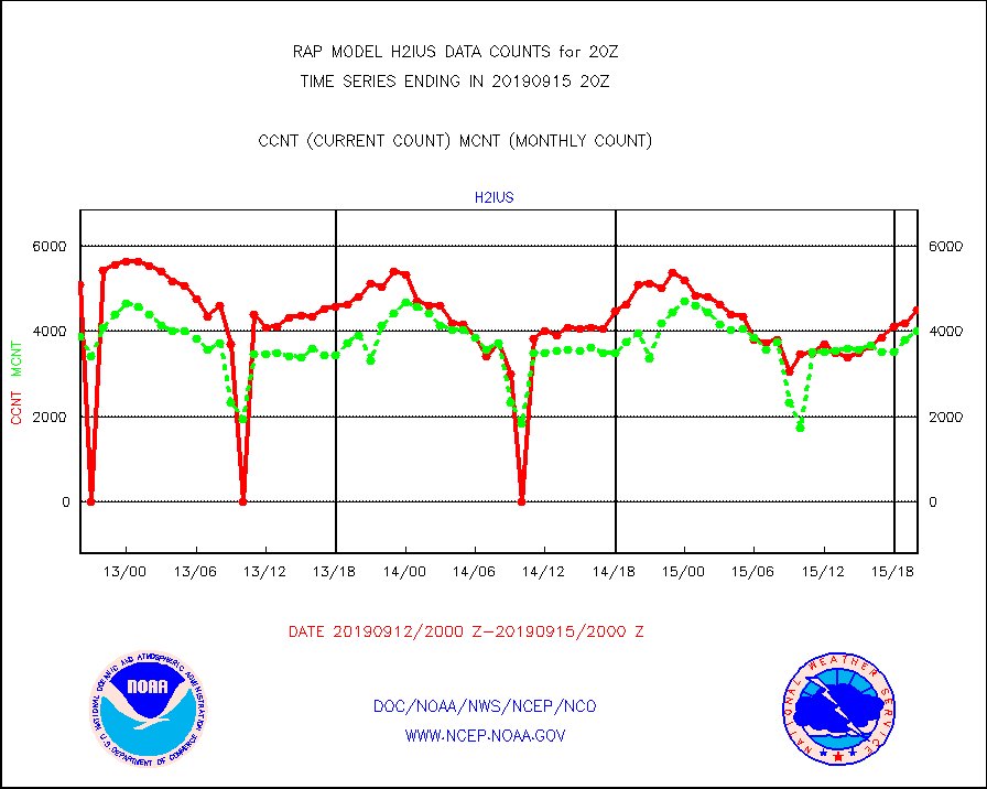
h2ius |
GOES/NESDIS water vapor imager derived cld motion |
4502 |
4019 |
112.0 % |
1519.00-1519.99 |
infmo |
MODIS (AQUA/TERRA) ir l-wave derived cloud motion |
0 |
0 |
n/a |
1517.50-1522.50 |
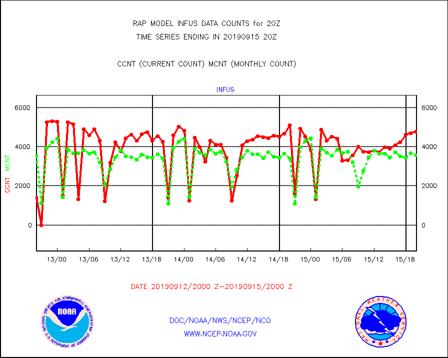
infus |
GOES/NESDIS infrared lg-wave derived cloud motion |
4773 |
3554 |
134.3 % |
1519.00-1519.99 |
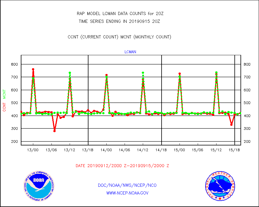
lcman |
Land-based CMAN stations decoded from CMAN format |
421 |
419 |
100.5 % |
1519.50-1520.50 |
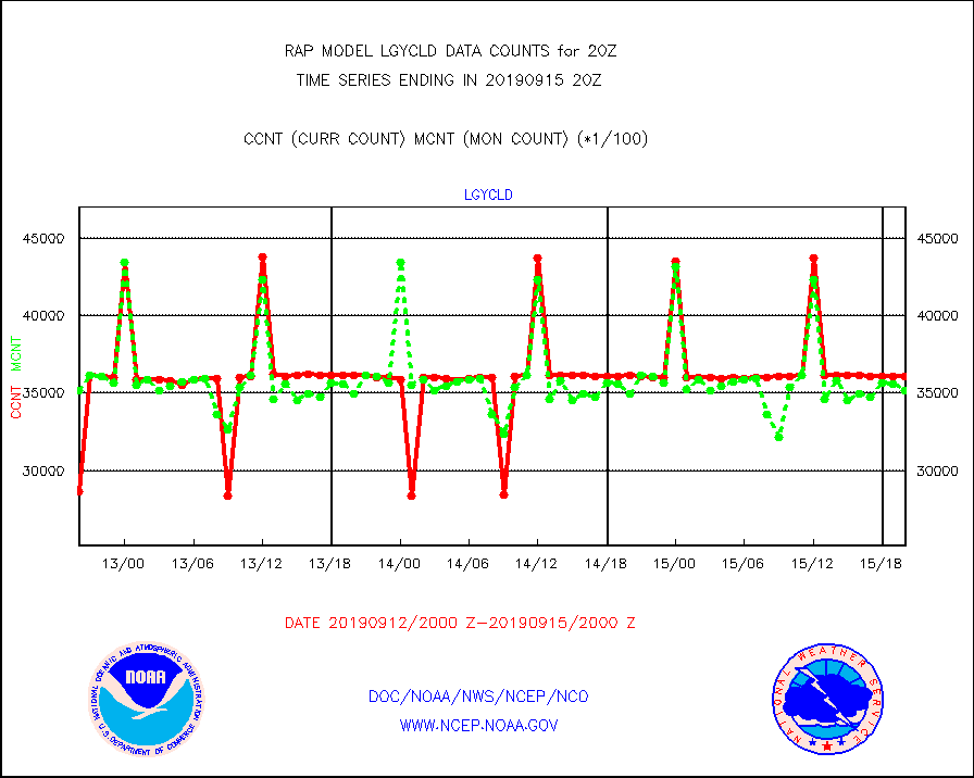
lgycld |
GOES/NASA(Langley) hi-res. (1x1 f-o-v) cloud data |
3609503 |
3520200 |
102.5 % |
1519.50-1520.50 |
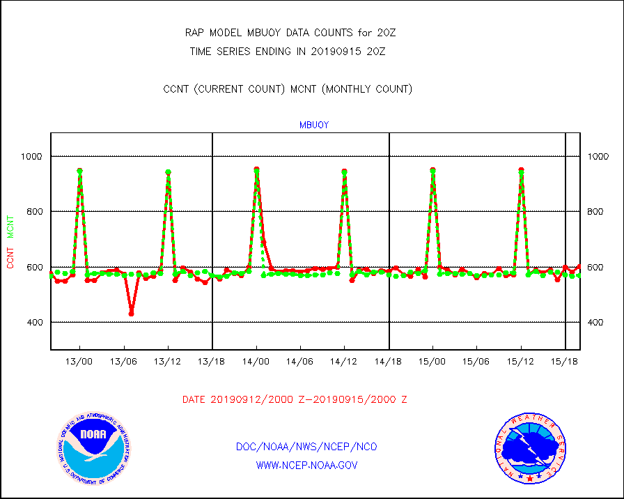
mbuoy |
Buoys decoded from FM-13 format (moored) |
601 |
569 |
105.6 % |
1519.50-1520.50 |
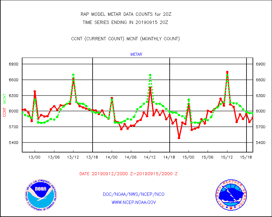
metar |
Aviation - METAR |
5873 |
5964 |
98.5 % |
1519.50-1520.50 |
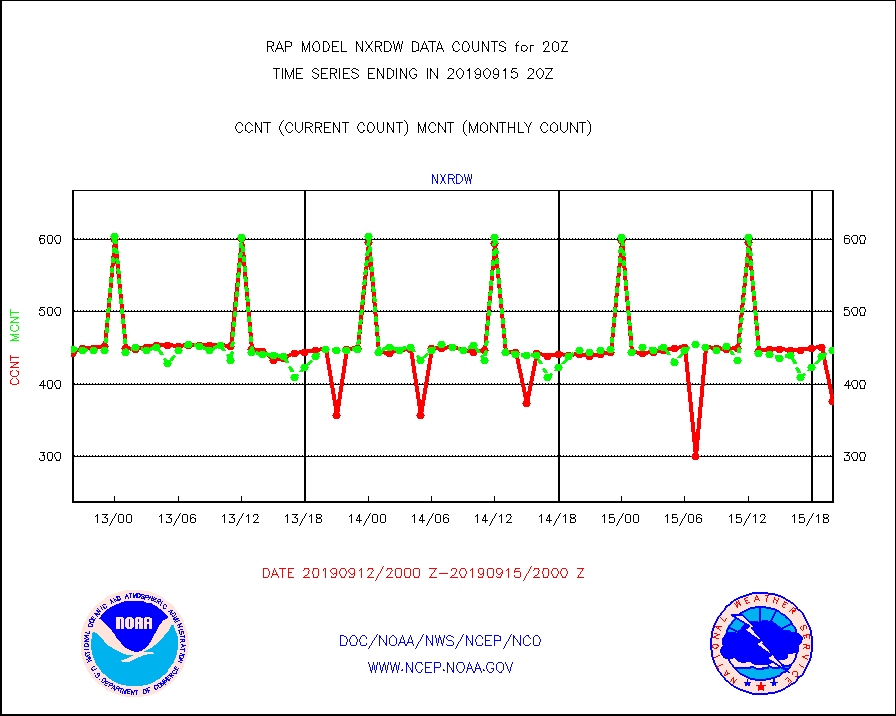
nxrdw |
NEXRAD Vel Azm Dsp(VAD) winds via radar coded msg |
376 |
447 |
84.1 % |
1519.00-1521.00 |
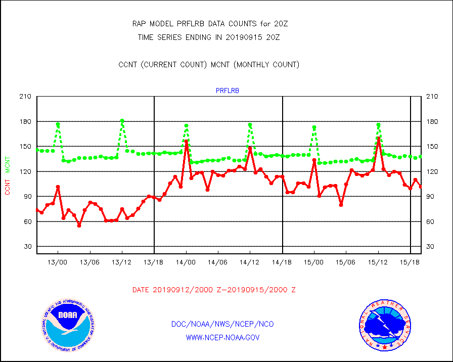
prflrb |
Multi-Agency Profiler (MAP) and SODAR winds |
102 |
138 |
73.9 % |
1518.50-1521.50 |
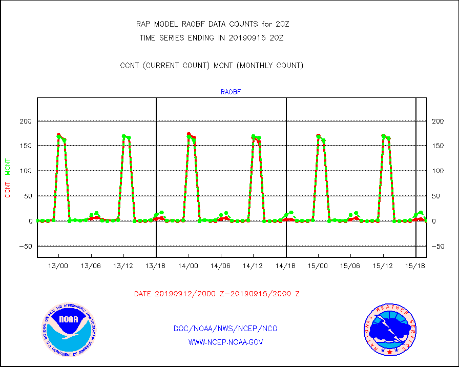
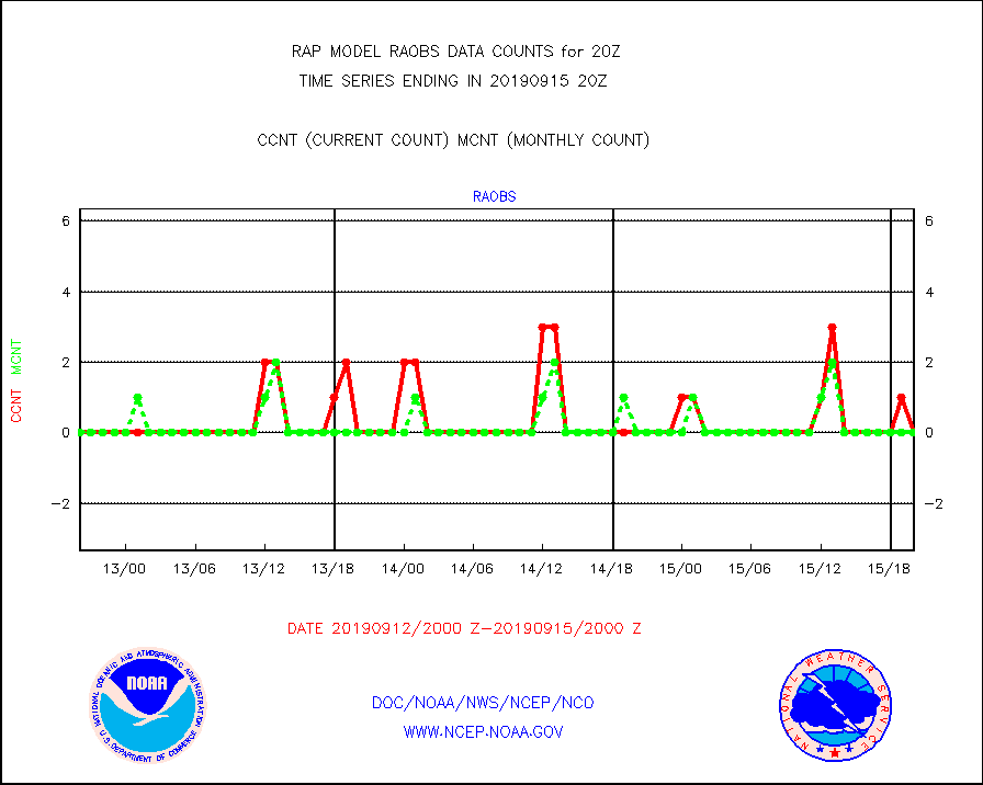
raobf |
Rawinsonde - fixed land (from TEMP or PILOT) |
0 |
1 |
0.0 % |
1519.00-1521.00 |
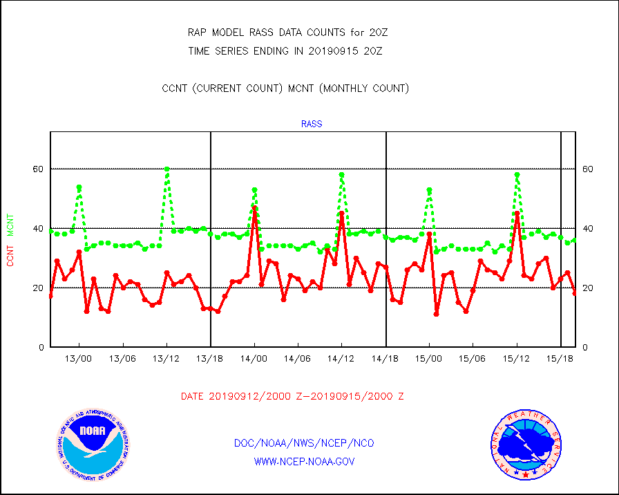
rass |
RASS temperatures (NOAA and Multi-Agency) |
18 |
36 |
50.0 % |
1519.50-1520.50 |
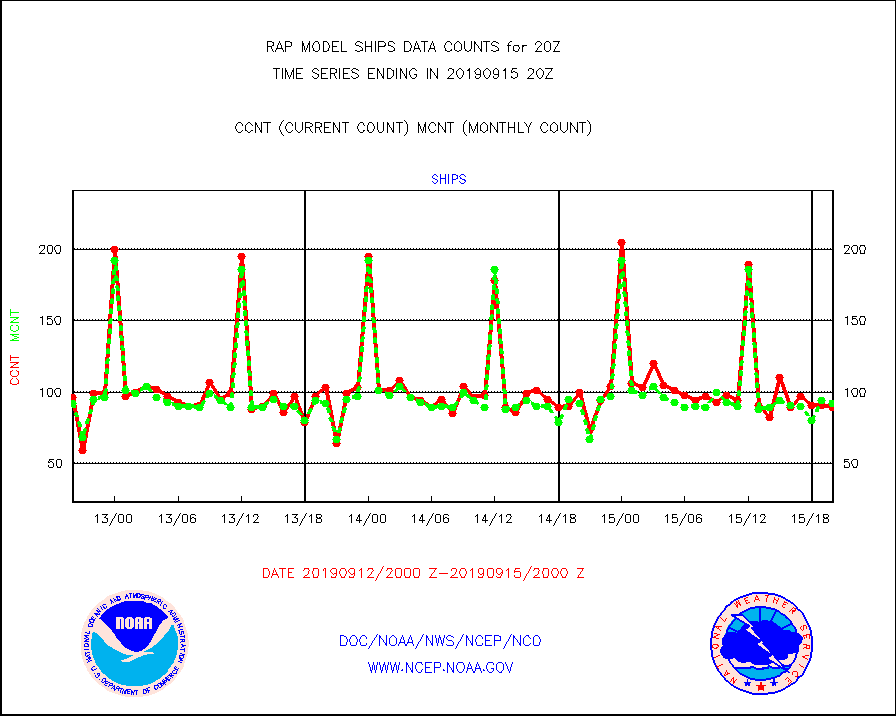
ships |
Ship - manual and automatic, restricted |
89 |
92 |
96.7 % |
1519.50-1520.50 |
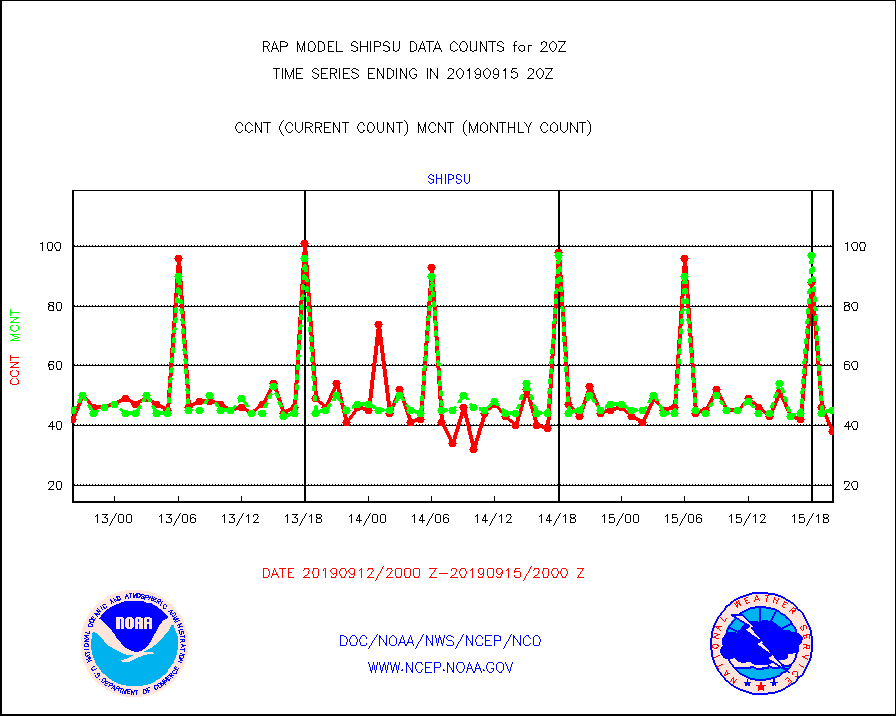
shipsu |
Ship - manual and automatic, unrestricted |
38 |
45 |
84.4 % |
1519.50-1520.50 |
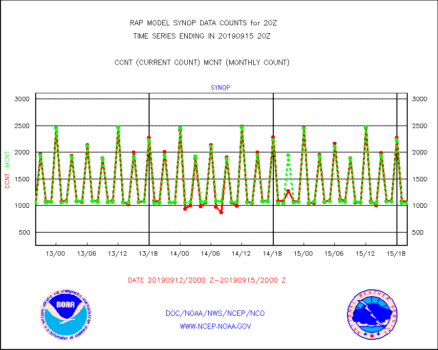
synop |
Synoptic - fixed manual and automatic |
1064 |
1050 |
101.3 % |
1519.50-1520.50 |
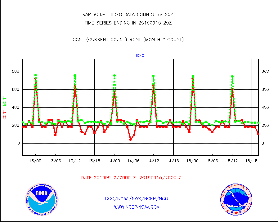
tideg |
Tide gauge reports decoded from CREX format |
109 |
231 |
47.2 % |
1519.50-1520.50 |
| Data Types of Opportunity with Normal Counts |
|---|
| Type | Description | Hourly Count | Monthly Average | Percent (%) of Monthly Mean | UTC Time Window |
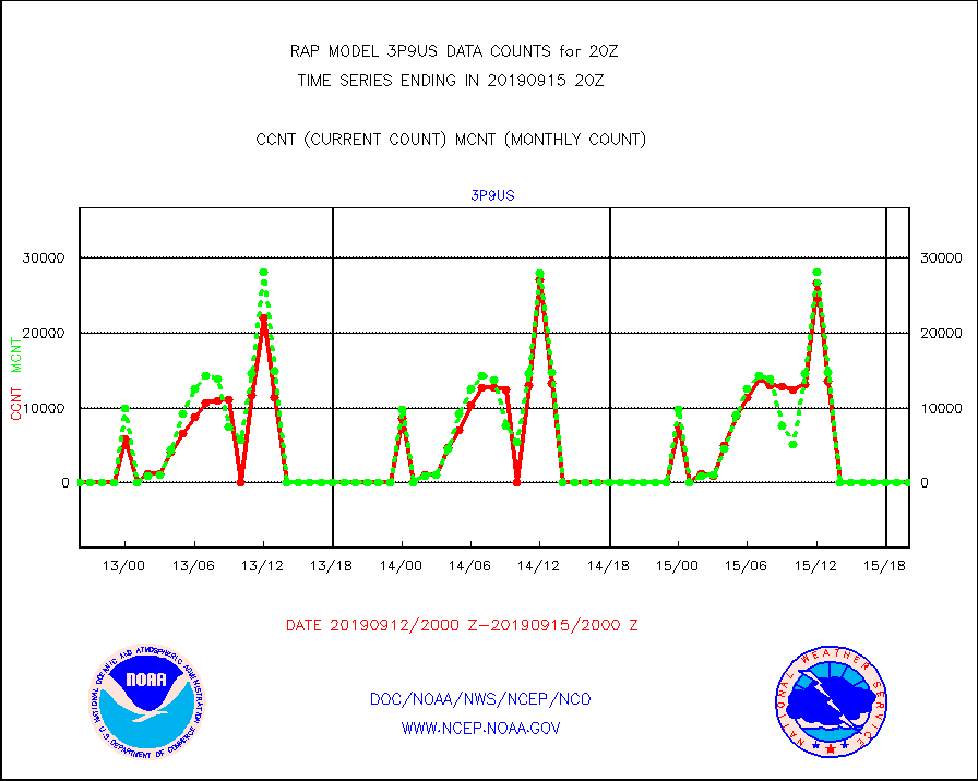
3p9us |
GOES/NESDIS infrared shrt-wave derived cld motion |
0 |
0 |
n/a |
1519.00-1519.99 |
acarsa |
MDCRS ACARS acft data (ARINC via AFWA)(AIREP fmt) |
0 |
0 |
n/a |
1516.75-1523.25 |
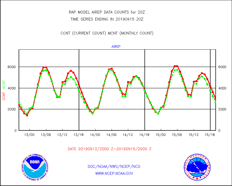
airep |
Manual AIREP aircraft data (dcded from AIREP fmt) |
3012 |
2673 |
112.7 % |
1516.75-1523.25 |
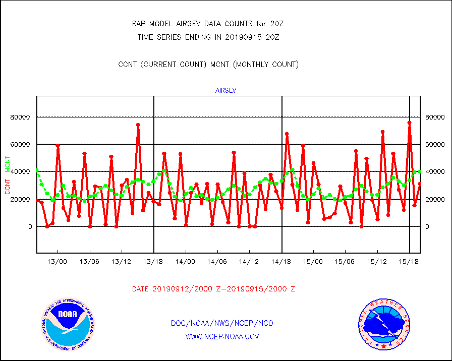
airsev |
AQUA AIRS/AMSU-A/HSB brightness temps- every FOV |
31232 |
40344 |
77.4 % |
1517.00-1522.99 |
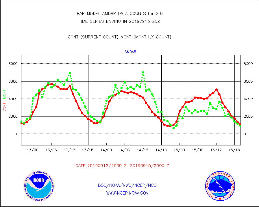
amdar |
AMDAR aircraft data (decoded from AMDAR format) |
1084 |
882 |
122.9 % |
1516.75-1523.25 |
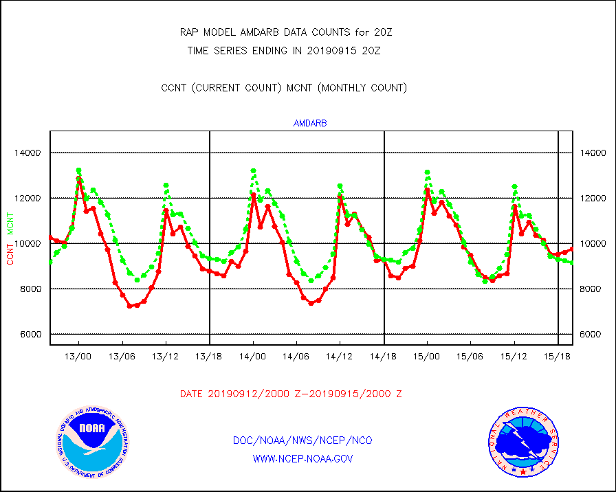
amdarb |
AMDAR aircraft data (decoded from BUFR) |
9772 |
9169 |
106.6 % |
1516.75-1523.25 |
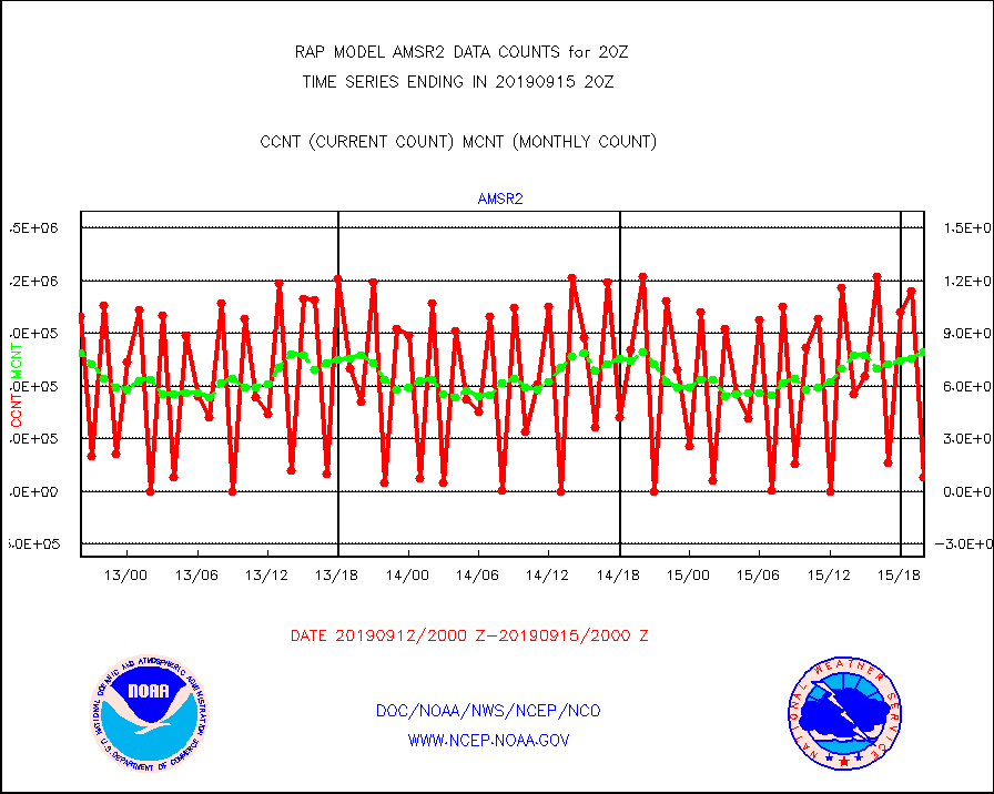
amsr2 |
GCOM-W AMSR2 1B brightness temperatures |
82079 |
790915 |
10.4 % |
1517.00-1517.99 |
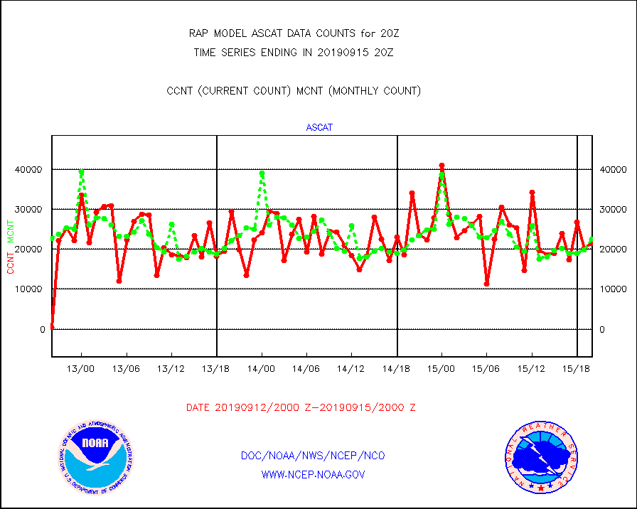
ascat |
METOP 1-2 ASCAT products |
21464 |
22511 |
95.3 % |
1518.00-1522.00 |
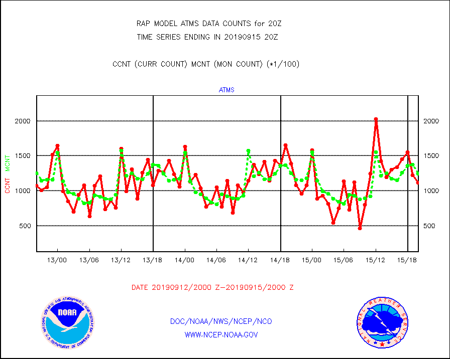
atms |
NPP Adv. Tech. Microwave Sounder (ATMS) br. temps |
111857 |
124377 |
89.9 % |
1518.00-1521.99 |
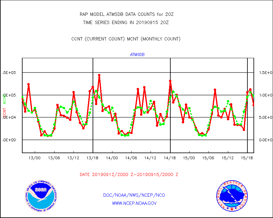
atmsdb |
NPP Adv Tech MW Sndr(ATMS) b. temps-dir bcst SSEC |
77222 |
98593 |
78.3 % |
1518.00-1521.99 |
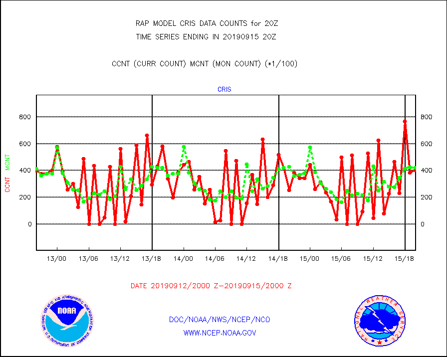
cris |
NPP Cross-track Infrared Sounder (CrIS) radiances |
40368 |
42172 |
95.7 % |
1518.00-1521.99 |
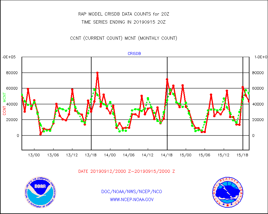
crisdb |
NPP Crss-trk IR Sndr(CrIS) radiance-dir bcst SSEC |
43338 |
53613 |
80.8 % |
1518.00-1521.99 |
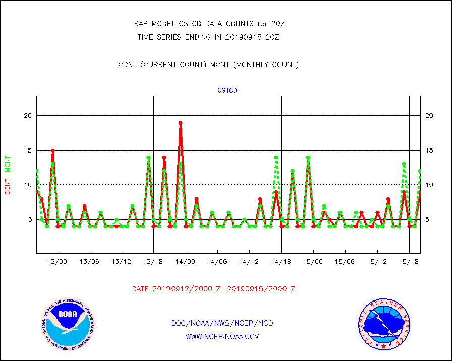
cstgd |
Coast Guard |
9 |
12 |
75.0 % |
1519.50-1520.50 |
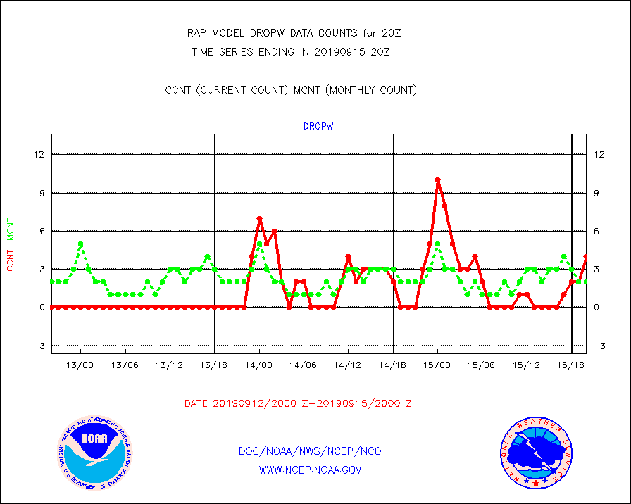
dropw |
Dropwinsonde (from TEMP DROP) |
4 |
2 |
200.0 % |
1519.00-1521.00 |
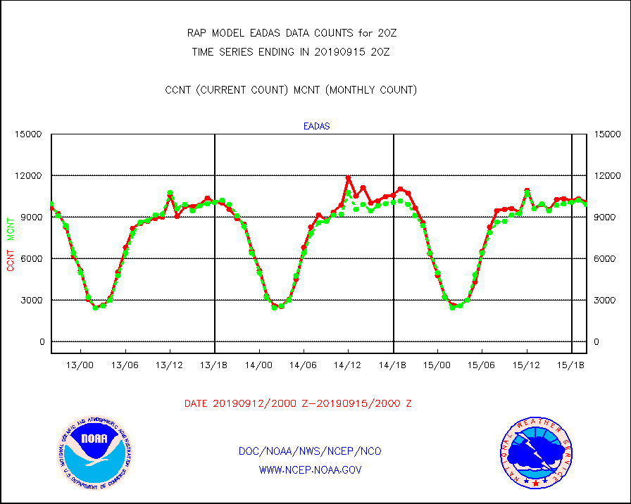
eadas |
E-AMDAR (European AMDAR acft decoded from BUFR) |
10096 |
9945 |
101.5 % |
1516.75-1523.25 |
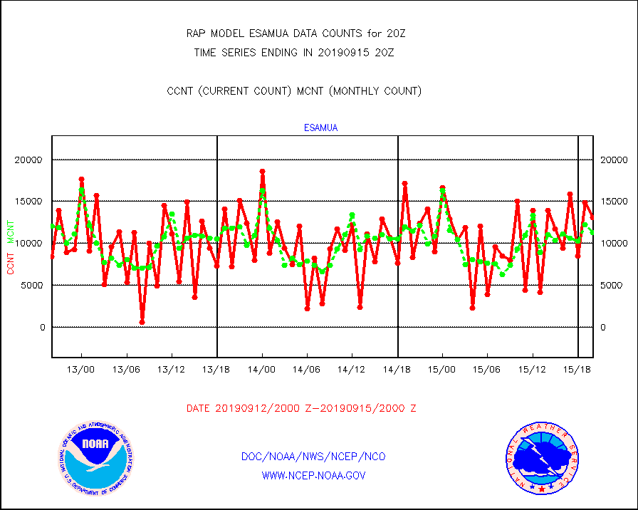
esamua |
NOAA 15-19 & METOP 1-2 AMSU-A proc btmps frm RARS |
13056 |
11282 |
115.7 % |
1519.00-1521.00 |
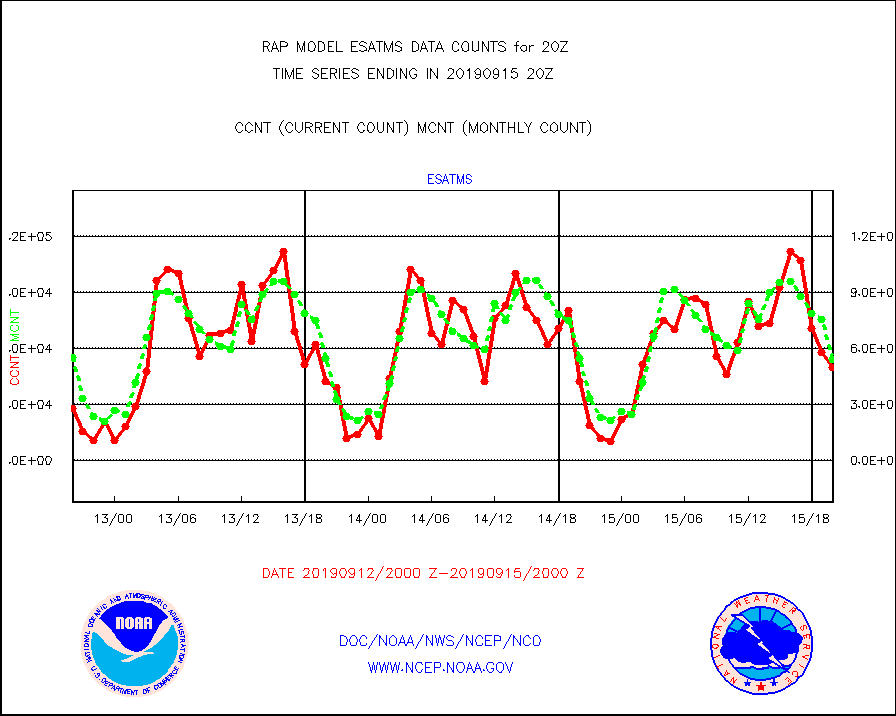
esatms |
NPP Adv. Tech. MW Sndr (ATMS) br. temps from RARS |
49790 |
54331 |
91.6 % |
1518.00-1521.99 |
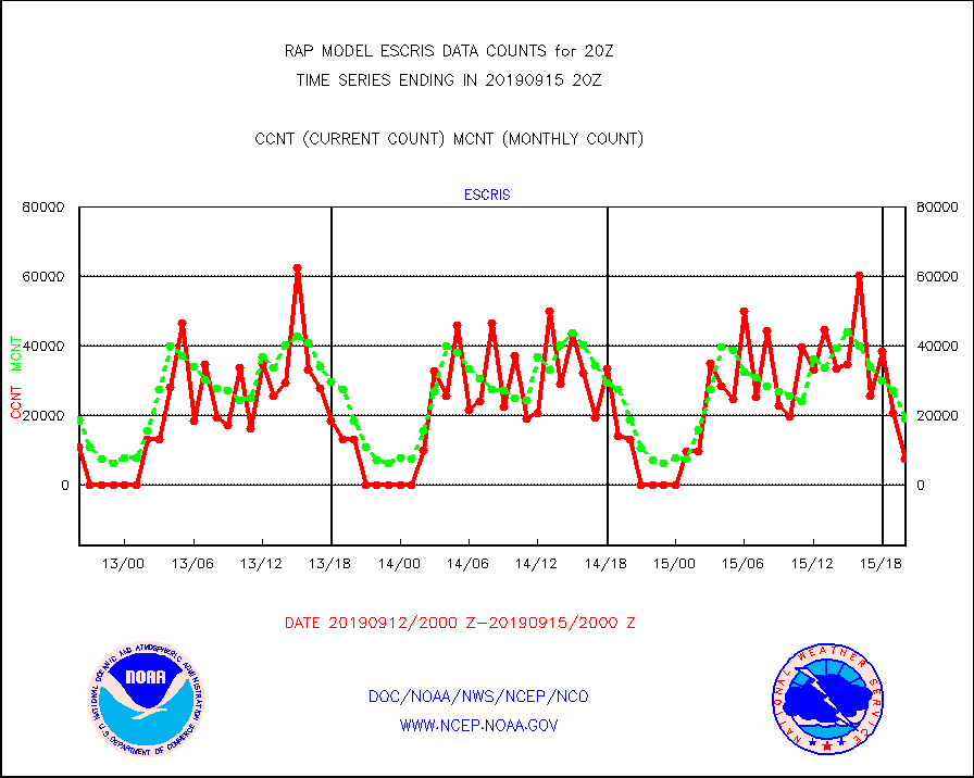
escris |
NPP Crss-track IR Sndr (CrIS) radiances from RARS |
7560 |
18999 |
39.8 % |
1518.00-1521.99 |
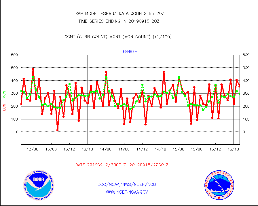
eshrs3 |
NOAA 15-19 & METOP 1-2 HIRS-3/4 pr btmps frm RARS |
35499 |
29798 |
119.1 % |
1519.00-1521.00 |
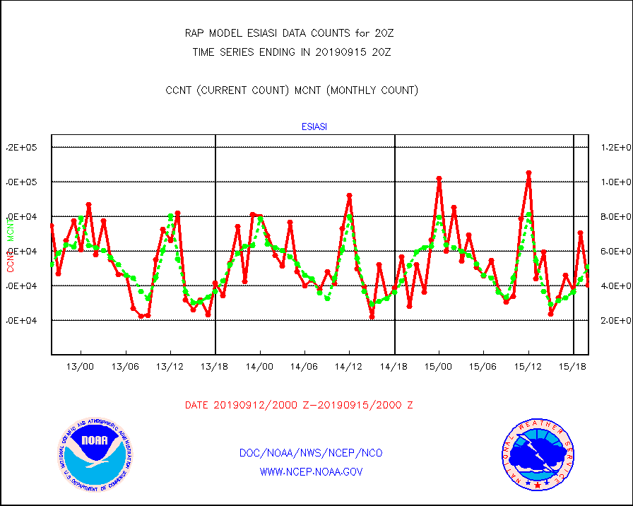
esiasi |
METOP 1-2 IASI 1C radiance data vbl chn from RARS |
40433 |
50956 |
79.3 % |
1518.00-1521.99 |
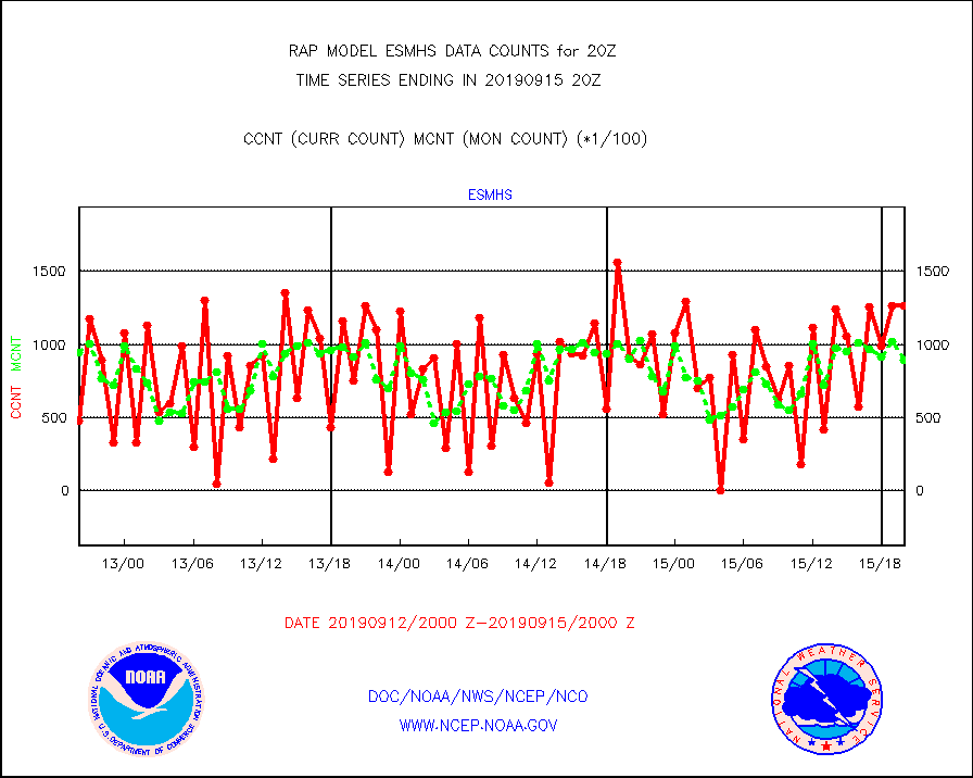
esmhs |
NOAA 18-19 & METOP 1-2 MHS proc. btemps from RARS |
126658 |
89371 |
141.7 % |
1519.00-1521.00 |
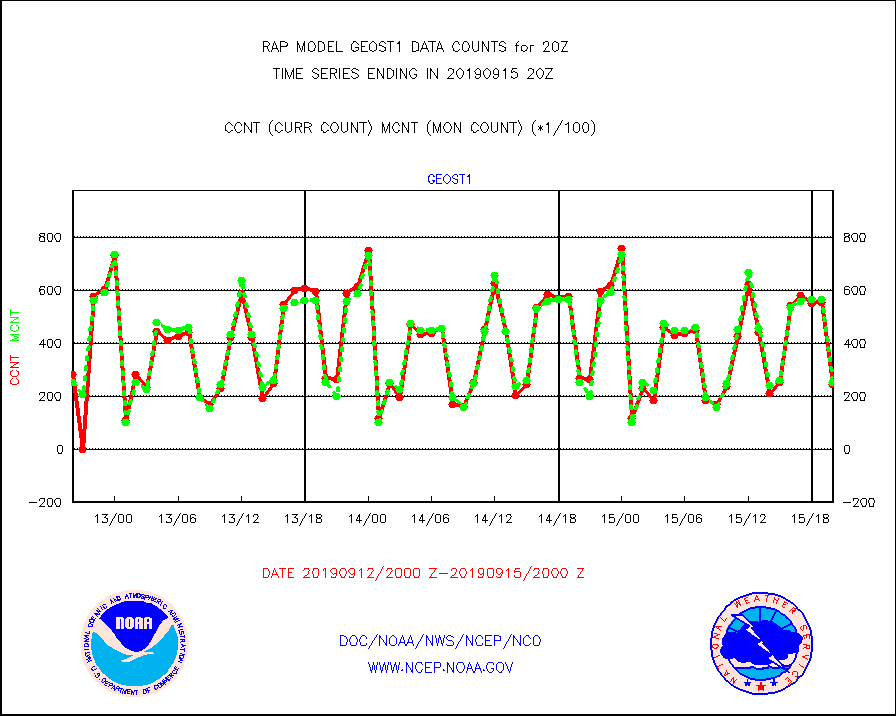
geost1 |
GOES/NESDIS hi-resol. (1x1 f-o-v) sndgs/radiances |
24226 |
25295 |
95.8 % |
1519.00-1521.00 |
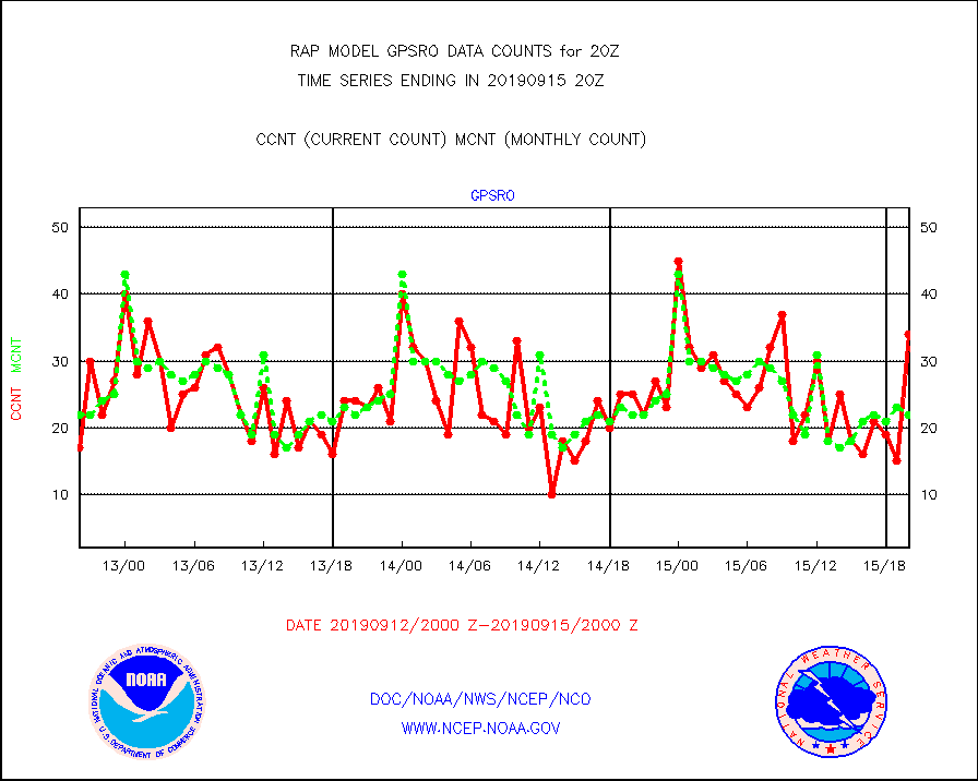
gpsro |
GPS radio occultation data |
34 |
22 |
154.5 % |
1518.00-1521.99 |
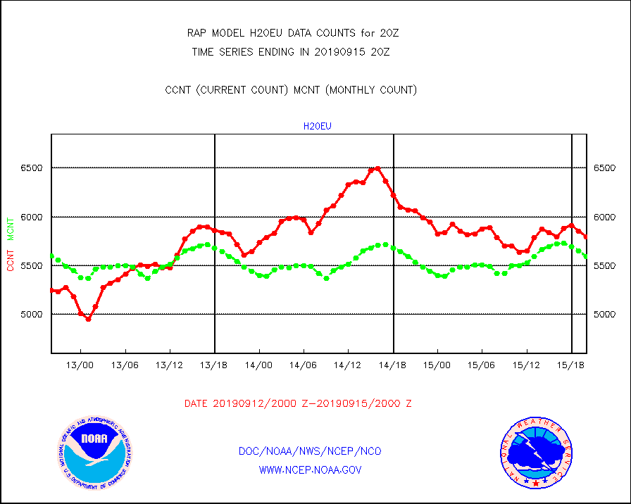
h20eu |
METEOSAT/EUMETSAT wvpr imager derived cld motion |
5798 |
5594 |
103.6 % |
1518.50-1521.49 |
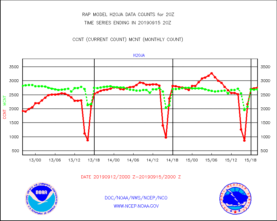
h20ja |
MTSAT/JMA water vapor imager derived cloud motion |
2745 |
2694 |
101.9 % |
1517.50-1522.50 |
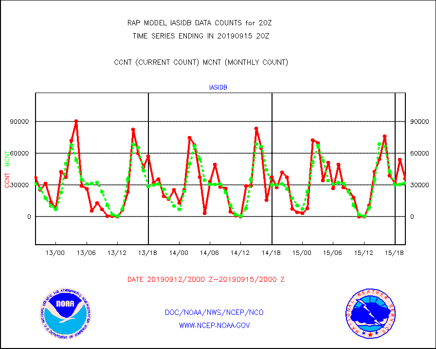
iasidb |
METOP 1-2 IASI 1C radiances-direct broadcast SSEC |
35822 |
31701 |
113.0 % |
1518.00-1521.99 |
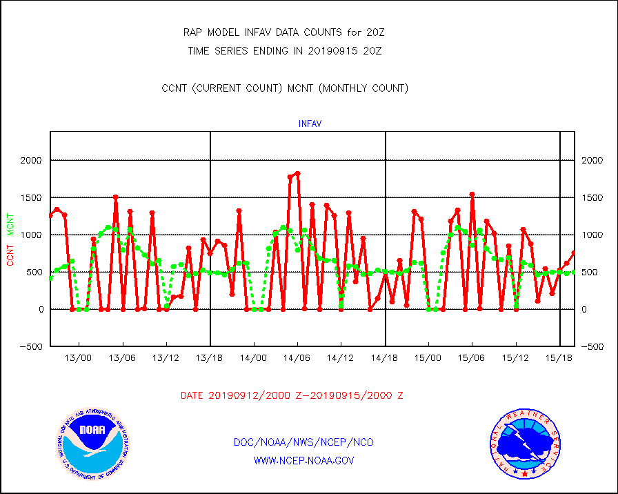
infav |
AVHRR (NOAA/METOP) ir lg-wave derived cld motion |
759 |
502 |
151.2 % |
1517.50-1522.50 |
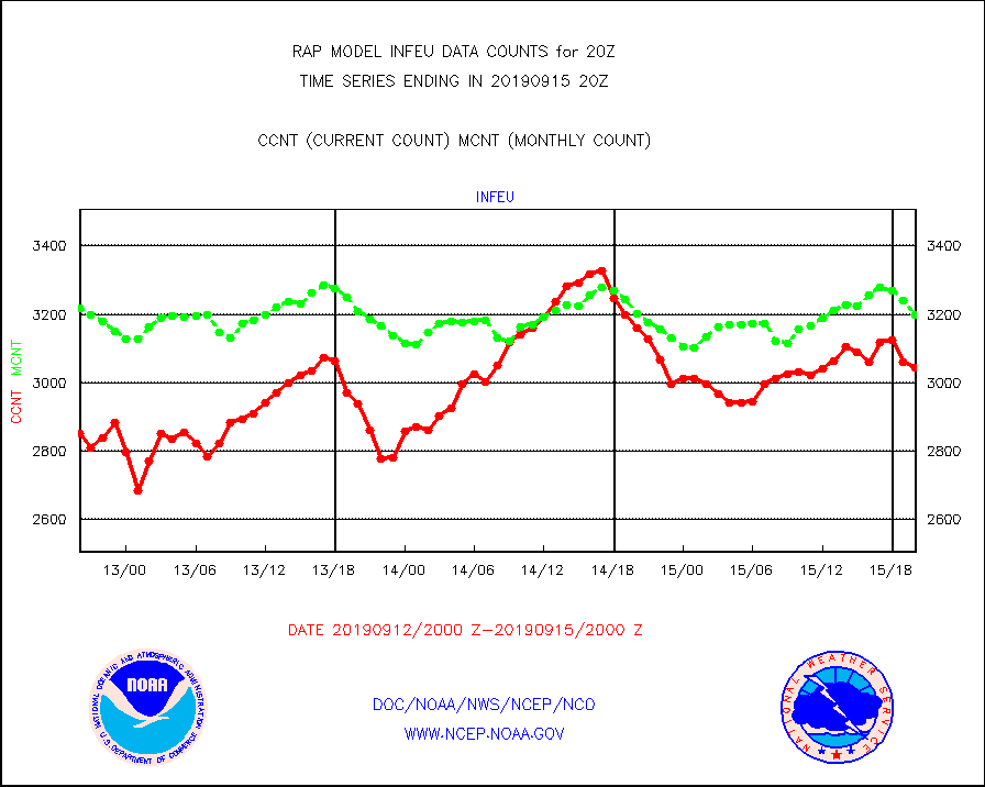
infeu |
METEOSAT/EUMETSAT ir lg-wave derived cloud motion |
3043 |
3198 |
95.2 % |
1518.50-1521.49 |
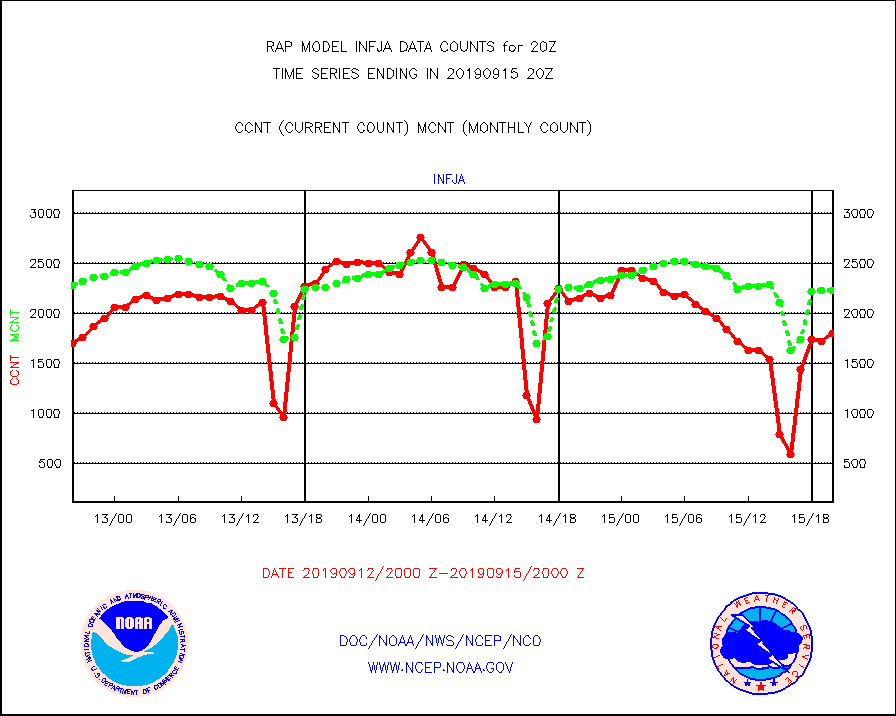
infja |
MTSAT/JMA infrared long-wave derived cloud motion |
1794 |
2230 |
80.4 % |
1517.50-1522.50 |
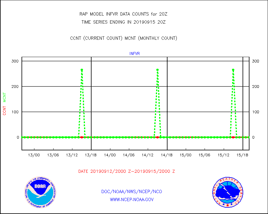
infvr |
VIIRS (NPP) infrared lg-wave derived cloud motion |
0 |
0 |
n/a |
1517.50-1522.50 |
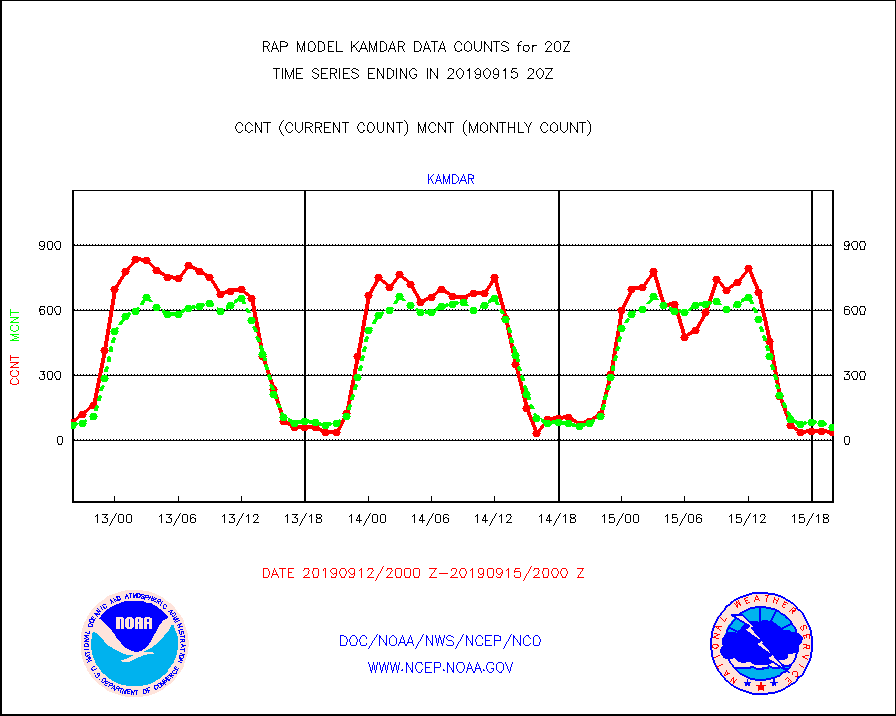
kamdar |
Korean AMDAR aircraft data (decoded from BUFR) |
39 |
63 |
61.9 % |
1516.75-1523.25 |
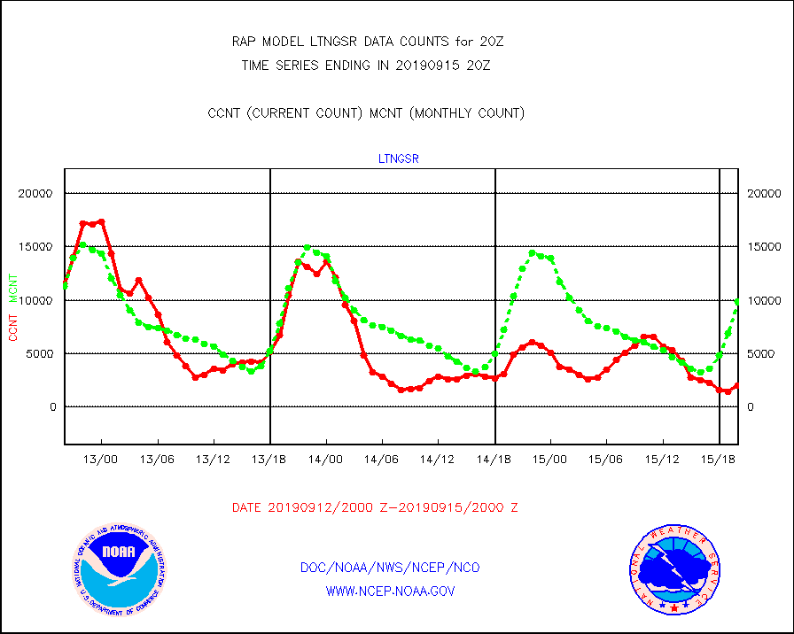
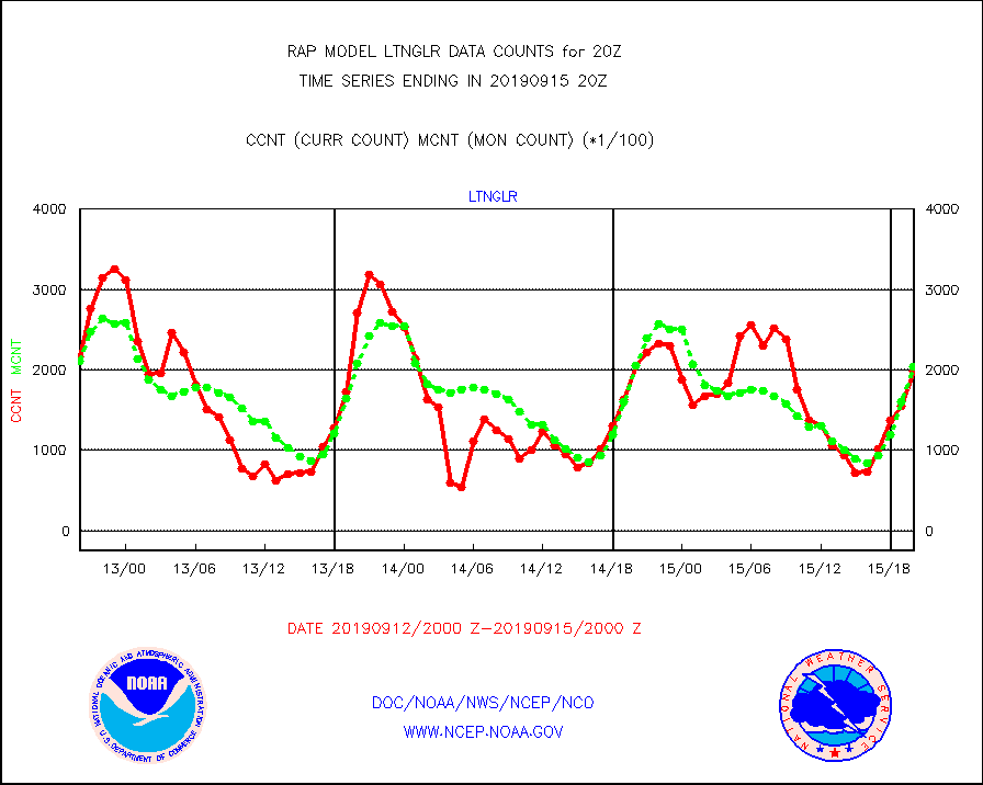
ltnglr |
LLDN Long-rng lightning from Vaisala via NOAAPORT |
199053 |
204443 |
97.4 % |
1519.00-1520.50 |
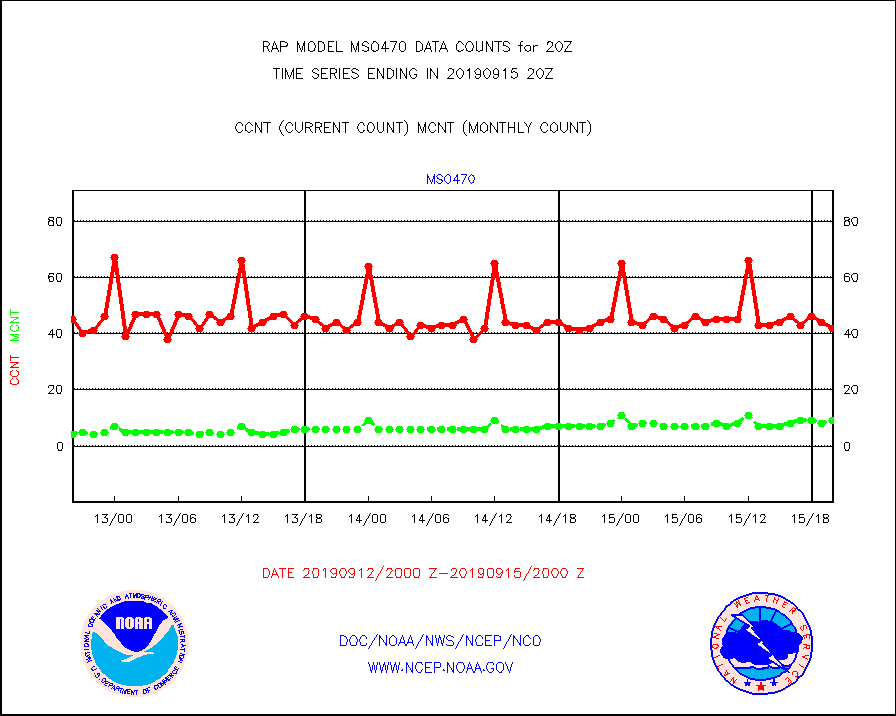
mso470 |
Mesonet/MADIS Colorado E-470 (Interstate 470) |
42 |
9 |
466.7 % |
1519.50-1520.50 |
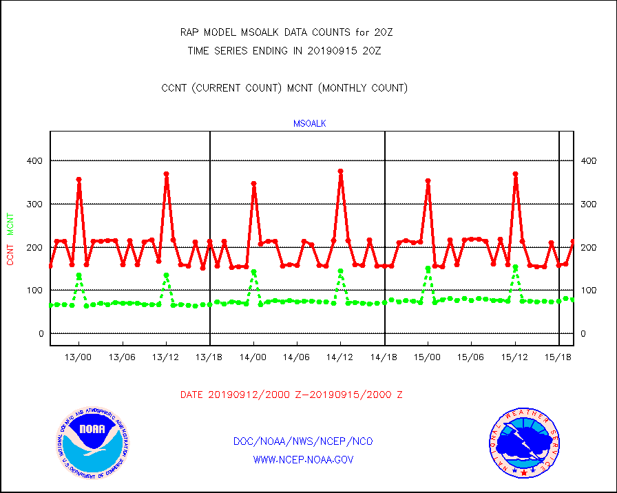
msoalk |
Mesonet/MADIS Alaska Department of Transportation |
213 |
79 |
269.6 % |
1519.50-1520.50 |
msoapg |
Mesonet/MADIS U.S. Army Aberdeen Proving Grounds |
0 |
0 |
n/a |
1519.50-1520.50 |
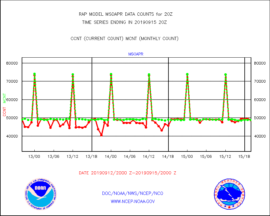
msoapr |
Mesonet/MADIS Citizen Weather Observers Program |
48730 |
48934 |
99.6 % |
1519.50-1520.50 |
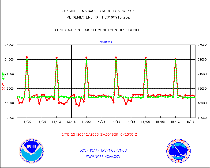
msoaws |
Mesonet/MADIS AWS Convergence Technologies, Inc. |
16408 |
16197 |
101.3 % |
1519.50-1520.50 |
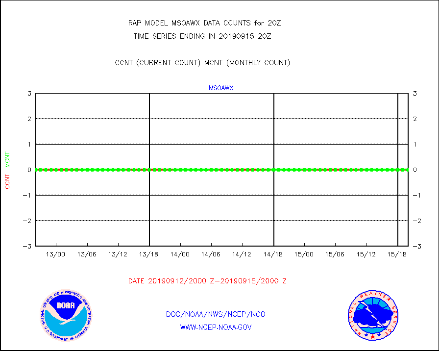
msoawx |
Mesonet/MADIS "Anything Weather" |
0 |
0 |
n/a |
1519.50-1520.50 |
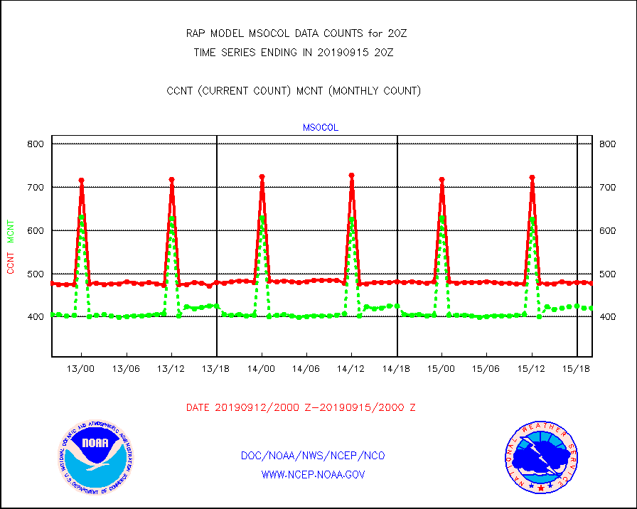
msocol |
Mesonet/MADIS Colorado Dept. of Transportation |
478 |
420 |
113.8 % |
1519.50-1520.50 |
msodcn |
Mesonet/MADIS DC Net |
0 |
0 |
n/a |
1519.50-1520.50 |
msoden |
Mesonet/MADIS Denver Urban Drainage & Flood Cntrl |
0 |
0 |
n/a |
1519.50-1520.50 |
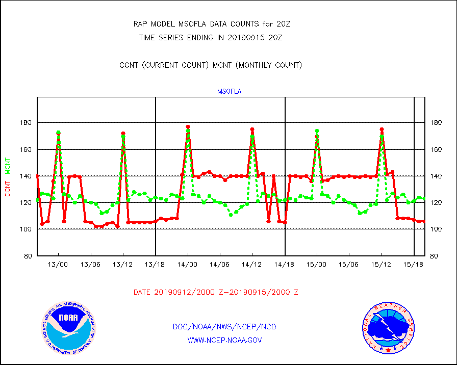
msofla |
Mesonet/MADIS Florida (FAWN & USF) |
106 |
123 |
86.2 % |
1519.50-1520.50 |
msoflt |
Mesonet/MADIS Florida Dept. of Transportation |
0 |
0 |
n/a |
1519.50-1520.50 |
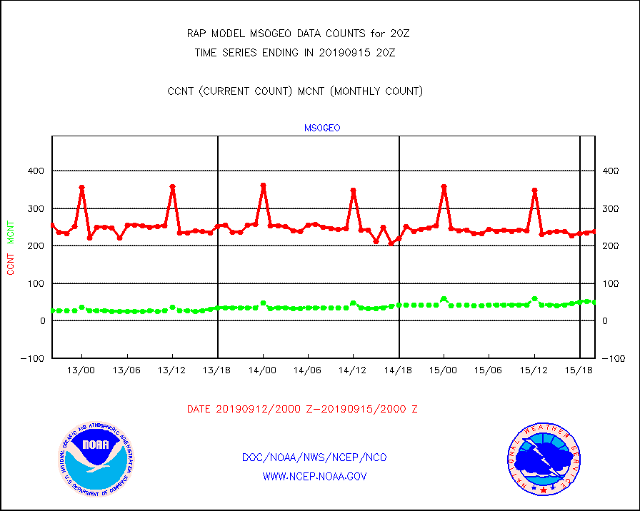
msogeo |
Mesonet/MADIS Georgia Dept. of Transportation |
239 |
50 |
478.0 % |
1519.50-1520.50 |
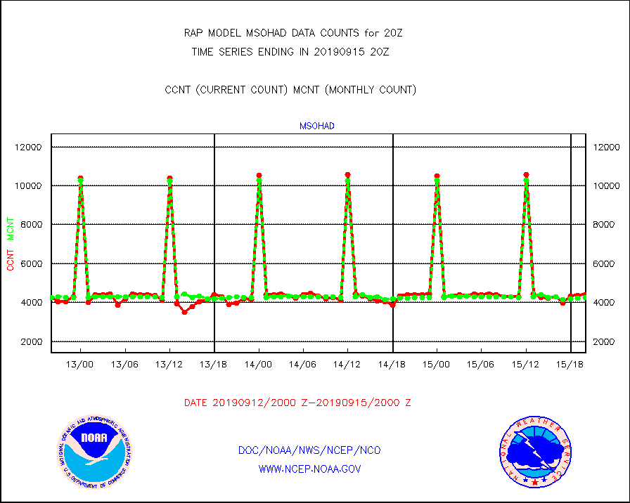
msohad |
Mesonet/MADIS NWS Hydromet Auto Data System(HADS) |
4415 |
4243 |
104.1 % |
1519.50-1520.50 |
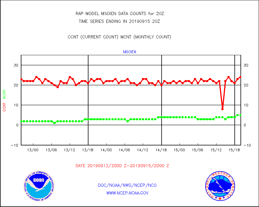
msoien |
Mesonet/MADIS Iowa Environmental |
24 |
5 |
480.0 % |
1519.50-1520.50 |
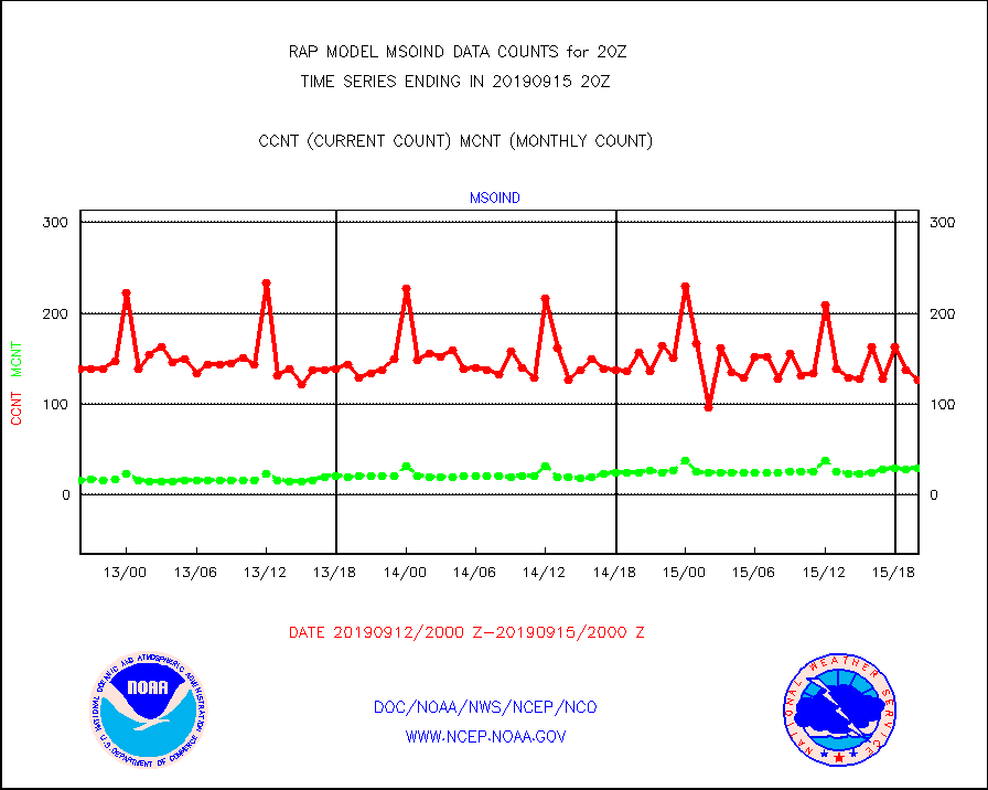
msoind |
Mesonet/MADIS Indiana Dept. of Transportation |
126 |
29 |
434.5 % |
1519.50-1520.50 |
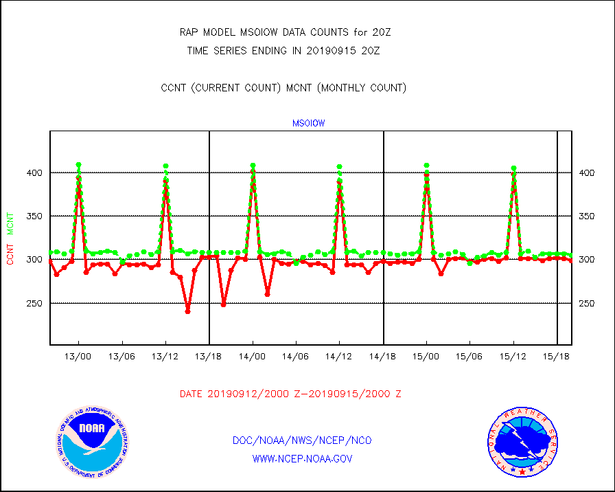
msoiow |
Mesonet/MADIS Iowa Department of Transportation |
299 |
305 |
98.0 % |
1519.50-1520.50 |
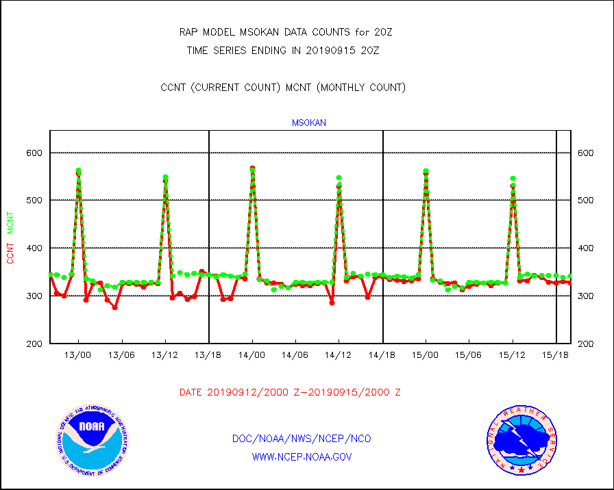
msokan |
Mesonet/MADIS Kansas Department of Transportation |
327 |
342 |
95.6 % |
1519.50-1520.50 |
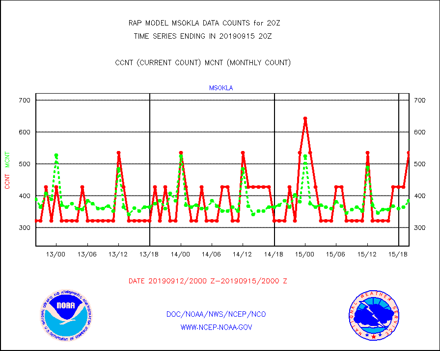
msokla |
Mesonet/MADIS Oklahoma Mesonet |
535 |
385 |
139.0 % |
1519.50-1520.50 |
msolju |
Mesonet/MADIS Louisiana State/Jackson State Univ. |
0 |
0 |
n/a |
1519.50-1520.50 |
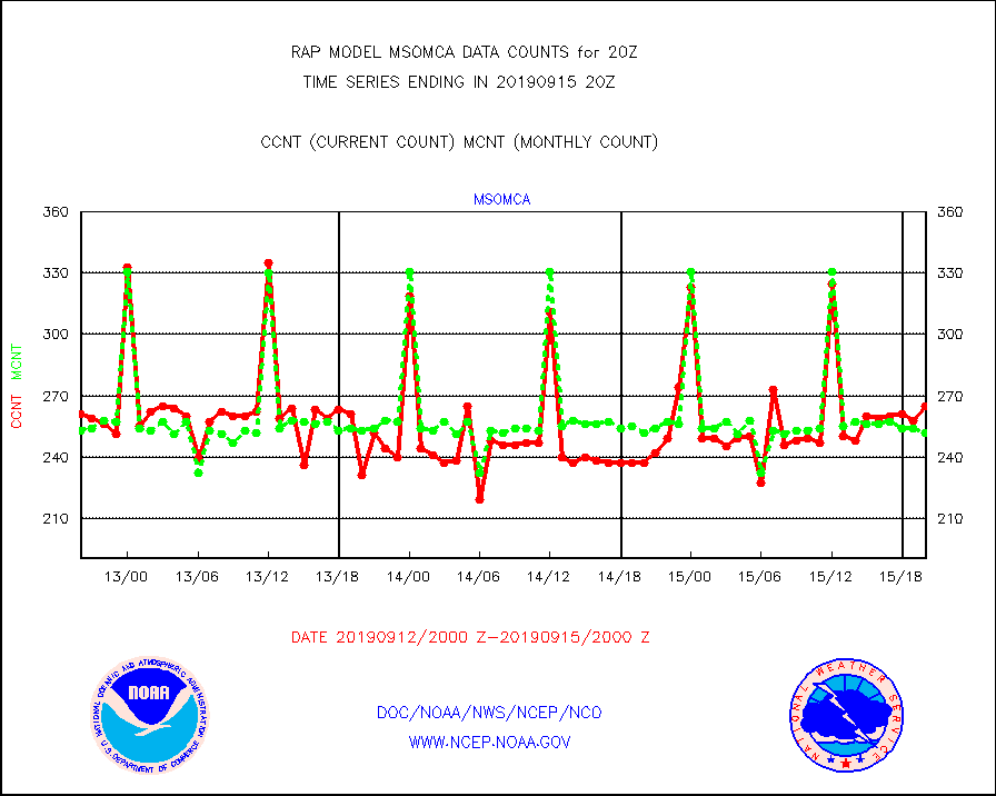
msomca |
Mesonet/MADIS Missouri Commercial Agricult Wx Net |
265 |
252 |
105.2 % |
1519.50-1520.50 |
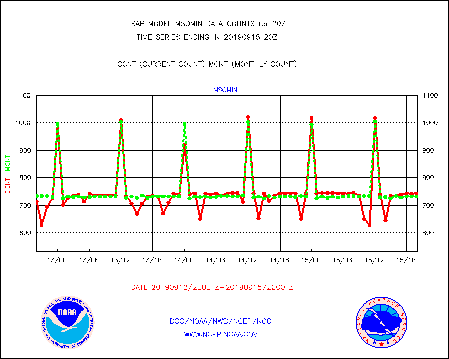
msomin |
Mesonet/MADIS Minnesota Dept. of Transportation |
744 |
732 |
101.6 % |
1519.50-1520.50 |
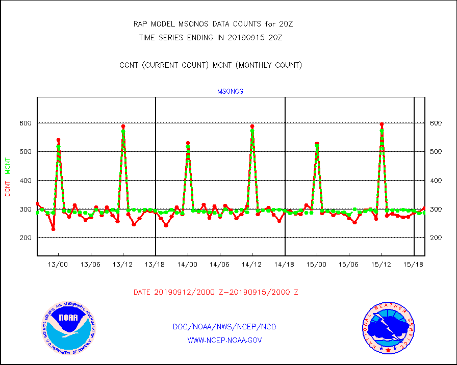
msonos |
Mesonet/MADIS NOS-Phys Oceanographic Realtime Sys |
304 |
288 |
105.6 % |
1519.50-1520.50 |
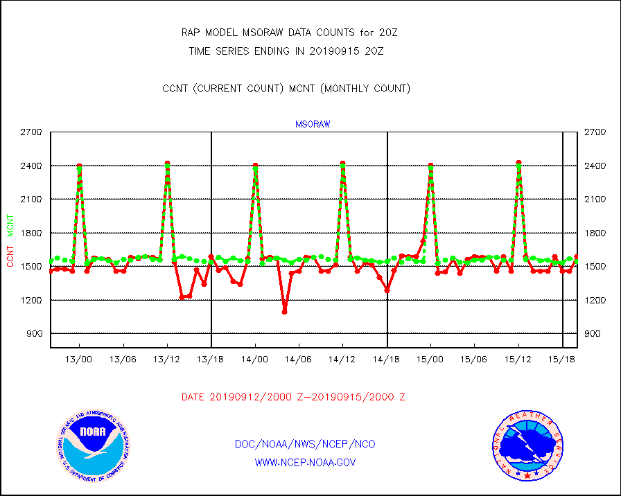
msoraw |
Mesonet/MADIS NFIC Remote Automated Wx Stns(RAWS) |
1588 |
1541 |
103.0 % |
1519.50-1520.50 |
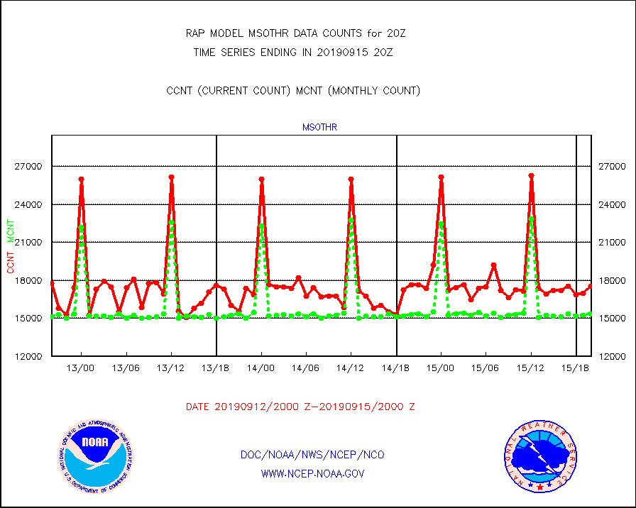
msothr |
Mesonet/MADIS many providers, not separated out |
17549 |
15351 |
114.3 % |
1519.50-1520.50 |
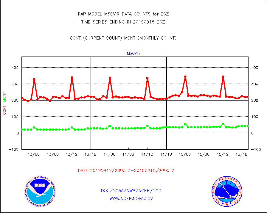
msovir |
Mesonet/MADIS Virginia Dept. of Transportation |
220 |
44 |
500.0 % |
1519.50-1520.50 |
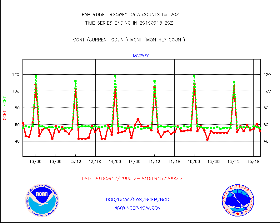
msowfy |
Mesonet/MADIS "Weather for You" |
52 |
56 |
92.9 % |
1519.50-1520.50 |
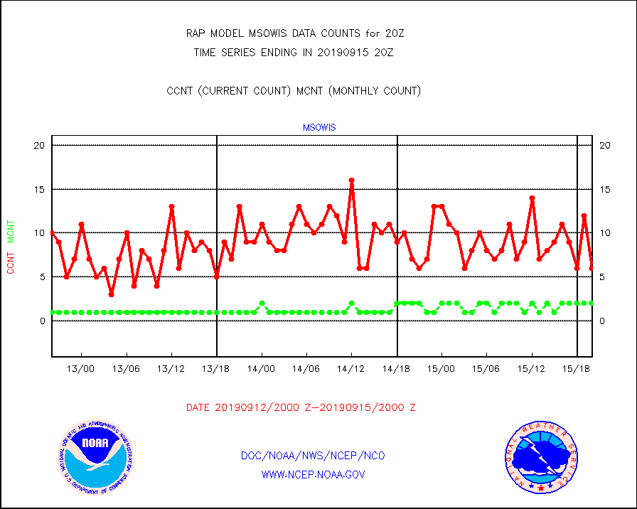
msowis |
Mesonet/MADIS Wisconsin Dept. of Transportation |
6 |
2 |
300.0 % |
1519.50-1520.50 |
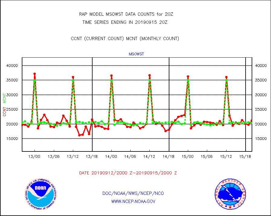
msowst |
Mesonet/MADIS MesoWest (many subproviders) |
21221 |
20339 |
104.3 % |
1519.50-1520.50 |
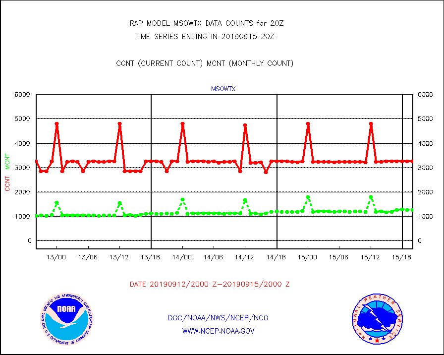
msowtx |
Mesonet/MADIS West Texas |
3251 |
1263 |
257.4 % |
1519.50-1520.50 |
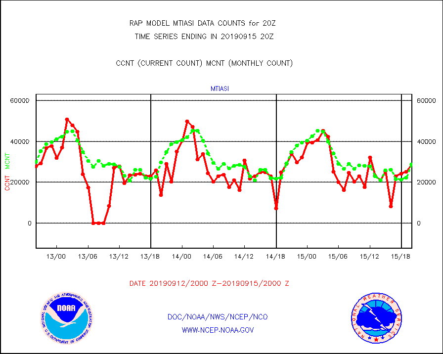
mtiasi |
METOP 1-2 IASI 1C radiance data (varbl. channels) |
28916 |
28868 |
100.2 % |
1518.00-1521.99 |
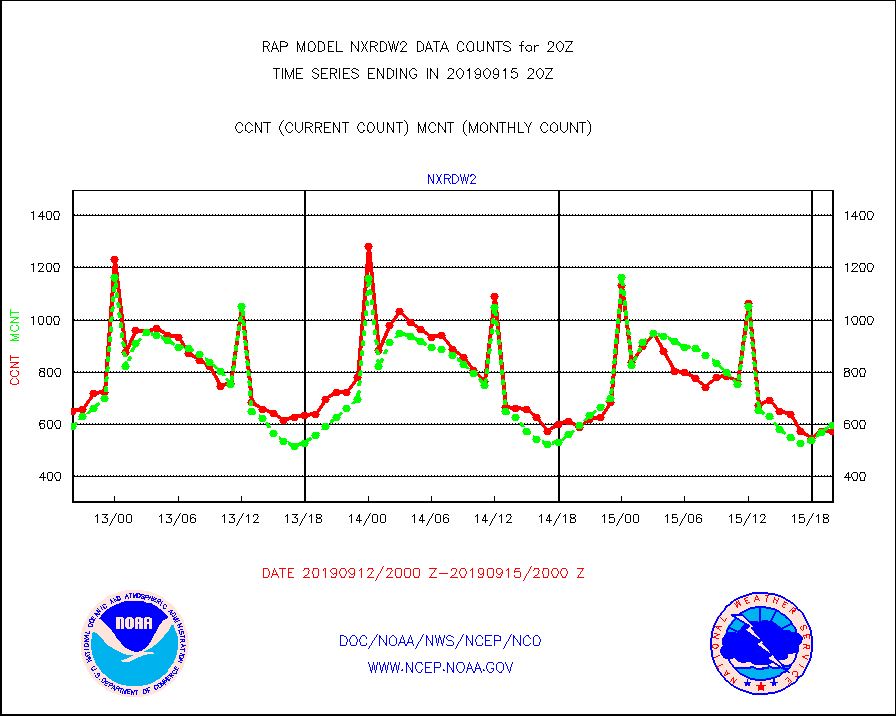
nxrdw2 |
NEXRAD Vel Azm Dsp(VAD) winds via Level 2 decoder |
574 |
597 |
96.1 % |
1519.00-1521.00 |
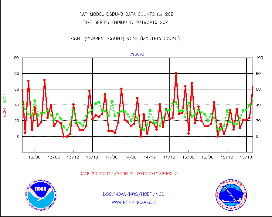
osbuv8 |
NOAA 16-19 Solar Backscatter UV-2 rad frm V8 BUFR |
63 |
45 |
140.0 % |
1518.00-1520.99 |
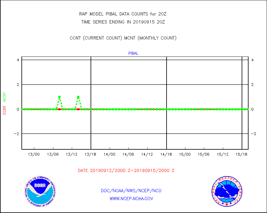
pibal |
PIBAL (from PILOT, PILOT SHIP, PILOT MOBIL) |
0 |
0 |
n/a |
1519.00-1521.00 |
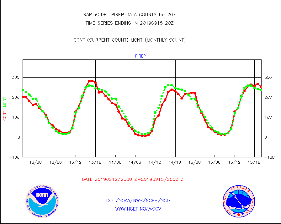
pirep |
Manual PIREP aircraft data (dcded from AIREP fmt) |
252 |
236 |
106.8 % |
1516.75-1523.25 |
prflrp |
Profilr winds from PIBAL (PILOT,PILOT SHIP/MOBIL) |
0 |
0 |
n/a |
1518.50-1521.50 |
radw25 |
NEXRAD radial wind superobs (Level 2.5 - ORPG) |
0 |
0 |
n/a |
1519.00-1521.00 |
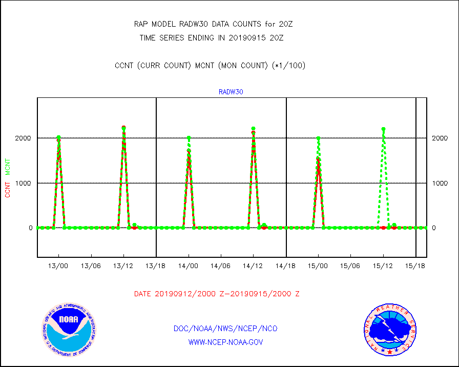
radw30 |
NEXRAD radial wind superobs (Level 3 - NIDS) |
0 |
0 |
n/a |
1519.00-1521.00 |
raobm |
Rawinsonde - mobile land (from TEMP/PILOT MOBIL) |
0 |
0 |
n/a |
1519.00-1521.00 |
raobs |
Rawinsonde - ship (from TEMP SHIP, PILOT SHIP) |
0 |
0 |
n/a |
1519.00-1521.00 |
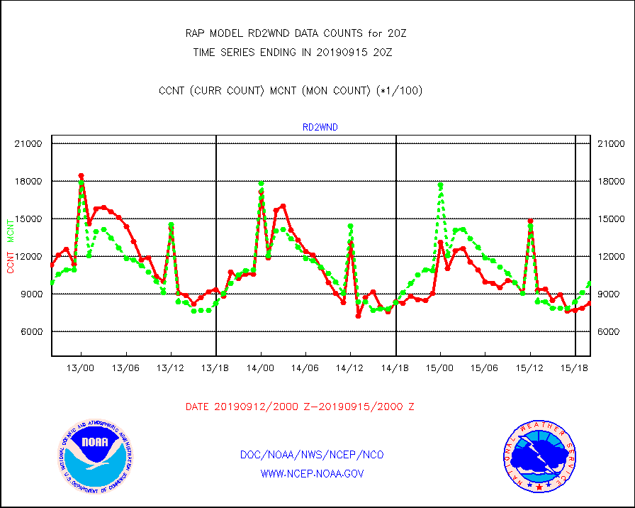
rd2wnd |
NEXRAD radial wind (Level 2 - GTS) |
826153 |
984549 |
83.9 % |
1519.50-1520.49 |
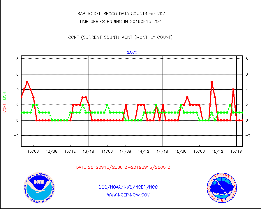
recco |
Flight level reconnaissance aircraft data |
0 |
1 |
0.0 % |
1519.00-1521.00 |
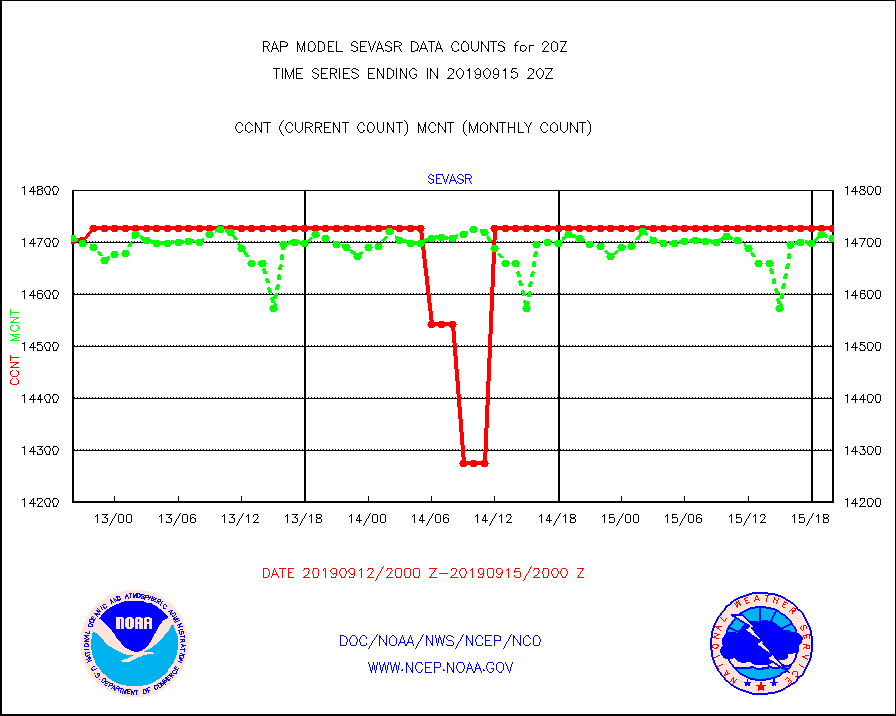
sevasr |
METEOSAT-10 2nd Gen SEVIRI All Sky Radiance(proc) |
14727 |
14708 |
100.1 % |
1518.00-1521.99 |
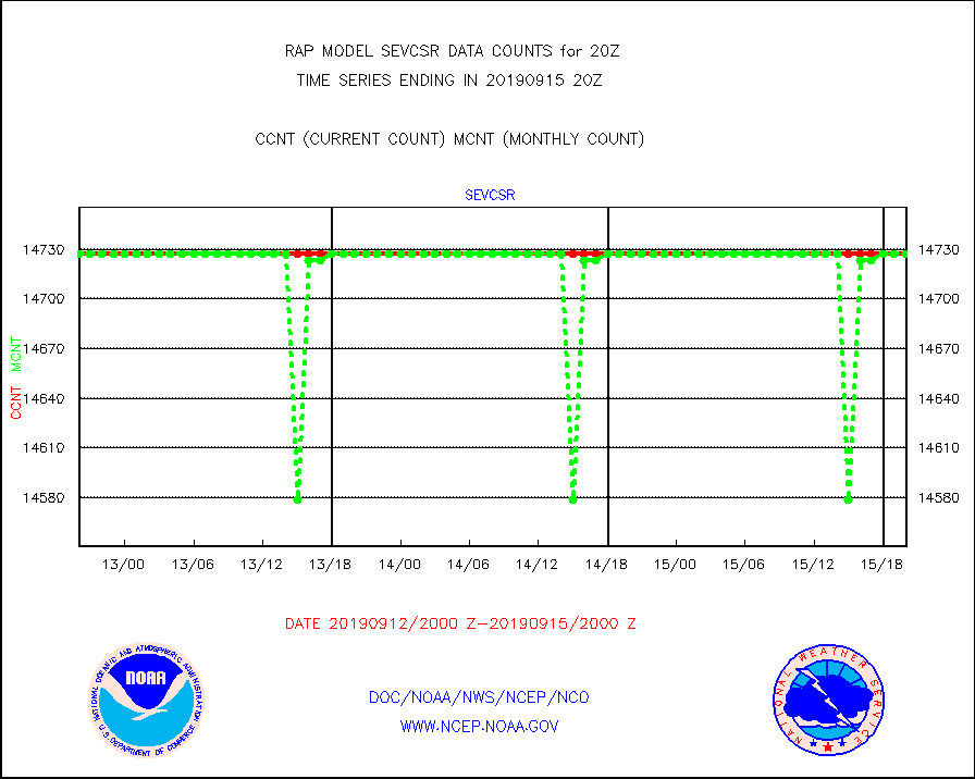
sevcsr |
METEOSAT-10 2nd Gen SEVIRI Clr Sky Radiance(proc) |
14727 |
14727 |
100.0 % |
1518.00-1521.99 |
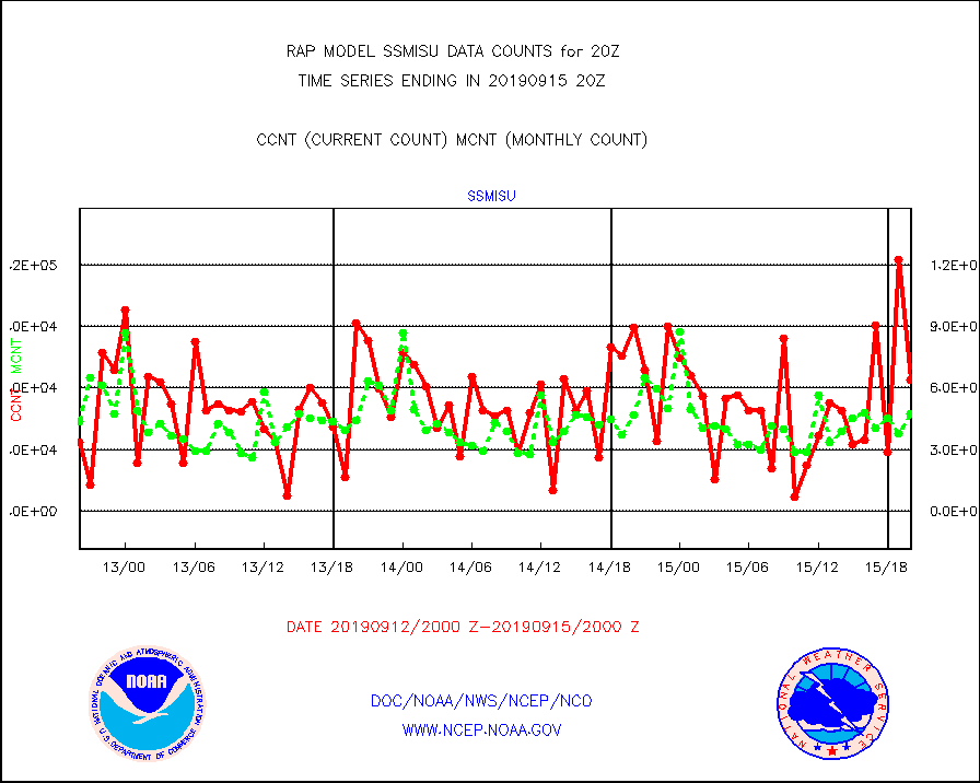
ssmisu |
DMSP SSM/IS 1C radiance data (Unified Pre-Proc.) |
64188 |
47290 |
135.7 % |
1518.00-1521.99 |
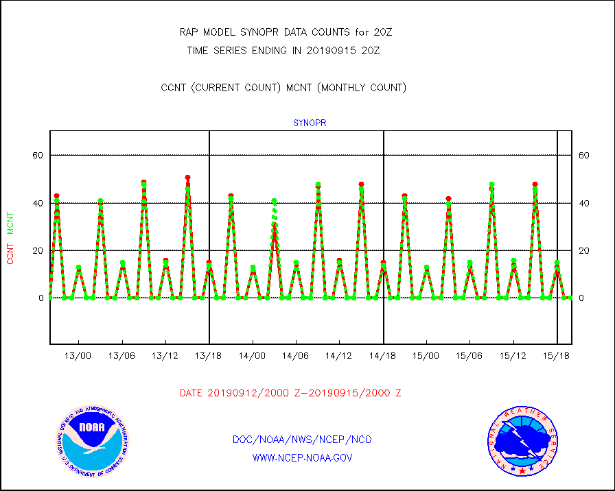
synopr |
Synoptic - restricted (WMO Res 40) manual & auto. |
0 |
0 |
n/a |
1519.50-1520.50 |
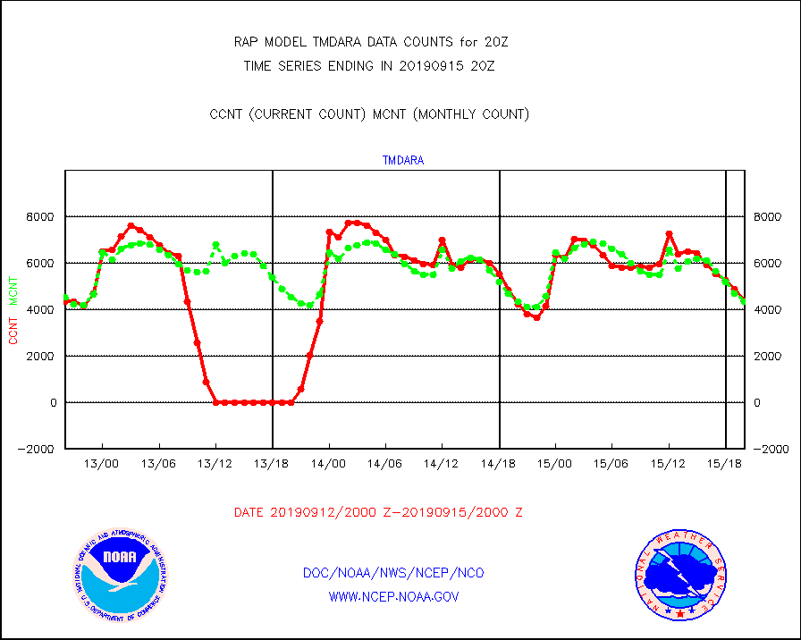
tmdara |
TAMDAR aircft data-all types(from Panasonic,BUFR) |
4384 |
4317 |
101.6 % |
1516.75-1523.25 |
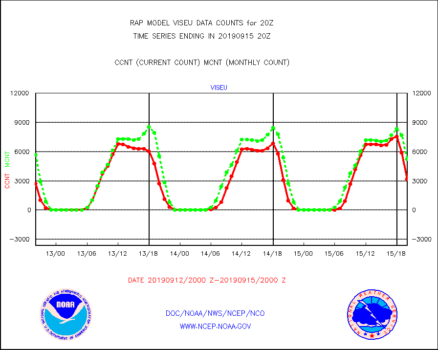
viseu |
METEOSAT/EUMETSAT visible derived cloud motion |
3161 |
5242 |
60.3 % |
1518.50-1521.49 |
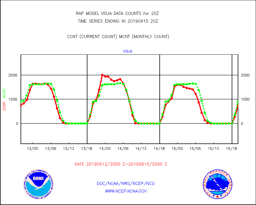
visja |
MTSAT/JMA visible derived cloud motion |
741 |
894 |
82.9 % |
1517.50-1522.50 |
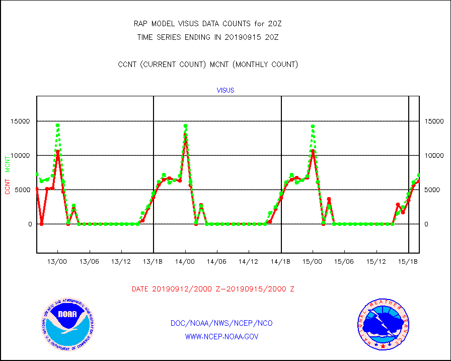
visus |
GOES/NESDIS visible derived cloud motion |
6261 |
7147 |
87.6 % |
1519.00-1519.99 |


