| Critical Data with Normal Counts |
|---|
| Type | Description | Hourly Count | Monthly Average | Percent (%) of Monthly Mean | UTC Time Window |
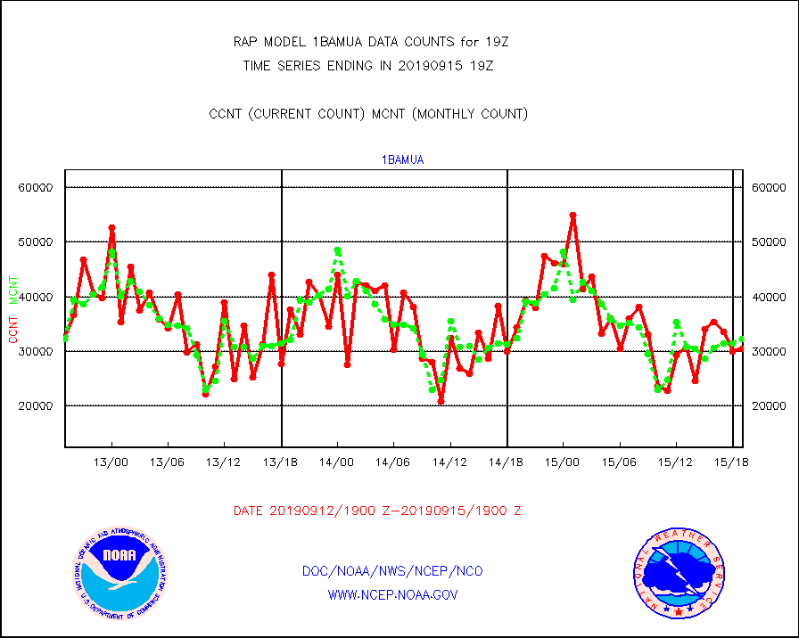
1bamua |
NOAA 15-19 & METOP 1-2 AMSU-A NCEP-proc. br.temps |
30489 |
32224 |
94.6 % |
1516.00-1521.99 |
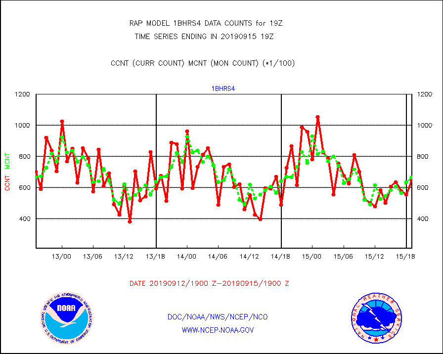
1bhrs4 |
NOAA 18-19 & METOP 1-2 HIRS-4 NCEP-proc. br.temps |
64841 |
66670 |
97.3 % |
1516.00-1521.99 |
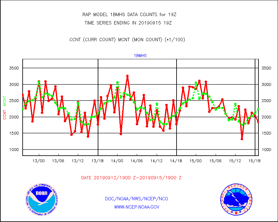
1bmhs |
NOAA 18-19 & METOP 1-2 MHS NCEP-proces. br. temps |
185066 |
224615 |
82.4 % |
1516.00-1521.99 |
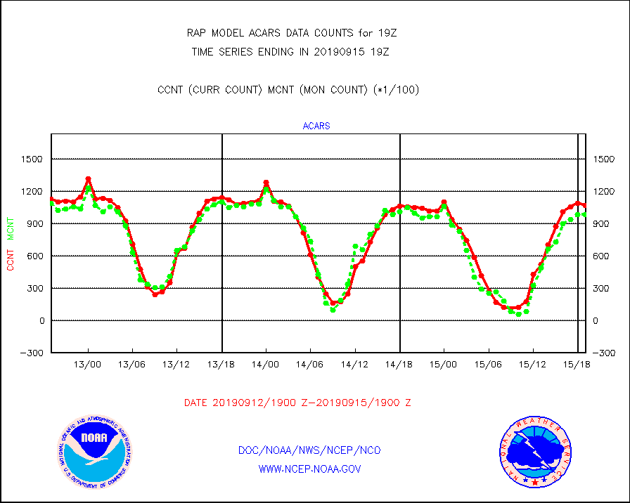
acars |
MDCRS ACARS acft data from ARINC(dcded from BUFR) |
106646 |
98504 |
108.3 % |
1515.75-1522.25 |
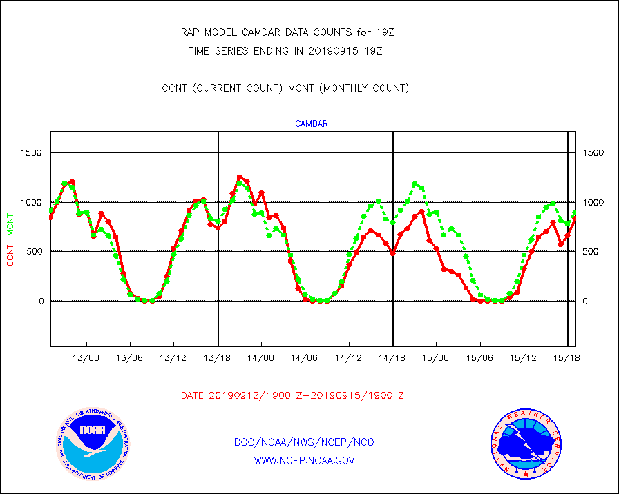
camdar |
Canadian AMDAR aircraft data (decoded from BUFR) |
842 |
905 |
93.0 % |
1515.75-1522.25 |
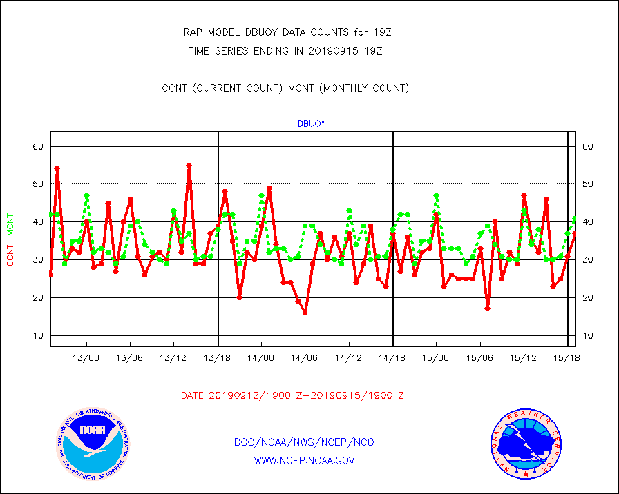
dbuoy |
Buoys decoded from FM-18 fmt (moored or drifting) |
37 |
41 |
90.2 % |
1518.50-1519.50 |
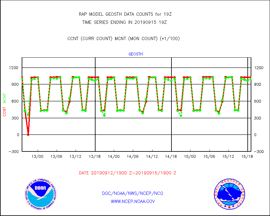
geosth |
GOES/NESDIS hi-resol. (1x1 f-o-v) cloud data |
102715 |
100786 |
101.9 % |
1517.75-1518.99 |
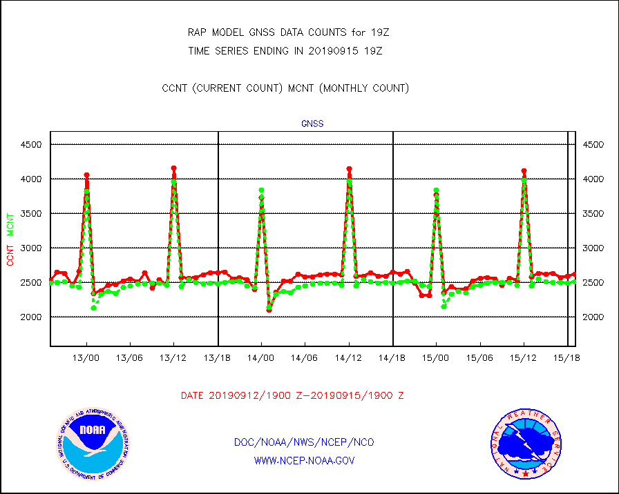
gnss |
Grnd-based Gbl Navigation Sat System (GNSS) data |
2611 |
2506 |
104.2 % |
1517.95-1518.05 |
h20mo |
MODIS (AQUA/TERRA) wvpr imager derived cld motion |
0 |
0 |
n/a |
1516.50-1521.50 |
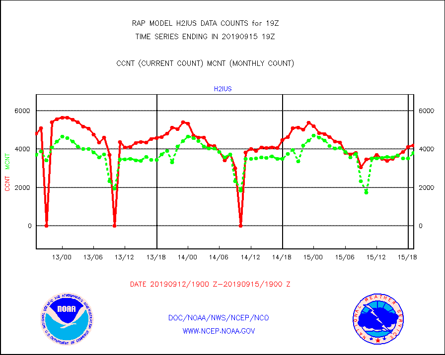
h2ius |
GOES/NESDIS water vapor imager derived cld motion |
4178 |
3796 |
110.1 % |
1518.00-1518.99 |
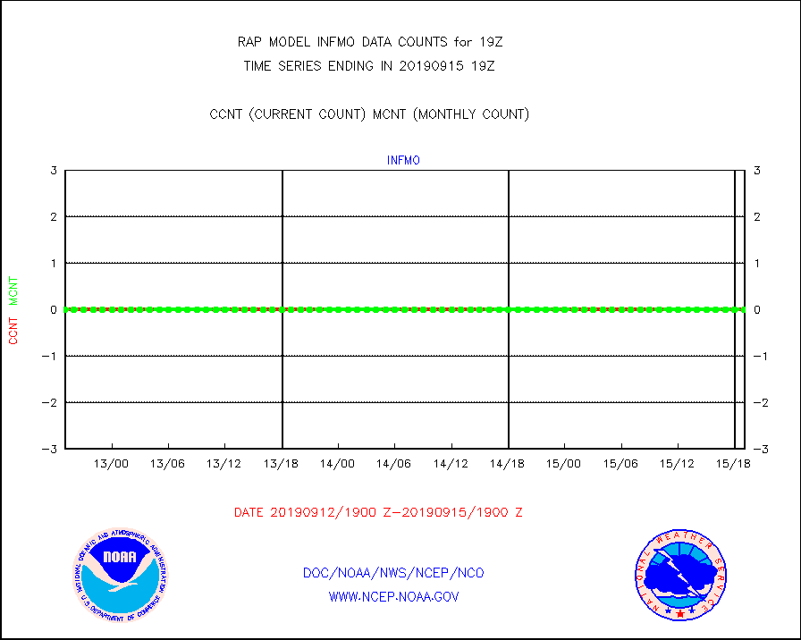
infmo |
MODIS (AQUA/TERRA) ir l-wave derived cloud motion |
0 |
0 |
n/a |
1516.50-1521.50 |
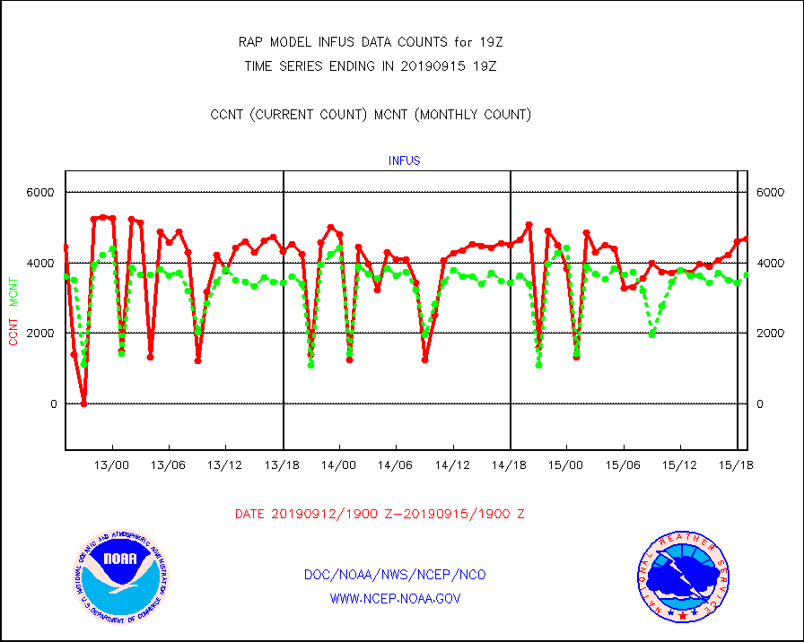
infus |
GOES/NESDIS infrared lg-wave derived cloud motion |
4679 |
3668 |
127.6 % |
1518.00-1518.99 |
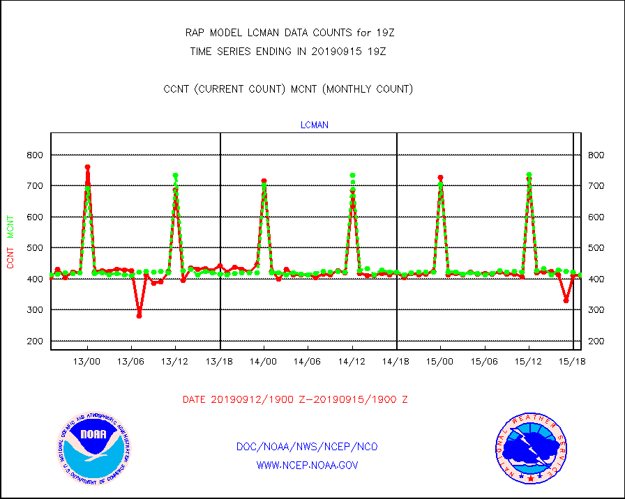
lcman |
Land-based CMAN stations decoded from CMAN format |
410 |
412 |
99.5 % |
1518.50-1519.50 |
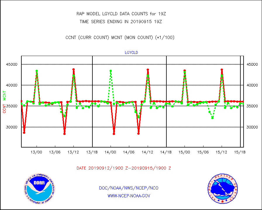
lgycld |
GOES/NASA(Langley) hi-res. (1x1 f-o-v) cloud data |
3610627 |
3558375 |
101.5 % |
1518.50-1519.50 |
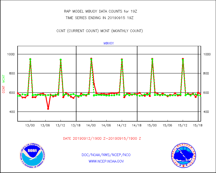
mbuoy |
Buoys decoded from FM-13 format (moored) |
582 |
565 |
103.0 % |
1518.50-1519.50 |
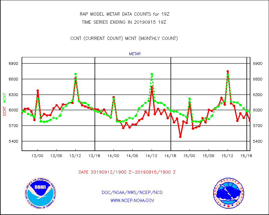
metar |
Aviation - METAR |
5794 |
5962 |
97.2 % |
1518.50-1519.50 |
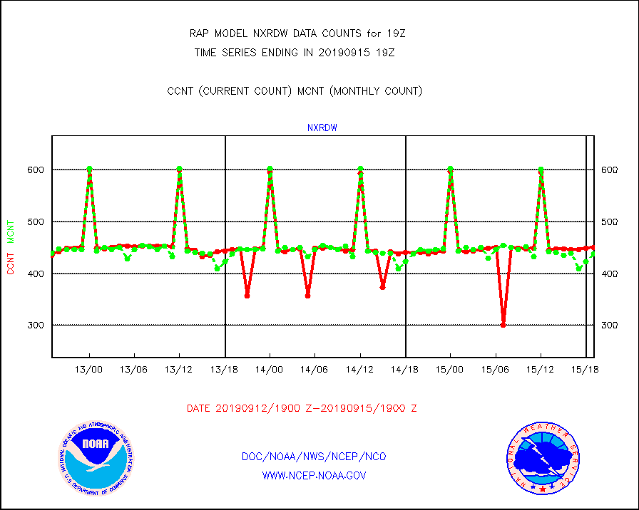
nxrdw |
NEXRAD Vel Azm Dsp(VAD) winds via radar coded msg |
450 |
438 |
102.7 % |
1518.00-1520.00 |
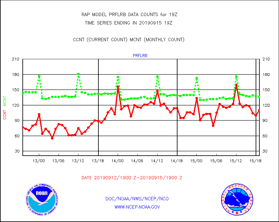
prflrb |
Multi-Agency Profiler (MAP) and SODAR winds |
110 |
136 |
80.9 % |
1517.50-1520.50 |
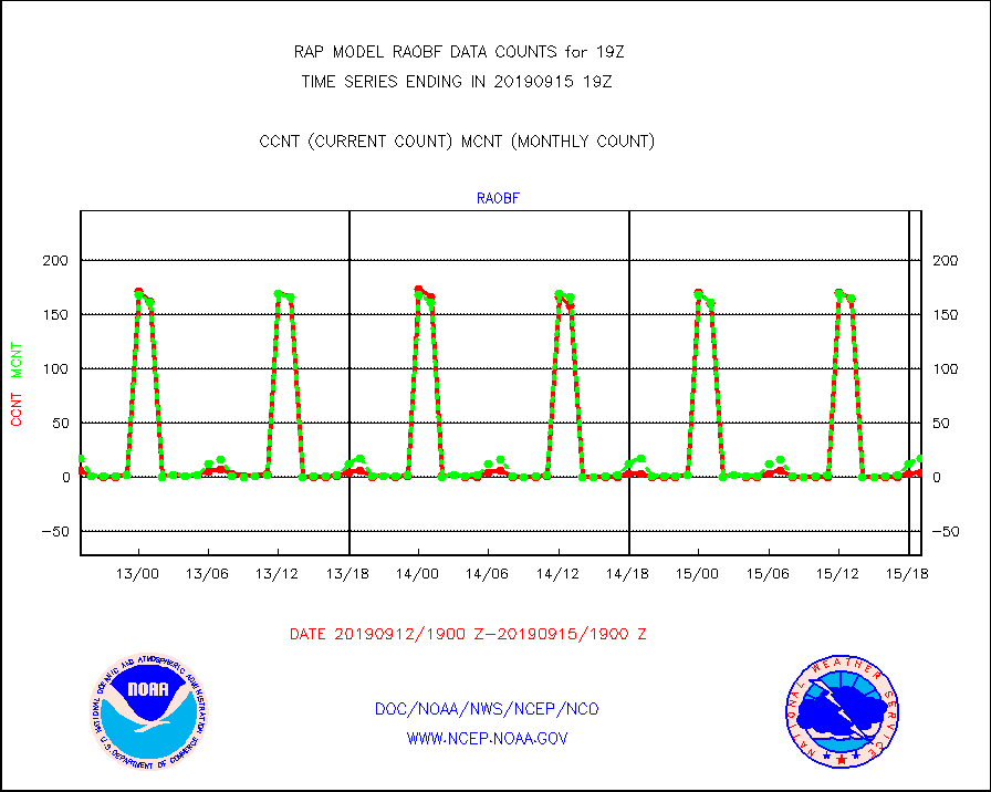
raobf |
Rawinsonde - fixed land (from TEMP or PILOT) |
4 |
17 |
23.5 % |
1518.00-1520.00 |
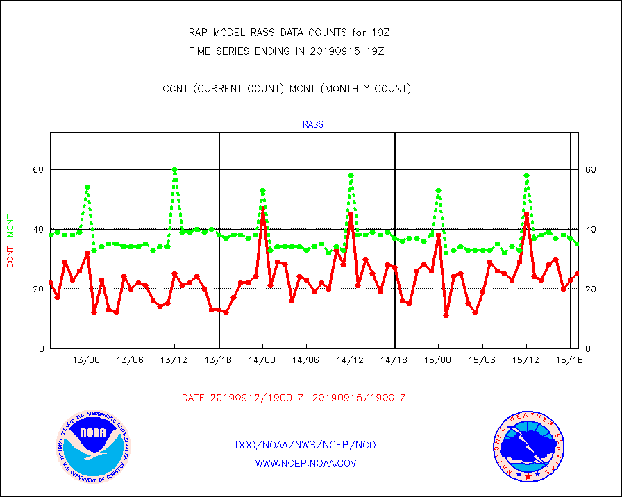
rass |
RASS temperatures (NOAA and Multi-Agency) |
25 |
35 |
71.4 % |
1518.50-1519.50 |
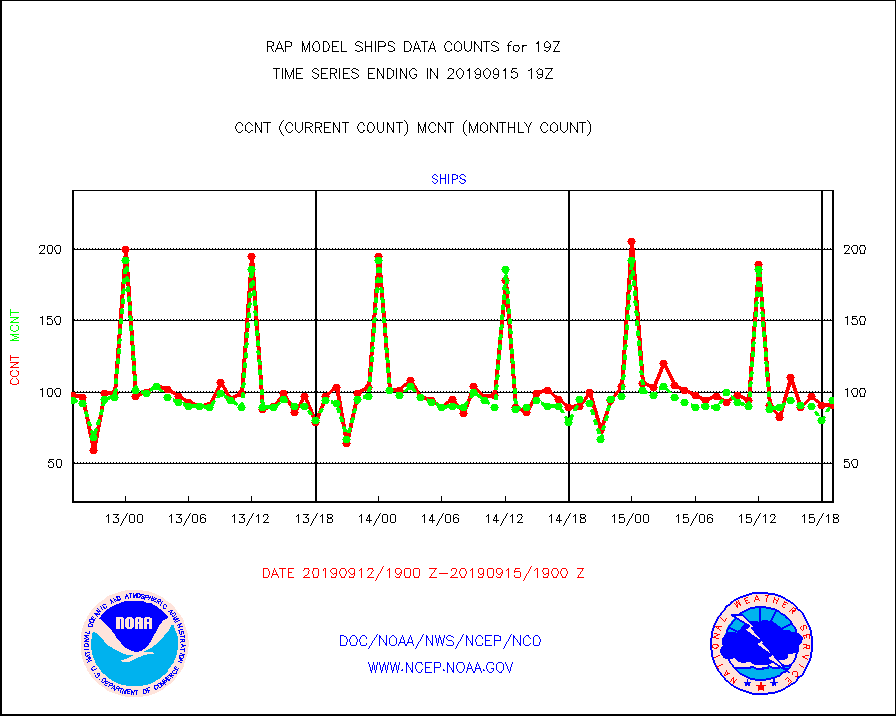
ships |
Ship - manual and automatic, restricted |
91 |
94 |
96.8 % |
1518.50-1519.50 |
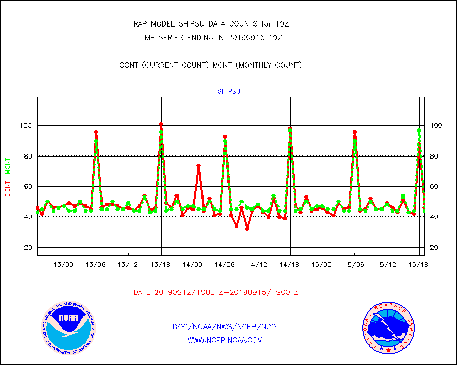
shipsu |
Ship - manual and automatic, unrestricted |
46 |
44 |
104.5 % |
1518.50-1519.50 |
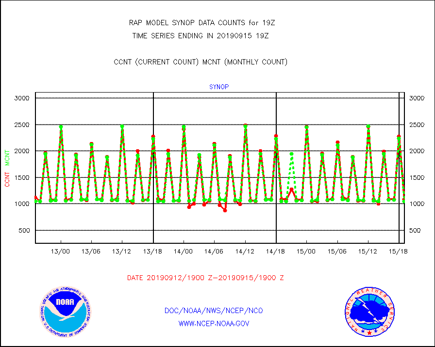
synop |
Synoptic - fixed manual and automatic |
1085 |
1051 |
103.2 % |
1518.50-1519.50 |
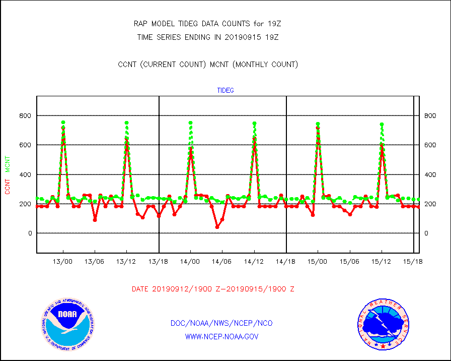
tideg |
Tide gauge reports decoded from CREX format |
181 |
230 |
78.7 % |
1518.50-1519.50 |
| Data Types of Opportunity with Normal Counts |
|---|
| Type | Description | Hourly Count | Monthly Average | Percent (%) of Monthly Mean | UTC Time Window |
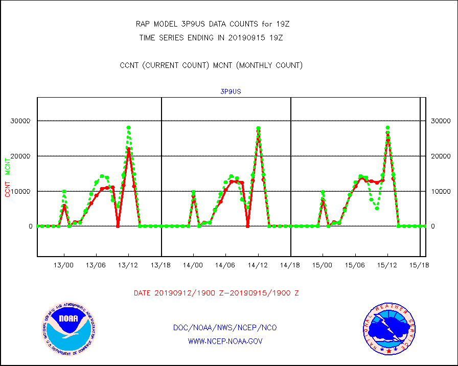
3p9us |
GOES/NESDIS infrared shrt-wave derived cld motion |
0 |
0 |
n/a |
1518.00-1518.99 |
acarsa |
MDCRS ACARS acft data (ARINC via AFWA)(AIREP fmt) |
0 |
0 |
n/a |
1515.75-1522.25 |
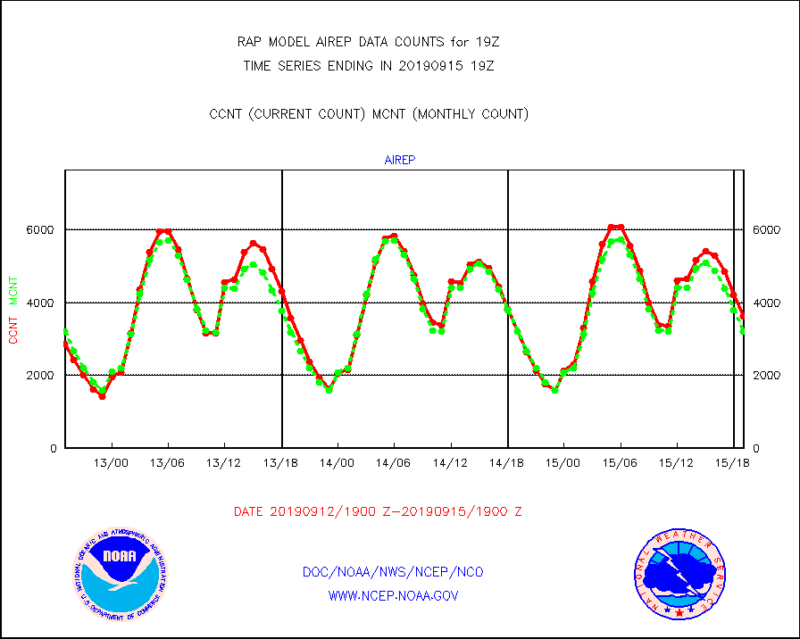
airep |
Manual AIREP aircraft data (dcded from AIREP fmt) |
3628 |
3212 |
113.0 % |
1515.75-1522.25 |
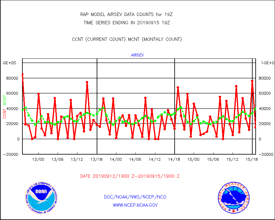
airsev |
AQUA AIRS/AMSU-A/HSB brightness temps- every FOV |
15465 |
39757 |
38.9 % |
1516.00-1521.99 |
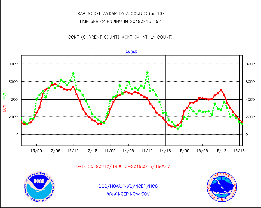
amdar |
AMDAR aircraft data (decoded from AMDAR format) |
1399 |
1178 |
118.8 % |
1515.75-1522.25 |
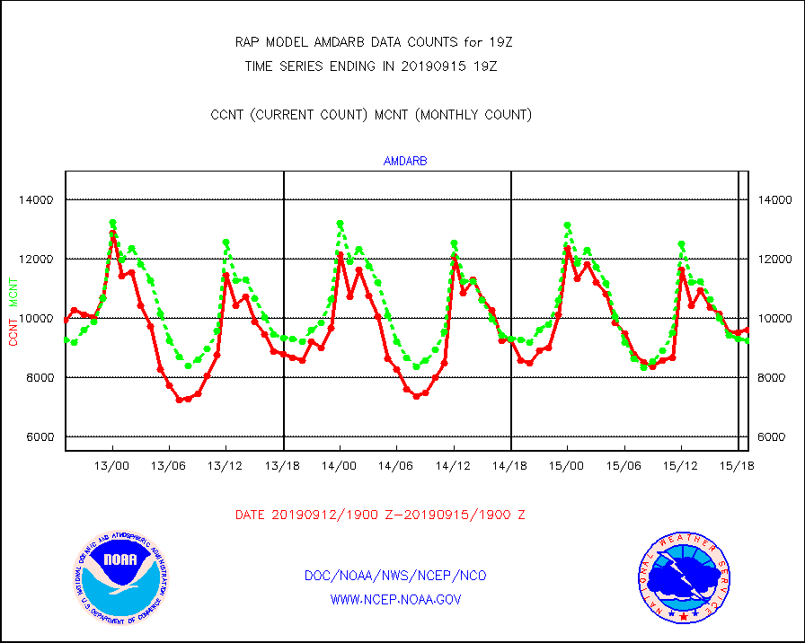
amdarb |
AMDAR aircraft data (decoded from BUFR) |
9605 |
9254 |
103.8 % |
1515.75-1522.25 |
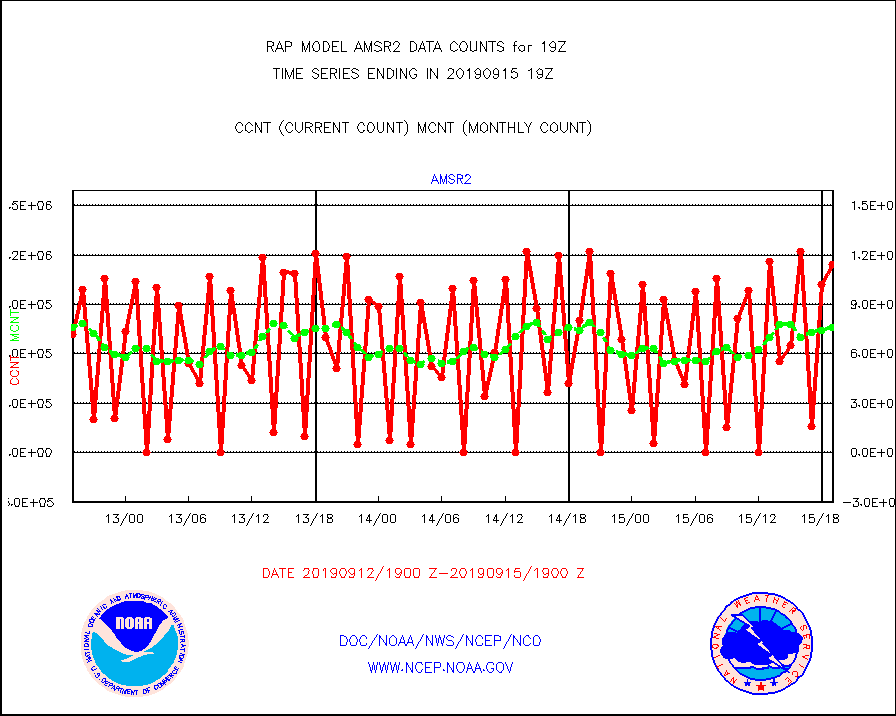
amsr2 |
GCOM-W AMSR2 1B brightness temperatures |
1143249 |
757277 |
151.0 % |
1516.00-1516.99 |
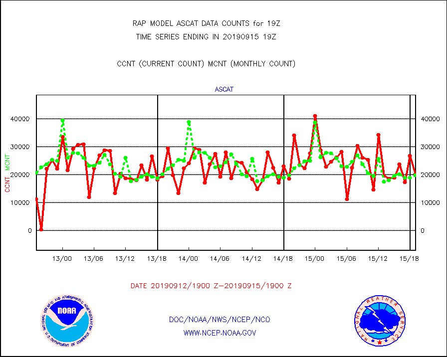
ascat |
METOP 1-2 ASCAT products |
20158 |
19843 |
101.6 % |
1517.00-1521.00 |
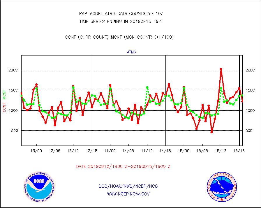
atms |
NPP Adv. Tech. Microwave Sounder (ATMS) br. temps |
122212 |
137607 |
88.8 % |
1517.00-1520.99 |
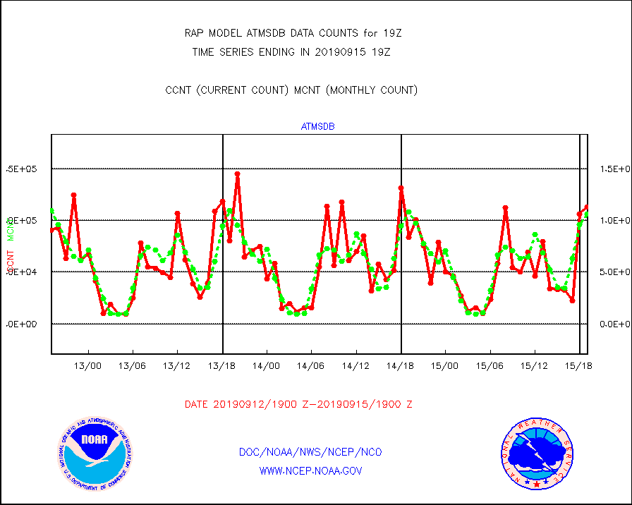
atmsdb |
NPP Adv Tech MW Sndr(ATMS) b. temps-dir bcst SSEC |
112973 |
106019 |
106.6 % |
1517.00-1520.99 |
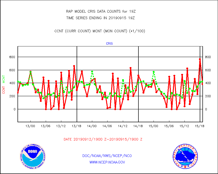
cris |
NPP Cross-track Infrared Sounder (CrIS) radiances |
38522 |
42301 |
91.1 % |
1517.00-1520.99 |
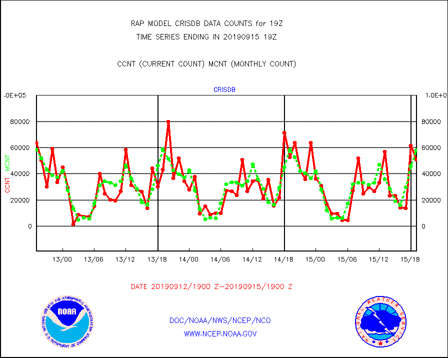
crisdb |
NPP Crss-trk IR Sndr(CrIS) radiance-dir bcst SSEC |
50868 |
57965 |
87.8 % |
1517.00-1520.99 |
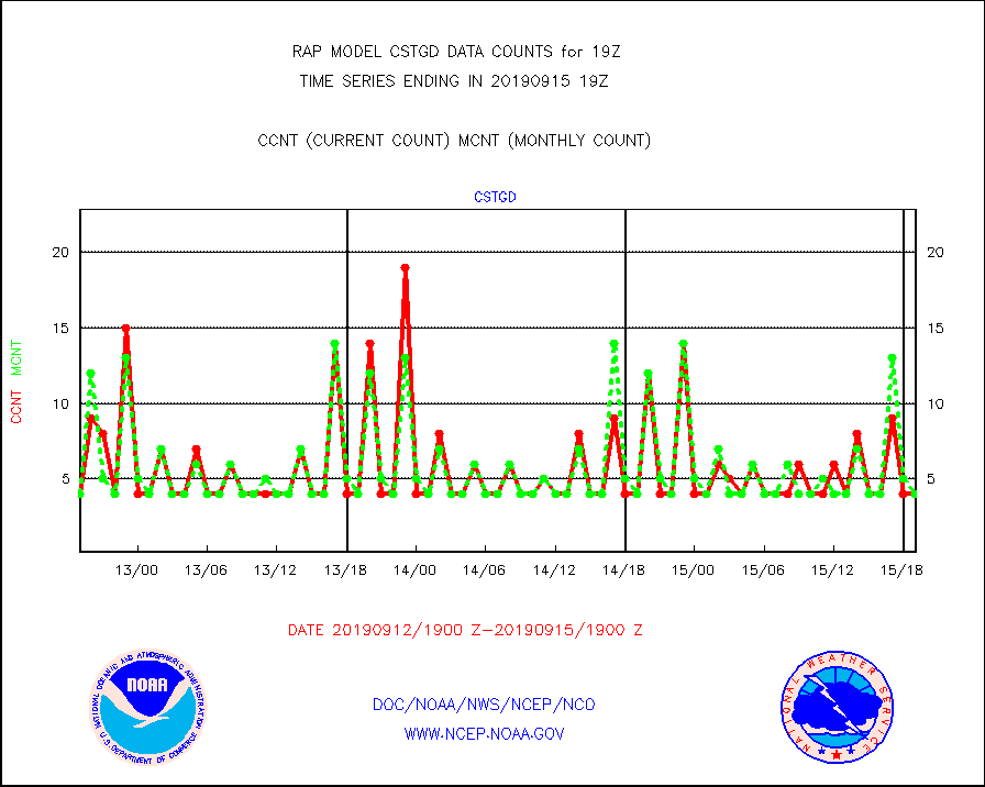
cstgd |
Coast Guard |
4 |
4 |
100.0 % |
1518.50-1519.50 |
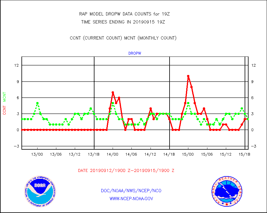
dropw |
Dropwinsonde (from TEMP DROP) |
2 |
2 |
100.0 % |
1518.00-1520.00 |
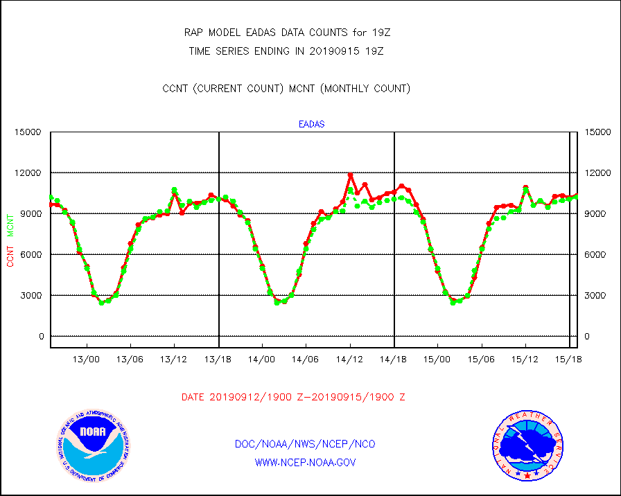
eadas |
E-AMDAR (European AMDAR acft decoded from BUFR) |
10319 |
10221 |
101.0 % |
1515.75-1522.25 |
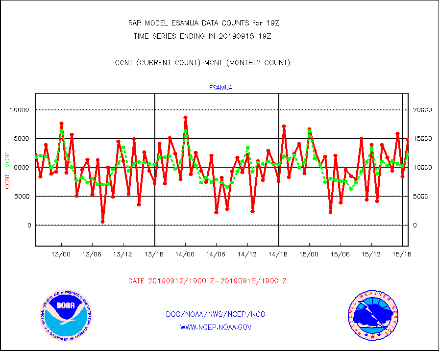
esamua |
NOAA 15-19 & METOP 1-2 AMSU-A proc btmps frm RARS |
14838 |
12258 |
121.0 % |
1518.00-1520.00 |
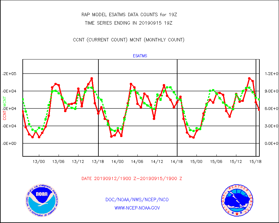
esatms |
NPP Adv. Tech. MW Sndr (ATMS) br. temps from RARS |
58207 |
75845 |
76.7 % |
1517.00-1520.99 |
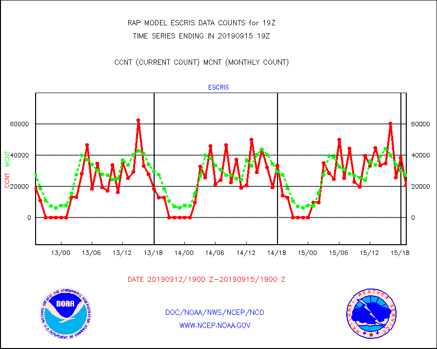
escris |
NPP Crss-track IR Sndr (CrIS) radiances from RARS |
20520 |
27174 |
75.5 % |
1517.00-1520.99 |
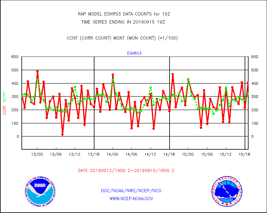
eshrs3 |
NOAA 15-19 & METOP 1-2 HIRS-3/4 pr btmps frm RARS |
40506 |
32205 |
125.8 % |
1518.00-1520.00 |
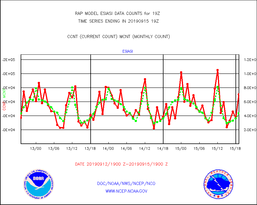
esiasi |
METOP 1-2 IASI 1C radiance data vbl chn from RARS |
70688 |
43748 |
161.6 % |
1517.00-1520.99 |
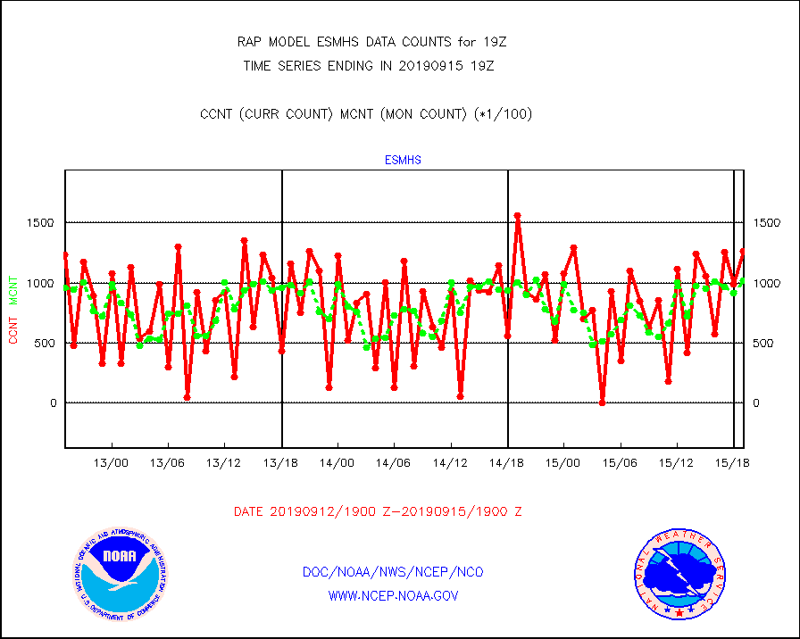
esmhs |
NOAA 18-19 & METOP 1-2 MHS proc. btemps from RARS |
126694 |
101984 |
124.2 % |
1518.00-1520.00 |
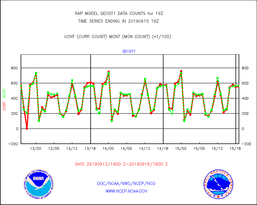
geost1 |
GOES/NESDIS hi-resol. (1x1 f-o-v) sndgs/radiances |
55449 |
56383 |
98.3 % |
1518.00-1520.00 |
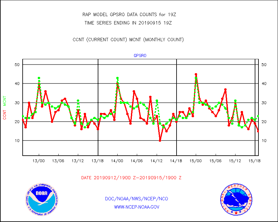
gpsro |
GPS radio occultation data |
15 |
23 |
65.2 % |
1517.00-1520.99 |
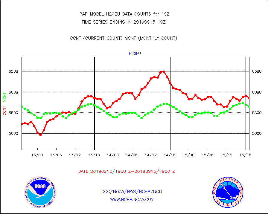
h20eu |
METEOSAT/EUMETSAT wvpr imager derived cld motion |
5851 |
5649 |
103.6 % |
1517.50-1520.49 |
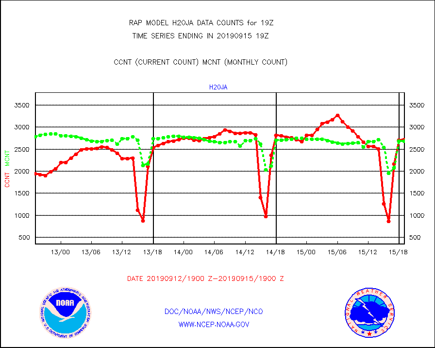
h20ja |
MTSAT/JMA water vapor imager derived cloud motion |
2723 |
2684 |
101.5 % |
1516.50-1521.50 |
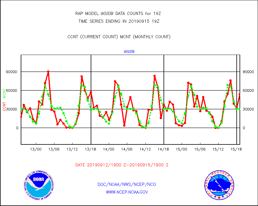
iasidb |
METOP 1-2 IASI 1C radiances-direct broadcast SSEC |
54005 |
30222 |
178.7 % |
1517.00-1520.99 |
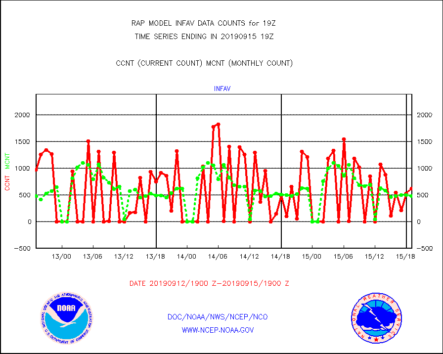
infav |
AVHRR (NOAA/METOP) ir lg-wave derived cld motion |
620 |
480 |
129.2 % |
1516.50-1521.50 |
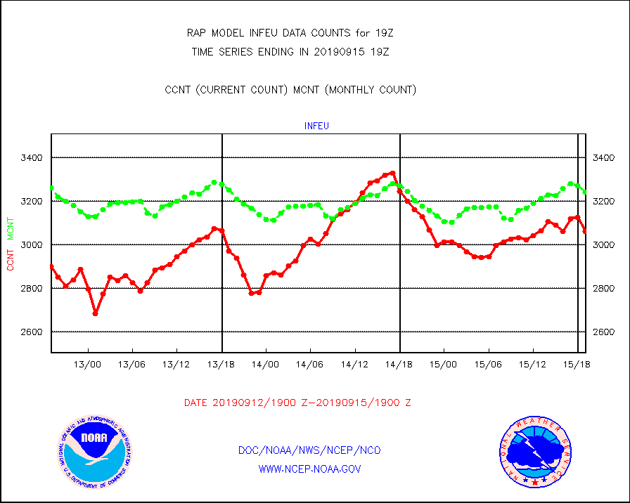
infeu |
METEOSAT/EUMETSAT ir lg-wave derived cloud motion |
3062 |
3242 |
94.4 % |
1517.50-1520.49 |
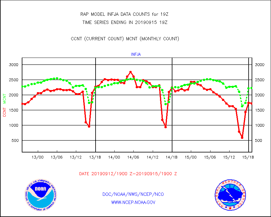
infja |
MTSAT/JMA infrared long-wave derived cloud motion |
1719 |
2230 |
77.1 % |
1516.50-1521.50 |
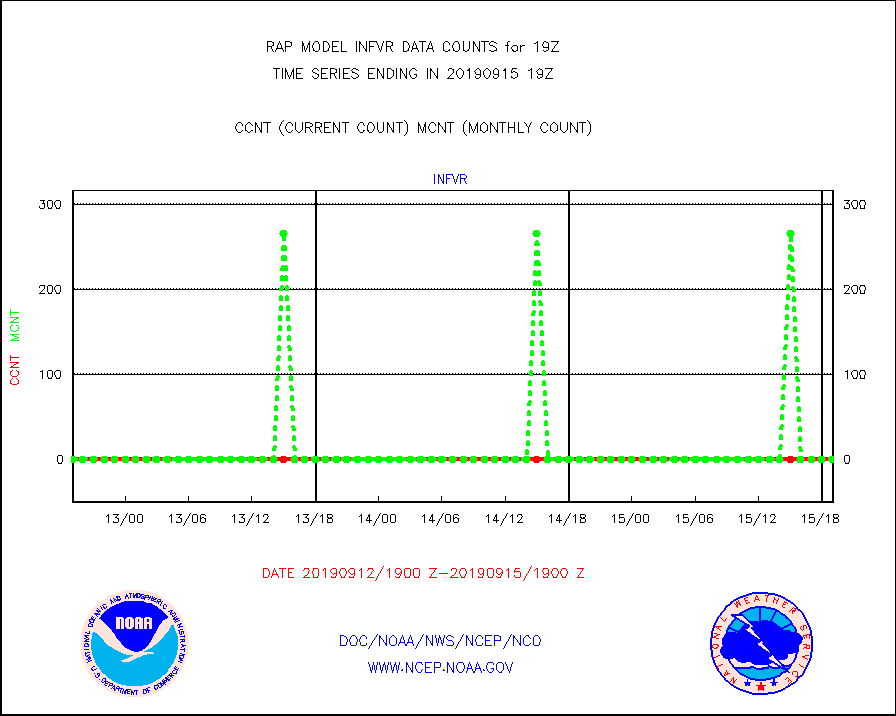
infvr |
VIIRS (NPP) infrared lg-wave derived cloud motion |
0 |
0 |
n/a |
1516.50-1521.50 |
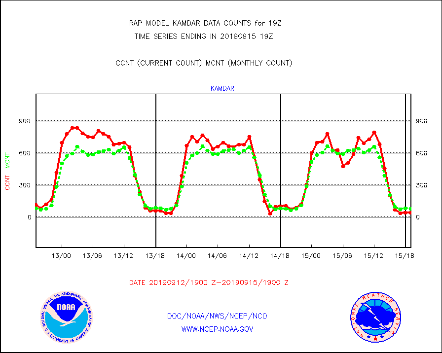
kamdar |
Korean AMDAR aircraft data (decoded from BUFR) |
43 |
78 |
55.1 % |
1515.75-1522.25 |
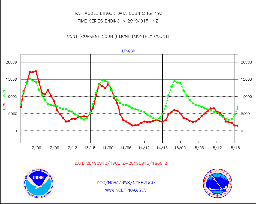
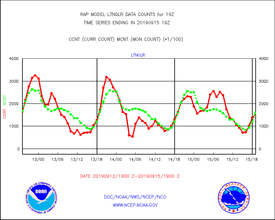
ltnglr |
LLDN Long-rng lightning from Vaisala via NOAAPORT |
154962 |
160456 |
96.6 % |
1518.00-1519.50 |
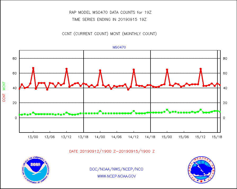
mso470 |
Mesonet/MADIS Colorado E-470 (Interstate 470) |
44 |
8 |
550.0 % |
1518.50-1519.50 |
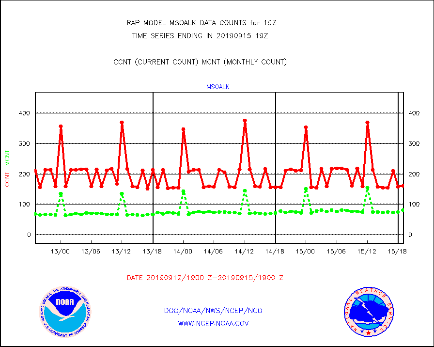
msoalk |
Mesonet/MADIS Alaska Department of Transportation |
161 |
81 |
198.8 % |
1518.50-1519.50 |
msoapg |
Mesonet/MADIS U.S. Army Aberdeen Proving Grounds |
0 |
0 |
n/a |
1518.50-1519.50 |
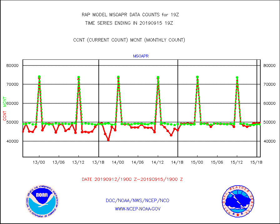
msoapr |
Mesonet/MADIS Citizen Weather Observers Program |
49504 |
48823 |
101.4 % |
1518.50-1519.50 |
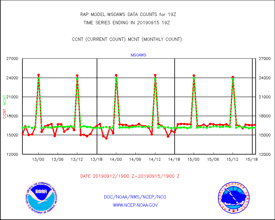
msoaws |
Mesonet/MADIS AWS Convergence Technologies, Inc. |
16610 |
16168 |
102.7 % |
1518.50-1519.50 |
msoawx |
Mesonet/MADIS "Anything Weather" |
0 |
0 |
n/a |
1518.50-1519.50 |
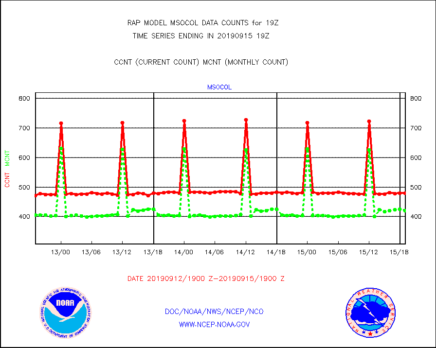
msocol |
Mesonet/MADIS Colorado Dept. of Transportation |
479 |
421 |
113.8 % |
1518.50-1519.50 |
msodcn |
Mesonet/MADIS DC Net |
0 |
0 |
n/a |
1518.50-1519.50 |
msoden |
Mesonet/MADIS Denver Urban Drainage & Flood Cntrl |
0 |
0 |
n/a |
1518.50-1519.50 |
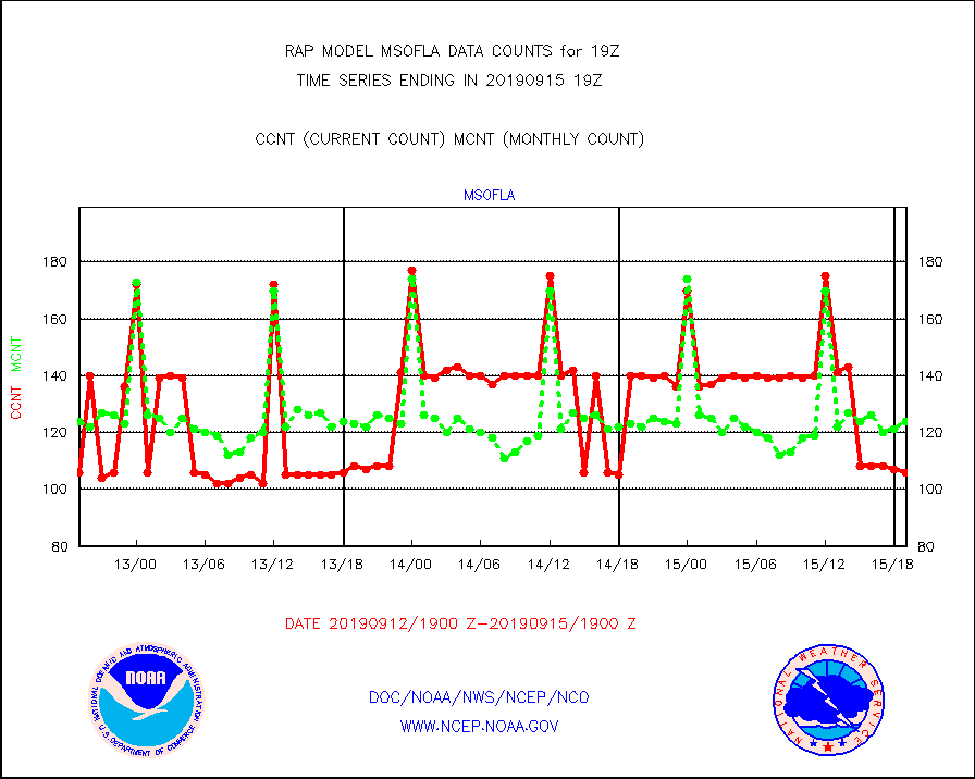
msofla |
Mesonet/MADIS Florida (FAWN & USF) |
106 |
124 |
85.5 % |
1518.50-1519.50 |
msoflt |
Mesonet/MADIS Florida Dept. of Transportation |
0 |
0 |
n/a |
1518.50-1519.50 |
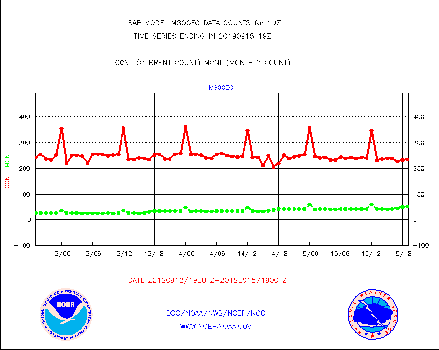
msogeo |
Mesonet/MADIS Georgia Dept. of Transportation |
235 |
51 |
460.8 % |
1518.50-1519.50 |
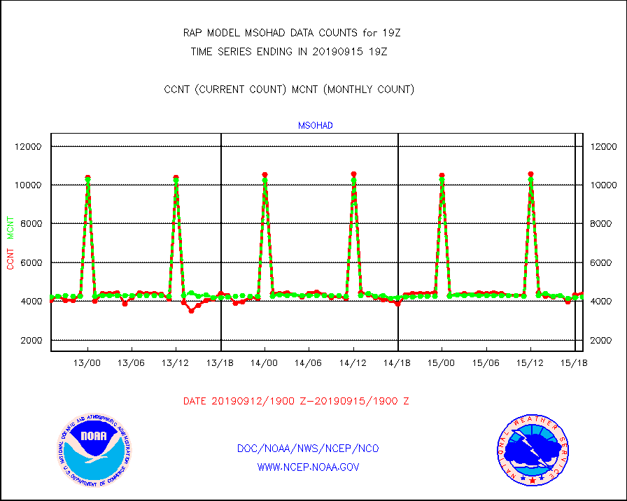
msohad |
Mesonet/MADIS NWS Hydromet Auto Data System(HADS) |
4361 |
4211 |
103.6 % |
1518.50-1519.50 |
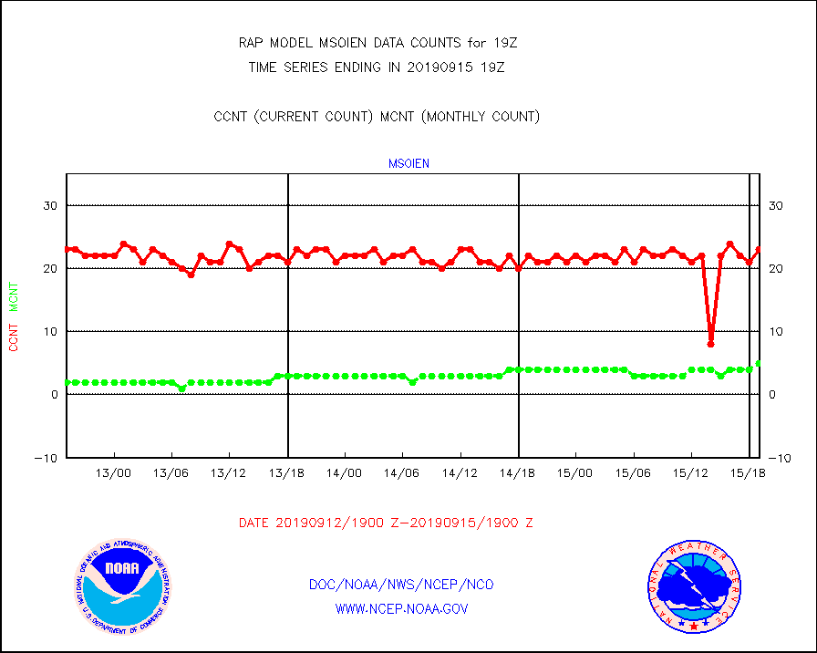
msoien |
Mesonet/MADIS Iowa Environmental |
23 |
5 |
460.0 % |
1518.50-1519.50 |
msoind |
Mesonet/MADIS Indiana Dept. of Transportation |
137 |
28 |
489.3 % |
1518.50-1519.50 |
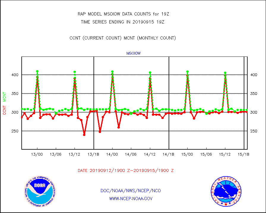
msoiow |
Mesonet/MADIS Iowa Department of Transportation |
301 |
307 |
98.0 % |
1518.50-1519.50 |
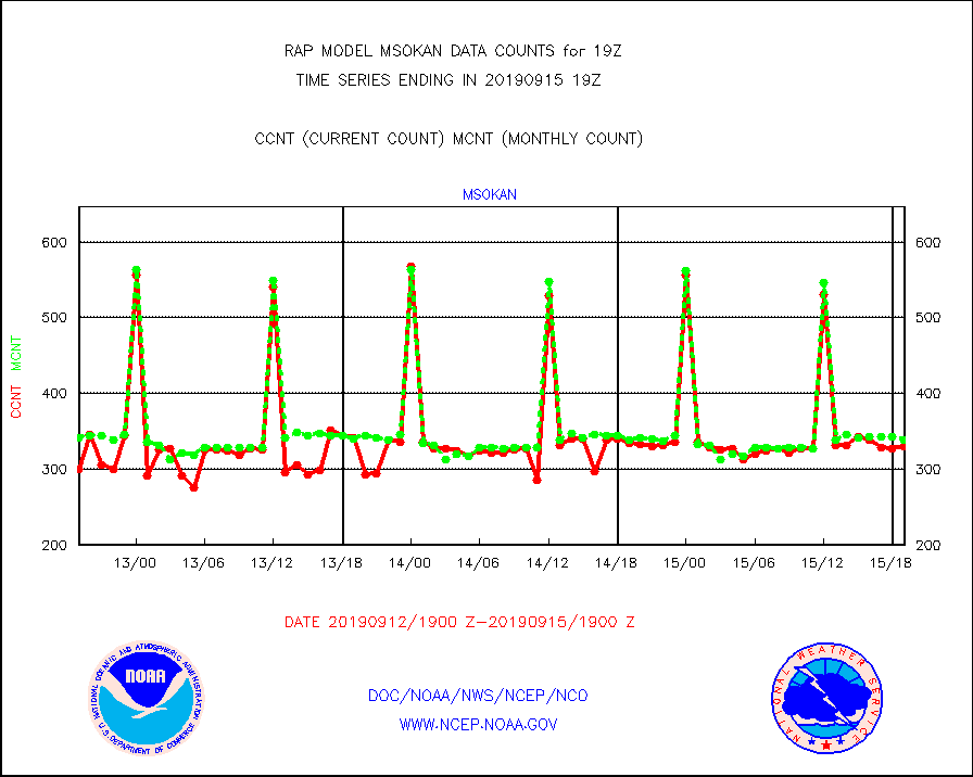
msokan |
Mesonet/MADIS Kansas Department of Transportation |
330 |
338 |
97.6 % |
1518.50-1519.50 |
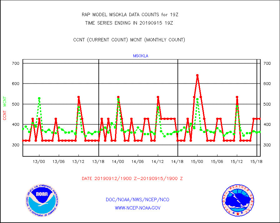
msokla |
Mesonet/MADIS Oklahoma Mesonet |
428 |
364 |
117.6 % |
1518.50-1519.50 |
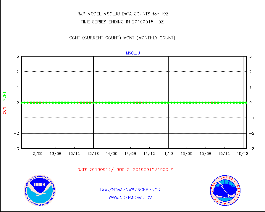
msolju |
Mesonet/MADIS Louisiana State/Jackson State Univ. |
0 |
0 |
n/a |
1518.50-1519.50 |
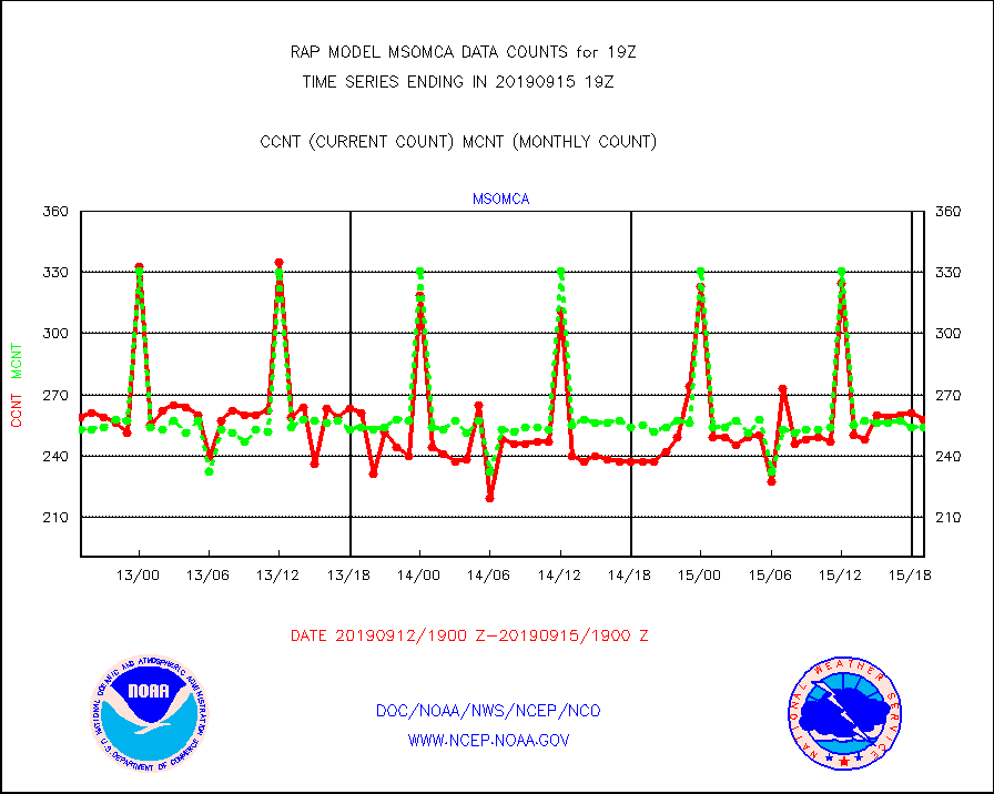
msomca |
Mesonet/MADIS Missouri Commercial Agricult Wx Net |
258 |
254 |
101.6 % |
1518.50-1519.50 |
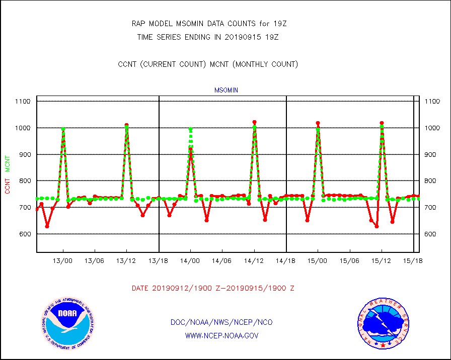
msomin |
Mesonet/MADIS Minnesota Dept. of Transportation |
741 |
733 |
101.1 % |
1518.50-1519.50 |
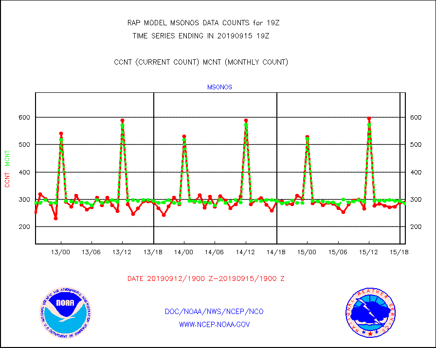
msonos |
Mesonet/MADIS NOS-Phys Oceanographic Realtime Sys |
289 |
286 |
101.0 % |
1518.50-1519.50 |
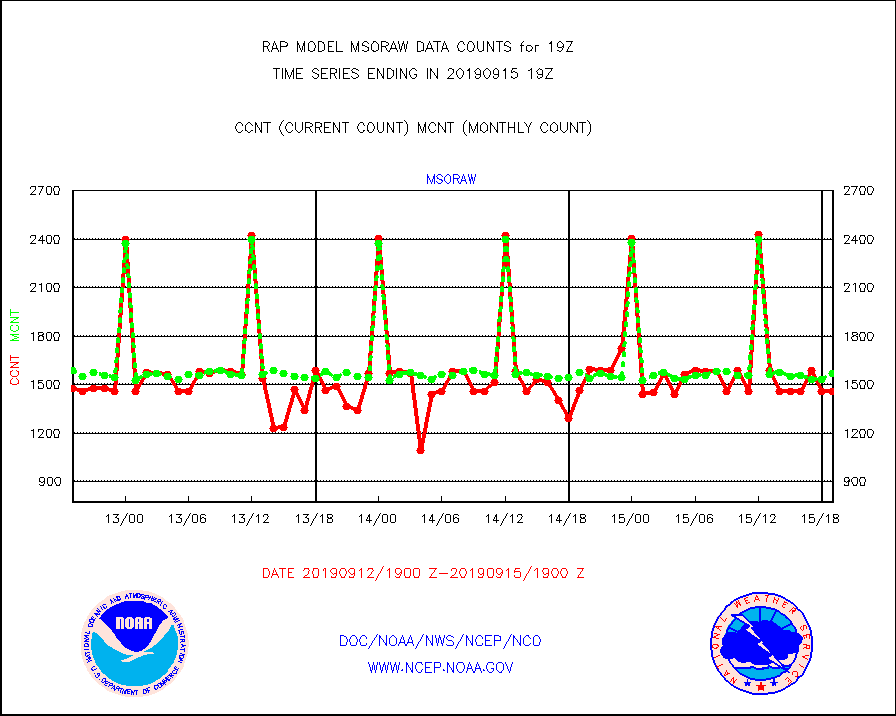
msoraw |
Mesonet/MADIS NFIC Remote Automated Wx Stns(RAWS) |
1459 |
1570 |
92.9 % |
1518.50-1519.50 |
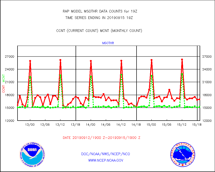
msothr |
Mesonet/MADIS many providers, not separated out |
16988 |
15227 |
111.6 % |
1518.50-1519.50 |
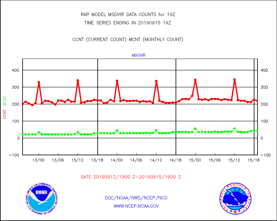
msovir |
Mesonet/MADIS Virginia Dept. of Transportation |
220 |
43 |
511.6 % |
1518.50-1519.50 |
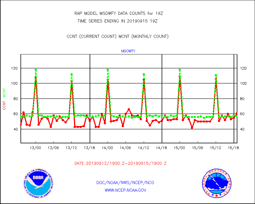
msowfy |
Mesonet/MADIS "Weather for You" |
61 |
57 |
107.0 % |
1518.50-1519.50 |
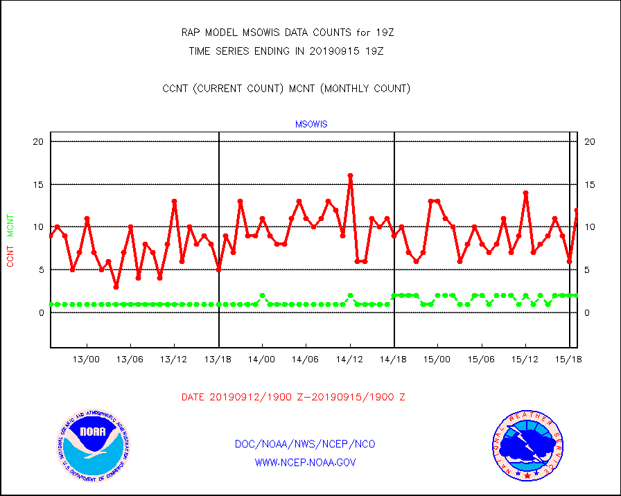
msowis |
Mesonet/MADIS Wisconsin Dept. of Transportation |
12 |
2 |
600.0 % |
1518.50-1519.50 |
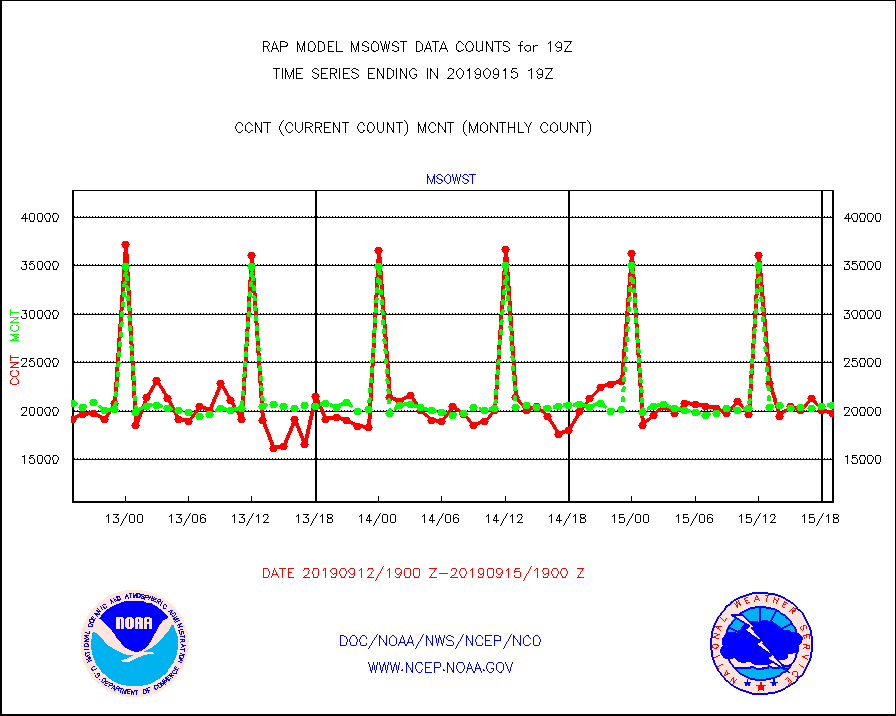
msowst |
Mesonet/MADIS MesoWest (many subproviders) |
19743 |
20609 |
95.8 % |
1518.50-1519.50 |
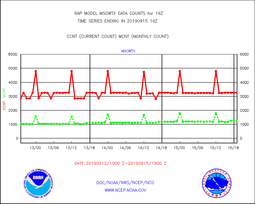
msowtx |
Mesonet/MADIS West Texas |
3251 |
1263 |
257.4 % |
1518.50-1519.50 |
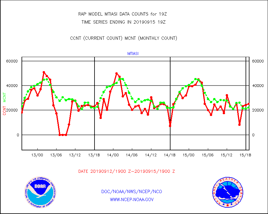
mtiasi |
METOP 1-2 IASI 1C radiance data (varbl. channels) |
25167 |
22268 |
113.0 % |
1517.00-1520.99 |
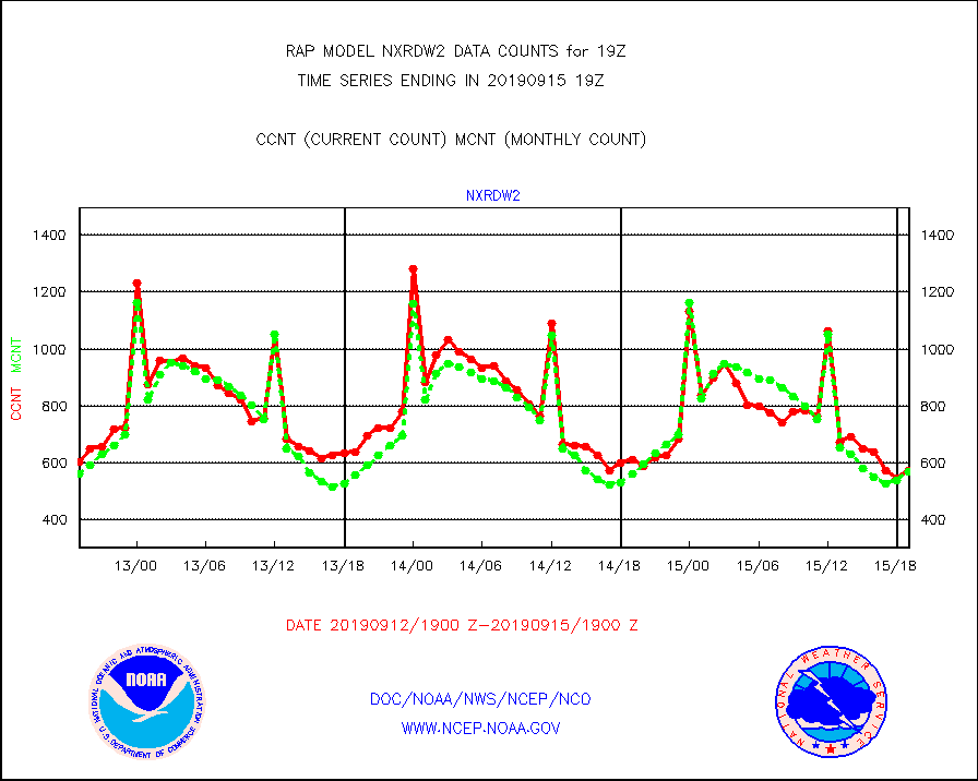
nxrdw2 |
NEXRAD Vel Azm Dsp(VAD) winds via Level 2 decoder |
575 |
569 |
101.1 % |
1518.00-1520.00 |
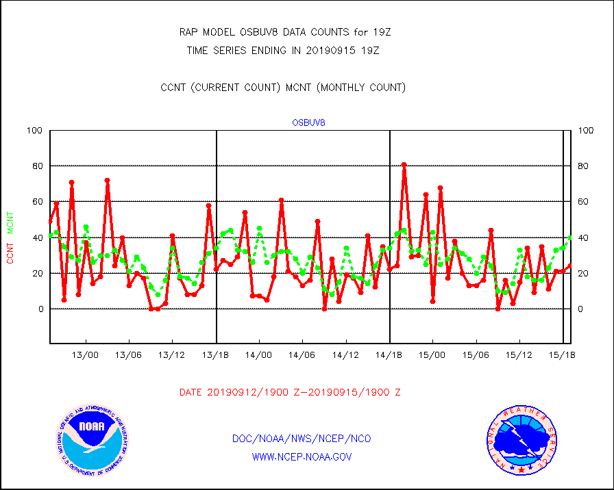
osbuv8 |
NOAA 16-19 Solar Backscatter UV-2 rad frm V8 BUFR |
24 |
40 |
60.0 % |
1517.00-1519.99 |
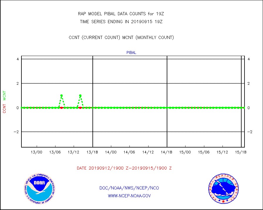
pibal |
PIBAL (from PILOT, PILOT SHIP, PILOT MOBIL) |
0 |
0 |
n/a |
1518.00-1520.00 |
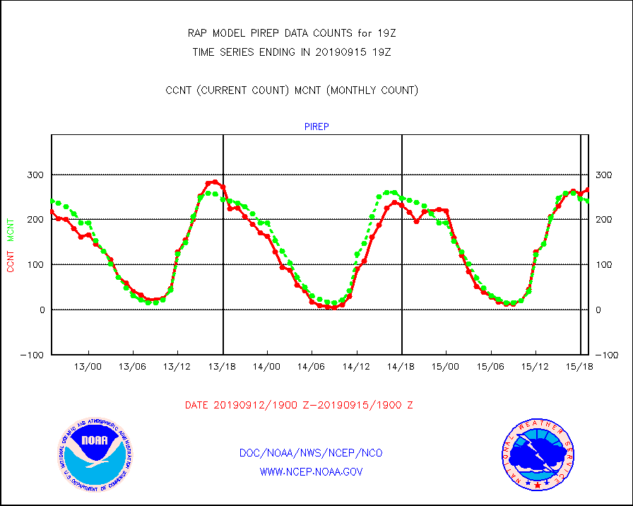
pirep |
Manual PIREP aircraft data (dcded from AIREP fmt) |
266 |
241 |
110.4 % |
1515.75-1522.25 |
prflrp |
Profilr winds from PIBAL (PILOT,PILOT SHIP/MOBIL) |
0 |
0 |
n/a |
1517.50-1520.50 |
radw25 |
NEXRAD radial wind superobs (Level 2.5 - ORPG) |
0 |
0 |
n/a |
1518.00-1520.00 |
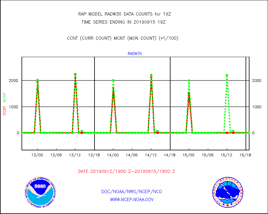
radw30 |
NEXRAD radial wind superobs (Level 3 - NIDS) |
0 |
0 |
n/a |
1518.00-1520.00 |
raobm |
Rawinsonde - mobile land (from TEMP/PILOT MOBIL) |
0 |
0 |
n/a |
1518.00-1520.00 |
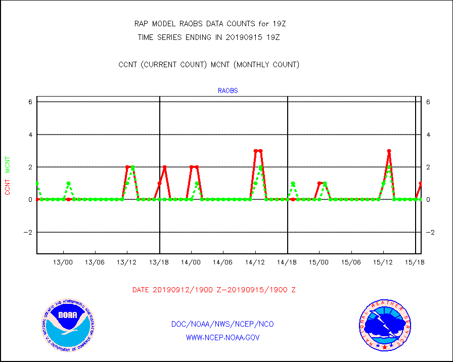
raobs |
Rawinsonde - ship (from TEMP SHIP, PILOT SHIP) |
1 |
0 |
n/a |
1518.00-1520.00 |
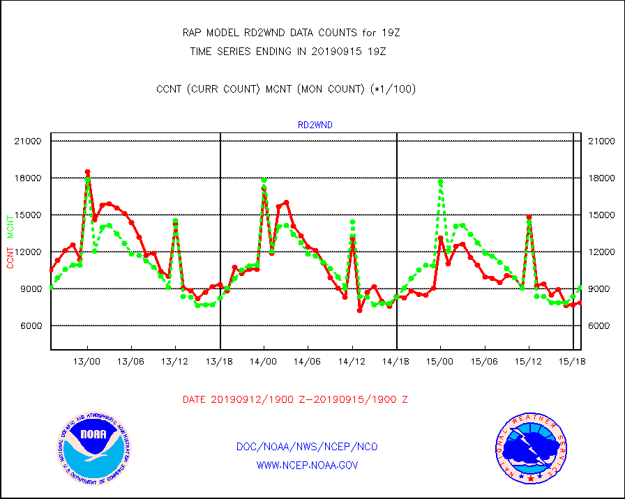
rd2wnd |
NEXRAD radial wind (Level 2 - GTS) |
788904 |
913141 |
86.4 % |
1518.50-1519.49 |
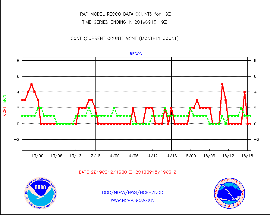
recco |
Flight level reconnaissance aircraft data |
0 |
1 |
0.0 % |
1518.00-1520.00 |
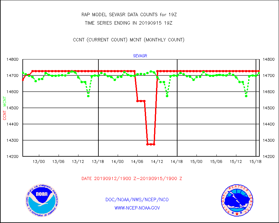
sevasr |
METEOSAT-10 2nd Gen SEVIRI All Sky Radiance(proc) |
14727 |
14715 |
100.1 % |
1517.00-1520.99 |
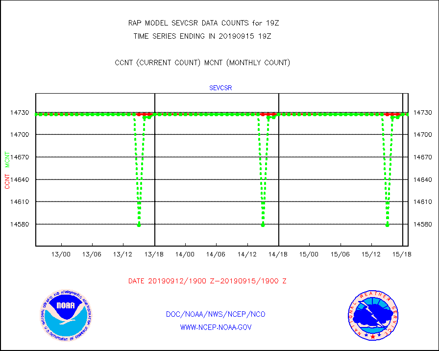
sevcsr |
METEOSAT-10 2nd Gen SEVIRI Clr Sky Radiance(proc) |
14727 |
14727 |
100.0 % |
1517.00-1520.99 |
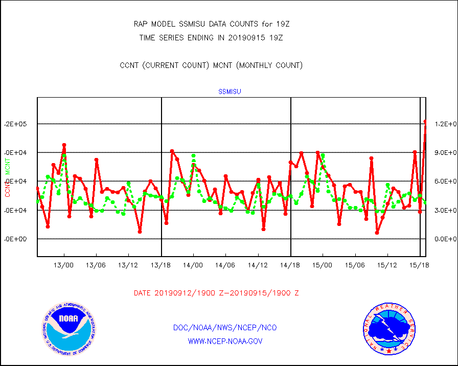
ssmisu |
DMSP SSM/IS 1C radiance data (Unified Pre-Proc.) |
122533 |
38034 |
322.2 % |
1517.00-1520.99 |
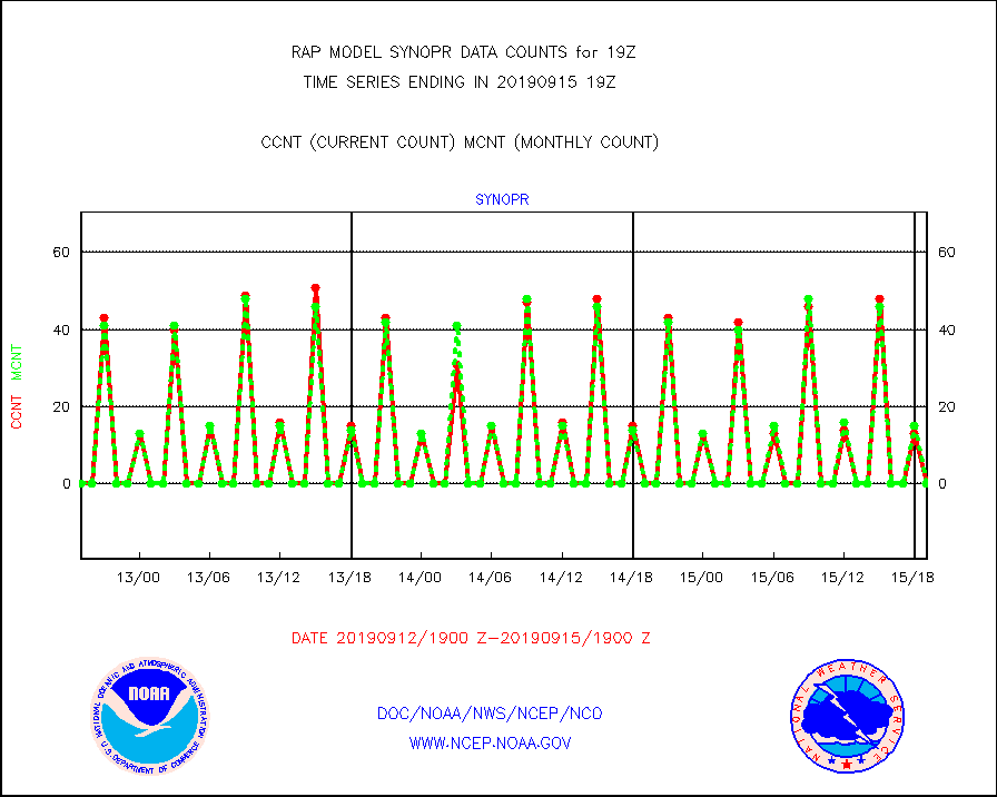
synopr |
Synoptic - restricted (WMO Res 40) manual & auto. |
0 |
0 |
n/a |
1518.50-1519.50 |
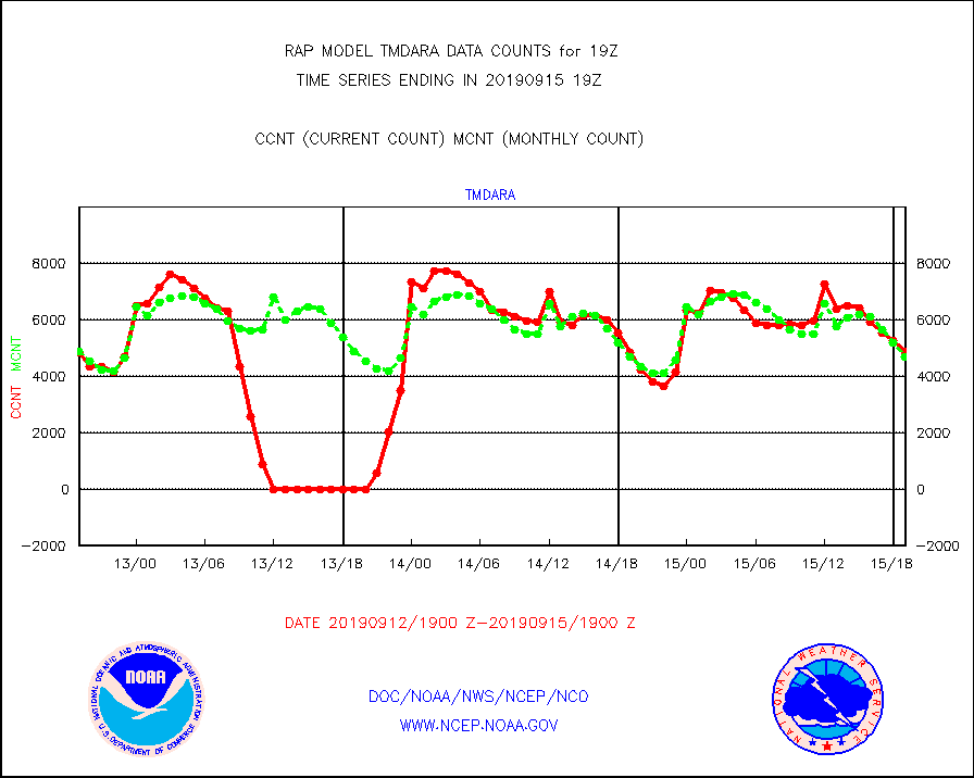
tmdara |
TAMDAR aircft data-all types(from Panasonic,BUFR) |
4867 |
4671 |
104.2 % |
1515.75-1522.25 |
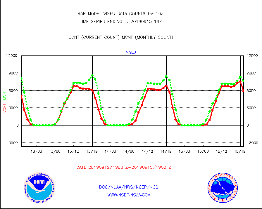
viseu |
METEOSAT/EUMETSAT visible derived cloud motion |
5885 |
7686 |
76.6 % |
1517.50-1520.49 |
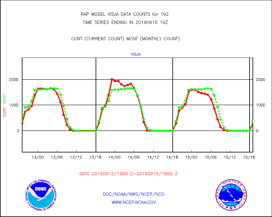
visja |
MTSAT/JMA visible derived cloud motion |
267 |
371 |
72.0 % |
1516.50-1521.50 |
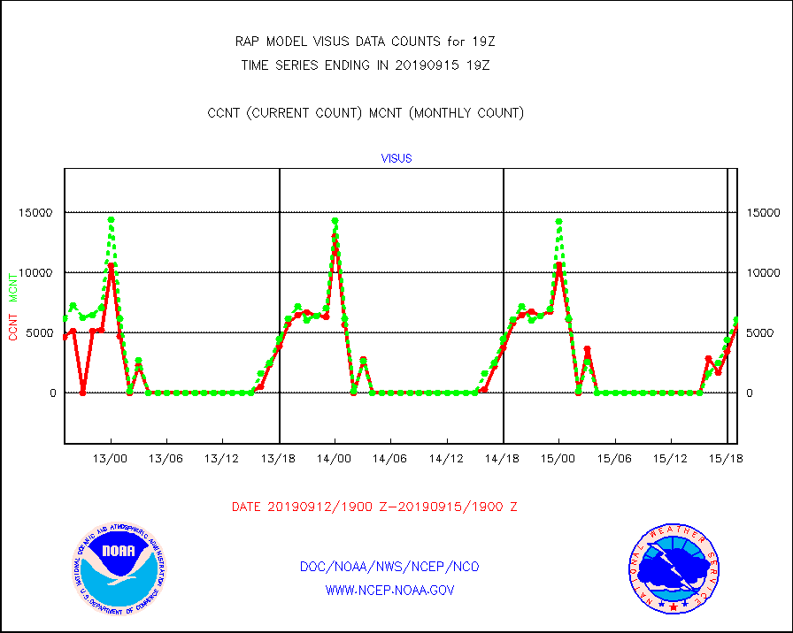
visus |
GOES/NESDIS visible derived cloud motion |
5651 |
6096 |
92.7 % |
1518.00-1518.99 |


