| Critical Data with Normal Counts |
|---|
| Type | Description | Hourly Count | Monthly Average | Percent (%) of Monthly Mean | UTC Time Window |
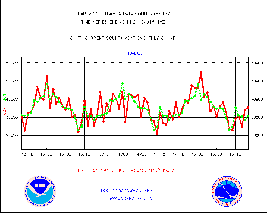
1bamua |
NOAA 15-19 & METOP 1-2 AMSU-A NCEP-proc. br.temps |
35331 |
30624 |
115.4 % |
1513.00-1518.99 |
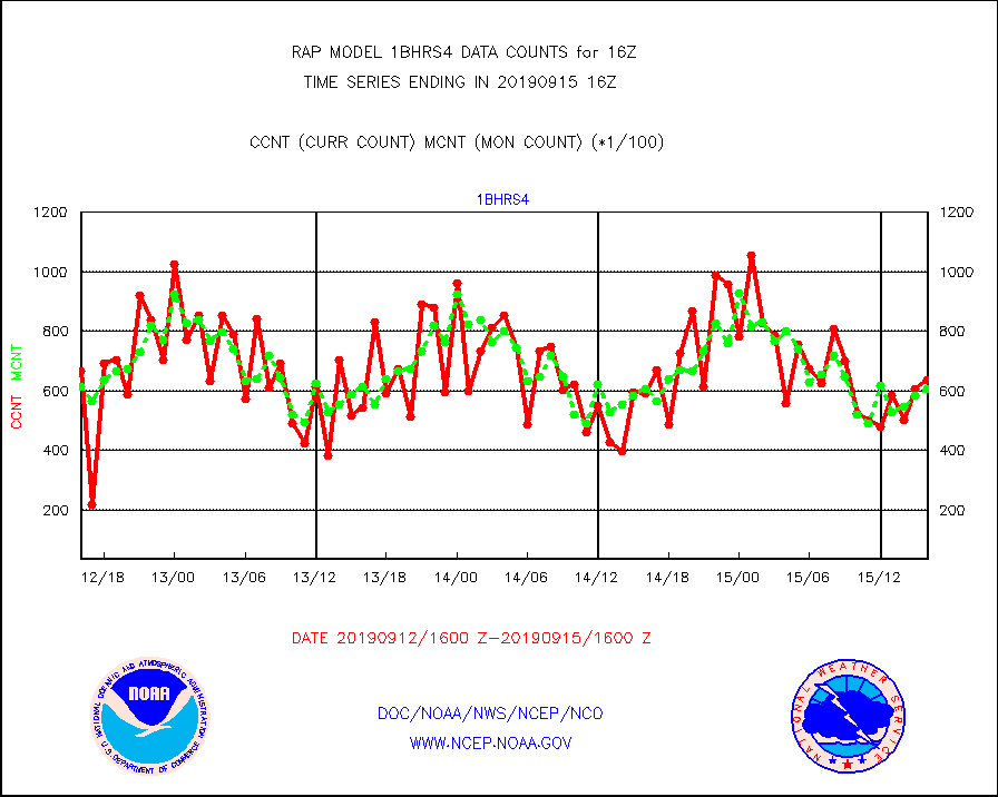
1bhrs4 |
NOAA 18-19 & METOP 1-2 HIRS-4 NCEP-proc. br.temps |
63518 |
60729 |
104.6 % |
1513.00-1518.99 |
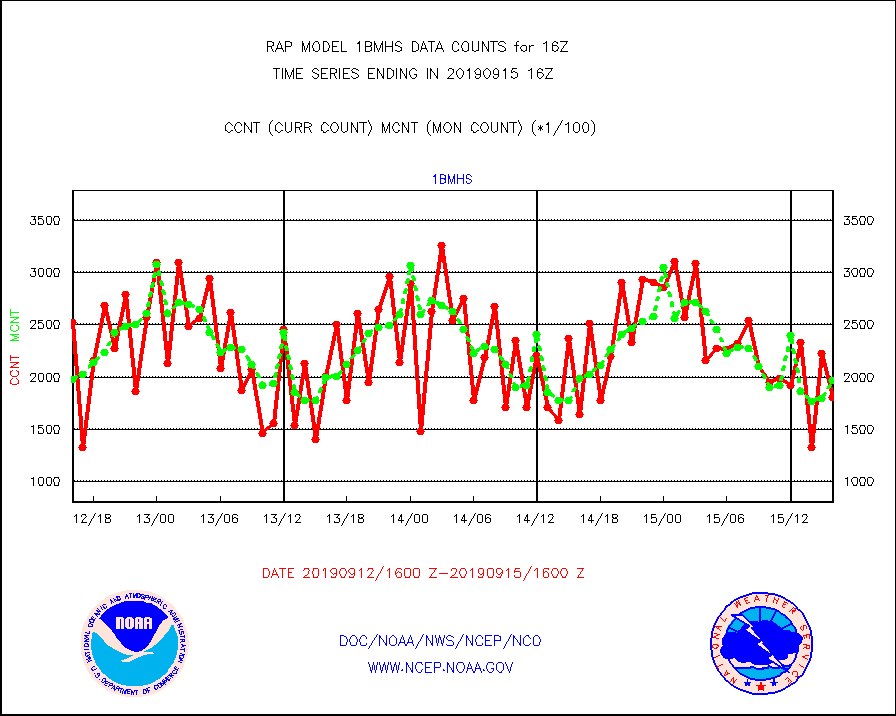
1bmhs |
NOAA 18-19 & METOP 1-2 MHS NCEP-proces. br. temps |
180680 |
196885 |
91.8 % |
1513.00-1518.99 |
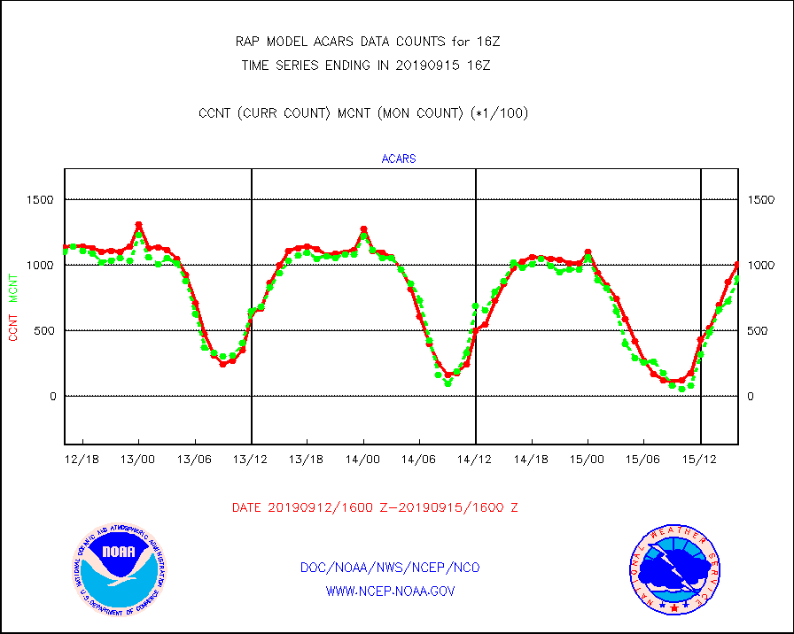
acars |
MDCRS ACARS acft data from ARINC(dcded from BUFR) |
100950 |
90072 |
112.1 % |
1512.75-1519.25 |
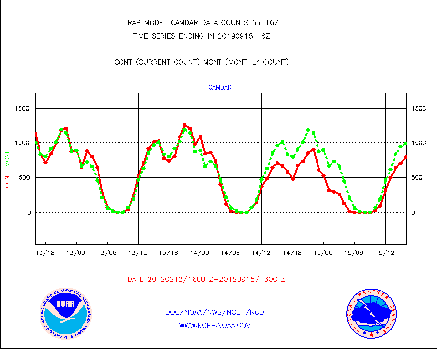
camdar |
Canadian AMDAR aircraft data (decoded from BUFR) |
800 |
993 |
80.6 % |
1512.75-1519.25 |
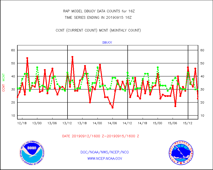
dbuoy |
Buoys decoded from FM-18 fmt (moored or drifting) |
23 |
30 |
76.7 % |
1515.50-1516.50 |
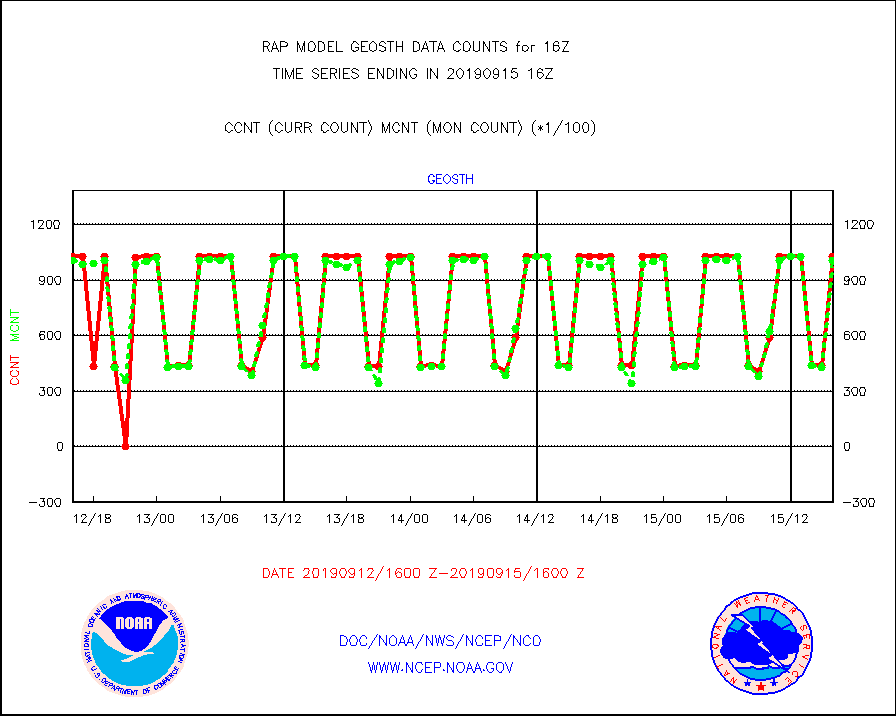
geosth |
GOES/NESDIS hi-resol. (1x1 f-o-v) cloud data |
102964 |
100721 |
102.2 % |
1514.75-1515.99 |
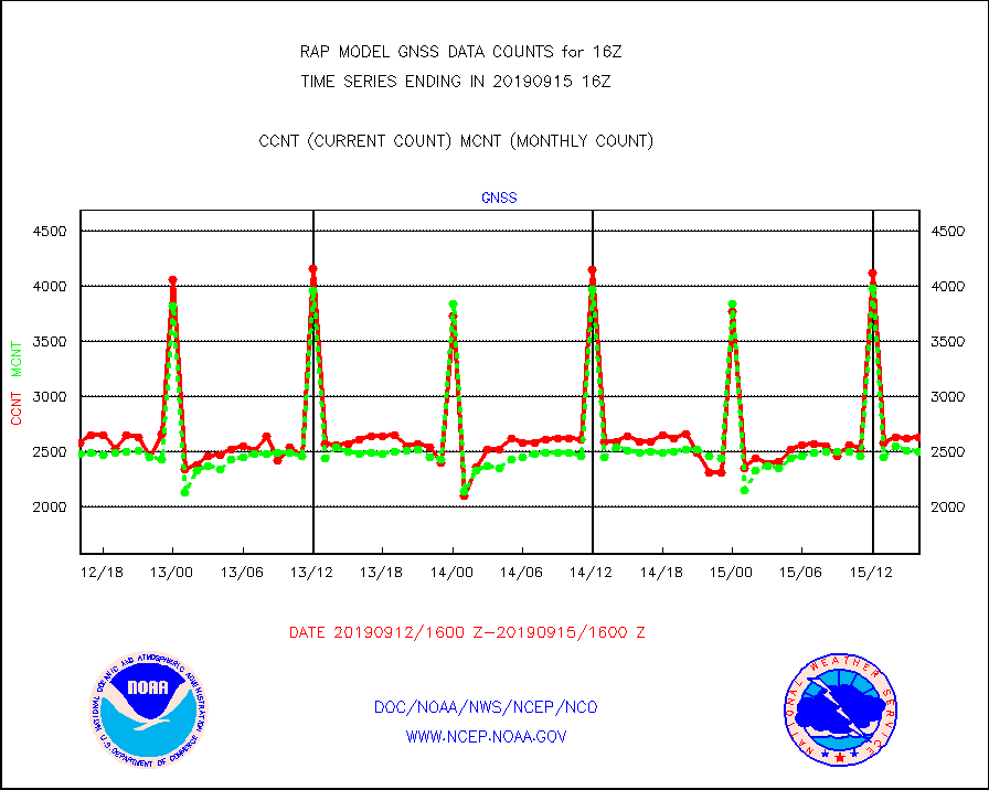
gnss |
Grnd-based Gbl Navigation Sat System (GNSS) data |
2624 |
2491 |
105.3 % |
1514.95-1515.05 |
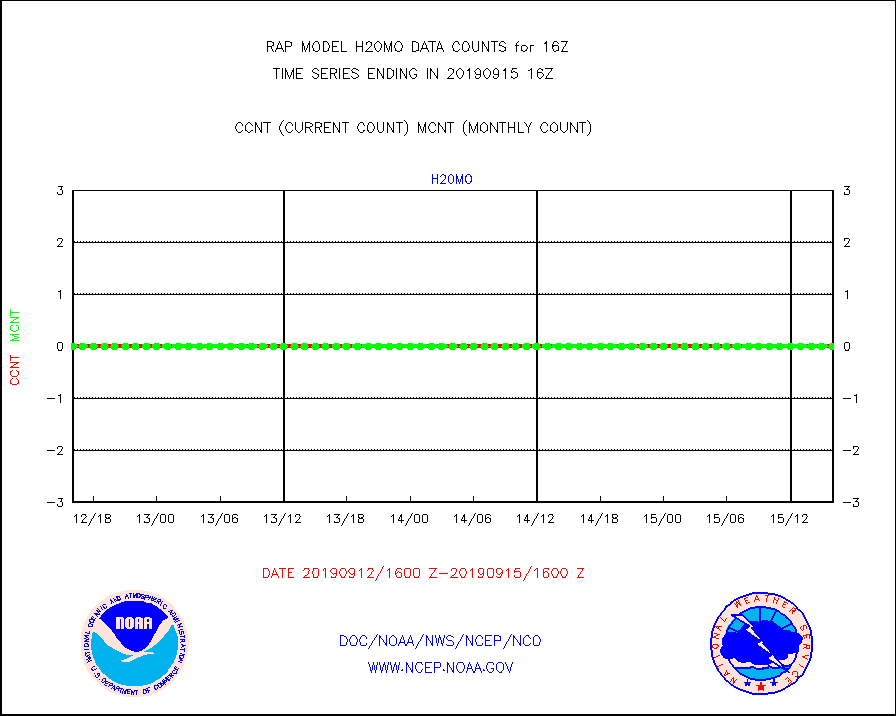
h20mo |
MODIS (AQUA/TERRA) wvpr imager derived cld motion |
0 |
0 |
n/a |
1513.50-1518.50 |
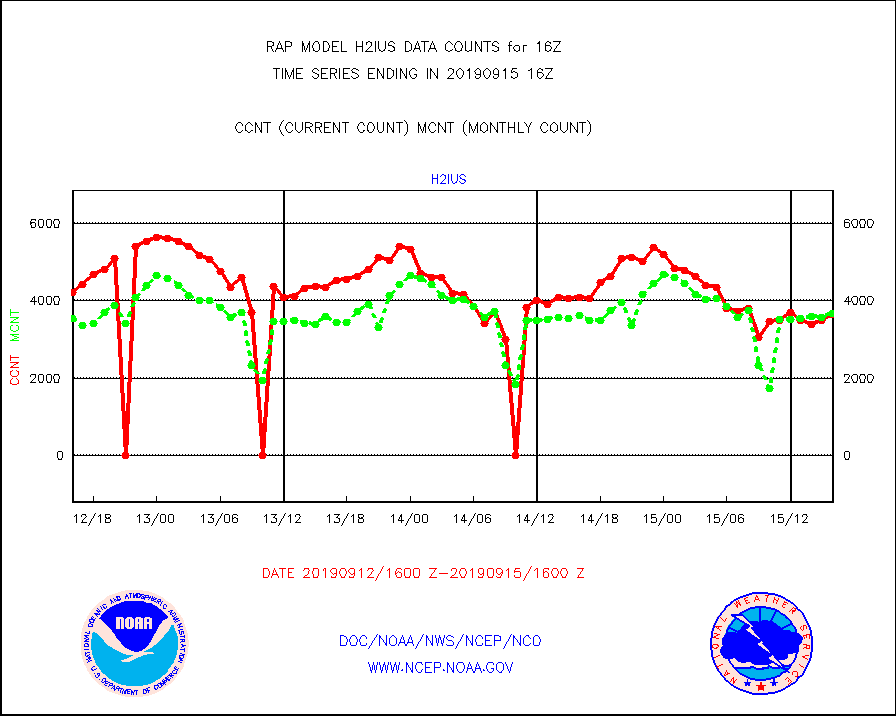
h2ius |
GOES/NESDIS water vapor imager derived cld motion |
3636 |
3665 |
99.2 % |
1515.00-1515.99 |
infmo |
MODIS (AQUA/TERRA) ir l-wave derived cloud motion |
0 |
0 |
n/a |
1513.50-1518.50 |
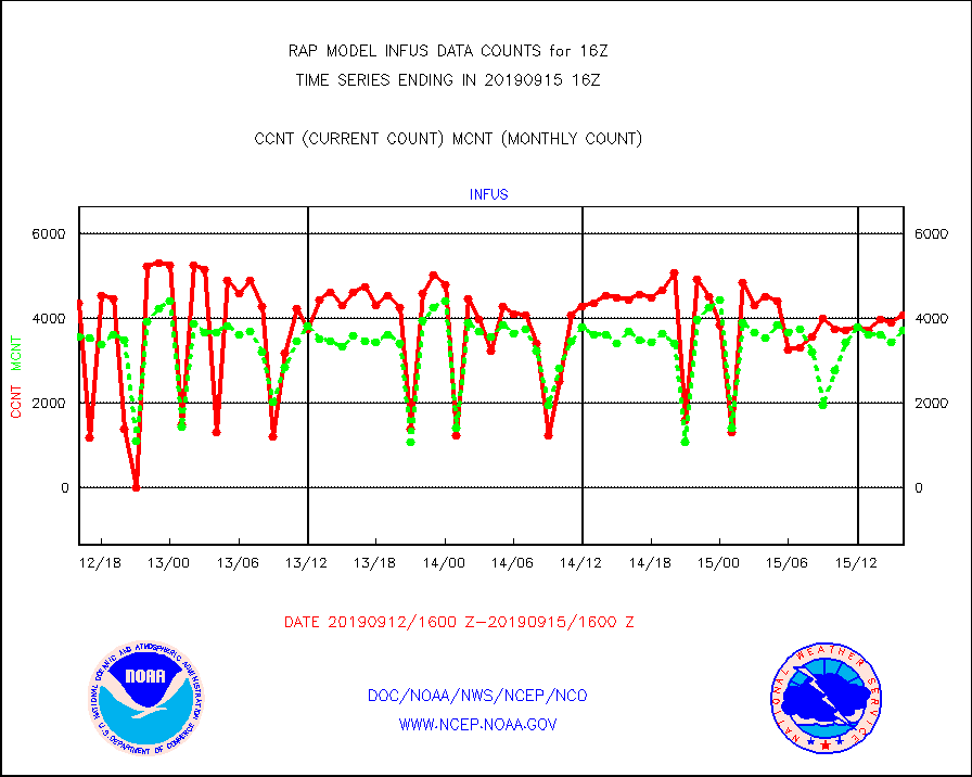
infus |
GOES/NESDIS infrared lg-wave derived cloud motion |
4081 |
3729 |
109.4 % |
1515.00-1515.99 |
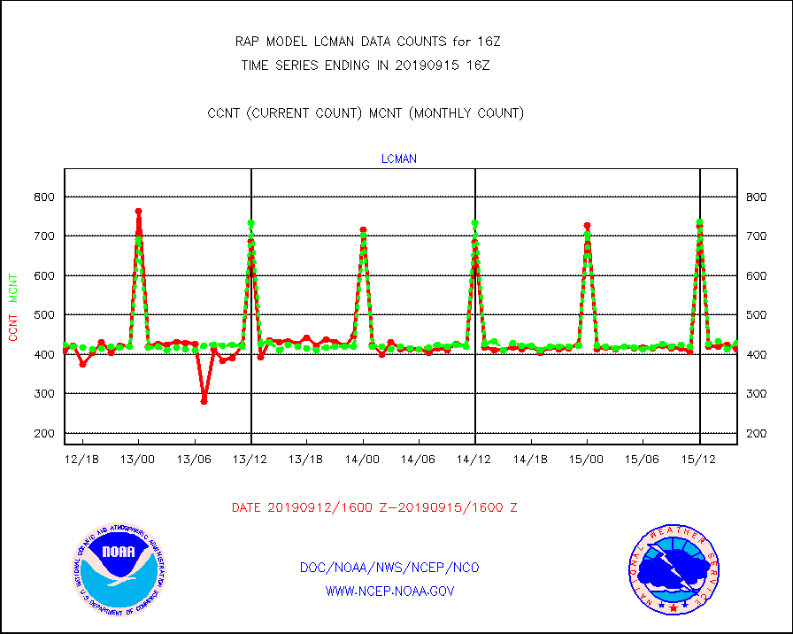
lcman |
Land-based CMAN stations decoded from CMAN format |
413 |
428 |
96.5 % |
1515.50-1516.50 |
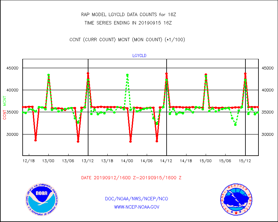
lgycld |
GOES/NASA(Langley) hi-res. (1x1 f-o-v) cloud data |
3614241 |
3496107 |
103.4 % |
1515.50-1516.50 |
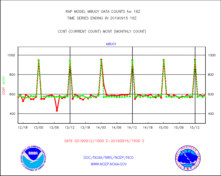
mbuoy |
Buoys decoded from FM-13 format (moored) |
590 |
581 |
101.5 % |
1515.50-1516.50 |
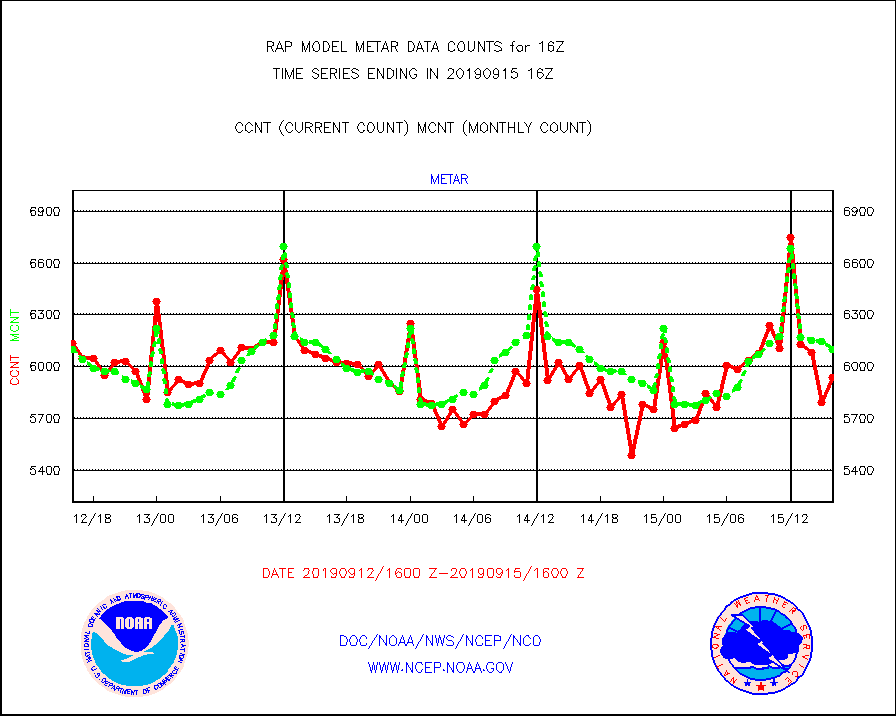
metar |
Aviation - METAR |
5936 |
6102 |
97.3 % |
1515.50-1516.50 |
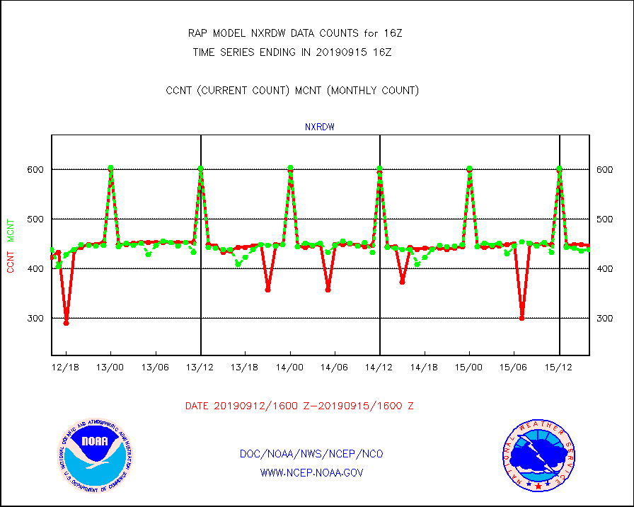
nxrdw |
NEXRAD Vel Azm Dsp(VAD) winds via radar coded msg |
446 |
439 |
101.6 % |
1515.00-1517.00 |
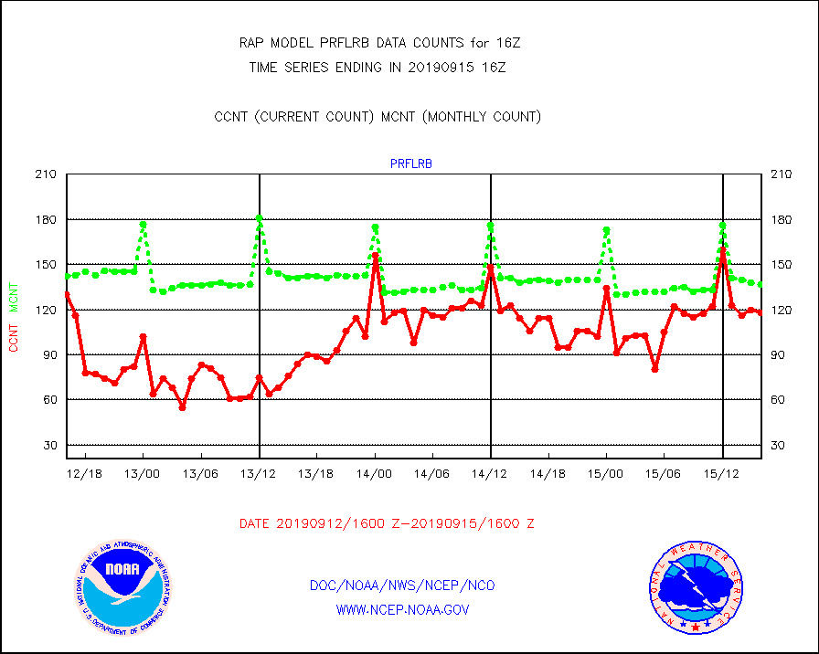
prflrb |
Multi-Agency Profiler (MAP) and SODAR winds |
118 |
137 |
86.1 % |
1514.50-1517.50 |
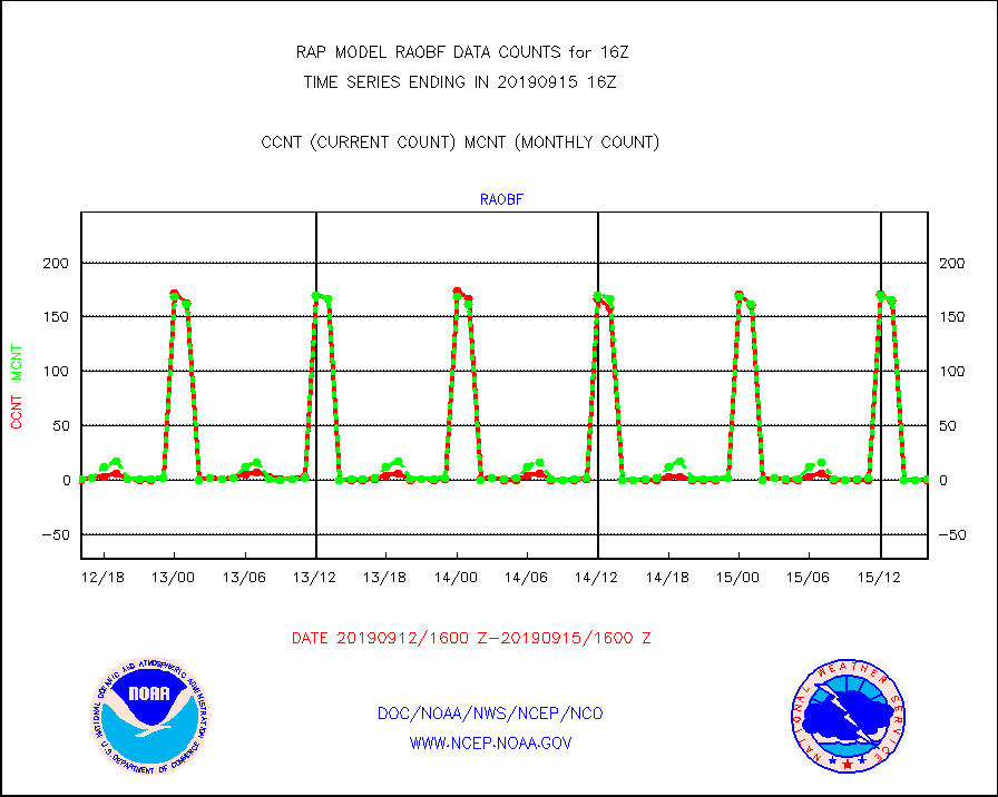
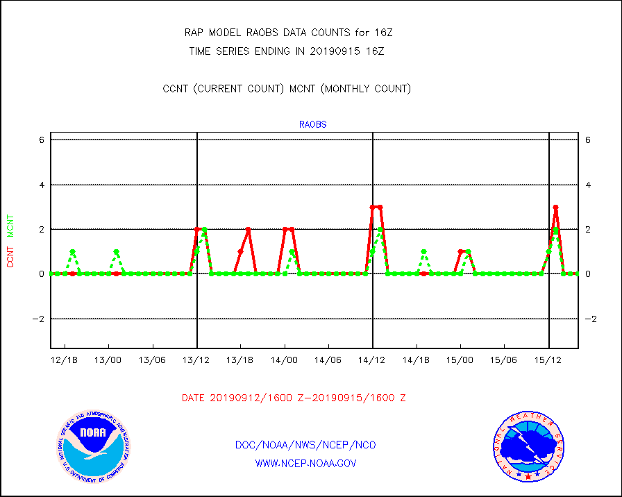
raobf |
Rawinsonde - fixed land (from TEMP or PILOT) |
0 |
1 |
0.0 % |
1515.00-1517.00 |
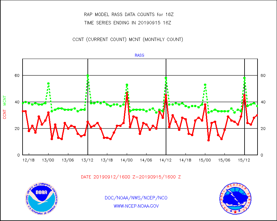
rass |
RASS temperatures (NOAA and Multi-Agency) |
30 |
37 |
81.1 % |
1515.50-1516.50 |
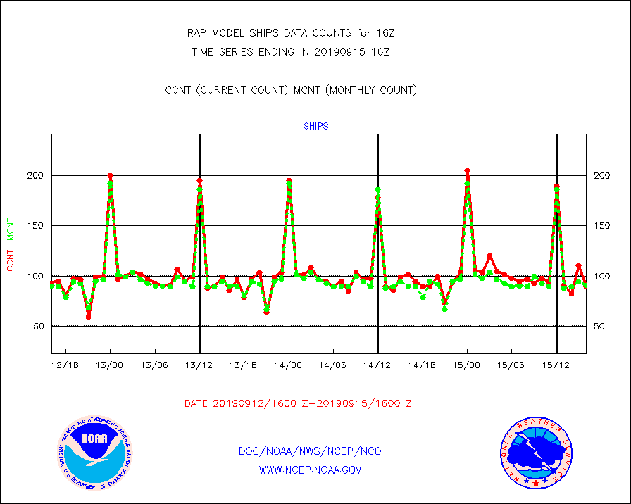
ships |
Ship - manual and automatic, restricted |
89 |
91 |
97.8 % |
1515.50-1516.50 |
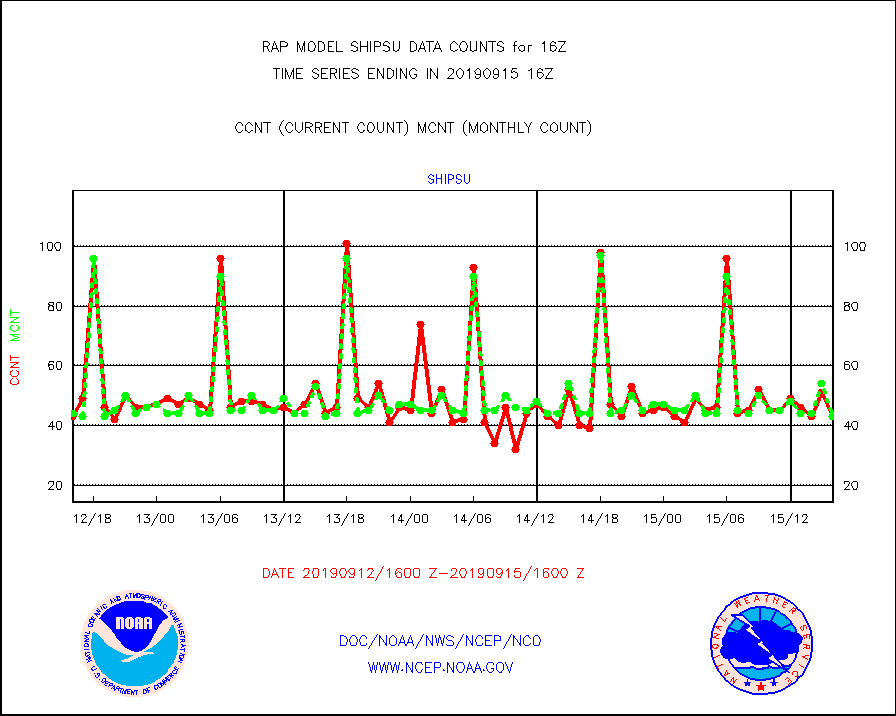
shipsu |
Ship - manual and automatic, unrestricted |
43 |
43 |
100.0 % |
1515.50-1516.50 |
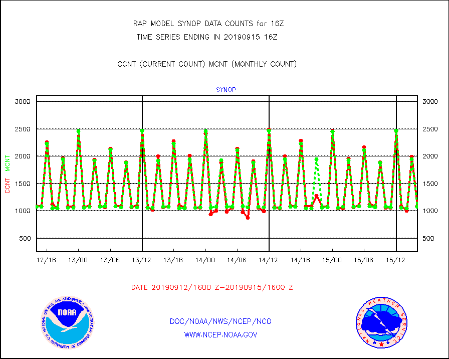
synop |
Synoptic - fixed manual and automatic |
1087 |
1073 |
101.3 % |
1515.50-1516.50 |
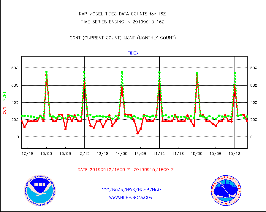
tideg |
Tide gauge reports decoded from CREX format |
182 |
238 |
76.5 % |
1515.50-1516.50 |
| Data Types of Opportunity with Normal Counts |
|---|
| Type | Description | Hourly Count | Monthly Average | Percent (%) of Monthly Mean | UTC Time Window |
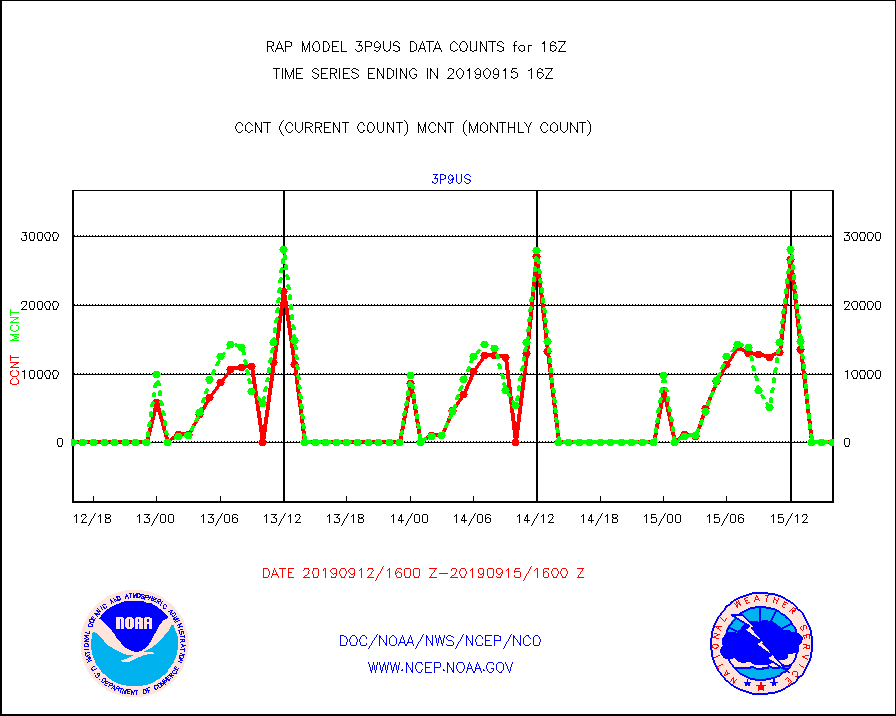
3p9us |
GOES/NESDIS infrared shrt-wave derived cld motion |
0 |
0 |
n/a |
1515.00-1515.99 |
acarsa |
MDCRS ACARS acft data (ARINC via AFWA)(AIREP fmt) |
0 |
0 |
n/a |
1512.75-1519.25 |
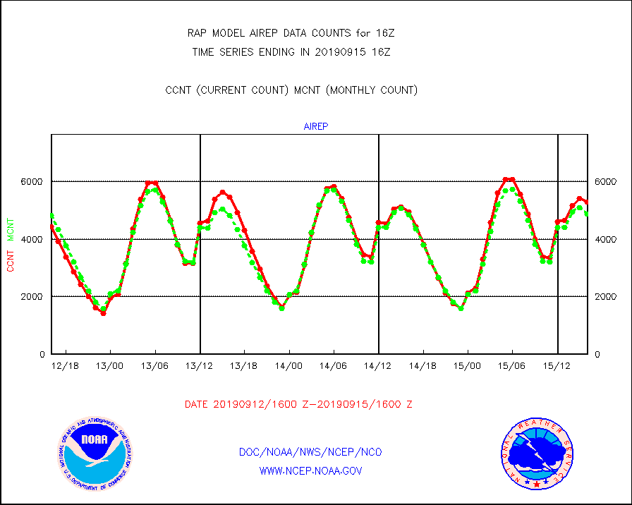
airep |
Manual AIREP aircraft data (dcded from AIREP fmt) |
5286 |
4877 |
108.4 % |
1512.75-1519.25 |
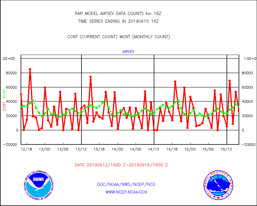
airsev |
AQUA AIRS/AMSU-A/HSB brightness temps- every FOV |
27056 |
33054 |
81.9 % |
1513.00-1518.99 |
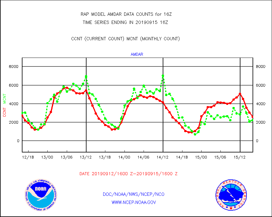
amdar |
AMDAR aircraft data (decoded from AMDAR format) |
2578 |
2230 |
115.6 % |
1512.75-1519.25 |
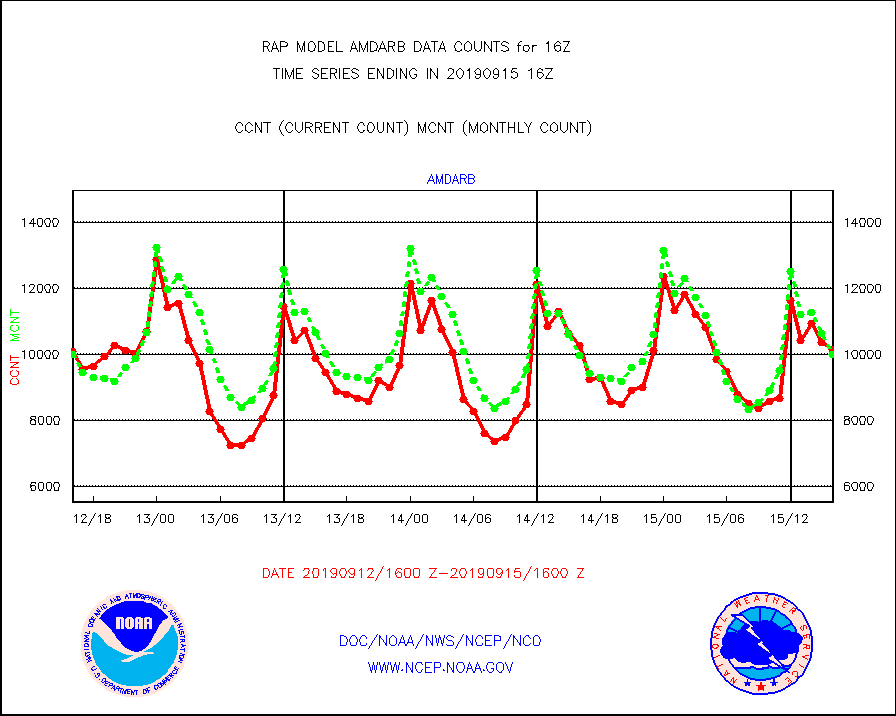
amdarb |
AMDAR aircraft data (decoded from BUFR) |
10156 |
10005 |
101.5 % |
1512.75-1519.25 |
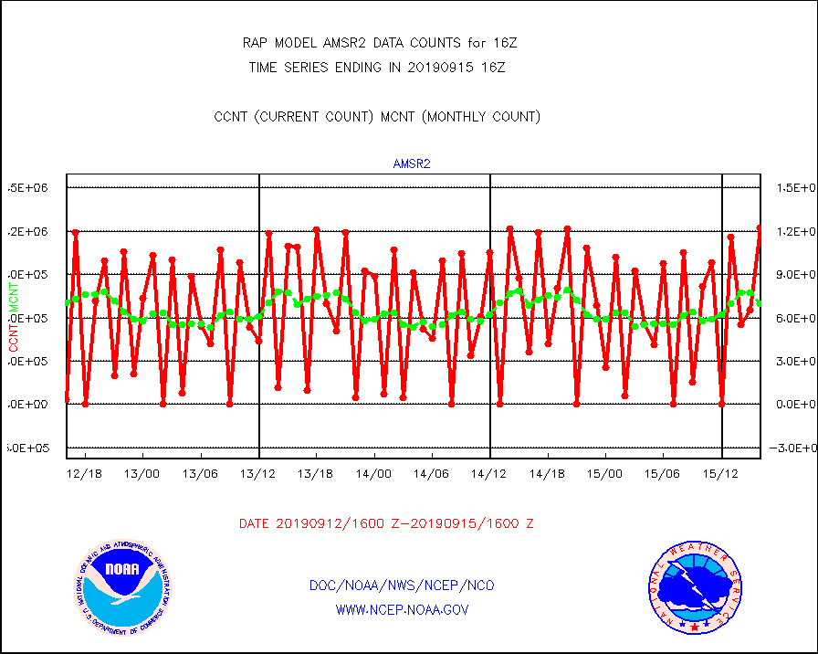
amsr2 |
GCOM-W AMSR2 1B brightness temperatures |
1222288 |
701759 |
174.2 % |
1513.00-1513.99 |
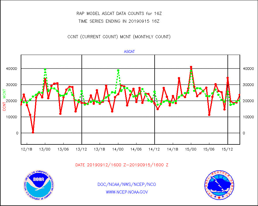
ascat |
METOP 1-2 ASCAT products |
23844 |
20270 |
117.6 % |
1514.00-1518.00 |
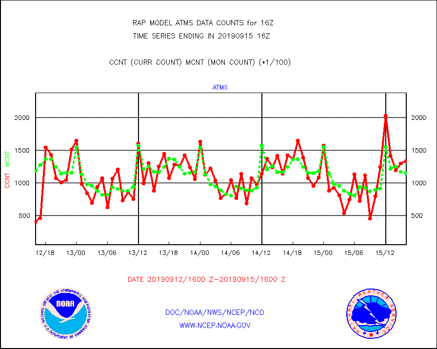
atms |
NPP Adv. Tech. Microwave Sounder (ATMS) br. temps |
133785 |
115302 |
116.0 % |
1514.00-1517.99 |
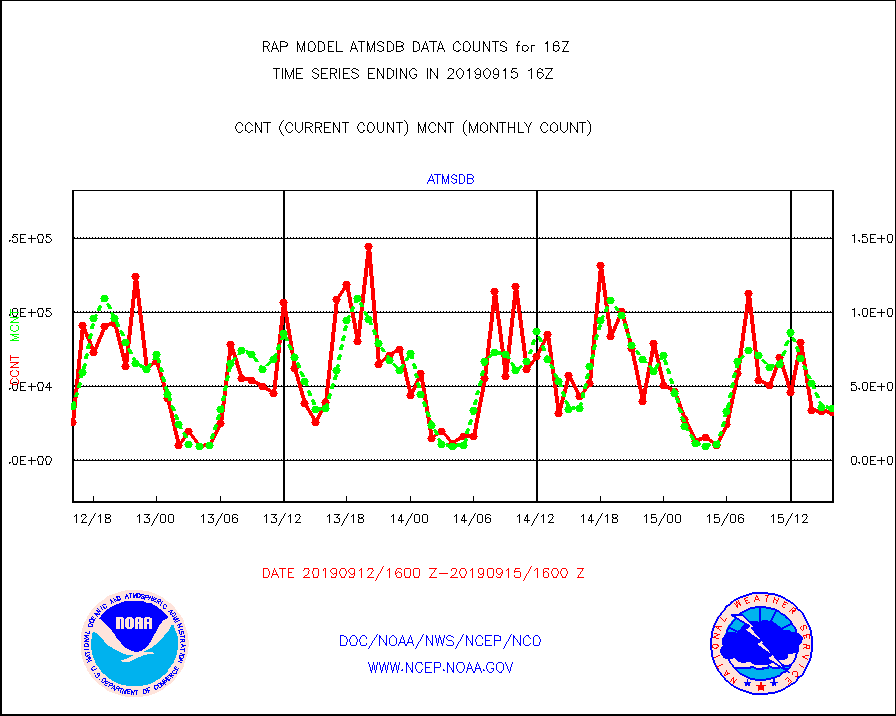
atmsdb |
NPP Adv Tech MW Sndr(ATMS) b. temps-dir bcst SSEC |
32438 |
34774 |
93.3 % |
1514.00-1517.99 |
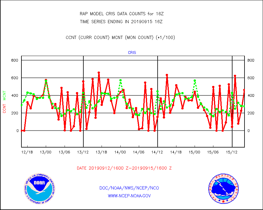
cris |
NPP Cross-track Infrared Sounder (CrIS) radiances |
46433 |
27718 |
167.5 % |
1514.00-1517.99 |
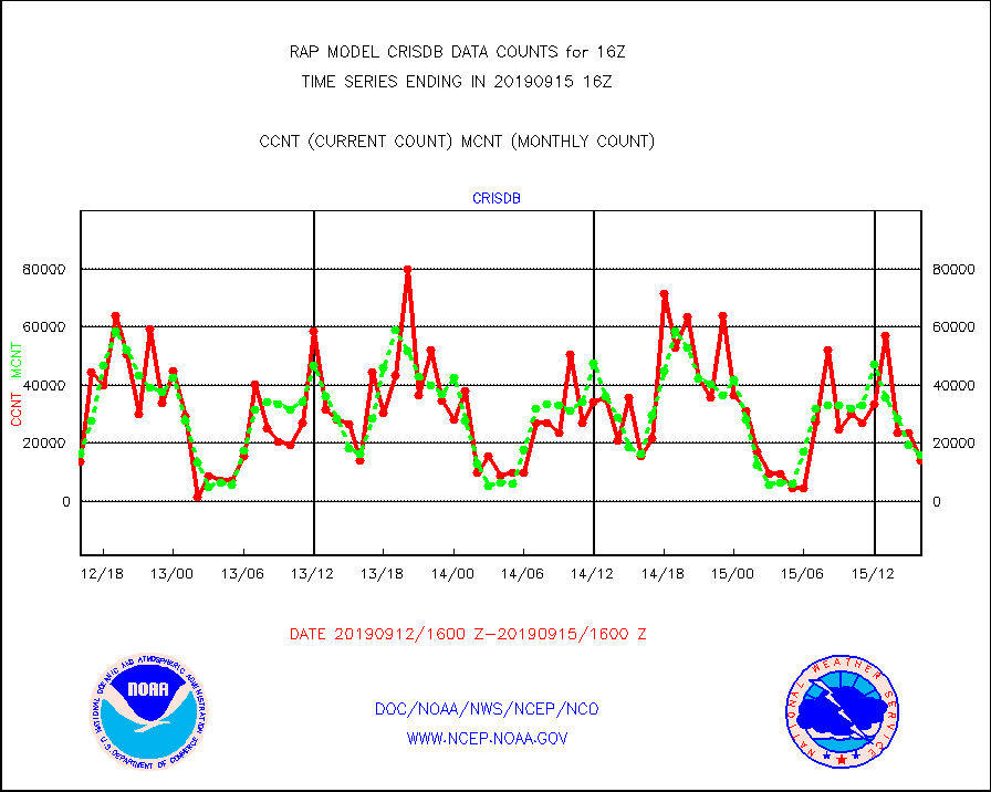
crisdb |
NPP Crss-trk IR Sndr(CrIS) radiance-dir bcst SSEC |
14113 |
16166 |
87.3 % |
1514.00-1517.99 |
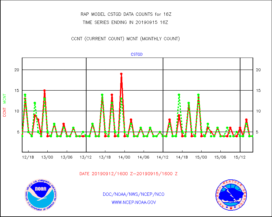
cstgd |
Coast Guard |
4 |
4 |
100.0 % |
1515.50-1516.50 |
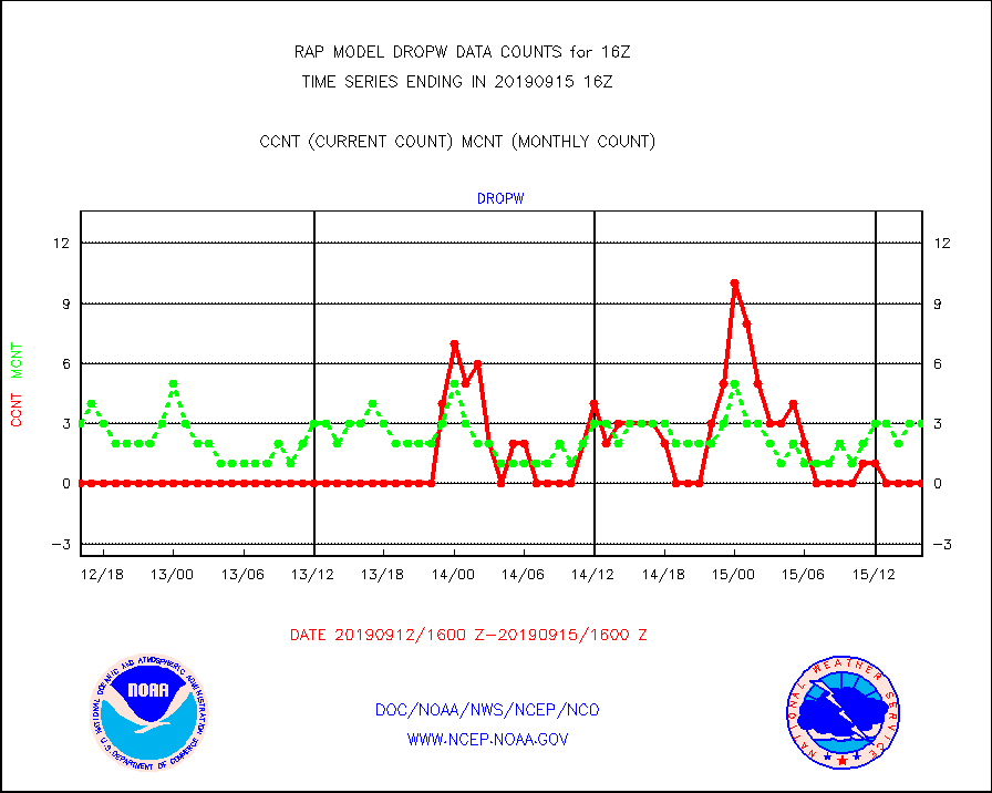
dropw |
Dropwinsonde (from TEMP DROP) |
0 |
3 |
0.0 % |
1515.00-1517.00 |
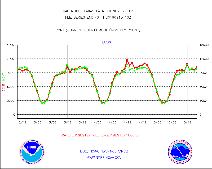
eadas |
E-AMDAR (European AMDAR acft decoded from BUFR) |
10282 |
9855 |
104.3 % |
1512.75-1519.25 |
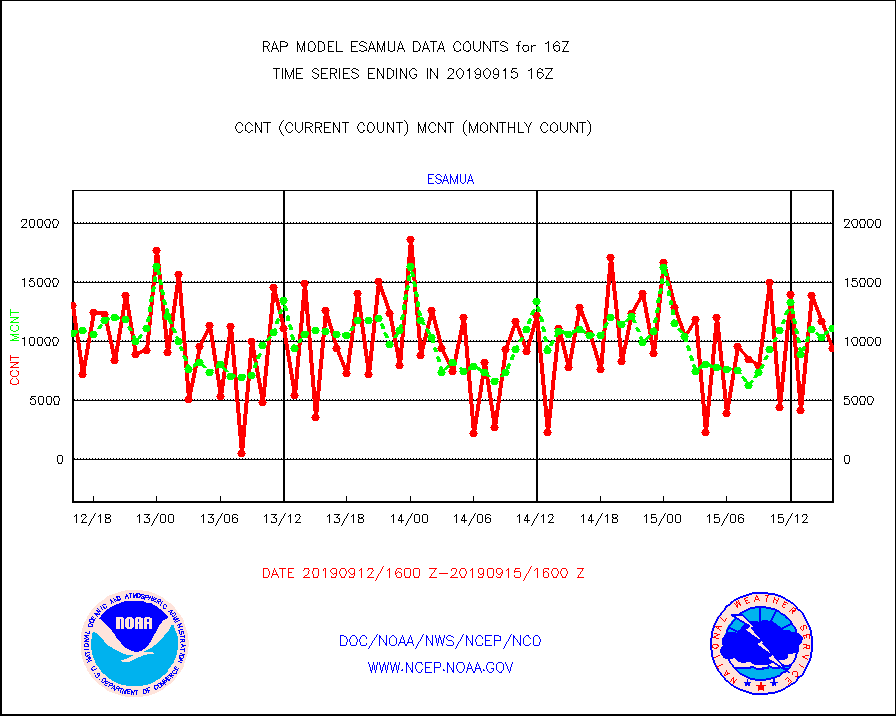
esamua |
NOAA 15-19 & METOP 1-2 AMSU-A proc btmps frm RARS |
9440 |
11093 |
85.1 % |
1515.00-1517.00 |
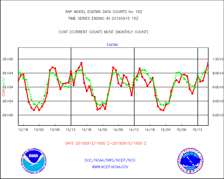
esatms |
NPP Adv. Tech. MW Sndr (ATMS) br. temps from RARS |
112063 |
96139 |
116.6 % |
1514.00-1517.99 |
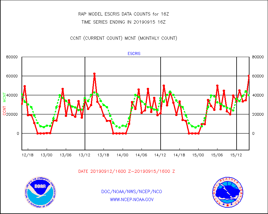
escris |
NPP Crss-track IR Sndr (CrIS) radiances from RARS |
60333 |
39967 |
151.0 % |
1514.00-1517.99 |
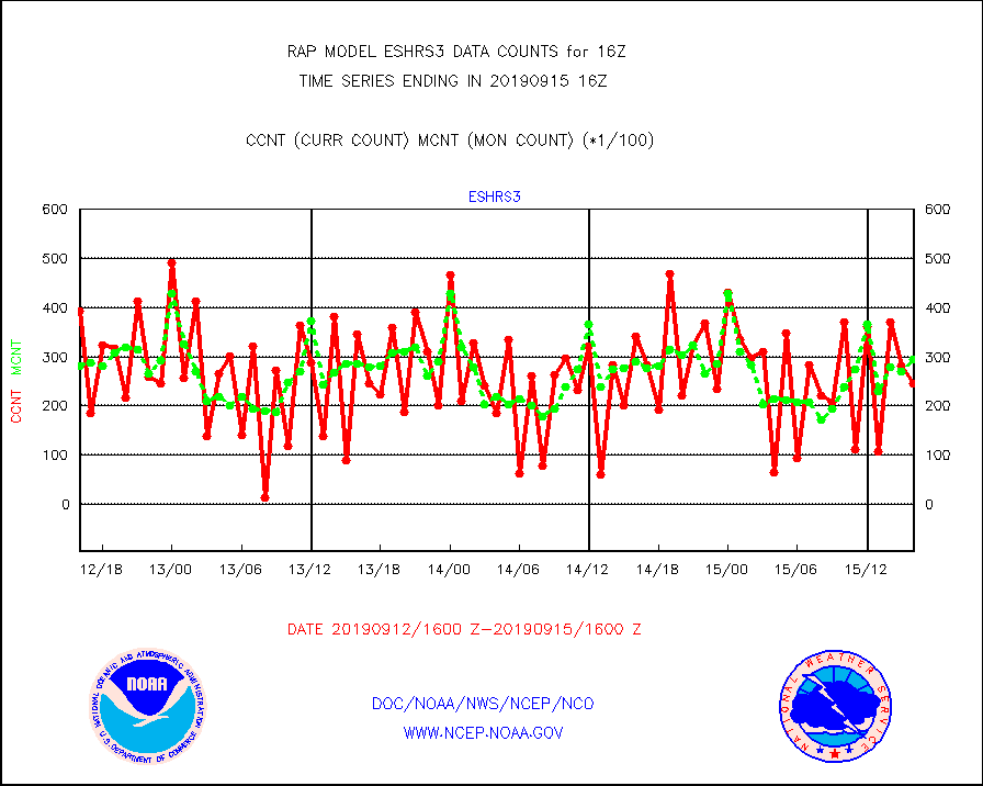
eshrs3 |
NOAA 15-19 & METOP 1-2 HIRS-3/4 pr btmps frm RARS |
24698 |
29418 |
84.0 % |
1515.00-1517.00 |
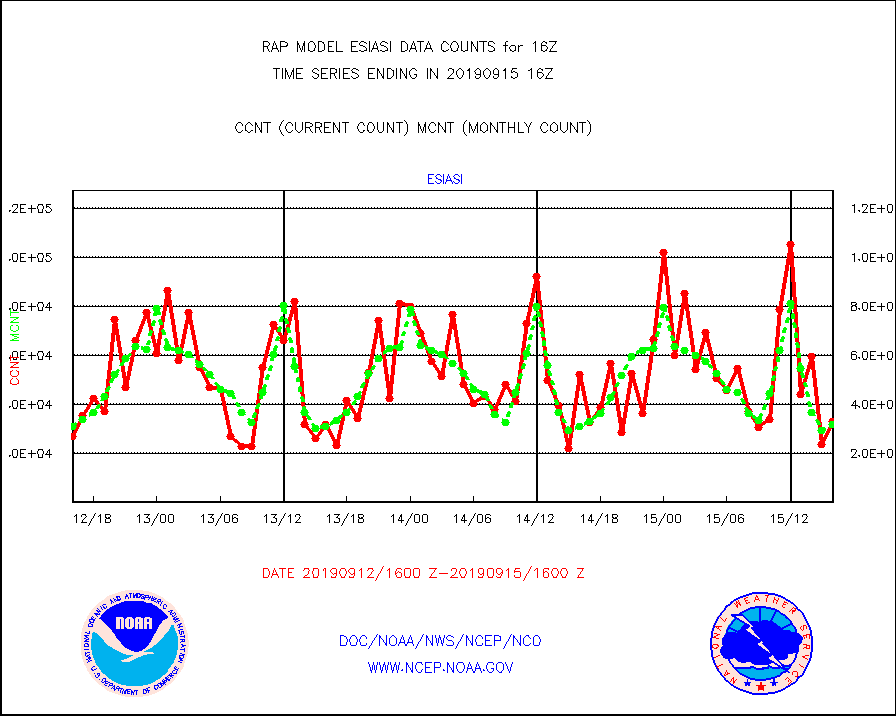
esiasi |
METOP 1-2 IASI 1C radiance data vbl chn from RARS |
33201 |
31771 |
104.5 % |
1514.00-1517.99 |
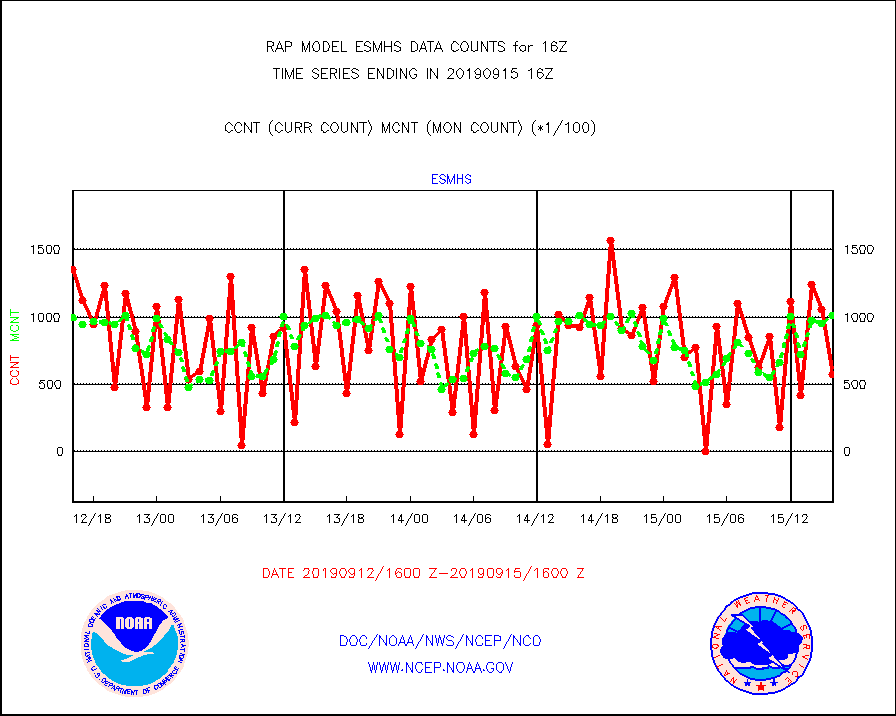
esmhs |
NOAA 18-19 & METOP 1-2 MHS proc. btemps from RARS |
57346 |
101224 |
56.7 % |
1515.00-1517.00 |
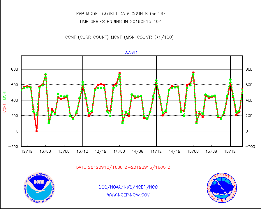
geost1 |
GOES/NESDIS hi-resol. (1x1 f-o-v) sndgs/radiances |
54136 |
53434 |
101.3 % |
1515.00-1517.00 |
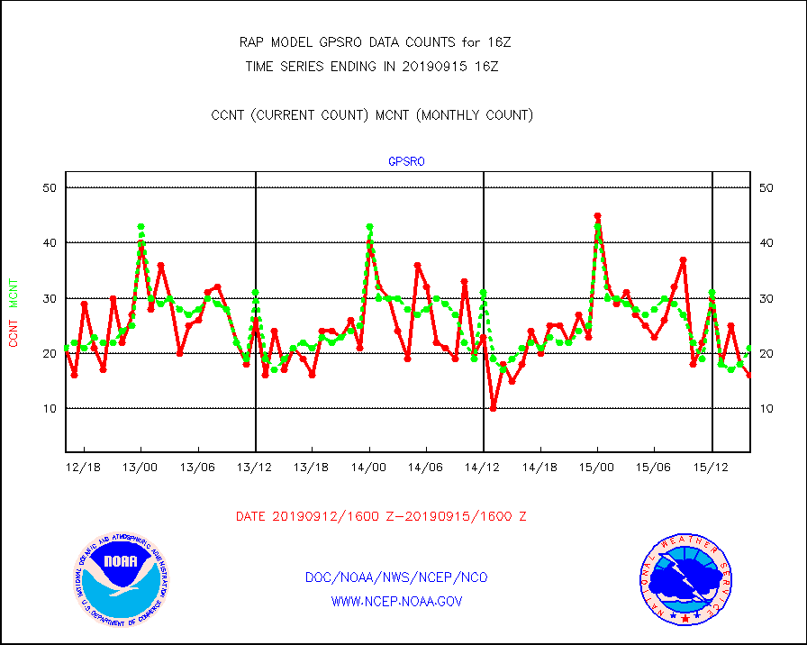
gpsro |
GPS radio occultation data |
16 |
21 |
76.2 % |
1514.00-1517.99 |
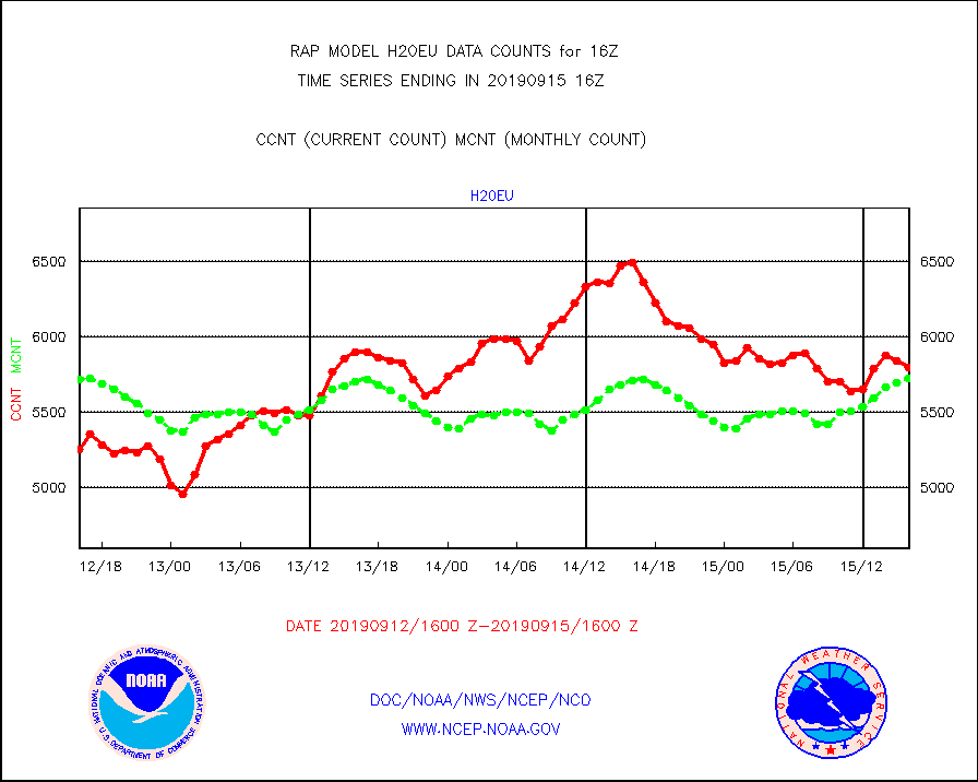
h20eu |
METEOSAT/EUMETSAT wvpr imager derived cld motion |
5794 |
5720 |
101.3 % |
1514.50-1517.49 |
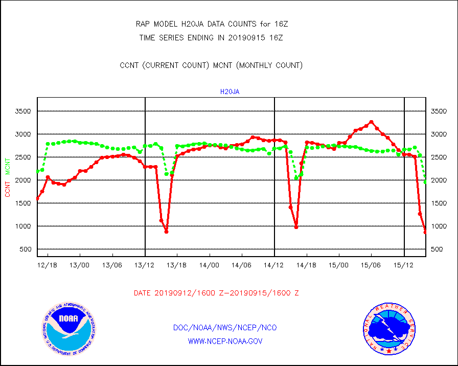
h20ja |
MTSAT/JMA water vapor imager derived cloud motion |
869 |
1953 |
44.5 % |
1513.50-1518.50 |
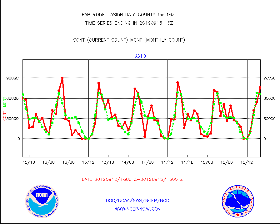
iasidb |
METOP 1-2 IASI 1C radiances-direct broadcast SSEC |
76278 |
66464 |
114.8 % |
1514.00-1517.99 |
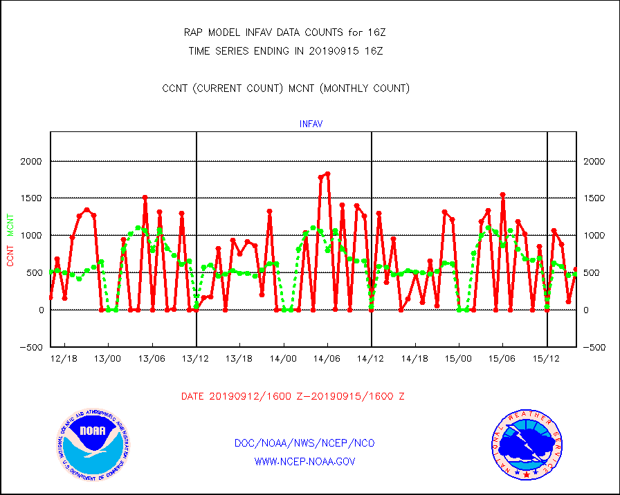
infav |
AVHRR (NOAA/METOP) ir lg-wave derived cld motion |
548 |
483 |
113.5 % |
1513.50-1518.50 |
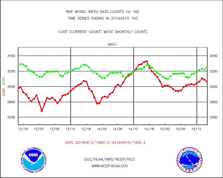
infeu |
METEOSAT/EUMETSAT ir lg-wave derived cloud motion |
3059 |
3256 |
93.9 % |
1514.50-1517.49 |
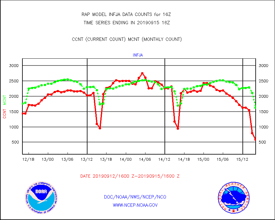
infja |
MTSAT/JMA infrared long-wave derived cloud motion |
584 |
1632 |
35.8 % |
1513.50-1518.50 |
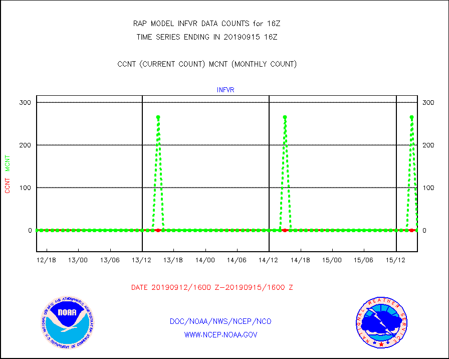
infvr |
VIIRS (NPP) infrared lg-wave derived cloud motion |
0 |
0 |
n/a |
1513.50-1518.50 |
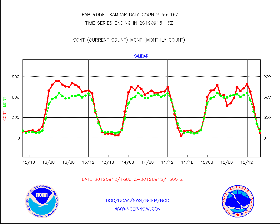
kamdar |
Korean AMDAR aircraft data (decoded from BUFR) |
72 |
99 |
72.7 % |
1512.75-1519.25 |
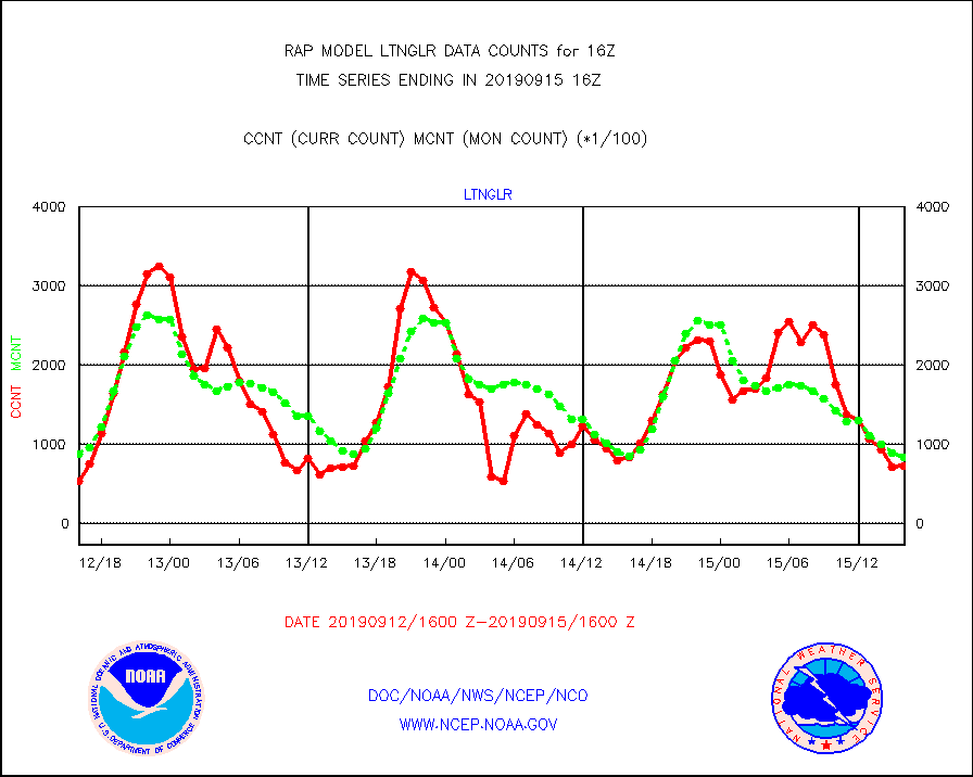
ltnglr |
LLDN Long-rng lightning from Vaisala via NOAAPORT |
73438 |
84123 |
87.3 % |
1515.00-1516.50 |
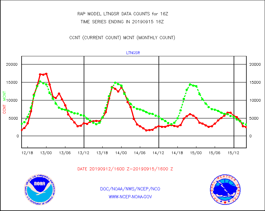
ltngsr |
NLDN Shrt-rng lightning from Vaisala via NOAAPORT |
2489 |
3251 |
76.6 % |
1515.00-1516.50 |
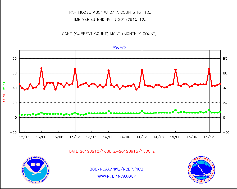
mso470 |
Mesonet/MADIS Colorado E-470 (Interstate 470) |
46 |
8 |
575.0 % |
1515.50-1516.50 |
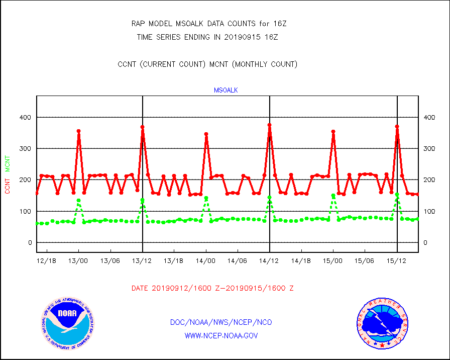
msoalk |
Mesonet/MADIS Alaska Department of Transportation |
155 |
75 |
206.7 % |
1515.50-1516.50 |
msoapg |
Mesonet/MADIS U.S. Army Aberdeen Proving Grounds |
0 |
0 |
n/a |
1515.50-1516.50 |
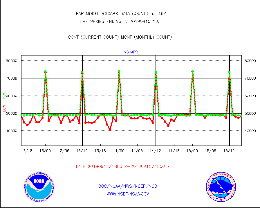
msoapr |
Mesonet/MADIS Citizen Weather Observers Program |
48228 |
48609 |
99.2 % |
1515.50-1516.50 |
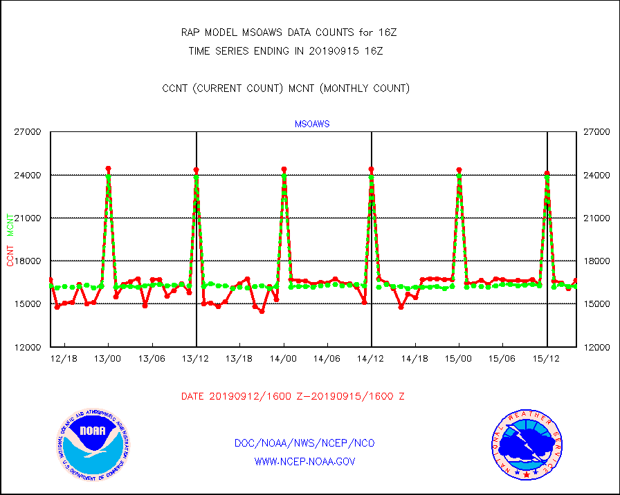
msoaws |
Mesonet/MADIS AWS Convergence Technologies, Inc. |
16633 |
16197 |
102.7 % |
1515.50-1516.50 |
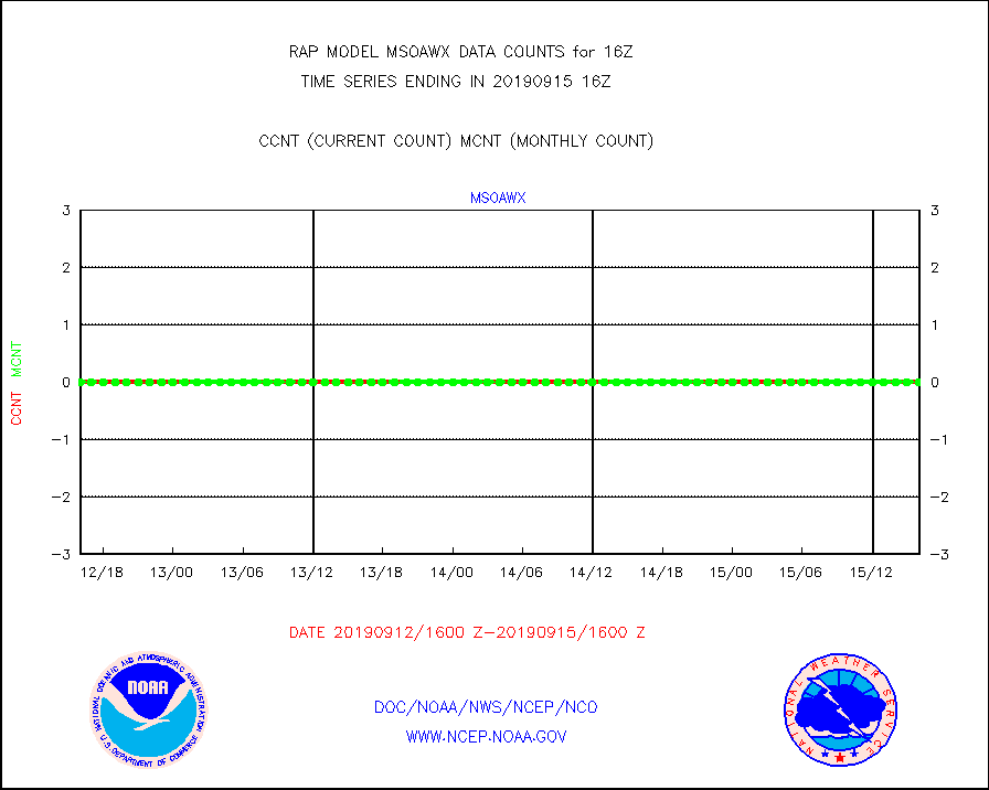
msoawx |
Mesonet/MADIS "Anything Weather" |
0 |
0 |
n/a |
1515.50-1516.50 |
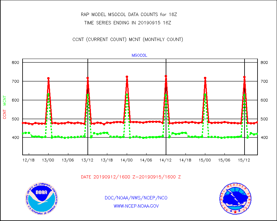
msocol |
Mesonet/MADIS Colorado Dept. of Transportation |
481 |
421 |
114.3 % |
1515.50-1516.50 |
msodcn |
Mesonet/MADIS DC Net |
0 |
0 |
n/a |
1515.50-1516.50 |
msoden |
Mesonet/MADIS Denver Urban Drainage & Flood Cntrl |
0 |
0 |
n/a |
1515.50-1516.50 |
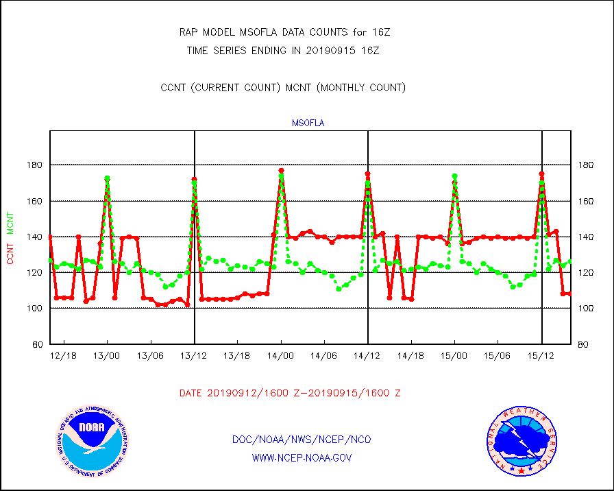
msofla |
Mesonet/MADIS Florida (FAWN & USF) |
108 |
126 |
85.7 % |
1515.50-1516.50 |
msoflt |
Mesonet/MADIS Florida Dept. of Transportation |
0 |
0 |
n/a |
1515.50-1516.50 |
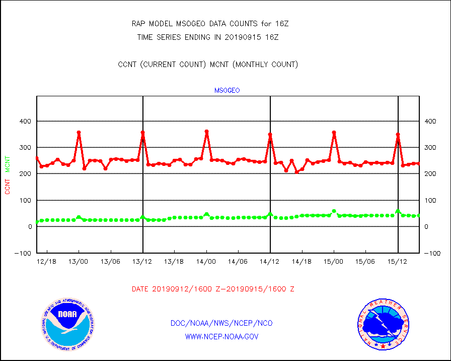
msogeo |
Mesonet/MADIS Georgia Dept. of Transportation |
239 |
42 |
569.0 % |
1515.50-1516.50 |
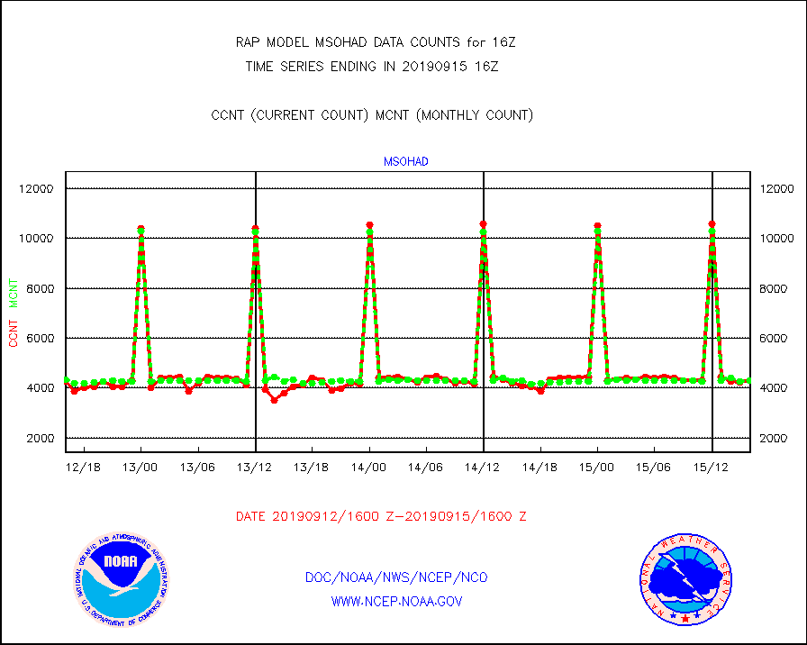
msohad |
Mesonet/MADIS NWS Hydromet Auto Data System(HADS) |
4301 |
4311 |
99.8 % |
1515.50-1516.50 |
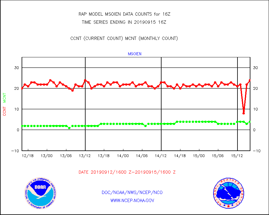
msoien |
Mesonet/MADIS Iowa Environmental |
24 |
4 |
600.0 % |
1515.50-1516.50 |
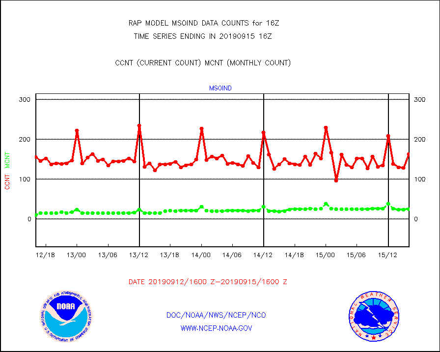
msoind |
Mesonet/MADIS Indiana Dept. of Transportation |
163 |
24 |
679.2 % |
1515.50-1516.50 |
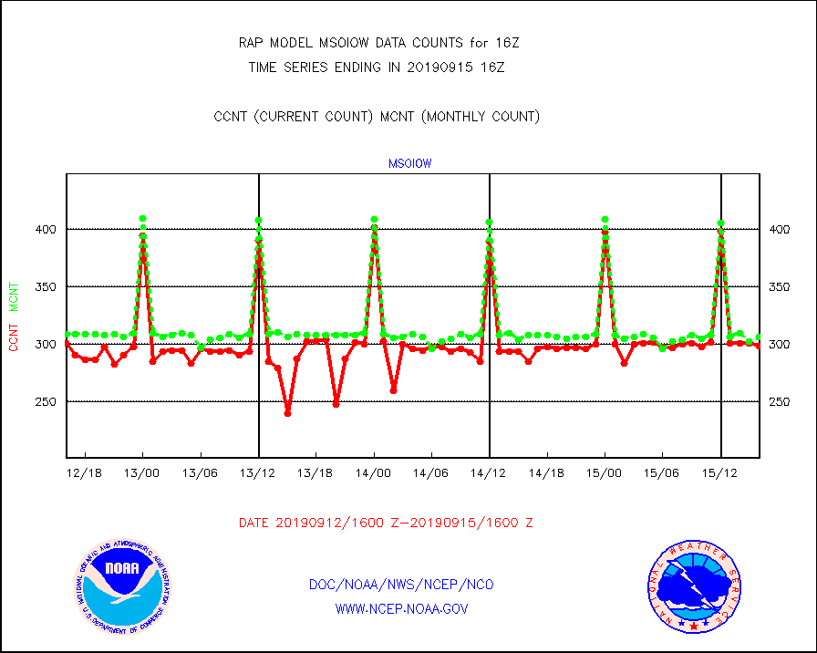
msoiow |
Mesonet/MADIS Iowa Department of Transportation |
299 |
307 |
97.4 % |
1515.50-1516.50 |
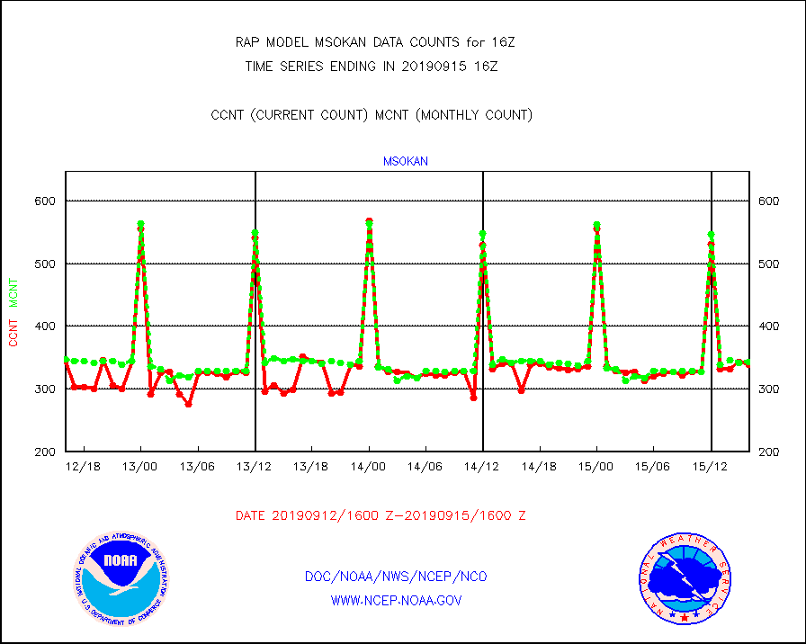
msokan |
Mesonet/MADIS Kansas Department of Transportation |
339 |
343 |
98.8 % |
1515.50-1516.50 |
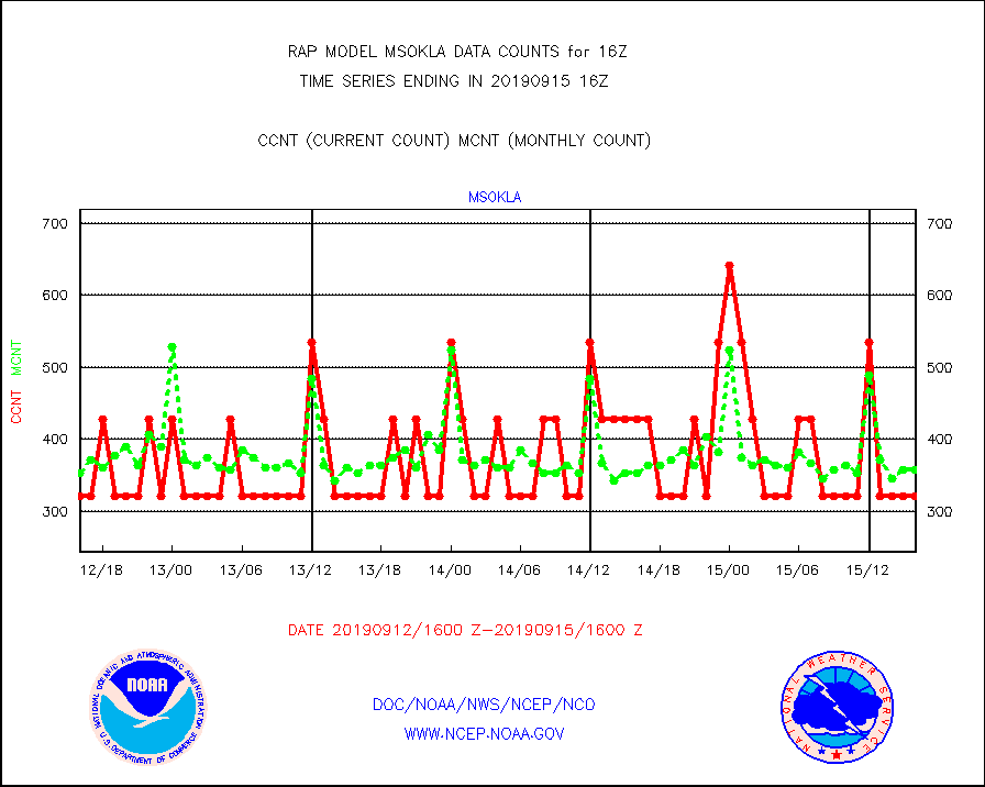
msokla |
Mesonet/MADIS Oklahoma Mesonet |
321 |
357 |
89.9 % |
1515.50-1516.50 |
msolju |
Mesonet/MADIS Louisiana State/Jackson State Univ. |
0 |
0 |
n/a |
1515.50-1516.50 |
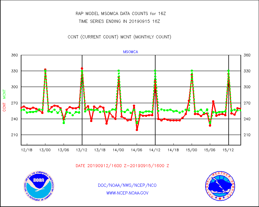
msomca |
Mesonet/MADIS Missouri Commercial Agricult Wx Net |
259 |
256 |
101.2 % |
1515.50-1516.50 |
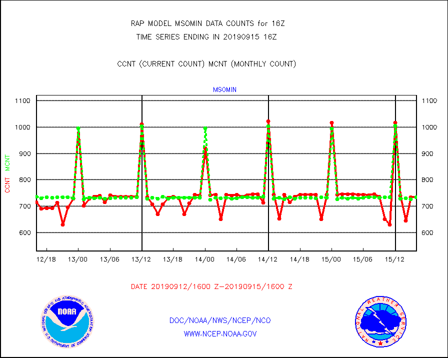
msomin |
Mesonet/MADIS Minnesota Dept. of Transportation |
735 |
734 |
100.1 % |
1515.50-1516.50 |
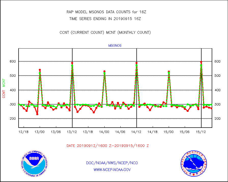
msonos |
Mesonet/MADIS NOS-Phys Oceanographic Realtime Sys |
271 |
298 |
90.9 % |
1515.50-1516.50 |
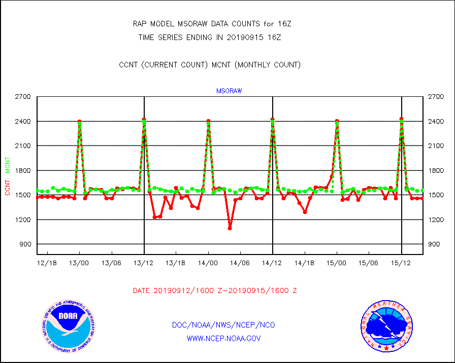
msoraw |
Mesonet/MADIS NFIC Remote Automated Wx Stns(RAWS) |
1460 |
1554 |
94.0 % |
1515.50-1516.50 |
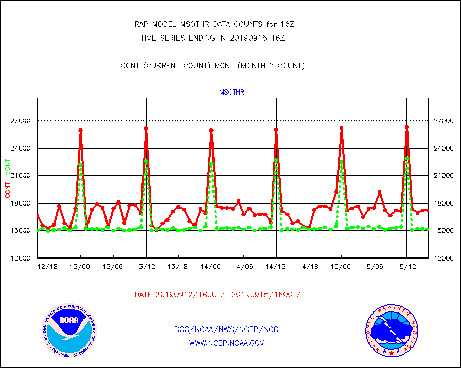
msothr |
Mesonet/MADIS many providers, not separated out |
17201 |
15143 |
113.6 % |
1515.50-1516.50 |
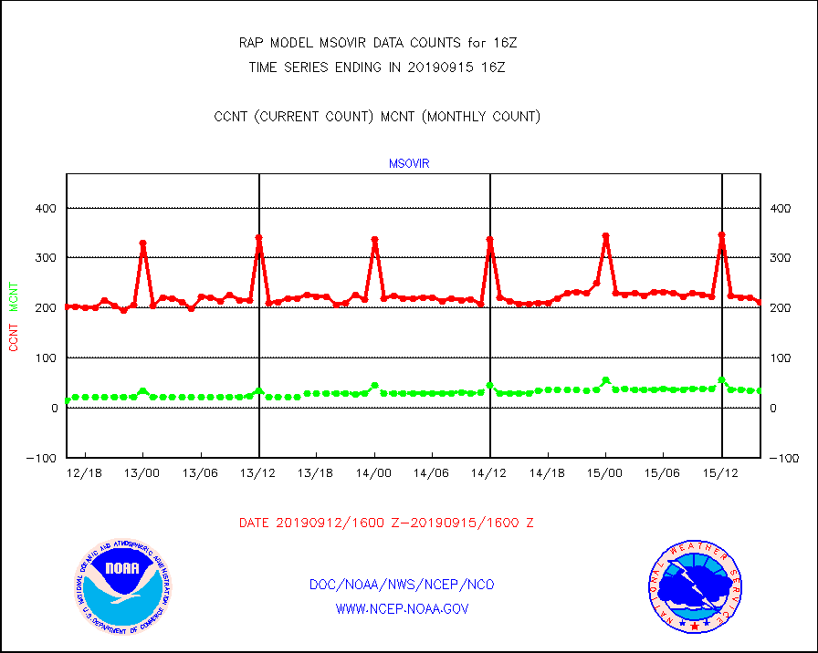
msovir |
Mesonet/MADIS Virginia Dept. of Transportation |
212 |
35 |
605.7 % |
1515.50-1516.50 |
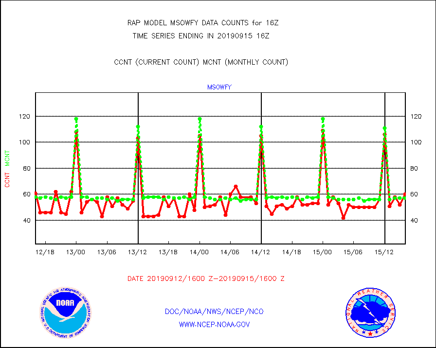
msowfy |
Mesonet/MADIS "Weather for You" |
60 |
57 |
105.3 % |
1515.50-1516.50 |
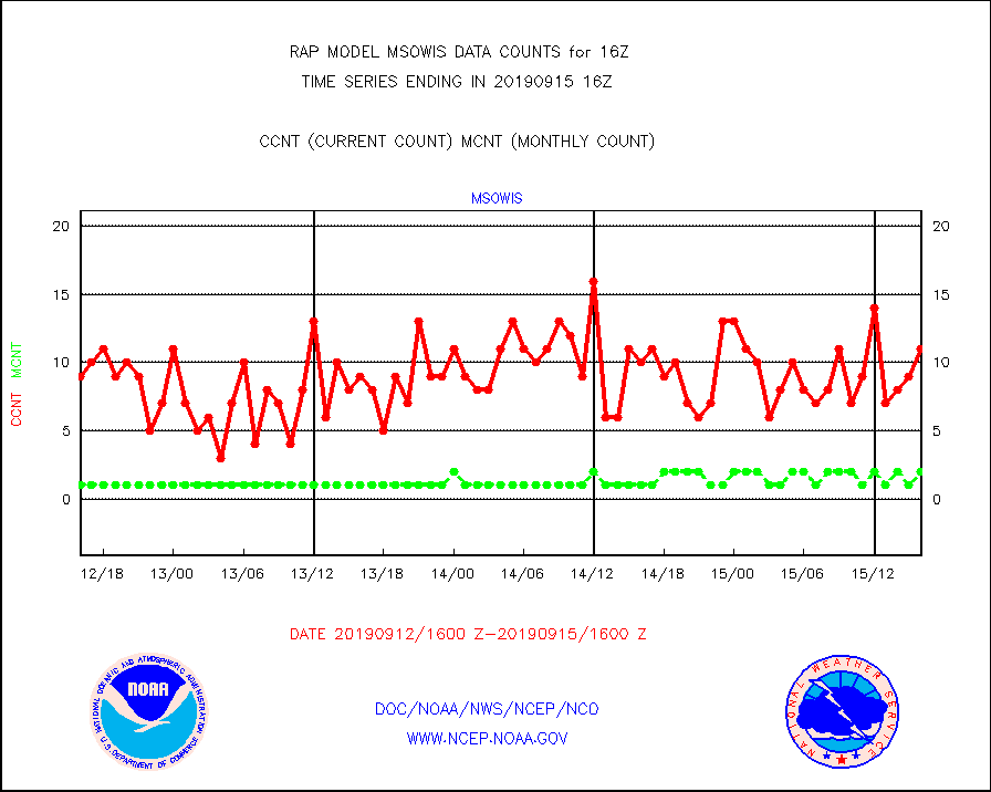
msowis |
Mesonet/MADIS Wisconsin Dept. of Transportation |
11 |
2 |
550.0 % |
1515.50-1516.50 |
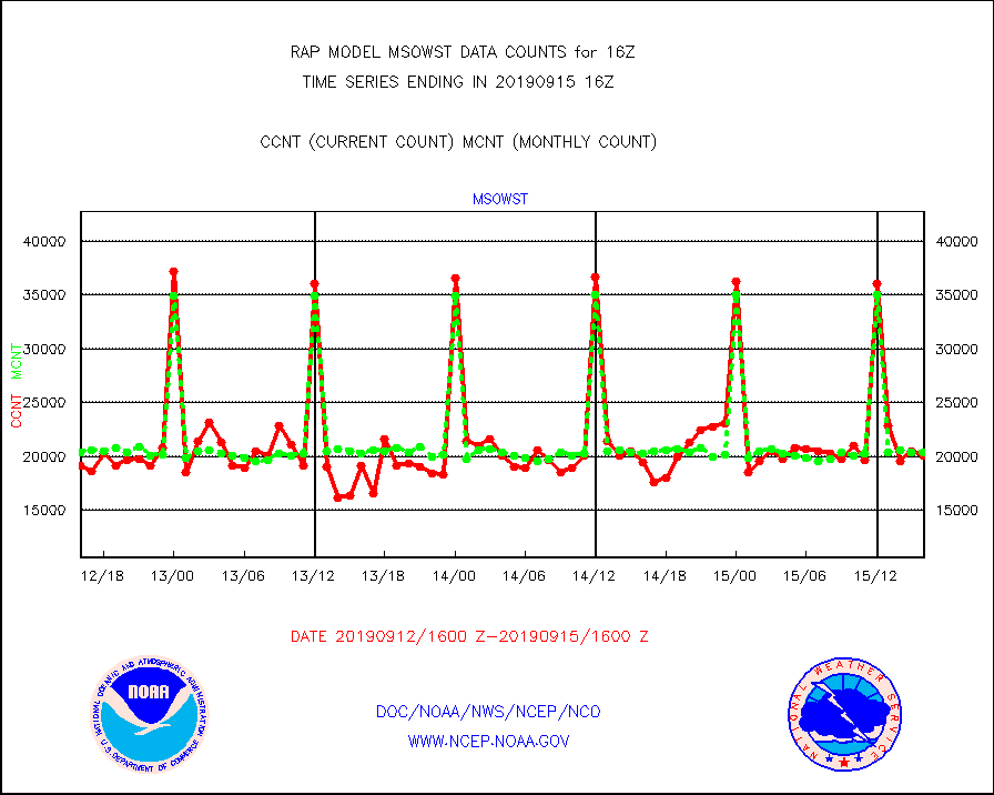
msowst |
Mesonet/MADIS MesoWest (many subproviders) |
20052 |
20327 |
98.6 % |
1515.50-1516.50 |
msowtx |
Mesonet/MADIS West Texas |
3251 |
1187 |
273.9 % |
1515.50-1516.50 |
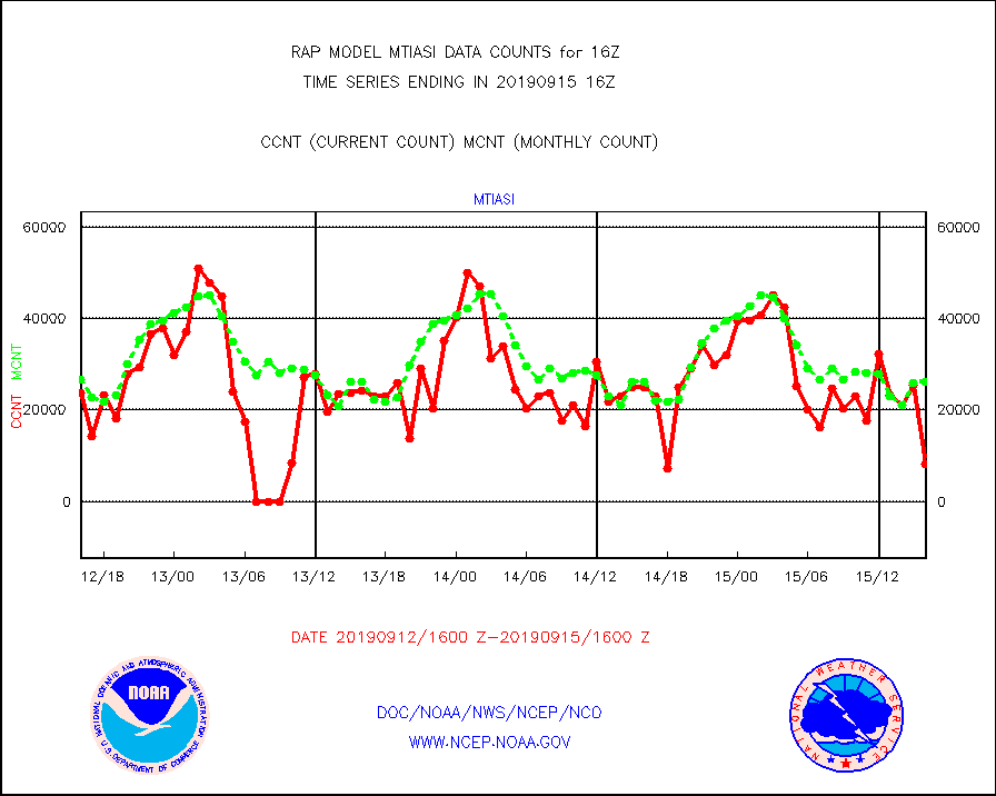
mtiasi |
METOP 1-2 IASI 1C radiance data (varbl. channels) |
8135 |
26120 |
31.1 % |
1514.00-1517.99 |
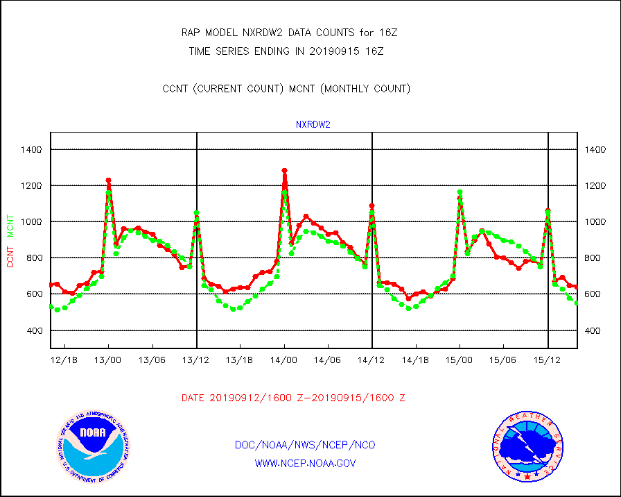
nxrdw2 |
NEXRAD Vel Azm Dsp(VAD) winds via Level 2 decoder |
640 |
551 |
116.2 % |
1515.00-1517.00 |
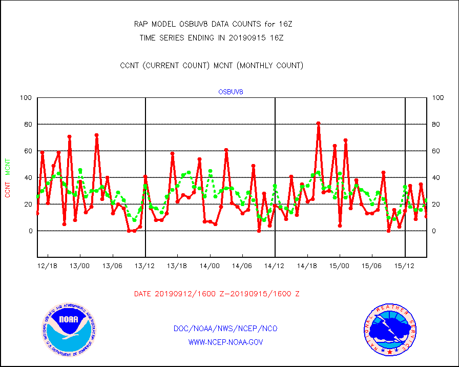
osbuv8 |
NOAA 16-19 Solar Backscatter UV-2 rad frm V8 BUFR |
11 |
23 |
47.8 % |
1514.00-1516.99 |
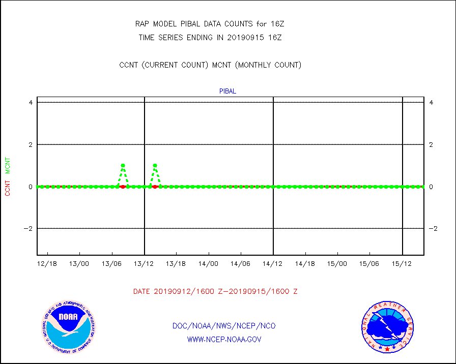
pibal |
PIBAL (from PILOT, PILOT SHIP, PILOT MOBIL) |
0 |
0 |
n/a |
1515.00-1517.00 |
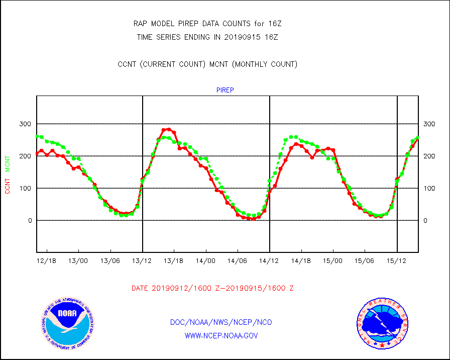
pirep |
Manual PIREP aircraft data (dcded from AIREP fmt) |
256 |
258 |
99.2 % |
1512.75-1519.25 |
prflrp |
Profilr winds from PIBAL (PILOT,PILOT SHIP/MOBIL) |
0 |
0 |
n/a |
1514.50-1517.50 |
radw25 |
NEXRAD radial wind superobs (Level 2.5 - ORPG) |
0 |
0 |
n/a |
1515.00-1517.00 |
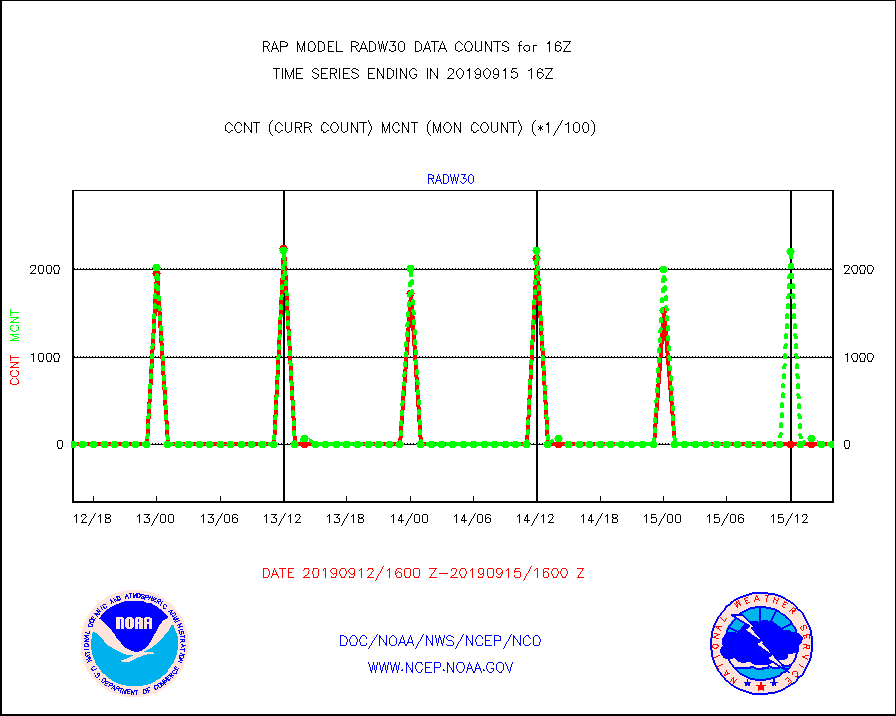
radw30 |
NEXRAD radial wind superobs (Level 3 - NIDS) |
0 |
0 |
n/a |
1515.00-1517.00 |
raobm |
Rawinsonde - mobile land (from TEMP/PILOT MOBIL) |
0 |
0 |
n/a |
1515.00-1517.00 |
raobs |
Rawinsonde - ship (from TEMP SHIP, PILOT SHIP) |
0 |
0 |
n/a |
1515.00-1517.00 |
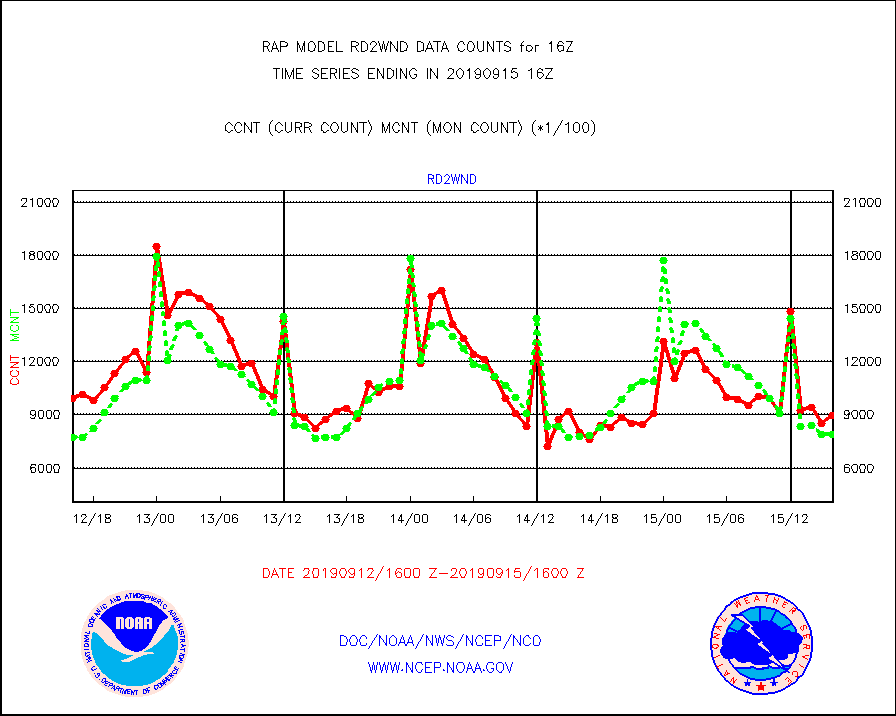
rd2wnd |
NEXRAD radial wind (Level 2 - GTS) |
895458 |
787756 |
113.7 % |
1515.50-1516.49 |
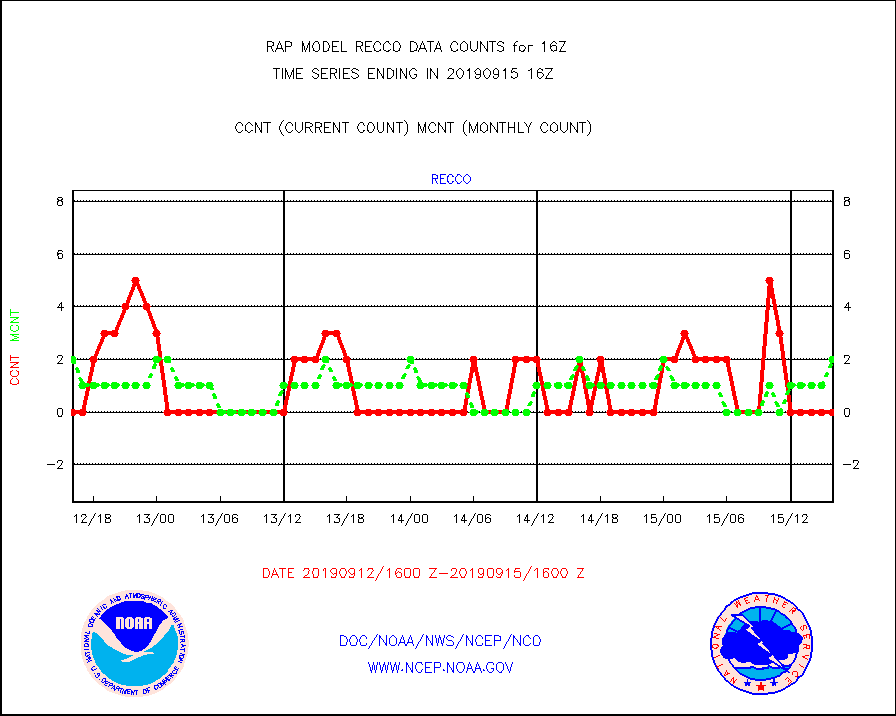
recco |
Flight level reconnaissance aircraft data |
0 |
2 |
0.0 % |
1515.00-1517.00 |
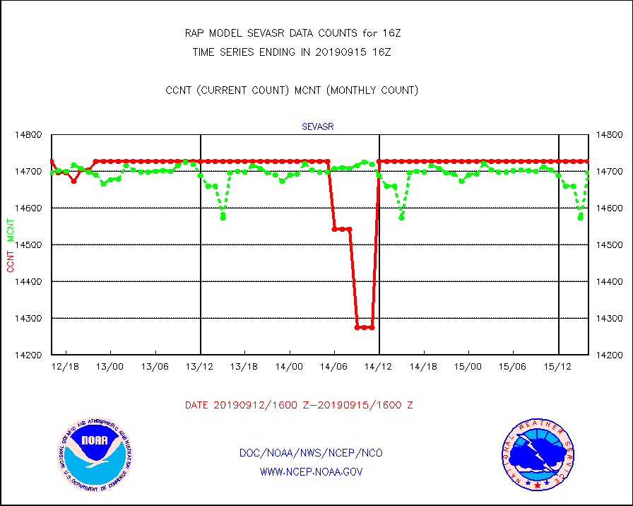
sevasr |
METEOSAT-10 2nd Gen SEVIRI All Sky Radiance(proc) |
14727 |
14697 |
100.2 % |
1514.00-1517.99 |
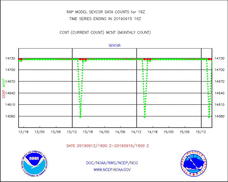
sevcsr |
METEOSAT-10 2nd Gen SEVIRI Clr Sky Radiance(proc) |
14727 |
14723 |
100.0 % |
1514.00-1517.99 |
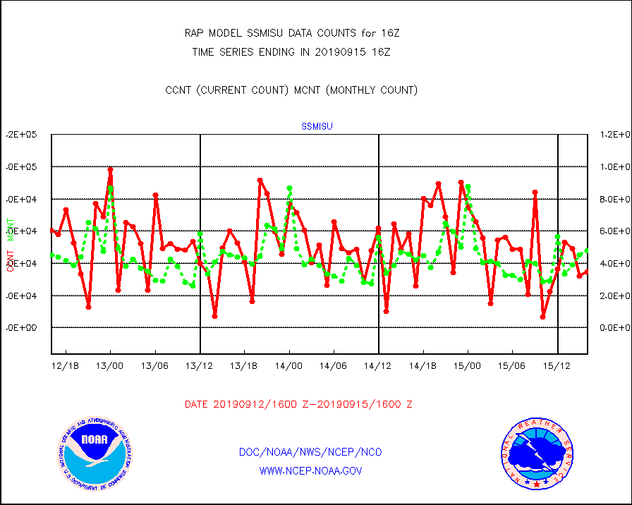
ssmisu |
DMSP SSM/IS 1C radiance data (Unified Pre-Proc.) |
34803 |
47683 |
73.0 % |
1514.00-1517.99 |
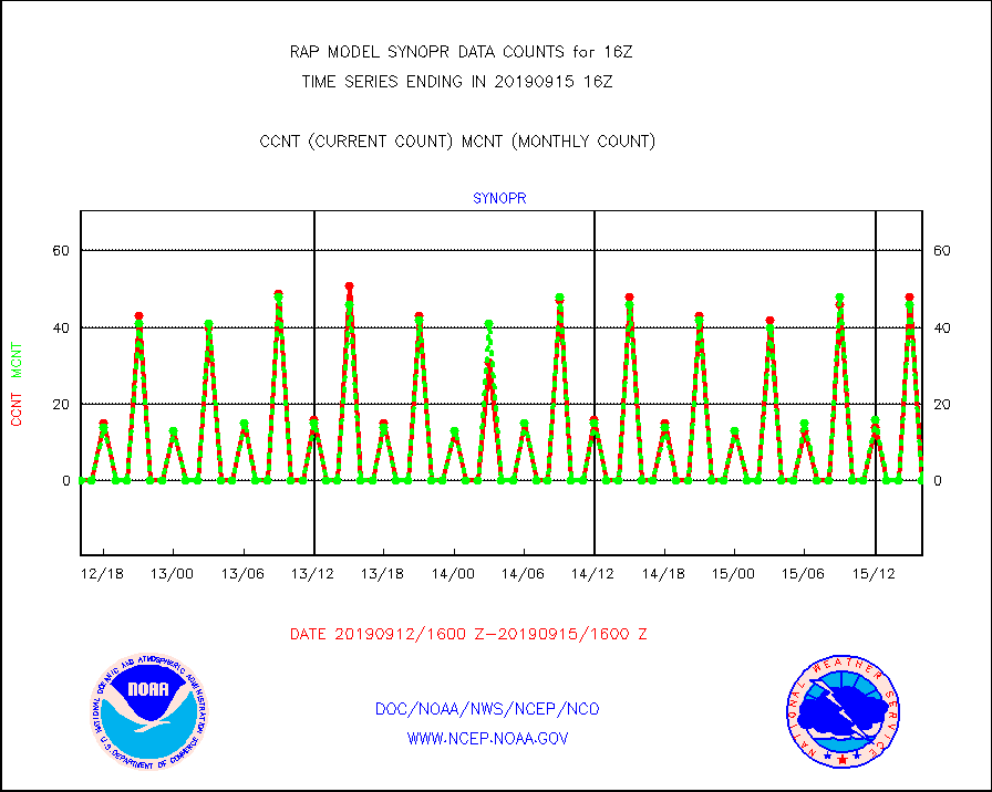
synopr |
Synoptic - restricted (WMO Res 40) manual & auto. |
0 |
0 |
n/a |
1515.50-1516.50 |
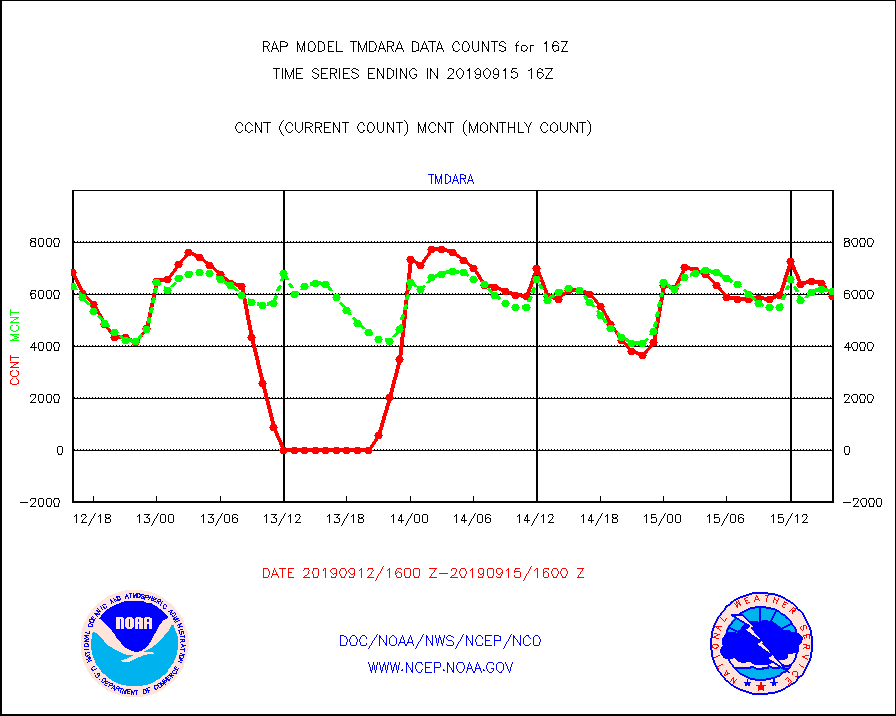
tmdara |
TAMDAR aircft data-all types(from Panasonic,BUFR) |
5908 |
6119 |
96.6 % |
1512.75-1519.25 |
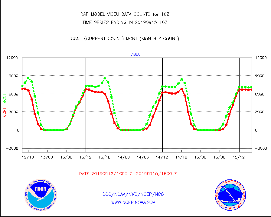
viseu |
METEOSAT/EUMETSAT visible derived cloud motion |
6716 |
7144 |
94.0 % |
1514.50-1517.49 |
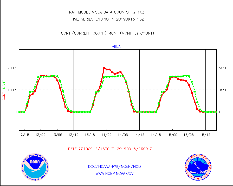
visja |
MTSAT/JMA visible derived cloud motion |
0 |
0 |
n/a |
1513.50-1518.50 |
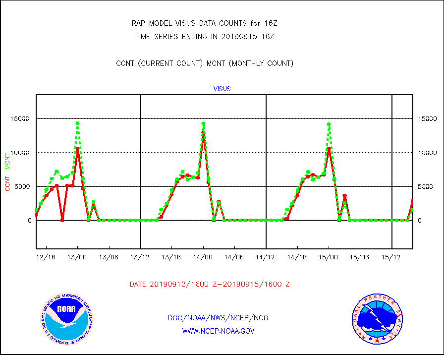
visus |
GOES/NESDIS visible derived cloud motion |
2870 |
1611 |
178.2 % |
1515.00-1515.99 |


