| Critical Data with Normal Counts |
|---|
| Type | Description | Hourly Count | Monthly Average | Percent (%) of Monthly Mean | UTC Time Window |
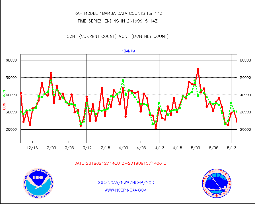
1bamua |
NOAA 15-19 & METOP 1-2 AMSU-A NCEP-proc. br.temps |
24617 |
30472 |
80.8 % |
1511.00-1516.99 |
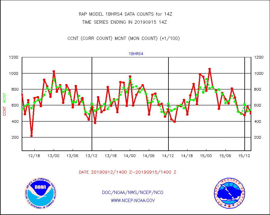
1bhrs4 |
NOAA 18-19 & METOP 1-2 HIRS-4 NCEP-proc. br.temps |
50215 |
54646 |
91.9 % |
1511.00-1516.99 |
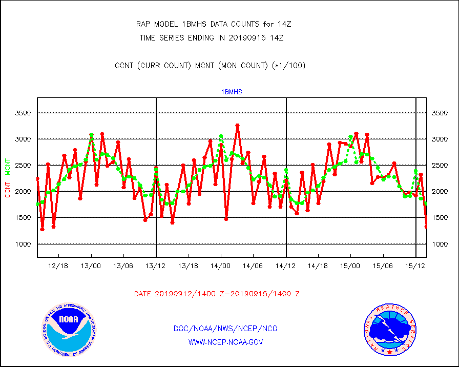
1bmhs |
NOAA 18-19 & METOP 1-2 MHS NCEP-proces. br. temps |
132747 |
176574 |
75.2 % |
1511.00-1516.99 |
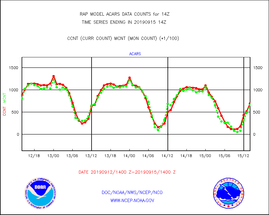
acars |
MDCRS ACARS acft data from ARINC(dcded from BUFR) |
70034 |
66630 |
105.1 % |
1510.75-1517.25 |
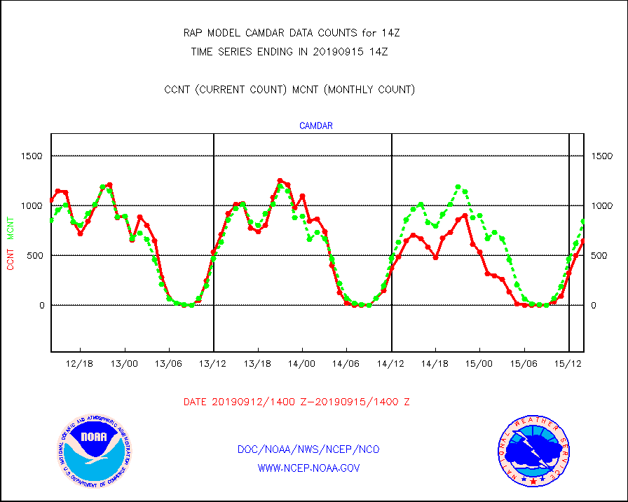
camdar |
Canadian AMDAR aircraft data (decoded from BUFR) |
653 |
850 |
76.8 % |
1510.75-1517.25 |
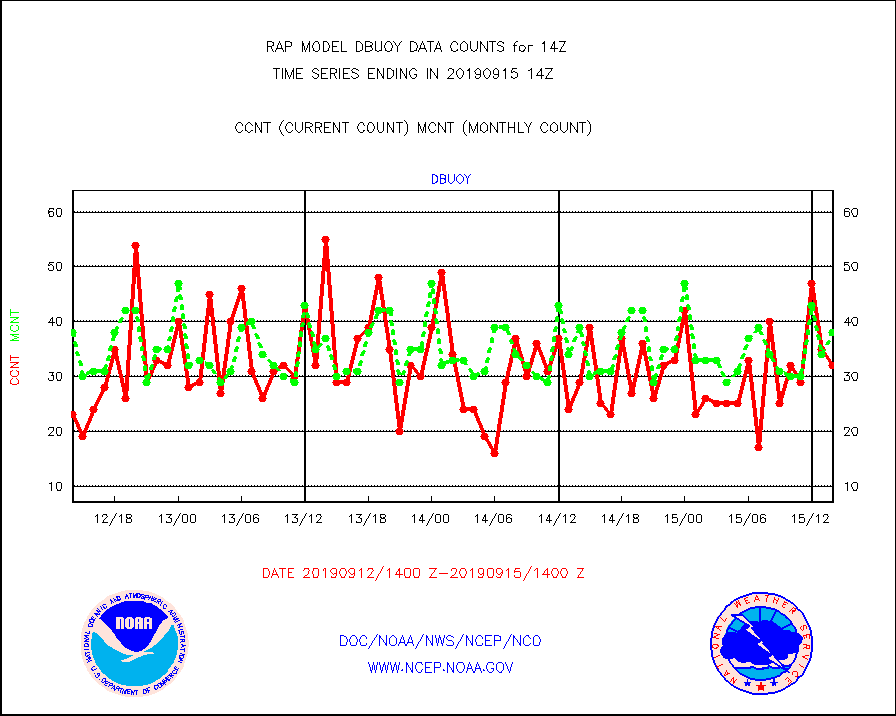
dbuoy |
Buoys decoded from FM-18 fmt (moored or drifting) |
32 |
38 |
84.2 % |
1513.50-1514.50 |
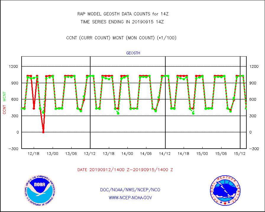
geosth |
GOES/NESDIS hi-resol. (1x1 f-o-v) cloud data |
43748 |
43615 |
100.3 % |
1512.75-1513.99 |
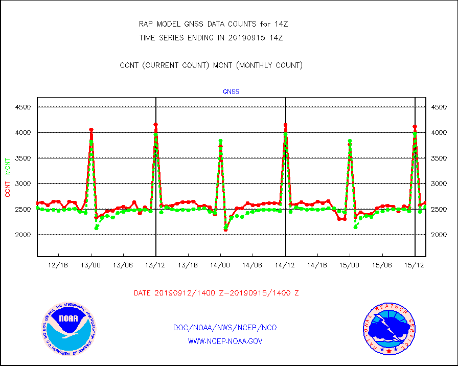
gnss |
Grnd-based Gbl Navigation Sat System (GNSS) data |
2630 |
2541 |
103.5 % |
1512.95-1513.05 |
h20mo |
MODIS (AQUA/TERRA) wvpr imager derived cld motion |
0 |
0 |
n/a |
1511.50-1516.50 |
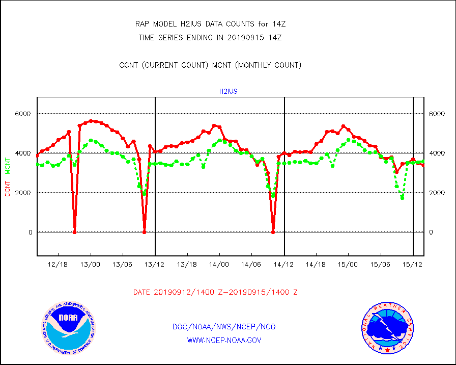
h2ius |
GOES/NESDIS water vapor imager derived cld motion |
3392 |
3592 |
94.4 % |
1513.00-1513.99 |
infmo |
MODIS (AQUA/TERRA) ir l-wave derived cloud motion |
0 |
0 |
n/a |
1511.50-1516.50 |
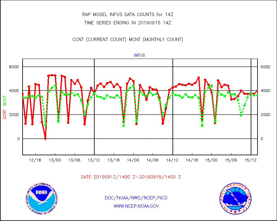
infus |
GOES/NESDIS infrared lg-wave derived cloud motion |
3977 |
3631 |
109.5 % |
1513.00-1513.99 |
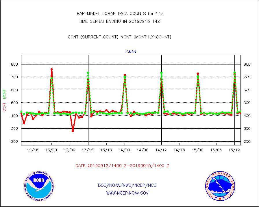
lcman |
Land-based CMAN stations decoded from CMAN format |
421 |
433 |
97.2 % |
1513.50-1514.50 |
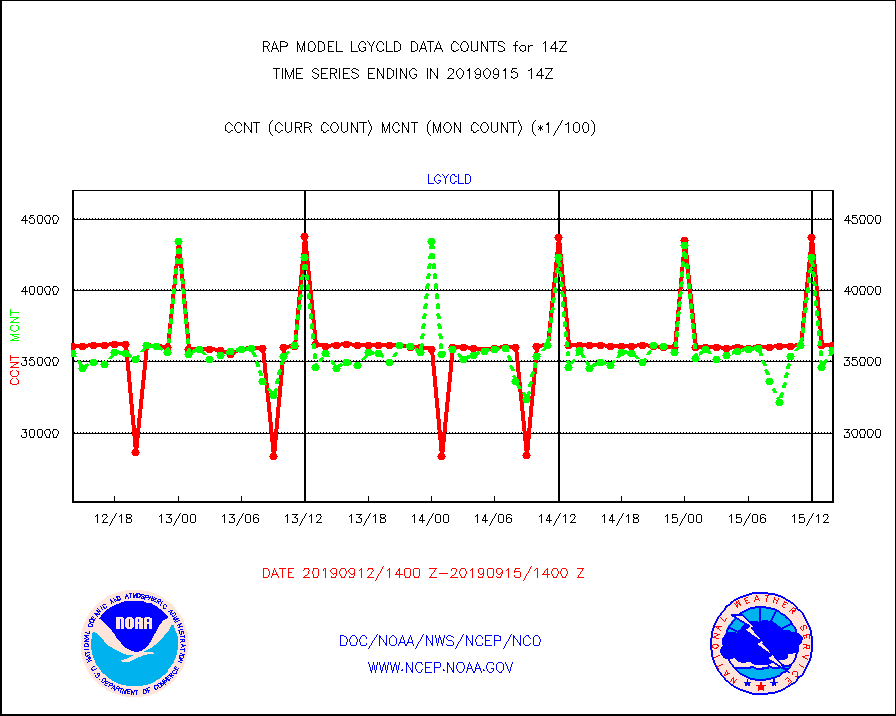
lgycld |
GOES/NASA(Langley) hi-res. (1x1 f-o-v) cloud data |
3615905 |
3581993 |
100.9 % |
1513.50-1514.50 |
mbuoy |
Buoys decoded from FM-13 format (moored) |
588 |
584 |
100.7 % |
1513.50-1514.50 |
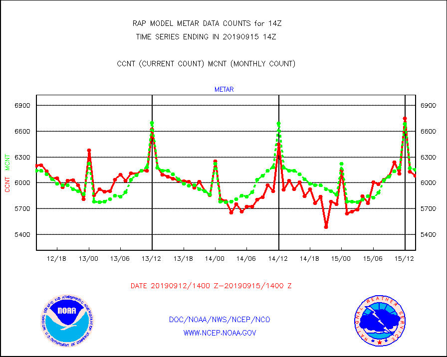
metar |
Aviation - METAR |
6083 |
6151 |
98.9 % |
1513.50-1514.50 |
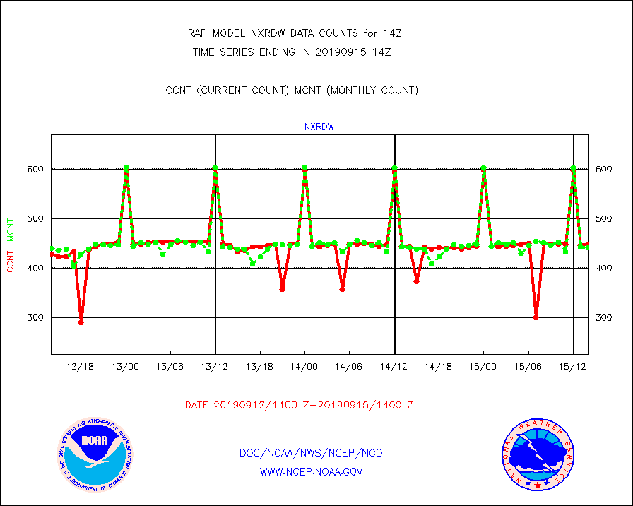
nxrdw |
NEXRAD Vel Azm Dsp(VAD) winds via radar coded msg |
448 |
441 |
101.6 % |
1513.00-1515.00 |
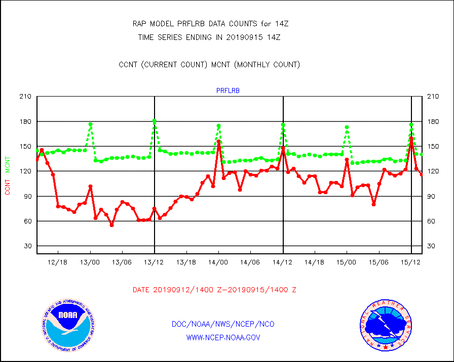
prflrb |
Multi-Agency Profiler (MAP) and SODAR winds |
116 |
140 |
82.9 % |
1512.50-1515.50 |
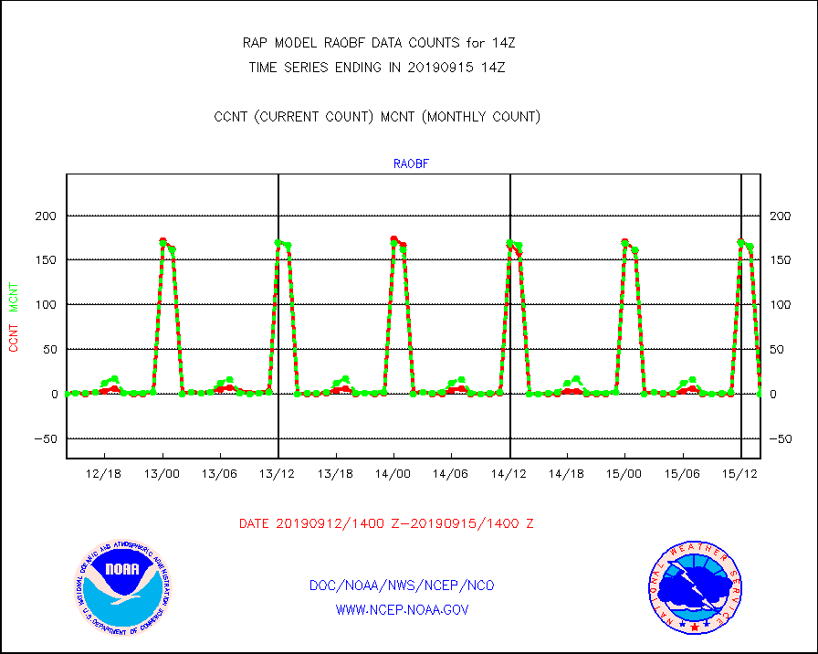
raobf |
Rawinsonde - fixed land (from TEMP or PILOT) |
0 |
0 |
n/a |
1513.00-1515.00 |
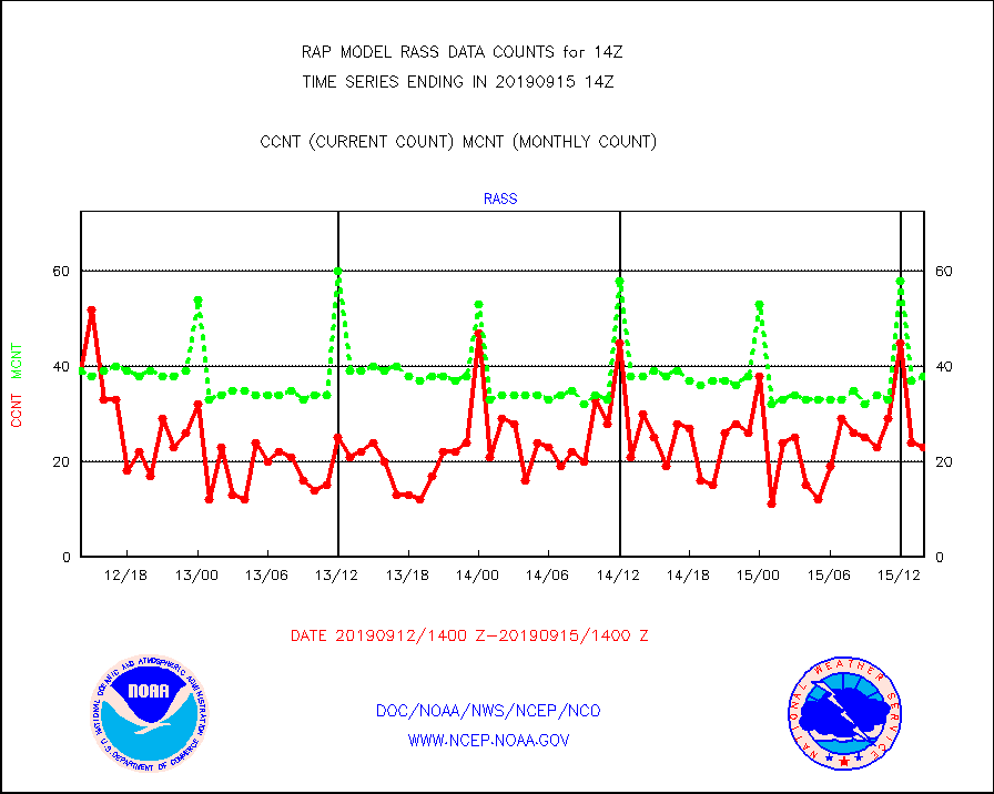
rass |
RASS temperatures (NOAA and Multi-Agency) |
23 |
38 |
60.5 % |
1513.50-1514.50 |
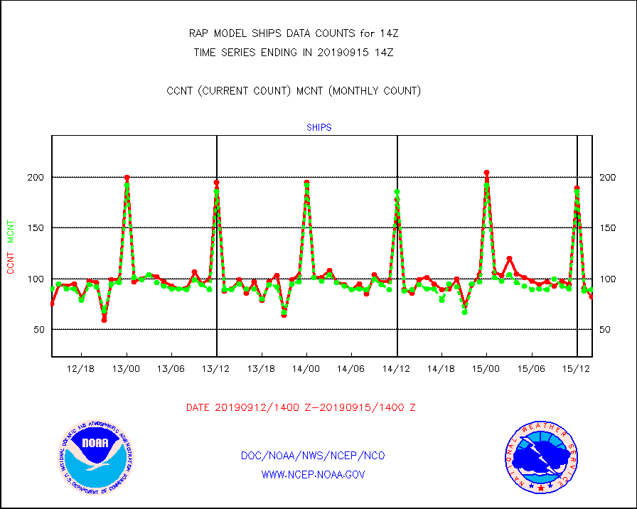
ships |
Ship - manual and automatic, restricted |
82 |
89 |
92.1 % |
1513.50-1514.50 |
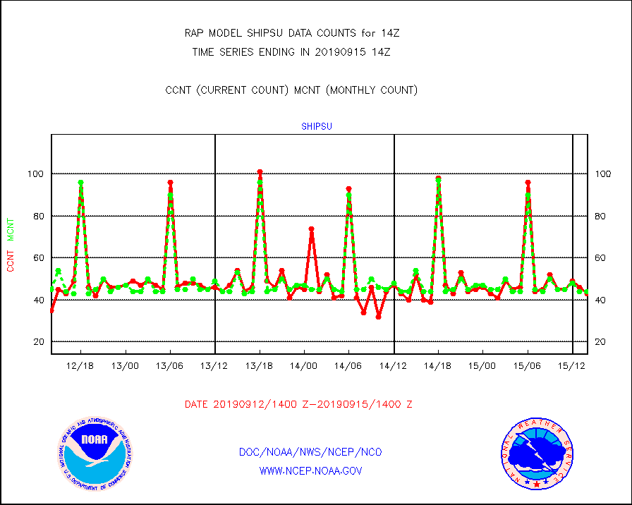
shipsu |
Ship - manual and automatic, unrestricted |
43 |
44 |
97.7 % |
1513.50-1514.50 |
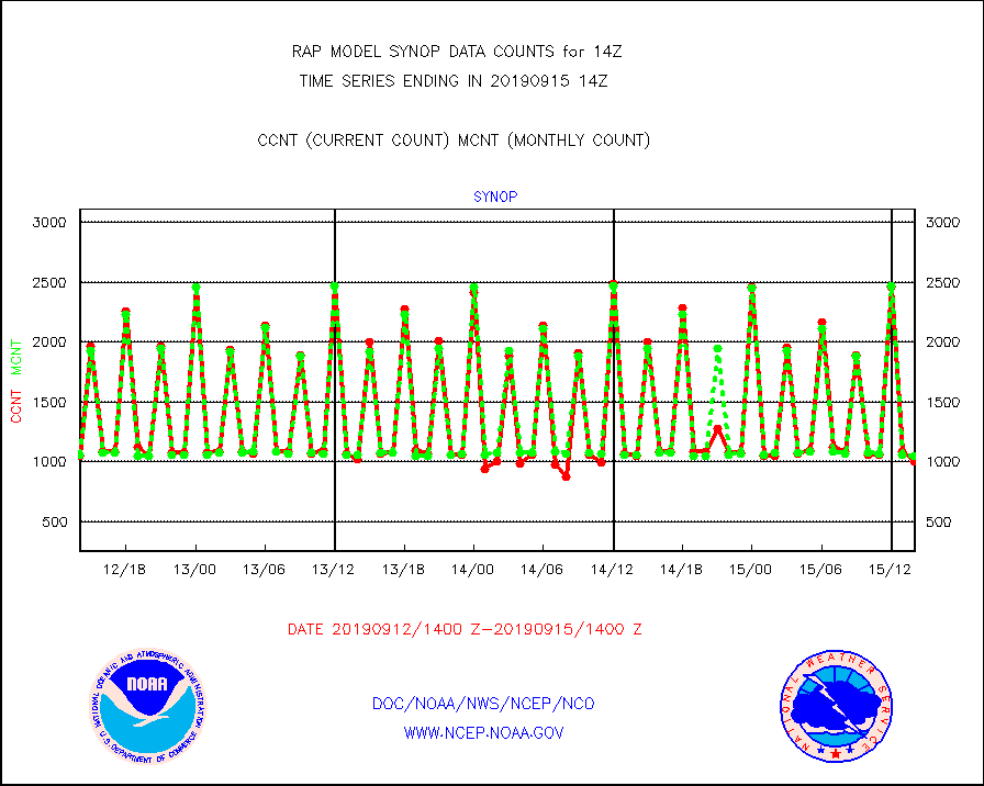
synop |
Synoptic - fixed manual and automatic |
1004 |
1051 |
95.5 % |
1513.50-1514.50 |
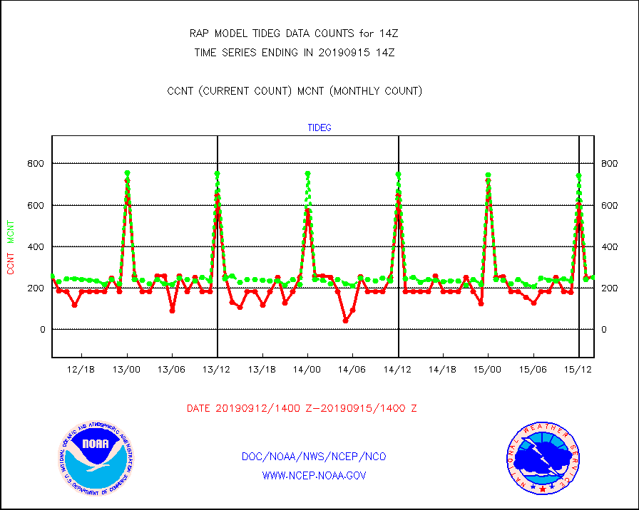
tideg |
Tide gauge reports decoded from CREX format |
253 |
251 |
100.8 % |
1513.50-1514.50 |
| Data Types of Opportunity with Normal Counts |
|---|
| Type | Description | Hourly Count | Monthly Average | Percent (%) of Monthly Mean | UTC Time Window |
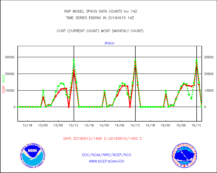
3p9us |
GOES/NESDIS infrared shrt-wave derived cld motion |
0 |
0 |
n/a |
1513.00-1513.99 |
acarsa |
MDCRS ACARS acft data (ARINC via AFWA)(AIREP fmt) |
0 |
0 |
n/a |
1510.75-1517.25 |
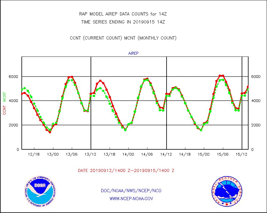
airep |
Manual AIREP aircraft data (dcded from AIREP fmt) |
5171 |
4950 |
104.5 % |
1510.75-1517.25 |
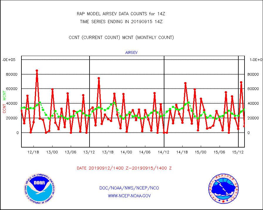
airsev |
AQUA AIRS/AMSU-A/HSB brightness temps- every FOV |
8692 |
31491 |
27.6 % |
1511.00-1516.99 |
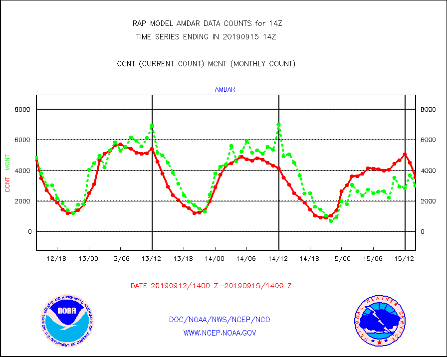
amdar |
AMDAR aircraft data (decoded from AMDAR format) |
3566 |
3015 |
118.3 % |
1510.75-1517.25 |
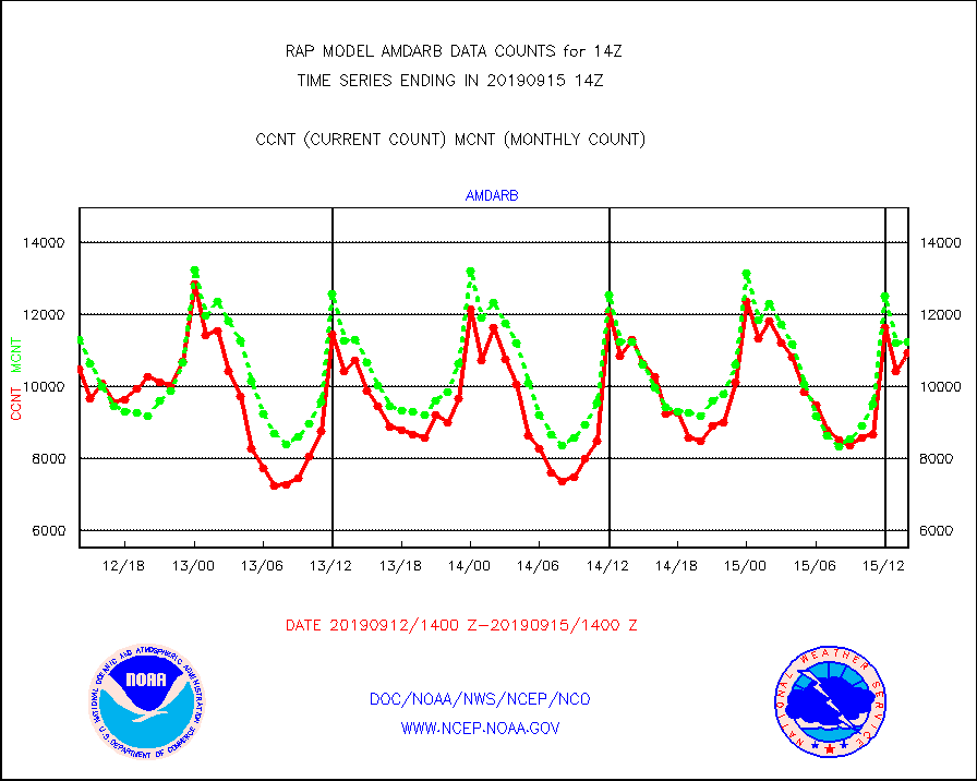
amdarb |
AMDAR aircraft data (decoded from BUFR) |
10958 |
11263 |
97.3 % |
1510.75-1517.25 |
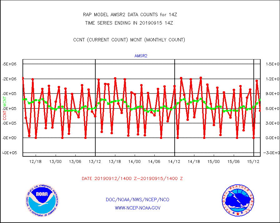
amsr2 |
GCOM-W AMSR2 1B brightness temperatures |
555361 |
776395 |
71.5 % |
1511.00-1511.99 |
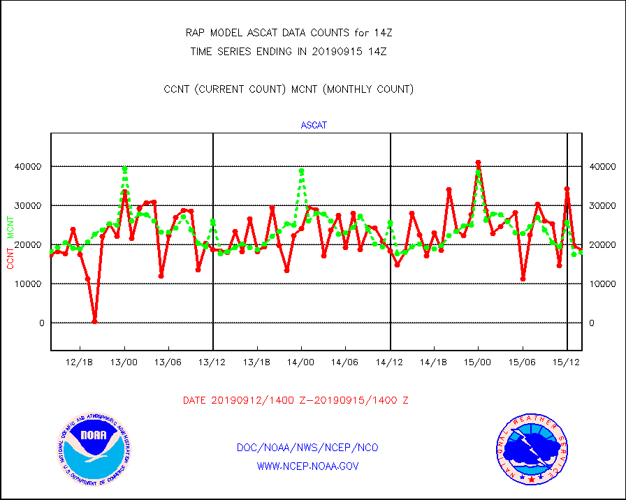
ascat |
METOP 1-2 ASCAT products |
18579 |
18019 |
103.1 % |
1512.00-1516.00 |
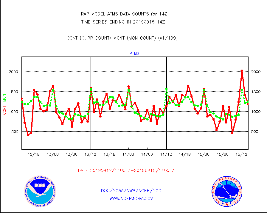
atms |
NPP Adv. Tech. Microwave Sounder (ATMS) br. temps |
119541 |
125504 |
95.2 % |
1512.00-1515.99 |
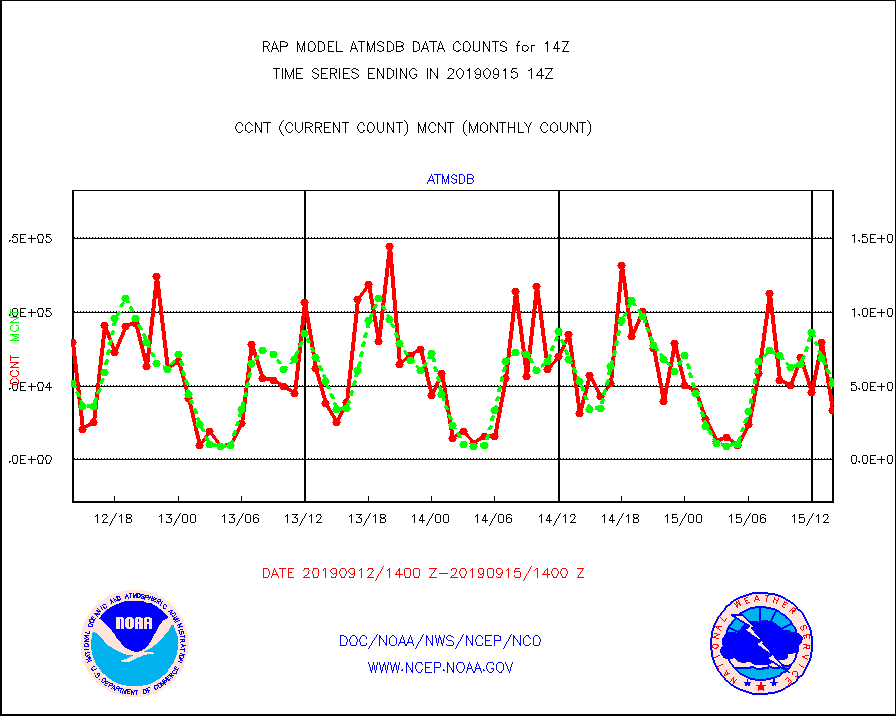
atmsdb |
NPP Adv Tech MW Sndr(ATMS) b. temps-dir bcst SSEC |
33777 |
52029 |
64.9 % |
1512.00-1515.99 |
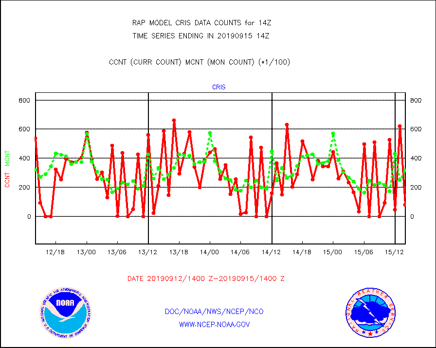
cris |
NPP Cross-track Infrared Sounder (CrIS) radiances |
8062 |
31889 |
25.3 % |
1512.00-1515.99 |
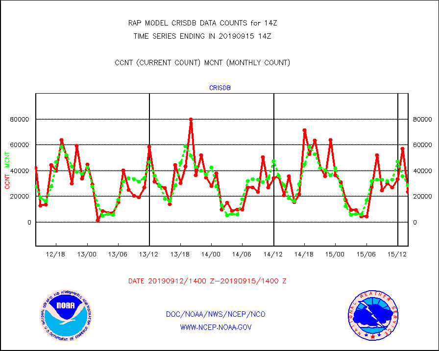
crisdb |
NPP Crss-trk IR Sndr(CrIS) radiance-dir bcst SSEC |
23502 |
28589 |
82.2 % |
1512.00-1515.99 |
cstgd |
Coast Guard |
8 |
7 |
114.3 % |
1513.50-1514.50 |
dropw |
Dropwinsonde (from TEMP DROP) |
0 |
2 |
0.0 % |
1513.00-1515.00 |
eadas |
E-AMDAR (European AMDAR acft decoded from BUFR) |
9896 |
9985 |
99.1 % |
1510.75-1517.25 |
esamua |
NOAA 15-19 & METOP 1-2 AMSU-A proc btmps frm RARS |
13931 |
11036 |
126.2 % |
1513.00-1515.00 |
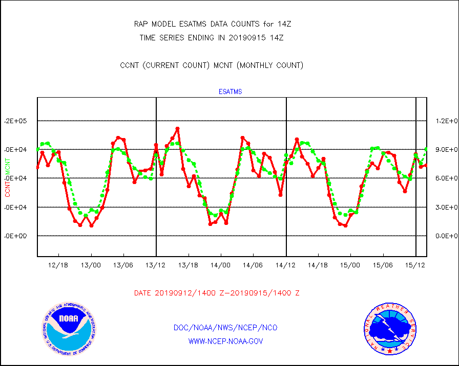
esatms |
NPP Adv. Tech. MW Sndr (ATMS) br. temps from RARS |
73658 |
90409 |
81.5 % |
1512.00-1515.99 |
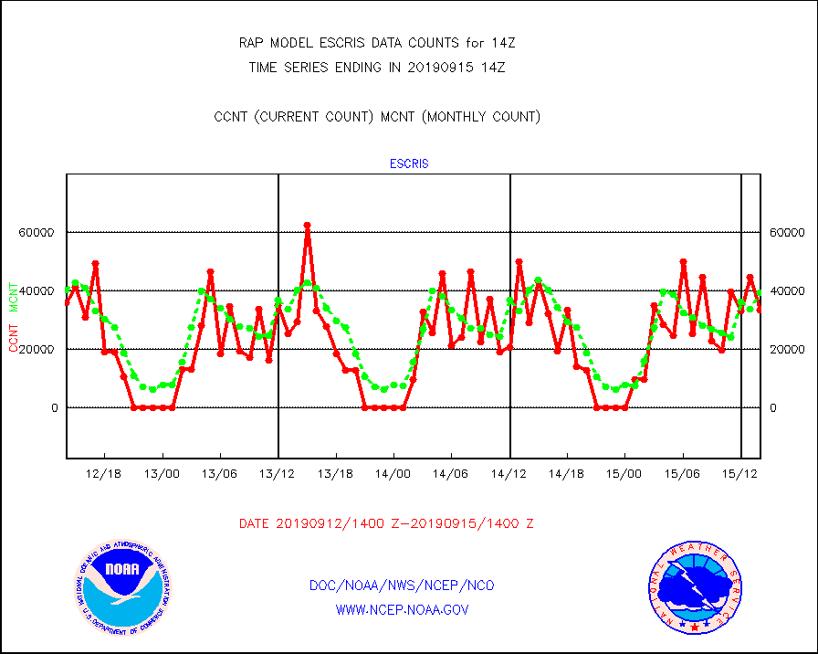
escris |
NPP Crss-track IR Sndr (CrIS) radiances from RARS |
33346 |
39468 |
84.5 % |
1512.00-1515.99 |
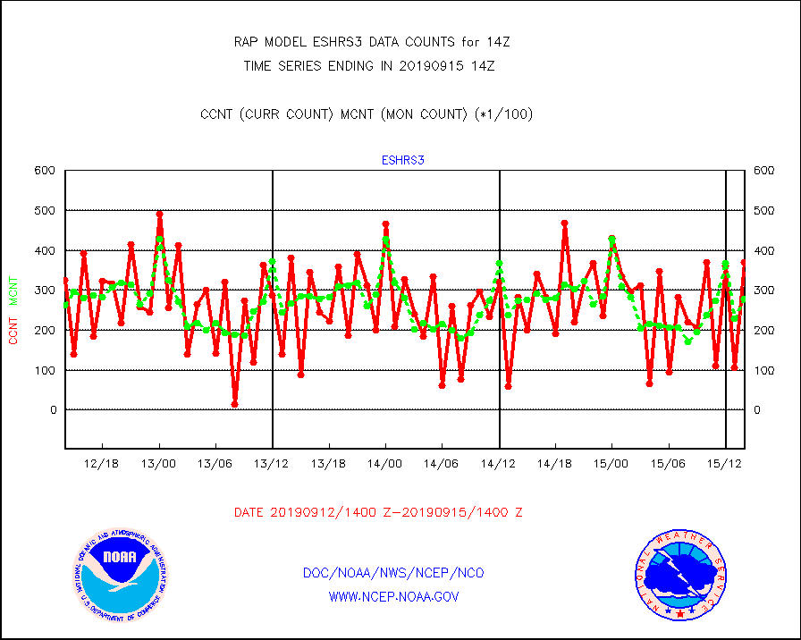
eshrs3 |
NOAA 15-19 & METOP 1-2 HIRS-3/4 pr btmps frm RARS |
37199 |
27949 |
133.1 % |
1513.00-1515.00 |
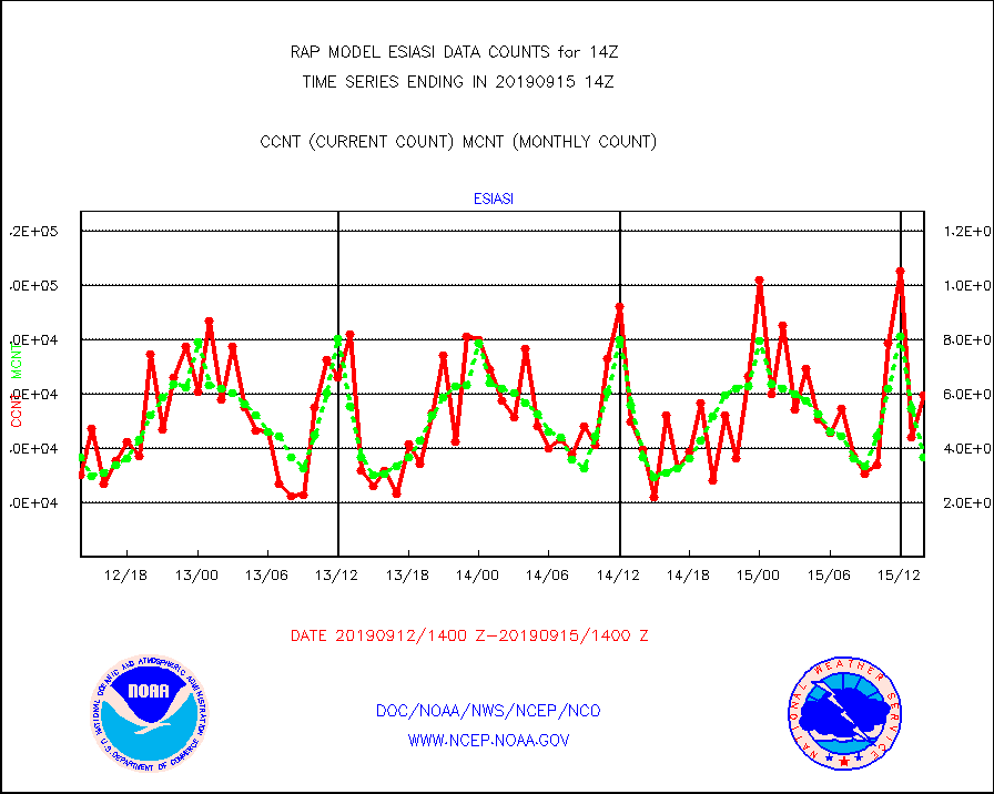
esiasi |
METOP 1-2 IASI 1C radiance data vbl chn from RARS |
59619 |
36969 |
161.3 % |
1512.00-1515.99 |
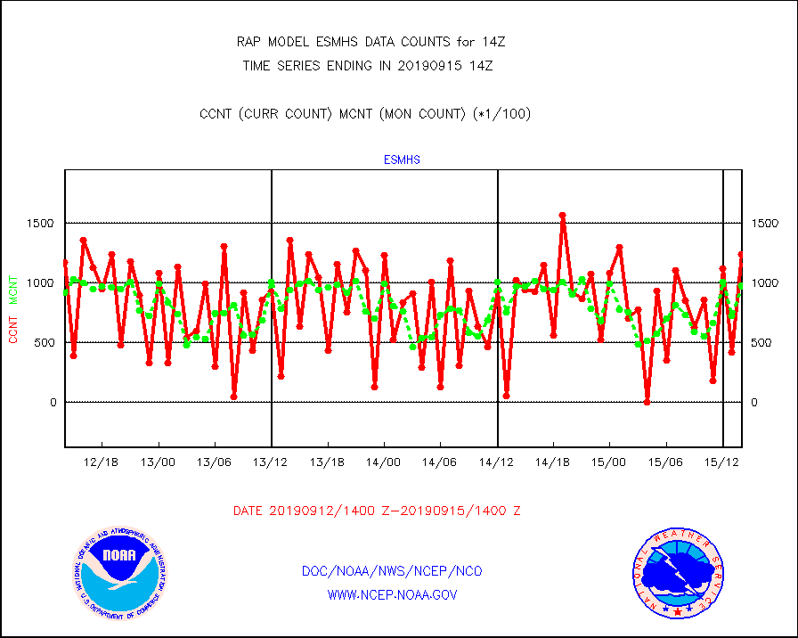
esmhs |
NOAA 18-19 & METOP 1-2 MHS proc. btemps from RARS |
124069 |
97465 |
127.3 % |
1513.00-1515.00 |
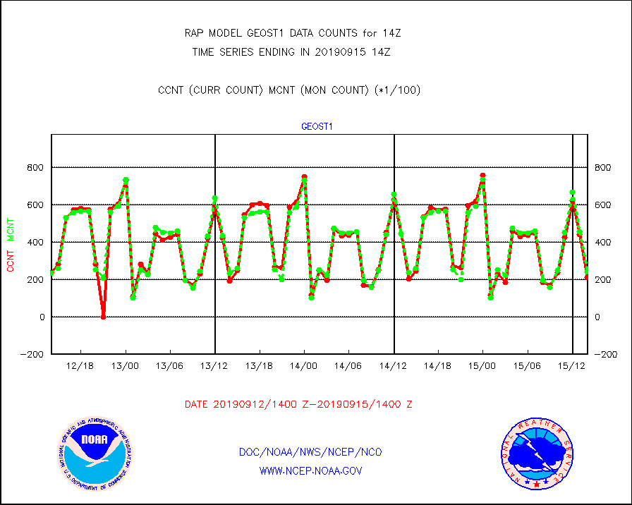
geost1 |
GOES/NESDIS hi-resol. (1x1 f-o-v) sndgs/radiances |
20923 |
23920 |
87.5 % |
1513.00-1515.00 |
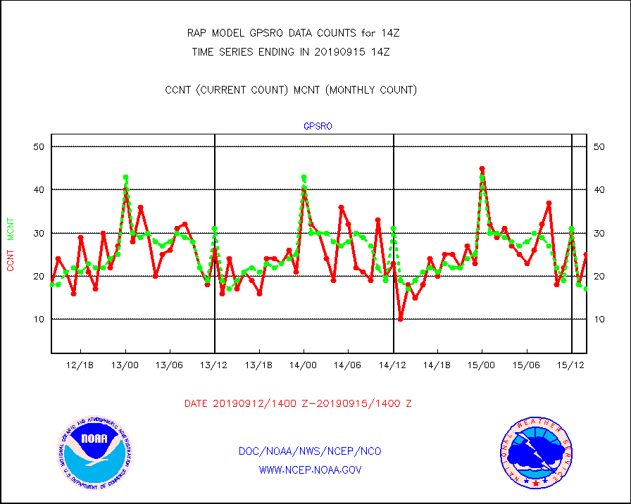
gpsro |
GPS radio occultation data |
25 |
17 |
147.1 % |
1512.00-1515.99 |
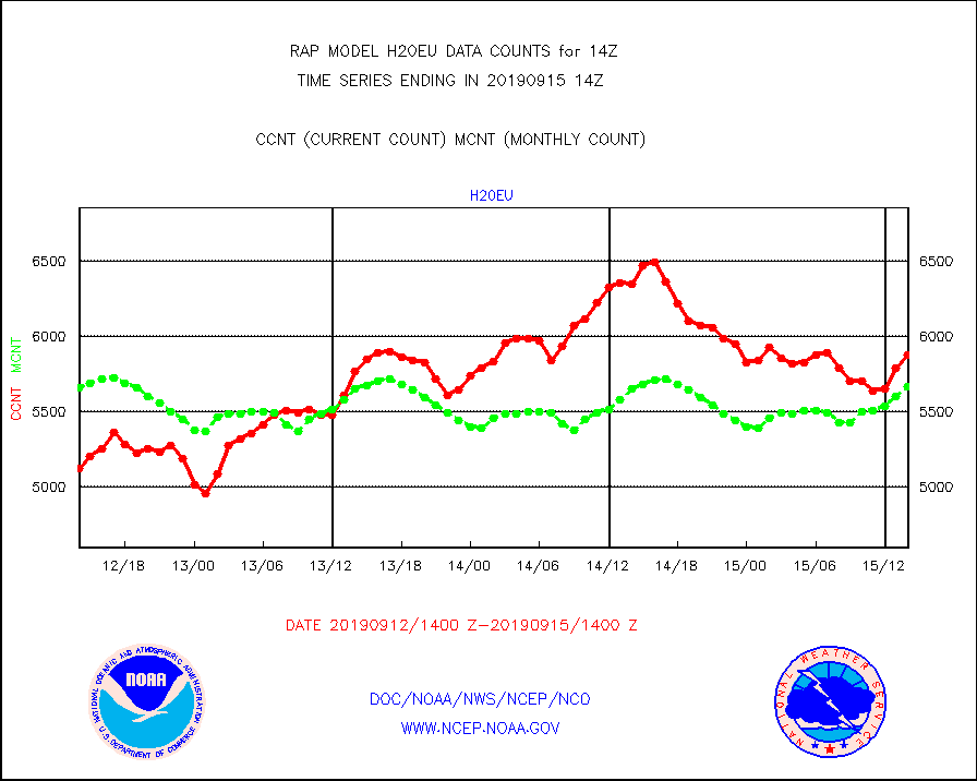
h20eu |
METEOSAT/EUMETSAT wvpr imager derived cld motion |
5876 |
5666 |
103.7 % |
1512.50-1515.49 |
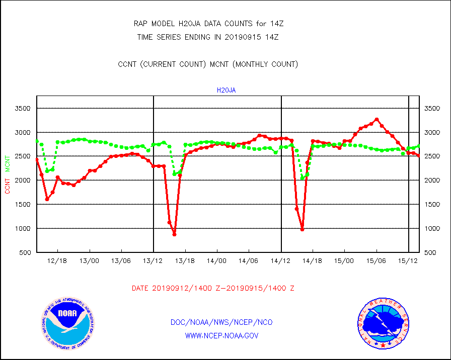
h20ja |
MTSAT/JMA water vapor imager derived cloud motion |
2513 |
2716 |
92.5 % |
1511.50-1516.50 |
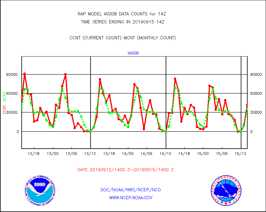
iasidb |
METOP 1-2 IASI 1C radiances-direct broadcast SSEC |
42452 |
35240 |
120.5 % |
1512.00-1515.99 |
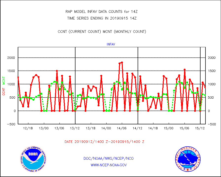
infav |
AVHRR (NOAA/METOP) ir lg-wave derived cld motion |
883 |
587 |
150.4 % |
1511.50-1516.50 |
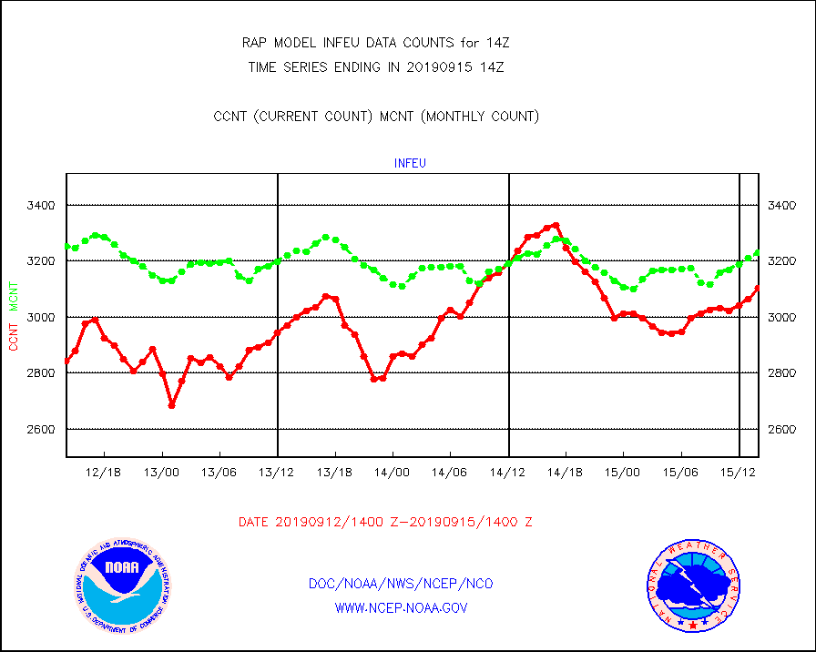
infeu |
METEOSAT/EUMETSAT ir lg-wave derived cloud motion |
3105 |
3229 |
96.2 % |
1512.50-1515.49 |
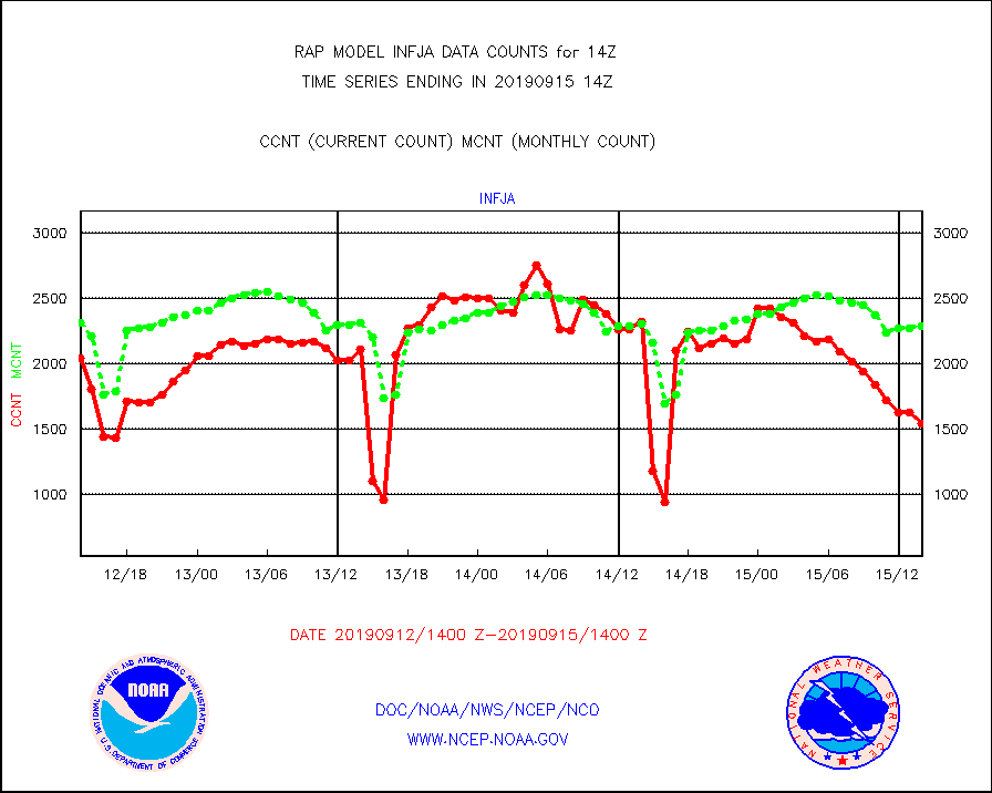
infja |
MTSAT/JMA infrared long-wave derived cloud motion |
1543 |
2292 |
67.3 % |
1511.50-1516.50 |
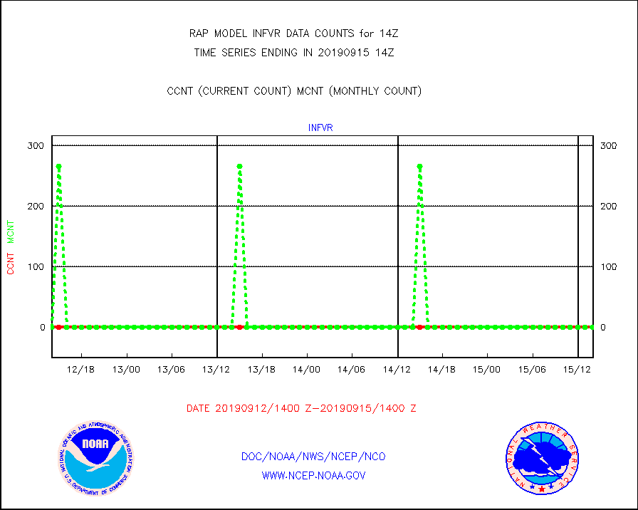
infvr |
VIIRS (NPP) infrared lg-wave derived cloud motion |
0 |
0 |
n/a |
1511.50-1516.50 |
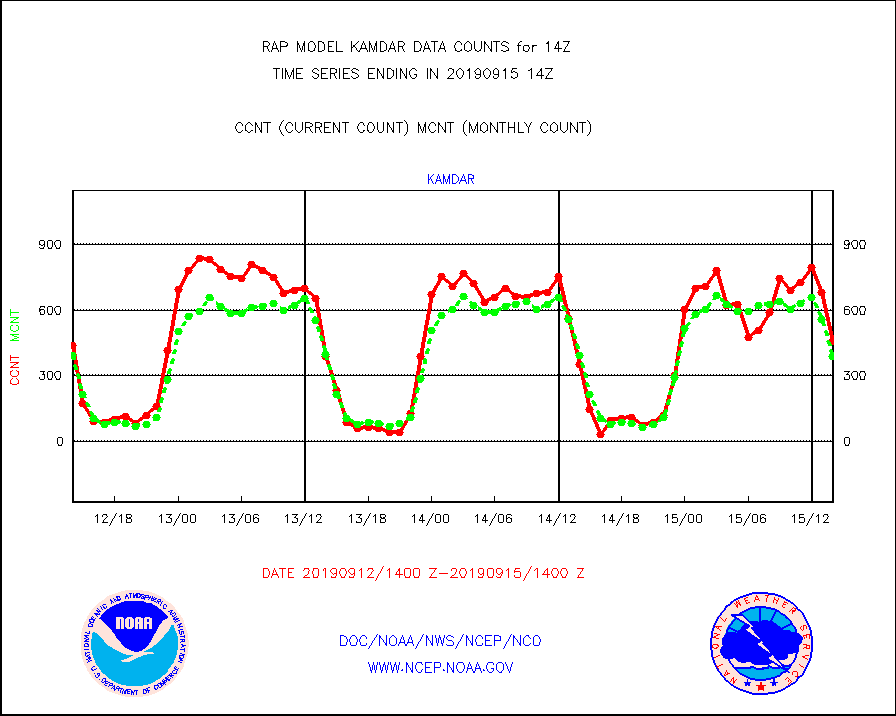
kamdar |
Korean AMDAR aircraft data (decoded from BUFR) |
456 |
390 |
116.9 % |
1510.75-1517.25 |
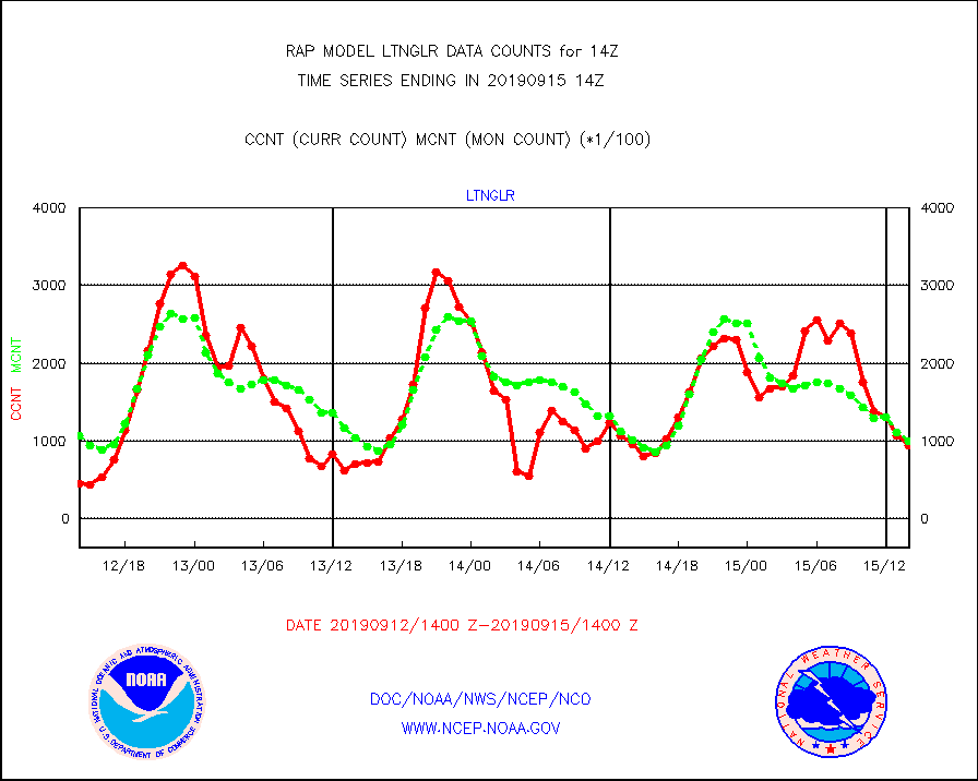
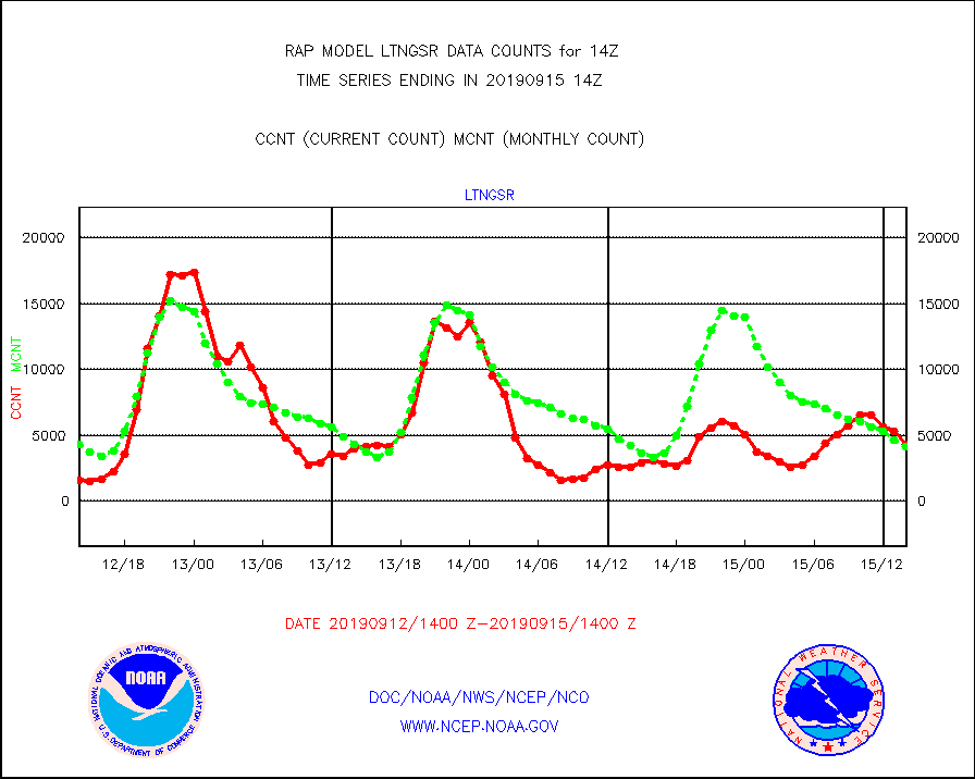
ltnglr |
LLDN Long-rng lightning from Vaisala via NOAAPORT |
93760 |
100232 |
93.5 % |
1513.00-1514.50 |
ltngsr |
NLDN Shrt-rng lightning from Vaisala via NOAAPORT |
4339 |
4138 |
104.9 % |
1513.00-1514.50 |
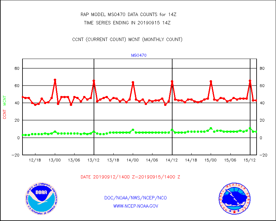
mso470 |
Mesonet/MADIS Colorado E-470 (Interstate 470) |
43 |
7 |
614.3 % |
1513.50-1514.50 |
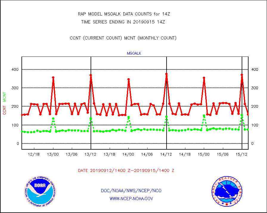
msoalk |
Mesonet/MADIS Alaska Department of Transportation |
158 |
75 |
210.7 % |
1513.50-1514.50 |
msoapg |
Mesonet/MADIS U.S. Army Aberdeen Proving Grounds |
0 |
0 |
n/a |
1513.50-1514.50 |
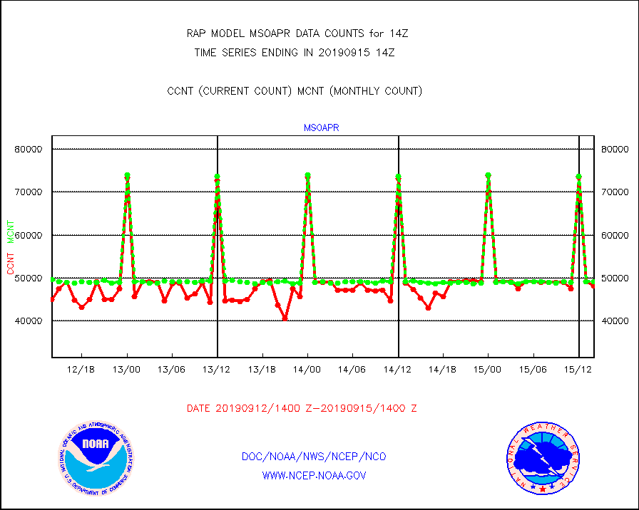
msoapr |
Mesonet/MADIS Citizen Weather Observers Program |
48179 |
49239 |
97.8 % |
1513.50-1514.50 |
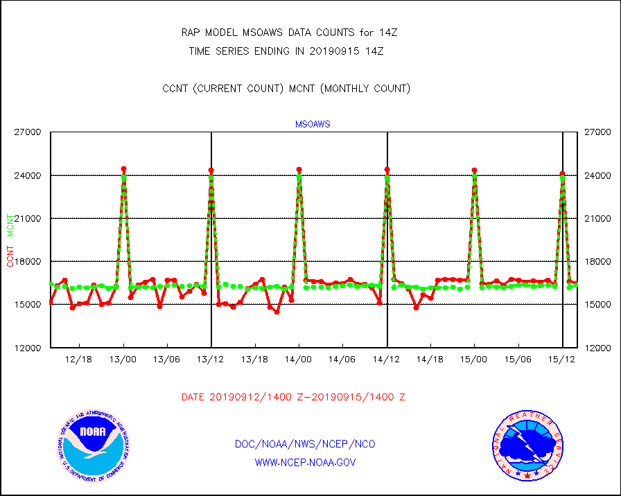
msoaws |
Mesonet/MADIS AWS Convergence Technologies, Inc. |
16444 |
16372 |
100.4 % |
1513.50-1514.50 |
msoawx |
Mesonet/MADIS "Anything Weather" |
0 |
0 |
n/a |
1513.50-1514.50 |
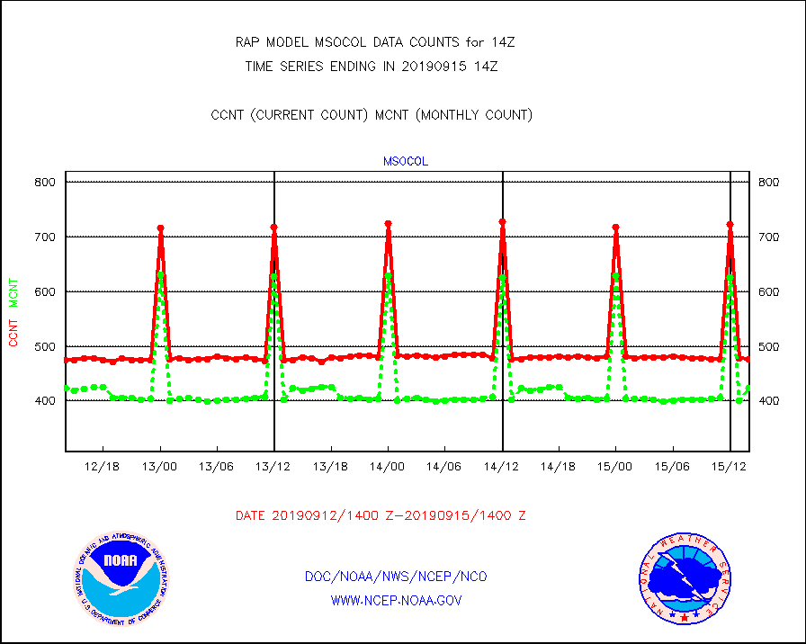
msocol |
Mesonet/MADIS Colorado Dept. of Transportation |
477 |
423 |
112.8 % |
1513.50-1514.50 |
msodcn |
Mesonet/MADIS DC Net |
0 |
0 |
n/a |
1513.50-1514.50 |
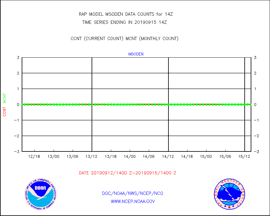
msoden |
Mesonet/MADIS Denver Urban Drainage & Flood Cntrl |
0 |
0 |
n/a |
1513.50-1514.50 |
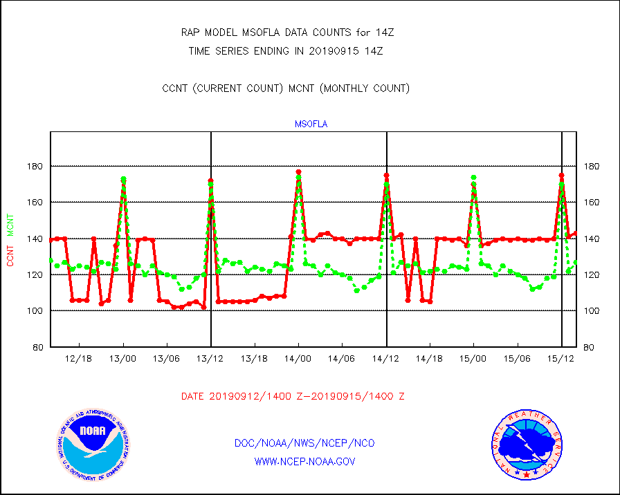
msofla |
Mesonet/MADIS Florida (FAWN & USF) |
143 |
127 |
112.6 % |
1513.50-1514.50 |
msoflt |
Mesonet/MADIS Florida Dept. of Transportation |
0 |
0 |
n/a |
1513.50-1514.50 |
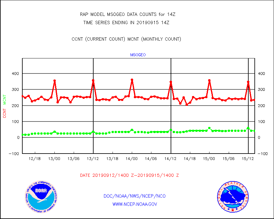
msogeo |
Mesonet/MADIS Georgia Dept. of Transportation |
236 |
42 |
561.9 % |
1513.50-1514.50 |
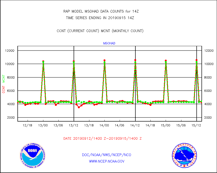
msohad |
Mesonet/MADIS NWS Hydromet Auto Data System(HADS) |
4269 |
4413 |
96.7 % |
1513.50-1514.50 |
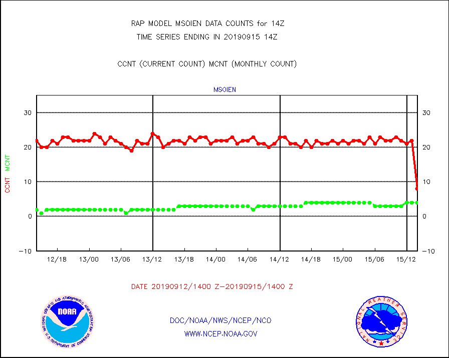
msoien |
Mesonet/MADIS Iowa Environmental |
8 |
4 |
200.0 % |
1513.50-1514.50 |
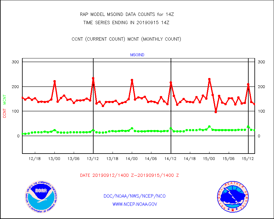
msoind |
Mesonet/MADIS Indiana Dept. of Transportation |
129 |
23 |
560.9 % |
1513.50-1514.50 |
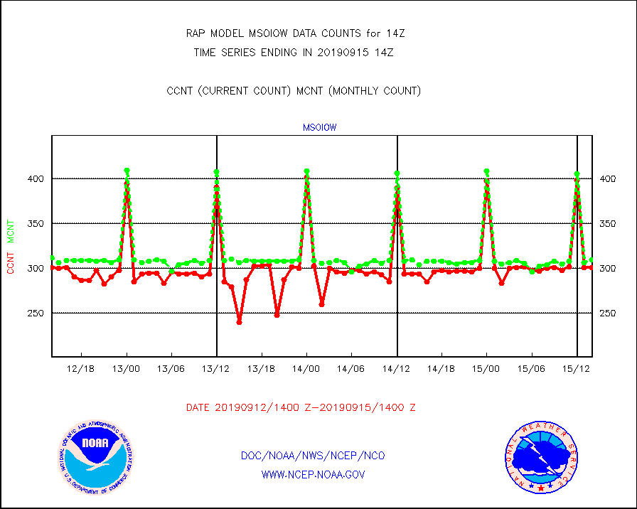
msoiow |
Mesonet/MADIS Iowa Department of Transportation |
301 |
310 |
97.1 % |
1513.50-1514.50 |
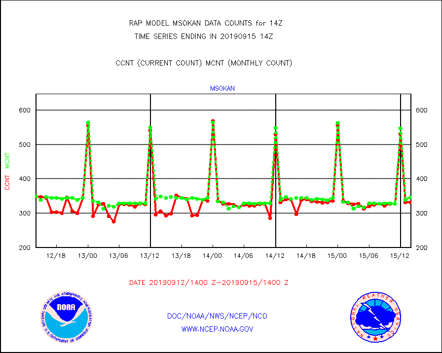
msokan |
Mesonet/MADIS Kansas Department of Transportation |
331 |
346 |
95.7 % |
1513.50-1514.50 |
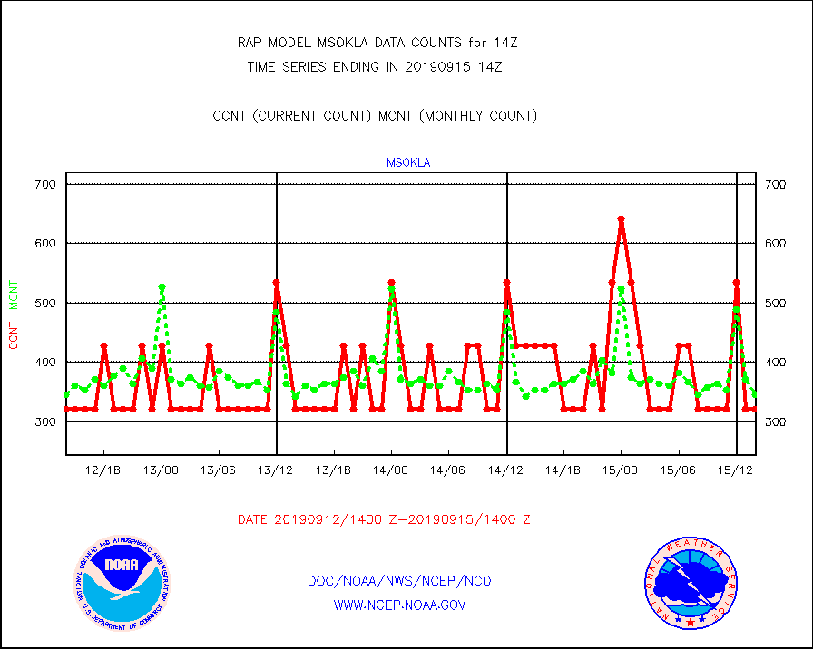
msokla |
Mesonet/MADIS Oklahoma Mesonet |
321 |
346 |
92.8 % |
1513.50-1514.50 |
msolju |
Mesonet/MADIS Louisiana State/Jackson State Univ. |
0 |
0 |
n/a |
1513.50-1514.50 |
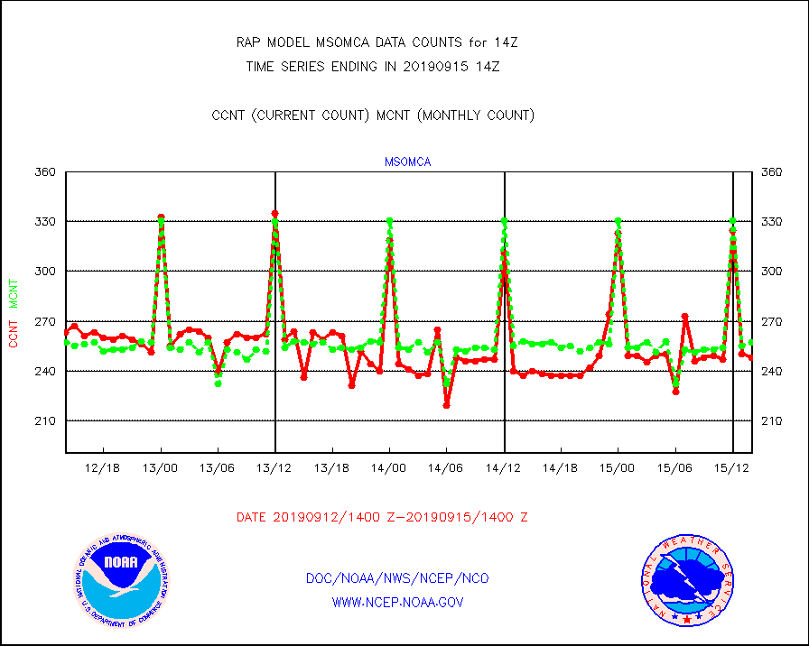
msomca |
Mesonet/MADIS Missouri Commercial Agricult Wx Net |
248 |
257 |
96.5 % |
1513.50-1514.50 |
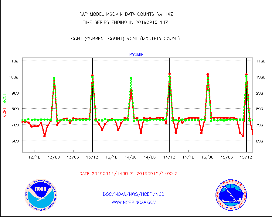
msomin |
Mesonet/MADIS Minnesota Dept. of Transportation |
645 |
730 |
88.4 % |
1513.50-1514.50 |
msonos |
Mesonet/MADIS NOS-Phys Oceanographic Realtime Sys |
284 |
296 |
95.9 % |
1513.50-1514.50 |
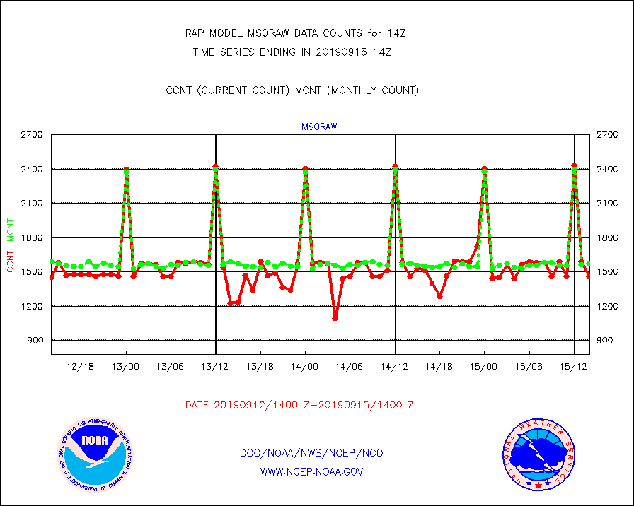
msoraw |
Mesonet/MADIS NFIC Remote Automated Wx Stns(RAWS) |
1457 |
1575 |
92.5 % |
1513.50-1514.50 |
msothr |
Mesonet/MADIS many providers, not separated out |
16932 |
15243 |
111.1 % |
1513.50-1514.50 |
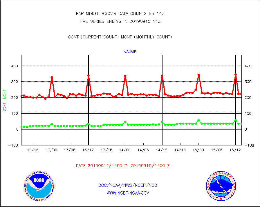
msovir |
Mesonet/MADIS Virginia Dept. of Transportation |
220 |
36 |
611.1 % |
1513.50-1514.50 |
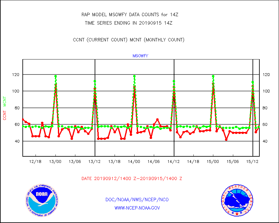
msowfy |
Mesonet/MADIS "Weather for You" |
58 |
57 |
101.8 % |
1513.50-1514.50 |
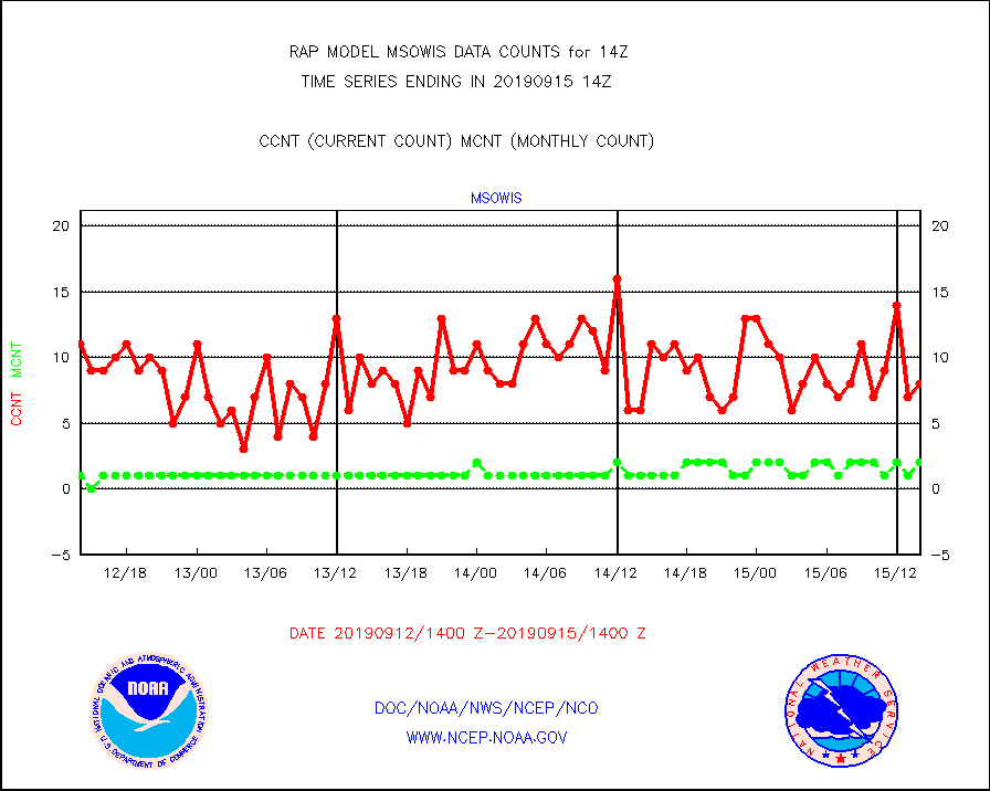
msowis |
Mesonet/MADIS Wisconsin Dept. of Transportation |
8 |
2 |
400.0 % |
1513.50-1514.50 |
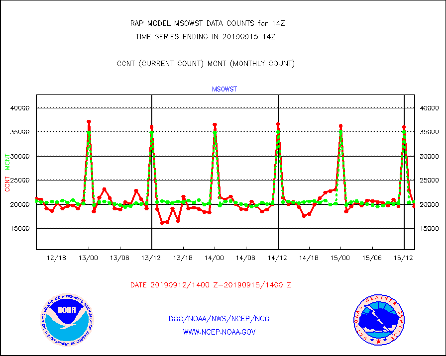
msowst |
Mesonet/MADIS MesoWest (many subproviders) |
19491 |
20578 |
94.7 % |
1513.50-1514.50 |
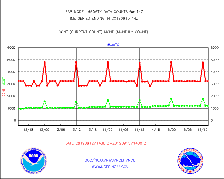
msowtx |
Mesonet/MADIS West Texas |
3238 |
1198 |
270.3 % |
1513.50-1514.50 |
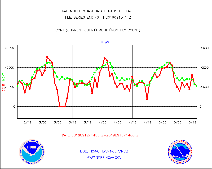
mtiasi |
METOP 1-2 IASI 1C radiance data (varbl. channels) |
21091 |
20988 |
100.5 % |
1512.00-1515.99 |
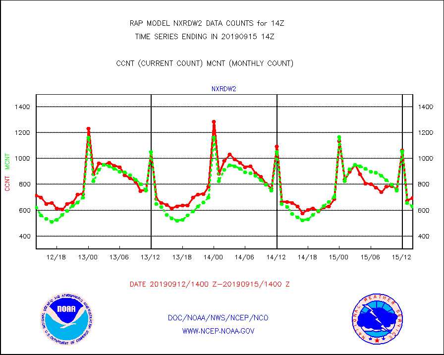
nxrdw2 |
NEXRAD Vel Azm Dsp(VAD) winds via Level 2 decoder |
693 |
630 |
110.0 % |
1513.00-1515.00 |
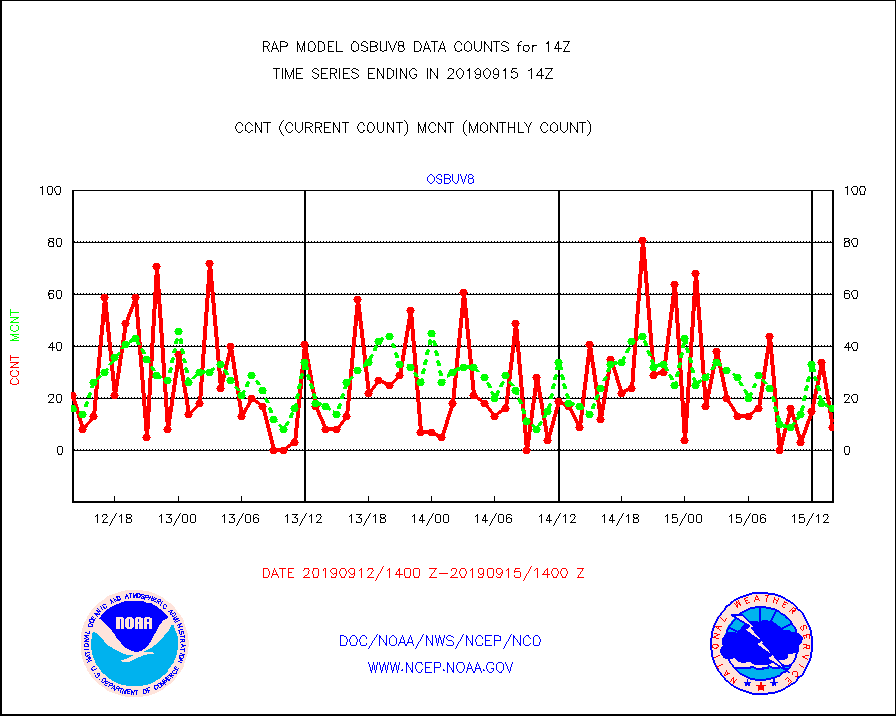
osbuv8 |
NOAA 16-19 Solar Backscatter UV-2 rad frm V8 BUFR |
9 |
16 |
56.2 % |
1512.00-1514.99 |
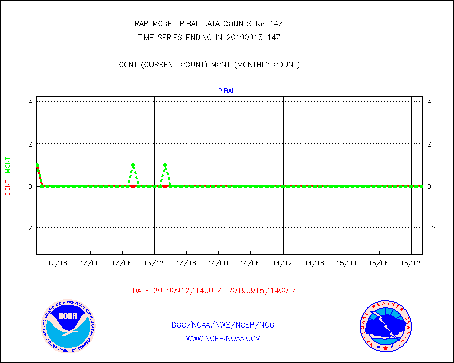
pibal |
PIBAL (from PILOT, PILOT SHIP, PILOT MOBIL) |
0 |
0 |
n/a |
1513.00-1515.00 |
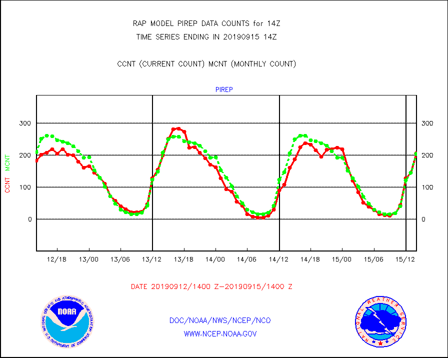
pirep |
Manual PIREP aircraft data (dcded from AIREP fmt) |
206 |
204 |
101.0 % |
1510.75-1517.25 |
prflrp |
Profilr winds from PIBAL (PILOT,PILOT SHIP/MOBIL) |
0 |
0 |
n/a |
1512.50-1515.50 |
radw25 |
NEXRAD radial wind superobs (Level 2.5 - ORPG) |
0 |
0 |
n/a |
1513.00-1515.00 |
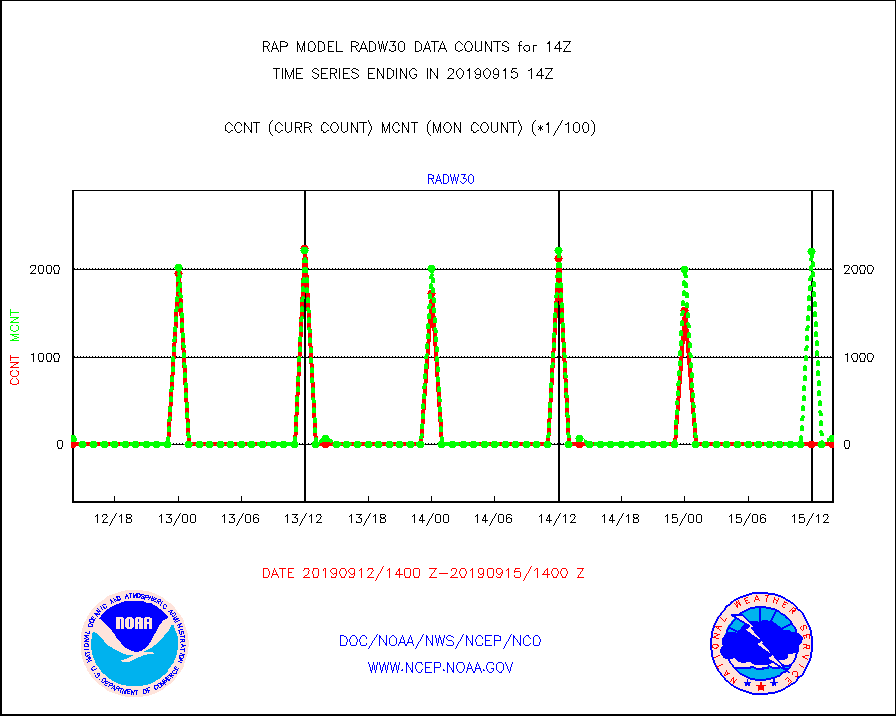
radw30 |
NEXRAD radial wind superobs (Level 3 - NIDS) |
0 |
6668 |
0.0 % |
1513.00-1515.00 |
raobm |
Rawinsonde - mobile land (from TEMP/PILOT MOBIL) |
0 |
0 |
n/a |
1513.00-1515.00 |
raobs |
Rawinsonde - ship (from TEMP SHIP, PILOT SHIP) |
0 |
0 |
n/a |
1513.00-1515.00 |
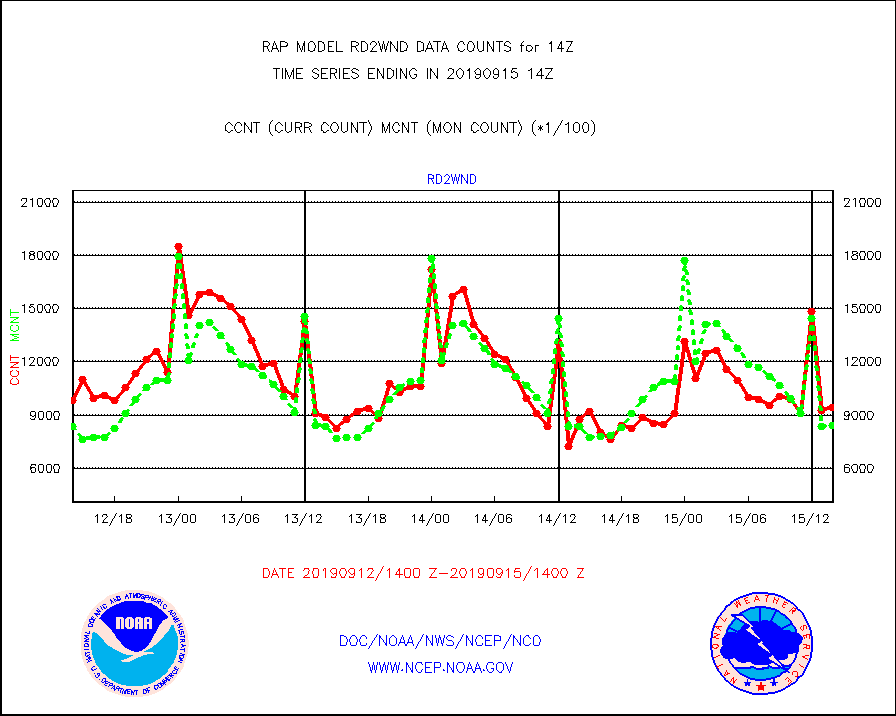
rd2wnd |
NEXRAD radial wind (Level 2 - GTS) |
941879 |
839908 |
112.1 % |
1513.50-1514.49 |
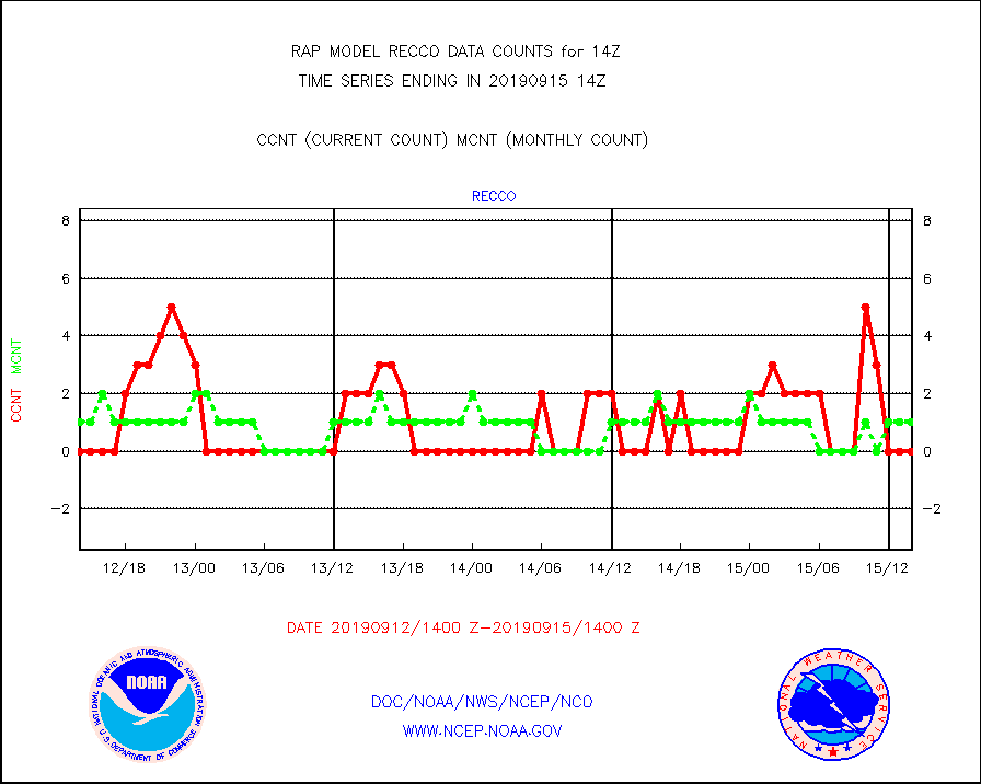
recco |
Flight level reconnaissance aircraft data |
0 |
1 |
0.0 % |
1513.00-1515.00 |
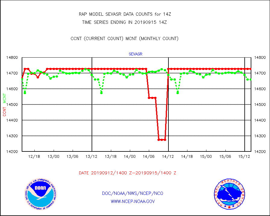
sevasr |
METEOSAT-10 2nd Gen SEVIRI All Sky Radiance(proc) |
14727 |
14660 |
100.5 % |
1512.00-1515.99 |
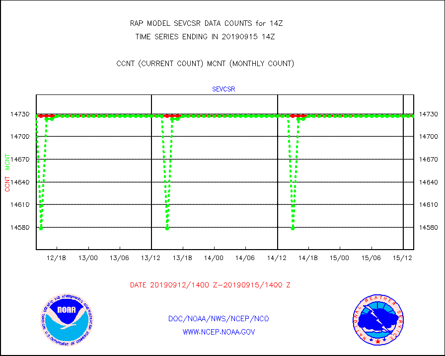
sevcsr |
METEOSAT-10 2nd Gen SEVIRI Clr Sky Radiance(proc) |
14727 |
14727 |
100.0 % |
1512.00-1515.99 |
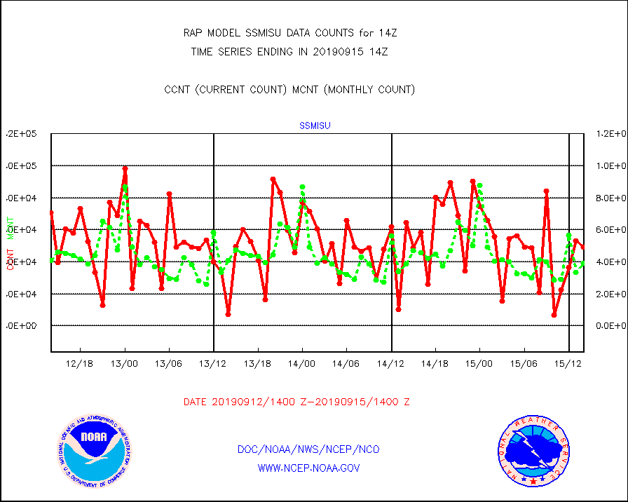
ssmisu |
DMSP SSM/IS 1C radiance data (Unified Pre-Proc.) |
49268 |
38921 |
126.6 % |
1512.00-1515.99 |
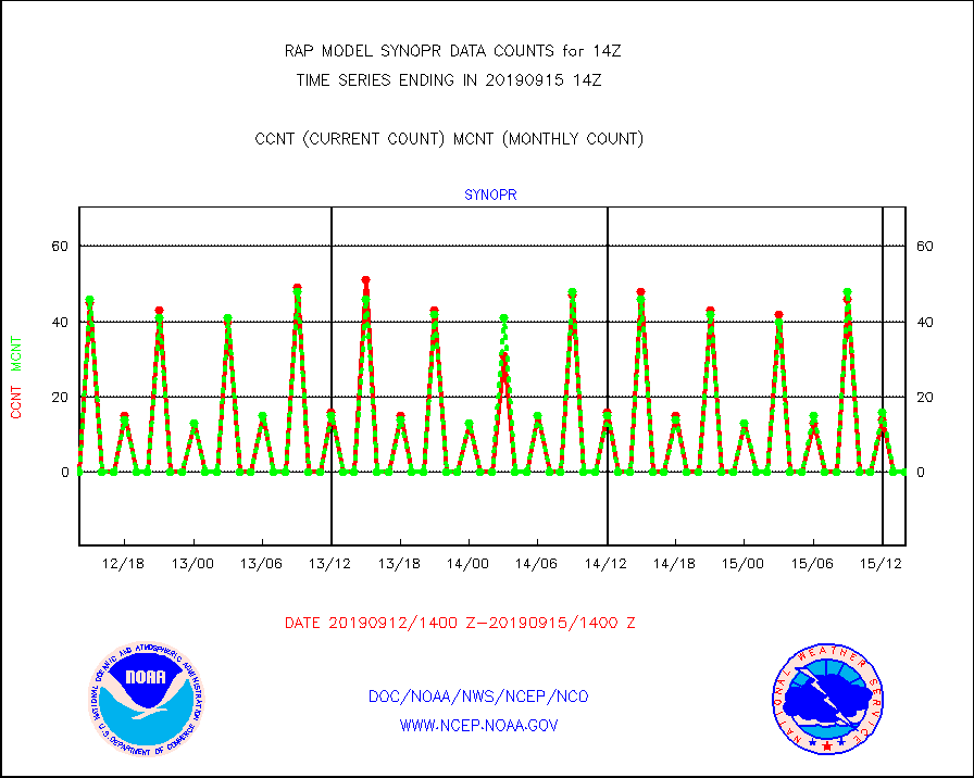
synopr |
Synoptic - restricted (WMO Res 40) manual & auto. |
0 |
0 |
n/a |
1513.50-1514.50 |
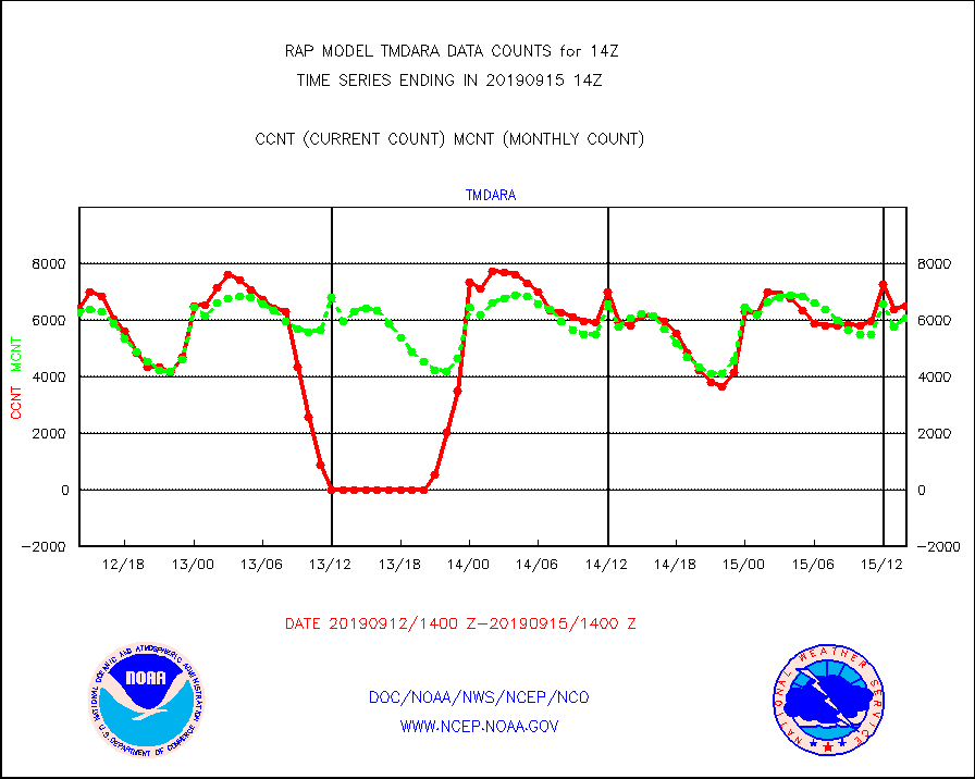
tmdara |
TAMDAR aircft data-all types(from Panasonic,BUFR) |
6499 |
6061 |
107.2 % |
1510.75-1517.25 |
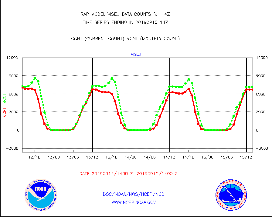
viseu |
METEOSAT/EUMETSAT visible derived cloud motion |
6742 |
7155 |
94.2 % |
1512.50-1515.49 |
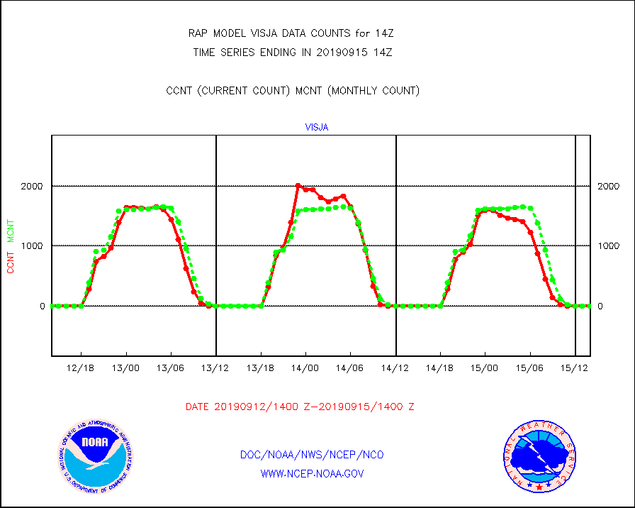
visja |
MTSAT/JMA visible derived cloud motion |
0 |
0 |
n/a |
1511.50-1516.50 |
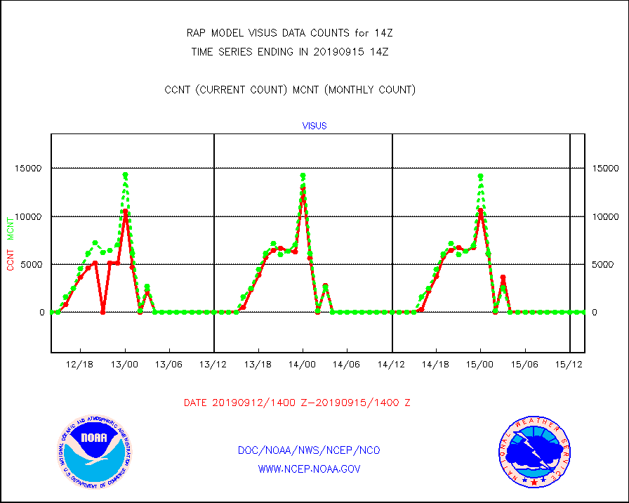
visus |
GOES/NESDIS visible derived cloud motion |
0 |
0 |
n/a |
1513.00-1513.99 |


