| Critical Data with Normal Counts |
|---|
| Type | Description | Hourly Count | Monthly Average | Percent (%) of Monthly Mean | UTC Time Window |
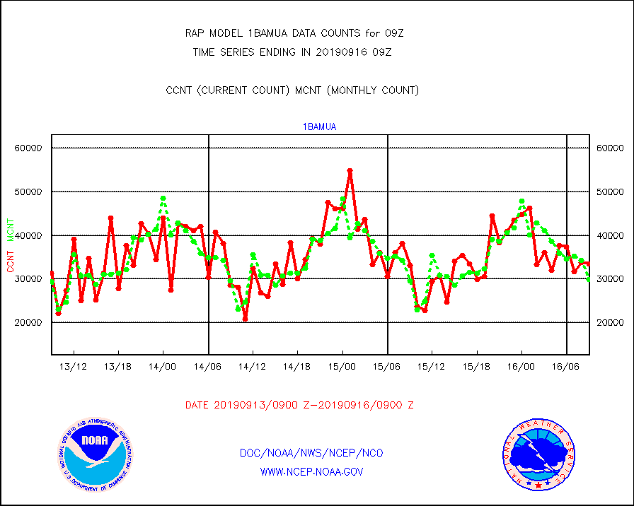
1bamua |
NOAA 15-19 & METOP 1-2 AMSU-A NCEP-proc. br.temps |
33416 |
29923 |
111.7 % |
1606.00-1611.99 |
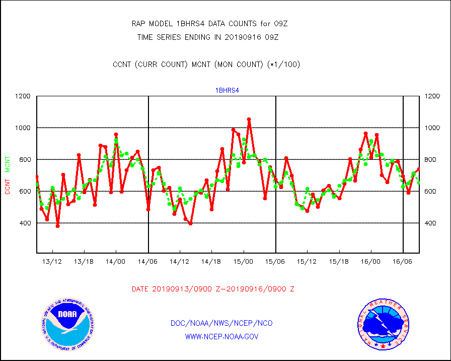
1bhrs4 |
NOAA 18-19 & METOP 1-2 HIRS-4 NCEP-proc. br.temps |
74072 |
65606 |
112.9 % |
1606.00-1611.99 |
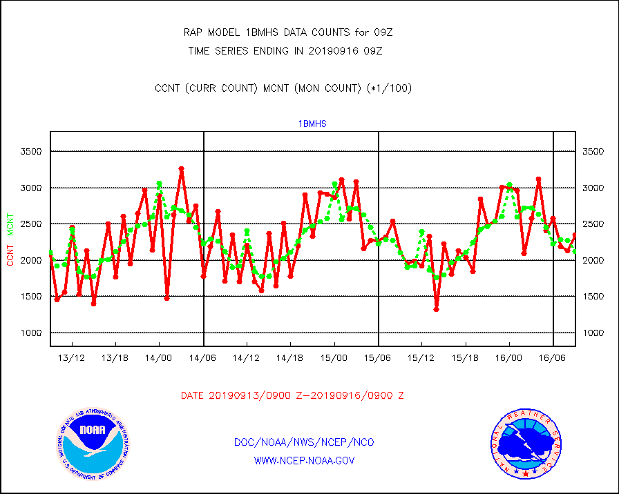
1bmhs |
NOAA 18-19 & METOP 1-2 MHS NCEP-proces. br. temps |
235005 |
211823 |
110.9 % |
1606.00-1611.99 |
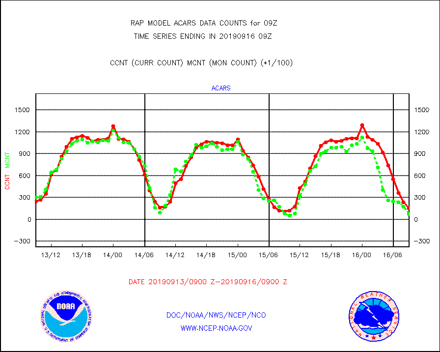
acars |
MDCRS ACARS acft data from ARINC(dcded from BUFR) |
15429 |
7155 |
215.6 % |
1605.75-1612.25 |
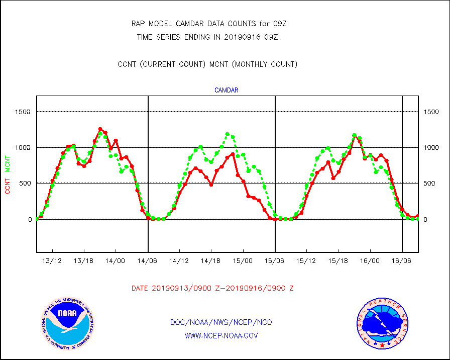
camdar |
Canadian AMDAR aircraft data (decoded from BUFR) |
48 |
5 |
960.0 % |
1605.75-1612.25 |
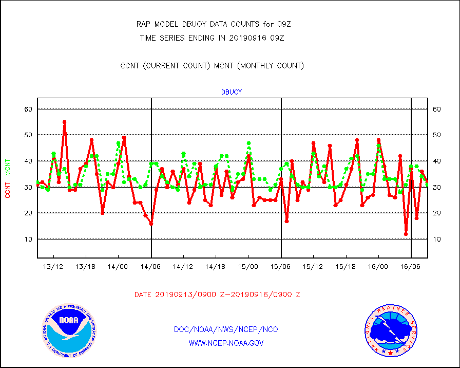
dbuoy |
Buoys decoded from FM-18 fmt (moored or drifting) |
32 |
31 |
103.2 % |
1608.50-1609.50 |
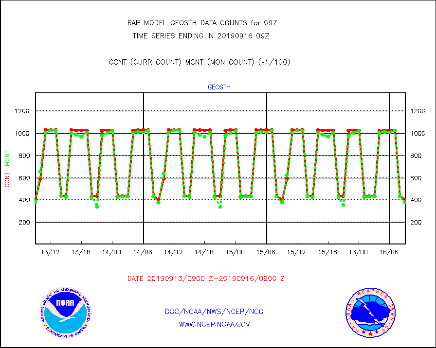
geosth |
GOES/NESDIS hi-resol. (1x1 f-o-v) cloud data |
40570 |
38031 |
106.7 % |
1607.75-1608.99 |
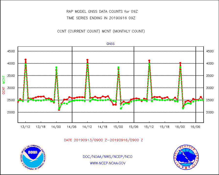
gnss |
Grnd-based Gbl Navigation Sat System (GNSS) data |
2472 |
2499 |
98.9 % |
1607.95-1608.05 |
h20mo |
MODIS (AQUA/TERRA) wvpr imager derived cld motion |
0 |
0 |
n/a |
1606.50-1611.50 |
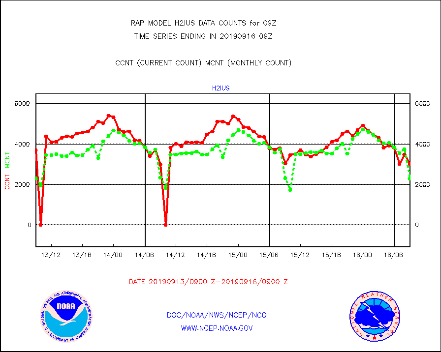
h2ius |
GOES/NESDIS water vapor imager derived cld motion |
3021 |
2296 |
131.6 % |
1608.00-1608.99 |
infmo |
MODIS (AQUA/TERRA) ir l-wave derived cloud motion |
0 |
0 |
n/a |
1606.50-1611.50 |
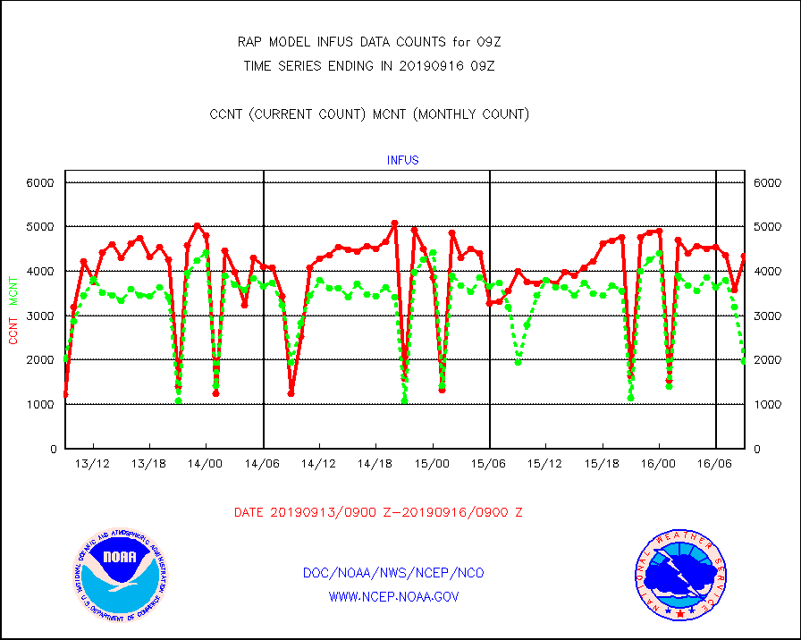
infus |
GOES/NESDIS infrared lg-wave derived cloud motion |
4344 |
1970 |
220.5 % |
1608.00-1608.99 |
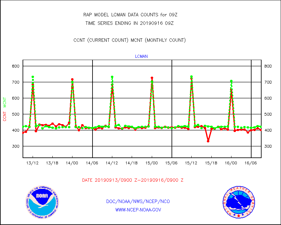
lcman |
Land-based CMAN stations decoded from CMAN format |
401 |
421 |
95.2 % |
1608.50-1609.50 |
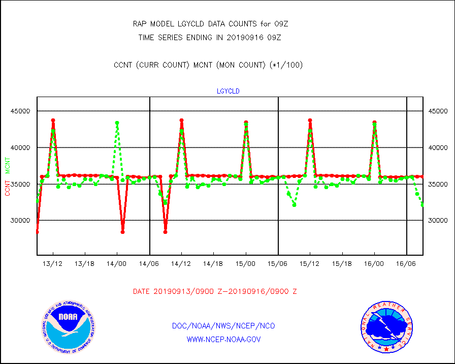
lgycld |
GOES/NASA(Langley) hi-res. (1x1 f-o-v) cloud data |
3604753 |
3214125 |
112.2 % |
1608.50-1609.50 |
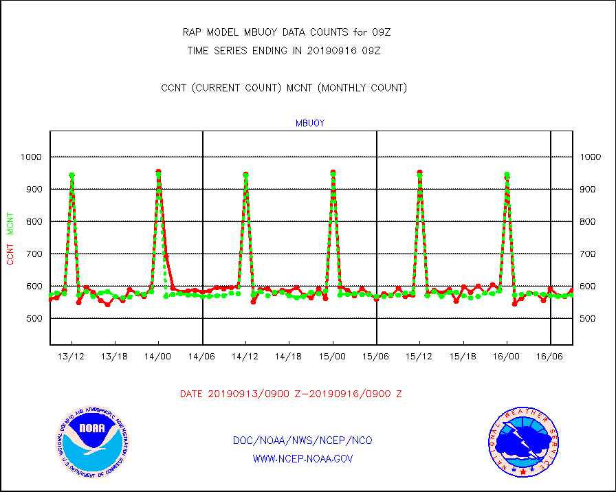
mbuoy |
Buoys decoded from FM-13 format (moored) |
587 |
573 |
102.4 % |
1608.50-1609.50 |
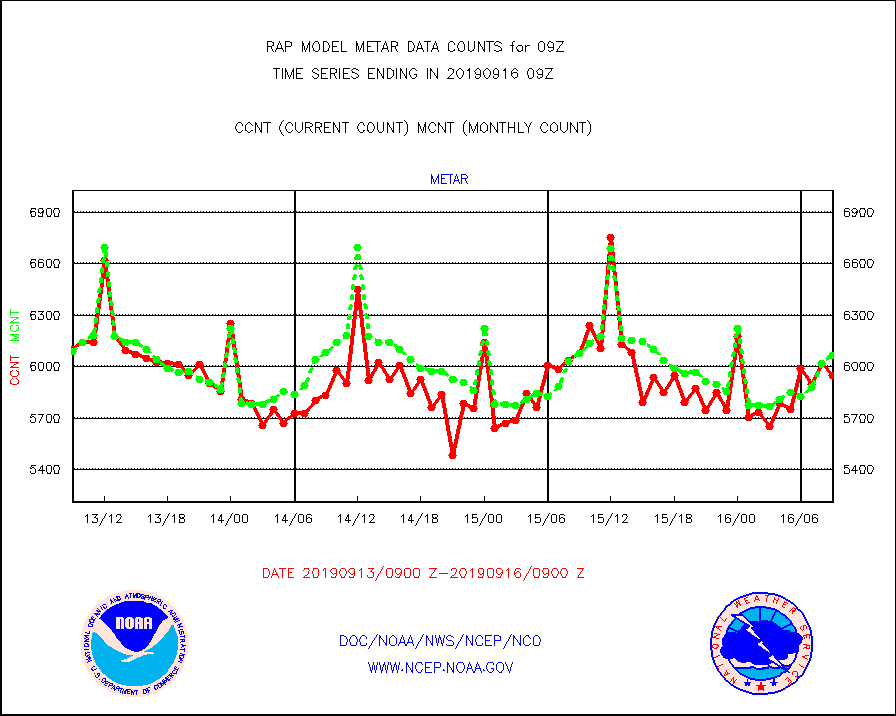
metar |
Aviation - METAR |
5950 |
6066 |
98.1 % |
1608.50-1609.50 |
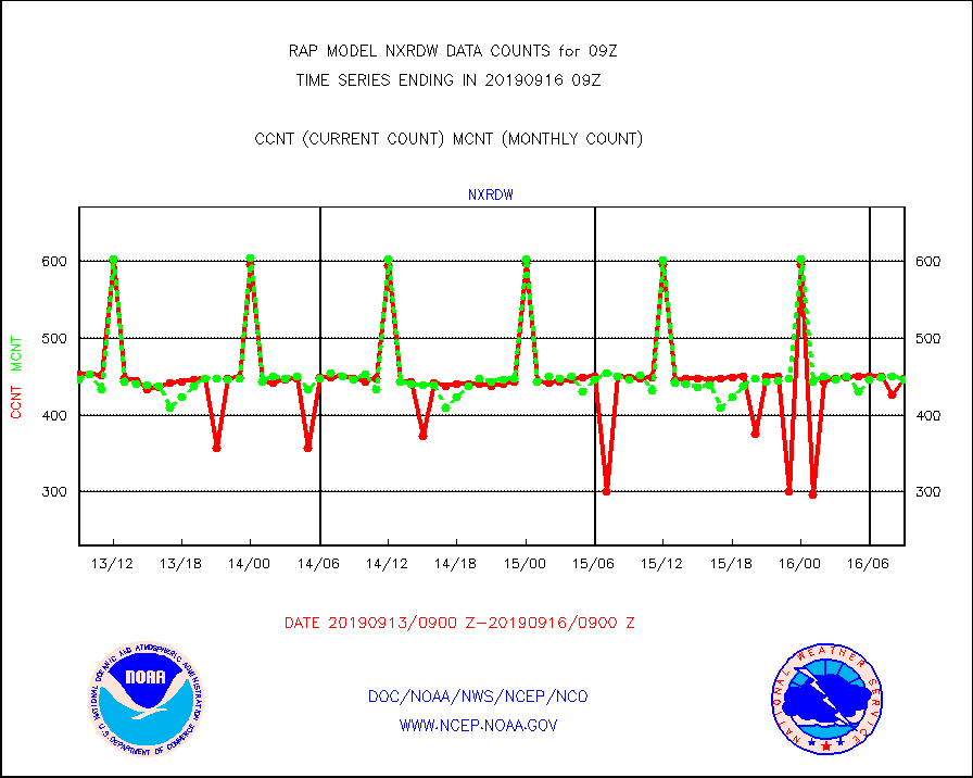
nxrdw |
NEXRAD Vel Azm Dsp(VAD) winds via radar coded msg |
448 |
446 |
100.4 % |
1608.00-1610.00 |
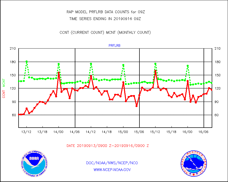
prflrb |
Multi-Agency Profiler (MAP) and SODAR winds |
117 |
132 |
88.6 % |
1607.50-1610.50 |
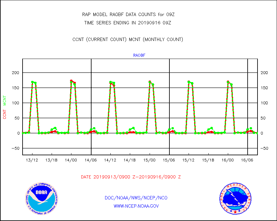
raobf |
Rawinsonde - fixed land (from TEMP or PILOT) |
0 |
0 |
n/a |
1608.00-1610.00 |
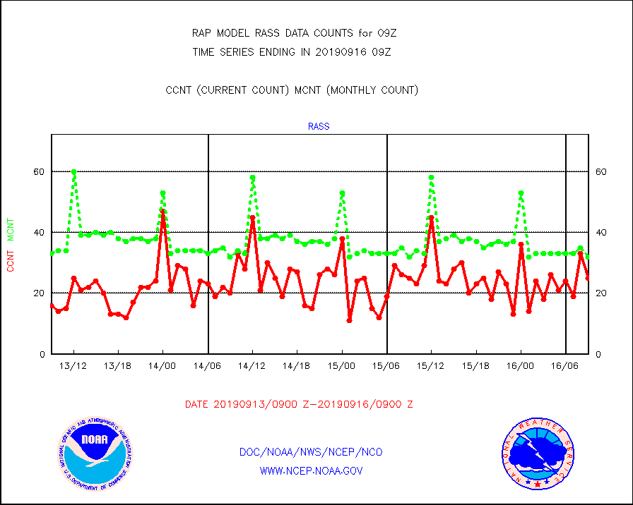
rass |
RASS temperatures (NOAA and Multi-Agency) |
25 |
32 |
78.1 % |
1608.50-1609.50 |
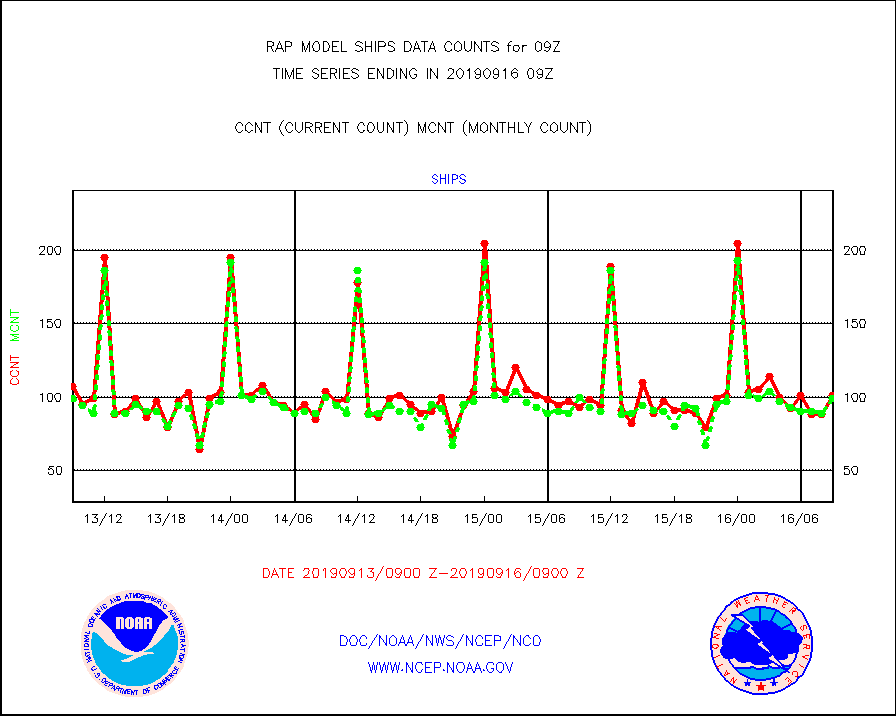
ships |
Ship - manual and automatic, restricted |
101 |
99 |
102.0 % |
1608.50-1609.50 |
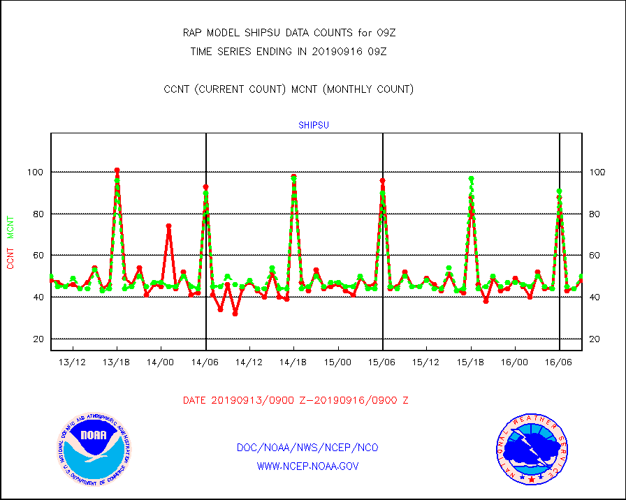
shipsu |
Ship - manual and automatic, unrestricted |
48 |
50 |
96.0 % |
1608.50-1609.50 |
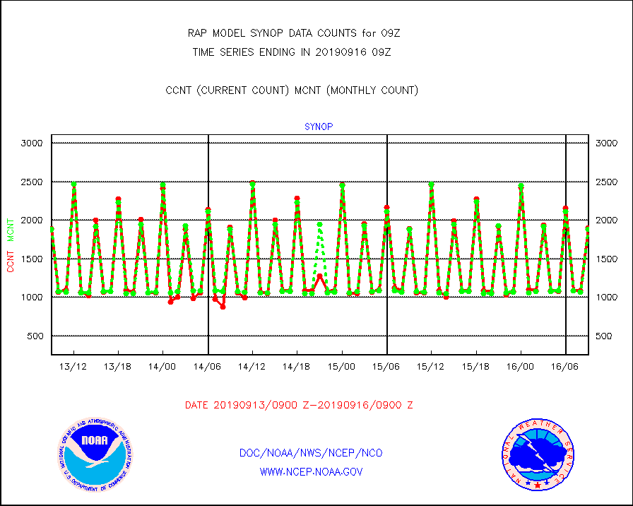
synop |
Synoptic - fixed manual and automatic |
1905 |
1885 |
101.1 % |
1608.50-1609.50 |
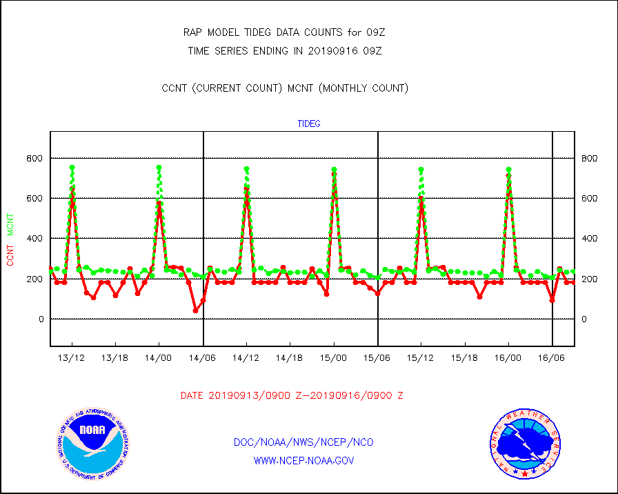
tideg |
Tide gauge reports decoded from CREX format |
184 |
237 |
77.6 % |
1608.50-1609.50 |
| Data Types of Opportunity with Normal Counts |
|---|
| Type | Description | Hourly Count | Monthly Average | Percent (%) of Monthly Mean | UTC Time Window |
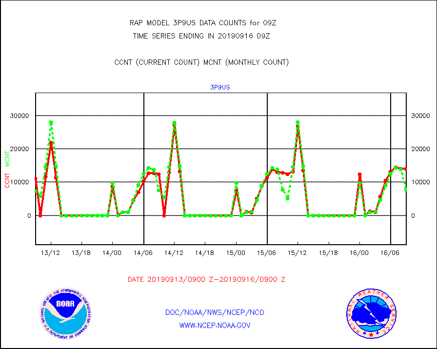
3p9us |
GOES/NESDIS infrared shrt-wave derived cld motion |
13985 |
7802 |
179.2 % |
1608.00-1608.99 |
acarsa |
MDCRS ACARS acft data (ARINC via AFWA)(AIREP fmt) |
0 |
0 |
n/a |
1605.75-1612.25 |
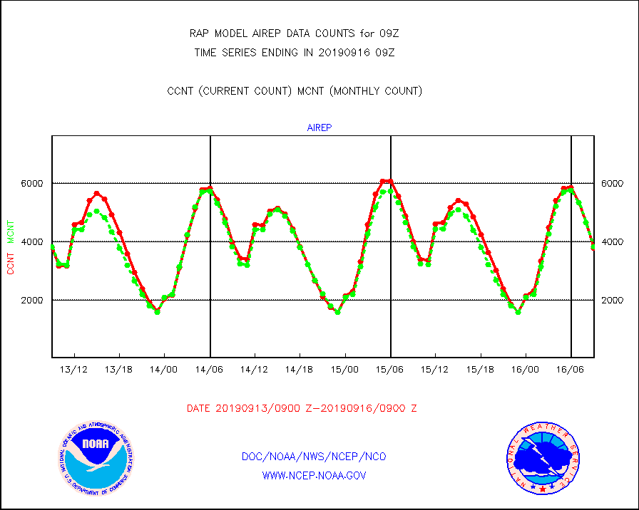
airep |
Manual AIREP aircraft data (dcded from AIREP fmt) |
3781 |
3829 |
98.7 % |
1605.75-1612.25 |
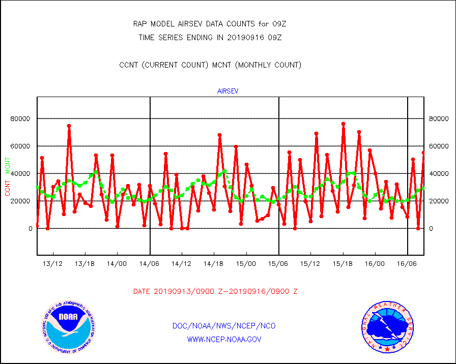
airsev |
AQUA AIRS/AMSU-A/HSB brightness temps- every FOV |
55108 |
29093 |
189.4 % |
1606.00-1611.99 |
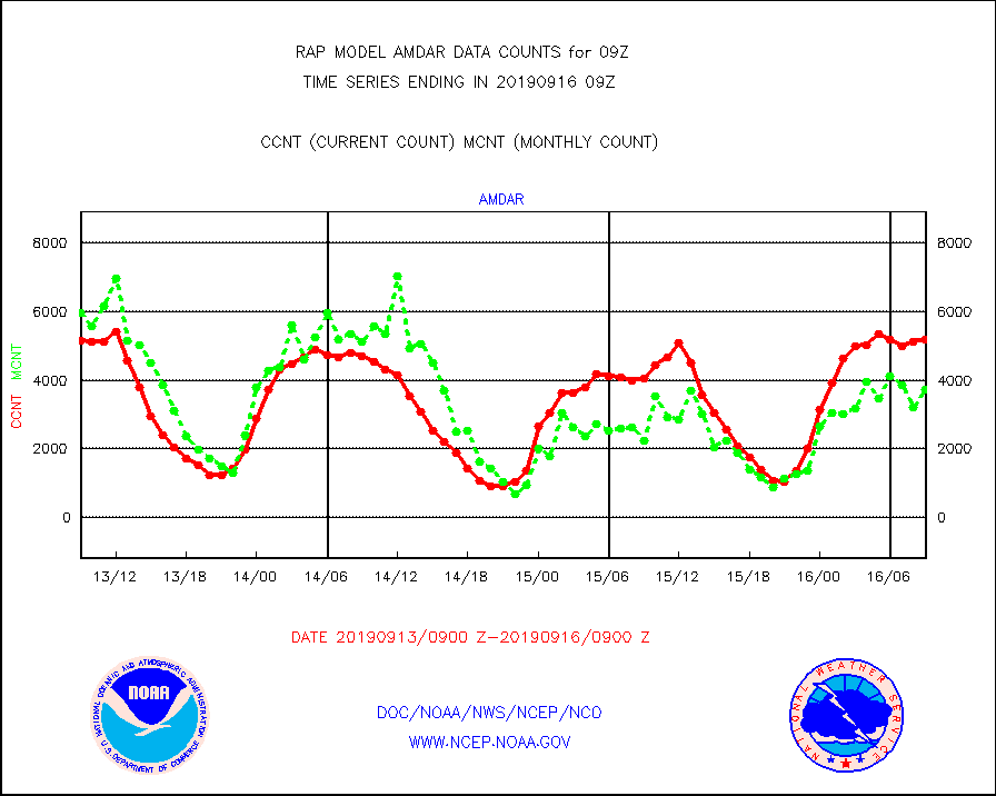
amdar |
AMDAR aircraft data (decoded from AMDAR format) |
5186 |
3717 |
139.5 % |
1605.75-1612.25 |
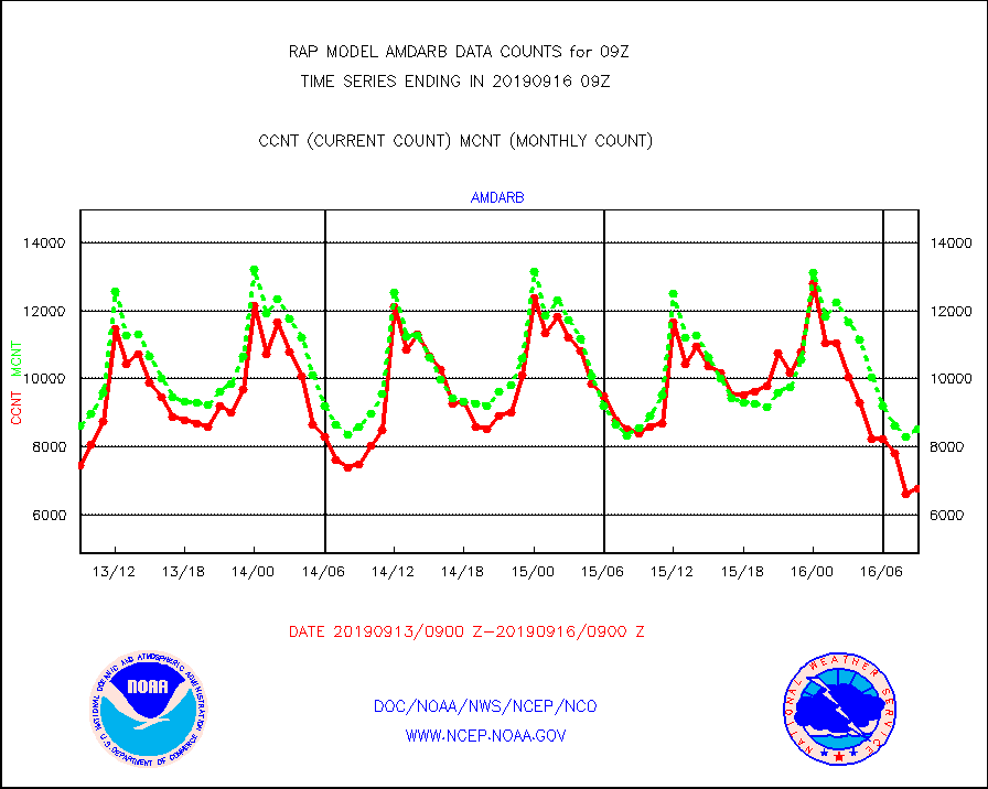
amdarb |
AMDAR aircraft data (decoded from BUFR) |
6762 |
8509 |
79.5 % |
1605.75-1612.25 |
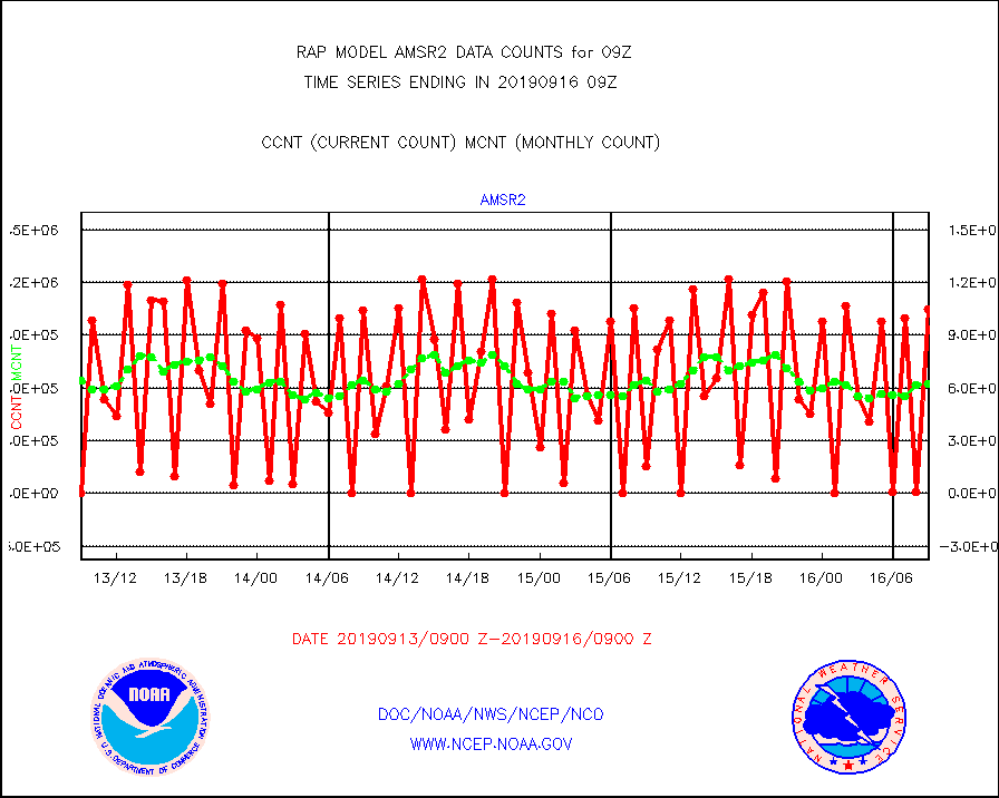
amsr2 |
GCOM-W AMSR2 1B brightness temperatures |
1046599 |
624186 |
167.7 % |
1606.00-1606.99 |
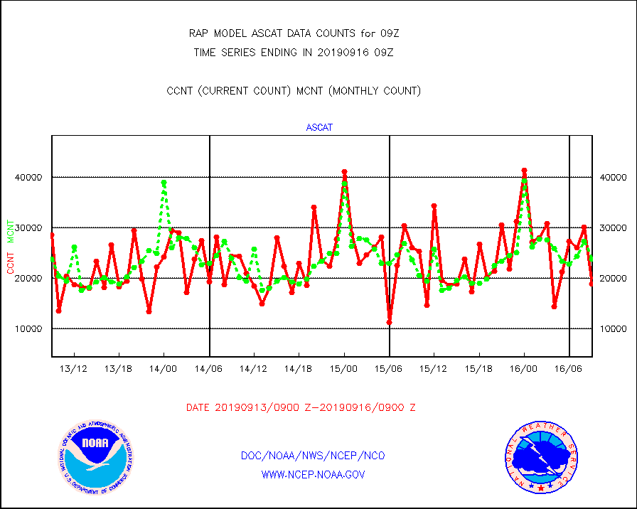
ascat |
METOP 1-2 ASCAT products |
18821 |
23760 |
79.2 % |
1607.00-1611.00 |
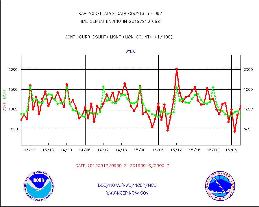
atms |
NPP Adv. Tech. Microwave Sounder (ATMS) br. temps |
107981 |
85575 |
126.2 % |
1607.00-1610.99 |
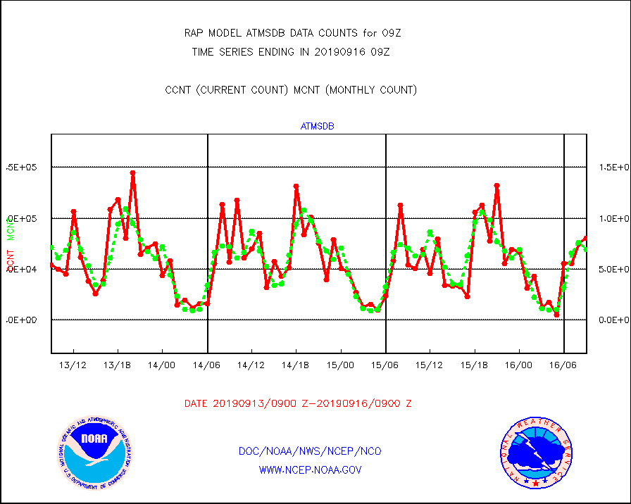
atmsdb |
NPP Adv Tech MW Sndr(ATMS) b. temps-dir bcst SSEC |
80652 |
68993 |
116.9 % |
1607.00-1610.99 |
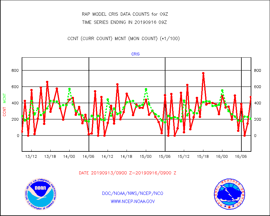
cris |
NPP Cross-track Infrared Sounder (CrIS) radiances |
47435 |
21183 |
223.9 % |
1607.00-1610.99 |
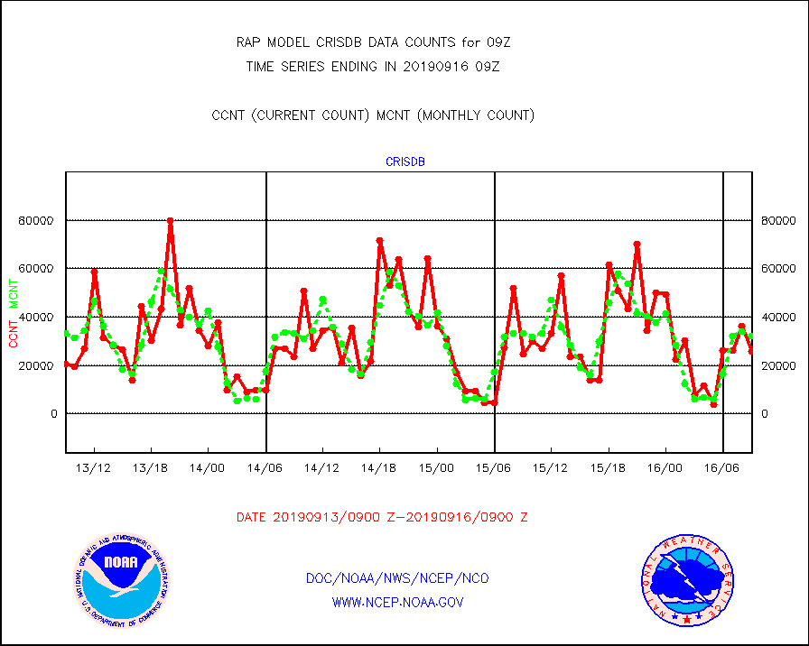
crisdb |
NPP Crss-trk IR Sndr(CrIS) radiance-dir bcst SSEC |
25920 |
32204 |
80.5 % |
1607.00-1610.99 |
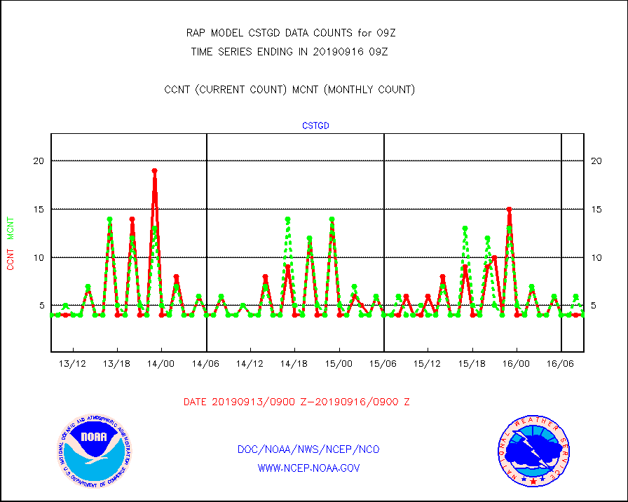
cstgd |
Coast Guard |
4 |
4 |
100.0 % |
1608.50-1609.50 |
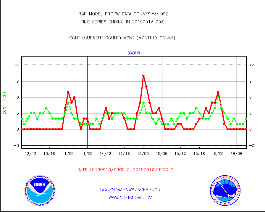
dropw |
Dropwinsonde (from TEMP DROP) |
0 |
2 |
0.0 % |
1608.00-1610.00 |
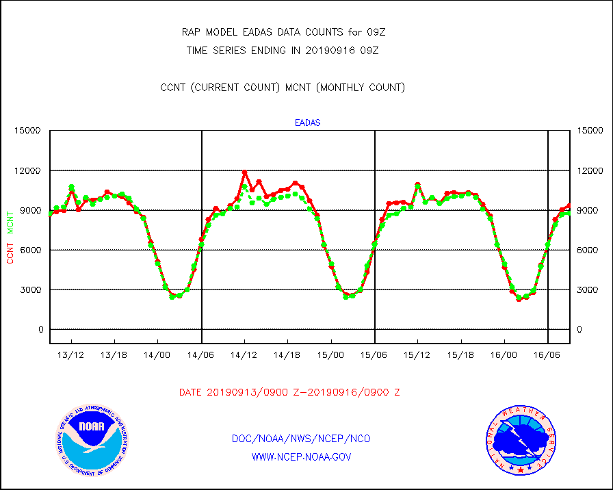
eadas |
E-AMDAR (European AMDAR acft decoded from BUFR) |
9355 |
8753 |
106.9 % |
1605.75-1612.25 |
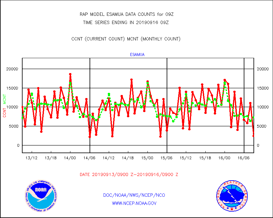
esamua |
NOAA 15-19 & METOP 1-2 AMSU-A proc btmps frm RARS |
2478 |
7308 |
33.9 % |
1608.00-1610.00 |
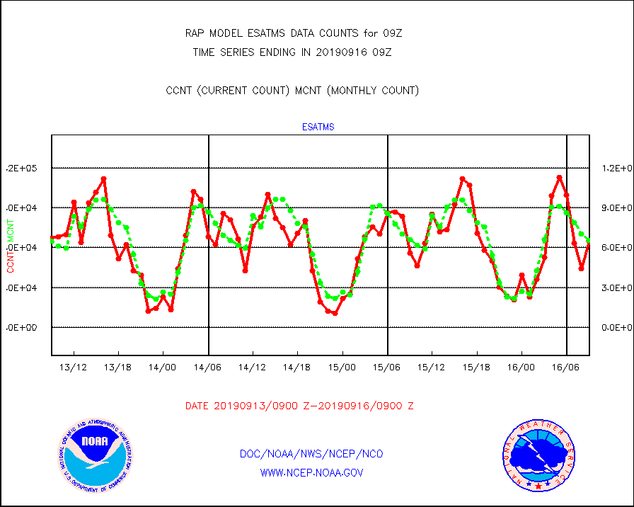
esatms |
NPP Adv. Tech. MW Sndr (ATMS) br. temps from RARS |
65232 |
65420 |
99.7 % |
1607.00-1610.99 |
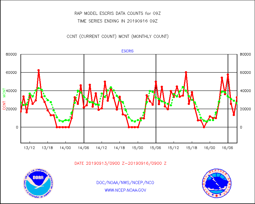
escris |
NPP Crss-track IR Sndr (CrIS) radiances from RARS |
32729 |
26337 |
124.3 % |
1607.00-1610.99 |
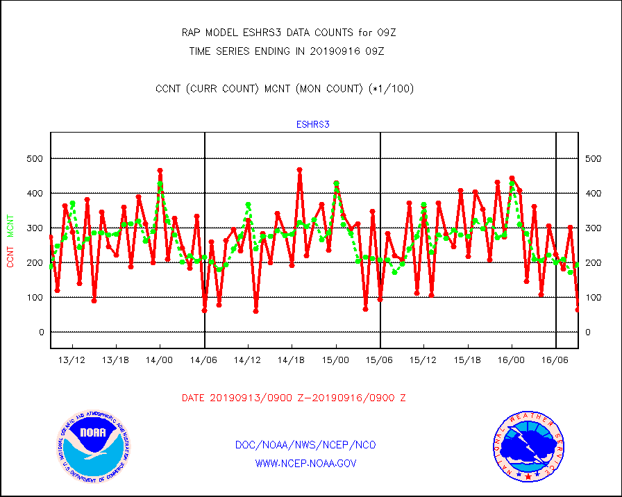
eshrs3 |
NOAA 15-19 & METOP 1-2 HIRS-3/4 pr btmps frm RARS |
6320 |
19309 |
32.7 % |
1608.00-1610.00 |
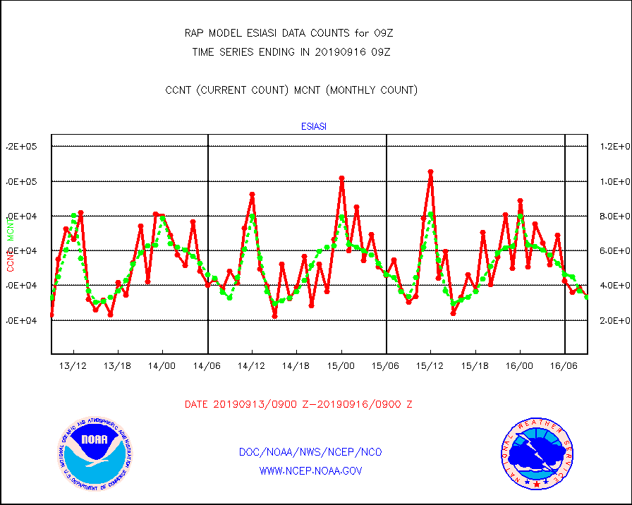
esiasi |
METOP 1-2 IASI 1C radiance data vbl chn from RARS |
33486 |
33093 |
101.2 % |
1607.00-1610.99 |
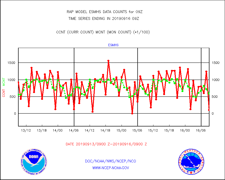
esmhs |
NOAA 18-19 & METOP 1-2 MHS proc. btemps from RARS |
11029 |
58683 |
18.8 % |
1608.00-1610.00 |
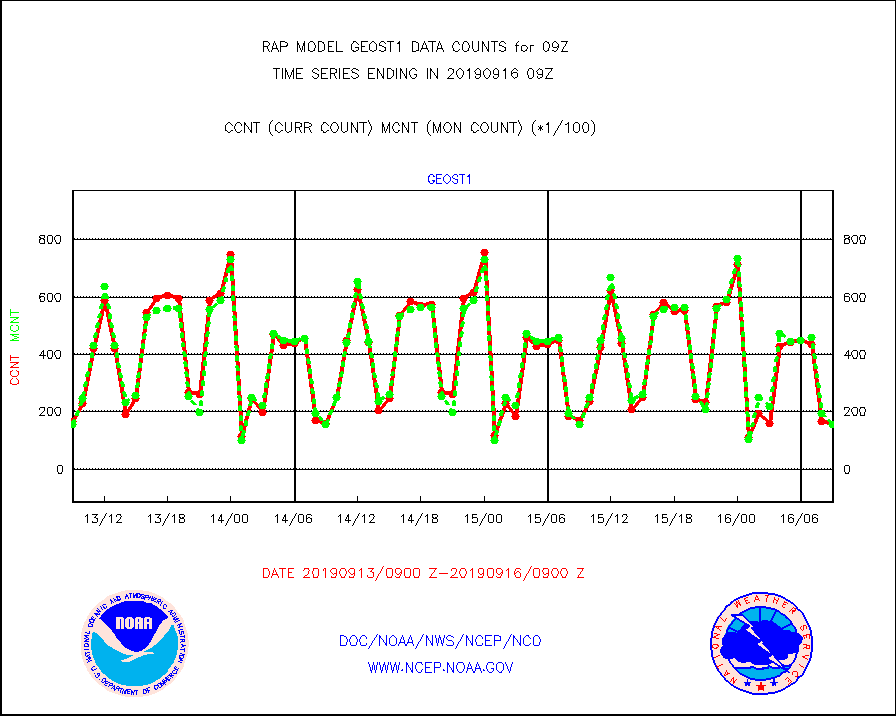
geost1 |
GOES/NESDIS hi-resol. (1x1 f-o-v) sndgs/radiances |
15523 |
15740 |
98.6 % |
1608.00-1610.00 |
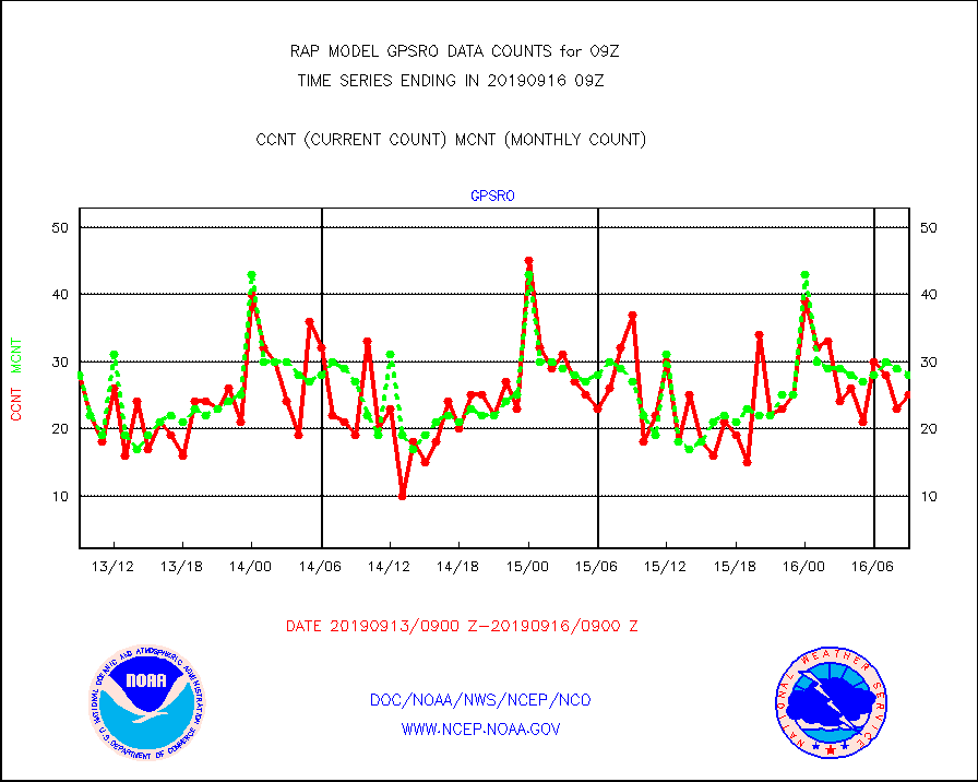
gpsro |
GPS radio occultation data |
25 |
28 |
89.3 % |
1607.00-1610.99 |
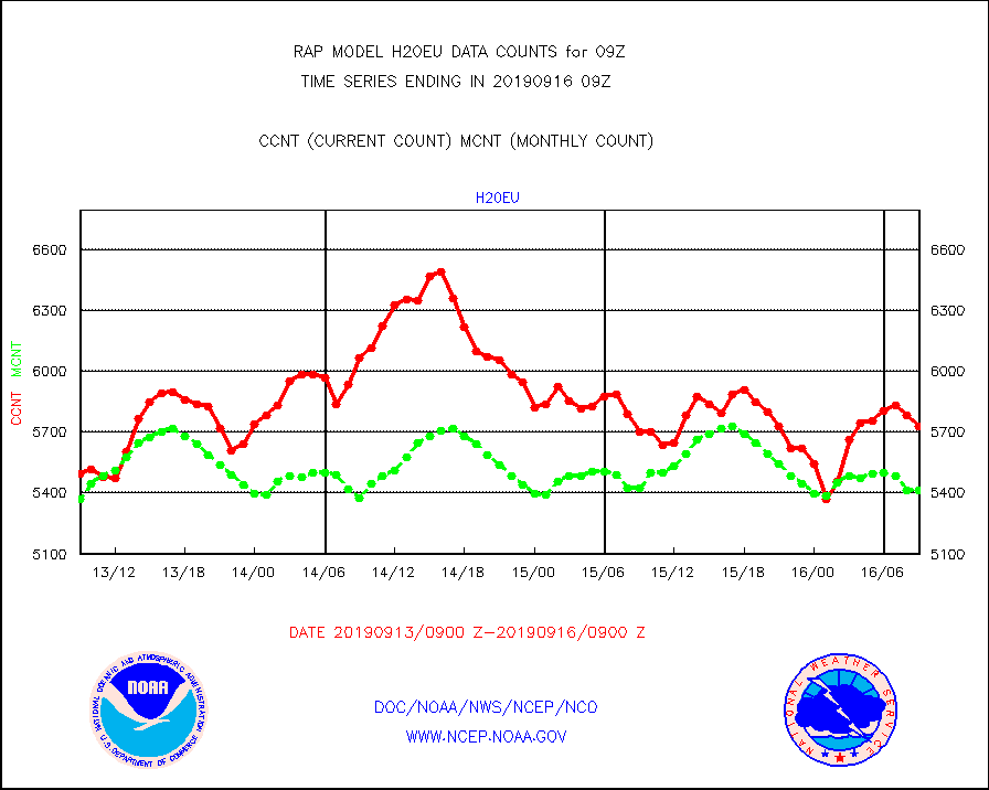
h20eu |
METEOSAT/EUMETSAT wvpr imager derived cld motion |
5731 |
5412 |
105.9 % |
1607.50-1610.49 |
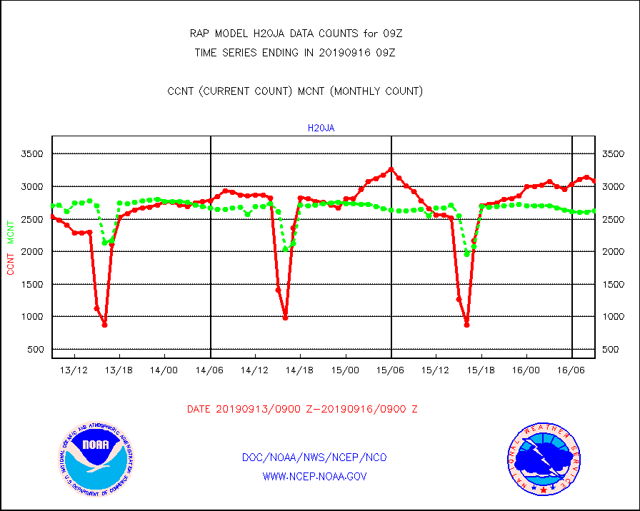
h20ja |
MTSAT/JMA water vapor imager derived cloud motion |
3091 |
2622 |
117.9 % |
1606.50-1611.50 |
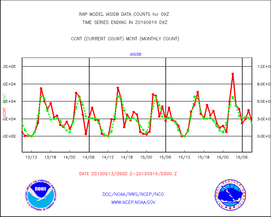
iasidb |
METOP 1-2 IASI 1C radiances-direct broadcast SSEC |
23911 |
23500 |
101.7 % |
1607.00-1610.99 |
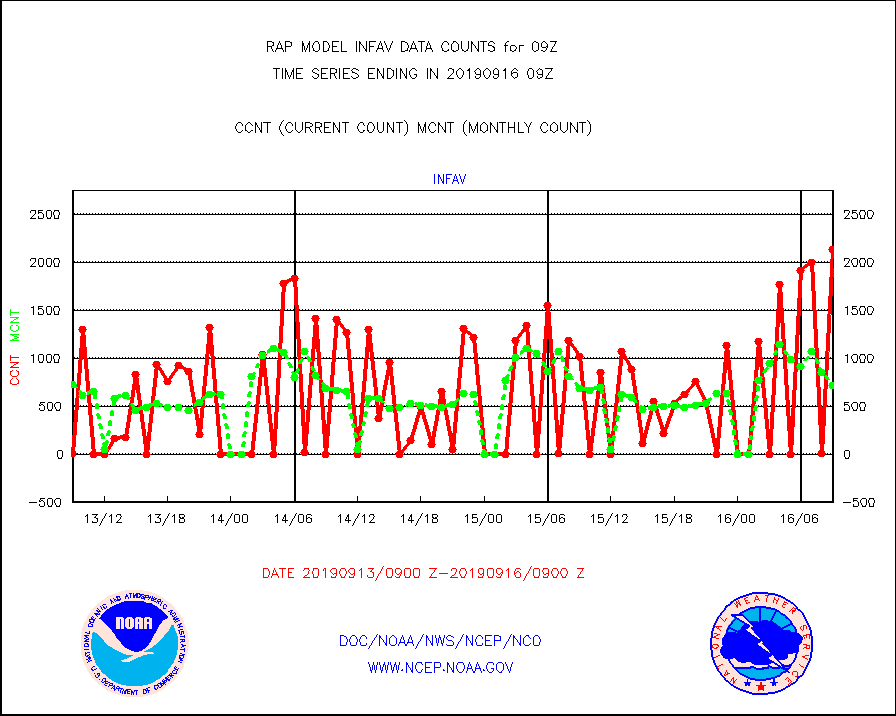
infav |
AVHRR (NOAA/METOP) ir lg-wave derived cld motion |
2131 |
718 |
296.8 % |
1606.50-1611.50 |
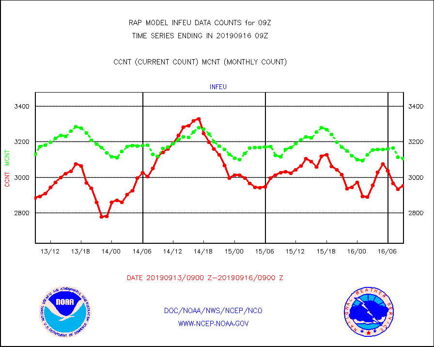
infeu |
METEOSAT/EUMETSAT ir lg-wave derived cloud motion |
2952 |
3106 |
95.0 % |
1607.50-1610.49 |
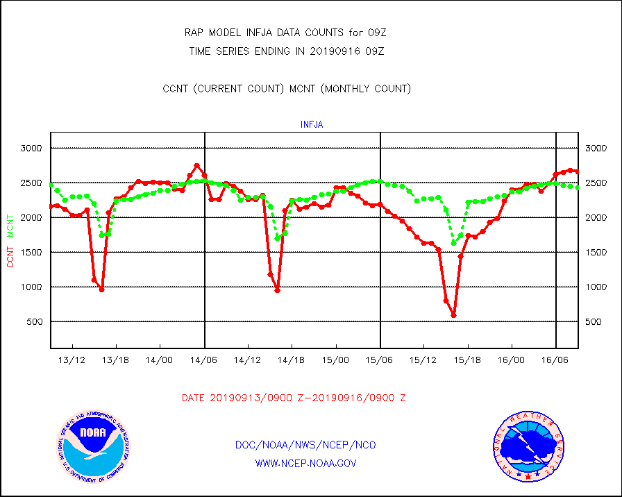
infja |
MTSAT/JMA infrared long-wave derived cloud motion |
2664 |
2425 |
109.9 % |
1606.50-1611.50 |
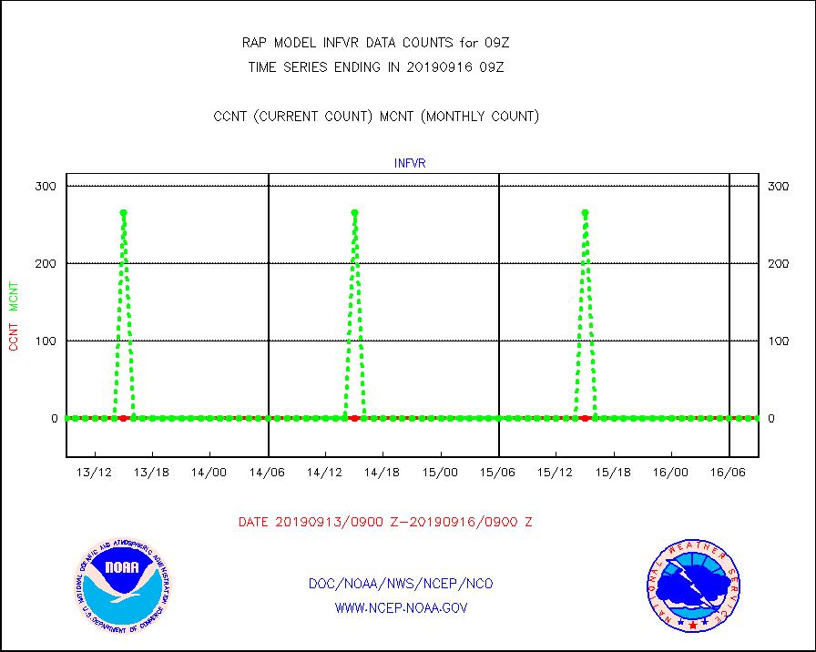
infvr |
VIIRS (NPP) infrared lg-wave derived cloud motion |
0 |
0 |
n/a |
1606.50-1611.50 |
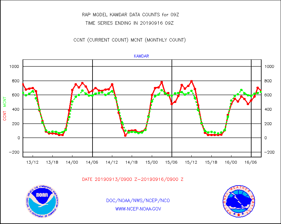
kamdar |
Korean AMDAR aircraft data (decoded from BUFR) |
657 |
644 |
102.0 % |
1605.75-1612.25 |
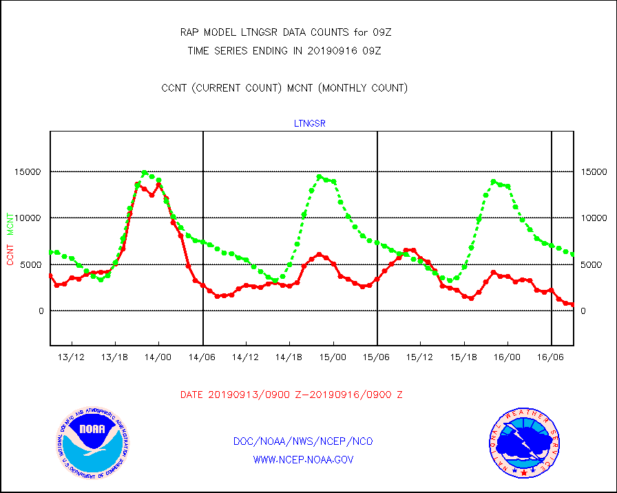
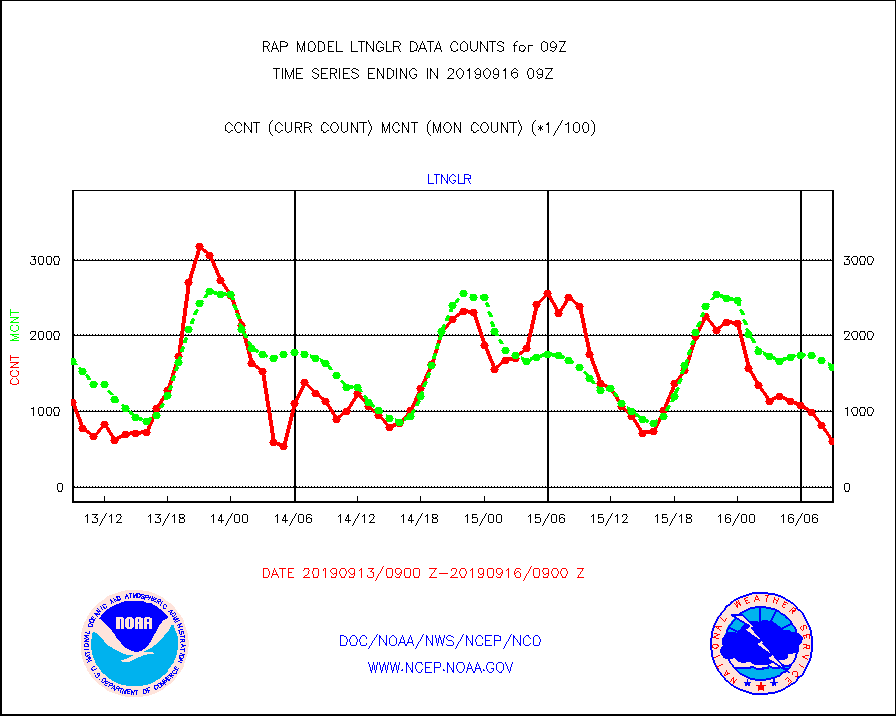
ltnglr |
LLDN Long-rng lightning from Vaisala via NOAAPORT |
60978 |
158793 |
38.4 % |
1608.00-1609.50 |
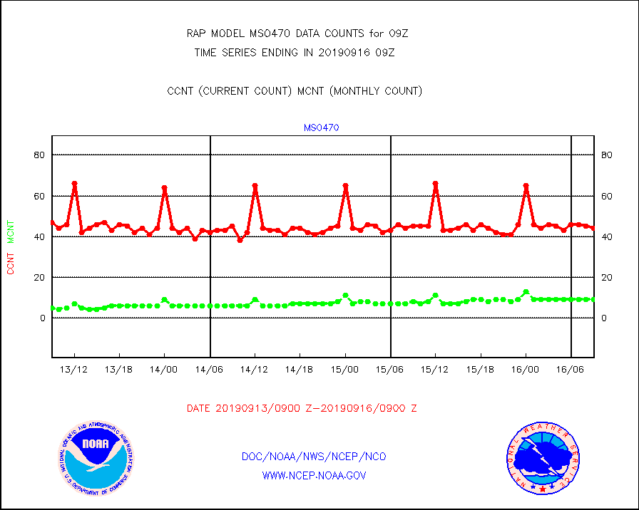
mso470 |
Mesonet/MADIS Colorado E-470 (Interstate 470) |
44 |
9 |
488.9 % |
1608.50-1609.50 |
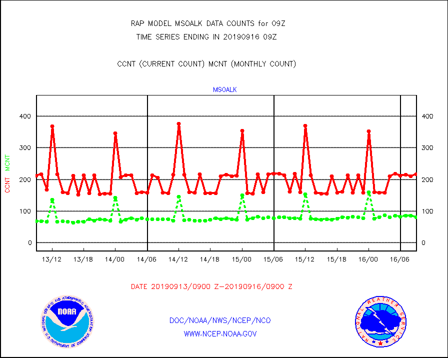
msoalk |
Mesonet/MADIS Alaska Department of Transportation |
217 |
80 |
271.2 % |
1608.50-1609.50 |
msoapg |
Mesonet/MADIS U.S. Army Aberdeen Proving Grounds |
0 |
0 |
n/a |
1608.50-1609.50 |
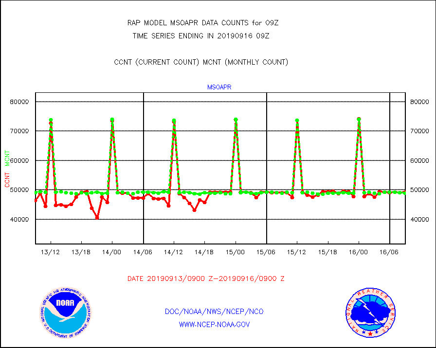
msoapr |
Mesonet/MADIS Citizen Weather Observers Program |
49228 |
48874 |
100.7 % |
1608.50-1609.50 |
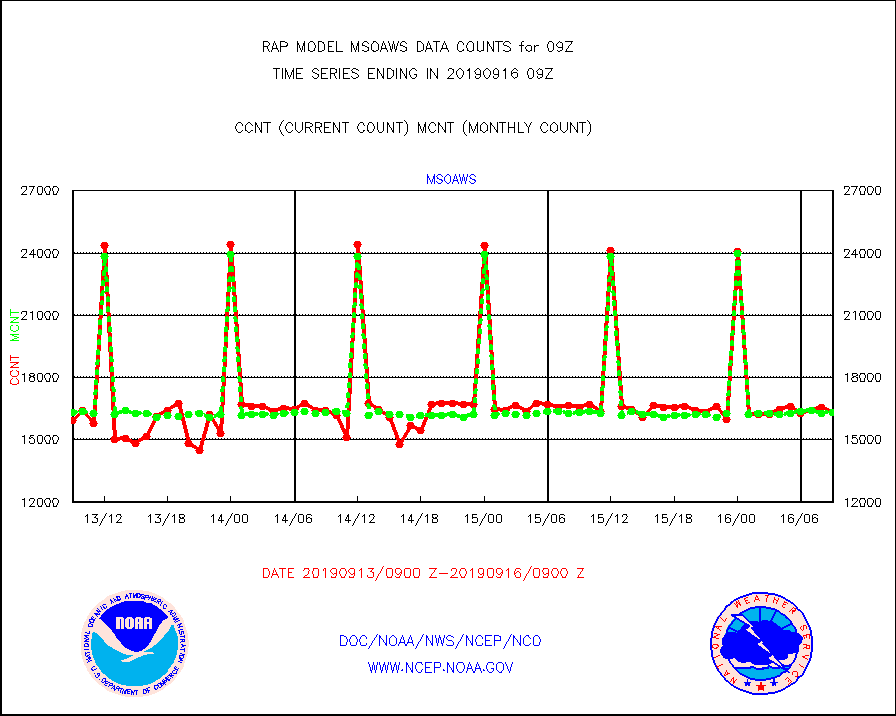
msoaws |
Mesonet/MADIS AWS Convergence Technologies, Inc. |
16305 |
16307 |
100.0 % |
1608.50-1609.50 |
msoawx |
Mesonet/MADIS "Anything Weather" |
0 |
0 |
n/a |
1608.50-1609.50 |
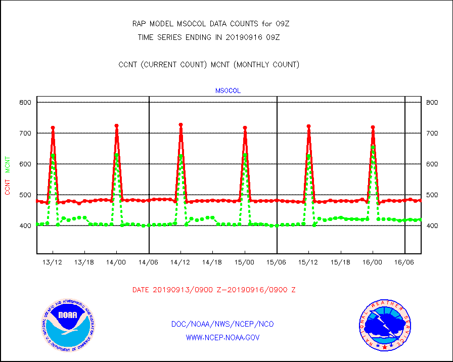
msocol |
Mesonet/MADIS Colorado Dept. of Transportation |
481 |
419 |
114.8 % |
1608.50-1609.50 |
msodcn |
Mesonet/MADIS DC Net |
0 |
0 |
n/a |
1608.50-1609.50 |
msoden |
Mesonet/MADIS Denver Urban Drainage & Flood Cntrl |
0 |
0 |
n/a |
1608.50-1609.50 |
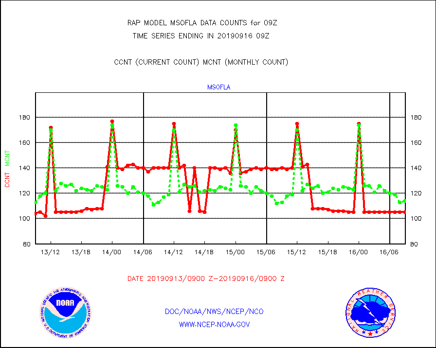
msofla |
Mesonet/MADIS Florida (FAWN & USF) |
105 |
114 |
92.1 % |
1608.50-1609.50 |
msoflt |
Mesonet/MADIS Florida Dept. of Transportation |
0 |
0 |
n/a |
1608.50-1609.50 |
msogeo |
Mesonet/MADIS Georgia Dept. of Transportation |
255 |
50 |
510.0 % |
1608.50-1609.50 |
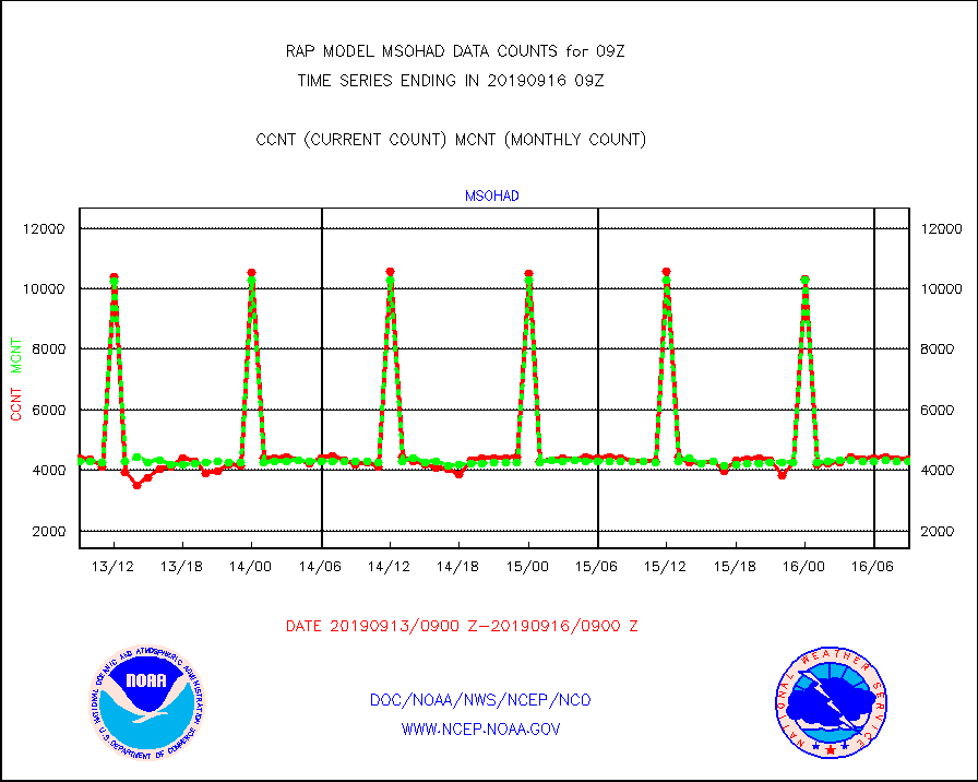
msohad |
Mesonet/MADIS NWS Hydromet Auto Data System(HADS) |
4371 |
4293 |
101.8 % |
1608.50-1609.50 |
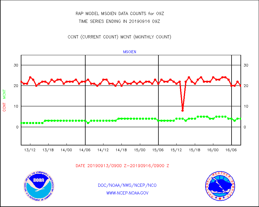
msoien |
Mesonet/MADIS Iowa Environmental |
20 |
4 |
500.0 % |
1608.50-1609.50 |
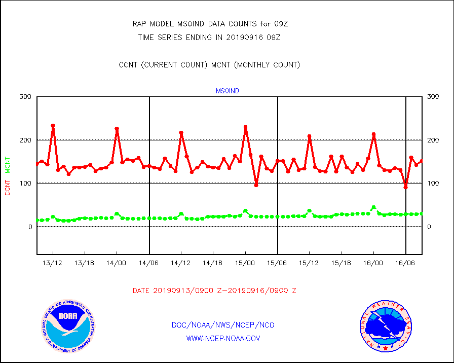
msoind |
Mesonet/MADIS Indiana Dept. of Transportation |
152 |
30 |
506.7 % |
1608.50-1609.50 |
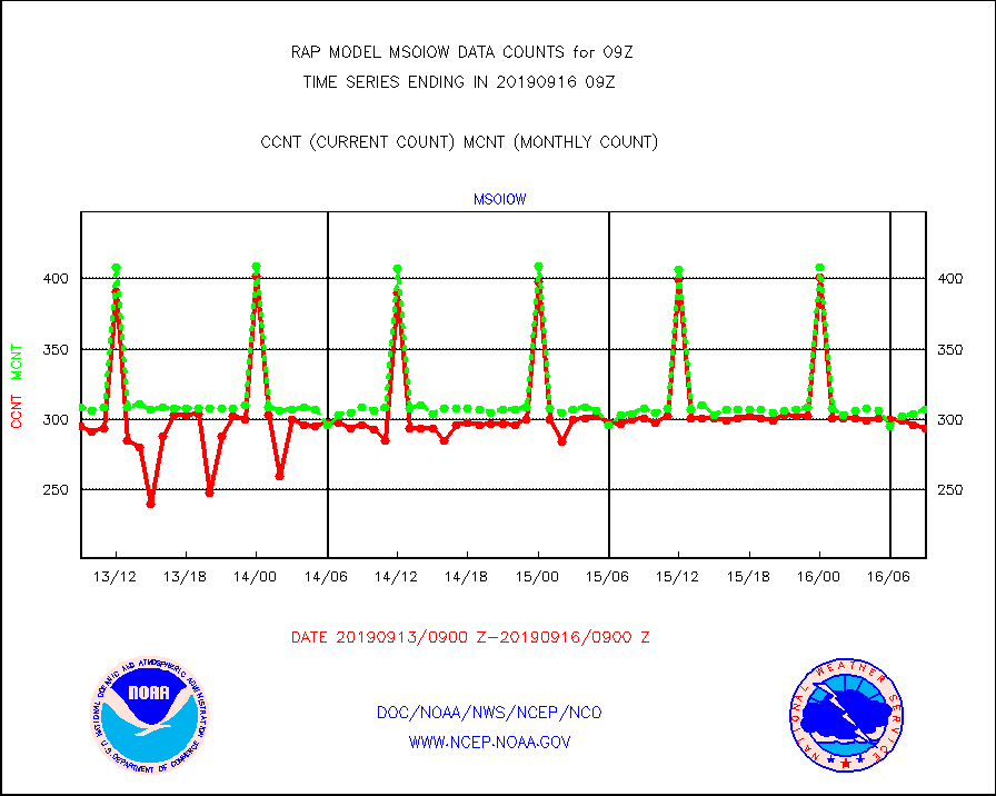
msoiow |
Mesonet/MADIS Iowa Department of Transportation |
294 |
307 |
95.8 % |
1608.50-1609.50 |
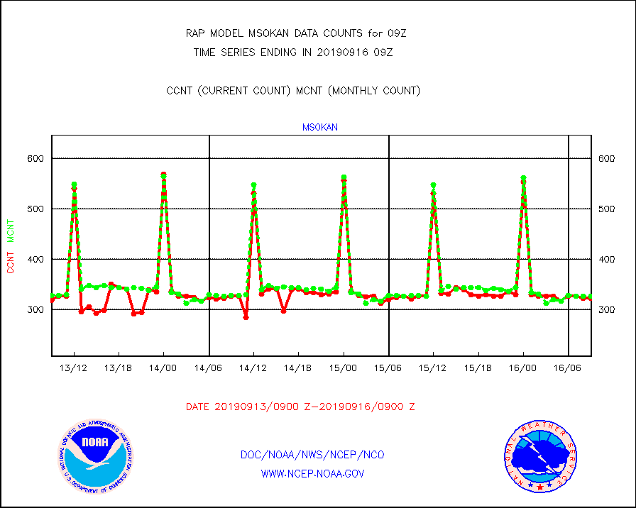
msokan |
Mesonet/MADIS Kansas Department of Transportation |
323 |
327 |
98.8 % |
1608.50-1609.50 |
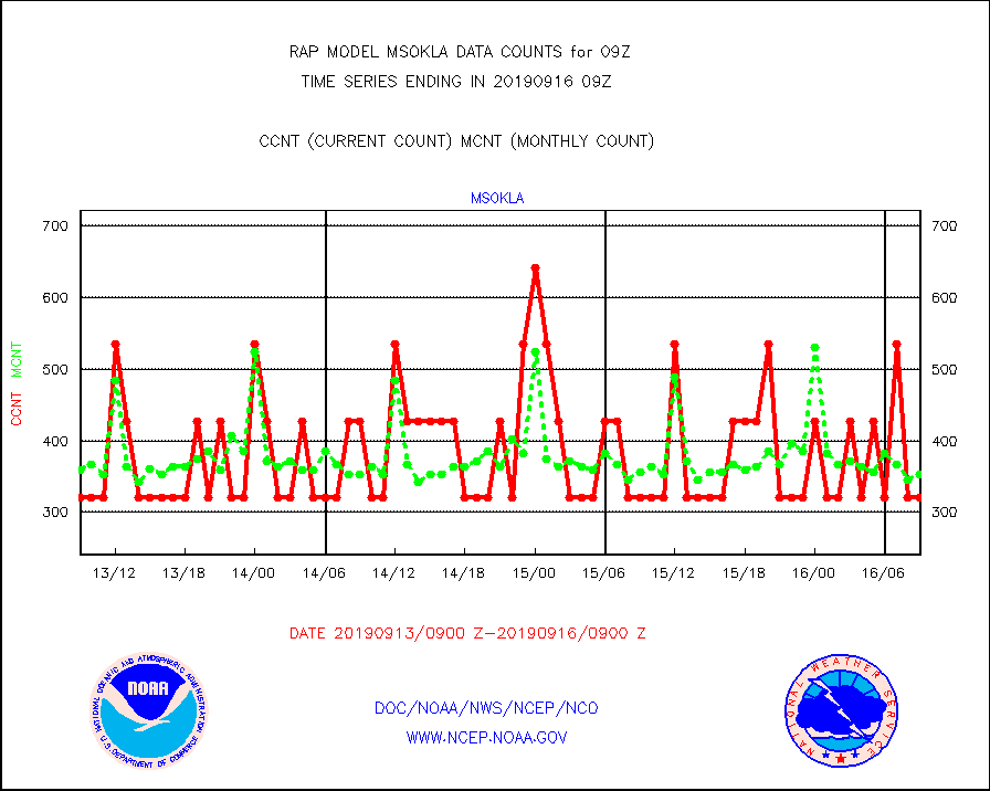
msokla |
Mesonet/MADIS Oklahoma Mesonet |
321 |
353 |
90.9 % |
1608.50-1609.50 |
msolju |
Mesonet/MADIS Louisiana State/Jackson State Univ. |
0 |
0 |
n/a |
1608.50-1609.50 |
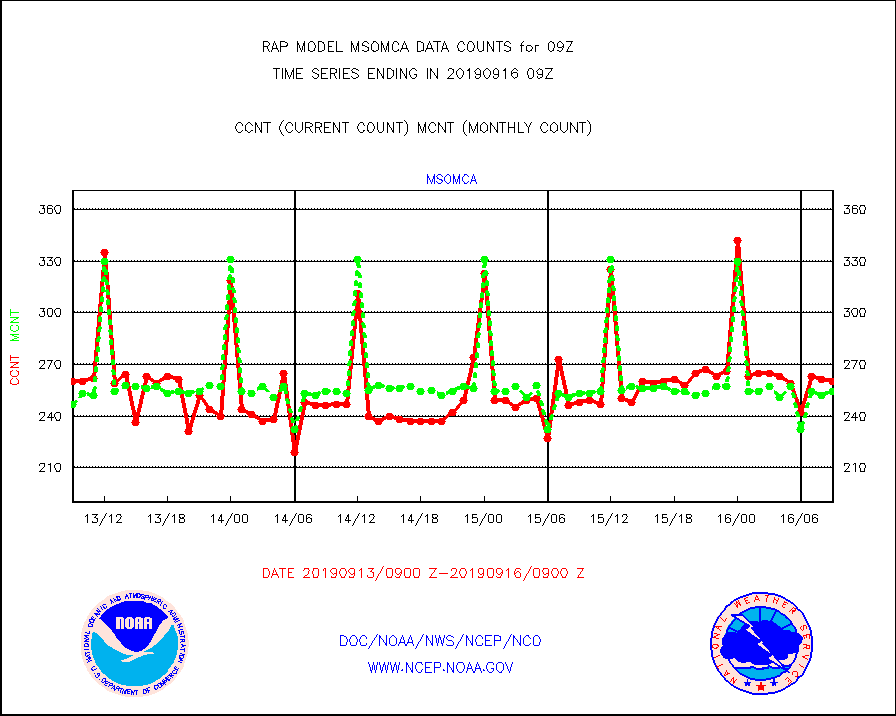
msomca |
Mesonet/MADIS Missouri Commercial Agricult Wx Net |
260 |
254 |
102.4 % |
1608.50-1609.50 |
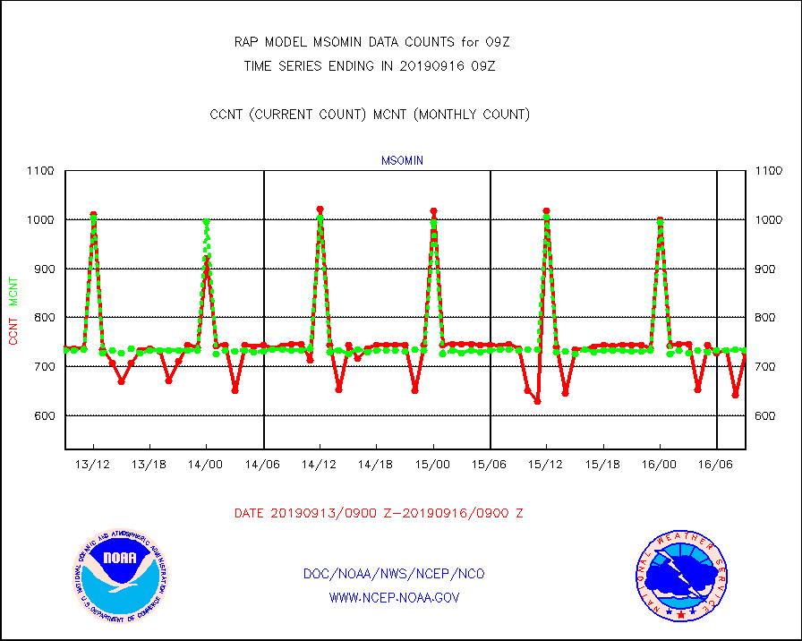
msomin |
Mesonet/MADIS Minnesota Dept. of Transportation |
727 |
733 |
99.2 % |
1608.50-1609.50 |
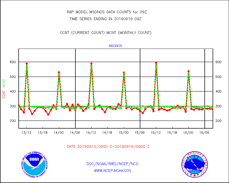
msonos |
Mesonet/MADIS NOS-Phys Oceanographic Realtime Sys |
279 |
293 |
95.2 % |
1608.50-1609.50 |
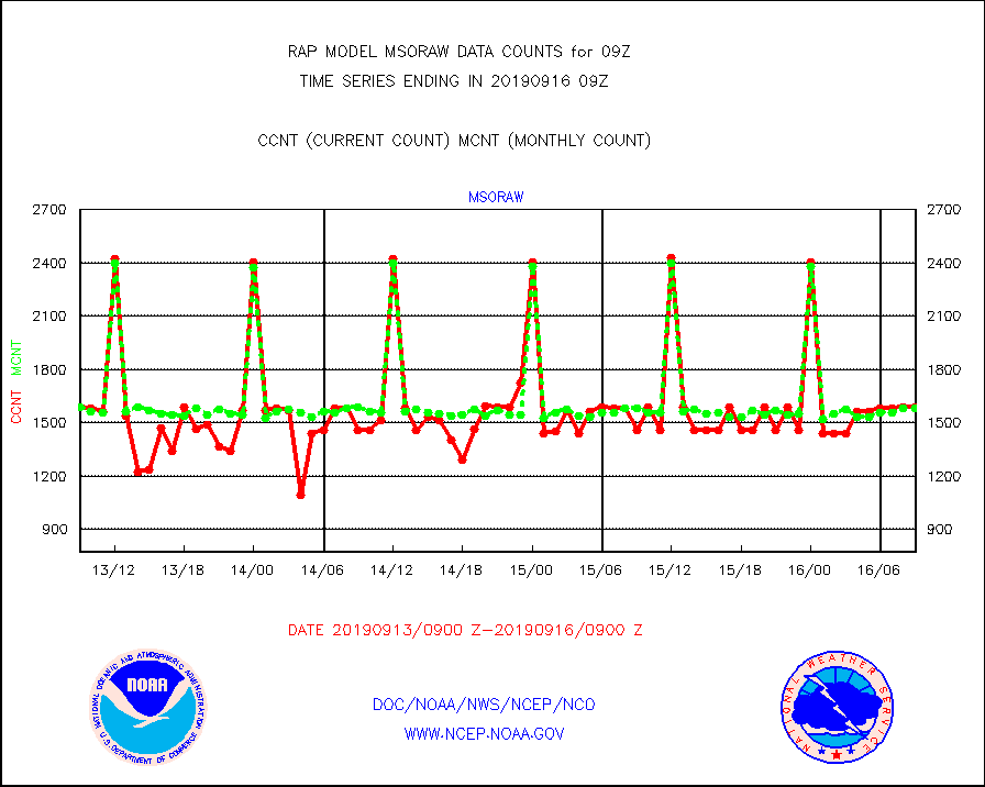
msoraw |
Mesonet/MADIS NFIC Remote Automated Wx Stns(RAWS) |
1587 |
1579 |
100.5 % |
1608.50-1609.50 |
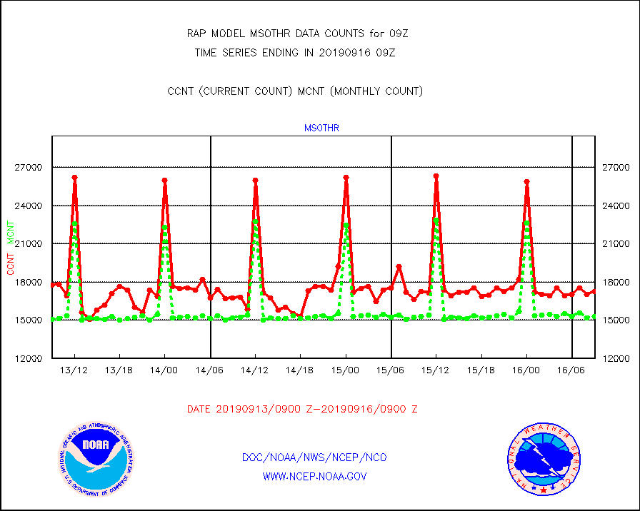
msothr |
Mesonet/MADIS many providers, not separated out |
17259 |
15303 |
112.8 % |
1608.50-1609.50 |
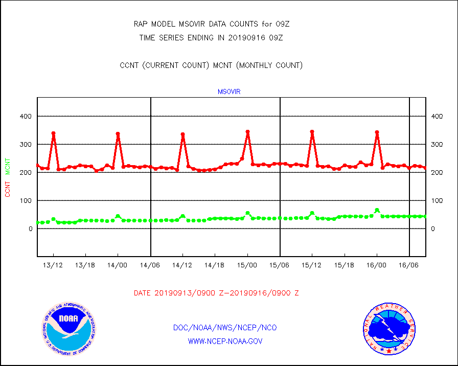
msovir |
Mesonet/MADIS Virginia Dept. of Transportation |
217 |
44 |
493.2 % |
1608.50-1609.50 |
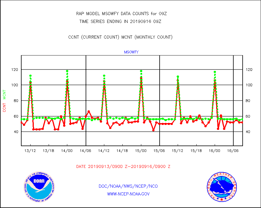
msowfy |
Mesonet/MADIS "Weather for You" |
52 |
56 |
92.9 % |
1608.50-1609.50 |
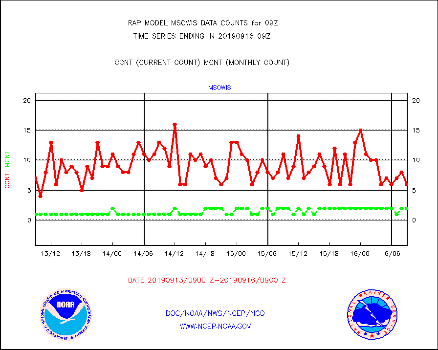
msowis |
Mesonet/MADIS Wisconsin Dept. of Transportation |
6 |
2 |
300.0 % |
1608.50-1609.50 |
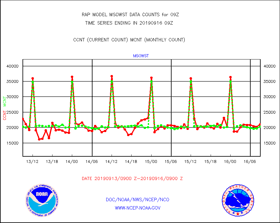
msowst |
Mesonet/MADIS MesoWest (many subproviders) |
21057 |
20310 |
103.7 % |
1608.50-1609.50 |
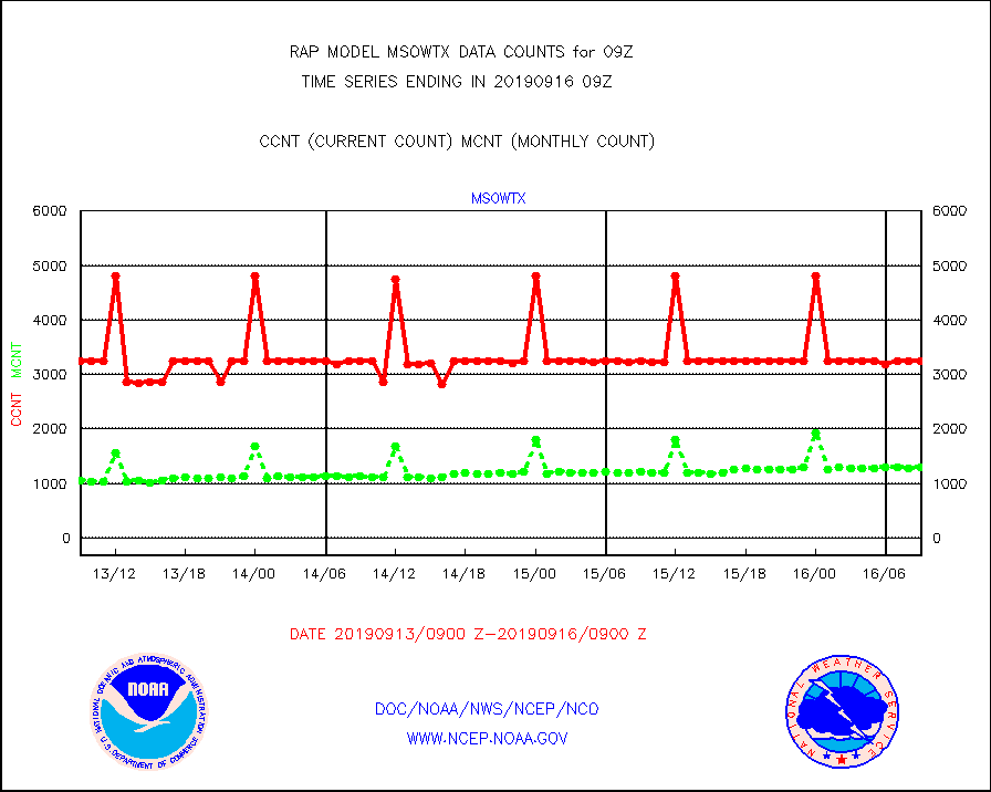
msowtx |
Mesonet/MADIS West Texas |
3242 |
1292 |
250.9 % |
1608.50-1609.50 |
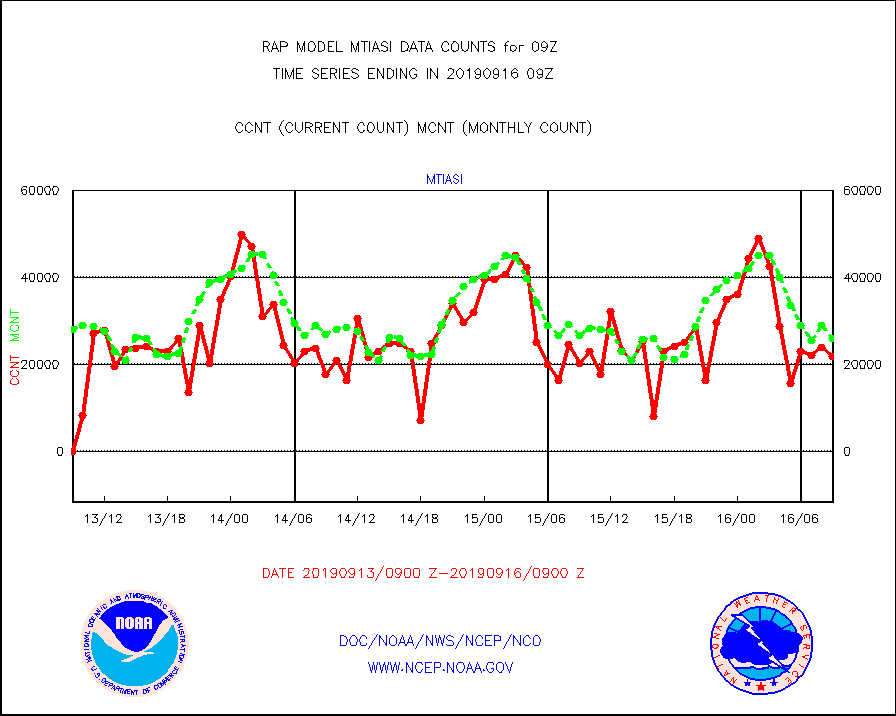
mtiasi |
METOP 1-2 IASI 1C radiance data (varbl. channels) |
21945 |
26066 |
84.2 % |
1607.00-1610.99 |
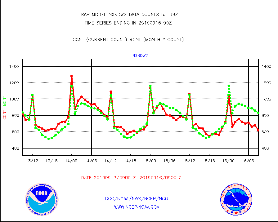
nxrdw2 |
NEXRAD Vel Azm Dsp(VAD) winds via Level 2 decoder |
620 |
834 |
74.3 % |
1608.00-1610.00 |
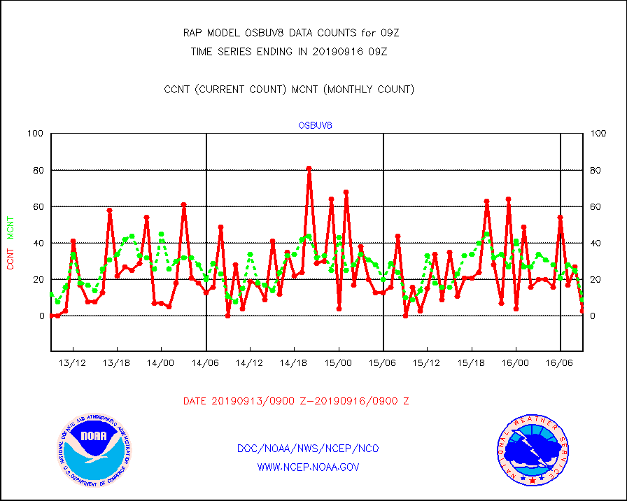
osbuv8 |
NOAA 16-19 Solar Backscatter UV-2 rad frm V8 BUFR |
3 |
9 |
33.3 % |
1607.00-1609.99 |
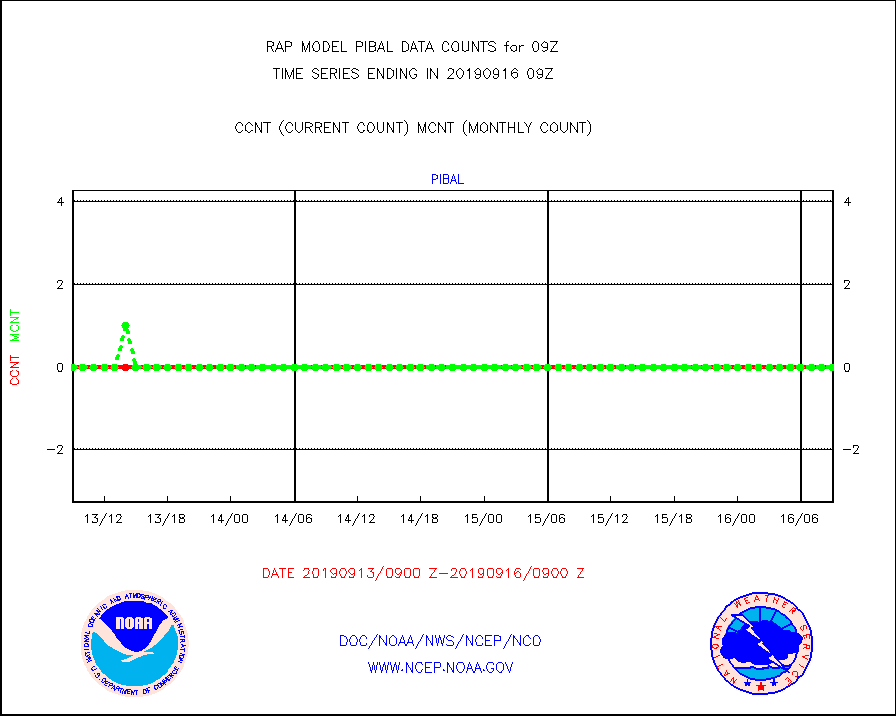
pibal |
PIBAL (from PILOT, PILOT SHIP, PILOT MOBIL) |
0 |
0 |
n/a |
1608.00-1610.00 |
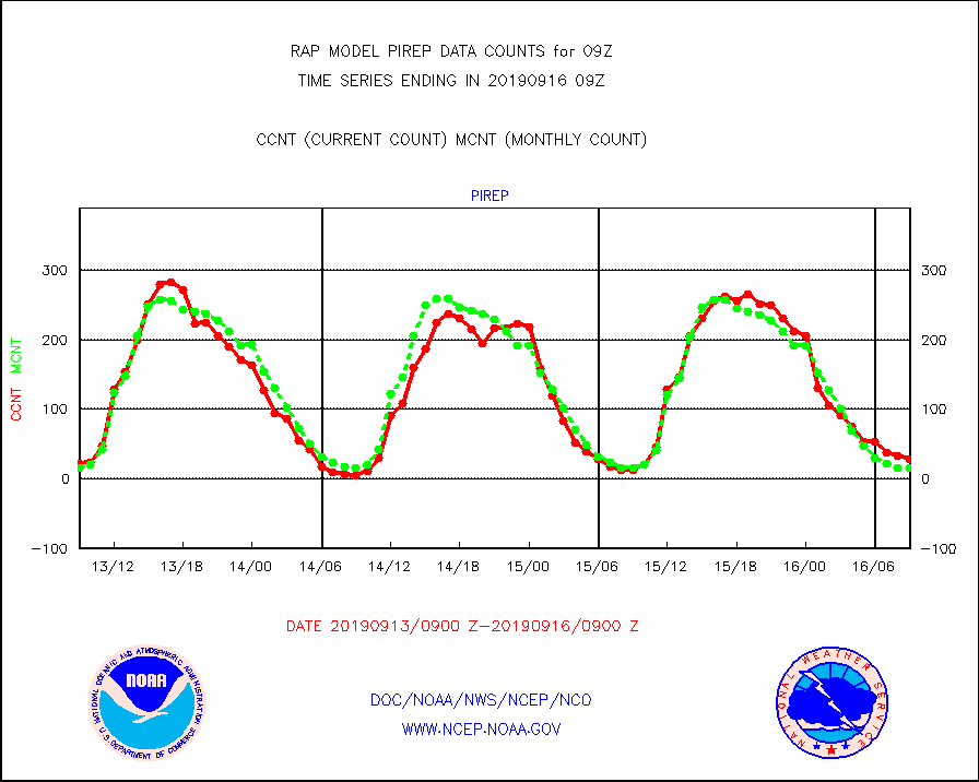
pirep |
Manual PIREP aircraft data (dcded from AIREP fmt) |
29 |
16 |
181.2 % |
1605.75-1612.25 |
prflrp |
Profilr winds from PIBAL (PILOT,PILOT SHIP/MOBIL) |
0 |
0 |
n/a |
1607.50-1610.50 |
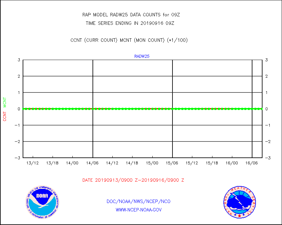
radw25 |
NEXRAD radial wind superobs (Level 2.5 - ORPG) |
0 |
0 |
n/a |
1608.00-1610.00 |
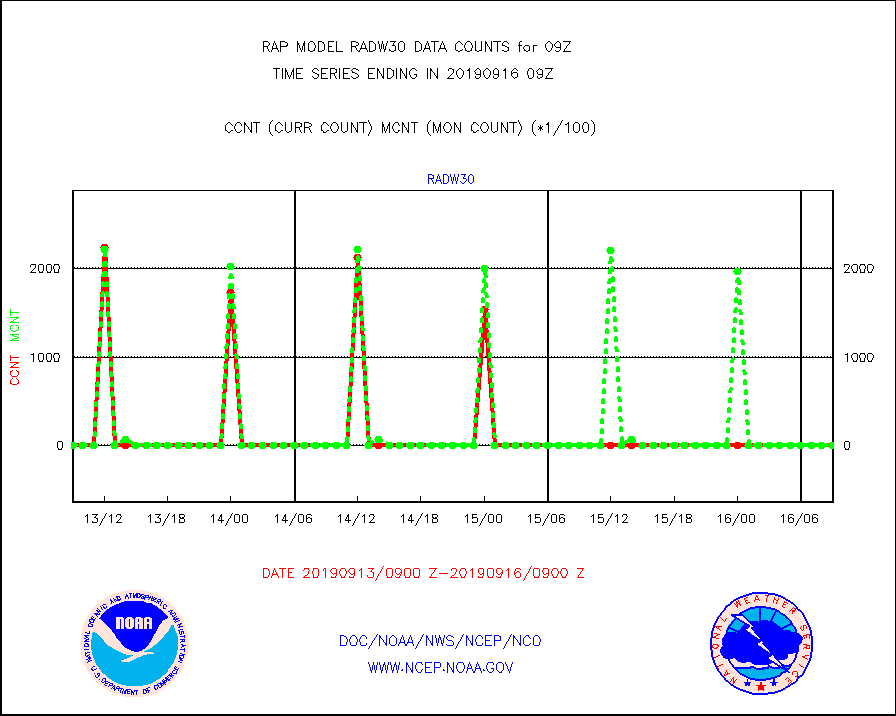
radw30 |
NEXRAD radial wind superobs (Level 3 - NIDS) |
0 |
0 |
n/a |
1608.00-1610.00 |
raobm |
Rawinsonde - mobile land (from TEMP/PILOT MOBIL) |
0 |
0 |
n/a |
1608.00-1610.00 |
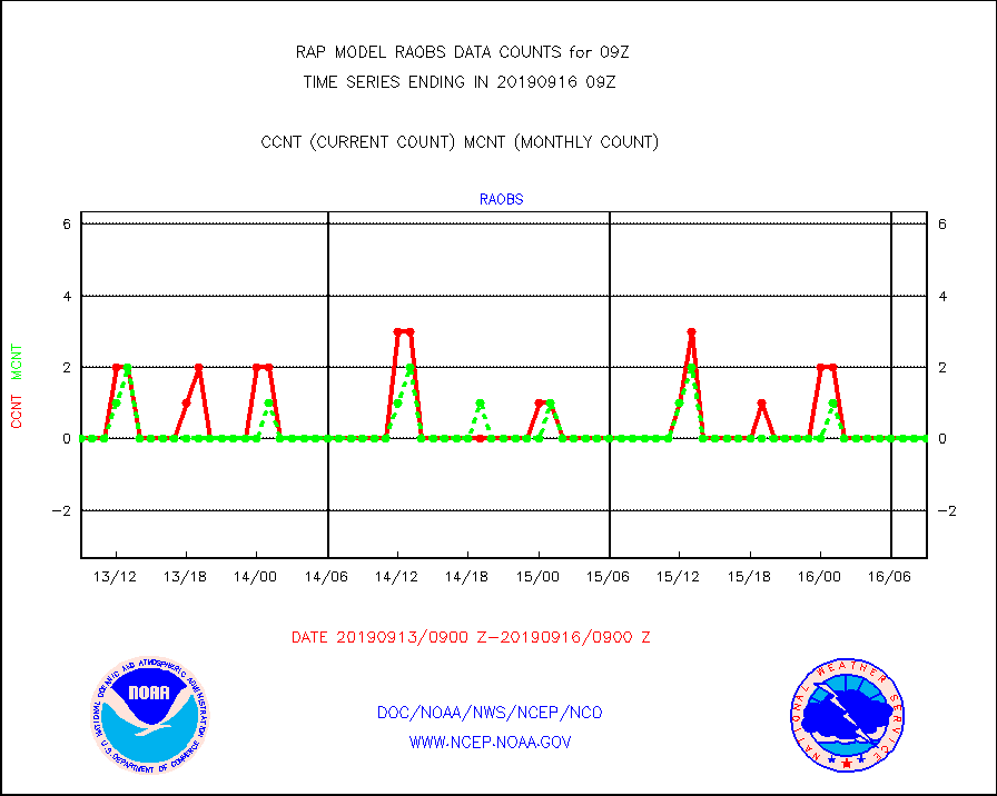
raobs |
Rawinsonde - ship (from TEMP SHIP, PILOT SHIP) |
0 |
0 |
n/a |
1608.00-1610.00 |
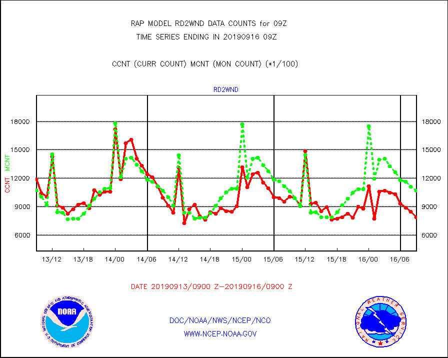
rd2wnd |
NEXRAD radial wind (Level 2 - GTS) |
786027 |
1067503 |
73.6 % |
1608.50-1609.49 |
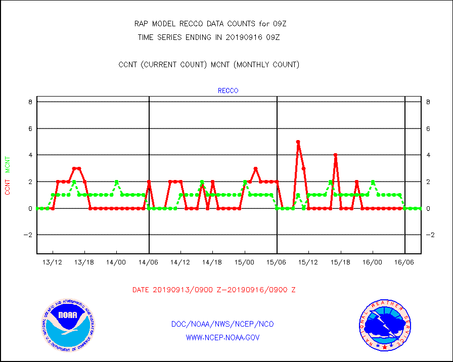
recco |
Flight level reconnaissance aircraft data |
0 |
0 |
n/a |
1608.00-1610.00 |
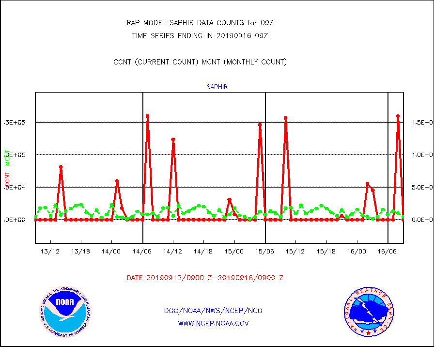
saphir |
Megha-Tropiques SAPHIR L1A2 brightness temps |
0 |
4592 |
0.0 % |
1606.00-1611.99 |
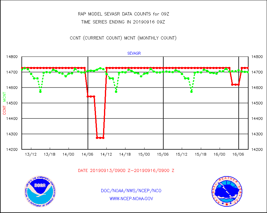
sevasr |
METEOSAT-10 2nd Gen SEVIRI All Sky Radiance(proc) |
14727 |
14701 |
100.2 % |
1607.00-1610.99 |
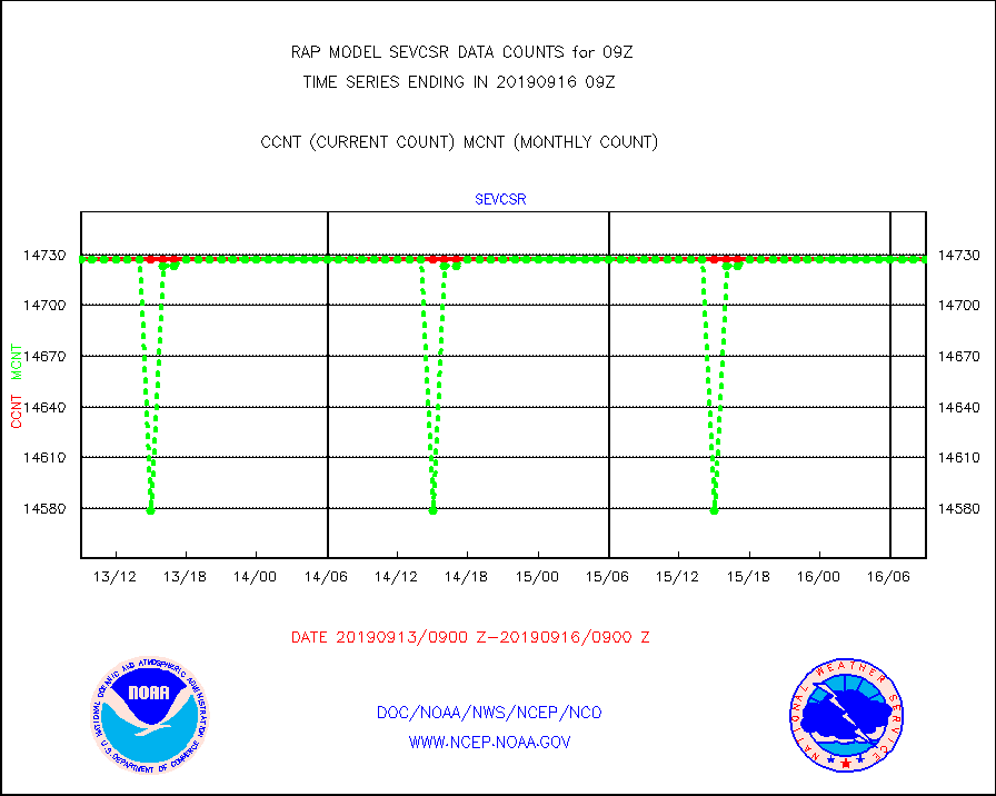
sevcsr |
METEOSAT-10 2nd Gen SEVIRI Clr Sky Radiance(proc) |
14727 |
14727 |
100.0 % |
1607.00-1610.99 |
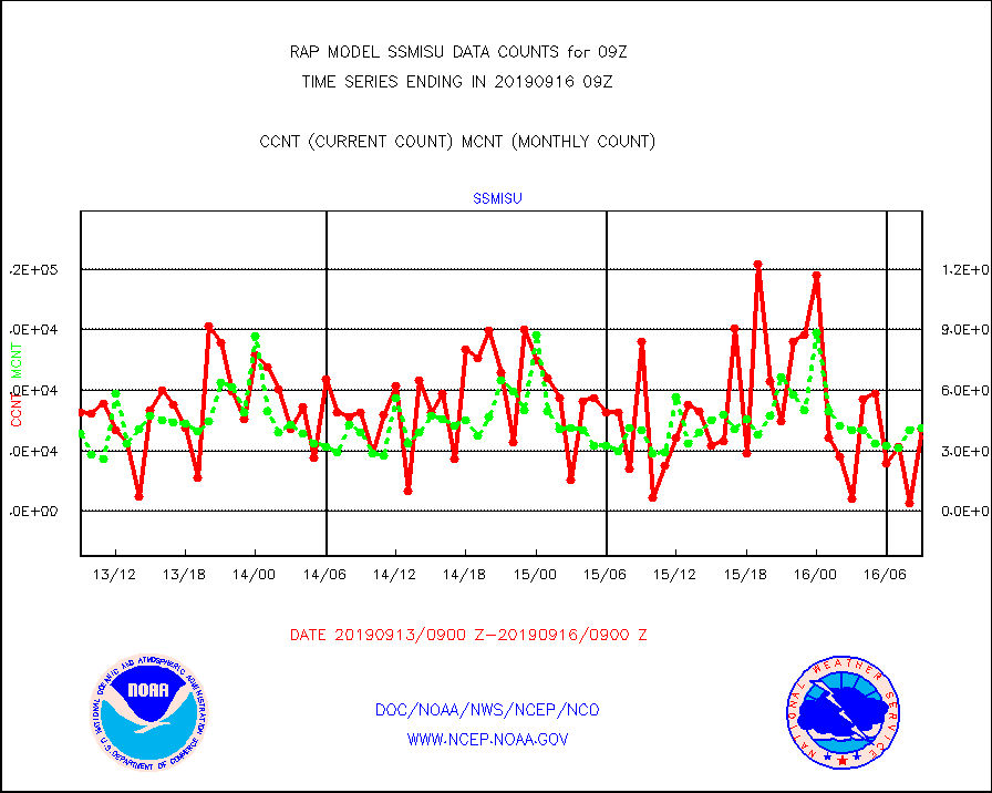
ssmisu |
DMSP SSM/IS 1C radiance data (Unified Pre-Proc.) |
40740 |
41249 |
98.8 % |
1607.00-1610.99 |
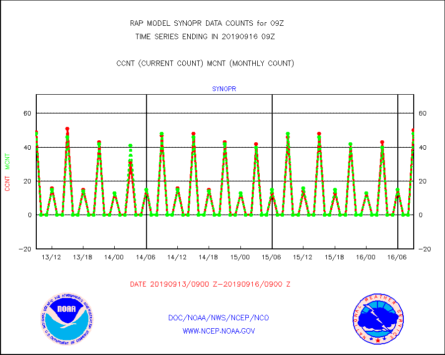
synopr |
Synoptic - restricted (WMO Res 40) manual & auto. |
50 |
48 |
104.2 % |
1608.50-1609.50 |
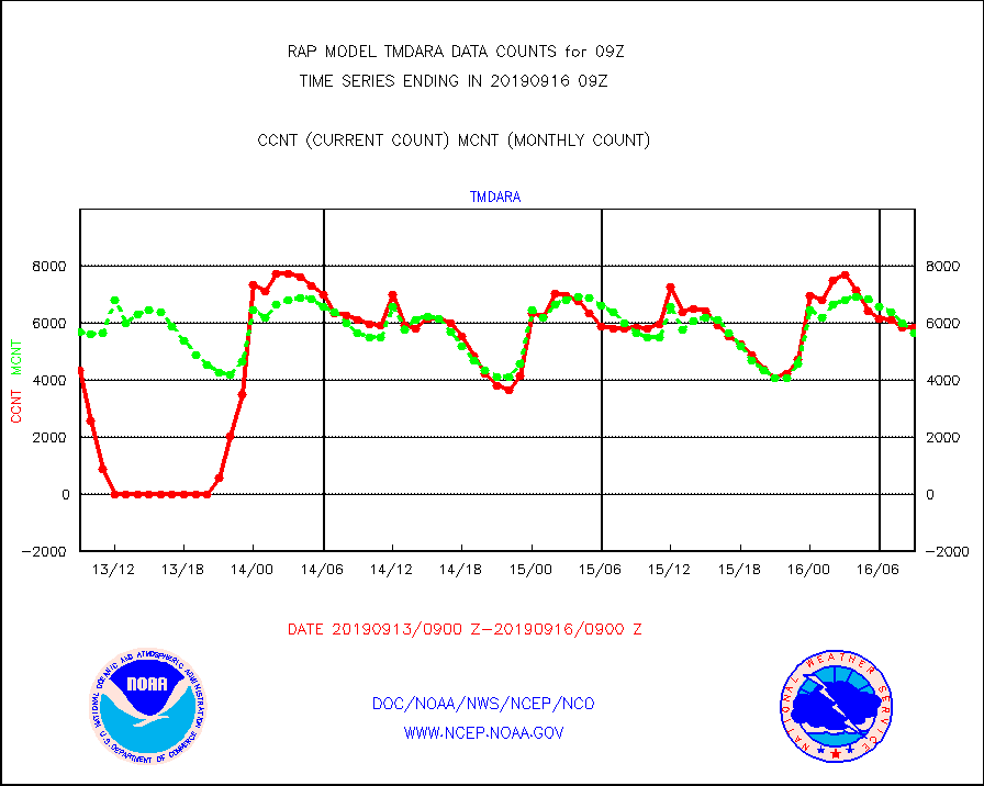
tmdara |
TAMDAR aircft data-all types(from Panasonic,BUFR) |
5838 |
5656 |
103.2 % |
1605.75-1612.25 |
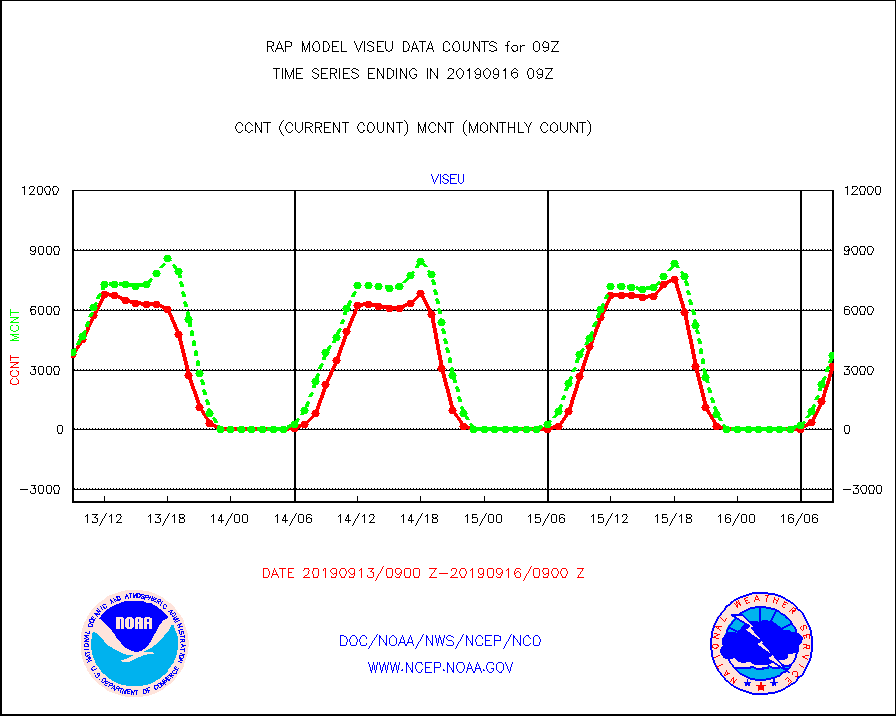
viseu |
METEOSAT/EUMETSAT visible derived cloud motion |
3162 |
3744 |
84.5 % |
1607.50-1610.49 |
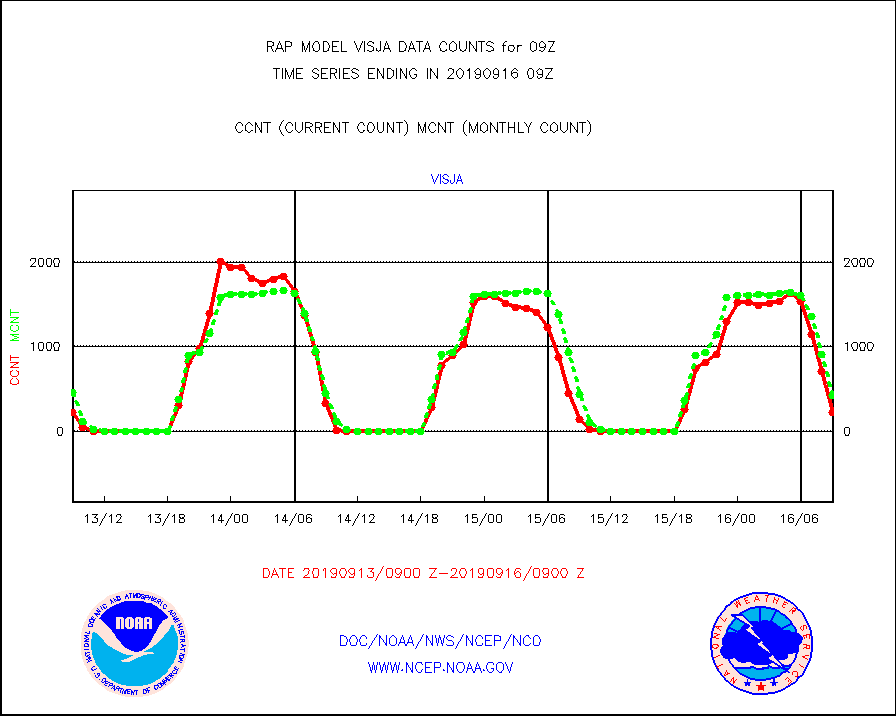
visja |
MTSAT/JMA visible derived cloud motion |
227 |
429 |
52.9 % |
1606.50-1611.50 |
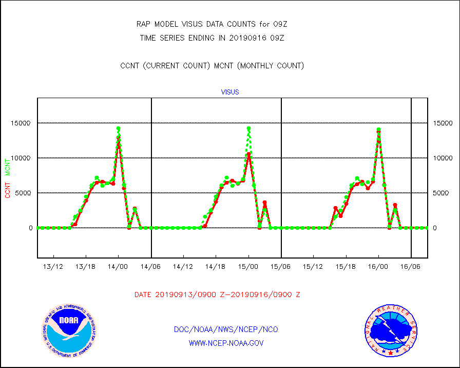
visus |
GOES/NESDIS visible derived cloud motion |
0 |
0 |
n/a |
1608.00-1608.99 |


