| Critical Data with Normal Counts |
|---|
| Type | Description | Hourly Count | Monthly Average | Percent (%) of Monthly Mean | UTC Time Window |
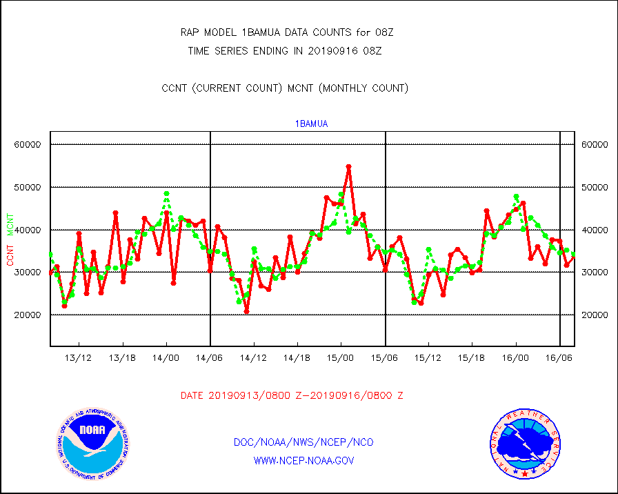
1bamua |
NOAA 15-19 & METOP 1-2 AMSU-A NCEP-proc. br.temps |
33793 |
34180 |
98.9 % |
1605.00-1610.99 |
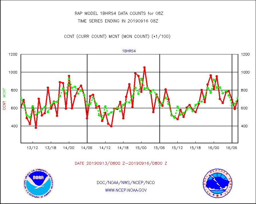
1bhrs4 |
NOAA 18-19 & METOP 1-2 HIRS-4 NCEP-proc. br.temps |
71067 |
71692 |
99.1 % |
1605.00-1610.99 |
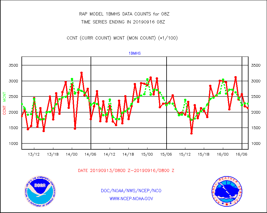
1bmhs |
NOAA 18-19 & METOP 1-2 MHS NCEP-proces. br. temps |
212980 |
227081 |
93.8 % |
1605.00-1610.99 |
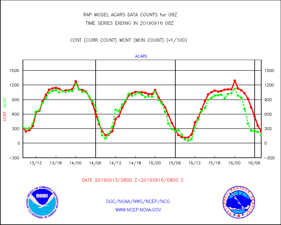
acars |
MDCRS ACARS acft data from ARINC(dcded from BUFR) |
23921 |
17272 |
138.5 % |
1604.75-1611.25 |
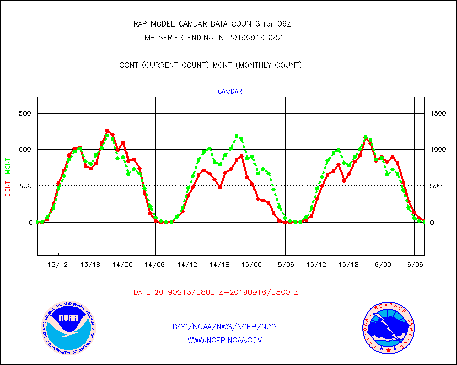
camdar |
Canadian AMDAR aircraft data (decoded from BUFR) |
20 |
6 |
333.3 % |
1604.75-1611.25 |
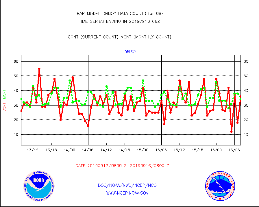
dbuoy |
Buoys decoded from FM-18 fmt (moored or drifting) |
36 |
34 |
105.9 % |
1607.50-1608.50 |
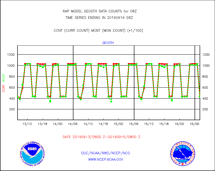
geosth |
GOES/NESDIS hi-resol. (1x1 f-o-v) cloud data |
43654 |
43451 |
100.5 % |
1606.75-1607.99 |
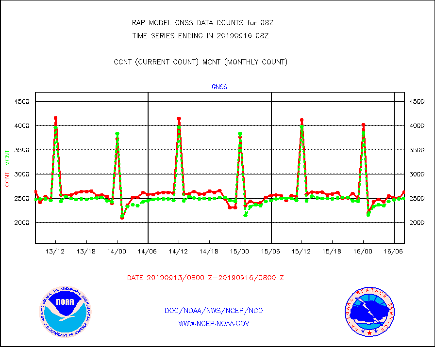
gnss |
Grnd-based Gbl Navigation Sat System (GNSS) data |
2623 |
2496 |
105.1 % |
1606.95-1607.05 |
h20mo |
MODIS (AQUA/TERRA) wvpr imager derived cld motion |
0 |
0 |
n/a |
1605.50-1610.50 |
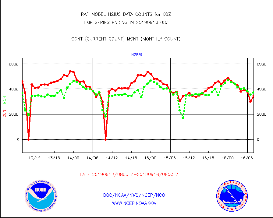
h2ius |
GOES/NESDIS water vapor imager derived cld motion |
3475 |
3738 |
93.0 % |
1607.00-1607.99 |
infmo |
MODIS (AQUA/TERRA) ir l-wave derived cloud motion |
0 |
0 |
n/a |
1605.50-1610.50 |
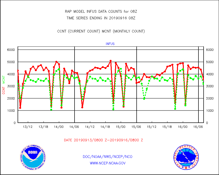
infus |
GOES/NESDIS infrared lg-wave derived cloud motion |
3580 |
3184 |
112.4 % |
1607.00-1607.99 |
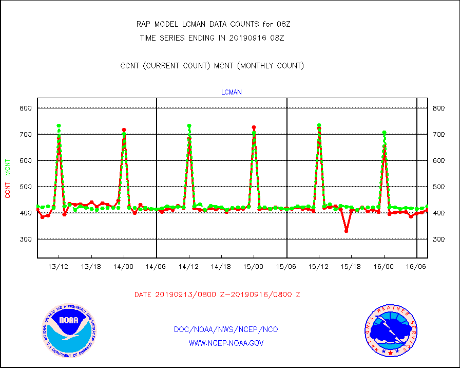
lcman |
Land-based CMAN stations decoded from CMAN format |
412 |
426 |
96.7 % |
1607.50-1608.50 |
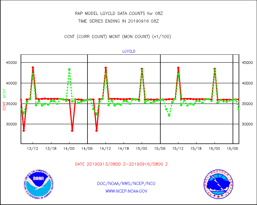
lgycld |
GOES/NASA(Langley) hi-res. (1x1 f-o-v) cloud data |
3605225 |
3365373 |
107.1 % |
1607.50-1608.50 |
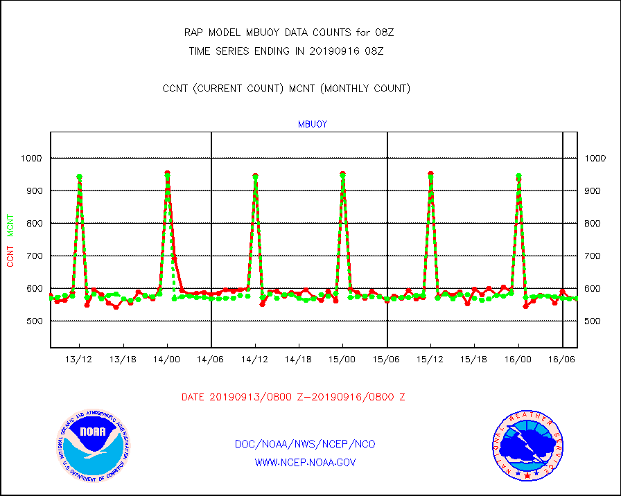
mbuoy |
Buoys decoded from FM-13 format (moored) |
568 |
571 |
99.5 % |
1607.50-1608.50 |
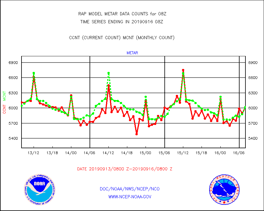
metar |
Aviation - METAR |
6018 |
6020 |
100.0 % |
1607.50-1608.50 |
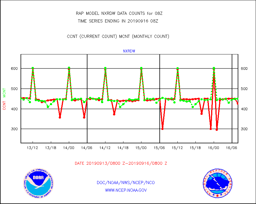
nxrdw |
NEXRAD Vel Azm Dsp(VAD) winds via radar coded msg |
426 |
451 |
94.5 % |
1607.00-1609.00 |
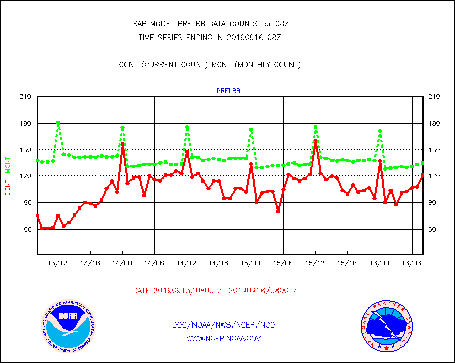
prflrb |
Multi-Agency Profiler (MAP) and SODAR winds |
121 |
135 |
89.6 % |
1606.50-1609.50 |
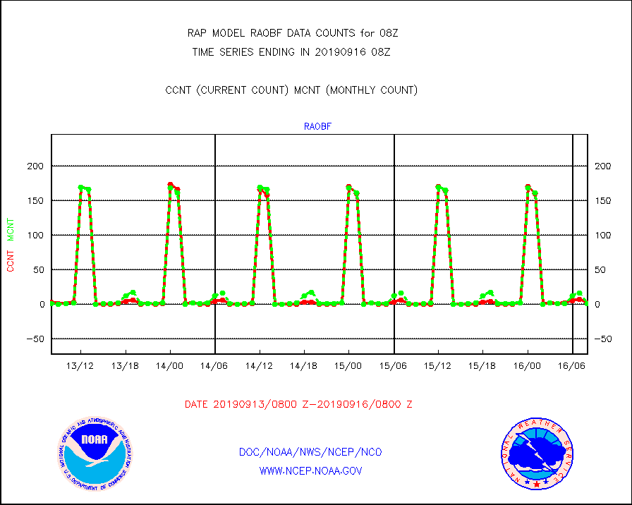
raobf |
Rawinsonde - fixed land (from TEMP or PILOT) |
2 |
1 |
200.0 % |
1607.00-1609.00 |
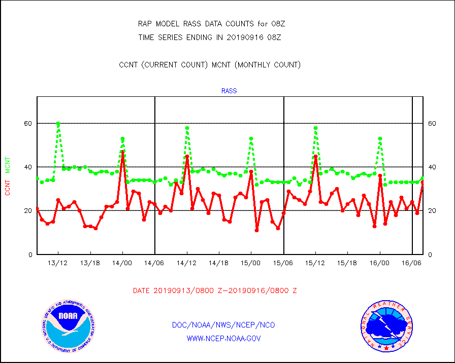
rass |
RASS temperatures (NOAA and Multi-Agency) |
33 |
35 |
94.3 % |
1607.50-1608.50 |
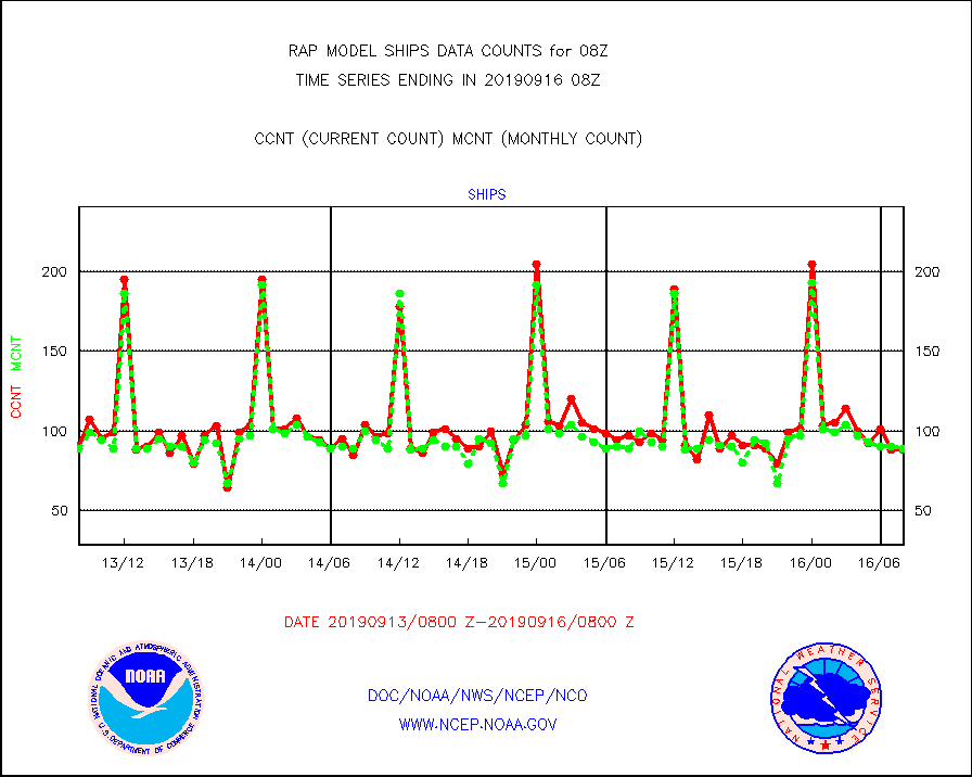
ships |
Ship - manual and automatic, restricted |
88 |
89 |
98.9 % |
1607.50-1608.50 |
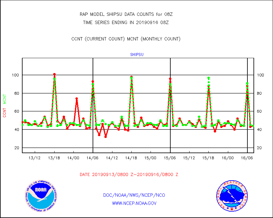
shipsu |
Ship - manual and automatic, unrestricted |
44 |
44 |
100.0 % |
1607.50-1608.50 |
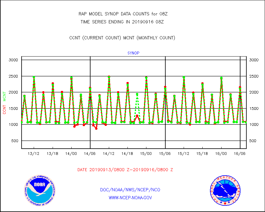
synop |
Synoptic - fixed manual and automatic |
1083 |
1064 |
101.8 % |
1607.50-1608.50 |
tideg |
Tide gauge reports decoded from CREX format |
184 |
235 |
78.3 % |
1607.50-1608.50 |
| Data Types of Opportunity with Normal Counts |
|---|
| Type | Description | Hourly Count | Monthly Average | Percent (%) of Monthly Mean | UTC Time Window |
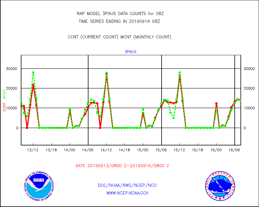
3p9us |
GOES/NESDIS infrared shrt-wave derived cld motion |
13954 |
13863 |
100.7 % |
1607.00-1607.99 |
acarsa |
MDCRS ACARS acft data (ARINC via AFWA)(AIREP fmt) |
0 |
0 |
n/a |
1604.75-1611.25 |
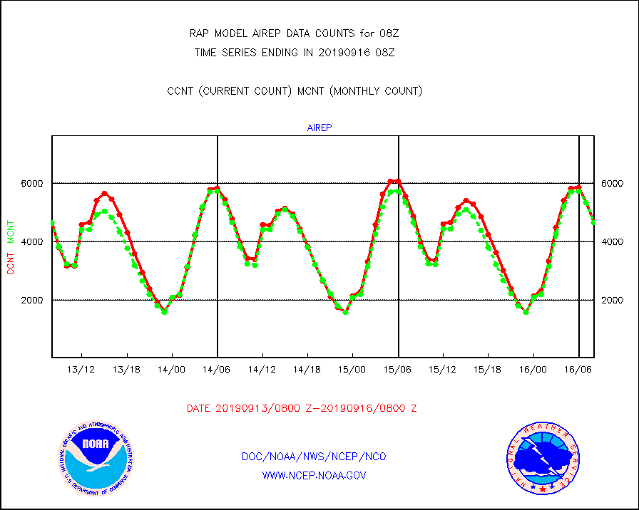
airep |
Manual AIREP aircraft data (dcded from AIREP fmt) |
4655 |
4653 |
100.0 % |
1604.75-1611.25 |
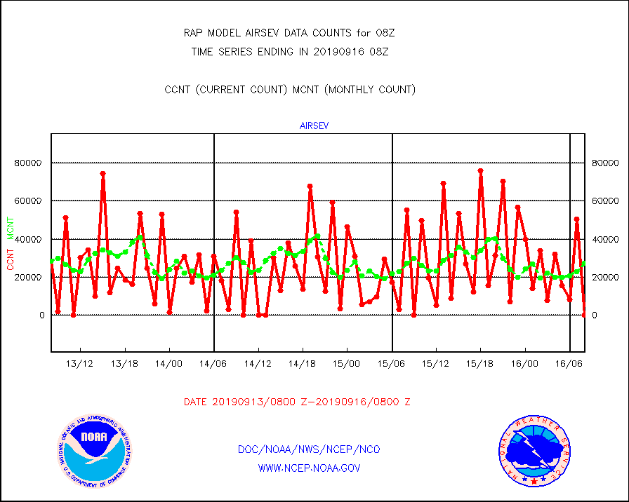
airsev |
AQUA AIRS/AMSU-A/HSB brightness temps- every FOV |
0 |
27444 |
0.0 % |
1605.00-1610.99 |
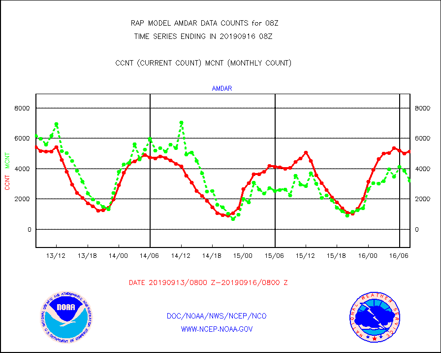
amdar |
AMDAR aircraft data (decoded from AMDAR format) |
5136 |
3205 |
160.2 % |
1604.75-1611.25 |
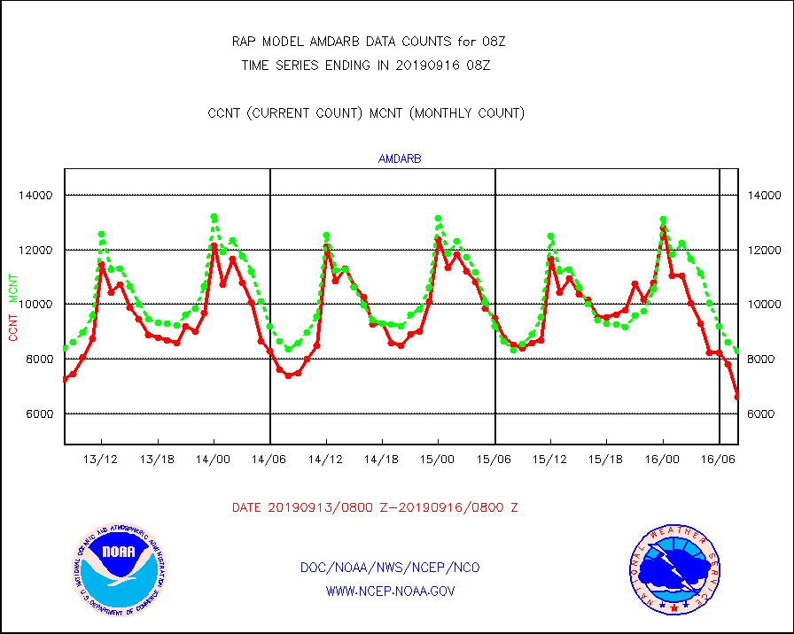
amdarb |
AMDAR aircraft data (decoded from BUFR) |
6611 |
8304 |
79.6 % |
1604.75-1611.25 |
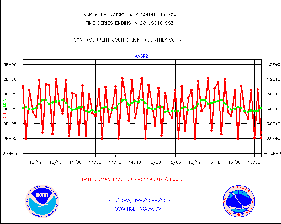
amsr2 |
GCOM-W AMSR2 1B brightness temperatures |
5469 |
616342 |
0.9 % |
1605.00-1605.99 |
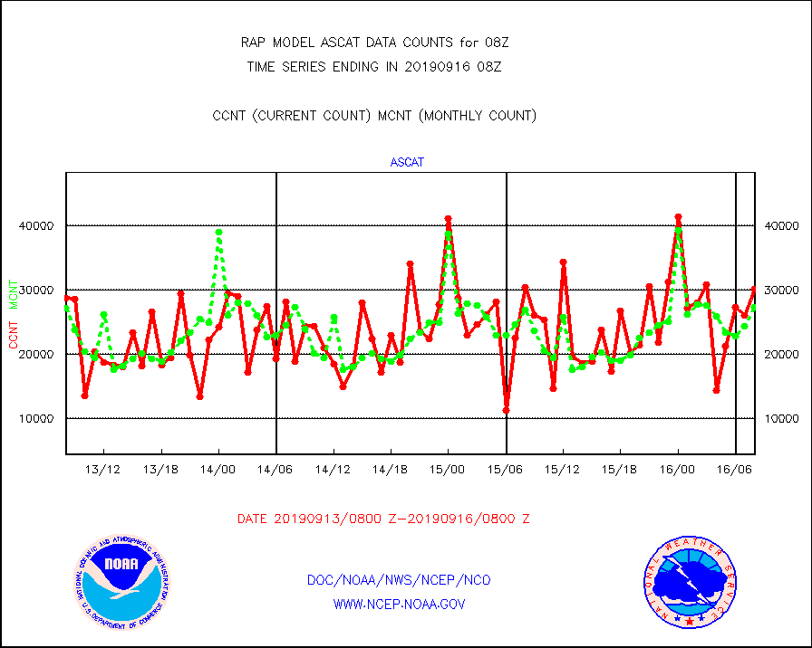
ascat |
METOP 1-2 ASCAT products |
30192 |
27272 |
110.7 % |
1606.00-1610.00 |
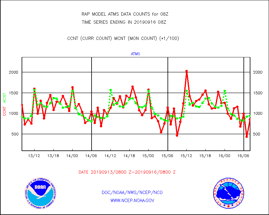
atms |
NPP Adv. Tech. Microwave Sounder (ATMS) br. temps |
86027 |
94116 |
91.4 % |
1606.00-1609.99 |
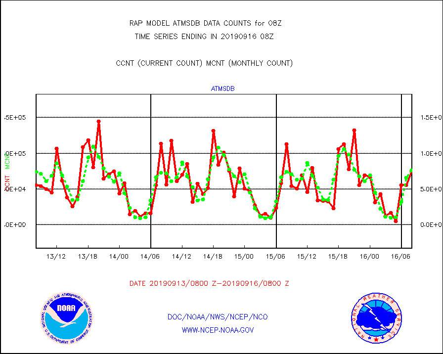
atmsdb |
NPP Adv Tech MW Sndr(ATMS) b. temps-dir bcst SSEC |
74900 |
75935 |
98.6 % |
1606.00-1609.99 |
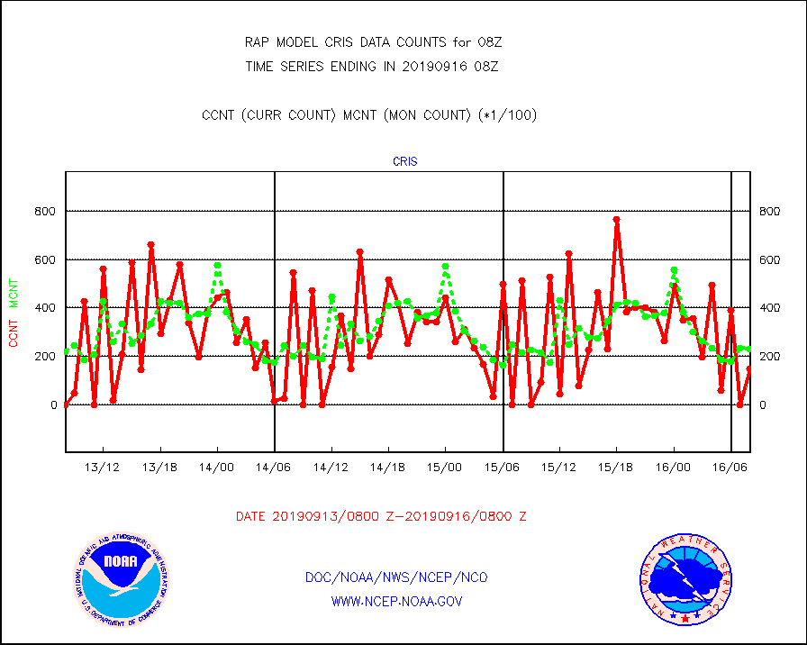
cris |
NPP Cross-track Infrared Sounder (CrIS) radiances |
14951 |
23218 |
64.4 % |
1606.00-1609.99 |
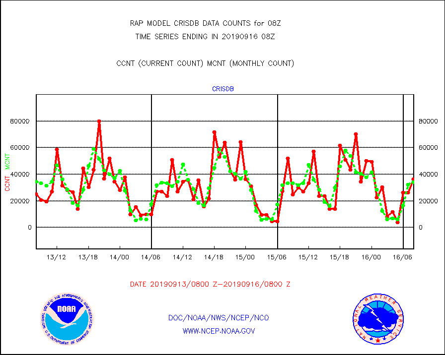
crisdb |
NPP Crss-trk IR Sndr(CrIS) radiance-dir bcst SSEC |
36441 |
34108 |
106.8 % |
1606.00-1609.99 |
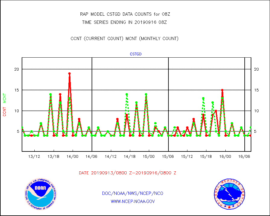
cstgd |
Coast Guard |
4 |
6 |
66.7 % |
1607.50-1608.50 |
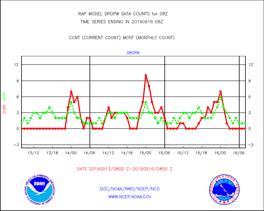
dropw |
Dropwinsonde (from TEMP DROP) |
0 |
1 |
0.0 % |
1607.00-1609.00 |
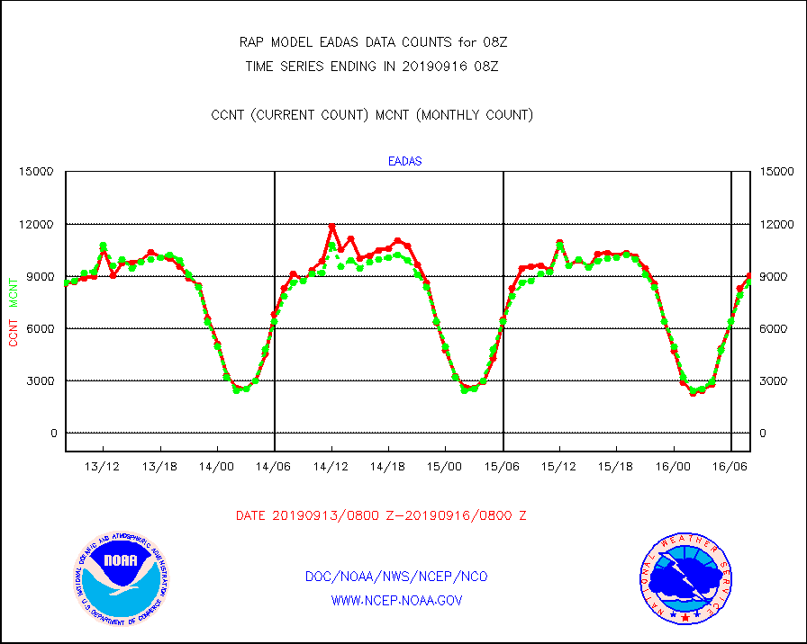
eadas |
E-AMDAR (European AMDAR acft decoded from BUFR) |
9050 |
8667 |
104.4 % |
1604.75-1611.25 |
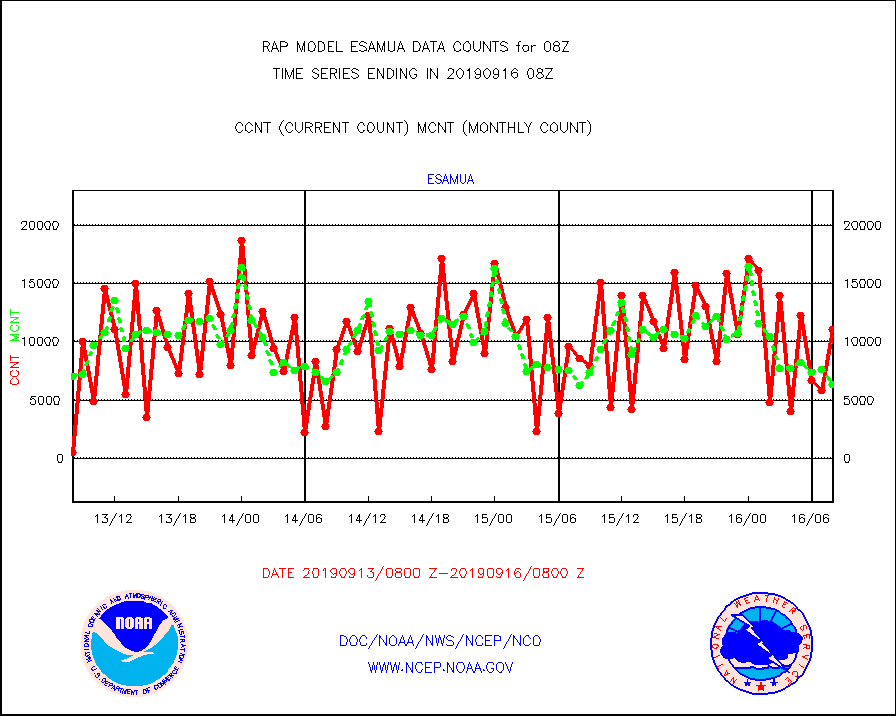
esamua |
NOAA 15-19 & METOP 1-2 AMSU-A proc btmps frm RARS |
11071 |
6342 |
174.6 % |
1607.00-1609.00 |
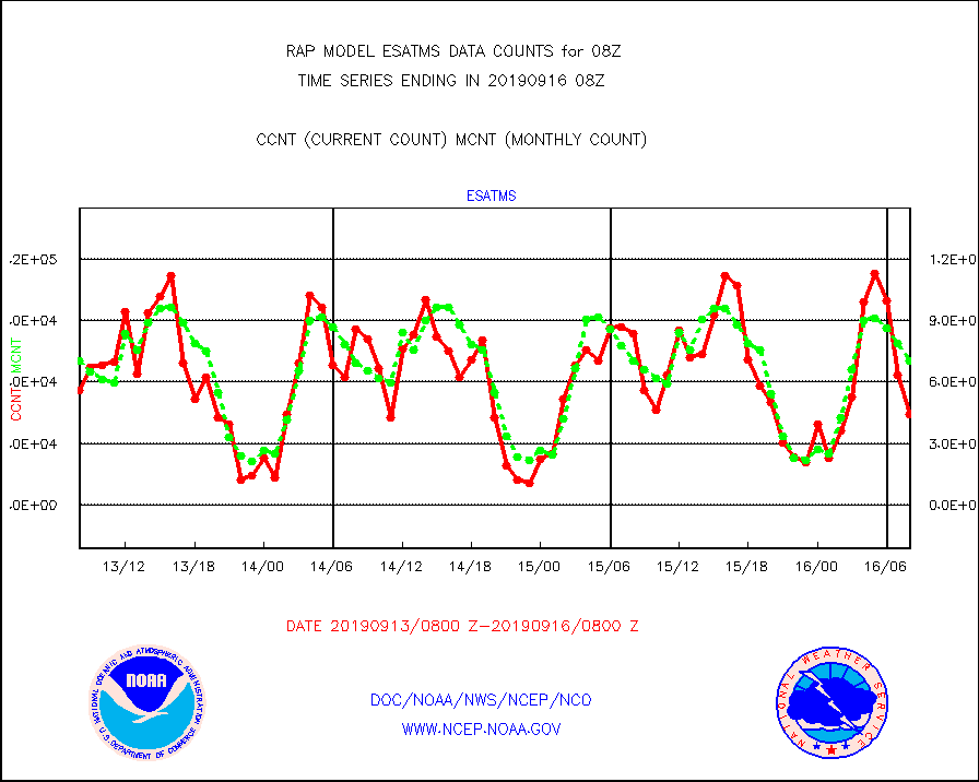
esatms |
NPP Adv. Tech. MW Sndr (ATMS) br. temps from RARS |
44174 |
70424 |
62.7 % |
1606.00-1609.99 |
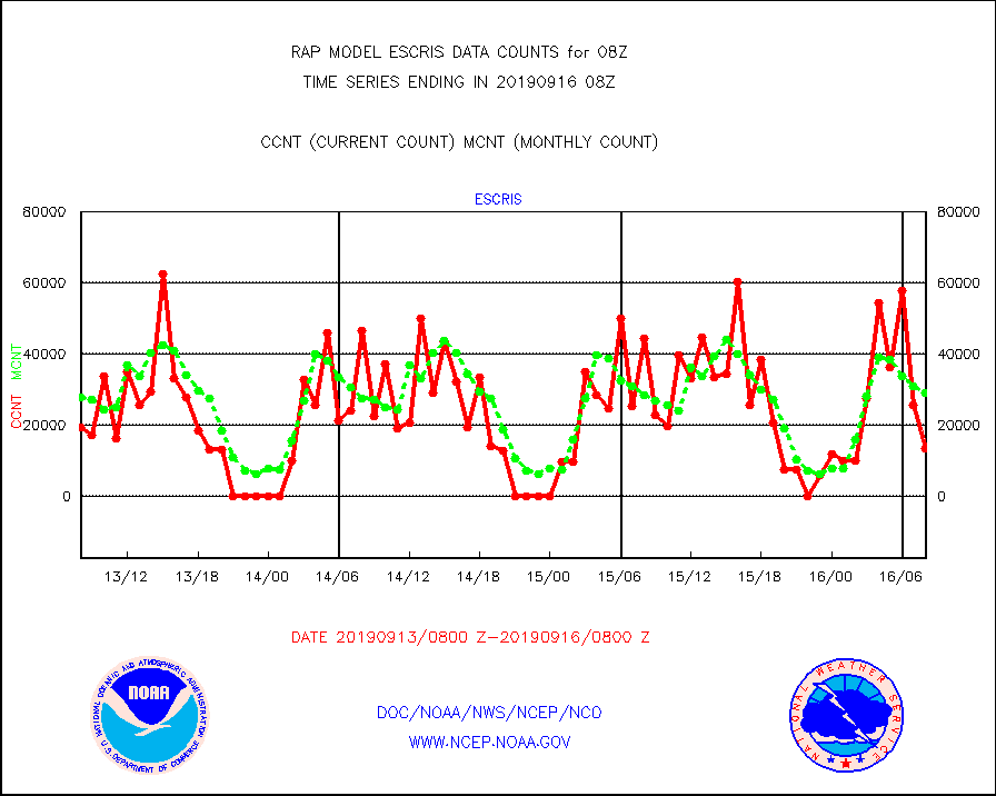
escris |
NPP Crss-track IR Sndr (CrIS) radiances from RARS |
13368 |
29136 |
45.9 % |
1606.00-1609.99 |
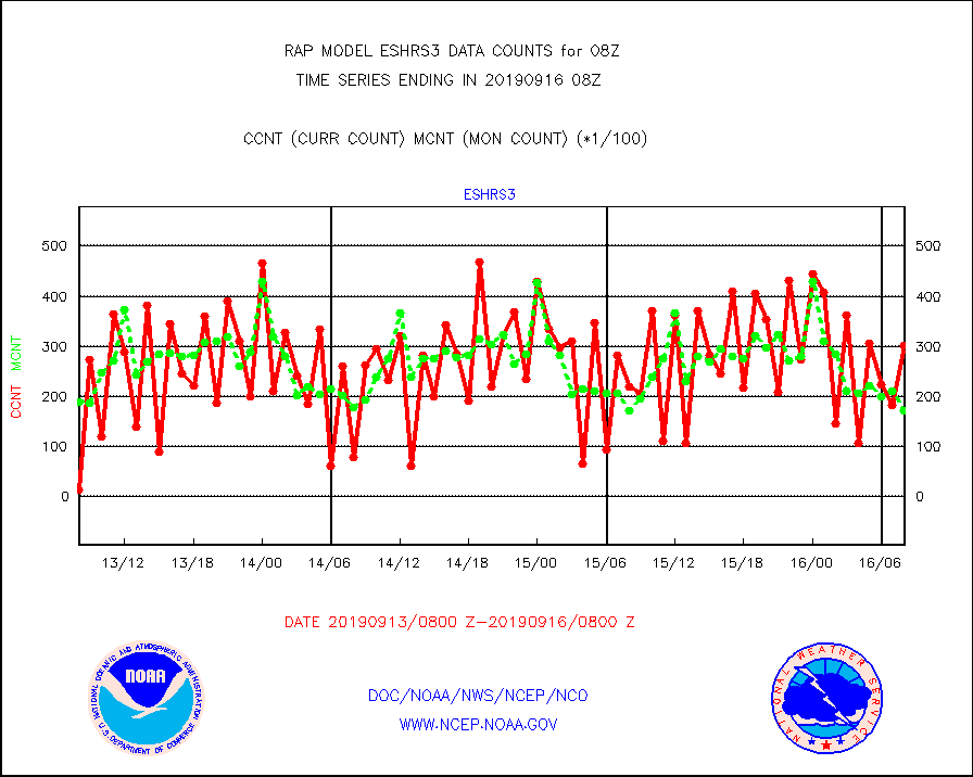
eshrs3 |
NOAA 15-19 & METOP 1-2 HIRS-3/4 pr btmps frm RARS |
30268 |
17150 |
176.5 % |
1607.00-1609.00 |
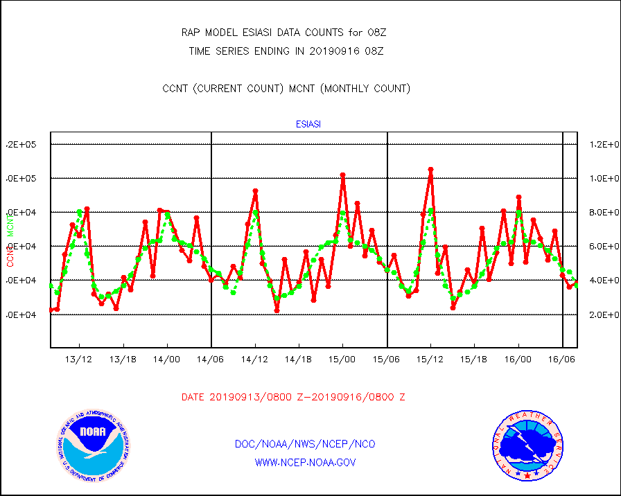
esiasi |
METOP 1-2 IASI 1C radiance data vbl chn from RARS |
38601 |
36759 |
105.0 % |
1606.00-1609.99 |
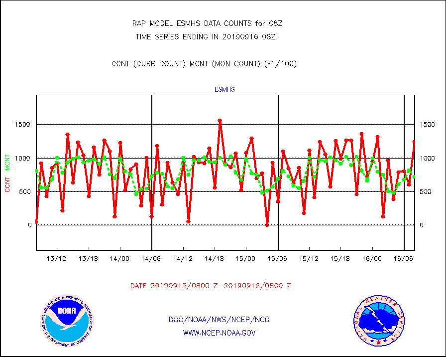
esmhs |
NOAA 18-19 & METOP 1-2 MHS proc. btemps from RARS |
124124 |
72579 |
171.0 % |
1607.00-1609.00 |
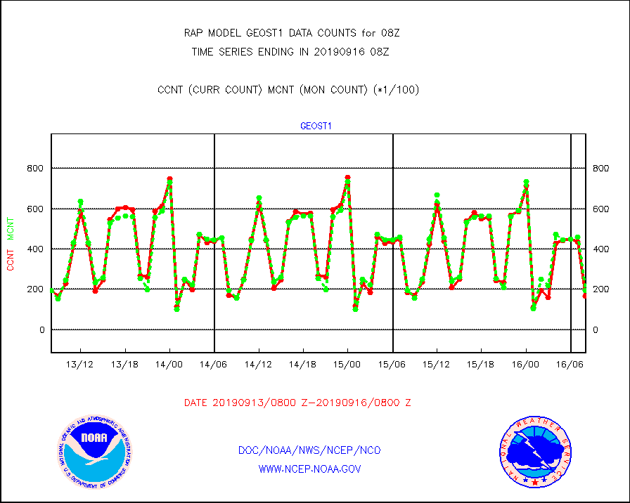
geost1 |
GOES/NESDIS hi-resol. (1x1 f-o-v) sndgs/radiances |
16549 |
19444 |
85.1 % |
1607.00-1609.00 |
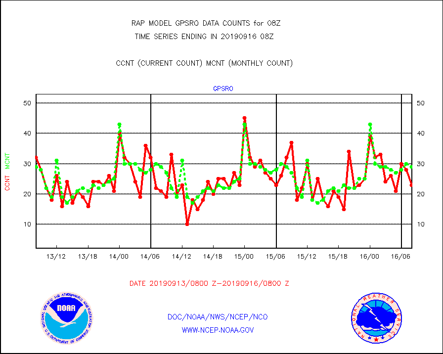
gpsro |
GPS radio occultation data |
23 |
29 |
79.3 % |
1606.00-1609.99 |
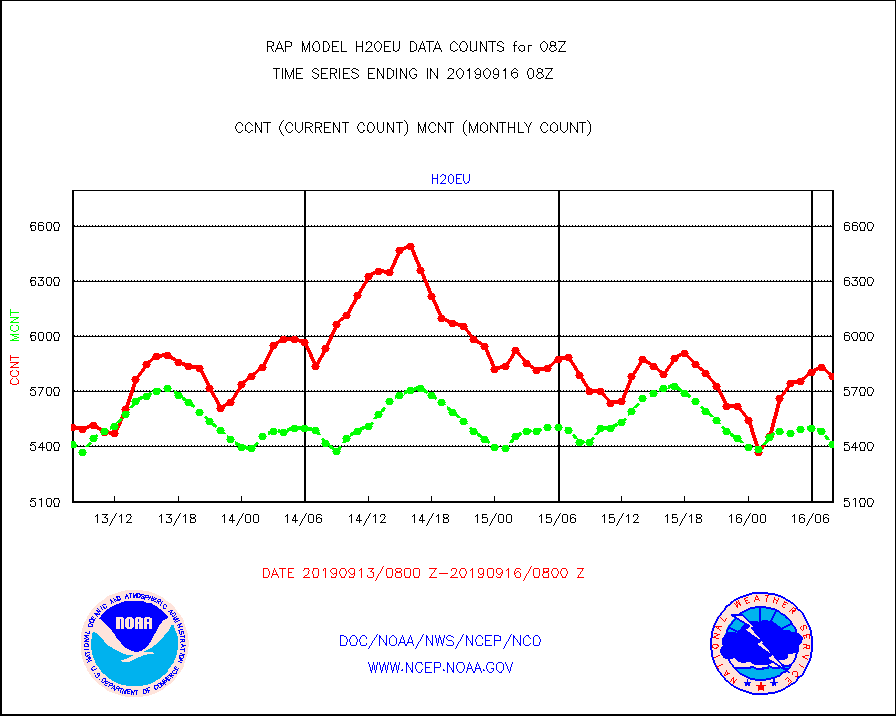
h20eu |
METEOSAT/EUMETSAT wvpr imager derived cld motion |
5785 |
5415 |
106.8 % |
1606.50-1609.49 |
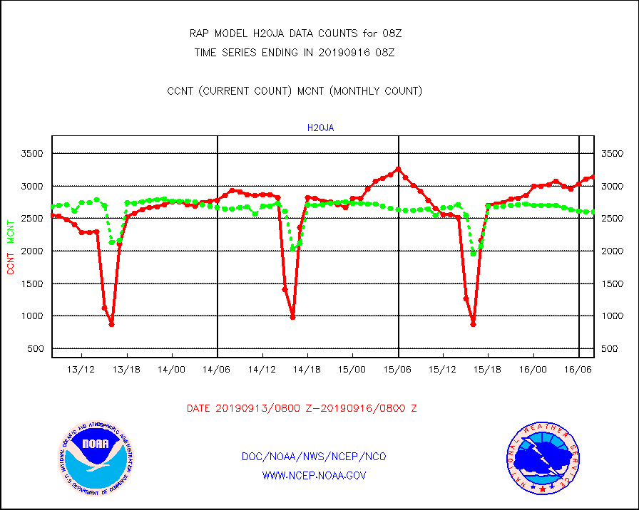
h20ja |
MTSAT/JMA water vapor imager derived cloud motion |
3145 |
2604 |
120.8 % |
1605.50-1610.50 |
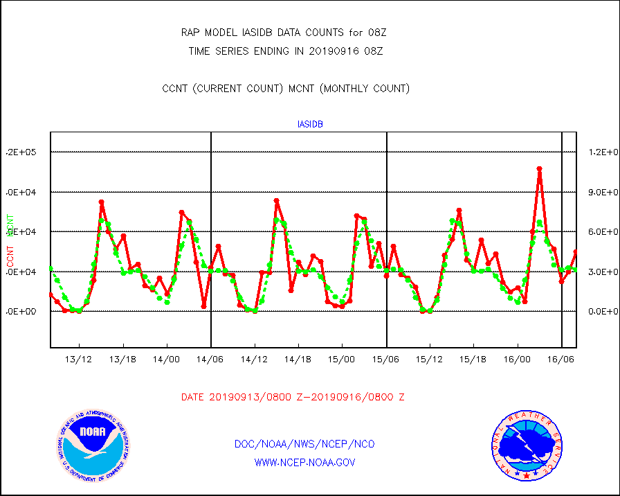
iasidb |
METOP 1-2 IASI 1C radiances-direct broadcast SSEC |
44759 |
31404 |
142.5 % |
1606.00-1609.99 |
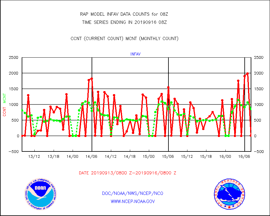
infav |
AVHRR (NOAA/METOP) ir lg-wave derived cld motion |
7 |
850 |
0.8 % |
1605.50-1610.50 |
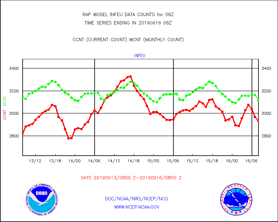
infeu |
METEOSAT/EUMETSAT ir lg-wave derived cloud motion |
2934 |
3113 |
94.2 % |
1606.50-1609.49 |
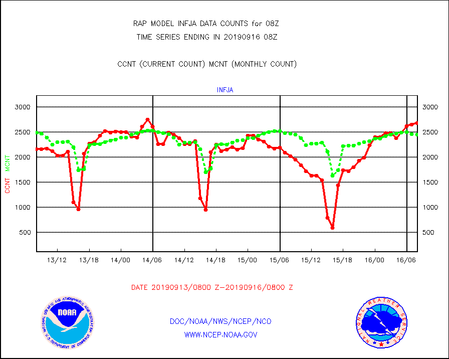
infja |
MTSAT/JMA infrared long-wave derived cloud motion |
2682 |
2446 |
109.6 % |
1605.50-1610.50 |
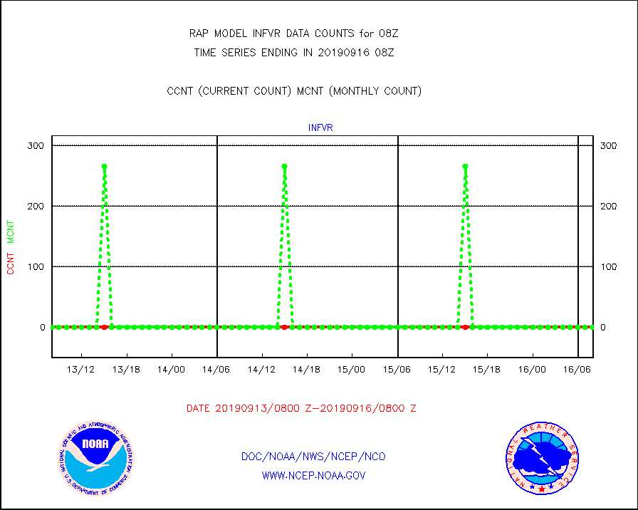
infvr |
VIIRS (NPP) infrared lg-wave derived cloud motion |
0 |
0 |
n/a |
1605.50-1610.50 |
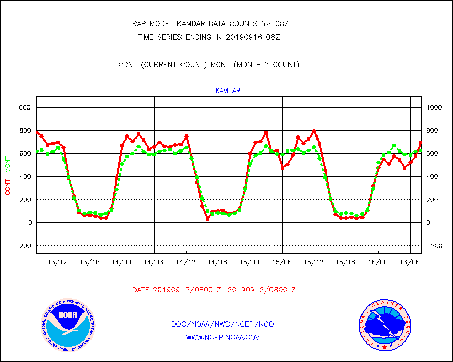
kamdar |
Korean AMDAR aircraft data (decoded from BUFR) |
700 |
626 |
111.8 % |
1604.75-1611.25 |
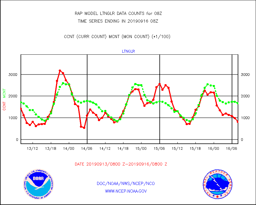
ltnglr |
LLDN Long-rng lightning from Vaisala via NOAAPORT |
81816 |
167585 |
48.8 % |
1607.00-1608.50 |
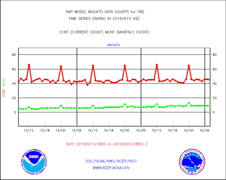
mso470 |
Mesonet/MADIS Colorado E-470 (Interstate 470) |
45 |
9 |
500.0 % |
1607.50-1608.50 |
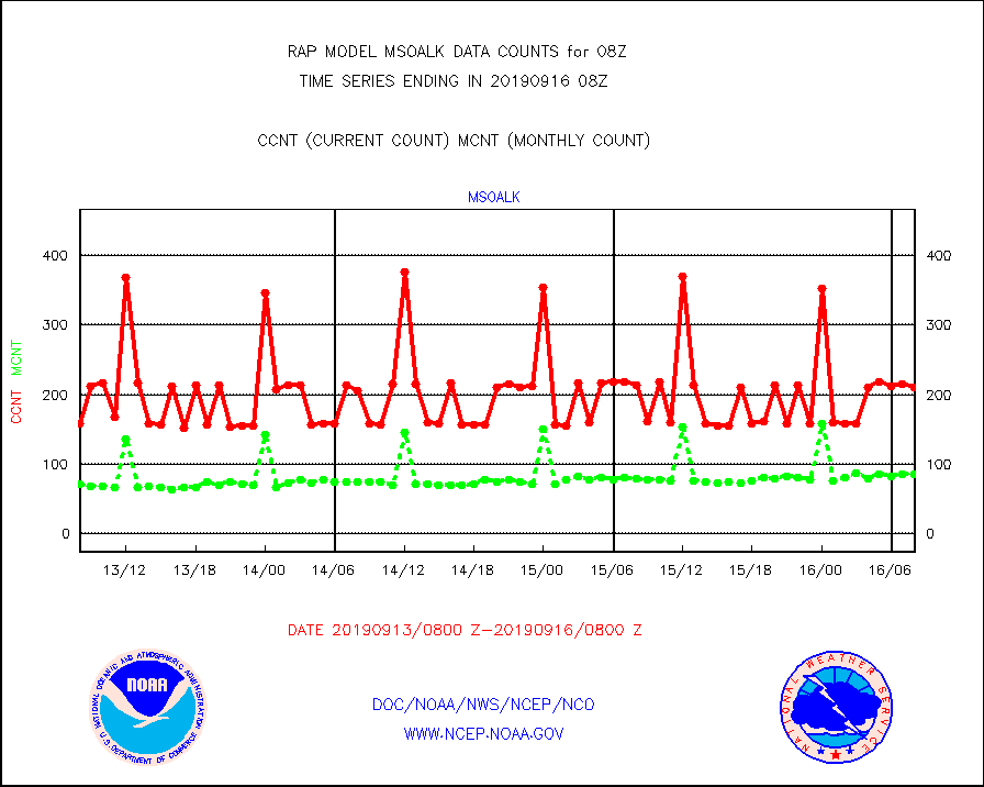
msoalk |
Mesonet/MADIS Alaska Department of Transportation |
211 |
85 |
248.2 % |
1607.50-1608.50 |
msoapg |
Mesonet/MADIS U.S. Army Aberdeen Proving Grounds |
0 |
0 |
n/a |
1607.50-1608.50 |
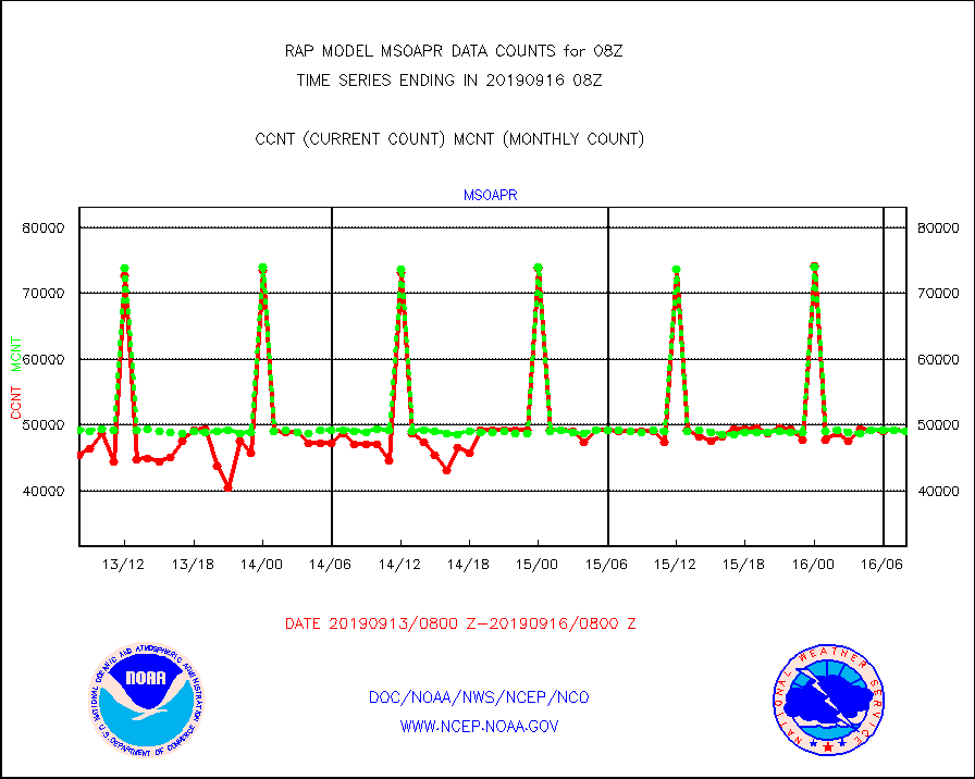
msoapr |
Mesonet/MADIS Citizen Weather Observers Program |
49112 |
49002 |
100.2 % |
1607.50-1608.50 |
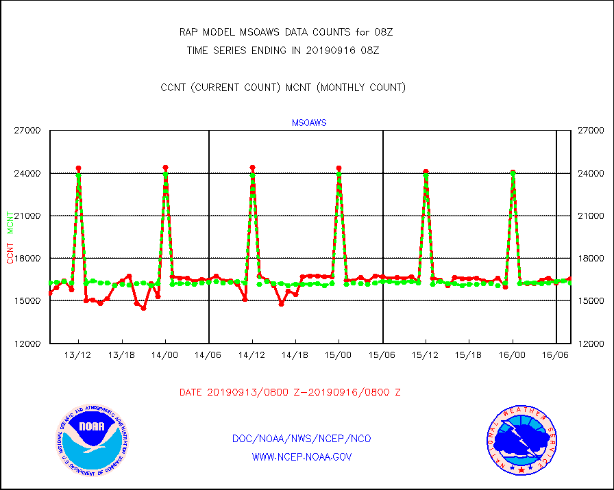
msoaws |
Mesonet/MADIS AWS Convergence Technologies, Inc. |
16562 |
16276 |
101.8 % |
1607.50-1608.50 |
msoawx |
Mesonet/MADIS "Anything Weather" |
0 |
0 |
n/a |
1607.50-1608.50 |
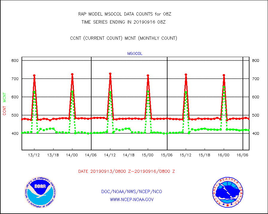
msocol |
Mesonet/MADIS Colorado Dept. of Transportation |
480 |
418 |
114.8 % |
1607.50-1608.50 |
msodcn |
Mesonet/MADIS DC Net |
0 |
0 |
n/a |
1607.50-1608.50 |
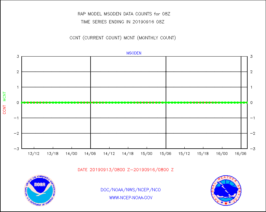
msoden |
Mesonet/MADIS Denver Urban Drainage & Flood Cntrl |
0 |
0 |
n/a |
1607.50-1608.50 |
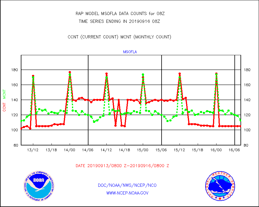
msofla |
Mesonet/MADIS Florida (FAWN & USF) |
105 |
113 |
92.9 % |
1607.50-1608.50 |
msoflt |
Mesonet/MADIS Florida Dept. of Transportation |
0 |
0 |
n/a |
1607.50-1608.50 |
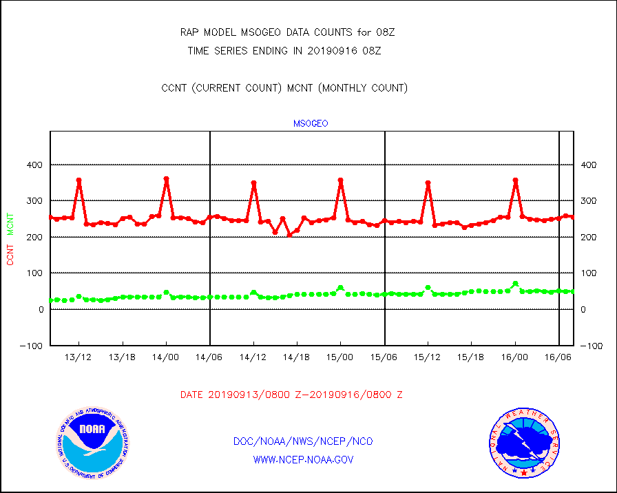
msogeo |
Mesonet/MADIS Georgia Dept. of Transportation |
255 |
50 |
510.0 % |
1607.50-1608.50 |
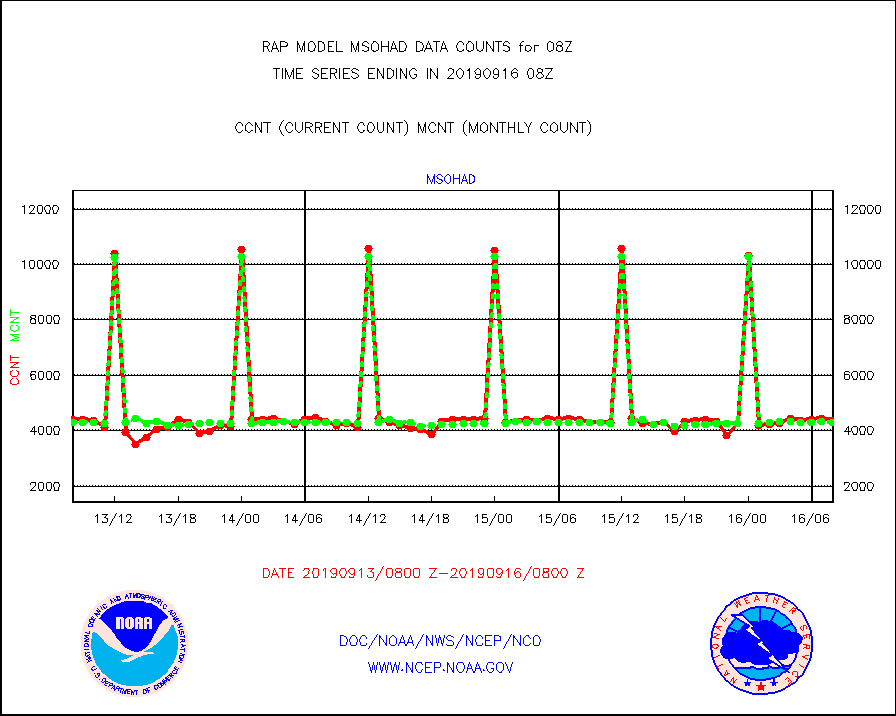
msohad |
Mesonet/MADIS NWS Hydromet Auto Data System(HADS) |
4386 |
4305 |
101.9 % |
1607.50-1608.50 |
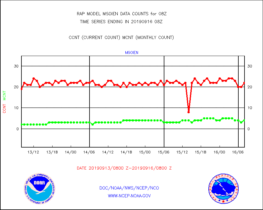
msoien |
Mesonet/MADIS Iowa Environmental |
22 |
4 |
550.0 % |
1607.50-1608.50 |
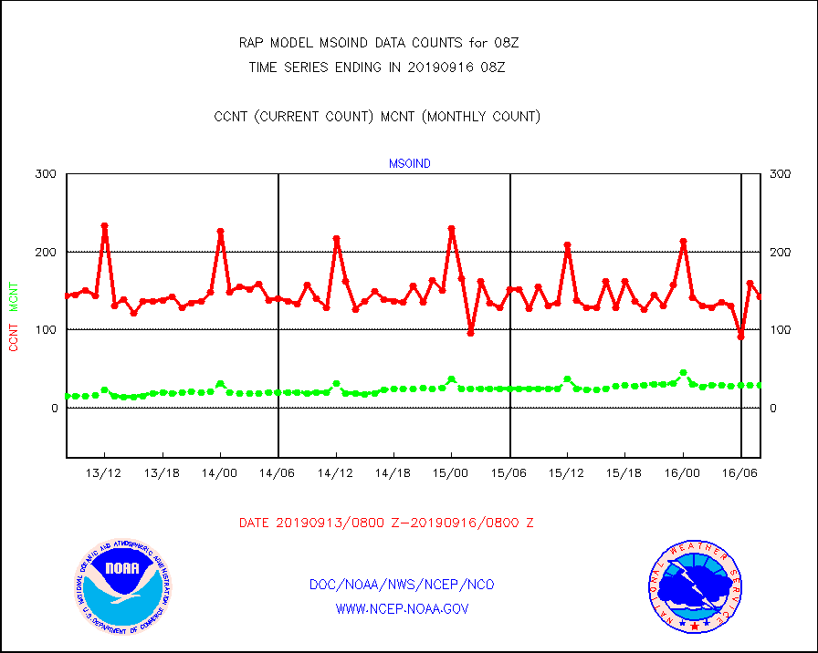
msoind |
Mesonet/MADIS Indiana Dept. of Transportation |
143 |
29 |
493.1 % |
1607.50-1608.50 |
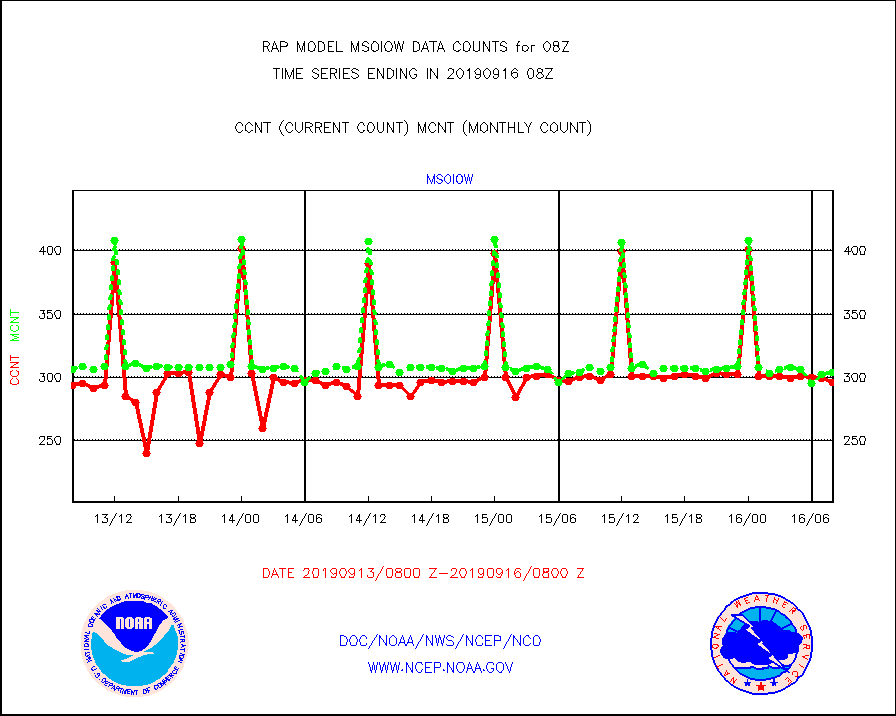
msoiow |
Mesonet/MADIS Iowa Department of Transportation |
296 |
304 |
97.4 % |
1607.50-1608.50 |
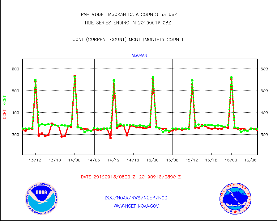
msokan |
Mesonet/MADIS Kansas Department of Transportation |
323 |
327 |
98.8 % |
1607.50-1608.50 |
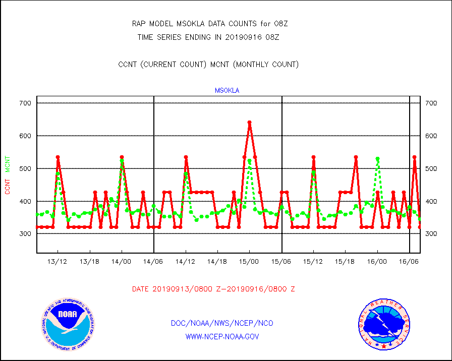
msokla |
Mesonet/MADIS Oklahoma Mesonet |
321 |
346 |
92.8 % |
1607.50-1608.50 |
msolju |
Mesonet/MADIS Louisiana State/Jackson State Univ. |
0 |
0 |
n/a |
1607.50-1608.50 |
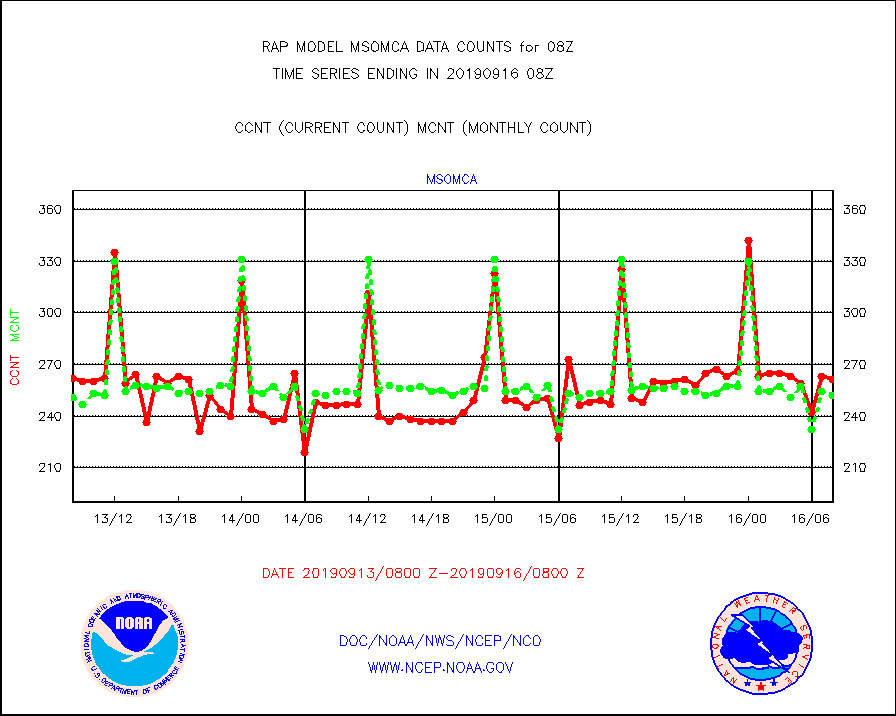
msomca |
Mesonet/MADIS Missouri Commercial Agricult Wx Net |
261 |
252 |
103.6 % |
1607.50-1608.50 |
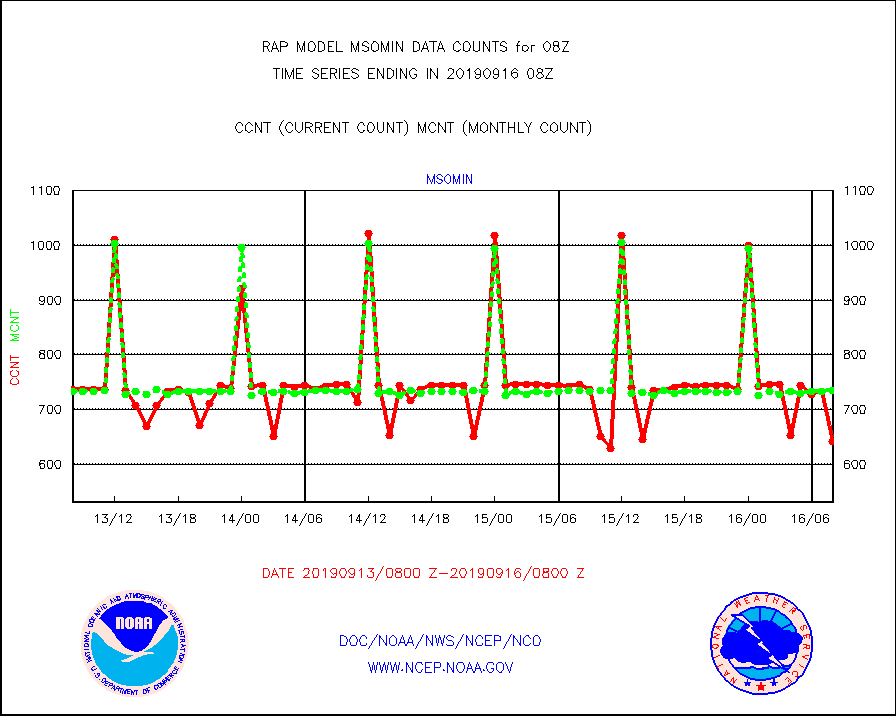
msomin |
Mesonet/MADIS Minnesota Dept. of Transportation |
641 |
734 |
87.3 % |
1607.50-1608.50 |
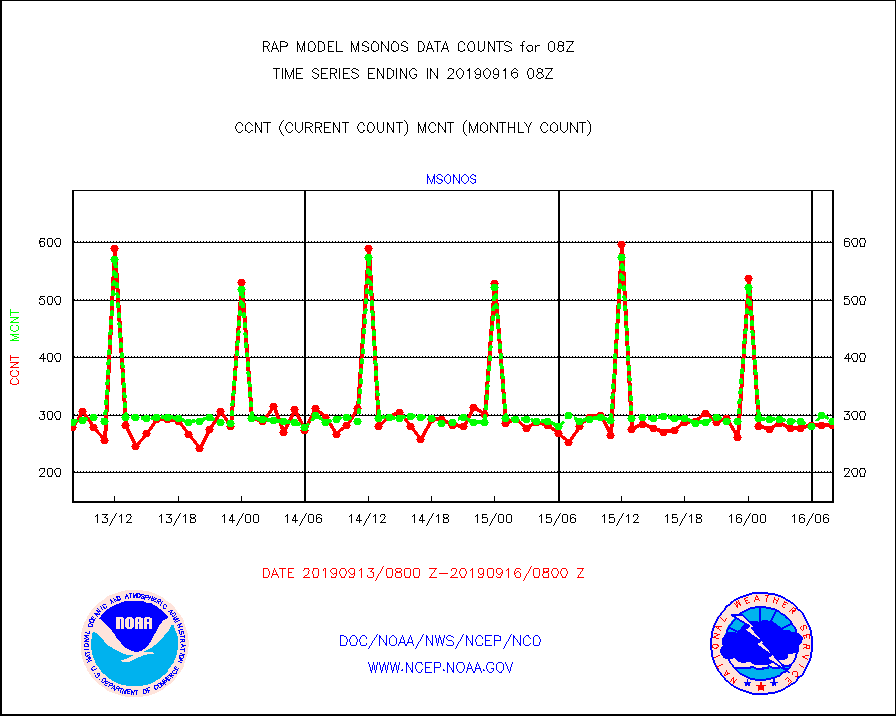
msonos |
Mesonet/MADIS NOS-Phys Oceanographic Realtime Sys |
283 |
290 |
97.6 % |
1607.50-1608.50 |
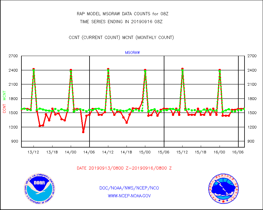
msoraw |
Mesonet/MADIS NFIC Remote Automated Wx Stns(RAWS) |
1585 |
1580 |
100.3 % |
1607.50-1608.50 |
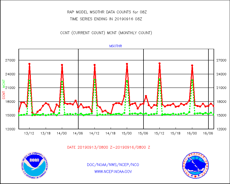
msothr |
Mesonet/MADIS many providers, not separated out |
16998 |
15181 |
112.0 % |
1607.50-1608.50 |
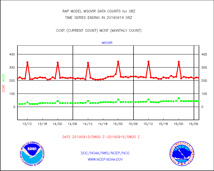
msovir |
Mesonet/MADIS Virginia Dept. of Transportation |
222 |
43 |
516.3 % |
1607.50-1608.50 |
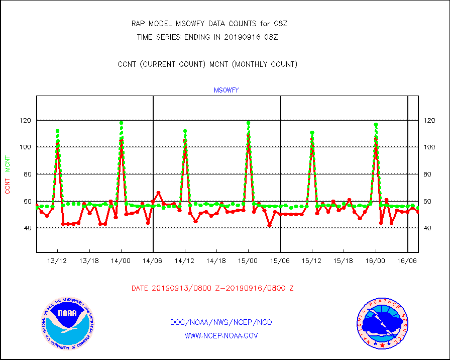
msowfy |
Mesonet/MADIS "Weather for You" |
52 |
55 |
94.5 % |
1607.50-1608.50 |
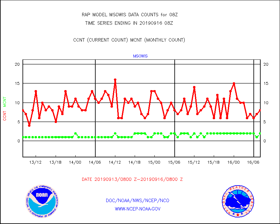
msowis |
Mesonet/MADIS Wisconsin Dept. of Transportation |
8 |
2 |
400.0 % |
1607.50-1608.50 |
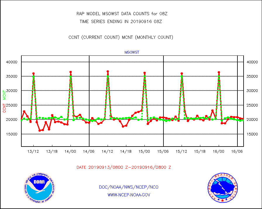
msowst |
Mesonet/MADIS MesoWest (many subproviders) |
20223 |
19733 |
102.5 % |
1607.50-1608.50 |
msowtx |
Mesonet/MADIS West Texas |
3239 |
1270 |
255.0 % |
1607.50-1608.50 |
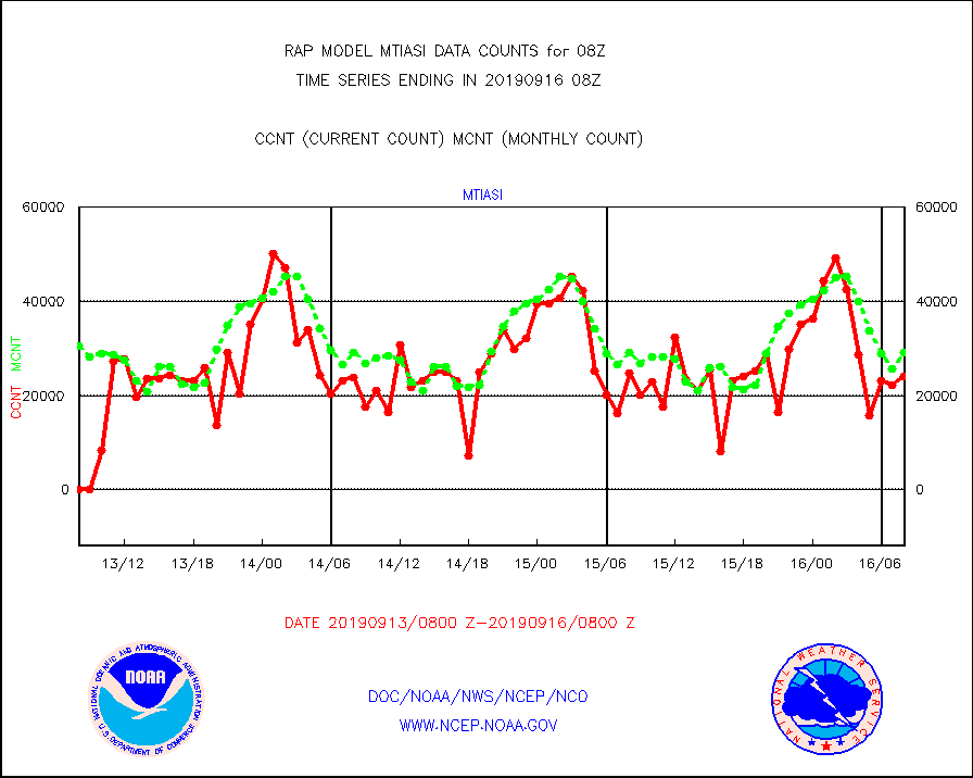
mtiasi |
METOP 1-2 IASI 1C radiance data (varbl. channels) |
24044 |
29068 |
82.7 % |
1606.00-1609.99 |
nxrdw2 |
NEXRAD Vel Azm Dsp(VAD) winds via Level 2 decoder |
679 |
863 |
78.7 % |
1607.00-1609.00 |
osbuv8 |
NOAA 16-19 Solar Backscatter UV-2 rad frm V8 BUFR |
27 |
25 |
108.0 % |
1606.00-1608.99 |
pibal |
PIBAL (from PILOT, PILOT SHIP, PILOT MOBIL) |
0 |
0 |
n/a |
1607.00-1609.00 |
pirep |
Manual PIREP aircraft data (dcded from AIREP fmt) |
33 |
16 |
206.2 % |
1604.75-1611.25 |
prflrp |
Profilr winds from PIBAL (PILOT,PILOT SHIP/MOBIL) |
0 |
0 |
n/a |
1606.50-1609.50 |
radw25 |
NEXRAD radial wind superobs (Level 2.5 - ORPG) |
0 |
0 |
n/a |
1607.00-1609.00 |
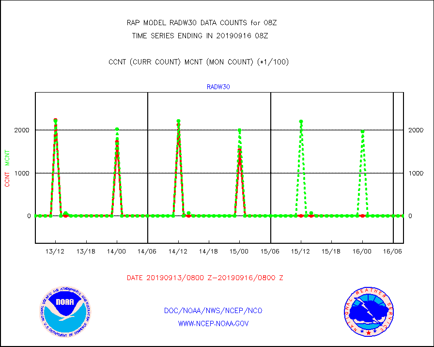
radw30 |
NEXRAD radial wind superobs (Level 3 - NIDS) |
0 |
0 |
n/a |
1607.00-1609.00 |
raobm |
Rawinsonde - mobile land (from TEMP/PILOT MOBIL) |
0 |
0 |
n/a |
1607.00-1609.00 |
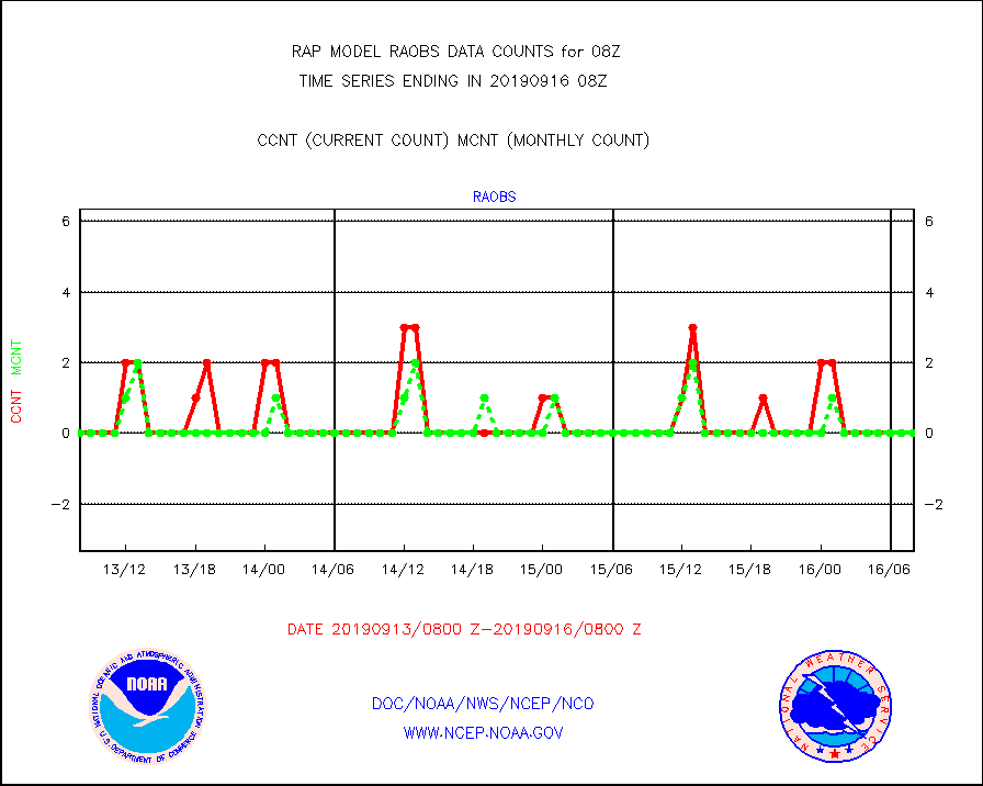
raobs |
Rawinsonde - ship (from TEMP SHIP, PILOT SHIP) |
0 |
0 |
n/a |
1607.00-1609.00 |
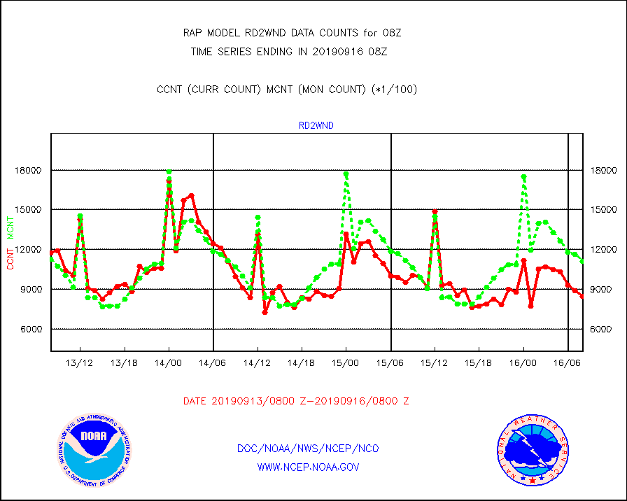
rd2wnd |
NEXRAD radial wind (Level 2 - GTS) |
846570 |
1110227 |
76.3 % |
1607.50-1608.49 |
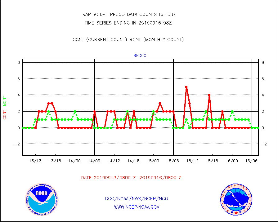
recco |
Flight level reconnaissance aircraft data |
0 |
0 |
n/a |
1607.00-1609.00 |
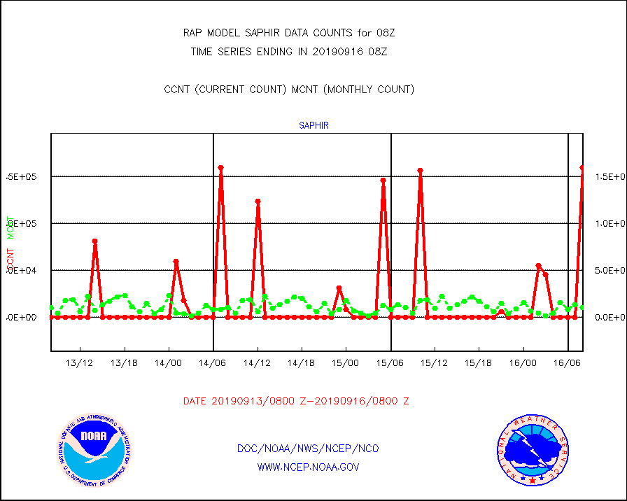
saphir |
Megha-Tropiques SAPHIR L1A2 brightness temps |
159871 |
10058 |
n/a |
1605.00-1610.99 |
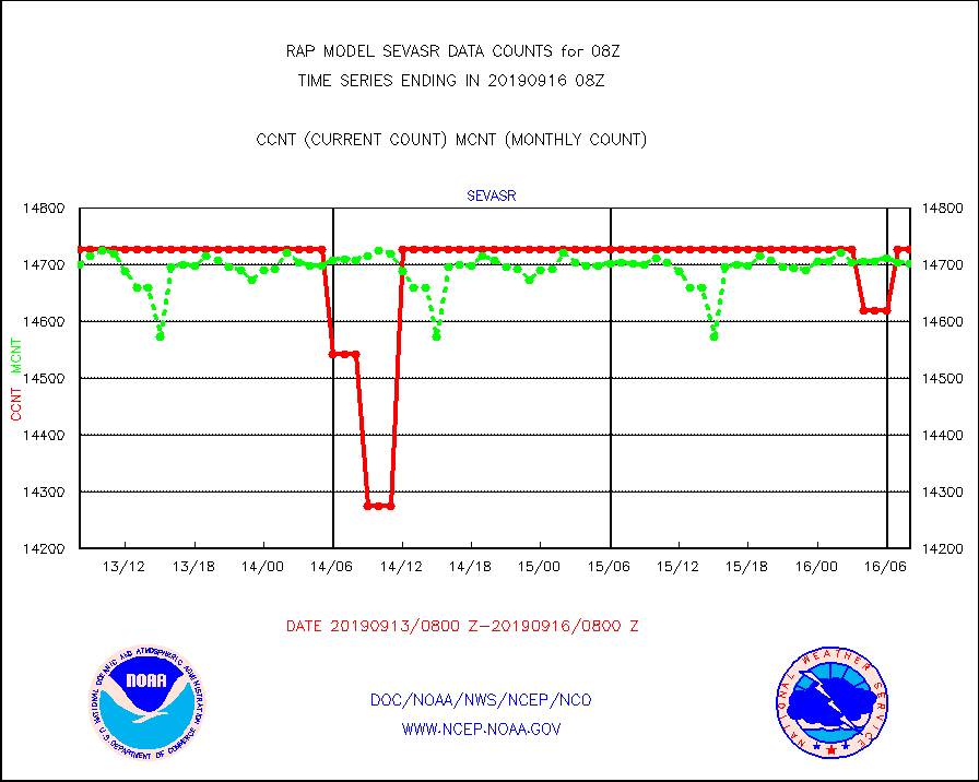
sevasr |
METEOSAT-10 2nd Gen SEVIRI All Sky Radiance(proc) |
14727 |
14703 |
100.2 % |
1606.00-1609.99 |
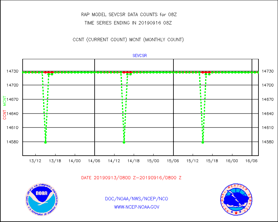
sevcsr |
METEOSAT-10 2nd Gen SEVIRI Clr Sky Radiance(proc) |
14727 |
14727 |
100.0 % |
1606.00-1609.99 |
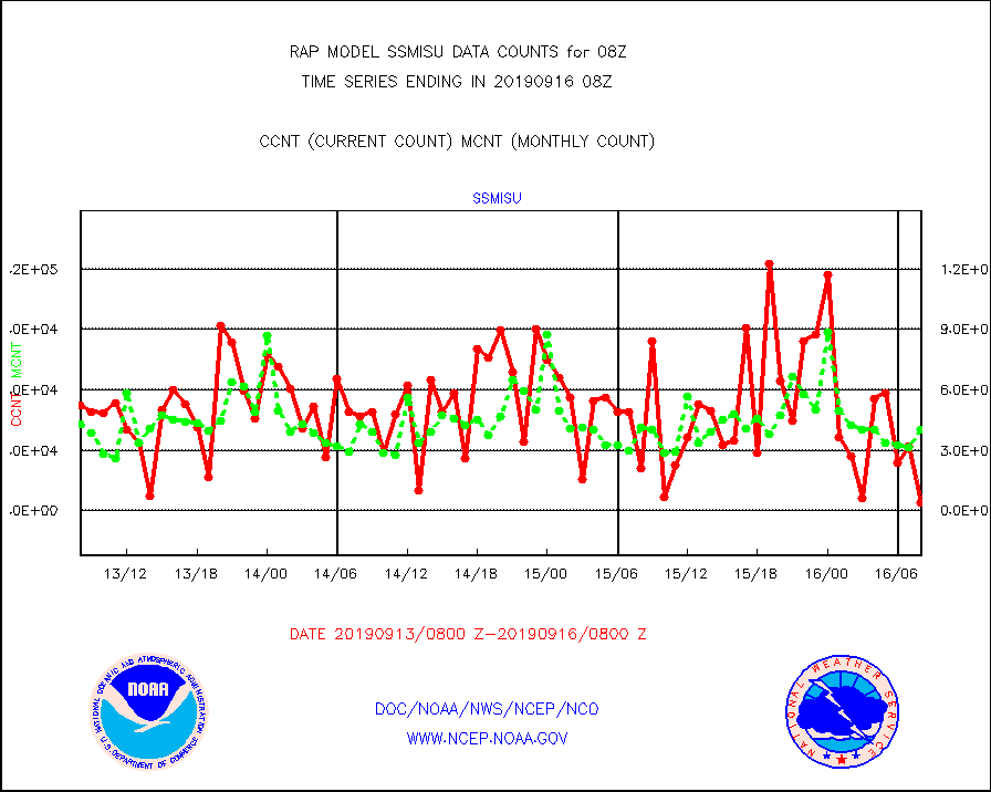
ssmisu |
DMSP SSM/IS 1C radiance data (Unified Pre-Proc.) |
3968 |
40067 |
9.9 % |
1606.00-1609.99 |
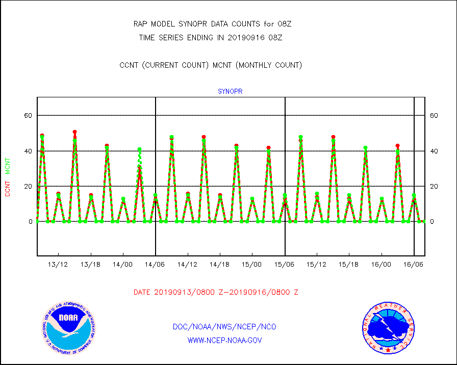
synopr |
Synoptic - restricted (WMO Res 40) manual & auto. |
0 |
0 |
n/a |
1607.50-1608.50 |
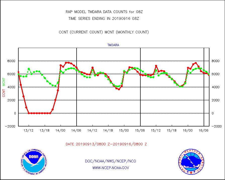
tmdara |
TAMDAR aircft data-all types(from Panasonic,BUFR) |
5821 |
5983 |
97.3 % |
1604.75-1611.25 |
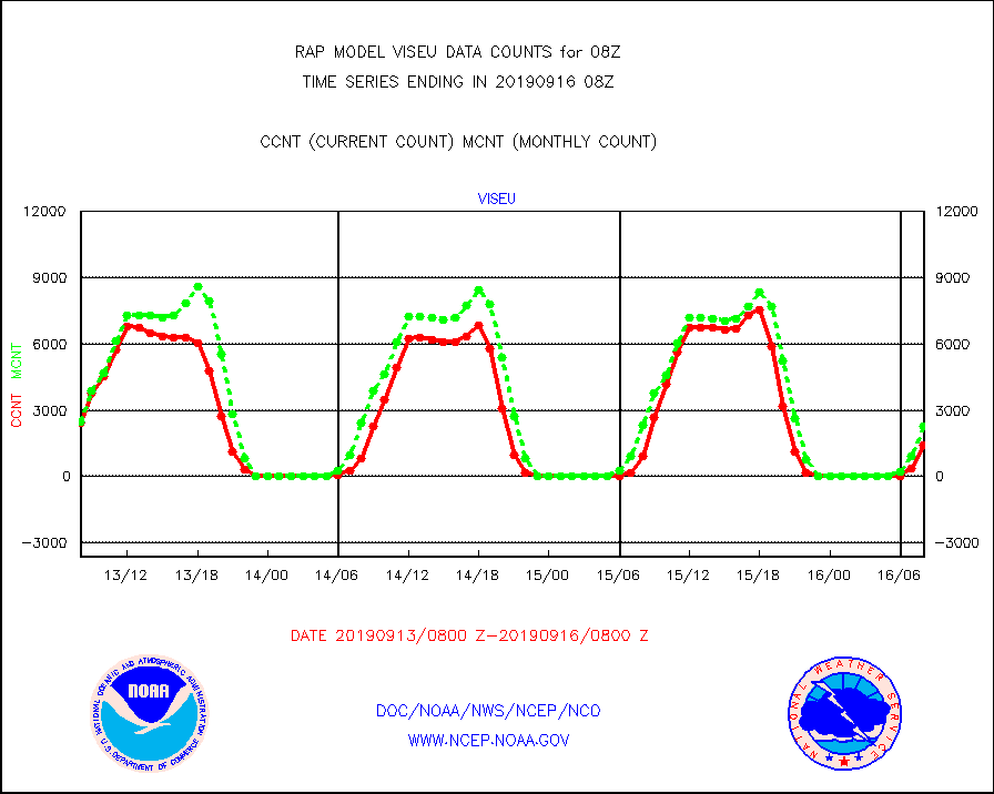
viseu |
METEOSAT/EUMETSAT visible derived cloud motion |
1404 |
2293 |
61.2 % |
1606.50-1609.49 |
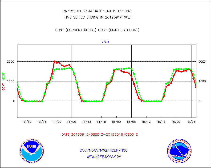
visja |
MTSAT/JMA visible derived cloud motion |
714 |
911 |
78.4 % |
1605.50-1610.50 |
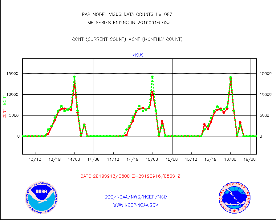
visus |
GOES/NESDIS visible derived cloud motion |
0 |
0 |
n/a |
1607.00-1607.99 |


