| Critical Data with Normal Counts |
|---|
| Type | Description | Hourly Count | Monthly Average | Percent (%) of Monthly Mean | UTC Time Window |
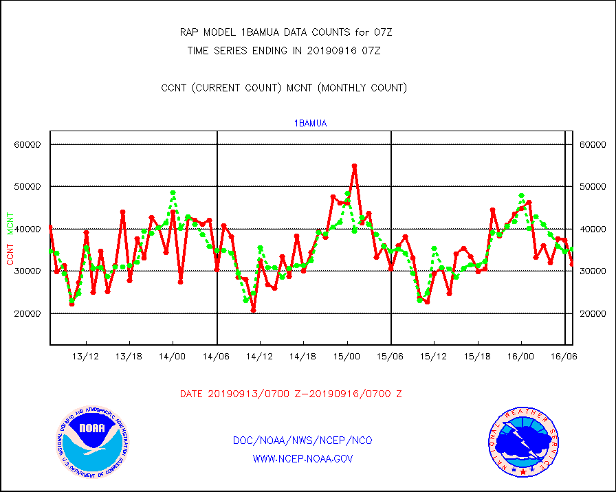
1bamua |
NOAA 15-19 & METOP 1-2 AMSU-A NCEP-proc. br.temps |
31599 |
35270 |
89.6 % |
1604.00-1609.99 |
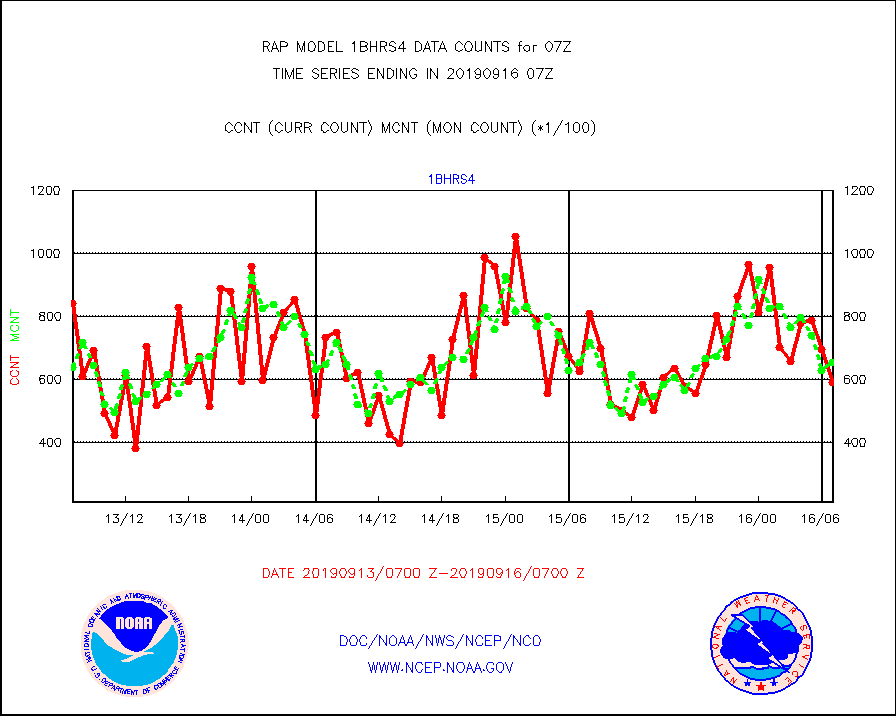
1bhrs4 |
NOAA 18-19 & METOP 1-2 HIRS-4 NCEP-proc. br.temps |
59283 |
65370 |
90.7 % |
1604.00-1609.99 |
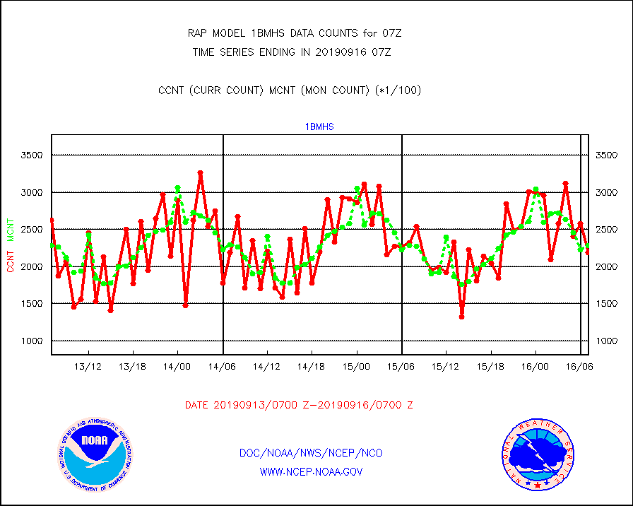
1bmhs |
NOAA 18-19 & METOP 1-2 MHS NCEP-proces. br. temps |
218857 |
228840 |
95.6 % |
1604.00-1609.99 |
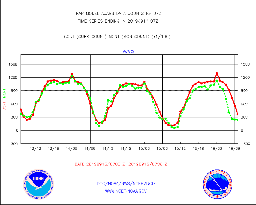
acars |
MDCRS ACARS acft data from ARINC(dcded from BUFR) |
36280 |
23847 |
152.1 % |
1603.75-1610.25 |
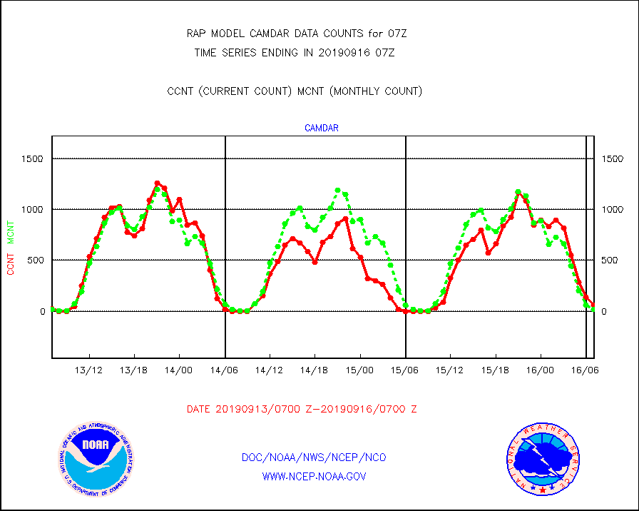
camdar |
Canadian AMDAR aircraft data (decoded from BUFR) |
65 |
19 |
342.1 % |
1603.75-1610.25 |
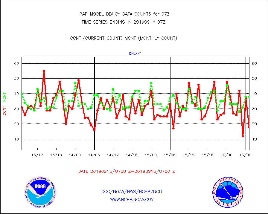
dbuoy |
Buoys decoded from FM-18 fmt (moored or drifting) |
18 |
38 |
47.4 % |
1606.50-1607.50 |
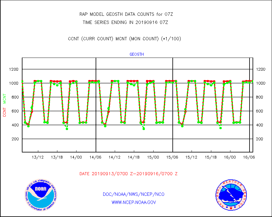
geosth |
GOES/NESDIS hi-resol. (1x1 f-o-v) cloud data |
102801 |
102745 |
100.1 % |
1605.75-1606.99 |
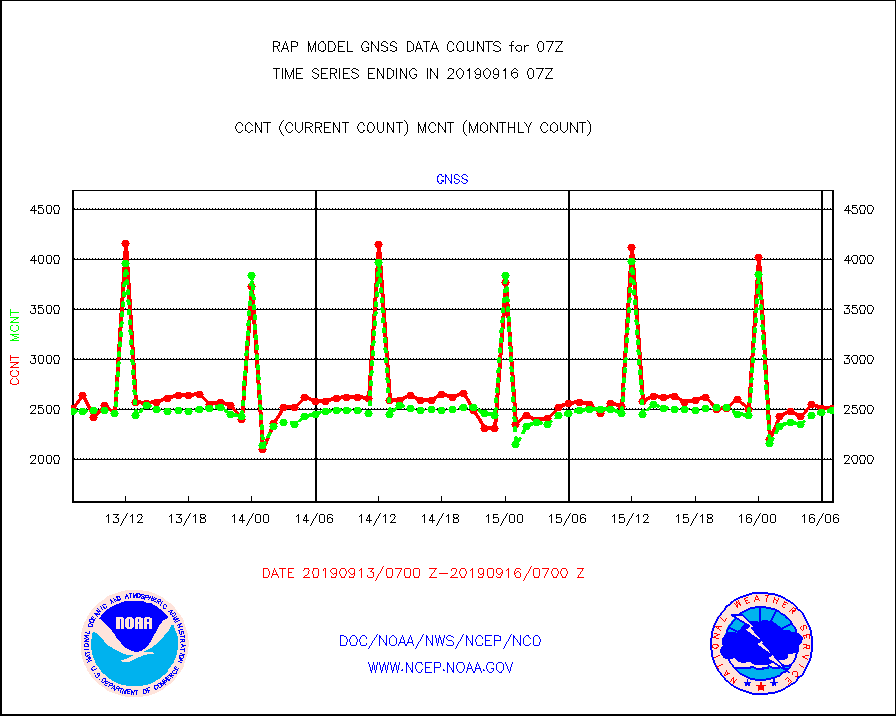
gnss |
Grnd-based Gbl Navigation Sat System (GNSS) data |
2504 |
2484 |
100.8 % |
1605.95-1606.05 |
h20mo |
MODIS (AQUA/TERRA) wvpr imager derived cld motion |
0 |
0 |
n/a |
1604.50-1609.50 |
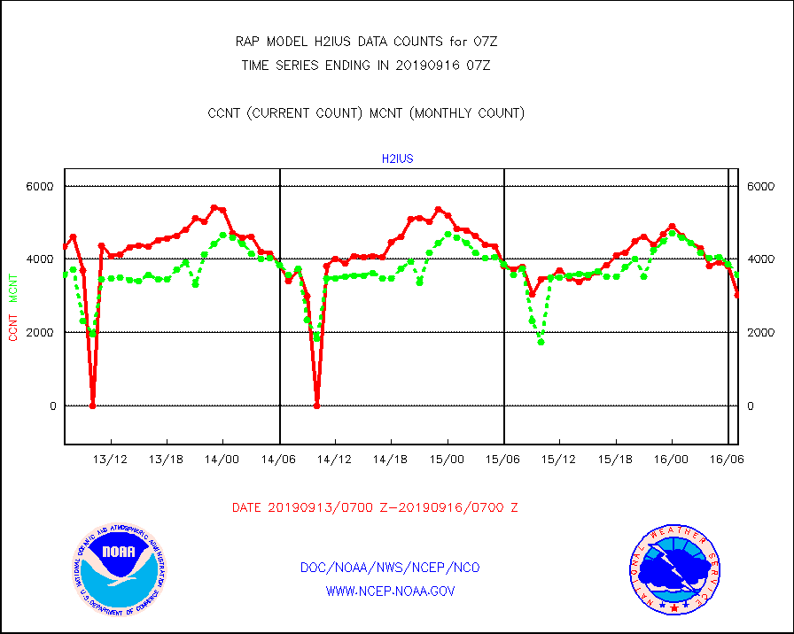
h2ius |
GOES/NESDIS water vapor imager derived cld motion |
3010 |
3563 |
84.5 % |
1606.00-1606.99 |
infmo |
MODIS (AQUA/TERRA) ir l-wave derived cloud motion |
0 |
0 |
n/a |
1604.50-1609.50 |
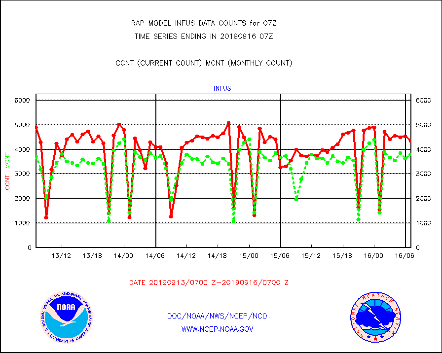
infus |
GOES/NESDIS infrared lg-wave derived cloud motion |
4366 |
3804 |
114.8 % |
1606.00-1606.99 |
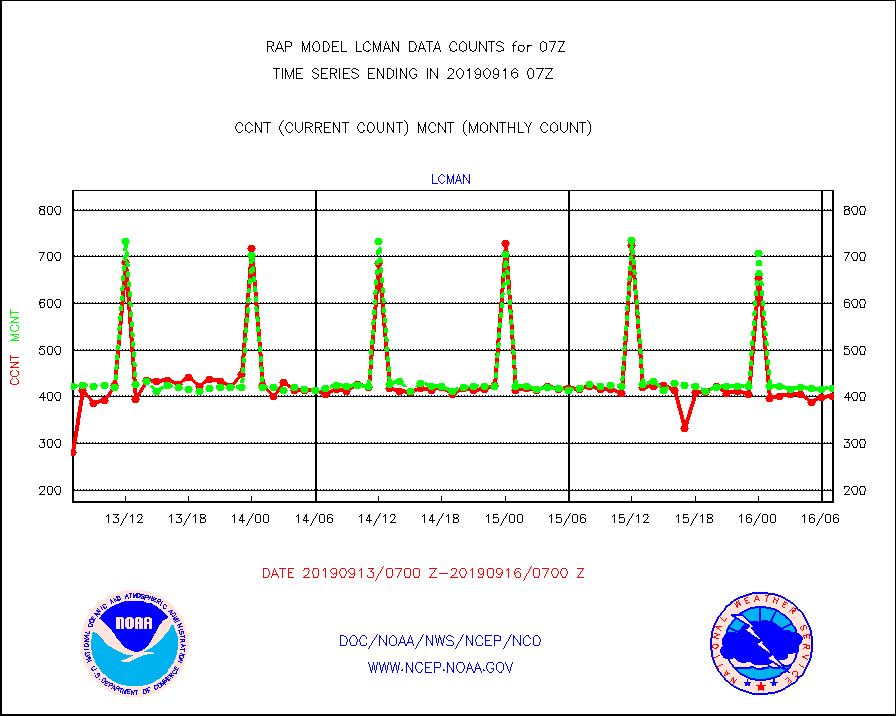
lcman |
Land-based CMAN stations decoded from CMAN format |
401 |
417 |
96.2 % |
1606.50-1607.50 |
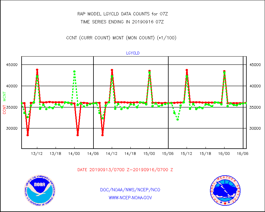
lgycld |
GOES/NASA(Langley) hi-res. (1x1 f-o-v) cloud data |
3602849 |
3593082 |
100.3 % |
1606.50-1607.50 |
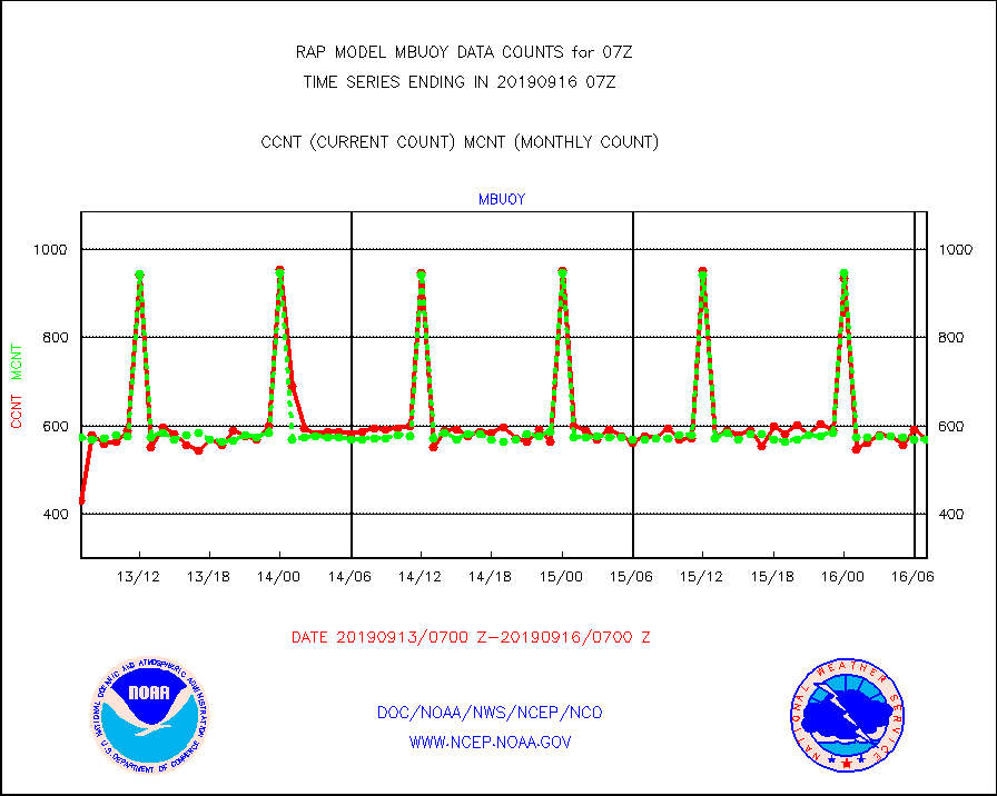
mbuoy |
Buoys decoded from FM-13 format (moored) |
570 |
569 |
100.2 % |
1606.50-1607.50 |
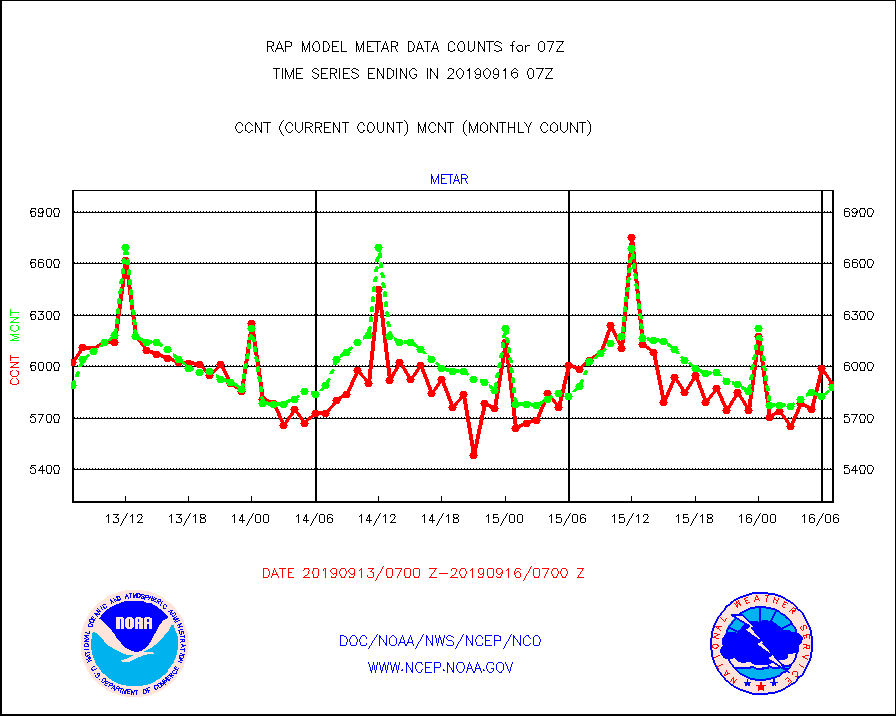
metar |
Aviation - METAR |
5897 |
5878 |
100.3 % |
1606.50-1607.50 |
nxrdw |
NEXRAD Vel Azm Dsp(VAD) winds via radar coded msg |
450 |
449 |
100.2 % |
1606.00-1608.00 |
prflrb |
Multi-Agency Profiler (MAP) and SODAR winds |
108 |
133 |
81.2 % |
1605.50-1608.50 |
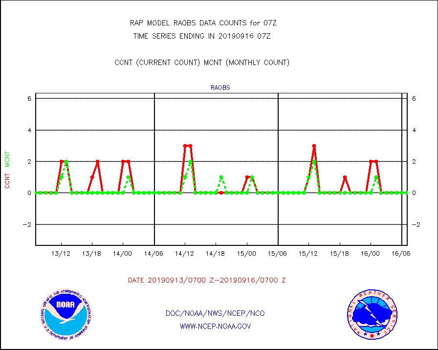
raobf |
Rawinsonde - fixed land (from TEMP or PILOT) |
7 |
16 |
43.8 % |
1606.00-1608.00 |
rass |
RASS temperatures (NOAA and Multi-Agency) |
19 |
33 |
57.6 % |
1606.50-1607.50 |
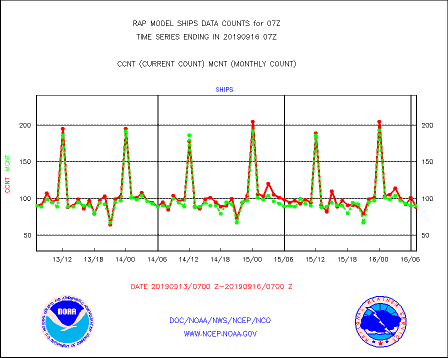
ships |
Ship - manual and automatic, restricted |
88 |
90 |
97.8 % |
1606.50-1607.50 |
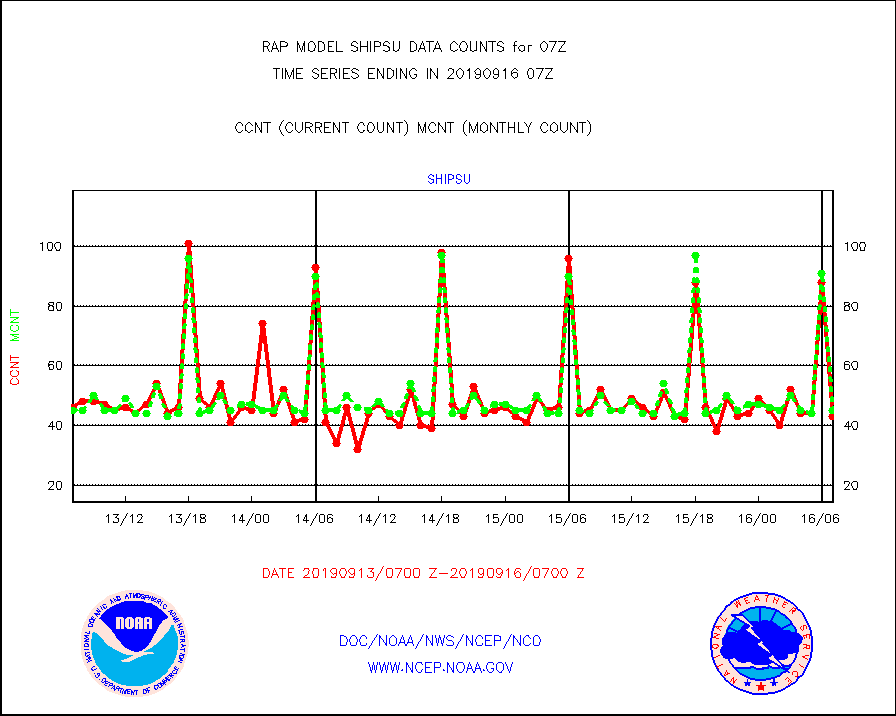
shipsu |
Ship - manual and automatic, unrestricted |
43 |
45 |
95.6 % |
1606.50-1607.50 |
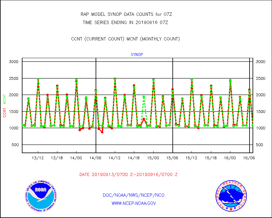
synop |
Synoptic - fixed manual and automatic |
1085 |
1084 |
100.1 % |
1606.50-1607.50 |
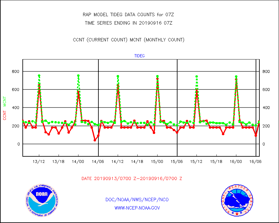
tideg |
Tide gauge reports decoded from CREX format |
251 |
245 |
102.4 % |
1606.50-1607.50 |
| Data Types of Opportunity with Normal Counts |
|---|
| Type | Description | Hourly Count | Monthly Average | Percent (%) of Monthly Mean | UTC Time Window |
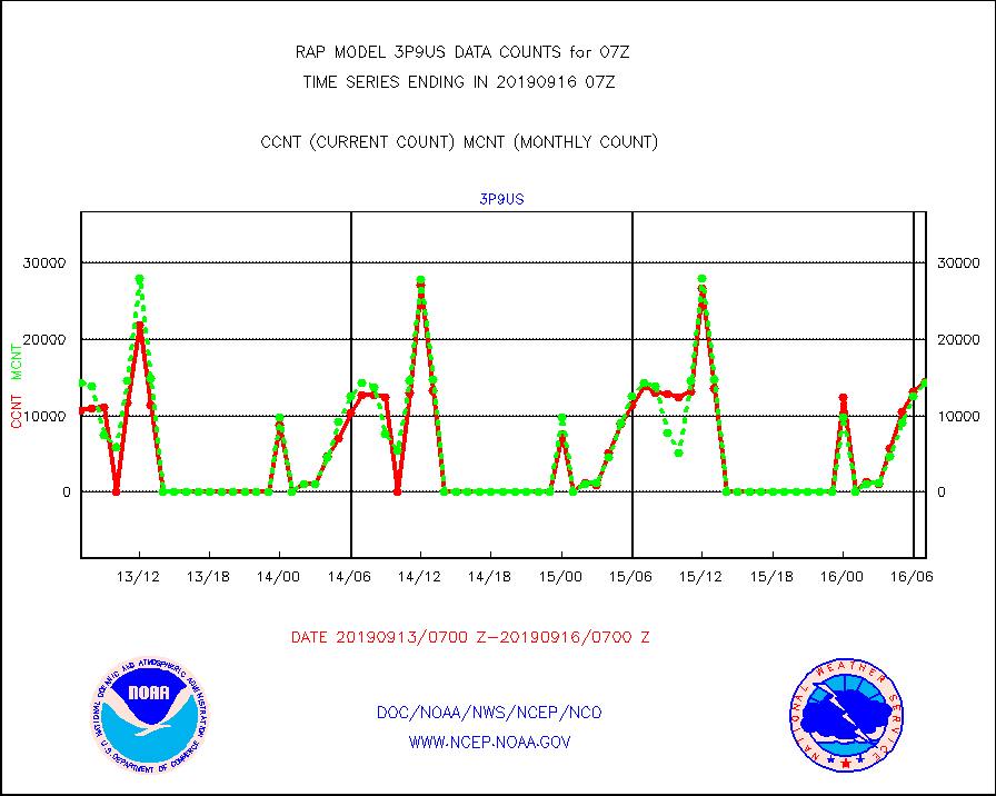
3p9us |
GOES/NESDIS infrared shrt-wave derived cld motion |
14387 |
14359 |
100.2 % |
1606.00-1606.99 |
acarsa |
MDCRS ACARS acft data (ARINC via AFWA)(AIREP fmt) |
0 |
0 |
n/a |
1603.75-1610.25 |
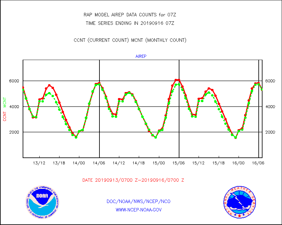
airep |
Manual AIREP aircraft data (dcded from AIREP fmt) |
5323 |
5325 |
100.0 % |
1603.75-1610.25 |
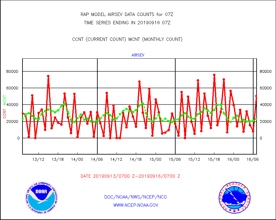
airsev |
AQUA AIRS/AMSU-A/HSB brightness temps- every FOV |
50347 |
22770 |
221.1 % |
1604.00-1609.99 |
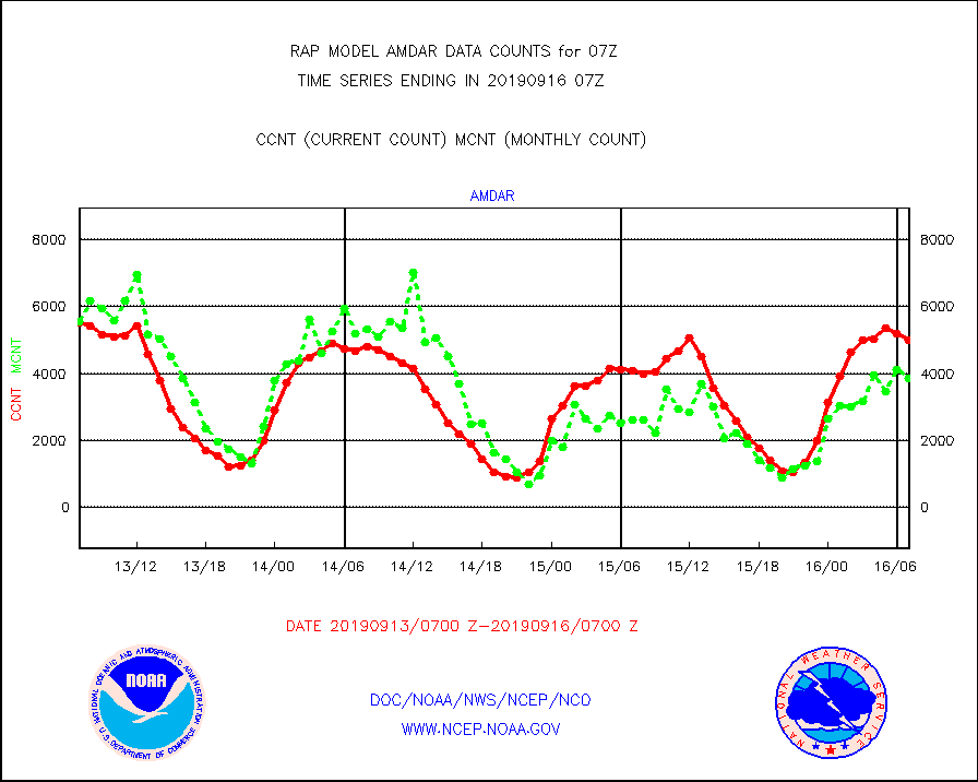
amdar |
AMDAR aircraft data (decoded from AMDAR format) |
4989 |
3859 |
129.3 % |
1603.75-1610.25 |
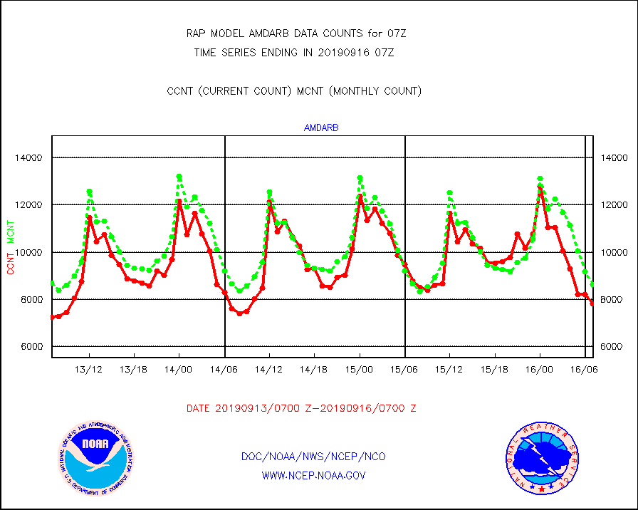
amdarb |
AMDAR aircraft data (decoded from BUFR) |
7815 |
8626 |
90.6 % |
1603.75-1610.25 |
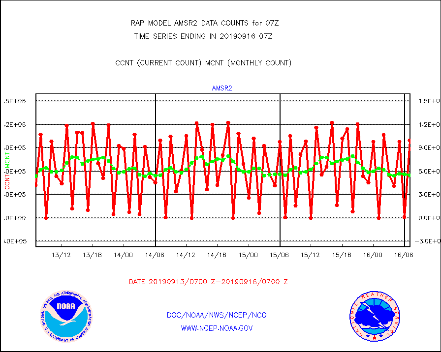
amsr2 |
GCOM-W AMSR2 1B brightness temperatures |
998127 |
550691 |
181.2 % |
1604.00-1604.99 |
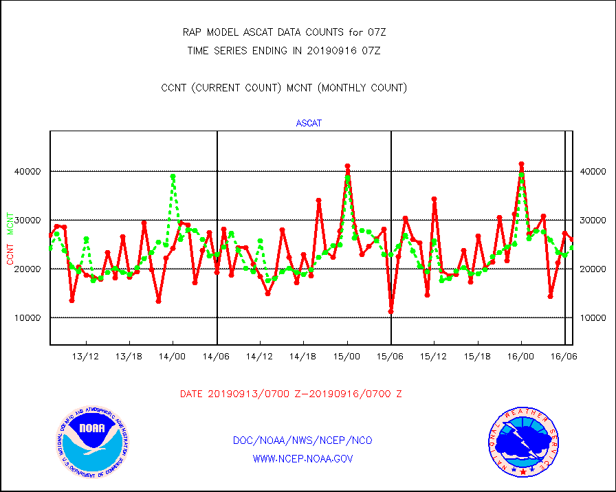
ascat |
METOP 1-2 ASCAT products |
26049 |
24384 |
106.8 % |
1605.00-1609.00 |
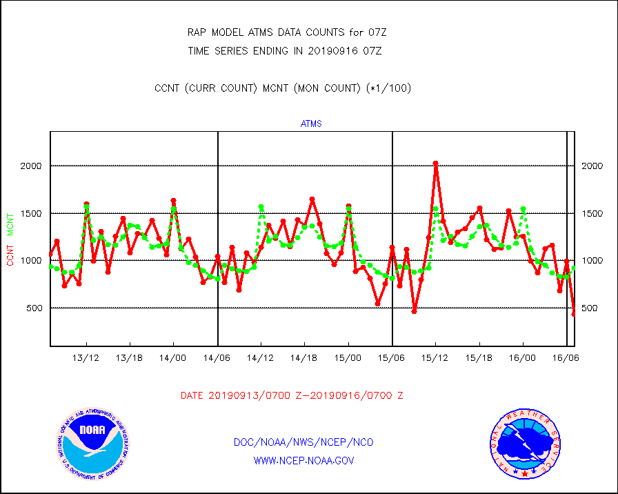
atms |
NPP Adv. Tech. Microwave Sounder (ATMS) br. temps |
43149 |
92675 |
46.6 % |
1605.00-1608.99 |
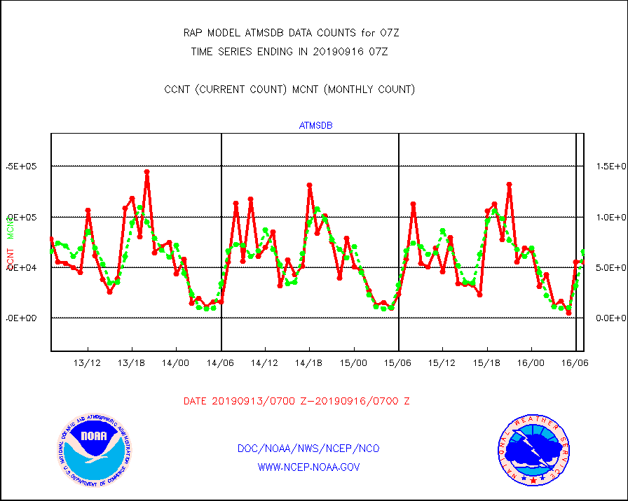
atmsdb |
NPP Adv Tech MW Sndr(ATMS) b. temps-dir bcst SSEC |
55118 |
66042 |
83.5 % |
1605.00-1608.99 |
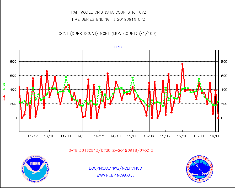
cris |
NPP Cross-track Infrared Sounder (CrIS) radiances |
0 |
23517 |
0.0 % |
1605.00-1608.99 |
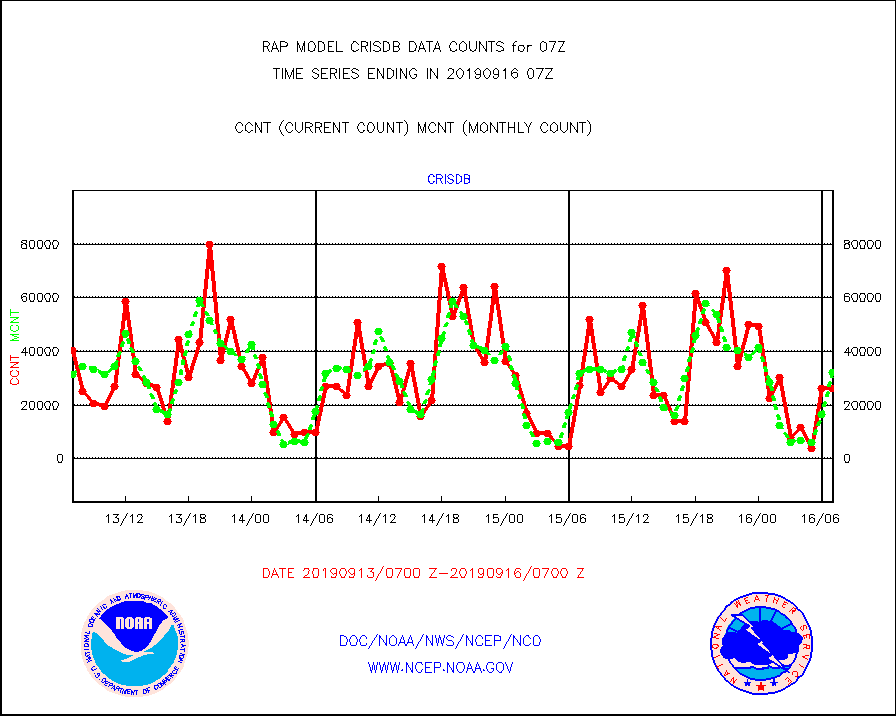
crisdb |
NPP Crss-trk IR Sndr(CrIS) radiance-dir bcst SSEC |
26184 |
32081 |
81.6 % |
1605.00-1608.99 |
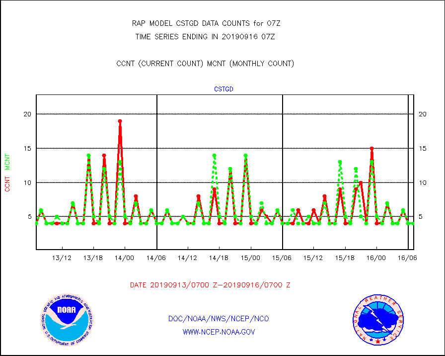
cstgd |
Coast Guard |
4 |
4 |
100.0 % |
1606.50-1607.50 |
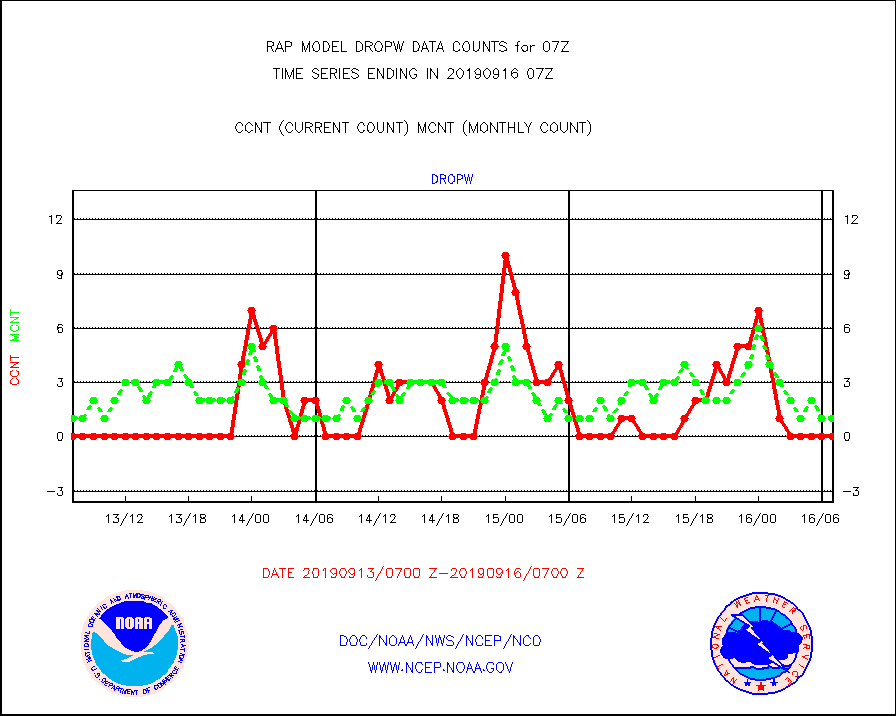
dropw |
Dropwinsonde (from TEMP DROP) |
0 |
1 |
0.0 % |
1606.00-1608.00 |
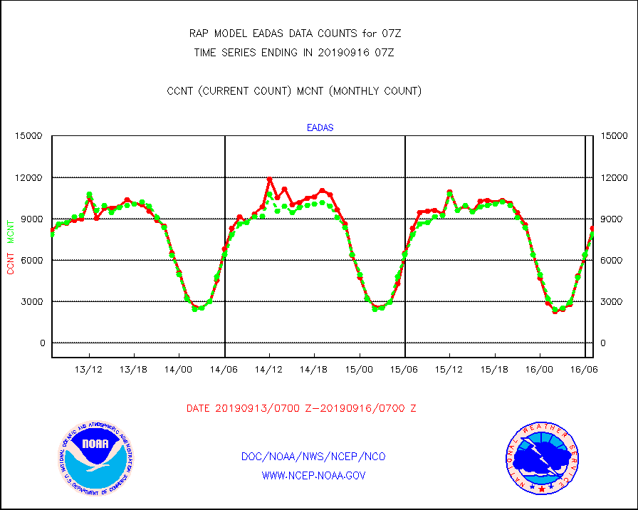
eadas |
E-AMDAR (European AMDAR acft decoded from BUFR) |
8334 |
7881 |
105.7 % |
1603.75-1610.25 |
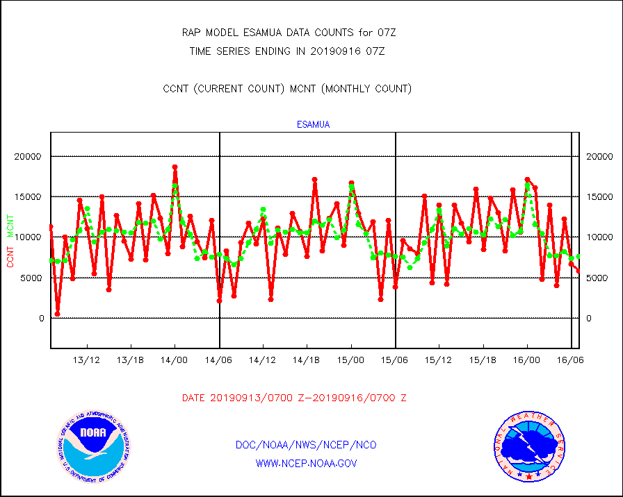
esamua |
NOAA 15-19 & METOP 1-2 AMSU-A proc btmps frm RARS |
5815 |
7658 |
75.9 % |
1606.00-1608.00 |
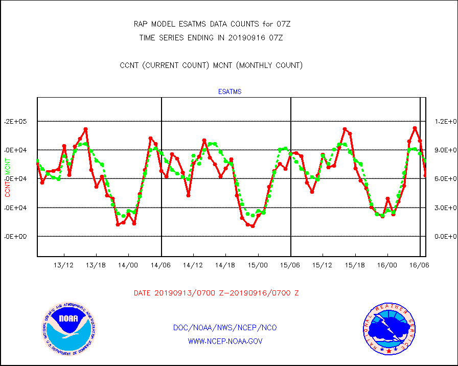
esatms |
NPP Adv. Tech. MW Sndr (ATMS) br. temps from RARS |
63556 |
78936 |
80.5 % |
1605.00-1608.99 |
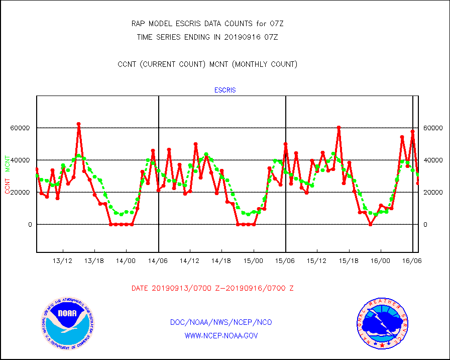
escris |
NPP Crss-track IR Sndr (CrIS) radiances from RARS |
25691 |
31058 |
82.7 % |
1605.00-1608.99 |
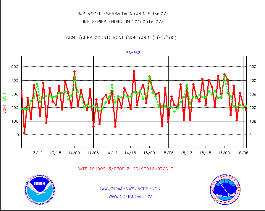
eshrs3 |
NOAA 15-19 & METOP 1-2 HIRS-3/4 pr btmps frm RARS |
18286 |
21045 |
86.9 % |
1606.00-1608.00 |
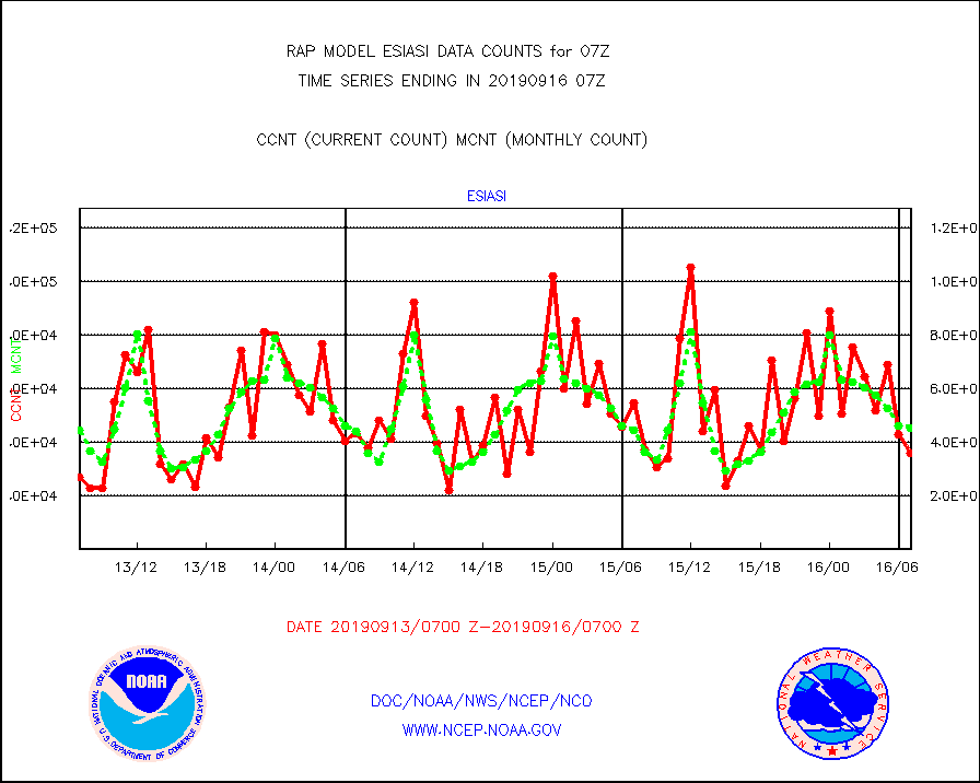
esiasi |
METOP 1-2 IASI 1C radiance data vbl chn from RARS |
36042 |
45213 |
79.7 % |
1605.00-1608.99 |
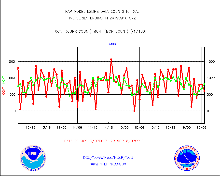
esmhs |
NOAA 18-19 & METOP 1-2 MHS proc. btemps from RARS |
60430 |
82386 |
73.3 % |
1606.00-1608.00 |
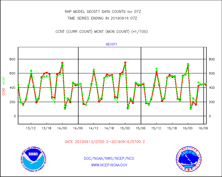
geost1 |
GOES/NESDIS hi-resol. (1x1 f-o-v) sndgs/radiances |
43366 |
46001 |
94.3 % |
1606.00-1608.00 |
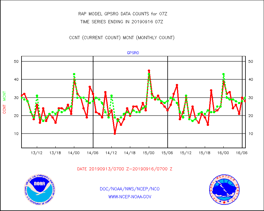
gpsro |
GPS radio occultation data |
28 |
30 |
93.3 % |
1605.00-1608.99 |
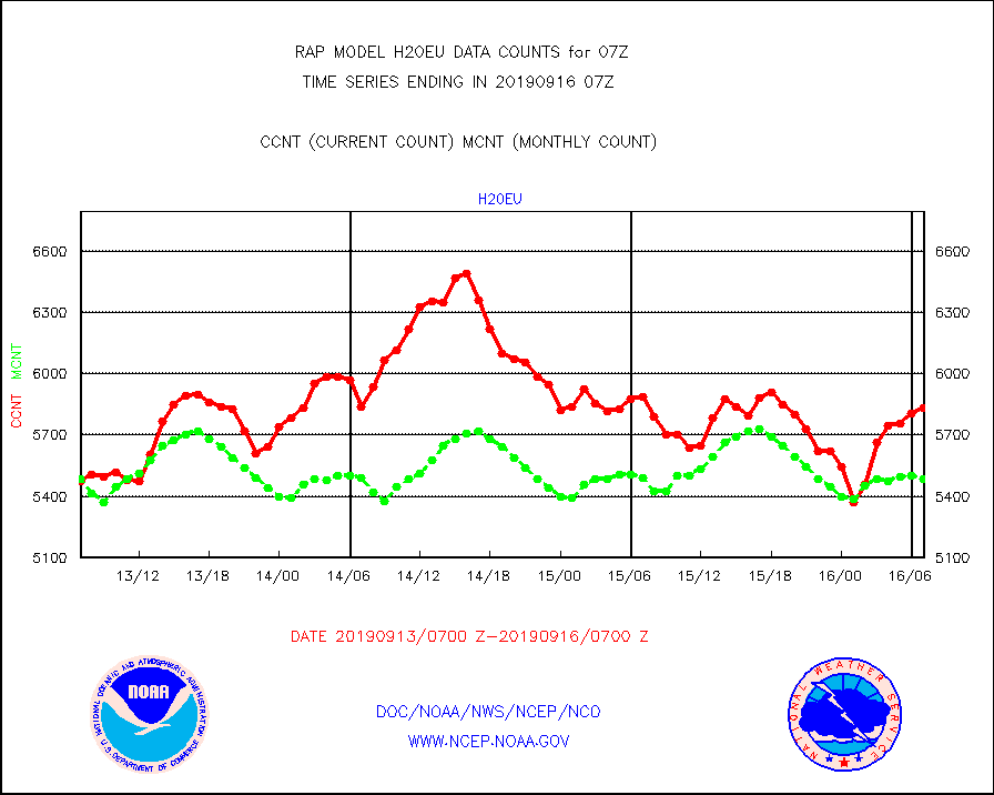
h20eu |
METEOSAT/EUMETSAT wvpr imager derived cld motion |
5834 |
5486 |
106.3 % |
1605.50-1608.49 |
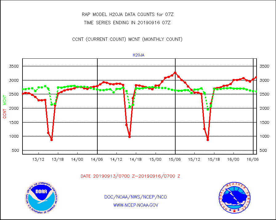
h20ja |
MTSAT/JMA water vapor imager derived cloud motion |
3112 |
2602 |
119.6 % |
1604.50-1609.50 |
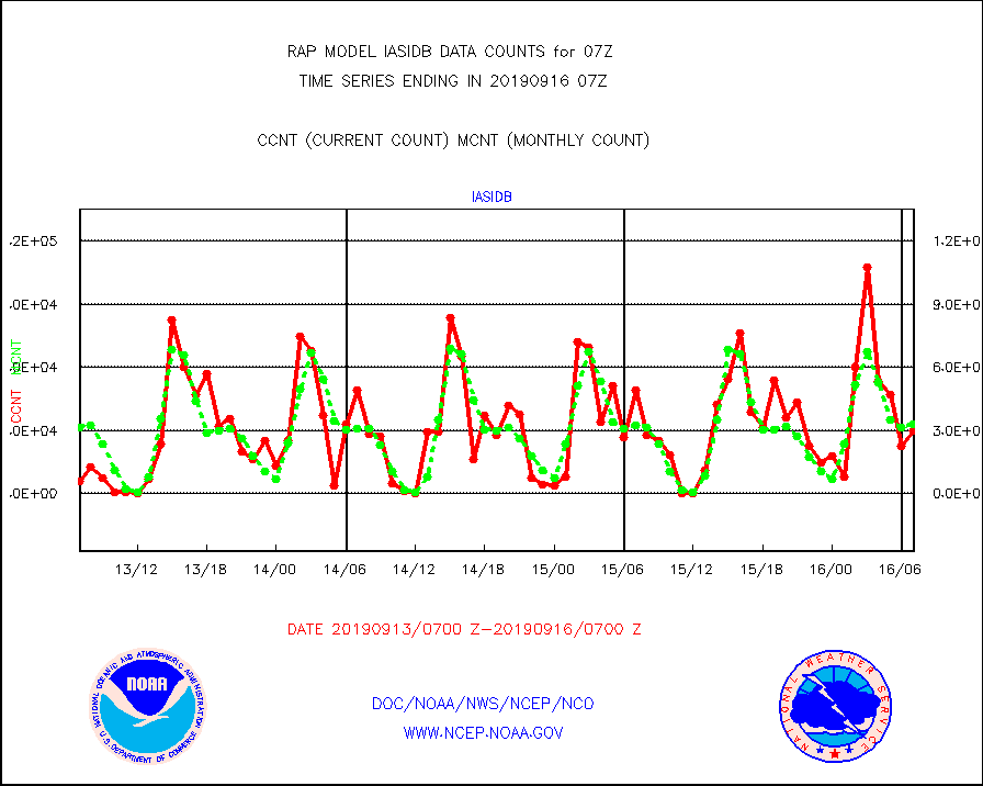
iasidb |
METOP 1-2 IASI 1C radiances-direct broadcast SSEC |
29618 |
32698 |
90.6 % |
1605.00-1608.99 |
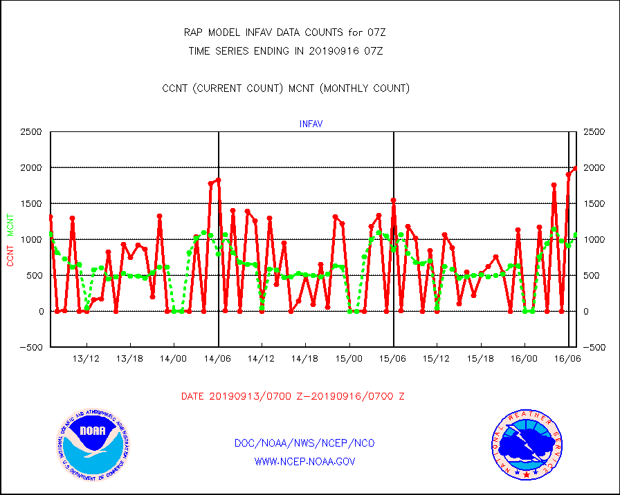
infav |
AVHRR (NOAA/METOP) ir lg-wave derived cld motion |
1991 |
1068 |
186.4 % |
1604.50-1609.50 |
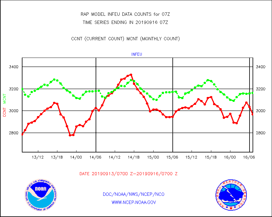
infeu |
METEOSAT/EUMETSAT ir lg-wave derived cloud motion |
2967 |
3164 |
93.8 % |
1605.50-1608.49 |
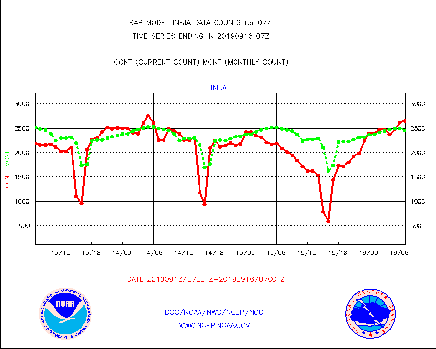
infja |
MTSAT/JMA infrared long-wave derived cloud motion |
2648 |
2462 |
107.6 % |
1604.50-1609.50 |
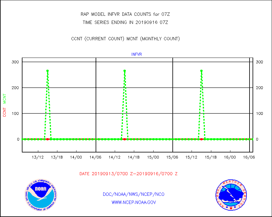
infvr |
VIIRS (NPP) infrared lg-wave derived cloud motion |
0 |
0 |
n/a |
1604.50-1609.50 |
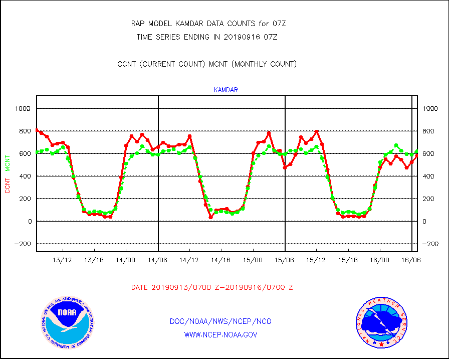
kamdar |
Korean AMDAR aircraft data (decoded from BUFR) |
581 |
621 |
93.6 % |
1603.75-1610.25 |
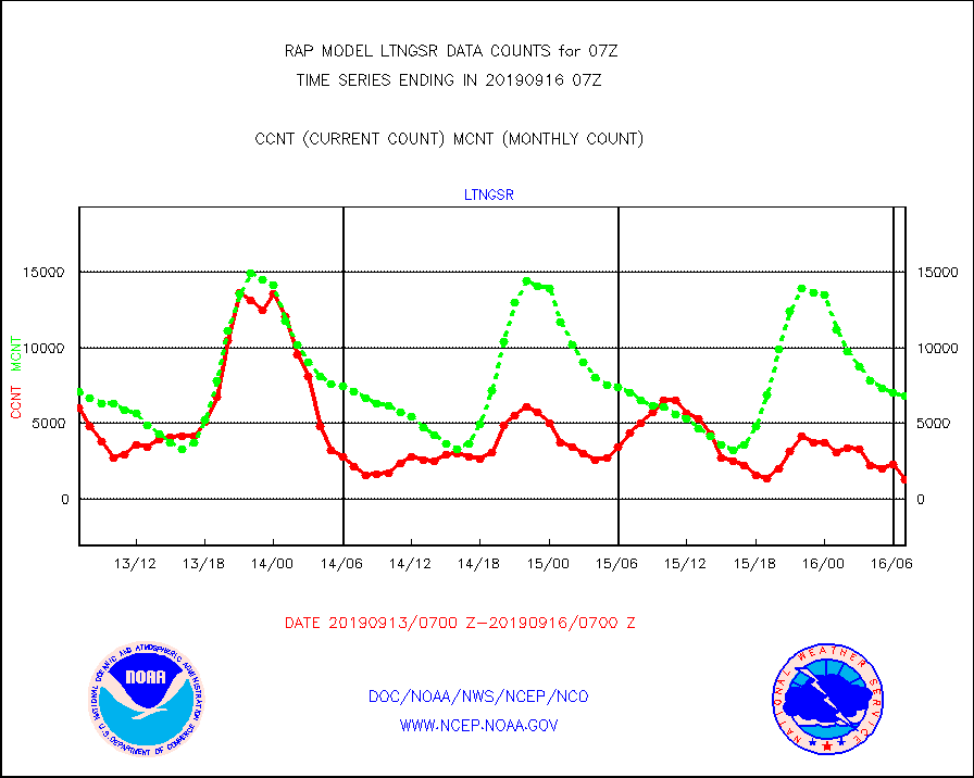
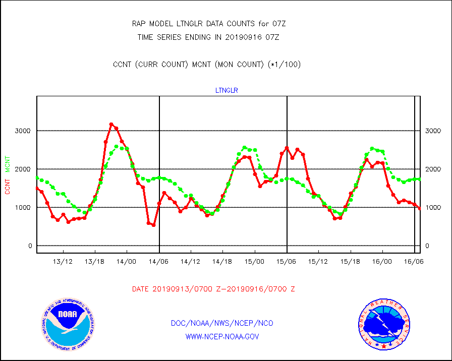
ltnglr |
LLDN Long-rng lightning from Vaisala via NOAAPORT |
98501 |
173944 |
56.6 % |
1606.00-1607.50 |
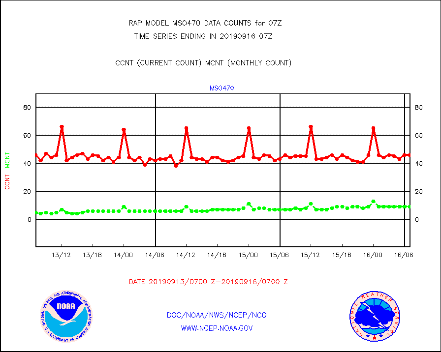
mso470 |
Mesonet/MADIS Colorado E-470 (Interstate 470) |
46 |
9 |
511.1 % |
1606.50-1607.50 |
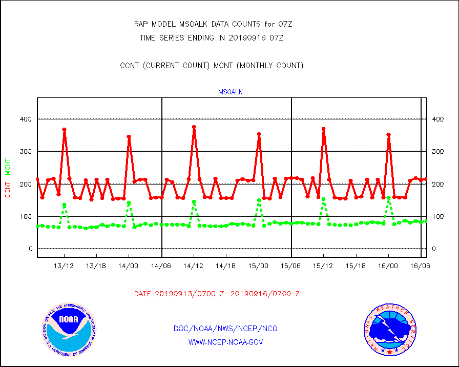
msoalk |
Mesonet/MADIS Alaska Department of Transportation |
215 |
86 |
250.0 % |
1606.50-1607.50 |
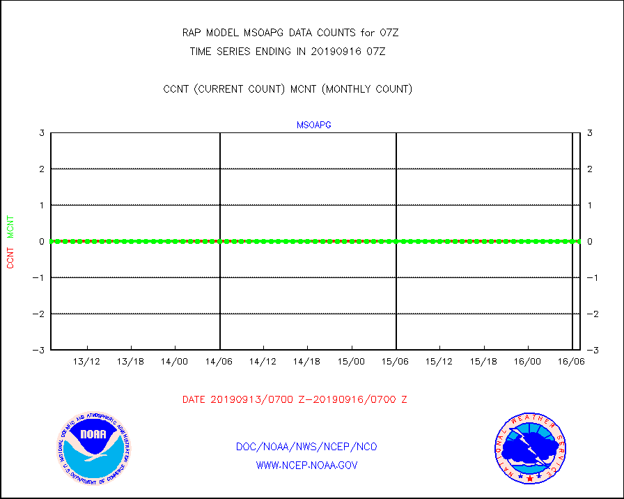
msoapg |
Mesonet/MADIS U.S. Army Aberdeen Proving Grounds |
0 |
0 |
n/a |
1606.50-1607.50 |
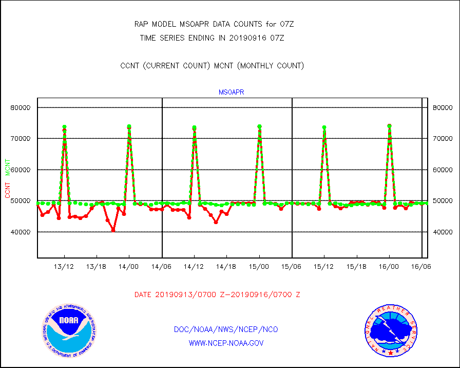
msoapr |
Mesonet/MADIS Citizen Weather Observers Program |
49263 |
49253 |
100.0 % |
1606.50-1607.50 |
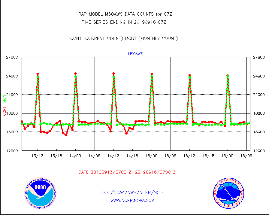
msoaws |
Mesonet/MADIS AWS Convergence Technologies, Inc. |
16419 |
16396 |
100.1 % |
1606.50-1607.50 |
msoawx |
Mesonet/MADIS "Anything Weather" |
0 |
0 |
n/a |
1606.50-1607.50 |
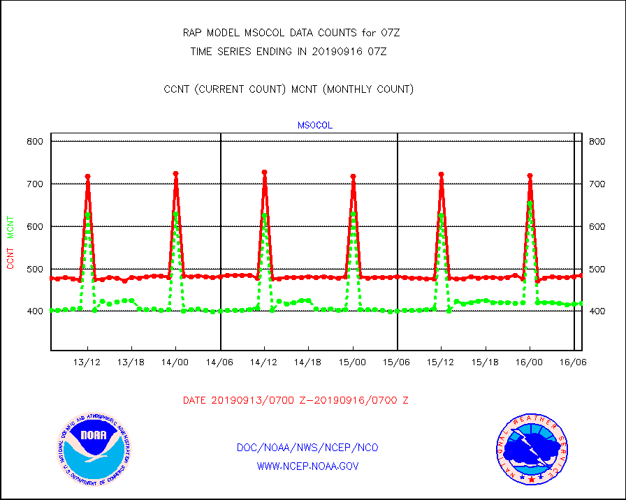
msocol |
Mesonet/MADIS Colorado Dept. of Transportation |
484 |
419 |
115.5 % |
1606.50-1607.50 |
msodcn |
Mesonet/MADIS DC Net |
0 |
0 |
n/a |
1606.50-1607.50 |
msoden |
Mesonet/MADIS Denver Urban Drainage & Flood Cntrl |
0 |
0 |
n/a |
1606.50-1607.50 |
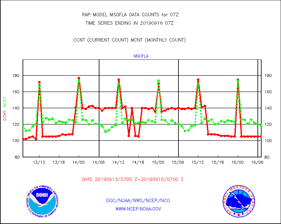
msofla |
Mesonet/MADIS Florida (FAWN & USF) |
105 |
119 |
88.2 % |
1606.50-1607.50 |
msoflt |
Mesonet/MADIS Florida Dept. of Transportation |
0 |
0 |
n/a |
1606.50-1607.50 |
msogeo |
Mesonet/MADIS Georgia Dept. of Transportation |
259 |
50 |
518.0 % |
1606.50-1607.50 |
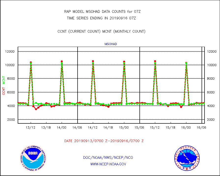
msohad |
Mesonet/MADIS NWS Hydromet Auto Data System(HADS) |
4434 |
4319 |
102.7 % |
1606.50-1607.50 |
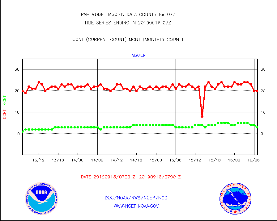
msoien |
Mesonet/MADIS Iowa Environmental |
20 |
3 |
666.7 % |
1606.50-1607.50 |
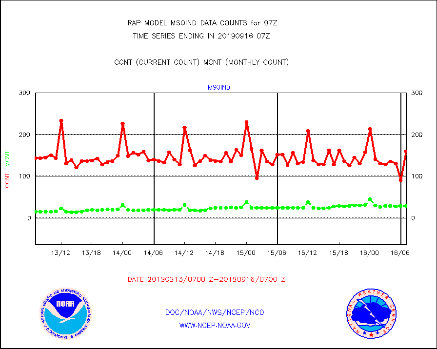
msoind |
Mesonet/MADIS Indiana Dept. of Transportation |
160 |
29 |
551.7 % |
1606.50-1607.50 |
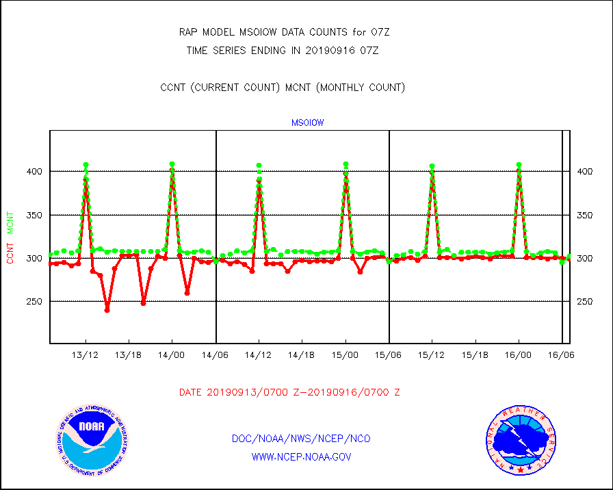
msoiow |
Mesonet/MADIS Iowa Department of Transportation |
299 |
302 |
99.0 % |
1606.50-1607.50 |
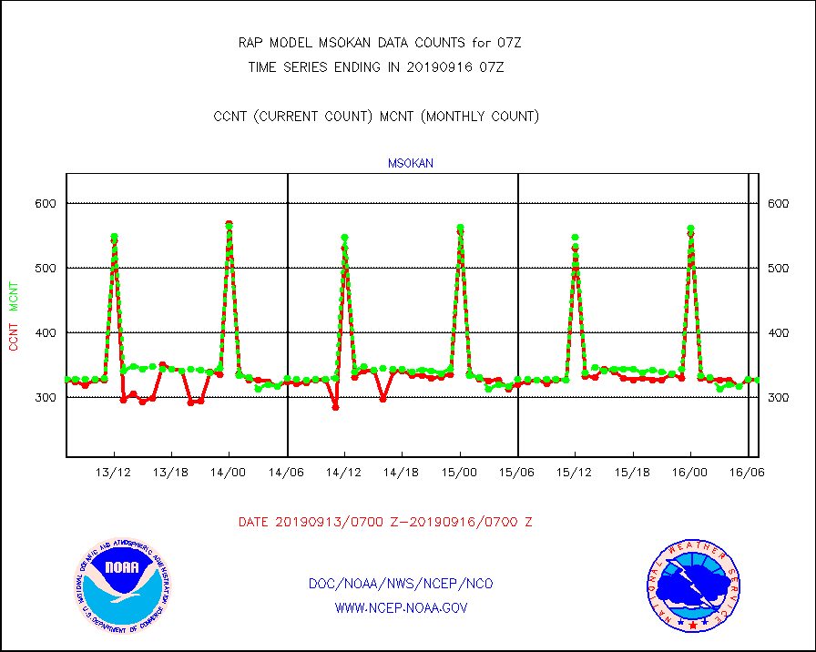
msokan |
Mesonet/MADIS Kansas Department of Transportation |
327 |
327 |
100.0 % |
1606.50-1607.50 |
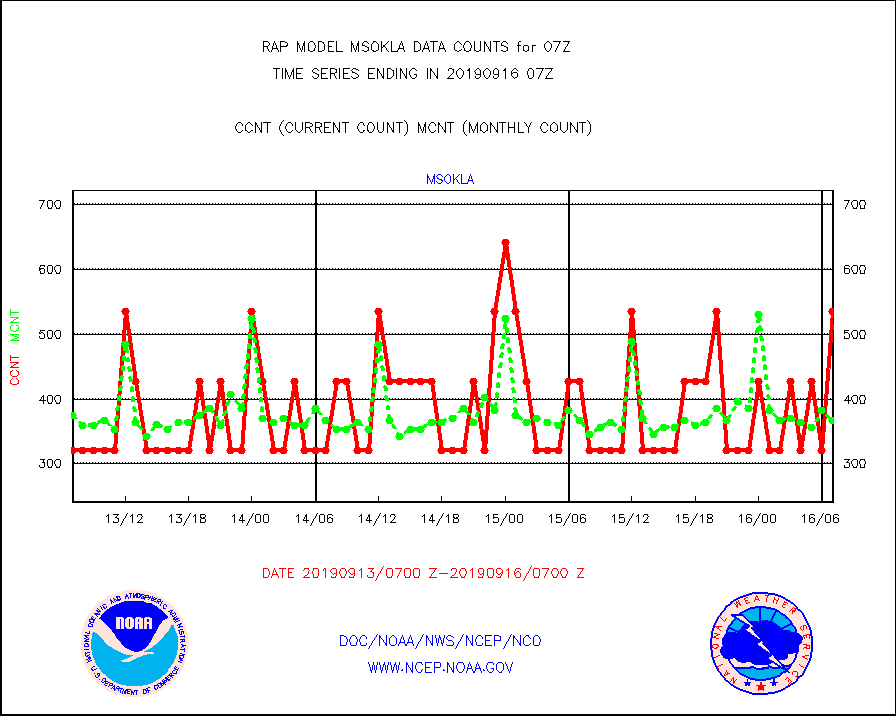
msokla |
Mesonet/MADIS Oklahoma Mesonet |
535 |
367 |
145.8 % |
1606.50-1607.50 |
msolju |
Mesonet/MADIS Louisiana State/Jackson State Univ. |
0 |
0 |
n/a |
1606.50-1607.50 |
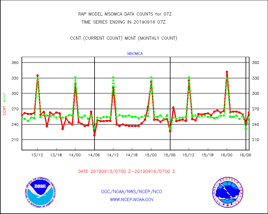
msomca |
Mesonet/MADIS Missouri Commercial Agricult Wx Net |
263 |
254 |
103.5 % |
1606.50-1607.50 |
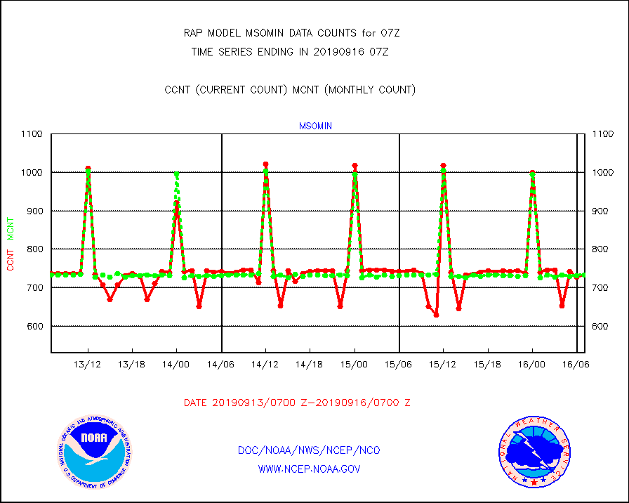
msomin |
Mesonet/MADIS Minnesota Dept. of Transportation |
733 |
733 |
100.0 % |
1606.50-1607.50 |
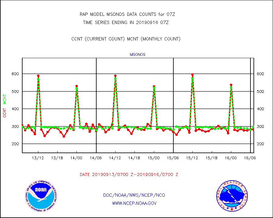
msonos |
Mesonet/MADIS NOS-Phys Oceanographic Realtime Sys |
282 |
299 |
94.3 % |
1606.50-1607.50 |
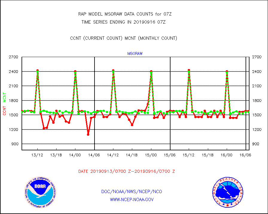
msoraw |
Mesonet/MADIS NFIC Remote Automated Wx Stns(RAWS) |
1583 |
1557 |
101.7 % |
1606.50-1607.50 |
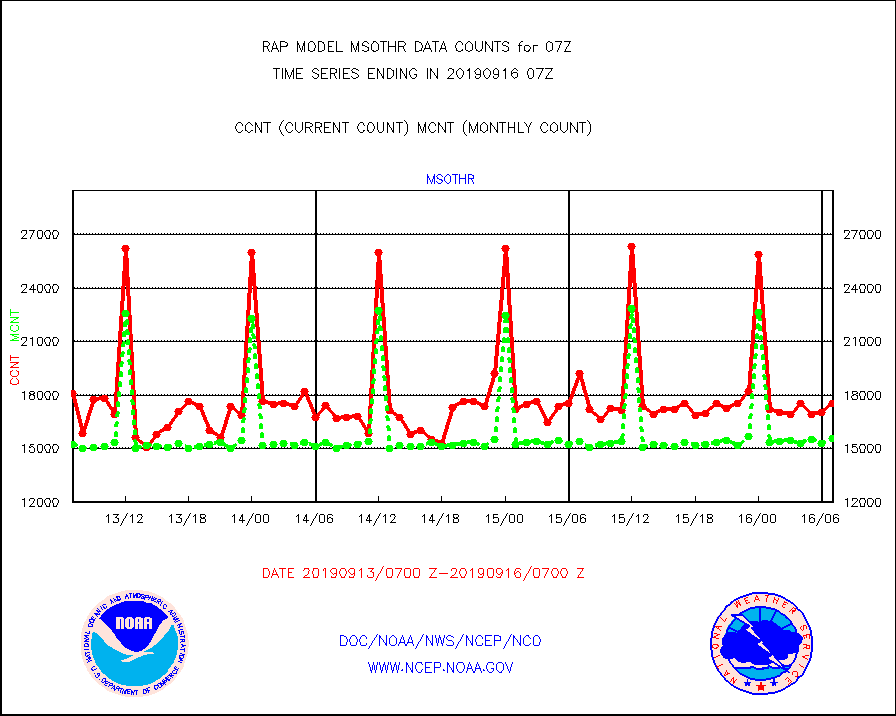
msothr |
Mesonet/MADIS many providers, not separated out |
17529 |
15559 |
112.7 % |
1606.50-1607.50 |
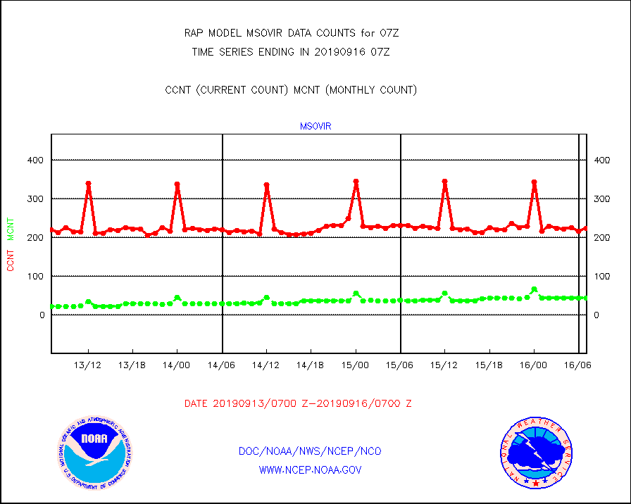
msovir |
Mesonet/MADIS Virginia Dept. of Transportation |
223 |
44 |
506.8 % |
1606.50-1607.50 |
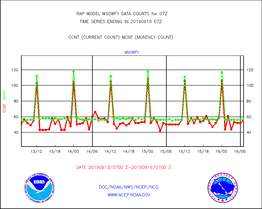
msowfy |
Mesonet/MADIS "Weather for You" |
55 |
57 |
96.5 % |
1606.50-1607.50 |
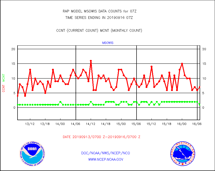
msowis |
Mesonet/MADIS Wisconsin Dept. of Transportation |
7 |
1 |
700.0 % |
1606.50-1607.50 |
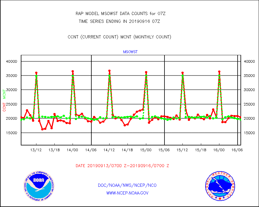
msowst |
Mesonet/MADIS MesoWest (many subproviders) |
20480 |
19576 |
104.6 % |
1606.50-1607.50 |
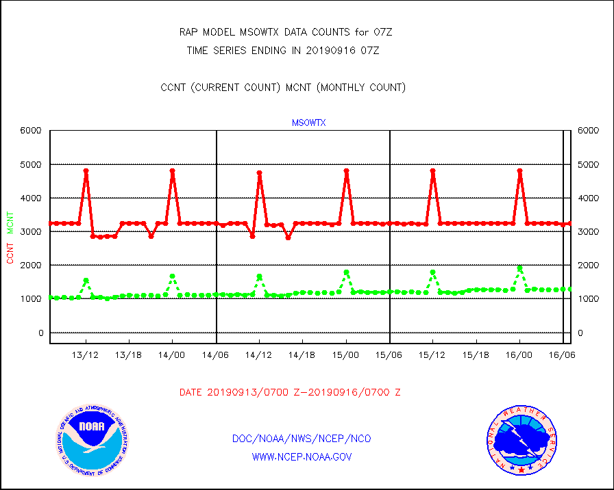
msowtx |
Mesonet/MADIS West Texas |
3240 |
1286 |
251.9 % |
1606.50-1607.50 |
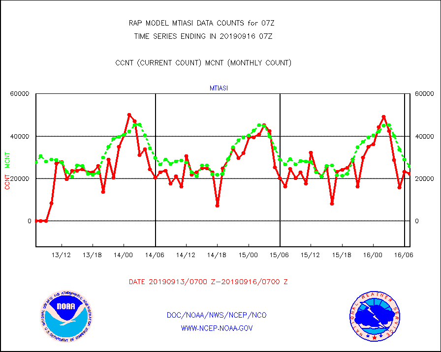
mtiasi |
METOP 1-2 IASI 1C radiance data (varbl. channels) |
22252 |
25706 |
86.6 % |
1605.00-1608.99 |
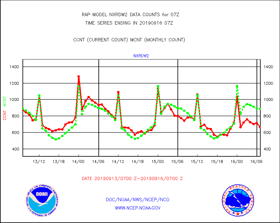
nxrdw2 |
NEXRAD Vel Azm Dsp(VAD) winds via Level 2 decoder |
664 |
886 |
74.9 % |
1606.00-1608.00 |
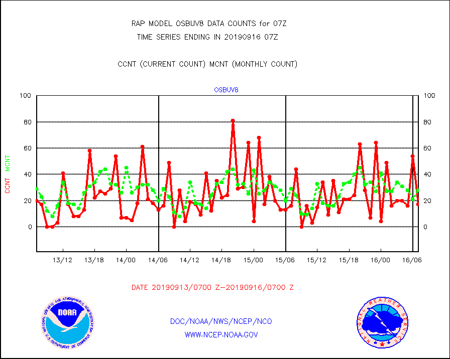
osbuv8 |
NOAA 16-19 Solar Backscatter UV-2 rad frm V8 BUFR |
17 |
28 |
60.7 % |
1605.00-1607.99 |
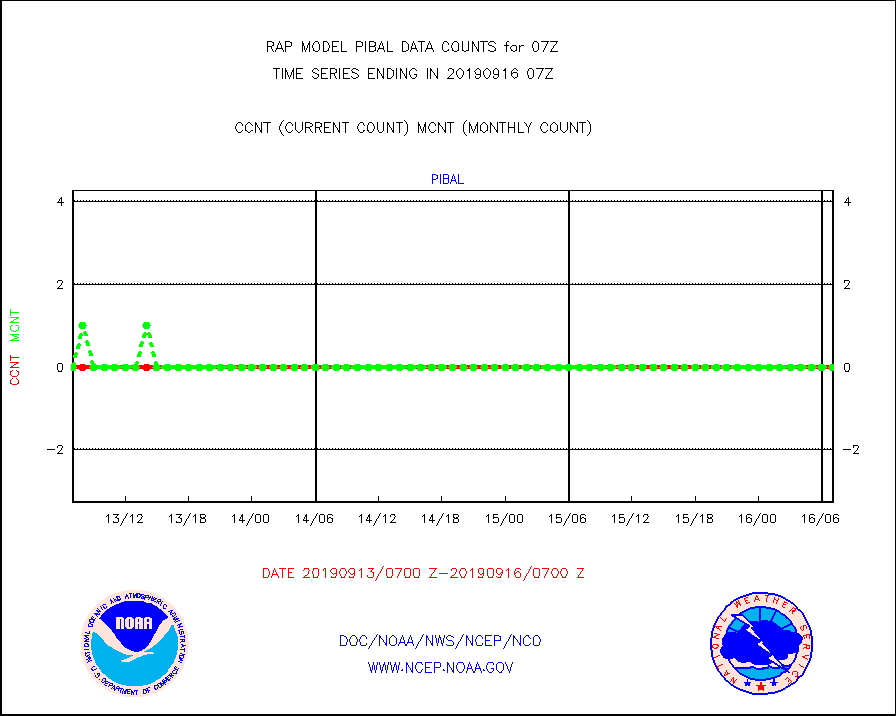
pibal |
PIBAL (from PILOT, PILOT SHIP, PILOT MOBIL) |
0 |
0 |
n/a |
1606.00-1608.00 |
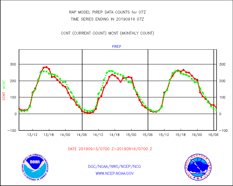
pirep |
Manual PIREP aircraft data (dcded from AIREP fmt) |
38 |
22 |
172.7 % |
1603.75-1610.25 |
prflrp |
Profilr winds from PIBAL (PILOT,PILOT SHIP/MOBIL) |
0 |
0 |
n/a |
1605.50-1608.50 |
radw25 |
NEXRAD radial wind superobs (Level 2.5 - ORPG) |
0 |
0 |
n/a |
1606.00-1608.00 |
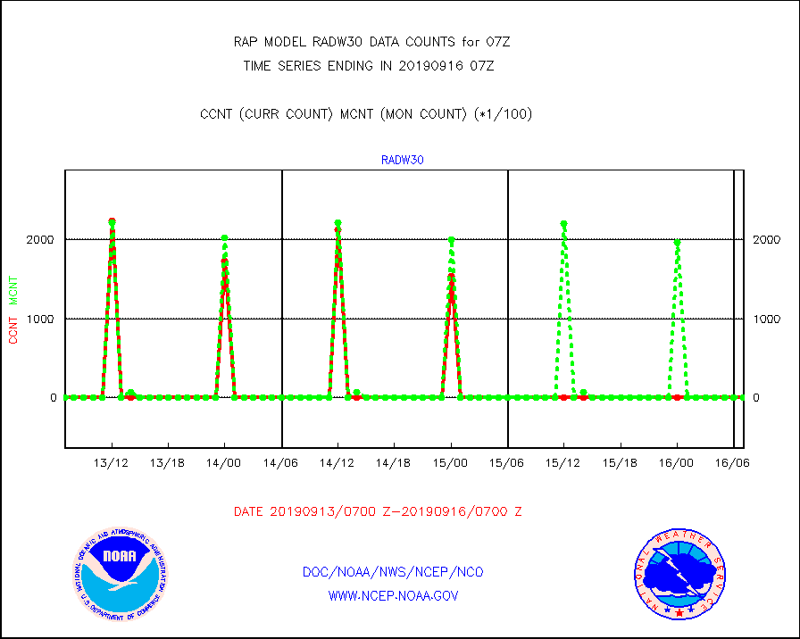
radw30 |
NEXRAD radial wind superobs (Level 3 - NIDS) |
0 |
0 |
n/a |
1606.00-1608.00 |
raobm |
Rawinsonde - mobile land (from TEMP/PILOT MOBIL) |
0 |
0 |
n/a |
1606.00-1608.00 |
raobs |
Rawinsonde - ship (from TEMP SHIP, PILOT SHIP) |
0 |
0 |
n/a |
1606.00-1608.00 |
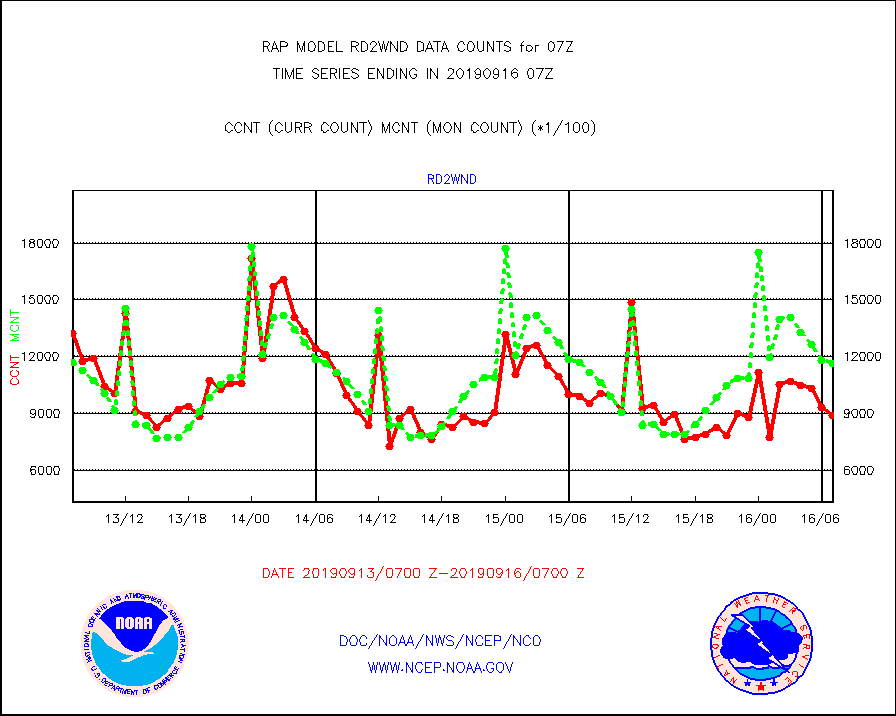
rd2wnd |
NEXRAD radial wind (Level 2 - GTS) |
886742 |
1161957 |
76.3 % |
1606.50-1607.49 |
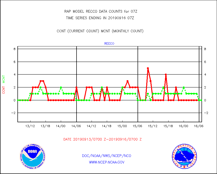
recco |
Flight level reconnaissance aircraft data |
0 |
0 |
n/a |
1606.00-1608.00 |
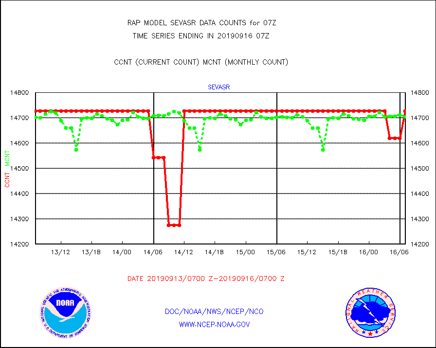
sevasr |
METEOSAT-10 2nd Gen SEVIRI All Sky Radiance(proc) |
14727 |
14704 |
100.2 % |
1605.00-1608.99 |
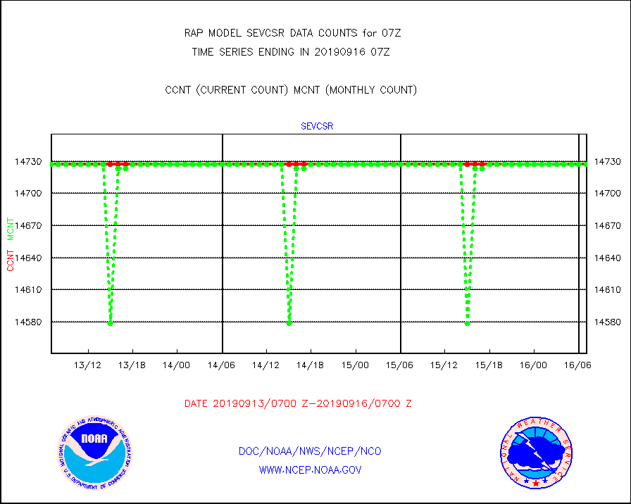
sevcsr |
METEOSAT-10 2nd Gen SEVIRI Clr Sky Radiance(proc) |
14727 |
14727 |
100.0 % |
1605.00-1608.99 |
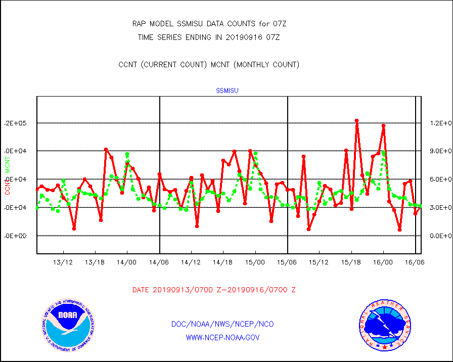
ssmisu |
DMSP SSM/IS 1C radiance data (Unified Pre-Proc.) |
31720 |
31377 |
101.1 % |
1605.00-1608.99 |
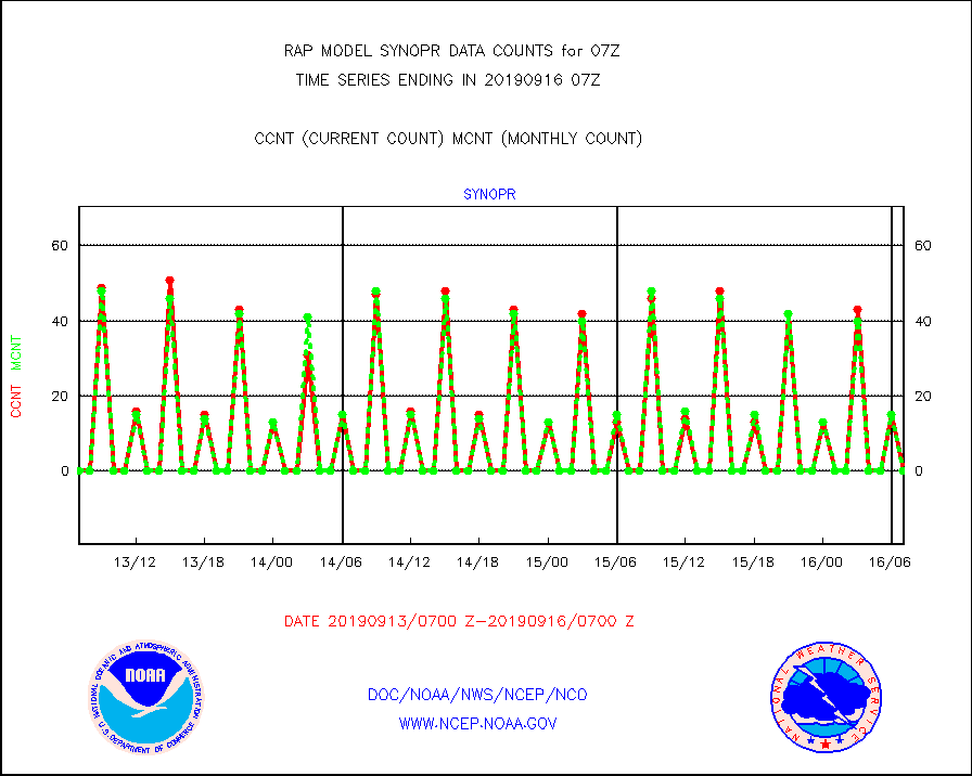
synopr |
Synoptic - restricted (WMO Res 40) manual & auto. |
0 |
0 |
n/a |
1606.50-1607.50 |
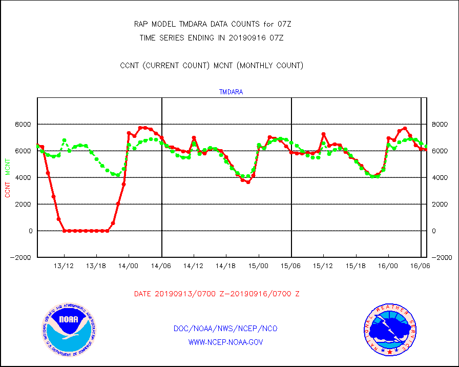
tmdara |
TAMDAR aircft data-all types(from Panasonic,BUFR) |
6096 |
6356 |
95.9 % |
1603.75-1610.25 |
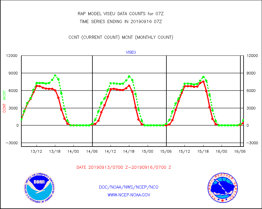
viseu |
METEOSAT/EUMETSAT visible derived cloud motion |
395 |
912 |
43.3 % |
1605.50-1608.49 |
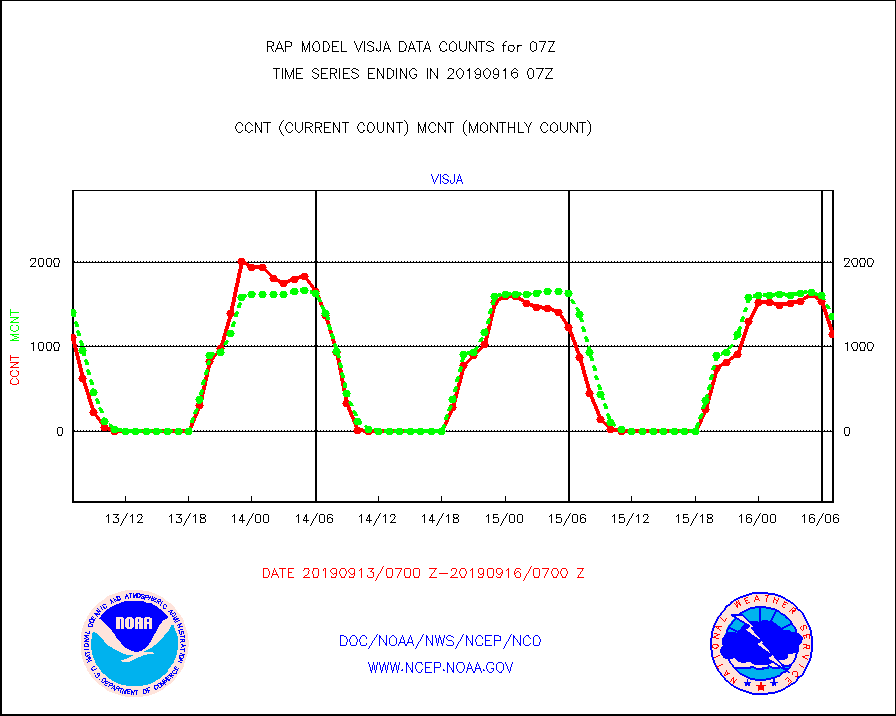
visja |
MTSAT/JMA visible derived cloud motion |
1152 |
1361 |
84.6 % |
1604.50-1609.50 |
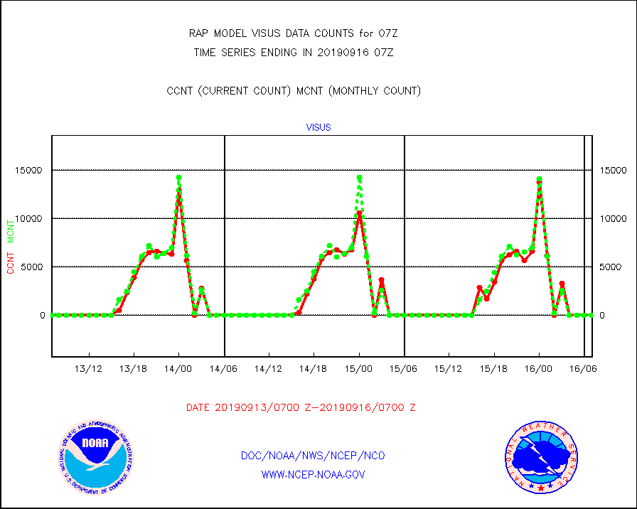
visus |
GOES/NESDIS visible derived cloud motion |
0 |
0 |
n/a |
1606.00-1606.99 |


