| Critical Data with Normal Counts |
|---|
| Type | Description | Hourly Count | Monthly Average | Percent (%) of Monthly Mean | UTC Time Window |
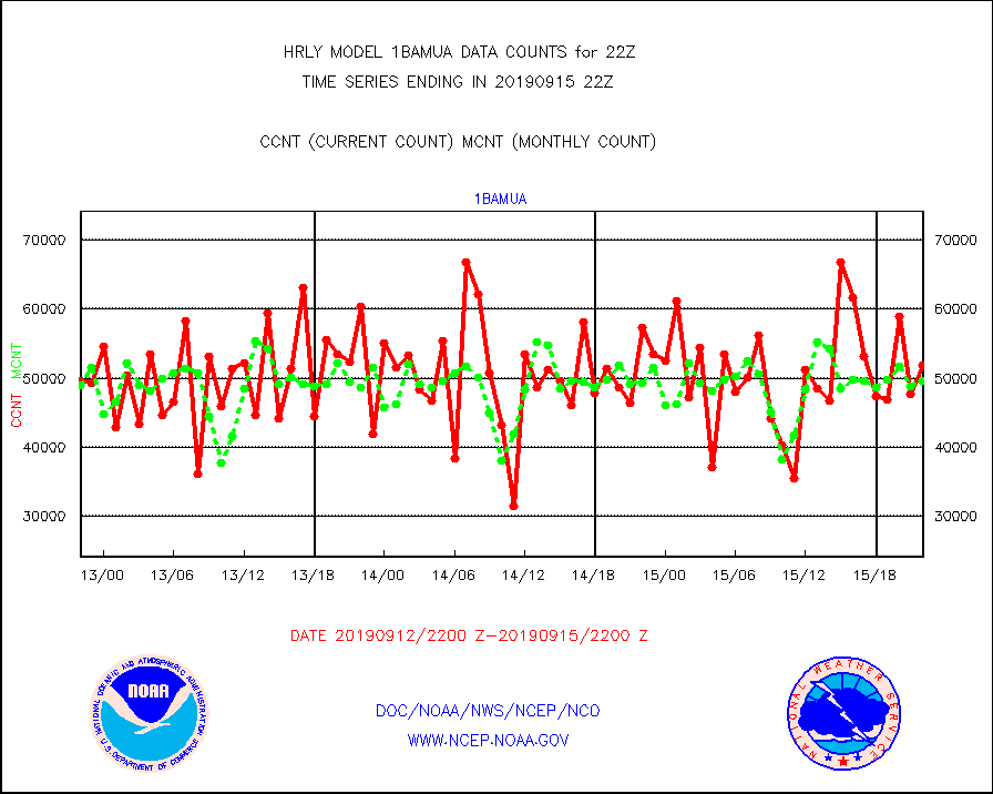
1bamua |
NOAA 15-19 & METOP 1-2 AMSU-A NCEP-proc. br.temps |
51809 |
49659 |
104.3 % |
1520.00-1520.99 |
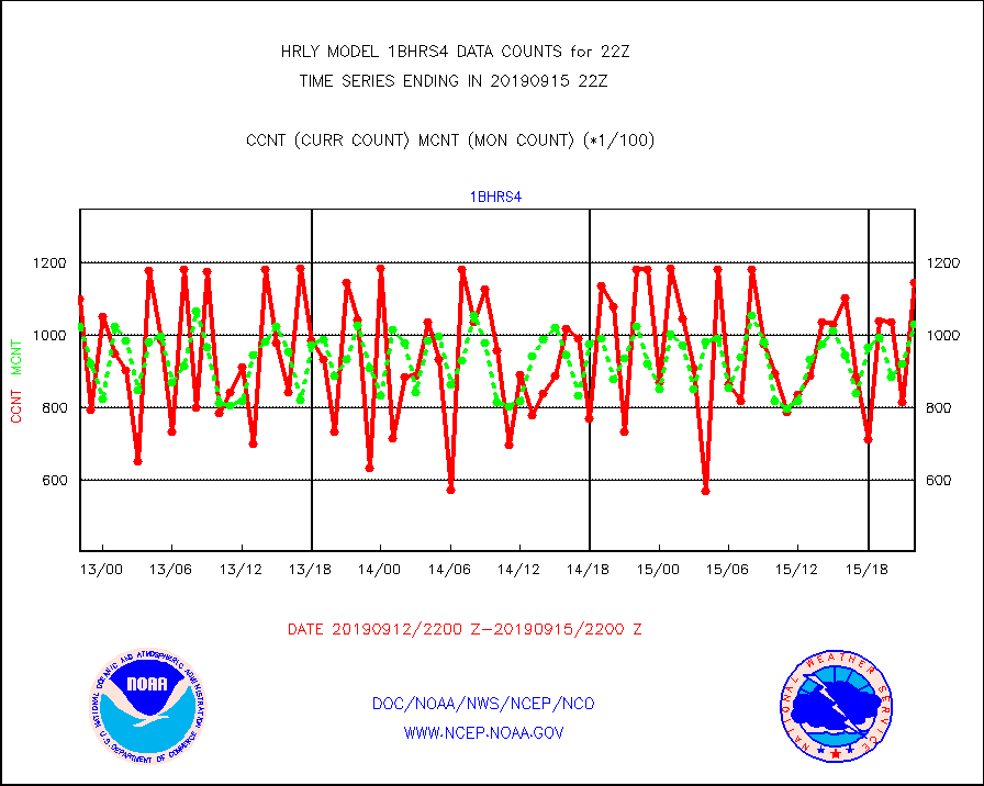
1bhrs4 |
NOAA 18-19 & METOP 1-2 HIRS-4 NCEP-proc. br.temps |
114799 |
103092 |
111.4 % |
1520.00-1520.99 |
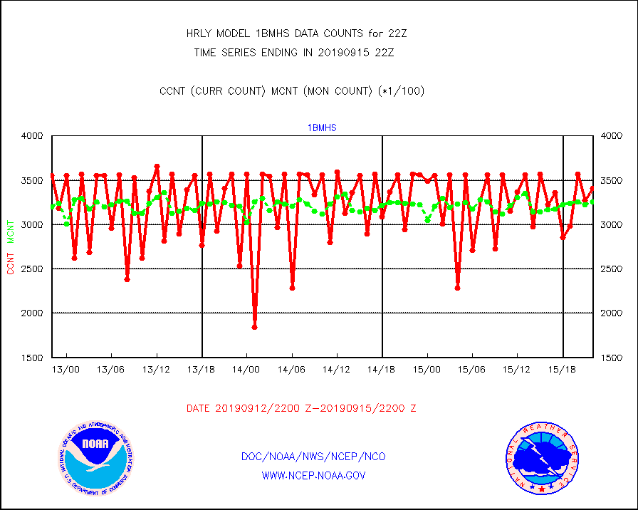
1bmhs |
NOAA 18-19 & METOP 1-2 MHS NCEP-proces. br. temps |
340927 |
325251 |
104.8 % |
1520.00-1520.99 |
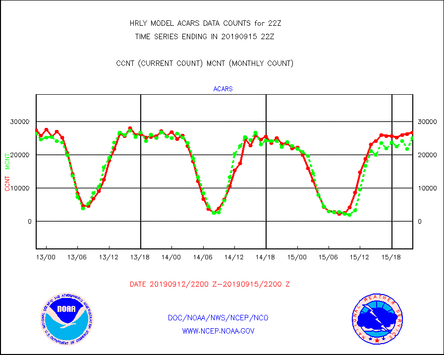
acars |
MDCRS ACARS acft data from ARINC(dcded from BUFR) |
26646 |
25002 |
106.6 % |
1521.50-1522.49 |
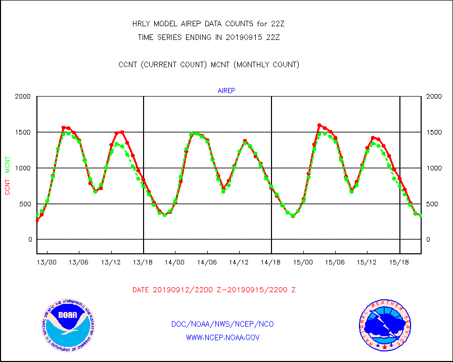
airep |
Manual AIREP aircraft data (dcded from AIREP fmt) |
331 |
336 |
98.5 % |
1521.50-1522.49 |
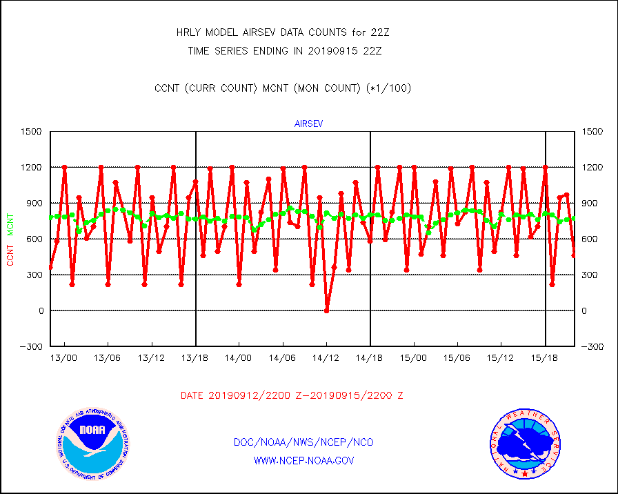
airsev |
AQUA AIRS/AMSU-A/HSB brightness temps- every FOV |
46389 |
77401 |
59.9 % |
1519.50-1520.49 |
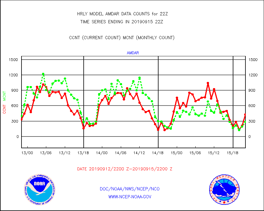
amdar |
AMDAR aircraft data (decoded from AMDAR format) |
432 |
283 |
152.7 % |
1521.50-1522.49 |
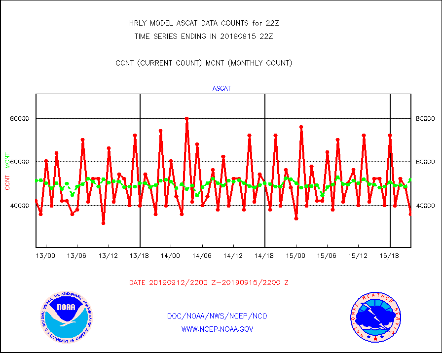
ascat |
METOP 1-2 ASCAT products |
36288 |
51983 |
69.8 % |
1520.50-1521.49 |
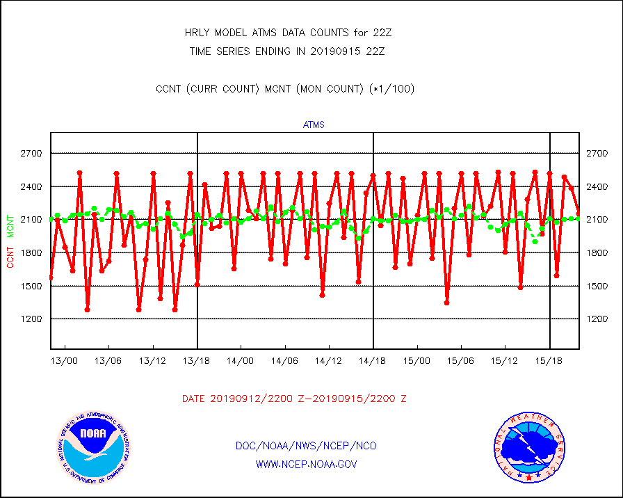
atms |
NPP Adv. Tech. Microwave Sounder (ATMS) br. temps |
215232 |
211162 |
101.9 % |
1520.50-1521.49 |
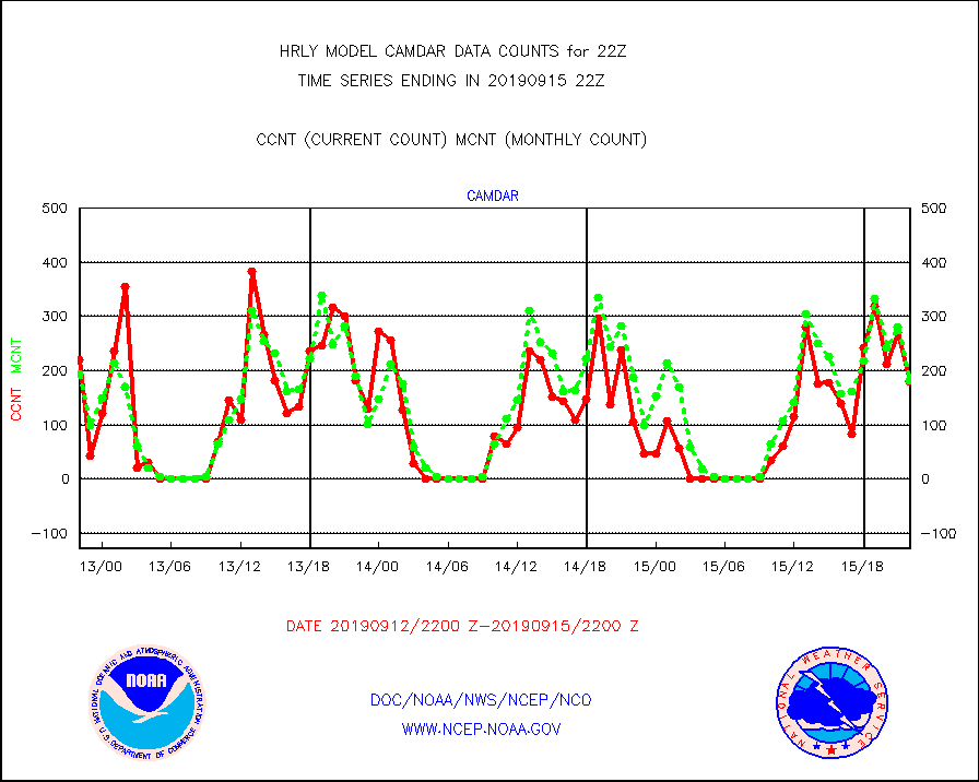
camdar |
Canadian AMDAR aircraft data (decoded from BUFR) |
180 |
182 |
98.9 % |
1521.50-1522.49 |
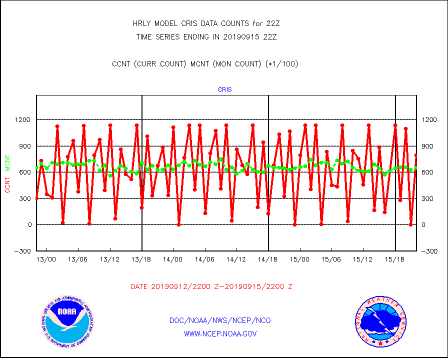
cris |
NPP Cross-track Infrared Sounder (CrIS) radiances |
79371 |
65420 |
121.3 % |
1520.50-1521.49 |
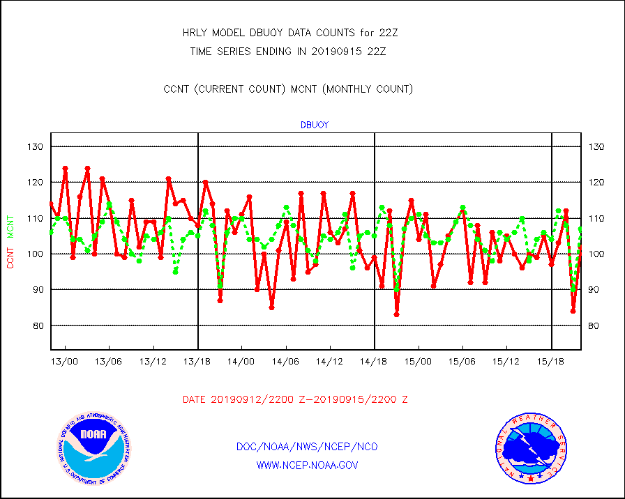
dbuoy |
Buoys decoded from FM-18 fmt (moored or drifting) |
102 |
107 |
95.3 % |
1521.50-1522.49 |
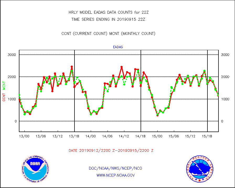
eadas |
E-AMDAR (European AMDAR acft decoded from BUFR) |
1144 |
1178 |
97.1 % |
1521.50-1522.49 |
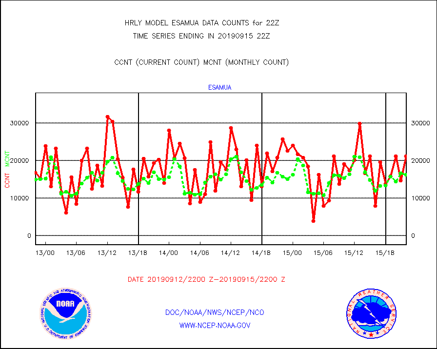
esamua |
NOAA 15-19 & METOP 1-2 AMSU-A proc btmps frm RARS |
21203 |
16343 |
129.7 % |
1521.50-1522.49 |
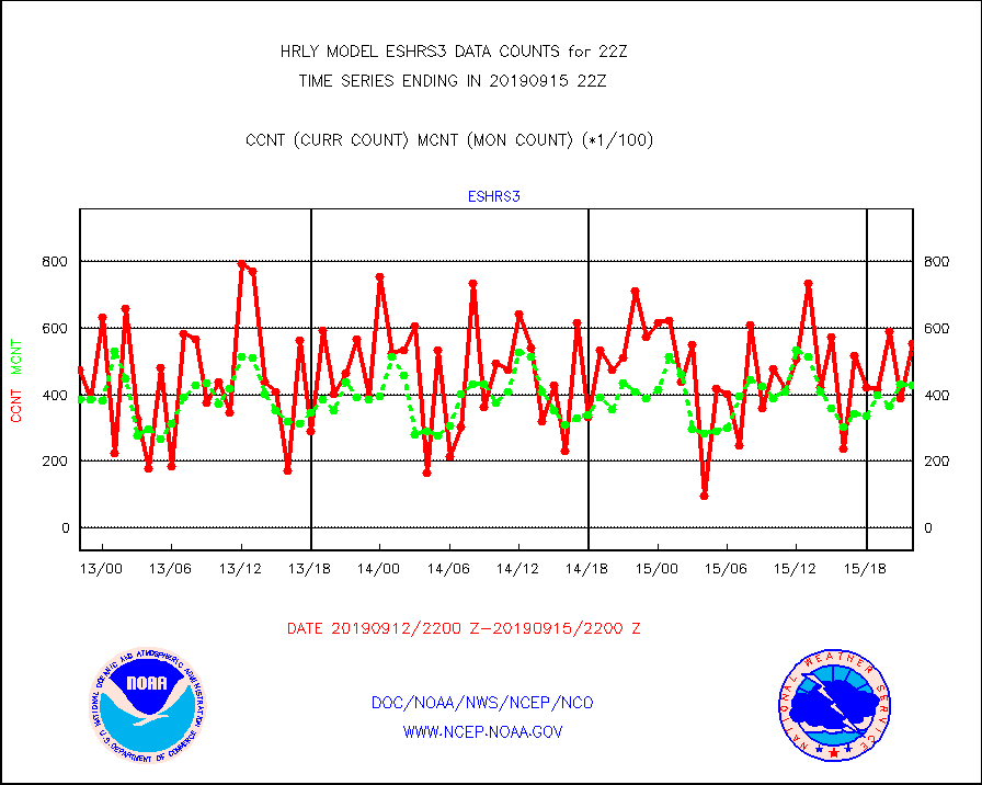
eshrs3 |
NOAA 15-19 & METOP 1-2 HIRS-3/4 pr btmps frm RARS |
55252 |
42720 |
129.3 % |
1521.50-1522.49 |
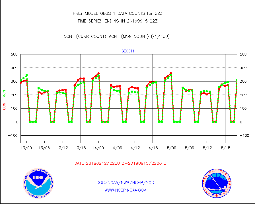
geost1 |
GOES/NESDIS hi-resol. (1x1 f-o-v) sndgs/radiances |
30784 |
30819 |
99.9 % |
1521.50-1522.49 |
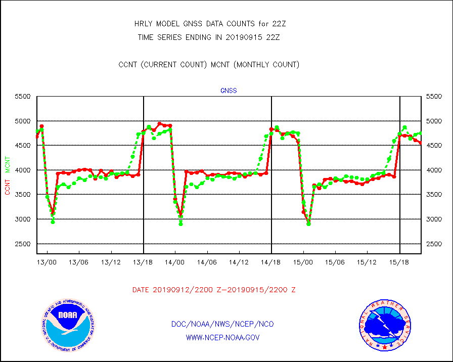
gnss |
Grnd-based Gbl Navigation Sat System (GNSS) data |
4551 |
4752 |
95.8 % |
1521.00-1521.99 |
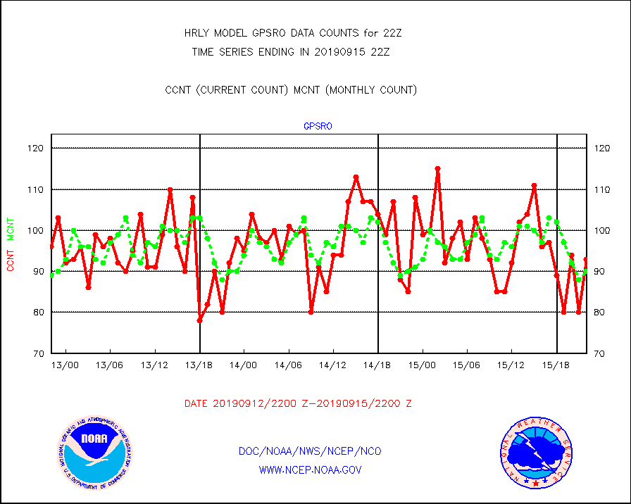
gpsro |
GPS radio occultation data |
93 |
90 |
103.3 % |
1519.50-1520.49 |
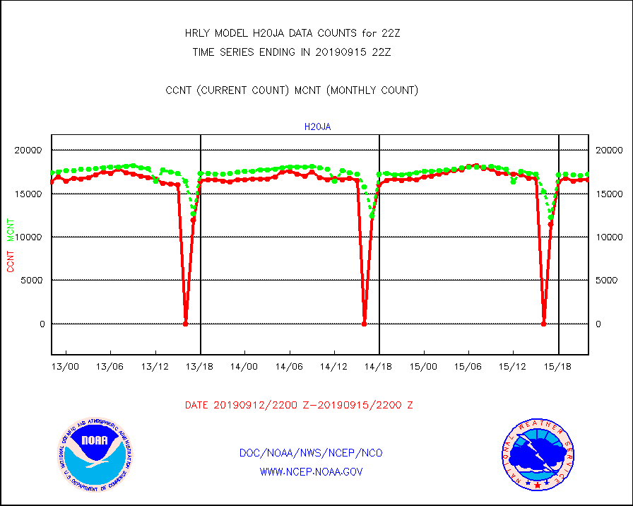
h20ja |
MTSAT/JMA water vapor imager derived cloud motion |
16576 |
17233 |
96.2 % |
1519.50-1520.49 |
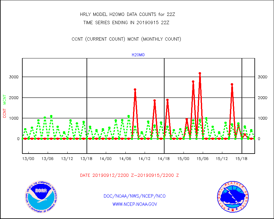
h20mo |
MODIS (AQUA/TERRA) wvpr imager derived cld motion |
0 |
0 |
n/a |
1518.00-1518.99 |
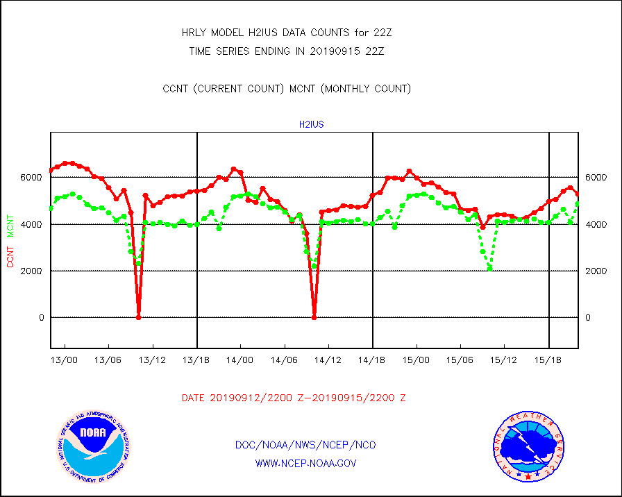
h2ius |
GOES/NESDIS water vapor imager derived cld motion |
5292 |
4897 |
108.1 % |
1521.00-1521.99 |
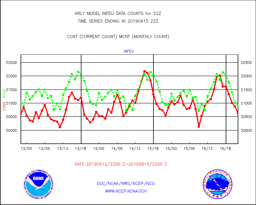
infeu |
METEOSAT/EUMETSAT ir lg-wave derived cloud motion |
20641 |
20928 |
98.6 % |
1520.50-1521.49 |
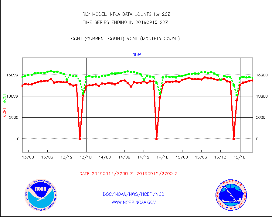
infja |
MTSAT/JMA infrared long-wave derived cloud motion |
13676 |
14311 |
95.6 % |
1519.50-1520.49 |
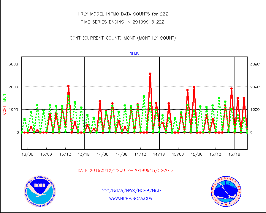
infmo |
MODIS (AQUA/TERRA) ir l-wave derived cloud motion |
0 |
1 |
0.0 % |
1518.00-1518.99 |
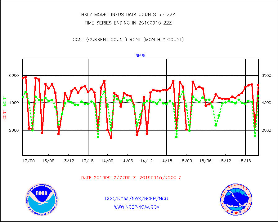
infus |
GOES/NESDIS infrared lg-wave derived cloud motion |
5294 |
4510 |
117.4 % |
1521.00-1521.99 |
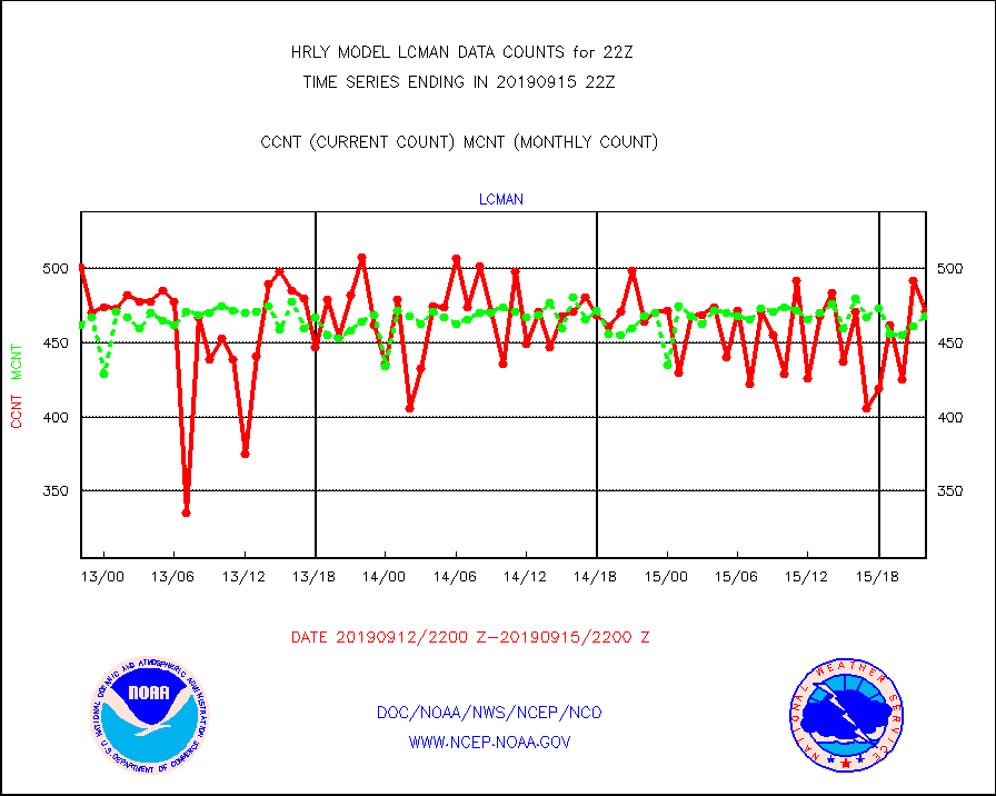
lcman |
Land-based CMAN stations decoded from CMAN format |
471 |
468 |
100.6 % |
1521.50-1522.49 |
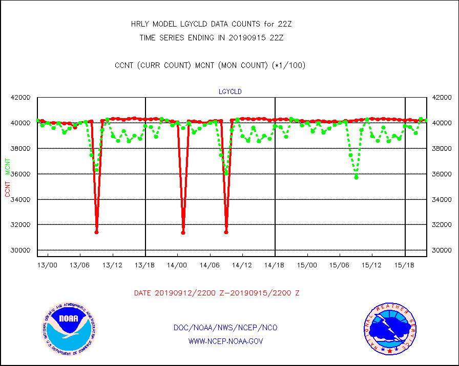
lgycld |
GOES/NASA(Langley) hi-res. (1x1 f-o-v) cloud data |
4019252 |
4021556 |
99.9 % |
1521.50-1522.49 |
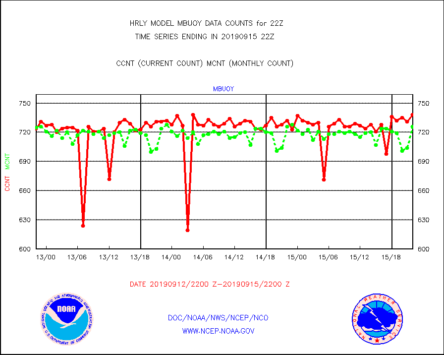
mbuoy |
Buoys decoded from FM-13 format (moored) |
738 |
726 |
101.7 % |
1521.50-1522.49 |
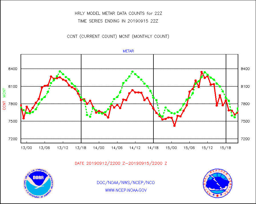
metar |
Aviation - METAR |
7648 |
7724 |
99.0 % |
1521.50-1522.49 |
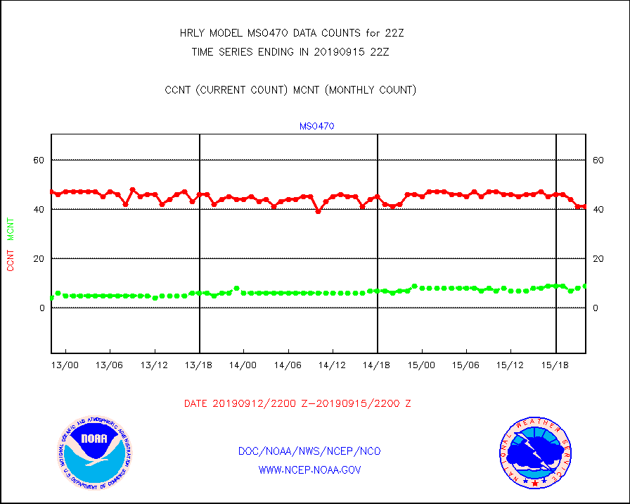
mso470 |
Mesonet/MADIS Colorado E-470 (Interstate 470) |
41 |
9 |
455.6 % |
1521.50-1522.49 |
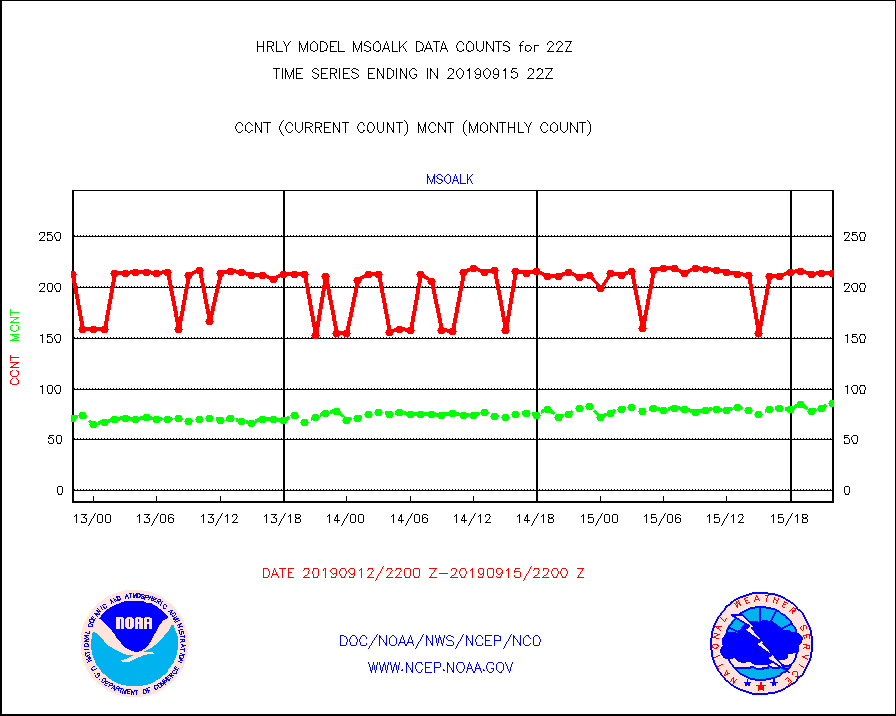
msoalk |
Mesonet/MADIS Alaska Department of Transportation |
214 |
86 |
248.8 % |
1521.50-1522.49 |
msoapg |
Mesonet/MADIS U.S. Army Aberdeen Proving Grounds |
0 |
0 |
n/a |
1521.50-1522.49 |
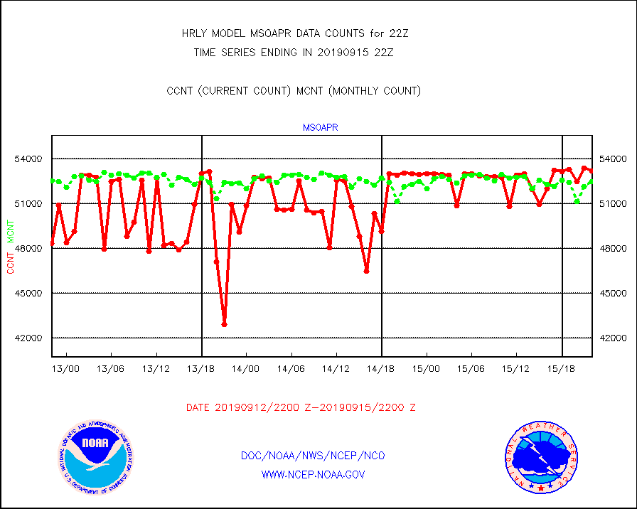
msoapr |
Mesonet/MADIS Citizen Weather Observers Program |
53191 |
52473 |
101.4 % |
1521.50-1522.49 |
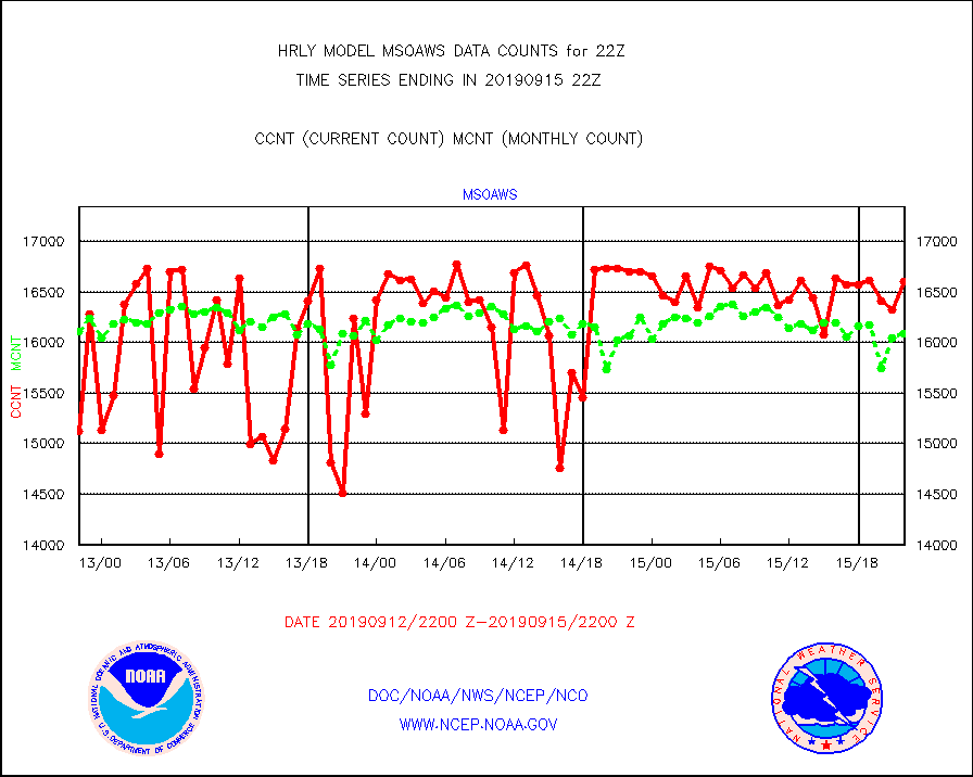
msoaws |
Mesonet/MADIS AWS Convergence Technologies, Inc. |
16607 |
16082 |
103.3 % |
1521.50-1522.49 |
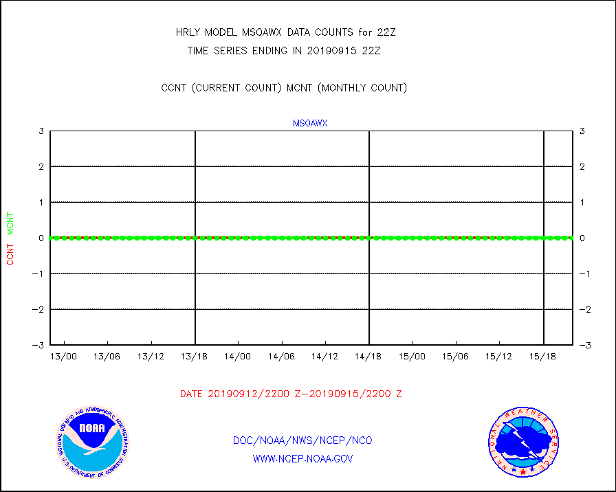
msoawx |
Mesonet/MADIS "Anything Weather" |
0 |
0 |
n/a |
1521.50-1522.49 |
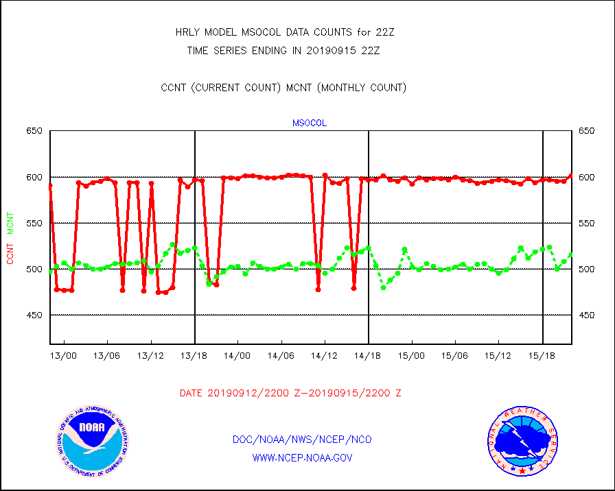
msocol |
Mesonet/MADIS Colorado Dept. of Transportation |
601 |
516 |
116.5 % |
1521.50-1522.49 |
msodcn |
Mesonet/MADIS DC Net |
0 |
0 |
n/a |
1521.50-1522.49 |
msoden |
Mesonet/MADIS Denver Urban Drainage & Flood Cntrl |
0 |
0 |
n/a |
1521.50-1522.49 |
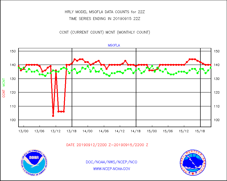
msofla |
Mesonet/MADIS Florida (FAWN & USF) |
140 |
138 |
101.4 % |
1521.50-1522.49 |
msoflt |
Mesonet/MADIS Florida Dept. of Transportation |
0 |
0 |
n/a |
1521.50-1522.49 |
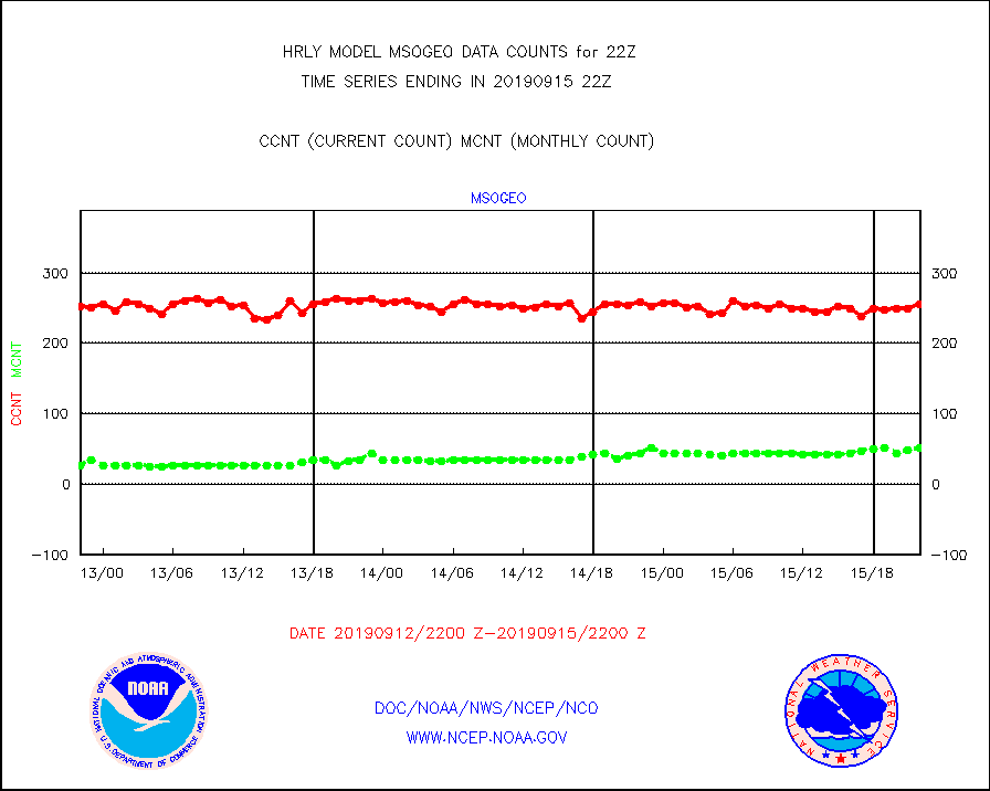
msogeo |
Mesonet/MADIS Georgia Dept. of Transportation |
256 |
52 |
492.3 % |
1521.50-1522.49 |
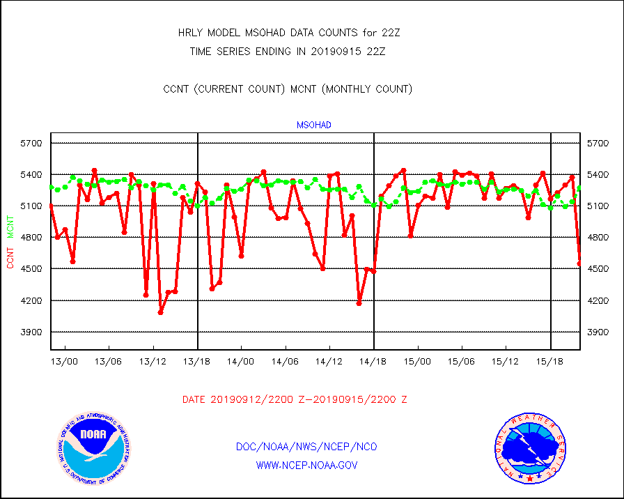
msohad |
Mesonet/MADIS NWS Hydromet Auto Data System(HADS) |
4551 |
5275 |
86.3 % |
1521.50-1522.49 |
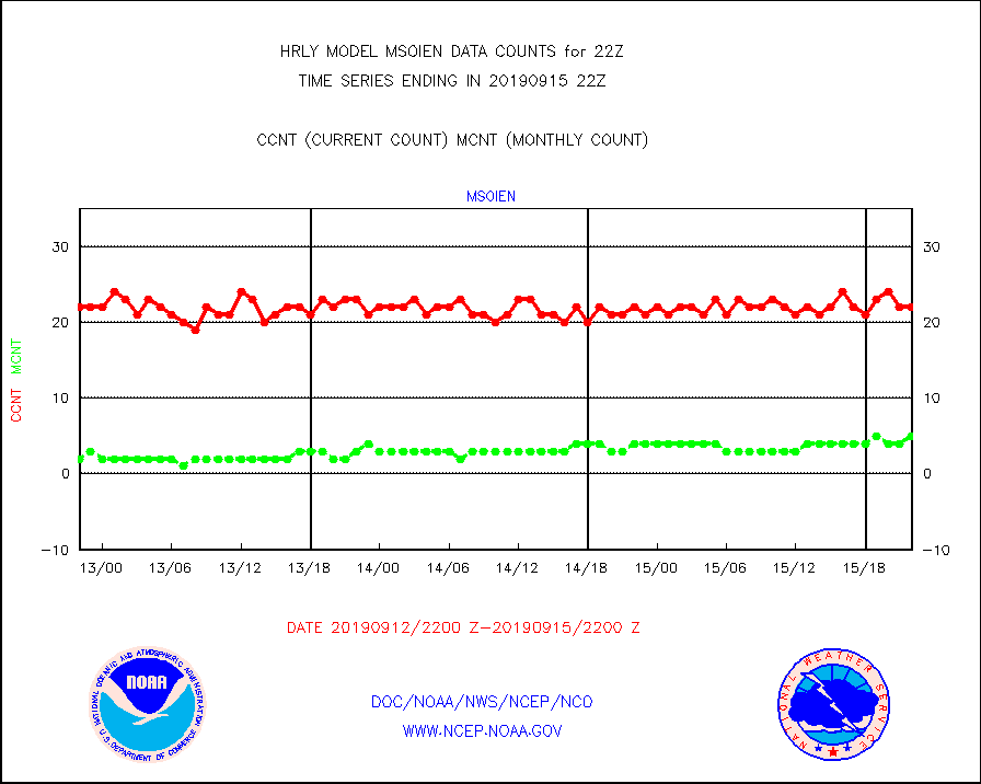
msoien |
Mesonet/MADIS Iowa Environmental |
22 |
5 |
440.0 % |
1521.50-1522.49 |
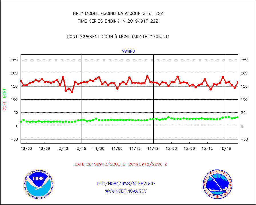
msoind |
Mesonet/MADIS Indiana Dept. of Transportation |
166 |
33 |
503.0 % |
1521.50-1522.49 |
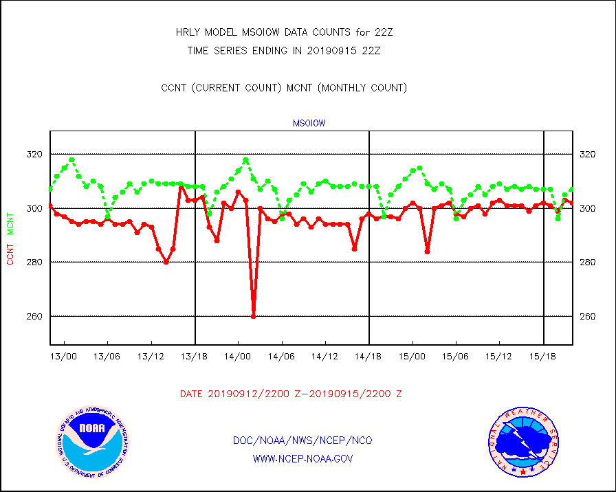
msoiow |
Mesonet/MADIS Iowa Department of Transportation |
302 |
307 |
98.4 % |
1521.50-1522.49 |
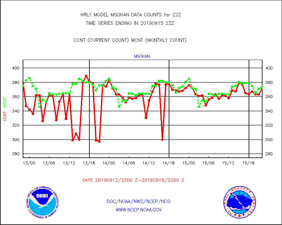
msokan |
Mesonet/MADIS Kansas Department of Transportation |
371 |
373 |
99.5 % |
1521.50-1522.49 |
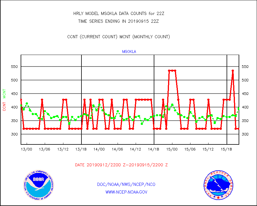
msokla |
Mesonet/MADIS Oklahoma Mesonet |
321 |
396 |
81.1 % |
1521.50-1522.49 |
msolju |
Mesonet/MADIS Louisiana State/Jackson State Univ. |
0 |
0 |
n/a |
1521.50-1522.49 |
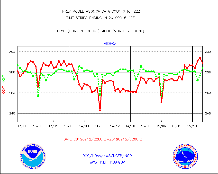
msomca |
Mesonet/MADIS Missouri Commercial Agricult Wx Net |
289 |
284 |
101.8 % |
1521.50-1522.49 |
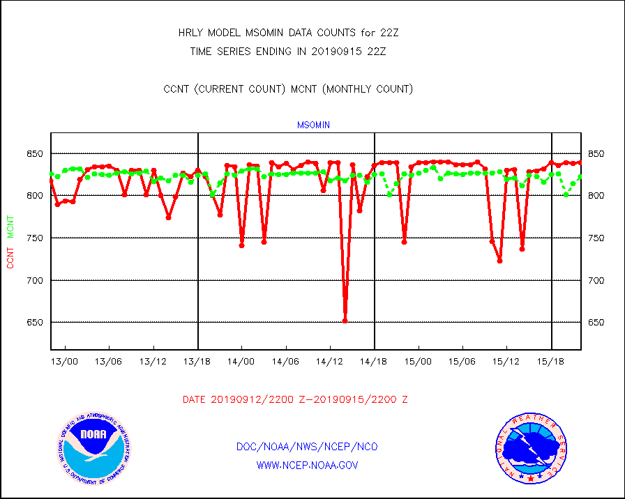
msomin |
Mesonet/MADIS Minnesota Dept. of Transportation |
839 |
823 |
101.9 % |
1521.50-1522.49 |
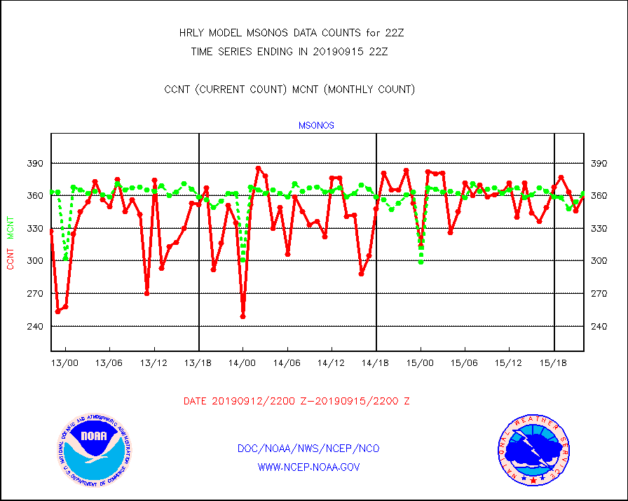
msonos |
Mesonet/MADIS NOS-Phys Oceanographic Realtime Sys |
360 |
362 |
99.4 % |
1521.50-1522.49 |
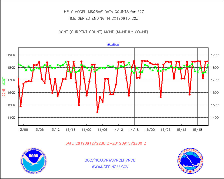
msoraw |
Mesonet/MADIS NFIC Remote Automated Wx Stns(RAWS) |
1850 |
1823 |
101.5 % |
1521.50-1522.49 |
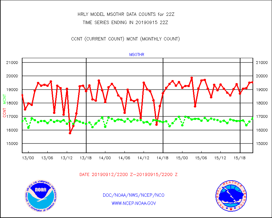
msothr |
Mesonet/MADIS many providers, not separated out |
19520 |
16877 |
115.7 % |
1521.50-1522.49 |
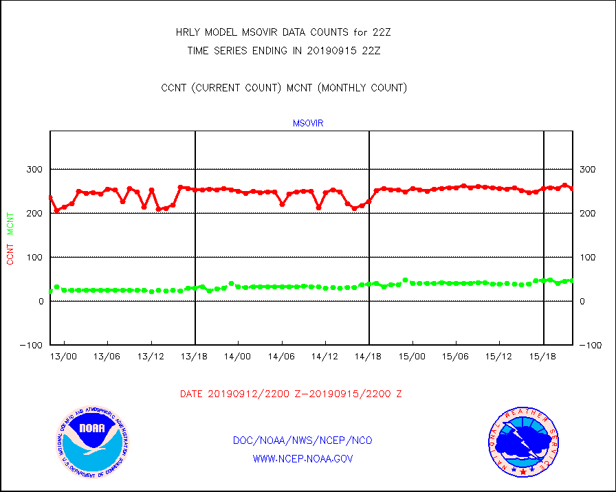
msovir |
Mesonet/MADIS Virginia Dept. of Transportation |
256 |
47 |
544.7 % |
1521.50-1522.49 |
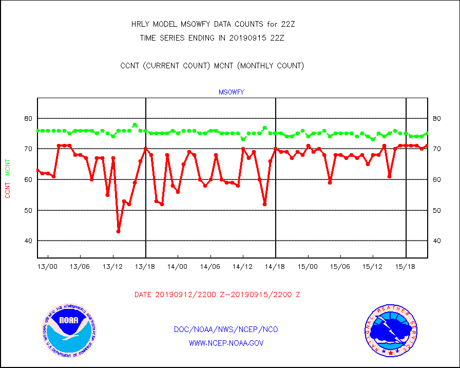
msowfy |
Mesonet/MADIS "Weather for You" |
71 |
75 |
94.7 % |
1521.50-1522.49 |
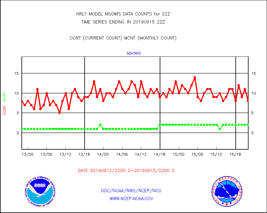
msowis |
Mesonet/MADIS Wisconsin Dept. of Transportation |
8 |
2 |
400.0 % |
1521.50-1522.49 |
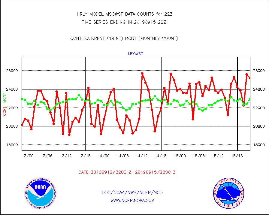
msowst |
Mesonet/MADIS MesoWest (many subproviders) |
25183 |
22951 |
109.7 % |
1521.50-1522.49 |
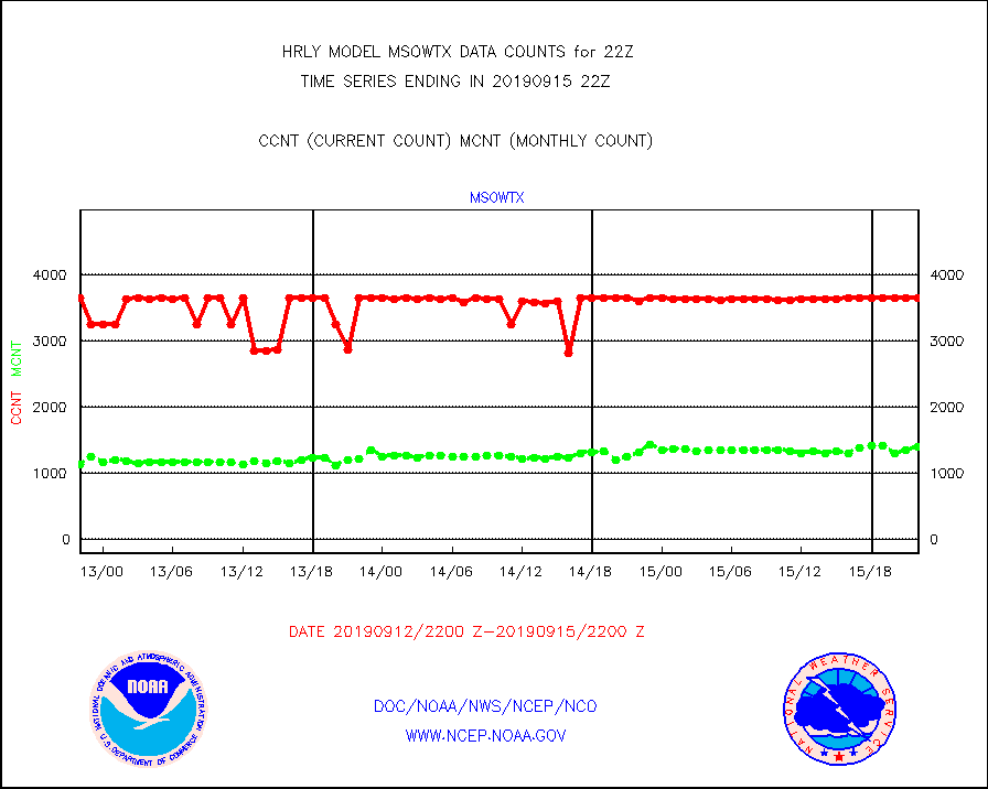
msowtx |
Mesonet/MADIS West Texas |
3642 |
1401 |
260.0 % |
1521.50-1522.49 |
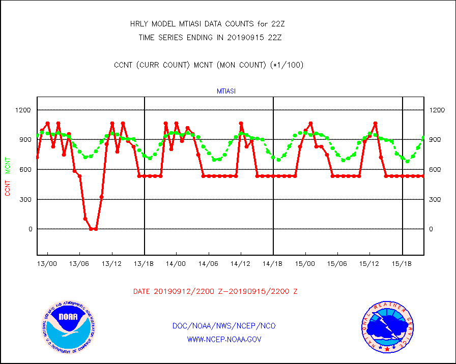
mtiasi |
METOP 1-2 IASI 1C radiance data (varbl. channels) |
53448 |
92438 |
57.8 % |
1520.00-1520.99 |
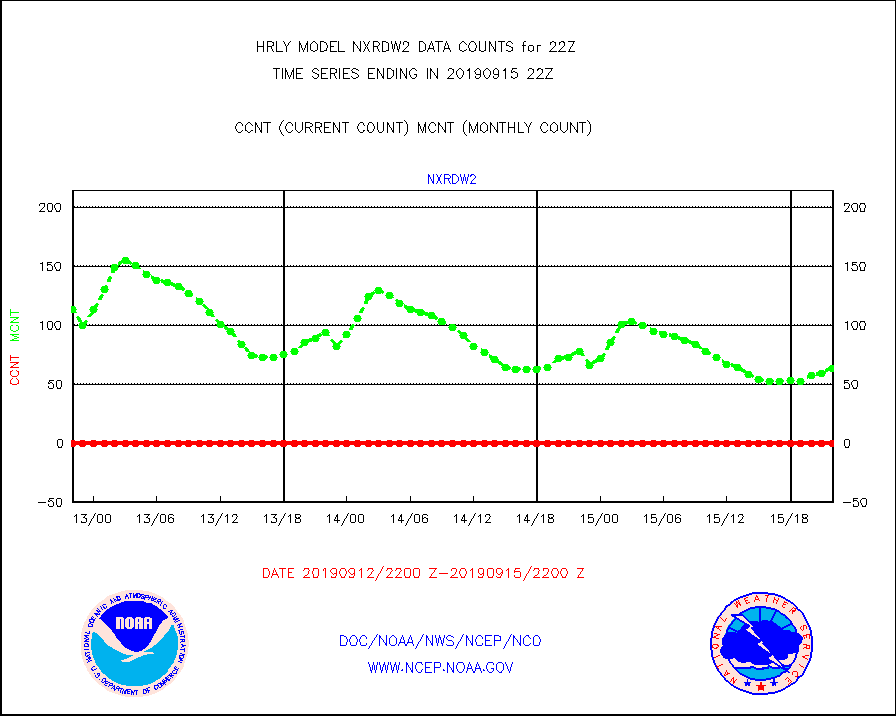
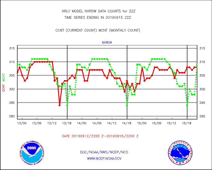
nxrdw |
NEXRAD Vel Azm Dsp(VAD) winds via radar coded msg |
308 |
309 |
99.7 % |
1521.50-1522.49 |
omi |
Aura Ozone Monitoring Instrument (OMI) data |
76920 |
37916 |
202.9 % |
1519.50-1520.49 |
osbuv8 |
NOAA 16-19 Solar Backscatter UV-2 rad frm V8 BUFR |
8 |
42 |
19.0 % |
1520.00-1520.99 |
pibal |
PIBAL (from PILOT, PILOT SHIP, PILOT MOBIL) |
0 |
0 |
n/a |
1521.50-1522.49 |
prflrb |
Multi-Agency Profiler (MAP) and SODAR winds |
53 |
65 |
81.5 % |
1521.50-1522.49 |
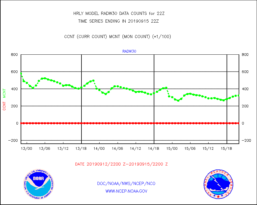
radw25 |
NEXRAD radial wind superobs (Level 2.5 - ORPG) |
0 |
0 |
n/a |
1520.50-1521.49 |
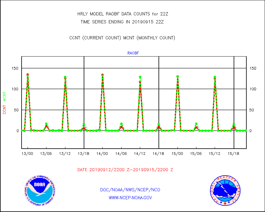
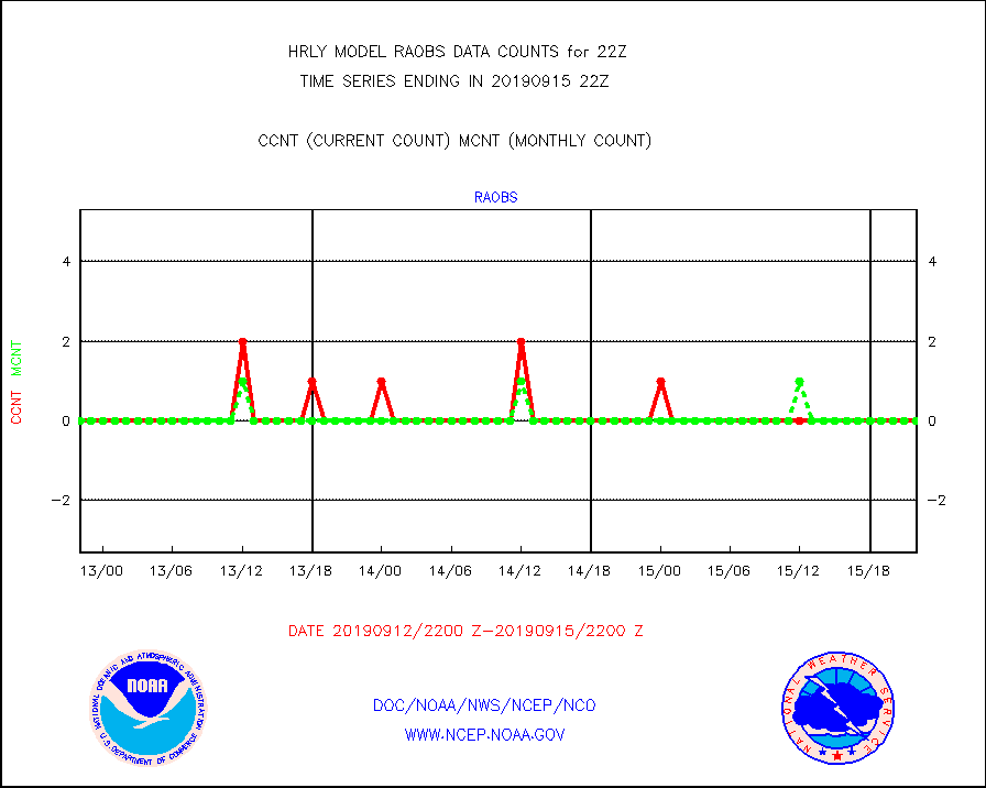
raobf |
Rawinsonde - fixed land (from TEMP or PILOT) |
0 |
1 |
0.0 % |
1521.50-1522.49 |
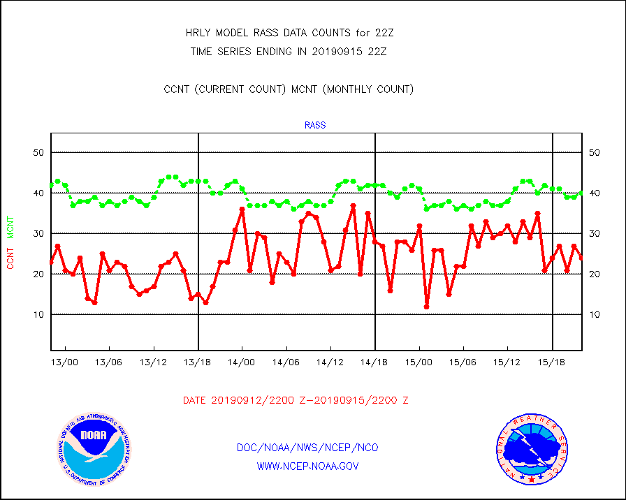
rass |
RASS temperatures (NOAA and Multi-Agency) |
24 |
40 |
60.0 % |
1521.50-1522.49 |
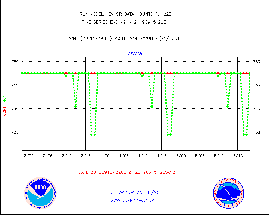
sevcsr |
METEOSAT-10 2nd Gen SEVIRI Clr Sky Radiance(proc) |
75512 |
75512 |
100.0 % |
1521.50-1522.49 |
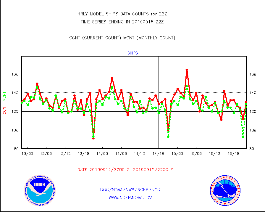
ships |
Ship - manual and automatic, restricted |
130 |
128 |
101.6 % |
1521.50-1522.49 |
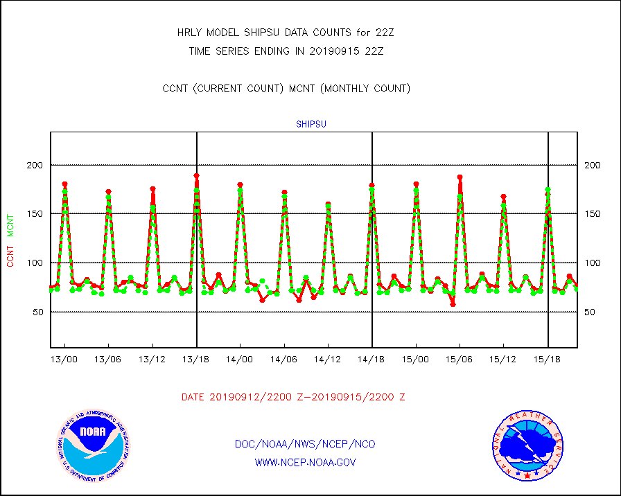
shipsu |
Ship - manual and automatic, unrestricted |
77 |
73 |
105.5 % |
1521.50-1522.50 |
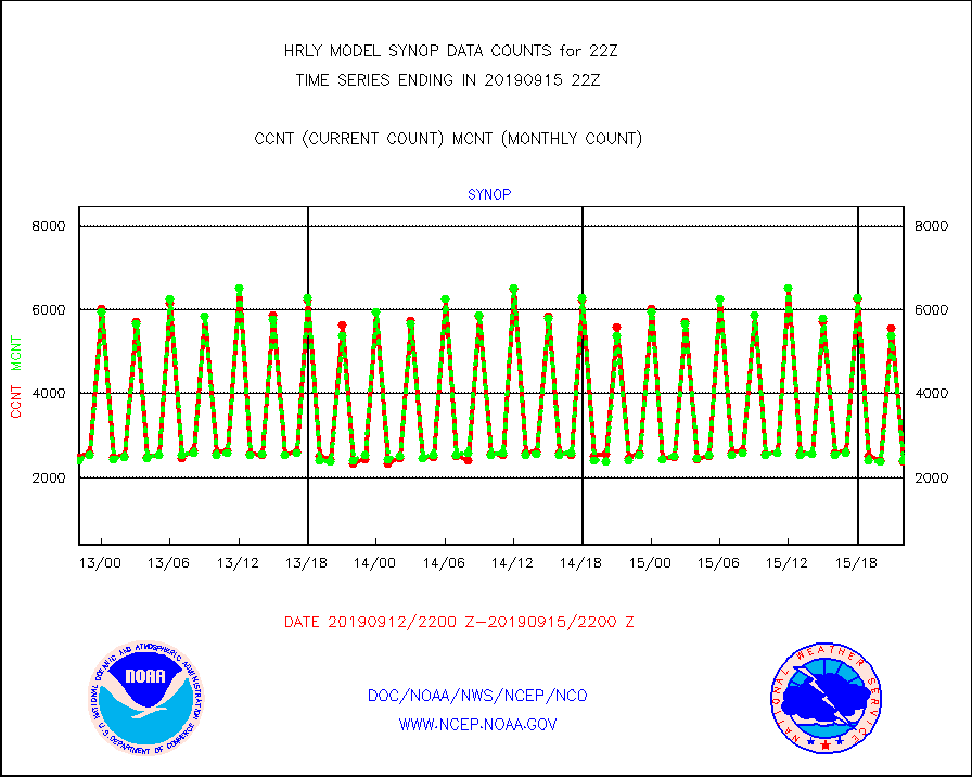
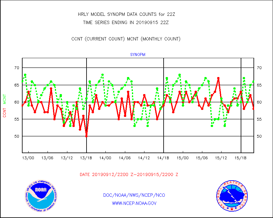
synop |
Synoptic - fixed manual and automatic |
2391 |
2398 |
99.7 % |
1521.50-1522.49 |
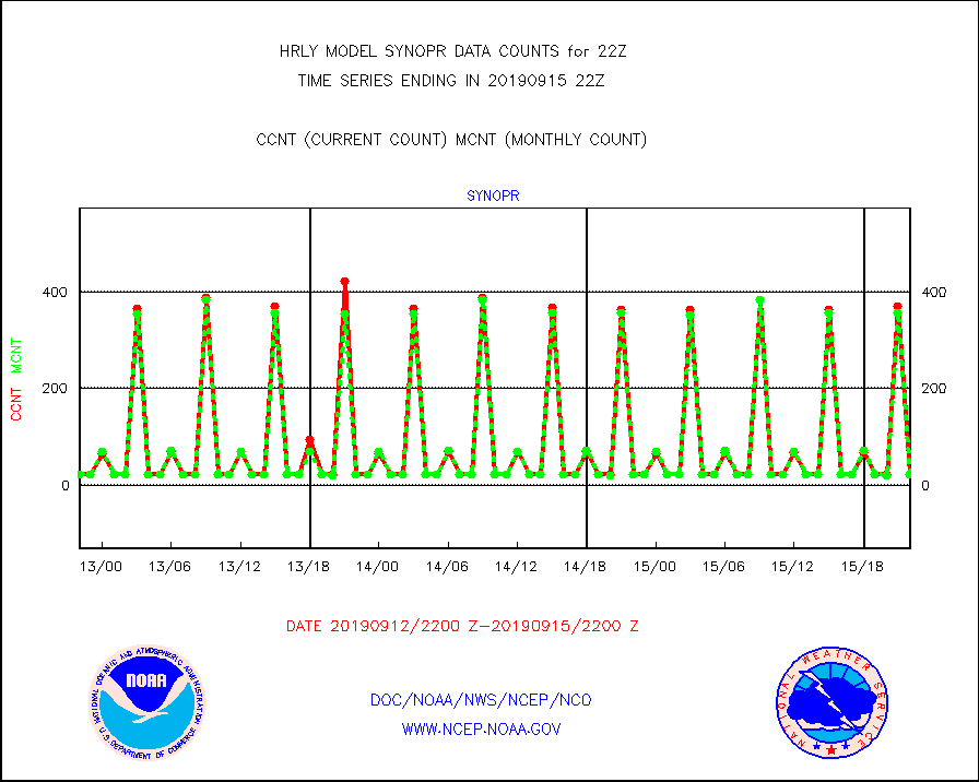
synopr |
Synoptic - restricted (WMO Res 40) manual & auto. |
23 |
23 |
100.0 % |
1521.50-1522.49 |
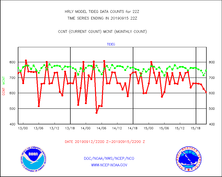
tideg |
Tide gauge reports decoded from CREX format |
606 |
748 |
81.0 % |
1521.00-1521.99 |
| Data Types of Opportunity with Normal Counts |
|---|
| Type | Description | Hourly Count | Monthly Average | Percent (%) of Monthly Mean | UTC Time Window |
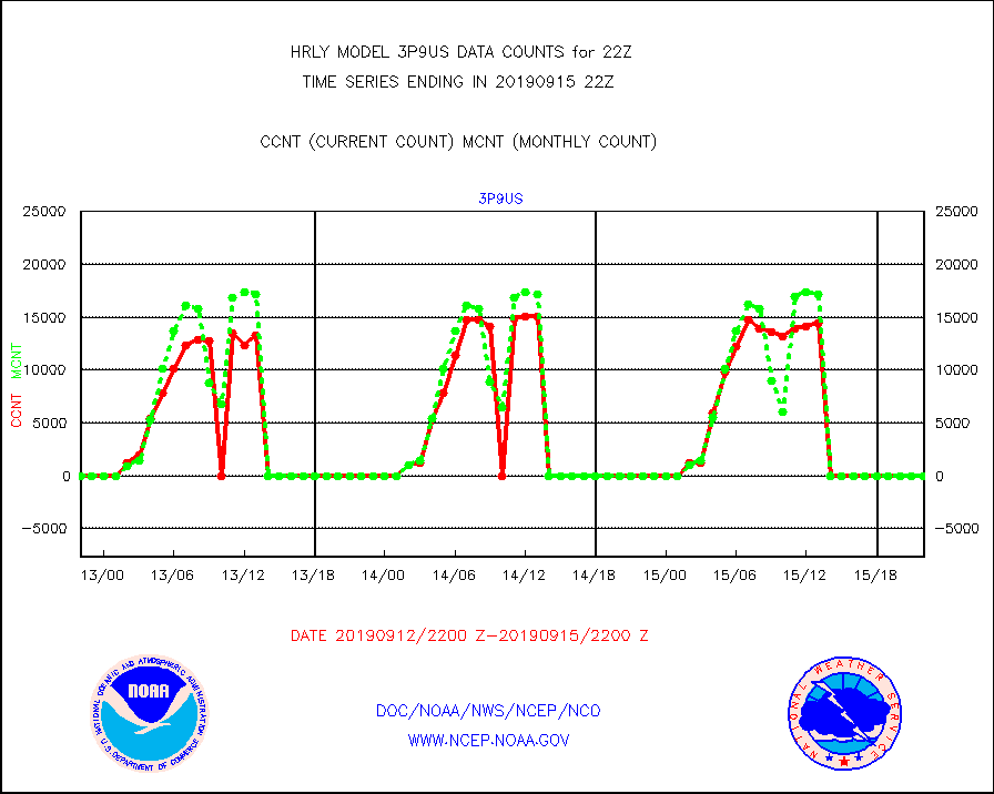
3p9us |
GOES/NESDIS infrared shrt-wave derived cld motion |
0 |
0 |
n/a |
1521.00-1521.99 |
acarsa |
MDCRS ACARS acft data (ARINC via AFWA)(AIREP fmt) |
0 |
0 |
n/a |
1521.50-1522.49 |
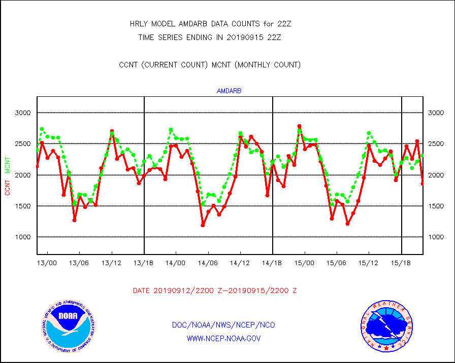
amdarb |
AMDAR aircraft data (decoded from BUFR) |
1862 |
2315 |
80.4 % |
1521.50-1522.49 |
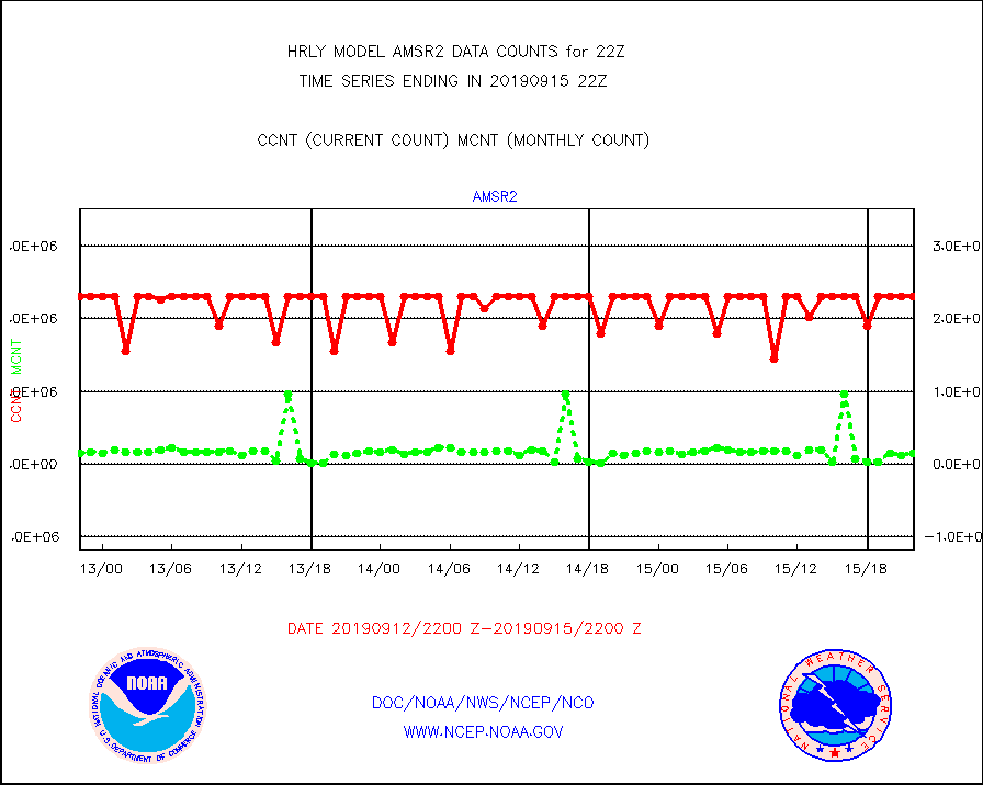
amsr2 |
GCOM-W AMSR2 1B brightness temperatures |
2309472 |
2157751 |
107.0 % |
1520.00-1520.99 |
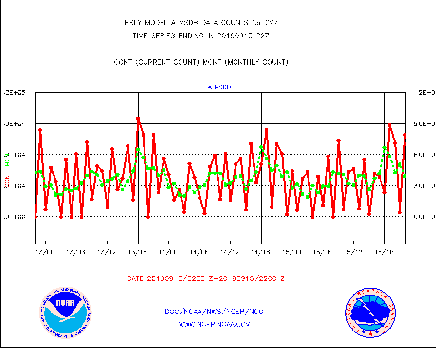
atmsdb |
NPP Adv Tech MW Sndr(ATMS) b. temps-dir bcst SSEC |
79488 |
39148 |
203.0 % |
1520.50-1521.49 |
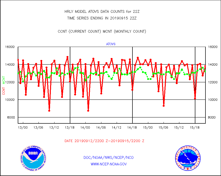
atovs |
POES/NESDIS - processed ATOVS soundings/radiances |
13838 |
13230 |
104.6 % |
1520.00-1520.99 |
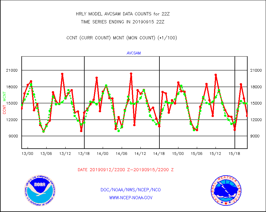
avcsam |
A.M.(N17,M2) AVHRR GAC NCEP-proc clr & sea btemps |
1270363 |
1496003 |
84.9 % |
1519.50-1520.49 |
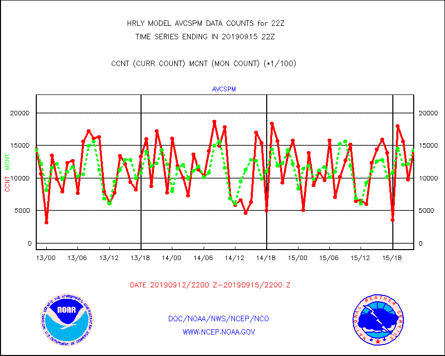
avcspm |
P.M.(N18-19) AVHRR GAC NCEP-proc clr & sea btemps |
1405462 |
1427778 |
98.4 % |
1519.50-1520.49 |
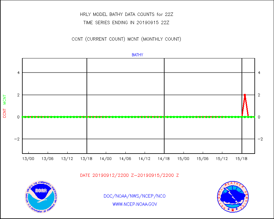
bathy |
Bathythermal |
0 |
0 |
n/a |
1515.00-1515.99 |
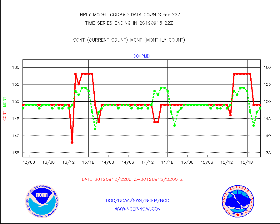
coopmd |
Coop/MADIS NEPP & HCN-Modernization NOAA COOP Obs |
149 |
148 |
100.7 % |
1521.50-1522.49 |
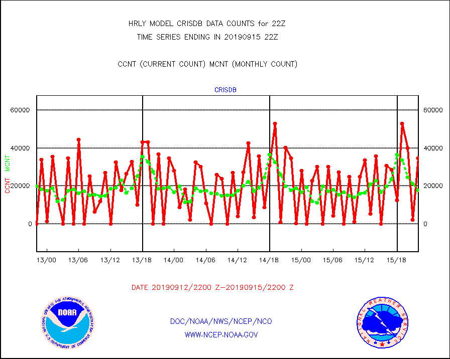
crisdb |
NPP Crss-trk IR Sndr(CrIS) radiance-dir bcst SSEC |
34560 |
17658 |
195.7 % |
1520.50-1521.49 |
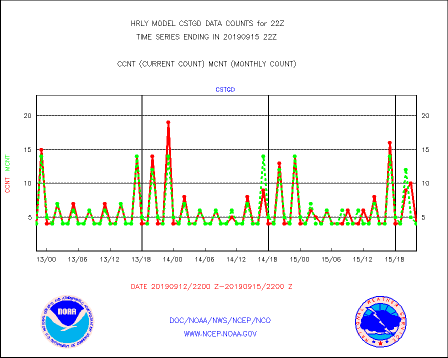
cstgd |
Coast Guard |
4 |
4 |
100.0 % |
1521.50-1522.50 |
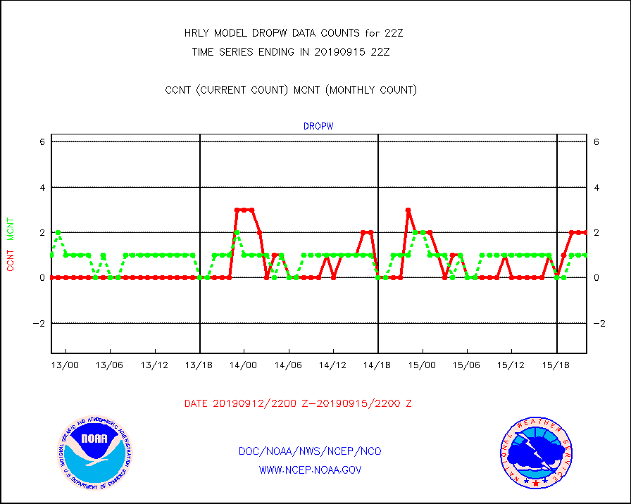
dropw |
Dropwinsonde (from TEMP DROP) |
2 |
1 |
200.0 % |
1521.50-1522.49 |
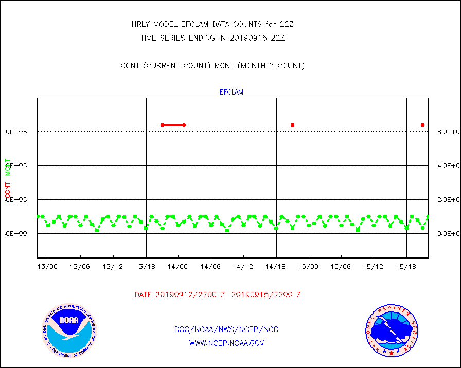
efclam |
GOES imager effective cloud amount data (U.Wisc.) |
9999999 |
9999999 |
100.0 % |
1521.50-1522.49 |
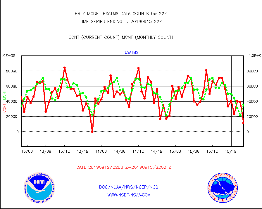
esatms |
NPP Adv. Tech. MW Sndr (ATMS) br. temps from RARS |
11520 |
35826 |
32.2 % |
1520.50-1521.49 |
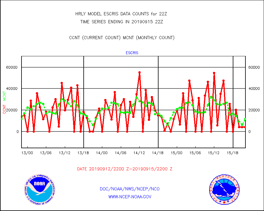
escris |
NPP Crss-track IR Sndr (CrIS) radiances from RARS |
4320 |
11859 |
36.4 % |
1520.50-1521.49 |
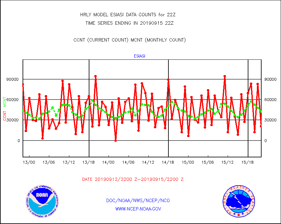
esiasi |
METOP 1-2 IASI 1C radiance data vbl chn from RARS |
20981 |
42388 |
49.5 % |
1521.00-1521.99 |
esmhs |
NOAA 18-19 & METOP 1-2 MHS proc. btemps from RARS |
140760 |
111320 |
126.4 % |
1521.50-1522.49 |
geoimr |
GOES/NESDIS (11x17 f-o-v) imager clear radiances |
24109 |
23236 |
103.8 % |
1521.00-1521.99 |
geosth |
GOES/NESDIS hi-resol. (1x1 f-o-v) cloud data |
102638 |
100281 |
102.4 % |
1521.00-1521.99 |
gome |
METOP 1-2 Global Ozone Monitoring Exp.-2 (GOME-2) |
14468 |
13369 |
108.2 % |
1520.50-1521.49 |
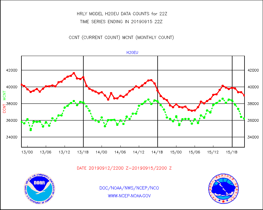
h20eu |
METEOSAT/EUMETSAT wvpr imager derived cld motion |
38968 |
36230 |
107.6 % |
1520.50-1521.49 |
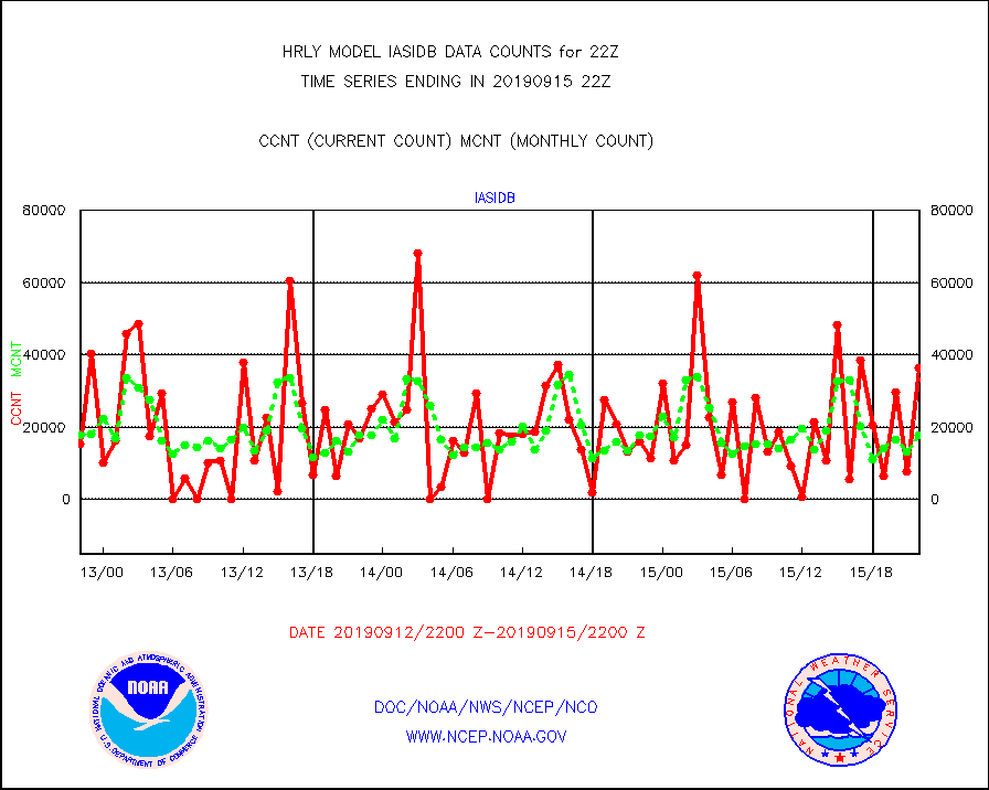
iasidb |
METOP 1-2 IASI 1C radiances-direct broadcast SSEC |
36235 |
17796 |
203.6 % |
1520.50-1521.49 |
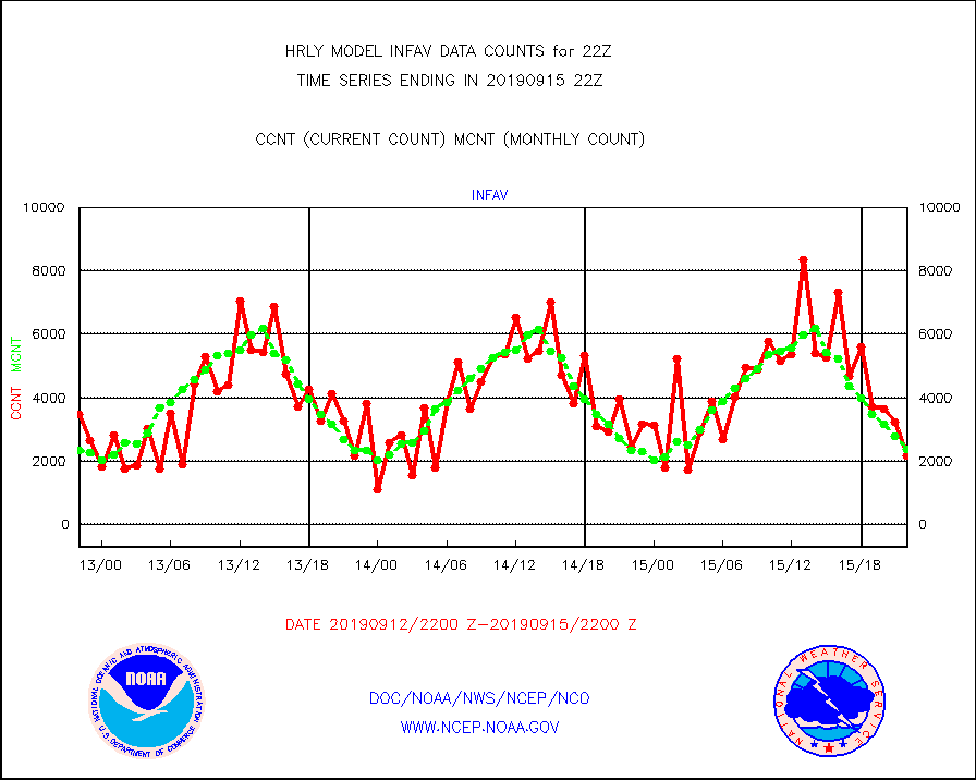
infav |
AVHRR (NOAA/METOP) ir lg-wave derived cld motion |
2159 |
2378 |
90.8 % |
1518.00-1518.99 |
infin |
INSAT/KALPANA India ir lg-wave derived cld motion |
0 |
0 |
n/a |
1519.50-1520.49 |
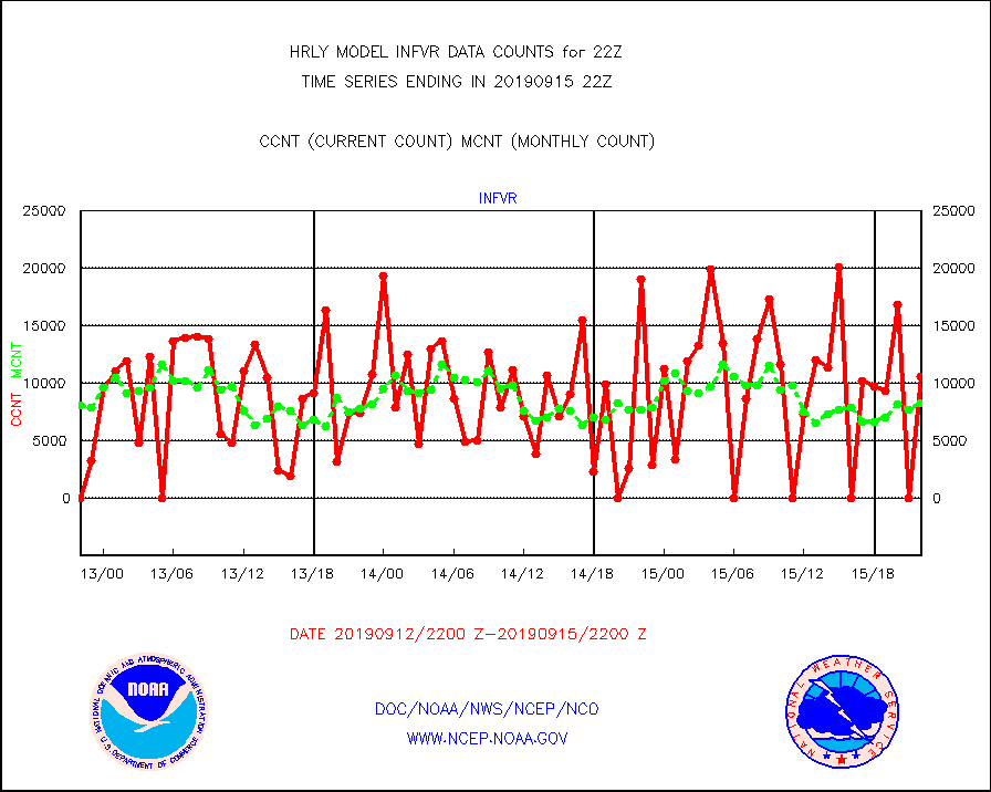
infvr |
VIIRS (NPP) infrared lg-wave derived cloud motion |
10623 |
8295 |
128.1 % |
1518.00-1518.99 |
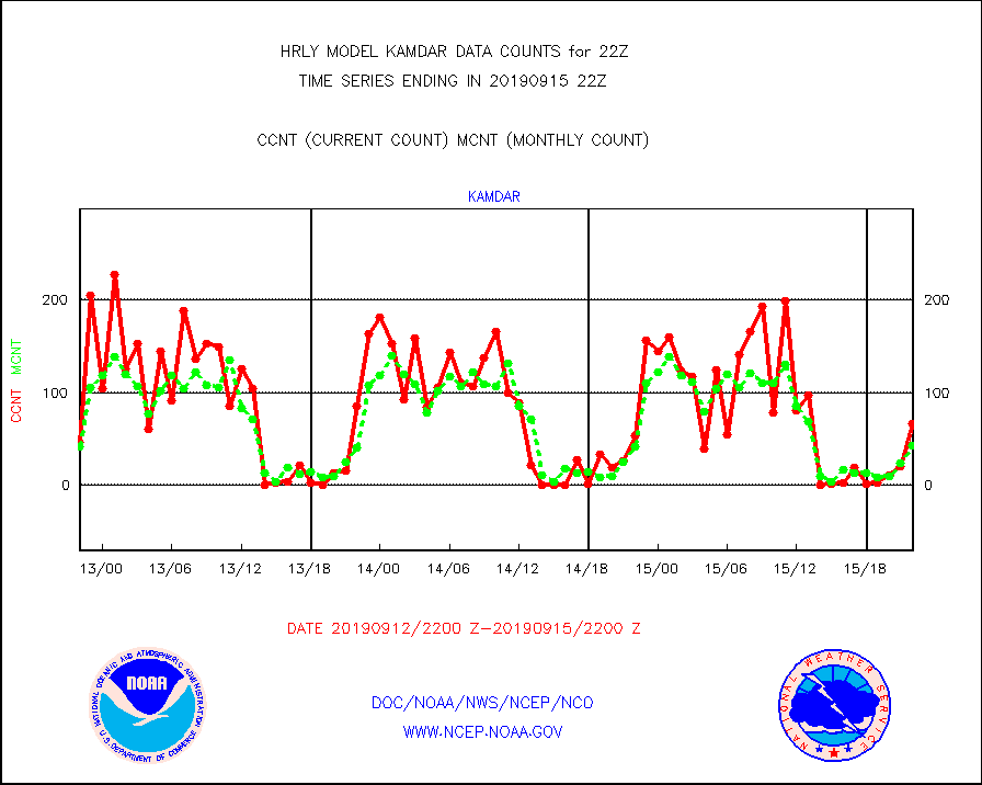
kamdar |
Korean AMDAR aircraft data (decoded from BUFR) |
67 |
43 |
155.8 % |
1521.50-1522.49 |
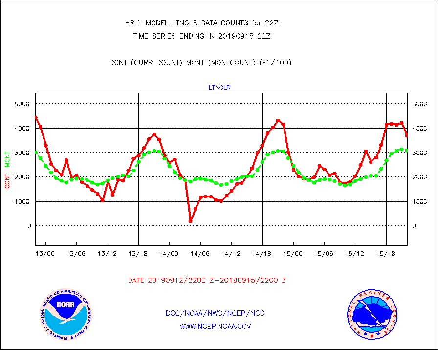
ltnglr |
LLDN Long-rng lightning from Vaisala via NOAAPORT |
369376 |
310460 |
119.0 % |
1521.50-1522.49 |
mls |
Aura Microwave Limb Sounder (MLS) ozone data |
0 |
0 |
n/a |
1520.00-1520.99 |
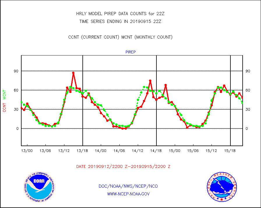
pirep |
Manual PIREP aircraft data (dcded from AIREP fmt) |
48 |
40 |
120.0 % |
1521.50-1522.49 |
prflrj |
Japanese Meteorological Agency profiler winds |
0 |
0 |
n/a |
1521.50-1522.49 |
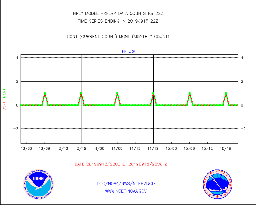
prflrp |
Profilr winds from PIBAL (PILOT,PILOT SHIP/MOBIL) |
0 |
0 |
n/a |
1521.50-1522.49 |
raobm |
Rawinsonde - mobile land (from TEMP/PILOT MOBIL) |
0 |
0 |
n/a |
1521.50-1522.49 |
raobs |
Rawinsonde - ship (from TEMP SHIP, PILOT SHIP) |
0 |
0 |
n/a |
1521.50-1522.49 |
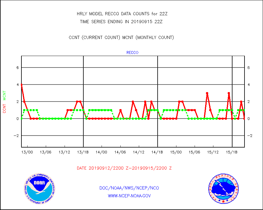
recco |
Flight level reconnaissance aircraft data |
0 |
1 |
0.0 % |
1521.50-1522.49 |
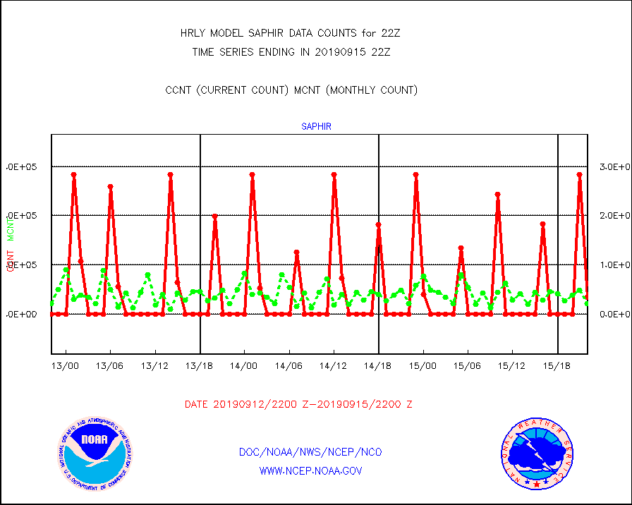
saphir |
Megha-Tropiques SAPHIR L1A2 brightness temps |
33150 |
21147 |
156.8 % |
1519.50-1520.49 |
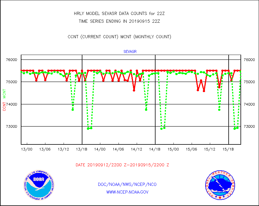
sevasr |
METEOSAT-10 2nd Gen SEVIRI All Sky Radiance(proc) |
75512 |
75468 |
100.1 % |
1521.50-1522.49 |
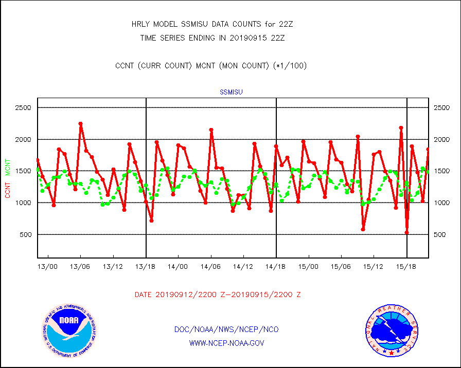
ssmisu |
DMSP SSM/IS 1C radiance data (Unified Pre-Proc.) |
184320 |
148404 |
124.2 % |
1520.50-1521.49 |
synopm |
Synoptic - mobile manual and automatic |
58 |
66 |
87.9 % |
1521.50-1522.49 |
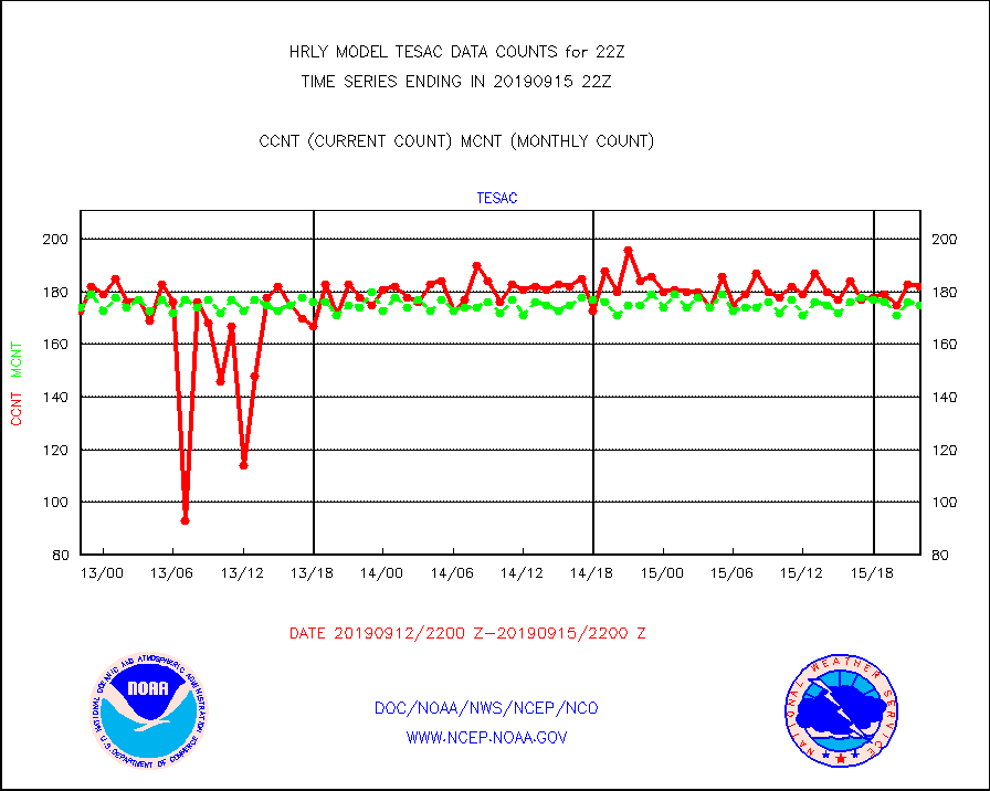
tesac |
TESAC |
182 |
175 |
104.0 % |
1521.50-1522.49 |
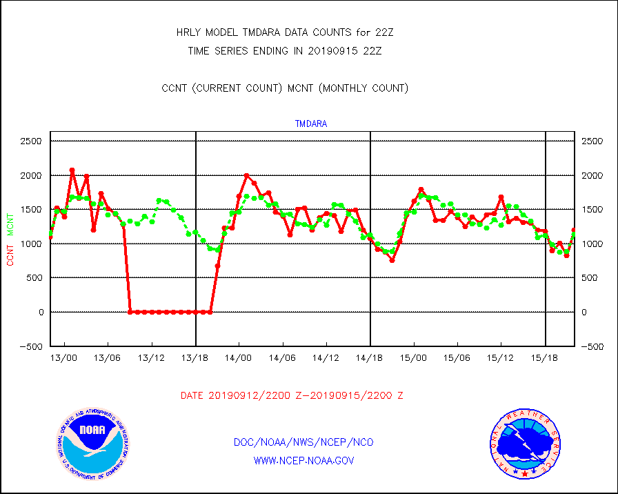
tmdara |
TAMDAR aircft data-all types(from Panasonic,BUFR) |
1196 |
1136 |
105.3 % |
1521.50-1522.49 |
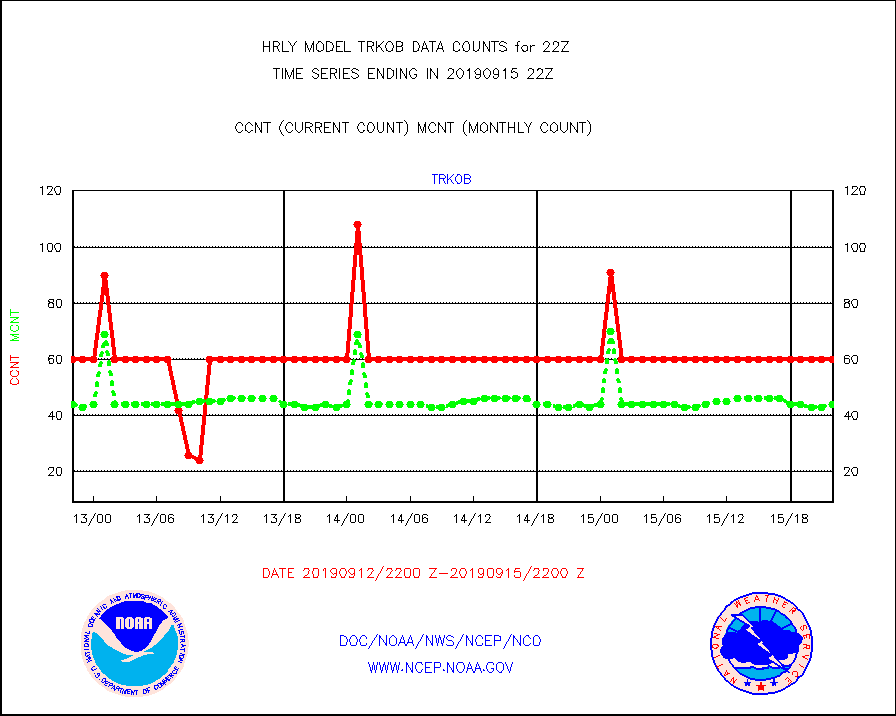
trkob |
TRACKOB |
60 |
44 |
136.4 % |
1520.50-1521.49 |
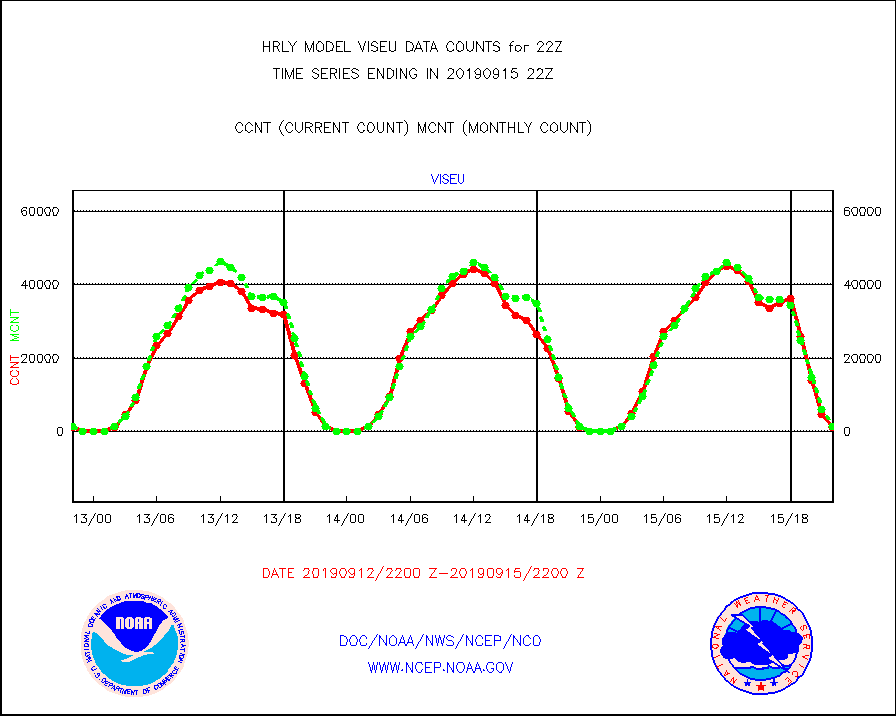
viseu |
METEOSAT/EUMETSAT visible derived cloud motion |
945 |
1361 |
69.4 % |
1520.50-1521.49 |
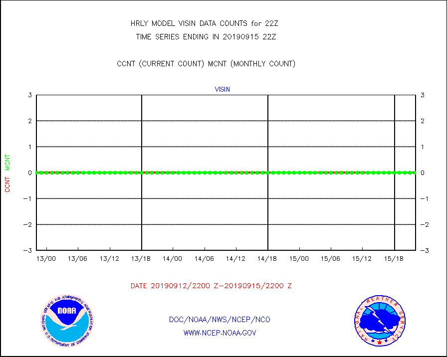
visin |
INSAT/KALPANA India visible derived cloud motion |
0 |
0 |
n/a |
1519.50-1520.49 |
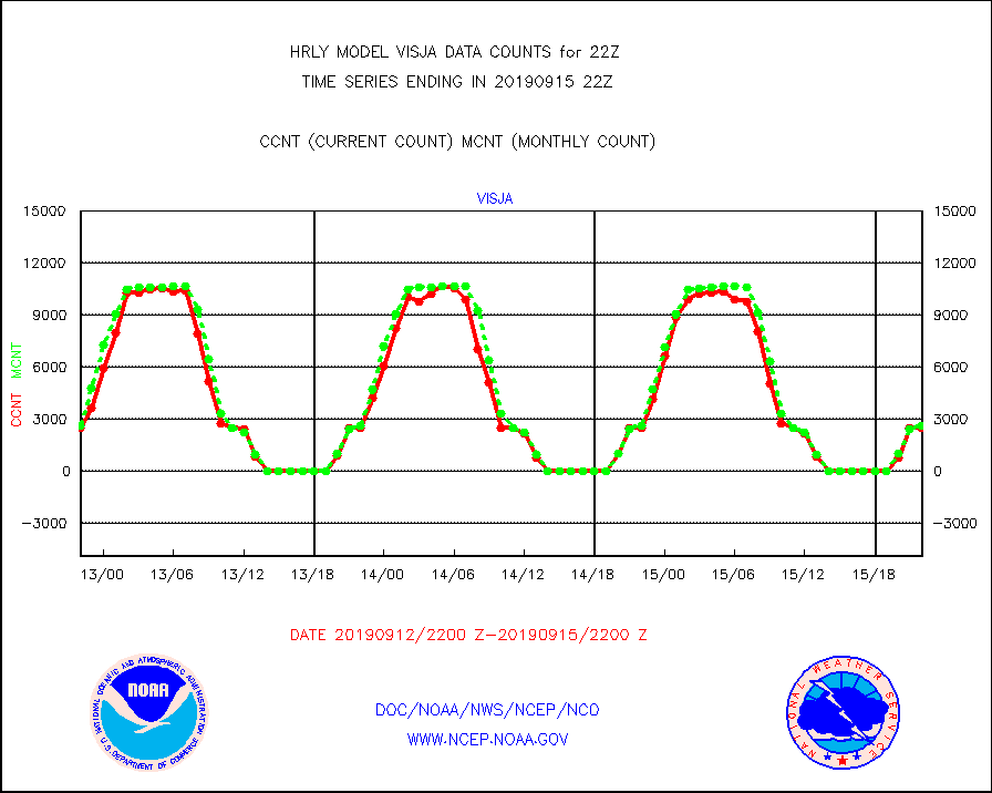
visja |
MTSAT/JMA visible derived cloud motion |
2520 |
2611 |
96.5 % |
1519.50-1520.49 |
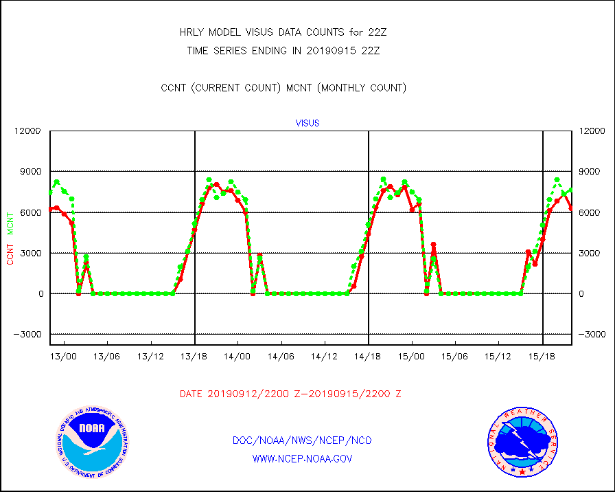
visus |
GOES/NESDIS visible derived cloud motion |
6271 |
7661 |
81.9 % |
1521.00-1521.99 |


