| Critical Data with Normal Counts |
|---|
| Type | Description | Hourly Count | Monthly Average | Percent (%) of Monthly Mean | UTC Time Window |
1bamua |
NOAA 15-19 & METOP 1-2 AMSU-A NCEP-proc. br.temps |
58977 |
51753 |
114.0 % |
1518.00-1518.99 |
1bhrs4 |
NOAA 18-19 & METOP 1-2 HIRS-4 NCEP-proc. br.temps |
103673 |
88562 |
117.1 % |
1518.00-1518.99 |
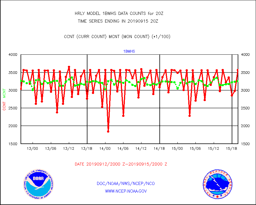
1bmhs |
NOAA 18-19 & METOP 1-2 MHS NCEP-proces. br. temps |
356604 |
325201 |
109.7 % |
1518.00-1518.99 |
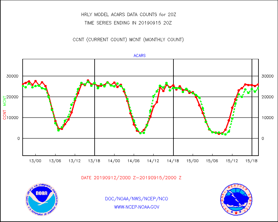
acars |
MDCRS ACARS acft data from ARINC(dcded from BUFR) |
25972 |
24198 |
107.3 % |
1519.50-1520.49 |
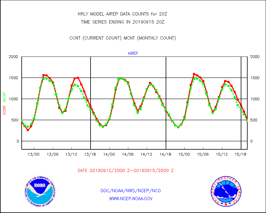
airep |
Manual AIREP aircraft data (dcded from AIREP fmt) |
512 |
480 |
106.7 % |
1519.50-1520.49 |
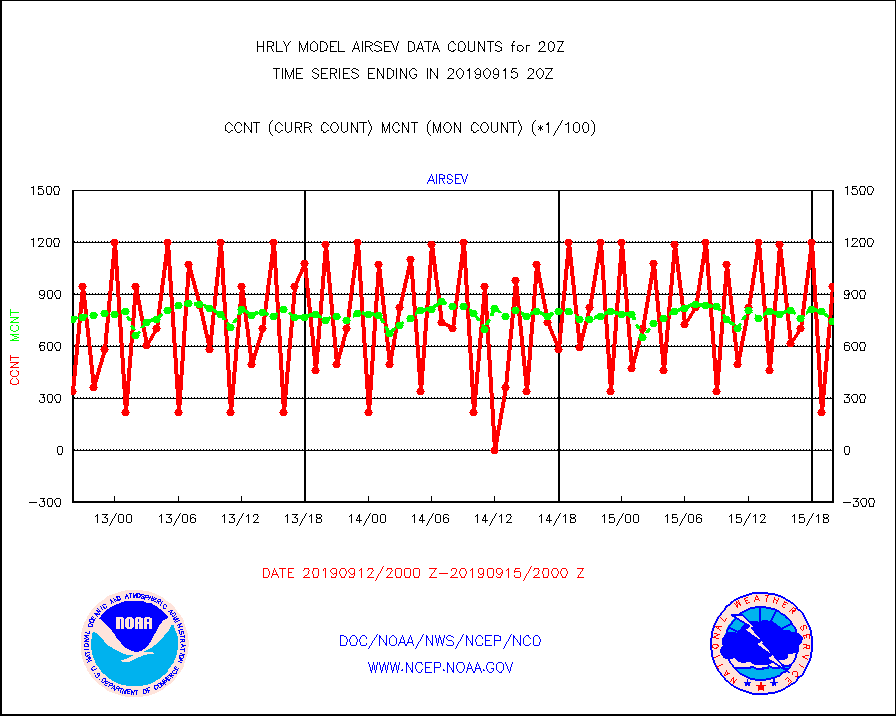
airsev |
AQUA AIRS/AMSU-A/HSB brightness temps- every FOV |
94989 |
74235 |
128.0 % |
1517.50-1518.49 |
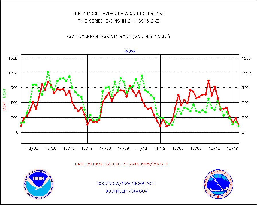
amdar |
AMDAR aircraft data (decoded from AMDAR format) |
135 |
126 |
107.1 % |
1519.50-1520.49 |
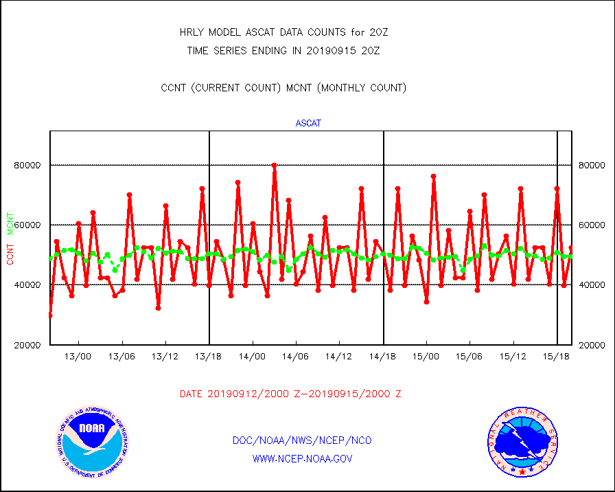
ascat |
METOP 1-2 ASCAT products |
52416 |
49564 |
105.8 % |
1518.50-1519.49 |
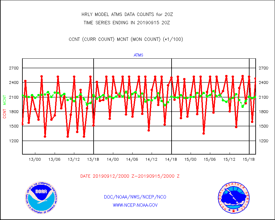
atms |
NPP Adv. Tech. Microwave Sounder (ATMS) br. temps |
248640 |
210125 |
118.3 % |
1518.50-1519.49 |
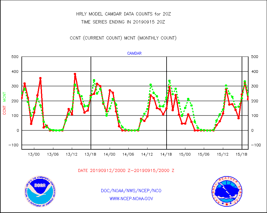
camdar |
Canadian AMDAR aircraft data (decoded from BUFR) |
212 |
242 |
87.6 % |
1519.50-1520.49 |
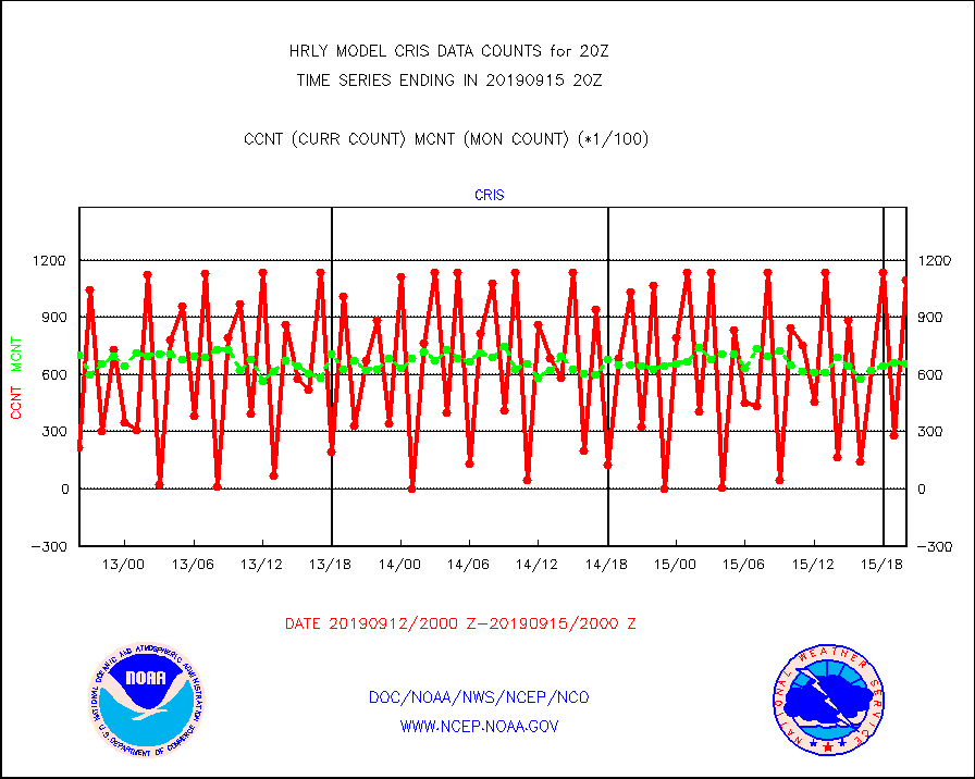
cris |
NPP Cross-track Infrared Sounder (CrIS) radiances |
109611 |
65783 |
166.6 % |
1518.50-1519.49 |
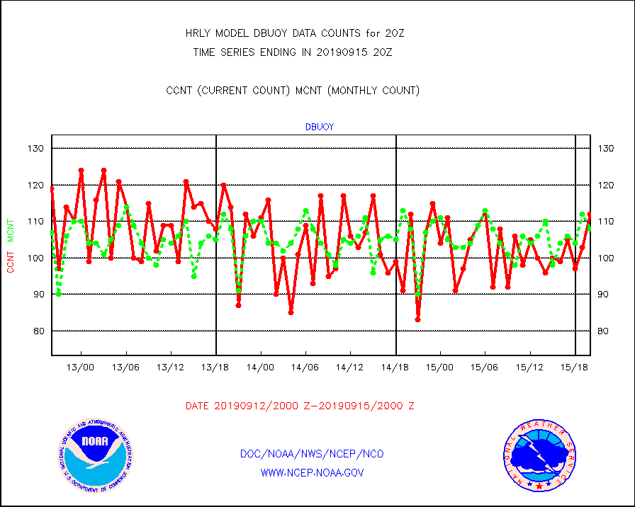
dbuoy |
Buoys decoded from FM-18 fmt (moored or drifting) |
112 |
108 |
103.7 % |
1519.50-1520.49 |
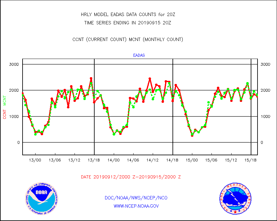
eadas |
E-AMDAR (European AMDAR acft decoded from BUFR) |
1772 |
1813 |
97.7 % |
1519.50-1520.49 |
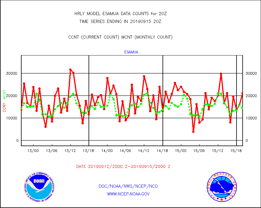
esamua |
NOAA 15-19 & METOP 1-2 AMSU-A proc btmps frm RARS |
21255 |
14408 |
147.5 % |
1519.50-1520.49 |
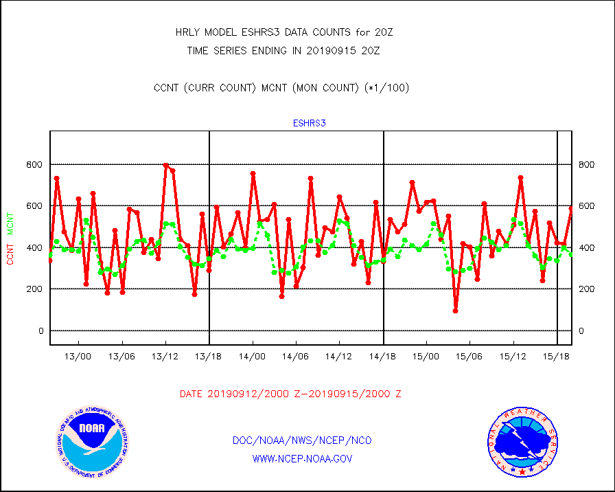
eshrs3 |
NOAA 15-19 & METOP 1-2 HIRS-3/4 pr btmps frm RARS |
58838 |
36562 |
160.9 % |
1519.50-1520.49 |
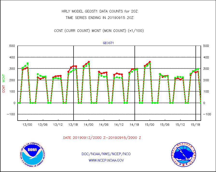
geost1 |
GOES/NESDIS hi-resol. (1x1 f-o-v) sndgs/radiances |
0 |
0 |
n/a |
1519.50-1520.49 |
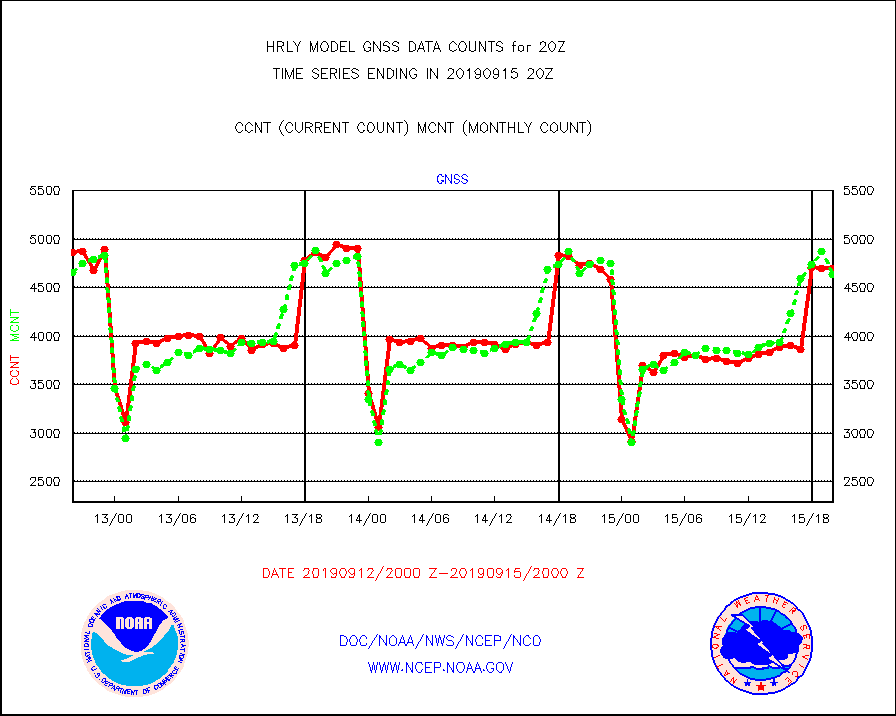
gnss |
Grnd-based Gbl Navigation Sat System (GNSS) data |
4694 |
4637 |
101.2 % |
1519.00-1519.99 |
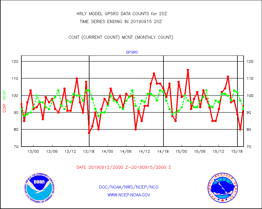
gpsro |
GPS radio occultation data |
94 |
92 |
102.2 % |
1517.50-1518.49 |
h20ja |
MTSAT/JMA water vapor imager derived cloud motion |
16429 |
17138 |
95.9 % |
1517.50-1518.49 |
h20mo |
MODIS (AQUA/TERRA) wvpr imager derived cld motion |
0 |
0 |
n/a |
1516.00-1516.99 |
h2ius |
GOES/NESDIS water vapor imager derived cld motion |
5431 |
4649 |
116.8 % |
1519.00-1519.99 |
infeu |
METEOSAT/EUMETSAT ir lg-wave derived cloud motion |
21013 |
21413 |
98.1 % |
1518.50-1519.49 |
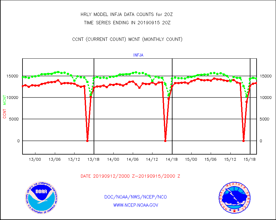
infja |
MTSAT/JMA infrared long-wave derived cloud motion |
13309 |
14403 |
92.4 % |
1517.50-1518.49 |
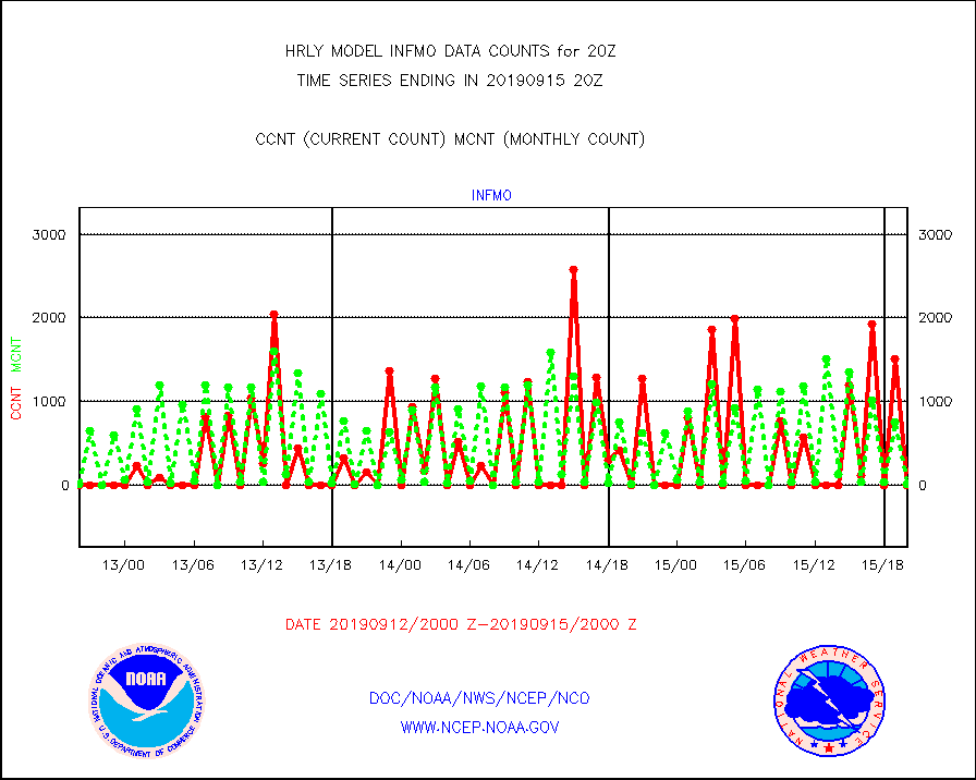
infmo |
MODIS (AQUA/TERRA) ir l-wave derived cloud motion |
0 |
13 |
0.0 % |
1516.00-1516.99 |
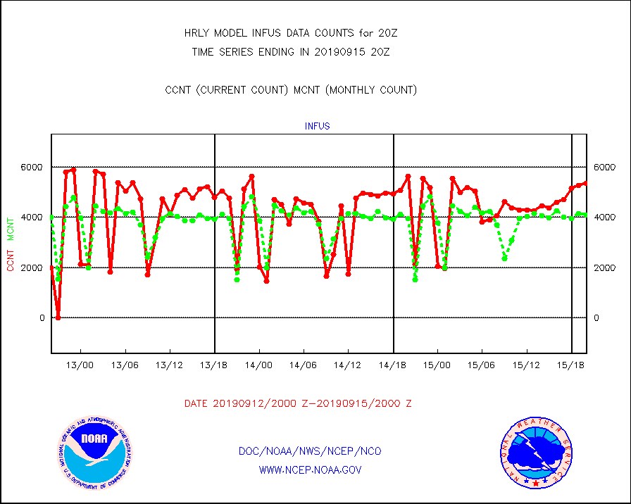
infus |
GOES/NESDIS infrared lg-wave derived cloud motion |
5350 |
4085 |
131.0 % |
1519.00-1519.99 |
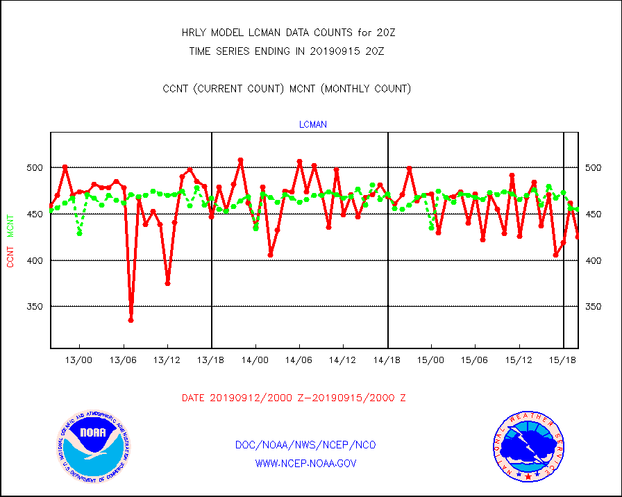
lcman |
Land-based CMAN stations decoded from CMAN format |
425 |
455 |
93.4 % |
1519.50-1520.49 |
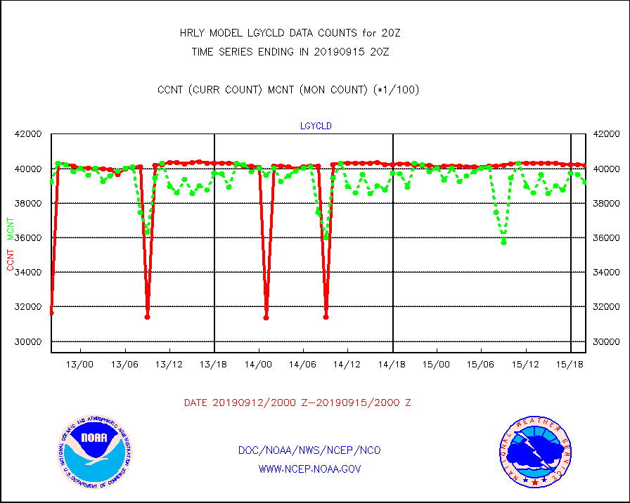
lgycld |
GOES/NASA(Langley) hi-res. (1x1 f-o-v) cloud data |
4017634 |
3919879 |
102.5 % |
1519.50-1520.49 |
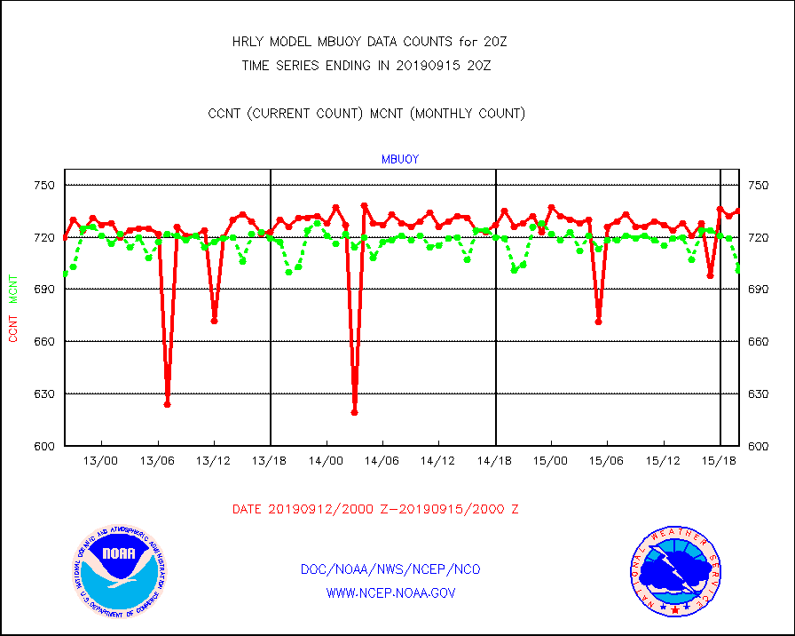
mbuoy |
Buoys decoded from FM-13 format (moored) |
735 |
701 |
104.9 % |
1519.50-1520.49 |
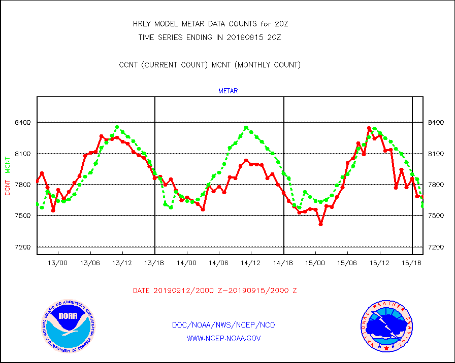
metar |
Aviation - METAR |
7684 |
7597 |
101.1 % |
1519.50-1520.49 |
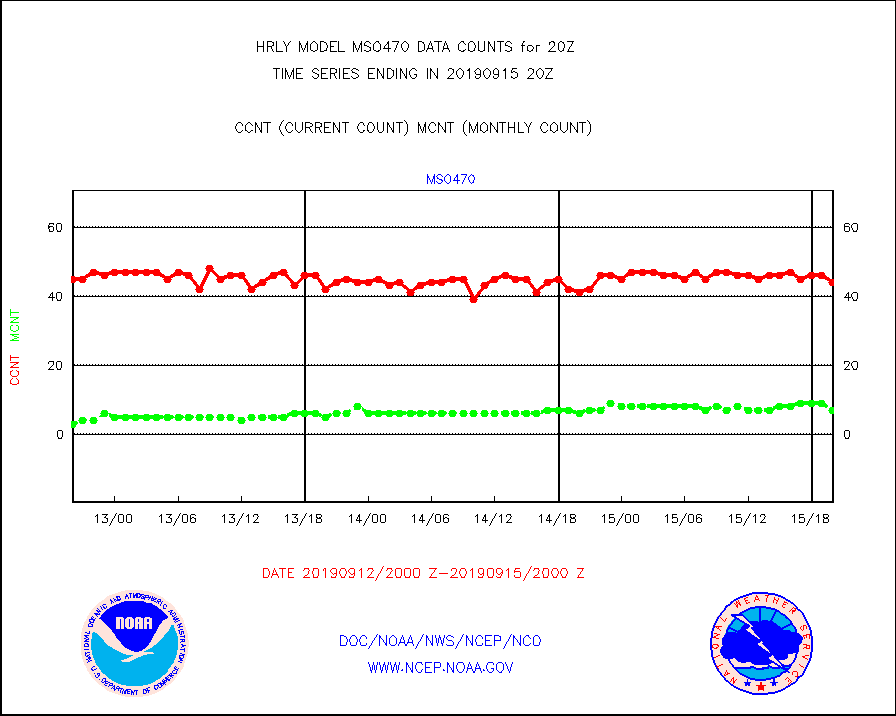
mso470 |
Mesonet/MADIS Colorado E-470 (Interstate 470) |
44 |
7 |
628.6 % |
1519.50-1520.49 |
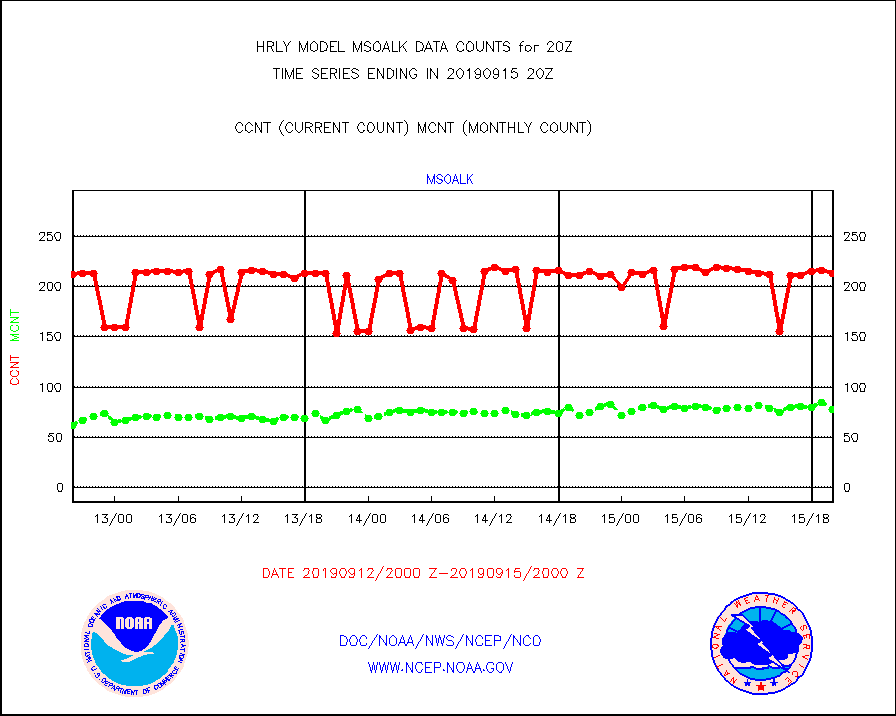
msoalk |
Mesonet/MADIS Alaska Department of Transportation |
213 |
78 |
273.1 % |
1519.50-1520.49 |
msoapg |
Mesonet/MADIS U.S. Army Aberdeen Proving Grounds |
0 |
0 |
n/a |
1519.50-1520.49 |
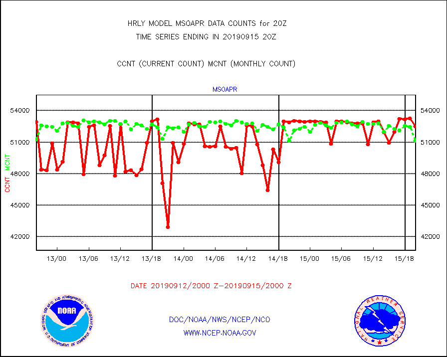
msoapr |
Mesonet/MADIS Citizen Weather Observers Program |
52481 |
51125 |
102.7 % |
1519.50-1520.49 |
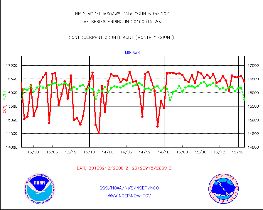
msoaws |
Mesonet/MADIS AWS Convergence Technologies, Inc. |
16408 |
15748 |
104.2 % |
1519.50-1520.49 |
msoawx |
Mesonet/MADIS "Anything Weather" |
0 |
0 |
n/a |
1519.50-1520.49 |
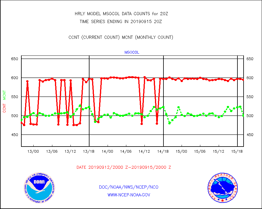
msocol |
Mesonet/MADIS Colorado Dept. of Transportation |
595 |
500 |
119.0 % |
1519.50-1520.49 |
msodcn |
Mesonet/MADIS DC Net |
0 |
0 |
n/a |
1519.50-1520.49 |
msoden |
Mesonet/MADIS Denver Urban Drainage & Flood Cntrl |
0 |
0 |
n/a |
1519.50-1520.49 |
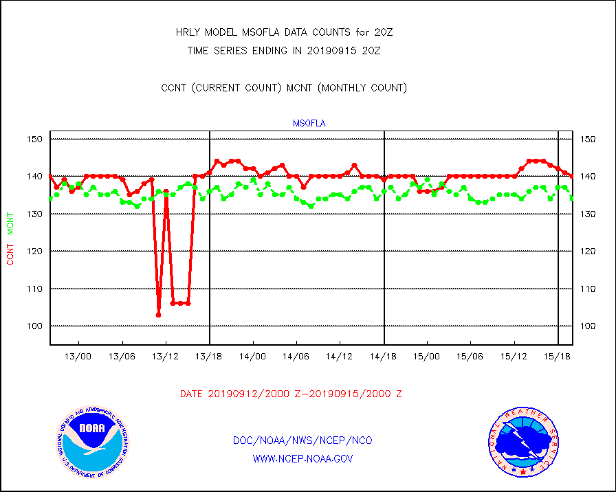
msofla |
Mesonet/MADIS Florida (FAWN & USF) |
140 |
134 |
104.5 % |
1519.50-1520.49 |
msoflt |
Mesonet/MADIS Florida Dept. of Transportation |
0 |
0 |
n/a |
1519.50-1520.49 |
msogeo |
Mesonet/MADIS Georgia Dept. of Transportation |
250 |
44 |
568.2 % |
1519.50-1520.49 |
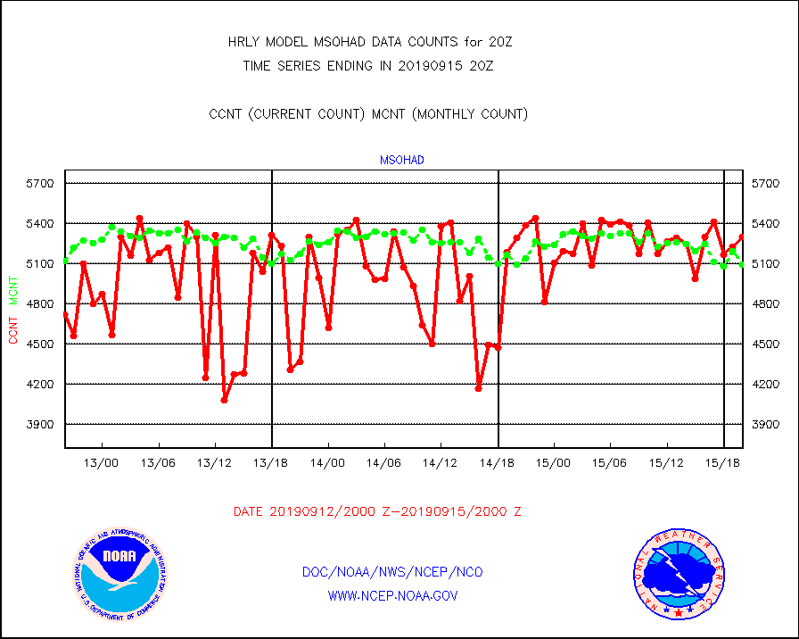
msohad |
Mesonet/MADIS NWS Hydromet Auto Data System(HADS) |
5300 |
5093 |
104.1 % |
1519.50-1520.49 |
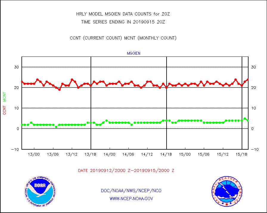
msoien |
Mesonet/MADIS Iowa Environmental |
24 |
4 |
600.0 % |
1519.50-1520.49 |
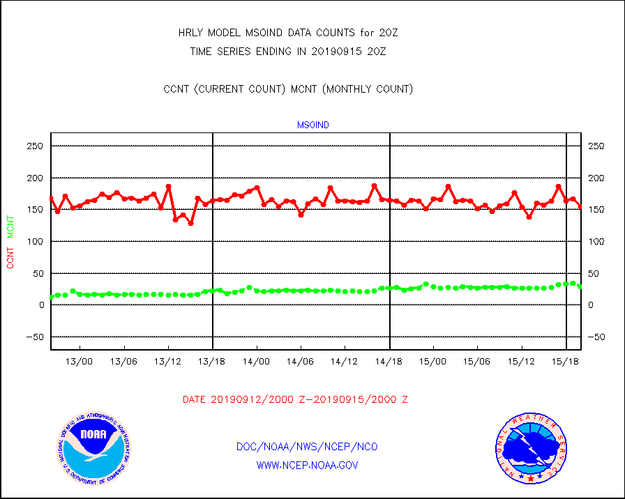
msoind |
Mesonet/MADIS Indiana Dept. of Transportation |
155 |
29 |
534.5 % |
1519.50-1520.49 |
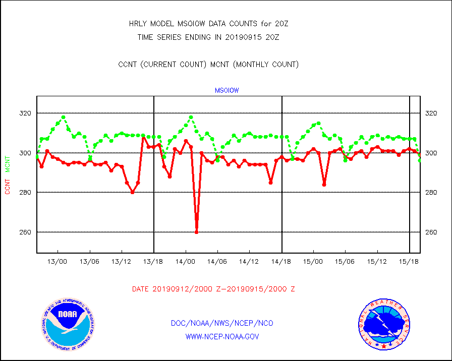
msoiow |
Mesonet/MADIS Iowa Department of Transportation |
299 |
296 |
101.0 % |
1519.50-1520.49 |
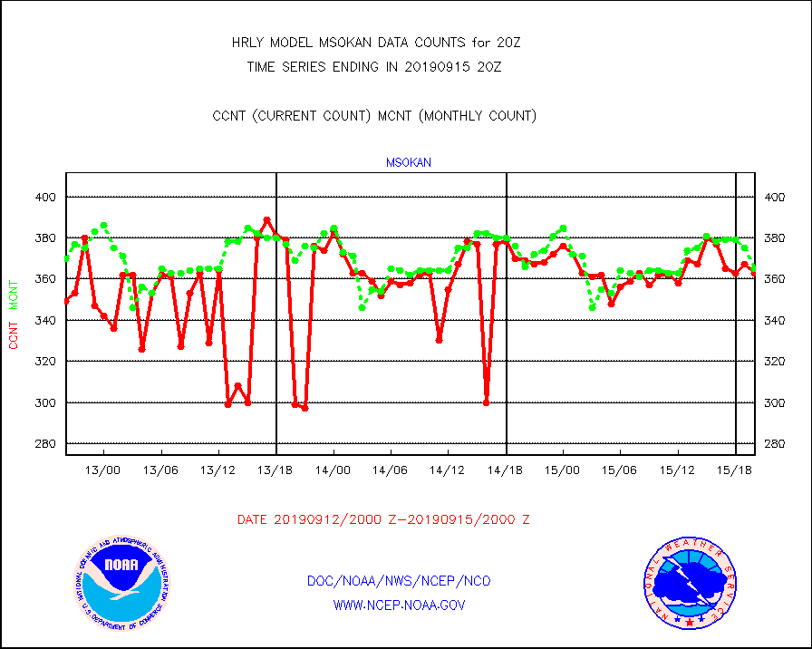
msokan |
Mesonet/MADIS Kansas Department of Transportation |
363 |
365 |
99.5 % |
1519.50-1520.49 |
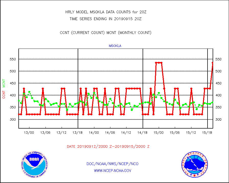
msokla |
Mesonet/MADIS Oklahoma Mesonet |
535 |
371 |
144.2 % |
1519.50-1520.49 |
msolju |
Mesonet/MADIS Louisiana State/Jackson State Univ. |
0 |
0 |
n/a |
1519.50-1520.49 |
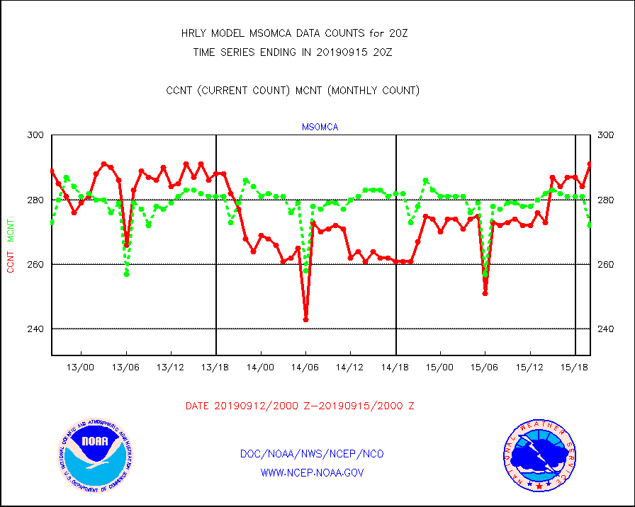
msomca |
Mesonet/MADIS Missouri Commercial Agricult Wx Net |
291 |
272 |
107.0 % |
1519.50-1520.49 |
msomin |
Mesonet/MADIS Minnesota Dept. of Transportation |
839 |
801 |
104.7 % |
1519.50-1520.49 |
msonos |
Mesonet/MADIS NOS-Phys Oceanographic Realtime Sys |
363 |
348 |
104.3 % |
1519.50-1520.49 |
msoraw |
Mesonet/MADIS NFIC Remote Automated Wx Stns(RAWS) |
1716 |
1756 |
97.7 % |
1519.50-1520.49 |
msothr |
Mesonet/MADIS many providers, not separated out |
19108 |
16358 |
116.8 % |
1519.50-1520.49 |
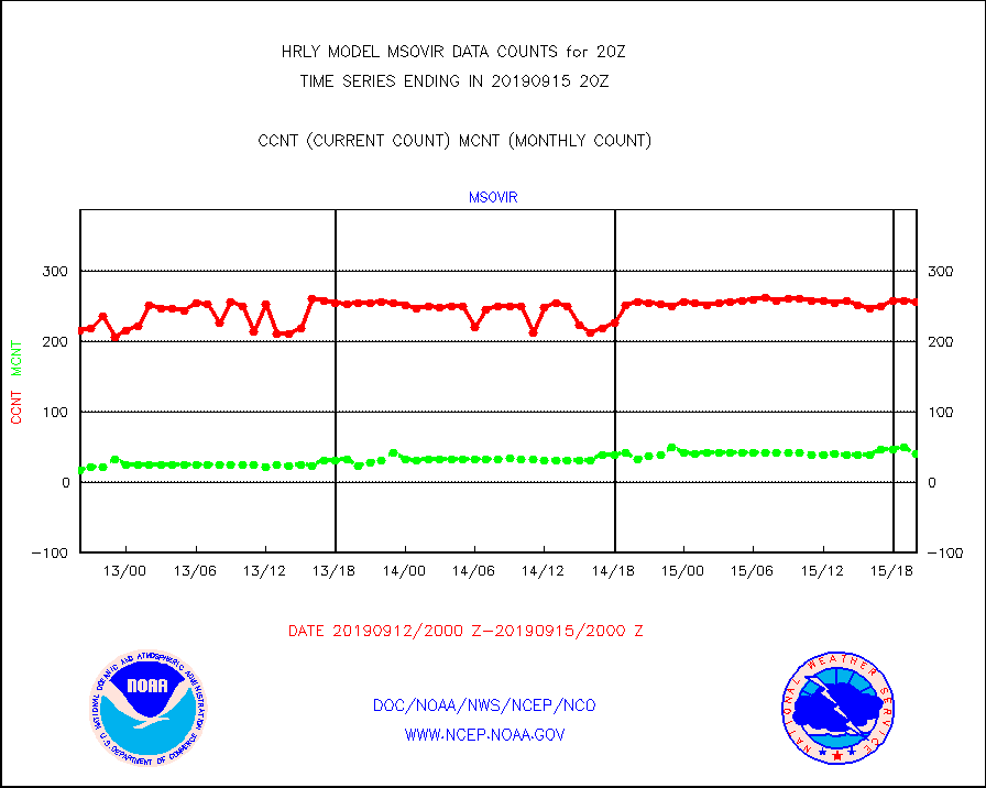
msovir |
Mesonet/MADIS Virginia Dept. of Transportation |
256 |
40 |
640.0 % |
1519.50-1520.49 |
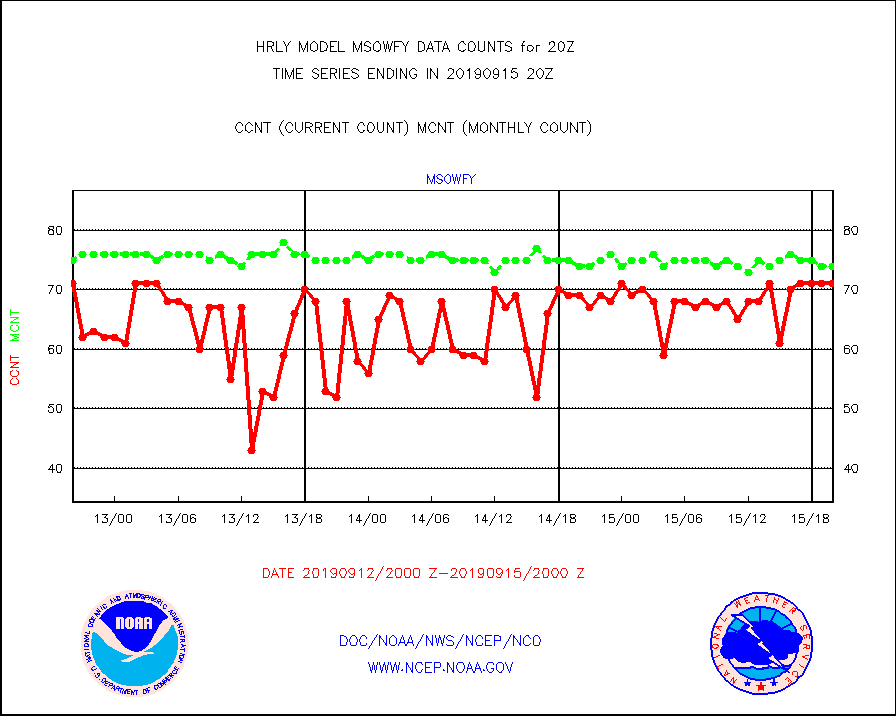
msowfy |
Mesonet/MADIS "Weather for You" |
71 |
74 |
95.9 % |
1519.50-1520.49 |
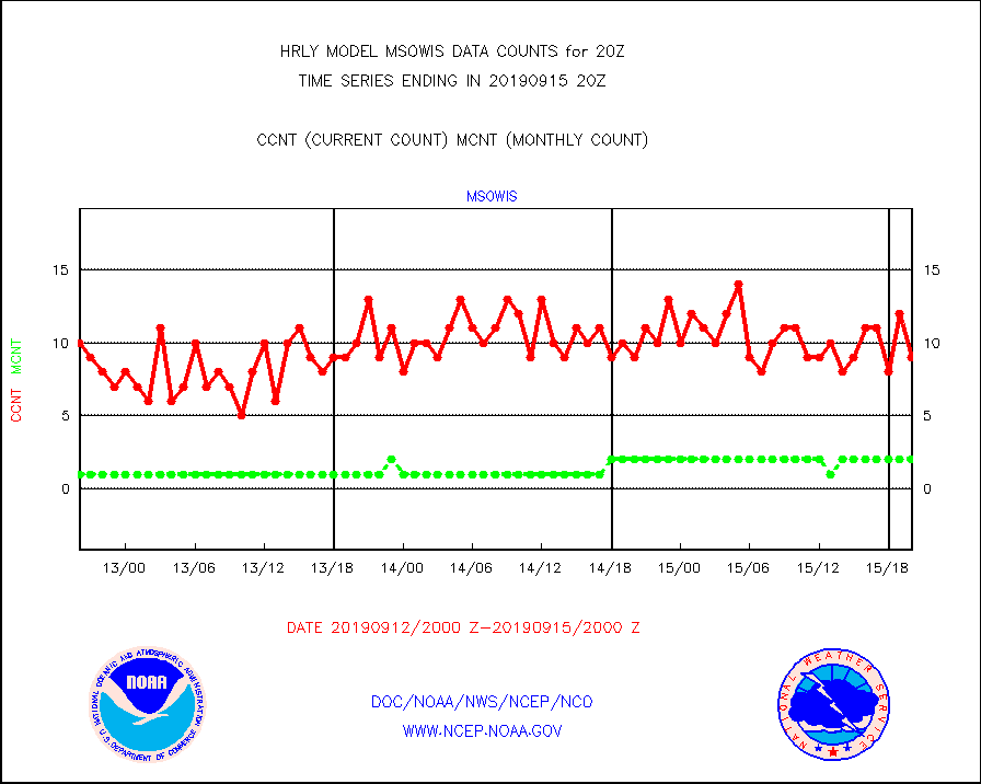
msowis |
Mesonet/MADIS Wisconsin Dept. of Transportation |
9 |
2 |
450.0 % |
1519.50-1520.49 |
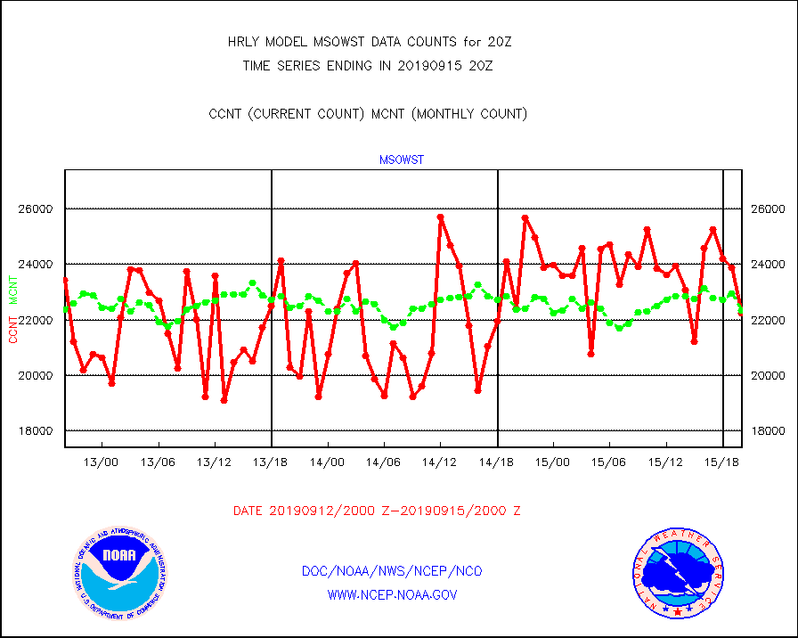
msowst |
Mesonet/MADIS MesoWest (many subproviders) |
22247 |
22356 |
99.5 % |
1519.50-1520.49 |
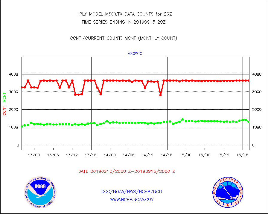
msowtx |
Mesonet/MADIS West Texas |
3642 |
1293 |
281.7 % |
1519.50-1520.49 |
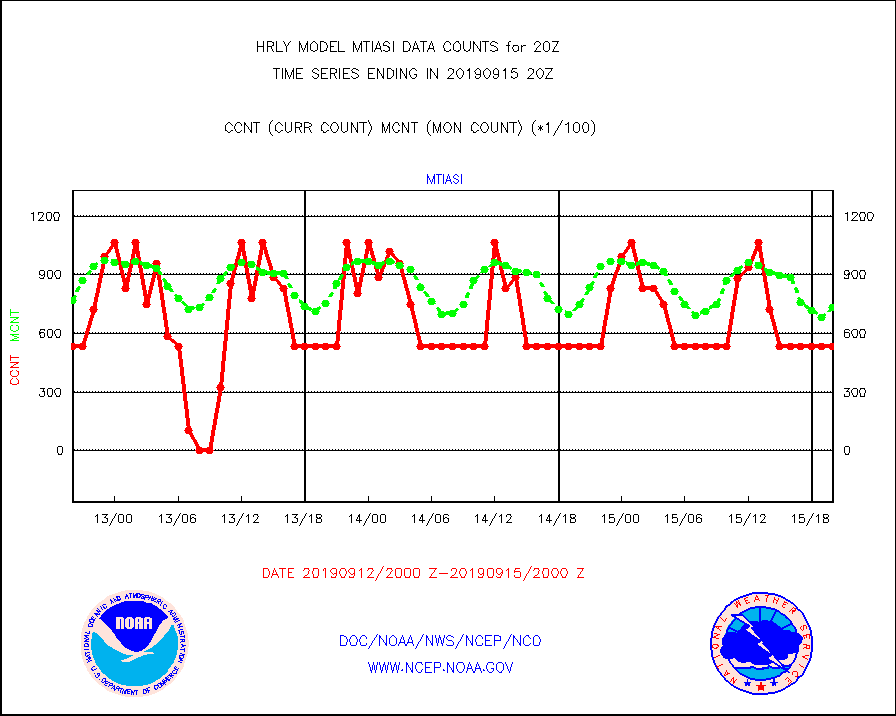
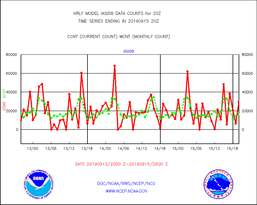
mtiasi |
METOP 1-2 IASI 1C radiance data (varbl. channels) |
53448 |
73144 |
73.1 % |
1518.00-1518.99 |
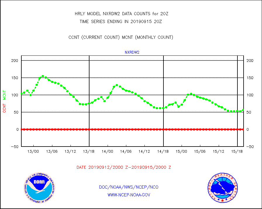
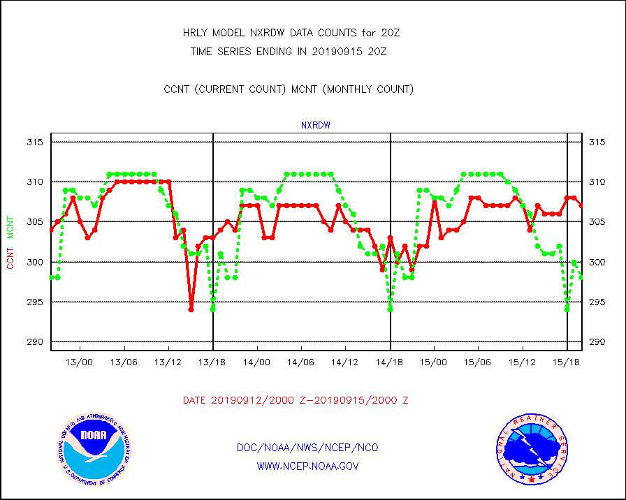
nxrdw |
NEXRAD Vel Azm Dsp(VAD) winds via radar coded msg |
307 |
298 |
103.0 % |
1519.50-1520.49 |
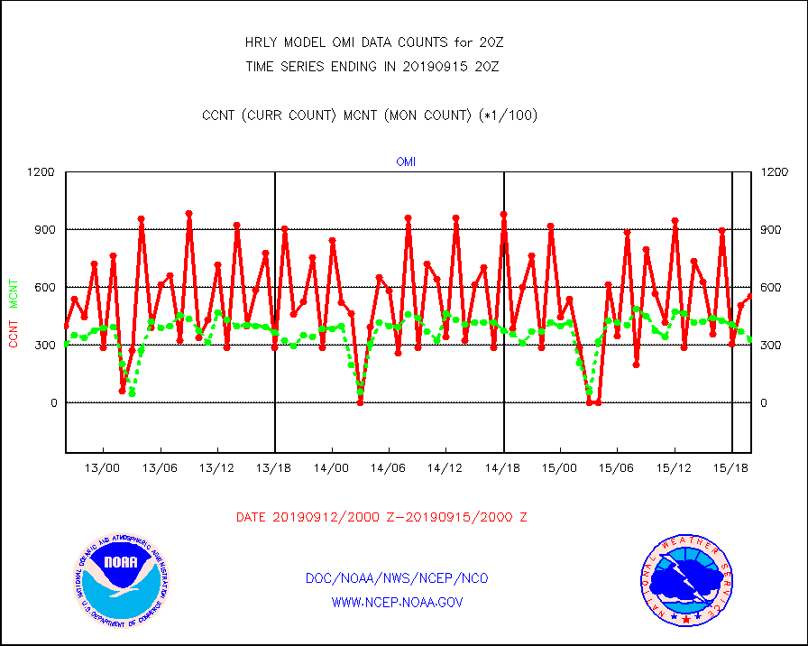
omi |
Aura Ozone Monitoring Instrument (OMI) data |
55680 |
33072 |
168.4 % |
1517.50-1518.49 |
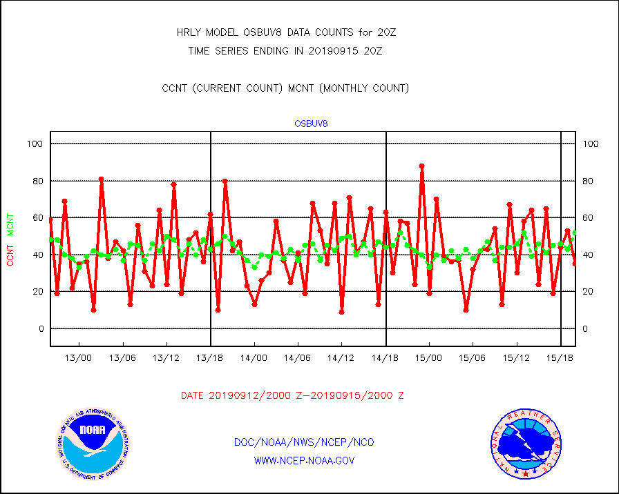
osbuv8 |
NOAA 16-19 Solar Backscatter UV-2 rad frm V8 BUFR |
35 |
52 |
67.3 % |
1518.00-1518.99 |
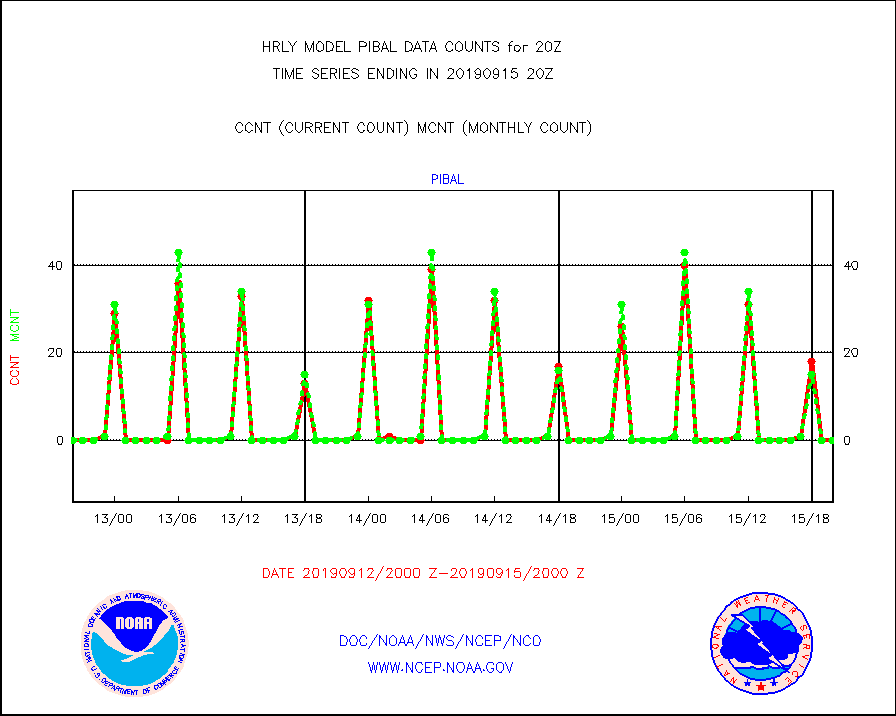
pibal |
PIBAL (from PILOT, PILOT SHIP, PILOT MOBIL) |
0 |
0 |
n/a |
1519.50-1520.49 |
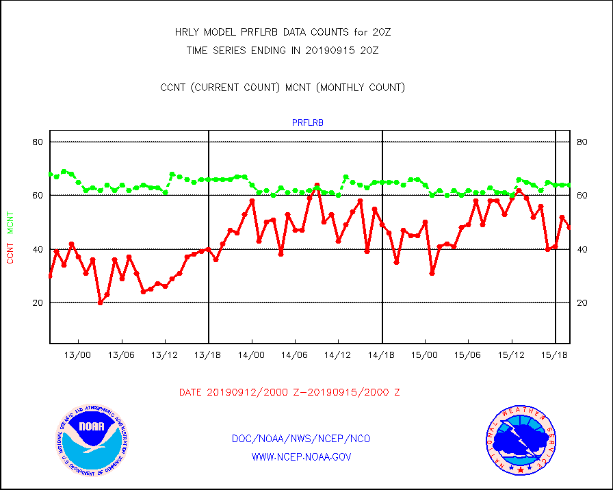
prflrb |
Multi-Agency Profiler (MAP) and SODAR winds |
48 |
64 |
75.0 % |
1519.50-1520.49 |
radw25 |
NEXRAD radial wind superobs (Level 2.5 - ORPG) |
0 |
0 |
n/a |
1518.50-1519.49 |
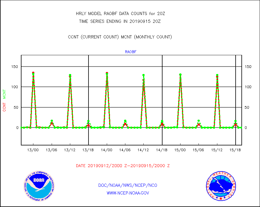
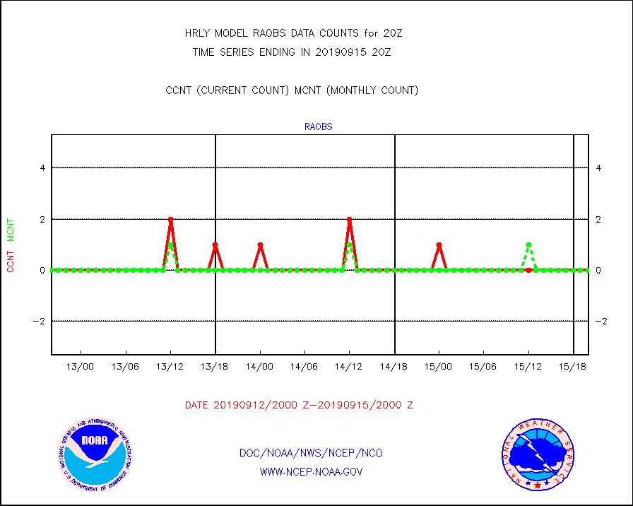
raobf |
Rawinsonde - fixed land (from TEMP or PILOT) |
0 |
0 |
n/a |
1519.50-1520.49 |
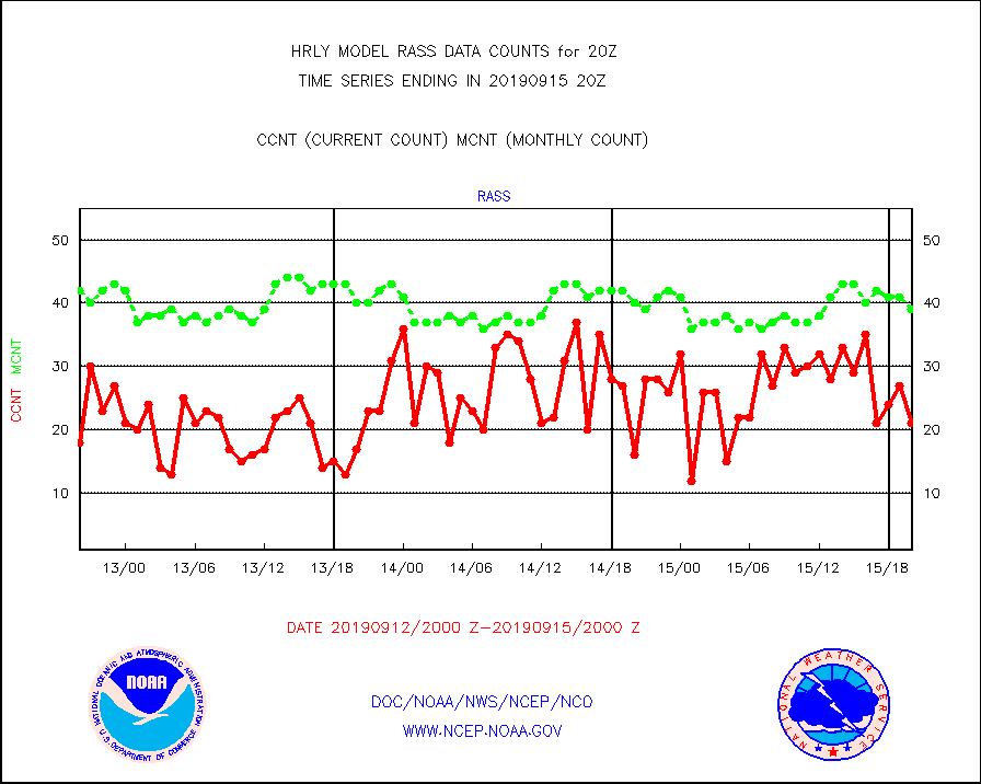
rass |
RASS temperatures (NOAA and Multi-Agency) |
21 |
39 |
53.8 % |
1519.50-1520.49 |
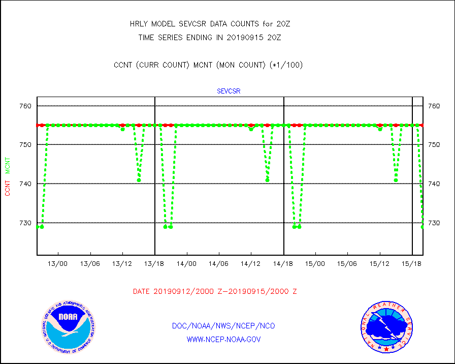
sevcsr |
METEOSAT-10 2nd Gen SEVIRI Clr Sky Radiance(proc) |
75512 |
72995 |
103.4 % |
1519.50-1520.49 |
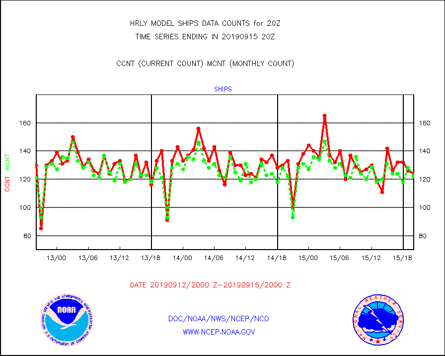
ships |
Ship - manual and automatic, restricted |
124 |
122 |
101.6 % |
1519.50-1520.49 |
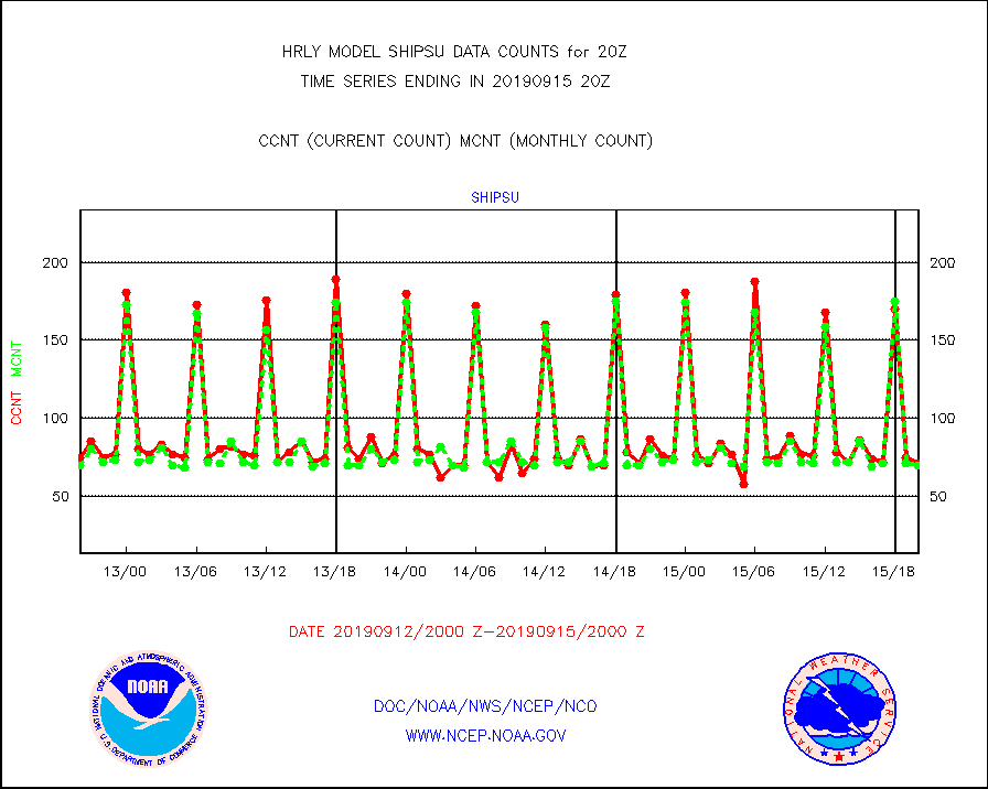
shipsu |
Ship - manual and automatic, unrestricted |
71 |
70 |
101.4 % |
1519.50-1520.50 |
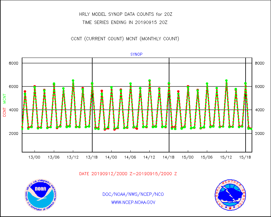
synop |
Synoptic - fixed manual and automatic |
2415 |
2374 |
101.7 % |
1519.50-1520.49 |
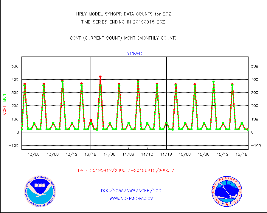
synopr |
Synoptic - restricted (WMO Res 40) manual & auto. |
23 |
22 |
104.5 % |
1519.50-1520.49 |
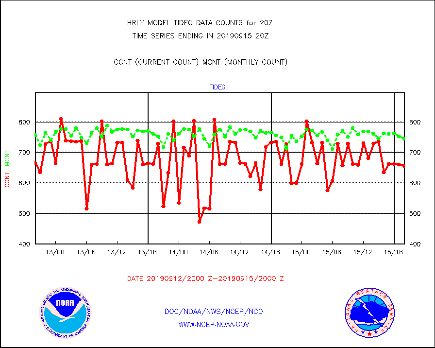
tideg |
Tide gauge reports decoded from CREX format |
656 |
745 |
88.1 % |
1519.00-1519.99 |
| Data Types of Opportunity with Normal Counts |
|---|
| Type | Description | Hourly Count | Monthly Average | Percent (%) of Monthly Mean | UTC Time Window |
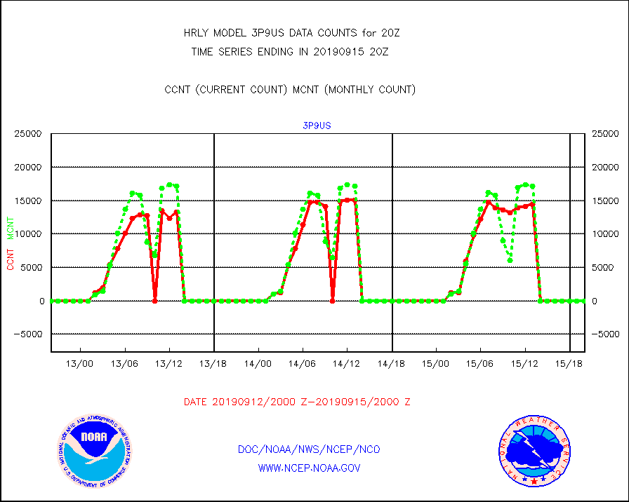
3p9us |
GOES/NESDIS infrared shrt-wave derived cld motion |
0 |
0 |
n/a |
1519.00-1519.99 |
acarsa |
MDCRS ACARS acft data (ARINC via AFWA)(AIREP fmt) |
0 |
0 |
n/a |
1519.50-1520.49 |
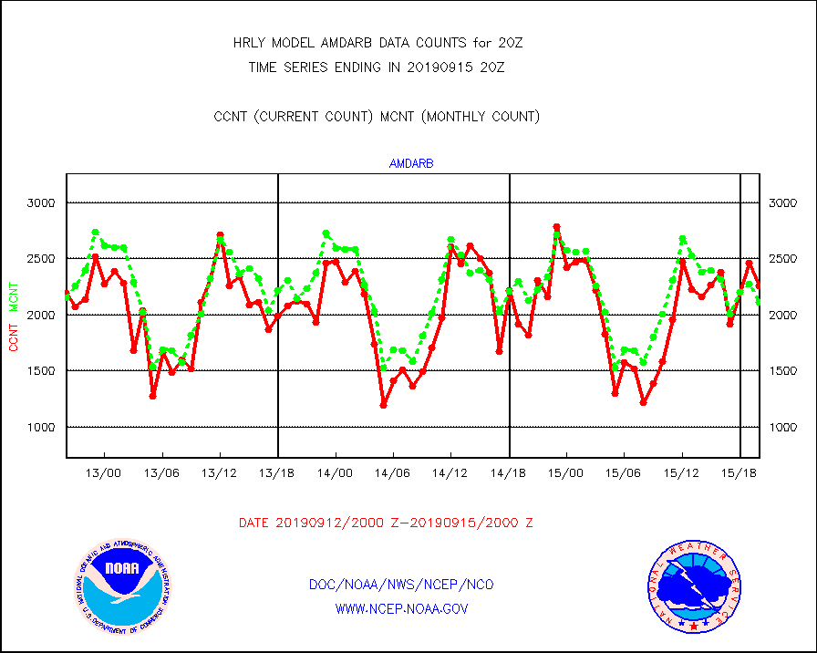
amdarb |
AMDAR aircraft data (decoded from BUFR) |
2261 |
2112 |
107.1 % |
1519.50-1520.49 |
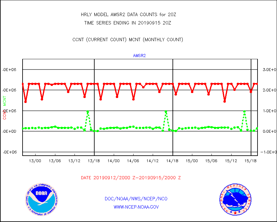
amsr2 |
GCOM-W AMSR2 1B brightness temperatures |
2309472 |
2154406 |
107.2 % |
1518.00-1518.99 |
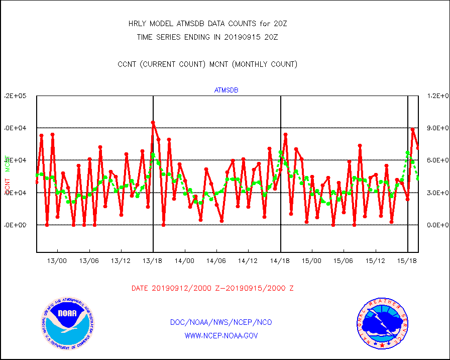
atmsdb |
NPP Adv Tech MW Sndr(ATMS) b. temps-dir bcst SSEC |
71430 |
43064 |
165.9 % |
1518.50-1519.49 |
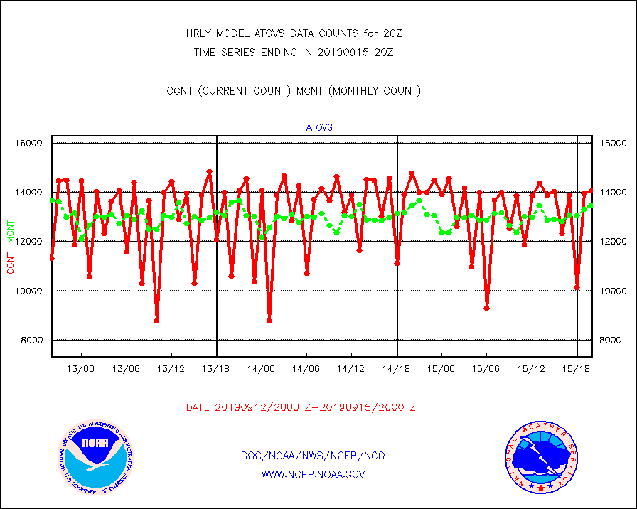
atovs |
POES/NESDIS - processed ATOVS soundings/radiances |
14085 |
13482 |
104.5 % |
1518.00-1518.99 |
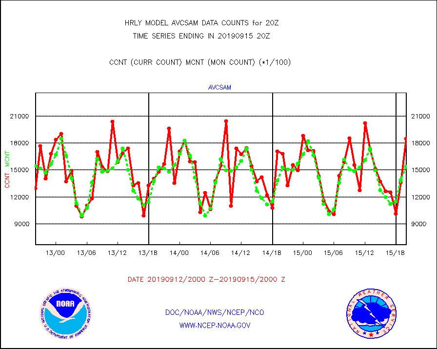
avcsam |
A.M.(N17,M2) AVHRR GAC NCEP-proc clr & sea btemps |
1846233 |
1537470 |
120.1 % |
1517.50-1518.49 |
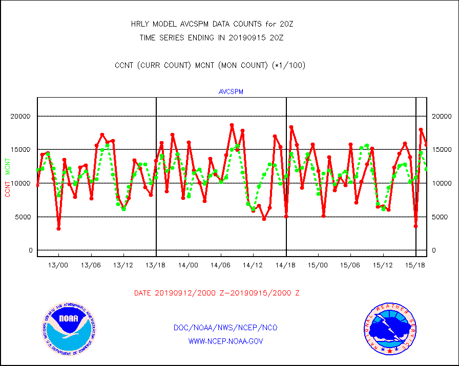
avcspm |
P.M.(N18-19) AVHRR GAC NCEP-proc clr & sea btemps |
1567984 |
1205312 |
130.1 % |
1517.50-1518.49 |
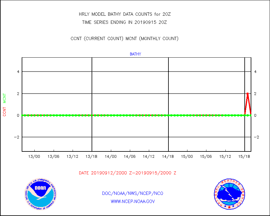
bathy |
Bathythermal |
0 |
0 |
n/a |
1513.00-1513.99 |
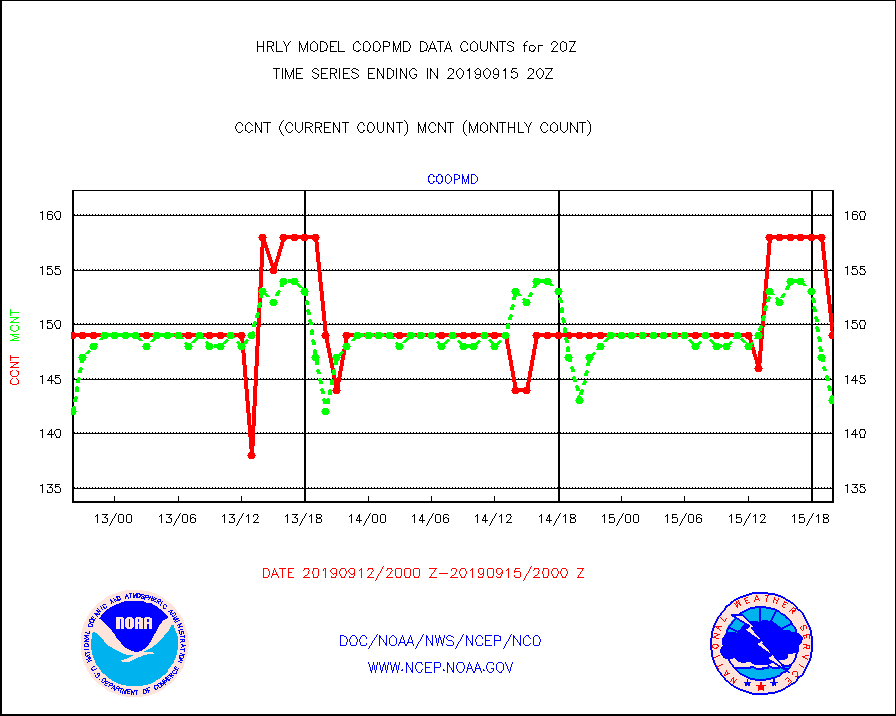
coopmd |
Coop/MADIS NEPP & HCN-Modernization NOAA COOP Obs |
149 |
143 |
104.2 % |
1519.50-1520.49 |
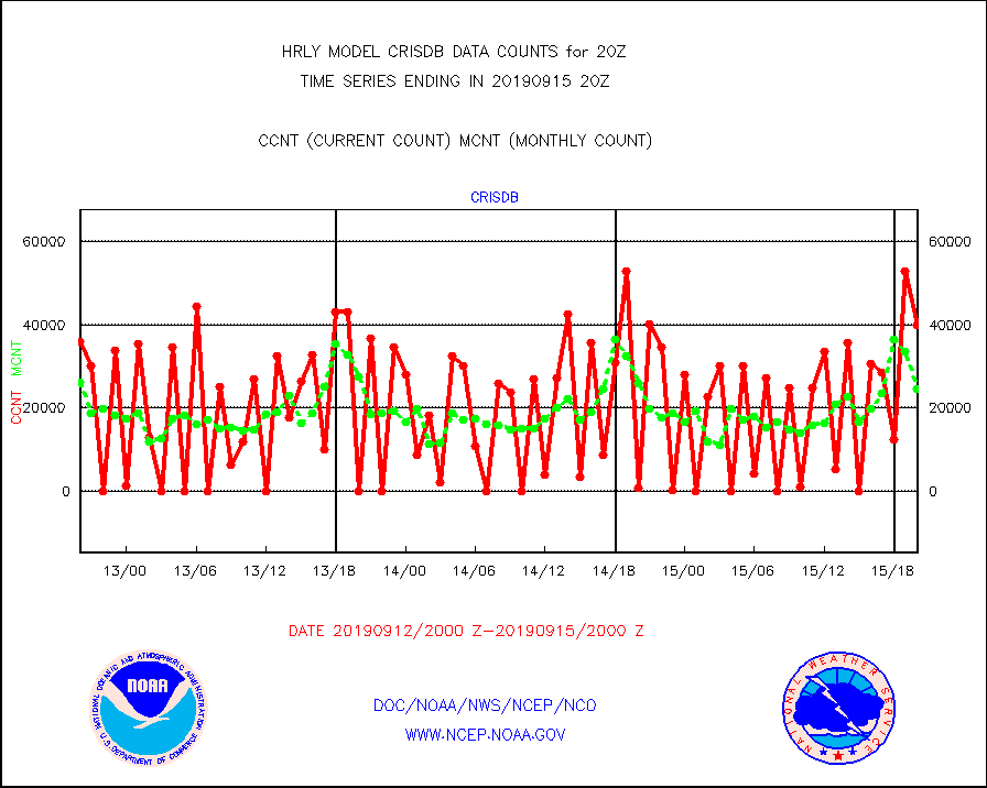
crisdb |
NPP Crss-trk IR Sndr(CrIS) radiance-dir bcst SSEC |
39879 |
24672 |
161.6 % |
1518.50-1519.49 |
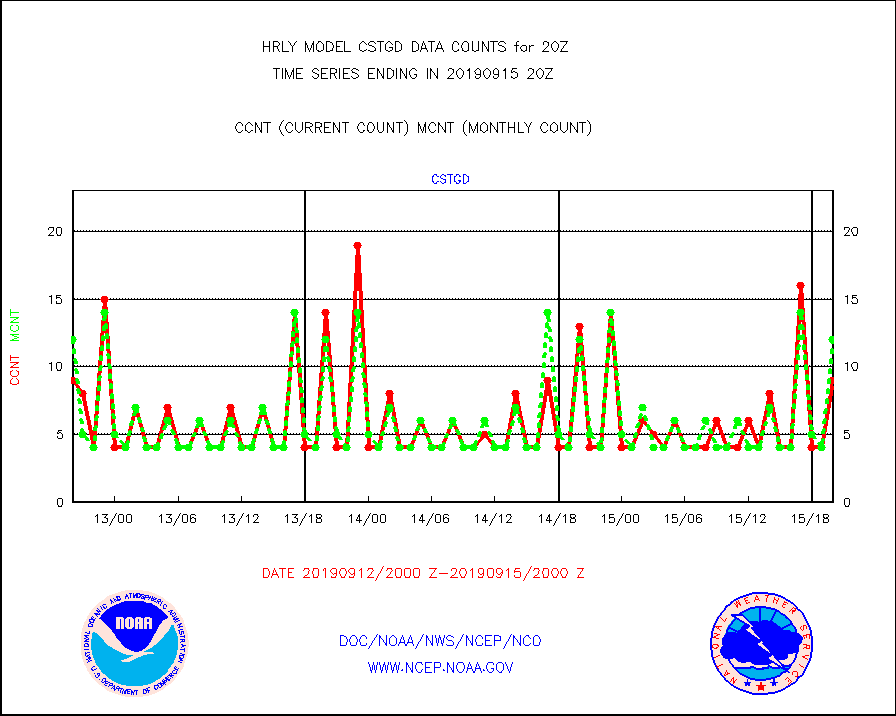
cstgd |
Coast Guard |
9 |
12 |
75.0 % |
1519.50-1520.50 |
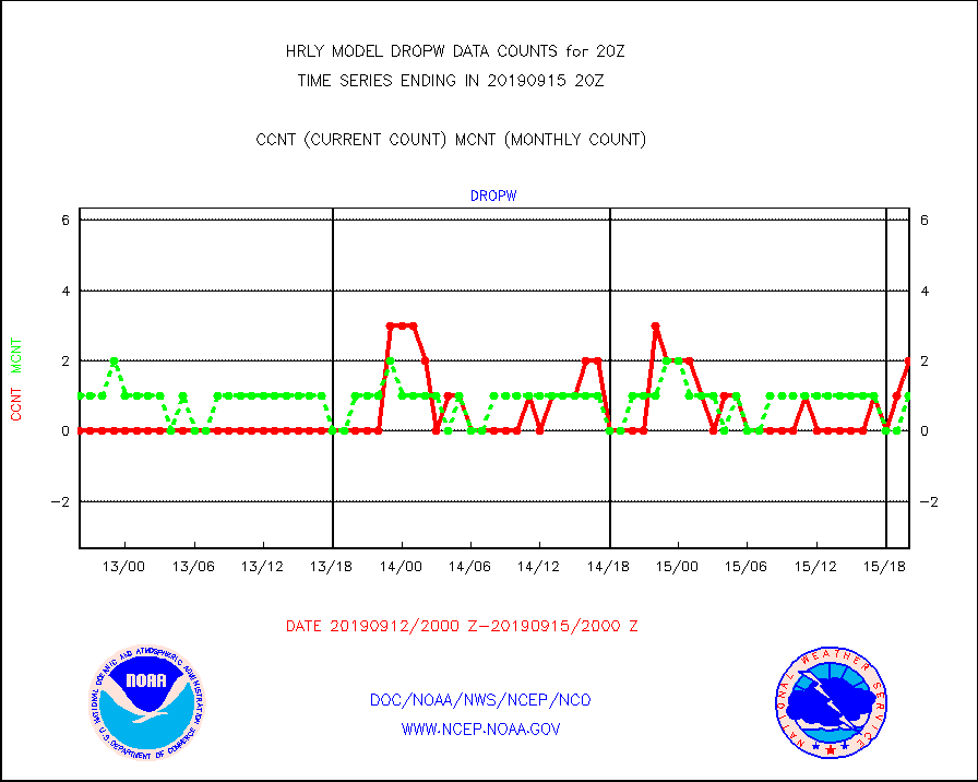
dropw |
Dropwinsonde (from TEMP DROP) |
2 |
1 |
200.0 % |
1519.50-1520.49 |
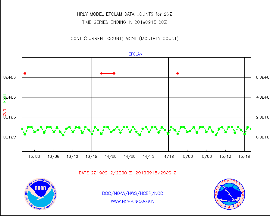
efclam |
GOES imager effective cloud amount data (U.Wisc.) |
9999999 |
9796492 |
102.1 % |
1519.50-1520.49 |
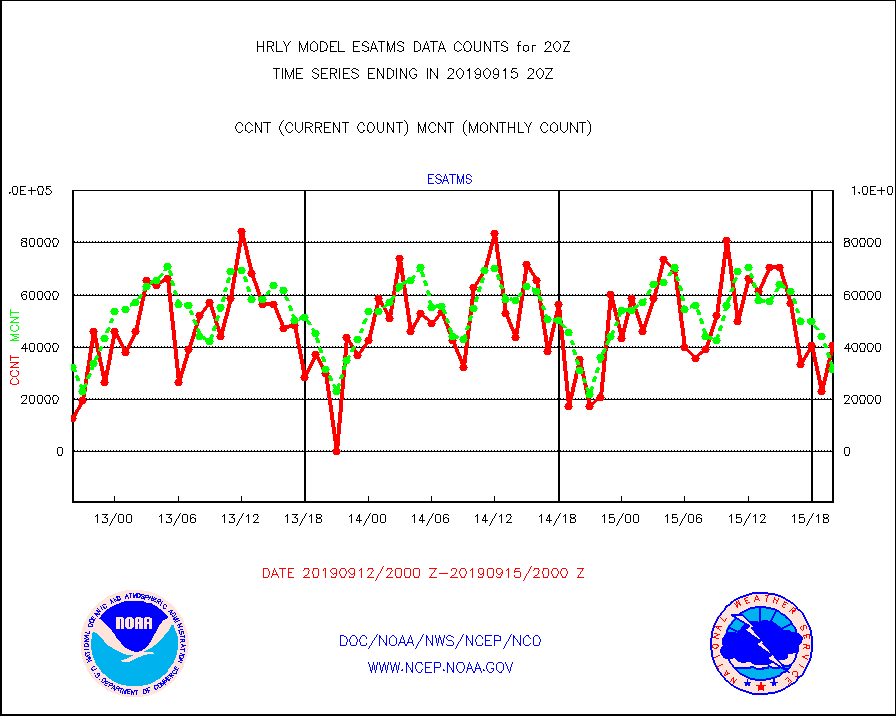
esatms |
NPP Adv. Tech. MW Sndr (ATMS) br. temps from RARS |
40800 |
31432 |
129.8 % |
1518.50-1519.49 |
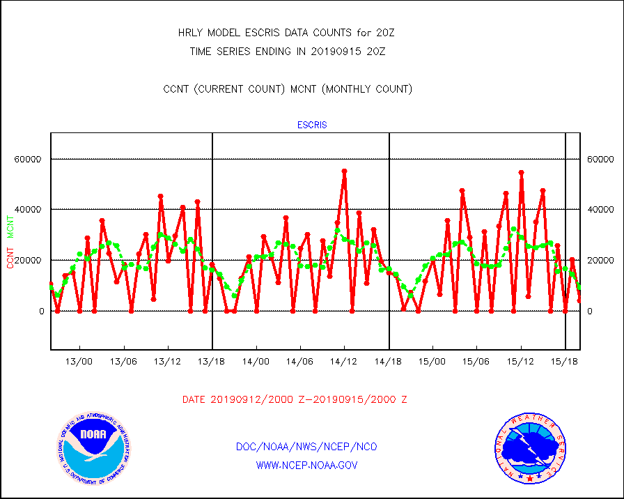
escris |
NPP Crss-track IR Sndr (CrIS) radiances from RARS |
4320 |
9500 |
45.5 % |
1518.50-1519.49 |
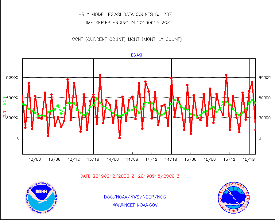
esiasi |
METOP 1-2 IASI 1C radiance data vbl chn from RARS |
12505 |
52504 |
23.8 % |
1519.00-1519.99 |
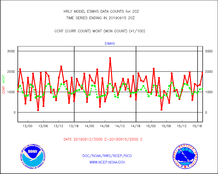
esmhs |
NOAA 18-19 & METOP 1-2 MHS proc. btemps from RARS |
195070 |
115403 |
169.0 % |
1519.50-1520.49 |
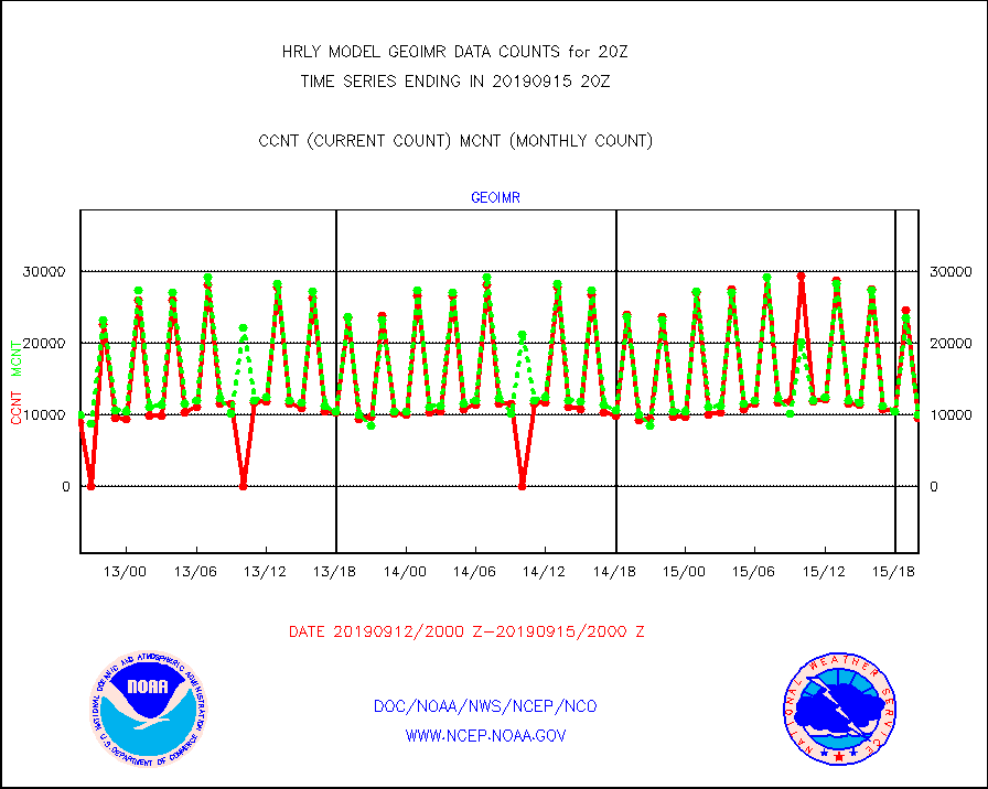
geoimr |
GOES/NESDIS (11x17 f-o-v) imager clear radiances |
9663 |
10011 |
96.5 % |
1519.00-1519.99 |
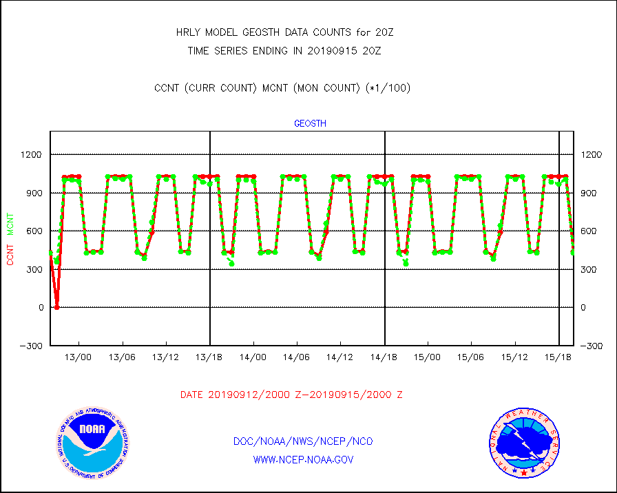
geosth |
GOES/NESDIS hi-resol. (1x1 f-o-v) cloud data |
43716 |
42975 |
101.7 % |
1519.00-1519.99 |
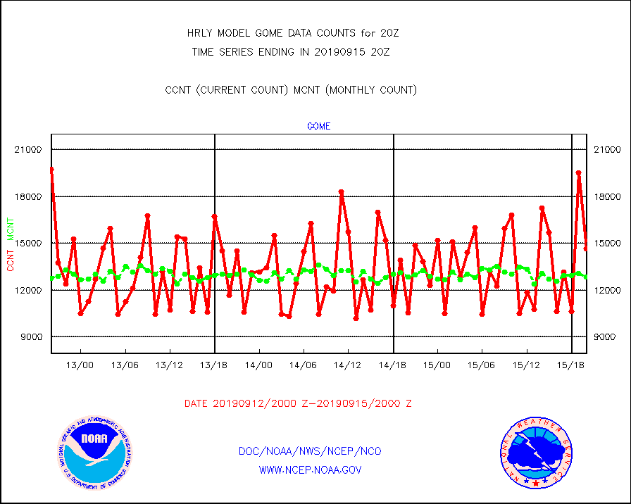
gome |
METOP 1-2 Global Ozone Monitoring Exp.-2 (GOME-2) |
14636 |
12847 |
113.9 % |
1518.50-1519.49 |
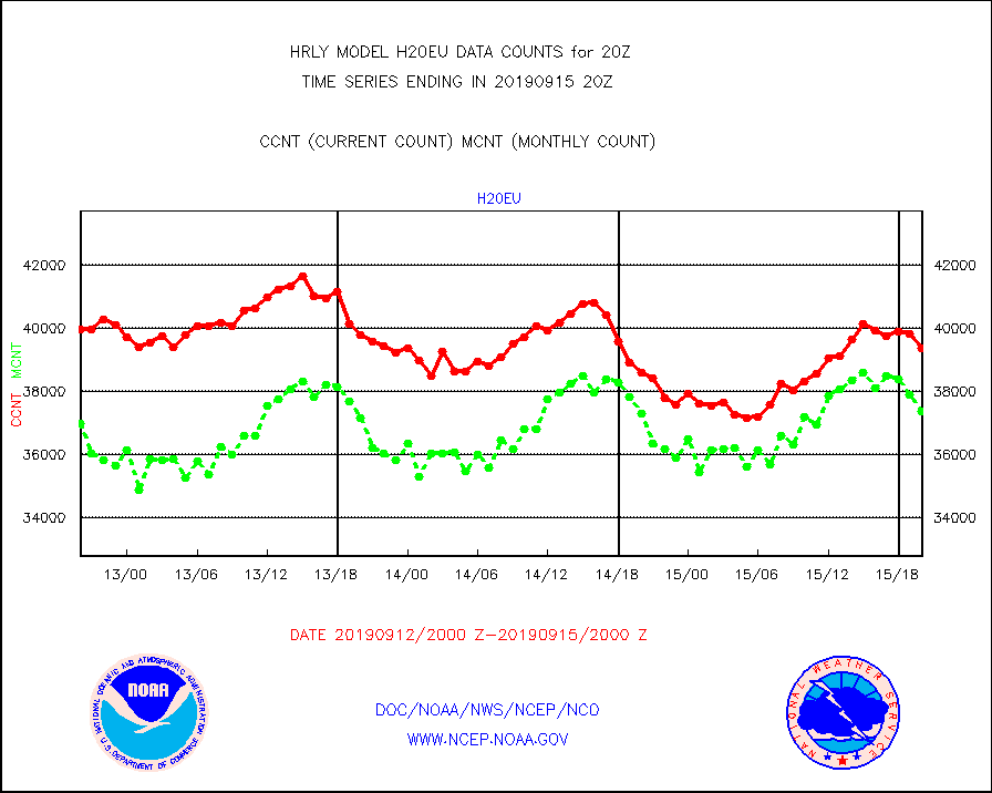
h20eu |
METEOSAT/EUMETSAT wvpr imager derived cld motion |
39368 |
37371 |
105.3 % |
1518.50-1519.49 |
iasidb |
METOP 1-2 IASI 1C radiances-direct broadcast SSEC |
29629 |
16403 |
180.6 % |
1518.50-1519.49 |
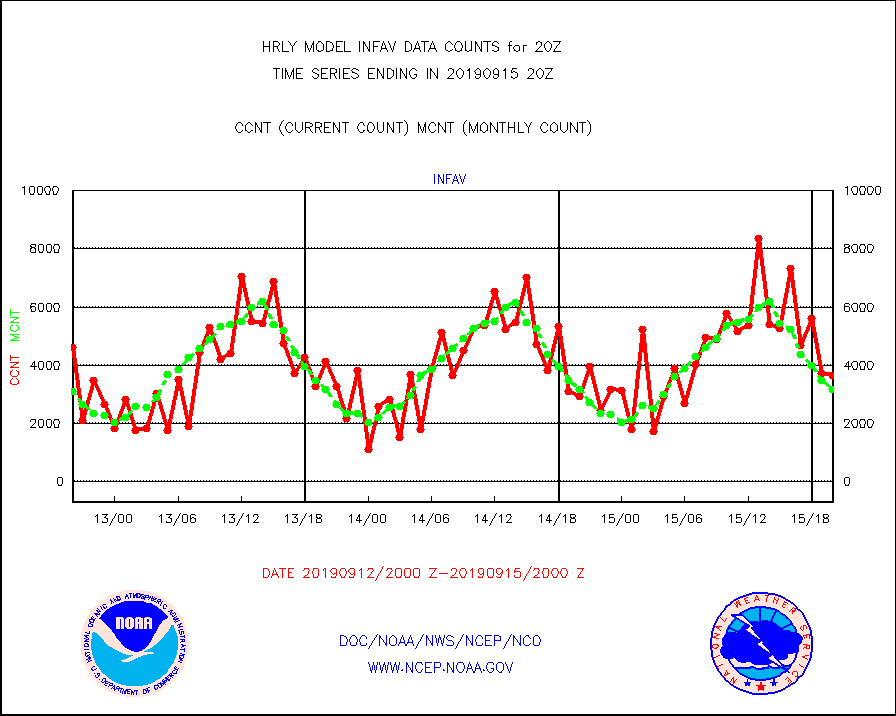
infav |
AVHRR (NOAA/METOP) ir lg-wave derived cld motion |
3636 |
3171 |
114.7 % |
1516.00-1516.99 |
infin |
INSAT/KALPANA India ir lg-wave derived cld motion |
0 |
0 |
n/a |
1517.50-1518.49 |
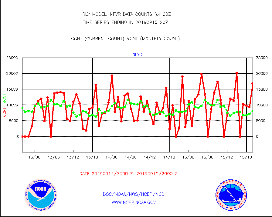
infvr |
VIIRS (NPP) infrared lg-wave derived cloud motion |
16850 |
8202 |
205.4 % |
1516.00-1516.99 |
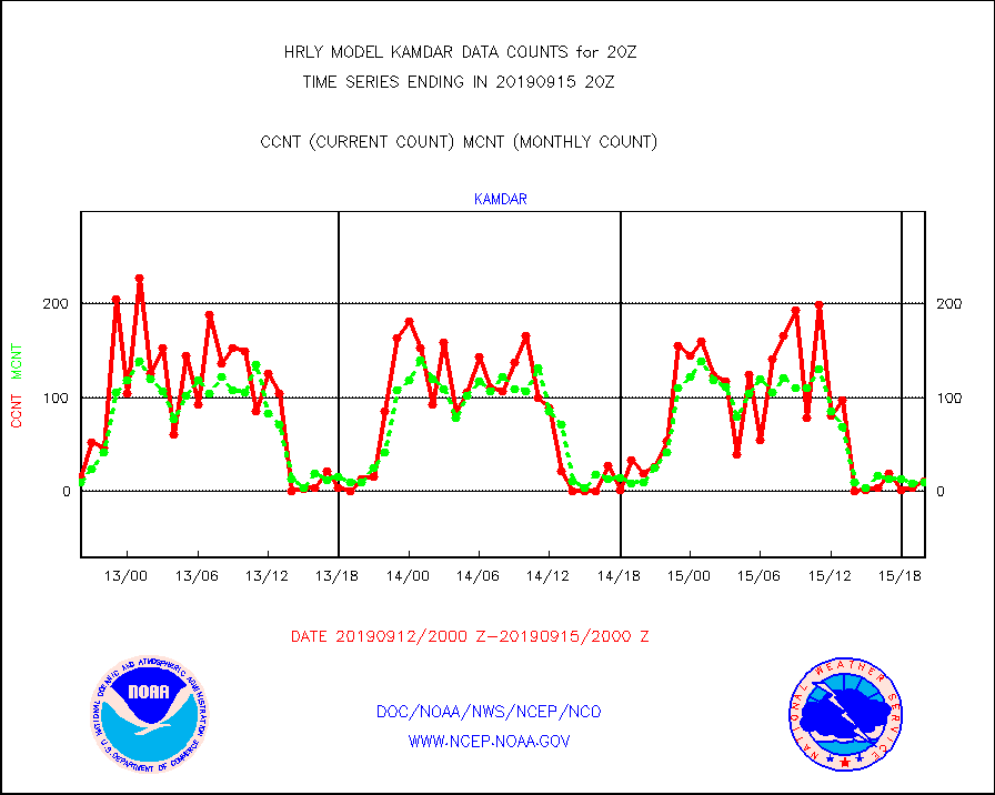
kamdar |
Korean AMDAR aircraft data (decoded from BUFR) |
11 |
10 |
110.0 % |
1519.50-1520.49 |
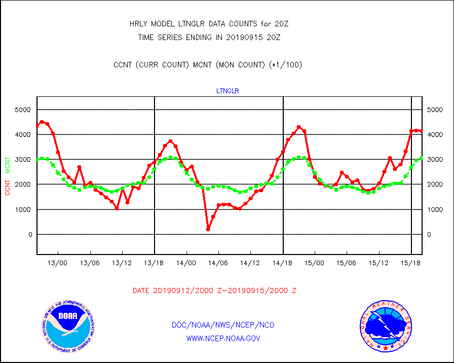
ltnglr |
LLDN Long-rng lightning from Vaisala via NOAAPORT |
414382 |
307169 |
134.9 % |
1519.50-1520.49 |
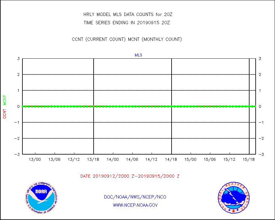
mls |
Aura Microwave Limb Sounder (MLS) ozone data |
0 |
0 |
n/a |
1518.00-1518.99 |
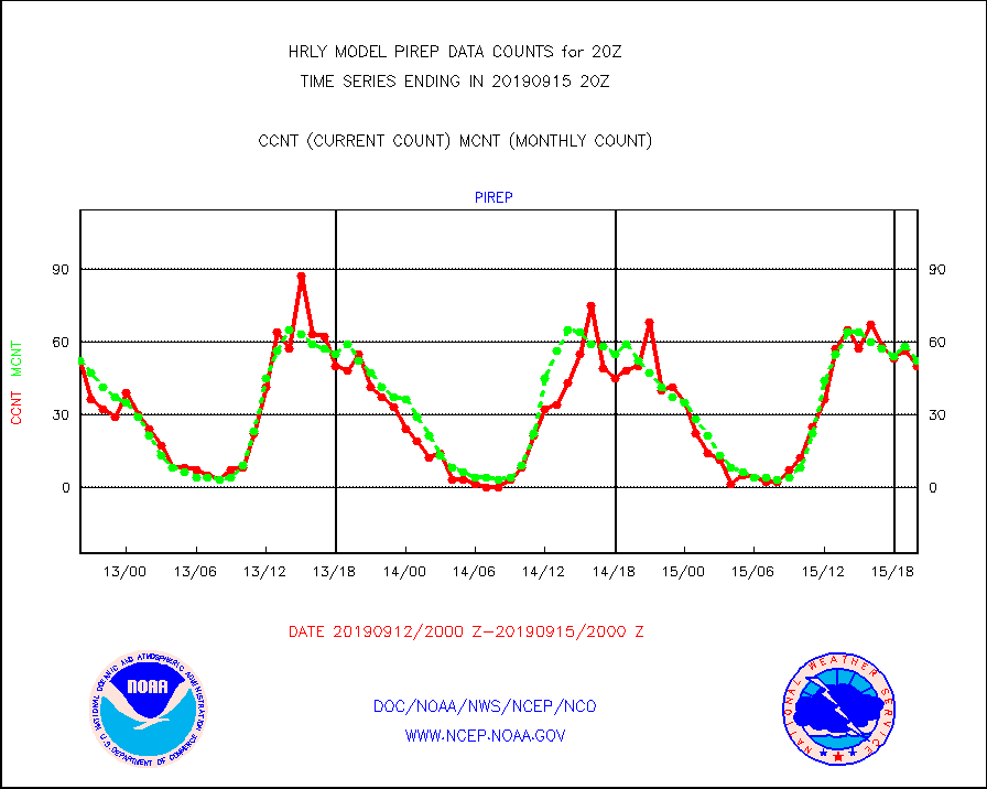
pirep |
Manual PIREP aircraft data (dcded from AIREP fmt) |
50 |
52 |
96.2 % |
1519.50-1520.49 |
prflrj |
Japanese Meteorological Agency profiler winds |
0 |
0 |
n/a |
1519.50-1520.49 |
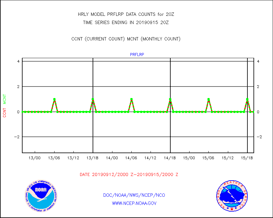
prflrp |
Profilr winds from PIBAL (PILOT,PILOT SHIP/MOBIL) |
0 |
0 |
n/a |
1519.50-1520.49 |
raobm |
Rawinsonde - mobile land (from TEMP/PILOT MOBIL) |
0 |
0 |
n/a |
1519.50-1520.49 |
raobs |
Rawinsonde - ship (from TEMP SHIP, PILOT SHIP) |
0 |
0 |
n/a |
1519.50-1520.49 |
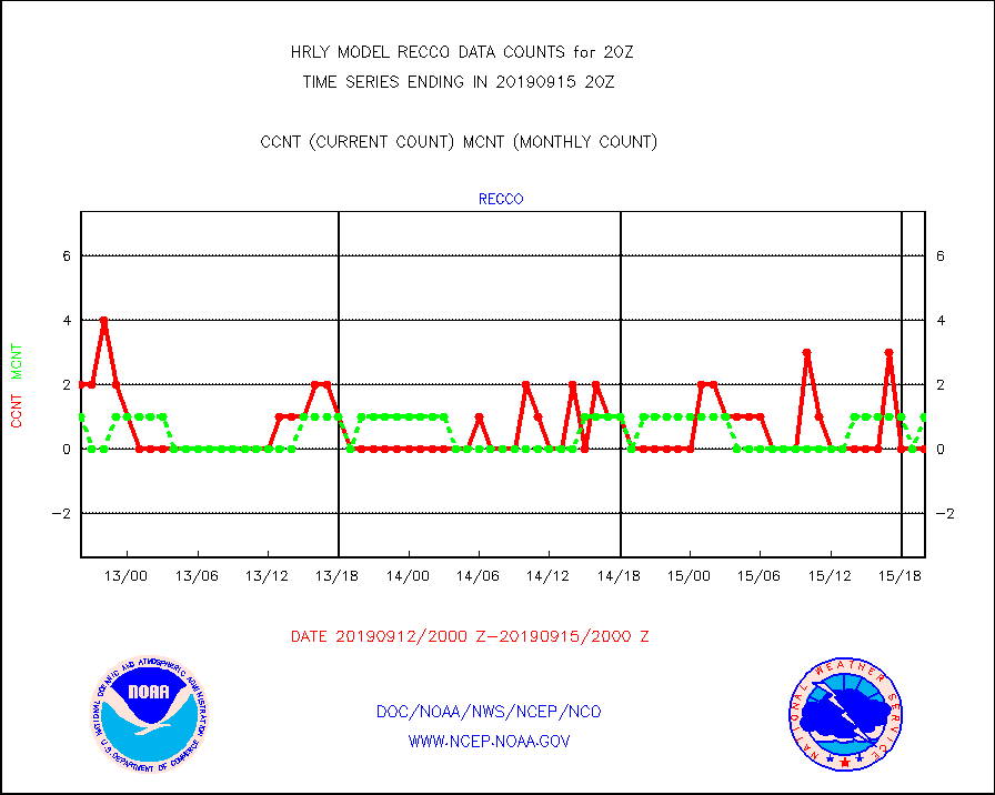
recco |
Flight level reconnaissance aircraft data |
0 |
1 |
0.0 % |
1519.50-1520.49 |
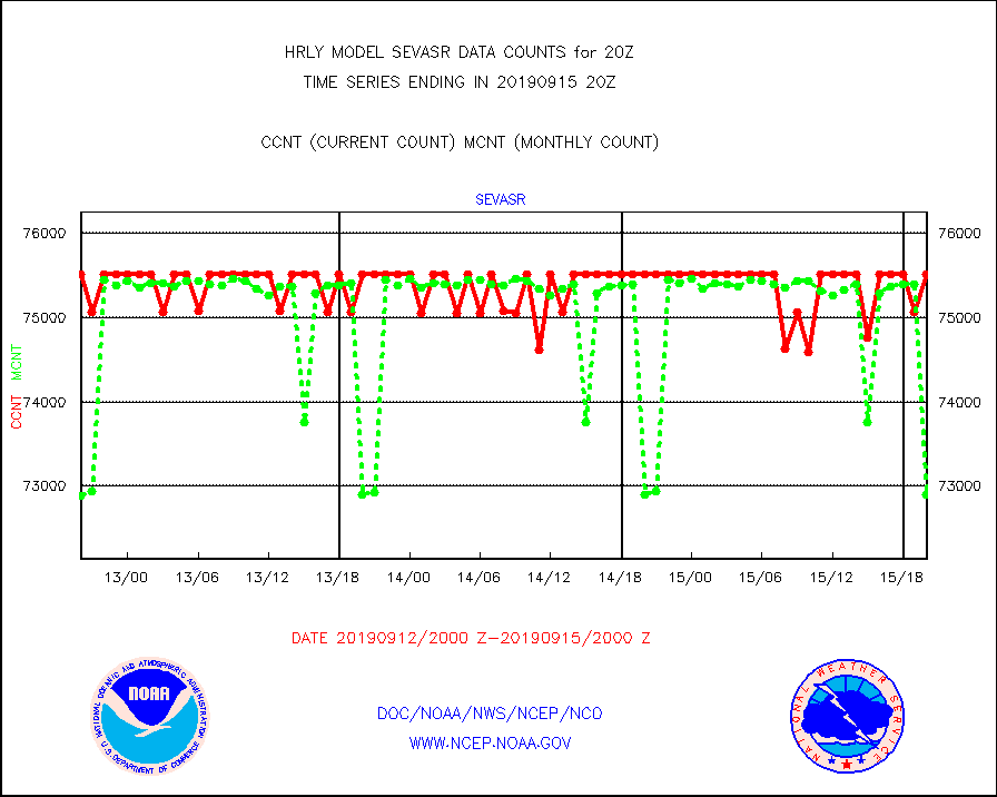
sevasr |
METEOSAT-10 2nd Gen SEVIRI All Sky Radiance(proc) |
75512 |
72895 |
103.6 % |
1519.50-1520.49 |
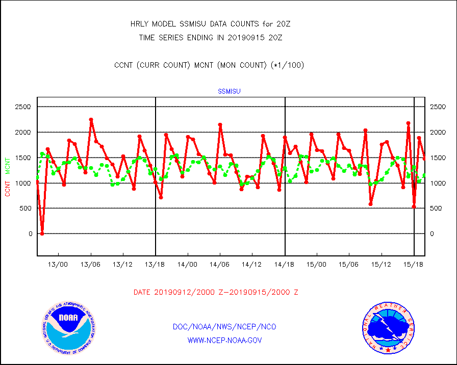
ssmisu |
DMSP SSM/IS 1C radiance data (Unified Pre-Proc.) |
148020 |
115690 |
127.9 % |
1518.50-1519.49 |
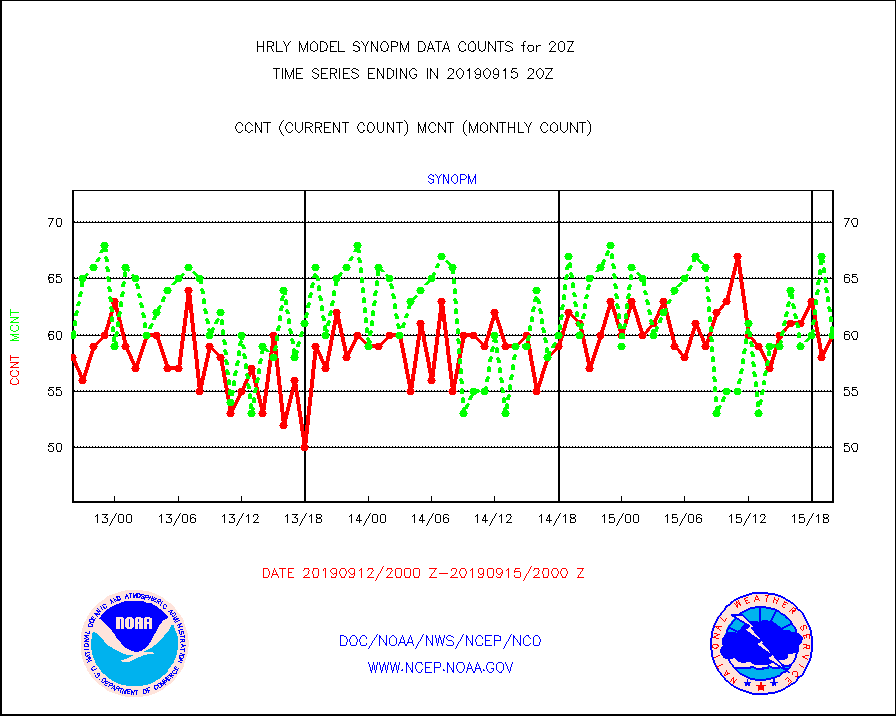
synopm |
Synoptic - mobile manual and automatic |
60 |
60 |
100.0 % |
1519.50-1520.49 |
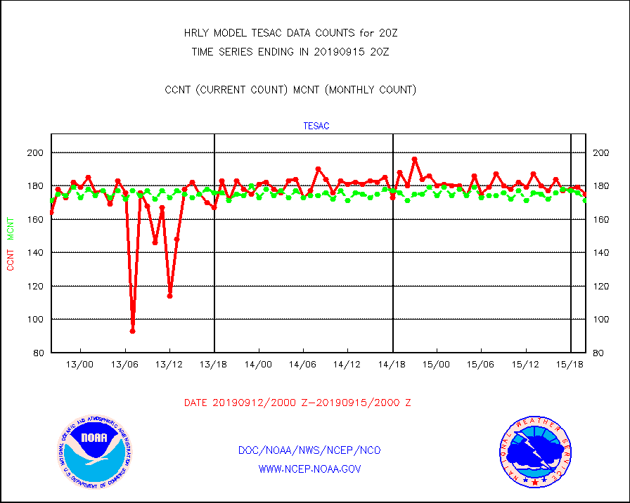
tesac |
TESAC |
175 |
171 |
102.3 % |
1519.50-1520.49 |
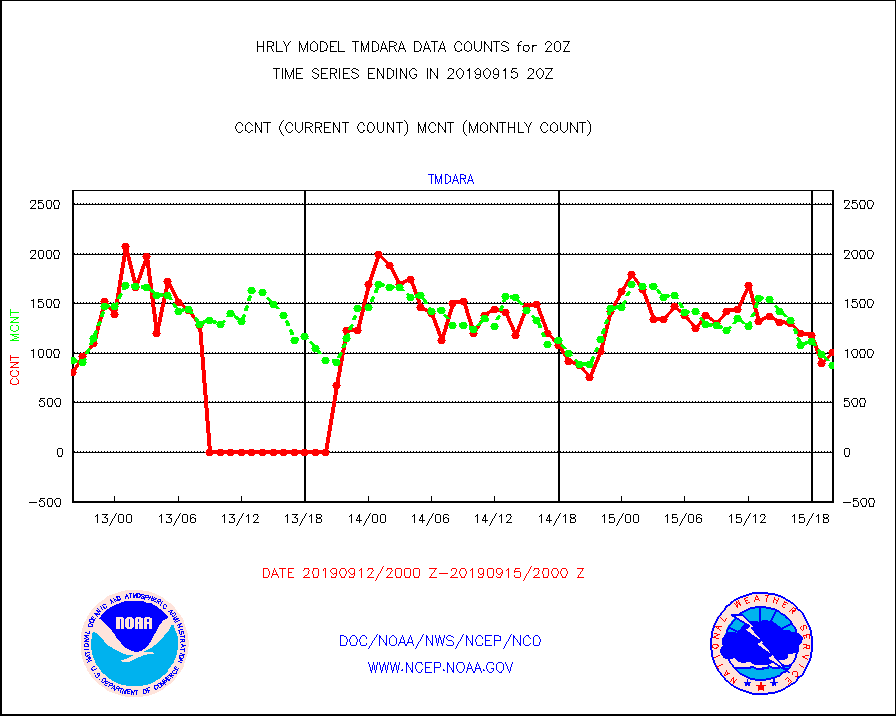
tmdara |
TAMDAR aircft data-all types(from Panasonic,BUFR) |
1004 |
874 |
114.9 % |
1519.50-1520.49 |
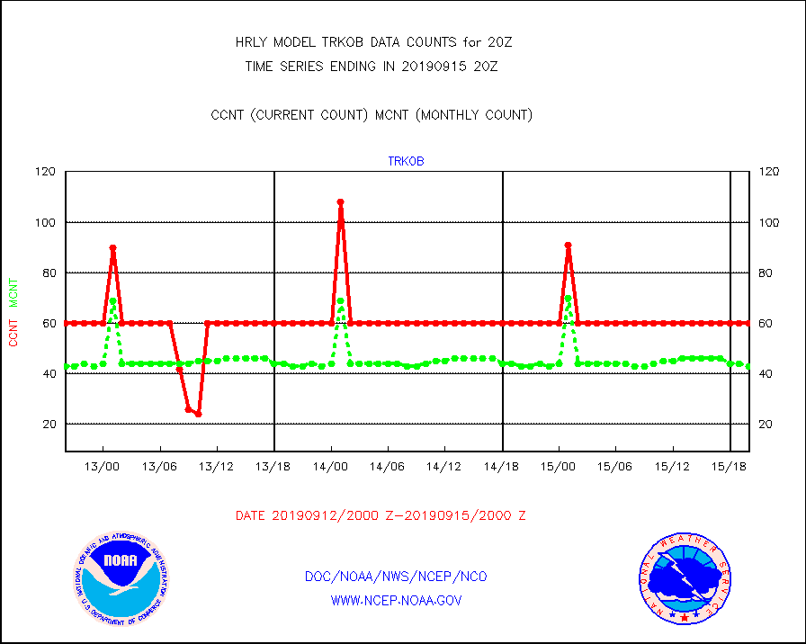
trkob |
TRACKOB |
60 |
43 |
139.5 % |
1518.50-1519.49 |
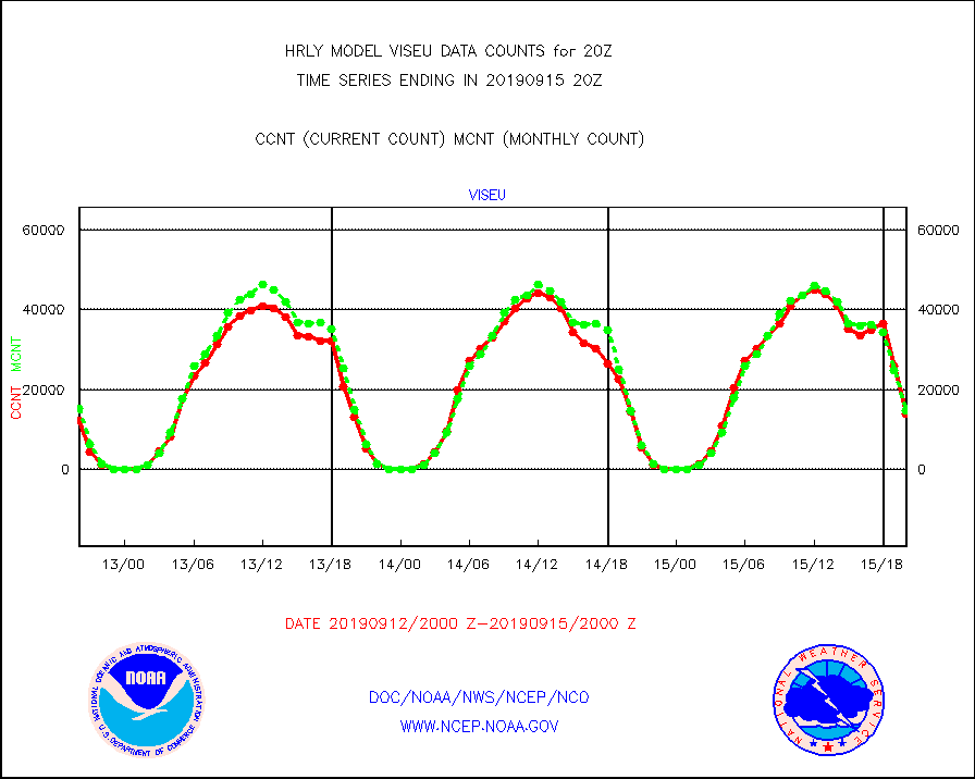
viseu |
METEOSAT/EUMETSAT visible derived cloud motion |
13921 |
14674 |
94.9 % |
1518.50-1519.49 |
visin |
INSAT/KALPANA India visible derived cloud motion |
0 |
0 |
n/a |
1517.50-1518.49 |
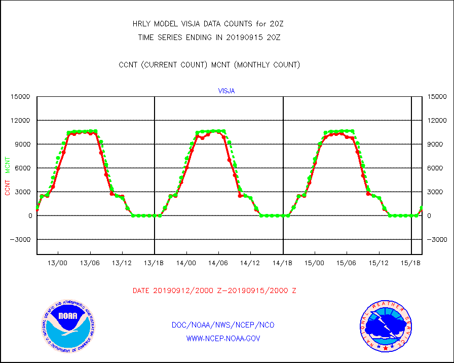
visja |
MTSAT/JMA visible derived cloud motion |
806 |
1012 |
79.6 % |
1517.50-1518.49 |
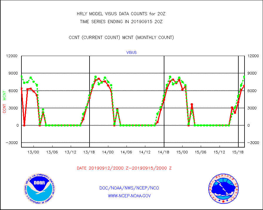
visus |
GOES/NESDIS visible derived cloud motion |
6863 |
8414 |
81.6 % |
1519.00-1519.99 |


