| Critical Data with Normal Counts |
|---|
| Type | Description | Hourly Count | Monthly Average | Percent (%) of Monthly Mean | UTC Time Window |
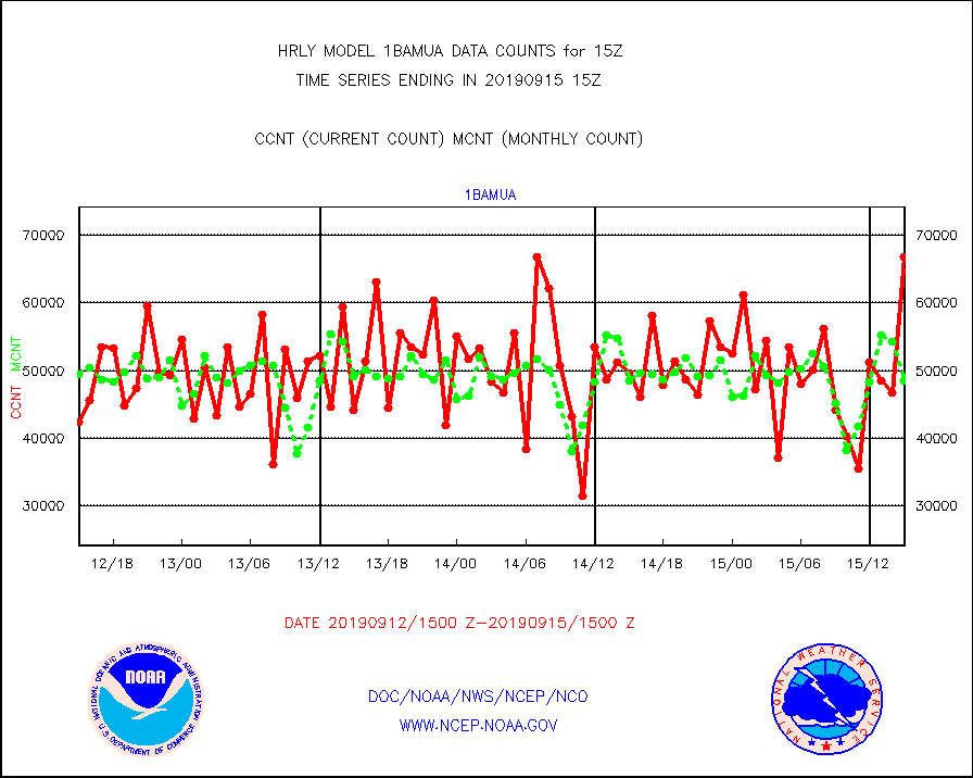
1bamua |
NOAA 15-19 & METOP 1-2 AMSU-A NCEP-proc. br.temps |
66832 |
48433 |
138.0 % |
1513.00-1513.99 |
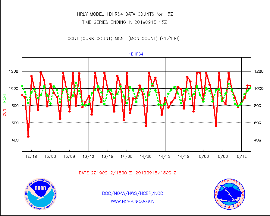
1bhrs4 |
NOAA 18-19 & METOP 1-2 HIRS-4 NCEP-proc. br.temps |
103080 |
101378 |
101.7 % |
1513.00-1513.99 |
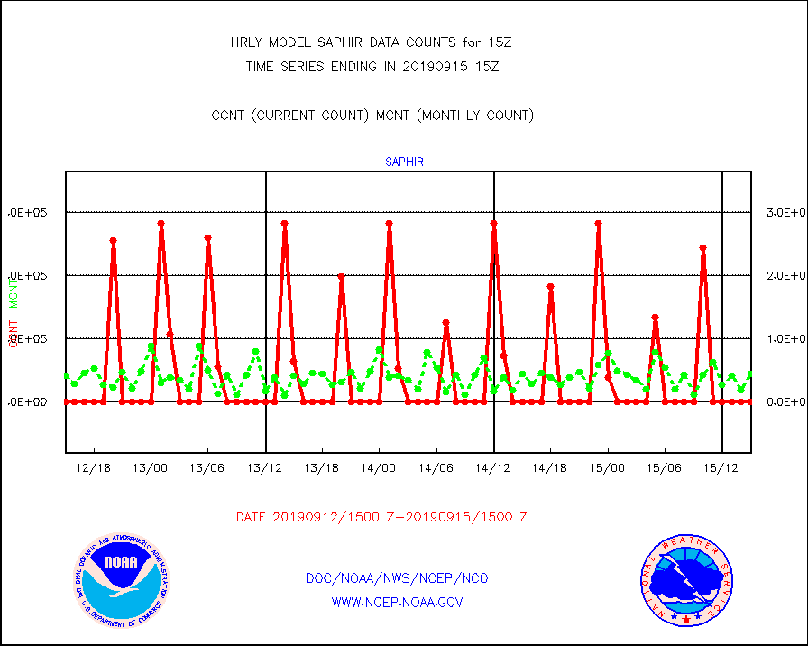
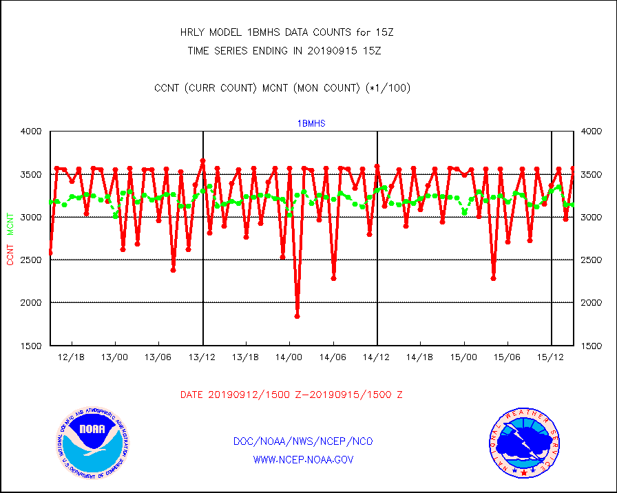
1bmhs |
NOAA 18-19 & METOP 1-2 MHS NCEP-proces. br. temps |
356659 |
314684 |
113.3 % |
1513.00-1513.99 |
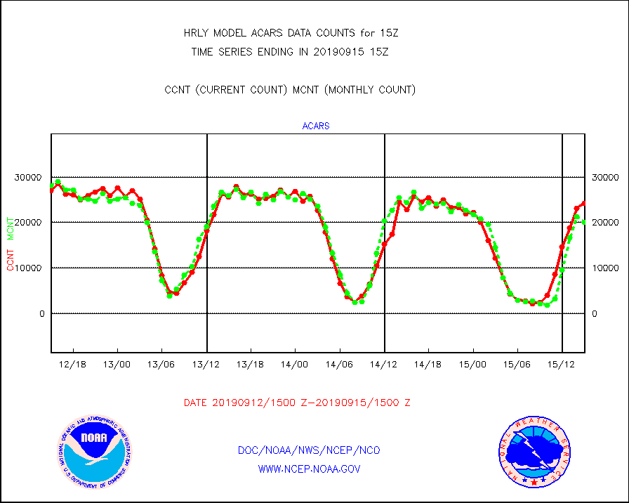
acars |
MDCRS ACARS acft data from ARINC(dcded from BUFR) |
24189 |
20048 |
120.7 % |
1514.50-1515.49 |
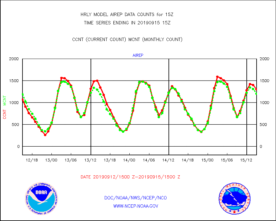
airep |
Manual AIREP aircraft data (dcded from AIREP fmt) |
1307 |
1203 |
108.6 % |
1514.50-1515.49 |
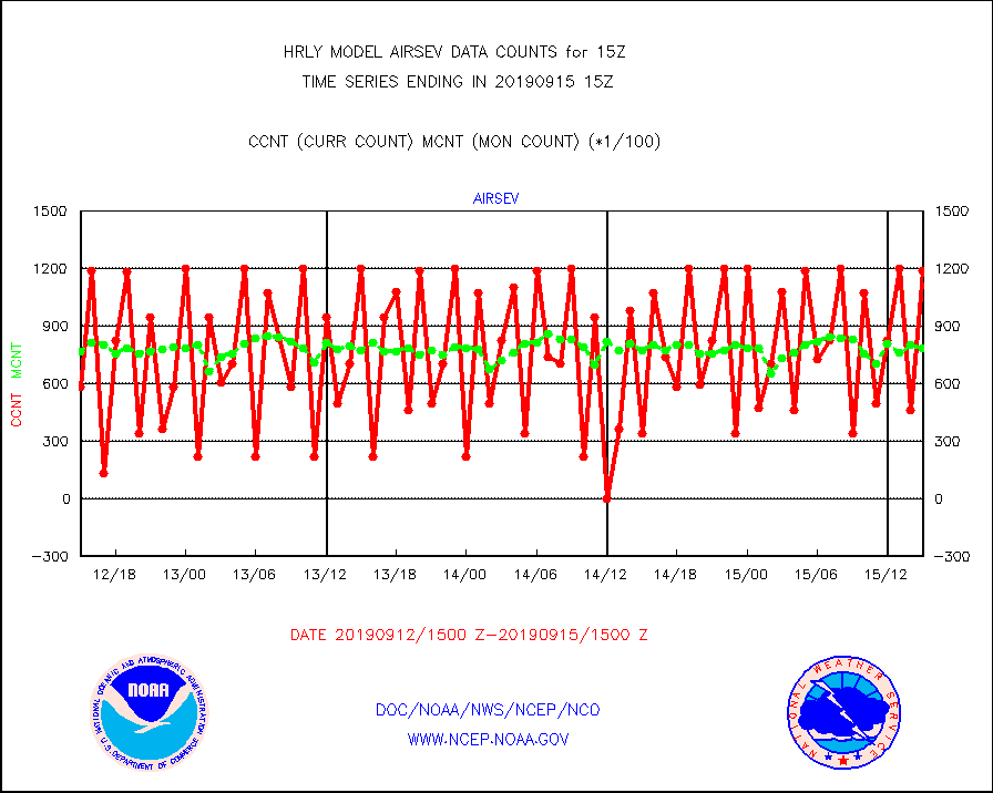
airsev |
AQUA AIRS/AMSU-A/HSB brightness temps- every FOV |
119289 |
78571 |
151.8 % |
1512.50-1513.49 |
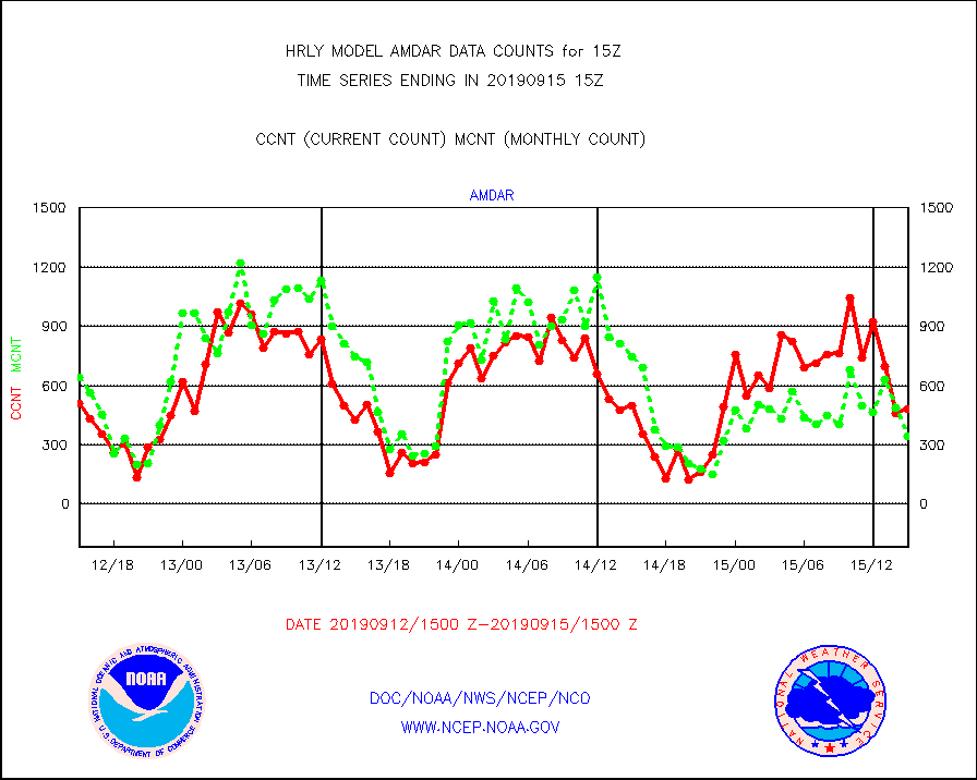
amdar |
AMDAR aircraft data (decoded from AMDAR format) |
481 |
342 |
140.6 % |
1514.50-1515.49 |
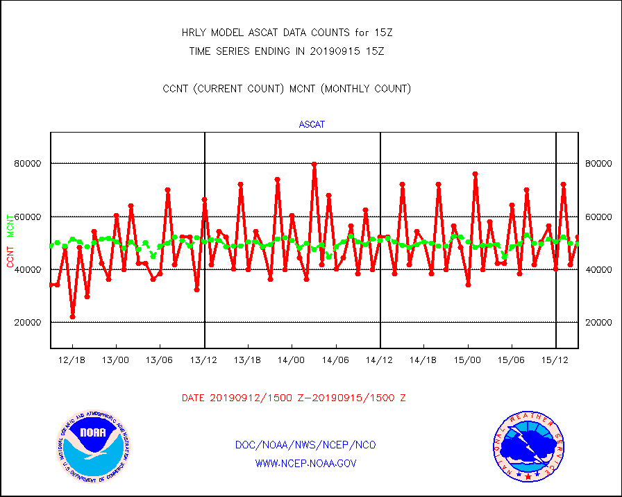
ascat |
METOP 1-2 ASCAT products |
52416 |
49778 |
105.3 % |
1513.50-1514.49 |
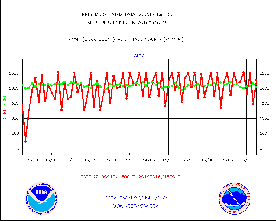
atms |
NPP Adv. Tech. Microwave Sounder (ATMS) br. temps |
228576 |
204301 |
111.9 % |
1513.50-1514.49 |
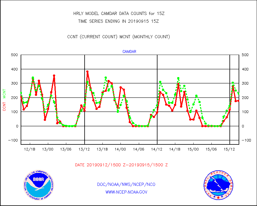
camdar |
Canadian AMDAR aircraft data (decoded from BUFR) |
177 |
227 |
78.0 % |
1514.50-1515.49 |
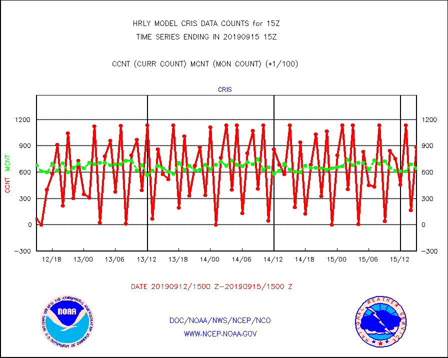
cris |
NPP Cross-track Infrared Sounder (CrIS) radiances |
88560 |
64845 |
136.6 % |
1513.50-1514.49 |
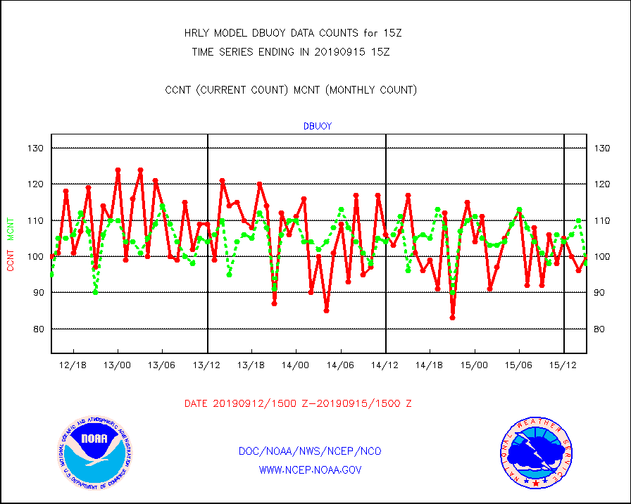
dbuoy |
Buoys decoded from FM-18 fmt (moored or drifting) |
100 |
98 |
102.0 % |
1514.50-1515.49 |
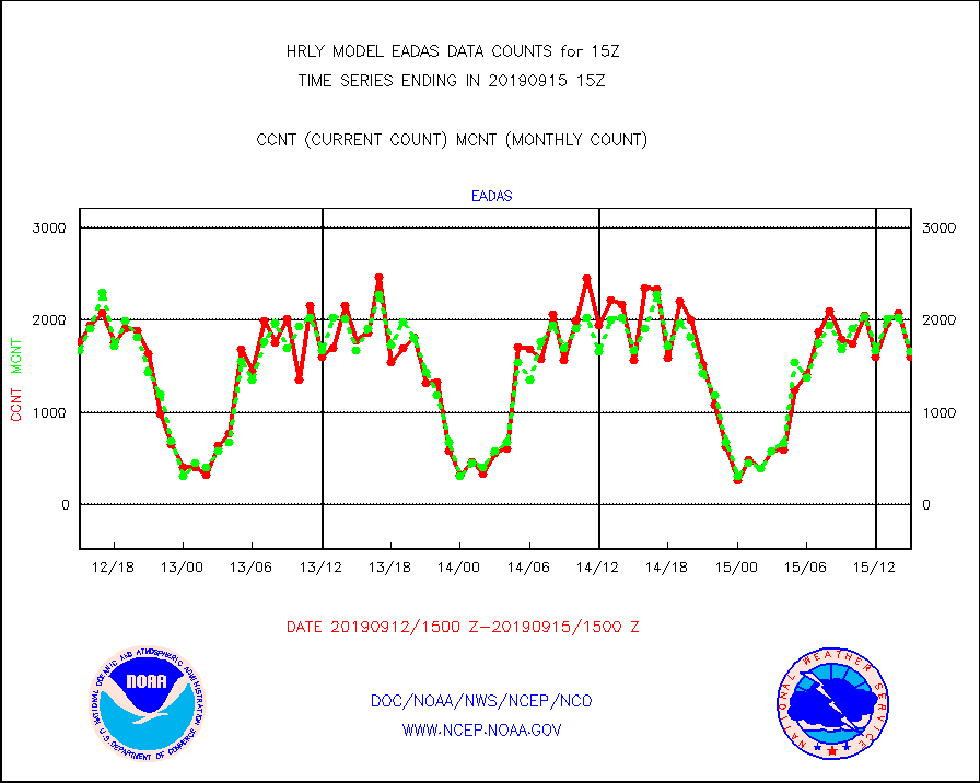
eadas |
E-AMDAR (European AMDAR acft decoded from BUFR) |
1606 |
1661 |
96.7 % |
1514.50-1515.49 |
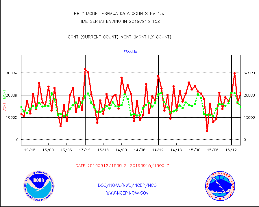
esamua |
NOAA 15-19 & METOP 1-2 AMSU-A proc btmps frm RARS |
21157 |
14849 |
142.5 % |
1514.50-1515.49 |
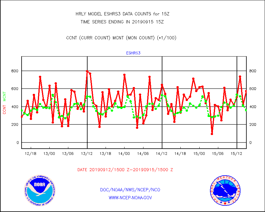
eshrs3 |
NOAA 15-19 & METOP 1-2 HIRS-3/4 pr btmps frm RARS |
57414 |
35899 |
159.9 % |
1514.50-1515.49 |
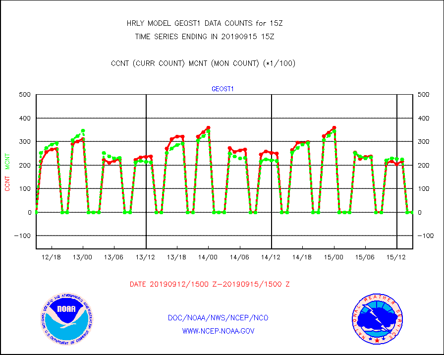
geost1 |
GOES/NESDIS hi-resol. (1x1 f-o-v) sndgs/radiances |
0 |
0 |
n/a |
1514.50-1515.49 |
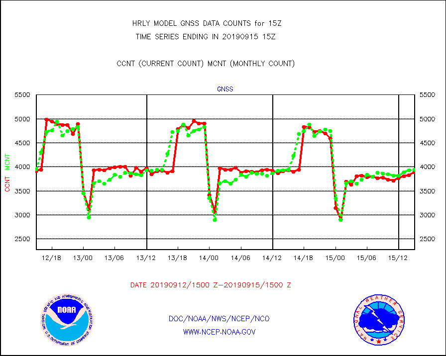
gnss |
Grnd-based Gbl Navigation Sat System (GNSS) data |
3887 |
3936 |
98.8 % |
1514.00-1514.99 |
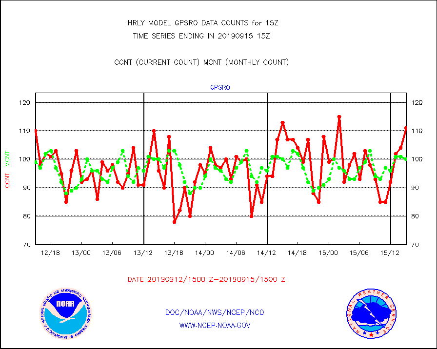
gpsro |
GPS radio occultation data |
111 |
100 |
111.0 % |
1512.50-1513.49 |
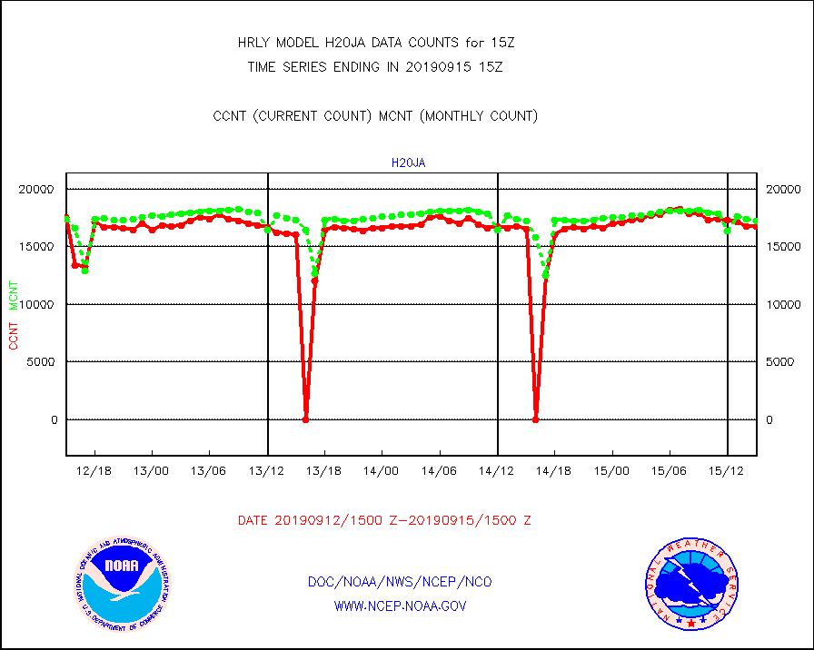
h20ja |
MTSAT/JMA water vapor imager derived cloud motion |
16776 |
17234 |
97.3 % |
1512.50-1513.49 |
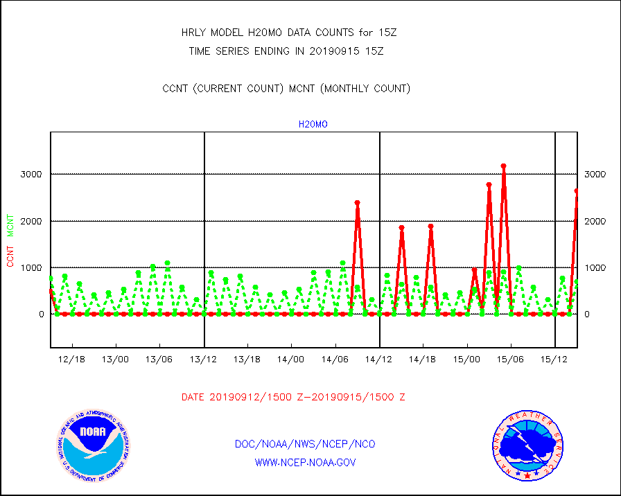
h20mo |
MODIS (AQUA/TERRA) wvpr imager derived cld motion |
2654 |
700 |
379.1 % |
1511.00-1511.99 |
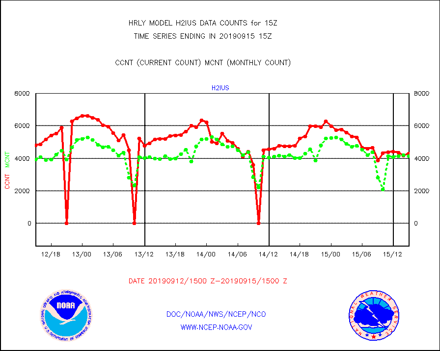
h2ius |
GOES/NESDIS water vapor imager derived cld motion |
4282 |
4152 |
103.1 % |
1514.00-1514.99 |
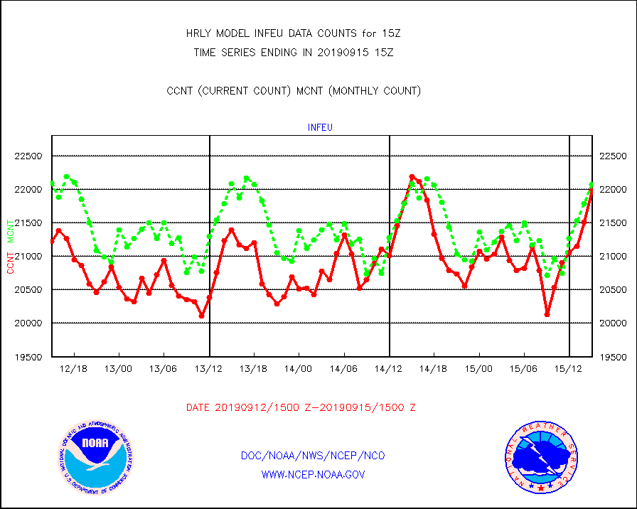
infeu |
METEOSAT/EUMETSAT ir lg-wave derived cloud motion |
21982 |
22075 |
99.6 % |
1513.50-1514.49 |
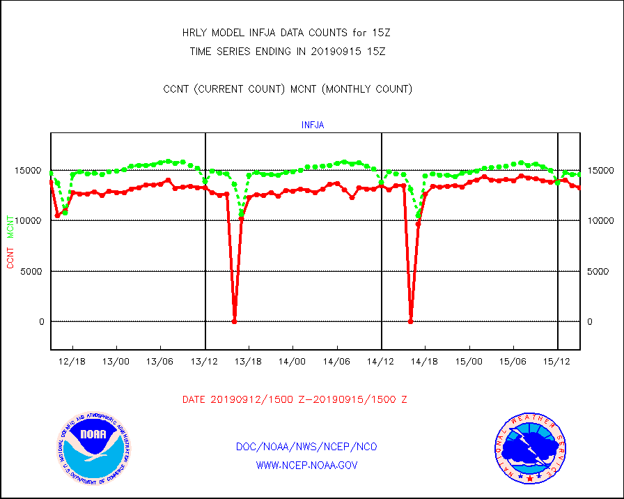
infja |
MTSAT/JMA infrared long-wave derived cloud motion |
13238 |
14529 |
91.1 % |
1512.50-1513.49 |
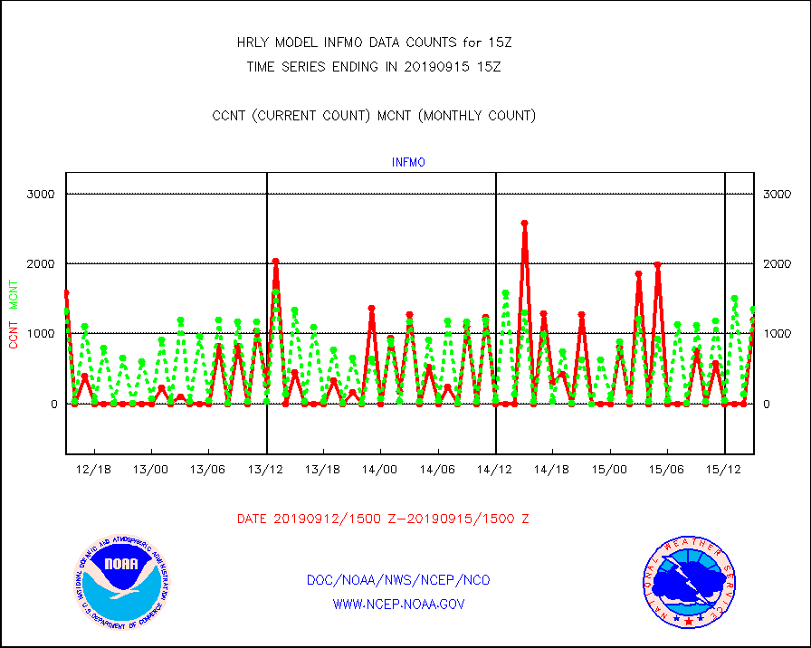
infmo |
MODIS (AQUA/TERRA) ir l-wave derived cloud motion |
1199 |
1350 |
88.8 % |
1511.00-1511.99 |
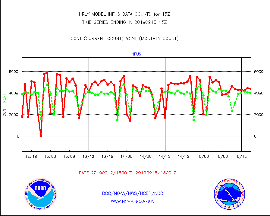
infus |
GOES/NESDIS infrared lg-wave derived cloud motion |
4372 |
3976 |
110.0 % |
1514.00-1514.99 |
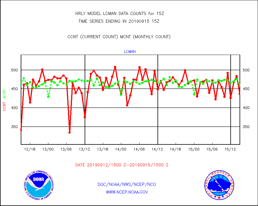
lcman |
Land-based CMAN stations decoded from CMAN format |
437 |
460 |
95.0 % |
1514.50-1515.49 |
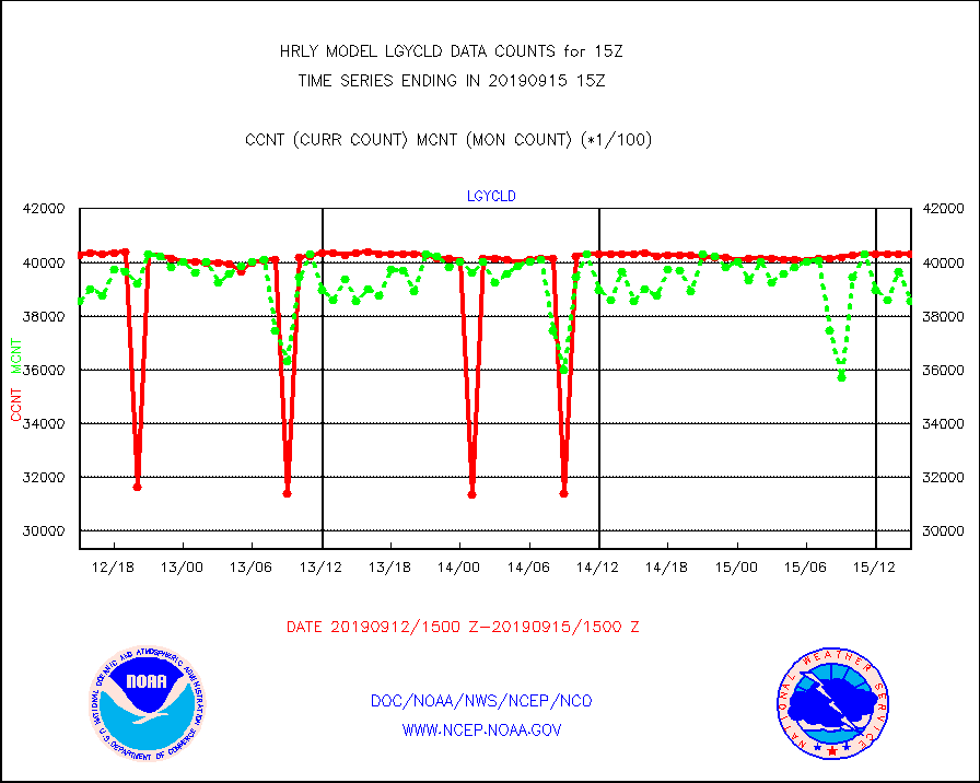
lgycld |
GOES/NASA(Langley) hi-res. (1x1 f-o-v) cloud data |
4029454 |
3855358 |
104.5 % |
1514.50-1515.49 |
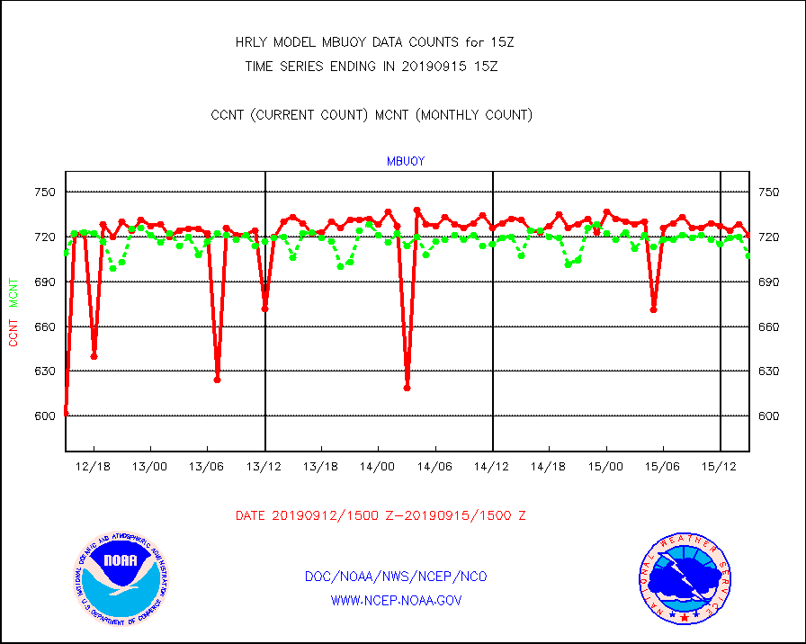
mbuoy |
Buoys decoded from FM-13 format (moored) |
721 |
707 |
102.0 % |
1514.50-1515.49 |
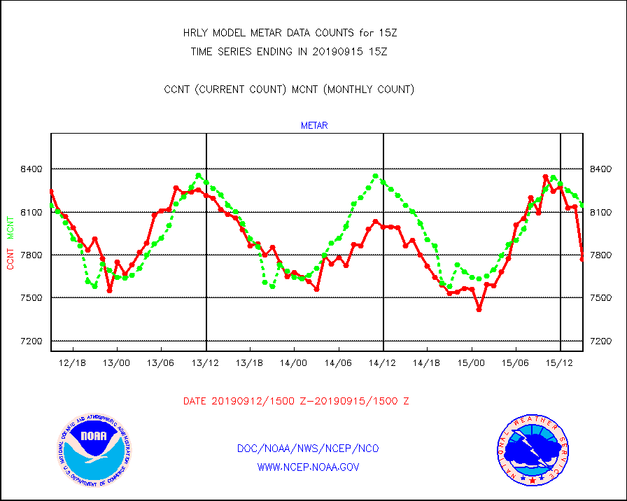
metar |
Aviation - METAR |
7773 |
8148 |
95.4 % |
1514.50-1515.49 |
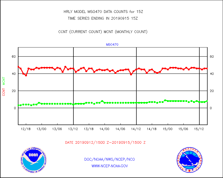
mso470 |
Mesonet/MADIS Colorado E-470 (Interstate 470) |
46 |
8 |
575.0 % |
1514.50-1515.49 |
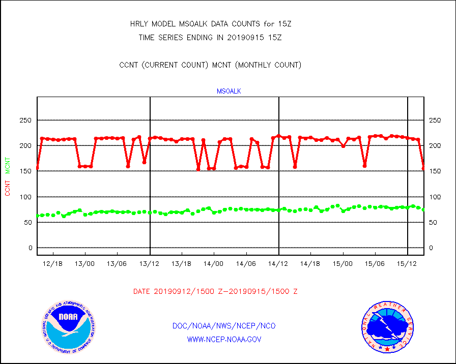
msoalk |
Mesonet/MADIS Alaska Department of Transportation |
155 |
75 |
206.7 % |
1514.50-1515.49 |
msoapg |
Mesonet/MADIS U.S. Army Aberdeen Proving Grounds |
0 |
0 |
n/a |
1514.50-1515.49 |
msoapr |
Mesonet/MADIS Citizen Weather Observers Program |
50930 |
52533 |
96.9 % |
1514.50-1515.49 |
msoaws |
Mesonet/MADIS AWS Convergence Technologies, Inc. |
16076 |
16196 |
99.3 % |
1514.50-1515.49 |
msoawx |
Mesonet/MADIS "Anything Weather" |
0 |
0 |
n/a |
1514.50-1515.49 |
msocol |
Mesonet/MADIS Colorado Dept. of Transportation |
592 |
523 |
113.2 % |
1514.50-1515.49 |
msodcn |
Mesonet/MADIS DC Net |
0 |
0 |
n/a |
1514.50-1515.49 |
msoden |
Mesonet/MADIS Denver Urban Drainage & Flood Cntrl |
0 |
0 |
n/a |
1514.50-1515.49 |
msofla |
Mesonet/MADIS Florida (FAWN & USF) |
144 |
137 |
105.1 % |
1514.50-1515.49 |
msoflt |
Mesonet/MADIS Florida Dept. of Transportation |
0 |
0 |
n/a |
1514.50-1515.49 |
msogeo |
Mesonet/MADIS Georgia Dept. of Transportation |
252 |
42 |
600.0 % |
1514.50-1515.49 |
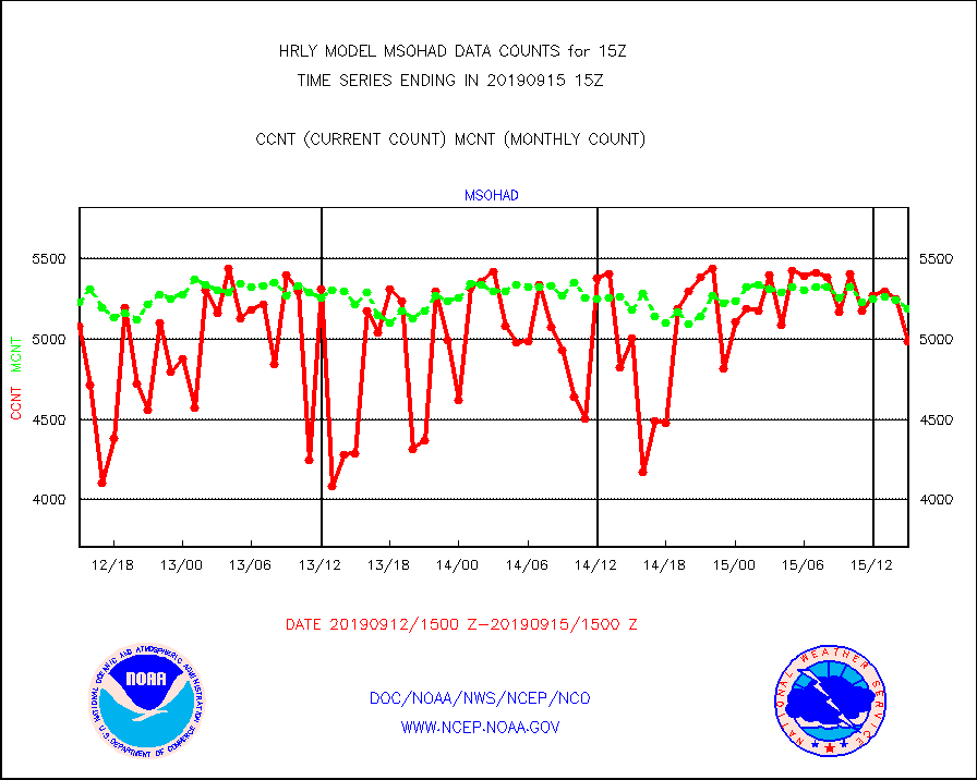
msohad |
Mesonet/MADIS NWS Hydromet Auto Data System(HADS) |
4988 |
5193 |
96.1 % |
1514.50-1515.49 |
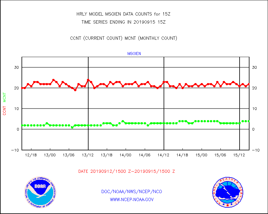
msoien |
Mesonet/MADIS Iowa Environmental |
22 |
4 |
550.0 % |
1514.50-1515.49 |
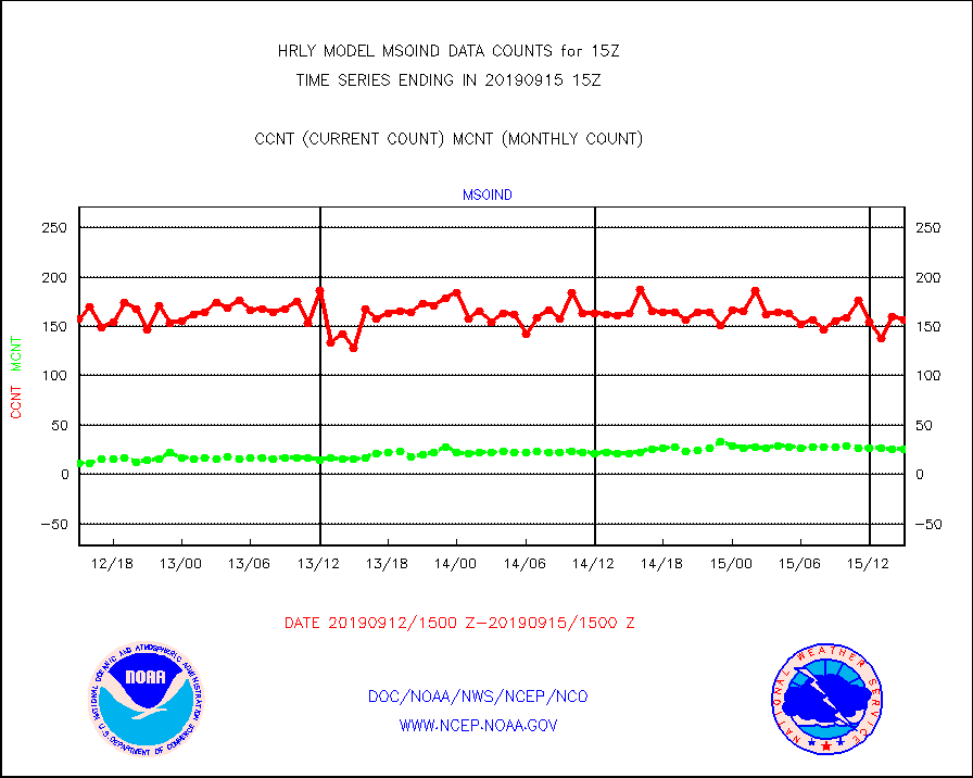
msoind |
Mesonet/MADIS Indiana Dept. of Transportation |
157 |
26 |
603.8 % |
1514.50-1515.49 |
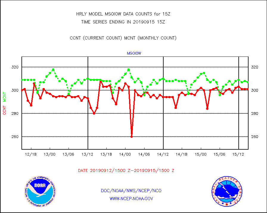
msoiow |
Mesonet/MADIS Iowa Department of Transportation |
301 |
307 |
98.0 % |
1514.50-1515.49 |
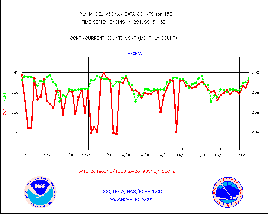
msokan |
Mesonet/MADIS Kansas Department of Transportation |
380 |
381 |
99.7 % |
1514.50-1515.49 |
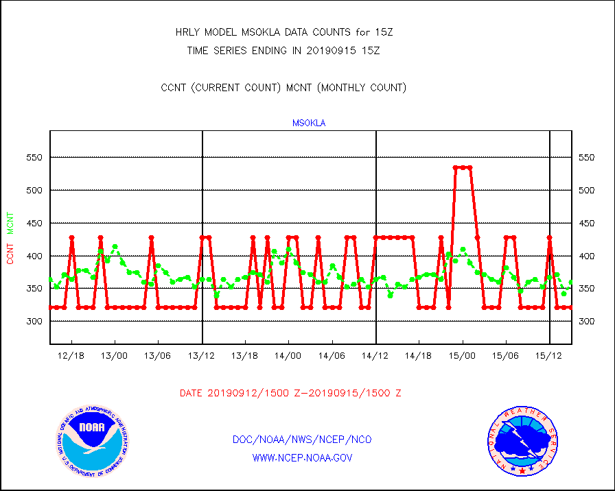
msokla |
Mesonet/MADIS Oklahoma Mesonet |
321 |
360 |
89.2 % |
1514.50-1515.49 |
msolju |
Mesonet/MADIS Louisiana State/Jackson State Univ. |
0 |
0 |
n/a |
1514.50-1515.49 |
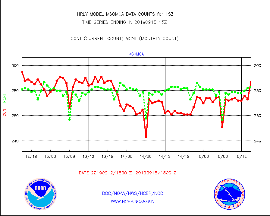
msomca |
Mesonet/MADIS Missouri Commercial Agricult Wx Net |
287 |
283 |
101.4 % |
1514.50-1515.49 |
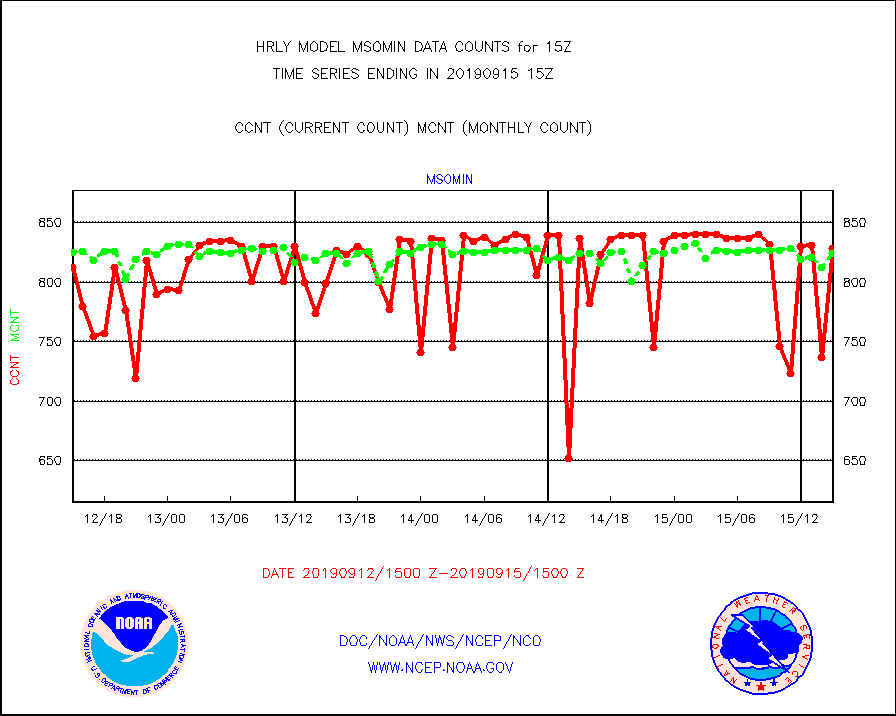
msomin |
Mesonet/MADIS Minnesota Dept. of Transportation |
828 |
824 |
100.5 % |
1514.50-1515.49 |
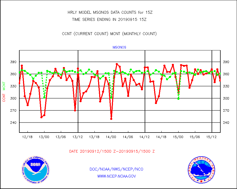
msonos |
Mesonet/MADIS NOS-Phys Oceanographic Realtime Sys |
344 |
361 |
95.3 % |
1514.50-1515.49 |
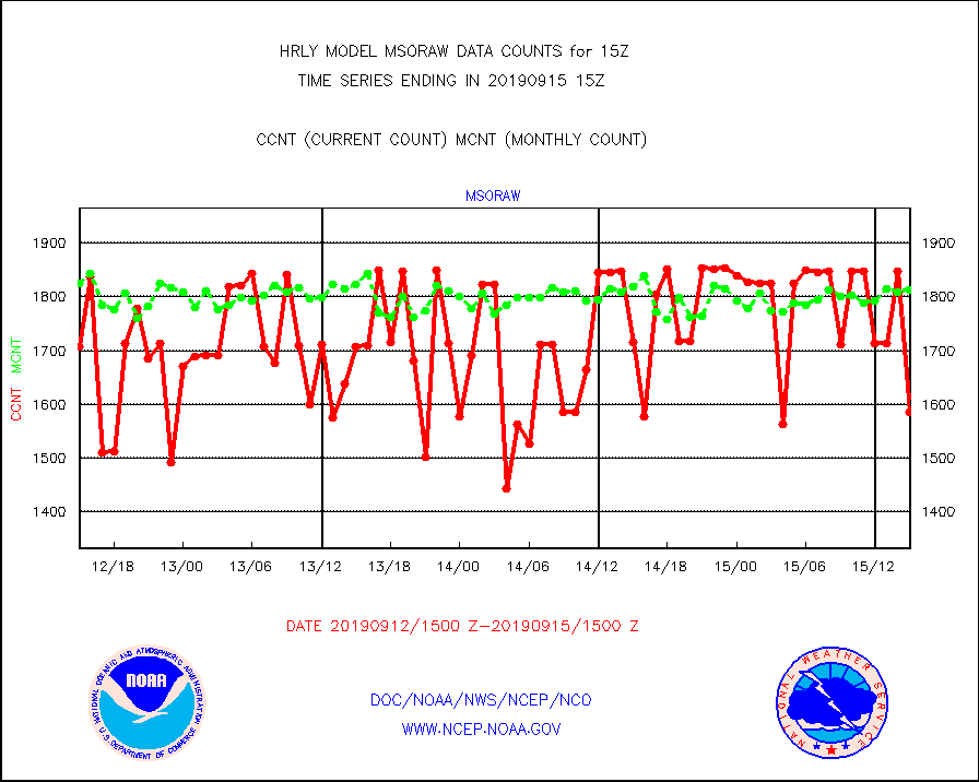
msoraw |
Mesonet/MADIS NFIC Remote Automated Wx Stns(RAWS) |
1585 |
1812 |
87.5 % |
1514.50-1515.49 |
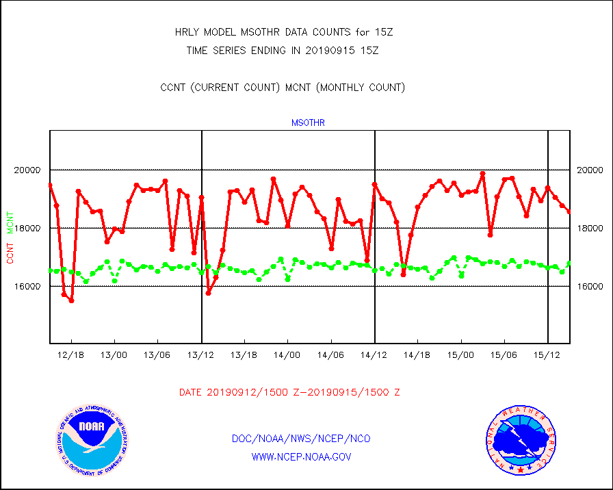
msothr |
Mesonet/MADIS many providers, not separated out |
18569 |
16794 |
110.6 % |
1514.50-1515.49 |
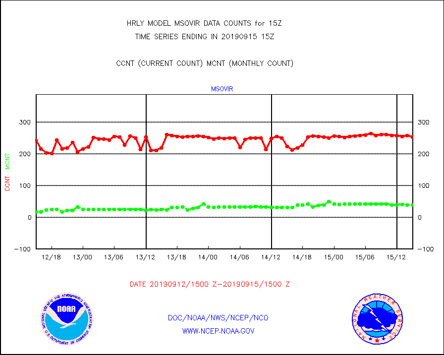
msovir |
Mesonet/MADIS Virginia Dept. of Transportation |
252 |
38 |
663.2 % |
1514.50-1515.49 |
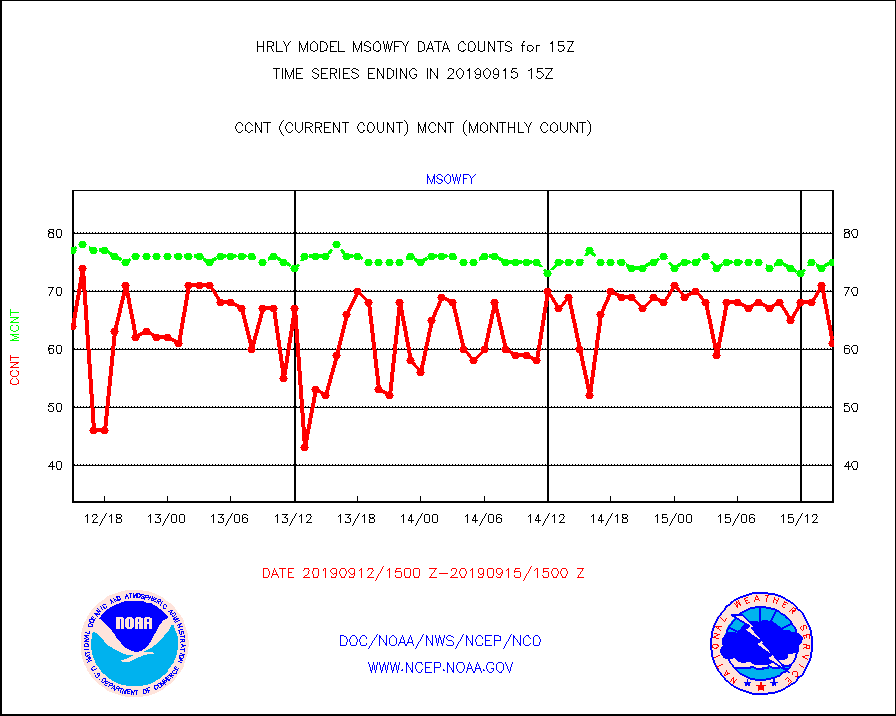
msowfy |
Mesonet/MADIS "Weather for You" |
61 |
75 |
81.3 % |
1514.50-1515.49 |
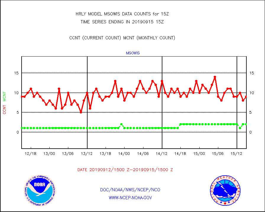
msowis |
Mesonet/MADIS Wisconsin Dept. of Transportation |
9 |
2 |
450.0 % |
1514.50-1515.49 |
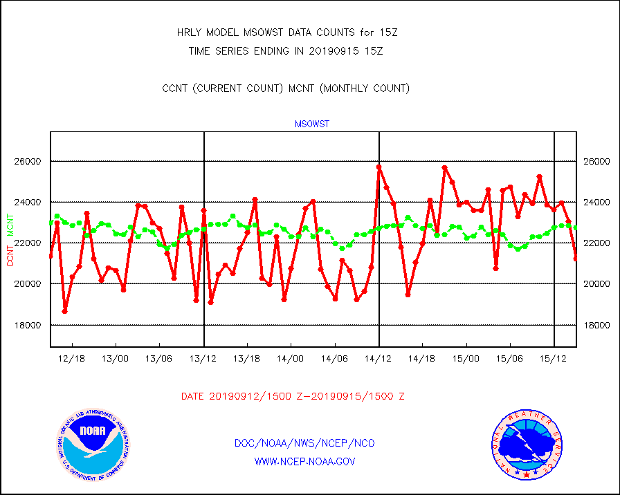
msowst |
Mesonet/MADIS MesoWest (many subproviders) |
21220 |
22764 |
93.2 % |
1514.50-1515.49 |
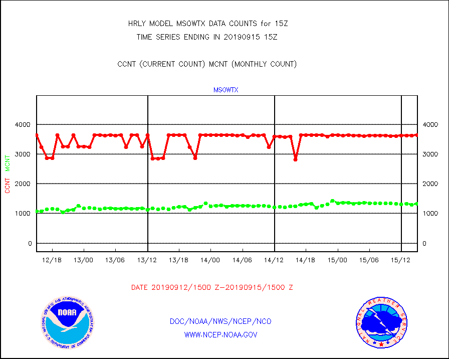
msowtx |
Mesonet/MADIS West Texas |
3637 |
1330 |
273.5 % |
1514.50-1515.49 |
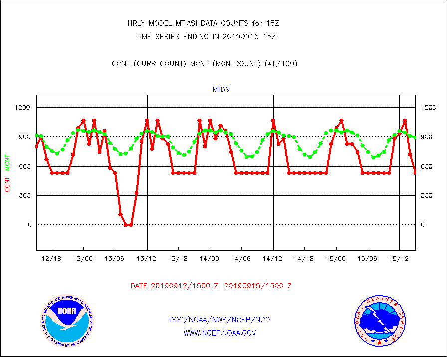
mtiasi |
METOP 1-2 IASI 1C radiance data (varbl. channels) |
53448 |
89705 |
59.6 % |
1513.00-1513.99 |
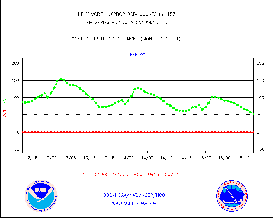
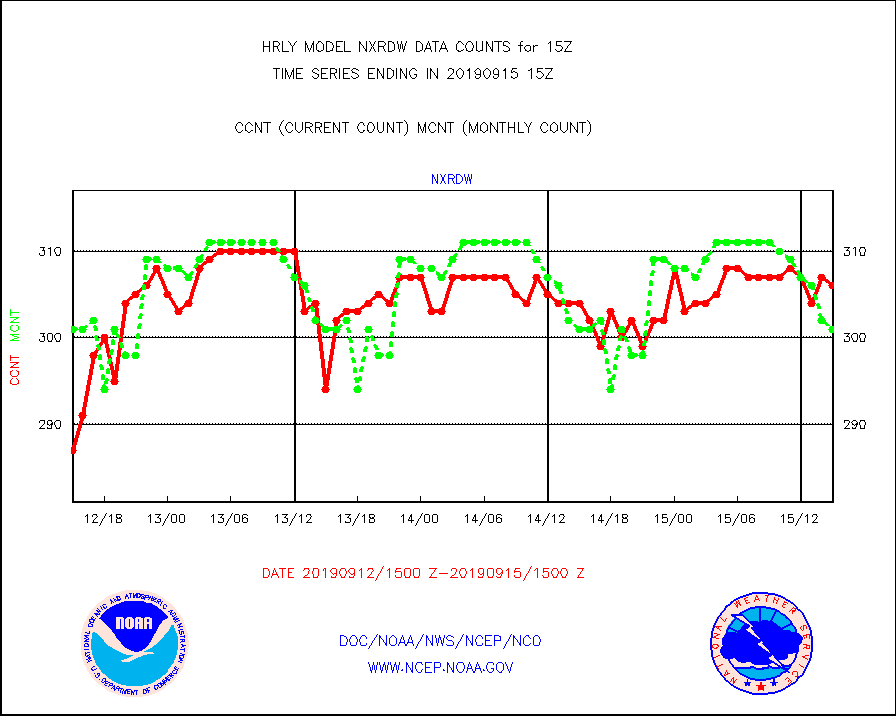
nxrdw |
NEXRAD Vel Azm Dsp(VAD) winds via radar coded msg |
306 |
301 |
101.7 % |
1514.50-1515.49 |
omi |
Aura Ozone Monitoring Instrument (OMI) data |
62700 |
42434 |
147.8 % |
1512.50-1513.49 |
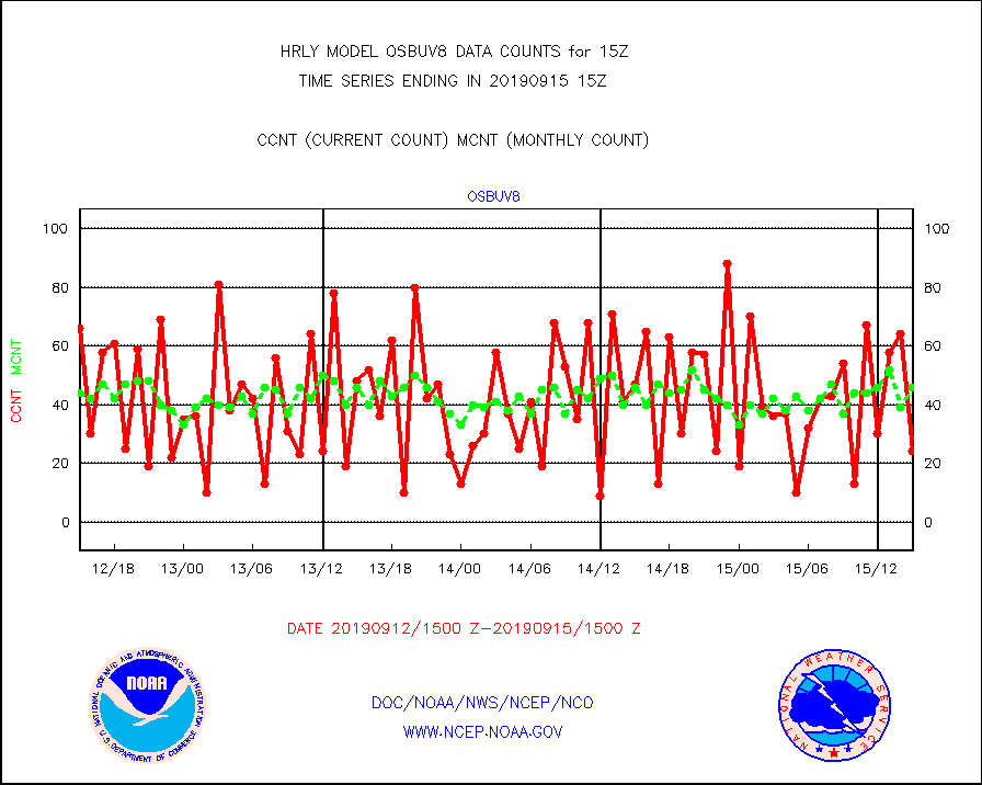
osbuv8 |
NOAA 16-19 Solar Backscatter UV-2 rad frm V8 BUFR |
24 |
46 |
52.2 % |
1513.00-1513.99 |
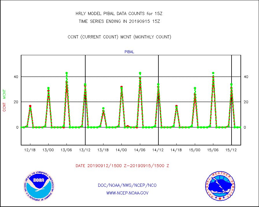
pibal |
PIBAL (from PILOT, PILOT SHIP, PILOT MOBIL) |
0 |
0 |
n/a |
1514.50-1515.49 |
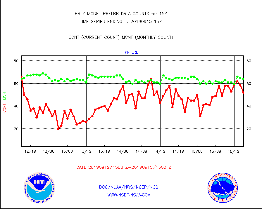
prflrb |
Multi-Agency Profiler (MAP) and SODAR winds |
52 |
64 |
81.2 % |
1514.50-1515.49 |
radw25 |
NEXRAD radial wind superobs (Level 2.5 - ORPG) |
0 |
0 |
n/a |
1513.50-1514.49 |
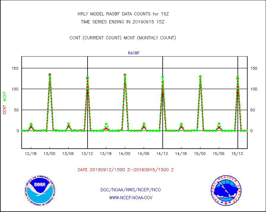
raobf |
Rawinsonde - fixed land (from TEMP or PILOT) |
0 |
0 |
n/a |
1514.50-1515.49 |
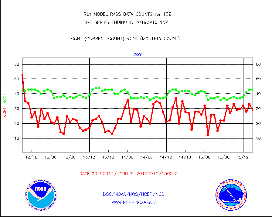
rass |
RASS temperatures (NOAA and Multi-Agency) |
29 |
43 |
67.4 % |
1514.50-1515.49 |
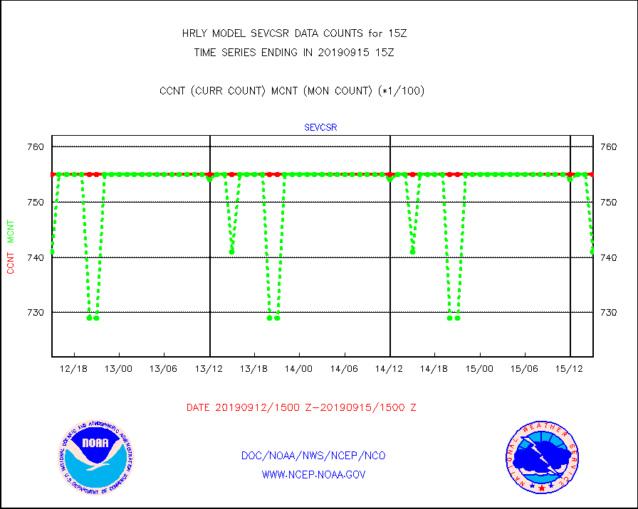
sevcsr |
METEOSAT-10 2nd Gen SEVIRI Clr Sky Radiance(proc) |
75512 |
74198 |
101.8 % |
1514.50-1515.49 |
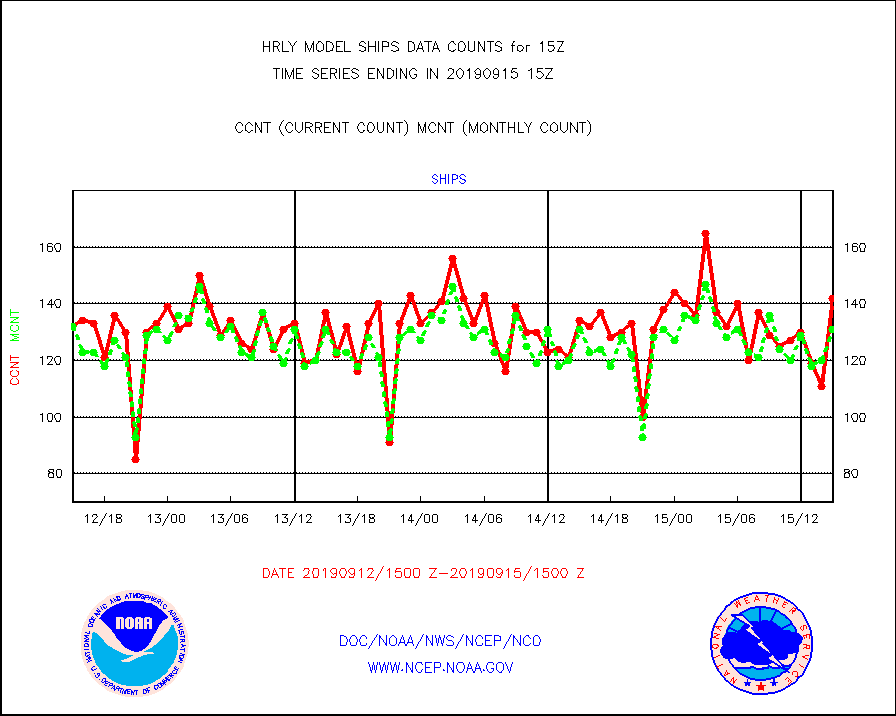
ships |
Ship - manual and automatic, restricted |
142 |
131 |
108.4 % |
1514.50-1515.49 |
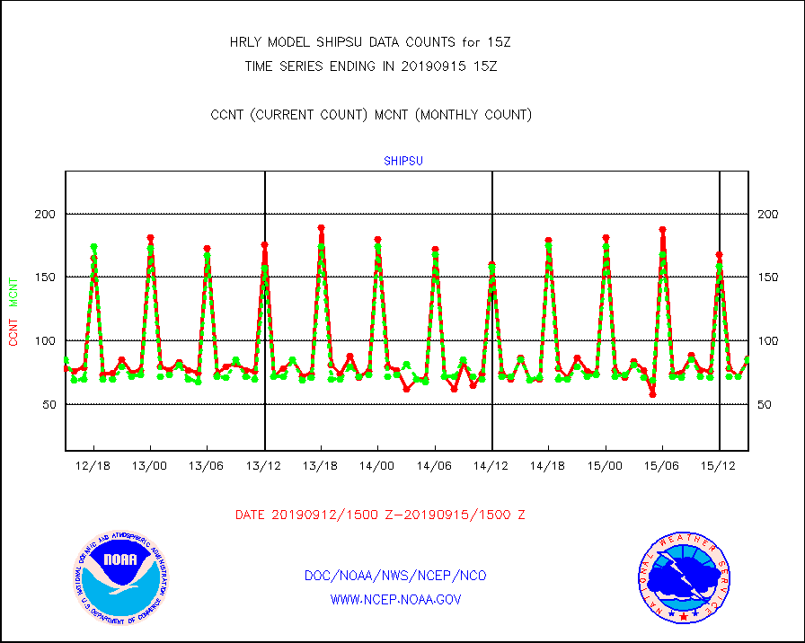
shipsu |
Ship - manual and automatic, unrestricted |
86 |
85 |
101.2 % |
1514.50-1515.50 |
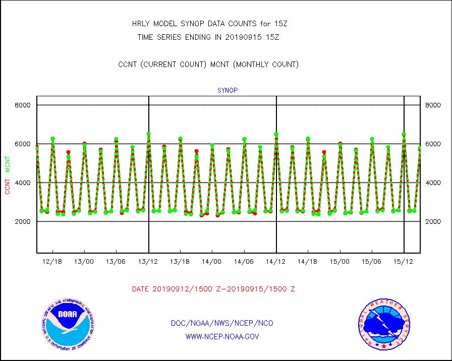
synop |
Synoptic - fixed manual and automatic |
5713 |
5795 |
98.6 % |
1514.50-1515.49 |
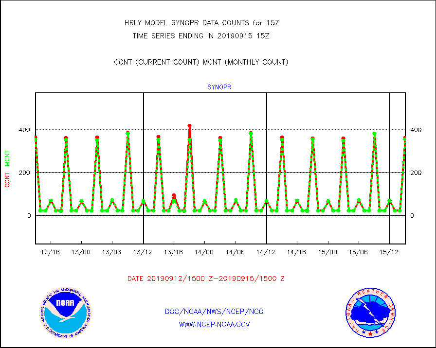
synopr |
Synoptic - restricted (WMO Res 40) manual & auto. |
364 |
357 |
102.0 % |
1514.50-1515.49 |
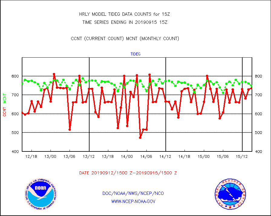
tideg |
Tide gauge reports decoded from CREX format |
736 |
747 |
98.5 % |
1514.00-1514.99 |
| Data Types of Opportunity with Normal Counts |
|---|
| Type | Description | Hourly Count | Monthly Average | Percent (%) of Monthly Mean | UTC Time Window |
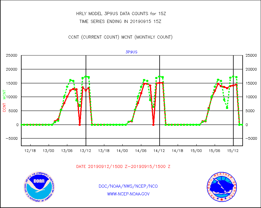
3p9us |
GOES/NESDIS infrared shrt-wave derived cld motion |
0 |
0 |
n/a |
1514.00-1514.99 |
acarsa |
MDCRS ACARS acft data (ARINC via AFWA)(AIREP fmt) |
0 |
0 |
n/a |
1514.50-1515.49 |
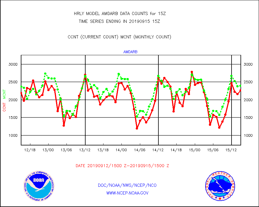
amdarb |
AMDAR aircraft data (decoded from BUFR) |
2264 |
2394 |
94.6 % |
1514.50-1515.49 |
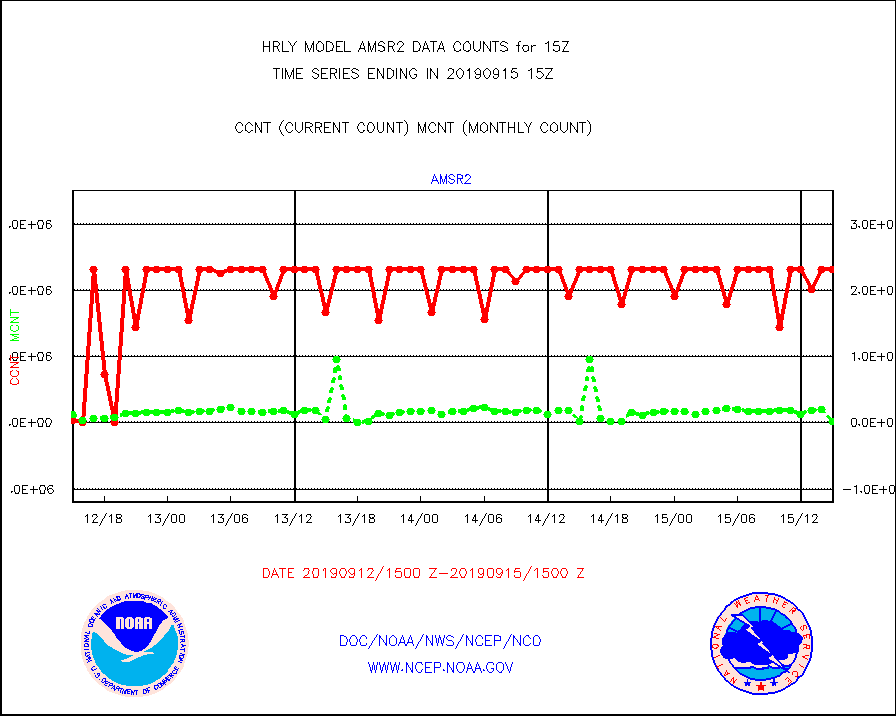
amsr2 |
GCOM-W AMSR2 1B brightness temperatures |
2309472 |
2024838 |
114.1 % |
1513.00-1513.99 |
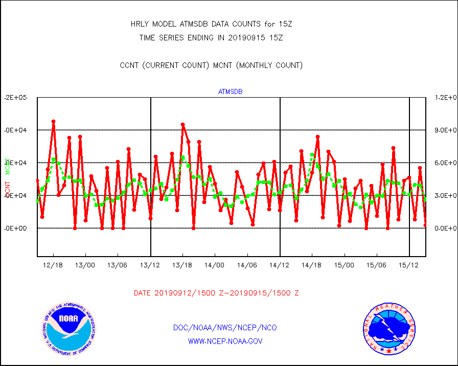
atmsdb |
NPP Adv Tech MW Sndr(ATMS) b. temps-dir bcst SSEC |
2784 |
26522 |
10.5 % |
1513.50-1514.49 |
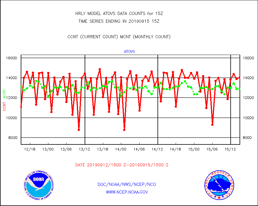
atovs |
POES/NESDIS - processed ATOVS soundings/radiances |
14041 |
12904 |
108.8 % |
1513.00-1513.99 |
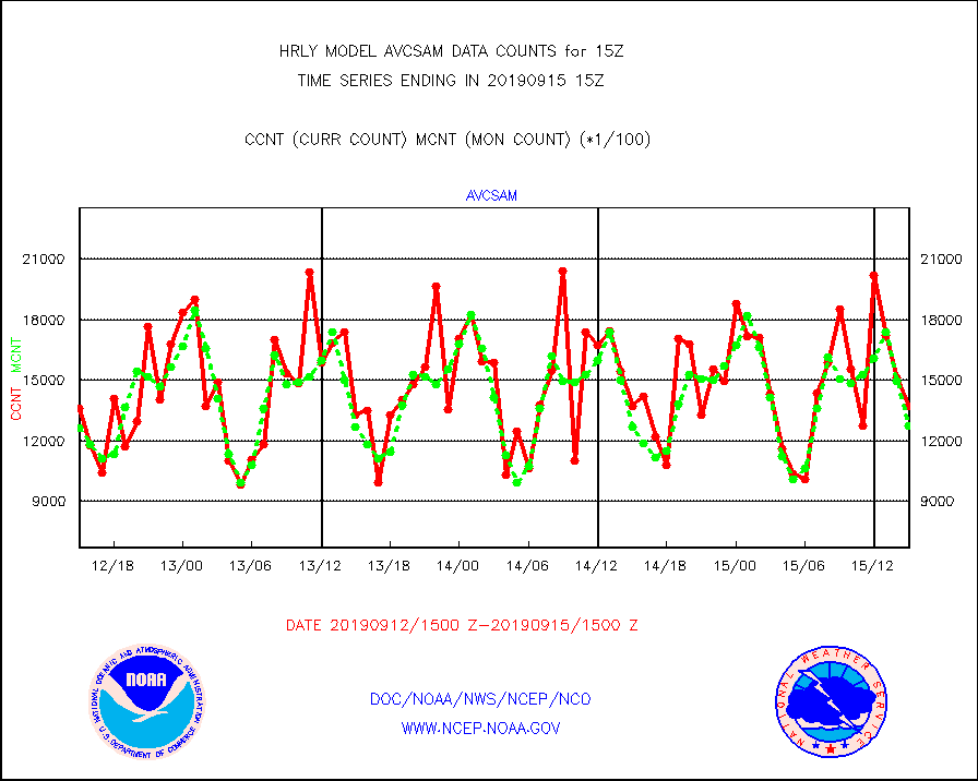
avcsam |
A.M.(N17,M2) AVHRR GAC NCEP-proc clr & sea btemps |
1374060 |
1273185 |
107.9 % |
1512.50-1513.49 |
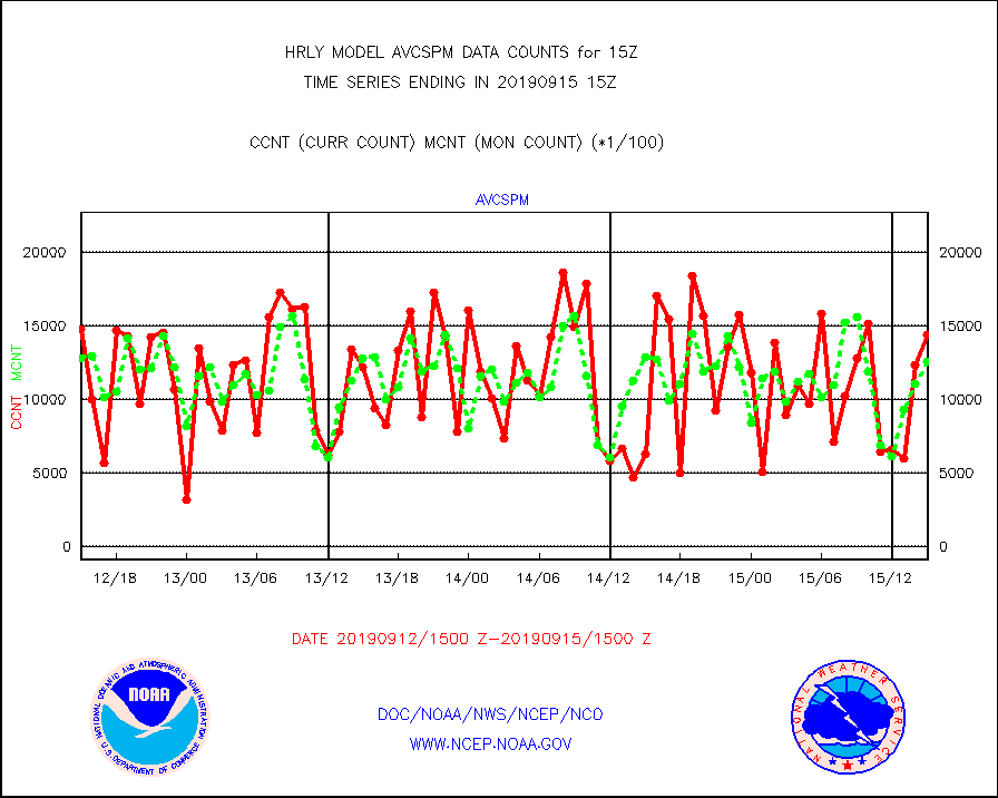
avcspm |
P.M.(N18-19) AVHRR GAC NCEP-proc clr & sea btemps |
1442564 |
1261154 |
114.4 % |
1512.50-1513.49 |
bathy |
Bathythermal |
0 |
0 |
n/a |
1508.00-1508.99 |
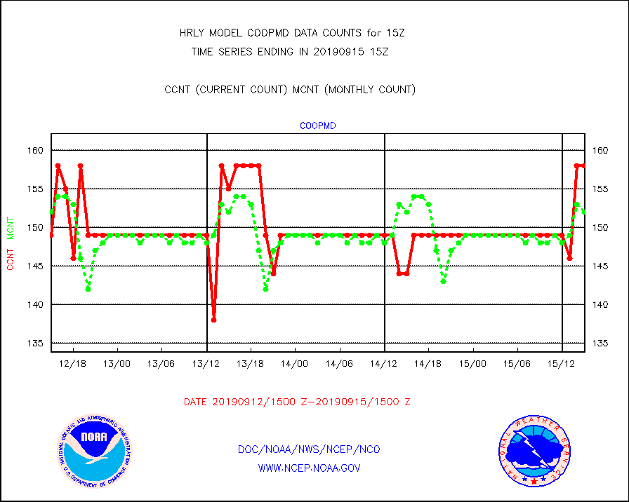
coopmd |
Coop/MADIS NEPP & HCN-Modernization NOAA COOP Obs |
158 |
152 |
103.9 % |
1514.50-1515.49 |
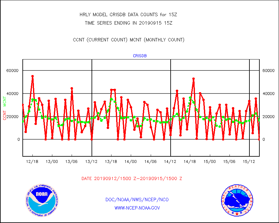
crisdb |
NPP Crss-trk IR Sndr(CrIS) radiance-dir bcst SSEC |
0 |
16773 |
0.0 % |
1513.50-1514.49 |
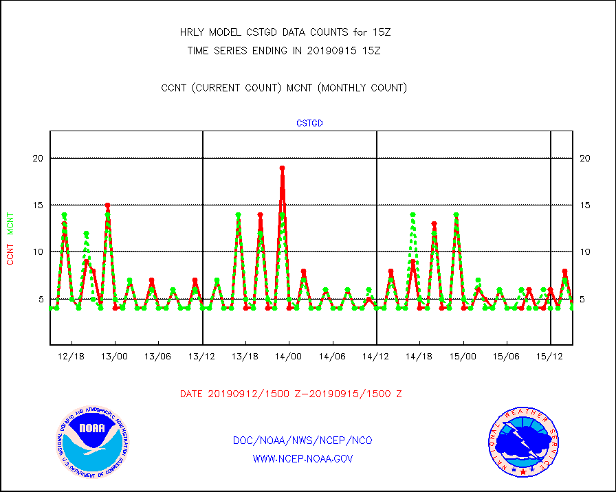
cstgd |
Coast Guard |
4 |
4 |
100.0 % |
1514.50-1515.50 |
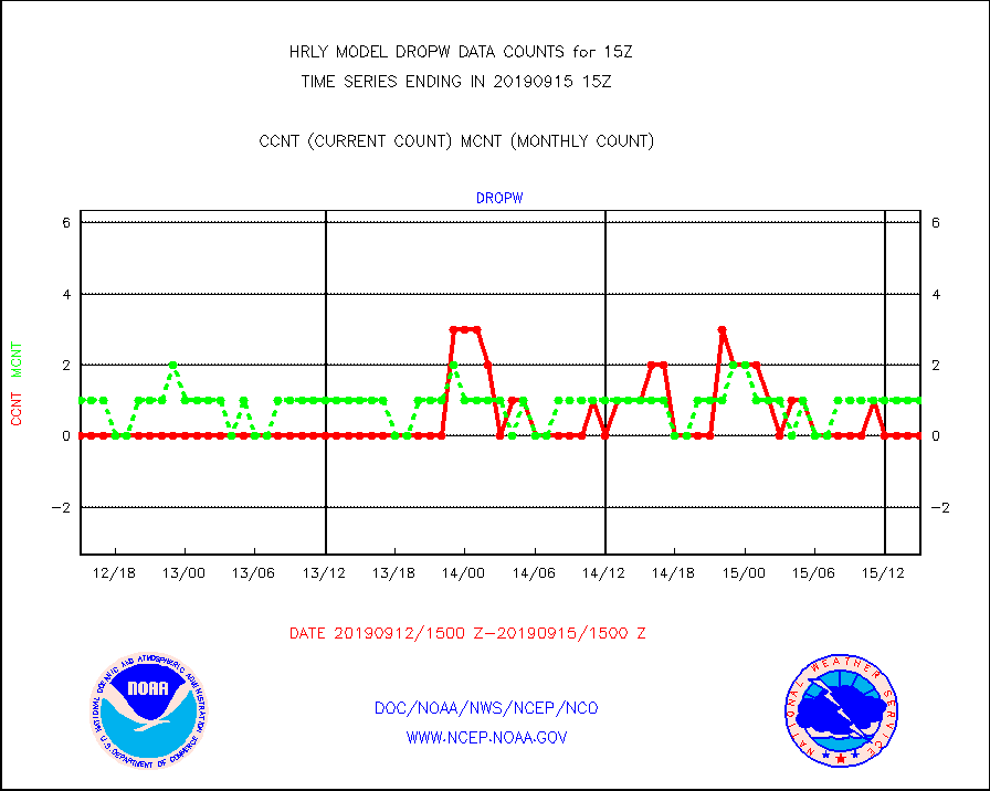
dropw |
Dropwinsonde (from TEMP DROP) |
0 |
1 |
0.0 % |
1514.50-1515.49 |
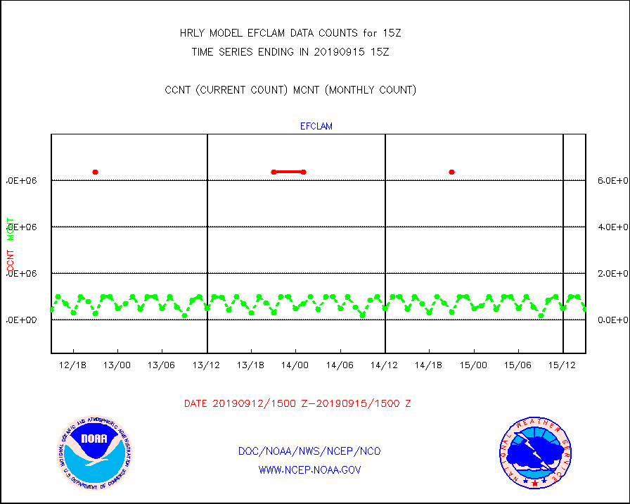
efclam |
GOES imager effective cloud amount data (U.Wisc.) |
8475139 |
8440441 |
100.4 % |
1514.50-1515.49 |
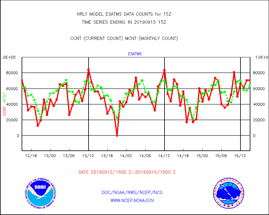
esatms |
NPP Adv. Tech. MW Sndr (ATMS) br. temps from RARS |
70730 |
64035 |
110.5 % |
1513.50-1514.49 |
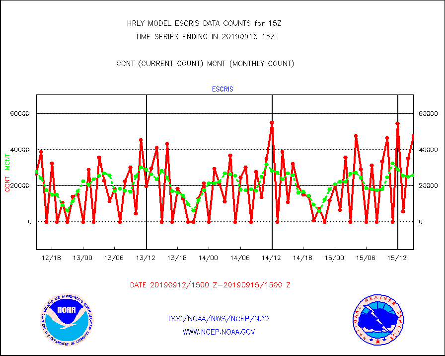
escris |
NPP Crss-track IR Sndr (CrIS) radiances from RARS |
47520 |
25934 |
183.2 % |
1513.50-1514.49 |
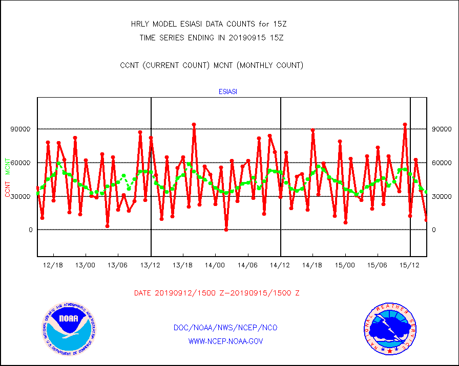
esiasi |
METOP 1-2 IASI 1C radiance data vbl chn from RARS |
8528 |
34104 |
25.0 % |
1514.00-1514.99 |
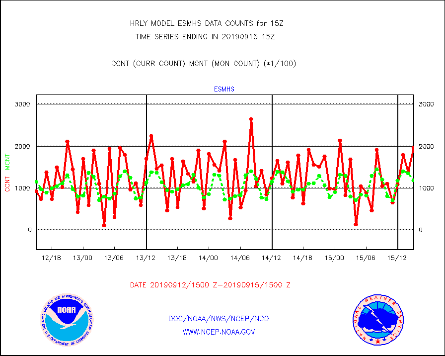
esmhs |
NOAA 18-19 & METOP 1-2 MHS proc. btemps from RARS |
195776 |
118702 |
164.9 % |
1514.50-1515.49 |
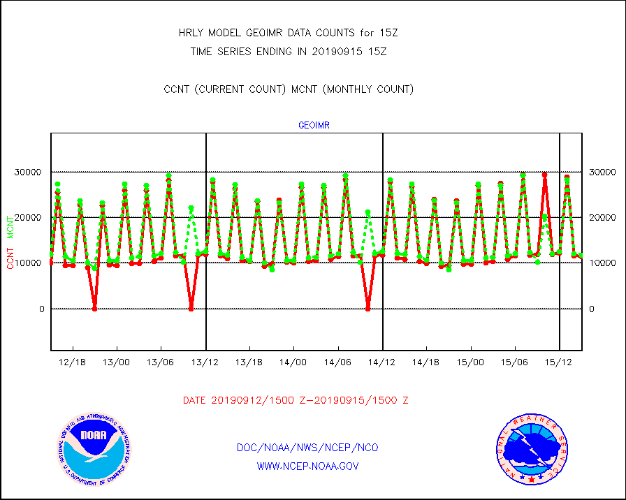
geoimr |
GOES/NESDIS (11x17 f-o-v) imager clear radiances |
11491 |
11810 |
97.3 % |
1514.00-1514.99 |
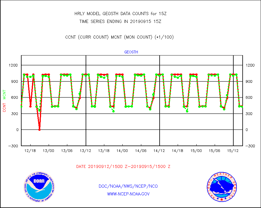
geosth |
GOES/NESDIS hi-resol. (1x1 f-o-v) cloud data |
43731 |
43008 |
101.7 % |
1514.00-1514.99 |
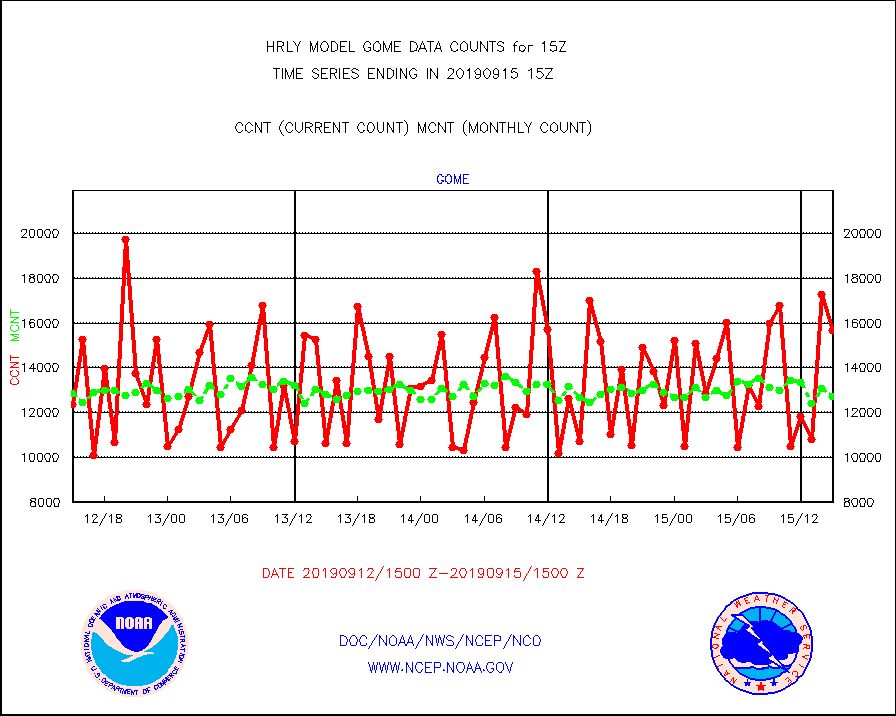
gome |
METOP 1-2 Global Ozone Monitoring Exp.-2 (GOME-2) |
15680 |
12704 |
123.4 % |
1513.50-1514.49 |
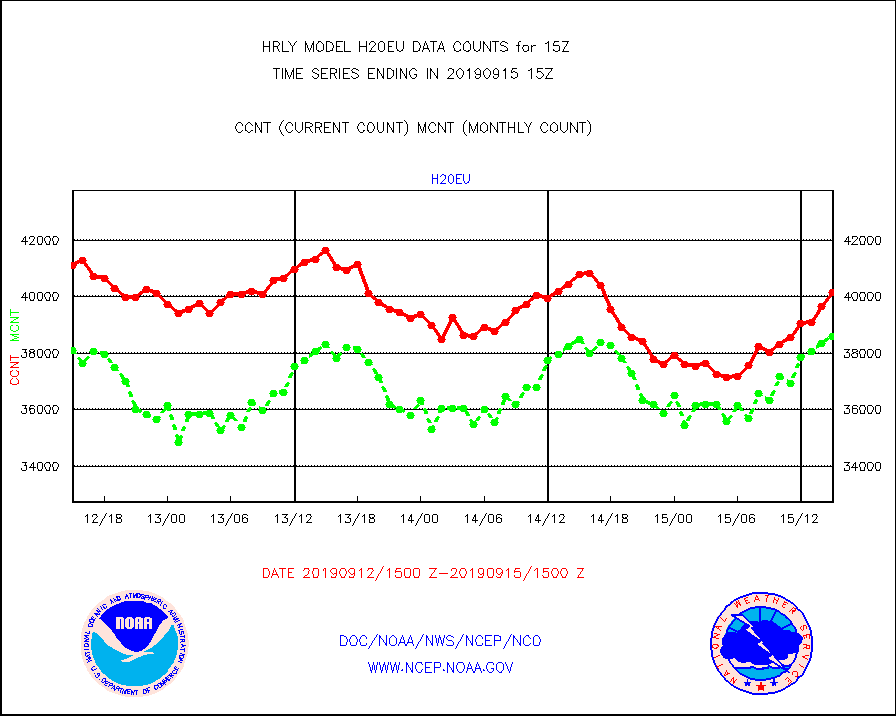
h20eu |
METEOSAT/EUMETSAT wvpr imager derived cld motion |
40138 |
38596 |
104.0 % |
1513.50-1514.49 |
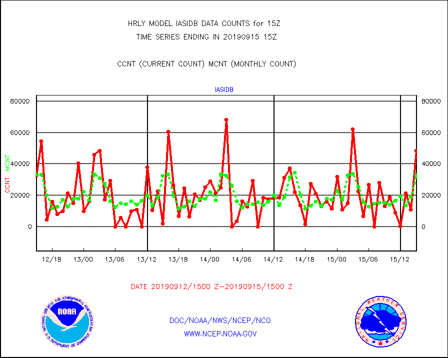
iasidb |
METOP 1-2 IASI 1C radiances-direct broadcast SSEC |
48289 |
32818 |
147.1 % |
1513.50-1514.49 |
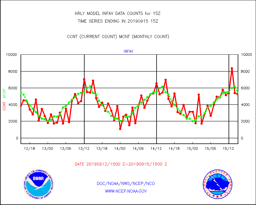
infav |
AVHRR (NOAA/METOP) ir lg-wave derived cld motion |
5251 |
5448 |
96.4 % |
1511.00-1511.99 |
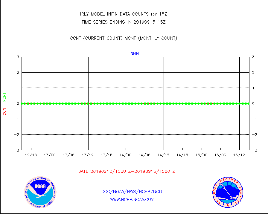
infin |
INSAT/KALPANA India ir lg-wave derived cld motion |
0 |
0 |
n/a |
1512.50-1513.49 |
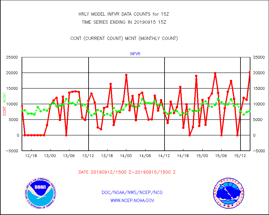
infvr |
VIIRS (NPP) infrared lg-wave derived cloud motion |
20165 |
7722 |
261.1 % |
1511.00-1511.99 |
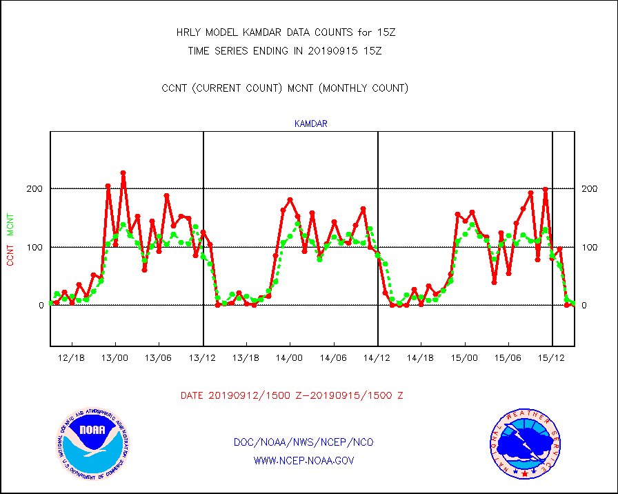
kamdar |
Korean AMDAR aircraft data (decoded from BUFR) |
1 |
4 |
25.0 % |
1514.50-1515.49 |
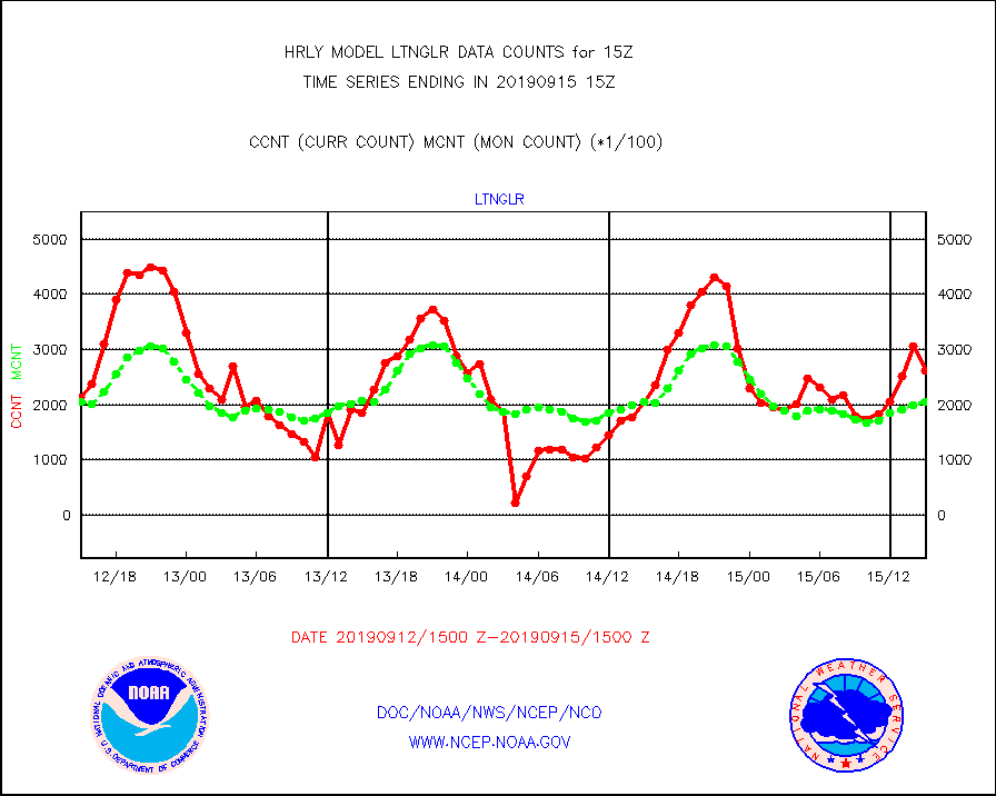
ltnglr |
LLDN Long-rng lightning from Vaisala via NOAAPORT |
261818 |
205469 |
127.4 % |
1514.50-1515.49 |
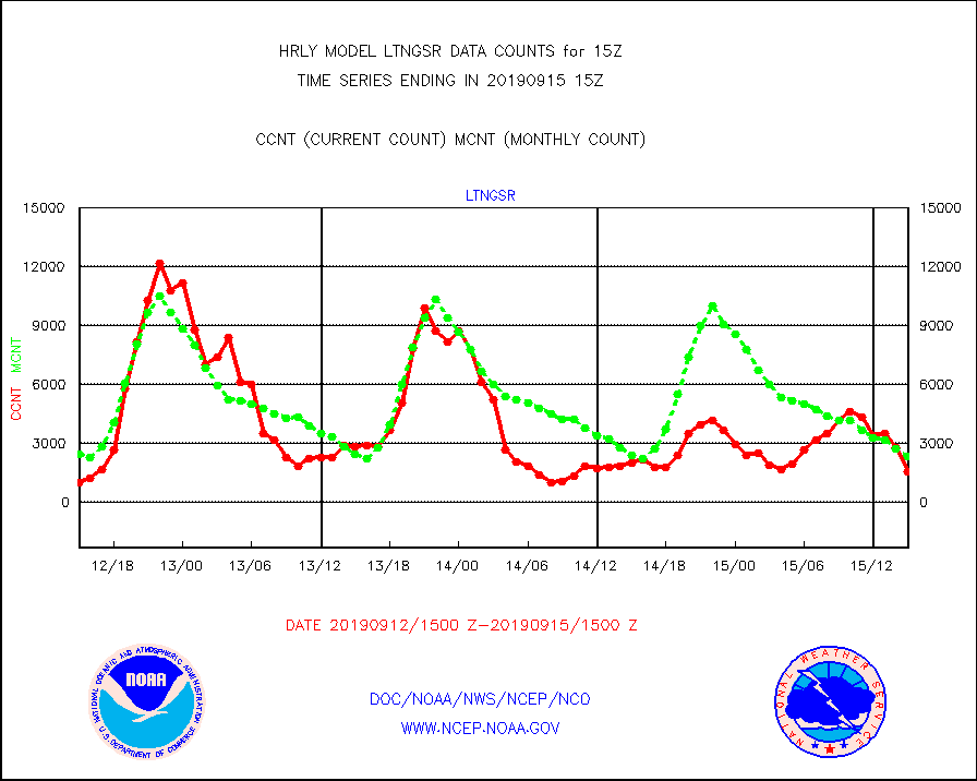
ltngsr |
NLDN Shrt-rng lightning from Vaisala via NOAAPORT |
1552 |
2351 |
66.0 % |
1514.50-1515.49 |
mls |
Aura Microwave Limb Sounder (MLS) ozone data |
0 |
0 |
n/a |
1513.00-1513.99 |
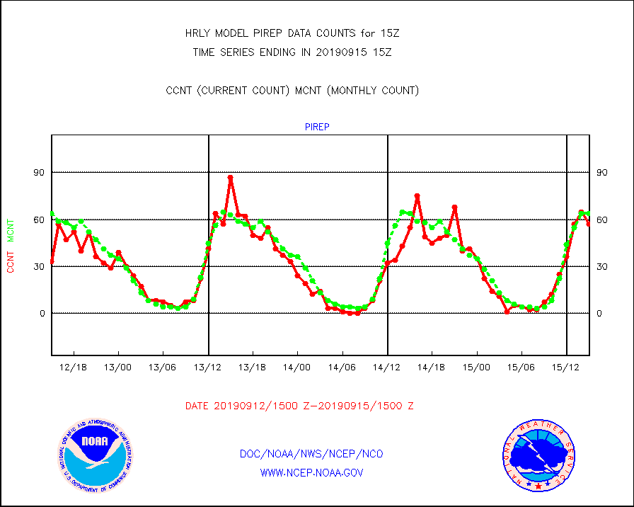
pirep |
Manual PIREP aircraft data (dcded from AIREP fmt) |
57 |
64 |
89.1 % |
1514.50-1515.49 |
prflrj |
Japanese Meteorological Agency profiler winds |
0 |
0 |
n/a |
1514.50-1515.49 |
prflrp |
Profilr winds from PIBAL (PILOT,PILOT SHIP/MOBIL) |
0 |
0 |
n/a |
1514.50-1515.49 |
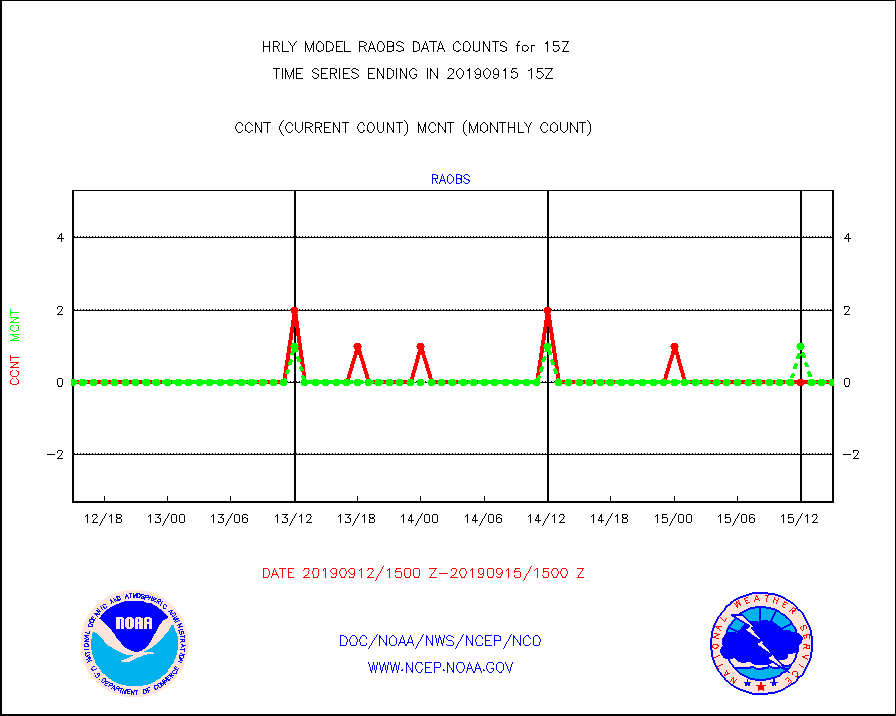
raobm |
Rawinsonde - mobile land (from TEMP/PILOT MOBIL) |
0 |
0 |
n/a |
1514.50-1515.49 |
raobs |
Rawinsonde - ship (from TEMP SHIP, PILOT SHIP) |
0 |
0 |
n/a |
1514.50-1515.49 |
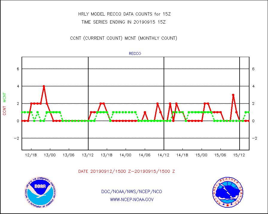
recco |
Flight level reconnaissance aircraft data |
0 |
1 |
0.0 % |
1514.50-1515.49 |
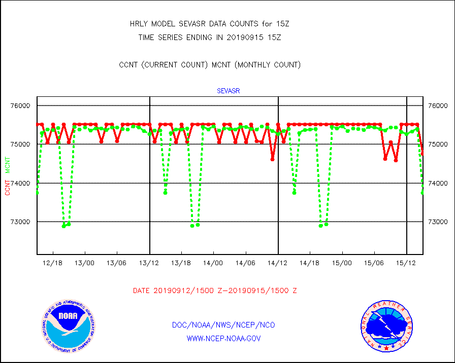
sevasr |
METEOSAT-10 2nd Gen SEVIRI All Sky Radiance(proc) |
74760 |
73756 |
101.4 % |
1514.50-1515.49 |
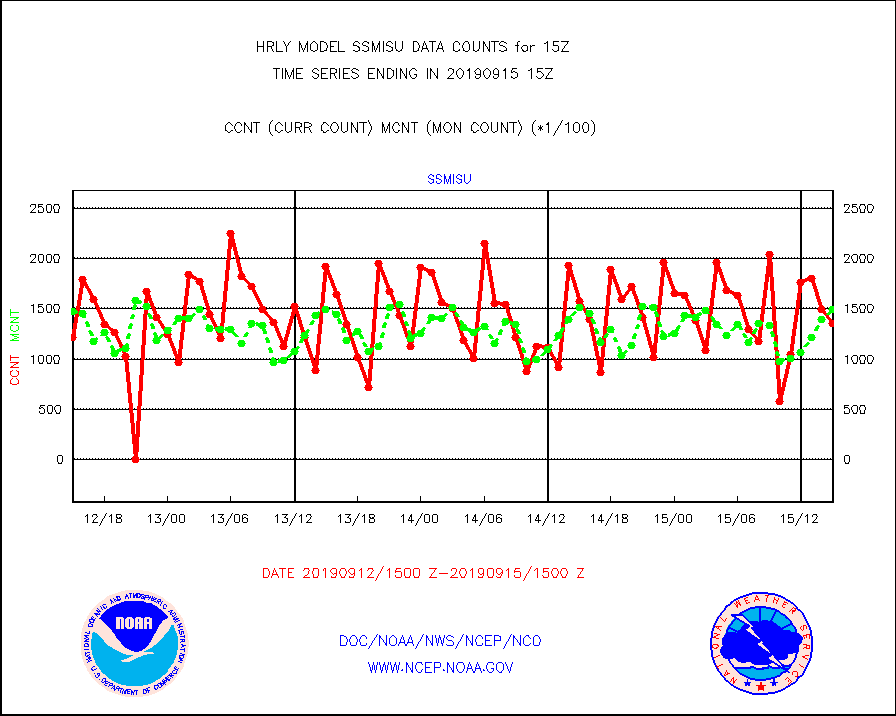
ssmisu |
DMSP SSM/IS 1C radiance data (Unified Pre-Proc.) |
135000 |
149588 |
90.2 % |
1513.50-1514.49 |
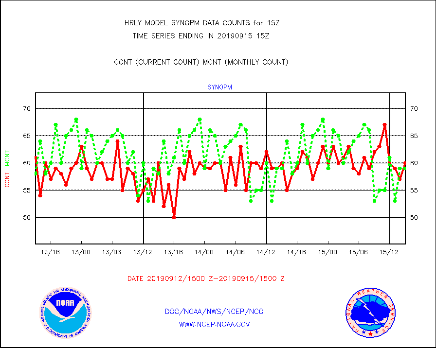
synopm |
Synoptic - mobile manual and automatic |
60 |
59 |
101.7 % |
1514.50-1515.49 |
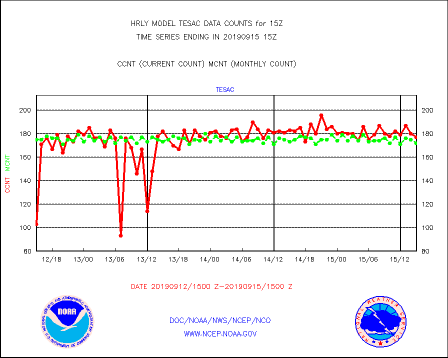
tesac |
TESAC |
177 |
172 |
102.9 % |
1514.50-1515.49 |
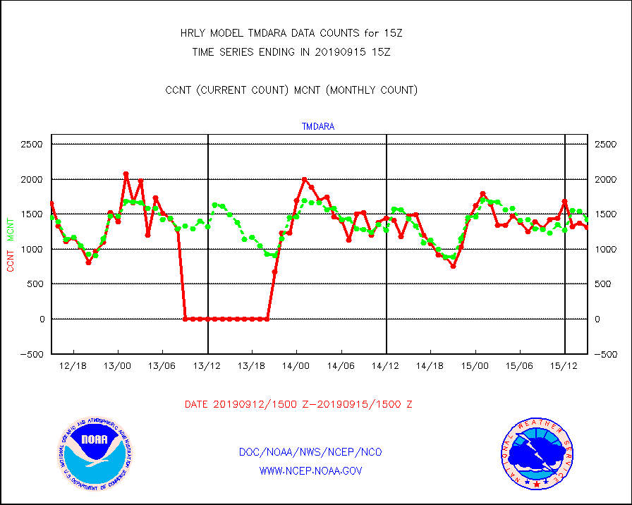
tmdara |
TAMDAR aircft data-all types(from Panasonic,BUFR) |
1315 |
1426 |
92.2 % |
1514.50-1515.49 |
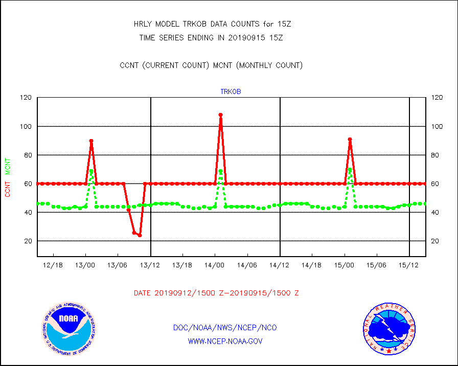
trkob |
TRACKOB |
60 |
46 |
130.4 % |
1513.50-1514.49 |
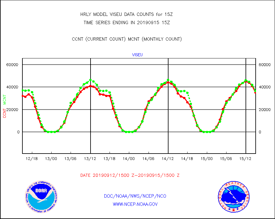
viseu |
METEOSAT/EUMETSAT visible derived cloud motion |
35183 |
36577 |
96.2 % |
1513.50-1514.49 |
visin |
INSAT/KALPANA India visible derived cloud motion |
0 |
0 |
n/a |
1512.50-1513.49 |
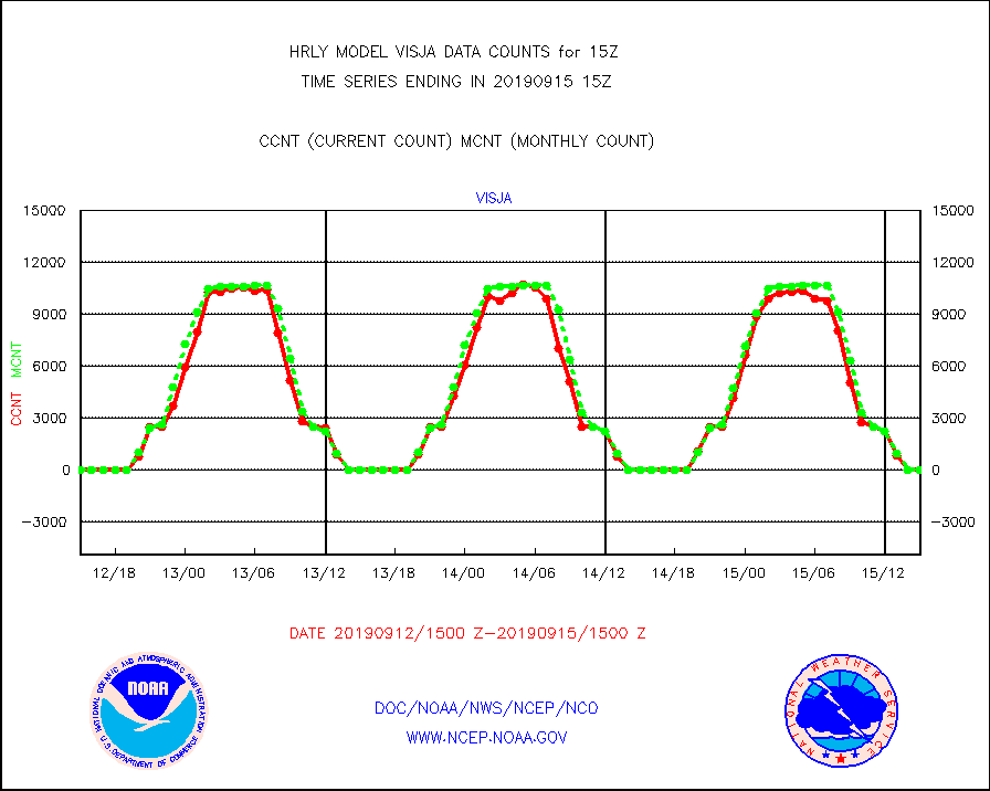
visja |
MTSAT/JMA visible derived cloud motion |
0 |
0 |
n/a |
1512.50-1513.49 |
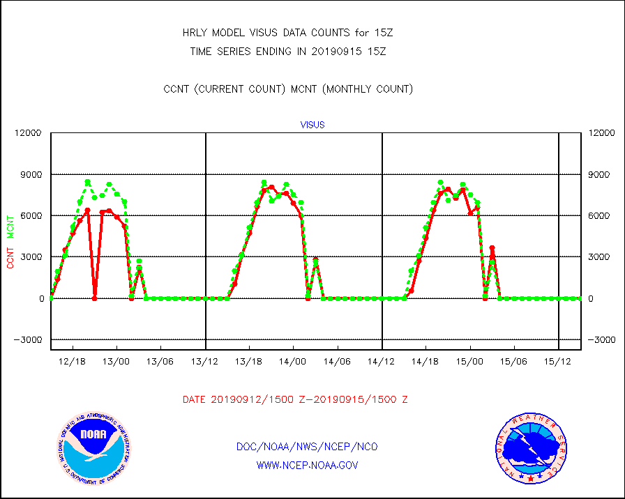
visus |
GOES/NESDIS visible derived cloud motion |
0 |
0 |
n/a |
1514.00-1514.99 |


