| Critical Data with Normal Counts |
|---|
| Type | Description | Hourly Count | Monthly Average | Percent (%) of Monthly Mean | UTC Time Window |
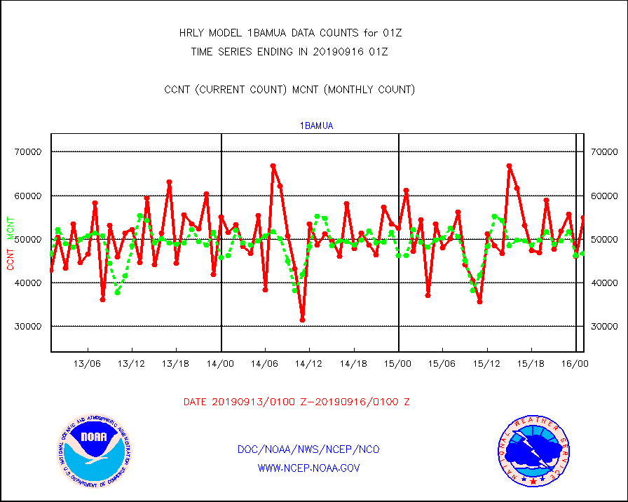
1bamua |
NOAA 15-19 & METOP 1-2 AMSU-A NCEP-proc. br.temps |
54878 |
46804 |
117.3 % |
1523.00-1523.99 |
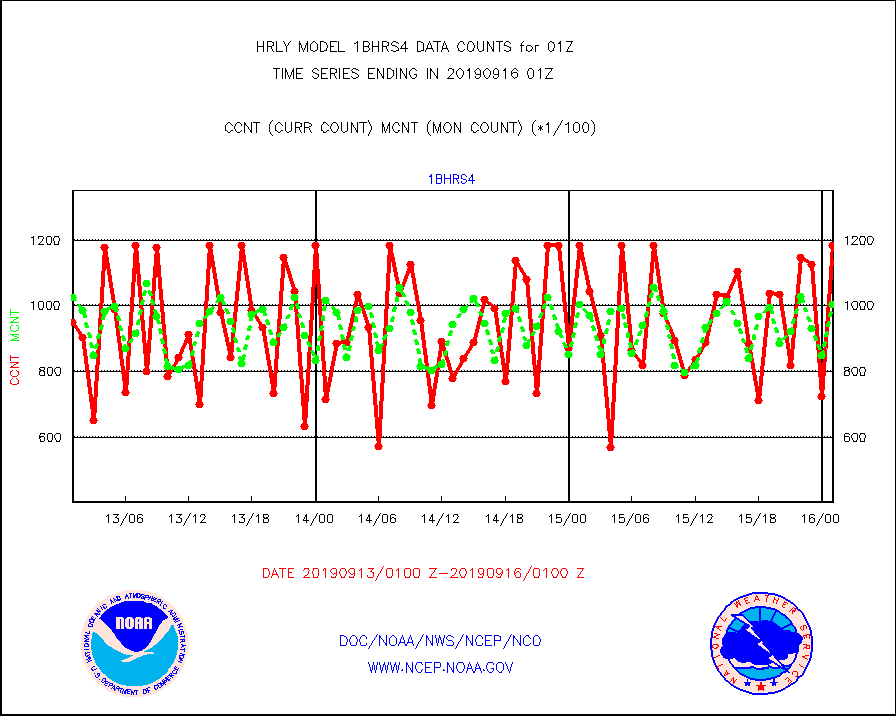
1bhrs4 |
NOAA 18-19 & METOP 1-2 HIRS-4 NCEP-proc. br.temps |
118495 |
100578 |
117.8 % |
1523.00-1523.99 |
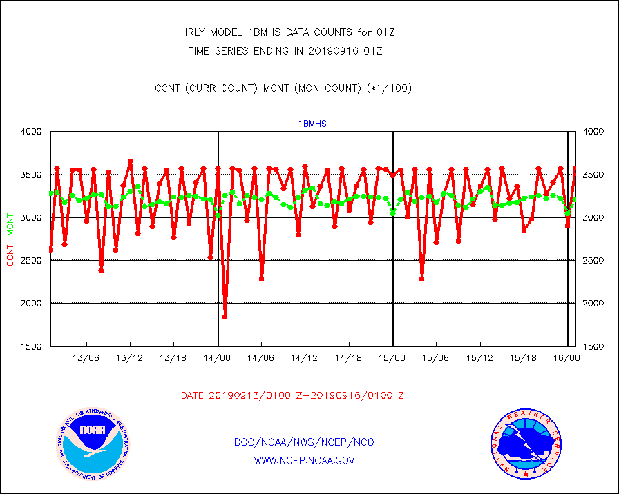
1bmhs |
NOAA 18-19 & METOP 1-2 MHS NCEP-proces. br. temps |
357321 |
321078 |
111.3 % |
1523.00-1523.99 |
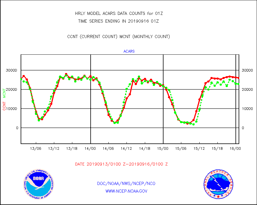
acars |
MDCRS ACARS acft data from ARINC(dcded from BUFR) |
25993 |
22858 |
113.7 % |
1600.50-1601.49 |
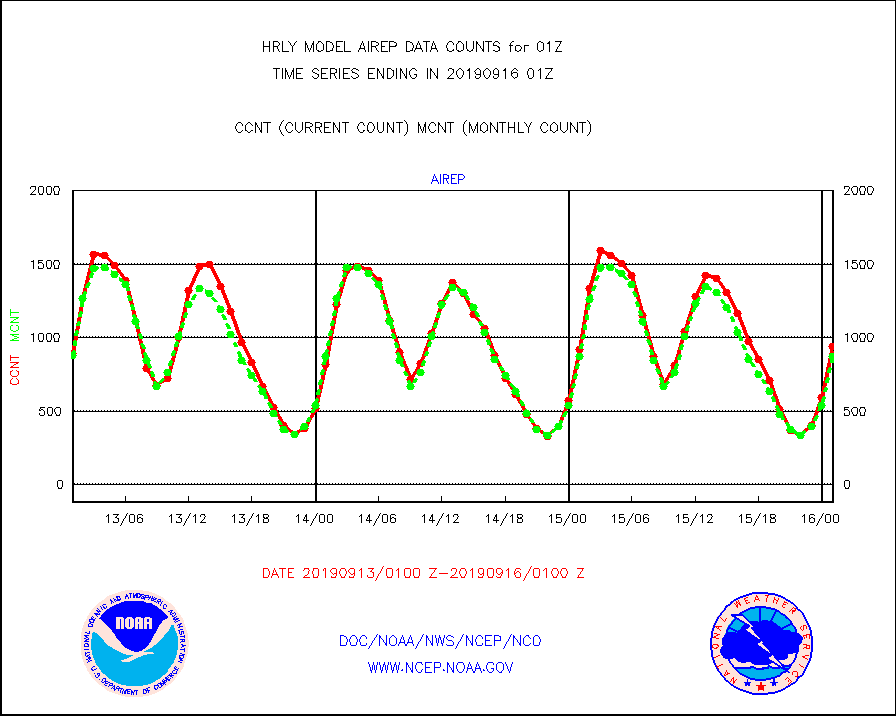
airep |
Manual AIREP aircraft data (dcded from AIREP fmt) |
937 |
874 |
107.2 % |
1600.50-1601.49 |
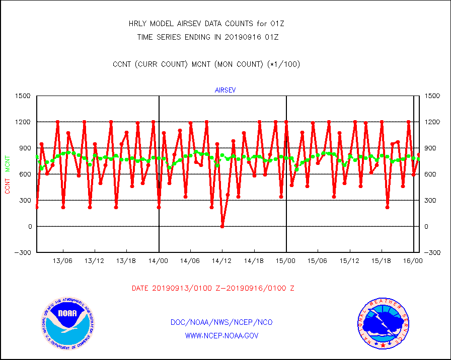
airsev |
AQUA AIRS/AMSU-A/HSB brightness temps- every FOV |
82839 |
77449 |
107.0 % |
1522.50-1523.49 |
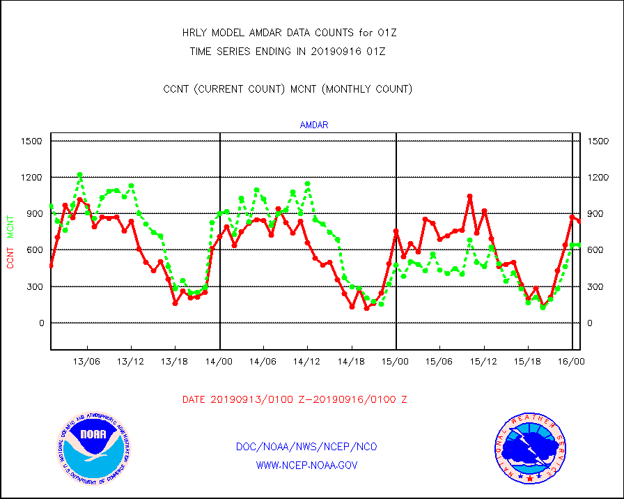
amdar |
AMDAR aircraft data (decoded from AMDAR format) |
838 |
643 |
130.3 % |
1600.50-1601.49 |
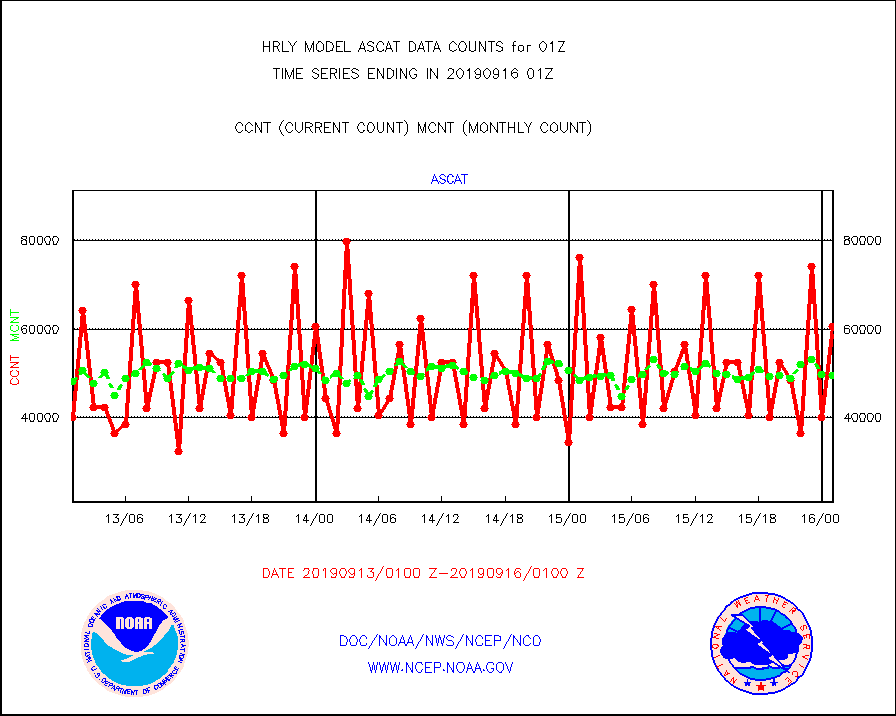
ascat |
METOP 1-2 ASCAT products |
60480 |
49455 |
122.3 % |
1523.50-1600.49 |
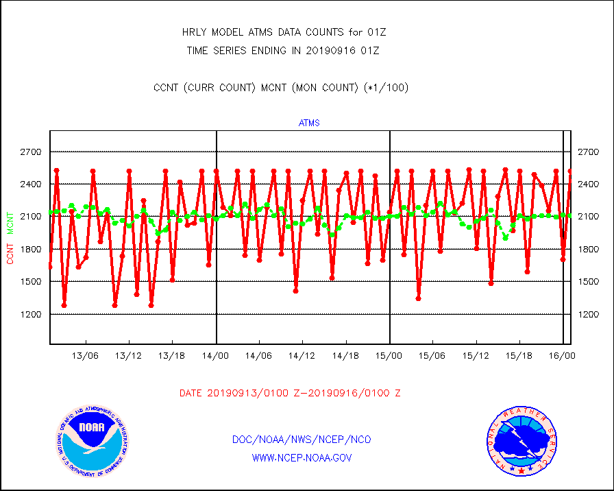
atms |
NPP Adv. Tech. Microwave Sounder (ATMS) br. temps |
252096 |
211075 |
119.4 % |
1523.50-1600.49 |
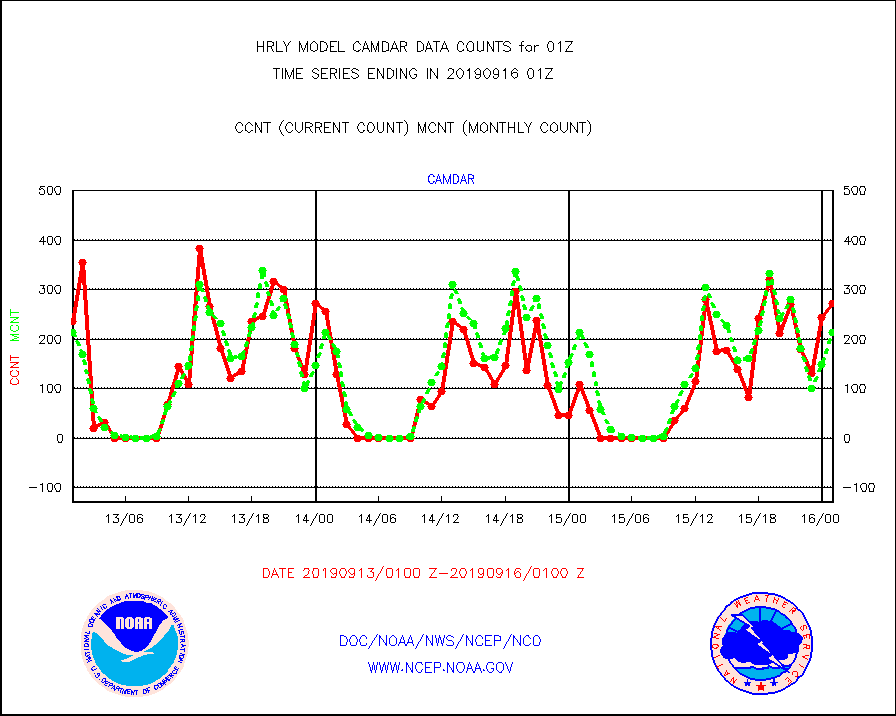
camdar |
Canadian AMDAR aircraft data (decoded from BUFR) |
272 |
213 |
127.7 % |
1600.50-1601.49 |
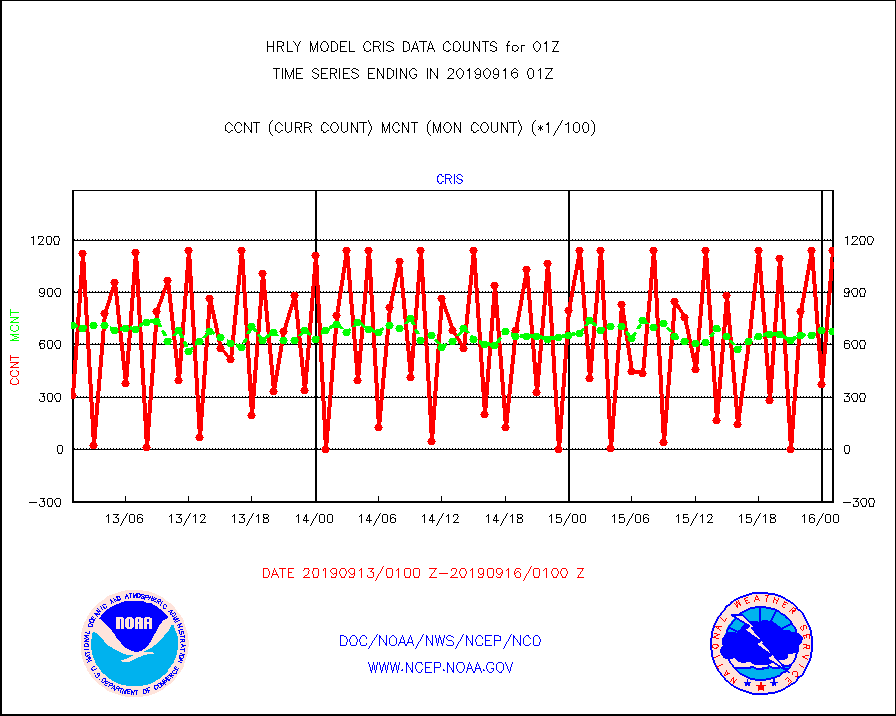
cris |
NPP Cross-track Infrared Sounder (CrIS) radiances |
113850 |
67608 |
168.4 % |
1523.50-1600.49 |
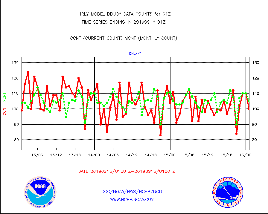
dbuoy |
Buoys decoded from FM-18 fmt (moored or drifting) |
100 |
105 |
95.2 % |
1600.50-1601.49 |
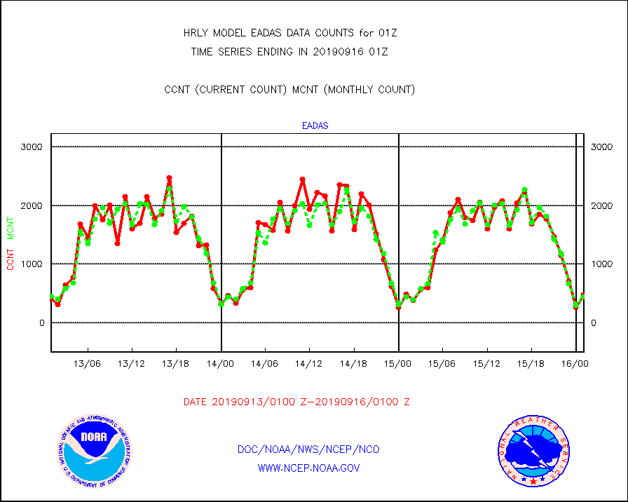
eadas |
E-AMDAR (European AMDAR acft decoded from BUFR) |
480 |
439 |
109.3 % |
1600.50-1601.49 |
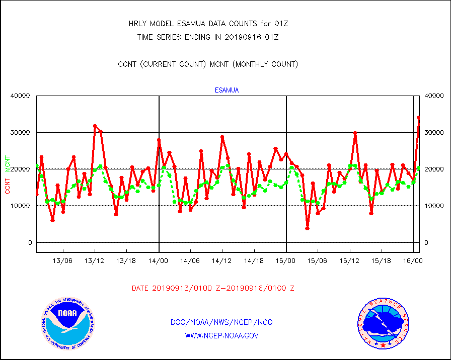
esamua |
NOAA 15-19 & METOP 1-2 AMSU-A proc btmps frm RARS |
34111 |
20485 |
166.5 % |
1600.50-1601.49 |
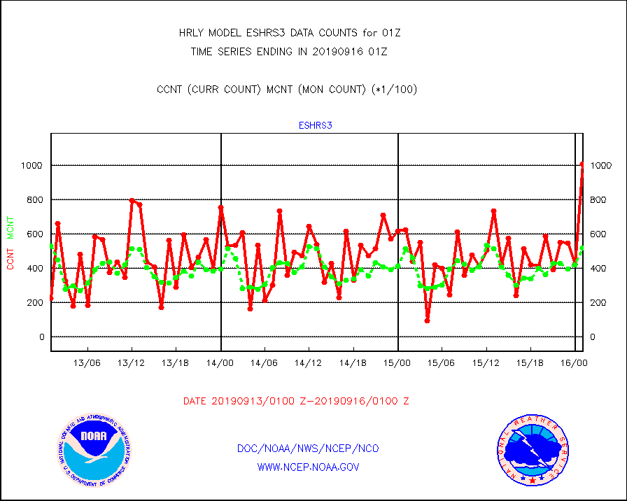
eshrs3 |
NOAA 15-19 & METOP 1-2 HIRS-3/4 pr btmps frm RARS |
100690 |
51713 |
194.7 % |
1600.50-1601.49 |
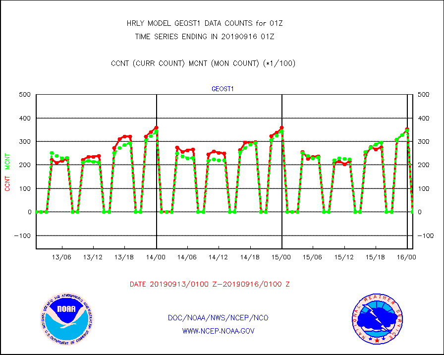
geost1 |
GOES/NESDIS hi-resol. (1x1 f-o-v) sndgs/radiances |
0 |
0 |
n/a |
1600.50-1601.49 |
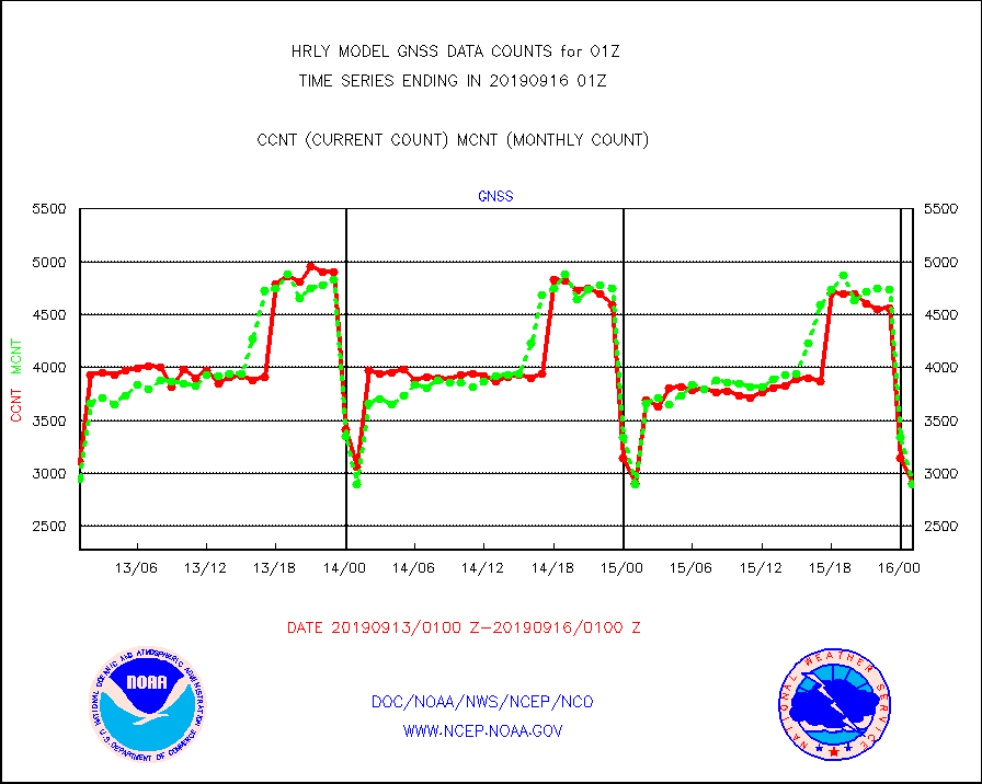
gnss |
Grnd-based Gbl Navigation Sat System (GNSS) data |
2903 |
2896 |
100.2 % |
1600.00-1600.99 |
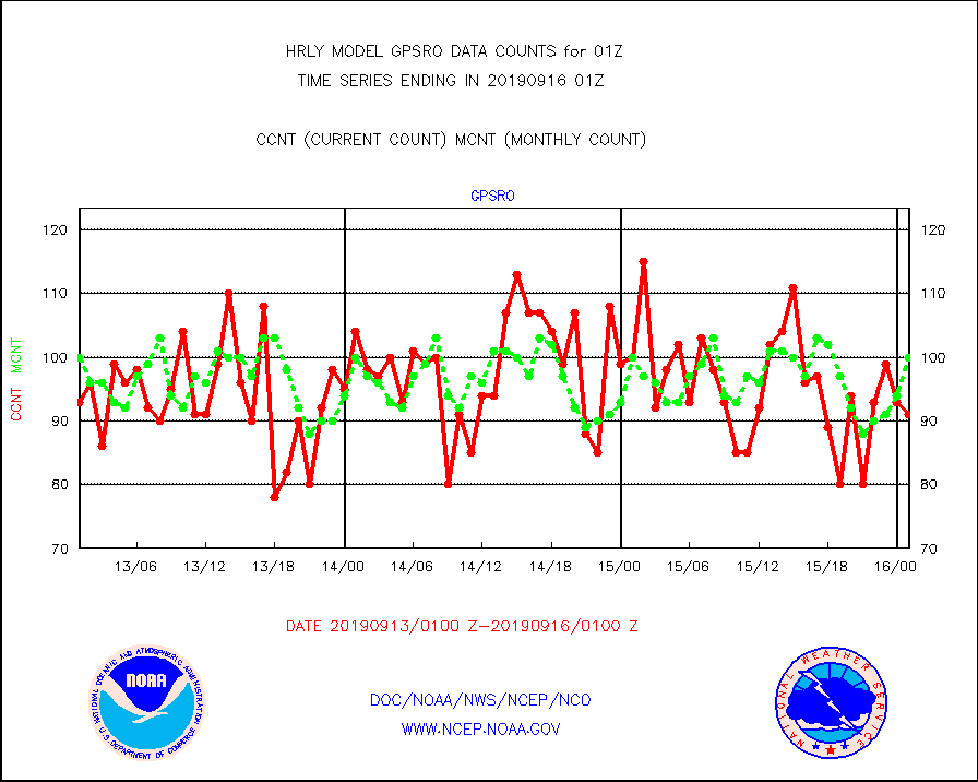
gpsro |
GPS radio occultation data |
91 |
100 |
91.0 % |
1522.50-1523.49 |
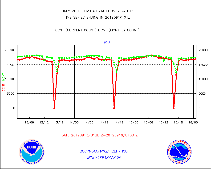
h20ja |
MTSAT/JMA water vapor imager derived cloud motion |
16999 |
17513 |
97.1 % |
1522.50-1523.49 |
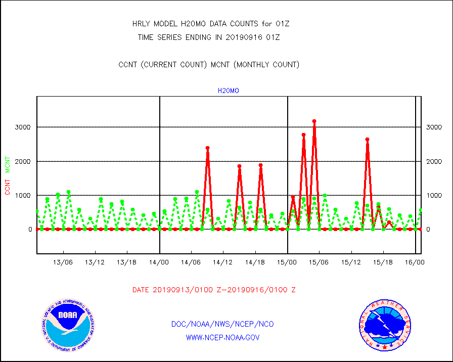
h20mo |
MODIS (AQUA/TERRA) wvpr imager derived cld motion |
0 |
561 |
0.0 % |
1521.00-1521.99 |
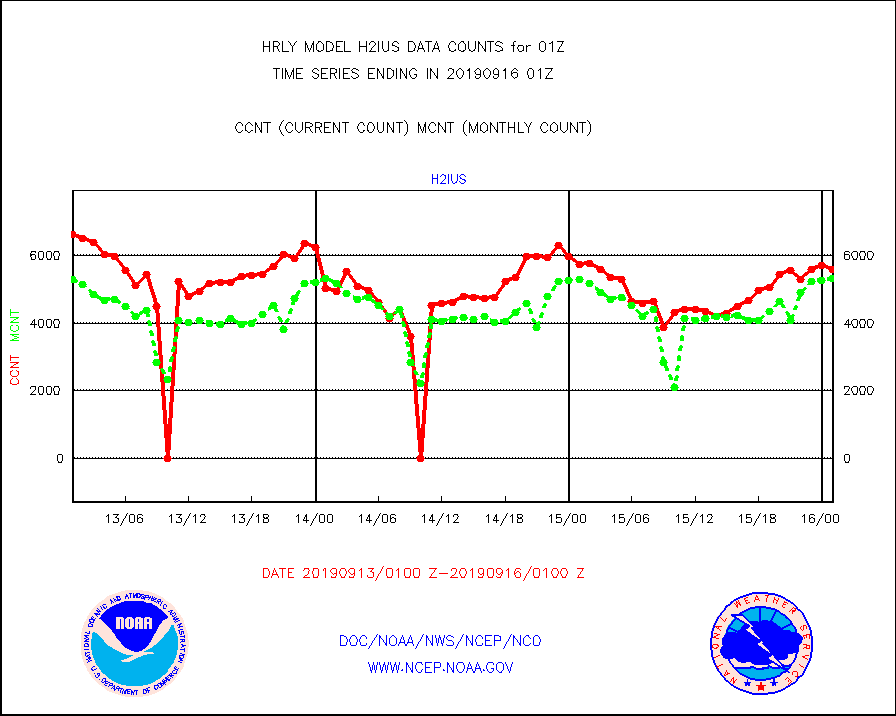
h2ius |
GOES/NESDIS water vapor imager derived cld motion |
5571 |
5315 |
104.8 % |
1600.00-1600.99 |
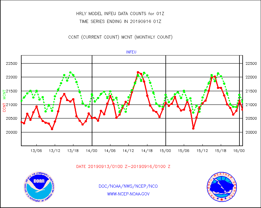
infeu |
METEOSAT/EUMETSAT ir lg-wave derived cloud motion |
20826 |
21104 |
98.7 % |
1523.50-1600.49 |
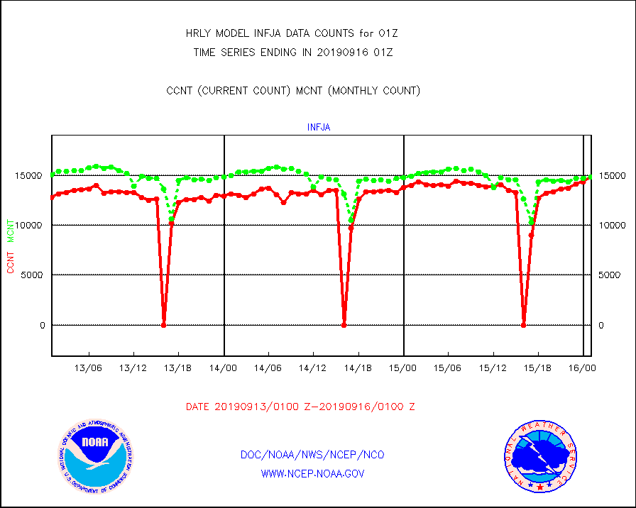
infja |
MTSAT/JMA infrared long-wave derived cloud motion |
14832 |
14820 |
100.1 % |
1522.50-1523.49 |
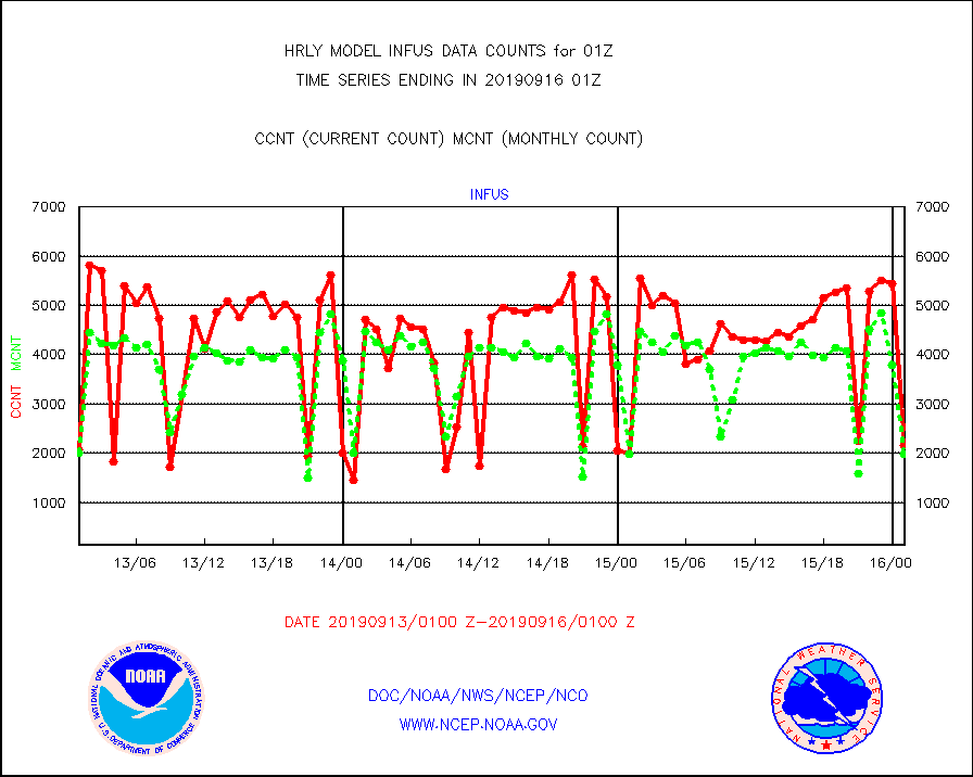
infus |
GOES/NESDIS infrared lg-wave derived cloud motion |
2160 |
1974 |
109.4 % |
1600.00-1600.99 |
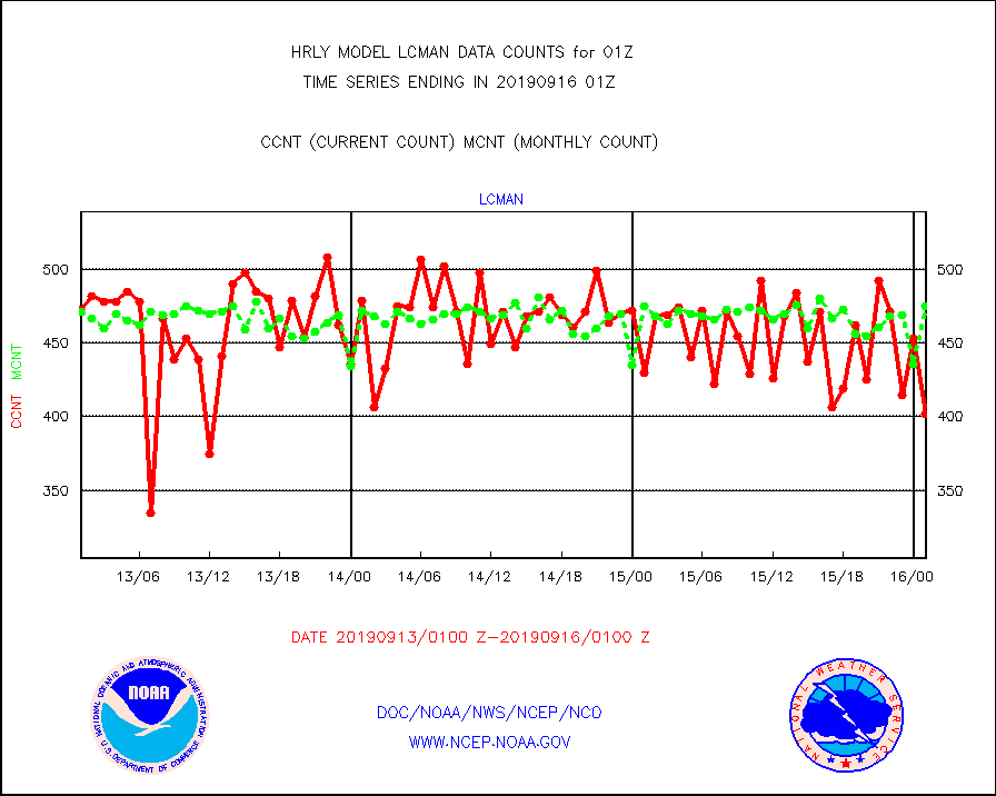
lcman |
Land-based CMAN stations decoded from CMAN format |
402 |
475 |
84.6 % |
1600.50-1601.49 |
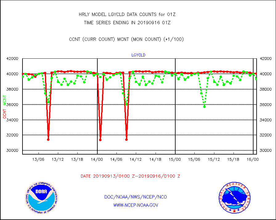
lgycld |
GOES/NASA(Langley) hi-res. (1x1 f-o-v) cloud data |
4005439 |
3932359 |
101.9 % |
1600.50-1601.49 |
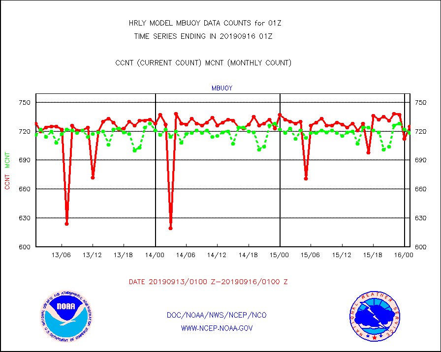
mbuoy |
Buoys decoded from FM-13 format (moored) |
725 |
718 |
101.0 % |
1600.50-1601.49 |
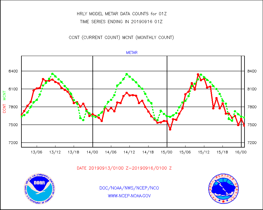
metar |
Aviation - METAR |
7485 |
7624 |
98.2 % |
1600.50-1601.49 |
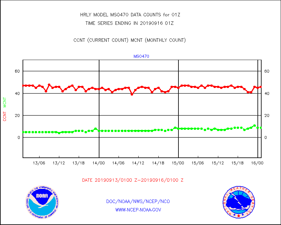
mso470 |
Mesonet/MADIS Colorado E-470 (Interstate 470) |
46 |
9 |
511.1 % |
1600.50-1601.49 |
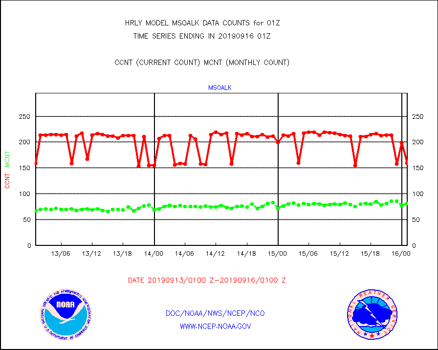
msoalk |
Mesonet/MADIS Alaska Department of Transportation |
160 |
81 |
197.5 % |
1600.50-1601.49 |
msoapg |
Mesonet/MADIS U.S. Army Aberdeen Proving Grounds |
0 |
0 |
n/a |
1600.50-1601.49 |
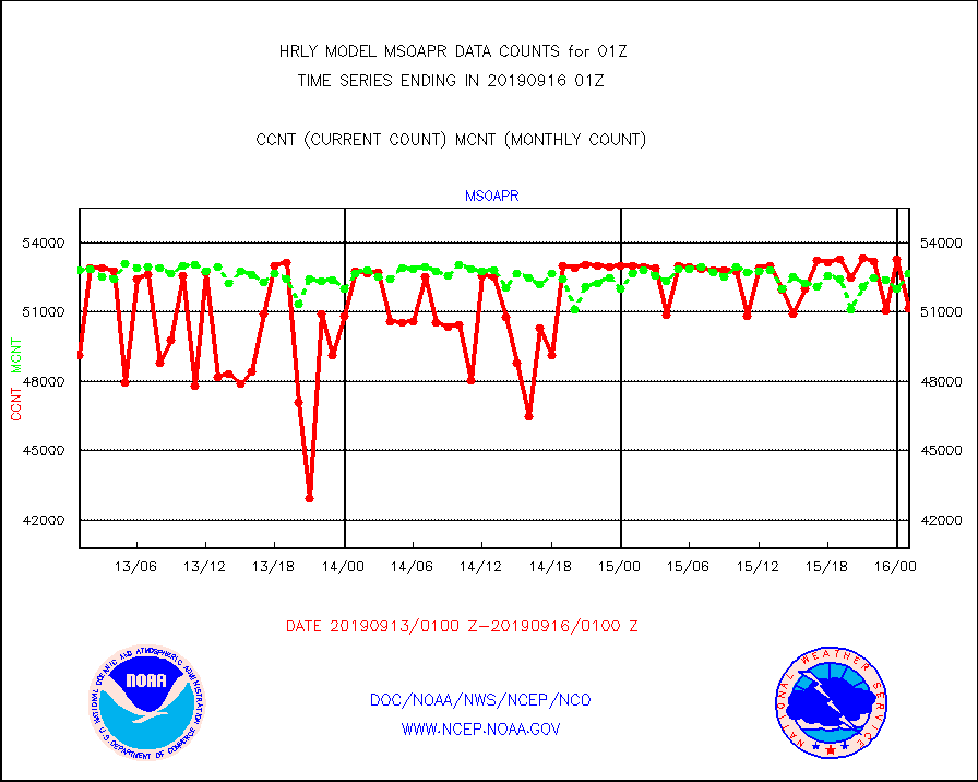
msoapr |
Mesonet/MADIS Citizen Weather Observers Program |
51147 |
52674 |
97.1 % |
1600.50-1601.49 |
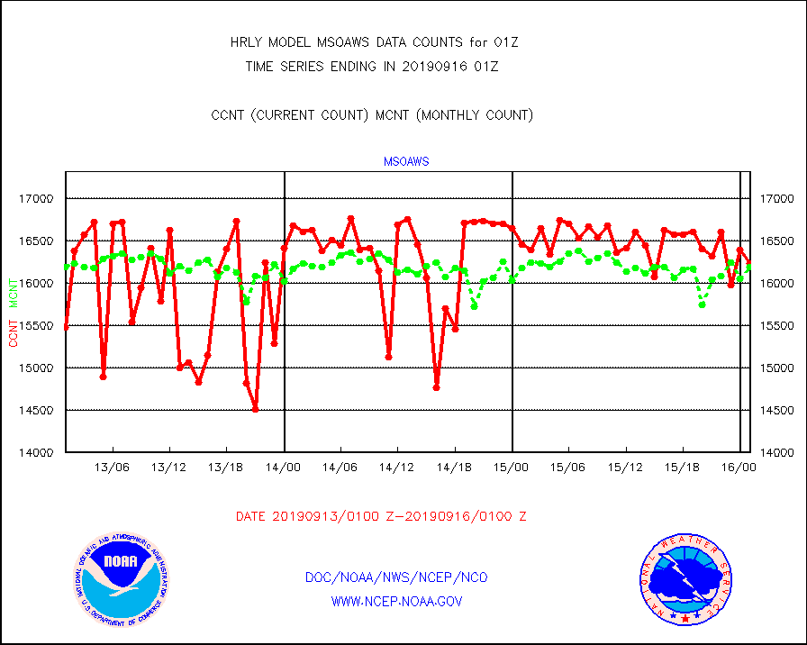
msoaws |
Mesonet/MADIS AWS Convergence Technologies, Inc. |
16240 |
16198 |
100.3 % |
1600.50-1601.49 |
msoawx |
Mesonet/MADIS "Anything Weather" |
0 |
0 |
n/a |
1600.50-1601.49 |
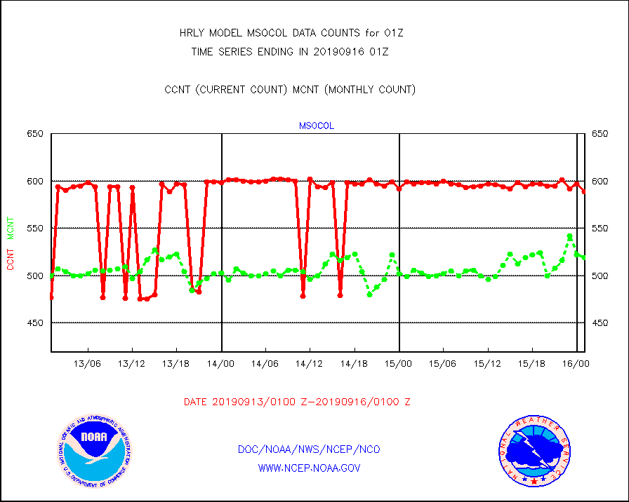
msocol |
Mesonet/MADIS Colorado Dept. of Transportation |
589 |
519 |
113.5 % |
1600.50-1601.49 |
msodcn |
Mesonet/MADIS DC Net |
0 |
0 |
n/a |
1600.50-1601.49 |
msoden |
Mesonet/MADIS Denver Urban Drainage & Flood Cntrl |
0 |
0 |
n/a |
1600.50-1601.49 |
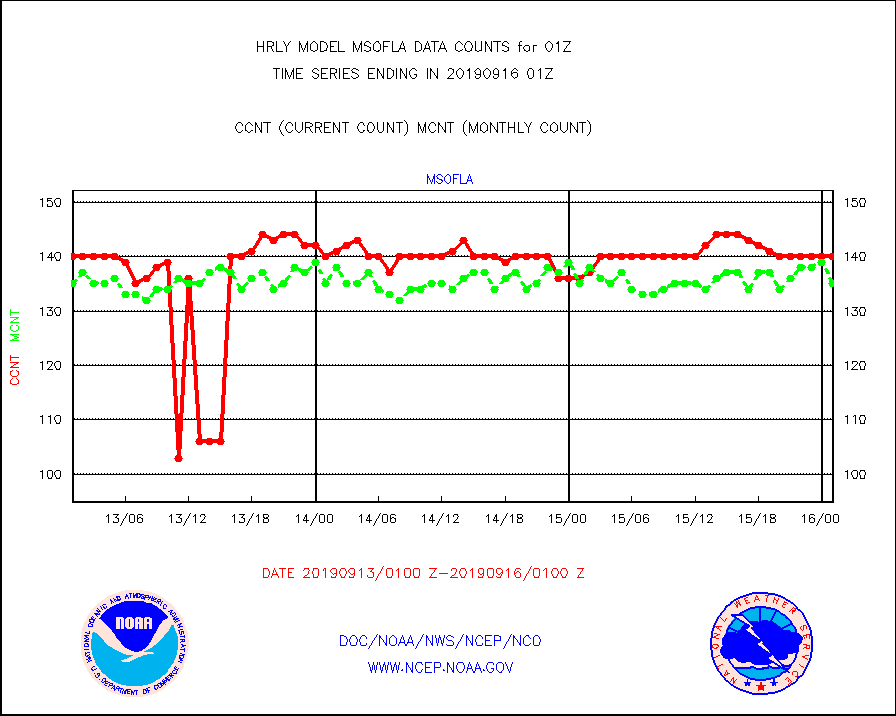
msofla |
Mesonet/MADIS Florida (FAWN & USF) |
140 |
135 |
103.7 % |
1600.50-1601.49 |
msoflt |
Mesonet/MADIS Florida Dept. of Transportation |
0 |
0 |
n/a |
1600.50-1601.49 |
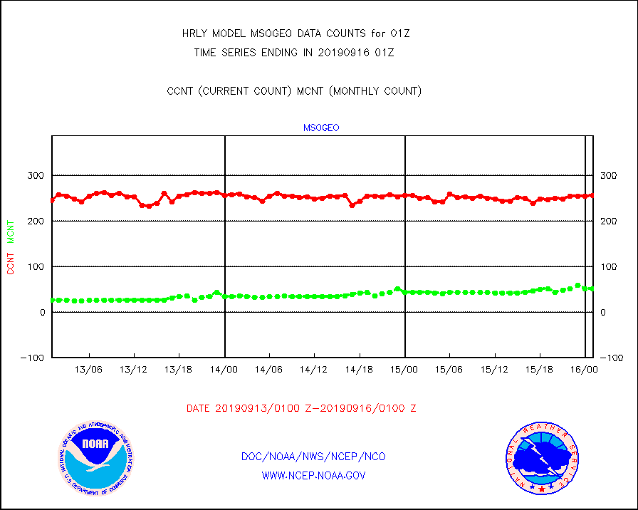
msogeo |
Mesonet/MADIS Georgia Dept. of Transportation |
257 |
51 |
503.9 % |
1600.50-1601.49 |
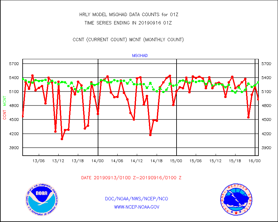
msohad |
Mesonet/MADIS NWS Hydromet Auto Data System(HADS) |
4933 |
5297 |
93.1 % |
1600.50-1601.49 |
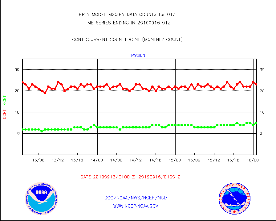
msoien |
Mesonet/MADIS Iowa Environmental |
23 |
5 |
460.0 % |
1600.50-1601.49 |
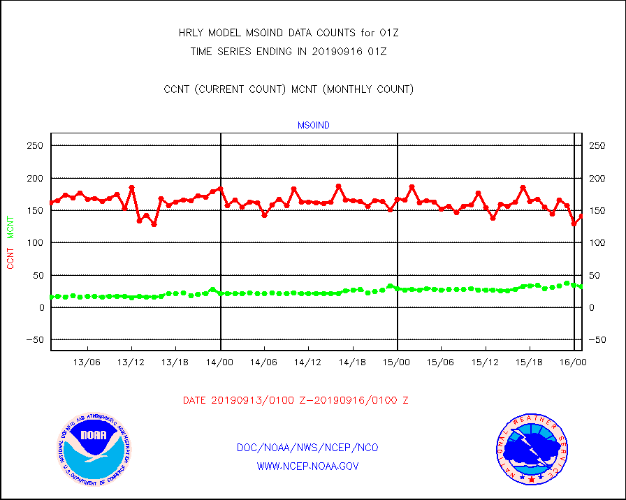
msoind |
Mesonet/MADIS Indiana Dept. of Transportation |
141 |
32 |
440.6 % |
1600.50-1601.49 |
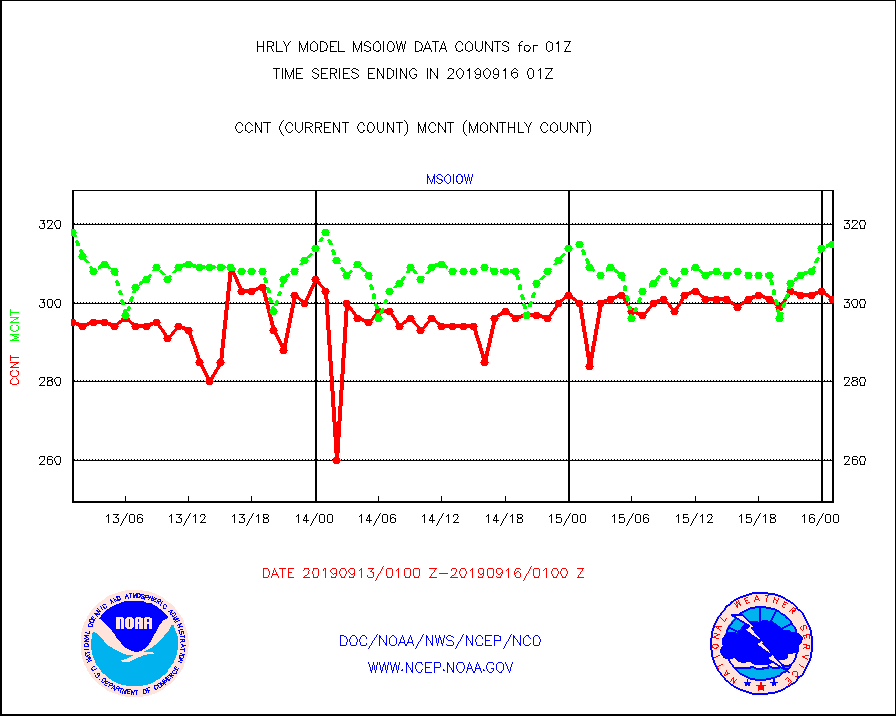
msoiow |
Mesonet/MADIS Iowa Department of Transportation |
301 |
315 |
95.6 % |
1600.50-1601.49 |
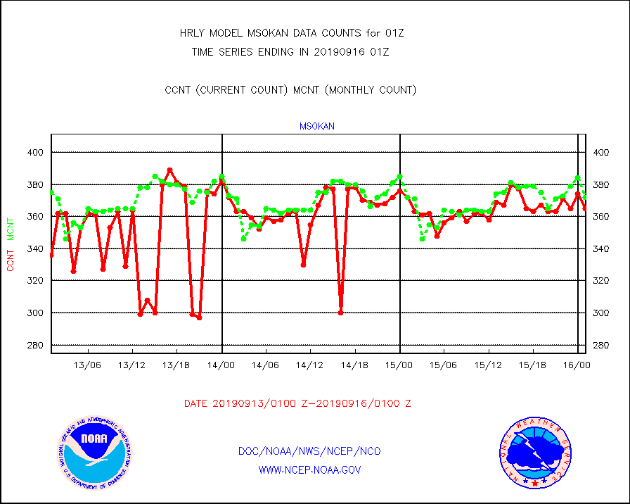
msokan |
Mesonet/MADIS Kansas Department of Transportation |
365 |
372 |
98.1 % |
1600.50-1601.49 |
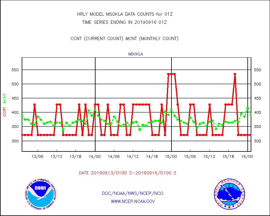
msokla |
Mesonet/MADIS Oklahoma Mesonet |
321 |
392 |
81.9 % |
1600.50-1601.49 |
msolju |
Mesonet/MADIS Louisiana State/Jackson State Univ. |
0 |
0 |
n/a |
1600.50-1601.49 |
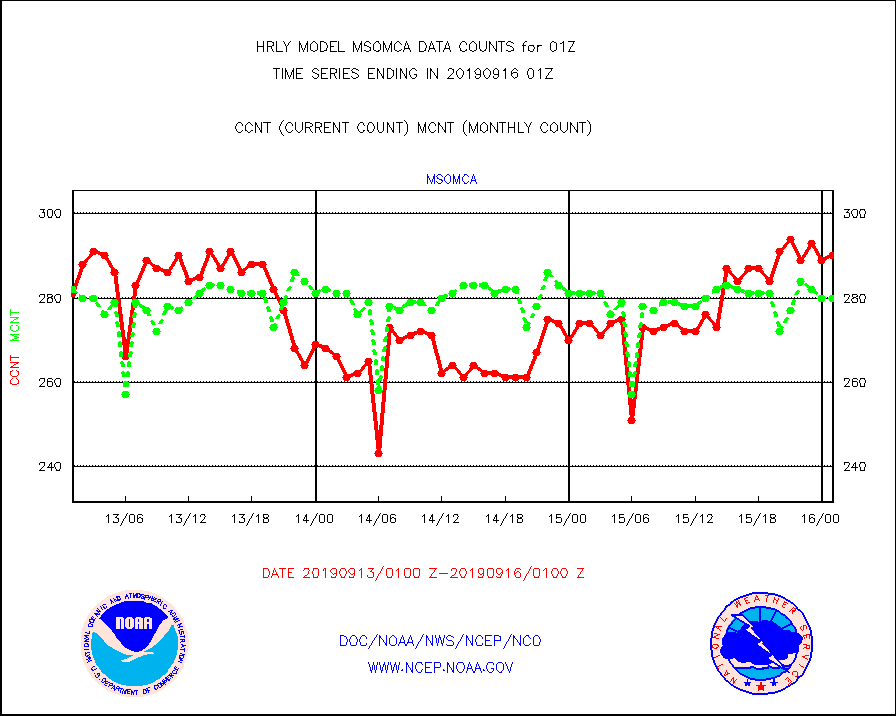
msomca |
Mesonet/MADIS Missouri Commercial Agricult Wx Net |
290 |
280 |
103.6 % |
1600.50-1601.49 |
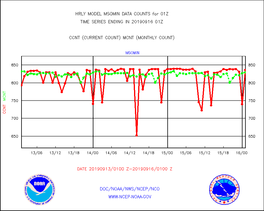
msomin |
Mesonet/MADIS Minnesota Dept. of Transportation |
836 |
830 |
100.7 % |
1600.50-1601.49 |
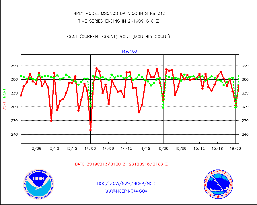
msonos |
Mesonet/MADIS NOS-Phys Oceanographic Realtime Sys |
347 |
368 |
94.3 % |
1600.50-1601.49 |
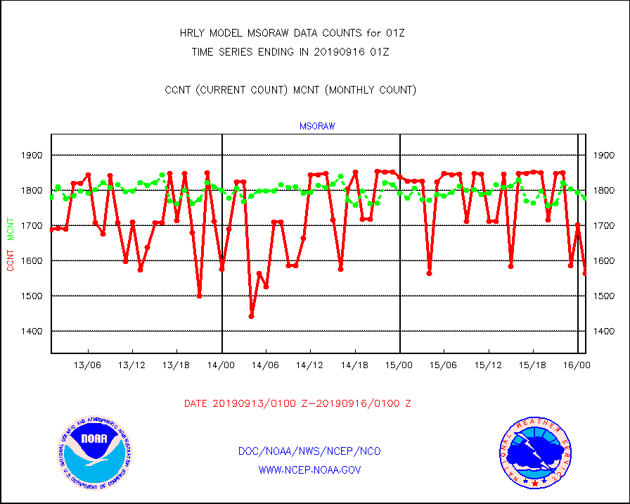
msoraw |
Mesonet/MADIS NFIC Remote Automated Wx Stns(RAWS) |
1565 |
1779 |
88.0 % |
1600.50-1601.49 |
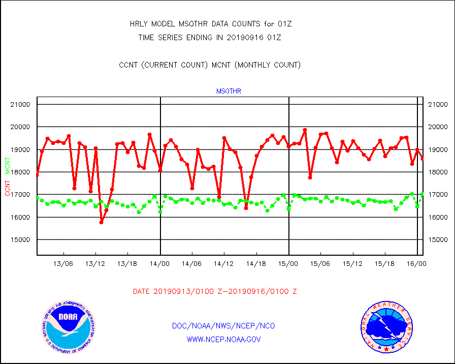
msothr |
Mesonet/MADIS many providers, not separated out |
18591 |
17038 |
109.1 % |
1600.50-1601.49 |
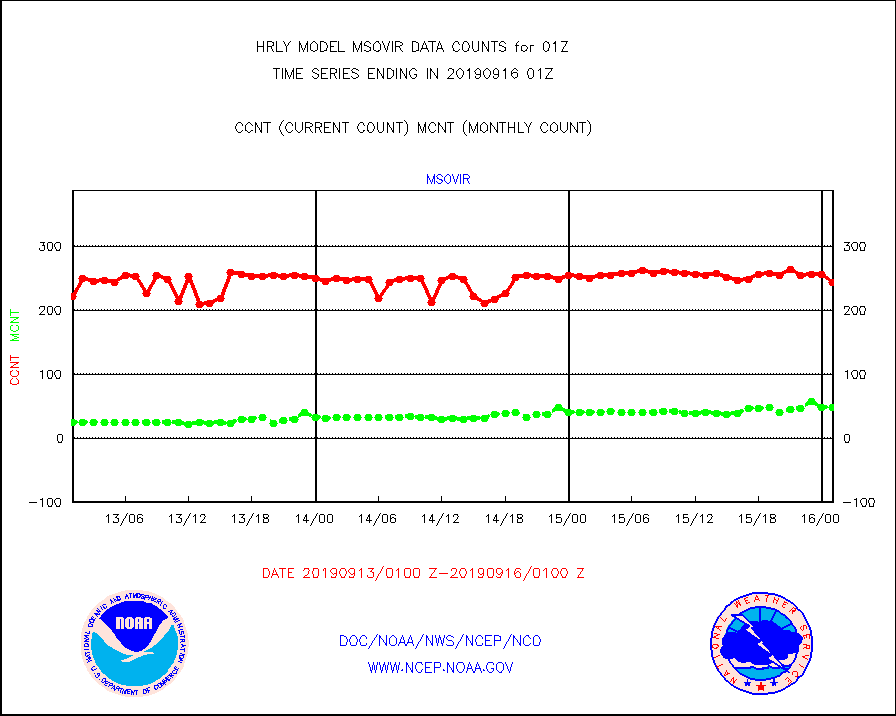
msovir |
Mesonet/MADIS Virginia Dept. of Transportation |
245 |
48 |
510.4 % |
1600.50-1601.49 |
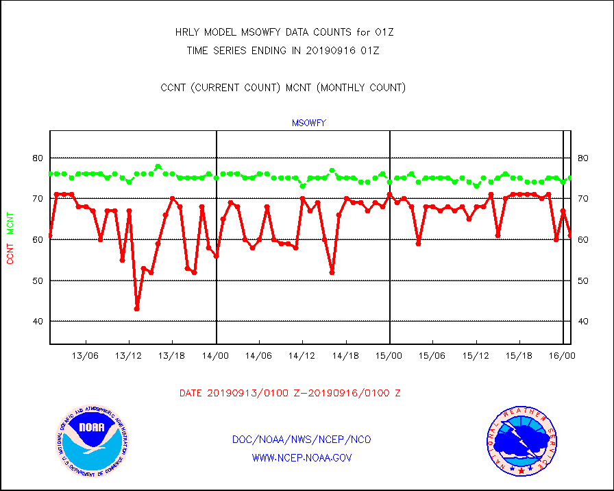
msowfy |
Mesonet/MADIS "Weather for You" |
61 |
75 |
81.3 % |
1600.50-1601.49 |
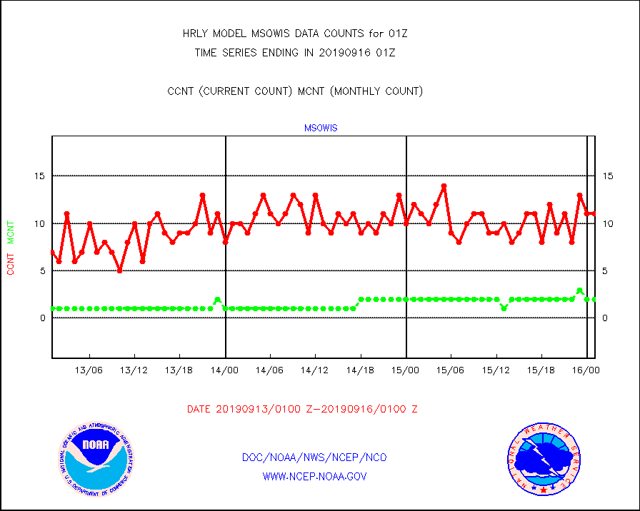
msowis |
Mesonet/MADIS Wisconsin Dept. of Transportation |
11 |
2 |
550.0 % |
1600.50-1601.49 |
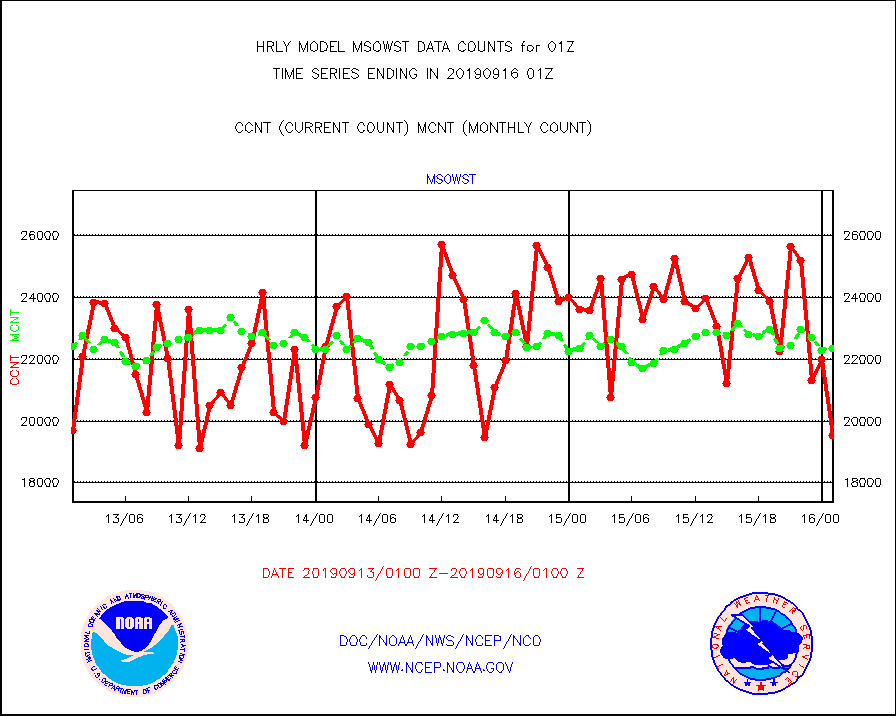
msowst |
Mesonet/MADIS MesoWest (many subproviders) |
19519 |
22358 |
87.3 % |
1600.50-1601.49 |
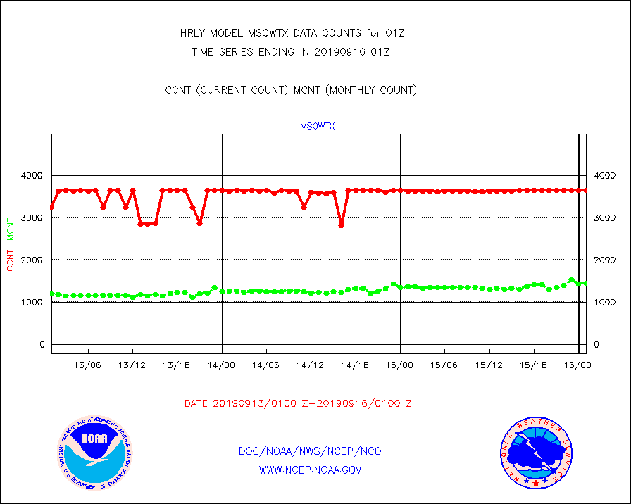
msowtx |
Mesonet/MADIS West Texas |
3641 |
1445 |
252.0 % |
1600.50-1601.49 |
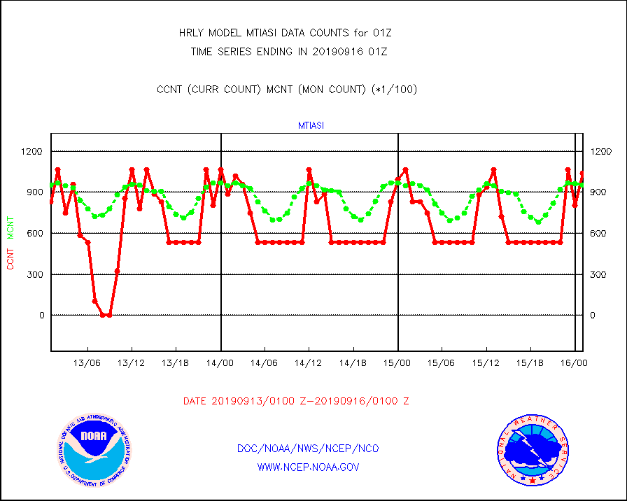
mtiasi |
METOP 1-2 IASI 1C radiance data (varbl. channels) |
104256 |
95327 |
109.4 % |
1523.00-1523.99 |
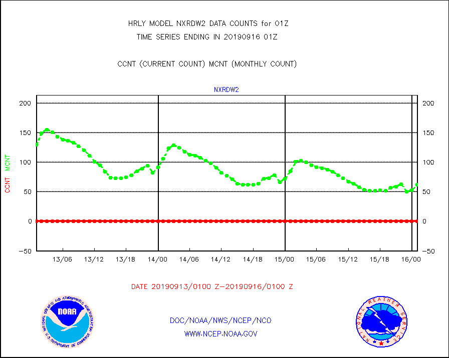
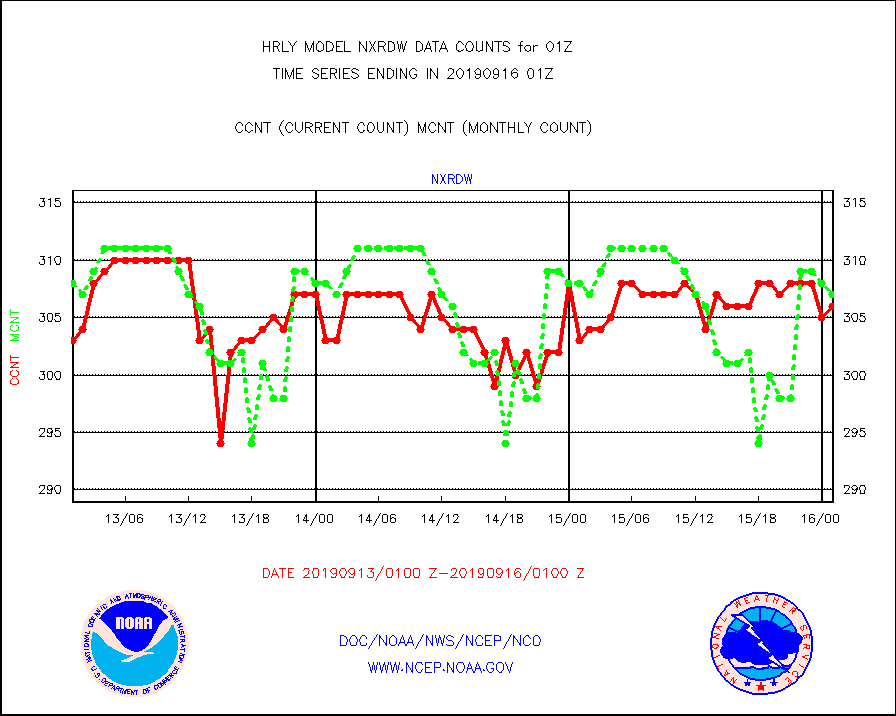
nxrdw |
NEXRAD Vel Azm Dsp(VAD) winds via radar coded msg |
306 |
307 |
99.7 % |
1600.50-1601.49 |
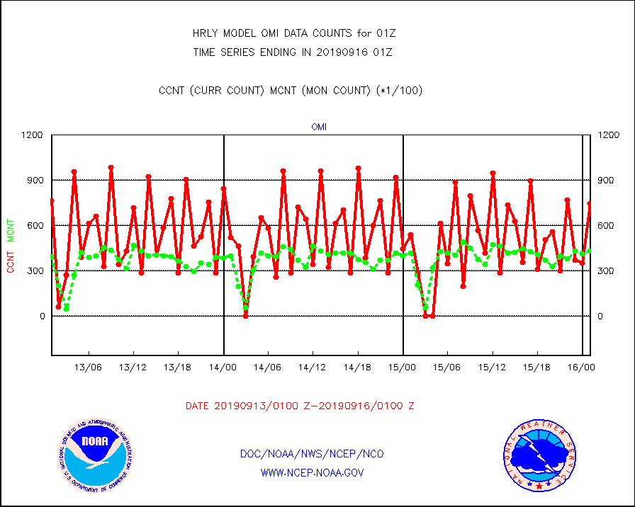
omi |
Aura Ozone Monitoring Instrument (OMI) data |
74880 |
42910 |
174.5 % |
1522.50-1523.49 |
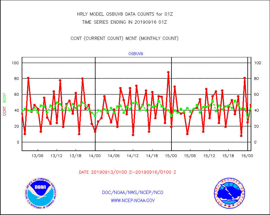
osbuv8 |
NOAA 16-19 Solar Backscatter UV-2 rad frm V8 BUFR |
47 |
42 |
111.9 % |
1523.00-1523.99 |
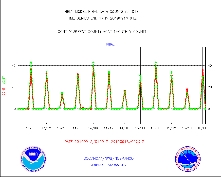
pibal |
PIBAL (from PILOT, PILOT SHIP, PILOT MOBIL) |
0 |
0 |
n/a |
1600.50-1601.49 |
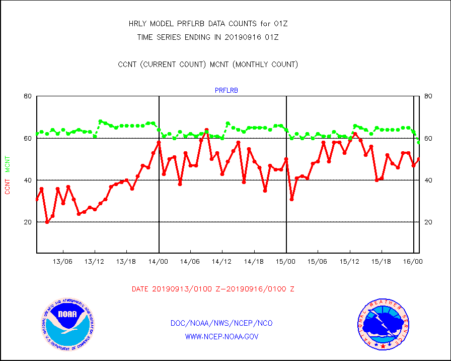
prflrb |
Multi-Agency Profiler (MAP) and SODAR winds |
50 |
58 |
86.2 % |
1600.50-1601.49 |
radw25 |
NEXRAD radial wind superobs (Level 2.5 - ORPG) |
0 |
0 |
n/a |
1523.50-1600.49 |
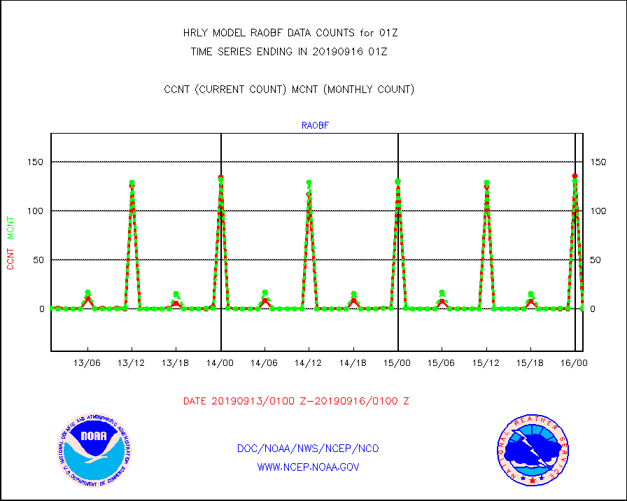
raobf |
Rawinsonde - fixed land (from TEMP or PILOT) |
0 |
1 |
0.0 % |
1600.50-1601.49 |
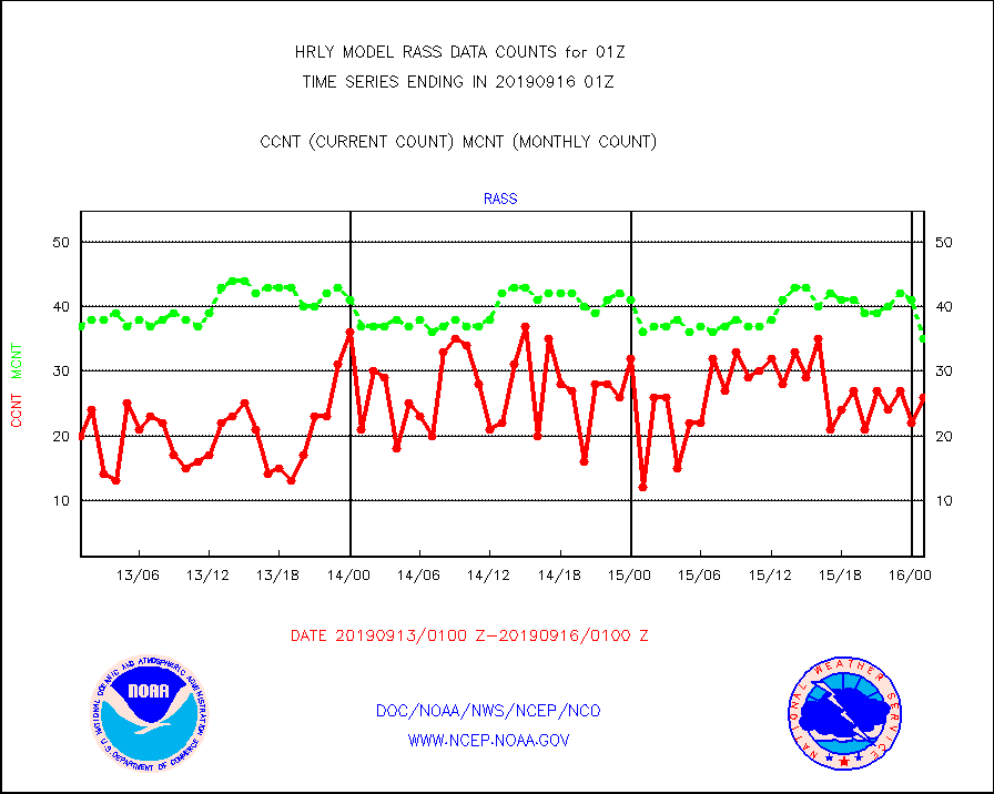
rass |
RASS temperatures (NOAA and Multi-Agency) |
26 |
35 |
74.3 % |
1600.50-1601.49 |
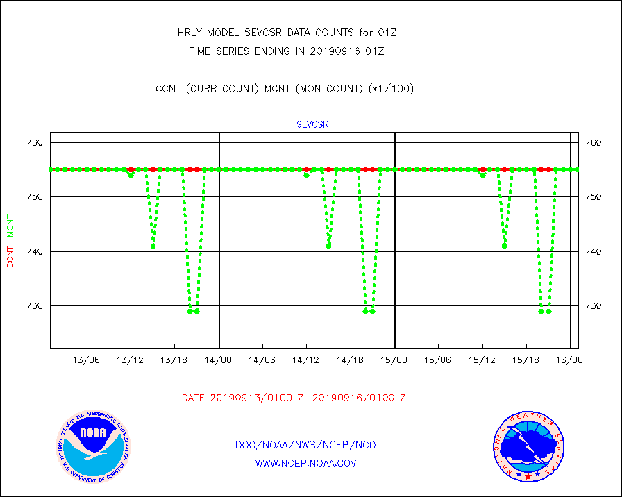
sevcsr |
METEOSAT-10 2nd Gen SEVIRI Clr Sky Radiance(proc) |
75512 |
75512 |
100.0 % |
1600.50-1601.49 |
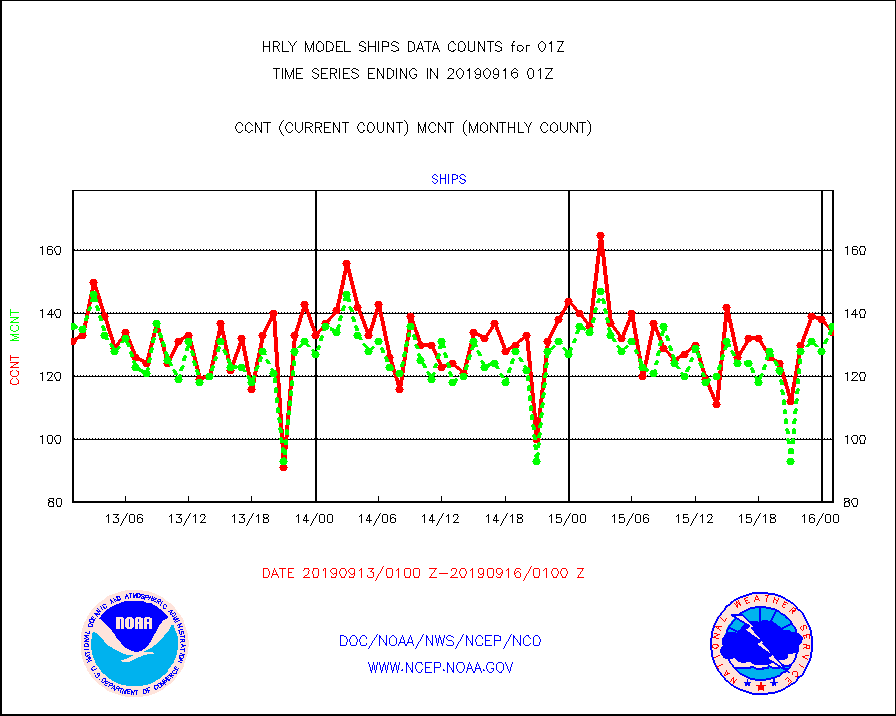
ships |
Ship - manual and automatic, restricted |
134 |
136 |
98.5 % |
1600.50-1601.49 |
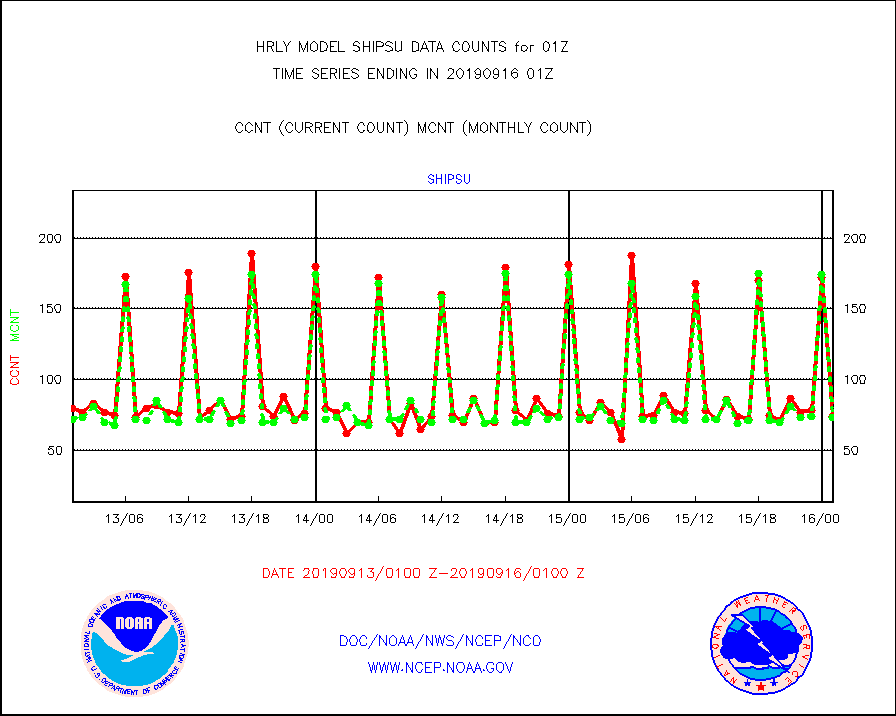
shipsu |
Ship - manual and automatic, unrestricted |
74 |
73 |
101.4 % |
1600.50-1601.50 |
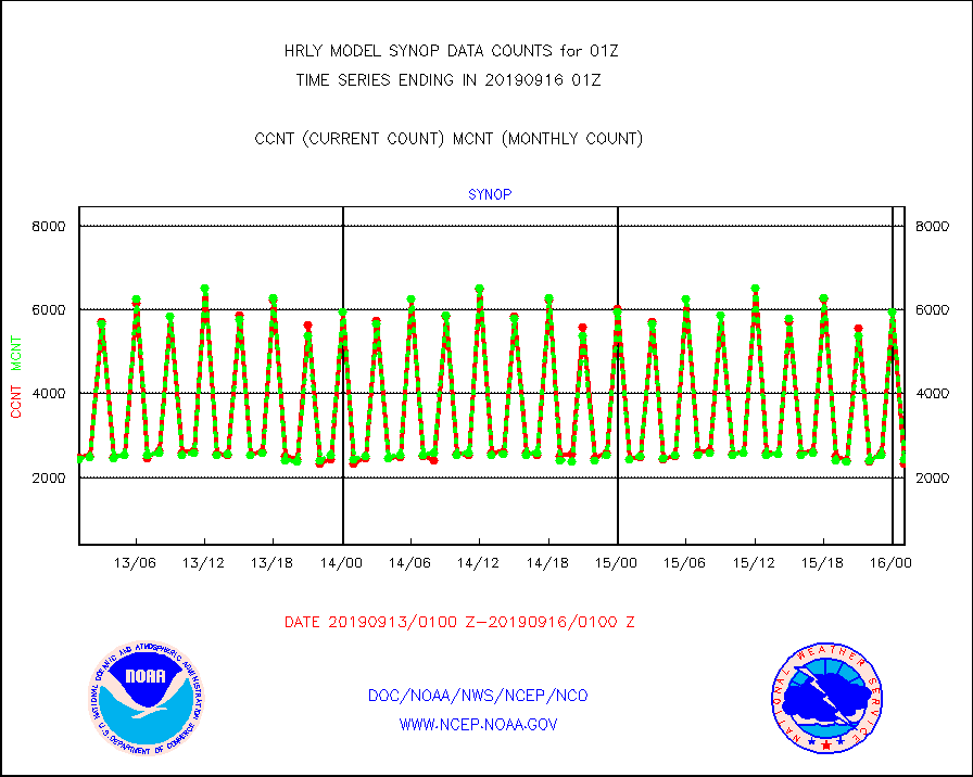
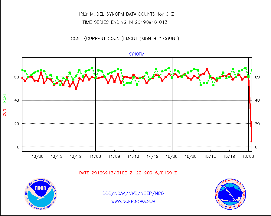
synop |
Synoptic - fixed manual and automatic |
2332 |
2428 |
96.0 % |
1600.50-1601.49 |
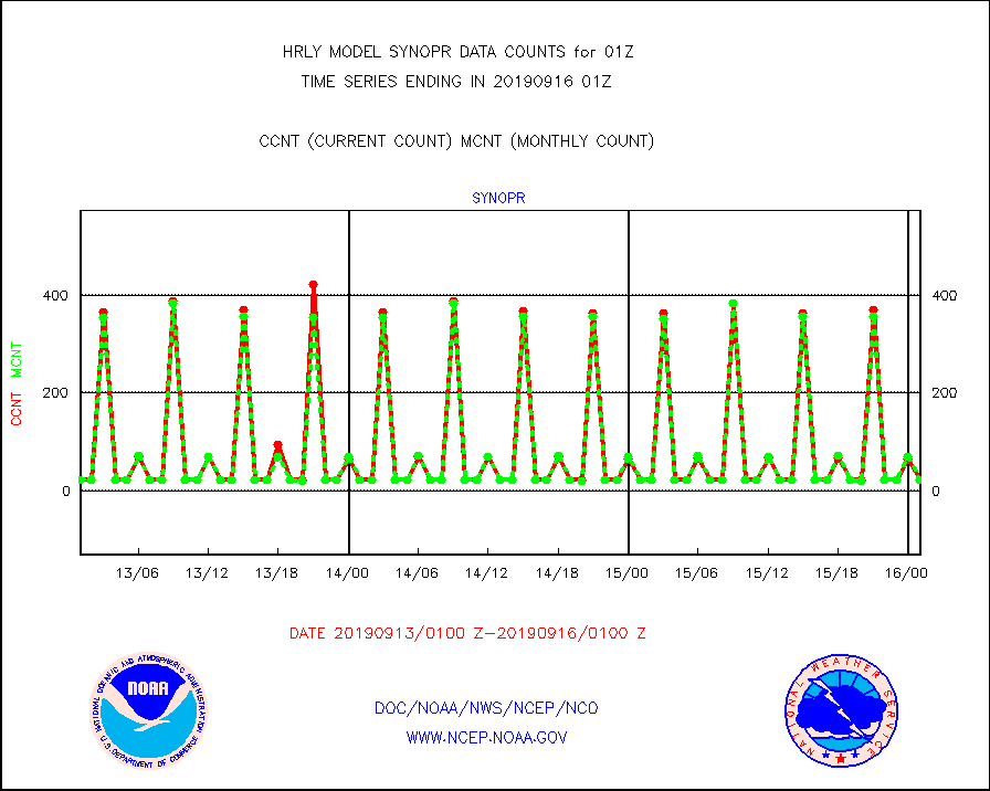
synopr |
Synoptic - restricted (WMO Res 40) manual & auto. |
23 |
23 |
100.0 % |
1600.50-1601.49 |
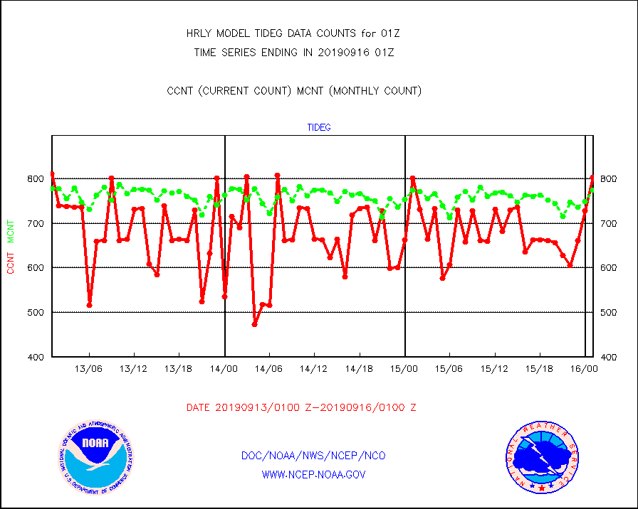
tideg |
Tide gauge reports decoded from CREX format |
804 |
775 |
103.7 % |
1600.00-1600.99 |
| Data Types of Opportunity with Normal Counts |
|---|
| Type | Description | Hourly Count | Monthly Average | Percent (%) of Monthly Mean | UTC Time Window |
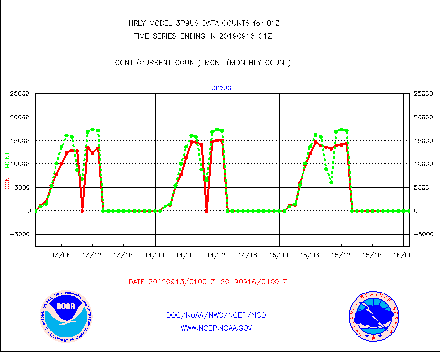
3p9us |
GOES/NESDIS infrared shrt-wave derived cld motion |
0 |
0 |
n/a |
1600.00-1600.99 |
acarsa |
MDCRS ACARS acft data (ARINC via AFWA)(AIREP fmt) |
0 |
0 |
n/a |
1600.50-1601.49 |
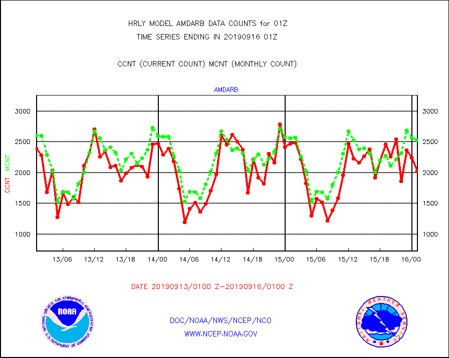
amdarb |
AMDAR aircraft data (decoded from BUFR) |
2025 |
2530 |
80.0 % |
1600.50-1601.49 |
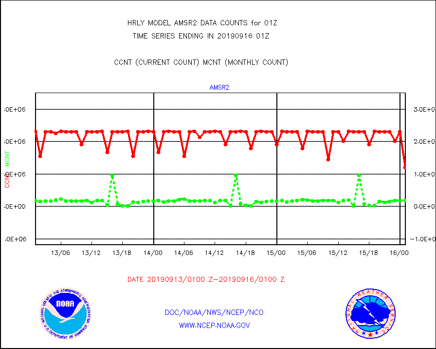
amsr2 |
GCOM-W AMSR2 1B brightness temperatures |
1205280 |
2177896 |
55.3 % |
1523.00-1523.99 |
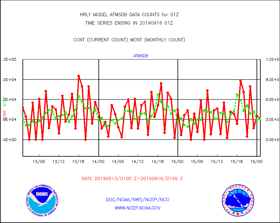
atmsdb |
NPP Adv Tech MW Sndr(ATMS) b. temps-dir bcst SSEC |
31776 |
30701 |
103.5 % |
1523.50-1600.49 |
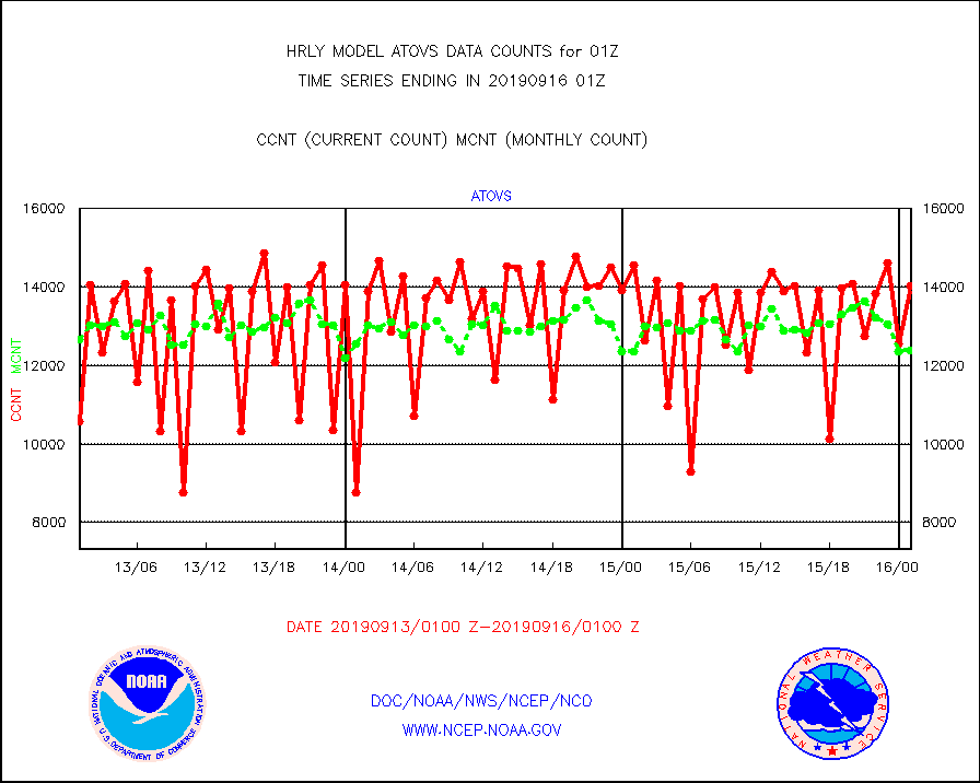
atovs |
POES/NESDIS - processed ATOVS soundings/radiances |
14026 |
12378 |
113.3 % |
1523.00-1523.99 |
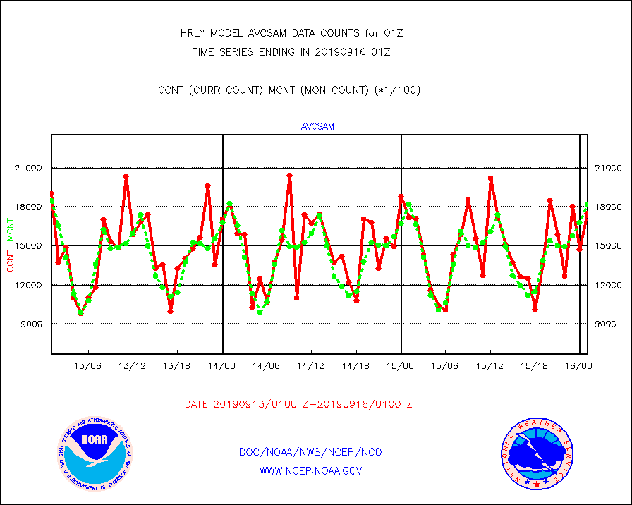
avcsam |
A.M.(N17,M2) AVHRR GAC NCEP-proc clr & sea btemps |
1750413 |
1815713 |
96.4 % |
1522.50-1523.49 |
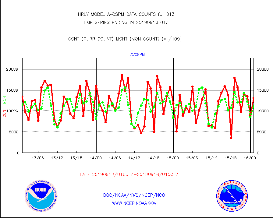
avcspm |
P.M.(N18-19) AVHRR GAC NCEP-proc clr & sea btemps |
1315608 |
1118450 |
117.6 % |
1522.50-1523.49 |
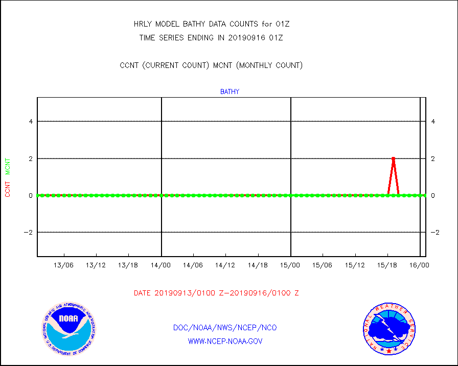
bathy |
Bathythermal |
0 |
0 |
n/a |
1518.00-1518.99 |
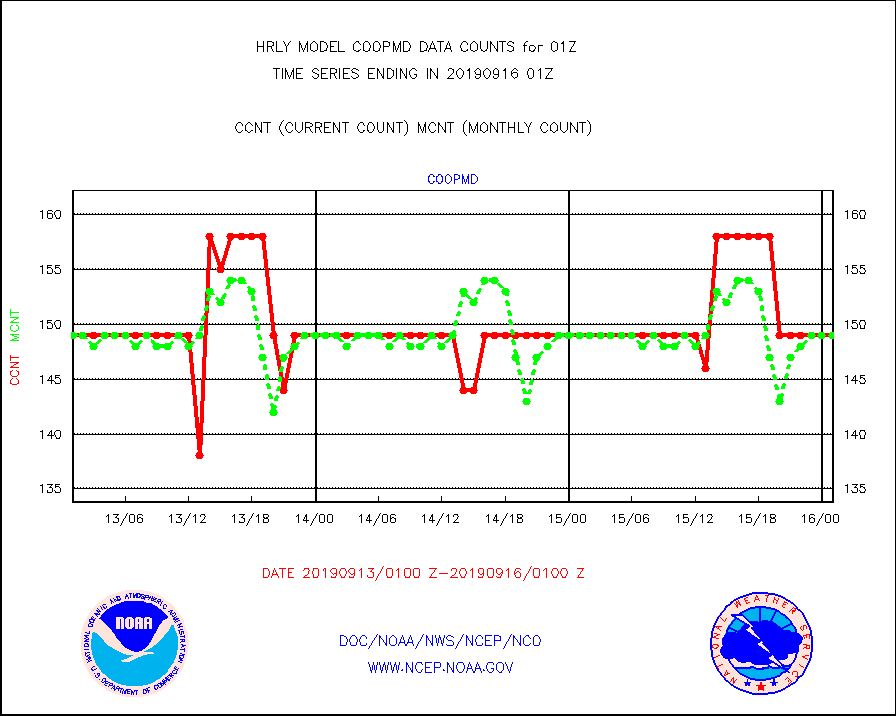
coopmd |
Coop/MADIS NEPP & HCN-Modernization NOAA COOP Obs |
149 |
149 |
100.0 % |
1600.50-1601.49 |
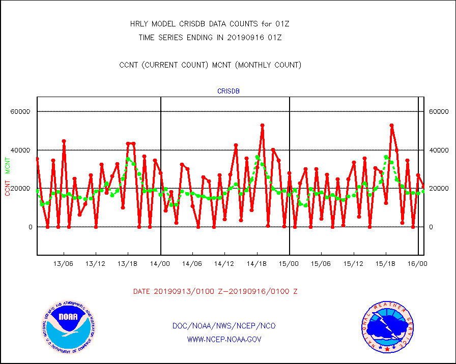
crisdb |
NPP Crss-trk IR Sndr(CrIS) radiance-dir bcst SSEC |
20979 |
18435 |
113.8 % |
1523.50-1600.49 |
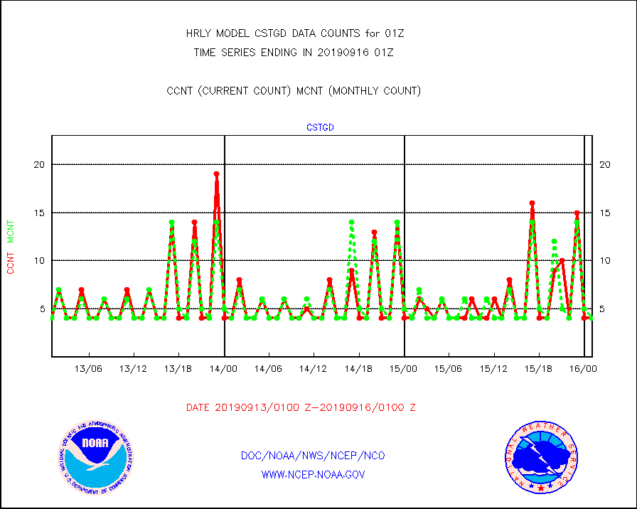
cstgd |
Coast Guard |
4 |
4 |
100.0 % |
1600.50-1601.50 |
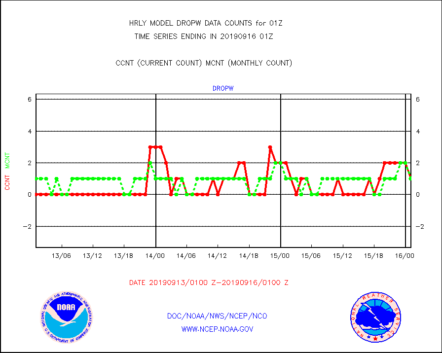
dropw |
Dropwinsonde (from TEMP DROP) |
1 |
1 |
100.0 % |
1600.50-1601.49 |
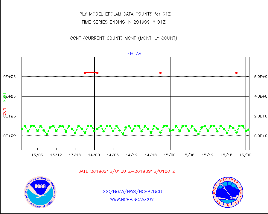
efclam |
GOES imager effective cloud amount data (U.Wisc.) |
9780530 |
9626697 |
101.6 % |
1600.50-1601.49 |
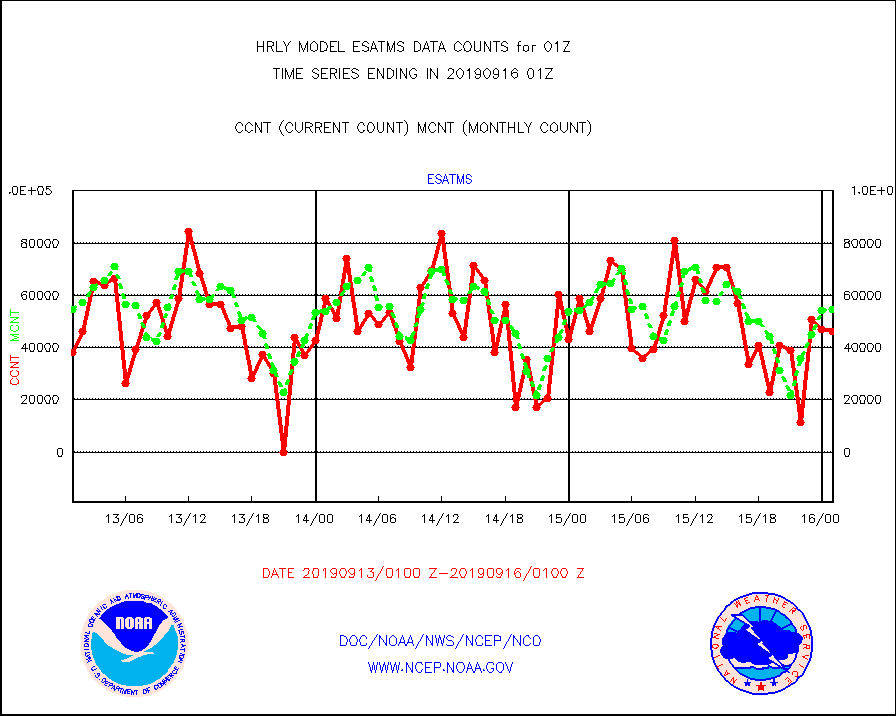
esatms |
NPP Adv. Tech. MW Sndr (ATMS) br. temps from RARS |
46080 |
54643 |
84.3 % |
1523.50-1600.49 |
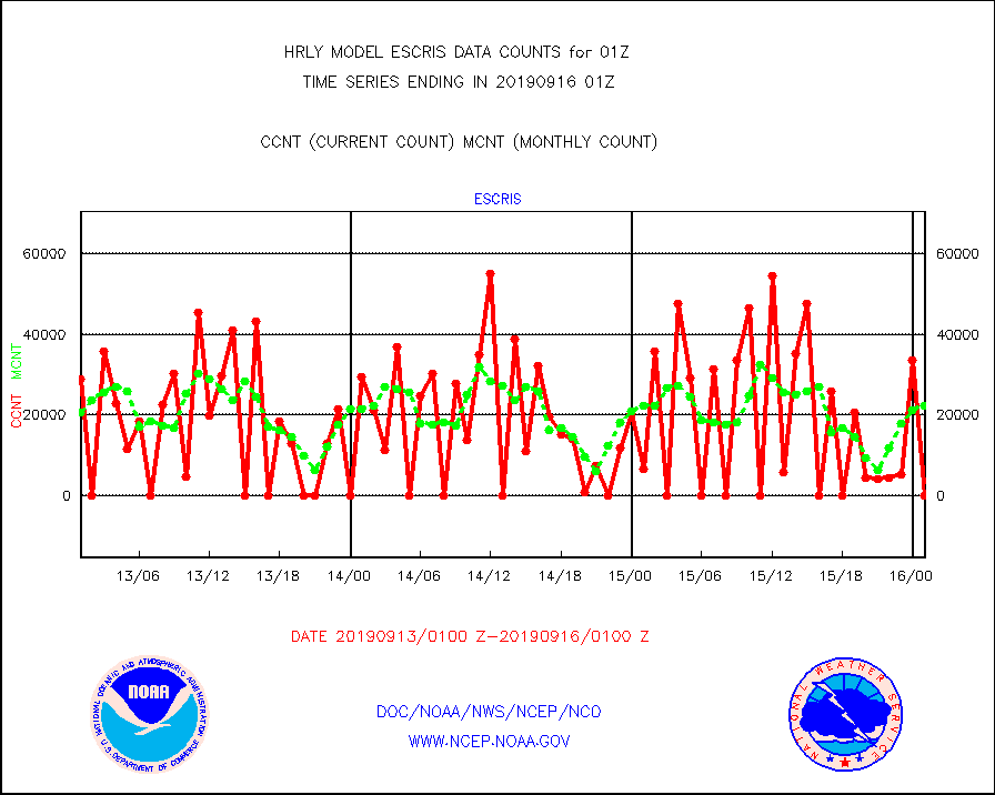
escris |
NPP Crss-track IR Sndr (CrIS) radiances from RARS |
0 |
22430 |
0.0 % |
1523.50-1600.49 |
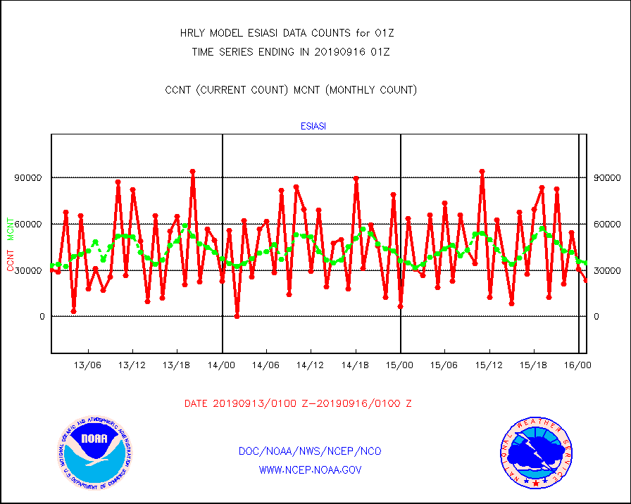
esiasi |
METOP 1-2 IASI 1C radiance data vbl chn from RARS |
23206 |
34974 |
66.4 % |
1600.00-1600.99 |
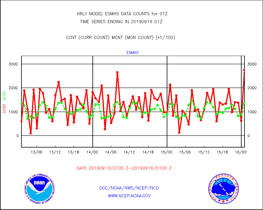
esmhs |
NOAA 18-19 & METOP 1-2 MHS proc. btemps from RARS |
275250 |
136466 |
201.7 % |
1600.50-1601.49 |
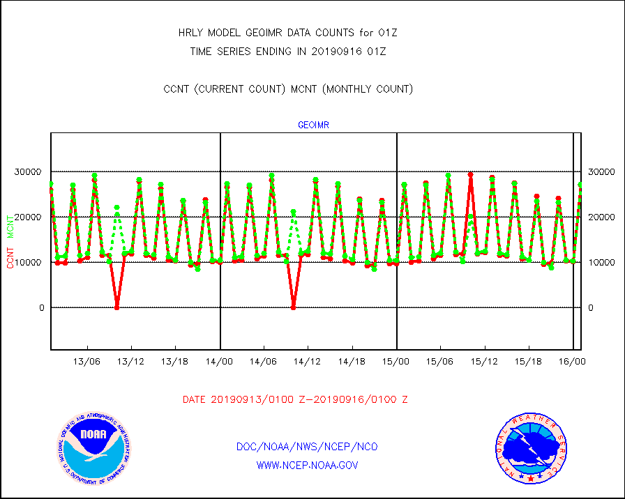
geoimr |
GOES/NESDIS (11x17 f-o-v) imager clear radiances |
27109 |
27281 |
99.4 % |
1600.00-1600.99 |
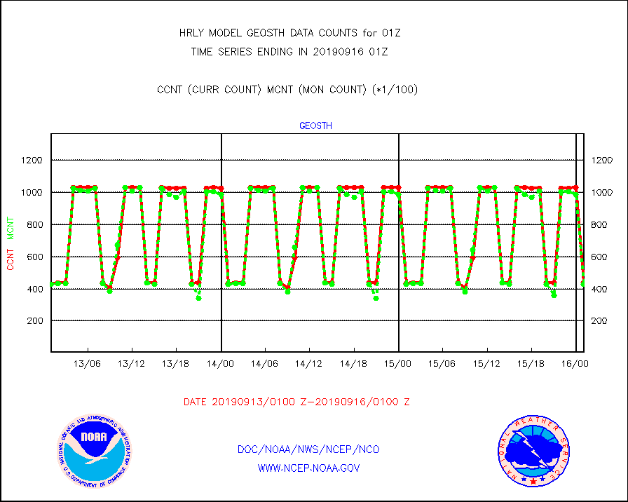
geosth |
GOES/NESDIS hi-resol. (1x1 f-o-v) cloud data |
43570 |
42744 |
101.9 % |
1600.00-1600.99 |
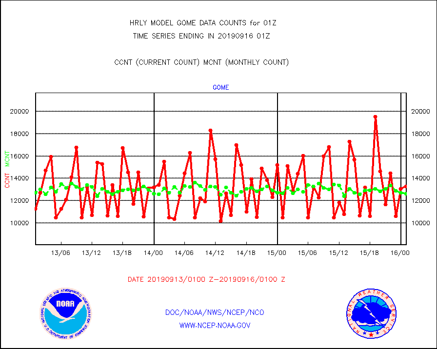
gome |
METOP 1-2 Global Ozone Monitoring Exp.-2 (GOME-2) |
13280 |
12620 |
105.2 % |
1523.50-1600.49 |
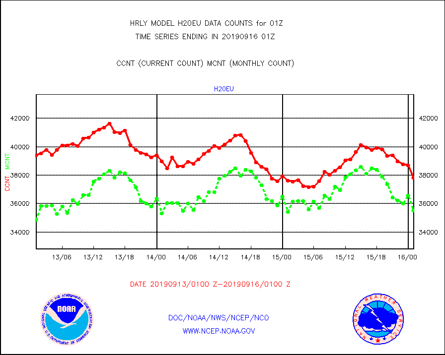
h20eu |
METEOSAT/EUMETSAT wvpr imager derived cld motion |
37819 |
35519 |
106.5 % |
1523.50-1600.49 |
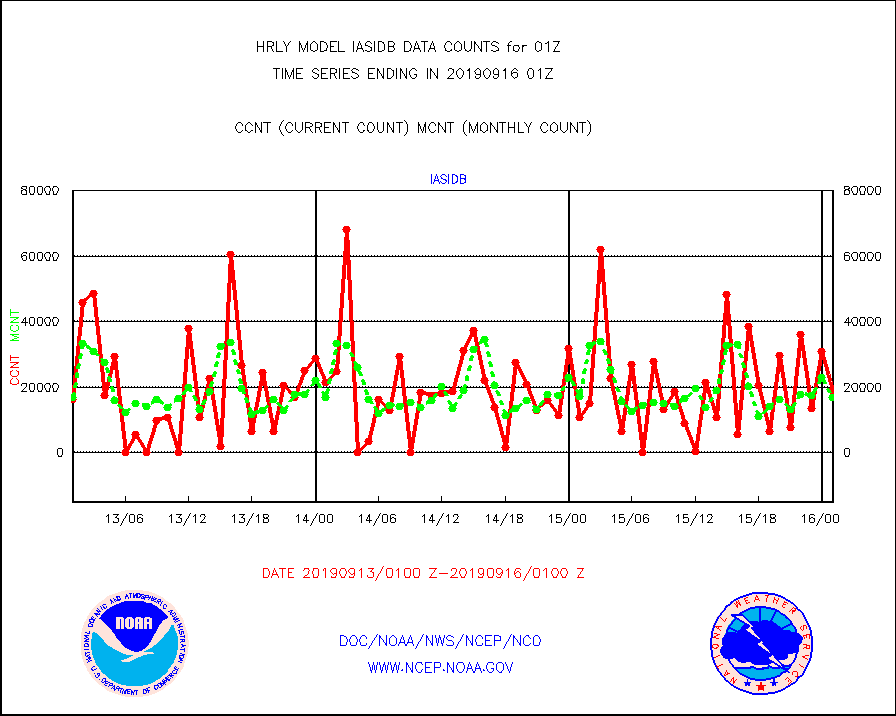
iasidb |
METOP 1-2 IASI 1C radiances-direct broadcast SSEC |
19080 |
16728 |
114.1 % |
1523.50-1600.49 |
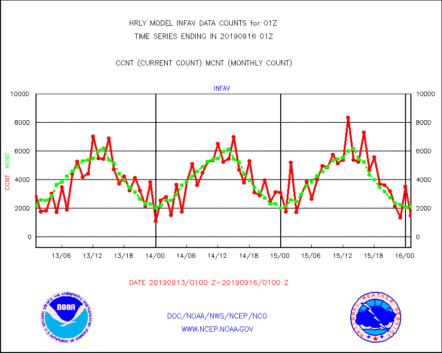
infav |
AVHRR (NOAA/METOP) ir lg-wave derived cld motion |
1488 |
2116 |
70.3 % |
1521.00-1521.99 |
infin |
INSAT/KALPANA India ir lg-wave derived cld motion |
0 |
0 |
n/a |
1522.50-1523.49 |
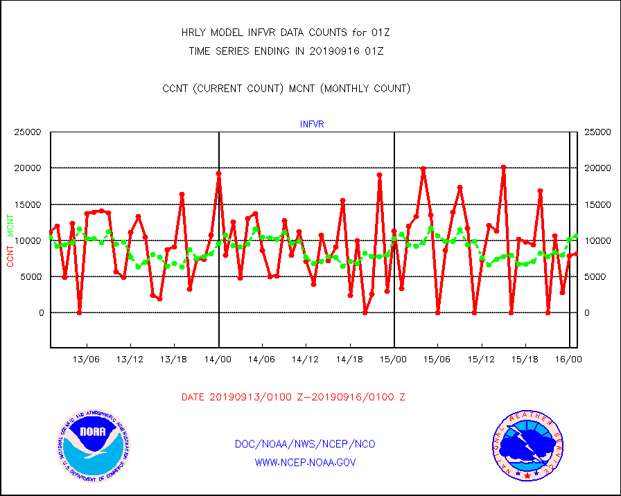
infvr |
VIIRS (NPP) infrared lg-wave derived cloud motion |
8122 |
10639 |
76.3 % |
1521.00-1521.99 |
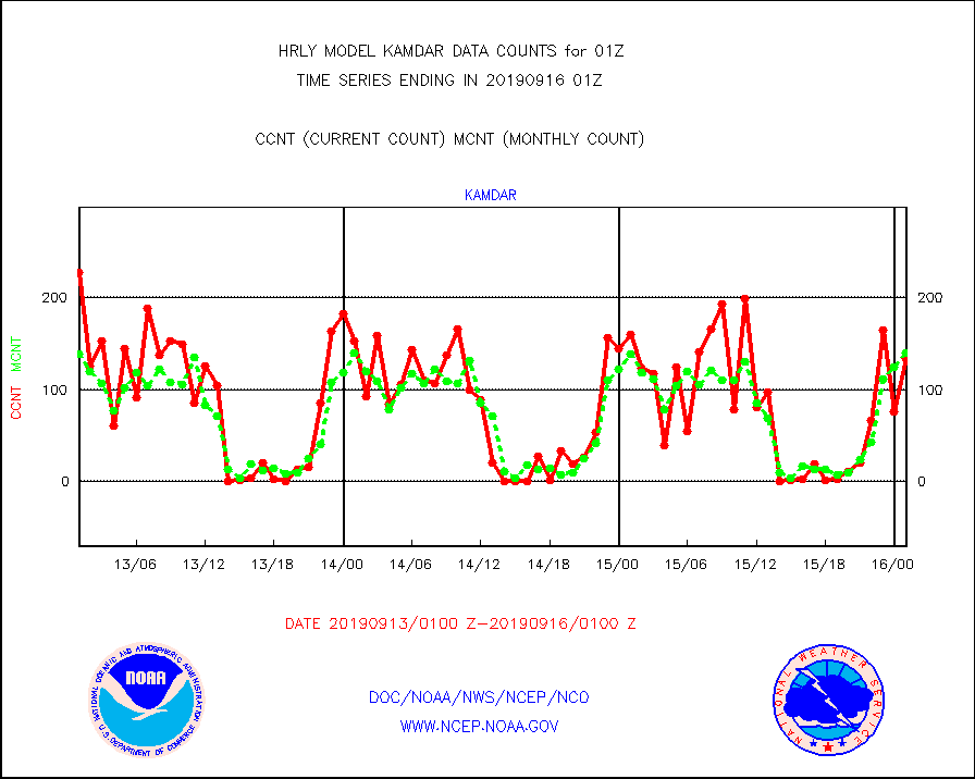
kamdar |
Korean AMDAR aircraft data (decoded from BUFR) |
134 |
140 |
95.7 % |
1600.50-1601.49 |
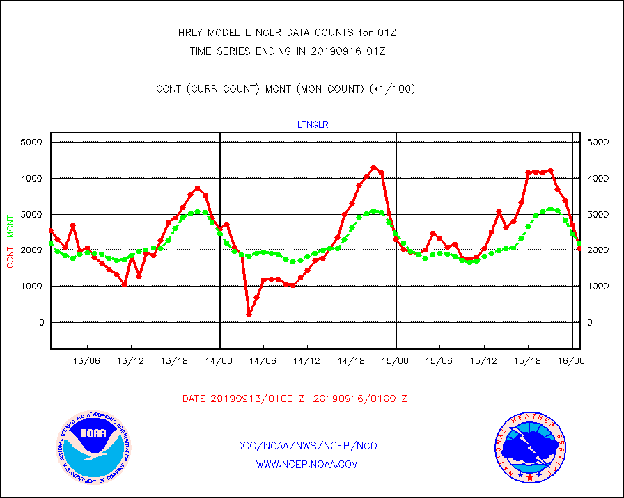
ltnglr |
LLDN Long-rng lightning from Vaisala via NOAAPORT |
204726 |
219057 |
93.5 % |
1600.50-1601.49 |
mls |
Aura Microwave Limb Sounder (MLS) ozone data |
0 |
0 |
n/a |
1523.00-1523.99 |
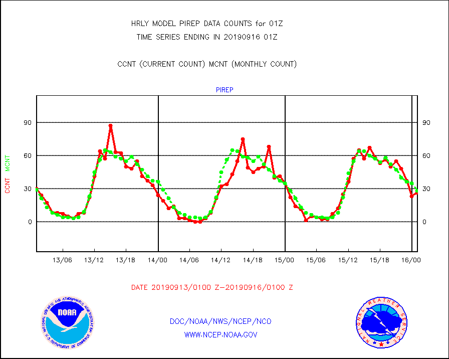
pirep |
Manual PIREP aircraft data (dcded from AIREP fmt) |
26 |
28 |
92.9 % |
1600.50-1601.49 |
prflrj |
Japanese Meteorological Agency profiler winds |
0 |
0 |
n/a |
1600.50-1601.49 |
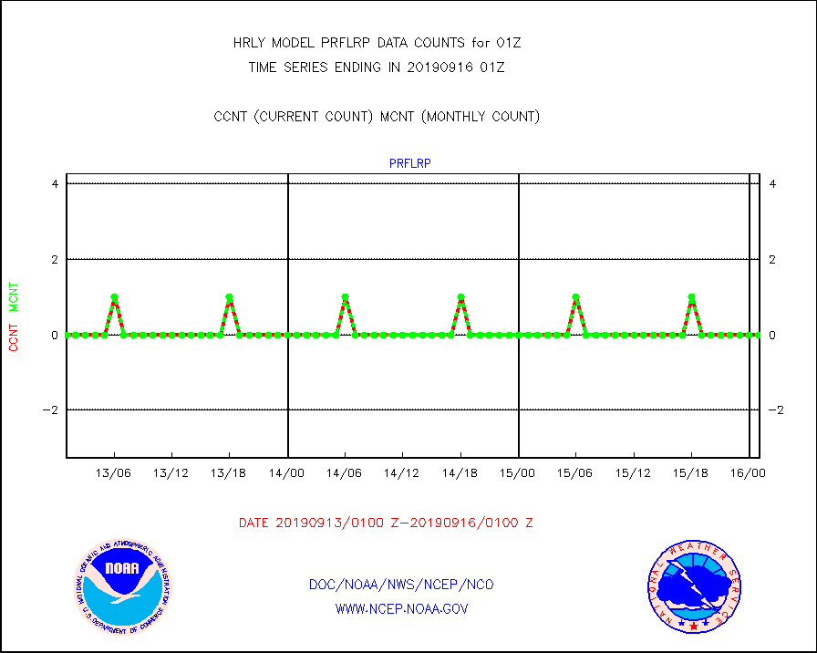
prflrp |
Profilr winds from PIBAL (PILOT,PILOT SHIP/MOBIL) |
0 |
0 |
n/a |
1600.50-1601.49 |
raobm |
Rawinsonde - mobile land (from TEMP/PILOT MOBIL) |
0 |
0 |
n/a |
1600.50-1601.49 |
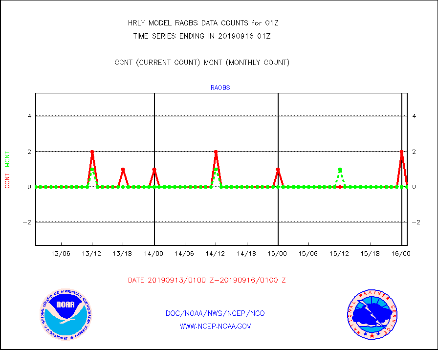
raobs |
Rawinsonde - ship (from TEMP SHIP, PILOT SHIP) |
0 |
0 |
n/a |
1600.50-1601.49 |
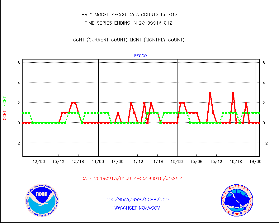
recco |
Flight level reconnaissance aircraft data |
0 |
1 |
0.0 % |
1600.50-1601.49 |
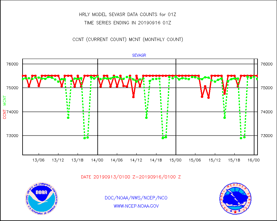
sevasr |
METEOSAT-10 2nd Gen SEVIRI All Sky Radiance(proc) |
75512 |
75365 |
100.2 % |
1600.50-1601.49 |
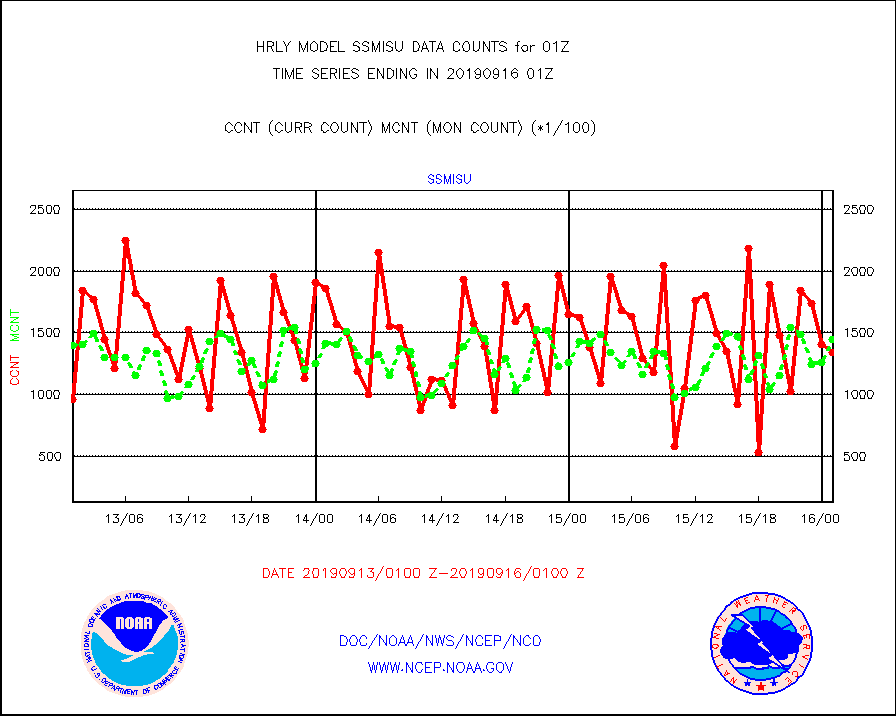
ssmisu |
DMSP SSM/IS 1C radiance data (Unified Pre-Proc.) |
133920 |
145156 |
92.3 % |
1523.50-1600.49 |
synopm |
Synoptic - mobile manual and automatic |
5 |
66 |
7.6 % |
1600.50-1601.49 |
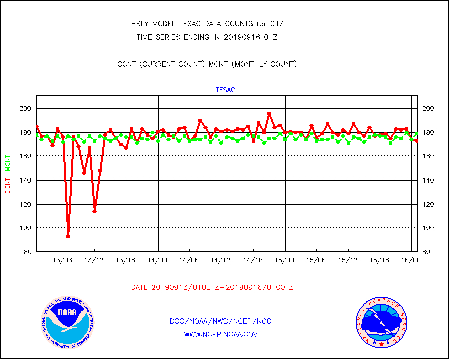
tesac |
TESAC |
173 |
179 |
96.6 % |
1600.50-1601.49 |
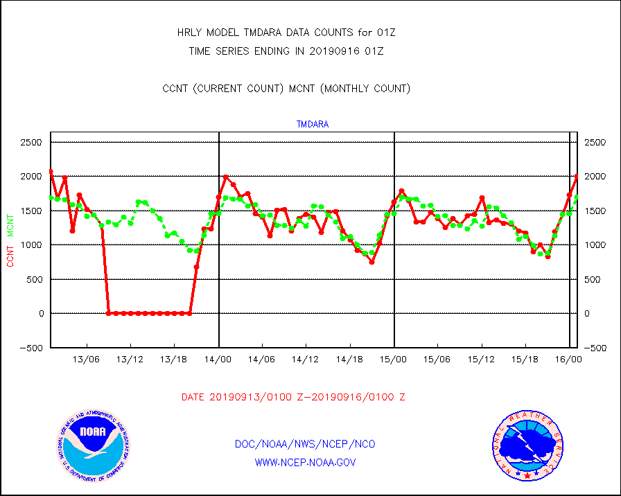
tmdara |
TAMDAR aircft data-all types(from Panasonic,BUFR) |
2002 |
1695 |
118.1 % |
1600.50-1601.49 |
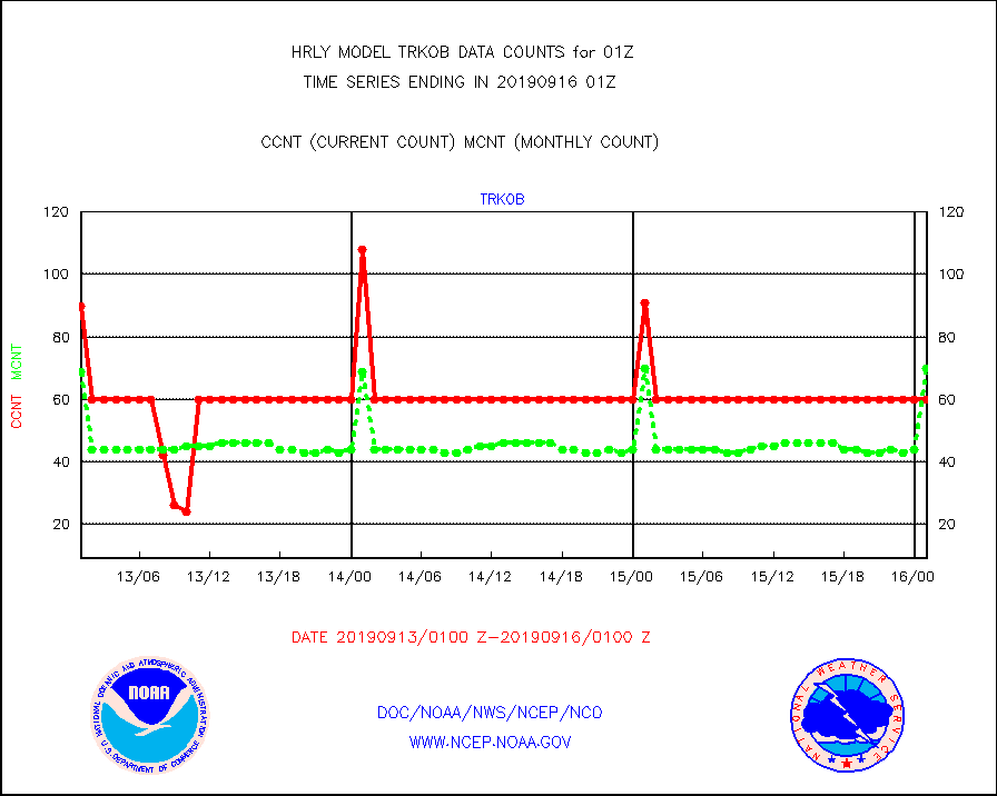
trkob |
TRACKOB |
60 |
70 |
85.7 % |
1523.50-1600.49 |
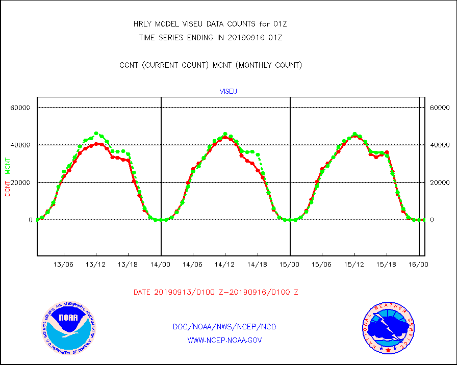
viseu |
METEOSAT/EUMETSAT visible derived cloud motion |
0 |
0 |
n/a |
1523.50-1600.49 |
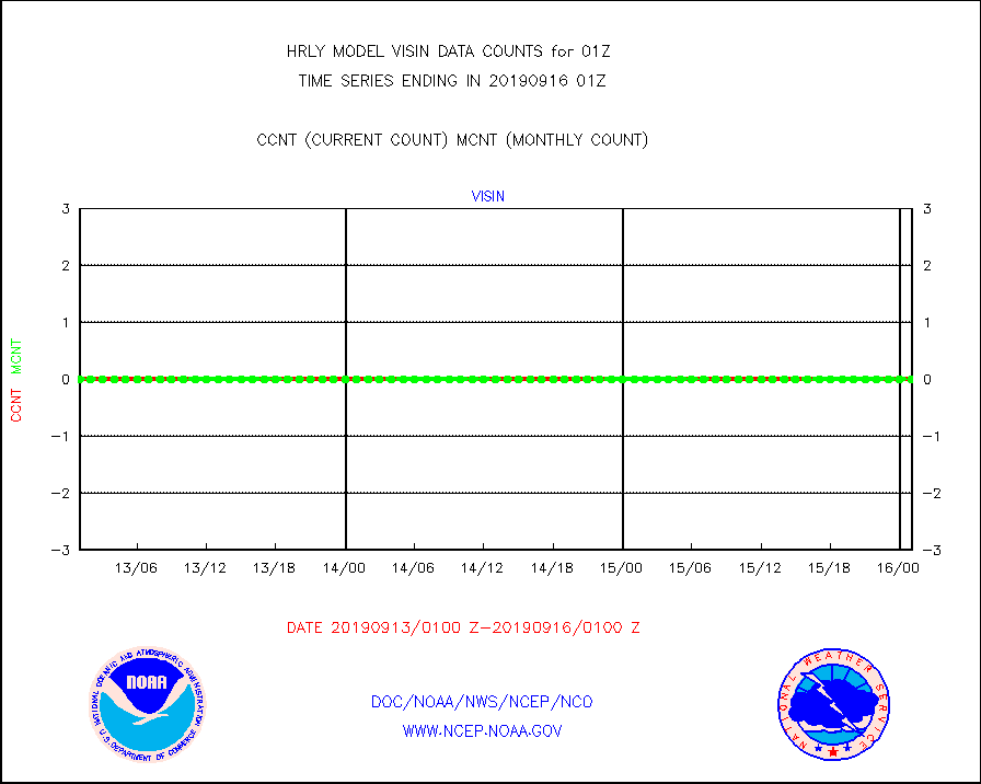
visin |
INSAT/KALPANA India visible derived cloud motion |
0 |
0 |
n/a |
1522.50-1523.49 |
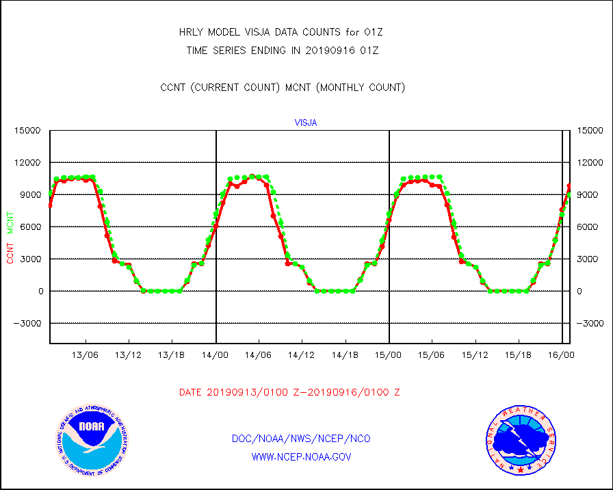
visja |
MTSAT/JMA visible derived cloud motion |
9862 |
9040 |
109.1 % |
1522.50-1523.49 |
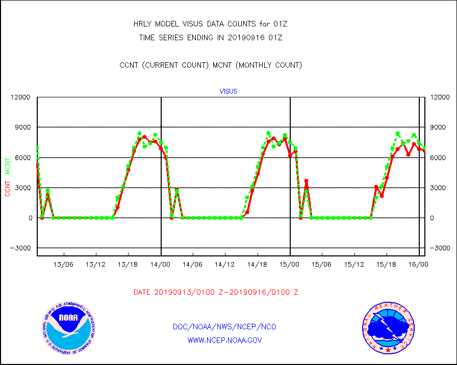
visus |
GOES/NESDIS visible derived cloud motion |
6700 |
6939 |
96.6 % |
1600.00-1600.99 |


